26 minute read
Cover Story

from AS WE REOPEN...

A WAKE-UP CAll A WAKE-UP CAll
The COVID-19 global pandemic, apart from being an unparalleled crisis, is a unique opportunity for the world to enhance efforts around technology democratization, so that we can collectively be prepared to take on future challenges. By Avneep Dhingra
Women are lagging in terms of access to digital technologies in two thirds of countries around the world
In India, there is Internet density of 49.78%, which means that every second person is not connected
The ubiquity of technology in developed parts of the world is simply astonishing. Almost everyone has a smartphone and access to high-speed Internet. But netizens do not necessarily assert their ascendancy — for them it is part and parcel of living in a “connected society”. No wonder that a handful of countries account for nearly 90% of the market capitalization value of the world’s 70 largest digital platforms and over 75% of the cloud computing market (UNCTAD’s Digital Economy Report, 2019).
But what about less developed parts of the world, where the “connected population” is below 20%. There is little or no access to mobile networks and the Internet, let alone emerging technologies, which have the power to boost governance and decision-making — thereby boosting socio-economic development. According to the World Economic Forum, among the many inequalities exposed by COVID-19, the digital divide is not only one of the starkest, but also among the most surprising.
How we are divided A 2019 report (Measuring digital development: Facts & figures) byITU’s Telecommunication Development Bureausuggeststhatonly 4.1 billion people, or just over 53% of the global population, are online, while a staggering 3.6 billion people are unconnected. Further, in 47 least developed nations, over 80% of the population is still offline. ITU data show that in the most extreme case, a mere 2% of the population is using the Internet. The report indicates that the women are lagging behind men in their ability to take advantage of the power of digital technologies in almost two thirds of countries around the world.
“Access to connectivity is not a luxury, but a critical service to society. As we have witnessed today, our networks must remain resilient and responsive to citizens’ immediate needs — whether it is businesses (of all sizes), government institutions, education and healthcare systems, power utilities or transportation providers,” says Mike Cala
brese, Vice President of Global Enterprise
and Webscale at Nokia. Even in a fast-developing country like India, there is Internet


With the world rushing to build maps, dashboards and apps to combat the COVID-19, the significance of technology, especially geospatial data and tools has once again come to the fore


density of 49.78%, which means that for every person who is connected, there exists one who lacks access to the Internet. In most parts of the world, this divide is determined by factors such as location, income, gender, age, etc.
According to the World Health Organization, the need to spread information about how to combat COVID-19 is most urgent in poorer countries, where migrants and the destitute are most vulnerable to the virus. Further, children’s education has abruptly come to a halt, and work from home is an option for very few people. In the absence of technology access, these problems render governance ineffective, often leading to continued suffering for citizens. “This digital divide, which is not just about having the Internet, but about having data to make decisions, has to be bridged,” emphasizes Milorad Kovacevic,
Chief of Statistics, United Nations Development Programme.
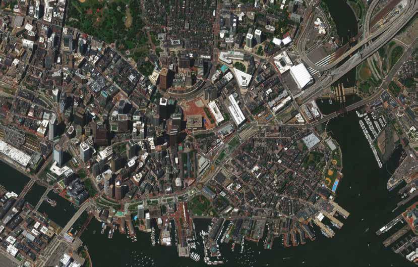
How tech democratization can help With the world rushing to build maps, dashboards and apps to combat COVID-19, the significance of technology, especially geospatial data and tools has once again come to the fore. Almost every major organization — ranging from businesses, academic institutions to news broadcasters — were seen using spatial data for planning, acting and information sharing. It did not take long for governments, healthcare service providers and other responders from all over the world to realize that they all needed such technology tools to mitigate the coronavirus crisis. “GIS is unique because users everywhere can create their own individual sets of information as map layers. Everyone’s Access to connectivity is not a luxury, but a critical service to society. Our networks must remain resilient and responsive to citizens’ immediate needs
Mike Calabrese Vice President, Global Enterprise and Webscale, Nokia
content is compiled and is represented as a series of information overlays covering specific areas across the planet. In today’s world of cloud computing, all of these layers have their own individual URLs, enabling these layers to be integrated and synthesized together,” says Esri Founder
and President Jack Dangermond.
Democratization of technology has the power to change people’s lives. The access to technology, from the simple to the sophisticated provides the innovative environment to push technology further and to participate in its advancement meaningfully. “The opportunity to use technology gives us the tools to re-imagine and redefine jobs and industries that can help us thrive mentally, physically and economically as communities. That access is vital,” argues
Trimble President and CEO Rob Painter.
The real power of technology lies in the valuable information that can be derived from it. In any given situation, especially


in case of a health emergency, connectivity and access to accurate information can make a world of difference. For instance, if we hadn’t been able to trace the origin of the COVID-19 back to Wuhan, or track its movement and spread, the number of infected cases and fatalities, apart from the damage caused to the global economy would have been a lot higher. “The ability to access information from anywhere at any time has never been more important. For example, our companies, and even our governments, are now operating from thousands of locations where they hadn’t been before — employees’ homes. This means software and services that enable collaboration have become critical in ways we didn’t expect, but now rely upon,” explains Hexagon CEO Ola Rollén.
We are living in a fast-changing world, which poses new challenges to our survival every now and then. In such a scenario, technology is the best tool for crisis management
Jack Dangermond Esri Founder and President
for all stakeholders. “Therefore, democratization of technology is tremendouslyimportantfor governments, corporations and all other decision-makers who have a certain socialresponsibility, so that we are allable to act as timely as possiblebased on the most current and,” feels Matthew Zenus, Global
Vice-President, HANA & Analytics, Solution Strategy at SAP.
Why is ‘where’ so important The COVID-19 outbreak has disrupted our entire world. From healthcare services to school education, business processes to everyday movement, each and every activity performed by human beings have undergone a drastic change. As we collectively adjust to the new normal, the knowledge of location and all the information related to it (what, how and when) will hold the key to our survival and well-being.
Today, governments around the world are using contact tracing through mobile applications to keep the people safe, and are relying on location tech to streamline

Rob Painter Trimble President and CEO
Today, governments around the world are using contact tracing through mobile applications to keep the people safe, and are relying on location tech to streamline work operations
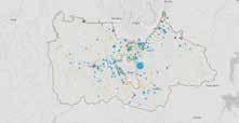
work operations, strengthen supply chains and restart industries. For example, India’s National Disaster Management Authority (NDMA) has developed an online dashboard to capture information regarding millions of migrant workers who were stranded due to the nationwide lockdown to provide them relief and facilitate their safe movement across states.
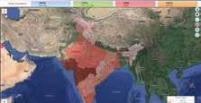
“Being able to visualize information about confirmed cases, fatalities, testing facilities, or where to buy supplies is a very powerful and effective way to communicate critical information. We have seen first-hand how governments are deploying feature-rich, yet accessible technologies to develop dynamic maps and dashboards that help their citizens understand the threat of COVID-19 at local, regional and national levels,” says Mladen Stojic, President,
Hexagon Geospatial.
How can geospatial make a difference With data holding unprecedented significance in today’s day and age, geospatial technologies provide not only the ability to manage and integrate data, but also the analytical tools that support quick decision-making, thereby saving both time and money. Using data in new ways helps in reviving sluggish economies and making governments and organizations efficient and resilient in the face of a crisis. “Geospatial information provides context to information to determine the what, where, when and why of something. The influence and impact that knowledge can bring is powerful, particularly during a crisis such as COVID-19,” adds Painter. Since the current pandemic began, developers, researchers, geoscientists and health organizations have been developing
The ability to access information from anywhere at any time has never been more important. Our companies and governments, are now operating from thousands of locations where they hadn’t been before
Ola Rollén Hexagon CEO
technological tools and apps to help inform and enable societies to adapt and rebuild. Widely sharing these map-based resources are helping people and industries regain control and certainty.
Going forward, geospatial data and Location Intelligence are going to be critical for economic recovery — from being able to continue tracking the spread of the virus and its impact at any given time, to supporting cities and nations that are trying to understand what is the new normal for their essential services and management of everyday public life.
Who should lead the way and how As we move ahead, It will be important that resource-rich organizations act as enablers in ensuring that people have equal access and support to create or adopt solutions that work specifically for them. “For example, in ArcGIS Online, users have created over 35 millions layers worldwide. We estimate that as many as 40-50% of these items are publicly shared,” adds Dangermond, highlighting that since the
beginning of 2020, extraordinary efforts worldwide sprang up as a global response to the coronavirus pandemic. “GIS practitioners and heroic people everywhere joined together to implement and apply community GIS in virtually every nation and global region as well as at local levels. One of the most impactful traits of GIS information is the user community’s strong interest in sharing — we all need access to each other’s data.”
Governments, businesses and trained developers can commit to creating and offering open-source approaches to information sharing, system development and data management, says Painter. For example, users in underdeveloped countries could use a free and open-source desktop GIS tool to work with geospatial data, analyze datasets, connect to external tools and publish and share geospatial information. User-friendly environments such as these give stakeholders efficiencies and confidence to build knowledge and develop systems and plans that best serve their communities.
Likewise, geospatial manufacturers can provide support and tools that enable developers to create specialized applications that bring the best value to their working environments. For instance, a trained developer could create simple, customized workflows to aid in locating and tracking virus hotspots and concentrations of infected people. “On-demand access to real-time, accurate geospatial data and Location Intelligence for all is critical for a coordinated, global response to any shared crisis,” adds Rollén.
Providing access to technology is akin to providing opportunity, but that’s possible only through partnerships and collaborations. “Governments, big and small businesses and societies would do well to partner in that and provide the hardware, software and infrastructure to allow local innovation to happen. Creating tools and applications to gain knowledge is one of the best ways to build strength and resilience to better respond to an ‘unknown enemy’ like a future pandemic,” emphasizes Painter.
“It’s definitely possible to work together and learn from each other’s experiences and experiments, but there is no one-size-fits-all response. With the diversity of solutions needed across geospatial applications, the idea is the same. COVID-19 is an opportunity for sharing best practices to aid in future situations where we are experiencing the same challenges at different times for different reasons,” feels Rollén.
Dangermond thinks that the geospatial community must work to ensure technologies are open, interoperable, and readily accessible worldwide. These goals include effective configuration and use of COTS tools, adoption of best practices, and open information sharing across geospatial organizations, because shared data layers are easily integrated in to GIS.
The COVID-19 pandemic may have caused tremendous disruption to the global society and economy, but has also acted as a wake-up call, a unique opportunity to enhance efforts around democratization of technology, so that we can collectively be prepared to take on future challenges.
If the Chinese use two brush strokes to write the word ‘crisis’, (as stated by John F. Kennedy) with one brush stroke standing for danger and the other for opportunity, perhaps it’s time to shift focus to the second stroke of the brush.
Avneep Dhingra
Associate Editor - Policy & Public Affairs avneep@geospatialmedia.net
LESSONS FOR INDIA IN COMMERCIALIZATION
OF SPACE To be able to bring the policy statement to reality requires a major overhaul of government-led Space activities. Only then will the promises be realizable. By Prof. Arup Dasgupta
Here is what the minister said


On May 16, 2020, Indian
Finance Minister Nirmala
Sitharamanelectrified the Space community with the bold announcement on boosting private participation in Space activities.
Indian private sector will be a co-traveler in the country’s Space sector journey India will provide level playing field for private companies in satellites, launches and Space-based services
India will provide predictable policy and regulatory environment to private players
Future projects for planetary exploration, outer Space travel, etc. will be open for private sector
Private sector will be allowed to use ISRO facilities and other relevant assets to improve their capacities
There will be a liberal geospatial data policy for providing Remote Sensing data to tech-entrepreneurs
Even though these bold statements have excited the Space communities in the technology and application areas, it needs to be said that a policy statement such as this, which gives a “feel good” warmth, needs to be followed up with cold and hard actions. A statement is not a policy. A policy needs to be backed up with processes which will give rise to programs and projects.
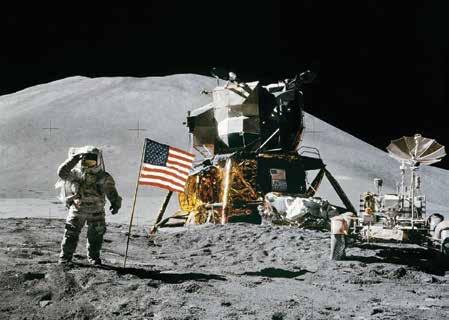
Example of policy implementation When the US was losing the Space race to the erstwhile USSR, President John F. Kennedy declared in September 1962 that “we choose to go to the Moon in this decade and do the other things, not because they are easy, but because they are hard; because that goal will serve to organize and measure the best of our energies and skills, because that challenge is one that we are willing to accept, one we are unwilling to postpone, and one we intend to win, and the others, too.” This was followed by the Apollo Program, and with Apollo 11, the first human, an American, stepped on the Moon in July 1969.
In these seven years, several US industries blossomed and grew into global Space giants which supported the US to further its Space ventures, till the tragic failures of the Space Shuttle, which effectively closed down human spaceflight from American soil on American vehicles. In the first decade of the new millennium, SpaceX, Virgin Galactic and many other private Space startups jumped in with new ideas and new programs.
On May 30, 2020 after nine years, NASA astronauts have once again ridden into Space from US soil on a US built vehicle. The only difference being that Falcon 9 launcher and the Crew Dragon spacecraft were designed, built and launched by SpaceX from a completely refurbished and a very aesthetically attractive Pad 39A of the NASA launch complex. It is also important to note that an old hand like Boeing lost out to a bold startup like SpaceX.
Origins of ISRO and its core purpose As far back as the early 1960s, a scientist, Vikram Sarabhai, working with the Department of Atomic Energy, realized that Space could play an important role in India’s develop
When the US was losing the Space race to the erstwhile USSR, President John F. Kennedy declared in September 1962 that his country will “go to the Moon in this decade”. This was followed by the Apollo Program, and with Apollo 11, the first human, an American, stepped on the Moon (in picture) in July 1969
ment. In 1962, he formed the Indian National Committee for Space Research, INCOSPAR, with the support of the then Prime Minister Jawaharlal Nehru. INCOSPAR was managed by the Physical Research Laboratory, which was a grant-in-aid institution of the Department of Atomic Energy.
Eventually INCOSPAR activities migrated to the Indian Space Research Organisation, ISRO, a project of PRL. Under INCOSPAR and later ISRO, several projects were launched like sounding rockets for Space Sciences, Experimental Satellite Communications Earth Station for training in Earth station operations, Satellite Instructional Television Experiment, etc.
In an address to the first UN Conference on Peaceful Uses of Outer Space, UNISPACE, held in 1969, Vikram Sarabhai also recognized the importance of Remote Sensing for development, and these activities began under ISRO.
While the Indian Space Program is quite different from the US Space Program, and ISRO is quite different from NASA, it is necessary to learn from the US experience and those of other countries, to steer commercialization of Space activities in a “co-traveler” mode. It is also necessary to understand where ISRO stands today in terms of working with co-travelers. ISRO, it should be noted, is the primary research and development arm of the Department of Space, DOS. The key term is research and development.
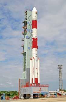
R&D – an instrument of societal development In 1971, Dr. Sarabhai, the architect of India’s nascent Space program, passed away, leaving an inchoate ISRO to Prof. Satish Dhawan, who took over in 1972 and gave it a direction and defined specific goals. Prof. Dhawan realized that ISRO needed to co-travel with other Indian entities in order to be relevant. Under his leadership, ISRO forged ahead with launchers, primarily PSLV, INSAT communications satellites and IRS Remote Sensing satellites. While the launchers would ultimately serve to launch Indian satellites, the satellites themselves would have to serve India meaningfully in terms of communications, broadcasting, meteorology and natural resources management.
Thanks to his far-sightedness, the Indian Space Program formed very useful relationships for both upstream and downstream activities. The Indian industry, both heavy industries and MSMEs, were roped in to supply the essential components of launch vehicles and
tion and service agency. There is precious
is an exception, but two years after its commissioning, its usage is still minimal. The worst action of internalization was the unnecessary creation of the Remote Sensing Data Policy. Till this came, IRS data was available openly. On the other hand, decades old policies of Survey of India made it difficult for scientists to acquire topographic maps, particularly of coastal and international boundary areas, essential for the analysis of satellite imagery. Similarly, policies of the Ministries of Home and Defence made it extremely difficult Courtesy: ISRO which were useful as supplementary data. The RSDP ensured that ISRO joined the dubious club of data deniers. The decision to
ISRO’s transition, from a primarily R&D organization to an operational agency for the manufacture of launchers, canalize import of high resolution imagery is communications satellites and Remote Sensing satellites, and the provision of services for launches, communications satellite management and Remote Sensing data services, has left several experts and old hands surprised another choke-point which smacks of conflict of interest. While the unstated desire is to promote satellites. At the same time, ISRO engaged with We are far behind in the development of high resolution IRS data, the RSDP effectively the end users of communications, meteorology reusable launchers because our attention is denies this data to users other than from the and natural resources management to evolve more on increasing the number of launches. government or government-sponsored projects. meaningful uses of the satellites in these areas. When PSLV is built with nearly 80% of Worse still was its decision to sell imagery contracted components, what is holding which was being generated using taxpayers’ Transformation of ISRO from ISRO back from passing on the manufacture money. The result was to drive away potential research to operational institution and launch activities of PSLV to the industry users from industry and academia. Ostensibly,
Most old ISRO hands wonder since when and concentrating on new developments in Bhuvan is designed to make data available to did a primarily R&D organization become launcher technologies? end users for free. In reality, Bhuvan, with its an operational agency for the manufacture In applications too, the much vaunted poor bandwidth, is no match for Landsat and of launchers, communications satellites and 160 projects to be executed by end users to Sentinel data, which are available for free to
Remote Sensing satellites, and the provision give a fillip to the use of Remote Sensing download from the Cloud, but policy restricof services for launches, communications data by end user departments were intertions prevent ISRO from doing the same. satellite management and Remote Sensing nalized to a set of Bhuvan maps prepared data services? It happened over time. by ISRO. There are hardly any applications Deterioration of leadership that are significant, and that extend the and disempowerment of young Diversion from core purpose to capabilities of modeling and analysis. While generation internalization of ISRO data science has taken the world by storm, The journey of ISRO under a Chairman who
From the heady and challenging days of ISRO seems to be well insulated from these could boldly go out and face a hostile media working with other organizations, ISRO has advances. There have been no significant after the failure of the first SLV launch to a steadily internalized its activities and turned developments in the communications field Chairman whose prime interest is to launch, itself into a launcher and satellite produceither on satellites or on the ground. IRNSS launch and launch, and who cries on the to acquire aerial photographs and imagery, little R&D that goes on which we are aware about. The small satellite launch vehicle is an afterthought, as the same has been already There is need for a comprehensive Space policy, which has been hanging fire for long. proposed by NewSpace India participants. While the development of the cryogenic engine is significant, it should be noted that Such a policy will encourage a vibrant Space industry independent of ISRO-DOS. And it it got delayed due to a decision to tie up with Russia for the cryogenic engines and the subsequent geopolitical maneuvers and events. must emerge from the Space industry and user communities, and not be driven by ISRO-DOS
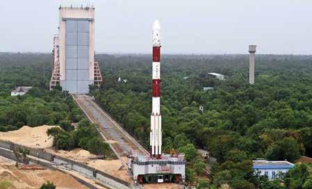
Under the leadership of Vikram Sarabhai, ISRO forged ahead with launchers, primarily PSLV, INSAT communications satellites and IRS Remote Sensing satellites
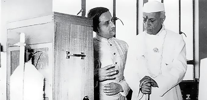
Courtesy: PRL, Ahmedabad A file photo of Vikram Sarabhai (left) with Jawaharlal Nehru. As far back as the early 1960s, Sarabhai, working with the Department of Atomic Energy, realized that Space could play an important role in India’s development. In 1962, he formed the Indian National Committee for Space Research, with the support of the then Prime Minister Nehru
shoulders of the Prime Minister after the failure of the Chandrayaan lander is not one that instills confidence in the organization’s ability to co-travel with potential challengers in the fields of technology and applications.
Given this scenario, ISRO is most unsuited to take on the task of encouraging co-travelers. There is too much of bureaucratization and severe conflict of interest. The sad stories of Devas and TeamIndus strengthen this view. Leaving operational activities to others more suited for the task will be painful for ISRO because over time, it has given birth to a Siamese twin of R&D
Under the leadership of Vikram Sarabhai, ISRO forged ahead with launchers, primarily PSLV, INSAT communications satellites and IRS Remote Sensing satellites
and operations. While the R&D is in the ICU, the operations part is thriving.
ISRO has world-class facilities for fabrication and testing, which are used by both, but operations get a higher priority and R&D suffers. Also, working on operational projects with a short life span is more interesting, as it

Geo-Intelligence
THE NEW STANDARD OF GLOBAL ELEVATION MODELS
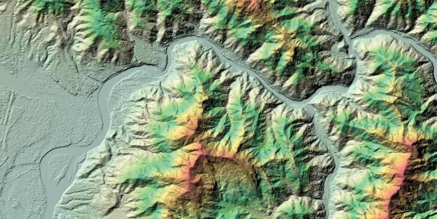
WORLDDEM™ at a glance: • Superior elevation information anywhere on Earth • Homogenous standardised pole-to-pole coverage • Unrivalled accuracy: 2m (relative) / 4m (absolute) vertical accuracy in a 5m x 5m raster • Easy access
Rishikesh
Authorized Distributor: India MICRONET SOLUTIONS Plot No.80, KT Nagar, Katol road, Nagpur- 440013 Phone: +91-9422 104111, +91-844-6563560 | Fax: +91-712-2570055 Email: info@micronetsolutions.in, marketing@micronetsolutions.in
www.micronetsolutions.in
Internal restructuring and discontinuation of all operational activities
Structural reforms and strengthening of research and exploration Comprehensive Space policy based on inputs by industry and user communities

Focus on advanced launchers, payloads and ground systems for Earth-related applications, Space Sciences and humans in Space programs
PRESCRIPTION FOR ISRO
gives greater short-term visibility and therefore better career progression for the staff. R&D requires patience and the use of brain power. Success is slow in coming and not guaranteed.
Commercialization of capabilities It should be noted that ISRO is just a part of the Department of Space, which is the main body akin to NASA. However, because of its size and the nature of its growth, it is easy to confuse ISRO with DOS and use the acronyms interchangeably. DOS has two other units which are not a part of ISRO. These include Antrix Corporation Limited, ACL, and NewSpace India Limited, NSIL. The latter should not be confused with NewSpace India, which represents an informal consortium of private Space entrepreneurs.
ACL is dubbed as the commercial arm of ISRO and is engaged in providing Space products and services to international customers worldwide. It is really the commercial arm of DOS, but it uses all ISRO facilities and manpower to further its business. Started as a one-and-a-half person organization, housed in ISRO headquarters, it relies heavily on the Space organization without any benefit to it in terms of sharing profits or even funding research there. In short, ISRO is forced into operational and commercial tasks through ACL, neglecting its mandated role of R&D, much to its detriment as explained above.
NSIL was set up recently with the “primary mandate of enabling Indian industries to scale up high-technology manufacturing and production base for Indian Space Program.” Both ACL and NSIL are wholly owned Government of India entities under the administrative control of DOS. It seems that while ACL is to market ISRO products and services abroad, NSIL is to encourage industry to scale up to meet ISRO requirements of high technology manufacturing.
It is clear from the above information that the vision of DOS viz-a-viz private industry is one of managing contractors for ISRO requirements and not one of encouraging independent co-travelers. In order to realize the independent participation of private industry in Space activities, the government needs to look beyond ISRO-DOS.
Structural reforms & strengthening of research and exploration To be able to bring the policy statement to reality requires a major overhaul of government led Space activities. Only then will the promises be realizable.
The first need is of a Space policy, which is hanging fire for long. Such a policy is needed to encourage a vibrant space industry independent of ISRO-DOS. Such a policy must emerge from the Space industry and user communities, and not be driven by ISRO-DOS. One such draft by an organization, Takshashila Institution, needs to be considered seriously.
Secondly, ISRO needs to be restructured by removing all operational activities including their related facilities and services. All services should be with ACL. The huge facilities in ISRO funded by the government should be made into national Space technology fabrication and testing assets which are open to both ISRO-DOS and Industry impartially. NSIL should be repurposed to manage these assets on behalf of the Government of India.
ISRO should concentrate on advanced launchers, payloads and ground systems for Earth related applications, Space Sciences and Human in Space programs. While interaction with ACL and NSIL will be necessary, it should be on strictly commercial terms as applicable to other co-travelers.
Scalability of societal impact One of the very interesting ideas that has been posted recently is the possibility of independent industries to meet the needs of the defense forces independent of ISRO, which is essentially a civilian organization. It is also possible that private communications service providers could fund communications satellites using the MEO, as is happening in the rest of the world, maybe for 5G services for example. The same could apply for Remote Sensing constellations.
The government should break away and do only those things that industry cannot do. These include developing advanced technologies and systems for healthcare, education, Space sciences and humans in Space. Leave the industry to find its own way and do their own thing guided by an enabling Space policy which should be reviewed and modified from time to time in consultation with all stakeholders.
Prof. Arup Dasgupta
Managing Editor arup@geospatialmedia.net


E
C