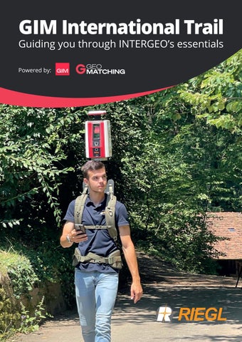
GIM International Trail Guiding you through INTERGEO’s essentials Powered by:
Whatever the mission, capture more. Imagery · LiDAR · Hybrid Hyperspectral · Thermal Bathymetry · Topography The right technology for every application. One comprehensive airborne sensor portfolio. More flexibility. More efficiency. More from every flight.
Imagery
LiDAR
Hyperspectral
Hybrid
Thermal
To learn more, visit Hexagon booth #C6A125 and ITRES booth #B5L055 ©2026 Hexagon AB and/or its subsidiaries and affiliates. All rights reserved.
Editorial
Nowhere without people Ask anyone what makes geospatial technology valuable and their answer will usually circle back to the data, the sensors or the algorithms. However, across the articles gathered in this special publication, a different story keeps surfacing: the people who steward the technology and, crucially, those being trained to carry it forward matter just as much as the technology itself. How to ensure there are enough people to actually carry it forward is a common thread running throughout this issue. The article by Craig Roberts on protecting small surveying programmes lays out how fragile the pipeline has become. As university funding tightens and international rankings reshape academic priorities, niche disciplines such as surveying risk being squeezed out unless programme heads actively fight for them – through marketing, industry partnerships and relentless advocacy. It is a sobering thought that a profession so fundamental for modern society could quietly disappear if nobody champions the students pursuing it. The EAASI Student Tour, this year being organized at Intergeo for the third time, is one concrete answer to that challenge. By actively guiding students to crewed aerial mapping companies’ booths for first-hand encounters, EAASI helps inspire young people to choose a field that they’ve so far only read about. It seems like a small initiative on paper, but it is in line with something the industry’s leading annual gathering does particularly well, not only through tours like this one but also spaces like GeoCampus: bringing together the next generation of surveyors and geospatial professionals with the companies and technologies that will define their careers.
This year, that mission has a particularly fitting backdrop. Intergeo 2026 takes place in Munich – the city for which Markus Mohl and his team have spent nearly a decade building one of Europe’s most advanced digital twins. In our exclusive interview with him, Mohl reveals that the hardest part of developing Digital Twin Munich was never the technology; it was convincing city departments to share data and trust one another. An urban digital twin, in his words, is not about decisionmaking but about decision-supporting, built on communication between people as much as on code – a lesson the host city itself is offering to this year’s attendees. Our interview with Olaf Freier provides the event organizer’s perspective on why a trade show still matters in the digital age. Once again, this comes down to people. He emphasizes the value of cross-disciplinary exchange, such as an unplanned conversation between a surveyor, a BIM manager and a drone-data scientist that no webinar can replicate. Freier acknowledges that this year’s headline technologies – reality capture and AI – have both already changed how products get built, yet he is careful to note that AI’s potential depends entirely on the quality of the data and also the people behind it. In an industry where AI seems to be everywhere, it’s worth remembering that the surveying profession can’t survive without skilled people who collect the data, question the model and make the judgement calls no algorithm can. So while geospatial technology is advancing faster than ever, its future depends on the students we bring into the field, the communication between the people already in it, and the conversations that only happen when all types of geospatial professionals physically come together. And, in my view, there’s no better place this year than the city that is a shining example of how our industry can address modern challenges.
Wim van Wegen head of content, GIM International
3
UltraMap strengthens the foundations of photogrammetric production UltraMap’s latest innovations focus on what matters most in photogrammetric production: stronger geometric foundations and more consistent image quality. A fully redesigned automated global colour balancing algorithm and an upcoming machine learning-based reconstruction pipeline reinforce both the radiometric and geometric basis of the workflow. Introduced in July, UltraMap’s new global colour balancing for nadir and oblique imagery automatically creates seamless, homogeneous projects with naturally preserved appearance. The result is more consistent image quality across complete datasets, achieved with up to 2x faster processing throughput. Additional major advances made in development will be presented at Intergeo 2026, including a new ML-based reconstruction pipeline for UltraMap. This is a fundamental innovation, because the quality of every deliverable depends on the quality of the underlying geometric
reconstruction. Whether generating point clouds, DSMs, DTMs, orthophotos or 3D TINs, improving reconstruction at the source elevates every downstream product: surface models become cleaner, terrain models more reliable, orthomosaics more precise and 3D outputs more consistent. UltraMap is Vexcel’s end-to-end software platform for producing these products from UltraCam imagery within one integrated environment. Built for ever-larger data volumes, it combines a high degree of automation with quality monitoring and diagnostics, while still enabling intuitive manual interaction where needed. Its sophisticated machine learning algorithms are trained on the robust foundation of the Vexcel Data Program, the world’s largest aerial imagery and geospatial data library, and make full use of the rich raw information captured by UltraCam sensors. The result is a photogrammetric workflow engineered not only for productivity, but for measurable advances in output quality.
More information
Intergeo 2026
Intergeo 2026 broadens conference access for all attendees Intergeo 2026 will arrive this September as the sector’s principal forum for all the challenges facing the geospatial industry, just as it has for decades. This year, the sector is convening in Munich against a backdrop of mounting pressure: governments racing to digitize infrastructure, cities grappling with climate risk, and an AI wave reshaping how location data is collected, interpreted and acted upon. To bridge the gap between conference and expo, all ticket holders can attend the keynote addresses this year. For the first time at Intergeo, all keynotes are open to every ticket holder, not just conference delegates. (Image courtesy: Intergeo / Nico Herzog Fotografie)
Few industry gatherings can match the breadth of Intergeo. The three-day event, running from 15-17 September 2026 at Messe München, draws together geodesy professionals, software vendors, public-sector users and researchers under a single roof. This year’s edition has an even sharper focus around practical applications: digital twins, reality capture, geodata infrastructure, and the use of location intelligence in areas ranging from mobility planning to environmental management. A more open conference floor One of the more striking structural changes this year concerns access. For the first time, the conference’s opening session and all keynote addresses will be open to every ticket holder, so not just registered conference delegates. The move is a deliberate attempt to bridge the expo and conference tracks, communities that have historically operated in parallel. Among the keynote speakers is Jack Dangermond, the founder and president of Esri, whose influence on the geographic information systems field spans more than five decades. “Intergeo brings together professionals from around the world to share solutions to some of the most pressing location-based challenges of our time. With GIS, we can make more informed decisions for a more sustainable and resilient future. I look forward to speaking to the geospatial community, which continues to drive important innovations in modern mapping technology,” he states. Side-by-side comparisons Beyond the conference halls, the expo floor is
getting a notable addition. Hall C5 will house the new Reality Capturing Experience Parc, a hands-on environment where visitors can directly compare technologies for mobile mapping, laser scanning and photogrammetry. The pitch is practical: rather than viewing product demonstrations in isolation, attendees will see competing approaches applied to the same use cases side by side. The format reflects a broader industry trend. As the cost of high-fidelity spatial data capture has fallen, the question is no longer whether to capture the physical world digitally, but how to do so. Above all, users want to know which workflows hold up under real operating conditions. Where geodata meets urban development The Real Estate Lab, which debuted at last year’s Intergeo, returns with an expanded scope. The format brings together stakeholders from property, urban planning and GeoIT to examine how spatial data is reshaping development decisions. A white paper produced at the 2025 event will
be presented and debated, with morning sessions open to all conference participants followed by more focused expert discussion in the afternoons. The conference programme itself spans digital twins, AI in geospatial applications, Earth observation, building information modelling and connected data infrastructures. The diversity of these topics reflects how thoroughly location intelligence has embedded itself in sectors well beyond traditional surveying. Continued relevance Intergeo’s continued relevance rests on a straightforward proposition: that the people building geospatial technology, the institutions procuring it and the researchers pushing its boundaries are better served by meeting in person than by fragmenting across vertical trade shows. As the applications of location data extend further into public administration, climate adaptation and infrastructure resilience, the event clearly has a strong role to play as a central forum bringing the entire community together.
5
B5.L012
B5.H059
B5.L034
B6.D046
B6.D019
B6.D035, B6.G033
6
B6.B006
B6.D040
C5.I114
C6.A125 C6.A114
C6.F125
7
The importance of protecting small academic programmes
Fighting for the surveying discipline: a multi-pronged approach By Craig Roberts, Australia
Education has become a commodity. In an uncertain world of climate change, conflict, energy transitions and food security challenges, national budgets are increasingly stretched. Public university funding is squeezed, and smaller surveying/spatial departments are vulnerable. How can we as an industry respond?
in a multi-pronged approach. This draws on a number of strategies, including marketing, advocacy, creativity in the face of restructuring, industry engagement and broad communication:
Heads of academic programmes must adapt or they will vanish. Gone are the days of pompous academics in ivory towers imparting pearls of wisdom on fawning students. Globally, the corporates are taking over the purse strings of university administrations, and programme heads must learn to advocate for their disciplines. In Australia, public-sector funding has reduced from ~80% in the 1980s to less than 40% now. Domestic university fees were re-introduced in 1989 to supplement this reduced funding, but as students numbers more than doubled, a full-fee paying international student scheme was devised. The scheme was so successful that it now rates as the fourth-largest goods and services revenue stream for the Australian economy! Senior managers in universities and bureaucrats are delighted. The power of international rankings But how does a prospective international student judge which is the ‘best’ university? Enter international rankings. Since 2003, the Academic Ranking of World Universities (ShanghaiRanking), the Times Higher Education (THE) World University Rankings and the Quacquarelli Symonds (QS) World University Rankings all assess which educational institutions are the ‘best’, and full fee-paying students are persuaded accordingly. As they climb the rankings, universities can charge higher fees. This has supercharged the university ‘market’ in Australia and distorted policy. To be fair, the highest-ranking universities are very good. So how can we protect our small but plucky
8
Education Forum at the Country Surveyors Conference, Terrigal, November 2023. surveying/spatial field in this competitive environment? Become a superhero Programme heads must transform into superheroes and fight for their discipline
• Marketing Programme heads must lead marketing efforts to attract new students. University budgets are a numbers game, but you are not alone. Our wider industry relies on good graduates for their business success. Programme heads must lean on industry players to provide funds, resources, time and energy to assist with combined marketing activities both within the university and externally. Develop clear and consistent talking points, engage with schools, mentor
Debriefing three hands-on activities to high-school students at Surveying Unleashed, Sydney, 2025.
Perspectives • Restructuring Squeezed university budgets may prompt a restructuring of your programme. Don’t panic. Rather, look to adapt to the opportunities presented. Decide on the core of your programme and defend it, whilst working with senior managers to find a compromise. At the University of New South Wales (UNSW), our School of Surveying and Spatial Information Systems (later known as the School of Surveying and Geospatial Engineering [SAGE]) was very successfully merged with the School of Civil and Environmental Engineering in 2013. In the new school we see a range of disciplines, all of which benefit from the diverse offerings of surveying/ spatial. Programme heads must engage with diverse colleagues on combined projects, teaching and research and demonstrate to all the importance of our discipline. Another opportunity to advocate!
High-school students compute remote sensing, GNSS and geostationary satellite orbits to scale. recent graduates to help run hands-on activities and follow up with interested students. Tell stories that demonstrate the role of surveying/spatial in society and give students a sense of purpose – because this is very persuasive for young people. Follow-on work experience within the industry to align with school curriculums is very powerful and should be linked with university open days so students can see a pathway. In the Australian state of New South Wales (NSW), we have a dedicated person and website for surveying careers. We have nurtured a culture whereby educators and industry players understand the value of this interdependent relationship. • Educating up Whilst marketing is important to ensure sustainable numbers of students in programmes, senior managers within tertiary institutions often see only the student numbers. Programme heads must therefore engage with their senior managers and educate them on surveying’s importance to the wider community. Senior managers (head of school, dean, vice chancellor) are often very internally focused and can’t automatically be expected to know the crucial role surveyors have in society. How else will they know if you don’t tell them? For example, tell them that: • Registered land surveyors (RLS) are the only professionals who can legally define property boundaries • RLS are regulated by an Act of Parliament • The numbers of RLS are small (there are only around 800 RLS in NSW – a state of more than eight million people!) • To register, an RLS first needs to complete a four-year degree recognized under the Act • Only your university offers this programme • The skills shortage in surveying is holding back development Take care not to lecture the senior managers. Instead, mention the critical role that surveyors play in your nation’s ongoing housing crisis, or an iconic infrastructure project like a high-profile tunnel, bridge, harbour or energy precinct. Remind them that their support of your small but crucial programme enables the development of their city and nation. Let them share the weight of your responsibility.
11 students used 11 devices to measure the new SouthPan SBAS service for the first time. • University educators There is a perception in the wider community that universities are disconnected from society. Consequently, universities like to demonstrate industry engagement. In surveying, there is also a disconnect between the sort of work that many graduate surveyors undertake and cutting-edge research that will attract research metrics which mostly drive higher rankings. Replacing academic staff in a surveying programme is therefore challenging. Universities are loathe to employ a teaching academic who may take the lion’s share of the teaching load but will contribute little to the research metrics. Industry, on the other hand, would like authentic teachers that understand their profession and may be less concerned with research performance. At UNSW, we think we have found a solution to this conundrum: employing a half-industry-funded Lecturer in Surveying. A consortium of five industry partners was formed to provide 50% of the funds for the lecturer position. In return, the consortium builds a much closer relationship with Australia’s highest-ranking university through activities such as careers markets for networking/job hunting, elite student breakfasts, guest lectures, combined Hons research thesis projects, engagement on capstone courses/survey camps, research relationships with postgraduate researchers, representation on
9
FIG Working Week 2027 Stavanger, Norway, 23-27 May 2027
Join the global surveying and geospatial community in Stavanger to shape The Power of Where for the New Generations Photo: Tomas Walter
FIG WORKING WEEK 2027
STAVANGER, NORWAY
FIG Working Week 2027 will explore how geospatial knowledge and surveying expertise provide the foundation for sustainable development, resilient societies, and smart innovation - empowering the next generation to lead the future.
Why attend Gain cutting-edge insights into climate adaptation, coastal and ocean management, Arctic monitoring, and building resilient societies. Connect globally with experts, policymakers, industry leaders and young professionals. Shape the future of sustainable and resilient geospatial infrastructure. Experience Stavanger - where professional dialogue meets fjords and smart-city innovation.
Get involved There are several ways to take part: as a delegate, by contributing a project or presentation to the technical programme, as an exhibitor, or as a sponsor. Peer review abstracts + full paper
1 October 2026
Non-peer review abstract
1 November 2026
Exhibition & sponsorship
Open now
Registration
Opens October 2026
fig.net/fig2027 10
Perspectives the School Industry Advisory Committee, liaison on curriculum updates, and so on. In essence, UNSW has opened the door to the international world of academic R&D, limited only by our combined creativity. In doing so, the consortium members have also shored up the quality of graduates by ensuring experienced teachers. • More industry support In NSW, players in our industry have funded consultancy reports such as ‘Determining the Future Demand, Supply and Skills Gap for Surveying and Geospatial Professionals in Australia: 2022-2032’, providing statistics that university senior managers and government representatives will trust. These numbers tell a story of skills shortages and provide powerful talking points for advocacy. Heads of surveying programmes across Australia are indebted to their professional associations and leverage these to champion their programmes.
About the author Craig Roberts bridges the gap between teaching and research, industry and academia for modern high-precision geospatial technologies and their practical application. From a humble degree in surveying, conducting pioneering GPS surveys for tectonic studies and GPS volcano monitoring (PhD), he now heads the surveying programme at UNSW in Sydney, Australia.
• Communicate widely Lastly, heads of programmes must regularly and widely communicate surveyors’ importance to society, their challenges, industry engagement and successes. Volunteer to speak at industry conferences/seminars. Write magazine articles (including lots of pictures) about recent student projects. LinkedIn is an excellent medium for broadcasting small stories of interest to a wider audience. This outreach is applauded by university management. Speak in radio interviews or podcasts – but first seek media training through your university. Write letters to editors of industry magazines. Encourage students and staff to apply for awards bringing
Surveying students consulting to groundwater engineering students at a final-year capstone course, Wellington, NSW. profile and kudos to your programme and your university. Volunteer yourself and your staff on industry committees for some industry intelligence and engagement. Nurturing a supportive culture Yes indeed, as a head of a surveying/spatial programme, you need to be a superhero – but remember, you are not alone. Engage your allies and nurture a supportive culture across the industry.
Further reading Roberts, C., ‘Protecting Small Surveying Programs’, presented at FIG 2026 in Cape Town, https://fig.net/resources/proceedings/ fig_proceedings/fig2026/papers/ts02f/TS02F_roberts_13999. pdf
Third-year surveying students designing a high-precision survey for a fictitious conveyor belt between buildings.
NSW’s website: https://www.surveyingcareers.com.au/ ‘Determining the Future Demand, Supply and Skills Gap for Surveying and Geospatial Professionals in Australia: 20222032’, BIS Oxford Economics, https://www.fig.net/resources/ proceedings/fig_proceedings/fig2023/papers/ts08g/TS08G_ blicavs_11926_abs.pdf
11
Meet the Trimble team at INTERGEO and visit our Liverpool Football Club Lounge 15-17 September 2026 MESSE MÜNCHEN | HALL B6
© 2026, Trimble Inc. All rights reserved. PN GEO-264
Confidence ™ at every turn
EAASI Student Tour
EAASI Student Tour returns to Intergeo for a third year The European Association of Aerial Surveying Industries (EAASI) is demonstrating its commitment to closing the geospatial skills gap by organizing the EAASI Student Tour for the third consecutive year at Intergeo 2026. Students on the tour will visit participating companies at the event on Wednesday, 16 September.
Skilled surveying and geospatial professionals are becoming harder to find across Europe, as fewer students choose to specialize in the field. Crewed aerial mapping makes this challenge even more acute. It is a niche discipline and, during their university years, students typically only encounter its fundamentals in theory, with little exposure to the technology itself. Closing that gap was one of the founding motivations behind EAASI, and supporting the next generation of professionals remains a key priority for the association today. That commitment returns to Intergeo this year with the third edition of the EAASI Student Tour, taking place at 10:30h on Wednesday, 16 September 2026. Moving beyond theory The tour gives students attending Intergeo the chance to move beyond theory and actually see and touch the technology behind crewed aerial mapping – a first-hand encounter that can spark genuine interest in a discipline many have only studied on paper. Rather than a general walkthrough,
the route follows a curated path of EAASI member company booths, where a representative from each stand welcomes the group and explains what their company does, the technologies they work with, and how they fit into the wider aerial surveying ecosystem.
EAASI member companies exhibiting at Intergeo are warmly invited to welcome students at their stands as part of the tour. Companies interested in taking part should contact the EAASI team directly.
It is a simple idea, but an effective one: put students directly in front of the people and platforms shaping the industry, rather than leaving them to interpret unfamiliar equipment and acronyms on their own.
For an industry that depends on a steady pipeline of skilled professionals, initiatives like this are a small but meaningful investment, giving the next generation of surveyors, pilots and geospatial specialists a reason to look twice at a career in crewed aerial surveying.
High demand from students This year, EAASI is offering more places on the tour than in previous editions, in response to demand from students who were unable to secure a spot before. The tour will once again be led by Patrik Meixner, chair of the EAASI Students Committee, and EAASI Secretary-General Marcos MartínezFernández.
Register for the EAASI Student Tour Students planning to attend Intergeo can register for the tour here.
13
A chance to feel the industry’s energy and spark new connections
Driving real-world solutions with geospatial technology As chief strategy officer at Hinte Expo & Conference, operational partner of the German Association for Geodesy, Geoinformation and Land Management (DVW), Olaf Freier plays a pivotal role in shaping Intergeo’s development. For him, one common thread runs through all three days of this leading annual industry event: geospatial technology driving real-world solutions. In this Q&A, he discusses why the concept of trade shows is far from old-fashioned, provides a behind-the-scenes glimpse of how Intergeo comes together and reveals his hopes and expectations for this year’s edition. A trade show is an almost ‘old-fashioned’ concept in today’s digital world. What is it that keeps this format working so well, year after year? I wouldn’t call it old-fashioned at all. If anything, the more digital our industry becomes, the more valuable the physical encounter gets. What geospatial technology delivers, and the insights we draw from analysing it, has become an enabler for solutions in construction, energy, mobility, agriculture and urban planning. We rarely build the end product ourselves, but almost nothing gets planned, built or monitored today without a layer of geodata underneath it. No webinar or AI assistant can reproduce what happens when a surveyor, a BIM manager and a drone-data scientist end up at the same table comparing notes. That unplanned, cross-disciplinary exchange is exactly what a trade show delivers, and a digital format cannot. The format continues to thrive because it compresses a year’s worth of relationship-building into three intense days. What are you personally most excited about at this year’s Intergeo? What are the key not-to-be-missed themes, sessions or highlights for visitors? Reality capture and artificial intelligence are the two themes I keep coming back to. In a very short time, they have already changed how products get built and how processes run – and BIM and digital twins are catching up fast right behind them. At this year’s Intergeo, visitors can actually
14
Olaf Freier at the Intergeo 2025 press conference. (Image courtesy: Intergeo / Nico Herzog Fotografie) try reality capture for themselves. At the Reality Capturing Experience Park – powered by NavVis – in Hall C5, exhibitors such as NavVis and Hexagon/Leica are putting their scanning technology directly into visitors’ hands. Another highlight is the Main Stage and Application Dome format, which we introduced in 2025. It worked so well that we are continuing it, with the Main Stage focusing on the technology itself and the Application Dome on how it performs in practice – such as how BIM and digital twins come together in urban twins, where reconstruction, sensor data and AI converge into models that cities can actually use, not just look at. Could you take us behind the scenes for a moment? What actually goes into preparing an event on the scale of Intergeo? People are often surprised at how far in
advance the preparation starts. We begin working on the next edition – drafting the first hall-plan structure and a set of key themes – roughly eight weeks before the current Intergeo opens its doors. We then treat the show itself as a live test; we talk to exhibitors and visitors on the floor to see whether those themes are actually right for next year or need adjusting. After that comes the debrief, both internally and with our long-standing partner and owner of Intergeo, DVW. We shape the professional backbone of the Conference content so that the content side of the next Intergeo is essentially in place by the end of December or early January. I never lose sight of the fact that all this exists to create magical moments: those encounters when an exhibitor and a visitor, or two visitors, find themselves having exactly the right conversation.
Interview In what ways do businesses, industry associations and educational institutions influence the final outcome? This is really where Intergeo’s DNA lies. Each stakeholder group gets its own format to shape, rather than simply having a seat at the table. DVW runs the scientific congress and ensures that the programme remains strong in terms of substance. Industry shapes the Main Stage and the Application Dome in the Expo, deciding which technologies and which applications truly deserve a stage. Universities and the next generation have the GeoCampus, our dedicated space for students and young professionals within the Expo. Specialist communities also work with us to create their own thematic areas, such as the Reality Capturing Hub, run with 3DISE and Prague’s European Reality Capturing Congress, and the Reality Capturing Experience Park, powered by NavVis. Intergeo works because each of these groups builds a piece of it with us, rather than simply having it built for them. How would you describe the mood within the geospatial industry right now? I would describe it as dynamic and positive. AI and reality capture in particular have given almost every part of our industry a real boost in innovation. Optimized processes and brand-new technology are not just improving existing solutions; they are opening up entirely new ones. Two years ago, AI in geodata was still mostly potential. Today, semantic recognition and automated classification are standard, and reality capture – from Lidar to photogrammetry to 3D Gaussian splatting – has gone from niche to something people simply expect. Alongside that momentum, there is a more serious conversation about data sovereignty and responsibility: who owns geodata, how should it be governed and how do we handle it across borders? But I see that as a sign of maturity rather than uncertainty – an industry confident enough to ask itself the harder questions while continuing to grow. You have been working in the geospatial world since the early 1990s, so you’ve obviously visited your fair share of industry events. Which encounters have stayed with you most? Getting the chance to talk with Jack Dangermond is always a special moment, and that happened again most recently at the Esri User Conference in San Diego in mid-July. The 3DISE reality capture conference in Prague in May also made a real impression on me. Getting to know that dynamic, innovative community better
About Olaf Freier Olaf Freier is chief strategy officer at Hinte Expo & Conference and has been a dedicated geospatial industry expert since the early 1990s. He plays a pivotal role in supporting Intergeo’s development, with Hinte serving as operational partner to the DVW eV., the official host for more than three decades. His previous senior positions at Reed Exhibitions and Mack Brooks underline his strategic vision for innovation and international growth.
and meeting so many thought leaders in the field was genuinely overwhelming, in the best sense. And those are just two examples. At other industry events, whether in London, Berlin or Frankfurt, I keep running into creative, driven experts who give me real impulses to take back into our own planning. What stays with me is not one single big moment, but how consistently this industry keeps brining together people who are pushing it forward. What would need to happen for you to look back on Intergeo 2026 and say, ‘Yes, this was truly a success’? Many trade shows are judged solely by hard numbers, but for Intergeo that is far too narrow. Yes, we expect to welcome over 18,000 visitors, more than 1,000 congress delegates and over 500 exhibitors in Munich, but these numbers alone tell you very little. What matters is whether we have identified the trends shaping the industry and successfully built on them, whether the positive response to the Main Stage and Application Dome in 2025 continues and whether exhibitors converted interest into leads and achieved their ROI targets. I will call Intergeo 2026 a success if it sparks new connections through spontaneous encounters and creates those memorable magic moments, and if people can feel the industry’s energy in the halls rather than just hearing about it. If people leave with a good story to tell and if DVW and my team can say we delivered an event worthy of the industry, then it has been a success.
15
A democratic foundation for common discussions
People, not technology, are at the heart of an urban digital twin By Wim van Wegen, GIM International
The digital twin of Munich, Intergeo’s host city this year, has made impressive progress since its early days as a HoloLens demo in 2019. In this exclusive interview, Markus Mohl, head of Geoservices and Digital Twin Munich, reflects on that journey and on the enormous importance of municipal urban geodata. He also discusses how the digital twin helps to address the wide range of challenges facing a major modern city like Munich. You’ve watched the digital twin of the city of Munich grow from a demo into what is arguably Germany’s most advanced piece of urban infrastructure. What do many people – perhaps including geospatial professionals – still misunderstand about the concept of urban digital twins? Thank you very much for your kind feedback, but I wouldn’t want to judge whether our Digital Twin Munich can actually be described as the most advanced piece of urban infrastructure. Since our HoloLens demo, many cities have made considerable progress, just as we have here in Munich. I believe geospatial professionals already have a very good understanding of urban digital twins. What – in my opinion – still receives too little attention is the importance of communication within that concept. All the different experts within the city administration need to engage in dialogue
with one another. First and foremost are the use cases. They reflect the challenges cities are facing. The data experts, especially the geospatial professionals, must understand those challenges. They can then guide the development of a solution in collaboration with the colleagues from the relevant departments. It´s all about teamwork within the city administration. Of everything the digital twin has enabled over the years – from public participation tools to air-quality modelling to construction coordination – which examples most clearly demonstrate its value for the city? One of the greatest benefits of the Digital Twin Munich is that it facilitates more transparent communication between citizens and political decision-makers. Another advantage is the improved opportunities for analysis and simulation on the path
Visualization of the same area in 2022 (left) and 2026 (right). (Image courtesy: City of Munich)
16
towards a climate-neutral city. The urban digital twin is based on municipal data, and the departments of the city administration are working with this data all the time. Visualizations based on that data provide a democratic foundation for common discussions. The urban digital twin is not about decision-making, but about decisionsupporting. Beyond visualizations, we are making significant efforts to collect and maintain interconnected datasets. A citywide building register has been established, assigning a unique ID to each building. Munich’s Lane Model is a unique dataset that contains information about the street space, the traffic regulations applicable there, and the relationships between areas of public space. The same data can be used to create visualizations and to carry out comprehensive analysis and simulations. Modifications of the underlying data allow us to create ‘what if’ scenarios and verify their
Interview impact. We want to continue making the most of this potential. There is one extra thing I must mention at this point. We take data privacy issues very seriously and put a lot of effort into complying with the terms of the GDPR (Global Data Protection Regulation, Ed.). Looking back, was there a technology that seemed genuinely promising at the time but ultimately didn’t develop as expected or got quietly overtaken by something else? In fact, the augmented reality (AR) technology did not prove successful due to technical and practical limitations. Nevertheless, nine years ago, it was a very exciting approach. We learnt a lot, particularly about what was already possible. As far as extended reality (XR) is concerned, virtual reality (VR) has a much stronger presence today. From a practitioner’s perspective, the possibilities of using game engines are of particular significance today. Our first visualizations had the look of computer graphics from the 1990s. At least, that’s how the Süddeutsche Zeitung described them. Nowadays, we use the latest game engines and we are able to engage with the citizens and decision-makers with much better graphics and state-of-the-art gamification concepts. Out of all the different geospatial inputs for the digital twin – photorealistic mesh, semantic 3D city models, lane-level road data, mobile mapping, drone surveys and real-time sensor feeds for weather, noise and air quality – which is the most valuable source? Were any of them more difficult to acquire or integrate than expected? There is no single data source that can be labelled ‘most valuable’. Indeed, you could call the municipal geodata ‘most valuable’ because it is the absolute foundation of an urban digital twin. Aside from this, the most valuable part of an urban digital twin, and specifically the Digital Twin Munich, is the ability to combine all data freely according to the requirements of the use case. This concept is commonly referred to as ‘breaking up the data silos’. The most challenging part of living this concept wasn’t the acquisition of the different data layers or the technical realization of integrating all this data. The biggest challenge was convincing all the different data owners that it was worth the effort to establish a culture of sharing their data and contributing, even when they had no direct benefit from it. So again, it is all about communication. By joining resources, sharing knowledge and giving data input in every department, it is possible to gain impact by using the urban digital twin. Therefore, city-wide teamwork is the most important part. To bring this concept to life, it is essential that one entity within the city administration coordinates and moderates this communication and brings practical users and technical implementers together. To me, it is absolutely clear that this role is best handled by the Geodata Department. We know this approach very well from building up a municipal geodata infrastructure for quite a long time. When the original federal funding ended in December 2023, the digital twin was institutionalized as a
VR solution in use. (Image courtesy: City of Munich)
17
Lane model. (Image courtesy: City of Munich) permanent city project. What did that transition change financially and organizationally, and has it become easier or harder to keep investing in new capabilities? It was a very strong moment of good fortune and wise foresight that we started to develop the city’s digital twin in 2017. In addition to the initial project funding, we succeeded in securing further support. Together with the cities of Hamburg and Leipzig, we were able to take important next steps as part of the Connected Urban Twins (CUT) project, and we are currently learning quite a lot from the EU-funded project ASCEND. In 2022, the Munich City Council decided that the Digital Twin Munich project would continue permanently. This step provided reassurance to all those involved, and we were able to further develop the digital twin to meet the objectives of an economically and sustainably managed city administration. Unfortunately, the situation is currently very difficult due to a lack of financial resources in local municipalities, including in Munich. Now, we must demonstrate that we can provide
18
profitable support even in these times, but this is a huge challenge because of the shortage of staff. As the geometry becomes more detailed and data sources multiply, how do you communicate to planners, politicians and citizens what level of trust they should place in a given part of the model? Is there a risk of the visualization looking more accurate and authoritative than the underlying data actually is? We use our catalogue, which we were able to establish as part of the CUT funding project and are continuing to improve. This catalogue makes the digital resources of the Digital Twin Munich discoverable, e.g. data and documents, services and layers, portals and applications, use cases, projects, software, models and simulations. The metadata for all these digital resources is also documented and maintained in our catalogue. This facilitates access to the digital resources and makes interrelationships and dependencies visible.
Besides that, we provide advice and support to develop the use cases in a co-creation process. Working on solutions for certain challenges always includes a deep exchange among the participating experts. And we are very aware of double-checking certain solutions. It is absolutely vital that the results are based on actual data and not on a wish to produce the desired outcomes. Many of the models referred to in the industry as ‘digital twins’ are really just static visualizations. What’s your definition of what actually qualifies as
Further reading How it all began for the Digital Twin Munich: https://www.gim-international. com/content/article/3d-city-modeland-augmented-reality DIN Specification 91607 ‘Digital Twins for Cities and Municipalities’, https:// www.dinmedia.de/en/technical-rule/ din-spec-91607/384414386
Feature a digital twin, and where do you think most projects still fall short? Well, the DIN specification 91607 ‘Digital Twins for Cities and Municipalities’ offers a very detailed description of urban digital twins. The term ‘digital twin’ has its origins in the field of Industry 4.0. In the early years of our journey towards the Digital Twin Munich, we always spoke of upgrading our geodata infrastructure from Version 2.0 to Version 4.0. I think that is still a very good metaphor. Ultimately, a static visualization can already constitute the first stage of a digital twin. If one considers varieties of potential ‘what if’ scenarios, this generates knowledge or is even used to make data-driven decisions. Thus, a very good level of maturity has certainly been achieved. In this context, changes in the virtual world lead to actions being taken in the real city. In Munich, we have achieved this – as long as you assume that the actions have to be triggered manually in reality. An automated change in the real city, triggered by results in the digital model? I don’t think we’ve reached the final stage here yet. Unfortunately, I’m not currently aware of any examples of this being used in a German city. Nor am I sure whether automated interaction can ever actually be achieved. But it would be an exciting development. Munich is hosting Intergeo this year and putting German geospatial practice on the world stage. What does the profession as a whole most need to solve next – e.g. real-time integration, standardization, funding models, public trust –
About Markus Mohl Markus Mohl serves as head of Geoservices and Digital Twin Munich at the City of Munich, where he leads the digital replica that forms the technological core of the city’s smart city strategy. He holds a degree in geodesy and geoinformation from the Technical University of Munich.
to make high-end urban digital twins the norm rather than the exception? We must continue to focus on highlighting the enormous importance of municipal urban geodata. In view of communal sovereignty, this has become even more relevant today. This is also true when we talk about combining artificial intelligence and urban digital twins. Of course, there is enormous potential here, but leveraging the potential of AI depends entirely on the quality of the underlying data. We must continue to raise awareness of this – amongst decision-makers in politics and the city administrations, and of course amongst our citizens too. In the end, the challenges and needs of the cities are at the centre of attention and people are at the heart of it, not technology. It is always about communication, about talking to one another.
WORKSITE CONNECTIVITY BUILT TO IMPROVE EFFICIENCY AND PRODUCTIVITY The need for seamless and multifunctional connectivity has become the foundation of modern worksite. SATEL MCCU-30 is a robust multi-band router solution, specifically designed for worksite connectivity applications in harsh environments. •
Rugged, field-proven unit for demanding environments
•
Key wireless technologies in one box (LTE, Wi-Fi, UHF, Bluetooth)
•
Simultaneous multi-radio operation
•
Cloud-managed router for fast remote setup
•
Global cellular connectivity plan as option
•
Built for cybersecurity, aligned with RED 3.3(d) and CRA
VISIT US: HALL C6 / STAND F125
Scan to read more or visit satel.com
19
Building the foundation for better understanding
A conversation with Jack Dangermond By Wim van Wegen, GIM International
Earlier this year, GIM International had the honour of exclusively interviewing Esri founder and president Jack Dangermond. He was in a very talkative mood, which resulted in a fascinating long-read article. To tie in with his presence at Intergeo this year, including his keynote speech on 15 September, we bring you a heavily condensed version of that interview here. To read (and perhaps even re-read) the full version, including Dangermond’s insightful responses to many more questions, scan the QR code at the end of this article. In 1969, Jack and Laura Dangermond launched Esri with a bold idea: geographic tools could help people understand – and actively shape – a better world. Such tools now underpin billions of maps created each day, supporting fields ranging from urban planning to environmental management. In this interview, Jack Dangermond reflects on Esri’s journey – from early custom projects to today’s AI- and cloud-based innovations – and shares his perspectives on the current and future geospatial industry. How did the specialized concept of geographic science evolve into a global essential? Why does he describe GIS as “the nervous system of the planet”? And how has the relationship between humans and maps evolved over time? The geospatial landscape has shifted dramatically over the years. How does Esri remain a market leader? Esri’s position has been shaped by a few consistent principles. As a private organization, we are not driven by public markets or short-term financial pressure. That gives us the freedom to focus on serving our users first. Our engineering direction is guided by that mindset, and it stays current because thousands of engineers around the world are constantly asking a simple question: what do our users actually need, and how can we translate those needs into innovation? Another factor is our long-standing focus on technology transitions. We have lived through each major shift, from mainframes to minicomputers, then workstations, desktops,
20
client-server architectures, and now cloud and mobile environments. At every stage, we have continued to reinvest a significant share of our revenue into research and development. Today, our labs span the globe, with teams in places such as Zurich, Edinburgh, Spain, Turkey, Australia and India, all working at the edge of reality capture, digital twins, artificial intelligence and machine learning. That breadth of effort reflects a long-term commitment rather than a short-term product cycle.
small villages and cadastral buildings. When modern digital maps are overlaid on it, the accuracy is striking.
Since the 1980s, our core philosophy has been to build a library of high-performance tools based on first principles, designed so others can adapt and extend them. That approach continues today across ArcGIS Pro on the desktop, ArcGIS Enterprise within organizations, and ArcGIS Online, where millions of users now create four to five billion maps every day. Adoption continues to grow at 35% annually.
Fast-forward to the mosaic map of Jerusalem in a church in Jordan, then to early collections of cartography, such as those preserved by the Catholic Church at the Observatory in Rome. After that came the development of instruments – Galileo’s transformational tools, telescopes and compasses. Space, geography and maps have always played a role in the evolution of civilization. Today’s industry professionals should be proud of that legacy, because their work – the practical application of digital instruments, cartography and analytics – is now evolving at an enormously rapid rate. GIS is helping to expand the role of geography, spatial thinking and mapping – not least thanks to our customers, who are embedding components of our platform everywhere, including directly into field devices.
Billions of maps a day? That’s mindblowing… The way people use and work with maps is fascinating, diverse, and reflects an evolution of geography itself. I am not a scholar in the evolution of civilization, but I find books such as Sapiens and Nexus particularly interesting because they cover some 50,000 years of history. When we go back 4,000 to 5,000 years, we see that maps already played a role. One of the best surviving examples is found in western France, where a large, two-metre clay tablet was discovered. It lays out roads,
We’re witnessing the rise of AI. How do GIS and AI relate to each other currently, and what can we expect? I’ve spent a lot of time with executives from large IT companies and even they have no idea how technology will change in ten years’ time. It’s exhilarating, but foolish to speculate too far. What we’re seeing now are developments in four main areas: feature extraction, AI assistants, agent-based systems, and large language models around geospatial data. In terms of feature extraction, we have embedded into our software roughly
Interview
90 image-based models that users can access freely. These models leverage computer vision and AI to extract features from imagery, and people adapt them to their own local data to create building maps, parking maps, flood maps and other thematic products from different types of imagery. That approach has become quite common across the geospatial community. For observation and interpretation, we apply GeoAI to pull out features, update maps and refresh datasets. That capability is now accelerating into the mobile environment. Models are being embedded directly into tools such as ArcGIS Field Maps and Survey123, enabling people to recognize features from photos and automatically populate forms or capture stories about a location. In many cases, this significantly speeds up data collection. Behind all of this are traditional geoprocessing tools that automate measurements and connect them directly to GIS databases as transactions. Much like scanning a barcode, you can update a city’s vegetation inventory or a utility company’s asset condition data almost instantly. ‘Assistants’ are built-in helpers that sit alongside the software and help GIS professionals do their work better. We now have assistants across virtually all of our software, similar to what companies such as Microsoft or Salesforce are doing. These systems don’t replace GIS professionals; they help them work faster, automate routine tasks, navigate complex tools and think problems through more efficiently. Given the volume of documentation involved, that kind of support makes a real difference. We are also applying these assistants to programming. Many users rely on Arcade, our web-based scripting language, to automate their workflows. We are now introducing assisted scripting for Arcade, and the same approach is being applied to Python. Users can generate a working script automatically and then edit it as needed.
It is still very early days for what people are calling ‘agents’ or ‘agentbased systems’ and we don’t yet have fully productized examples, but we are building agents for specific customers, such as weatherforecasting agents. Standards are emerging that allow these agents to talk to one another, as well as to people. It’s hard to say exactly how this will evolve, but I do think agents – working alongside assistive tools – could become foundational for the next generation of geospatial applications. We already think in terms of layers – data, tools, applications built through scripting, and potentially an agent layer on top of that – and natural language could be used to interact with it. So it is worth keeping an eye on the developments around an agent-based geospatial ecosystem. Lastly, some cloud providers are experimenting with large language models around geospatial data. It’s still very expensive and there is no strong evidence that it is going to be very valuable, but something may come of it. The great dilemma today is our lack of understanding and our inability to collaborate – that’s the fundamental thing! Geography and mapping are the languages of understanding, and understanding precedes action. What we’re doing as a community, millions of people worldwide, is building the foundation for better understanding. And AI will build on that foundation, using the language of maps to facilitate collaboration and to address these challenges. The ‘E’ in Esri stands for ‘environmental’. How can GIS help us address today’s challenges related to climate, natural disasters and environmental preservation? I think some climate and biodiversity challenges are being politicized. That’s unfortunate, because climate change is not a myth or a
21
political statement – evidence shows it’s actually happening. The real question is what humans should do about it. GIS is built on geography, the science of our world, and geography integrates many other sciences: geology, climatology, health science, economics. It’s an abstraction of our world in digital form. What isn’t geographic? In fact, my new word for geography is ‘everything’. So geospatial players in the GIS world – drawing on data from almost every other discipline – are increasingly involved in planning, designing and managing the fundamental infrastructure of modern society. It is hard to think of anything of real significance today that isn’t, in some way, managed using GIS, maps, geographic knowledge or imagery. While most GIS users are working in their own organizations – from water companies to planning agencies or other businesses – all the data layers can be brought together into a network of interconnected, distributed services and called upon as a kind of nervous system of the planet. And that information and geospatial infrastructure has a real role to play in the next step of the planet’s evolution. Because the emergence of this nervous system of the planet is real, and it’s going to continue. Edge devices, computing at the edge, AI built into sensors, and large enterprise GIS systems are all coming together with applications that can be used by everyone. That’s why the theme of the Esri User Conference 2025 was ‘GIS integrating everything, everywhere, for everyone’. This rapidly emerging infrastructure, with billions of maps being made every day, is guiding national security, policing, infrastructure, investment, forest management, protected areas, shipping,
22
About Jack Dangermond If anyone in the geospatial industry needs no introduction, it’s Jack Dangermond, founder and president of Esri, the world’s leading GIS software company. Widely recognized as a pioneer in spatial analysis, Dangermond is one of the most influential figures in the history of GIS. Today, Esri’s technology is an essential tool across the private, public and nonprofit sectors, empowering organizations to make smarter, location-informed decisions.
transportation – everything. As it becomes smarter, humans will become more knowledgeable. There will be more geospatial intelligence, which will lead to better outcomes – including for the environment. Read the full interview To read the complete version of this interview as published in the GIM International Business Guide edition of 2026, simply scan this QR code.
FIG Young Surveyors
8th FIG Young Surveyors European Meeting, 11-12 November 2026, Republic of Moldova
Future-ready young surveyors to meet in Chișinău On 11 and 12 November 2026, Chișinău will welcome the 8th FIG Young Surveyors European Meeting, bringing together students, young surveyors and young professionals from across Europe. Following the successful European meeting held in Bucharest in 2024, the young surveyors community now moves to Moldova for two days of knowledge exchange, professional development and international networking Under the theme ‘Future-ready young surveyors: bridging AI, innovation and sustainability’, the meeting will explore how the profession can embrace rapidly developing technologies while continuing to deliver reliable, sustainable and socially valuable services. Leveraging AI Artificial intelligence is already transforming how information is collected, processed and interpreted. Together with advances in geospatial technologies, GIS, Earth observation, automation and digital workflows, it offers new possibilities for the profession. In Chișinău, participants will discuss how young surveyors can leverage AI and innovation, exchange good practices and prepare for the skills and responsibilities of tomorrow. An important part of the programme will be learning from one another. Participants will discover what a day in the life of a young surveyor looks like in different countries: the
tools they use, the challenges they encounter and the solutions they develop. By sharing these experiences, the meeting aims to turn individual knowledge into stronger professional connections across borders. Cooperation and connections The event is made possible through cooperation between the FIG Young Surveyors Network, Council of European Geodetic Surveyors (CLGE), Romanian Surveyors Union (UGR), Technical University of Moldova (UTM) and Union of Geodesists of Moldova (UGM), bringing together international, European, national and academic communities. The host city will add its own character to the experience. Chișinău, Moldova’s capital, offers visitors the opportunity to discover a country known for its hospitality, cultural traditions and wine heritage. Beyond the professional programme, the meeting will provide a welcoming setting for conversations, new friendships and connections that can continue long after the event. Inspiring the next generation The organizers warmly invite students and young professionals to participate. Young professionals with inspiring achievements in AI, innovation, sustainability and related fields are also encouraged to get in contact, join the programme and inspire the next generation. Companies and organizations are invited to support and sponsor the meeting,
helping create opportunities for young professionals while building stronger links between industry, academia and the future generation of surveyors. Moving forward together Chișinău 2026 represents another step in strengthening the international young surveyors network. The connections created in Moldova can continue towards Stavanger in 2027 and Paris in 2028, bringing together young surveyors from across the globe and helping the profession move forward together in an era of rapid change. The meeting will be co-chaired by Marcus Schmitt (USA), chair of the FIG Young Surveyors Network, Iaroslav Zifceac (Romania), chair of the FIG Young Surveyors Network – Europe, and Marineli Dancheva (Bulgaria), representative of Young Surveyors on the CLGE Executive Board. Together, they reflect the international cooperation at the heart of the meeting and its ambition to connect the next generation of surveyors across Europe and beyond. Further information about registration, the programme, speakers and sponsorship opportunities will follow soon.
More information fig.ysem.chisinau2026@gmail.com figyoungsurveyors@gmail.com
23
The Intergeo experience from a journalist’s perspective By Wim van Wegen, GIM International
For three days each year, the world’s geospatial community comes together at Intergeo. For most attendees, it’s about seeing the technology on display and talking to fellow professionals. But how does the event look through a reporter’s eyes? As head of content for GIM International, my job is to absorb as much of the goings-on as possible to share with you later. The results of my annual visit to Intergeo can generally be summed up as: a phone full of halffinished notes, a notepad packed with barely legible scribbles, enough business cards to paper a wall and sore feet. Whoever said journalism was a desk job?
For most visitors, Intergeo begins when they walk through the doors on the Tuesday. For me and my colleagues, it usually starts a day earlier. After travelling to the venue from the Netherlands on the Monday morning, we spend the afternoon unpacking boxes and setting up the Geomares stand (where we promote GIM International and our other industry publications and brands, such as Geo-matching). Around us, the halls still resemble a building site: forklift trucks move through the aisles, stands are being assembled and other exhibitors rush to complete the finishing touches. But by the next morning, it has all been ‘miraculously’ transformed into a professional, international trade show. When things get underway for real on the Tuesday, the first few hours always feel slightly overwhelming. Hundreds of exhibitors, countless demos to choose from and a diary full of appointments – with no shortage of familiar faces in the aisles to distract (and invariably delay!) me on the way to my next meeting. Gradually, though, a rhythm develops. My mind forms a mental map of the halls and I’m soon navigating my way through the maze of stands with ease. Listening above the noise Unfortunately, I have never properly measured how far I walk during Intergeo, but I know for sure that the kilometres soon add up. And the event is not only physically
24
tiring; it also requires considerable concentration. During almost back-to-back meetings at exhibitors’ stands, my task is to listen, ask questions and mentally assess what I hear. Is this genuinely new? Does it fit into a wider trend? Is there a story here? Who could I interview? All this happens against the unmistakable soundtrack of a major trade show: a cacophony of background noise created by thousands of people sharing the same space. Press conference The Wednesday brings an anchor point in my Intergeo schedule: the traditional press conference, where a panel of industry figureheads, leading experts and the organizers meet the international press. It’s the ideal opportunity for a sector ‘pulse check’: what is changing, what are the main concerns and what is on the geospatial horizon? Needless to say, being an accredited journalist has its perks too. I gain access to the press room, an oasis of calm where I can briefly escape the hubbub of the show floor to check my emails, re-read my notes or simply enjoy the excellent catering – and I don’t only mean the food. Good coffee is the fuel that keeps me going during Intergeo!
Emerging stories Amidst all the technology and appointments, however, the people and sense of community are what make Intergeo so special. After working in the geospatial field for so many years, it feels like I’m constantly bumping into someone I know. These spontaneous encounters matter journalistically. Whereas a scheduled
Perspectives meeting usually has an agenda, an unexpected conversation in the aisles can go anywhere – from a quick hello and brief catch-up to a detailed discussion of the state of the industry. One person mentions a development they have noticed, another questions the latest hype, and another enthusiastically recommends an exhibitor that I hadn’t considered visiting. Such encounters often spark ideas for future articles.
Trade shows are designed to generate excitement, of course. Everything is presented as new, groundbreaking or transformative. Part of the journalist’s job is to dig deeper. Which problem does this technology actually solve? Is it genuinely new and innovative? Does it improve the workflow? And will we still be talking about it in three years’ time? Having so many geospatial industry professionals gathered together under one roof – from different countries, companies, organizations and universities – is what makes Intergeo the perfect place to find answers. Thursday arrives suddenly And then it’s Thursday. In the afternoon, the aisles slowly start emptying. The final conversations take place, exhibitors begin dismantling their stands and the polished show floor reverts to something resembling the building site we encountered on Monday. My notepad is full, my
Impressions of Intergeo 2025. (Image courtesy: Intergeo / Nico Herzog Fotografie)
business-card collection has grown and my phone contains photos, notes and cryptic reminders that seemed perfectly logical when I typed them. My body and brain have also taken a beating. I usually arrive home very late that evening, both energized and exhausted, and sleep soundly. Fertile ground But Intergeo does not end for me on the Thursday. On the contrary! I spend the subsequent weeks deciphering my notes (the sooner, the better!), reviewing my photos and following up on my interactions. A demonstration I attended could become a magazine feature, a casual remark might lead to an interview, and a 20-minute conversation will perhaps spark an editorial idea months later. From a content perspective, Intergeo is very fertile ground with a long shelf life. Intergeo is where I take the geospatial industry’s temperature – not only by checking out the technology on display, but also by talking to hundreds of people to learn more about their challenges, doubts and hopes and dreams for future solutions. So maybe I should activate my step counter this year. But no matter how many kilometres I clock up, the amount of inspiration I gain makes the intensity of the three-day event more than worthwhile.
Discover the Future of Geomatics at Hall B5, Stand H059
25
Exhibitor Directory - INTERGEO 2026 12D UK
B6 | B6B045
BLUE MARBLE GEOGRAPHICS
2FREEDOM IMAGING SOFTWARE AND HARDWARE
B5 | B5I028
BLURRY
C5 | C5K113
360GEO
B5 | B5H018
BOHNENSTINGL
B5 | B5I045
3D TARGET
C6 | C6E102
BSF SWISSPHOTO
C6 | C6B107
3DFLOW
C5 | C5K131
BUILDINGSMART DEUTSCHLAND
C6 | C6C159
3DMAKERPRO
C6 | C6F154
BUND DER ÖFFENTLICH BESTELLTEN VERMESSUNGSINGENIEURE
C6 | C6C159
3DSURVEY
C6 | C6D115
BUNDESAMT FÜR KARTOGRAPHIE UND GEODÄSIE (BKG)
C6 | C6F113
ACCA SOFTWARE
C6 | C6B101
BUNDESNACHRICHTENDIENST
C6 | C6D103
ADV C/O LDBV BAYERN
C6 | C6D107
BUNDESWEHR
C5 | C5K146
ADVENTUM TECH
B5 | B5N059
BUSHMAN PANORAMIC
C5 | C5L132
AEROWEST
C6 | C6B107
CAD DEUTSCHLAND CDIC
C5 | C5K135
AI MAPPING
B5 | B5M049
CADDY GEOMATICS
B5 | B5I022
AI-INFRASOLUTIONS
C6 | C6C145
CADMAP - CONSULTING INGENIEURGESELLSCHAFT
C6 | C6G102
AIRBORNEHYDROMAPPING
B6 | B6D046
CALIAN GROUP
B6 | B6E056
AIRBUS DEFENCE AND SPACE / SPACE DIGITAL
B5 | B5I013
CAMPUS GEOINNOVATION
AIRPULS
B6 | B6D025
AISPECO
B5 | B5K028
C5 | C5H159, C5 | C5H160, C5 | C5H149
AKG SOFTWARE CONSULTING
B6 | B6B018
CARLSON SOFTWARE
B5 | B5H035
ALBERDING
B6 | B6A002
CATALYST (PCI GEOMATICS)
C5 | C5I119
ALLSAT
C5 | C5L114
CELANTUR
B5 | B5H016
ALLTERRA DEUTSCHLAND
B6 | B6D035
CHANGZHOU JINLI OPTICAL INSTRUMENT
C5 | C5H123
ALPHA GEO
SILVER MEMBER
C6 | C6D121
ALPHA SURVEYING TECHNOLOGY
C6 | C6C148
ALTERGEO - AIRCRAFTS
C5 | C5I158
ALTO DRONES
B6 | B6D046
AMBERG GROUP
C6 | C6C140
AMUSE ONESELF
BRONZE MEMBER
B6 | B6B010
ANALIST GROUP
SILVER MEMBER
C6 | C6F158
ANDROTEC
C5 | C5K135
ANKAGEO
B5 | B5L048
APGLOS
C6 | C6G135
APLITOP
B5 | B5I046
ARCHIZEM
C6 | C6F135
ASSECO BERIT
B6 | B6D025
ATIS.CLOUD | CYDIS
B6 | B6B058
AUTODESK
B6 | B6B019
AVT AIRBONE SENSING
C6 | C6B107
AXPO GRID
B6 | B6G057
BALKO TECHNOLOGIES
B5 | B5H010
BARAL GEOHAUS-CONSULTING
B6 | B6F003
BASETIME
B5 | B5I064
BAYERISCHES STAATSMINISTERIUM FÜR ERNÄHRUNG, LANDWIRTSCHAFT, FORSTEN & TOURISMUS
C6 | C6G109
BAYESMAP SOLUTIONS
B6 | B6A056
BAYWEISONAR
B5 | B5H053
BEIJING BDSTAR NAVIGATION
BRONZE MEMBER
B6 | B6C010
BENACO
B5 | B5M045
BENTLEY SYSTEMS INTERNATIONAL
B5 | B5K025
BIMM SERVICES
B5 | B5M048
GOLD MEMBER
CHANNEL MICROELECTRONIC CHC NAVIGATION | CHCNAV
B5 | B5H050 SILVER MEMBER
CINTOO
C6 | C6D149 B5 | B5M055
CLGE COMNAV TECHNOLOGY
B5 | B5M032
C6 | C6C159 BRONZE MEMBER
B6 | B6D022, B6 | B6A018
CON TERRA
B6 | B6D003
CONSORTIS GEOSPATIAL
B6 | B6G013
CONSTELLR
B5 | B5H003
CONTELOS
B6 | B6B019
COUNT FROM ABOVE
B5 | B5M049
CR3ATE.AI
C5 | C5K113
CREMER PROGRAMMENTWICKLUNG
C6 | C6F136
CYCLOMEDIA DEUTSCHLAND
B5 | B5H040
DAT/EM SYSTEMS EUROPE
B6 | B6G031
DATADEV
C6 | C6F123
DATALABS
C6 | C6G107
DATIE INS SURVEYING TECH OF GUANGZHOU
C6 | C6G125
DEEPUP
B5 | B5I001
DELTAIOT
C5 | C5K124
DESIGNSENSE SOFTWARE TECHNOLOGIES
C5 | C5K135
DEUTSCHE GESELLSCHAFT FÜR KARTOGRAPHIE (DGFK
C6 | C6C159
DEUTSCHE HYDROGRAPHISCHE GESELLSCHAFT
C6 | C6C159
DEUTSCHE INFRASOFT
C6 | C6A103
DEUTSCHE TELEKOM BUSINESS SOLUTIONS
B5 | B5H003
DEUTSCHER CHRISTLICHER TECHNIKER-BUND
C6 | C6A150
DEUTSCHER DACHVERBAND FÜR GEOINFORMATION (DDGI)
B6 | B6C052
DEUTSCHER MARKSCHEIDER-VEREIN
C6 | C6C159
DEUTSCHES ZENTRUM FÜR LUFT- UND RAUMFAHRT (DLR)
B5 | B5K015
GEOCUE GROUP
B6 | B6B040
DIAMOND AIRCRAFT INDUSTRIES
B6 | B6D046
GEODNET
B6 | B6B039
DIGITAL REALITIES SAS / TOPOTRADE
B5 | B5H001
GEO-DV
C6 | C6E115
DIVERSIFIED US
B5 | B5M047
GEOFLY
C6 | C6B107
DJI
B6 | B6D032
GEOGIS CONSULTANTS
B6 | B6C059
DMT
C6 | C6C107
GEOKOMM
B6 | B6D025
DONGGUAN DOVOH LASER INSTRUMENT
B5 | B5L015
GEOLAB
B6 | B6F011
DREAMTNS
B5 | B5L011
GEOLAS SYSTEMS
B6 | B6A056
DT MAPPING
B6 | B6B046
GEOMAGIC
B5 | B5K003
DVW E.V. - GESELLSCHAFT FÜR GEODÄSIE, GEOINFORMATION UND LANDMANAGEMENT
C6 | C6C159, C6 | C6E154
GEOMATICS, GEOLOGICAL AND GEOGRAPHERS PROFESSIONAL ASSOCIATON
C6 | C6F121
EDDYFI REMOTE MONITORING
C6 | C6C107
GEOMETRICS
C5 | C5K118
EFTAS FERNERKUNDUNG TECHNOLOGIETRANSFER
B6 | B6C052
GEOMETRICUS
C6 | C6B146
B6 | B6D040
GEOPHYSICAL SURVEY SYSTEMS
C5 | C5K118
EMLID
B6 | B6D053
GEOPLANA INGENIEURGESELLSCHAFT
C6 | C6B107
ENCARDIO RITE ELECTRONICS
C6 | C6G143
GEOPLEX GIS
B5 | B5L013
B6 | B6F004
GEO-PLUS
B6 | B6B029
EMESENT
SILVER MEMBER
EOS POSITIONING SYSTEMS
B6 | B6E066
GEOPOST VISION
C5 | C5K106
EPSON EUROPE ELECTRONICS
B5 | B5H050
GEORAIL.SOLUTIONS
C5 | C5H119
ESN ENERGIESYSTEME NORD
B5 | B5K003
GEOSYSTEMS
B5 | B5I019
ESRI
B6 | B6D009
GEOTECH BRATISLAVA
B6 | B6A004
EUROPEAN ASSOCIATION OF AERIAL SURVEYING INDUSTRIES (EAASI)
C6 | C6A104
GEOTRADE
C6 | C6B149
EUROPEAN SPACE IMAGING
B5 | B5H003
GERMAN DEEP TECH INNOVATIONS
B6 | B6D025
C6 | C6E115
GERMAN SOCIETY FOR PHOTOGRAMMETRY, REMOTE SENSING AND GEOINFORMATION (DGPF)
C6 | C6C159
GET3D.AI
C6 | C6G136
EPIC LIDAR TECH
EVOLOGICS
SILVER MEMBER
BRONZE MEMBER
EXCAV
B5 | B5M049
EXTGSI
B5 | B5N061
F. W. BREITHAUPT & SOHN
B6 | B6D065
FARO EUROPE
B6 | B6D010
FEELBAT FEIMA ROBOTICS
C6 | C6E158 SILVER MEMBER
B6 | B6A039
FIG-INTERNATIONAL FEDERATION OF SURVEYORS
C6 | C6C159
FIXPOSITION
B5 | B5L059
FJ DYNAMICS INTERNATIONAL
B6 | B6D006
FLAI
C6 | C6E106
FMI - FEYMAN TECHNOLOGY (BERLIN)
C5 | C5I120
FÖRDERKREIS VERMESSUNGSTECHNISCHES MUSEUM
C6 | C6C159
FORSENSE (SHANGHAI) TECHNOLOGY
B5 | B5M052
FPM HOLDING
B5 | B5L052
FRANKFURT UNIVERSITY OF APPLIED SCIENCES
B5 | B5L016
FRAUNHOFER-INSTITUT FÜR PHYSIKALISCHE MESSTECHNIK
B5 | B5I010
FROX
C6 | C6B128
FUKUDA LASER PRECISION INSTRUMENT
B5 | B5L026
G & W SOFTWARE
B6 | B6E049
GAF GEOSPATIAL
B5 | B5H003, B5 | B5I005
GARUDALYTICS
C5 | C5L124
GENSPOW
B5 | B5M065
GEO++
B6 | B6D052
GEOALLEN
C6 | C6G155
GEOCONSULT DEUTSCHLAND
C6 | C6F129
GEOCONSULTING
B5 | B5M046
GETAC TECHNOLOGY GEXCEL
B5 | B5K003 SILVER MEMBER
B6 | B6B006
GGS - GEOTECHNIK, GEOINFORMATIK & SERVICE
B5 | B5H025
GI GEOINFORMATIK
B6 | B6C052
GIM INTERNATIONAL
B5 | B5L012
GIS CONSULT
B5 | B5K003
GISPOINT
B5 | B5K029
GLOBAL GEOSYSTEMS
C5 | C5H139
GMV AEROSPACE AND DEFENCE
C6 | C6G154
GNS ELECTRONICS
B6 | B6G003
GOECKE
C6 | C6C113, C6 | C6C107
GOSLAM
C6 | C6C139
GOTTLIEB NESTLE
C6 | C6D128
GREENATURE SOLUTIONS GREENVALLEY INTERNATIONAL
B6 | B6C052 BRONZE MEMBER
GRIT GTER
B6 | B6F049 C6 | C6B158
SILVER MEMBER
B5 | B5K031
GUANGZHOU GEOSURV INFORMATION TECHNOLOGY
C6 | C6B140
GUANGZHOU MERIDIAN GNSS
B6 | B6D048
GUANGZHOU SPHEREFIX NAVIGATION TECHNOLOGY
C6 | C6C102
GUIDELINE GEO
B5 | B5L035
HANGZHOU LONGSHUO TECHNOLOGY
C5 | C5H121
HAPPY SURVEY
C6 | C6D121
HASSO-PLATTNER-INSTITUT FÜR DIGITAL ENGINEERING
B6 | B6D025
HAVELPORT BERLIN
B6 | B6D025
HEBEI ZHUFENG APPARATUS&METER HESAI HEXAGON
GOLD MEMBER
C6 | C6A157
KEMPTER
C5 | C5K135
B5 | B5I025
KICKTHEMAP
B5 | B5K027
C6 | C6A125, C6 | C6A114
KONTUR
B5 | B5I040 C6 | C6F113
HHK DATENTECHNIK
B6 | B6D035
KOORDINIERUNGSSTELLE GDI-DE IM BUNDESAMT FÜR KARTOGRAPHIE UND GEODÄSIE
HI-TARGET INTERNATIONAL
B6 | B6D049
KQ GEO TECHNOLOGIES
C6 | C6G129
HOCHSCHULE ANHALT/ FB AFG
C5 | C5H149
KUMO SOFTWARE
C6 | C6F136
HOCHSCHULE MAINZ - UNIVERSITY OF APPLIED SCIENCE
C5 | C5H149
LANDESAMT FÜR DIGITALISIERUNG, BREITBAND UND VERMESSUNG
C6 | C6F115
HOCHSCHULE NEUBRANDENBURG
C6 | C6F106
LANDESHAUPTSTADT MÜNCHEN
C6 | C6G103
HONEYWELL AEROSPACE - INERTIAL SENSORS AND NAVIGATORS
B6 | B6F018
LANDESVERMESSUNG UND GEOBASISINFORMATION BRANDENBURG
B6 | B6D025
HORUS | MOBILE MAPPING TECHNOLOGY
B5 | B5H018
LANDMANAGER
B6 | B6C052
HP SITEPRINT
C6 | C6A113
LANGE-ELECTRONIC
HPRC CASES - PLABER
B5 | B5K046
LASER TECH
HUNAN BYNAV TECHNOLOGY
B6 | B6A008
LASERSCANNING EUROPE
B5 | B5K045
HXGN SAFETY & INFRASTRUCTURE
C6 | C6A119
LASTOOLS LIDAR SOFTWARE - RAPIDLASSO
B6 | B6A052
IB&T SOFTWARE
B6 | B6E049
LEFIXEA
C6 | C6B159
IDC EDV
C5 | C5K135
LEICA GEOSYSTEMS
C6 | C6A125
IDCITI
C5 | C5K108
LOGICALIS CONNECTED
B6 | B6D025
C6 | C6A125
LUMIDB
B6 | B6A050
B6 | B6F053
LUP LUFTBILD UMWELT PLANUNG
B5 | B5K013
IGNW SENSO
B6 | B6A040
LUPOS3D
B6 | B6D025
ILV - FERNERKUNDUNG
B5 | B5L050
M.O.S.S. COMPUTER GRAFIK SYSTEME
C6 | C6G102
IMAJING
B6 | B6A059
MACH9
C5 | C5K139
IMPULSERADAR SWEDEN
B5 | B5K019
MAGELLANGEOINFORM SOFTWAREVERTRIEB
C5 | C5K135
INDUSTRIEANLAGEN BETRIEBSGESELLSCHAFT
B5 | B5K014
MANIFOLD TECH
C5 | C5H145
INFREST - INFRASTRUKTUR ESTRASSE
B6 | B6D025
MAPERSIVE
B5 | B5P054
ING. -BÜRO FÜR KOMMUNIKATIONSTECHNIK
B6 | B6D025
MAPSOFT
C6 | C6G113
INGENIEURGESELLSCHAFT NORDWEST
B6 | B6A040
MARBLE IMAGING
B5 | B5H003
INNOTECH-DRONE
B6 | B6A032
MECHASYS
B5 | B5L046
INOVI
B6 | B6B019
MEGAMAP
B6 | B6A012
INOVITAS DEUTSCHLAND
C6 | C6F103
MEIXNER VERMESSUNG ZT
B6 | B6G025
INSTITUT CARTOGRÀFIC I GEOLÒGIC DE CATALUNYA
C6 | C6F121
MENA3D
B5 | B5K040
INSTITUTE FOR Q-SHU PIONEERS OF SPACE
B6 | B6G019
MENSCH UND MASCHINE DEUTSCHLAND
B6 | B6B019
INTELLI SOFTWARE
B5 | B5L010
MERVISOFT
C5 | C5K135
INTERGEO REBOOKING AREA
C5 | C5H112
METASPATIAL SOLUTIONS
B5 | B5K064
INTERGEO TV
C5 | C5K103
METGIS
C5 | C5K113
INTERMETRIC GESELLSCHAFT FÜR INGENIEURMESSUNG UND RAUMBEZOGENE INFORMATIONSSYSTEME
C6 | C6D129
METTENMEIER
B5 | B5K003
MILAN GEOSERVICE
B6 | B6D046
IRS ITALIAN REMOTE SENSING
C6 | C6A104
MIRAMON - CREAF
C6 | C6F121
ISL-KOCHER
B5 | B5N048
MIVISO
C5 | C5I105
ITER SYSTEMS
B5 | B5H029
MOASURE
B6 | B6A034
ITRES, PART OF HEXAGON
B5 | B5L055
MOBIBIZ
C5 | C5K129
ITS GEO SOLUTIONS
C5 | C5K127
MOSAIC - 360° CAMERA SOLUTIONS / UNIRMI
B5 | B5H019
ITS INFORMATIONSTECHNIK SERVICE
B5 | B5K003
MOST ROBOTICS
B6 | B6A053
IVB KRAUSE + PARTNER
B6 | B6D025
MOSTATECH
B6 | B6G055
JAVAD GNSS
C5 | C5L114
MOVE SOLUTIONS
B6 | B6A016
JAWESO
B5 | B5H045
MPMSOFT TECHNOLOGY
B6 | B6A030
JOSEF ATTENBERGER
C6 | C6D132, C6 | C6D136
MRK MEDIA
B6 | B6D025
MTS SCHRODE
B5 | B5N048
MURMURATION
C6 | C6F121
MWSE - MICROWAVE SENSORS AND ELECTRONICS
C6 | C6F121
IDS GEORADAR IGI
JUNIPER SYSTEMS KAV MEDIDA
SILVER MEMBER
SILVER MEMBER
C5 | C5I114 B5 | B5I019
C6 | C6G145 BRONZE MEMBER
B6 | B6D065
MYZOX
B5 | B5K065
RESEPI, POWERED BY INERTIAL LABS, A VIAVI SOLUTIONS COMPANY
B5 | B5H031
N+P INFORMATIONSSYSTEME
B6 | B6B019
RIB SOFTWARE
B6 | B6B035
NAVMATIX
C6 | C6A107
RICOH
NAVTRON
C6 | C6A108
RIEGL LASER MEASUREMENT SYSTEMS
NAVVIS
C5 | C5H129
RMDATA
C6 | C6C128
NEOSPECTRA
C5 | C5H107
ROSE PLASTIC
C5 | C5K104
NGN IT SOLUTIONS
B5 | B5H006
ROTHBUCHER SYSTEME
C6 | C6D132
NHAZCA
B6 | B6G005
RUNDER TISCH GIS
B5 | B5H003
NORDALP
B5 | B5M050
RUNIONE TECH
B6 | B6G046
NOVASKY TECHNOLOGY
C6 | C6G159
RZI SOFTWARE
B6 | B6E049
NOVATEL
C6 | C6A125
SAFRAN ELECTRONICS & DEFENSE
C5 | C5I109
NOVATRON
B5 | B5I029
SANLIEN TECHNOLOGY
B5 | B5M030
NTI DEUTSCHLAND
B6 | B6B019
SATEL
C6 | C6F125
C5 | C5K113
SATLAB GEOSOLUTIONS I GÖTEBORG
C6 | C6D125, C6 | C6E125
NUBIGON NV5
GOLD MEMBER
B5 | B5M055 GOLD MEMBER
B6 | B6D015
B6 | B6D046
C6 | C6B107
SBG SYSTEMS
B6 | B6C022
SCAN & GO
C6 | C6D114
OMNISLAM
B5 | B5H013
SCAN M2
B5 | B5K007
ONOCOY SERVICES
B6 | B6G003
SCHNEIDER DIGITAL
B5 | B5K036
C6 | C6A149
SEAFLOOR SYSTEMS
B6 | B6A038
OPEN COSMOS EUROPE
C5 | C5K110
SENMOS
B5 | B5M059
OPENGIS.CH
B5 | B5L028
SEPTENTRIO
C6 | C6A125
B6 | B6B028
SETTOPSURVEY
B6 | B6G049
ORBVIEW
B5 | B5H012
SHANGHAI ALLYNAV TECHNOLOGY
C6 | C6G134
ORORATECH
B5 | B5H003
SHANGHAI APEKSTOOL OPTOELECTRONIC TECHNOLOGY
C5 | C5I125
OUSTER
B5 | B5I018
SHANGHAI ESURVEY GNSS
B6 | B6F059, B6 | B6G061
SHANGHAI INFIPAX TECHNOLOGY
B6 | B6G029
SHANGHAI MERRYPAL IMPORT & EXPORT
C6 | C6G121
SHANGHAI UBIQUITOUS NAVIGATION TECHNOLOGY
C5 | C5K114
SHANGHAI VERTAXI AVIATION TECHNOLOGY
C6 | C6G139
SHANGRAO HAODI IMP&EXP TRADING
C6 | C6G132
SHARE3DCAM
B6 | B6D001
ODP - OPEN DAY PHOTOGRAMMETRY OMNIDOTS
OPEGIEKA
ORBITS ENGINEERING FIRM
OXFORD TECHNICAL SOLUTIONS
GOLD MEMBER
B5 | B5M039
PANARO
B5 | B5K022
PANASONIC CONNECT EUROPE
C6 | C6G127
PARALLEL SPACE
B5 | B5P058
PARALLELUM
B5 | B5H030
PARETO SOLUTIONS
C5 | C5K136
PHASE ONE
B6 | B6E019
PHOTOMAP
C6 | C6A104
PIX4D
B6 | B6G022
PLAN4BETTER
B5 | B5M049
PLANET
B6 | B6C052
POINT CLOUD TECHNOLOGY
B6 | B6D025
POINT ONE NAVIGATION
C5 | C5H113
POINTCAB
B5 | B5K045
POINTLY
C5 | C5K120
PPM PRECISE POSITIONING MANAGEMENT
C6 | C6F136
PREVU3D
B5 | B5K039
PRIMIS
C6 | C6A104
PROCEQ, A SCREENING EAGLE COMPANY
C6 | C6F131
PYTHAGORAS
SILVER MEMBER
B5 | B5M046
QUANTUM-SYSTEMS
B5 | B5H049
QUECTEL WIRELESS SOLUTION
C6 | C6D102
RADIODETECTION
C6 | C6F137
REDUCT
B5 | B5L014
REFLEKTAR
C5 | C5K115
SILVER MEMBER
SHENZHEN DINGYAO SCIENCE&TECHNOLOGIES SHENZHEN SKYLAND INNOVATION TECHNOLOGY
B6 | B6A049
C5 | C5I101 BRONZE MEMBER
C6 | C6G118
SI IMAGING SERVICES
B5 | B5K006
SIERRASOFT
B6 | B6A035
SILICON SENSING SYSTEMS
B5 | B5M040
SIMACTIVE
B6 | B6A014
SINGULARXYZ INTELLIGENT TECHNOLOGY
B6 | B6C006
SKYABILITY
B6 | B6D046
SKYLINE EUROPE
B5 | B5I019
SKYMAP INNOVATIONS
B5 | B5I019
SMALLWORLD PARTNER
B5 | B5K003
SMART DELTA SYSTEMS & SOLUTIONS
B6 | B6C022
SOKKIA SOMAG AG JENA
C5 | C5H103 BRONZE MEMBER
B5 | B5L049
SOOKI
C6 | C6A102
SOUTH SURVEYING & MAPPING TECHNOLOGY
C6 | C6E135, C6 | C6D139
SPATIX
C6 | C6G137
SPIE SAG GMBH, GRID SOLUTIONS
C6 | C6E136
STABI ALERT
B6 | B6C022
STAR.AI SPATIOTEMPORAL INTELLIGENCE TECHNOLOGY
B5 | B5H008
VERBAND DEUTSCHER VERMESSUNGSINGENIEURE
C6 | C6C159, C6 | C6C158
STEC
B6 | B6B014, B6 | B6C014
VERBÄNDEPARK
C6 | C6C159
VERMCAD
B5 | B5M061
STONEX
C6 | C6C136
VERMESSUNG3D
C6 | C6D135
SUPERMAP SOFTWARE
B6 | B6D036
VERMESSUNGSBÜRO RINK
C6 | C6C135
SUZHOU FOIF
C6 | C6E159
VERMESSUNGSTECHNIK ENGELMANN
C6 | C6B128
SUZHOU GEOLENI IMPORT AND EXPORT
C6 | C6A157
VERTIGIS
SVANTEK DEUTSCHLAND
C6 | C6A110
VEXCEL IMAGING
SVGEO
C6 | C6B119
VIALYTICS
C5 | C5K141
TECHNET GMBH GRÜNDIG + PARTNER
B5 | B5K045
VIAMETRIS
B6 | B6B065
TECHNISCHE UNIVERSITÄT DARMSTADT
B5 | B5L016
VIPTA
B5 | B5M049
TELEDYNE
C6 | C6F107
VIRTUAL SURVEYOR
B6 | B6G064
TELEDYNE VISION SOLUTIONS
C6 | C6F107
VIRTUALCITYSYSTEMS
C6 | C6F159
TERRA ADVANCED TECHNOLOGIES
C5 | C5L130
VISICOM
B6 | B6B032
TERRADATA
B5 | B5K023
VITERRA-ROBOTICS (CHENGDU) TECHNOLOGY
B5 | B5L039
TERRASOLID
B6 | B6D028
WENGER-WIETHÜCHTER VERMESSUNGSTECHNIK
C6 | C6B128
TERSUS GNSS
B6 | B6G018
WICHMANN VERLAG IM VDE VERLAG
B5 | B5I049
THE GEOHOLICS
C5 | C5I113
WINGTRA
B6 | B6E045
THE GREEN BRIDGE ING. GESELLSCHAFT
B6 | B6D025
WONCAN (HONG KONG)
THE STATE SERVICE OF UKRAINE FOR GEODESY, CARTOGRAPHY AND CADASTRE
C5 | C5H105
WOOLPERT WORLD GEOSPATIAL INDUSTRY COUNCIL
B6 | B6F046
TIANJIN QL MEASUREMENT & CONTROL TECHNOLOGY
B5 | B5H002
WORLDSENSING
B5 | B5M038
TIANJIN XINYING PHOTOELECTRIC INSTRUMENT
B5 | B5M052
WUDA GEOINFORMATICS
TIKI TECHNOLOGIES INT'L
C6 | C6G128
WUHAN GEOSUN NAVIGATION TECHNOLOGY
TINYMOBILEROBOTS
B6 | B6G053
TKI
B5 | B5I003
WUHAN MENGXIN TECHNOLOGY
B5 | B5I065
TOKSURVEY INFORMATION TECHNOLOGY
B6 | B6B022
WUHAN YUSHENG OPTOELECTRONIC
B6 | B6A020
B5 | B5H059
XENOMATIX
C6 | C6E105
TOPODOT SOLUTIONS
B6 | B6D014
XEOS IMAGING
C5 | C5I107
TOPOFLIGHT SYSTEMS
B5 | B5L049
XGRIDS
B6 | B6D002
TOPOGEOS
C6 | C6E103
XIMEA
B5 | B5N052
TOPTECH INTELLIGENT TECHNOLOGY
B5 | B5H004
XSENS TECHNOLOGIES
TOTALITE
B5 | B5L018
YELLOWSCAN
SILVER MEMBER
B6 | B6E053
TRANSCAD DIGITAL SOLUTIONS
C5 | C5I127
ZEUSCH AVIATION
GOLD MEMBER
B6 | B6B036
TRE ALTAMIRA
C6 | C6F129
ZHUHAI PRECISE TECHNOLOGY
B6 | B6D035, B6 | B6G033
ZOLLER & FRÖHLICH
TRIPLE-IN
B6 | B6A060
ZVNAV TECHNOLOGY (XI'AN)
B5 | B5K059
TUALCOM GERMANY
C5 | C5L118
ZZCOMM TECHNOLOGY (SUZHOU)
C5 | C5L128
TYKER CONSTRUCTION
C6 | C6G120
U-BLOX
C6 | C6B113
UNIVERSITÄT POTSDAM, DIGITAL ENGINEERING FAKULTÄT
B6 | B6D025
UNIVERSITÄT TÜBINGEN - TÜBINGER ZENTRUM FÜR WISSEN
C5 | C5H160
UNIVERSITY OF SALZBURG | DEPARTMENT OF GEOINFORMATICS – Z_GIS & UNIGIS
C5 | C5H159
UNRE (HANGZHOU) INFORMATION TECHNOLOGY
C6 | C6F139
UP42
B6 | B6A010
URBETHO CF
B5 | B5I019
US RADAR
B5 | B5L045
VEKTORIO
B5 | B5I029
TOPCON EUROPE POSITIONING
TRIMBLE GERMANY
GOLD MEMBER
SILVER MEMBER
B6 | B6F003 SILVER MEMBER
B6 | B6D019
B5 | B5L007 GOLD MEMBER
B5 | B5H039
C6 | C6E135 SILVER MEMBER
C6 | C6B103, C6 | C6C103
B6 | B6E067
B5 | B5L022 SILVER MEMBER
B5 | B5L034
The best SLAM-based mobile scanner in its class. Emesent GX1 is an all-in-one mobile scanner combining SLAM, LiDAR, RTK, PPK and 360 panoramic imagery into a quick-to-deploy unit designed to accelerate survey operations.
See it live at INTERGEO 2026! Booth #B6-D040