Contributing Editors Dr Rohan Bennett, Lars Langhorst
Head of Content Wim van Wegen
Copy Editor Lynn Radford, Englishproof.nl
Marketing Advisors Myrthe van der Schuit, Sandro Steunebrink
Circulation Manager Adrian Holland
Design Persmanager, The Hague
GIM International, one of the worldwide leading magazines in the geospatial industry, is published five times per year by Geomares. The magazine and related website and newsletter provide topical overviews and reports on the latest news, trends and developments in geomatics all around the world. GIM International is orientated towards a professional and managerial readership, those leading decision making, and has a worldwide circulation.
Subscriptions
GIM International is available five times per year on a subscription basis. Geospatial professionals can subscribe at any time via https://www.gim-international.com/subscribe/ print. Subscriptions will be automatically renewed upon expiry, unless Geomares receives written notification of cancellation at least 60 days before expiry date.
Advertisements
Information about advertising and deadlines are available in the media planner. For more information please contact our marketing advisor: myrthe.van.der.schuit@geomares.nl.
Editorial Contributions
All material submitted to Geomares and relating to GIM International will be treated as unconditionally assigned for publication under copyright subject to the editor’s unrestricted right to edit and offer editorial comment. Geomares assumes no responsibility for unsolicited material or for the accuracy of information thus received. Geomares assumes, in addition, no obligation to return material if not explicitly requested. Contributions must be sent for the attention of the head of content: wim.van.wegen@geomares.nl.
Every year, GIM International surveys geospatial professionals from all around the world to take the pulse of an industry in motion. This year’s results paint a vivid picture: a profession that admittedly has never been more relevant, yet one wrestling with real tensions.
GIM International spoke with Nick Maclean, president of the Royal Institution of Chartered Surveyors (RICS) for 2026, about how the organization plans to strengthen the role of surveyors and geomatics professionals this year and beyond.
In this interview, Jack Dangermond reflects on Esri’s journey – from early custom projects to today’s AI-based and cloud-based innovations –and shares his perspectives on the current and future geospatial industry. How did the specialized concept of geographic science evolve into a global essential?
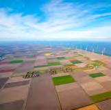
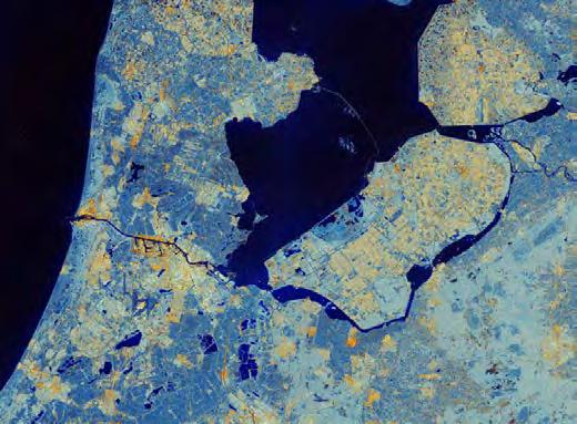
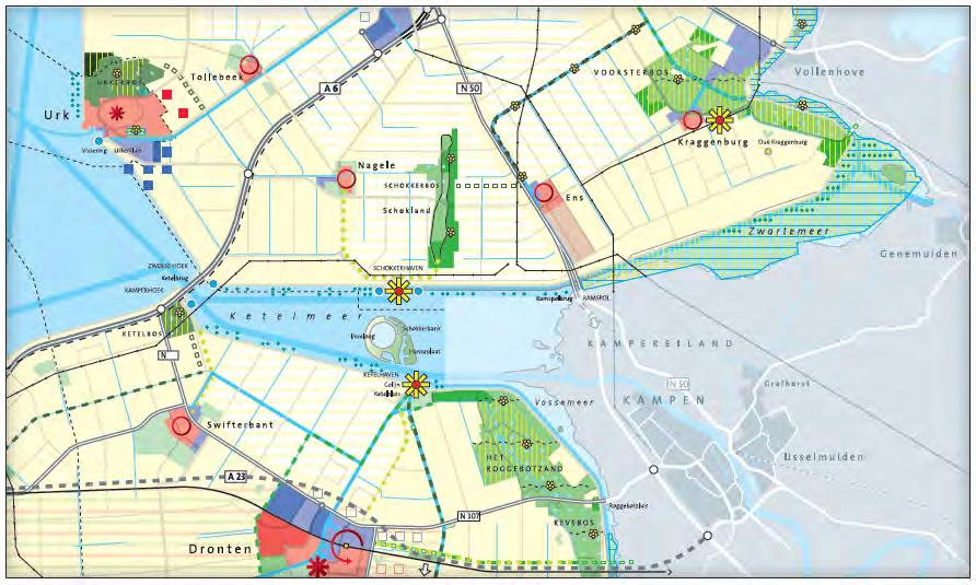
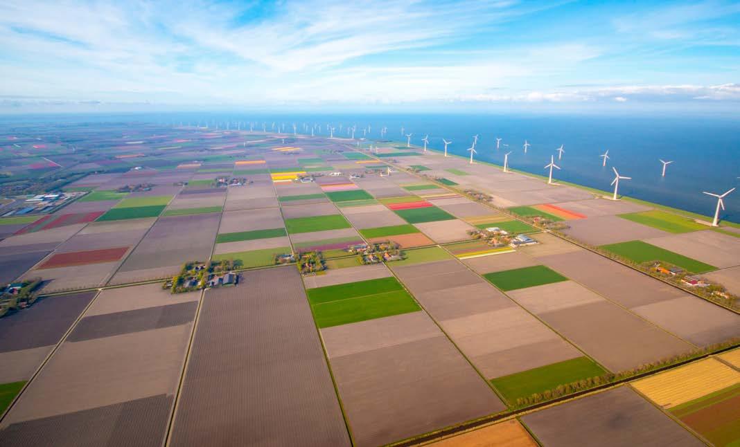
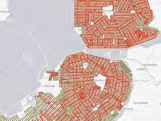
For the 40th anniversary of the Netherlands’ youngest province, this article features two geoinformation specialists spanning Flevoland’s full history. Their reflections offer a rare inside view of how geodata has evolved with the province.
Despite today’s highly advanced technology and expertise, many geospatial initiatives still fail to come to fruition. The problem often lies in the knowledge and language gap between technical specialists and executive decisionmakers. Well-rounded leadership skills hold the key to bridging this gap.
Geodesists are urgently needed to keep systems running, but where will they come from, what skills are needed, and what does that mean for training? To clarify challenges in the Nordic and Baltic countries and explore collaboration, the Nordic Geodetic Commission is mapping educational programmes.
The ongoing AI revolution, marked by rapid advances towards artificial general intelligence (AGI), is transforming the way we live and work. This is already having an impact in programming and general data management jobs, but how is it affecting the geospatial data scene?
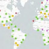
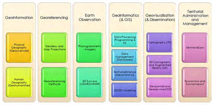
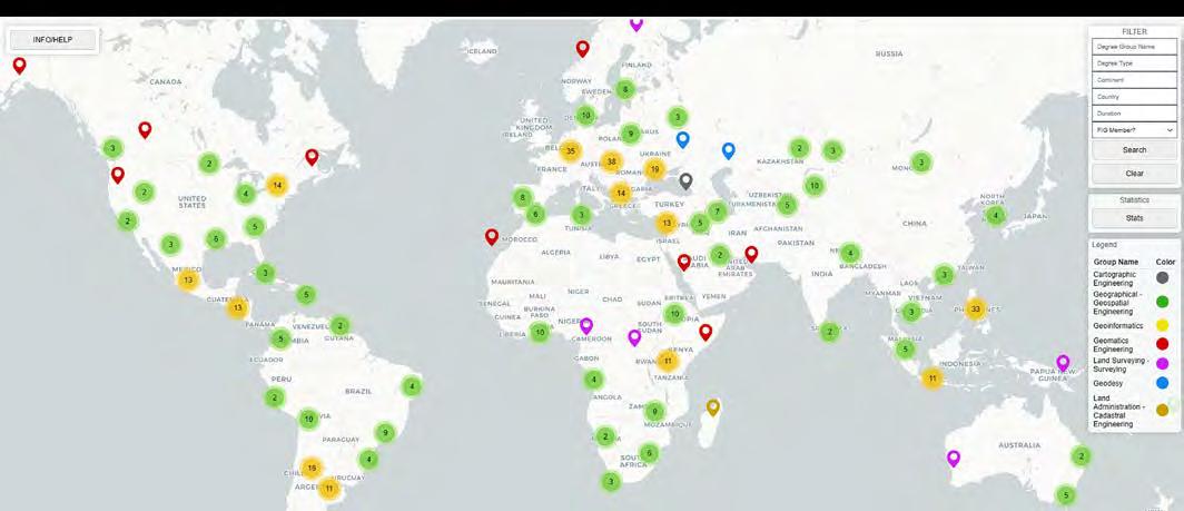
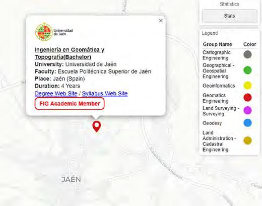
This article introduces a framework based on six core pillars of geomatics engineering and presents the FIG Worldwide Web Map Viewer of Geomatics Studies. Mapping over 700 universities, the tool provides a global census to identify curricular trends and safeguard the profession’s engineering boundaries.
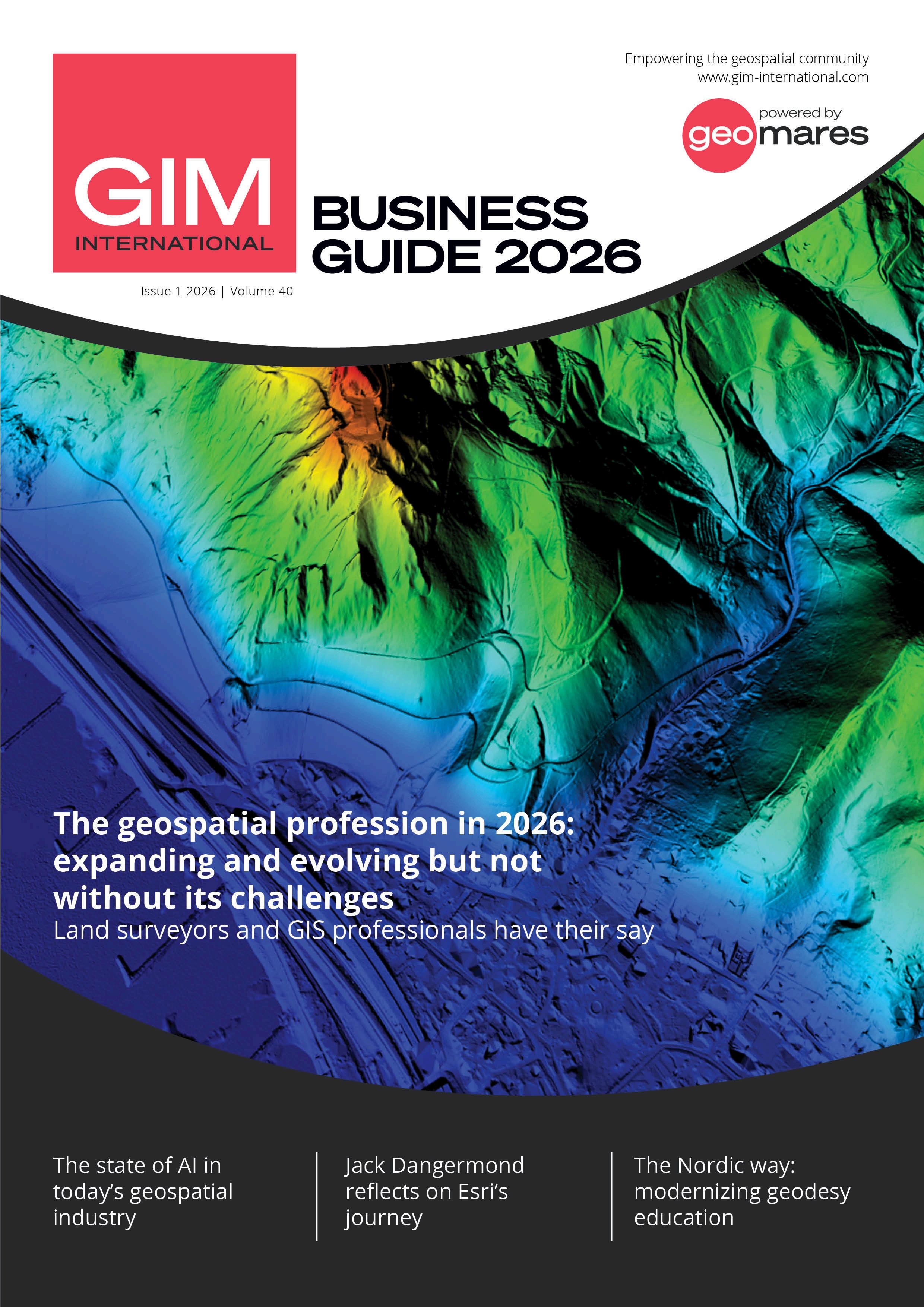
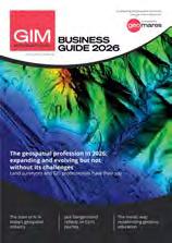
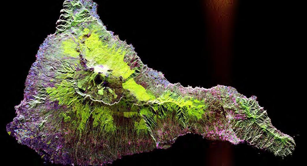
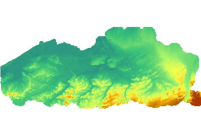
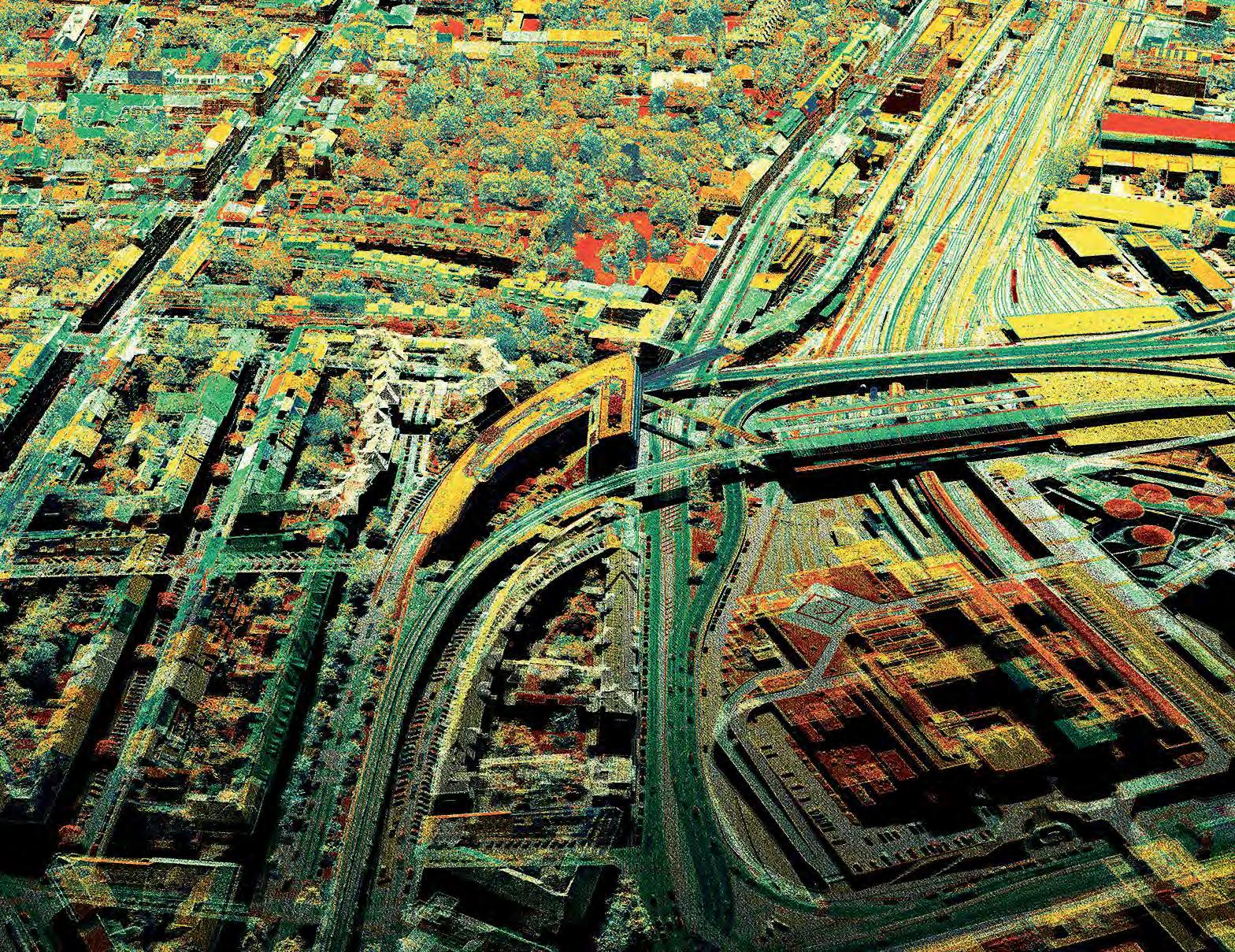
On the front cover of this issue of GIM International, a 1m-resolution digital terrain model (DTM) of the Drachenfels – the iconic rocky spur rising above the Rhine near Bonn, Germany – is rendered as a vivid colour spectrum. It transitions from deep blue along the floodplain through green and yellow to red at the highest peak. (Image courtesy: Bezirksregierung Köln)
Leica TS20
The standard for productivity
Built for surveyors who race the clock, brave the elements, and demand precision – Leica TS20 delivers speed and accuracy that define productivity.
Explore more
Owning the role
Around this time last year, I wrote here that we are living in an age of political and economic turmoil. That statement rings even truer this year. Things have not calmed down. On the contrary, it looks like we are on the brink of even more uncertainty – and that is not without consequences for the geospatial industry. Indeed, many hardware and software businesses will have noticed a shift in their revenue split, with defence and intelligence having become bigger contributors to the financial result. Beyond geopolitical challenges, we are still dealing with natural disasters, climate change, economic shifts and migration. Some say that a number of these developments are root causes of war and unrest, while others see them more as outcomes. There’s probably a degree of truth in both views. But either way, ‘geo’ plays an instrumental role in gaining insights and looking for possible solutions. For the past 40 years, GIM International has strived to serve as an independent, stable observer of all the industry developments. In line with tradition, this GIM International Business Guide brings you an overview of the most important findings from our yearly survey, compiled by our head of content, Wim van Wegen (see page 10). We are also happy and honoured to have been able to interview some of the world’s most notable figureheads in the industry for this special issue – first and foremost, Jack Dangermond of Esri. His original goal was to establish a better, more sustainable future for the world by gaining a deeper understanding of that same world, through geographical information systems that
could help people to manage their forests and cities better and to manage land and infrastructure in a more analytical way. That original vision not only definitely still stands, says Dangermond, but has also deepened: “We started with the idea that geographic tools could help people make better decisions. That core idea has guided everything”. You will find Wim van Wegen’s interview with him on page 15. I myself had the pleasure to interview Nick Maclean of the Royal Institution of Chartered Surveyors (RICS) about how the organization plans to strengthen the role of surveyors and geomatics professionals this year and beyond (see page 39). The importance of this is echoed by a plea from Andy Coote (see page 23), who makes a case for strengthening geospatial leadership. If the gap between technical expertise and geospatial business leadership is not bridged, the industry will lose opportunities to play its role. It’s quite clear that the global turmoil places a significant responsibility on the shoulders of the geobusiness. To counterbalance all the developments that are not good for our world, we should think and act to get the best out of our knowledge, data and leadership. This Business Guide contains profiles of all GIM International members. Those companies are the backbone of the geospatial ecosystem, rising to the abovementioned challenge. GIM International’s role in this whole ecosystem is a modest one, but –with the enduring support of our members – we will continue to update our readers in organizations, governments and companies worldwide on the latest developments. We are committed to providing you with the necessary information that enables you to take ownership of your role and to make changes for the better!
Durk Haarsma director of strategy & business development
Blue Marble Geographics
Blue Marble Geographics is a USbased software company offering geospatial tools with a focus on coordinate conversion, point cloud processing and machine-learning.
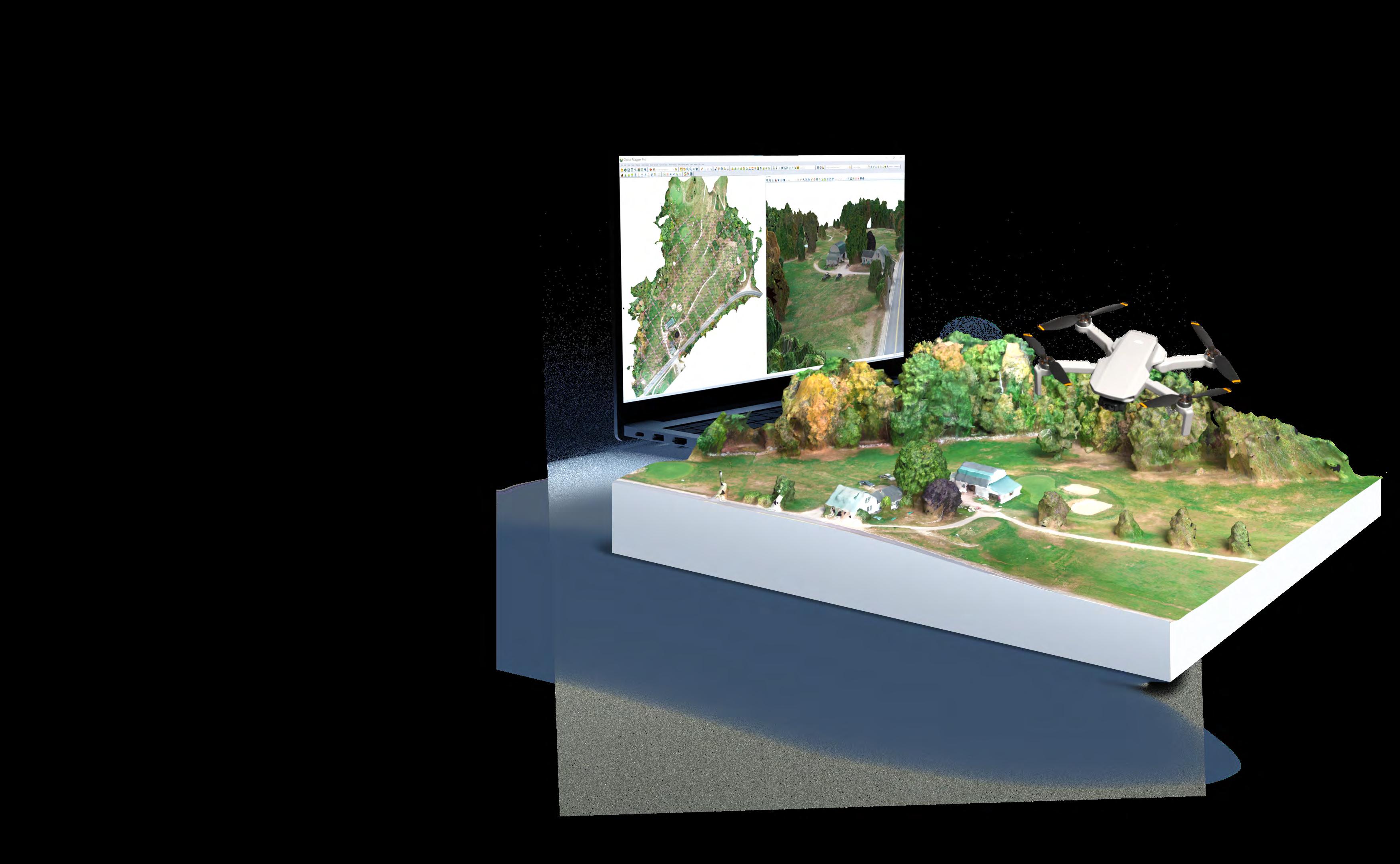
Blue Marble’s products include: Global Mapper, an all-in-one GIS application with an array of data processing and analysis tools; Global Mapper Pro, a suite of advanced tools for optimizing workflow efficiency, Lidar classification, also generating orthoimages and 3D models from drone-captured images; and Global Mapper Mobile, an app for efficient data viewing and collection while in the field. The company also offers Geographic Calculator, the industry standard for precise spatial data conversion and advanced coordinate system management, now with tools available in the cloud. All these tools are also available as software developer toolkits and libraries. For over three decades, Blue Marble’s products have been trusted by organizations around the globe – including government agencies, universities and Fortune 500 companies.
GEO Business
GEO Business is the UK’s largest geospatial event, designed to connect everyone involved in collecting, analysing, storing or sharing spatial data. The show returns to ExCeL London on 3-4 June 2026. With more than 130 companies showcasing geospatial tech, tools and solutions, visitors have the chance to get up-close to the latest innovations. Plus, the free-to-attend education programme features over 150 speakers. Hear from the brightest minds in the field, gain CPD points and get up to speed with the key trends. Don’t miss this chance to discover the latest developments in geospatial, get inspired and connect with others in the profession. Register for your FREE ticket now at: geobusinessshow.com
Hexagon
Hexagon is the global leader in measurement technologies. The company provides the confidence that vital industries rely on to build, navigate and innovate. From microns to Mars, its solutions ensure productivity, quality, safety and sustainability in everything from manufacturing and construction to mining and autonomous systems. Hexagon’s Geosystems Business Area focuses on combining accurate measurement, positioning and mapping technologies with industry-tailored workflows to help geodata-dependent industries capture, visualize and analyse the physical world, turning data into actionable insights for better decision-making and improved efficiency. It includes industry-leading brands such as Leica Geosystems, IDS GeoRadar, Hexagon Multivista, AGTEK, Xwatch and OxBlue.
NV5
NV5 is a global leader providing geospatial solutions, services and software to solve mission-critical challenges. From data acquisition and analytics to enterprise GIS solutions and software development, NV5 applies geospatial science to deliver end-to-end solutions and insights to mitigate risk, plan for growth, better manage resources, and advance scientific understanding. The company leverages the widest array of advanced remote sensing technologies and applies today’s most sophisticated analytic AI frameworks, including proprietary deep learning, computer vision and predictive analytic models tailored to clients’ needs. Through off-the-shelf and fully customized solutions, NV5 empowers its clients to enact meaningful change across enterprises, communities and the world.
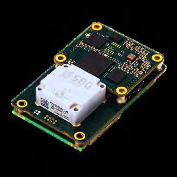
Oxford Technical Solutions (OXTS)
Oxford Technical Solutions
Ltd (OXTS) is a global leader in high-precision inertial navigation systems designed to support the most demanding surveying and mapping applications. Headquartered in Oxfordshire, UK, OXTS develops advanced GNSS/INS solutions that deliver centimetre-level positioning and orientation accuracy for mobile mapping, aerial mapping and geospatial data collection. By tightly integrating inertial sensors with GNSS technology, OXTS systems maintain reliable performance in GNSS-challenged environments such as urban canyons, dense vegetation and tunnels – ensuring continuous, high-quality data capture. Powerful post-processing software enhances accuracy and workflow efficiency, enabling surveyors to produce dependable results with confidence. Trusted by geospatial professionals worldwide, OXTS combines innovation, precision engineering and expert technical support to drive the future of mapping and spatial intelligence.
RIEGL
RIEGL is a leading international provider of cutting-edge airborne, mobile, terrestrial, bathymetric and UAV-based laser scanning technology for a wide range of applications in surveying. In addition to the headquarters in Horn, Austria – where research & development as well as production are located – RIEGL provides sales, support and service through the RIEGL USA headquarters in Winter Garden, Florida, its subsidiaries in Japan, China, Australia, Canada, Great Britain, Hong Kong, Germany, South America and France, and its worldwide network of distribution partners. RIEGL has been producing Lidar systems commercially for more than 40 years and focuses on pulsed time-of-flight laser radar technology in multiple wavelengths. RIEGL has always been committed to delivering the highest performance, quality, reliability and longevity of all its products and services to perfectly fulfil measurement tasks and fully satisfy the customers’ expectations.
Topcon Positioning Systems
Topcon Positioning Systems is an industry-leading designer, manufacturer and distributor of precision measurement and workflow solutions for the global construction, geospatial and agriculture markets. From high-accuracy scanning to advanced data modelling, Topcon innovations allow users to capture, process and analyse information with unmatched precision – streamlining workflows, boosting collaboration and simplifying digital transformation. Topcon Positioning Systems is headquartered in Livermore, California, USA. Its European head office is in Zoetermeer, the Netherlands. Founded in 1932, Topcon Corporation (topcon.com) is traded on the Tokyo Stock Exchange (7732).
Woolpert
Woolpert is a global leader in architecture, engineering and geospatial (AEG) services, with over a century of experience driving innovation and delivering impact. The company fuses deep technical expertise with a forward-thinking mindset to solve complex challenges across the public, private and government sectors. Woolpert is proud to be a certified Great Place to Work, a Top 25 Building Design+Construction firm, a Top 50 Engineering News-Record Design firm and a Global Top 100 Geospatial company. Woolpert operates from more than 75 offices across five continents – building smarter, more resilient communities around the world.
Zeusch Aviation
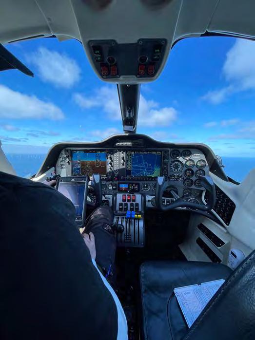
Zeusch Aviation BV delivers highperformance airborne solutions to the aerial surveying community. Based at Lelystad Airport (EHLE) in the Netherlands, the company operates King Air twin-turboprop aircraft tailored for demanding missions. Its services include aerial survey, surveillance, RF relay, Medevac and transplant flights, and business charters. Zeusch Aviation conducts missions worldwide, from Europe to the Pacific and from the Nordics to Africa, across diverse environments. Its aircraft support single and doublehatch configurations, with or without glass, and can operate unpressurized or at high altitude in pressurized survey setups. The King Air’s performance maximizes weather windows and efficiency. The team combines expertise from military, commercial and business aviation, including pilots, engineers and Part 145 specialists, ensuring safe, versatile, flexible and reliable operations.
Land surveyors and GIS professionals have their say
The geospatial profession in 2026: expanding and evolving but not without its challenges
By Wim van Wegen, GIM International
Every year, GIM International surveys geospatial professionals from all around the world to take the pulse of an industry in motion. This year’s results paint a vivid picture: a profession that admittedly has never been more relevant, yet one wrestling with real tensions – between opportunity and uncertainty, and between technological promises and the risk of being misunderstood. Here, members of the global geospatial community share their thoughts on investment priorities, the changing role of the professional and their confidence in the future.
Geospatial professionals have never been more important, according to many of the survey’s respondents. It is worth noting, of course, that those respondents are themselves geospatial professionals. Nevertheless, their sentiment is supported by the broader picture. Over the past few years, rapid technological advancements and a growing reliance on location-based data have fundamentally transformed how the role looks and what it covers. Today, geospatial professionals are key contributors across a wide spectrum of industries, from urban planning and environmental management to transportation and disaster response.
“As more and more of our infrastructures and buildings get digitized, the impact of geospatial grows,” observes a strategic business developer working at the intersection of geospatial and AI. A land surveyor from California, working in industrial construction since 1997, puts it in even more concrete terms: “More and more geospatial professionals are working in what I call industrial surveying, building mega-projects around the world and working with accuracies in the millimetres. It’s a very challenging and extremely stimulating high-end discipline that has absolutely nothing to do with boundaries and offers very good compensation for professionals with the right skills.”
More speed and precision
Satellite imagery, GNSS and the ubiquity of mobile devices have significantly lowered the barriers to collecting, analysing and visualizing location-based information, making it easier and faster to gather geospatial data. As a result, geospatial professionals can now tackle complex, realworld problems that were once difficult, or even impossible, to address with sufficient accuracy.
A researcher at the Universidad Tecnológica de Panamá describes the change in approach: “I use the same controller to switch from GPS to a robotic total station, fly my drone, and that’s it. I can do the work of many days in four or five hours. I can make decisions much faster and with total precision. The future is moving toward delivering results to the client on a geospatial platform.”
A geodetic engineer and owner of a small surveying firm in Romania offers a more nuanced perspective: “Time in the field has reduced, but time in the office has increased. The machines needed to process data have become more powerful, and more powerhungry. Storage needs have grown, too. Cloud services will be an option, but they will be limited by bandwidth and data safety.”
From measurement to meaning
One of the most notable themes running through this year’s survey is the shift from data acquisition to analysis, integration and decision support. As one respondent puts it: “As a professional, I am now more involved in providing decision support than simply data acquisition. The trend will continue, given that more policymakers are now depending on geospatial information to support decisionmaking.”
While the direction of travel is clear, the pace and smoothness of that transition varies considerably depending on the context. A mid-level manager at a small city government in the southeast of the USA describes a more constrained reality: “We still primarily perform data maintenance, as staff have been removed from our geospatial group. We have enough work to be performing analysis full-time, but we prioritize maintenance because the analysis will mean less and less as the data degrades.” This is a striking illustration of how technological progress can be slowed down (or even reversed) by internal organizational and governmental decisions.
The next major shift: convergence and integration
What makes the current era particularly exciting is the convergence of geospatial
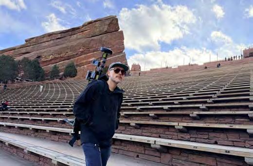
Mobile Lidar systems, such as the Tersus MVP S2 used here to map the Red Rocks Amphitheatre, are generating significant investment interest as key equipment among survey companies in the coming years. (Image courtesy: Desert Creative Group)
technologies with fields like artificial intelligence (AI), machine learning and big data analytics. This cross-disciplinary integration has greatly expanded the toolkit available to geospatial professionals, opening the door to innovative applications that would have been hard to imagine just a decade ago.
When the geospatial professionals were asked what they expected to shake up the sector the most, AI-driven, real-time intelligence was a recurring response. A large proportion of this year’s respondents take a measured view of AI, predicting that it will help professionals complete more tasks in less time, rather than replace jobs altogether. Simpler, repetitive tasks will increasingly be handled by AI, while more complex work (analysis involving multiple departments, nuanced judgment calls) will remain firmly in the hands of humans.
“I believe that AI-driven workflows have the most potential to significantly reshape the geospatial sector in the coming years. AI can enhance data analysis, automate processes and improve decisionmaking. It can also enable the development of more advanced applications such as predictive analytics and autonomous systems. As AI technology continues to advance, its integration into geospatial workflows will likely lead to increased efficiency, accuracy and innovation in the sector,” one of the respondents states.
According to various industry survey participants, this will put serious pressure on the existing GIS model, which has remained unchanged for decades. With the cities, ports and mobility systems in today’s world constantly changing and constantly generating data, that model based on static map layers, periodic projects and traditional workflows simply cannot keep up. AI is pushing the sector away from producing maps and towards generating insights, automatically and continuously.
Another recurring theme is data integration. GIS data is still mostly stored in separate ‘silos’ and rarely linked with other applications. There is a growing demand for interfaces allowing data to be maintained consistently across systems rather than duplicated. Moreover, decision-makers no longer want to wait for an analyst to get back to them. They want to know right now: where is the congestion, which vessel is behaving suspiciously, where is the next risk emerging?
Spatial intelligence needs to move out of its GIS silo and into the operational systems where decisions are actually made. The shift from a tool-focused approach to an outcome-focused one is happening –whether the sector is ready or not.
A GIS and remote sensing specialist based in Mali articulates the opportunity clearly: “The integration of artificial intelligence into geospatial workflows is already making it possible to automate complex tasks such as satellite image classification, change detection and object extraction from large datasets, significantly reducing processing time and improving accuracy of analysis. Combined with automation, it enables a shift from one-off analysis to near-real-time monitoring systems. Alongside this, the rise of digital twins and sensor fusion – bringing together satellites, drones and IoT devices – enables up-to-date representations of landscapes and environments, offering a deeper, more predictive understanding of complex phenomena.”
Agentic AI is set to take this a step further. By handling much of the routine but time-consuming work of data maintenance and analysis, it will free up professionals to focus on interpretation and strategy. One respondent states: “Agentic AI will help data maintenance and analysis. AI-powered robotics will make data acquisition more efficient. We will see more sensor fusion (combining data streams from satellites, drones and IoT devices, Ed.) and a continuous-update approach to keep data current. Metadata will be easier to maintain and more important when asking AI agents to answer a question.”
As AI agents become increasingly able to answer complex spatial queries, well-structured metadata will become not just useful, but essential. Meanwhile, sensor fusion will result in digital twins becoming “more automated and higher resolution and accuracy,” according to one experienced survey company owner.
Value and visibility
Despite undeniable growth in relevance, a persistent challenge runs through this year’s responses: ensuring that geospatial expertise receives the recognition it deserves. “Clients, including decisionmakers, place low value on geospatial work, particularly in developing countries,” says an experienced hydrographer. “Professionals have to spend a lot of energy ‘selling’ the geospatial world. The industry should organize itself better to help increase appreciation of geospatial professionals, through university programmes, government activism and professional societies.”
One respondent based in the east of the USA frames the challenge even more sharply: “There are myriad strategic values in the work of geospatial professionals. The challenge is achieving true visibility and a seat at the table. The profession has grown in tandem with the IT sector, which has given us great opportunities but also the problem of being seen as just a fancy Excel table, and by extension, a job that anyone with basic IT skills can perform. We need a way to highlight our unique abilities if we want the correct answers, not just the easy ones.”
Others are more optimistic. “The entire profession has been upgraded,” one respondent notes. “Most professionals are utilizing better instruments and better software and achieving incredible results. Clients who have made significant investments recognize today’s geospatial professionals’ level of talent and appreciate it. We
just need to keep raising the bar, and keep it high.”
The longer-term objective is not only for clients to increasingly see geospatial expertise as a valuable operational support tool for efficiency and risk management, but also for it to become regarded as a core strategic capability – both for predicting change and for guiding high-level decisions. That requires stronger awareness, clearer communication of business value and deeper integration into executive decision-making processes.
Confidence in the future
When asked about their confidence in the geospatial sector’s future, this year’s respondents painted a very mixed picture. On the one hand, there is real (and widely shared) optimism that the sector is heading in the right direction, particularly driven by technological innovation, a new generation of professionals and growing recognition of what geospatial expertise can deliver. On the other hand, that confidence is consistently being tempered by a range of concerns –some specific to the profession and others reflecting broader shifts in the economy, geopolitics and society.
“Most confidence comes from signs that the younger generation is becoming less enamoured with technology and paying more attention to the fundamentals,” says an experienced surveyor from the US state of Idaho. “My biggest concern is that the industry is increasingly being led by large corporate owners who are disconnected from individual projects.” An industry peer from elsewhere
in the USA echoes the optimism about new entrants: “Confidence is hard to come by right now, but the consistent embrace of geospatial technology by newcomers still gives me hope that we have a chance of not being consumed by the IT sector.”
The wide-ranging concerns include cybersecurity threats, regulatory challenges, geopolitical tensions, skills shortages and a race to the bottom on pricing. One UKbased respondent tellingly highlights a specific issue: “The biggest concern is the marketing of ‘survey-grade accuracy’ and the misunderstanding of that term, particularly by buyers who look only at the bottom line without understanding the value.” Another respondent comments: “A lot of clients think it is so easy to gather data (drone mapping, for instance) and that they do not need to pay for someone who delivers precise maps - until they make mistakes, since they are making decisions based on imprecise data.”
In the confidence equation, AI cuts both ways too. While many see it as a driver of efficiency and innovation, others worry about it damaging the professional reputation, eroding quality standards or creating a false sense of accessibility that undervalues expertise. Some are cautious about relying on it too heavily. Many point out that it should be incorporated into education programmes.
Investment outlook
When it comes to where organizations are planning to invest their budgets, a clear pattern emerges from this year’s survey. The main focus is on AI-enabled analytics
platforms, cloud-based data infrastructures and advanced data acquisition technologies –chiefly, high-precision Lidar, multi-sensor drones and real-time monitoring solutions. These investments share a common logic: making organizations faster, smarter and less dependent on manual processes.
A notably large number of respondents mention handheld scanners, valued for their versatility across diverse data capture scenarios. One respondent offers a candid take on their investment focus: “SLAM, because everyone else is using this method and pushing prices down so far that traditional, more accurate survey techniques are no longer viable.” This serves as a reminder that spending is shaped by not just strategic vision but also competitive pressure.
Simple goal
The survey reveals that, for many organizations, the goal is actually quite simple: to eliminate the friction between data and decision-making. Users need to be able to interact with geospatial data intuitively and uncover insights in seconds, not hours. The scalability of processing power is increasingly non-negotiable. Performance data, real-time analytics and system resilience have become genuine competitive differentiators as clients routinely handle billions of location points from vehicles, vessels and connected infrastructure. That’s why integration is perhaps the most telling indicator of where
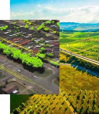
GeoAI is revolutionizing how quickly we extract insights from complex datasets, empowering us to tackle the planet’s most urgent challenges. As a result, expectations among geospatial professionals are soaring. (Image
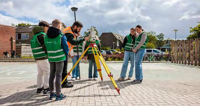
During GeoWeek 2025 in the Netherlands, eighth-grade students attended a guest lecture by MUG Ingenieursbureau, as the geospatial industry actively seeks to inspire and attract new talent for the future. (Image courtesy: Movares)
courtesy: Esri)
the market is heading. Clients are done with standalone tools. They expect spatial intelligence to be embedded directly into their operational systems, dashboards and digital twins.
While the strategic value of geospatial expertise is increasingly recognized – across urban planning, logistics, disaster management and environmental conservation – that recognition alone is not really enough. The real opportunity lies in closing the gap between awareness and action: moving from geospatial data as a supporting resource, to geospatial intelligence as a core driver of decision-making. The future belongs to organizations that treat geospatial professionals not as technical specialists operating in the background, but as essential partners in shaping strategy, driving innovation and building more sustainable and efficient systems.
Commitment and timing
Getting there requires more than just better tools; it demands a genuine shift in mindset, deeper collaboration between geospatial experts and decision-makers, but also a shared commitment to putting spatial intelligence at the heart of how we understand and respond to complex challenges. The timing also matters. Climate change, rapid urbanization, infrastructure pressure and growing geopolitical instability are producing exactly the kind of complex, location-dependent challenges that geospatial intelligence is uniquely equipped to help address. The profession is not evolving in a vacuum; it is evolving at precisely the moment when the world needs what it has to offer most. That convergence, more than any
single technology or market trend, may be the most compelling reason for confidence in the road ahead.
Much of that confidence, as this year’s survey makes clear, rests with the next generation. Younger professionals are entering the field already fluent in both technology and data. Perhaps even more encouragingly, several respondents suggest that this generation is also reconnecting with the fundamentals: precision, craftsmanship, the responsibility that comes with shaping how the world is measured as well as understood. That combination of technological capability and professional grounding is exactly what the sector needs to carry its relevance forward.
In an ideal world…
So, in an ideal world, how will the geospatial sector look in five or ten years’ time? Rather than having to explain its value, it will be demonstrating it daily – embedded in the systems that run our cities, guide our logistics networks, protect our natural resources and inform our biggest collective decisions. The profession will have moved from the margins of strategic conversations to their very centre. And the new generation of geospatial professionals will not just be technically skilled, but also recognized, rewarded and relied on as indispensable partners in navigating an increasingly complex world. The technology is ready. Now, the question is whether organizations, policymakers and society are prepared to truly embrace all that geospatial intelligence makes possible, and act on it.
for Your Entire Organization
Agent ™ Ge
GeoAgent is here—a new agentic AI platform for geospatial intelligence! It interprets intent, orchestrates workflows, and delivers geospatial outputs where you need them—automatically.
Move beyond dashboards and processing to turn geospatial data into operational decisions at speed.
See GeoAgent in Action and How It Can Support Your Users, Workflows, and Objectives.
GIM International interviews Jack Dangermond
A deeper understanding of the world to design a better future
By Wim van Wegen, GIM International
In 1969, Jack and Laura Dangermond launched Esri with a bold idea: geographic tools could help people understand – and actively shape – a better world. Such tools now underpin billions of maps created each day, supporting fields ranging from urban planning to environmental management. In this interview, Jack Dangermond reflects on Esri’s journey – from early custom projects to today’s AI-based and cloud-based innovations – and shares his perspectives on the current and future geospatial industry. How did the specialized concept of geographic science evolve into a global essential? Why does he describe GIS as “the nervous system of the planet”? And how has the relationship between humans and maps evolved over time?
Does your original vision when founding Esri still stand today?
When we founded Esri in 1969, the idea was to create what we called ‘environmental systems’, or what I would now describe as ‘geographic systems’. The original vision was that a mapping and analysis framework could help people understand the world more deeply and ultimately help design a better future. Initially, we wanted Esri to be
a research institute – a nonprofit – but that didn’t work financially. As youngsters, we simply couldn’t secure grants for something that bold. So after a couple of years, we switched to a normal company model: sell a vision, do the work, get paid, sell another vision, do the work, get paid, and so on.
For most of our first decade, we mainly did project work. We applied computer mapping
tools and spatial analysis to real projects. Looking back, that was unfortunate in one way, because we didn’t yet have the idea of building a software product. We built software around projects, and many of our customers didn’t even realize they were receiving software. They just saw the results, appreciated those results and moved on. But after eight or nine years, something changed. People began asking whether they could get our software themselves. Up to that point, we had provided our tools as open-source software. One example was the Polygon Information Overlay System, a system we called IONS. We had built a collection of tools for one customer, and they used it on their mainframes while we used our own mainframe here. Over that first decade, we accumulated quite a few customers who wanted to use the software directly.
Around that time, a group of about 11 of them gathered in a building here in Redlands and urged us to take what would today be called ‘homemade software’ and turn it into a real product. That was difficult because we were so focused on doing the project work. And the projects themselves were really fascinating – we built a whole GIS for the State of Maryland that was used to build their land-use plan, we did forestry studies for the US Forest
Jack and Laura Dangermond founded Esri in 1969 with the belief that geographic tools could help people understand and actively shape a better world. (Image courtesy: Eric Laycock / Esri)
Service, we collected data, produced maps, performed analytics, and helped people make decisions, like where to locate a power plant or a transmission line. We contributed to building an atlas of cancer patterns in the USA, helped companies pick retail sites, or assisted housing developers with environmental assessments that would guide more sustainable land-use planning. It was all incredibly energizing.
With so much project work happening, how did Esri then make the shift from custom projects to creating a true GIS product?
It really came from our users. By the end of those first ten years, customers were increasingly anxious to do the work themselves. We had pioneered many of these methods, but we weren’t the only ones thinking this way. People like Ian McHarg, the famous landscape planner, were doing similar things using plastic overlays. And many of my professors at Harvard, like Carl Steinitz, were articulating the conceptual foundations of geographic overlays. So in some sense, we were running in parallel – they were doing it in non-digital
ways, while we were doing it with digital tools.
But the idea caught on. And I was very fortunate around that time, in 1981, to be joined by a very talented software engineer, Scott Morehouse. He worked with our developer team to create the first principles-based GIS. Meanwhile, Roger Tomlinson – widely considered the inventor of the term ‘GIS’ – was consulting with forestry agencies around the world. They would run benchmark tests, comparing our software with other emerging tools. We took those benchmarks seriously and used the competitive pressure to build a better, more rigorous GIS.
That was the beginning of GIS becoming a system, something that could grow into a platform for building other systems. People wanted to manage their forests better, manage their cities better, manage land and infrastructure in a more analytical way. At that time, consultants and users began writing RFPs, and we had to demonstrate our capabilities in formal competitions. We competed against billion-dollar firms like
IBM, Intergraph and others who focused on automated mapping using CAD tools. And we were able to win because we were introducing a new generation of technology built on the concepts of GIS rather than automated mapping.
So to come back to your first question, the original vision absolutely still stands. In fact, it has only deepened. We started with the idea that geographic tools could help people make better decisions. That core idea has guided everything. Whatever the application, the principle’s always the same: bring data together geographically, visualize it, analyse it and use it to make better choices. Over time, that vision evolved into something even larger: the recognition that GIS could become not just a set of tools but a platform – a system for managing and integrating the knowledge needed to understand our world. Today, with interconnected services, cloud infrastructure, sensors, AI and billions of maps being made every day, that original vision is more alive than ever: we are still trying to build tools that help people understand the world and design a better future.
Coverage so much greater than GNSS
A complete suite of precise positioning solutions that exceed your farthest goals
Centimeter-Level Positioning Accuracy, Anywhere
With local RTK base stations, VRS networks and Trimble’s worldwide CenterPoint® RTX correction service via satellite or cellular/IP
Longer Product Life Cycles
Durable, completely supported future-proof solutions that last as you grow
Precise, Consistent Performance
Trimble ProPoint® GNSS technology leverages all constellations and frequencies with tight INS integration and sensor fusion to deliver unparalleled performance under challenging environments
Global Support
Get expert help through the entire lifecycle, wherever you are
Scalable technology platforms for the full autonomy stack and faster go-to-market implementation
LEARN MORE
The geospatial landscape has shifted dramatically over the years. How does Esri remain a market leader?
Esri’s position has been shaped by a few consistent principles. As a private organization, we are not driven by public markets or short-term financial pressure. That gives us the freedom to focus on serving our users first. Our engineering direction is guided by that mindset, and it stays current because thousands of engineers around the world are constantly asking a simple question: what do our users actually need, and how can we translate those needs into innovation? Another factor is our long-standing focus on technology transitions. We have lived through each major shift, from mainframes to minicomputers, then workstations, desktops, clientserver architectures, and now cloud and mobile environments. At every stage, we have continued to reinvest a significant share of our revenue into research and development. Today, our labs span the globe, with teams in places such as Zurich, Edinburgh, Spain, Turkey, Australia and India, all working at the edge of reality capture, digital twins, artificial intelligence and machine learning. That breadth of effort reflects a long-term commitment rather than a short-term product cycle.
Since the 1980s, our core philosophy has been to build a library of high-performance tools based on first principles, designed so others can adapt and extend them. That approach continues today across ArcGIS Pro on the desktop, ArcGIS Enterprise within organizations, and ArcGIS Online, where millions of users now create four to five billion maps every day. Adoption continues to grow at 35% annually.
Billions of maps a day? That’s mind-blowing…
The way people use and work with maps is fascinating, diverse, and reflects an evolution of geography itself. I am not a scholar in the evolution of civilization, but I find books such as Sapiens and Nexus particularly interesting because they cover some 50,000 years of history. When we go back 4,000 to 5,000 years, we see that maps already played a role. One of the best surviving examples is found in western France, where a large, two-metre clay tablet was discovered. It lays out roads, small villages and cadastral buildings. When modern digital maps are overlaid on it, the accuracy is striking.
Fast-forward to the mosaic map of Jerusalem in a church in Jordan, then to early collections of cartography, such as those preserved by the Catholic Church at the Observatory in Rome. After that came the development of instruments – Galileo’s transformational tools, telescopes and compasses. Space, geography and maps have always played a role in the evolution of civilization. Today’s industry professionals should be proud of that legacy, because their work – the practical application of digital instruments, cartography and analytics –is now evolving at an enormously rapid rate. GIS is helping to expand the role of geography, spatial thinking and mapping – not least thanks to our customers, who are embedding components of our platform everywhere, including directly into field devices.
We’re witnessing the rise of AI. How do GIS and AI relate to each other currently, and what can we expect?
I’ve spent a lot of time with executives from large IT companies and even they have no idea how technology will change in ten
Jack Dangermond: “I hope GIM International readers will take to heart that they are doing important work, and how they do it matters.”
years’ time. It’s exhilarating, but foolish to speculate too far. What we’re seeing now are developments in four main areas: feature extraction, AI assistants, agent-based systems, and large language models around geospatial data. In terms of feature extraction, we have embedded into our software roughly 90 image-based models that users can access freely. These models leverage computer vision and AI to extract features from imagery, and people adapt them to their own local data to create building maps, parking maps, flood maps and other thematic products from different types of imagery. That approach has become quite common across the geospatial community. For observation and interpretation, we apply GeoAI to pull out features, update maps and refresh datasets. That capability is now accelerating into the mobile environment. Models are being embedded directly into tools such as ArcGIS Field Maps and Survey123, enabling people to recognize features from photos and automatically populate forms or capture stories about a location. In many cases, this significantly speeds up data collection. Behind all of this are traditional geoprocessing tools that automate measurements and connect them directly to GIS databases as transactions. Much like scanning a barcode, you can update a city’s vegetation inventory or a utility company’s asset condition data almost instantly.
‘Assistants’ are built-in helpers that sit alongside the software and help GIS professionals do their work better. We now have assistants across virtually all of our software, similar to what companies such as Microsoft or Salesforce are doing. These systems don’t replace GIS professionals; they help them work faster, automate routine tasks, navigate complex tools and think problems through more efficiently.
Given the volume of documentation involved, that kind of support makes a real difference. We are also applying these assistants to programming. Many users rely on Arcade, our web-based scripting language, to automate their workflows. We are now introducing assisted scripting for Arcade, and the same approach is being applied to Python. Users can generate a working script automatically and then edit it as needed.
It is still very early days for what people are calling ‘agents’ or ‘agentbased systems’ and we don’t yet have fully productized examples, but we are building agents for specific customers, such as weatherforecasting agents. Standards are emerging that allow these agents to talk to one another, as well as to people. It’s hard to say exactly how this will evolve, but I do think agents – working alongside assistive tools – could become foundational for the next generation of geospatial applications. We already think in terms of layers – data, tools, applications built through scripting, and potentially an agent layer on top of that – and natural language could be used to interact with it. So it is worth keeping an eye on the developments around an agent-based geospatial ecosystem. Lastly, some cloud providers are experimenting with large language models around geospatial data. It’s still very expensive and there is no strong evidence that it is going to be very valuable, but something may come of it.
The great dilemma today is our lack of understanding and our inability to collaborate – that’s the fundamental thing! Geography and mapping are the languages of understanding, and understanding precedes action. What we’re doing as a community, millions of people worldwide, is building the foundation for better
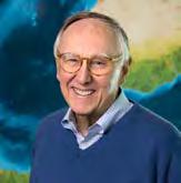
As president of Esri, Jack Dangermond has played a defining role in the evolution of GIS technology. (Image courtesy: Esri)
understanding. And AI will build on that foundation, using the language of maps to facilitate collaboration and to address these challenges.
The ‘E’ in Esri stands for ‘environmental’. How can GIS help us address today’s challenges related to climate, natural disasters and environmental preservation?
I think some climate and biodiversity challenges are being politicized. That’s unfortunate, because climate change is not a myth or a political statement – evidence shows it’s actually happening. The real question is what humans should do about it.
GIS is built on geography, the science of our world, and geography integrates many other sciences: geology, climatology, health science, economics. It’s an abstraction of our world in digital form. What isn’t geographic? In fact, my new word for geography is ‘everything’.
So geospatial players in the GIS world –drawing on data from almost every other discipline – are increasingly involved in planning, designing and managing the fundamental infrastructure of modern society. It is hard to think of anything of real significance today that isn’t, in some way, managed using GIS, maps, geographic knowledge or imagery. While most GIS users are working in their own organizations –from water companies to planning agencies or other businesses – all the data layers can be brought together into a network of interconnected, distributed services and called upon as a kind of nervous system of the planet. And that information and geospatial infrastructure has a real role to play in the next step of the planet’s evolution. Because the emergence of this nervous system of the planet is real, and it’s going to continue. Edge devices, computing at the edge, AI built into sensors, and large enterprise GIS systems are all coming together with applications that can be used by everyone. That’s why the theme of the Esri User Conference 2025 was ‘GIS integrating everything, everywhere, for everyone’.
This rapidly emerging infrastructure, with billions of maps being made every day, is guiding national security, policing, infrastructure, investment, forest management, protected areas,
shipping, transportation – everything. As it becomes smarter, humans will become more knowledgeable. There will be more geospatial intelligence, which will lead to better outcomes – including for the environment.
What’s your view on professional associations like FIG, ISPRS, OGC and UN-GGIM?
I believe deeply in the value of professional associations because they create spaces where people can connect with each other’s work and ideas. They act as facilitators –places where people can communicate openly and safely. Personal relationships matter. They shape your thinking and help you understand whose shoulders you’re standing on. In my own life, my father was one of those people, but many of the others who influenced me most were professionals I’d met at conferences who showed empathy for a young kid starting out. They offered advice, shared knowledge and became mentors and even friends. Those kinds of relationships fuel idea creation, knowledge exchange, confidence building and collective understanding of what is happening in the world.
Virtual interaction can never fully replace that. During COVID, many believed virtual conferences would become the new norm, but they didn’t stick. There’s an intimacy and bond that develops when people are physically together – whether it’s over a cup
of coffee or simply through being in the same room – that technology can’t replicate. That’s why professional societies and the meetings they organize remain so important. They create the relationships that enable mentoring, collaboration and the ideation and acceptance of new ideas. And mentoring is essential for creating the future!
When it comes to making the world a better place, how important is accurate parcel mapping for national economies, and how can GIS help governments develop affordable cadastral systems?
It’s my strong opinion that cadastral systems are the foundation for civil society. Countries with strong cadastres tend to be more successful – more stable, self-sustaining through taxation, better governed through administrative dimensions. We see the opposite in developing countries where the lack of a cadastral system leads to informal economies and corruption. Many efforts by countries in the Global North to export their technologies to the Global South have failed because they couldn’t afford the highaccuracy systems or didn’t have applications requiring them.
About five to seven years ago, we began developing a new parcel fabric. This is a data model designed to bring surveying and land boundaries together within a single system. Led by Chief Architect Amir Bar-Maor in the Netherlands, the team built this model and its supporting software directly inside ArcGIS. It works for both large and small cadastral systems and has already been adopted by land agencies in Switzerland and Sweden, as well as by local governments in Canada, with around 400 implementations to date. We are now introducing a new ArcGIS Online capability that has the potential to change how cadastral systems are delivered, particularly in developing countries.
Conventional cadastral systems often struggle in developing contexts because they depend on office-based infrastructure, climate-controlled environments, IT specialists and expensive software. Our web-based editor removes many of those barriers. It allows users to capture parcel data in the field using approximate GPS or high-performance GNSS, store that data in the cloud, scan and load existing parcel records, edit boundaries and generate maps and standard tax documentation, all within a
In The Power of Where, Jack Dangermond, co-founder of Esri, shares the ideas that have shaped the world’s leading mapping software company.
single environment. Moreover, ArcGIS Online operates as a softwareas-a-service (SaaS) environment, meaning users do not need to invest hundreds of thousands or even millions of dollars upfront in hardware or local installations. They simply subscribe, with access to editing and mapping tools at different price levels.
This approach supports fit-for-purpose land administration: walking parcel boundaries, approximating limits in collaboration with neighbours, and plotting parcels directly against imagery. It is not about replacing high-precision surveying where that is required, but about enabling practical, affordable cadastral systems that match local needs and capacities. Rather than relying on large, centrally funded or donor-driven projects, communities can start small – often at the neighbourhood level – and grow at their own pace. Modern measurement systems can still be integrated where available. This bottom-up approach allows cadastral modernization to expand organically over time.
With many now adopting open-source solutions, how do you see Esri’s role evolving, and what opportunities do you see for collaboration with the open-source community?
Our history with open source began long ago, but our users ultimately encouraged us to productize our tools so they could be supported without requiring software engineers on staff. At the same time, we’ve worked hard to ensure those tools remain open and interoperable, with open architectures, open APIs, open services and open standards. That openness is essential for building the system of systems that will be needed for the next stage of how we manage and understand our world.
We don’t dislike the open-source community at all. In fact, we have many collaborations where our tools work with open-source tools, both in the geospatial world and beyond. As I’m sure you know, we support and appreciate the OGC consortium, for instance. We embed things like GDAL into our platform, which has benefited us, and we share and integrate with the R community – the open-source statistics and data-science platform.
While there are areas of overlap and in some cases competition with our tools, generally we would assert that we can provide customers with more business value for their investment – even small ones – by giving them a COTS (commercial off-the-shelf, Ed.) platform.
Is there anything else you would like to share with our readers in the geospatial community?
One thing I reflect on from time to time is that the geospatial community is essential for our future. I hope GIM International readers will take to heart that they are doing important work, and how they do it matters. That means building the right data, the right systems and the right maps, applying the latest science and technology, and bringing together our best information, our best thinking and our most creative design ideas. Geospatial knowledge is evolving rapidly, and its importance is only increasing. But I also want to emphasize that our future requires more than technology alone. It requires community. This goes back to the professional meetings and collaborations in organizations such as ISPRS, ASPRS and the OGC. Technology is critical, but it’s the people who make progress happen. I truly believe the geospatial community will play a vital
About Jack Dangermond
Jack Dangermond is the founder and president of Esri, the world’s leading geographic information systems (GIS) software company. Together with his wife Laura, he established Esri in Redlands, California in 1969 – driven by a vision to harness spatial data as a tool for understanding and improving the world. Under Dangermond’s leadership, Esri has grown into one of the largest privately held software companies in the world, built on a foundation of continuous innovation, deep investment in research and development, and a genuine commitment to its customers.
Today, Esri’s GIS technology is an essential tool across the private, public, and nonprofit sectors, empowering organizations to make smarter, location-informed decisions. Dangermond is widely recognized as a pioneer in spatial analysis and one of the most influential figures in the history of GIS. He holds an undergraduate degree in Landscape Architecture from California State Polytechnic University, Pomona, a Master’s in Urban Planning from the University of Minnesota, and a Master of Landscape Architecture from the Harvard University Graduate School of Design.
role in shaping what comes next in the world. At its core, this work is about creating a culture of sharing, collaboration and integrated thinking – something that geography and geospatial information are uniquely able to support. By bringing data and powerful technology together, we can transform how we understand the world, how we work together and how we solve problems more holistically to build a better future.
Looking back, I think I intuitively sensed this potential even as a kid. My whole life has been about trying to advance the technical innovation needed to realize it. And what I’m seeing now is that everything is finally coming together. With web services and interconnected systems, geospatial technology is becoming a truly powerful platform for understanding and guiding the evolution of the planet. But above all, this isn’t about me. It’s about all the people in this ecosystem – GIM International readers, our users, practitioners everywhere – who are making it real. It’s not one vendor or one agency. It’s a system of systems. And that system of systems needs support through collaborative, open and interoperable technology.
Handheld Capture Reality Solution
Unlock game-changing insights with advanced RTK accuracy, dynamic AR tools, and e cient point cloud work ows.
Scan to learn more
Learn more at topconpositioning.com
Why geospatial practitioners must master the ‘business of geography’
The geospatial profession’s paradox
By Harry Storer and Andrew Coote, ConsultingWhere
Despite today’s highly advanced technology and expertise, many geospatial initiatives still fail to come to fruition. The problem often lies in the knowledge and language gap between technical specialists and executive decision-makers. Well-rounded leadership skills hold the key to bridging this gap.
The geospatial profession has never been more technically capable. From high-resolution remote sensing to AI-accelerated analytics, the tools are evolving rapidly and multiple training courses are available to help practitioners exploit these advances. Yet despite this innovation, many geospatial initiatives – such as those needed to address climate change or safeguard supply chains – often fail to come to fruition. This is not because the technology fails, but because the leadership skills needed to develop, promote and secure investment are often poorly developed.
Geospatial practitioners must be able to shape new ideas and capabilities into powerful business cases, work with – and understand – the business objectives of stakeholders, and be able to influence key decision-makers. In short, they need to develop wellrounded leadership skills.
The technical ceiling
For decades, the geospatial profession has prioritized technical excellence. Practitioner communities have advanced standards, certification and peer exchange. Technology leaders such as Esri have continually expanded the capabilities of GIS platforms, cloud infrastructure and spatial analytics. Too often, GIS teams are viewed
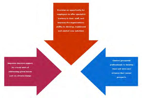
Benefits axes of geospatial leadership training.
as service providers rather than strategic partners. They respond to map requests. They generate dashboards. They maintain data layers. They support projects. But they are not consistently included when strategic priorities are defined or budgets are allocated. The question is: why?
The answer frequently lies in a knowledge and language gap between technical specialists and executive decision-makers. Executives and elected officials operate in a framework defined by return on investment, risk mitigation, cost control, regulatory compliance, organizational performance, strategic alignment and improvement to public services. When geospatial practitioners present their work, they often emphasize accuracy, resolution, innovation or methodological rigour. Take, for example, a statement such as ‘We implemented a new spatial data model that improves topological consistency’. This speaks to technical accomplishment. While these qualities matter, they do not automatically answer the executive question: ‘How does this help meet our business objectives?’.
Therefore, geospatial practitioners must increasingly be able to translate spatial insight into measurable organizational outcomes. By saying ‘We reduced infrastructure planning errors by 18%, preventing costly redesigns and accelerating project delivery by six weeks’, they speak to business value. If such skills are not developed (and fast), new and innovative ideas risk being misunderstood, underfunded or, worse still, sidelined.
Why leadership skills matter now
Three forces are now making leadership skills particularly urgent for geospatial practitioners who wish to develop and promote solutions within their organizations: enterprise integration, fiscal accountability, and executive expectations.
Enterprise integration: Geospatial is no longer a standalone desktop application, it is increasingly seen as a key approach to addressing some of the world’s most urgent issues, such as climate change. GIS is embedded within enterprise architecture. Cloud migration, cybersecurity requirements, data governance frameworks and API integrations – all of these carry significant financial and operational
implications. Understanding these implications requires an understanding of an organization’s objectives, beyond spatial analysis.
Fiscal accountability: Public and private organizations alike face intense budget scrutiny. Every initiative competes for limited resources. Geospatial leaders must justify investments not only in software licences and hardware, but also in staffing, training and data acquisition. In other words, essential spatial programmes must now be supported by clear, concise and wellgrounded business cases, which fit within budget constraints, yet demonstrate the business value of the programme.
Executive expectations: Executive leaders increasingly expect data-driven decision support. But they also expect presentations that are clear, concise and well argued. Long technical explanations are rarely persuasive in boardrooms or council chambers. Geospatial practitioners must learn to understand an organization’s business objectives, work with key stakeholders and be able to present their proposals fluently to win over key decision-makers.
From technical expert to business leader
Many geospatial practitioners advance through technical excellence. They become experts in GIS software, data management, spatial statistics and visualization. However, progressing to leadership roles require additional skill sets. These include understanding an organization’s objectives and key stakeholder pains and gains, developing and promoting business cases for geospatial investments, leading and managing cross-functional teams, influencing key decision-makers, and planning and managing implementation projects. Without these competencies, even the most sophisticated geospatial programme may struggle to gain sustained executive support.
So how does a geospatial practitioner develop leadership skills? And equally importantly, how do businesses who want to attract and retain the best talent help individuals to gain these skills? There are typically three approaches: on-the-job learning, mentoring, and education and training.
On-the-job learning: This is a time-honoured approach across many industries. While – ultimately – leaders cannot be optimally successful without having built authentic skills through experience, the fact is that this approach is too slow to satisfy demand.
Mentoring: Mentoring, where inexperienced staff are formally supported by those with more experience, faces the same challenge as on-the-job training – a lack of experienced people with well-developed leadership skills. Over time, mentoring should become more useful as geospatial professionals develop their business skills, but currently they are too thinly spread to meet demand.
Education and training: Whilst education and training cannot replace the skills learned by the experience of doing, it can equip practitioners with the skills to ‘sit at the top table’ more comfortably with decisionmakers. Some larger organizations offer leadership training in-house. However, there is a need to ensure that any course considers some of the specific leadership issues that geospatial practitioners face. It is also possible to enrol in an MBA or one of a range of external leadership courses, but they are often expensive and assignments are often very generic. Or even when practical work can be linked to organizational issues, the tutors often do not have the geospatial domain knowledge to be able to really get to the core of the issues. Geospatial practitioners will increasingly demand access to leadership training and will seek out organizations who provide – and value – access. Organizations who wish to retain and develop the best talent will have to consider how to provide leadership training, or risk losing their most valuable assets. In short, there is a huge need for geospatial leadership training but, as of today, there are few effective options available.
Growing the leadership pipeline
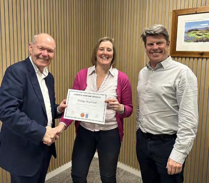
To help grow the leadership pipeline, ConsultingWhere has developed – together with a team of subject-matter experts from within the geospatial industry – the Geospatial Leadership Certificate (GLC) specifically for geospatial practitioners. Involving part-time study typically over a nine-month period, it is designed to work alongside a student’s day job. The GLC is accredited for continuous professional
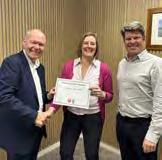
Jenny Sharrock (centre), GIS manager at Government of Jersey, first graduate of the Geospatial Leadership Course. With course director, Andrew Coote (left) and head of property strategy at Government of Jersey, Ralph Buchholz (right)
development (CPD) by the UK’s Association for Geographic Information (AGI) and the Royal Geographic Society and, as the course is run by chartered surveyors, it is also eligible for consideration under the Royal Institute of Chartered Surveyors’ CPD scheme.
In addition to studying leadership, team development, justifying investment in geospatial projects, and influencing decision-makers as mandatory modules, GLC students choose two of the following five optional modules: geospatial project management, geospatial maturity assessment, sustainable business models, marketing strategy and planning, and mastering basic sales skills. An additional module on the business impact of artificial intelligence has also been developed to further enhance the curriculum. Each of the mandatory and optional modules consists of a self-paced e-learning component, an assignment usually based on some aspect of the student’s work, and a workshop with fellow students and a panel of industry experts.
Solving urgent problems
In an era defined by complex challenges – climate resilience, infrastructure modernization, public health preparedness, economic competitiveness – location matters more than ever. These rising demands on the geospatial industry call for stronger leadership skills to enable greater success in solving some of the world’s most urgent problems. The industry can, and should, continue to refine its tools, because innovation remains essential. But there must also be investment in the leadership capacity of geospatial practitioners – because, increasingly, they must be able to translate spatial
Meet the UrbanMapper-2 EVO Evolution of Performance
Large Format/3D-Mapping Camera System
About the authors
Harry Storer is strategy director of ConsultingWhere harry.storer@consultingwhere. com
Andrew Coote is chief executive of ConsultingWhere andrew.coote@consultingwhere. com
insight into measurable organizational outcomes. If these skills are not developed quickly, there is the risk that new opportunities for innovation will be missed. However, there is a well-recognized gap in the availability of leadership-skills training that would help geospatial practitioners to play leading roles in developing, promoting and successfully implementing new solutions. Geospatial practitioners, and the organizations they work for, should therefore urgently think about how they can develop the necessary leadership skills, including consideration of external education offerings.
450MP ultra-wide nadir channel RGBI (34,500 x 14,100 pix)
Electronically controlled shutter (up to 1/2500 sec) and up to 0,6s triggering rate
Multiple lens configuration
Improved temperature and humidity management
Extended interfacing options and multi-sensor operation ready (e.g. Riegl)
Equipped with:
Robust CCNS-5 FMS
AEROcontrol GNSS/IMU positioning system with anti-jamming solution
Precise leveling technology for gyro-stabilized mount
Guardians of precision: the role of surveyors in reality capture workflows
By John Fraser, Geomatics Division, Hexagon
For more than a hundred years, surveyors have been at the core of Hexagon Geosystems’ innovation. With a deep understanding of the challenges they face and the environments they operate in, we continuously develop solutions that make their lives easier through improved efficiency and accuracy. Advanced tools like total stations seamlessly integrate imaging, GNSS and robotic capabilities, while intuitive field apps and sophisticated office software streamline workflows, ensuring surveyors can deliver results faster and with greater confidence.
As surveying demands grew more complex, navigating tighter deadlines and budgets, laser scanning began to play an increasingly important role in complementing traditional tools. These technologies have evolved significantly. Early laser scanners were bulky and niche, but today’s models are compact and capable of capturing millions of points per second. For a professional surveyor, this means completing more projects on time and to specification with a high degree of accuracy. Over time, the scanners and software have become much easier to use, allowing professionals with no surveying background (like architects and construction managers) to adopt scanning solutions in their own projects.
The surveyor’s toolkit of specialized skills
While this opens up opportunities for
As scanning tools spread more widely, surveyors are key to ensuring data is validated, grounded in reality and fit for purpose.
collaboration between professions, it also presents a risk. Nonsurveyors may overlook the critical importance of understanding ground truth, meaning the physical reality that the data must accurately represent. Lacking expertise in data quality assurance and essential field procedures, they end up with models that are highly accurate visually but technically flawed. This can lead to costly and unsafe design errors.
Ground truthing is vital, as it involves verifying digital data against physical site measurements. When done accurately, it is the blueprint that ensures a successful project. Furthermore, the volume of equipment and digital tools on offer, all built for different purposes and not always of survey-grade quality, means professionals without a surveying background risk undertaking scanning tasks without the right equipment or expert guidance.
Surveyors play an indispensable role in bridging the gap between digital models and the physical world. Their expertise ensures that reality capture processes are anchored in precise, reliable data – an essential foundation for making high-stakes decisions with confidence. Surveyors also bring depth of knowledge of industry standards and best practices to any project. Professional survey practice is governed by standards such as the RICS ‘Measured Surveys of Land, Buildings and Utilities’ (2022), TSA Client Guides, and Historic England’s ‘Geospatial Survey Specifications for Cultural Heritage’ (2024). These ensure accuracy, accountability and long-term value of survey data.
While accessible geospatial tools empower non-surveyors to complete simple reality capture tasks quickly and effectively, all users should understand the unique expertise and insights professional surveyors bring to a project. Recognizing how surveyors enhance project outcomes can prevent potential issues and ensure the highest standards of data accuracy.
Four types of projects with different levels of complexity help understand where and why a surveyor’s expertise and skills are key.
Looking at four types of projects with different levels of complexity can help understand where and why a surveyor’s expertise and skills are key:
1. Trade fit-out measurements
These straightforward projects involve capturing basic dimensions when installing fixtures, furniture or equipment. In these cases, where the demands and stakes are lower, non-surveyors – such as contractors or designers – can often use accessible tools like handheld laser scanners or compact devices such as the Leica BLK360. The focus here is on speed and simplicity, with minimal need for advanced surveying techniques.
While surveyors may not always be required for these projects, their involvement can still add value by ensuring that measurements are precise and aligned with broader site conditions, as well as making sure they adhere to industry standards.
2. Basic layout and area measurement
The next level includes projects that require more detailed site documentation, such as floor plans, area calculations or simple renovations. This might involve creating 2D or 3D models for design or planning purposes. While non-surveyors can handle some of these tasks using user-friendly software and scanning tools like the BLK360 or the Leica RTC360, the risk of inaccuracies increases when workflows lack the proper quality control provided by a professional surveyor.
For projects at this level, there can be an initial misunderstanding around the
complexity of the task and the level of survey-grade accuracy required. What was first thought to be a single area measurement can become multiple. Having a surveyor’s expert guidance from the start helps avoid misunderstandings like this and validate any data captured, ensuring that the information is reliable and aligned with project requirements.
3. Commercial site renovations
At this level, the complexity increases significantly. Office building refurbishments, retail store redesigns or industrial site upgrades often require precise spatial data for planning and execution. These projects typically involve multiple stakeholders, from architects to engineers and construction managers, making collaboration essential. Here, surveyors are essential and play a vital role in ensuring geospatial accuracy and data alignment with real-world conditions through proper reference frames. Surveying expertise prevents costly errors, such as misaligned designs or structural issues that could arise from relying on flawed data.
4. High-accuracy engineering and heritage documentation
The most complex projects fall into this category, including infrastructure development (e.g. bridges, tunnels, railways), heritage preservation and large-scale engineering ventures. These projects demand the highest levels of precision and often involve unique challenges, such as accounting for the curvature of the Earth, monitoring structural shifts or preserving intricate historical details. Surveyors are indispensable here, as they bring specialized
knowledge and experience with expert tools to capture data with unparalleled accuracy. From managing control points to ensuring that digital models reflect the physical reality of the site, their expertise is critical to the success of these high-stakes projects.
The surveyor at the centre of the geospatial workflow
Reality capture tools have become more accessible than ever, but understanding how digital models connect to physical reality still requires a professional surveyor. From ground truthing to quality assurance and data validation, surveyors ensure expert precision and help prevent the costly errors and safety risks that can derail a project.
In a growing community of non-surveying professionals who also use geospatial technology, a surveyor’s role has expanded into that of an educator and guide, providing essential knowledge of industry standards and best practices. Initiatives like The Survey School, Level 3 and 6 Geospatial Apprenticeships, and Get Kids Into Survey highlight the commitment of the profession to education and succession.
For over a century, the unique skills of a surveyor and the challenges they face have driven our innovation at Hexagon. We remain dedicated to building the technology that provides surveyors with high-precision tools to make the most of their skills and expertise. At the same time, we welcome the growing accessibility of geospatial technology, which allows more people to benefit from its capabilities. We are committed to fostering a greater understanding of the value of geospatial solutions while continuing to support the indispensable role of professional surveyors in delivering accurate and reliable results.
In a growing ecosystem of users benefiting from geospatial data, professional surveyors remain essential. Their unique expertise elevates the value of geospatial tools, ensuring data accuracy and reliability that drive successful outcomes for all.
This article was created in collaboration with The Survey Association (UK)
Where are we and what can we expect?
The state of AI in today’s geospatial industry
By Lars Langhorst, GIM International
The ongoing AI revolution, marked by rapid advances towards artificial general intelligence (AGI), is transforming the way we live and work. This is already having an impact in programming and general data management jobs, but how is it affecting the geospatial data scene? This article highlights the latest advancements of AI in our industry, and informs geospatial specialists of what to expect in the coming year and how to love, rather than fear, AI.
Artificial intelligence (AI) is growing at an exponential rate. From assistive tools to autonomous agents. AI systems are no longer limited to answering questions; they can now plan, execute and evaluate multistep tasks with minimal human oversight. Agentic AI can operate software, coordinate workflows and make decisions based on context, changing how humans interact with digital systems.
This growth is nothing short of explosive, and control of these systems is deemed by many to be a true necessity rather than an annoyance. Therefore, governing bodies are constantly trying to control and regulate the growth and implementation of AI for public safety. The EU AI Act is establishing global standards for transparency, risk management and accountability. As it comes into force, organizations deploying AI in Europe must demonstrate compliance and explainability. This will shape how AI systems are designed and deployed worldwide.
In the meantime, the growth of AI is largely limited by its implementation. This means the technology and processing power are there, but what’s lacking is our ability to provide the right information, and ask the right questions. For example, the video game industry has always been a benchmark for digital technology, and AI is no exception. What started with AI text generation soon progressed to images and video, and AI is now able to create entire video games from a single prompt. These systems can dynamically generate
environments, characters, narratives and gameplay logic, which is positioning AI as a general-purpose creative engine rather than a set of narrow tools. Needless to say, this does not only count for video games, but for all types of computer programs that can be produced, launched and maintained by AI.
From tool-driven to intent-driven GIS workflows
The geospatial sector is feeling the effects of these changes and innovations just like the rest of the world, and in some cases it is being hit even harder. AI is reshaping the geospatial sector by shifting GIS workflows from tool-driven to intent-driven. Instead of manually chaining software tools and scripts, users increasingly describe what they want to know, while AI systems determine the data sources, processing steps and validation automatically.
Tools like Esri’s ArcGIS GeoAI toolbox are at the forefront of this automation wave in the geospatial sector, incorporating machine learning for classification, regression and natural language processing on diverse datasets. Esri’s GeoAI helps users to automatically classify and transform complex point clouds and datasets into usable objects. In an interview in this edition of GIM International, Esri’s CEO Jack Dangermond says: “Much like scanning a barcode, you can update a city’s vegetation inventory or a utility company’s asset condition data almost instantly.” He is not only referring to once-a-year tasks, but also to more repetitive tasks that take valuable
time out of each day for employees in the public and private sector. Over the past decades, Esri has built up a strong reputation for accurately predicting the way the industry is heading. Based on the company’s views on AI, these tools will cause a substantial shift.
The industry is also transitioning from batch analysis to near-real-time and streaming Earth observation. AI pipelines increasingly ingest continuous satellite data streams, allowing automated processing
Figure 1: AI has rapidly become a generalpurpose creative engine rather than a set of narrow tools. (Image courtesy: ChatGPT)
as new imagery arrives. As a result, change detection alerts can be generated within hours instead of weeks, supporting faster responses for disaster management, infrastructure monitoring and environmental compliance.
Radar and optical data fusion
One major technical advance is the move towards radar and optical data fusion. AI models now routinely combine synthetic aperture radar (SAR) data, such as the aperture of the Teide volcano in Figure 4, with optical imagery from Sentinel-2 or commercial satellites. This enables reliable monitoring regardless of clouds, darkness or seasonal conditions, making year-round observation practical even in challenging environments.
The latest, and perhaps most crucial, shift for the geospatial industry is AI’s recent ability to work with vectors and point clouds, where before this was exclusively rasters. By working with these more inclusive, scalable and complex data formats, AI systems can work directly in projects for supporting roles with digital twins, urban analytics and infrastructure planning. Together, these developments are transforming geospatial data into continuous, actionable spatial intelligence – not only for geospatial specialists themselves, but also in terms of how they work together and communicate with different domains.
The digital-to-physical link
At its core, AI operates entirely within the digital domain; it can process, generate and analyse any information that can be represented as data. This makes it extraordinarily powerful in text, images, code and structured datasets that exist in digital form. However, the physical world remains outside AI’s direct reach. It cannot sense or control reality without a digital interface translating physical phenomena into data it can interpret.
This physical-to-digital ‘translation’ layer is where spatial data plays a critical role. Spatial data captures the geometry, location and attributes of the real world, turning physical entities into digital representations. That being said, spatial data by itself is not enough. AI needs context: scales, rotations, translations, transformation and interpretations – all crucial information to make sense of generic spatial data. This involves the gathering of different data sources, interpretation of these sources with context for each source, and informed decision-making.
Geospatial specialists are irreplaceable
This is where spatial data specialists are irreplaceable. They receive data and context, decide which data is required if none is available, and bridge the gap between the digital and the physical world. Specialists are needed for every step in data processing, from collection to validation and publication. Whether strategizing model placement, validating model outputs, ensuring data quality and provenance or interpreting spatial patterns within real-world contexts, a controlling party with full context information is necessary.
Figure 2: Video game designers can now implement AI in modelling, character creation and backend systems and can even create fully AI-generated games. (Image courtesy: Shutterstock)
Figure 3: Esri GeoAI enables users to process varying datasets to one model at the click of a button. (Image courtesy: Esri)
What’s next?
Some people say that AI, with all its hype, is just another bubble – just like the internet, it will not deliver on its value promise. Whether this is true or not, here are a few things that are likely to be on the horizon in the coming year:
1. Reliable autonomous AI agents
AI agents will move from experimental to operational use, handling complex, multi-step tasks end-to-end with built-in self-checking and escalation. In particular, keep an eye on NemoClaw, the enterprise-friendly OpenClaw by NVIDIA. This recent opensource software unlocks the power of LLMs like ChatGPT and Gemini, turning them into ‘personal assistants’ with memory, access, job scheduling and more.
2. Real-time, multimodal AI systems
AI systems will increasingly operate in real time while natively combining text, vision, audio, video and sensor data. This is essentially a crucial step for the true agentic AI systems crossing into our world.
3. AI designed for regulation and trust by default With regulations like the EU AI Act coming into force, AI systems will be developed with built-in compliance features: traceability, explainability, confidence scoring and audit logs. Even though such regulations slow
AI growth, we rely on the EU and other governments to maintain a grip and ensure the safe development and usage of AI.
Preparing professionals for the transformation
So how should today’s professionals prepare themselves for this transformation? As Esri’s CEO Jack Dangermond notes, it is impossible to predict exactly what the next decade of technological advancement will bring. What is clear, however, is that repetitive tasks are rapidly disappearing. Work in the geospatial sector – both in the field and during desktop processing – is increasingly focused on determining what is needed, rather than on executing every step required to obtain it.
“Our industry is moving beyond the hype of AI faster than others because we have so many repetitive tasks it can improve,” said Ron Bisio, Trimble’s senior vice president of field systems, in a recent interview with GIM International. Surveyors know this better than anyone, and understand that thinking on your feet and solving problems as they arise is key to being a good surveyor.
As automation is implemented at an accelerating pace, understanding both the capabilities and the boundaries of AI systems will become a core professional skill. When facing a challenging setup
with a laser scanner, for example, field professionals should ask themselves how AI could perform that task, and where it would encounter limitations. The same applies to data processing workflows. Any task that is performed repeatedly is a strong candidate for delegation to AI assistants or autonomous agents. Data specialists must remain critical and reflect on the obstacles they encounter during processing, and on the decisions that fall outside standard workflows. How was a specific result produced, and which steps were required beyond the default processing pipeline? Such considerations will remain essential, as these workflows increasingly serve as the foundation on which AI-driven processing systems are trained and refined. Having a good understanding of where AI may take place in their workflows the coming years will help data specialists shift their focus and adapt this fast new helper in their own work.
The educational shift
Looking to the next generation of talent, how can educational institutions prepare tomorrow’s land surveyors and geomatics specialists to work effectively alongside AI, especially since our sector is one of the early adopters? Today, many university curriculums are task-focused and toolfocused in order to give students a sufficiently profound understanding of the
Figure 4: A synthetic radar aperture map of the island of Tenerife and the Teide volcano. (Image courtesy: NASA)
discipline’s various topics. However, as AI will take over many of the tasks these subjects cover, it is becoming more relevant to train the new generation in intent-driven decision-making. As the ‘what’ and the ‘how’ are disappearing, students should be encouraged to think about the ‘why’. In other words, to protect the future of the industry, schools and universities must move beyond teaching software operation and procedural workflows alone, and instead emphasize critical thinking, system understanding and AI literacy.
Figure 5: The petrochemical industry – a typical example of an industry where new technologies are considered carefully, accessibility is difficult and regulations are strict – continues to rely on geospatial specialists to bridge the gap between the digital and the physical world. (Image courtesy: Shutterstock)
About the author
Conclusion
Lars Langhorst (MSc) is a pioneer at the frontier where AI meets surveying and asset management. With a background in geomatics and AI, Langhorst believes the next big innovations are just around the corner. He aims to bring these innovations to organizations, bridging the gap between today’s and tomorrow’s technology.
As artificial intelligence continues to advance and robotization increases, the gap between the digital and physical worlds is steadily decreasing. Autonomous surveying robots will increasingly enable data collection, evaluation, processing and delivery with minimal human intervention. Does this development imply a complete AI takeover of the profession? No. Much like ChatGPT, which initially caused uncertainty but has since become a common household tool, AI is evolving into a practical assistant rather than a replacement. Geospatial specialists should embrace these technologies and benefit from the increased efficiency, quality and volume of work they enable. This technological shift is not temporary; it is here to stay.
Airbus
Airbus delivers trusted, highresolution satellite imagery and geospatial intelligence to support critical decision-making worldwide. Drawing on decades of Earth observation expertise, Airbus provides accurate, timely data from its industry-leading satellite constellation, enabling applications across civil engineering, mapping, urban planning, environmental monitoring, defence and disaster response. With a focus on precision, reliability and innovation, Airbus combines advanced sensor technology, consistent global coverage and rigorous quality standards to help organizations see the world more clearly and act with confidence.
AlphaGEO
AlphaGEO brings together a group of partners with nearly 20 years of industry experience and a passion for surveying and mapping.
The company adheres to independent R&D and ‘Made in China’ principles. It aims to drive positive evolution in the industry by establishing a development model comprising ‘hardware + software + digital services’.
AlphaGEO encompasses a ‘4+N’ pan-surveying product system, centred on RTK, total stations, uncrewed surface vessels (USVs) and Lidar scanners, integrating GIS equipment, levels and ground-penetrating radar, etc. Applications include geographic surveying, engineering construction, precision agriculture, deformation monitoring and smart city. All products are rigorously tested and comply with international standards such as ISO/CE/FCC, ensuring stable and accurate operational performance even in extreme environments. AlphaGEO’s global sales network covers over 60 countries, with a particularly strong user base in Europe and Asia.
Analist Group
Analist Group is an Italian technology company specializing in geomatics software and professional surveying solutions for the AEC sector. Its flagship product, ProTRACK, is a high-precision GNSS RTK rover designed for land surveying, infrastructure monitoring and drone georeferencing. It operates as a handheld rover with tilt compensation, as a base station for drone PPK/RTK missions, and in base-rover configurations for traditional topographic surveys. Combining centimetre-level accuracy with a rugged, field-ready design, ProTRACK integrates seamlessly with leading UAV systems, total stations and BIM workflows. Alongside ProTRACK, Analist Group develops Analist CLOUD, a complete point cloud processing platform, and ProBIM, a professional scan-to-BIM modelling environment. With over a decade of experience and a growing international presence, Analist Group delivers end-to-end solutions from field data capture to digital deliverables.
CHC Navigation
CHC Navigation (CHCNAV) is a global innovator in high-precision navigation, positioning and mapping technologies, serving a wide range of industries including geospatial, construction, marine, agriculture and autonomous systems. Founded in 2003, CHCNAV has focused on making advanced technology both efficient and accessible, delivering solutions that combine high performance, reliability, ease of use and affordability. Through continuous investment in research and development, the company drives innovation in proprietary software, algorithms and core hardware to ensure accuracy, scalability and long-term value. With more than 2,000 employees and a global network of regional offices and distributors, CHCNAV supports professionals in over 140 countries. As the needs of spatial data and automation continue to grow, the firm remains committed to advancing navigation, positioning and mapping technologies that enable smarter, faster and more efficient operations.
DATIE INS Surveying Tech
DATIE INS TECH is a technologydriven innovative enterprise integrating R&D, manufacturing, sales and services, headquartered in Guangzhou Science City. The company’s creative application of multi-source fused inertial precision measurement technology in rail track geometry measurement and underground pipeline positioning simultaneously solves accuracy and efficiency challenges. DATIE Detection is dedicated to inertial measurement and structural safety monitoring applications. The company brings together industry experts and senior engineers, maintaining deep collaboration with Wuhan University. It has developed proprietary hardware and software products for rail track precision measurement, underground pipeline 3D attitude measurement and structural health monitoring. The enterprise has obtained SRDI, IPMS and ISO certifications and its products are exported to multiple countries worldwide. DATIE is a member of multiple industry associations in China and has participated in drafting several technical standards.
Emesent
Emesent’s mobile Lidar mapping solutions deliver fast, accurate and reliable results – even in the most challenging environments. Emesent Hovermap is an autonomous mapping system powered by Emesent SLAM, the world’s leading SLAM technology. Hovermap has already been deployed across multiple sites, provide 3D visualized data for diverse use cases spanning mining, construction, public safety and defence. The newly released Emesent GX1 is an all-in-one scanner featuring SLAM, RTK and 360-degree panoramic imagery integrated within a sleekly designed mapping unit that will be the go-to tool for busy surveyors. Both scanners can be deployed via backpack, vehicle mount or handheld. Both systems come with Emesent Commander for mission planning and monitoring captured data in real time, and Emesent Aura, the data processing and visualization tool. More information about all these products – and related accessories – is available on the Emesent website.
EPiC LiDAR
EPiC LiDAR is a high-tech enterprise specializing in the R&D and manufacturing of high-precision 3D Lidar systems. It provides accurate, efficient 3D laser scanning solutions for surveying, geospatial mapping, construction BIM and industrial intelligence. Supported by an R&D team with 15 years of expertise, EPiC has achieved fully independent development from laser-ranging modules to system integration. With 56 intellectual property rights, the company’s portfolio includes high-precision terrestrial laser scanners, aerial Lidar systems and specialized sensors designed for demanding professional environments. EPiC’s products are deployed in 30+ countries, including major economies like the USA, Japan, Germany and Saudi Arabia. As a ‘Gazelle Enterprise’, it is committed to becoming a global leader in 3D laser scanning, redefining spatial data efficiency through continuous innovation
Feima Robotics
Founded in 2015 by senior managers jointly with senior experts in IT and drone technology, Shenzhen Feima Robotics Co, Ltd (Feima Robotics) is a world-leading solution provider for drones and modern geospatial applications. Feima Robotics has R&D centres in Shenzhen, Beijing and Tianjin, totalling more than 200 staff in the research team. With more than 20 years’ accumulation in technology and marketing, and with experience in IT product design and industrial manufacturing, Feima Robotics is dedicated to providing drones and geospatial solutions with integrated software and hardware and a one-stop spatial data system service. So far, Feima Robotics has released about 20 types of intelligent drone systems for aerial survey, remote sensing, patrol, emergency applications and dynamic 3D mobile surveying platforms including handheld SLAM laser scanners and data processing software. Feima Robotics has gained a wide range of users in the world and built up a solid reputation in the industry.
Geosun Navigation
Geosun Navigation Technology Co Ltd, founded in 2015, specializes in intelligent positioning and spatial perception technologies. With fully independent intellectual property rights, GEOSUN integrates GNSS, INS, Lidar, SLAM and multi-sensor fusion to deliver high-precision data acquisition and navigation solutions for geospatial and mobility applications. The company’s portfolio includes UAV and mobile Lidar systems, integrated navigation platforms, autonomous driving positioning systems and road information collection solutions. Serving global clients across surveying, smart transportation, infrastructure inspection and digital twin sectors, GEOSUN holds over 20 granted invention patents and 40+ proprietary technical solutions, supported by ISO 9001:2015-certified quality management processes. The firm is committed to advancing Lidar and SLAM solutions to be more applicable, reliable and cost-effective for real-world deployment worldwide.
GEXCEL
GEXCEL is an independent company with nearly two decades of experience in the geospatial and 3D mapping industry. It designs and develops advanced hardware and software solutions for 3D surveying and Lidar data processing, helping professionals capture spatial data more efficiently. The flagship product, the HERON portable 3D mapping system, reflects the company’s commitment to innovation. Powered by advanced SLAM algorithms, HERON enables users to capture high-quality 3D data quickly and effortlessly, maintaining reliable accuracy across long trajectories and in very complex environments. GEXCEL provides support, training and technical service directly from its headquarters in Italy and through a global network of distributors. The company collaborates with leading industry partners to ensure seamless integration and usability of its technologies, and actively participates in research and development projects that contribute to the advancement of the geospatial sector.
IGI – Integrated Geospatial Innovations – is one of the world’s leading geospatial companies and conducts business worldwide. IGI’s customized concept provides modular but also durable and easy-to-use turnkey solutions, which offer high-end quality in deliverables at the best possible accuracy. This ensures that the company’s clients achieve sustainable and smart geospatial solutions. The company’s success is driven by its people and commitment to achieving results the right way – by operating responsibly, executing with excellence, applying innovative technologies, and seizing new opportunities. IGI’s entrepreneurial focus is on integrating various sensors into its in-house-developed positioning system, as well as providing all-in-one solutions for mobile and airborne surveying missions. geosunlidar.com
Gter
Gter Srl is an SME founded in 2010 and active in the space technology and geomatics sectors. The company focuses on spatial information systems for web-based geographic data management and on applications based on precise GNSS positioning. With a team of 15 professionals and about 50% of turnover invested in R&D, Gter develops advanced GNSS positioning solutions and downstream services. The company specializes in open-source GIS software and custom geospatial solutions and is one of just a few European companies developing GNSS downstream software using an open-source approach. Gter is also one of only two Italian organizations accredited to provide official international QGIS certification. Its multidisciplinary team integrates expertise in GIS, surveying, 3D modelling and satellite data analysis, delivering comprehensive end-to-end geomatics solutions.
IGI
Juniper Systems
Juniper Systems Inc is a leading manufacturer of ultra-rugged field computing solutions, GNSS receivers and mapping software designed for professionals working in demanding environments. Its headquarters and manufacturing are in Logan, Utah, USA, and the company also has an office and service centre in the UK to serve international clients. Juniper Systems serves a global customer base across the utility, environmental, geospatial and infrastructure sectors, delivering reliable tools that empower accurate data collection, asset mapping and field operations. Its solutions can endure the harshest conditions and allow users to focus on the job and not on their equipment. The firm believes the equipment you use should be as capable as you are – ‘rock solid and field ready’.
Pointerra3D
Pointerra3D is redefining how organizations manage and operationalize geospatial data. Instead of fragmented files and desktop-bound workflows, Pointerra3D serves as a foundational component of the enterprise geospatial stack – transforming Lidar, photogrammetry and 360-degree imagery into secure, enterprise-scale digital twins. Built for infrastructure owners, utilities, mining companies, transportation authorities, service providers and government agencies, the platform streams and analyses massive geospatial datasets instantly through a web browser, eliminating data silos and IT bottlenecks. Integrated analytics support desktop inspection, measurement, compliance and model comparison, enabling teams to move from static capture to continuous operational intelligence. Pointerra3D doesn’t just visualize data. It turns your data into a measurable, collaborative and decision-ready asset.
Pythagoras
Pythagoras BV has been a trusted name in the surveying industry for more than 30 years. Pythagoras CAD is developed specifically for surveyors and trusted by thousands of geospatial professionals worldwide. It supports all measurement instruments and standard data formats, ensuring reliable, accurate and efficient workflows. Building on this expertise, the company developed Pointorama to accelerate modern scan-toCAD and scan-to-BIM workflows. The platform uses intelligent floor, room, window and door detection to turn point cloud data into precise floorplans. With one click, intelligent detection works room by room, guided by your input. You remain fully in control – reviewing, refining and validating every element before export. The result is a CAD drawing or BIM-ready model, delivered significantly faster than manual tracing while maintaining professional accuracy.
SBG Systems
SBG Systems, a leading provider of navigation technology, presents Quanta Plus, a high-performance inertial navigation system optimized for SWaP and harsh environments. It combines a miniature tactical IMU with a GNSS receiver providing RTK fixes even in challenging conditions (0.015° roll/pitch, 0.04° heading and 1cm positioning). The company’s professional post-processing software, Qinertia 5, delivers high-precision inertial+GNSS data for surveying, mapping, hydrography and navigation. It supports multi-constellation, multi-frequency GNSS processing, including traditional PPK, near-real-time PPK with RTCM corrections, and tightly-coupled PPP for global accuracy. Key features include intelligent sensor aiding (DVL, odometer, magnetometer), advanced trajectory smoothing and access to over 10,000 reference stations worldwide, suitable for land, marine and airborne workflows.
Trimble Applanix
We live in a complex and dynamic world. As your business evolves, you need a partner who can adapt with you and help orient your business for success. Trimble Applanix’s systems, software and solutions are designed for pinpoint accuracy, efficiency and ease of use, supporting applications for mobile mapping, surveying and autonomous vehicles. Like its solutions, the company works for you in all environments, applying deep expertise and passion to customize practical solutions that meet your complex needs, whether on the ground, in the air or on water. In a dynamic world, trust your position with Applanix.
Trimble GNSS for OEMs
Dedicated to the world’s tomorrow, Trimble is a technology company delivering solutions that enable our customers to work in new ways to measure, build, grow and move goods for a better quality of life. Core technologies in positioning, modelling, connectivity and data analytics connect the digital and physical worlds to improve productivity, quality, safety, transparency and sustainability. Trimble GNSS technology delivers position integrity and localization as it relates to the overall safety and accuracy of operations. With the increase in demand for highquality, reliable positioning, Trimble has developed leading high-precision solutions to ensure the application can operate successfully in all conditions. Positioning – and so much more: there’s more to solving today’s industry challenges than accuracy alone. Trimble empowers you with customized solutions that work whenever you need them, now and into the future. And makes them easy for anyone to use.
Vexcel Imaging
Vexcel Imaging is a global leader in aerial imaging, delivering a fully integrated ecosystem for professional geospatial production. Its flagship UltraCam large-format aerial and hybrid camera-Lidar systems, together with the UltraMap photogrammetric processing software, form a seamless acquisitionto-delivery solution. UltraCam systems are engineered for radiometric performance, geometric accuracy and flight efficiency, enabling the production of photogrammetric imagery and point clouds, Lidar point clouds, DSMs, DTMs, orthoimages and 3D data. UltraMap enhances workflows through advanced automation and scalable processing architecture. In 2025, Vexcel introduced UltraCam Osprey 4.2, UltraCam Dragon 4.2 and UltraCam Merlin 5.0, built on Sony’s IMX811 CMOS technology, further increasing efficiency at highest image quality. The Vexcel Data Program (VDP) features the world’s largest aerial imagery and geospatial data programme, currently covering more than 45 countries.
YellowScan
YellowScan designs, develops and builds Lidar solutions for professionals who require performance, robustness and accuracy. Its hardware and software solutions are easy-to-use data collection tools that come with training and support from the company’s experts. The products include embedded laser scanners, INS, GNSS receivers and onboard computing. Each system is designed to meet the highest precision and accuracy needs for 3D mapping. Founded in 2012 in the south of France, YellowScan has sales, customer training and support representatives around the globe. The company’s products are used worldwide in surveying, bathymetry, forestry, environmental research, archaeology, civil engineering, mining sectors and more.
Zoller + Fröhlich
Beyond being a leader in the fields of ferrules, wire harnessing technology and laser measurement technology, Zoller + Fröhlich (Z+F) is known worldwide as a manufacturer of innovative products in the areas of switch cabinets and special machinery. All products have been developed and produced exclusively in Germany, where the company employs more than 300 people. Z+F is an internationally operating company and cooperates with dealers in more than 40 countries. It also has a permanent subsidiary in the USA. Besides the business success, human beings have always been at the heart of the corporate philosophy. This principle can be seen in the company’s various social and cultural commitments, which always share the objective of regionality and strengthening the company’s locations.
Everything you need in GIS software
Lidar & 3D point cloud classification, feature extraction, and analysis
Photogrammetric analysis of UAV/drone imagery
Advanced geospatial analysis tools for a multitude of GIS workflows
Read/write support for over 300 file formats
Workflow automation through Python and Global Mapper scripting
Featuring object detection and landcover classification powered by deep learning
GIM International interviews Nick Maclean, new RICS president
Navigating the future of surveying
By Durk Haarsma, GIM International
From demographic changes and skills shortages to climate-driven land pressures, AI ethics and hydrography, the surveying profession is undergoing rapid transformation. GIM International spoke with Nick Maclean, president of the Royal Institution of Chartered Surveyors (RICS) for 2026, about how the organization plans to strengthen the role of surveyors and geomatics professionals this year and beyond.
Can you tell us a little about yourself and how your career has led to the role of RICS president?
I was acting president of RICS from March 2025, and have now just formally begun my presidential year this year. I have been with CBRE for almost my entire career, much of it international, including 21 years in the Middle East. Before entering surveying, I served with the Royal Navy, which gave me a deep appreciation for hydrography and the resources that underpin it. These experiences have shaped the priorities I want to drive through RICS: education reform, and strengthening our influence across the broad spectrum of surveying disciplines.
As part of those priorities, you’ve said you want to increase the influence of the surveying profession among lawmakers and regulators. Why now?
RICS represents 140,000 professionals working at the frontline of the built and natural environment. Our members have expertise that governments increasingly need – whether the subject is housing shortages, infrastructure planning, climatedriven environmental challenges or land-use policy. Many governments simply don’t have this technical depth in-house. It’s not just an opportunity for RICS to support policymakers; it’s essential that we help them understand what our profession can offer.
How has your experience in the Middle East influenced your way of thinking about Europe?
The Middle East is creating infrastructure from scratch and doing so at speed, which
Nick Maclean, president of the Royal Institution of Chartered Surveyors (RICS) for 2026.
offers valuable lessons. There’s strong inbound investment, proactive housing provision and a far more positive view of immigration, when newcomers contribute economically. These countries have moved from underdeveloped economies to competitive global players. Europe could learn from that boldness, although it may not be an easy message to convey. We can’t continue on our current trajectory without addressing major structural issues.
Climate change is reshaping the built environment. What responsibility do surveyors hold?
Surveyors must show that sustainability and large-scale development are not mutually exclusive. Policymakers often think they must choose one or the other. Our role
is to highlight unintended consequences: how policy changes impact development feasibility, stall housing delivery or distort affordability. Advising on these market interactions is one of our most important contributions.
You mentioned affordable housing, which is a global challenge. How can surveyors and geospatial professionals help in this context?
Their role is critical, though sometimes indirect. Ensuring we don’t build in the wrong locations – such as on floodplains – can save enormous long-term cost and risk. Sustainability and resilience must be integral to housing strategies. Location intelligence, environmental modelling and land-suitability analysis are areas where geospatial professionals excel. Housing also shapes future migration patterns, making geospatial expertise indispensable as governments plan for demographic shifts.
Technology is transforming the profession. How do we balance AI and digital tools with professional judgement?
‘Artificial intelligence’ often means different things to different people, but let’s call it ‘sophisticated data analytics’. We must embrace these tools while ensuring surveyors can recognize when the technology is wrong. Technology accelerates the work, but it cannot replace judgement. Education must evolve to include drones, autonomous underwater vehicles, advanced analytics and modern software. And we must help lawmakers understand both the power and limitations of new technologies.
RICS recently introduced a global standard for AI conduct. Why is this important?
Technology evolves too quickly for traditional regulation. Instead of trying to regulate the technology, RICS has focused on ethical behaviour – requiring transparency when AI tools are used, and making sure professionals take responsibility for outcomes. No other professional body has taken this angle. It has already been well received internationally.
Beyond AI, which emerging technologies will impact the profession most?
Autonomous survey vehicles, drones, robotic sonar and laser-based inspection and infrastructure assessments, enhanced imaging technologies, and access to previously unreachable environments. These tools vastly increase speed, safety and data richness, but they also reinforce the need for professionals with strong interpretive skills.
There’s a worrying skills gap in the surveying profession. What concerns you most?
We face two issues: not enough young people are entering the profession, and the demographic profile of current members is aging rapidly. Many highly experienced professionals are retiring, taking decades of knowledge with them. If we don’t address this, we risk losing embedded expertise that technology alone cannot replace. Attracting new talent and retaining retiring expertise through mentorship or structured transitional roles are critical priorities.
What is the role of institutions like RICS in helping the profession remain attractive to future generations?
We must demonstrate that surveying is not just valuable, but a rewarding career path. That includes clearer communication of financial benefits, stronger outreach to students, and closer collaboration between industry, academia, and the institution.
Apprenticeship models and vocational training are especially promising, connecting companies directly with talent pipelines.
How can you encourage more young professionals to join RICS?
In emerging markets, membership of RICS is seen as essential and the numbers are growing. In Europe, there’s cynicism, with numbers flat, so we must communicate the commercial value of membership more clearly. We need to show that being a chartered surveyor improves career prospects, income and professional credibility. Clients also need to see that RICS members commit to ethical standards and continuing professional development. That distinction matters.
RICS encompasses more than 20 specializations. How do you promote cross-disciplinary cooperation?
The diversity of disciplines is our strength, but it can create silos. To address this, we
A strong RICS presence: Nick Maclean with Gordon Johnston and James Kavanagh.
established Professional Group Panels to feed market insights back to the Governing Council. We’ve already seen strong multidisciplinary outputs, such as our flooding guidance, which combined six different professional groups. We need to continue improving international representation and ensure that natural-resources and landmanagement voices are heard alongside dominant commercial sectors.
What do you hope to have achieved by the end of your presidency?
A year is short, but I want RICS firmly set on a path toward modernized education and renewed influence. We’ve lost some impact compared with ten years ago, and that must change. My earlier time as chair allowed me to start this work; I returned as president to finish it. RICS has a unique ‘public interest’ mandate – we serve both our members and the users of their services. I intend for us to communicate that far more strongly.
Do you have a message for the global geomatics community?
Although relatively small, the Land & Natural Resources community within RICS will grow dramatically in importance as humanity demands more resources, explores harsher environments, and faces much tighter land constraints. Efficient and responsible land management is becoming central to global sustainability.
Moreover, commercial priorities have overshadowed hydrography, but geopolitical realities are bringing hydrographic capability back
Nick Maclean OBE RD FRICS became the 144th president of the Royal Institution of Chartered Surveyors (RICS) on 1 January 2026. He brings more than 30 years of experience at CBRE, including serving as chair for the Middle East and North Africa region, alongside seven years as a Scottish Trade Envoy. A long-standing RICS member, he has over two decades of involvement in its governance, including as former chair of the Governing Council, and now provides leadership focused on strengthening the profession’s influence, skills development and professional value.
into focus and it deserves more attention. We don’t need thousands of experts, but we do need enough specialists across domains to maintain national resilience. Additionally, hydrography is increasingly merging with GIS, environmental science and marine resource management, which strengthens its strategic role.
YellowScan Venturer.
About Nick Maclean
How a new province evolved from the drawing board into a living laboratory
Engineered from scratch: 40 years of geospatial intelligence in Flevoland
By Wim van Wegen, GIM International
To mark the 40th anniversary of the Netherlands’ youngest province, GIM International interviewed two geoinformation specialists who between them span the full arc of Flevoland’s existence: Alex Lucassen and Christiaan de Waal. Having started their careers at the national service that managed the polders before provincial status was formalized, they currently work on behalf of the Province of Flevoland, in today’s era of digital twins and AI-assisted analysis. Their reflections offer a rare inside view of how geodata collection, processing and application have evolved in parallel with the province itself.
There are very few places on Earth where you can say, with complete precision, exactly when the land came into existence. Flevoland, the 12th and newest province of the Netherlands, is one of them. The ground beneath its cities and farms used to be at the bottom of the IJsselmeer lake (and, for centuries before that, of the shallow inland Zuiderzee sea in the north of the Netherlands, which was closed off and partially reclaimed by the Zuiderzee Works project) until engineers pumped it dry; Southern Flevoland emerged from the water in 1968, Eastern Flevoland in 1957, and Noordoostpolder in 1942. What followed was one of the most extraordinary experiments in deliberate nation-building ever undertaken: a province designed entirely from scratch, surveyed before a single field was ploughed, and precisely planned on the drawing board – right down to the placement of individual tree lines.
Established on 1 January 1986, Flevoland celebrates its 40th anniversary as an official Dutch province this year. Over the past four decades, a polder born from hydrographic soundings and trigonometric survey stations has grown into a densely networked, digitally informed and still rapidly growing territory of 470,000 people, six municipalities and some of the Netherlands’ most ambitious spatial planning initiatives. Throughout that journey,
geospatial data has not just supported decision-making – it has been the very language of the province’s development.
Designing
land that did not exist
The story of Flevoland’s geospatial heritage begins well before the province itself.
Cornelis Lely, the hydraulic engineer whose surveys and lobbying efforts made the Zuiderzee Works project possible in the 20th century, understood from the outset that reliable geographic data was the key requirement for everything. His hydrographic surveys of the Zuiderzee, conducted from the 1890s onwards, captured water depths, bottom-sediment composition and tidal behaviour – precisely the information needed to determine whether and how a polder could be made habitable.
The Wieringermeer lake, which was drained in 1930 to create a polder, actually served as a working prototype. Every lesson learned there (about soil settlement, drainage spacing and parcel sizes suited to agricultural mechanization) was carried forward into the design of the Noordoostpolder and then, increasingly, into both flanks of Flevoland. “You can see how Walter Christaller’s Central Place Theory works in practice in the Noordoostpolder,” notes Alex Lucassen, referring to the planned settlement hierarchy of a central town surrounded by satellite
villages within cycling distance. “By the time you get to the younger part of Flevoland, that model had already been adjusted – the car had arrived, and some of the planned villages were simply dropped from the design.”
The land-use framework for the Noordoostpolder – including the cabledrain network, the locations of farms, forests, roads and towns – was drawn up even before the polder was fully drained. Soil maps, derived from thousands of bore samples taken both before and during the drainage process, informed key decisions: where agriculture would be viable, where the subsiding peat-soils were better suited to forestry, and how the cable-drain system would manage water levels. This meticulous planning ensured that the polder’s infrastructure and land allocation were optimized from the start. The ancient buried channel of the Eemstroom – a river that once flowed northward and drained into what later became the Zuiderzee –influenced the alignment of primary drainage canals. The channel was invisible to the eye, but detectable in the sediment data. Geoinformation, in this sense, preceded Flevoland’s physical existence. This is a fitting illustration of how geological and hydrological data shaped the polder’s design before the land was even reclaimed.
The plan by Cornelis Lely regarding the enclosure and reclamation of the Zuiderzee as presented in 1924.
Measurement-taking in this era was necessarily physical. Theodolites – precise optical instruments requiring stable ground stations – were among the first things placed on the newly exposed polder floors. A replica of one such ‘measuring chair’ still stands in the Kuinderbos forest. The triangulation network provided the geodetic backbone from which all subsequent survey work was referenced. “The philosophy was to start from a basic reference framework and then progressively densify,” says Lucassen. “That principle, which those early surveyors thought through so carefully, is essentially still what we do today. We just use different tools.”
From darkroom to digital plotter
The Rijksdienst voor de IJsselmeerpolders, the national agency responsible for polder management up until Flevoland’s provincial independence, operated what was effectively a vertically integrated geographic information machine. It collected and processed field data, produced maps, managed land cadastre and also planned spatial development, all under one institutional roof. The agricultural surveying department, known internally as the landbouwkundige afdeling, sat at the centre of this web, supplying spatial data to engineers, planners, ecologists and road designers alike.
Map production in the 1970s and the early 1980s was literally a craft. Survey data, computed on punched cards using time on a shared mainframe called SARA in Amsterdam, was output of an automated plotting table which engraved linework onto large red plastic sheets.
These sheets were then taken to a darkroom (a restricted space reached through a revolving door) where photographic negatives were being made and paper prints produced. Thematic content was added by hand by cartographers using ecoline ink to shade polygons, each mapping a meticulous watercolour of spatial policy.
The transition to digital was gradual and, by modern standards, quite painstaking. In the early 1980s, the Rijksdienst was among the first Dutch government organizations to bring in computer-aided drafting. A visionary head of section called H.W. van de Zijpp –described by Alex Lucassen and Christiaan de Waal as a formative mentor – insisted that digitization was not merely about replicating analogue lines on screen. “He had this idea that when you digitize a line, you should attach intelligence to it,” Lucassen recalls. “You make polygons, you put attribute data inside them. That was already happening in the 1980s.” The system used was an early GRADIS 2000 workstation, and the data it produced was stored on large magnetic disks retrieved by a specialist operator in the computing centre.
Alongside survey works, the Rijksdienst produced the large-scale base mapping – the Grootschalige Basiskaart Nederland (GBKN) –for Eastern and Southern Flevoland. Coordinates were digitized by using a planimeter table, points clicked and recorded, then connected by hand with rotring pens of specified thicknesses before the automated plotter took over for bulk production. The same office ran the quasi-cadastral registration of land parcels, producing official transfer documents – typed in full by hand, accompanied by drawn plans – that were dispatched by a special courier to the land-registry keeper in the city of Zwolle.
New province, new geoinformation challenge
When Flevoland became province on 1 January 1986, the competences were not transferred from the Rijksdienst
Wim Dekker, land surveyor at the Rijksdienst voor de IJsselmeerpolders in the 1960s, carrying out levelling work. (Image courtesy: Batavialand, collection W. Dekker)
The province of Flevoland as seen from above today, captured by the Sentinel-1C satellite. (Image courtesy: ESA)
instantaneously. The old agency’s surveying and mapping functions continued in parallel with the new provincial administration for two to three transitional years. But the fundamental logic of who owned and managed geographic data did change rapidly in that time.
The new provincial government organization initially maintained two surveyors in-house within its Roads & Traffic department. It quickly became clear, however, that the small organization – of barely 300 staff at that time – could not financially sustain a full surveying operation. Instead, the province repositioned itself as a client and coordinator, commissioning field surveys from external specialists while building internal capacity for data processing and spatial analysis. “We don’t have field surveyors anymore,” Lucassen explains. “Now, we are more the director. The municipalities have their own surveying services, and we are the ones who commission, receive and process the data.”
A few years later, the geoinformation function was consolidated into a dedicated bureau: Bureau Kartografie en Grafisch Ontwerp (BKGO), staffed by four specialists covering land surveying, cartography and graphic design. This small team served the entire organization. It was here that some of Flevoland’s most distinctive cartographic work was produced – provincial maps that, according to Lucassen and De Waal, became reference points in not only Dutch cartographic circles but also international ones.
Pioneering cartography
Jan Schilder (1950, Kampen, the Netherlands) is a pioneering cartographer and graphic designer, celebrated as the founder of Flevocartography. After starting his career in 1967 at the Rijksdienst voor de IJsselmeerpolders (RIJP), he played a key role in visualizing and shaping the Netherlands’ newly reclaimed polders. As head of the Province of Flevoland’s Bureau of Cartography and Graphic Design (from 1987 onwards), Schilder redefined mapmaking by merging topographic precision with bold artistic expression, drawing inspiration from Flevoland’s landscapes. His distinctive style gained global acclaim, and his maps adorn public spaces worldwide. In 2015, Schilder was knighted in the Order of Orange-Nassau for his transformative impact on cartography.
The cartographic philosophy developed at BKGO appeared deceptively simple on the surface, but it was actually astonishingly rigorous beneath, where artistry met the relentless precision of science. Large place-name labels were aligned to invisible horizontal and vertical grids; symbols were designed to sit in visual balance; colour palettes were calibrated, so that background information receded while thematic content remained legible. One set of provincial maps won awards from the Nederlandse Vereniging voor Kartografie. The province’s visual system was later cited as a model by international colleagues. “The complexity of the landscape was expressed in a simple way. That was the strength of it,” reflects De Waal. The logo of the province itself – the kiekendief (marsh harrier) – was designed by the same cartographic hand.
The GIS revolution: from layers to policy integration
Geographic information systems (GIS) arrived in the province of Flevoland’s workflow in the early 1990s, initially running alongside the existing CAD-based cartographic software in a dual-track arrangement. Data managed in the GIS environment was exported into Adobe Illustrator and similar packages for final cartographic refinement. The two streams served different masters: one optimized for analysis, the other for visual communication.
The analytical power of GIS was demonstrated early, and dramatically. An internal presentation showing spatial conflict analysis, where proposed industrial development impinged on nature areas, produced an unexpectedly strong reaction
In the 1980s, Flevoland’s massive cartographic project used engraving to create ultra-precise base maps for the IJsselmeerpolders’ rapid development. The result: the province’s highest-quality prints, perfect for planning and topography. Here, master engraver Richard Doup at work.
from senior management. “They were a bit alarmed,” Lucassen recalls with a smile. “With one press of a button, you could immediately show where conflicts arose. That was moving too fast for them.” The visual bluntness of binary GIS outputs – a pixel is either in conflict or it is not – required diplomatic handling. Later planning documents deliberately employed gradient shading and soft transitions to communicate the ambiguity that policy genuinely involves.
The province migrated through a succession of GIS platforms over the following decade. The first was Intergraph MGE, a pioneering GIS platform from the 1980s/1990s, designed for large-scale professional use in mapping, utilities and infrastructure. It merged vector and raster analysis, CAD precision and enterprise database integration, becoming a go-to system for engineering and utility sectors. Then came Bentley Microstation, and then an Esri ArcView environment backed by an Oracle database – a configuration that still remains in use today. Unusually, Flevoland and Limburg were the last Dutch provinces to align with the Esri standard that others had adopted. “We visited Limburg, borrowed their database structure one to one, and built from there,” Lucassen notes approvingly. “Somebody had designed something clever – why invent it again from scratch?”
Turning point
A turning point in the organizational positioning of geoinformation came when the team was moved from the IT department into the central policy directorate. This was, Lucassen suggests, a structurally significant decision that actually distinguished Flevoland from many peer organizations. “In other organizations, GIS was seen as a technical tool – a hobby of the IT department. We were positioned inside the policy process. We knew what was going on. We could act as the connector between all the thematic domains.” Geoinformation became, in the phrase Lucassen uses repeatedly, the ‘cement’ bonding together policy fields that would otherwise operate as silos.
The Geopolis project, an early European collaborative effort, produced one of the Netherlands’ first digital map viewers. This tool enabled a user to ‘probe’ the landscape by drawing a polygon and immediately see which thematic layers it intersected. As the polygon moved toward the city of Lelystad, more conflicts lit up; as it shifted to open agricultural land, the screen turned green. This primitive spatial decision-support tool prefigured much of what digital twins now promise. It was presented at European conferences as an example of how cartographic integration could serve integrated spatial policy.
Elevation, archaeology and the third dimension
Without any doubt, one of the datasets that has had the most transformative impact on provincial spatial management is the Actueel Hoogtebestand Nederland (AHN). This national airborne laser scanning archive provides centimetre-resolution elevation models of the entire country. For Flevoland, a province whose very existence depends on controlled water levels and whose soft peat soils are measurably subsiding, elevation data is not just an analytical luxury but an operational necessity.
The first time the AHN data was visualized with hill-shading, it revealed the hidden topographic memory of the pre-polder landscape: the sinuous trace of the ancient Eemstroom riverbed,
the micro-relief of former tidal flats, the subtle outlines of mediaeval settlements drowned by the Zuiderzee centuries before the polders were created. “The archaeologist was completely enthusiastic,” De Waal remembers. “He said, this is of inestimable value. You could see exactly where the Eemstroom runs.” Researcher Yftinus van Popta subsequently used Lidar-derived AHN data to locate submerged mediaeval villages in Flevoland, refining hypotheses about settlement locations which had been developed from historical documents.
Modelling soil subsidence
The same elevation data now feeds into long-range scenario modelling for soil subsidence – a pressing challenge, as Flevoland’s peat-based soils continue to compress and oxidize following drainage. Comparing historic survey benchmarks with current AHN measurements is allowing the province to quantify subsidence rates by area and to model future implications for infrastructure, water management and building foundations. The original survey data from the polder-construction era, painstakingly collected on punched cards and magnetic tapes, has regained contemporary relevance as a historical baseline.
Three-dimensional visualization has also reshaped the way in which spatial planning is communicated to decision-makers. Whereas a two-dimensional conflict map once had to be explained with lengthy annotations, a 3D model allows policymakers to ‘walk through’ a proposed development, experiencing its scale and implications in a way that a flat diagram cannot convey. “You take them along through the landscape,” De Waal comments. “And then all of a sudden they say, well, we’ve decided something – we need to look at this again.” The province currently uses Tygron, Esri Web Scenes and Erdas Imagine (a raster-based platform by Hexagon) for different 3D applications, deliberately maintaining platform plurality to avoid vendor lock-in.
Geoinformation professionals in the 1980s working with an early GRADIS 2000 workstation. Data was stored on large magnetic disks, retrieved by a specialist operator in the computing centre.
The province as data broker Flevoland’s approach to geodata publication reflects both its scale advantages and its philosophical commitments. With six municipalities, one water authority, one Rijkswaterstaat district and ProRail as primary partners, the provincial network is compact enough to enable genuine coordination rather than mere consultation. Land use data, which includes confidential municipal housing development plans, is aggregated in a shared platform that allows the province to track regional development trajectories and align provincial policy accordingly.
Public data dissemination operates through a geo-server environment running open-source software, exposing datasets via Open Geospatial Consortium (OGC) web services as well as newer API formats that allow developers and programmers to query and consume provincial data directly. A public map portal provides thematic viewers accessible to all. The province participates in the national INSPIRE reporting framework through the inter-provincial coordination body IPO, and is actively working towards compliance with INSPIRE Plus, the EU’s high-value dataset requirements.
A known tension in the current setup is the fragmentation between the public map portal and the geo-register, which both operate as separate environments. The province is therefore working towards integration: a unified platform creating a single interface where users – whether specialists or citizens – could search across all provincial spatial data, potentially assisted by AI-driven search. “We see ourselves as a kind of data broker,” explains De Waal. “We know where everything is, literally. We bring it together. And increasingly, we want to make that access seamless.”
The Basisregistratie Grootschalige Topografie (BGT), the Netherlands’ national large-scale topographic base register, is maintained in Flevoland through a formal contractual arrangement in which the six municipalities act as surveyors and the province as commissioning client. Periodic coordination meetings, held three to four times a year, align quality standards and resolve any discrepancies. The arrangement illustrates the collaborative model
that Flevoland developed: the province sets standards and holds data, the municipalities execute fieldwork, and the resulting dataset serves all parties.
Towards a digital twin
The concept of the digital twin, as a dynamic computational model of a physical territory that can be used to simulate and evaluate policy scenarios, correlates with Flevoland’s origins with unusual precision. A province that was designed from scratch on a drawing board, whose spatial layout was the product of deliberate computation, is in a sense already an analogue twin of itself. Flevoland’s aspiration with a digital twin is to close the loop: to maintain a continuously updated computational representation of the province that can be probed about the consequences of future decisions.
Current work is proceeding through a series of use cases under the Digital Model Infrastructure (DMI) programme. An already operational time-lapse application visualizes land-use change across the province over recent decades. Pilot projects in the town of Dronten have tested the Tygron environment for neighbourhoodlevel scenario planning, with the model subsequently shared with other organizations as an open framework. The province’s largest city by far, Almere – which faces severe urban heat island and flooding challenges – is engaged in a separate digital twin project to model precipitation response at city scale.
A Digital Experience Center, which is planned for completion in 2027 in the new provincial offices, will provide a purpose-built physical space where large-format digital displays present digital twin scenarios to politicians, citizens and partner organizations. The intent is explicitly collaborative: it should serve as a place where municipalities, the water authority and civil society organizations can gather around shared scenario-based evidence to discuss complex spatial challenges. “Seeing is believing, often,” Lucassen observes. “But you also have to make sure people understand that these are models. They come with uncertainty. At the provincial scale, we deliberately stay one abstraction level higher.”
Computational capacity remains a practical constraint. Running 3D scenario calculations for an entire province requires processing resources that exceed what the organization holds in-house. The organization has used Tygron’s cloud computing infrastructure for province-wide exercises, working within a European data sovereignty framework by specifying that computed resources remain within EU boundaries. The team is also experimenting with point cloud data – currently applied to bridge and viaduct surveys at small scales – anticipating that decreasing costs and increasing processing capacity will make province-wide Lidar analysis routine within the planning horizon.
AI and imagery analysis
Artificial intelligence tools are being piloted across several
This map from the Province’s Environmental Plan of 2006 is a fine reflection of the highly praised and acclaimed cartographer Jan Schilder, who is synonymous with the mapping of Flevoland.
application areas. The province holds an annual ‘development week’ in which the geospatial team suspends normal operations to experiment with emerging technologies – a deliberate innovation budget which has management support. Recent outputs include: AI-assisted classification of solar panels and solar farms from aerial imagery, generating provincial-scale estimates of realized and potential renewable energy capacity; detection of asbestoscontaining roofing from spectral imagery data, supporting a provincial programme to accelerate asbestos removal; and network analysis using both open-source QGIS tools and Esri’s ArcGIS suite in order to compare performance characteristics.
Spatial analysis of the energy transition is one example of how these tools are applied to complex policy problems. Gas pipeline networks serving farming operations were overlaid with agricultural enterprise distributions to identify potential hub locations for the activity of ‘green’ gas production from manure. The locations must have sufficient concentrations of livestock operations to justify pipeline upgrades and biodigester investment. “Through AI techniques, we can generate that kind of assessment much faster than before,” De Waal notes. “It’s still an experiment, limited in scope, but it’s something we’re exploring.”
The team maintains deliberate openness about platform selection, running parallel comparisons of commercial and open-source tools before committing to any particular solution for operational use. This philosophy of “we don’t lock ourselves in” extends to data architecture; where possible, services are exposed through open standards that allow downstream systems to be replaced
without data loss. It is a policy shaped partly by experience of past migrations, and partly by a commitment to data sovereignty and interoperability with the growing European spatial data infrastructure.
What Flevoland teaches the geospatial world
So what can the story of Flevoland teach geospatial professionals working in more conventionally evolved territories? Several themes go beyond the specific circumstances of the polders. The first is the enduring value of geodetic foundations. The triangulation network laid out on bare polder mud in the 1950s and 1960s established a reference framework whose logic – start from reliable base points, densify progressively – remains unchanged in the GPS era. Data collected then, with instruments that seem primitive today, has retained value as a historical baseline against which contemporary measurements reveal half a century of landscape change. The investment in rigorous ground control is paying back with compound interest across generations.
The second theme is organizational positioning. The decision to locate the geoinformation function within the policy directorate rather than the IT department had long-lasting consequences. It meant spatial analysts were present at the earliest stages of policy development, able to contribute analytical input before decisions crystallized rather than only illustrating conclusions already reached. It also meant that the team developed fluency in policy language, learning to present probabilistic and gradient results in ways which served deliberation rather than excluding it.
A part of the Noordoostpolder photographed from the air in spring, with the blooming tulip fields catching the eye. The parcel structure, conceived on the drawing board, is clearly visible. (Image courtesy: Shutterstock)
The third is the power of collaborative scale. Flevoland’s compactness – six municipalities, one water authority, short lines of communication, relationships built across careers – has enabled a degree of data integration and joint working that larger, more fragmented regions struggle to achieve. The BGT maintenance arrangement, the shared housing development monitoring platform, the joint digital twin pilots… they all depend on the same small network of professionals that have worked together for years. “We can adapt quickly,” Lucassen says. “Short lines. We know each other.” This is a structural advantage that cannot be entirely replicated by technology alone.
The fourth is the importance of a pioneering culture. Flevoland was built by people who were, by definition, doing something that had never been done before. That spirit of experimentation, the annual development week, the willingness to test multiple platforms in parallel, the comfort with ‘intelligent failure’, it all appears to be a genuine institutional inheritance from the Rijksdienst era. “People with a geo background always stay open to new developments,” Lucassen reflects. “They just go along with it. They know that if they want to stay relevant, they have to keep up with the pace of change.”
The parcel map of Flevoland provides insight into who uses the agricultural plots in the Noordoostpolder, Eastern and Southern Flevoland. As a planned polder landscape, Flevoland is laid out with remarkably straight and geometric parcels – a rational grid that is instantly recognizable both from the air and when driving through the open, orderly countryside. (Image courtesy: Province of Flevoland / LTO Noord)
Acknowledgements
This article is based on an interview conducted with two senior geoinformation specialists (Alex Lucassen and Christiaan de Waal) working on behalf of the Province of Flevoland. Additional context has been drawn from published documentation by Batavialand (formerly the archive of the Rijksdienst voor de IJsselmeerpolders) and the Waterschap Zuiderzeeland water authority, amongst other sources.
About Alex Lucassen and Christiaan de Waal
Alex Lucassen is a geoinformation advisor at the Province of Flevoland in the Netherlands. He has built an extensive career in land and spatial development, beginning at the Rijksdienst voor de IJsselmeerpolders (RIJP) – the Dutch government agency responsible for the development of newly reclaimed land in the drained IJsselmeer polders – where he worked from November 1981 to December 1987. Since January 1988, he has been with the Province of Flevoland, bringing over 38 years of dedicated expertise in geoinformation to the organization.
Conclusion
Christiaan de Waal is a geospecialist and graphic designer with over 20 years of experience at the Province of Flevoland in the Netherlands. He creates clear and functional visualizations. He is the ‘guardian’ of the Flevoland cartography, including the provincial map. His principle is simple: “less is more”. This way, complex information becomes easier to understand.
Four decades ago, in 1986, the Dutch state formally recognized that what had been built on the former Zuiderzee sea floor was not merely reclaimed agricultural land, but a genuine province with its own identity, institutions and future. The geoinformation professionals who have been serving that province throughout those 40 years have been more than technicians providing maps on demand. They have been, in the deepest sense, the memorykeepers and intelligence-providers of a territory that has no ancient cadastral record, no centuries-old survey tradition and no geological landscape predating human intention.
From hydrographic soundings in a shallow sea to AI-assisted solar panel classification from aircraft, and from punched-card polygons on shared mainframes to cloud-computed digital twin scenarios accessible on a wall of screens, the arc of Flevoland’s geospatial journey mirrors – and in some ways anticipates – the broader trajectory of the discipline. A province drawn before it even existed is now modelling its future in three dimensions.
The drawing board has become a digital twin. But the underlying imperative – to understand the land before you act upon it, and to share that understanding as openly as possible – has not changed at all.
European aerial surveying charts its course as the geospatial industry reconstitutes itself
Results of EAASI’s first industry survey
By Ada Perello, EAASI
To gain insight into how the crewed aerial surveying sector is navigating the transforming geospatial landscape, the European Association of Aerial Surveying Industries (EAASI) recently conducted its first-ever industry survey. The results offer a first baseline snapshot of where European aerial survey operators stand in this moment of industry-wide transformation.
The geospatial sector stands at a decisive moment. As the Association for Geographic Information’s Foresight Report 2030 notes, the industry “isn’t simply evolving, it’s fundamentally reconstituting itself”. New technologies, changing client demands and evolving workforce capabilities are reshaping how mapping and surveying professionals operate across Europe and beyond. Within this transforming landscape, crewed aerial surveying occupies a unique position. To understand how this specialized sector is navigating these broader
The European aerial surveying landscape is characterized by a high concentration of specialized, small-to-medium-sized service providers and manufacturers. (Image courtesy: Prop Express)
forces, EAASI conducted its inaugural industry survey from midDecember 2025 through mid-January 2026.
A sector defined by specialization
The survey respondents, primarily EAASI members and stakeholders, represent the full crewed aerial surveying ecosystem. Aerial survey service providers – companies that operate crewed aircraft equipped with specialized sensors to capture geospatial data – dominate at 62% of responses, followed by manufacturers of aircraft and sensors (20%) and software developers (9%). Universities, national mapping authorities and government agencies make up the remaining respondents. Geographically, Europe remains the centre of gravity with 71% of respondents, though North America, Asia and Oceania provide international perspectives reflecting the global reach of European firms.
There is considerable variation in company size. Small firms with fewer than 50 employees represent the largest segment, followed by medium-sized companies with up to 250 employees, while larger organizations maintain a meaningful presence. This distribution mirrors the European aerial survey landscape itself, which is dominated by specialized service providers and regionally focused firms rather than large multinational operators.
Measured optimism and steady growth
Market sentiment is cautiously positive. 33% of respondents describe the current market as strong, 20% as very strong and 33% as stable. Only 13% perceive weakness. Looking ahead, 47% of respondents anticipate moderate growth over the next three years, 9% foresee significant growth and 36% expect stability. Just 9% anticipate a decline.
This measured optimism reflects a sector confident in its core value proposition despite broader industry uncertainties. For crewed aerial surveying, the outlook suggests neither disruption nor stagnation, but steady demand rooted in specific high-value applications.
Demand drivers: precision at scale
The survey reveals clear concentration in applications where high-resolution, multi-sensor data delivers maximum value.
survey
for
National mapping programmes and urban development/digital twins are the top priorities, each cited by 67% of respondents, followed by infrastructure and construction projects (56%) and environmental and climate monitoring (27%).
These priorities align with broader geospatial trends. Digital twins represent one of the key forces reshaping the sector, with the convergence of physical and digital realities demanding precisely georeferenced, frequently updated data. Crewed aerial platforms, with their ability to carry sophisticated sensor arrays and cover large areas efficiently, appear well positioned to serve this emerging market.
Technological evolution remains a central aspect of the sector. Investment priorities underscore the ongoing emphasis on highprecision, multi-sensor data acquisition. Lidar leads as the most prioritized technology, mentioned by 69% of respondents. Multisensor fusion (51%) and AI data processing (49%) follow closely, reflecting the growing importance of integrating diverse data streams and applying machine learning to extract actionable insights. Oblique imagery (47%) and large-format cameras (36%) continue to be essential for 3D modelling and urban planning applications, while hyperspectral and thermal imaging (20%) are emerging priorities for niche environmental monitoring tasks.
While nearly half of respondents prioritize artificial intelligence (AI) for data processing workflows, the industry appears to be in
platforms
sophisticated
applications,
the early adoption phase. The emphasis on advanced data processing indicates that software and analytical capabilities are rapidly becoming as important as flight operations, though full-scale deployment of AI-driven solutions remains an evolving area.
Skills for a data-centric future
Responses about the critical workforce skills for the next three years signal a sector in transition. Advanced data processing leads at 49%, followed by multi-sensor integration (44%), AI adoption (44%) and aircraft operations optimization (40%). Project management is mentioned by 13% of respondents.
These results reveal a workforce evolving toward data-centric capabilities. The ability to operate complex sensor systems, integrate multiple data streams and leverage AIdriven analytics is increasingly defining the skillset required in the sector. While aircraft operations remain essential, the emphasis
on processing, integration and AI adoption underscores that competitive advantage increasingly lies in extracting insights from captured data.
EAASI’s strategic role
When it comes to the key organizational priorities, technical knowledge exchange and promotion of crewed aerial surveying score 42% each. These are followed by advocacy with European institutions and regulatory dialogue with aviation organizations (38% each) and standardization of data and processes (31%).
The dual emphasis on knowledge exchange and sector promotion reflects members’ recognition that crewed aerial surveying must actively assert its value proposition within an increasingly crowded geospatial ecosystem. As satellites improve in resolution and drones expand capabilities, operators see EAASI as both a technical resource and an advocacy platform.
Standardization carries strategic importance. As digital twins and other emerging applications demand interoperable data from multiple sources, common standards become essential for market access. EAASI’s role in shaping these standards could prove critical to long-term competitiveness.
Opportunities and competitive pressures
In the open-ended responses, survey respondents highlight a number of strategic opportunities for the European aerial surveying sector over the next few years. Among the most cited are the development of digital twins and urban modelling,
The industry is shifting towards a data-centric workforce, where expertise in advanced processing, AI adoption and multi-sensor integration is becoming as vital as traditional aircraft operations for extracting high-value insights. (Image courtesy: EAASI)
The
highlights a strong demand
crewed aerial
in large-scale
particularly for digital twins requiring high-resolution data and
sensor arrays, such as this digital twin of Nottingham, UK. (Image courtesy: Hexagon, Bluesky International)
which can provide high-value, large-scale datasets for smart city planning and infrastructure management. Continuous monitoring of landscapes and assets using crewed aerial surveys also emerge as a key opportunity, allowing organizations to move beyond episodic data collection towards more regular, actionable insights. In addition, automation and AI-driven workflows are frequently mentioned as tools to streamline operations, reduce manual processing and enhance the value of collected data.
At the same time, the survey reveals significant threats that could shape the sector’s evolution. Respondents express concern over the increasing availability and perceived sufficiency of satellite imagery, which may compete with crewed aerial services for certain applications. Similarly, the growing accessibility and capability of uncrewed aerial vehicles (drones) present competition for smallerscale or lower-cost projects. Lastly, broader geopolitical and market pressures are noted as potential challenges, highlighting the need for strategic advocacy and industry coordination to protect and advance the sector’s interests.
Conclusion
EAASI’s survey provides a clear baseline for the crewed aerial surveying sector, establishing a reference point against which future trends can be measured. Subsequent surveys will reveal whether the moderate growth expectations observed today come to fruition, whether AI adoption accelerates, and whether digital twins develop into the transformative applications that operators anticipate. Most importantly, these ongoing assessments will track how this
About the author
Ada Perello is the communications manager at the European Association of Aerial Surveying Industries (EAASI), which was established in 2019 to unite companies generating geographic data from crewed aerial platforms and has experienced rapid growth ever since. Prior to joining EAASI, Perello worked in external communications for organizations like IMO, FAO and the private sector. She holds a master’s degree in Journalism and International Business Administration.
specialized segment navigates the competitive and technological pressures reshaping geospatial intelligence.
The 2025 EAASI survey portrays a sector in transition yet resilient, with crewed aerial surveys continuing to offer a distinct value proposition for projects requiring precision and complex data integration. As technologies, data workflows and professional skillsets evolve, EAASI members are preparing for a more data-centric, multi-sensor future – one that promises to uphold the relevance and growth of crewed aerial surveying across Europe and beyond.
ULTRACAM PERFORMANCE REDEFINED. POWERED BY
SONY IMX811 CMOS SENSOR.
Mapping out educational programmes and exploring opportunities for collaboration
Towards a unified Nordic approach to geodesy education
By Maaria Nordman, Ola Øvstedal and Thorbjørn Nielsen
Geodesists are urgently needed to keep the current systems working, but where will they come from, what demands must they meet in the future, and what does this mean for the approach to training and education? To better understand the challenges in the Nordic and Baltic countries and to discuss opportunities for collaboration, the Nordic Geodetic Commission (NKG) is mapping out the programmes provided in each country.
Geodesy is the science that makes the world go round in a very real sense. It is the science that is used to define coordinate systems and Earth’s position in space, as well as Earth’s gravity field. Geodesy is the backbone for all geospatial data, the reliable and stable reference systems as well as the satellite positioning used to obtain coordinates for different types of geospatial data. Modern spatial science is a sophisticated interaction of people, systems and applied knowledge. At their core, and as the foundation of all other geospatial disciplines, is geodesy. One visualization of how geodesy supports all the fields and applications in the geospatial economy can be seen in Figure 1.
Who, then, are the people who support the pyramid? Who are needed to keep the current systems working? The short answer to that is: geodesists. They are experts who understand and define the reference systems, Earth’s movement in space and how the different systems work and support each other. The follow-up to this question is naturally: where do these geodesists come from, who is training and teaching them, and what will be demanded from a geodesist in the future? These questions have recently become more important.
Declining student interest
Education with the title ‘geodesy’ has diminished in Europe and, according to Bevis et al (2022), also in the USA. In fact, the only part of the world where geodesy education is increasing is China. Elsewhere,
many university study programmes that depend on students’ interest and abilities in mathematics, such as geodesy, are experiencing a decline in enrolment. Recent data shows decreasing interest among young people in several mathematically intensive science, technology, engineering and mathematics (STEM) fields, including engineering, robotics and computer science (Mercat, 2018, Junior Achievement USA, 2024).
Moreover, although the science of geodesy is quite straightforward, the terminology is often less clear. Geodesy-related topics can be taught under land surveying, geomatics, spatial sciences, geophysics and geoinformatics, as also remarked by Nally (2022). Geography degrees typically have some teaching on coordinates and positioning, although the term geodesy might not be used. This underlines the
Figure 1: The inverted geospatial pyramid. (Image courtesy: Dana Caccamise II)
widespread use of geodetic information and techniques in current society and the importance of accurate and easily available information on the topic.
Different levels of geodetic knowledge
There are several levels in geodetic knowledge, as noted also by Bevis et al (2022). Firstly, skilled experts are needed who can maintain the geodetic infrastructure and explore new possibilities with research activities. Secondly, as the use of coordinates and geospatial data is increasing, there is a growing number of experts in other fields that need some level of understanding of the topic. For example, automatic vehicles need precise positioning, and many modern photogrammetric and laser scanning devices will not work if the satellite positioning is compromised. Geodetic techniques are also used in other fields, such as hydrogeodesy, where gravity changes from satellites or water-surface heights from satellites or ground-based geodetic measurements are used in hydrological research.
The third level is the common knowledge among the general public. People using and relying on their mobile phones and navigation tools are not necessarily aware of what is needed to make the ‘dot’ on the map move and show their real-time position. In this context,
the United Nations recently established the Global Geodetic Centre of Excellence (UN-GGCE) in Bonn, Germany, supported by a very informative website. Its main mission is “to connect science with policy: raising awareness, securing resources and strengthening global geodetic infrastructure” according to an article in a previous edition of GIM International
Mastering modern complexities
The ability to map and define the location of its borders is one of the signs of a sovereign country. Clear borders allow a country to govern, enforce laws, manage resources and interact with other countries, making border definition both a practical and symbolic expression of sovereignty. Traditionally, this has been the reason for defining national coordinate systems and reference frames and keeping them up to date. Defining borders is not a small or insignificant task, and it requires knowledge about the local history, laws and practices. All of this necessitates that training and education is provided at least somewhat ‘domestically’.
The traditional role of geodesy still exists, but geodesy as a field is expanding. The complexities today’s geodesists must master can be illustrated by the concept of time frames. In traditional geodesy, observations have focused on movement of the tectonic plates
Figure 2: Aalto University students visiting the Metsähovi geodetic station in October 2025. (Image courtesy: Aalto University)
or land uplift after the last ice age – things that move very slowly (approximately at the speed at which fingernails grow). These changes and velocities can be reported every now and then, and are vital in keeping the reference frames stable. However, the modern applications such as precision farming or real-time positioning on construction sites require geodetic data to be put into the hands of end users with just milliseconds of a delay, or no delay at all.
Quantum technology
Quantum technology and chronometric levelling is entering the world of geodesy, pushing the envelope even further into attoseconds. Therefore, the geodetic education environment of tomorrow must encompass disciplines of mastering long-time series spanning years, harnessing real-time processing/data distribution at milliseconds, as well as envisioning and developing the coming wave of relativistic/quantum applications, and consequently possessing and promoting the knowledge needed to fully understand it.
Europe is at the forefront in quantum gravimeter research, as well as climate science and satellite positioning. These mostly geodetic disciplines have facilitated several public/private-sector startups and fed directly into ESA’s Copernicus Earth observation programme and Galileo GNSS system. In Europe, the geodesy triangle (Figure 1) is in relatively good shape but needs nurturing and constant development to support the demands by European society and public sector.
A shrinking pool
One further challenge in education is that university teachers and lecturers are retiring. University funding models sometimes favour larger fields with many students, meaning that small fields like geodesy might not survive. As the number of students is falling, some of the people leaving these positions might not be replaced or there might not be enough suitable applicants to fill the positions.
Even as the pool of specialized geodesists shrinks, experts will still be needed to maintain the systems, which will lead to the hiring of people from varying backgrounds: engineering, physics, astronomy, geography. While people from varying backgrounds are not necessarily a problem, it is crucial for them to develop a sense of identity as a geodesist in order to become involved, committed and enthusiastic geodesists. It remains to be seen how they can best be supported.
About the NKG
The Nordic Geodetic Commission (NKG) is an association of geodesists from Nordic and Baltic countries, i.e. Sweden, Norway, Denmark, Iceland, Finland, Estonia, Latvia and Lithuania. The main goal is to meet and collaborate, share good practices and support each other. The NKG community consists of people working at universities that are active in teaching and doing research in geodesy, as well as at the national mapping authorities.
More info: https://www.nordicgeodeticcommission.com/
About the authors
Maaria Nordman is assistant professor in geodesy and positioning at Aalto University and at the Finnish Geospatial Research Institute (FGI) of the National Land Survey of Finland. She was a research scientist at FGI for 16 years before becoming a professor in 2019. Nordman holds a PhD in Geophysics from the University of Helsinki, Finland.
Ola Øvstedal is associate professor at the Department of Geomatics, Faculty of Science and Technology, Norwegian University of Life Sciences. He received his PhD in Geodesy from the Norwegian University of Life Sciences in 1991. His current research interests are satellite positioning and estimation techniques.
Thorbjørn Nielsen is head of geodesy and surveying at the Danish Agency for Climate Data. He holds an MSc from Aalborg University, where he also taught photogrammetry as an external lecturer while working in the private sector within photogrammetry, remote sensing and Lidar. Since 2010, he has worked in the public sector with a focus on geodesy and geospatial data processing.
Outlook
The NKG Presidium is keen to better understand the challenges in geodesy teaching and education in the NKG countries. Therefore, a small group has been established to map out the educational programmes and teaching provided in each country, to analyse which topics are taught at which level, and to discuss the opportunities for collaboration in teaching (experts in both geodesy and other fields) as well as in raising public awareness of geodesy.
Elsewhere in Europe, the International Master in Geodesy programme offered by the TU Delft, ETH Zurich, RWTH Aachen, Chalmers University and Politecnico di Milano has brought one solution to the problem of diminishing student numbers (Hanssen and Teunissen, 2024). However, since part of being a successful geodesist in a particular country is also tied to understanding the local legislation related to coordinates, real estate and the cadastral system, international education cannot be the only solution for the lack of experts.
Geodesy student numbers will probably continue to decline in the future, not least because the birthrate is generally decreasing in the Western world and the cohorts are becoming smaller. At the same time, many study programmes that require interest and skills in mathematics and related subjects are experiencing a decline in appeal. To
Further reading
Hanssen R. and P. Teunissen, 2024, International Master in Geodesy, https://un-ggimeurope.org/wp-content/uploads/2024/08/20240820_Presentation_UN_hanssen_ teunissen.pdf
Zilkoski, D.B., 2022. The inverted geospatial pyramid shows our vulnerability, https:// www.gpsworld.com/the-inverted-geospatial-pyramid-shows-our-vulnerability/ Bevis et al. 2022, America’s loss of capacity and international competitiveness in geodesy, the economic and military implications, and some modes of corrective action, https://aagsmo.org/wp-content/uploads/2022/10/The_Geodesy_Crisis_Final_Version_ Mike_Bevis.pdf
Nally, J, (2022) Is there a crisis brewing in geodesy?, https://www.spatialsource.com.au/ is-there-a-crisis-brewing-in-geodesy/ Mercat, C. (2018). Mathematics education in EU for STEM disciplines. In S. Pohjolainen et al. (Eds.), Modern Mathematics Education for Engineering Curricula in Europe. Springer. Stemming the STEM decline. Junior Achievement USA, (2024). https://jausa.ja.org/news/ blog/stemming-the-stem-decline https://www.gim-international.com/content/article/the-visibility-challenge-of-geodesy https://geodesy.science/
address this, the industry must probably ask itself: why would it be worthwhile for a young student to aspire to a career in geodesy?
Key parameters are most likely profit/salary, as well as the possibility to work on very interesting and challenging tasks in a global setting. It is, however, worth noting that aspiring young students must be informed
that geodesy is a rewarding option in many ways. In Nally’s (2022) article, Nicholas Brown envisions a recruitment campaign revolving around ‘Study geodesy – see the world!’. Perhaps this can be a source of inspiration for the NKG as part of its initiatives to develop a unified Nordic approach to geodesy education.
Figure 3: AI’s vision of geodesy students.
Hudhud uses CHCNAV mobile mapping technology in Saudi Arabia
Mapping Riyadh’s roads in high-resolution
Hudhud deployed CHCNAV’s AU20 mobile mapping system (MMS) to survey tens of thousands of kilometres of road in Riyadh, Saudi Arabia, as part of building a high-resolution digital basemap of the city. The resulting dataset now supports Hudhud’s navigation application on iOS and Android and provides a scalable base for continuous updates.
Saudi geospatial technology company
Hudhud launched an initiative to build a high-resolution digital basemap of Riyadh to deliver locally optimized geospatial intelligence. To accelerate delivery, the company partnered with CHC Navigation (CHCNAV) and deployed the supplier’s AU20 mobile mapping system (MMS) to survey more than 23,000 linear kilometres of the road network in the metropolitan area. The aim was to create a reliable mapping foundation for lane-level navigation while preparing for broader digital twin applications in smart mobility and smart city services.
Hudhud Maps is now available for individual users. (Image courtesy: Hudhud Maps)
Why high-definition data mattered
In complex cities, standard-definition maps often fall short on positional accuracy, semantic detail and update frequency. Hudhud wanted to develop a proprietary, high-definition digital twin of Riyadh to reduce reliance on external providers and enable multiple use cases,
including:
• Personal navigation: lane level guidance, more accurate turns and improved point-of-interest positioning
• ADAS/AD readiness: machine-readable road features such as lane markings, kerbs and traffic signage
• Logistics and commercial use: better road topology and streetlevel context to improve last-mile efficiency and reduce delays
• Smart city operations: potential asset inventory and maintenance planning based on mapped infrastructure
• Urban planning: as-built documentation aligned with real-world conditions to support planning and engineering decisions
Achieving these outcomes required high resolution, consistent data captured efficiently at city scale without sacrificing accuracy.
Technical challenges: environmental and operational constraints
Riyadh’s high-rise districts create urban canyons where GNSS signals are blocked or reflected, introducing multipath errors and trajectory drift that can degrade map usability and drive resurveys. Sustained high temperatures and intense sunlight also demand hardware that maintains thermal stability, sensor calibration and uptime over long collection runs.
Hudhud’s production pipeline added strict quality requirements. It needed dense point clouds to capture fine surface details and small objects, high-quality imagery suitable for automated and manual feature extraction under strong sunlight and contrast changes, and continuous trajectories through tunnels, underpasses and bridges to avoid fragmented geometry. Lastly, the project required stable daily operations: limited downtime, predictable calibration behaviour and repeatable outputs to keep the stringent collection schedule on track. After evaluating options, Hudhud selected the CHCNAV AU20 MMS for its integrated sensor architecture and reliability in large-scale capture.
The solution: CHCNAV AU20 MMS
Hudhud deployed the CHCNAV AU20 MMS on the vehicle platform as an integrated system for 3D geospatial acquisition across urban and
highway environments. this delivered the following benefits:
High-density Lidar capture
The AU20 integrates dual Lidar scanners with a combined pulse frequency of up to four million points per second. This supported detailed capture of lane markings and pavement texture at driving speeds, while calibrated tilt angles reduced blind spots and maximized coverage. High point density also increased the likelihood that a single pass was sufficient across diverse road geometries, which was critical when surveying tens of thousands of kilometres.
Real-time waveform processing for challenging surfaces
Real-time waveform processing (RWP) enhanced detection of low-reflectivity materials such as asphalt and dark vehicle surfaces. With approximately 5mm resolution, the AU20 helped preserve subtle surface attributes, including painted line thickness, to enrich high-definition map layers and support additional analytics such as road-condition monitoring.
Multi-sensor
fusion: imagery, positioning and odometry
The CHCNAV AP7 platform synchronized sensors to produce time-aligned datasets. A 72MP Ladybug panoramic camera captured 360° street-view imagery, supported by two 12MP pavement cameras for road surface inspection. For positioning, a tightly coupled GNSS + IMU solution maintained accuracy in GNSS-challenged areas. A DMI wheel encoder provided speed and distance
constraints to reduce drift and keep the trajectory continuous through difficult segments, while the IMU could help maintain trajectory integrity in the case of any satellite
Software workflow: CoPre preprocessing for production efficiency
City-scale mobile mapping can generate terabytes of raw data per day, so converting acquisition into mapping-ready outputs is a major determinant of time-to-delivery.
CHCNAV’s CoPre pre-processing suite streamlined Hudhud’s data handling through automation and AI-assisted workflows:
• Automated object filtration: detection of dynamic elements such as moving vehicles and pedestrians to create cleaner static point clouds and reduce manual cleaning.
• Panoramic colourization: AI-assisted alignment of 360° imagery with Lidar, applying RGB values to 3D geometry with reported accuracy exceeding 95%. The coloured point cloud improved readability for human operators and supported
automated feature extraction for markings, signage and roadside assets.
With these steps completed, Hudhud’s internal team focused on feature extraction and final map production using the cleaned, aligned datasets.
Implementation and operational execution
Execution relied on close collaboration between Hudhud’s field teams and CHCNAV’s research and development organization. The AU20 maintained mechanical stability and calibration accuracy during extended acquisition runs despite rough roads and heat, enabling continuous operations aligned with project timelines. CHCNAV also provided tailored deployment support, including cloud-based processing tools optimized for Hudhud’s workflow and smoother integration with its GIS and map production systems.
Project outcomes and market impact
The AU20 deployment enabled Hudhud to meet technical and commercial objectives while minimizing rework:
• Total coverage: more than 23,000km of road network mapped across the Riyadh metropolitan area
• Data acceptance: processed datasets achieved a 99.99% acceptance rate under Hudhud’s quality control protocols
• Operational efficiency: a near-zero resurvey rate, with high point density and robust trajectories supporting single-pass collection in most areas
Overall, the project shows how industrialgrade mobile mapping hardware combined with efficient processing workflows can scale city-wide, high-definition (HD) mapping. By leveraging CHCNAV’s AU20 MMS and CoPre automation, Hudhud accelerated delivery of locally relevant, high-precision geospatial data and avoided the cost and time of building mapping hardware internally. The HD dataset strengthens Hudhud’s consumer navigation experience today and provides a platform for future services in smart mobility, autonomous driving, infrastructure inventory and city operations.
The CHCNAV AU20 MMS.
Data collection vehicle equipped with the AU20 MMS.
The FIG Worldwide Web Map Viewer as a catalyst for professional identity
Mapping global geomatics education
By Angel Collado, International Federation of Surveyors (FIG)
The geospatial discipline is undergoing a profound evolution, yet it faces a persistent challenge: the lack of a unified global identity. Until now, the International Federation of Surveyors (FIG) did not have a centralized, visual database of the academic foundations that sustain the profession. This article introduces a technical framework based on the six essential pillars of geomatics engineering and presents the FIG Worldwide Web Map Viewer of Geomatics Studies. Mapping over 700 universities, this tool serves as a first-ofits-kind global census to identify curricular trends and safeguard the high-level engineering boundaries of the profession.
The geospatial community has traditionally relied on the ISO/TC 211 definition for geomatics: a discipline concerned with the collection, distribution and analysis of geographic data. While technically accurate, this definition is no longer sufficient to protect the professional ‘border’ of the geomatics engineer. In the current landscape, the confusion between ‘geomatics’, ‘surveying’ and ‘geospatial science’ is not merely semantic; it affects legal recognition, public procurement and the technical authority required for territorial management.
An identity crisis: from technician to the ‘engineer of the territory’
To solve this, the profession must be anchored in its academic roots. If the core of geomatics cannot be clearly defined at the university level, it risks being diluted by non-technical disciplines that treat geospatial data as a mere commodity. Therefore, a holistic engineering framework is necessary. The professional must be recognized not just as a data collector or a technician, but as the ‘engineer of the territory’. This professional acts as the central engine of a multidisciplinary ecosystem, serving as the backbone for sectors such as construction, manufacturing, heritage, environmental sciences and national security. By defining the technical borders, we ensure that geomatics remains the leading authority in the global geospatial ecosystem.
The six pillars of geomatics
To provide a stable and defensible boundary for the discipline, a model comprising six interconnected pillars has been developed. These represent the ‘non-negotiable’ technical components of a modern geomatics engineering curriculum:
1) Geoinformation: This pillar bridges physical geosciences (physical geography) and geohumanities (human geography). It provides the essential ‘why’ behind the data. Without understanding the geographical context, spatial data remains a collection of coordinates without purpose. Geoinformation provides the essential context for territorial analysis.
2) Georeferencing: The mathematical heart of the profession. This involves geodesy, land surveying, map projections and highprecision positioning on a curved Earth. This pillar is the distinct signature of the geomatics engineering identity.
3) Earth observation: The evolution of data acquisition. From classical photogrammetry to advanced 3D sensors (Lidar, radar) and satellite imagery, this pillar focuses on capturing the physical world with extreme geometric and radiometric precision.
4) Geoinformatics: Often mistaken for the entirety of geomatics, it must be stated clearly: geomatics is not only geoinformatics.
Figure 1: The six pillars of geomatics. (Image courtesy: FIG)
Figure 2: Overview of the FIG Worldwide Web Map Viewer of Geomatics Studies showing the global distribution of georeferenced academic institutions. (Image courtesy: FIG)
While GIS is a vital tool for processing and spatial analysis, it is the ‘engine’ rather than the ‘vehicle’. It encompasses geospatial databases, programming and AI, managing massive datasets in the era of digital twins.
5) Geovisualization: The communication of geospatial truth. This includes 2D/3D cartography, augmented reality (AR) and the dissemination of data through spatial data infrastructures (SDIs). It ensures that complex geodata is accessible and actionable for decision-makers.
6) Territorial administration: The engineering of governance. Managing land tenure (cadastre, land registry, urban planning) is a technical engineering requirement for territorial security. This pillar links technical measurements with the legal and social reality of the land.
Figure 3: Interface detail of the FIG Worldwide Web Map Viewer of Geomatics Studies displaying granular data for a specific university. (Image courtesy: FIG)
A milestone for FIG: the first global academic database
Historically, FIG lacked a centralized, visual and interactive repository of university programmes. The creation of the FIG Worldwide Web Map Viewer of Geomatics Studies marks a significant milestone. Initially, the project attempted a global online survey, but this resulted in a low response rate. To ensure a comprehensive dataset, a rigorous manual search of university catalogues worldwide was conducted. Developed in collaboration with Global GIS (Sri Lanka) and supported by FIG Commission 2 and the Young Surveyors Network (YSN), the project has georeferenced approximately 700 universities. Each marker on the viewer allows users to access granular data (degree name, duration and syllabus), perform multi-criteria queries by continent or FIG membership, and switch to high-resolution orthophotos to verify the exact campus location. A dedicated statistics module generates real-time charts on degree nomenclatures and durations, providing a true ‘radiography’ of relevant studies globally. Every entry was validated to ensure that only programmes with a strong technical engineering basis were included, filtering out academic intrusion from less technical fields.
Global
trends and academic diversity
The data extracted from the viewer confirms a significant global shift. ‘Geomatics engineering’ is rapidly imposing itself as the umbrella term that encompasses the six pillars worldwide. This nomenclature is no longer exclusive to pioneers like Canada. It has become the standard in Europe (Spain, Norway, Switzerland), in the USA and, increasingly, in Asian nations such as Indonesia, Malaysia and Nepal. It is also gaining ground in Arab countries as technical education modernizes there.
The viewer highlights some fascinating regional holdouts. ‘Geodesy’ remains the dominant brand in Central and Eastern Europe, for example, reflecting a deep historical focus on the mathematical pillar. In contrast, ‘land administration’ has emerged as a distinct degree group in Sub-Saharan Africa, responding to the urgent need for technical land tenure management. Turkey and Brazil stand out historically for maintaining the title of ‘cartographic engineering’,
Contribute to the FIG Worldwide Web Map Viewer of Geomatics Studies
As this is a living project, the accuracy and comprehensiveness of the data are paramount. Academic institutions and FIG members are invited to contribute to this platform to ensure that the next generation of engineers is prepared to manage the complex geospatial ecosystems of the future. If your university is not yet listed or if the existing data requires refinement, please contact the author so that we can enhance this global resource together.
Email: angel.collado@cnig.es
while Hispanic America presents the greatest diversity, with a mix of different ways to say ‘land surveying’ in Spanish and the rise in geomatics engineering.
One sobering finding is the correlation between degree duration and quality. Data shows that four-year programmes are significantly more likely to cover all six pillars. In regions where three-year degrees are the norm, there is often a visible gap in either geoinformatics or territorial law, suggesting that three-year programmes may be insufficient to produce a fully-rounded ‘engineer of the territory’.
Synergies for the future
The geospatial profession will only be recognized as a global leader if it embraces a unified, technical and holistic identity. Therefore,
About the author
Angel Collado is a national civil servant at the Spanish Geomatics Agency (IGN-CNIG) with a PhD in Geomatics Engineering. As FIG YSN education lead, he spearheads global initiatives to redefine the academic and professional boundaries of geomatics within the evolving geospatial ecosystem.
the FIG Worldwide Web Map Viewer of Geomatics Studies is more than just a directory; it is a strategic tool for professional survival. Beyond mapping, its true utility lies in generating global synergies, facilitating direct collaboration between universities for research and student exchange. It also strengthens professional ties by improving the relationship between academic institutions and professional associations, ensuring curricula align with market needs. This will reinforce the international standing of the ‘engineer of the territory’.
Further reading
The FIG Worldwide Web Map Viewer of Geomatics Studies, http://5.78.72.202:2020/
amuse oneself
amuse oneself Inc, established in 2011, develops cutting-edge hardware, software and integrated services for 3D measurement in the information, communication and robot technology (ICRT) sector. Since successfully launching the world’s first Lidar scanner system optimized for drones in 2013, the company has remained at the forefront of R&D. This includes the 2018 debut of the world’s first Green Lidar for drones, a technology that amuse oneself Inc continues to refine today. The company’s expertise spans a wide range of industrial drone applications, including Lidar and photogrammetry. Beyond product development and sales, it provide comprehensive solutions tailored to clients’ specific challenges by integrating proprietary hardware, software and support services.
Archimedes Innovation (A&I)
Archimedes Innovation (A&I) develops positioning and perception technologies for automation in complex environments, focusing on robustness, sensor fusion and reliability.
A&I first introduced the M992-INS navigation board that supports flexible lever-arm conditions and stable operation in enclosed and partially denied areas. Laser ranging was later integrated with RTK and IMU for non-contact measurement, represented by the AL16 laser RTK receiver. The company emphasizes antenna materials, power systems, structural integrity and environmental design. A&I also develops GNSS array-based anti-interference antennas that mitigate jamming. Integrated with the M992-INS, this enables stable RTK-fixed positioning in disturbed environments and can extend to surveying and agricultural platforms. In agriculture, these technologies support reliable auto-steer systems, including the AS10. A&I collaborates with partners to assess challenging positioning and perception requirements and deliver technically feasible solutions.
ComNav Technology
ComNav Technology is dedicated to being an innovator and leader in high-precision GNSS technologies and applications. As of 2025, it had sold its products and solutions to 140+ countries, with millions of its module/receiver units used across more than ten different industries, including land survey, machine control, UAV, UGV, deformation monitoring, personnel positioning, precision agriculture and marine. As an R&D-driven company, owning 90+ technology patents and 70+ software copyrights, ComNav Technology continues to invest at least 22% of its annual revenue in R&D to pursue technological excellence. Each product is subject to strict quality control and has been certified by international certification authorities. More than 600 employees work at the 26,000m2 ComNav Technology GNSS Industrial Park in Shanghai. Driven by a team passionate about GNSS technology, the company is committed to providing best-inclass positioning solutions for various applications to delight clients with high-precision requirements.
EvoLogics
EvoLogics is a high-tech enterprise with headquarters in Berlin, Germany, and a US sales office in Yorktown, Virginia. Founded in 2000, the company’s product portfolio focuses on pioneering maritime technologies. Specializing in underwater smart robotics, sensor systems, acoustic communication and positioning networks, EvoLogics integrates advanced engineering with bionic principles. The company’s development strategy centres on an ‘underwater Internet of Things’ for intelligent vehicle and sensor cooperation. Smart underwater networks are built on EvoLogics’ S2C spread-spectrum communication technology that combines underwater acoustic data networks with integrated real-time positioning. The company designs highly capable underwater solutions for complex mission scenarios with advanced sensor systems, AI-based object recognition and analytics, diver navigation systems for interactive mission coordination, and autonomous subsea and surface vehicles for survey and support operations.
Geo-ICT Training Center
Geo-ICT Training Center is an international training provider specialized in geospatial technologies, GIS and geoinformation management. Based in the Netherlands, Geo-ICT supports professionals and organizations worldwide with practice-oriented courses, blended learning programmes and traineeships in GIS, CAD, geodesy, spatial data analysis and geospatial software development. The training portfolio ranges from introductory to advanced levels and includes technologies such as ArcGIS, QGIS, FME, Python and spatial databases, with a strong focus on real-world applicability. Geo-ICT serves both early-career professionals and experienced specialists, offering certification, career coaching and support for international and remote employment. With experienced trainers and customized training solutions, Geo-ICT contributes to the development of future-ready geospatial professionals across the global geoindustry.
Harxon
As a leading global provider of GNSS positioning antenna solutions, Harxon focuses on the development and manufacturing of high-precision GNSS antennas, standard-precision GNSS antennas, communication antennas and smart antennas. The company is committed to delivering high-performance, customizable GNSS solutions for global partners across a wide range of applications, including surveying and mapping, geodetic reference networks, UAVs, precision agriculture, automotive, robotics, marine, construction and mining, timing, IoT and challenging environments with severe interference.
With over 20 years of industry experience, Inertial Labs is a leading designer, integrator and manufacturer of cutting-edge inertial measurement units (IMUs), GPSaided inertial navigation systems (INSs), and attitude & heading reference systems (AHRSs). The team leverages highly accurate and temperature-calibrated MEMS gyroscopes and accelerometers to provide high-performing inertial solutions across many applications. As experts in sensor fusion, the team provide solutions capable of utilizing data from an array of sources, including air data computers (ADCs), ToF mesh-based software-defined radios (SDRs), visual odometry, air speed sensors, odometers, encoders, and standalone magnetic compasses (SAMCs). Inertial Labs is a lead developer of exciting technologies. Solutions include inertial sensing, assured position navigation and timing (APNT), GNSS tracking, Lidar scanning, alternative navigation (ALTNAV), visual navigation, and programmable navigation solutions. geo-ict.com +31
Hydro-Tech Marine Technology
Hydro-Tech Marine is a leading developer of underwater and hydrographic survey equipment for survey vessels, engineering vessels, science & research vessels, uncrewed surface vessels (USVs) and unmanned underwater vehicles such as remotely operated vehicles (ROVs) and autonomous underwater vehicles (AUVs). The product line covers multibeam echosounders, sidescan sonars, sound velocity sensors and profilers. All Hydro-Tech products have shown great performance and high quality. That is why the company wins customers’ loyalty and so many industry awards, and is very proud of the increasing market share of Hydro-Tech sonars in the international market. The team are experts in acoustic and sonar technology and, in addition to the off-the-shelf products, the company leverages its strong research and development capabilities to create bespoke underwater surveying solutions to meet unique and demanding requirements.
Inertial Labs
Laser Tech
Laser Tech equips professionals with smart measurement tools that save time, reduce rework and boost safety without compromising accuracy. The company’s tools streamline workflows for shorter project cycles and smaller budgets. Capture distance, height and elevation values, or verify azimuth direction or remote location with GPS. Safely position yourself to capture high-accuracy coordinates around trees, buildings or dangerous terrain and instantly spot check obstructions and overhang clearances to ensure a safe work area. The user-friendly, professional-grade laser rangefinders boost efficiency and accuracy in the field, helping keep projects on schedule and on budget, by collecting precise and accurate measurements the first time. Since 1985, Laser Tech has been designing innovative speed, distance and sensor devices, offering a versatile range of laser and app integrations to meet users’ needs in the field.
PMS Photo Mess Systeme
PMS AG is the developer of ELCOVISION 10, world’s first PCbased photogrammetry software. ELCOVISION 10 generates highly accurate, virtually noise-free point clouds from terrestrial, aerial or hybrid image sets using an extremely robust and fast automatic image orientation. All measurements are based on balanced forward intersection, ensuring exceptional detail and precision in the point clouds. ELCOVISION 10 supports all cameras and also stereo cameras like the Leica BLK3D. For ultra-precise measurements, ELCOVISION 10 uses special target markers which are usually measured with a precision better than 0.05 pixel, enabling users to measure those markers with submillimetre precision (0.05mm accuracy or better) quite easily.
PMS AG has also developed ELCOVISION ELTheo, a total station plugin for AutoCAD and BricsCAD that transforms total stations into efficient 3D digitizers for those CAD programs. This solution is ideal for as-built documentation and floorplan surveys, with users frequently measuring several thousand square metres per day.
SOMAG AG Jena
SOMAG AG Jena is a global specialist in high-precision gimbal systems. Since 2004, the company has focused on the development and production of gyro stabilization mounts for data acquisition and surveillance applications in the air, on land and at sea. SOMAG relies on a team of experts in electronics, mechanics and software. As an ISO 9001-certified company, SOMAG ensures strict quality control. All products are assembled and tested with precision at its headquarters in Jena, Germany. As an OEM partner to renowned camera and Lidar manufacturers, SOMAG remains an independent supplier in the market. Clients include commercial, governmental and defence organizations as well as research institutions. SOMAG enables precise and reliable data collection while minimizing costs and maximizing efficiency. With innovative technologies and a strong commitment to quality, SOMAG AG Jena sets industry standards in precision stabilization systems.
Ti Asahi
Founded in 2009, TI Asahi inherited the long-established business of manufacturing PENTAXbranded surveying instruments, a heritage that began in 1933 when Fuji Seisakusho started producing surveying equipment in Japan. As a leader in advanced surveying technology, TI Asahi delivers highprecision and high-quality solutions, including optical levels, total stations, GNSS receivers and 3D scanning systems. Trusted by professionals worldwide, these products support a wide range of surveying and construction applications. TI Asahi is committed to developing instruments that meet surveyors’ real-world needs by focusing on performance and reliability. The company strives to provide solutions that address technological and economic challenges, while continually refining its products and practices to align with the evolving expectations of customers.
Unicore Communications
Founded in early 2009, Unicore is a high-tech subsidiary of BDStar dedicated to the research and development of advanced satellite positioning core algorithms and highly integrated chips. Driven by independent innovation, the company offers a comprehensive portfolio of GNSS core products and spatiotemporal sensing services, delivering positioning capabilities ranging from centimetre-level to metre-level accuracy to meet diverse industrial demands worldwide. Unicore’s business spans a wide range of applications, including intelligent driving, invehicle navigation, precision agriculture, drones, surveying and mapping, robotics and other industrial sectors. Its product lineup features self-developed GNSS SoC chips, high-precision RTK modules and integrated navigation modules. Unicore’s global presence continues to expand through its international footprint and technology exports, with its products now sold in over 100 countries and regions.
Practical roadmaps start with real customer problems rather than hyped technology choices
Moving beyond ‘shiny object’ experimentation with GeoAI
By Wim van Wegen, GIM International
Few people are better placed to read the signals of a sector in transformation than Nadine Alameh. The founder of LunetaAI and former CEO of the Open Geospatial Consortium discusses how AI is not just accelerating geospatial – it is fundamentally redefining how spatial information is generated, interpreted and consumed. She also makes the case for why interoperability and trusted, clean data are essential to ensuring that AI delivers not just fast, but genuinely trustworthy and actionable insights.
Please tell us more about LunateAI, for those who may not yet be familiar with your company.
I founded LunateAI to bring together my global experience and deep understanding of emerging innovations across geospatial, Earth observation (EO) and artificial intelligence (AI), and to address a clear gap in the market. As AI accelerates and the volume of geospatial and EO data continues to surge, organizations are struggling to keep pace, cut through the noise and make informed decisions about what truly matters. LunateAI exists to be that trusted, experienced advisor. We help enterprises and governments translate rapidly evolving technologies into clear strategies, meaningful partnerships and practical implementation plans. At our core, we bridge the gap between real-world user needs and a growing portfolio of geospatial data, products, platforms and providers.
In a nutshell, if you’re a public or private organization feeling overwhelmed by the AI landscape and looking to effectively integrate it into your geospatial and EO workflows, we can help. And if you’re a company, especially a startup, building innovative solutions at the intersection of geospatial and AI, we can support you in positioning, refining and bringing your offering to market.
Ideally, how should the three domains of geospatial, Earth observation and AI interact to create real value?
I believe that we have reached a tipping point where every major decision – whether in infrastructure, climate adaptation, investment, real estate, farming or banking – has the potential of beginning with a ‘live conversation’ with the Earth. We are finally moving from simply looking at geospatial data; we are now asking it questions. Without going into the technical details, what we are seeing is that AI (Large Language Models, Embeddings and Generative AI) is enabling full leverage of data beyond data siloes and pipelines. The emergence of unified representations, like Google’s AlphaEarth, and the democratization of open-source
foundational models by organizations like Clay are nothing short of revolutionary. They, amongst many other innovations like TESSERA, IBM Terramind and Meta’s DINOv2, are allowing us to move from passive observation to active prediction.
In practice, this creates a three-way value chain. EO ‘sees’ the data (e.g. detecting a flood), AI provides the foresight (path prediction based on real-time, multimodal and archived data) and this all feeds into geospatial analysis which provides the context (identifying vulnerable infrastructure) in support of decision-making. In climate finance, this same value chain turns a patch of forest, for example, into a digital twin – integrating biomass density with land ownership records to create verifiable source of truth for a green bond audit. With AI, we aren’t just making maps anymore; we’re building the decision-support engine for the planet!
How would you assess organizations’ current level of awareness of combining geospatial data with AI? And why are advisory services so important when it comes to helping them harness the power of that combination?
I must start by expressing my frustration at the fact that here we are, in 2026, and
geospatial value is still not universally understood. Too often, it’s treated as a niche specialist function rather than a foundational decision-support capability. This siloed framing is the biggest barrier to adoption; it limits implementation to isolated projects and prevents geospatial artificial intelligence (GeoAI) from being embedded into the core operational DNA of organizations. While AI and GeoAI are lowering technical barriers, we still need to address the structural and cultural ones. I see many organizations having the data, tools and access to external experts, but they lack the leadership mandate, the return on investment (ROI) communication tools and the governance to move beyond ‘shiny object’ experimentation.
This is exactly why strategic advisory services are critical. It isn’t just about the technology; it’s a combination of awareness, of grounding and of translation. It’s about the journey to a practical roadmap that starts with the customer’s actual problems rather than the hyped technology choices. As a matter of fact, advisory services are often less about the technology choices and more about building a sustained capability that drives real-world outcomes. What we end up doing is helping organizations bypass the individual or departmentlevel experimentation, confusion and duplication, while identifying the right pilot projects and metrics to normalize geospatial data and AI as a strategic asset.
In your previous role as CEO of OGC, you worked to make geospatial information truly findable, accessible, interoperable and reusable (FAIR) for the benefit of society. How does that experience influence your approach at LunateAI?
Indeed, OGC has spent years ensuring geospatial information follows FAIR principles. In my current role, those principles have moved from standards to a Level 0 requirement for AI-ready infrastructures. If we want to truly ‘talk to the Earth’ and solve problems at scale, the data plumbing is really Level 0. I’m happy with the progress of the community on that front. It’s exciting to see continued work on cloud-native geospatial formats (STAC, cloud-optimized GeoTIFF, GeoParquet, Zarr, PMTiles and cloud-optimized point clouds) which are critical to helping us move away from slow file-based workflows to high-performance, integrated cloud workflows that incorporate geospatial and non-geospatial data. I’m also excited by the latest ‘buzz’ around discrete global grid systems (DGGS) as they will enable us to align and query disparate data sources without complex reprojections. The latest OGC AI DDGS pilot is a sneak preview of a future of AI chatbots for all sorts of applications, like disaster management. Last but not least, I am heartened by the emphasis on data quality, as it’s critical to build trustworthy AI-driven interoperable infrastructures.
Today, I apply this by assessing customers’ AI-readiness through a multi-layer lens: data readiness (ensuring we have authoritative, clean sources), infrastructure readiness (cloud readiness or migration), and standards compliance (implementing the modern cloud-native formats). Ultimately, interoperability and trusted clean data are the bedrocks of reliable AI as we move towards integrating more diverse data sources – often in real time – across multiple modalities, timelines and formats. AI requires a reliable data layer to ensure that the answers and decisions generated aren’t just fast, but are also trustworthy and actionable.
You have said that one of your favourite aspects of working in the geospatial industry is seeing trends emerge in different parts of the world. What makes this global perspective so compelling to you?
What I find most compelling about a global perspective in the geospatial industry is the privilege to observe how different ecosystems evolve – and how the partnership between public and private sectors shapes that evolution. For example, during a recent engagement in the UK as part of the GeoAI Festival initiative, we explored how to better connect GeoAI innovation and startups with public-sector needs, while navigating critical considerations like trust, governance, procurement, policy and workforce readiness. In this case, I feel lucky to be involved in a dialogue on how the UK can build on its long-time investment in high-quality, high-integrity government data to deliver a trusted foundation model for the nation.
At the same time, my engagement in the Gulf region inspires me because of their bold, strategic investments in geospatial – whether through large-scale infrastructure, space and AI initiatives in Saudi Arabia, or digital twin efforts in Qatar. These efforts reflect a deep recognition of geospatial as foundational to national transformation. And of course, wherever you look these days, you can’t escape the growing global emphasis on sovereignty – particularly around cloud and AI – and how that shapes policy and technology decisions. On that front, I’m learning a lot from being part of the Canadian dialogue on geospatial and AI sovereignty.
The bottom line is that this global lens matters because it helps us avoid reinventing the wheel. It allows us to channel our energy and resources into solving locally relevant challenges, rather than repeatedly building generic solutions. Geospatial, after all, is about our shared planet – and that interconnectedness makes a global perspective not just valuable, but essential.
You’ve described LunateAI as “the future of geospatial”. What does that future look like in practical terms?
The future I see is a true paradigm shift. AI is not just accelerating geospatial – it’s fundamentally redefining how spatial information is generated, interpreted and consumed. We’re already experiencing the innovations from applying generative AI to geospatial and EO data. Now imagine what happens as this evolve further. Imagine moving away from monolithic platforms towards ecosystems of intelligent agents – millions of them – working on coordination. They can task satellites and drones, discover and procure data, access historical archives, run algorithms, clean and process information, create maps and applications, and continuously learn. Imagine these agents working alongside us in real time, supporting analysis, simulating scenarios, answering questions, collaborating on decisions and closing the gap between data and actions.
The future is a shift from a world of dashboards and maps to one of dynamic, live decision-making. It’s less about reporting and more about continuously informing what’s next. It’s about local decision support as well as planetary intelligence. And within that, we are already seeing the push towards spatial intelligence and world models where AI understands and navigates the 3D physical world. In all of this, our role as geospatial professionals is to ensure that
this intelligence is built on foundations that are rigorous, resilient and trustworthy.
Is there anything else you would like to share with our readership of geospatial professionals across the globe?
First, AI is here to stay and it’s not just one moment. It’s a journey and we are all still in the formative stages of this journey when it comes to geospatial. As we move forward, we need to stay grounded: start with the problems, not the shiny tech. The real value will always be in solving meaningful challenges – that’s one thing all geospatial people have in common! Think big – we can now do things that we weren’t able to do before, and we can do them faster. But let’s also think ethically and responsibly. The systems we are building will shape how decisions are made at every level, and that comes with real accountability.
We also need to continue investing in people. We all need to experiment with AI (in geospatial and outside). And this applies not only to the tech geeks. It also applies to leaders and equipping them to ask the right questions, to understand what’s possible, and to lead through this transformation with clarity and confidence. At the same time, as a community, we still have work to do in clearly communicating the value of geospatial in ways that resonate beyond just our field.
About Nadine Alameh
Nadine Alameh is a widely recognized leader and visionary in the geospatial industry, with a track record of building and scaling organizations across both the private and nonprofit sectors. In July 2025 she founded LunetaAI, focused on AI-powered geospatial strategy and transformation. Before that, she served as the inaugural executive director of the Taylor Geospatial Institute from 2023 to 2025, and prior to that as CEO and president of the Open Geospatial Consortium (OGC).
credibly and in service of the public good. To the entrepreneurs –keep innovating. We’re here to help connect your innovations to larger missions. To organizations – experiment, collaborate, partner, invest. Let’s define the next generation of best practices together. We’re all on this journey together, collectively shaping what comes next. And I’m excited to play my part as I continue to shape and grow LunateAI.
We often say we’re at an inflection point, but I believe we are at a leadership point. This is our moment to lead: collaboratively,
Flanders starts large-scale aerial survey to renew digital elevation model
As governments increasingly rely on high-quality geospatial intelligence to support policy-making, infrastructure planning and risk management, accurate elevation data has become a strategic resource. In Flanders, the northern region of Belgium, a major investment in that foundation is now underway. This year marks the start of a comprehensive renewal of the Digital Elevation Model of Flanders, a dataset that underpins a wide range of public-sector and scientific applications.
The new programme, known as Digital Elevation Model Flanders III (DHMV III), is being initiated by Digitaal Vlaanderen. The decision reflects both the ongoing transformation of the Flemish landscape and the growing demand within government for reliable, high-resolution geodata that can be used consistently across policy domains.
Responding to a changing landscape
Digital elevation data forms a critical basis for applications such as flood modelling, 3D city models, noise impact assessments, infrastructure design and archaeological research. Although two earlier versions of the Digital Elevation Model are still available, their relevance has diminished over time. The first dataset was produced in the early 2000s, while the second dates from the 2013-2015 period.
Since then, extensive infrastructure works, continued urban development and the implementation of climate adaptation measures have significantly altered the terrain. As a result, existing elevation data no longer fully reflects current conditions. With DHMV III, Digitaal Vlaanderen aims to once again provide an up-to-date, area-wide and high-quality digital representation of the Flemish surface, suitable for both policy preparation and operational use.
Data acquisition and processing
The acquisition of DHMV III data relies on a combination of aerial photography and airborne laser scanning, or Lidar. These complementary techniques allow for
the collection of dense point clouds and centimetre-level elevation information. After acquisition, the measured points are classified so that terrain, buildings, vegetation and infrastructure elements can be accurately identified and processed into usable products.
Because Lidar acquisition is sensitive to weather conditions and vegetation cover, the flights are carefully planned during leaf-off periods, when trees no longer obstruct the view of the ground. For that reason, the data collection is spread across two winter seasons, with the first running from early January to mid-April 2026 and the second from November 2026 through mid-April 2027. Once the flights are completed, an intensive phase of processing and quality control will follow, carried out by Digitaal Vlaanderen’s geodata experts.
From acquisition to long-term value
The first flight season has already started. If the programme progresses according to schedule, the new Digital Elevation Model Flanders III products and services are expected to become available in 2028. These will include updated digital terrain models, digital surface models and renewed hillshade products, all designed to support a wide range of analytical and operational needs.
Although several years will pass before DHMV III is fully operational, the initiative represents a forward-looking investment in Flanders’ geospatial infrastructure. By renewing this foundational dataset, the region is strengthening its capacity for evidence-based decision-making and ensuring that future policies and projects are grounded in accurate, high-quality spatial information.
The digital elevation model of Flanders is a foundational reference dataset for spatial analysis, policy development and scientific research. (Image courtesy: Digitaal Vlaanderen)
Mapping a new town with 3D digital twin technology
Skytech Cambridge has captured more than 40,000 high-resolution aerial photographs to put a new housing development on the map in the UK. The company then used the images to build a true-to-scale 3D digital model and 2D map of the area. This has overcome the problem of the freely available imagery being years out of date, and now shows the true scale of the new town under construction.
Northstowe is one of the most significant new towns in Cambridgeshire. Planned as a long-term growth area on and around the former RAF Oakington airfield, it is intended to deliver thousands of new homes, as well as schools, community facilities, green space and transport links.
Understanding what is happening on site Progress on the ground has been closely watched. The town has already attracted national attention as one of the initial sites chosen for a new government taskforce to accelerate stalled housing. That focus on delivery makes it even more important to understand what is actually happening on site, not just what is shown on historic satellite imagery or in planning documents.
Yet rapid build-out creates its own problem: by the time new houses, roads and open spaces appear on traditional mapping, they may already have changed again. For planners, developers and infrastructure partners, that lag makes decision-making harder than it needs to be.
In fact, on existing standard web maps, large parts of the town either didn’t exist or appeared as bare ground – even though hundreds of families were already living in new streets, with more phases well underway.
40,000 aerial images covering 650 acres Skytech Cambridge therefore set out to create a living, accurate representation of Northstowe as it exists today. The objective was not simply to capture images, but to build a digital foundation that reflects the town’s current reality and can evolve alongside its development.
To achieve this, the team surveyed the entire 615-acre site of current development, covering all completed housing phases, schools, local centres, primary roads and the surrounding open landscape. By flying at a consistent altitude and maintaining precise image overlap, Skytech Cambridge captured more than 40,000 high-resolution aerial photographs across the town, ensuring uniform coverage and reliable data quality.
The images were then processed using advanced photogrammetry techniques to reconstruct a detailed true-to-scale 3D digital model of Northstowe’s buildings, streets and landscape. In parallel, a highresolution 2D orthomosaic was generated – a single, seamless map that can be measured accurately and used as a robust base layer for analysis and planning.
Crucially, all data is fully georeferenced. This allows the 3D model and 2D map to integrate seamlessly with existing GIS datasets, CAD drawings and planning information, providing planners and project teams with a shared, reliable view of the town – without the need for assumptions or manual alignment.
Browser-based digital twin
The result is a browser-based digital twin of Northstowe that anyone involved in the project can access on a standard device – no specialist software required.
In 3D, users can orbit, pan and zoom across the town to see the whole settlement at once. Roof forms, building heights, street layouts and relationships between new neighbourhoods are all clear at a glance.
In 2D, the orthomosaic provides a crisp, up-to-date basemap for more technical work. Planners and consultants can overlay red lines, infrastructure corridors, land ownership boundaries, transport proposals or environmental constraints, confident that the ground image beneath is current rather than several years old. This combination of 3D and 2D data is far more informative than a handful of static site photos or an outdated satellite view.
As of summer 2025, around 1,750 homes in the town were occupied, and all of them are now visible and measurable in the model.
More than 40,000 aerial images from Skytech Cambridge underpin a true-to-scale 3D model and 2D map, forming a browser-based digital twin of Northstowe. (Image courtesy: Skytech Cambridge)
Extremely accurate surveying gyroscope ensures alignment of Cairo metro tunnels
DMT is undertaking the high-precision surveying of two underground tunnels in the Egyptian capital as part of the construction of the new Cairo Metro Line 4. The aim is to ensure the exact alignment of the tunnel tubes between Cairo city centre and the Grand Egyptian Museum on the west bank of the Nile.
Cairo Metro Line 4 is one of the most important infrastructure projects for the future transport development of the Cairo metropolitan region. The new line will connect heavily frequented urban areas, relieve private transport and significantly increase the efficiency of local public transport. It will also directly link the city’s urban transport network to one of the country’s most important cultural projects: the Grand Egyptian Museum.
Continuous monitoring over almost 19km DMT, a company of the TÜV NORD GROUP, is responsible for checking the geodetic alignment of the two tunnel tubes over a distance of almost 19km. The company is using the Gyromat – one of the world’s most accurate surveying gyroscopes – for geodetic control of tunnel excavation. The system continuously provides highly accurate direction and position data, enabling continuous monitoring of the tunnel’s
course underground. Deviations from the target course can thus be detected at an early stage and compensated for in the construction process.
In addition, DMT is providing support in setting up a higher-level geodetic reference network based on satellite-based GNSS measurements, precisely coordinated fixed points and geodetic polygon chains. Particular attention is paid to the combined calculation of the various measurement data. This reference system forms the basis for all further surveying work – from control measurements and axis stakeouts to coordination between above-ground planning and underground tunnelling.
Maximum breakthrough accuracy
“As the length of the tunnel increases, the demands on geodetic control rise significantly, as even the smallest measurement deviations can add up over
the course of the tunnel,” explains Benedikt Wolters, senior surveying engineer at DMT. “With the help of the Gyromat, we achieve maximum breakthrough accuracy. Our aim is to monitor the tunnelling process in such a way that deviations are detected at an early stage and construction work is supported in a targeted manner.”
Supporting safety, efficiency and longterm availability
The surveying work ensures that the planned route is followed with the highest precision, even underground, and is being carried out alongside the tunnel excavation. Precise tunnel surveying forms the basis for safety, operational efficiency and long-term availability of the infrastructure.
“The expansion of high-performance transport infrastructure is a key prerequisite for meeting the growing demand for mobility in expanding metropolitan regions. With the help of our experts and our high-precision measurement technology on site, we are helping to lay the foundations for safe and permanently stable operation,” says Jens-Peter Lux, DMT managing director and head of infrastructure & raw materials at the TÜV NORD GROUP Business Unit Energy & Resources.
DMT brings knowledge from hundreds of international tunnel and metro construction projects to the project. The combination of decades of experience and a clear focus on quality, safety and accuracy using highprecision measurement technology forms the basis for reliable project implementation, with the aim of creating a modern and sustainable transport infrastructure for the rapidly growing Cairo metropolitan region.
Beneath a skyline marked by pyramids, the Gyromat gyroscope guides the accurate alignment of two underground Cairo metro tunnels. (Image courtesy: DMT)
We proudly present our premium members, the ambassadors of tomorrow's geomatics!