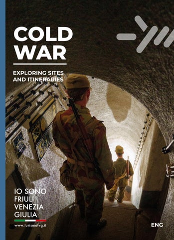
COLD WAR EXPLORING SITES AND ITINERARIES
ENG 1
Paluzza
CARNIA Malborghetto-Valbruna
Chiusaforte
JULIAN ALPS
Pinzano al Tagliamento
FRIULI, FROM THE NATISONE AND TORRE VALLEYS TO THE TAGLIAMENTO RIVER
Spilimbergo
Valvasone Arzene
GORIZIA, ISONZO KARST AND COLLIO Monfalcone
Doberdò del Lago
TRIESTE AND TRIESTE KARST
LEGEND TRIESTE AND TRIESTE KARST
PAG. 6
GORIZIA, ISONZO KARST AND COLLIO
PAG. 12
FRIULI, FROM THE NATISONE AND TORRE VALLEYS TO THE TAGLIAMENTO
PAG. 24
JULIAN ALPS
PAG. 32
CARNIA
PAG. 38
Itinerary guidelines To enjoy the proposed itineraries safely, visitors are advised to wear suitable clothing and bring appropriate equipment: sportswear, footwear suitable for dirt tracks or mountain trails, a sufficient supply of water and a source of light. It is also recommended that visitors carry a map of the area, either in printed or digital form, and to check the weather forecast before each excursion.
Scan to explore the 20th Century in Friuli Venezia Giulia 2
Discover all the itineraries available in the FVG Outdoor app!
INDEX
2
IN THE FOOTSTEPS OF HISTORY IN FRIULI VENEZIA GIULIA
4
1947 – 1991: THE COLD WAR
5
CHRONOLOGY
6
TRIESTE AND TRIESTE KARST
12
GORIZIA, ISONZO KARST AND COLLIO
24
FRIULI, FROM THE NATISONE AND TORRE VALLEYS TO THE TAGLIAMENTO
32
JULIAN ALPS
38
CARNIA
Pion Hill - Pinzano al Tagliamento
2
IN THE FOOTSTEPS OF HISTORY IN FRIULI VENEZIA GIULIA
Located in the far north-eastern corner of Italy, yet at the very heart of Europe, Friuli Venezia Giulia is a region like no other. Travelling through it means uncovering the traces left on this land by the great events of the Twentieth Century. This is a true journey through time, beginning with the fortifications built in the early 1900s in anticipation of a conflict that would soon become reality, and continuing through the many open-air museums of the First World War, stretching from the Alps to the Karst Plateau. The route then leads to the defensive structures constructed in the late 1930s, when the Fascist regime planned the Alpine Wall, or Vallo Alpino del Littorio, to protect the borders of the Kingdom of Italy. The journey finally reaches the Cold War. Although no battles were fought in this area, the period led to an unprecedented level of military fortification as a precautionary measure. Friuli Venezia Giulia shares a 232-kilometre border with what was then Yugoslavia, at the time regarded as a “non-aligned country”, against which Italy prepared to defend itself in the event of a possible invasion from the East. Near villages and hidden in alpine passes, carved underground and into bare mountain rock, concealed inside prefabricated structures or disguised as rocks deep in the forests: the so-called “bunkers” can be found throughout Friuli Venezia Giulia. These defensive systems consisted mainly of command and observation posts, machine-gun emplacements and anti-tank positions, all of which remained operational and manned until the early 1990s. Today, this remarkable heritage can still be explored thanks to the dedication of volunteers who preserve these sites and open some of them to visitors. Yet the history of the Cold War in Friuli Venezia Giulia is not only a history of military structures. It is also a human story, one of individuals and communities: stories of exiles, border populations and divided territories, now rediscovered through the museums and exhibitions that enrich the cultural heritage of this region.
3
1947 – 1991: THE COLD WAR
At the end of the Second World War, Friuli Venezia Giulia immediately assumed a key role on the international stage due to the tensions surrounding the definition of the border between Italy and Yugoslavia. This border was not merely a line separating two states: it also represented the southernmost section of the so-called “Iron Curtain”, which during the Cold War marked the division between the Western world and the socialist bloc. The strategic importance of the region, determined by its geographical position, became firmly established in 1949, when Italy joined NATO. From that moment onwards, Friuli Venezia Giulia, formally established as a region in 1963, became one of the West’s defensive frontiers, ready to be activated in the event of an invasion by the Red Army and socialist Yugoslavia. Beginning in the early 1950s, the region underwent an extensive process of militarisation that transformed it into a true fortress. Alongside hundreds of conventional military installations, including barracks, training areas and ammunition depots, more than one thousand bunkers were restored or newly built, carefully concealed within the landscape. To support this defensive system, the Italian Army deployed a substantial portion of its forces in the region, while hundreds of thousands of young conscripts from all over Italy completed their military service here. At the same time, however, certain border areas, such as Gorizia, also became important points of contact, fostering political and economic relations between two profoundly different worlds. For more than forty years, this vast military apparatus and the geopolitical significance of the area deeply influenced the society, economy and political life of Friuli Venezia Giulia, until the end of the Cold War radically transformed the role the region had played up to that point.
4
CHRONOLOGY April–May 1945. In the final days of the Second World War, the “Race for Trieste” begins: Yugoslav forces and the British Army race hasten to reach the city and take control of it. 8 May 1945. The Second World War comes to an end in Europe. 9 June 1945. The Belgrade Agreement establishes the Morgan Line, dividing Trieste and the Julian area into two military occupation zones. Yugoslav troops withdraw from the city. 5 March 1946. Winston Churchill delivers his famous “Iron Curtain” speech. 10 February 1947. The Paris Peace Treaties define the new Italian–Yugoslav border. Italy loses territories compared to the previous Morgan Line. The creation of the Free Territory of Trieste is envisaged for as a buffer state between Italy and Yugoslavia. The border becomes sealed. 4 April 1949. The North Atlantic Treaty is signed and NATO is established. The territory of what would later become Friuli Venezia Giulia becomes crucial for the defence of the Western bloc’s frontier. Spring 1951. Work begins to modernise and reactivate several fortified barriers of the Alpine Wall. At the same time, new fortifications are built along the Tagliamento River and the eastern border. Permanent fortifications continue to be updated and reorganised regularly until the early 1970s. 10 July 1951. LANDSOUTH (Allied Land Forces Southern Europe) is established: an allied command under Italian leadership created to coordinate the defence of the north-eastern frontier 5 October 1954. The London Memorandum of Understanding resolves the Trieste question and further shifts the border in favour of Yugoslavia: the administration of the city is assigned to Italy, while Zone B is allocated to Yugoslavia. 26 October 1954. Trieste returns to Italy.
14 May 1955. The Warsaw Pact is established. 30 September 1955. The border becomes permeable following the Udine Agreements: residents of border areas are allowed to cross using a special border pass. 31 January 1963. The Autonomous Region of Friuli Venezia Giulia with Special Statute is officially established. 10 November 1975. The Treaty of Osimo definitively settles the border, introducing minor adjustments compared to the previous arrangement. 4 May 1980. Tito, President of the Socialist Federal Republic of Yugoslavia, dies. An internal crisis begins, eventually leading to the dissolution of Yugoslavia and the subsequent Balkan wars. 9 November 1989. The Berlin Wall falls. 25 June 1991. Slovenia declares independence from Yugoslavia. 25–26 December 1991. The Soviet Union is dissolved. 1992. The dismantling of the permanent fortification system, which had begun a few years earlier, is completed. The region gradually undergoes demilitarisation. 1 May 2004. Slovenia joins the European Union. The symbolic celebration takes place in Piazza Transalpina – Trg Evrope, on the border between Gorizia and Nova Gorica.
The historical background texts included in this guide were written by Andrea Monopoli and Piero Zin as part of the PRIN 2022 PNRR project “Cultural Heritage of War on the Borderland. Politics of Memory, Economic Development and Local Communities”, coordinated by Tommaso Piffer (University of Udine) and Patrick Karlsen (University of Trieste).
5
TRIESTE AND TRIESTE KARST
The Karst Plateau is a crossroads of natural diversity, cultural heritage and local traditions stretching along the entire south-eastern border of Friuli Venezia Giulia. It is a land where visitors can immerse themselves in nature, discovering the Giant Cave, the springs of the Timavo River and the Rilke Trail, named after the poet who found inspiration here for his Duino Elegies. Nestled within the Karst landscape and overlooking the sea lies Trieste, a city that preserves a unique historical and cultural heritage. In the heart of the city, within just a few steps, visitors can admire fascinating Roman remains alongside magnificent Austro-Hungarian palaces. Declared a free port in the Eighteenth Century, Trieste has never lost its cosmopolitan character. Walking through the charming streets of the Borgo Teresiano district and its historic literary cafés, visitors can still experience the atmosphere that inspired great writers such as James Joyce, Italo Svevo and Umberto Saba. Yet this climate of peace and cultural coexistence was interrupted at the beginning of the twentieth century. After becoming both a symbol and an objective for Italy during the First World War and following the dramatic events of the Second World War, Trieste assumed a central role once again in the immediate post-war years. The city and its hinterland became one of Europe’s most sensitive crossroads, marked by tensions and territorial disputes between Italy and what was then Yugoslavia. Visiting Trieste today also means discovering the history of this border and learning about the people who crossed it.
6
Magazzino 18 ‒ Trieste
9
MUSEUMS AND EXHIBITIONS
7
THE FREE TERRITORY OF TRIESTE The Free Territory of Trieste was an independent state entity established at the end of the Second World War to resolve the territorial dispute between Italy and Yugoslavia over the city of Trieste and its surrounding area. Formally established on 15 September 1947 with the ratification of the Paris Peace Treaties, the Free Territory of Trieste was divided into two zones: Zone A, under Anglo-American administration and including the city of Trieste, and Zone B, located in the northwestern part of Istria, under Yugoslav administration. The Free Territory was conceived as a neutral and demilitarised state under the protection of the United Nations. Its purpose was to safeguard the rights of the different communities living there—Italians, Slovenes and Croats—while promoting the economic development of the strategically important Port of Trieste, a key gateway to Central Europe. Despite these objectives, the outbreak of the Cold War profoundly influenced the Free Territory's development. Growing tensions between the Western and Eastern blocs were reflected in the administration of the two zones, preventing the establishment of a unified government and the full implementation of its permanent statute. This situation remained unresolved for several years. A provisional solution was reached only on 5 October 1954, with the signing of the London Memorandum of Understanding. Under the agreement, Zone A was placed under Italian civil administration, while Zone B came under Yugoslav civil administration. Although the memorandum did not formally abolish the Free Territory of Trieste, it effectively marked its partition and the beginning of the gradual integration of the two zones into their respective states. The border issue was definitively settled only in 1975 with the Treaty of Osimo, which internationally recognised Italian and Yugoslav sovereignty over the former territories of the Free Territory of Trieste, bringing this unique political entity to an end.
8
MUSEUMS AND EXHIBITIONS
1
REFUGEE CAMP OF PADRICIANO The National Museum of the Refugee Camp of Padriciano is an essential place for understanding the history of the Istrian, Julian and Dalmatian exiles who arrived in Italy in the aftermath of the Second World War. The building was originally intended to accommodate the Anglo-American armed forces stationed in the Free Territory of Trieste, but it was soon abandoned and later converted to address the refugee emergency of the 1950s, which intensified following the definitive transfer of Zone B to Yugoslav administration. The Refugee Camp was closed in the 1970s and has since preserved its original structure, with the exception of the wooden barracks where the refugees slept, which were later demolished. Opened in 2004, the Museum preserves the memory of this place and its history. The exhibition begins with the faces and names of numerous exiles, guiding visitors through historical photographs and information panels that explore these events in greater depth. The museum also displays a selection of personal belongings from the warehouses of Trieste’s Old Port, together with a reconstruction of a living unit, offering an insight into the difficult living conditions endured by the refugees housed here.
Former Refugee Camp of Padriciano Hamlet Padriciano, 60 - 34149 Trieste (TS) 9
THE ISTRIAN, FIUMAN AND DALMATIAN EXODUS The Istrian, Fiuman and Dalmatian exodus represents one of the most dramatic chapters in Italy’s post-war history. Between 1943 and 1956, hundreds of thousands of Italians were forced to leave their homes and native lands in Istria, Fiume (now Rijeka) and Dalmatia, territories ceded to Yugoslavia following the Paris Peace Treaties of 1947. This mass migration resulted from a complex combination of factors: the Yugoslav occupation of these areas at the end of the Second World War, widespread violence, fear of political persecution and the unwillingness to accept a communist regime perceived as a threat to Italian cultural identity. Choosing to “opt” for Italian citizenship meant leaving behind all possessions and departing from one’s homeland. Although the exact figures remain the subject of historical debate, it is estimated that between 250,000 and 350,000 Italians left these territories. Many arrived in Italy and were often accommodated in refugee camps under extremely difficult conditions, facing a challenging process of integration into a country already devastated by war and initially unable to fully understand the scale and causes of the exodus. The exodus was not a single event, but rather a gradual process that unfolded in different waves depending on the territories involved and the changing political context. Even today, decades later, the experience of the exiles and the memory of their suffering remain a fundamental part of Italy’s collective memory, commemorated every year on 10 February during the Giorno del Ricordo (“Day of Remembrance”).
10
2
MAGAZZINO 18 “Magazzino 18” (Warehouse 18) is the name given to the collection of personal belongings that Istrian, Fiuman and Dalmatian exiles brought with them and deposited in the warehouses of Trieste’s Porto Vecchio after arriving in the city. For many years, these objects, laden with memories and personal histories, were preserved and displayed inside Magazzino 18 itself, which became a symbol of this heritage also thanks to the acclaimed theatrical production of the same name by Simone Cristicchi. Today, this extraordinary testimony to the exodus can be seen in Magazzino 26, whose larger spaces allow more than 2,000 cubic metres of furniture, work tools, everyday objects and private memorabilia to be properly displayed. The building will also host the future Museum of Istrian, Fiuman and Dalmatian Civilisation, whose ethnographic section has already been completed. The warehouse can be visited during the guided tours organised twice a month by the Regional Institute for the Istrian, Fiuman and Dalmatian Culture (I.R.C.I.), which also curates temporary exhibitions at its headquarters in the heart of Trieste, at Via Torino 8.
Museum Centre Magazzino 26 P. Franco Vecchio, 34135 Trieste 11
GORIZIA, ISONZO KARST AND COLLIO
Piazza della Transalpina/Trg Evrope - Gorizia/Nova Gorica
12
During the period of the Austro-Hungarian Empire, Gorizia earned the nickname “Austrian Nice” thanks to its mild climate, which attracted members of the Viennese bourgeoisie, who chose the city as a holiday destination. The magnificent parks and elegant historic buildings from that era still characterise much of the town centre today. Gorizia is also an important destination for discovering the history of TwentiethCentury Europe. After being deeply affected by the events of the First and Second World Wars, the border established in the post-war years divided the town centre from the surrounding area, which became Yugoslav territory. A striking example is Piazza Transalpina – Trg Evrope, once split in two by the so-called “Gorizia Wall”: often described as the last wall separating East and West to fall in Europe. Today, this square has become a symbol of unity and cross-border cooperation between the cities of Gorizia and Nova Gorica, a path that culminated in their joint nomination – and subsequent designation – as the European Capital of Culture 2025. The surrounding area also still bears visible traces of the Cold War: both the Collio hills and the Isonzo Karst lie along the former border. Here, walking along the area’s many trails, visitors can still encounter numerous permanent fortifications hidden among vineyards, woodlands and karst landscapes.
14
MUSEUMS AND EXHIBITIONS
15
MONUMENTS AND HISTORIC BUILDINGS
18
FORTIFICATIONS AND BUNKERS
21
ITINERARIES AND THEMATIC PARKS
13
MUSEUMS AND EXHIBITIONS
3
MUSEUM OF LASCIAPASSARE / PREPUSTNICA Inside the historic border guard house at the Rafut crossing point – one of the symbolic sites of the border established by the Paris Peace Treaties – the multimedia exhibition Lasciapassare / Prepustnica has been created. In the outdoor courtyard, historical photographs and information panels illustrate the events that shaped the Gorizia area throughout the Twentieth Century. Inside the former border post, the multimedia exhibition offers an immersive experience. In the first room, a series of historical photographs and archive footage, divided by a white line, presents the two different perspectives on the border: the Italian and the Yugoslav. In the second room, visitors are invited to interact with symbolic objects linked to the frontier and the experience of crossing it, including a packet of cigarettes, a customs officer’s signalling paddle and the indispensable border pass itself, each revealing its story through engaging video interviews.
Via del Rafut, 32 ‒ 34170, Gorizia (GO) 14
MONUMENTS AND HISTORIC BUILDINGS
4
RAFUT BORDER CROSSING
Although of secondary importance, the Rafut border crossing became a symbol of the irrational way in which the border between Italy and Yugoslavia was drawn following the Paris Peace Treaties of 1947. One striking example is the story of a house located in Italian territory but separated from its stable, which became Yugoslav territory, as well as the famous image of a cow standing on the border line itself. On this small strip of land, an original Italian border barrier can still be seen today, the only one preserved in the city, while the former border guard house now hosts the Museum of Lasciapassare / Prepustnica.
LASCIAPASSARE/PREPUSTNICA 1955 was a pivotal year in the history of the ItalianYugoslav border area. In August, the Udine Agreement regulating local cross-border traffic was signed. Through this agreement, the Italian and Yugoslav authorities introduced a special permit that allowed residents living along the border to move more easily between the two countries than had previously been possible. This permit became known as the lasciapassare in Italian, prepustnica in Slovenian and propustnica in Serbo-Croatian. The initiative not only improved commercial exchanges within the crossborder area but also encouraged greater mutual understanding between the two communities living along the frontier.
15
16
5
TRANSALPINA SQUARE Piazza della Transalpina (Trg Evrope in Slovenia) takes its name from the railway station through which the Transalpine Railway once passed, linking Trieste with the heart of Central Europe when it was inaugurated in the early Twentieth Century. At the time, the station welcomed many tourists eager to visit what was then known as the “Austrian Nice”; today, however, it stands in Slovenian territory. Following the Paris Peace Treaties of 1947, the square was divided in two, transforming it from a place of arrival and exchange into a space that visibly embodied the separation from what was then Yugoslavia. In 2004, the year Slovenia joined the European Union, the border markers and the characteristic low wall topped with green fencing that once marked the frontier were removed. In their place, a mosaic was installed at the centre of the square, symbolising the explosion of a border marker, with its fragmented identification numbers incorporated into the composition itself. Today, the square has become a symbol of unity and cross-border cooperation between the cities of Gorizia and Nova Gorica, a journey that culminated in their joint candidacy and subsequent designation as European Capital of Culture 2025.
Piazza della Transalpina / Trg Evrope ‒ 34170 Gorizia (GO) / SI–5000 Nova Gorica (GO) 17
FORTIFICATIONS AND BUNKERS
6
SAN MICHELE BUNKER The permanent fortification at Mount San Michele was built in 1970 on the summit of Mount Škofnik, a modest hill south-east of Mount San Michele, chosen for its strategic position. From here, it was possible to monitor the Vipava Valley, the Kostanjevica Karst plateau and, above all, the Gorizia Gap. The structure was built using the “cut and cover” method: first constructed on the levelled summit and then concealed beneath an artificial hill. Today, visitors can explore two areas of the complex: the Command and Observation Post (PCO) and a machine-gun emplacement (M4). The PCO was the operational heart of the entire structure, where communications were transmitted and received in order to coordinate the activities of the whole defensive complex. It is arranged over two levels: the upper floor housed the technical rooms, including the facilities for air filtration and decontamination from NBC agents (nuclear, biological and chemical), while the lower floor contained the command shelters, protected by a thick layer of reinforced concrete and the overlying ground. The bunker can be visited during scheduled openings with guided tours, made possible thanks to the commitment of volunteers from the Associazione Nazionale Fanti d’Arresto. On these occasions, the interiors are furnished with original period equipment, allowing visitors to step inside an authentic testimony to the Cold War.
18
THE PETEANO MASSACRE On the evening of 31 May 1972, in the small village of Peteano, around ten kilometres from the centre of Gorizia, a bomb hidden inside a Fiat 500 exploded. Three Carabinieri officers were killed in the attack, while two others were injured. The officers had arrived at the scene after an anonymous phone call reported an abandoned car with two bullet holes in its windscreen. At first, the investigation focused on leads connected to left-wing extremism and local criminal networks. Particular attention was given to the latter hypothesis, which later proved to be a deliberate attempt to mislead investigators, as later emerged from subsequent investigation. Responsibility for the attack was ultimately attributed to far-right extremist circles linked to Ordine Nuovo. In May 1992, exactly twenty years after the bombing, Vincenzo Vinciguerra and Carlo Cicuttini were sentenced to life imprisonment as the perpetrators of the attack. Meanwhile, Colonel Antonino Chirico and Colonel (later General) Dino Mingarelli were convicted of obstructing the investigation and sentenced to three years and ten months in prison, later benefiting from a pardon. For many years, the media impact of the “Peteano massacre” remained limited compared to the events more commonly associated with Italy’s “Years of Lead” and the so-called “strategy of tension”. Its peripheral location contributed significantly to making the episode less visible to the Italian public.
19
THE GORIZIA GAP At the end of the Second World War, with the division of the world into two opposing ideological blocs, Friuli Venezia Giulia found itself on the frontier between the capitalist and communist worlds. The proximity to Tito’s Yugoslavia – which, despite breaking away from direct Soviet control, remained a socialist country – increased uncertainty and fuelled tensions. The Italian eastern border, located along the so-called “Iron Curtain”, thus became one of the West’s main defensive frontiers. To counter the threat of a possible invasion from the East, the Italian Army, in cooperation with NATO, built and reactivated more than one thousand bunkers between the early 1950s and the late 1970s. Today, these structures represent one of the most fascinating and least-known aspects of Italy’s Cold War military history. The area most heavily affected by the fortification effort was the so-called “Gorizia Gap”, the wide plain stretching from the city of Gorizia towards the Friulian lowlands. Due to its geographical features, this territory was considered the most vulnerable section of the entire border and was regarded as the main access route from the East towards the northern Mediterranean basin and the Italian peninsula. For this reason, nearly one third of all the structures forming the defensive system were concentrated in this area.
20
ITINERARIES AND THEMATIC PARKS
7
THE GORIZIA GAP “The Gorizia Gap. From the Iron Curtain to the Path of Peace” is a project developed by the University of Trieste, aimed at studying and promoting the Cold War fortifications scattered across the Isonzo Karst. Already heavily fortified and the scene of fierce battles during the First World War, the Karst was also militarised and guarded throughout the Cold War period. The project has identified five itineraries of increasing length and difficulty, leading visitors to discover the traces left on this landscape by the permanent fortification system. The routes extend across the municipalities of Sagrado, Doberdò del Lago and Monfalcone, crossing through the Doberdò and Pietrarossa Lakes Nature Reserve and the Monfalcone First World War Theme Park. Exploring these places means uncovering the rich layering of defensive structures that have shaped the area over the centuries: from the prehistoric hillfort of Castellazzo, to the trenches of the First World War, and finally to the artillery positions and command-and-observation posts of the Fanteria d’Arresto units.
NUCLEAR MINES Between the mid-1950s and the early 1960s, the superiority of the Warsaw Pact’s ground forces was a major source of concern for NATO. As a result, plans were developed to ensure the defence of Western European countries. Among these strategies were the possible use of tactical nuclear weapons and, in heavily fortified regions such as Friuli Venezia Giulia, the deployment of atomic mines designed to slow a potential advance by Soviet and allied troops. Along the Italian border, the Karst was considered particularly suitable for such defensive needs and, for this reason, the use of nuclear devices in that sector was taken into consideration.
21
THE BORDER AND ITS ABSURDITIES After the end of the Second World War, the Peace Treaty was signed in Paris on 10 February 1947. For Italy, the treaty brought significant territorial changes, particularly along the border with Yugoslavia. The new frontier, officially established on 15 September 1947, was marked by the so-called “white line”. This line divided houses, farms, cemeteries, lands and families, becoming one of the most powerful symbols of the absurd barrier created by the Cold War. Although this may seem like a distant reality today, traces of this division can still be clearly seen by visiting some of the most significant places connected to the border. One of these is the Rafut border crossing in Gorizia, a secondary crossing point not far from the better-known Casa Rossa checkpoint. It was here that one of the most iconic photographs of the Gorizia border was taken: a cow, indifferent to the white chalk line separating the stable from the rest of the property, stood with two legs in Italy and the other two in Yugoslavia. Another symbolic site of the Cold War is the cemetery of the small Slovenian village of Miren/Merna. In 1947, the village was assigned to Yugoslavia, while its cemetery met a different fate. The border cut directly through the burial ground, leaving one half in Italy and the other in Yugoslavia. Here the strict armed surveillance of those years spared not even a cemetery. Another episode associated with the border was the so-called “Broom Sunday”. After the implementation of the Paris Peace Treaties, divided families were no longer able to see one another, except for brief greetings across the frontier, causing widespread hardship and emotional distress. Border authorities therefore introduced a special arrangement allowing relatives and friends to meet at two border crossings: Casa Rossa in Gorizia and Stupizza near Cividale del Friuli. The first meeting took place on 6 August 1950 and proved to be a great success. However, the following Sunday, 13 August 1950, events took an unexpected turn: around 5,000 people gathered on the Yugoslav side of the border and poured into Gorizia like a flood, buying everything that was unavailable in Yugoslavia, including the famous sorghum brooms that became the symbol of that day. The history of the Italian-Yugoslav border during the Cold War was therefore marked by both tensions and moments of openness. While in the years immediately following the conflict the division had devastating consequences for the local population, by the mid-1950s the situation gradually began to change. A decade later, the idea of cross-border cooperation had emerged, transforming the frontier into what became known as “the most open border in Europe”.
22
23
FRIULI, FROM THE NATISONE AND TORRE VALLEYS TO THE TAGLIAMENTO RIVER Stretching from east to west, from the Slovenian border to the Veneto region, this vast area encompasses the Friulian plain, hills and Pre-Alps. Beginning at the border are the Natisone and Torre Valleys, characterised by small villages, ancient traditions and a natural landscape that for centuries connected the communities living along the frontier. In the aftermath of the Second World War, however, these valleys found themselves directly along the border between Italy and Yugoslavia, becoming one of the most sensitive areas of the new European order. For decades, daily life was shaped by checkpoints and restrictions, while defensive structures and military infrastructure spread throughout the territory, traces of which can still be seen in the landscape today. The hills and plains preserve a cultural and historical heritage spanning thousands of years. This includes no fewer than four UNESCO World Heritage Sites (Palù di Livenza, Aquileia, Cividale del Friuli and Palmanova) and thirteen villages listed among Italy’s Most Beautiful Villages. The area also includes cities such as Udine, marked by its strong Venetian character, and Pordenone, which will be the Italian Capital of Culture in 2027. Like the rest of the region, this extensive area was deeply involved in the great events of the Twentieth Century. During the Cold War, in particular, it underwent extensive fortification works: natural defensive lines formed by the rivers were exploited, concentrating defences near the key strategic points along the Torre River in the east, while a more rearward defensive line was established further west along the Tagliamento River.
24
Colle Pion - Pinzano al Tagliamento
26
MUSEUMS AND EXHIBITIONS
28
FORTIFICATIONS AND BUNKERS
31
ITINERARIES AND THEMATIC PARKS
25
MUSEUMS AND EXHIBITIONS
8
HISTORICAL MUSEUM OF THE FANTERIA D’ARRESTO Inside a building of the former “Tagliamento” barracks in Valvasone Arzene, visitors can explore the historical collection of the Fanteria d’Arresto. The exhibition of military memorabilia is curated by the Associazione Nazionale Fanti d’Arresto (ANFA). The barracks were built in the 1960s to serve as the headquarters of the 73rd Fanteria d’Arresto Regiment “Lombardia”, which was responsible for managing the permanent fortification system between Valvasone Arzene and Pinzano al Tagliamento, a crucial sector of the defensive line established along the Tagliamento River. The complex was decommissioned in the 1990s following the demilitarisation of north-eastern Italy. Today, one of the former service buildings, managed by the Associazione Nazionale Fanti d’Arresto, hosts an exhibition of military artefacts and memorabilia. In particular, visitors can discover items related to the Fanteria d’Arresto units, including uniforms and original equipment from the period.
Former “Tagliamento” Barracks Via Grava s.n. ‒ 33098 Valvasone Arzene (PN) 26
MILITARY EASEMENTS All land on which bunkers were built was subject to military easements, which imposed particularly severe restrictions on landowners. These included the prohibition on building walls or other structures, raising existing structures, digging ditches or canals, as well as engaging in certain agricultural activities. In addition, whenever deemed necessary, the military authorities had the power to intervene directly on private property, including through demolitions or structural modifications. The situation was made even more restrictive by the fact that until 1968 landowners affected by military easements received compensation only in the event of a change of ownership, and not for the limitations imposed on the use of their property. Military easements did not apply solely to land occupied by fortifications but extended to all areas containing military installations, such as ammunition depots. During the 1960s, this system affected almost 50% of the regional territory, significantly limiting both personal freedoms and the economic development of Friuli Venezia Giulia. Over time, it sparked numerous protests from local residents as well as from regional and local political representatives. Even today, landowners whose properties once hosted bunkers continue to bear witness to the legacy of this system. In many cases, these now decommissioned yet still clearly visible structures remain in their backyards, standing as silent witnesses to the Cold War in this part of Italy.
27
FORTIFICATIONS AND BUNKERS 9
PURGESSIMO BUNKER
On the slopes of Mount Purgessimo (Karkoš in Slovenian) stands a Cold War defensive structure strategically positioned to oversee the road linking Cividale del Friuli to the Stupizza border crossing. Built into the rock during the 1950s, the bunker reused a structure dating back to the First World War as its entrance. It was later enlarged by excavating directly into the bare stone, parts of which are still visible today. At the time, the fortification was permanently manned by the Fanteria d’Arresto. The complex is laid out mainly on a single level and includes a command post, two machine-gun positions (M) and two anti-tank positions (P). The first section contains the toilets and storage rooms: equipment and supplies were stored inside wall niches and built-in compartments so as not to obstruct the soldiers’ operational activities. The strategic and operational areas, such as the communications room and the command office, retain their exposed concrete appearance, while the spaces intended for daily life – including the mess hall and dormitory – are distinguished by red tiles. Finally, a series of four spiral staircases leads to the observation post located along the ridge of Mount Purgessimo, as well as to the exit, or secondary entrance. The bunker is privately owned and can only be visited during guided tours organised by the Pro Loco Nediške Doline – Valli del Natisone APS.
THE OPENING OF THE STUPIZZA BORDER CROSSING IN 1955 Following the signing of the Paris Peace Treaties in 1947, the new border between Italy and Yugoslavia came into effect. For the following eight years, the frontier remained tightly sealed, making cross-border movement almost impossible. A first step towards reopening came with the Udine Agreement of 20 August 1955, which introduced, within the context of the Iron Curtain, an exceptionally open system of movement between two states belonging to opposing blocs. The agreement allowed residents living within ten kilometres of the border to cross it using a special permit known as the lasciapassare (prepustnica in Slovenian). Within this framework, an official ceremony was held on 10 October 1955 at the Stupizza border crossing to mark the reopening of the pass to traffic. According to contemporary reports, the event immediately helped restore friendships and family ties between the communities of the Natisone Valleys and the Kobarid area, while also facilitating trade between farmers and the purchase of essential goods, particularly by Yugoslav citizens. Large numbers of Yugoslav visitors crossed into Italian towns, giving rise to what the local press described as a “peaceful invasion”, which involved the entire Natisone Valleys area and especially the town of Cividale del Friuli. Including the three minor border crossings opened in the same area, by the end of August 1956 there had been 26,050 crossings by Italian citizens and 37,660 by Yugoslav citizens.
28
10
SPILIMBERGO BUNKER Spilimbergo is home to a unique Cold War fortification: the experimental nuclear fallout shelter that formed part of the “Villa Teresa” defensive complex, which also included a series of machine-gun (M) and anti-tank (P) positions built near the Tagliamento River. The shelter extends over two underground levels and was designed to accommodate up to twenty-five soldiers. Built in the late 1960s, it is one of the last defensive structures constructed in Friuli Venezia Giulia during the Cold War. The shelter housed the troops responsible for manning the surrounding positions and was specifically designed to provide protection even in the event of contamination from nuclear fallout. Its original purpose is still evident in the layout of the interior spaces. In particular, visitors can observe the unusually large number of water tanks, far exceeding normal daily requirements. The water was intended for decontaminating the soldiers’ protective equipment before they entered the innermost section of the shelter. This protected area was equipped with an air-filtration system and stocked with sufficient water and rations to allow its occupants to survive in complete isolation for approximately one week. Here, a long cylindrical corridor sealed by watertight doors housed the sleeping quarters. Access to the lower level was protected by two blast-resistant armoured doors fitted with a hydraulic safety system that prevented them from being opened simultaneously, ensuring maximum protection in an emergency. Immediately beyond these doors lies the shelter’s only machine-gun position (M), designed to respond to the possibility of an enemy attack. Today, the site can be visited thanks to the restoration and safety works carried out by the Associazione Nazionale Fanti d’Arresto (ANFA), which should be contacted for information regarding access and guided visits.
29
LIFE IN THE BUNKERS During the Cold War, the bunkers were constantly guarded and maintained by specialised units of the Italian Army created specifically for this purpose: the Alpini d’Arresto and the Fanteria d’Arresto. The fortifications considered strategically most important, particularly those located in sensitive areas close to the border, were permanently manned. In these cases, a group of soldiers was stationed in a small barracks near the defensive complex, ready to intervene at any moment. Day and night, these troops monitored the bunkers, ensuring both their operational readiness and the security of the surrounding area. The fortifications also regularly served as the setting for military exercises, during which combat scenarios were simulated and each soldier was required to perform specific duties according to his role and specialisation, such as radio operator, machine gunner or artilleryman. These training exercises often lasted several days, during which the soldiers lived inside the confined spaces of the bunkers: environments without natural light, often damp and bitterly cold. It was a life marked by preparation and waiting, lived under the shadow of a conflict that, fortunately, never came.
30
ITINERARIES AND THEMATIC PARKS Difficulty Easy Elevation gain Negligible Distance 1.5 km Duration Approximately 1 hour Recommended period Year-round Map Tabacco Map 028 Starting point Car park along Provincial Road SP4 (SP4)
11
BUNKERS ON PION HILL, PINZANO AL TAGLIAMENTO Pion Hill overlooks the Pinzano al Tagliamento Bridge, a strategically important crossing point over the Tagliamento River. For this reason, the area played a key role throughout the Twentieth Century. It was here that Italian troops attempted to halt the enemy advance during the Italian retreat after the Battle of Caporetto, and where Nazi Germany later planned the construction of a monumental ossuary dedicated to the soldiers who had fallen in the fighting. Although never completed, the structure was nevertheless used during the Second World War and was heavily damaged by air raids. During the Cold War, the entire area was manned by the Italian Army, and the unfinished ossuary itself was repurposed as an observation post and troop shelter. The itinerary begins at the entrance to the unpaved road leading to Pion Hill from Provincial Road SP4, shortly after the Pinzano Bridge for those arriving from Ragogna. After a short walk, visitors reach the remains of the unfinished ossuary. Returning along the same path, the route continues towards the edge of the hill, where two machine-gun positions can be seen: one disguised as a rock and the other concealed within a prefabricated structure. Nearby, visitors can also see the remains of the emplacement where a tank was once positioned. From here, a scenic viewpoint offers magnificent views over the Tagliamento River. Descending the western slope of the hill, with the river behind them, visitors encounter another defensive structure. The route then retraces its steps towards the starting point, where a second branch of the track leads in just a few minutes to the barracks that once housed the soldiers responsible for manning the fortifications.
31
JULIAN ALPS
Fort Beisner - Malborghetto-Valbruna
32
The Julian Alps are renowned for their breathtaking landscapes, which can be enjoyed through both easy walks and more demanding hikes: wide valleys, the ancient Tarvisio Forest and imposing peaks such as Jôf di Montasio, Jôf Fuârt and Mount Canin. The area is also home to crystal-clear lakes, including the Fusine Lakes, and centuries-old pilgrimage destinations such as the Sanctuary of Monte Lussari. Yet the atmosphere of peace that characterises these mountains today should not be taken for granted. The strategic location of this region, now bordering Austria and Slovenia, made it the scene of fierce battles and extensive fortification works throughout the Twentieth Century. Today, these remains form a vast open-air museum where visitors can discover AustroHungarian fortifications and First World War trenches, the defensive barriers of the Alpine Wall built during the 1930s, and Cold War fortifications. The Coccau Customs Museum and the Chiusaforte Cold War Museum also provide valuable insight into the historical context of this remarkable heritage.
34
MUSEUMS AND EXHIBITIONS
36
FORTIFICATIONS AND BUNKERS
33
MUSEUMS AND EXHIBITIONS
12
CHIUSAFORTE COLD WAR MUSEUM The Cold War Museum, managed by the Friuli Storia e Territorio Association, is housed in the building that once served as the canteen of the former “Zucchi” Barracks in Chiusaforte. Unique of its kind in Italy, the museum offers visitors the opportunity to explore the military history of the second half of the Twentieth Century and gain a deeper understanding of the Cold War along Italy’s eastern border. On the ground floor, a section is dedicated to the “Cividale” Alpini Battalion, which was stationed in the barracks from the 1960s until its decommissioning. On the first floor, the Cold War exhibition begins with a room devoted to the Allied Military Government of Trieste and the redefinition of the eastern border following the end of the Second World War. The exhibition continues with a collection of uniforms and equipment belonging to the Italian Armed Forces, as well as to other NATO and Warsaw Pact armies, with particular attention given to fortifications, military technology and Nuclear, Biological and Chemical (NBC) Defence. Highlights include the reconstruction of a military barracks dormitory, and a reproduction of a permanent fortification structure.
Former "Zucchi" barrack Via A. Ruffi, n. 40 ‒ 33010 - Chiusaforte (UD) 34
13
COCCAU CUSTOMS MUSEUM The Customs Museum in Coccau (Tarvisio), offers visitors a unique opportunity to explore the history of borders and customs services, with a particular focus on the history of the Italian-Austrian frontier. The museum is located at the Coccau border crossing, still one of the most important crossing points between Italy and Austria, inside the building where customs inspections were once carried out. Its extensive information panels, available in Italian, English, German and Slovenian, illustrate the evolution of borders from Roman times to the creation of the European Union, with particular attention to the postwar period and the distinctive features of frontier life during the Cold War. Visitors can also view a variety of historical artefacts, including customs officers’ manuals, uniforms, original signage and equipment used for inspecting goods.
Via Friuli, 43 ‒ 33018 Coccau Valico Tarvisio (UD)
THE BRETTO TUNNEL During the Cold War, one of the most unusual sections of Italy’s border was undoubtedly the one that ran through the Bretto Tunnel, where Italy and Yugoslavia were separated 240 metres below ground. The tunnel was built between 1899 and 1905 to drain water from the Raibl Mine (Cave del Predil) and had already played an important role during the First World War. Enlarged and equipped with a narrow-gauge railway, it allowed the Austro-Hungarian Army to supply the Isonzo Front without being detected by Italian forces. After the war, the tunnel began to be used by miners from the Bretto area, which had become part of the Kingdom of Italy, to reach the mine. Following the Second World War, the tunnel was divided for the first time between two states, and an iron gate was installed along the demarcation line. Yet while the new border above ground had become virtually impassable, underground the movement of miners continued uninterrupted.
35
FORTIFICATIONS AND BUNKERS
14
FORT BEISNER – UGOVIZZA–FORCELLA NEBRIA BUNKER NO. 4 Val Canale has always been a strategically important corridor for the defence of the border. At its centre, between 1938 and 1942, the Malborghetto–Valbruna defensive barrier of the Alpine Wall was constructed. In the early 1950s, seven of its fortifications were refurbished and equipped with new weaponry before being incorporated into the Ugovizza–Forcella Nebria defensive barrier, which NATO later used as part of its anti-Soviet strategy. Thanks to the work of the LandScapes Association, the so-called “Fort Beisner” is now open to visitors. It served as the command centre of the entire defensive barrier and was therefore equipped to respond immediately in the event of an emergency. The fortification featured one anti-tank gun position (P), seven machine-gun positions (M) and numerous service rooms. This impressive structure was excavated directly into the rock of Mount Palla (Kugel Berg) and extends across a single level, with approximately 1,000 metres of tunnels and a floor area of around 2,200 square metres. The only exception is the armoured observation post on the summit of the hill, which can be reached via a striking staircase carved through the bare rock, as this section was not reinforced with concrete. In several areas of the fortification, visitors can learn more about its construction and operational history through information panels and historical photographs. In addition, a number of rooms, including the first-aid station and the dormitory used by the soldiers on duty, have been furnished with original period equipment, offering an authentic impression of how the fortification appeared during its years of service.
36
15
BUNKER NO. 3 – MALBORGHETTO DEFENSIVE BARRIER Fortification No. 3 of the Malborghetto Defensive Line shared a similar operational history to Fortification No. 4 at Ugovizza. Originally built as part of the Malborghetto–Valbruna defensive Barrier of the Alpine Wall, it never entered service during the Second World War. In the early 1950s, following modernisation works, it was reactivated by NATO as part of the Malborghetto Defensive barrier and remained operational until its decommissioning in 1992. The structure originally consisted of a command post, a dormitory, three machine-gun positions and various service rooms. During its reactivation, one of the machine-gun positions was converted into an anti-tank position in order to meet new defensive requirements. The firing positions still retain their original camouflage systems: ingenious movable devices designed to blend seamlessly into the surrounding landscape. When required, these structures could be operated from inside the fortification, allowing fire to be directed through the embrasures while maintaining effective concealment.
37
CARNIA
“Cherso 1” Bunker Museum - Passo di Monte Croce Carnico
38
Located in the north-western part of Friuli Venezia Giulia, Carnia is home to some of the region’s most unspoilt natural landscapes. It is here, for example, that Mount Coglians, the highest peak in Friuli Venezia Giulia, rises above the surrounding mountains. Throughout the Twentieth Century, these mountains formed a natural defensive line that was later exploited and reinforced by military engineers. As a result, visitors can discover a remarkable layering of defensive structures that characterised the century: from the trenches of the First World War, through the fortifications of the Alpine Wall, to the defensive barriers of the Cold War. Particularly emblematic are the military remains surrounding Plöcken Pass (Passo di Monte Croce Carnico), still one of the main crossing points along the border with Austria, as well as those found near Torre Moscarda, a defensive stronghold since the Middle Ages.
40
FORTIFICATIONS AND BUNKERS
39
FORTIFICATIONS AND BUNKERS
16
TORRE MOSCARDA DEFENSIVE BARRIER Near Paluzza, visitors can discover a remarkable example of the layered defensive systems that have shaped Friuli Venezia Giulia over the centuries. Here, the But Valley narrows considerably, creating a natural barrier along the route leading to Plöcken Pass (Passo di Monte Croce Carnico). As early as the thirteenth century, a defensive complex was established in this strategic location. Today, its most prominent surviving element is Torre Moscarda, locally known as La Torate, which remained in use until the nineteenth century. The valley also preserves numerous traces of the First World War, including trenches, communication trenches and fortifications excavated into the rock. Making use of some of these pre-existing underground works, the Torre Moscarda Defensive Barrier was built in the late 1930s as a group of seven fortifications belonging to the Alpine Wall. Four of these fortifications were reactivated in the immediate post-war period after being expanded and modernised. Among them is Fortification No. 6, located directly beneath Torre Moscarda and now open to visitors through guided tours organised by Visit Zoncolan. The structure features two machine-gun positions (M) and was created by adapting a pre-existing underground fortification and reinforcing it with concrete. The other fortifications that formed part of the defensive barrier can still be seen from the outside while exploring the picturesque woodland surrounding Paluzza.
40
17
“CHERSO 1” BUNKER MUSEUM The “Cherso 1” Bunker Museum is a fortification belonging to the Passo Monte Croce Carnico Defensive Barrier, part of the Alpine Wall built in the 1930s to defend the border. The three underground fortifications that made up the defensive barrier were reactivated during the Cold War under the codename “Cherso”, following extensive upgrades to the infrastructure, the modernisation of the armaments and the restoration of the barracks used to accommodate the troops. The site is an excellent example of the layered defensive heritage that developed throughout the Twentieth Century. Part of Fortification No. 1, in fact, incorporates the remains of a First World War trench system, whose firing embrasures can still be seen today. Fortification No. 1 is now open to visitors thanks to the work of the Associazione per lo Studio e la Salvaguardia delle Fortificazioni a NordEst (A.S.S.F.N.E.). During scheduled opening days, the bunker displays reproductions of weapons, as well as original Cold War equipment and military gear. The carefully reconstructed setting, enhanced by the presence of historical re-enactors, offers an immersive experience that allows visitors to understand the daily life of the soldiers stationed in the fortification and to discover the operational procedures that would have been followed in the event of an emergency.
41
PromoTurismoFVG tourist offices Aquileia tourist office Via Giulia Augusta, 11 - 33051 Aquileia (UD) Tel. +39 0431 919491 | Cell. +39 335 7759580 info.aquileia@promoturismo.fvg.it
Lignano Pineta tourist office (summer season) Via dei Pini, 53 - 33054 Lignano Pineta (UD) Tel. +39 0431 422169 | Cell. +39 331 1435222 info.lignanopineta@promoturismo.fvg.it
Arta Terme tourist office Via Nazionale, 1 - 33022 Arta Terme (UD) Tel. +39 0433 929290 | Cell.+39 335 7463096 info.artaterme@promoturismo.fvg.it
Lignano Sabbiadoro tourist office Via Latisana, 42 - 33054 Lignano Sabbiadoro (UD) Tel. +39 0431 71821 | Cell. +39 335 7697304 info.lignano@promoturismo.fvg.it
Cormons tourist office Piazza XXIV Maggio, 15 – 34071 Cormons (GO) Tel. +39 0481 386224 | Cell. +39 335 7697061 info.cormons@promoturismo.fvg.it
Marano Lagunare tourist office (summer season) Piazza Cristoforo Colombo - 33050 Marano Lagunare (UD) Cell. +39 334 6835248 info.marano@promoturismo.fvg.it
Forni di Sopra tourist office Via Cadore, 1 - 33024 Forni di Sopra (UD) Tel. +39 0433 886767 | Cell. +39 335 1083703 info.fornidisopra@promoturismo.fvg.it
Miramare tourist office Porta della Bora, adiacente all’ingresso del Viale dei Lecci - 34121 Trieste Cell. +39 333 6121377 info.miramare@promoturismo.fvg.it
Gorizia tourist office Palazzo Paternolli, Piazza della Vittoria, 48 - 34170 Gorizia Tel. +39 0481 535764 | Cell. +39 335 1084763 info.gorizia@promoturismo.fvg.it Grado tourist office P.zza XXVI Maggio, 16 - angolo Portanuova, 26 34073 Grado (GO) Tel. +39 0431 877111 | Cell. +39 335 7705665 info.grado@promoturismo.fvg.it
42
Muggia tourist office Piazza Marconi, 1 - 34015 Muggia (TS) Tel. +39 040 9571085 info.muggia@promoturismo.fvg.it Palmanova tourist office Borgo Udine, 4 - 33057 Palmanova (UD) Tel. +39 0432 924815 | Cell. +39 335 7847446 info.palmanova@promoturismo.fvg.it
Piancavallo tourist office (winter and summer season) Via Collalto, 1 - 33081 Piancavallo (PN) Tel. +39 0434 655191 | Cell. +39 335 7313092 info.piancavallo@promoturismo.fvg.it Pordenone tourist office Palazzo Badini Via Mazzini, 2 - 33170 Pordenone Tel. +39 0434 520381 | Cell. +39 335 1516948 info.pordenone@promoturismo.fvg.it Sacile tourist office Palazzo Ragazzoni Viale P. Zancanaro 2 - 33077 Sacile (PN) Tel. +39 0434 737292 info.sacile@promoturismo.fvg.it Sappada tourist office c/o Borgata Bach, 9 - 33012 Sappada (UD) Tel. +39 0435 469131 | Cell. +39 335 1085932 info.sappada@promoturismo.fvg.it Sistiana tourist office (summer season) Sistiana 56/B - 34011 Duino - Aurisina (TS) Tel. +39 040 299166 | Cell. +39 335 7374953 info.sistiana@promoturismo.fvg.it
Tarvisio tourist office Via Roma, 14 - 33018 Tarvisio (UD) Tel. +39 0428 2135 | Cell. +39 335 7839496 info.tarvisio@promoturismo.fvg.it Tolmezzo tourist office Palazzo Lo Basso Piazza XX Settembre, 7 - 33028 Tolmezzo (UD) Tel. +39 0433 44898 | Cell. +39 335 7747958 info.tolmezzo@promoturismo.fvg.it Trieste Airport tourist office Via Aquileia, 46 - 34077 Ronchi dei Legionari (GO) Tel. +39 0481 476079 | Cell. +39 334 6430667 info.aeroportofvg@promoturismo.fvg.it Trieste tourist office Via dell'Orologio, 1 (angolo Piazza Unità d'Italia) 34121 Trieste Tel. +39 040 3478312 | Cell. +39 335 7429440 info.trieste@promoturismo.fvg.it Udine tourist office Piazza I Maggio, 7 - 33100 Udine Tel. +39 0432 295972 | Cell. +39 335 1088307 info.udine@promoturismo.fvg.it
43
Edition September 2026
HOW TO TRAVEL TO FRIULI VENEZIA GIULIA BY CAR
BY PLANE
BY TRAIN
Highway: A4 Torino/Trieste A23 Palmanova/Udine/Tarvisio A28 Portogruaro/Conegliano A27/A4 Trieste/Belluno
Trieste Airport www.triesteairport.it 40 km from Trieste and Udine 80 km from Pordenone 130 km from Venezia 120 km from Ljubljana
www.trenitalia.it www.italotreno.it
BY BIKE www.alpe-adria-radweg.com www.adriabike.eu
SOURCES OF HISTORICAL PHOTOGRAPHS p. 8 – General Dabney (USA), Opicina Barracks (6 October 1954) Archivio Foto Omnia di Ugo Borsatti – Photographic Archive of the Civic Museums of History and Art of Trieste p. 10 – Exodus from Pola (1947) Photographic Archive of the Civic Museums of History and Art of Trieste p. 16 – Transalpina Square (1955) ERPAC – Museums and Historical Archives Service, Photographic Archive of the Provincial Museums of Gorizia p. 20 – Position on the Karst Plateau Marco Basilisco Archive p. 22 – Transalpina Railway Station in Yugoslavia (1947) ERPAC – Museums and Historical Archives Service, Photographic Archive of the Provincial Museums of Gorizia p. 23 - Agricultural cart crossing the Italy–Yugoslavia border at the Casa Rossa checkpoint (between 1947 and 1950) ERPAC – Museums and Historical Archives Service, Photographic Archive of the Provincial Museums of Gorizia p. 35 – Bretto Tunnel. Border guarded by two officers Tarvisio Museums Archive Discover all the promotional brochures at: www.turismofvg.it/brochure 45
CREDIT PHOTOS Archivio PromoturismoFVG Archivio Musei Tarvisio ERPAC – Servizio Musei e Archivi Storici. Fototeca Musei Provinciali di Gorizia Fototeca dei Civici Musei di Storia ed Arte di Trieste Goriški muzej M. Basilisco F. Gallina A. Michelazzi D. Solerti L. Zoppolato
NextGenerationEU
INFO PromoTurismoFVG Strategies, Development, Operations for Tourism Trieste Airport - Via Aquileia, 46 34077 Ronchi dei Legionari (GO) info@promoturismo.fvg.it
46