1 minute read
Climate Change


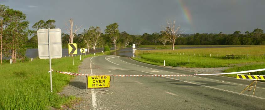
| Flooding in Logan |
Bromelton Dam is an off-stream storage adjacent to the Logan River, approximately 5km north of Beaudesert. Failure of the dam would result in minor flooding of properties to the north and west flowing into the Logan River. Maroon Dam is situated on Burnett Creek, approximately 25km above its confluence with the Logan River. The dam is located approximately 64km south west of Beaudesert. Failure of the dam would result in extensive flooding of the valley of Burnett Creek and would impact on the township of Maroon.
Wyaralong Dam is located on the Teviot Brook approximately 14km northwest of Beaudesert in the Logan River Catchment. Failure of the dam would result in extensive flooding of the Teviot Brook Valley flowing into the Logan River.
Climate change impacts Impacts associated with natural hazards need to consider the relationship with climate variables to understand current and future implications of climate change on people and infrastructure. The level of risk associated with a changing climate will not arise directly from the changes in the climate, but usually from a “cause-and-effect” chain. This is mapped out by considering the change in the climate variable (i.e. rainfall, temperature, wind etc.), the impacts on the vulnerable population or assets, and the risks to the objectives or operation of the community or infrastructure in the 2019 Hazard Risk Assessment.
Climate variables
The Intergovernmental Panel on Climate Change (IPCC) has developed four scenarios for global climate projections that relate to how the world may respond to the challenge of a changing climate, the need to continue to produce and use energy and resources, and the global greenhouse gas emissions that may occur. These scenarios incorporate diverging tendencies based on alternative economic, globalisation and environmental pathways. Projections are then developed at national and regional levels (in Australia these are developed by CSIRO and the Bureau of Meteorology) to help understand how the climate is projected to change over time. For the purposes of the HRA, a more extreme (high emissions) scenario was used to develop projections over 20-year intervals from 2030 to 2090.
These projections were consulted during the development of the 2019 Hazard Risk Assessment for the severe weather event, earthquake, landslide, bushfire, heatwave and flooding hazards.


