8 minute read
Hazards/Threats


PART 3: DISASTER RISK ASSESSMENT
A hazard is defined as a source of potential harm, or a situation with a potential to cause loss13 .
Hazardous Sites
There are a number of facilities which contain flammable and combustible liquids and other hazardous substances of varying quantities on sites across Logan City area. Work Health and Safety Queensland are responsible for maintaining a register and ensuring the safe handling and storage of a range of hazardous substances as per schedule 11 of the Work Health and Safety Regulation 2011.
Hazards to the City of Logan A number of natural and non-natural hazards, that may pose a risk to the Logan City area have been considered and are detailed below.
The Logan City Council LDMG All Hazards Risk Assessment Report14 identifies each hazard, its likelihood, consequence and overall risk rating as well outlines disaster management strategies. Severe Weather Events
Severe Storm
More intense than normal thunderstorms, severe storms can occur at any time, potentially causing significant localised damage. They mainly occur between the months of September and March and pose a low-to-moderate risk to the Logan community. The risk of severe damage (wind damage, hail and flash flooding) is mainly confined to the built environment.
Tropical Cyclone
Cyclone damage is a possibility although remote. Severe flooding should always be expected in the event of a cyclone and there is also the potential for damage to structures due to severe wind speeds. The Queensland cyclone season is usually from November to April. The majority of cyclone impacts are located in north Queensland, however this can result in heavy rain in areas south of the cyclone.
13 Emergency Management Australia 2004, Emergency Risk Management Applications Guide, Manual 5 14 LDMG All Hazards Risk Assessment Report, August 2019
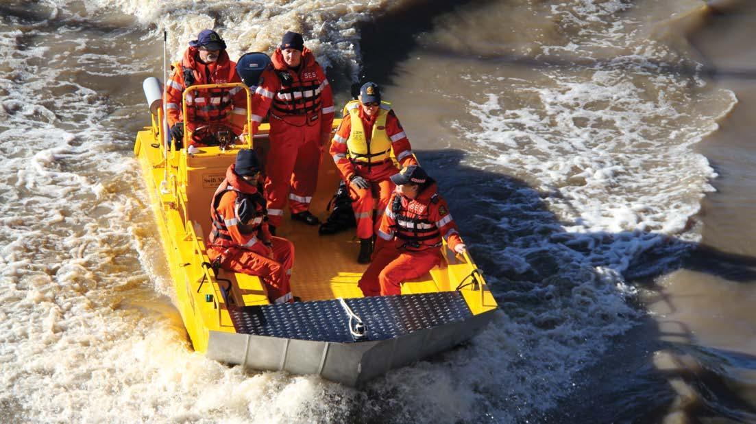
| SES flood boat operations |
East Coast Lows
East coast lows are intense low pressure systems that occur off the eastern coast of Australia and are more common during the winter months of May to August. East coast lows can be quite slow moving, which means that the effects, such as heavy widespread rainfall, gale or storm force winds and flash flooding often last much longer than normal low pressure systems or cold fronts.
Earthquake Earthquakes or seismic tremors of variable magnitude could occur without warning within the city. The effects of this type of disaster could include damage to property, disruption of essential services and loss of life or serious injury. There have been no recorded earthquakes in the city, although a number of minor seismic tremors have been recorded. The likelihood of an earthquake is low but the consequences can be high. Locations where an earthquake occurs and is more likely to impact on susceptible or vulnerable communities are Southern Council area adjacent to Gold Coast Hinterland, Mount Lindsay Highway, Waterford Tamborine Road, Motorway infrastructure and Queensland rail lines (Brisbane/Gold Coast rail line).
Landslide A Landslide is unlikely, but still poses a low risk threat to the community. The effects of this type of disaster include damage to buildings, infrastructure and possible loss of life and livestock. They are likely to be caused by a major event such as earthquakes, but more generally in Queensland by soil saturation from prolonged rainfall, or by human activity such as construction or vegetation removal.
Bushfire (Rural/Urban) Logan City has a diverse range of natural vegetation types including habitats that remain largely undisturbed by development. With approximately 27% of the city area being reserves, national parks, forest reserves and defence land, there is a potential bushfire threat. Bushfires can spread quickly and can occur in suburbs where houses are adjacent to parks, forests and nature reserves or are surrounded by grassland. The bushfire season extends from spring through to early summer, with peak risk in the drier months, November, December and January. The bushfire season can vary significantly from year to year, depending on the fuel loads, long-term climate and short-term weather conditions.
Hazardous Materials Accident There is potential for emergencies and disaster through the storage, transport, use and discharge of toxic, flammable, gaseous and infectious substances. Areas in the vicinity of light industrial are particularly vulnerable to such accidents as well as service stations, swimming pool complexes, waste water pumping stations and treatment plants, rural farm supply outlets, bulk LPG Gas supplies. An ever-increasing volume of chemicals, used in various industries, is transported through or within the city daily which further increases the potential for disaster.
The effects of this type of disaster could include severe chemical and/or thermal burns to large numbers of people requiring extensive medical treatment and/or the evacuation of people from within the disaster area, contaminated areas or damaged buildings.
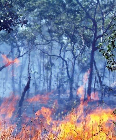
| Managing bushfire threats |
PART 3: DISASTER RISK ASSESSMENT
Heatwave
Heatwaves are likely and are defined as a prolonged period of excessive heat with temperatures exceeding 36 degrees for a period exceeding two days. A heatwave can occur in the summer months and can impact on human and animal health and cause disruption to community infrastructure such as power supply, public transport and services.
Major Passenger Transport Accident
Road Accident
The Pacific Motorway (M1), Mt Lindesay Highway from Brisbane City boundary to Logan City boundary and the Logan Motorway are the main arterial roads that form part of a major road system within the city. These roads carry a myriad of heavy transports (semitrailers, B-doubles etc.), intercity and tourist coaches, school buses and motor vehicles. Road accidents of any size and complexity may not affect a large number of residents directly but may stretch the capabilities of relevant emergency services.
Marine Accident
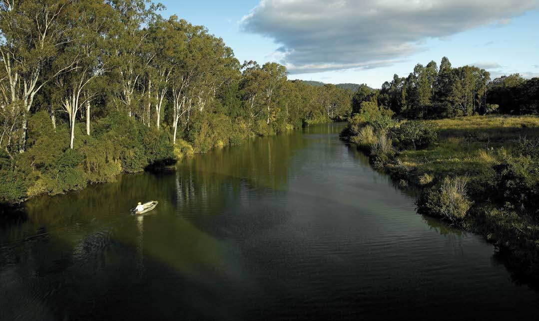
Although unlikely, a major incident could occur on one of the two major river systems traversing Logan City – the Logan and Albert Rivers. Minimal commercial and light marine industry use these waterways. House boats and leisure craft moored and anchored, could pose a potential threat during flooding or other marine events.
Rail Accident
The railway corridors through Logan City are: ■ the Brisbane to Sydney railway line passing through Forestdale, Hillcrest, Boronia Heights,
Greenbank, Jimboomba and Woodhill ■ the Brisbane to Gold Coast electric railway line passing through several suburbs from Trinder
Park Station to Beenleigh Station. Potential accidents may include collisions, derailments (passenger and freight) and rail level crossing collisions (involving passenger vehicles, semi-trailers, trucks, or coaches).
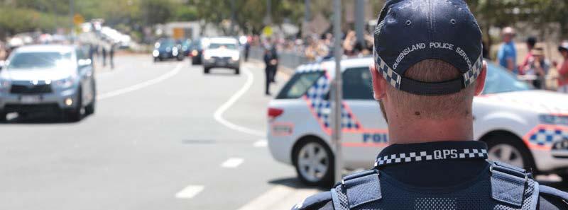
| Road safety in Logan |
Major Air Transport Accident An aircraft incident is possible, although rare, with flight paths of aircraft to and from the Brisbane Domestic and International Airports and Archerfield aerodrome frequently passing over the city each day. Areas impacted would range from densely populated suburban to sparsely populated, nonurban or industrial.
Pandemic15
The outbreak of any infectious disease throughout the city could cause high health service demand beyond current capacity. This may require the isolation and quarantine of numbers of people for extended periods. The extent of the threat this would pose depends on circumstances. The possibility of an epidemic/pandemic of an infectious disease is moderate. However, the following hierarchy indicates broad probabilities: ■ communicable diseases commonly found in the general population such as meningitis, foodborne illness, influenza or water-borne diseases. ■ setting for a potential disease outbreak (locations such as childcare centres, schools, aged care facilities, animal farms, event-specific locations, prisons or areas with a high population of marginalised groups such as intravenous drug users) ■ emerging infectious diseases could include various strains of bird-flu (such as H5N1), swineflu (H1N1) or Coronavirus. Other coronaviruses include Middle East Respiratory Syndrome (MERS) and Severe Acute Respiratory Syndrome (SARS) ■ biological assault such as terrorist threat or biological weapons. Animal and Plant Disease (bio-security) There is a possibility of the introduction and spread of animal and plant diseases in the city given the nature of the rural undertakings in the area. The Queensland Government Bio-security Animal and Plant Operational Plan, and the Biosecurity Strategy16 and Emergency Animal Disease Response17 documents provide direction to local governments in the management of an event.
15 State of Queensland Multi-Agency Response Plan to Chemical, Biological, Radiological incidents 2004 (disaster.qld.gov.au/cdmp/Documents/
State_CBR_Plan.pdf)
State of Queensland Biological Disaster Plan 2004 (disaster.qld.gov.au/cdmp/Documents/Biological_Plan.pdf)
Queensland Health pandemic influenza plan May 2018 (health.qld.gov.au/clinical-practice/guidelines-procedures/diseases-infection/diseases/ influenza/?a=167402)
16 daff.qld.gov.au
PART 3: DISASTER RISK ASSESSMENT
Terrorism
World events in recent times demonstrate that terrorism is a potential and serious threat for Australia and Logan City18. It is possible that an event in a neighbouring local government area could indirectly affect Logan City. Susceptible or vulnerable locations for an incident in Logan City have been identified.
For Logan City, the QPS have a dedicated Counter-Terrorism Unit that is actively engaged in the community working with key leaders across the various religious, cultural and community organisations to reduce the risk of any incident terrorist incident occurring with Logan City.
Flooding With the existence of two major rivers, the Logan and Albert Rivers, through the city and numerous creeks and floodplain areas, Logan can be prone to flooding following significant rainfall events. The source of flood waters in Logan City typically comes from creeks. Flash flooding is the most common type of flooding in Logan and can occur following intense rainfall events, such as thunderstorms. Flash flooding may have little warning time and result in flooding from storm water runoff and creek flooding. The Logan and Albert River Floodplain Management Study and Plan outline the main areas of flood risk for Logan.
Dam Failure
Logan City Council prepares and maintains Emergency Action Plans (EAP) for Lake Dennis and Expedition Drive, Yarrabilba Detention Basin. The EAP is publicly available via the Department of Natural Resources, Mines and Energy website at: business.qld.gov.au/industries/mining-energywater/water/industry-infrastructure/dams/ emergency-action-plans Seqwater prepares and maintains an Emergency Action Plan each for Bromelton Dam, Maroon Dam and Wyaralong Dam.
18 Terrorism (Commonwealth Powers) Act 2002 or (legislation.qld.gov.au)
National Counter Terrorism Plan or (nationalsecurity.gov.au)
Counter-terrorism risk assessment has been carried out with QPS. The results of this assessment are held by QPS.