13 minute read
Discover Bowland Itineraries The Ultimate Bowland Activity Holiday

by Hetty Byrne
Discover Bowland Itinerary – N o
6 The Ultimate Bowland Activity Holiday
Advertisement
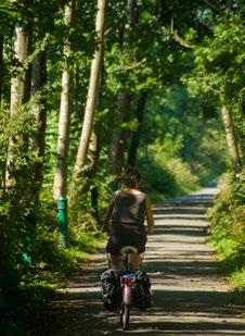
52 www.forestofbowland.com This action-packed five-day break explores some of the beautiful landscapes and pretty villages of the Forest of Bowland. It’s the perfect itinerary for couples or adventurous families to discover this Area of Outstanding Natural Beauty on foot and by bike.
Total area: 312 m 2 / 803 km 2 Population: 16,000 Highpoint: The Ward Stone 1841ft (561m)


Basecamps: Clitheroe, Bentham, Slaidburn, Settle

Wildlife highlights: Hen harrier, merlin, buzzard, hare, sika deer, otter

OS Explorer Maps: OL 41 Forest of Bowland & Ribblesdale OL2 Yorkshire Dales Southern & Western 287 West Pennine Moors
DAY 1: Journey to The Centre of The Kingdom

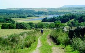
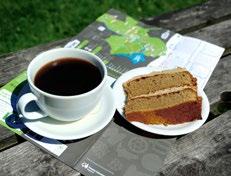
Ordnance Survey – the people who map the United Kingdom – calculated that the geographical centre of Great Britain is located on a remote hillside above Dunsop Bridge. This demanding 12 mile fell walk takes you – literally – to the centre of the kingdom. Park at the car park in Dunsop Bridge and fortify yourself with coffee and home-made cakes or scones at Puddleducks Café. Follow the track heading north from the café beside the river to the tiny farm hamlet of Whitendale and continue upstream to the water intake. Cross to the west bank via the ford onto the access land, following the track through a gate and climbing steeply up the right hand lip of Gutter Clough. A faint path leaves the track to head direct but it’s best to follow the series of posts past the rusty corrugated shelter and up to the stones. Head northwest of the stones for Grid Reference SD 642565 to reach the dead centre of Great Britain. Take the ubiquitous ‘selfie’ and post it on social media. Don’t forget to tag us @forestofbowland #HeartofBritain! Download other walks from the Forest of Bowland website: www.forestofbowland.com/walking

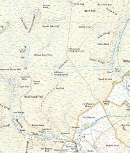

Centre of the Kingdom!
Alternative Activities Elizabethan Splendour

Visit historic Browsholme Hall – family seat of the Parker family and one of the most important stately homes in the area. Marvel at the Elizabethan splendour of this Grade 1 listed building before adjourning for tea and cake in the café. Enjoy a Picnic

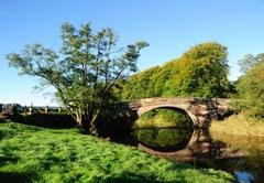
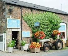
Pick up a mouth-watering picnic from Bowland Food Hall at Holmes Mill in Clitheroe and head to either Higher or Lower Hodder bridges. Follow the footpath along the western bank through dense woodland to find one of many perfect riverside picnic spots. Go Fishing

53 www.forestofbowland.com Day ticket fishing is available from as a little as £5 a day under an Angling Passport scheme which gives anglers access to these productive waters via an easy-to-use token scheme. Find out more at: https://ribbletrust.org.uk/go-fishing/
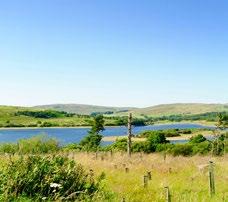
DAY 1: Journey to The Centre of The Kingdom DAY 2: Discover Gisburn Forest & Stocks Reservoir
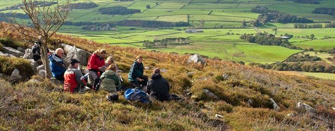
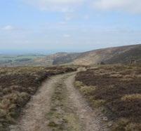
54 Ordnance Survey: the people who map the United Kingdom, calculated that the geographical centre of Great Britain is located on a remote hillside above Dunsop Bridge. This walk takes you – literally – to the centre of the kingdom Park at the car park in Dunsop Bridge and fortify yourself with coffee and home-made cakes or scones at Puddleducks Café. Follow the track heading north from the café beside the river to the tiny farm hamlet of Whitendale and continue upstream to the water intake. Cross to the west bank via the ford onto the access land, following the track through a gate and climbing steeply up the right hand lip of Gutter Clough. A faint path leaves the track to head direct but it’s best to follow the series of posts past the rusty corrugated shelter and up to the stones. Head northwest of the stones for Grid Reference SD 642565 to reach the dead centre of Great Britain. Take the ubiquitous ‘selfie’ and post it on social media. Don’t forget to tag us @forestofbowland #HeartofBritain! Download walking routes from the Bowland AONB pages of Viewranger. https://my.viewranger.com/user/details/2074758 The pristine uplands above Slaidburn are the perfect destination for walking, trail-running, mountain-biking and birding for visitors with a taste for adventure. Lace up your boots or clip into your pedals for a big day on the hill or in the saddle. The eight-mile Stocks Reservoir Circular route climbs into the hills above the reservoir, providing expansive views of the wider Bowland landscape before descending to complete a circuit of the entire reservoir. Allow at least three hours to complete the entire circuit on foot. Start from the pay and display car park on the eastern shore of the reservoir. For a two-wheeled off-road adventure, the purpose-built cycle trails through Gisburn Forest www.forestry.gov.uk/gisburn offer rides of varying length to suit all abilities. Refreshments and bike hire is available at Gisburn Forest Hub café www.forestry.gov.uk/forestry/ beeh-9s3mle. Road cyclists can try the 56km Roses Border Ride. www.forestofbowland.com/cycling Alternative Activities


Alternative Activities Tramper Trail
Elizabethan Splendour Visit historic Browsholme Hall – family seat of the Parker family and one of the most important stately homes in the area. Marvel at the Elizabethan splendour of this Grade 1 listed building before adjourning for tea and cake in the café. Lovers of the outdoors with mobility issues can also enjoy the wonderful scenery of Stocks Reservoir and Gisburn Forest on an easy access
Tramper trail. The Bowland Tramper can be booked in advance from Gisburn Forest Hub. Call 01200 446387 to make a reservation. Go Wild in The Hay Meadows


www.forestofbowland.com Enjoy a Picnic Pick up a mouth-watering picnic from Bowland Food Hall at Holmes Mill in Clitheroe and head to either Higher or Lower Hodder bridges. Follow the footpath along the western bank through dense woodland to find one of many perfect riverside picnic spots. Go Fishing Day ticket fishing is available from as a little as £5 a day under an Angling Passport scheme which gives anglers access to these productive waters via an easy-to-use token scheme. Find out more at: https://ribbletrust.org.uk/go-fishing/ Explore the restored traditional wildflower meadows around
Slaidburn on a leisurely wander through the verdant pastureland beside the River Hodder at Bell Sykes Farm
Sample The Local Nightlife
See the Milky Way brighter than you’ve ever seen it and search for constellations in the dark skies above the
Bowland Fells. There is a handy guide on the best places to go star spotting on the Forest of Bowland AONB website www.forestofbowland.com/star-gazing
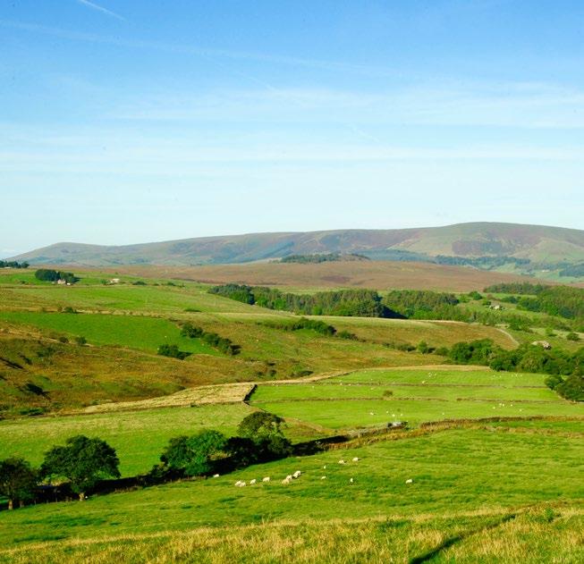
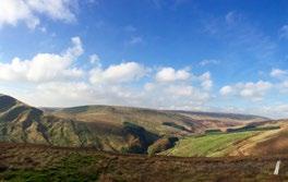
DAY 3: The Hidden Bowland Dales
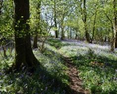


The north-western fringe of the AONB retains the wild and rugged nature that characterises the Forest of Bowland. It’s sometimes hard to believe such enchanting valleys lie less than 20 minutes from the M6 motorway… Head for the picturesque village of Wray, where artisans and light industry have prospered for hundreds of years. Wray is famous for its annual Scarecrow Festival in early May, which often attracts thousands of visitors. Walk up the quiet lane beside the left bank of the river to view the dense woodland that dominates this verdant valley. Look out for rare butterflies and woodland birds like the redstart and pied flycatcher. The woodland floor is carpeted in dense drifts of bluebells in May and the autumn colours in September and October rival those of New England. A series of footpaths and rights of way criss-cross the valley and three circular walks that explore Roeburndale are available for free download on the AONB website: www.forestofbowland.com/walking Post-walk, the Bridge House Farm Café and the George and Dragon pub both offer a warm welcome to weary walkers for refreshment and sustenance.
Alternative Activities The Way Of The Roses

The western edge of Bowland is close to both coast and mountains and the first section of the famous ‘Way of the Roses’ cycle route combines the two, visit: www.forestofbowland.com/ cycling. Covering the 35 miles between Morecambe and Settle, this section traverses some glorious countryside without too many hills. The route starts on the Promenade at Morecambe before heading to Lancaster then contouring around the Bowland Fells to Settle on the edge of the Yorkshire Dales. Amazing Views
If visibility is good, a drive up to Jubilee Tower above Quernmore is a must. The views from here are breath-taking, encompassing Lancaster and the Lune estuary, the Lake District fells, the Great Orme on the Coast of North Wales and maybe even a glimpse of Snaefell on Isle of the Man.
DAY 1: Journey to The Centre of The Kingdom DAY 4: Fields, Fells and Fabulous Local Food
56 Ordnance Survey: the people who map the United Kingdom, calculated that the geographical centre of Great Britain is located on a remote hillside above Dunsop Bridge. This walk takes you – literally – to the centre of the kingdom Park at the car park in Dunsop Bridge and fortify yourself with coffee and home-made cakes or scones at Puddleducks Café. Follow the track heading north from the café beside the river to the tiny farm hamlet of Whitendale and continue upstream to the water intake. Cross to the west bank via the ford onto the access land, following the track through a gate and climbing steeply up the right hand lip of Gutter Clough. A faint path leaves the track to head direct but it’s best to follow the series of posts past the rusty corrugated shelter and up to the stones. Head northwest of the stones for Grid Reference SD 642565 to reach the dead centre of Great Britain. Take the ubiquitous ‘selfie’ and post it on social media. Don’t forget to tag us @forestofbowland #HeartofBritain! Download walking routes from the Bowland AONB pages of Viewranger. https://my.viewranger.com/user/details/2074758 Stretching from the Bleasdale Horseshoe to the ridge of Longridge Fell, the southwestern fringe of the Forest of Bowland combines striking scenery with rich farmland and superb local produce. The Rolling hills that rise behind the Lancashire Plain offer splendid views over Morecambe Bay and beyond to the Lakeland fells. On a really clear day it’s possible to see the Isle of Man and the North Wales coast. The Visitor Centre at Beacon Fell is a good base from which to explore the western fringe of Bowland. There’s ample pay and display parking and a café to stock up on provisions. There’s plenty of scope for enthusiastic foodies to embark on a gastronomic tour of this productive corner of Bowland. Local cheeses are a speciality, but you’ll also find artisan pies, cooked meats, bread and confectionary in the many local shops and cafes. The quiet roads and rural trails make this part of Bowland a paradise for cyclists. On and off-road routes feature undulating terrain and some extended, steep climbs.

www.forestofbowland.com Alternative Activities Elizabethan Splendour Visit historic Browsholme Hall – family seat of the Parker family and one of the most important stately homes in the area. Marvel at the Elizabethan splendour of this Grade 1 listed building before adjourning for tea and cake in the café. Enjoy a Picnic Pick up a mouth-watering picnic from Bowland Food Hall at Holmes Mill in Clitheroe and head to either Higher or Lower Hodder bridges. Follow the footpath along the western bank through dense woodland to find one of many perfect riverside picnic spots. Go Fishing Day ticket fishing is available from as a little as £5 a day under an Angling Passport scheme which gives anglers access to these productive waters via an easy-to-use token scheme. Find out more at: https://ribbletrust.org.uk/go-fishing/ Alternative Activities The Big Cheese Lancashire Cheese is famous throughout Britain for its astringent tang and characteristic crumbliness and Dewlay, on the edge of Garstang, is one of the biggest producers of this subtle local cheese. Down on The Farm Get close to some friendly farm animals at Cobble Hey Farm and Gardens – a working farm in the foothills of the Bleasdale Fells. Feeding the lambs in March and April is extremely popular. Call Cobble Hey 01995 602643 to check opening times. Bowland Wild Boar Park
This out of the way farm and wildlife park is especially popular with families who love getting close to the animals. You can extend your stay by hiring one of the park’s camping pods.
DAY 5: Secrets Of Pendle Hill

Pendle’s slopes and summits have the wilderness feel of unspoiled landscapes. Whether you’re in search of a challenge or simply want to admire the view from the top, your Pendle Hill adventure starts here... The classic Pendle Route involves ascending “The Steps” from the pretty village of Barley and this popular walk in can get pretty busy. To avoid some of the crowds why not try making your way to the hill’s lofty trig point by one of the paths from Sabden or Downham, or even Spring Wood? With a whole host of rights of way to choose from, there are plenty of options for making a circular route to keep both your feet - and your camera - working hard. After the obligatory summit selfies, head back downhill to reward yourself with a well-earned pint or cuppa, and maybe a bite to eat, in one of the welcoming village pubs or cafes around the foot of the hill.
Pendle Hill Access Code
Most of the Pendle Hill landscape is accessible to the public with much of the hill itself designated as open access land where walkers have the right to roam. But it’s still important to respect the landscape and those with whom we share it – including livestock. Here are the golden rules: • Keep dogs under close control, preferably on a lead • Clear up after your dog • Stick to designated footpaths • Take litter home
Alternative Activities Take on The ‘Tour De Pendle’
It may only cover 15 miles, but this challenging circuit for road cyclists includes some of the toughest hill climbs in England. Expect a handful of 20 per cent gradients and plenty of 10 per cent ascents as you circumnavigate the hill via Sabden, Clitheroe, Worston, Downham, Barley and Newchurch. If you happen to be here on a Sunday, take a short detour along Jinny Lane for a brew and a natter at Britain’s the last remaining Clarion House www.roughlee.org.uk/clarion-house/ just outside Barley (Grid Ref: SD 831396).