COASTAL
Paralleling the Gulf and extending inland 4 to 6 miles are tidal marshes, including the Aripeka, Weeki Wachee, and Chassahowitzka swamps. Aside from the residential developments in Hernando Beach and along the Weeki Wachee River, much of the county’s coastal area is sparsely populated and relatively wild, with few roads, making access for bird watching difficult. The area is underlain by limestone with elevations up to 10 feet, covered by tidal marshes, many small springs, and drainage runs. The vegetation is primarily salt marsh grasses, with palms, pines, cedars, and mixed hardwoods in hammocks.
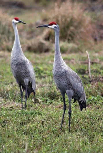
For coastal birding from the intersection of US-19 and SR-50, go west on CR-550. Just before the Bayport junction, there is a small marsh on the left where Sandhill Cranes nest and waders and shorebirds feed seasonally. At the junction, veer right onto CR-495, Pine Island Drive. Unfortunately, there are very few places you can safely pull off this road, but as you drive, look and listen along the salt marsh for rails, waders, and shorebirds.
Western Hernando County
1. Chassahowitzka WMA
2. Pine Island
3. Bayou Drive
4. Bayport Park
5. Rogers Park
6. Jenkins Creek Park
7. Linda Pedersen Park
8. Weekiwachee Preserve
9. Hunters Lake
10. Delta Woods Park
11. Hernando County Airport
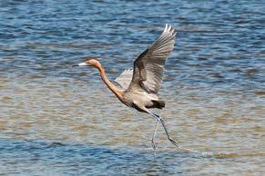
Alfred A. McKethan Pine Island Park, 10840 Pine Island Drive, is a 3-acre county park (open 8:30 a.m. to sunset; a daily or annual park fee is payable through ParkMobile). This is the only publicly accessible sand beach with an open view of the gulf in the county. Birding is best early in the morning, as soon as the park opens, before the birds are flushed by sunbathers. Check for rails, shorebirds, gulls, terns, herons, and egrets, including an occasional Reddish Egret. American Oystercatchers may feed at very low tide. There are restrooms and picnic tables here.
Reverse your route, and just before reaching the intersection with CR-550, turn right onto Bayou Drive, a one-mile loop that offers more views of salt marshes, before ending on CR-550. At dusk, Great Horned Owls sometimes perch on snags, and in daytime Bald Eagles or Ospreys are occasionally on the same snags. The wooded area on the left sometimes has migrants.
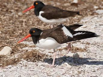
At the end of Bayou Drive, turn right onto CR-550 to Bayport Park, 4140 Cortez Boulevard. In winter and early spring, look for Common Loons, Horned Grebes, Red-breasted Mergansers, and Bufflehead. At low tide, American Oystercatchers are occasionally seen feeding on the distant
Reddish Egret
oyster bars. A Bald Eagle sometimes perches on the prominent snag across the river from the pier or in trees in the park. Songbirds are found in the wooded area. Occasionally manatees can be seen. There are restrooms and picnic tables in this 7-acre park. A daily or annual park fee is payable through ParkMobile.
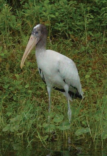
Rogers Park at 7244 Shoal Line Boulevard provides access to the Weeki Wachee River. The current is fast-running at 9 miles per hour, but it is possible to canoe or kayak 7.5 miles upstream close to its source in Weeki Wachee Springs. En route birds that may be seen are Ospreys, herons, egrets, and occasionally Wood Storks and Limpkins, as well as alligators, river otters, and manatees. A daily or annual park fee is payable through ParkMobile.
At three-acre Jenkins Creek Park, 6401 Shoal Line Boulevard, look for birds on both sides of the footbridge, and for waterfowl in the creek. There are restrooms and picnic tables. A daily or annual park fee is payable through ParkMobile.
Visit 135-acre Linda Pedersen Park at Jenkins Creek across the road, 6300 Shoal Line Boulevard. There is a second entrance to this park 0.2 mile further south. At low tide in winter, rails are sometimes seen in the marsh grass to the east of the road, after the U-turn, but before reaching the parking lot with restrooms. The oaks in this park sometimes attract songbirds. On cold days, manatees may be seen in the canal west of the swimming area. Restrooms and picnic tables are available. From here you can canoe or kayak on the signed Coastal Paddling Trail 1.7 miles to Bayport Park. A daily or annual park fee is payable through ParkMobile.
GULF COASTAL LOWLANDS
The Gulf Coastal Lowlands are a discontinuous area between the Coastal Swamp and the Brooksville Ridge, with an elevation of between 10 and 50 feet. The area is mostly palmetto and pine flatwoods with numerous small ponds in areas of broad, grassy sloughs. There is some patchy development.
Southwest Florida Water Management District (known as Swiftmud) purchased over 11,000 acres west of US-19, known as Weekiwachee Preserve, 2345 Osowaw Boulevard. There is no charge to enter the preserve, which is open every day, sunrise to sunset, for hiking, biking, birding, and fishing. There is a 5.5-mile loop trail, as well as many trails through wooded areas. A trail map is posted inside the gate.
Since the preserve was purchased in 1995, 254 species of birds and 77 species of butterflies have been seen there. Because the lakes were created by mining, they are deep, with steep sides, and thus are not attractive to most birds.
The surrounding wooded areas attract songbirds, especially during spring and fall migration. The best birding is often found by walking the paved road and turning left on the first trail. The rarest bird found in the preserve was a Hooded Oriole on December 23-29, 2019. From 2008 through 2017, wintering sparrows, including Le Conte’s, Henslow’s, Grasshopper, and Swamp, were banded in the preserve. A small portion of these banded birds returned to the same site in subsequent years.
A second entrance to Weekiwachee Preserve is off Shoal Line Boulevard (CR-597), but no parking is provided. Hernando County has plans to build Weekiwachee Preserve Park on Shoal Line Boulevard with a parking lot, restrooms, picnic tables, and kayak launch.
The entrance to 25,000-acre Chassahowitzka Wildlife Management Area, 13243 Commercial Way, is 6.7 miles north of SR-50. There is a fee of $3 per person or $6 per vehicle, which is waived for those with a Florida Wildlife Management Area permit or a sportsman’s, lifetime, or disabled license. There is a restroom and picnic tables at the entrance.
American Oystercatcher
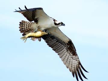
Osprey
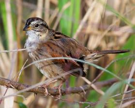
Swamp Sparrow
It’s possible to make a 6.6-mile driving loop by taking Rattlesnake Camp Road, turning right on Three Bridges Road, turning right on Thunder’s Crossing Road, and right on Gopher Road to return to the entrance. From Three Bridges Road, a 440-foot boardwalk provides access to Buford Springs, which is a very large dive-able cavern. The diversity of habitat from swamps to upland pine forests and hardwoods attracts a wide range of resident and migrant birds. To date, 165 species have been found there. Other explorable side roads are south and north of those mentioned here.
There are two walking trails that can be reached by continuing east on Three Bridges Road, 0.3 mile after the intersection with Thunder’s Crossing Road. Cypress Circle, a 1.5-mile walk that passes through a wetland, can attract a few migrants in the spring and fall. On Wild Turkey Trace, a three-quarter-mile loop trail, upland resident songbirds can be seen.
Caution: Various types of hunting occur in the Chassahowitzka Wildlife Management Area from late September through early January and in late March.
BROOKSVILLE RIDGE
Most of the county is in the Brooksville Ridge, chiefly at an elevation 50 to 100 feet, with a portion climbing to 300 feet. It extends from US-19 eastward to US-301. This area is mostly rolling, deep, sandy ridges with numerous depressions and sinks. Natural vegetation is largely turkey oak, bluejack oak, post oak, scrub live oak, and scattered longleaf pines. In places there are sand-bottomed ponds. The highest areas support pine and hardwood stands, although portions have been cleared for crops and pastures. A large portion of this area is highly developed in two communities, Brooksville and Spring Hill.
While much habitat has been lost due to this development, a side effect has been the required construction of numerous retention areas to hold the runoff during heavy rains. The water level fluctuates in these many retention areas throughout the county, depending on the accumulated rainfall. These should be checked for ducks, waders, and shorebirds.
To reach the Hunters Lake Boat Ramp, take the first left on Kenlake Avenue, just south of Applegate Drive. Like all other lakes in the
Central Hernando County
1. Wallien Drive Pond
2. Croom Tract
3. Forest Road 7
4. Trail to River
5. Ridge Manor Trailhead
6. Silver Lake
7. Nobelton Wayside Park
8. Lake Townsen Regional Park
9. McKethan Lake
10. Chinsegut Conservation Center
11. Lake Lindsey
12. Perry Oldenburg W&E Area
13. Big Pine
14. Cypress Lake Preserve
15. Bystre Lake
16. Spring Lake
17. Mountain Lake
18. Ernie Wever Park
19. Skinner Lake
20. Northwest Waste Management
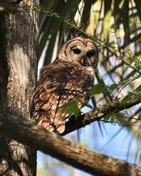
Barred Owl
county, this lake recedes greatly during periods of drought. Egrets and herons are here year round, and migratory ducks in winter. Water level permitting, a kayak can be launched to explore more of the lake. Then it might be possible to see Least Bitterns, Purple Gallinules and rails, as well as other species that can’t be seen from land. A daily or annual park fee is payable through ParkMobile.
Twenty acres Delta Woods Park at 3400 Deltona Boulevard borders the prairie lake called Lake Teresa. Over 100 species of birds have been reported to eBird from this small park.
At the end of Downwind Way at the Hernando County Airport Water Reclamation Facility the settling ponds are filled in random order. As the water is absorbed into the ground and evaporates, shorebirds and gulls can often be seen. Some ponds are distant from the road, and a spotting scope is often essential for identifying the birds.
Skinner Lake is 10 miles north of Brooksville. There is no public access to this lake that in the winter attracts hundreds of American Coots, as well as a few other duck species. It can only be viewed from the private road to CEMEX (16301 Ponce de Leon Boulevard). The road to CEMEX is only open on weekdays from about 9 a.m. to 3 p.m. Birders are tolerated if they park completely off the road. Since the road is quite distant from the lake, most of the birds can only be identified with a spotting scope.
At Northwest Waste Management Facility (14450 Landfill Road) tell the operator at the scale house that you are birdwatching and ask where you are permitted to bird. They are accommodating, but please don’t interfere with their work, and avoid the heavy trucks and other equipment. Landfill birding is best in winter. Ring-necked Duck, Blue-winged Teal, Bufflehead, Hooded Merganser, and other birds frequent the small retention pond then, and gulls, vultures, and Bald Eagles congregate around the garbage disposal area.
The 113-acre Ernie Wever Youth Park at 19473 Youth Drive in Brooksville attracts a variety of birds, but it’s
best to go there when youth sports are not scheduled.
At Big Pine Tract, 12060 Old Crystal River Road, several miles of trails bisect this second largest contiguous tract of old-growth longleaf pine in Florida, which includes some trees that are over 250 years old. Typical pine woodland resident birds can be found there, including Red-headed Woodpeckers. A trailhead for the Prairie-to-Pines Trail (discussed below) to Chinsegut Conservation Center is located at Big Pine.
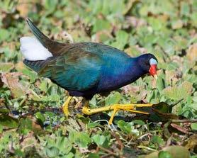
Lake Lindsey Boat Ramp at 28011 Lake Lindsey Road provides a limited view of the lake. A very few Purple Gallinules are resident on this lake.
Chinsegut Conservation Center, 23212 Lake Lindsey Road, is a 408-acre tract managed by the Florida Fish and Wildlife Conservation Commission. The center is open to the public every Friday and Saturday, from 8 a.m. to 2 p.m. There is a nature trail through turkey oak, longleaf pine, and hardwood hammocks circling a prairie. As a result of efforts to restore to upland sandhill habitat, Red-headed Woodpeckers are seen here regularly. A 2-mile Prairie-to-Pines Trail links Chinsegut Conservation Center to nearby Big Pine (described above). This trail is open every day during daylight hours. Trailheads are located at Chinsegut Conservation Center, Big Pine, and midway at the parking area at the junction of US-41 and Snow Memorial Highway. The public is invited to attend the scheduled activities and talks held at Chinsegut Conservation Center throughout the year. From September through April on the fourth Friday of each month Hernando Audubon conducts a Beginning Birding outing that starts at 8:00 am. For information about these events, call 352-754-6722, or check the website at: https://myfwc.com/education/outdoor-skills/chinsegut/
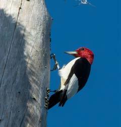
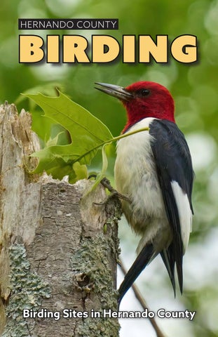
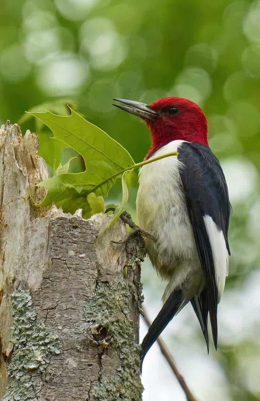
Red-headed Woodpecker
McKethan Lake, 15185 Broad Street, also called US-41, is open 8 a.m. to sunset. A $2 park fee is payable at ReserveAmerica. A 2-mile nature trail winds through the woods, and a one-way paved road circles the lake. The combination of hardwood hammock, marsh, and open water provides good habitat for a variety of birds. Herons, egrets, ducks, and songbirds can be found here, though the water level fluctuates with rainfall, and this impacts what birds are present. There are picnic tables and restrooms.
To reach Perry Oldenburg Wildlife and Environmental Area, 13489
Purple Gallinule
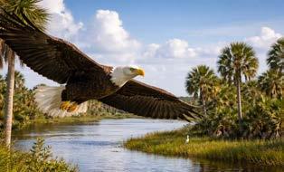
Bald Eagle
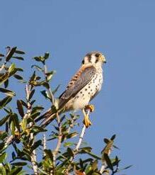
Government Road, from US-41, turn on Deer Run Road and drive 1.2 miles to the intersection with Government Road. At this intersection keep right and follow the sign for the preserve. Both resident and migrant songbirds can be seen along the 1.5-mile loop trail winding through sandhills and hardwood hammocks. American Kestrels, Red-headed Woodpeckers, and Bachman’s Sparrows reside here as well as passerines. There is a picnic table but no restrooms.
At Lake Townsen Regional Park, 28011 Lake Lindsey Road, the wooded area around the restrooms and picnic tables can be good for resident songbirds. The fishing pier and boat ramp provide a good view of a section of the Withlacoochee River where Limpkins are often seen. To view the river, pass the parking lot and continue right, crossing the bike trail, to the boat ramp parking area. A daily or annual park fee is payable through ParkMobile.
Two-acre Nobleton Wayside Park, 29061 Lamkin Drive, has a boat ramp and picnic tables. A pleasant birding experience is the 10-mile trip from Silver Lake downstream to Nobleton. A daily or annual park fee is payable through ParkMobile.
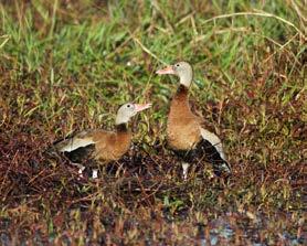
To reach a pasture that is often flooded near the Brooksville Country Club, drive east on Croom Road 1.7 miles. Turn right onto Dogwood Estates Drive, then in 0.1 mile, turn right onto Wallien Drive. In 0.1 mile pull off the road and view the pasture on the right that often attracts waders and shorebirds in winter or during migration, and Black-bellied Whistling-Ducks in late summer.
At the western edge of the Croom Tract of the Withlacoochee State Forest, at Tucker Hill (26572 Croom Road) there are restrooms, trails, and picnic tables, but the parking area doesn’t open until 8 a.m. The parking fee is $2 per person.
Caution: there are many sand roads in the forest that get very soft when it hasn’t rained for a while, or puddled after a rain. It is best to navigate these with a high-clearance or 4-wheel-drive vehicle to avoid getting stuck. “General gun” hunting occurs in Croom in
November. Inquire about the specific dates at the Withlacoochee Visitor Center, 15003 Broad Street, Brooksville, FL 34601; 352-797-4140.
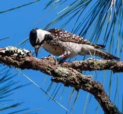
In the 1990s, the Croom population of the Red-cockaded Woodpecker was in a steep decline, due to lack of controlled burning during the critical growing season. But with a renewed effort by staff of the Florida Forest Service, with assistance from the Florida Fish and Wildlife Conservation Commission, to restore the habitat, and with the translocation of woodpeckers from other areas, the population is now healthy. In recognition of the significant advances that have been made, in 2005 this project received the prestigious federal Red-cockaded Woodpecker Recovery Program Award for management of the Croom Tract. In 2012 the Croom and Citrus tracts of the Withlacoochee State Forest were nominated by the National Audubon Society for Global Important Bird Area.
The Red-cockaded Woodpecker’s active roosting cavity in a longleaf pine tree has clear fresh sap streams glistening near the cavity entrance. It is best to look for the woodpeckers at dawn, when the birds are just leaving their roosting trees, or an hour or two before dusk, when they are returning to those trees. Red-cockaded Woodpeckers usually leave the area soon after dawn to search for food, though they may still be located occasionally by listening for their soft call. Please take care not to disturb these woodpeckers during the April to July nesting season.
To look for Red-cockaded Woodpeckers, 7 miles east of US-41, at theintersection of Croom Road with Forest Road 7, park in the parking area on the south side. Cross to the northwest corner of that intersection and look for the trail going north. Continue north when another trail crosses. Soon afterward, look for RCWs roosting in the trees marked with white paint.
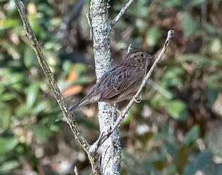
Bachman’s Sparrows can be found in areas with short vegetation. The sparrows sing from March to September. When singing, these sparrows are usually perched on a bare branch 6 to 15 feet above the ground, and are often closer than they sound, so approach them slowly. Other birds that nest in the Croom Tract include Swallow-tailed Kite, Wild Turkey, Yellow-billed Cuckoo, Yellow-throated Vireo, Northern Parula, and Summer Tanager. All of the eastern woodpeckers can be found in the Croom Tract, including Hairy Woodpeckers which are partial to areas that have recently had a prescribed burn.
American Kestrel
Black-bellied Whistling-Duck
Red-cockaded Woodpecker
Drive 0.4 east of the intersection of Croom Road and Nobleton Road, for a walking trail that gives a view of the Withlacoochee River, with woodland birding along the way. Park near the power line and substation on the north side of the road. Walk along the power line east to the Withlacoochee River (0.4 mile). Limpkins have been found at this section of the river, as well as at other viewpoints along the river. Scan the sky here and at other river sites, looking for Swallow-tailed Kites and Short-tailed Hawks in the spring and summer.
At Silver Lake Recreation Area at 31475 Silver Lake Road there is a boat ramp and camping. The $2 park fee is payable through ReserveAmerica. Drive through the entrance gate and go straight to the day use area to check the river for birds. Limpkins might be found here. The three separate campgrounds are restricted to registered campers, but there is a hiking trail along the edge of the river.
At 6410 Croom Rital Road, you will find the Ridge Manor Trailhead. There is a parking lot, picnic area, and restrooms for the 46-mile rails-to-trails paved biking trail called the Withlacoochee State Trail. There is also a hiking trail. To find the beginning of the hiking trail, walk past the picnic tables, and through the gate. In the open pasture, Eastern Bluebirds, Red-headed Woodpeckers, and American Kestrels may be found. A flock of songbirds can occasionally be found in the woods as the trail follows alongside the Withlacoochee River.
The parking lot for Cypress Lake Preserve is at the intersection of Olancha Road and Ridge Manor Blvd. The cypress-lined lake attracts herons, egrets, and Limpkins, and the woods draw both migratory and resident songbirds, as well as Wild Turkey.
To reach Bystre Lake, turn north on Clayton Road from S.R. 50. (Sometimes the sink hole on the west side of Clayton Road fills with water and attracts wading birds, etc.) Drive 0.5 mile to the end of the road, and turn right into the grassy field. This small, undeveloped county property provides a view of a portion of the lake. The rest of the lakefront is private
property. Bystre Lake attracts waterfowl in winter, as well as American White Pelicans. Year-round residents include herons, egrets, both Ibis, Osprey, Barred Owl, and Limpkins. Roseate Spoonbills and Black-bellied Whistling-Ducks are occasionally seen here.
There is a one-mile drive around Spring Lake which provides a diversity of birds, with a view of houses and pastures on one side of the road and the lake on the other side. This is accessed from Old Spring Lake Road east of Spring Lake Highway.
The small parking area at Mountain Lake Boat Ramp, 26091 Mountain Lake Road, provides a limited view of the lake, depending on the water level. Waders may be here year round.
Birds attracted to pastures can be found on the east side of Hernando County on Lockhart Road, Power Line Road, Myers Road, Church Road, and the vicinity, though some of the area is threatened by housing development.
EASTERN PORTION
The portion of the county east of US-301 is a plain at an elevation of 75 to 85 feet, mostly covered by pine and palmetto flatwoods, with numerous ponds and depressions of broad, grassy sloughs. Most of the area is in natural vegetation and has been preserved for woodland and wildlife.
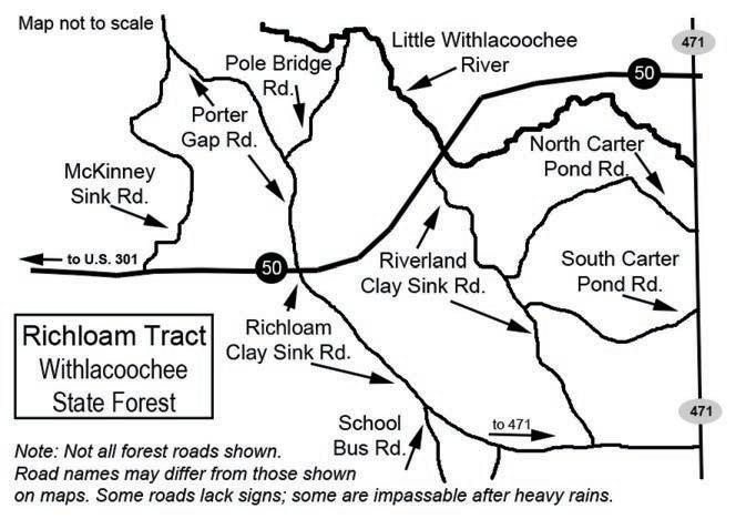
Caution should be taken when birding the Richloam Tract of the Withlacoochee State Forest because those roads that are not paved can be very muddy at times. There is “general gun” hunting in Richloam from November to early January, and Wild Turkey hunting in mid-March to mid-April. Inquire about the specific dates at the Withlacoochee Visitor Center, 15003 Broad Street, Brooksville, FL 34601; 352-797-4140; www.freshfromflorida.com/ Divisions-Offices/Florida-Forest-Service/Our-Forests/State-Forests/ Withlacoochee-State-Forest
Bachman’s Sparrow
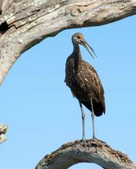
Limpkin
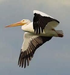
American White Pelican
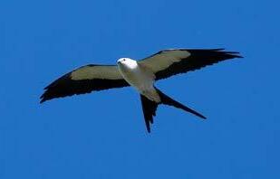
Swallow-tailed Kite
To make a loop route near the Little Withlacoochee River, which can be good during migration and year round for Brown-headed Nuthatches, from the intersection of SR-50 and US-301, head east on SR-50 1.4 miles to McKinney Sink Road on the left. Drive north on this road, parking and walking sections of the road that look promising. In 3.0 miles, turn right onto Porter Gap Road. In 1.8 miles, if the road appears passable, turn left onto Pole Bridge Road and drive 1.5 miles until the road ends at the Little Withlacoochee River. Return to Porter Gap Road, turn left, and drive 1.2 miles to the junction with SR-50.
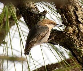
To reach more habitat for Brown-headed Nuthatches, cross SR-50 (this intersection is 3 miles east of US-301) and continue on Richloam Clay Sink Road. After 1 mile, this paved road becomes a good graded road. In another 0.9 mile, School Bus Road will be on your right. Nuthatch habitat begins across from School Bus Road, on the left side of Richloam Clay Sink Road. In another 1.9 miles, the road forks. Keep to the left fork (eastbound) looking for Nuthatches. This road ends at SR-471.
To search more for Nuthatches on South and North Carter Pond Roads, turn left (north) onto SR-471. Unmarked South Carter Pond Road is 1.4 miles north, on the left, and North Carter Pond Road is 0.7 mile further north, also on the left. At times both these sandy roads may not be passable without a high-clearance or 4-wheel-drive vehicle. SR-50 is 2.9 miles north of North Carter Pond Road.
CHECKLIST OF BIRDS FOR HERNANDO COUNTY
The checklist on the following pages lists 321 bird species seen in Hernando County. The list is arranged taxonomically, and includes only those species recognized as countable by the American Birding Association.
Many birds have strict habitat preferences, small local populations, and/or irregular migration patterns. The symbols used in this checklist are defined as follows:
Seasons: SP Spring March-May
SU Summer June-July
FA Fall August-November
WI Winter December-February
Probability of Sighting:
C Common: These birds should be seen or heard in suitable habitat.
U Uncommon: These birds are present, but not certain to be seen or heard, because of their low numbers, behavior, habitat, or distribution.
O Occasional: These birds are only seen a few times in a season. Many of them are only in the county during migration.
R Rare: These birds are not expected to be seen every year. They occur in low numbers and may be unreported for a number of years. Also included are erratics, those birds that are common some years and scarce or missing other years.
X Accidental: These birds were seen outside of their normal range.
* Indicates breeding in the county.
Brown-headed Nuthatch
Black-bellied Whistling-Duck * CCCC
Fulvous Whistling-Duck R
Snow Goose O OO
Ross’s Goose R
Greater White-fronted Goose RR
Canada Goose OO O
Egyptian Goose RRR
Muscovy Duck * UUUU
Wood Duck * UUUU
Blue-winged Teal COCC
Cinnamon Teal R
Northern Shoveler U UU
Gadwall U UU
American Wigeon U UU
Mallard * UUUU
Mottled Duck * CCCC
Northern Pintail OO
Green-winged Teal C CC
Canvasback OO
Redhead U UU
Ring-necked Duck CRCC
Greater Scaup O OO
Lesser Scaup COCC
Surf Scoter R
Black Scoter RR
Long-tailed Duck R
Bufflehead C CC
FA WI 17
SPSU FA WI
Common Goldeneye OO
Hooded Merganser CRCC
Common Merganser R
Red-breasted Merganser C CC
Ruddy Duck U UU
Northern Bobwhite * UUUU
Wild Turkey * CCCC
Rock Pigeon * UUUU
Eurasian Collared-Dove * CCCC
Common Ground-Dove * UUUU
White-winged Dove * UUUU
Mourning Dove * CCCC
Yellow-billed Cuckoo * UUU
Black-billed Cuckoo R R
Common Nighthawk * UUU
Chuck-will’s-widow * UUUR
Eastern Whip-poor-will U UU
Chimney Swift * UUU
Vaux’s Swift R
Ruby-throated Hummingbird * CCCO
Black-chinned Hummingbird O OO
Rufous Hummingbird O OO
Allen’s Hummingbird R
Buff-bellied Hummingbird R
King Rail * UUUU
Clapper Rail * CCCC
Virginia Rail U UU
Sora U UU
Common Gallinule * CCCC
American Coot COCC
Purple Gallinule * UUUU
Yellow Rail R
Black Rail * OR O
Limpkin * CCCC
Sandhill Crane * CCCC
Whooping Crane R
Black-necked Stilt * CCCR
American Avocet RRUU
American Oystercatcher * UUUU
Black-bellied Plover ORUU
American Golden-Plover RR
Killdeer * CCCC
Semipalmated Plover URUU
Piping Plover RO
Wilson’s Plover * OROO
Snowy Plover R R
Hudsonian Whimbrel R RR
Bar-tailed Godwit R
Marbled Godwit RROO
Short-billed Dowitcher CUCC
Long-billed Dowitcher URUU
American Woodcock * R UU
Wilson’s Snipe U UU
Wilson’s Phalarope OOO
SPSU FA WI 19
SPSU FA WI
Red-necked Phalarope R
Spotted Sandpiper UUUU
Solitary Sandpiper UUUU
Lesser Yellowlegs CUCC
Willet * CCCC
Greater Yellowlegs CUCC
Ruddy Turnstone CUCC
Red Knot O OO Ruff R
Stilt Sandpiper URUU
Sanderling CCCC
Dunlin URUU
Baird’s Sandpiper R
White-rumped Sandpiper OOO
Least Sandpiper CCCC
Pectoral Sandpiper ORO
Western Sandpiper UUUU
Semipalmated Sandpiper CUU
Parasitic Jaeger R
Pomarine Jaeger R
Razorbill R
Bonaparte’s Gull U RU
Laughing Gull CCCC
Franklin’s Gull OR
Ring-billed Gull COCC
American Herring Gull U UU
Great Black-backed Gull R R
Glaucous Gull R
Lesser Black-backed Gull OO
Black Skimmer CRCC
Brown Noddy R
Sooty Tern R
Least Tern OOO
Gull-billed Tern RO
Caspian Tern UUUU
Black Tern RRU
Forster’s Tern UOUU
Common Tern OOO
Sandwich Tern UOUO
Royal Tern CCCC
American Flamingo RR
Pied-billed Grebe * COCC
Horned Grebe UOUU
White-tailed Tropicbird R
Red-throated Loon R
Common Loon URUU
Wood Stork * UUUU
Magnificent Frigatebird OOOR
Northern Gannet OO O
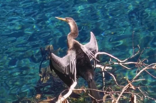
Anhinga * CCCC
Double-crested Cormorant * CCCC
White Ibis * CCCC
Glossy Ibis CCCC
White-faced Ibis OO O SPSU FA WI 21
SPSU FA WI
Roseate Spoonbill UUUU
American Bittern U UU
Least Bittern * UUUU
Yellow-crowned Night-Heron * UUUU
Black-crowned Night-Heron * UUUU
Little Blue Heron * CCCC
Tricolored Heron * CCCC
Reddish Egret UUUU
Snowy Egret * CCCC
Green Heron * UUUU
Western Cattle Egret * CCCC
Great Egret * CCCC
Great Blue Heron * CCCC
American White Pelican UOUU
Brown Pelican * CCCC
Black Vulture * CCCC
Turkey Vulture * CCCC
Osprey * UUUU
White-tailed Kite R
Swallow-tailed Kite * CCCC
Sharp-shinned Hawk U UU
Cooper’s Hawk * UUUU
Northern Harrier U UU
Double-toothed Kite X
Bald Eagle * UUUU
Mississippi Kite * UUU
Snail Kite OOOO
Broad-winged Hawk R OR
Red-shouldered Hawk * CCCC
Short-tailed Hawk * UUUU
Swainson’s Hawk OO
Red-tailed Hawk * UUUU
American Barn Owl * UUUU
Eastern Screech-Owl * UUUU
Great Horned Owl * UUUU
Barred Owl * CCCC
Belted Kingfisher UOUU
Yellow-bellied Sapsucker U UU
Red-headed Woodpecker * UUUU
Red-bellied Woodpecker * CCCC
Downy Woodpecker * CCCC
Red-cockaded Woodpecker * UUUU
Hairy Woodpecker * UUUU
Pileated Woodpecker * CCCC
Northern Flicker * UUUU
Crested Caracara R RR
American Kestrel * UUUU
Merlin U UU
Peregrine Falcon O OO
Eastern Wood-Pewee O C
Acadian Flycatcher RRU
Least Flycatcher R
Eastern Phoebe U UU
Say’s Phoebe RR
SPSU FA WI 23
SPSU FA WI
Vermilion Flycatcher R
Ash-throated Flycatcher OO
Great Crested Flycatcher * CCCR
Tropical Kingbird RR
Western Kingbird OROO
Eastern Kingbird * UUU
Gray Kingbird * OOO
Scissor-tailed Flycatcher O OO
White-eyed Vireo * CCCC
Yellow-throated Vireo * UUUU
Blue-headed Vireo U UU
Philadelphia Vireo O O
Warbling Vireo R
Red-eyed Vireo * CCCC
Loggerhead Shrike * UUUU
Blue Jay * CCCC
American Crow * CCCC
Fish Crow * CCCC
Carolina Chickadee * CCCC
Tufted Titmouse * CCCC
Bank Swallow ORU
Tree Swallow CRCC
Purple Martin * CCUO
N. Rough-winged Swallow * UUUR
Barn Swallow * CCCO
Cliff Swallow RRO
Cave Swallow RR
Ruby-crowned Kinglet U UU
Golden-crowned Kinglet OO
White-breasted Nuthatch R R
Brown-headed Nuthatch * UUUU
Red-breasted Nuthatch O OO
Brown Creeper R
Blue-gray Gnatcatcher * CCCC
Northern House Wren C CC
Sedge Wren U UU
Marsh Wren * UUUU
Carolina Wren * CCCC
European Starling * CCCC
Gray Catbird COCC
Brown Thrasher * UUUU
Northern Mockingbird * CCCC
Eastern Bluebird * CCCC
Veery U U
Gray-cheeked Thrush O O
Swainson’s Thrush O U
Hermit Thrush U UU
Wood Thrush U U
American Robin C CC
Cedar Waxwing CRCC
House Sparrow * CCCC
American Pipit U UU
House Finch * CCCC
Purple Finch O O SPSU FA WI 25
Pine Siskin O O
American Goldfinch C CC
Bachman’s Sparrow * UUUU
Grasshopper Sparrow U UU
Chipping Sparrow C UC
Clay-colored Sparrow O OO
Field Sparrow O OO
Lark Sparrow R
Dark-eyed Junco R R
White-crowned Sparrow U UU
Harris’s Sparrow R R
White-throated Sparrow O O
Vesper Sparrow U UU
Le Conte’s Sparrow R O
Seaside Sparrow * UUUU
Nelson’s Sparrow O OO
Saltmarsh Sparrow R
Savannah Sparrow C CC
Henslow’s Sparrow RO
Song Sparrow U UU
Lincoln’s Sparrow O OO
Swamp Sparrow C CC
Eastern Towhee * CCCC
Yellow-breasted Chat R
Yellow-headed Blackbird R
Bobolink O OO
Eastern Meadowlark * CCCC
Orchard Oriole ORR
Hooded Oriole X
Baltimore Oriole U UU
Scott’s Oriole X
Red-winged Blackbird * CCCC
Brown-headed Cowbird * UUUU
Rusty Blackbird O
Brewer’s Blackbird O OO
Common Grackle * CCCC
Boat-tailed Grackle * CCCC
Ovenbird UUUU
Worm-eating Warbler U U
Louisiana Waterthrush UUUU
Northern Waterthrush U UR
Golden-winged Warbler R U
Blue-winged Warbler R O
Black-and-white Warbler UUUU
Prothonotary Warbler UUU
Tennessee Warbler U U
Orange-crowned Warbler U UU
Nashville Warbler O OO
Connecticut Warbler R
Kentucky Warbler R U
Common Yellowthroat * UUUU
Hooded Warbler UOU
American Redstart UOUO
Cape May Warbler C UR
Cerulean Warbler R O
Northern Parula * CCCC
Magnolia Warbler U U
Bay-breasted Warbler O U
Blackburnian Warbler O U
Yellow Warbler URU
Chestnut-sided Warbler O OR
Blackpoll Warbler URR
Black-throated Blue Warbler C U
Palm Warbler C CC
Pine Warbler * CCCC
Yellow-rumped Warbler C CC
Yellow-throated Warbler * UUUU
Prairie Warbler UUUU
Black-throated Gray Warbler R
Black-throated Green Warbler O UR
Canada Warbler R
Wilson’s Warbler R
Summer Tanager * CCCU
Scarlet Tanager U O
Western Tanager R RR
Northern Cardinal * CCCC
Rose-breasted Grosbeak U U
Blue Grosbeak * UUU
Indigo Bunting * UOUU
Painted Bunting O OU
Dickcissel O O
Hernando Audubon Society, Inc.
Established 1959
501(c)(3) organization
Our mission is to promote an awareness and appreciation of nature, to preserve and protect wildlife and natural ecosystems, and to encourage responsible environmental stewardship.
Hernando Audubon organizes scheduled trips to local and regional birding sites, and holds regular meetings that feature experts who share information about birds, wildlife in general, and the habitats on which they depend. Meetings and field trips are open to the public.
To contact Hernando Audubon: hernandoaudubonpresident@gmail.com
P.O. Box 1678 - Brooksville, FL 34605
For more information about the Hernando Audubon Society, see the following: www.hernandoaudubon.org www.facebook.com/HernandoAudubonSociety/ https://www.instagram.com/hernando_audubon/
Photographs by Wally Handeland.
We appreciate the support of the Florida Adventure Coast Visitors Bureau in the printing and distribution of this pamphlet.
(clockwise from top left)
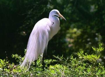
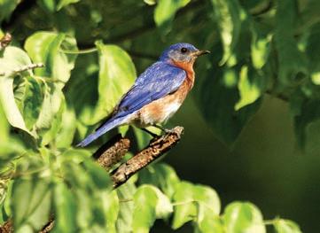
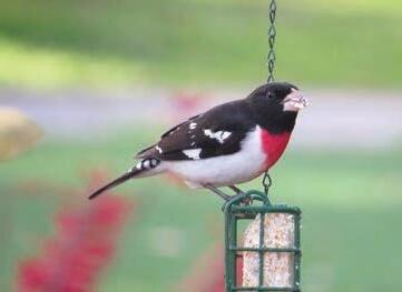
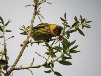
Great Egret, Sandhill Crane, Wood Stork, Cape May Warbler, Rose-breasted Grosbeak, Eastern Bluebird
This booklet is designed to help local and visiting birders by indicating the localities and times of year when birds are most likely to be found in Hernando County. The accompanying checklist indicates the seasonal distribution and probability of finding each species in suitable habitat.
352.754.4405 - www.FloridasAdventureCoast.com This guide prepared in March 2026 by Hernando Audubon Society P.O. Box 1678, Brooksville, FL 34605 www.hernandoaudubon.org
Anhinga
Photograph by Carole Knudson.