1 minute read
The geography of the CAZ, inner London and outer London


The Economic Future of the Central Activity Zone (CAZ) Phase 1: Office use trends and the CAZ ecosystem Report to the Greater London Authority (GLA)
Introduction
Advertisement
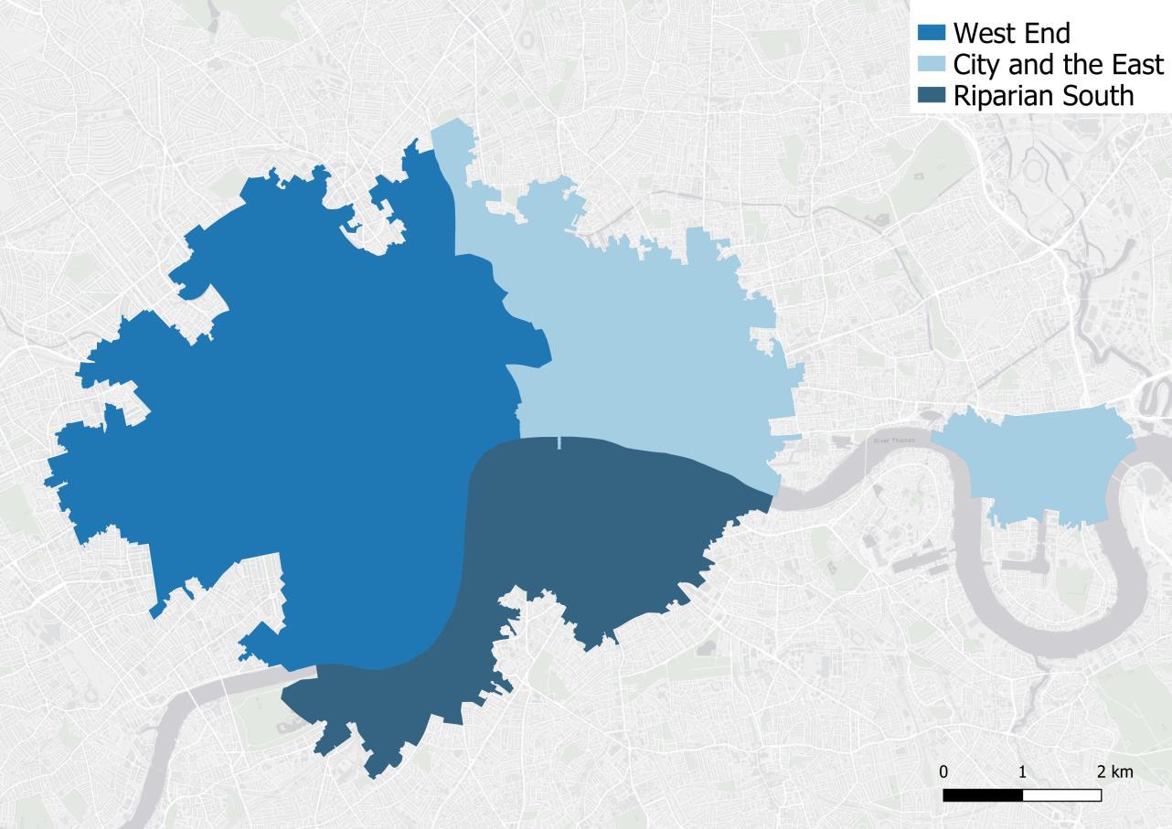
Sub-geographies within the CAZ
The CAZ has been defined using boundaries based on the Publication London Plan (GLA, 2020b), and built up using: • Lower Super Output Areas (LSOAs) where possible. • Middle Super Output Areas (MSOAs) where LSOA data is not possible or when maps would be made more legible. • Estimates based on borough-level data, pro-rated to the CAZ spatial area, when neither LSOA or MSOA data is available. In this last case, where data has been estimated, this has been noted in the relevant charts and/or maps. The CAZ, can be divided into sub areas, including the City of London, the West End, parts to the south of the Thames, referred to as the Riparian South, and the Northern Isle of Dogs (NIoD).


