4 minute read
The Secret Life of ZIP Codes


How Five Little Numbers Keep Us Connected
by Ann Marie Kennon
Here’s something you probably don’t think about when you scribble your return address on an envelope or click “ship” on Amazon: those five little numbers at the end of your address hold the entire United States in a neat, invisible grid. One that was designed not to separate us, but to bring us together.
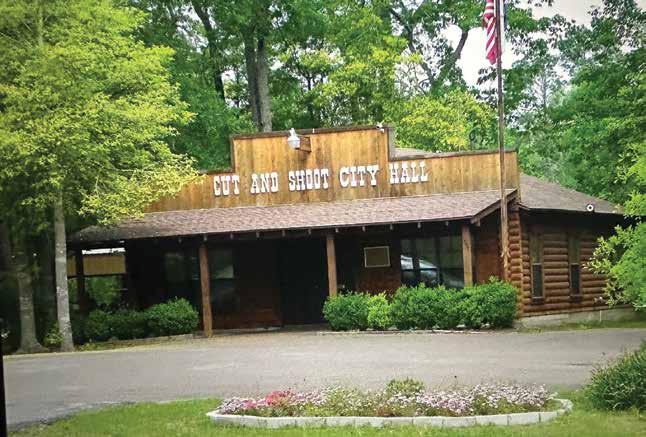
Still, here in Jarrell, sharing a ZIP code doesn’t always feel like togetherness. Sonterra residents and folks in “old town” Jarrell know there is a sometimes a weight to the virtual dividing line the postal map doesn’t recognize. So, let’s take a peek behind the curtain of the ZIP code system itself—and discover how it actually tells a story of connection.
Wartime Mayhem
Picture it: it’s 1943. The United States is in the middle of World War II, and seasoned postal clerks are being drafted from all the big cities and tiny rural outposts. That leaves stacks of letters piling up, threatening to delay news from the front lines. The Post Office hatches a quick fix—simple numbers tacked onto addresses in large urban areas, guiding rookie clerks to the right part of town. Boston might have “Zone 5,” Chicago “Zone 16.”
Fast forward 20 years, and the country is still enjoying post-war booms. Suburbs are sprawling, businesses are mailing millions of catalogs, and the mail room chaos is worse than ever. That’s when postal inspector Robert A. Moon comes up with a crazy idea: why not number the entire nation?
It was an “aha” moment that wasn’t really about bureaucracy. It was about speed—making sure a love letter, a college acceptance packet, or even a box of grandma’s cookies could zip (pun intended) across the country faster than ever before.
Mapping America
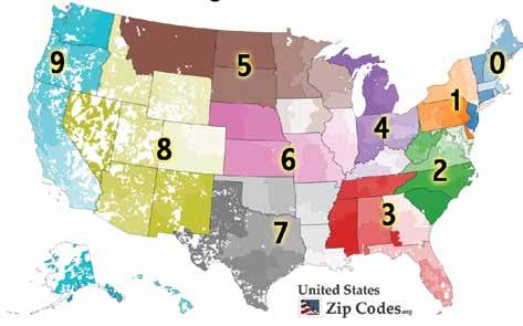
When Mr. Moon’s Zoning Improvement Plan (ZIP) code launched in 1963, it didn’t just appear randomly. It painted a picture of America from east to west:
The first digit begins in the Northeast with 0, climbs upward through the Mid-Atlantic, stretches through the Midwest, and hits 7 by the time it reaches Texas. California and the West Coast? Those are our 9s.
The next two digits pinpoint a major sorting center (think of it as your mail’s first “pit stop”).
The last two digits land it at your local post office.
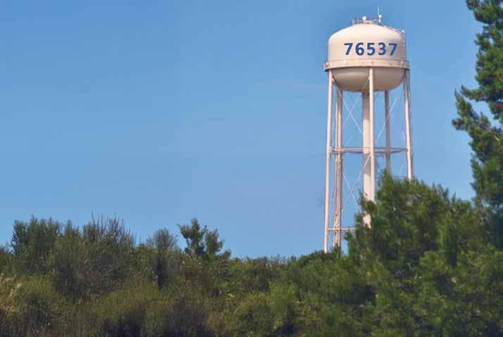
So when you see 7 kicking off your Jarrell and Sonterra ZIP, you’re looking at Texas on a nationwide postal map.
Mr. ZIP and the Speed of Friendship
Of course, people weren’t thrilled about memorizing new numbers in 1963. It felt like a government plot to make brains hurt. Americans were already grappling with longer phone numbers—goodbye to breezy operator requests for “Main 245,” and farewell to telephone exchanges with charming names like “MUrray Hill” or “KLondike.”
The era of seven-digit phone numbers was rolling in, replacing letters with numbers.
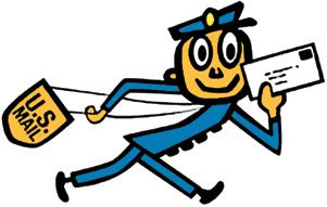
So when the Post Office added five-digit ZIP codes to addresses, it felt like insult to injury: more numbers to remember! That’s when the Post Office introduced Mr. ZIP, a cartoon mail carrier who zipped across posters, stamps, and even TV spots. He made the change feel a little less like bureaucracy and a little more like progress.
By the late ’60s, almost everyone was using ZIP codes, and by the ’80s, telephone numbers had fully made the leap to all digits. In hindsight, those changes didn’t just complicate life—they modernized how we connected with each other.
One Code, One Community
It’s important to remember ZIP codes were never meant to define a town’s character or limit its identity. They were drawn for mail routes, not political maps. That’s why Sonterra and Jarrell share the same code—because when the system was designed, the best way to get letters delivered wasn’t by city boundary, but by delivery route.
And while it might feel like a dividing line sometimes, it’s actually the opposite. Those five numbers are what unite every front porch, every business, and every mailbox in this community under the same delivery umbrella.
The Big Picture
Think about that for a moment: a farmer in rural Maine, a banker in Chicago, a surfer in California—and yes, all of us right here in Jarrell and Sonterra—share the same system. Five digits that quietly, efficiently, and faithfully connect over 330 million people every day.
The next time you see 76537, maybe you’ll see it differently. Not as a line between neighborhoods, but as part of a bigger picture—a story that started in wartime, crossed decades of innovation, and still delivers a simple message: we’re all on the same map.