2025


2025
John Truscinski, Director of Resilience Planning
Mary Buchanan, Community Resilience Planner
Nicole Govert, Community Resilience Planner
Danielle Chesebrough, First Selectwoman
Deborah Downie, Selectwoman
Clifton Iler, Town Planner
Consultant Team – Fuss & O’Neill
Beth Kirmmse
Andrew Bohne
Ian Concannon
Peyton Debowsky
Allyson Fairweather
Michael Frederick
Faith Long
Rebecca Madsen
Diane Mas
Erik Mas
Katherine McCombs
Sara Morrison
Arnold Robinson
Lara Sup
Benjamin Weintraub
Greg Wilson
Chelsea Zakas
Lynn Rae
Olivia Ahner
Emma Lepisto
Stefan Bengstan
Emily Wright
Climate change is reshaping coastal communities across New England, exacerbating ongoing issues such as erosion and coastal flooding. In response, the Town of Stonington has partnered with the Connecticut Institute of Resilience and Climate Adaptation (CIRCA) and other environmental and social organizations to honor the Town's heritage and meet climate change head-on. By laying the groundwork for major development decisions today, Resilient Mystic prepares Stonington to navigate the changes brought about by climate change, integrating numerous responses that maintain the area’s character and quality of life.
The proposed climate adaptation strategy advances a long-term vision for Mystic to “live with the water” well into the 21st century. This strategy includes near-term measures to mitigate coastal flooding and sea level rise that range from nature-based solutions to shoreline hardening, while evaluating the increasing impacts of stormwaterrelated flooding. In the longer term, the strategy identifies policies to guide future risk reduction, including the removal of buildings and roads out of vulnerable areas via elevation and/or strategic relocation.
The focus of the Resilient Mystic strategy is to elevate and/or relocate vulnerable buildings and structures out of flood impacted areas to create a Resilient Corridor along Route 1 (Main Street). Implementation of the Route 1 Resilient Corridor will require multiple phases first, to maintain critical facility access, safe shoreline evacuation, elevate existing properties where possible, and cultivate infill development along the corridor by relocating structures from areas at risk or pursuing new construction—and second, to bolster community development and connectivity. With this primary concept guiding long-term development within the project area, this multi-pronged approach positions climate adaptation as a catalyst for long-term community resilience and quality of life.
Resilient Mystic builds on prior planning and assessment of flood and extreme heat vulnerabilities by CIRCA completed for Phases I and II of Resilient Connecticut. This Phase III Resilient Connecticut project develops adaptation strategies to mitigate current and future climate-induced impacts to community assets, residents, and transportation corridors in Downtown Mystic. This report:
• Summarizes the Resilient Mystic project and planning process
• Shares the outcomes and results of the process
• Provides an actionable roadmap for reducing anticipated flood and heat risks for Mystic through preferred resilience strategies and actions
Note that planning-level designs for a large-scale flood barrier surrounding Mystic Harbor fall outside the scope of this project. Such a project would need to be studied in coordination with the U.S. Army Corps of Engineers and/or other regional entities, such as Amtrak. See Appendix G for more information.
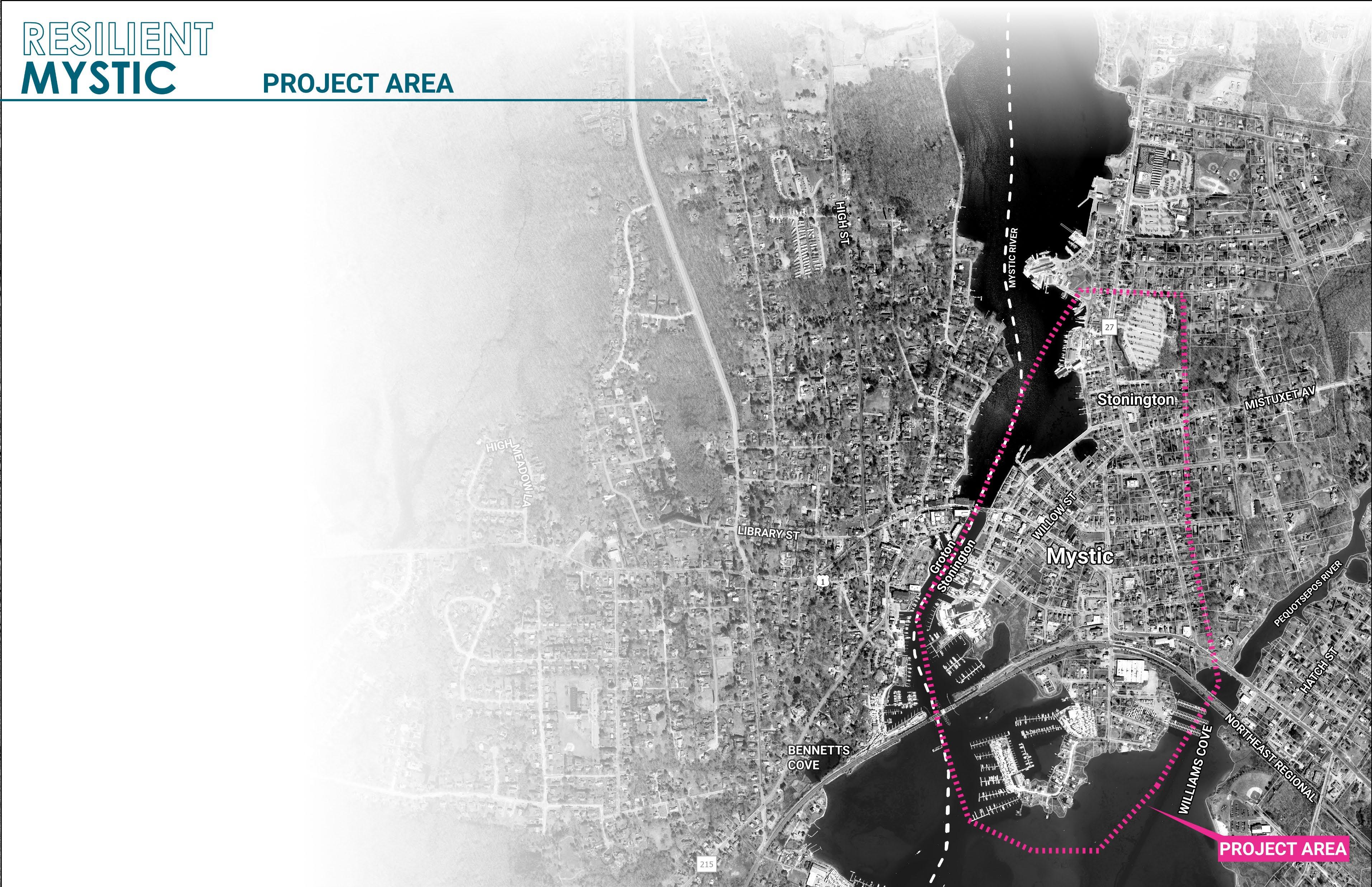
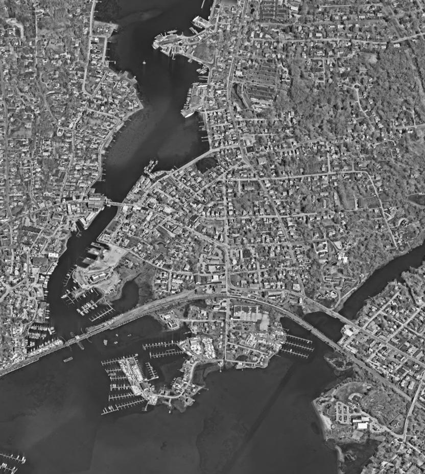
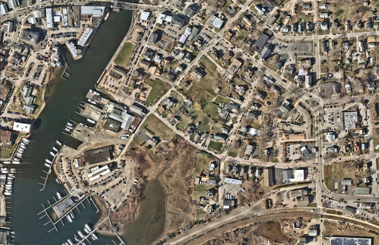
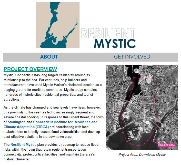
Mystic, Connecticut is a historic village and a Census-designated place (CDP) of just over four square-miles that spans both sides of the Mystic River in Stonington to the east and Groton to the west. This project focuses on the portion of Mystic that is within the Town of Stonington specifically on the portion of Mystic known as Downtown Mystic that extends from Mystic River and Mystic Harbor on the west to Williams Cove and the Pequotsepos River on the east, and northward along the State Route 27 corridor past the Mystic Seaport Museum. Both the Mystic and Pequotsepos Rivers are tidally influenced, although restrictions such as the Amtrak railroad tracks and Route 1 Bridge limit water from circulating into their upper bays.
Downtown Mystic is highly urbanized, containing a dense streetscape, parking lots, and hundreds of businesses, tourist attractions, and residential properties. The area hosts numerous assets that anchor the region's tourism-based economy, including the world-famous Mystic Seaport Museum and Williams Mystic Program and a shopping and restaurant district that attracts over a million visitors annually.
Many of the buildings in the project area fall within the Mystic River Historic District. Additionally, the project area includes Mystic Station on the Amtrak Northeast corridor train line and critical healthcare and emergency response facilities. Numerous shipyards and marinas provide harbor for boat anchorage and other water-dependent uses during the summer high season.
Downtown Mystic’s identity and history are shaped by its relationship to the rivers and sea. As a result of local development patterns that emerged in response to Mystic's historic water-dependent industries, the area is especially vulnerable to coastal flooding. Downtown Mystic is already experiencing impacts from high tides and coastal storm surge, and projected impacts from sea level rise and increased flooding have further potential to damage Mystic’s cherished historic structures, impede transportation, and hinder access to community lifelines.
This project builds on the results of Resilient Connecticut 2.0 Phase II, in which CIRCA identified Resilience Opportunity Areas (ROARs) where climate-induced flooding and heat risks intersected with vulnerable populations and key regional assets. In CIRCA's Resilient Connecticut 2.0 Phase II analysis, Mystic was identified as being at high risk to coastal inundation from storm surge and sunny day flooding from king tides both of which were expected to increase in frequency and duration as sea levels continue to rise.
The project team analyzed climate risk across Downtown Mystic by reviewing existing existing plans, studies, GIS data, maps, and reports from the area. Given the prevalence of coastal hazards in this region, several of these documents mentioned policies and to build coastal resilience in Mystic. The planning documents reviewed included:
• Past vulnerability assessments and community resilience reports
• Sea level rise reports
• Town hazard mitigation and flood management plans
• Town comprehensive plans
• Transportation fact sheets and parking studies
Several coastal resilience strategies identified in these plans have already been implemented, while others remain in the planning phase.
A full summary of the planning documentation reviewed is provided in Appendix A.
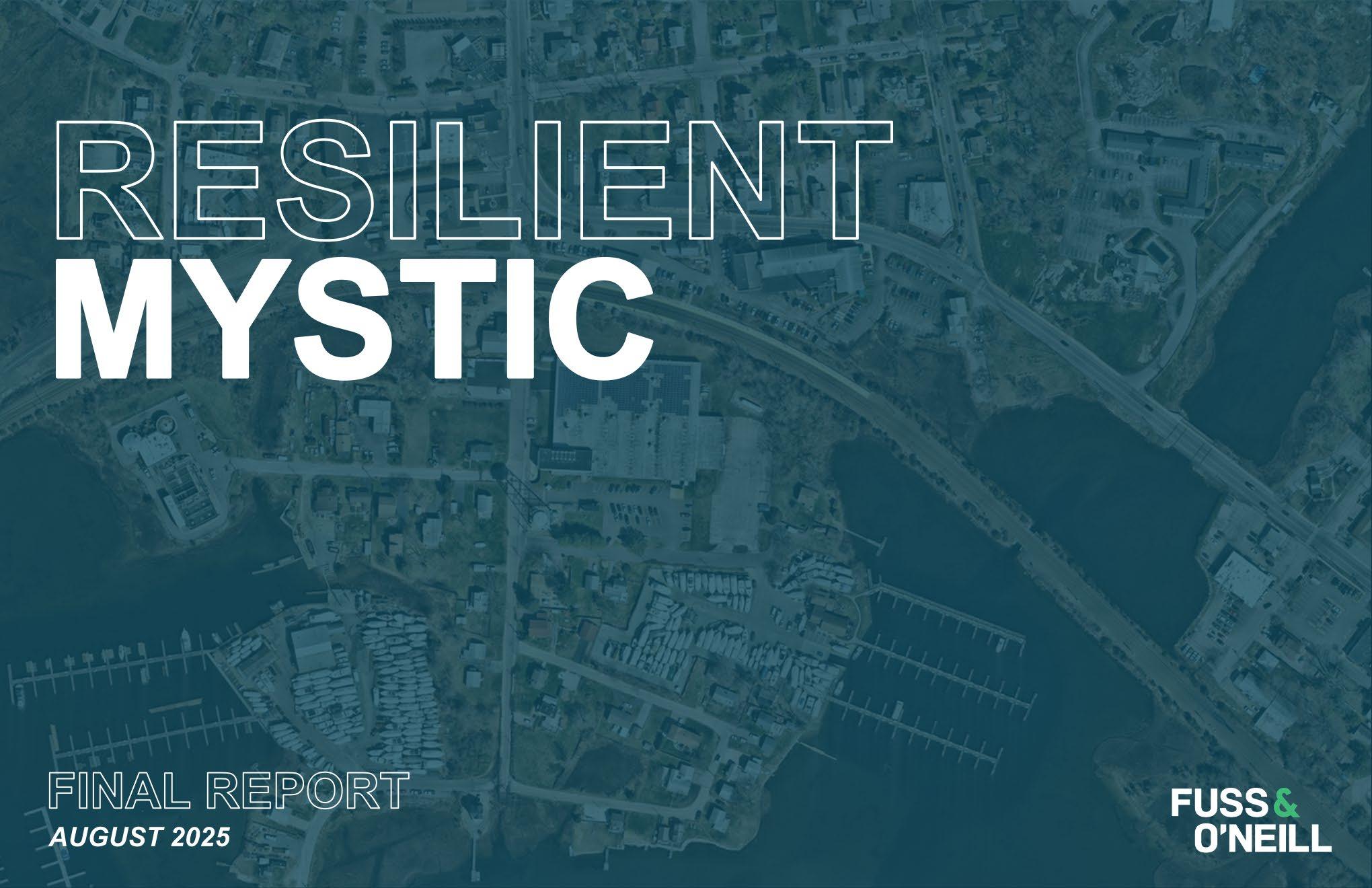
The Resilient Mystic planning process incorporated risk assessment, vulnerability analysis, and robust engagement with Town Leadership, the Citizen and Technical Advisory Committee (CTAC), and the public at large.
CIRCA modeled current and future flood conditions associated with coastal surge and tidal flooding. Using the data produced by CIRCA, Fuss & O'Neill created maps showing the extents of flooding within the project area. Using GIS, the team identified the flood risks to structures, transportation, and other infrastructure throughout the project area.
The project team researched recent climate analyses and studies that addressed resilience concerns in and around the project area.
Multiple strategies were used for outreach, including virtual tools like a GIS-based online comment map and virtual presentations and meetings, and in-person opportunities including tabling at events, walking workshops, and community and public meetings and presentations.
Fuss & O'Neill's interdisciplinary team of Engineers, Landscape Architects, Planners, and Scientists worked together to develop resilience concepts which were shared with Town leaders and CIRCA and further refined to meet the Town's needs and goals.
The project team developed this final report to summarize the planning process and outcomes from the public engagement. This final report also outlines potential next steps for preferred actions depending on timelines and funding sources
BACKGROUND RESEARCH ON PREVIOUS REPORTS
PUBLIC ENGAGEMENT
DEVELOP ADAPTATION & MITIGATION CONCEPTS REFINE CONCEPTS THROUGH CONTINUED ENGAGEMENT
Develop Coastal Inundation Model
Research Past Reports
Advisory Committee Formation & Engagement
Cultivate Concepts for Adaptation & Mitigation
Refine Concepts and Implementation Ideas Final Report
Engagement with
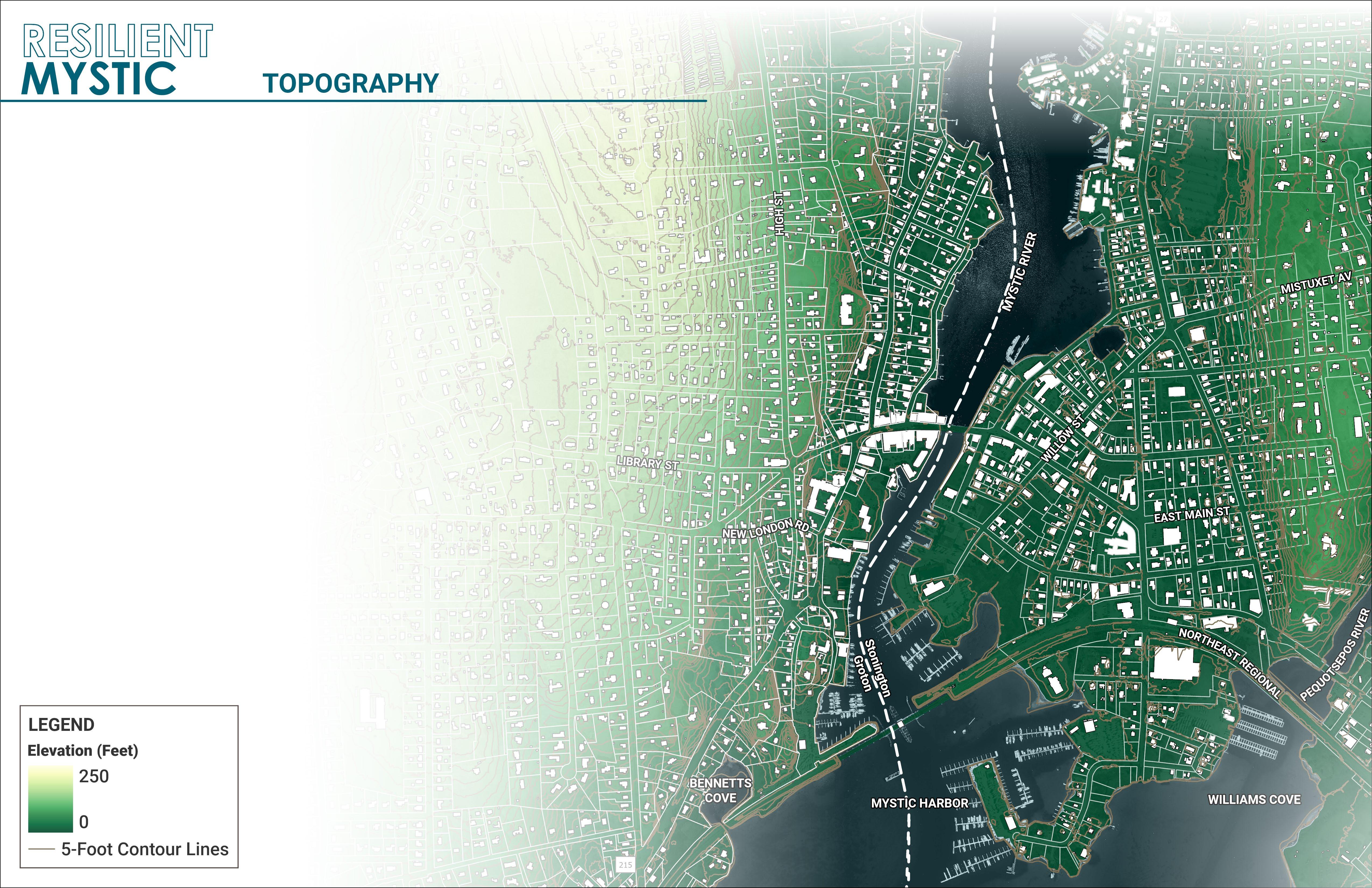
The project area follows natural topographic boundaries, outlining the low-lying floodplain making up the Stonington portion of Downtown Mystic. Directly to the east of the Resilient Corridor, topography rises steeply to 250 feet or more above sea level (NAVD 88), protecting more inland neighborhoods of Stonington from the coastal flooding which Mystic experiences.
Today, Mystic’s elevated drumlins, sheltered harbor, and sandy till atop metamorphic bedrock serve as evidence of natural geologic processes that have shaped this area of coastal Connecticut, such as glaciation, erosion, and tectonic activity. This post-glacier coastline poses a unique challenge to adapting to sea level rise and increased storm magnitudes because the complex geology can require a variety of distinct interventions that must be knitted together to mitigate flood hazards.
Some resilience design concepts presented in this report may extend beyond the formal project area boundaries. For example, road elevations or future evacuation route designs may depend on inland travel through the rest of Stonington while streets are inundated by coastal storms in Mystic. Even with Route 1 developed into a possible Resilient Corridor, it would be necessary to address low points that frequently flood on connected roads leading to higher ground like Route 27 (Greenmanville Avenue).

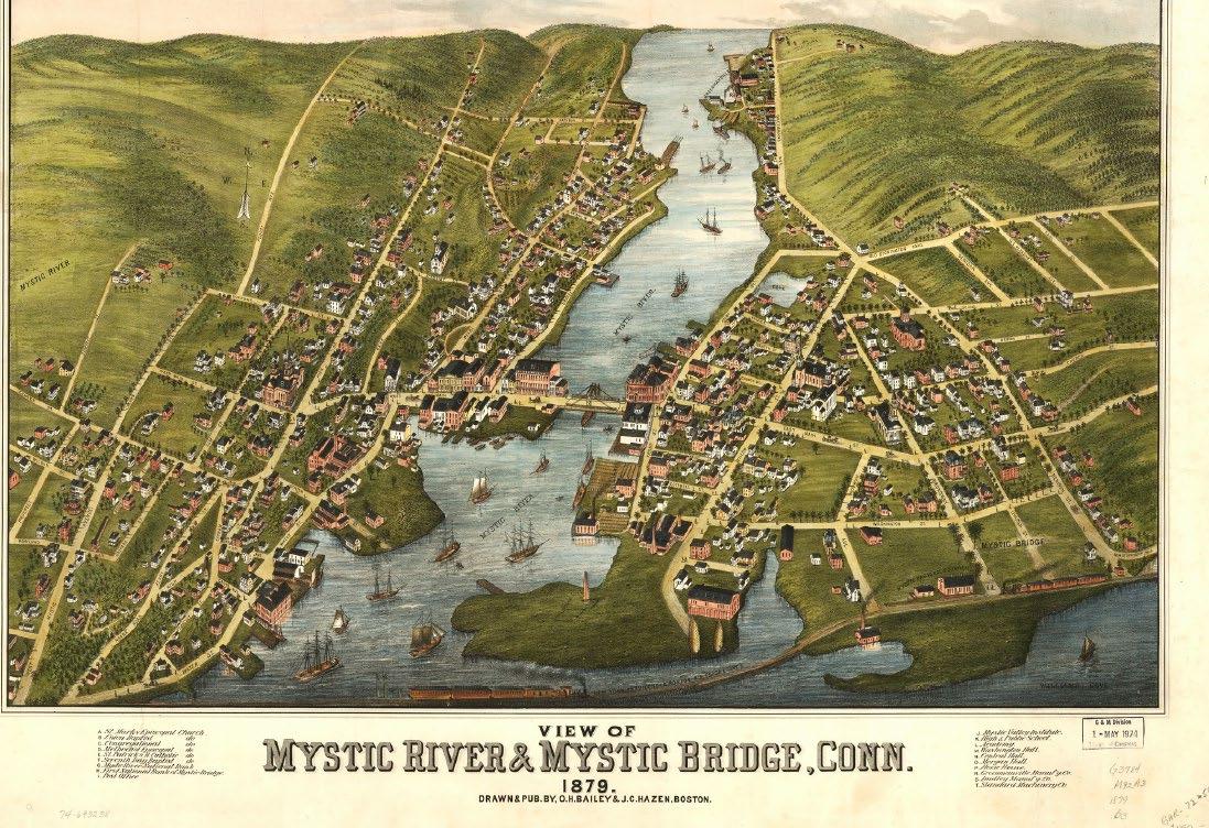
Since its establishment in the 1600s, the shoreline in Mystic has undergone profound change to support the village’s position as a hub for shipbuilding, whaling, and maritime trade. Given how heavily these industries relied on waterfront access, human intervention has followed a pattern of coastal infill, development, and armoring, with the aim of protecting land from erosion and preserving access to the tidal Mystic River and Mystic Harbor while developing low floodable parcels where ships could be built and readily launched.
By the time historic record-keeping began in the late 19th century, Mystic had already developed much of its current urban configuration, with manufacturing, other commercial activity and transportation lines concentrated at a narrow portion of the Mystic River particularly in the vicinity of the wooden drawbridge, first built in 1819, where the river could be crossed efficiently.
The historic record of images throughout the 20th century reveals land use patterns indicative of intensified development and fill, accompanied by moderate wetland and sediment loss along low-lying coastlines. This process is most apparent by the late 20th century in areas that had remained undeveloped through the early 1900s, such as Murphy Point and along the Pequotsepos River.
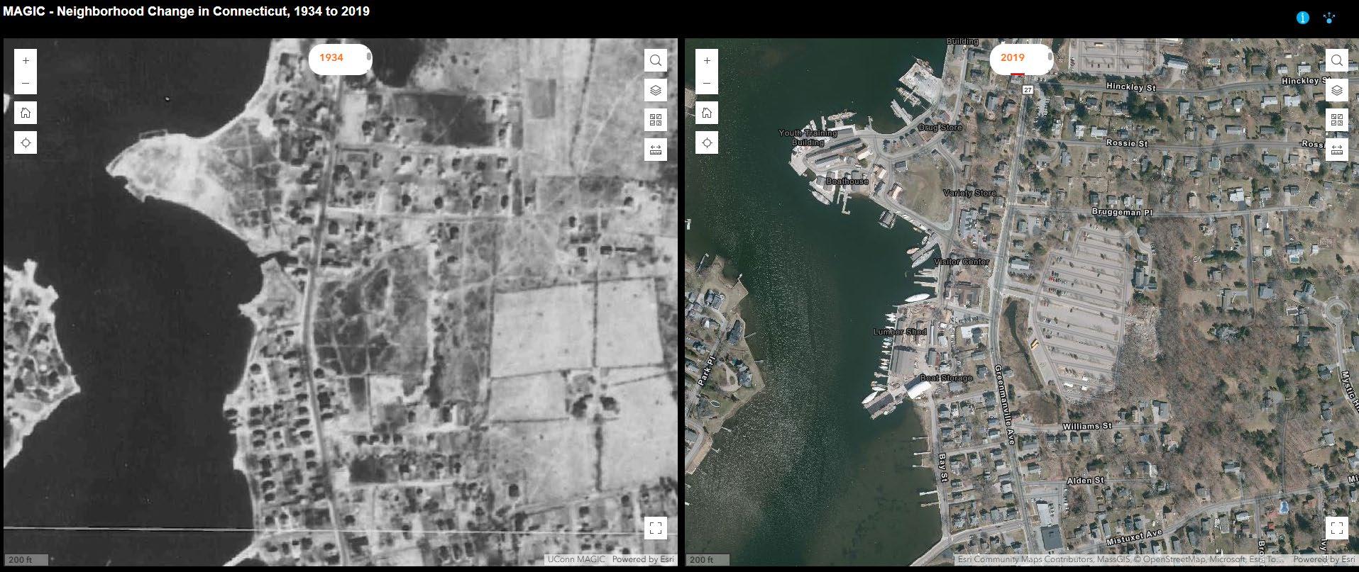
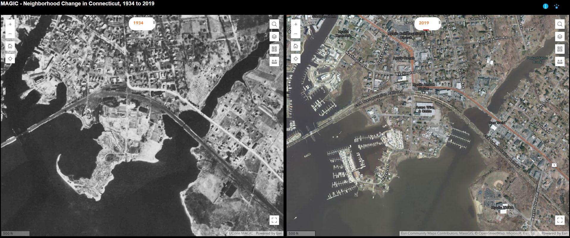
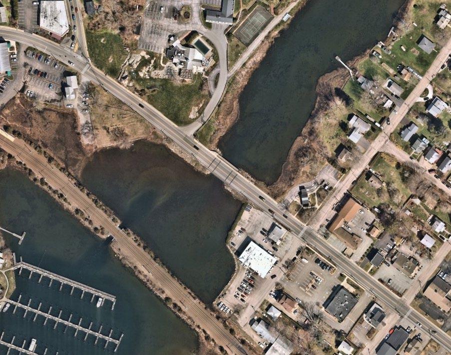
Portions of the shoreline within the project area have experienced tremendous change over the last century. These comparisons of aerial photos from 1934 and 2019 depict changes in shoreline development throughout Mystic in response to evolution in cultural and economic needs. Major changes include the transformation from a working waterfront to one that supports recreational activities such as commercial marinas, hardening along shorelines to protect property, and wetland fill. Analysis of changes to the waterfront informed the shoreline interventions detailed in Concept 3, Shoreline Adaptations.
In 1934 the George Greenman & Co. Shipyard had not launched a vessel in over 50 years and the former site of the shipyard, which was built on filled marsh, remained undeveloped. A small tidal creek stretched inland towards a tidally-influenced marsh through a culvert under Greenmanville Avenue. Today this peninsula is home to the Mystic Seaport Museum, the tidal creek has been buried, and the marsh has been filled in to create a parking lot.
The shoreline immediately adjacent to the drawbridge both to the north and the south has experienced systematic infill over the years. The docks and associated commercial marine uses have been filled to support tourism-related businesses and bulkheads built to secure the infill against the River. The shoreline in this area incrementally encroached out into the river as wharves became land. Where Cottrell Lumber's docks once welcomed schooners from the north carrying lumber to support the ship-building industry in Mystic, along the edge of the river to the south of the bridge, most of the lumber yard's buildings have been removed, and land has been formed to the outer edge of the docks to create Mystic River Park, an important community space in modern Downtown Mystic. Another notable change can be seen just to the north of the bridge where a tidally-influenced wetland was filled to become dry land that would support commercial and residential uses.
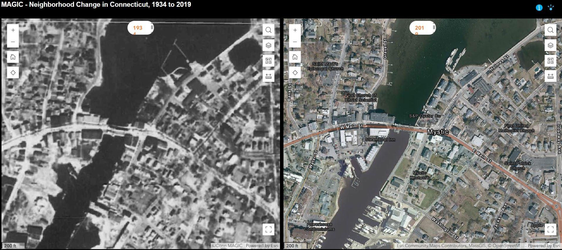
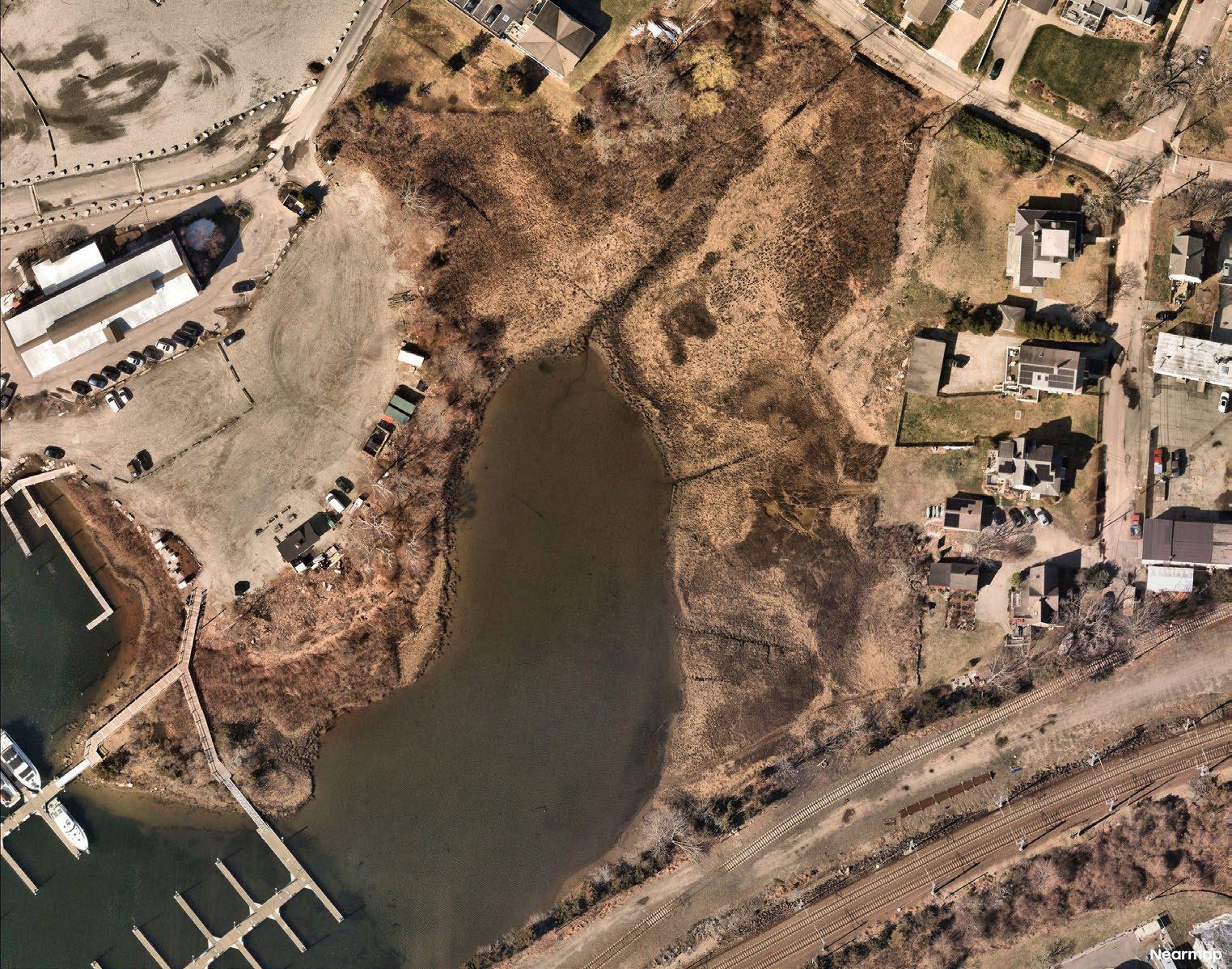
Areas along the shoreline at the Seaport Marine parcel, which burned in 2022, remained open water in 1934 and the piers that would support the shipyard's services as a commercial shipyard and recreational yacht yard had yet to be constructed. Much of the marsh that lay to the east of the Shipyard had been developed into worker housing. In more recent years, the wetland has been reestablished in this area and is now federally recognized.
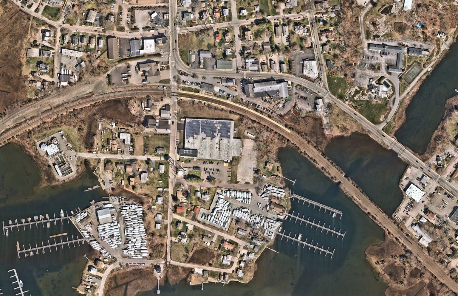
In 1934, Murphy Point was largely undeveloped and consisted of a sandy spit and low marshlands. As the most low-lying area in the project extent, Murphy Point is highly vulnerable to flooding and is the most challenging place to increase resilience. It now includes the Wastewater Treatment Facility, a handful of industrial businesses, three major marinas, and many seasonal and year-round homes. As one of the most vulnerable locations in Downtown Mystic with exposure to flooding on all sides of the peninsula, mitigating flood hazards in this location will be difficult to achieve at the neighborhood scale.
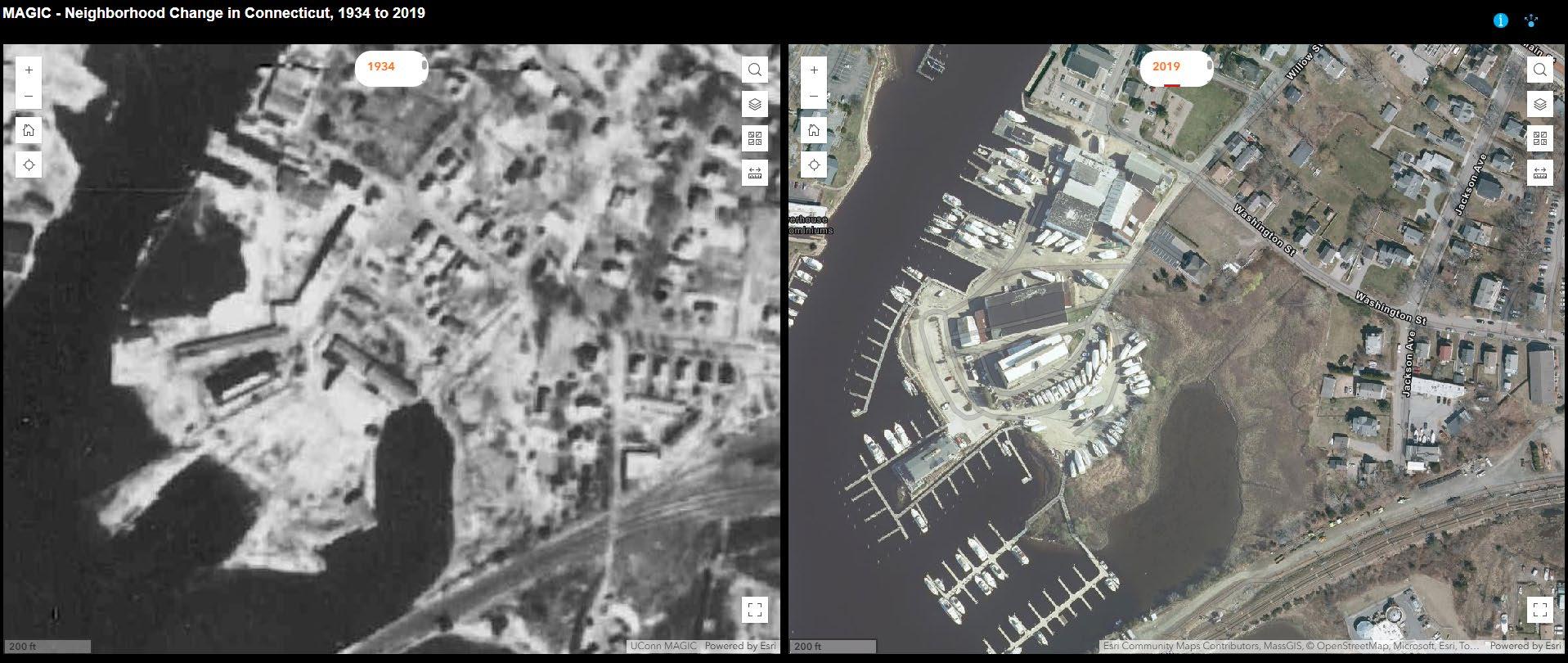
MURPHY POINT
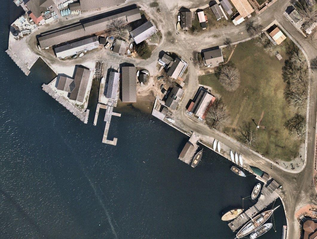
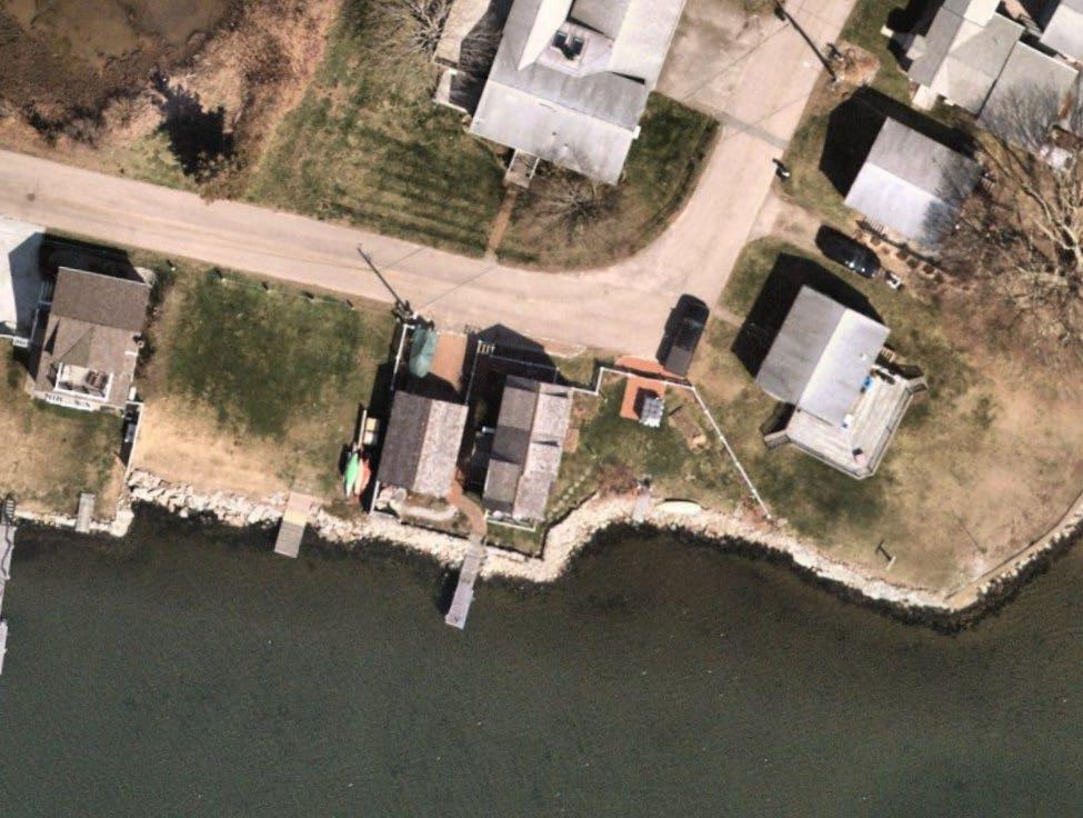
Present-day aerial photography reveals a mixture of shoreline engineering techniques within the limits of the project area. Besides piers and docks, coastal protection structures primarily consist of riprap revetments and vertical bulkheads intended to reduce wave action and retain land for human uses such as waterfront businesses, recreation, tourism, and transportation.
These engineered structures helped protect manmade infrastructure from storm surge under typical conditions until the past decade when flooding from storm surge and high tides increasingly overtopped the barriers more frequently. They are not expected to protect Mystic from sea level rise and future storm surges that exceed certain flood levels.
While most of the shoreline has been hardened, some natural salt marsh areas remain, including a federally recognized wetland. These wetlands absorb wave energy, provide floodwater storage, and habitat necessary for the local ecosystem
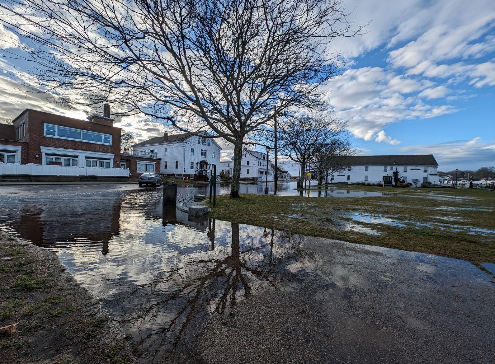
Downtown Mystic experiences flooding from multiple sources, including coastal flooding driven by tidal cycles, storm surge, and wave action, as well as riverine (fluvial) and surface water (pluvial) flooding during heavy rain events. The village’s location in a low-lying coastal floodplain bounded by the Mystic River and Pequotsepos River, with steeply rising terrain on to the east makes it particularly vulnerable. Historic shoreline development, including the filling of wetlands for industry, has reduced natural flood storage and buffering capacity. Poorly draining soils and an aging, undersized stormwater drainage system further exacerbate flooding by slowing the movement of water away from streets and buildings. The combined effect is that even moderate coastal storms or intense rainfall can produce disruptive flooding in the downtown area.
Most of the project area already experiences frequent flooding. With increases in storm frequency, precipitation rates, and with sea level rise, Downtown Mystic can expect that flooding will continue to occur at increasingly higher levels and with a higher frequency.
This study focuses on flooding from coastal storms and tidal influence. A holistic approach to flood mitigation in Mystic will require an additional analysis of pluvial flooding. It is critical that interventions to mitigate coastal flooding not exacerbate stormwater flooding by preventing drainage to the River and adjacent coastal waters.
December 23, 2022 Haven + Clay Street Intersection
January 10, 2024 -
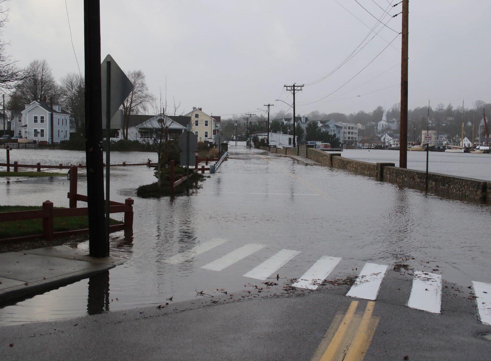
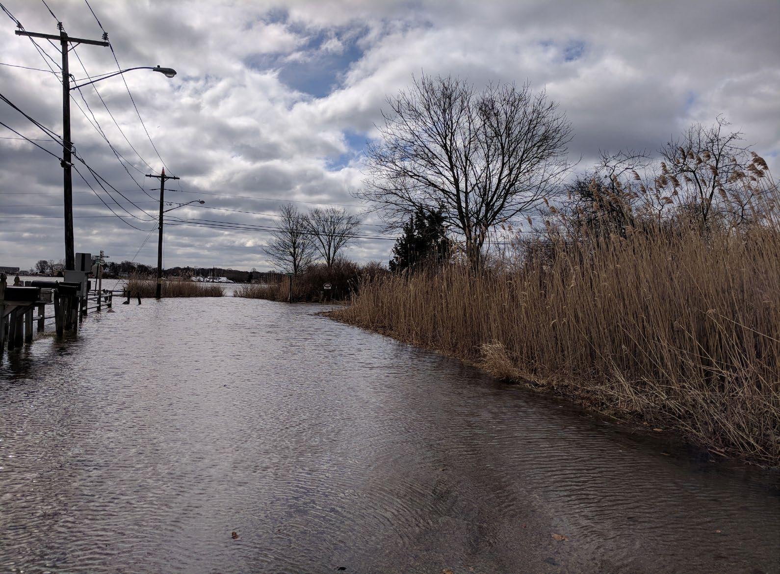
January 10, 2024
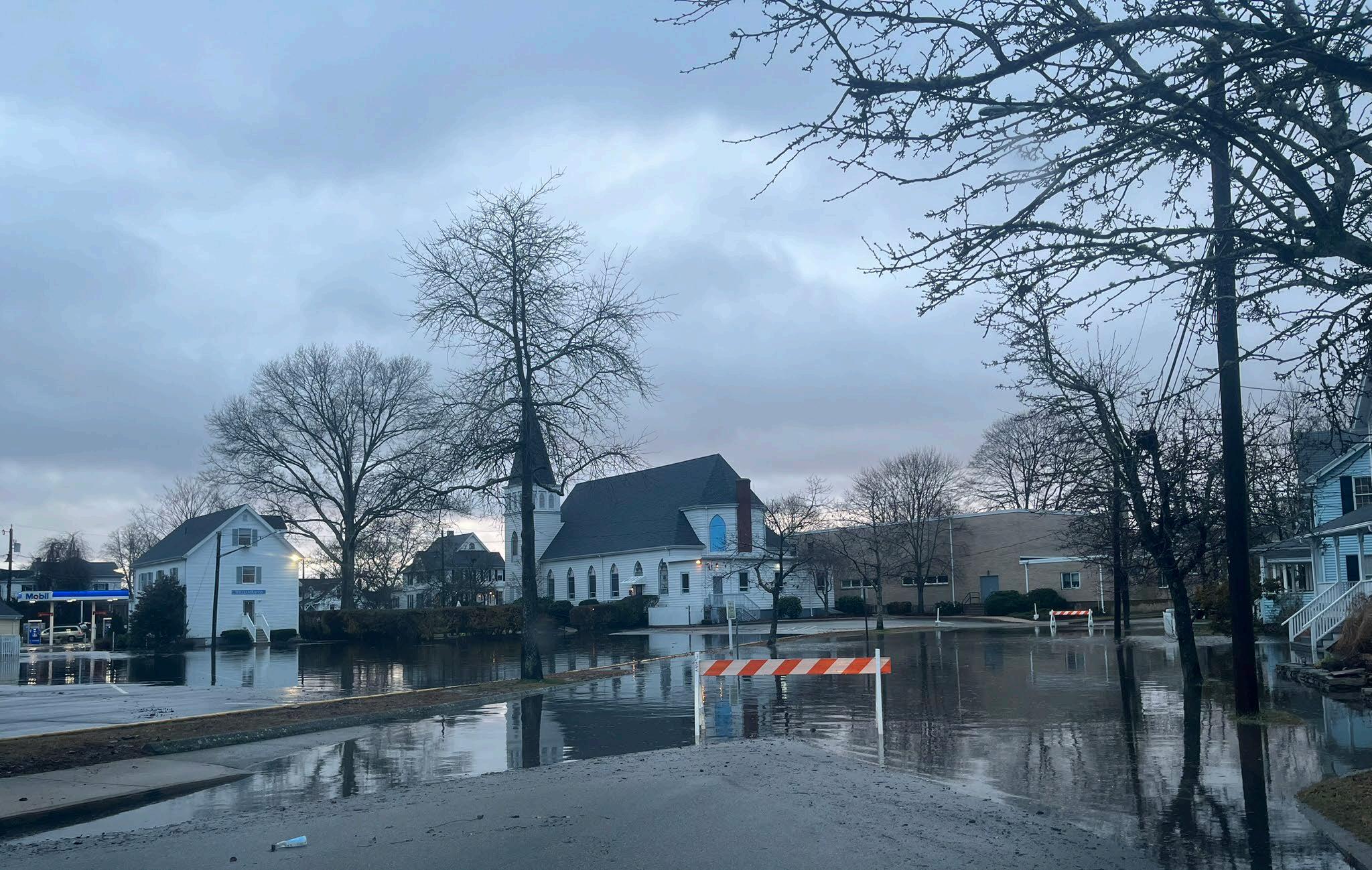
December 16,
The project team reviewed the existing and future projected sea level rise and coastal storm scenarios for the State of Connecticut. To capture the complex, dynamic processes of tides, storms, and waves, the Connecticut Institute for Resilience and Climate Adaptation (CIRCA) generated a coastal flood model for use in this project. This included mapping the 10% and 1% annual exceedance probability (AEP) coastal flood events (also sometimes referred to as the “10year” and “100-year” flood events) for current and projected future 10and 20-inch sea level rise (SLR) scenarios.
CIRCA SLR projections are based on the IPCC Fifth Assessment Report released in 2014, along with local observations. CIRCA recommends that Connecticut plan for up to 20” of sea level rise by 2050, above the national tidal datum (NAVD 88). The planning benchmarks used in this report are consistent with other projects studying coastal flooding and SLR in Connecticut, including the 2024 Town of Groton Downtown Mystic Resiliency and Sustainability Plan.
The CIRCA model used to develop these maps represents current and future coastal (storm surge) flooding probabilities based on simulations of previous storms for which we have data. Detailed precipitation and drainage (stormwater) induced flooding is not included in this model. Therefore, these maps are appropriate for beginning to understand how sea level rise will impact flooding in Downtown Mystic over time. Additional studies should provide more detailed assessment of stormwater infrastructure and the potential impacts of extreme precipitation.
Sea level rise (SLR) is an important climate-related hazard that will impact shorelines, estuaries, bays, and tidal rivers across Connecticut. As the sea and mean tide levels rise, low points across the Connecticut shoreline that were once above the intertidal zone will become inundated with tidal flood waters more frequently. To start, these nuisance tidal flooding events may only happen a few times per year. However, as SLR increases, these events will be more likely to occur monthly or even daily.
Precipitation and drainage flooding, also known as pluvial flooding, occurs when heavy rainfall overwhelms drainage systems, causing surface water to accumulate and overflow onto normally dry land, even without nearby bodies of water. Rainfall flooding can occur along waterways (riverine flooding) or inland where rainfall overwhelms storm drains. Pluvial flooding and the related storm drainage system capacities were not modeled as part of this study.
Storm surge flooding is a result of coastal storms that generate winds that push coastal waters towards land, which leads to a “surge” that increases the water surface elevations (WSEs) above normal tides. When coupled with the tide, the maximum WSE reached during a flood event is often referred to as a “storm tide.” In Connecticut, some of the most common types of storms include nor’easters and hurricanes. As SLR increases, a weaker storm in the future may still lead to the same (or greater) amounts of coastal flooding as a more powerful storm today.
Annual exceedance probability (AEP) is the likelihood of a specific event occurring at least once in a given year.
• The 10% annual exceedance probability (AEP) flood is a flood event that has a 10% probability of being equaled or exceeded each year.
• The 1% annual exceedance probability (AEP) flood is a flood event that has a 1% probability of being equaled or exceeded each year.
The entire project area is designated a Special Flood Hazard Area by the Federal Emergency Management Agency (FEMA). FEMA flood maps are an important component of the National Flood Insurance Program (NFIP), as they serve as the foundation for establishing regulations and insurance requirements.
A Special Flood Hazard Area (SFHA) is a high-risk flood zone where there is a 1% annual chance of flooding. These areas are also known as the 100-year flood zone and are identified on Flood Insurance Rate Maps (FIRMs). The NFIP's floodplain management regulations are enforced in SFHAs, and flood insurance is required for all properties with federally-backed mortgages. Although all SFHAs are equally at risk of flooding on any given year, the Velocity (VE) Zone is defined as those areas at risk from damage caused by coastal waves of three feet or greater. Large portions of Murphy Point in Downtown Mystic fall within the VE Zone.
CIRCA flood models are the standard for coastal climate change planning in the State of Connecticut. Unlike FEMA FIRMs that estimate present flood risk based upon observations of historic riverine and coastal flooding, CIRCA models incorporate tides and river flows both at the present day and into future, with different degrees of SLR. Moreover, where FEMA flood zones focus primarily on defining areas that are subject to the 1% annual probability of flooding, CIRCA models were developed for a range of flood recurrence intervals and magnitudes, from 10% to 0.2% AEP. CIRCA's modeling in this area provides higher resolution on the risk and delineates the risk associated with properties with a higher level of specificity within the SFHA.
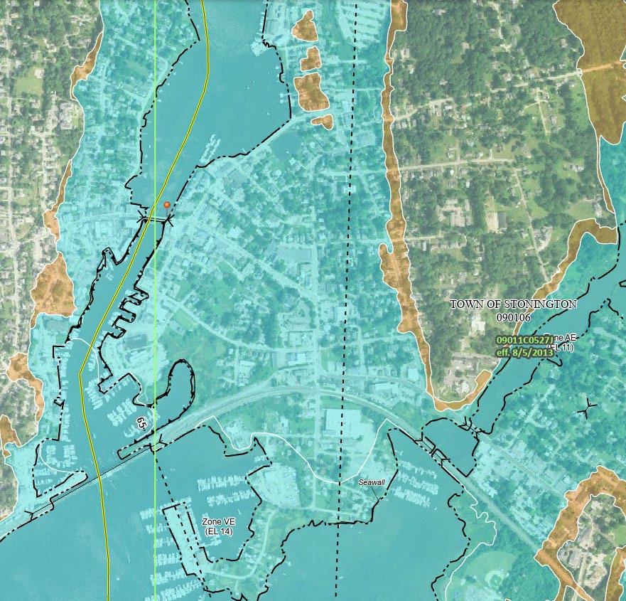
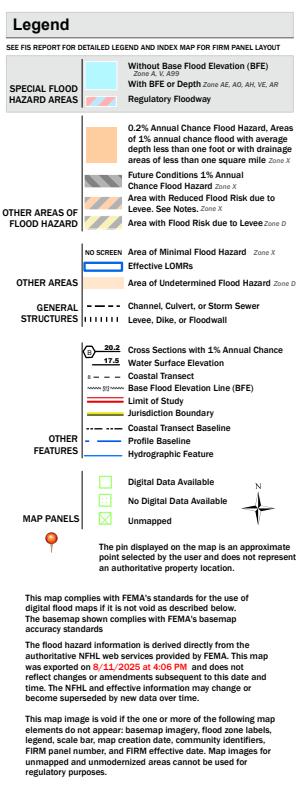
FEMA FIRM Depicting Special Flood Hazard Areas across Mystic
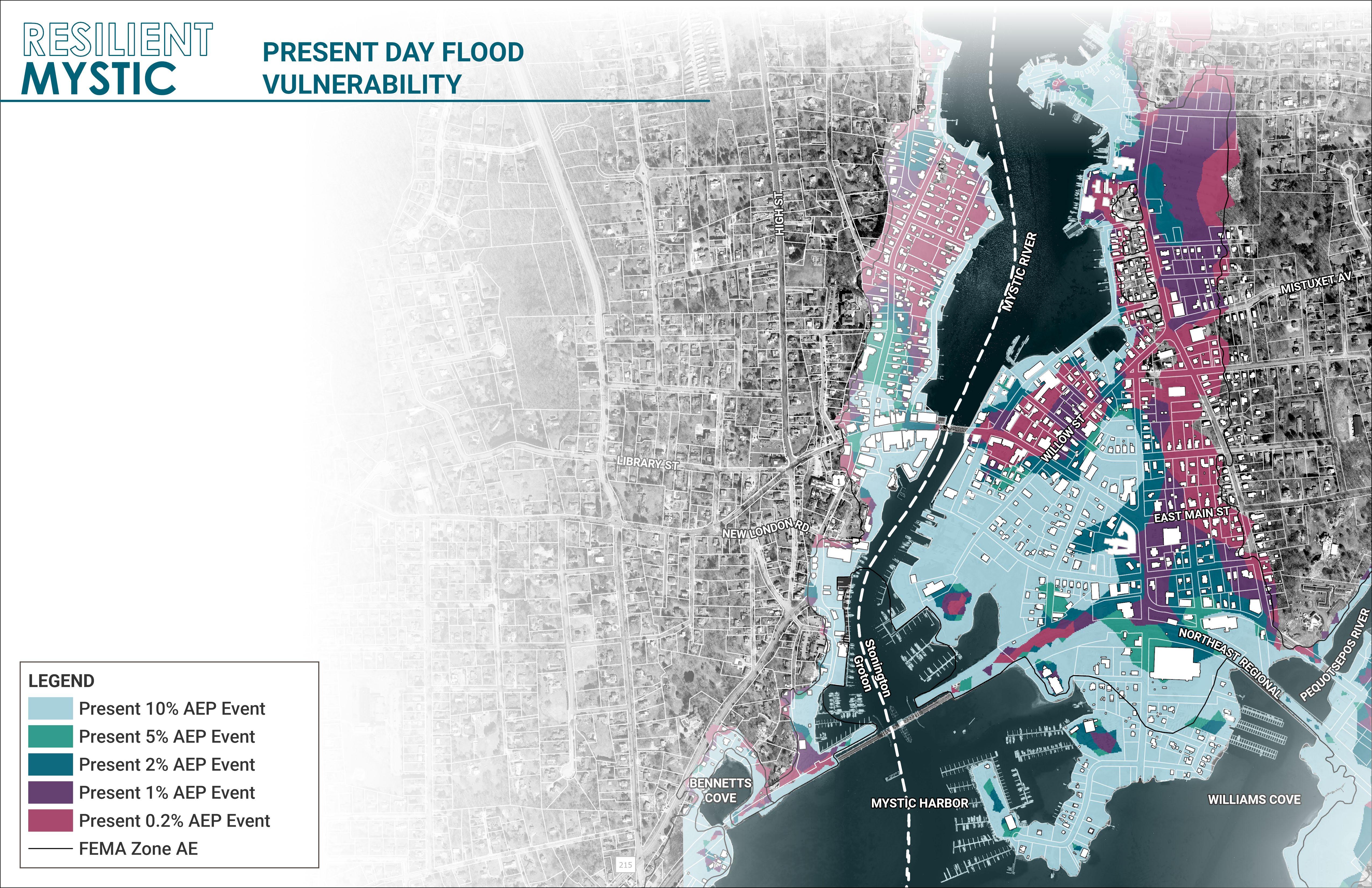
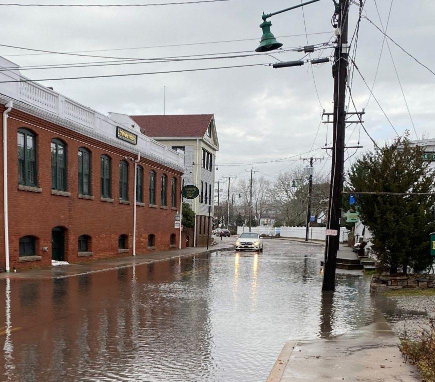
CIRCA coastal flood models reveal the areas of Mystic that are currently most prone to coastal flooding. The present-day 10% AEP flood extent is already widespread, inundating travel routes such as the railroad tracks and Route 1 as they pass through Stonington after crossing the Mystic River from Groton. Overall, this magnitude of flooding is familiar to many Mystic residents. Although major disruptions to businesses were largely avoided in these cases, these relatively common storms can quickly overcome the low-lying terrain bordering the Mystic River especially when ocean flooding is combined with extreme precipitation, as was the case in the January 2024 storm.
Higher magnitude storms outlined in dark blue and teal drive impacts to principal travel arteries such as Holmes Street, Willow Street, Broadway, and Route 1/East Main Street. Overall, Mystic’s south and west are most exposed to the 10% and 1% AEP coastal flood event today.
Per definitions offered by CIRCA and federal agencies such as NOAA, vulnerability is defined as the intersection of exposure, sensitivity, and adaptive capacity i.e., how the assets, infrastructure, or other valuable contents are adversely affected by a climate hazard such as coastal flooding.
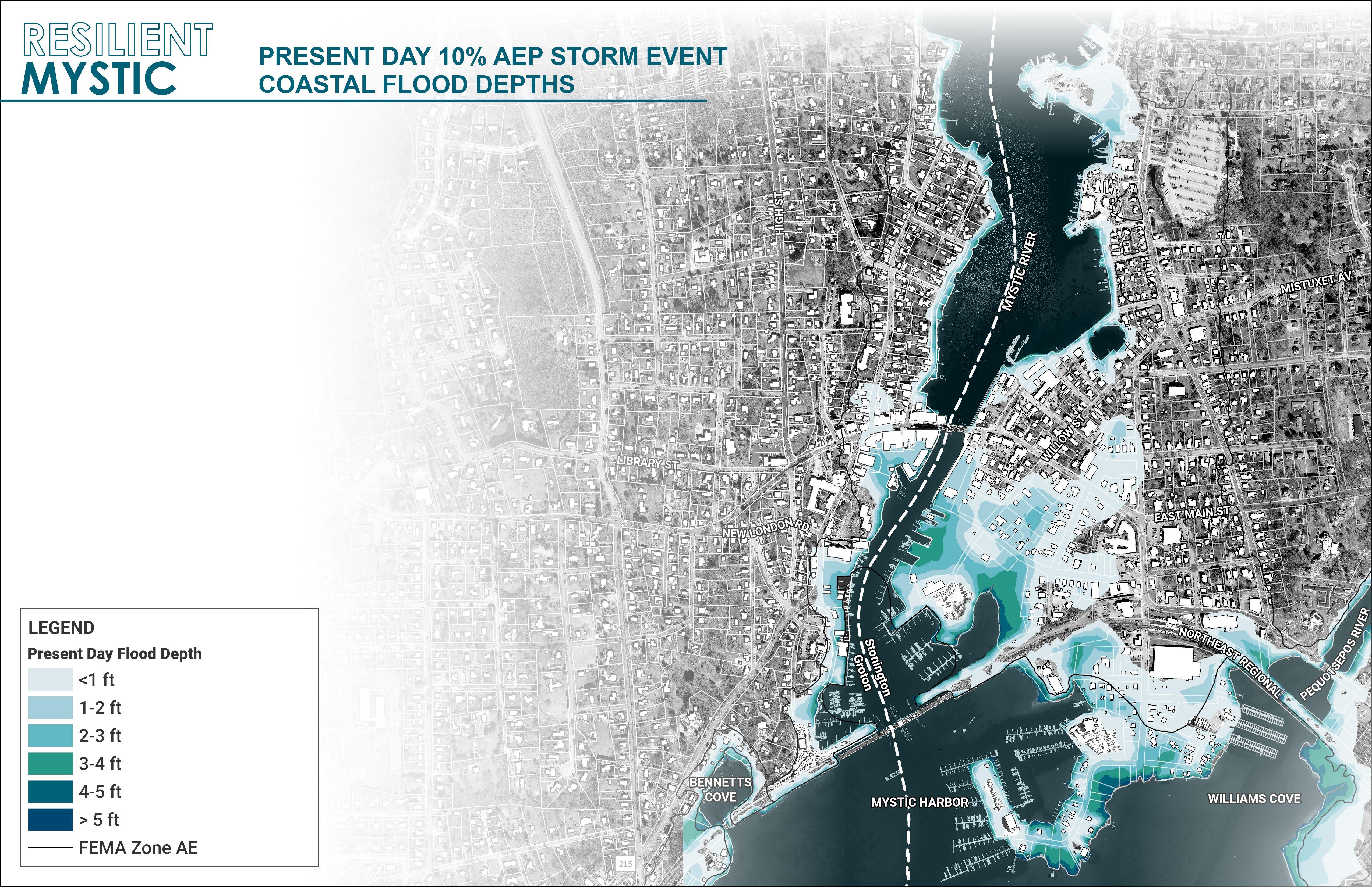
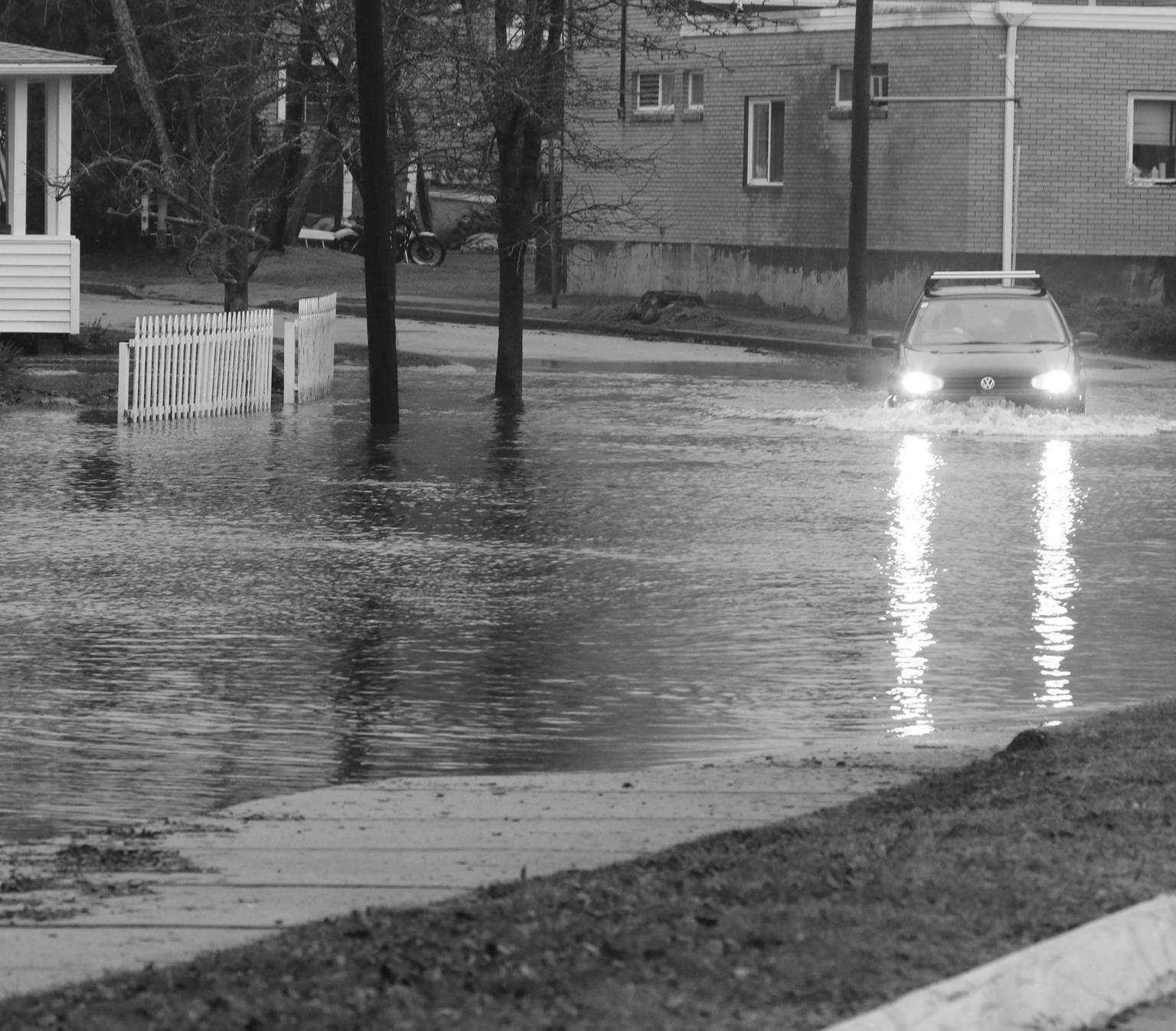
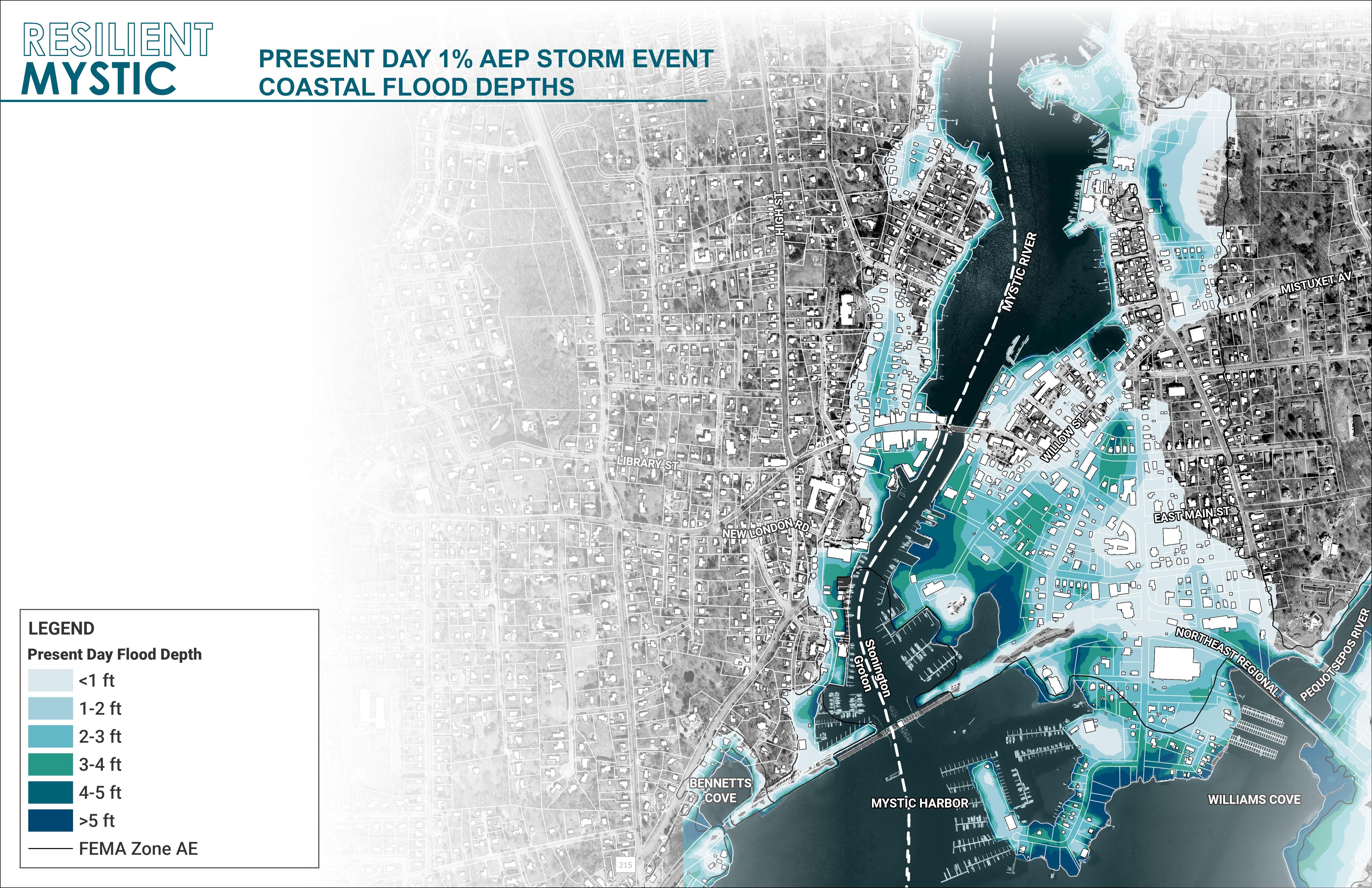
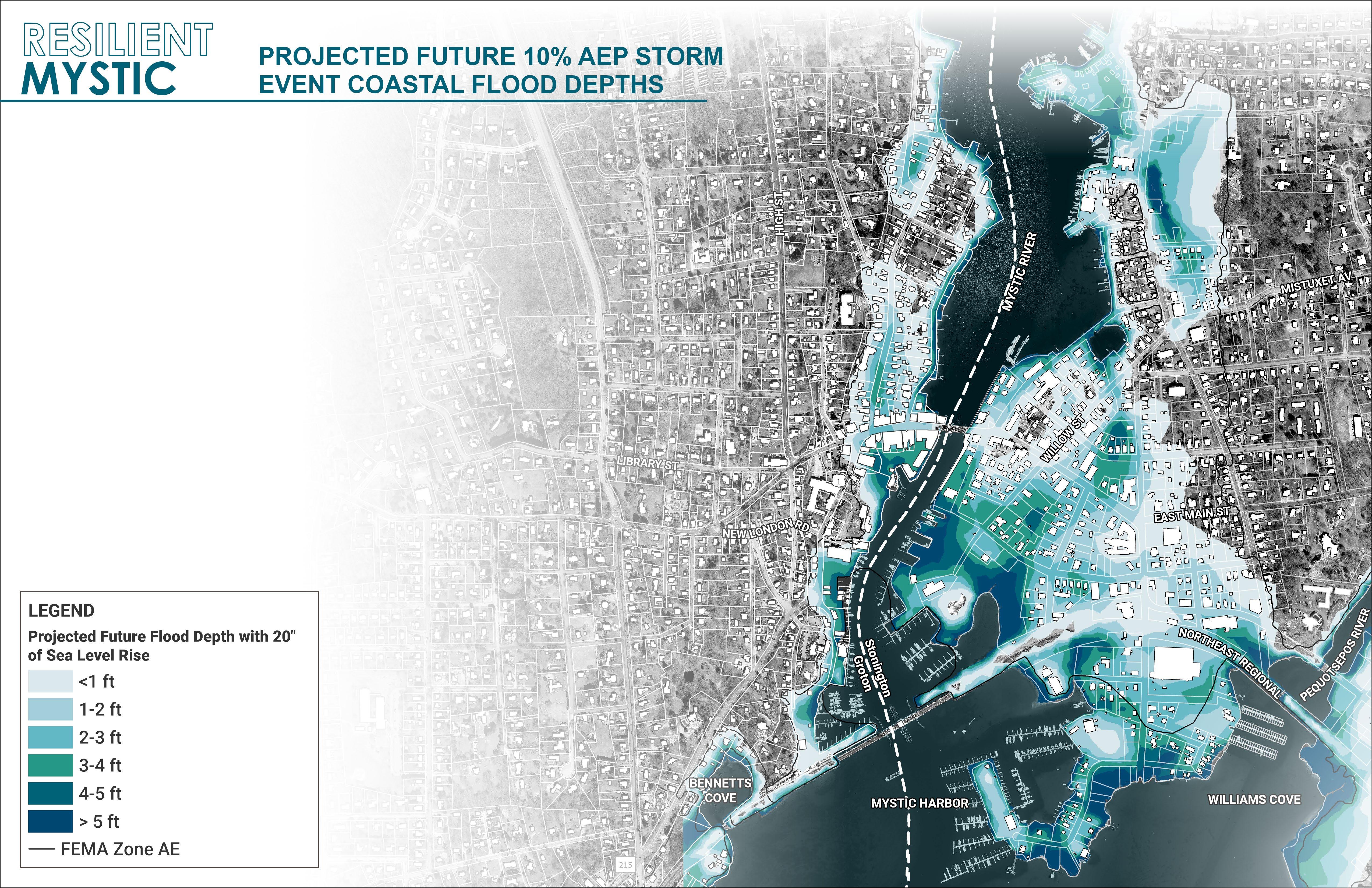
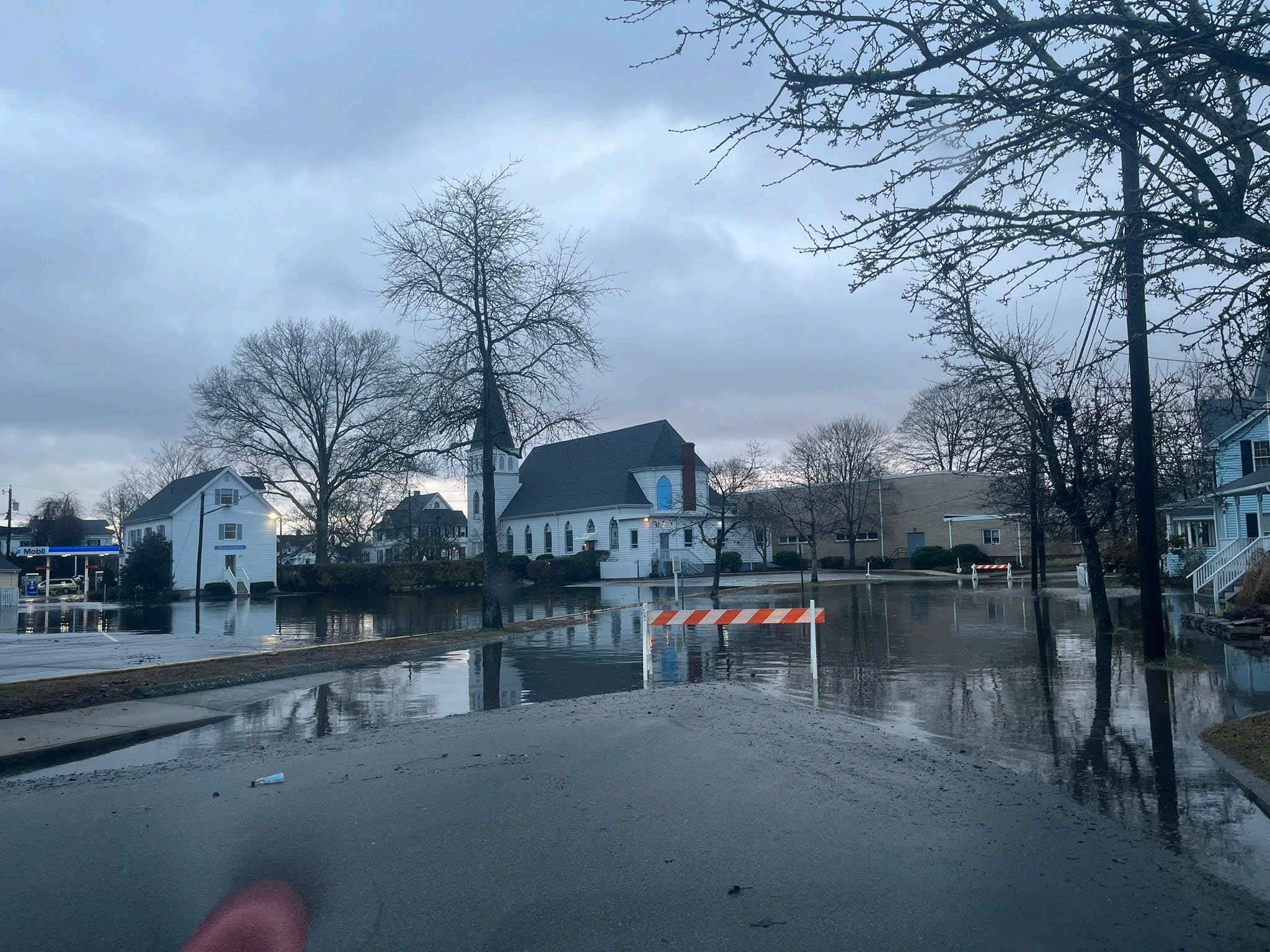
Where modeled flood extents provide a sense of flood frequency and location, flood depths offer complementary insight into flood events’ corresponding severity of impacts. The 10% AEP flood event depicted here is similar to those observed by Mystic residents in December 2023 and January 2024. During those storms, locations along Main Street and Holmes Street experienced stormwater flooding flowing through streets and into basements. These events were exacerbated by high tides that prevented the land area of Mystic from effectively draining, which speaks to the compounding effects of high volumes of stormwater, impermeable land use, and coastal flood vulnerability. Conversely, reports of flooding at Mystic River Park Playground on Cottrell Street have diminished since the 2022 fire and subsequent clearing of the Seaport Marine Warehouse, which freed up the space for an expansion of some permeable surfaces.
Despite the already widespread nature of flooding in the area, flood residence time (duration) remains relatively low, with 2023-24 flood events generally draining once the tide receded. The modeled present-day 10% AEP flood inundates approximately 177 acres.
While deployable barriers or other temporary protective measures may reduce flood impacts at strategic locations, six to eight inches of water is enough to cripple automobile traffic for most ordinary vehicles. One foot of water is enough to reach many electrical outlets. At two feet of flooding, large vehicles including emergency vehicles such as fire trucks tend to float, leading to complete mobility loss and potential safety hazards. Flood depths of three feet or more may cause structural damage to the point that building repairs may be impossible.
At present, the most severe flooding in Mystic is concentrated in the southern areas of town. Murphy Point peninsula Mystic’s southernmost prominence, containing several marinas and shipyards as well as along the southeastern banks of the Mystic River, just north of the railroad tracks. These areas indicate present or historic wetlands and/or other places where people have built extensions into the water including fixed piers. The modeled present-day 1% AEP flood event inundates an area of approximately 40 acres on Murphy Point.
The former Seaport Marina property experiences flooding nearly as severe as Murphy Point despite being located north of the railroad causeway. This site houses marina facilities, a restaurant, and other businesses with the surrounding neighborhood containing approximately 42 structures. The modeled present-day 1% AEP flood event inundates an area of approximately four acres on this parcel.
The modeled present-day 1% AEP flood inundates approximately 284 acres throughout Mystic.
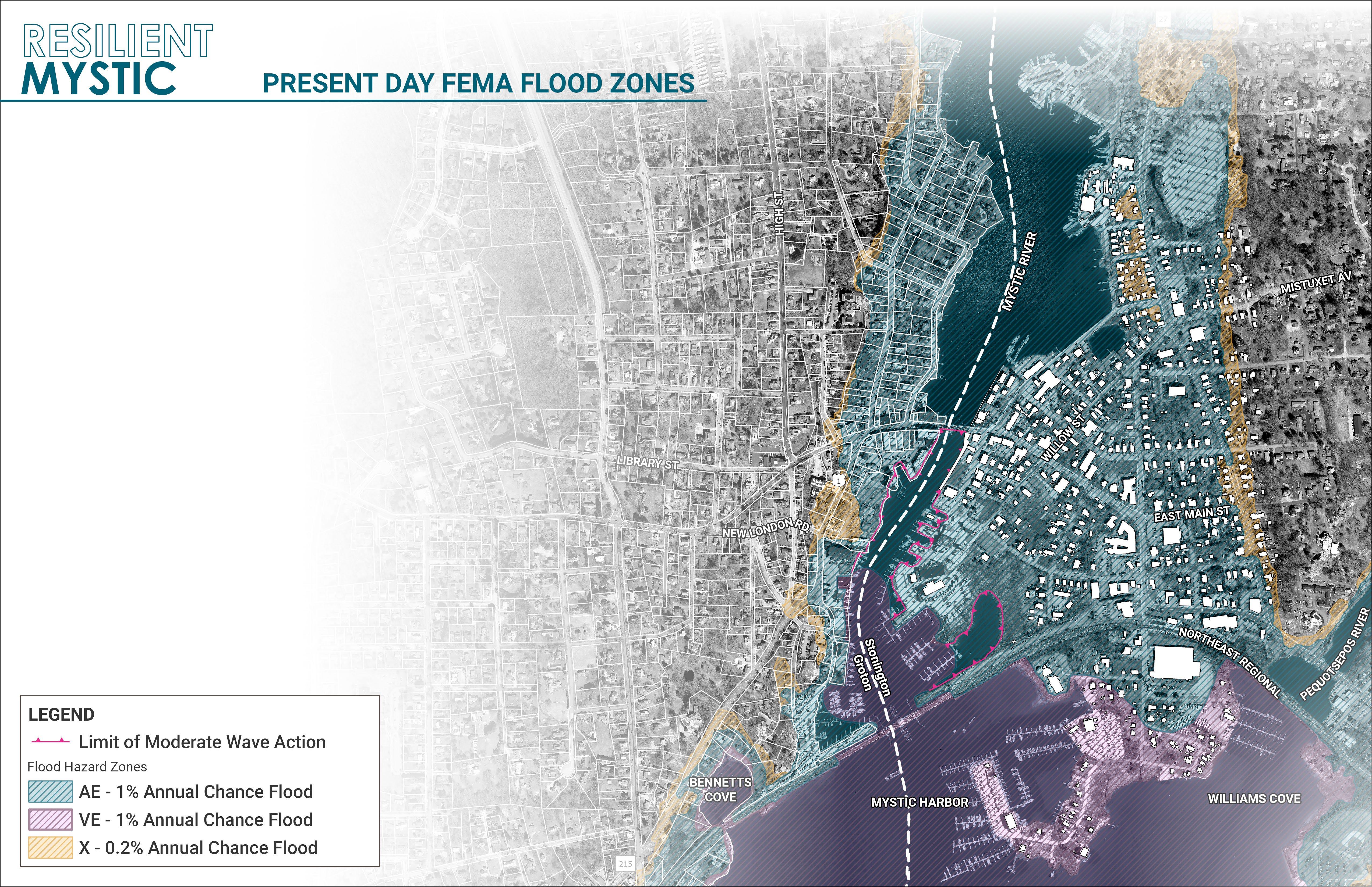
Federal Emergency Management Agency (FEMA) floodplain extents are marked on Flood Insurance Rate Maps (FIRMs). These data can be used to complement CIRCA coastal modeling to indicate areas of higher historic and present-day flood risk.
FIRM maps align with CIRCA coastal flood maps by indicating that large expanses of the project area lie exposed to the present-day 1%
AEP flood, as captured in the blue AE and purple VE flood zones mapped here. The Limit of Moderate Wave Action, or ‘LiMWA’ line, marks the boundary between different portions of the AE Zone, with the seaward side subject to greater levels of potential damage from waves as determined by FEMA. Moderate flood hazard areas, labeled Zone X in orange, are less likely to flood at present due to their underlying topography or orientation.
Development in Stonington’s coastal floodplains is governed by local zoning regulations, State Building Codes, and National Flood Insurance Program requirements. Current State Building Code requires that buildings within the FEMA AE zone be elevated at least one foot above the Base Flood Elevation (BFE). However, the town of Stonington is currently considering updating its zoning ordinances to require at least three feet of freeboard (vertical space) above the BFE for buildings in the 1% floodplain to reduce flood exposure. If adopted, these and other zoning laws would provide greater levels of flood protection while also making it more challenging to construct new buildings or rebuild following flood damage in these zones. However, these updated practices will likely still feature elevation and floodproofing exceptions for historic structures.
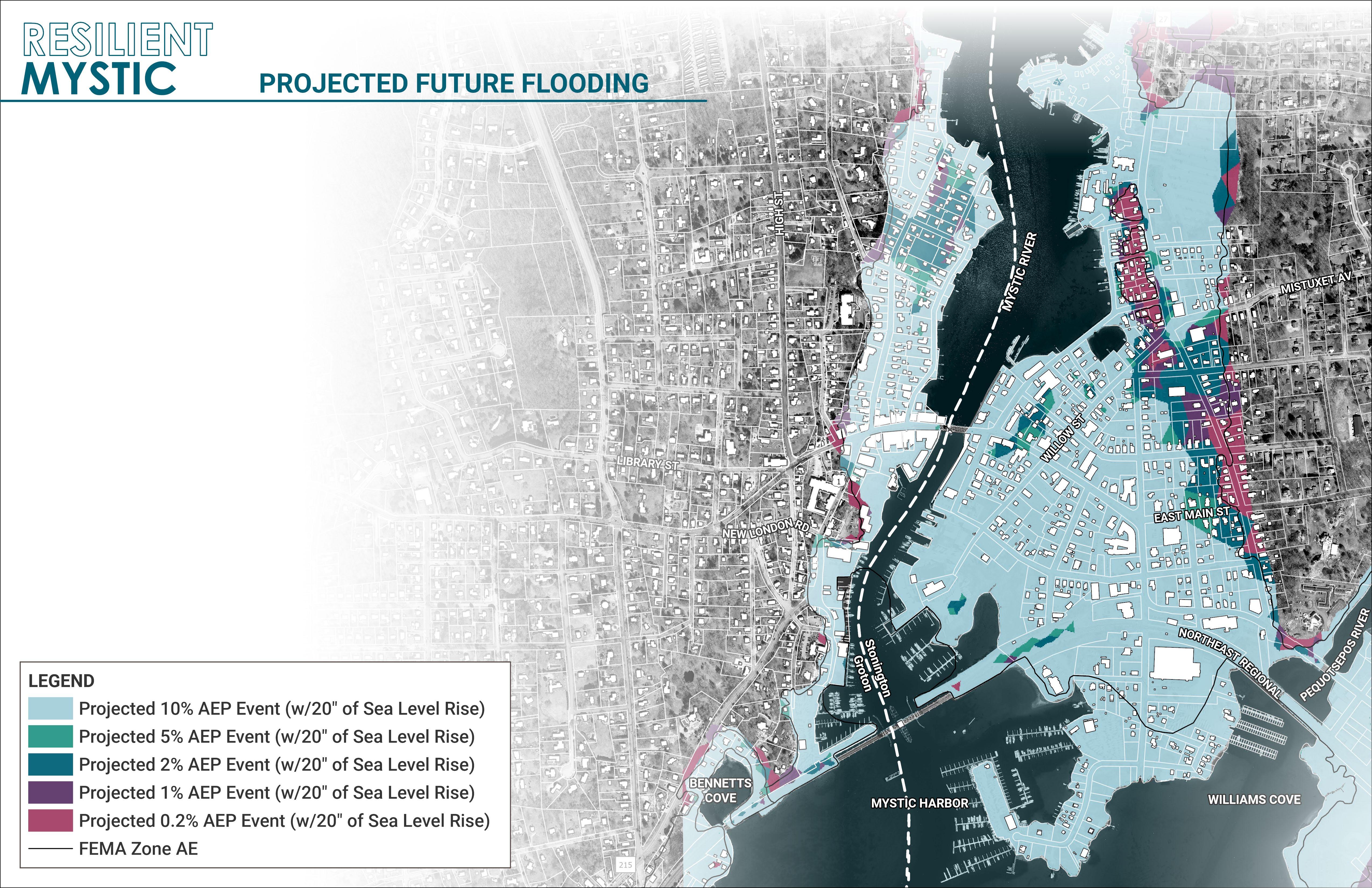
With 20 inches of sea level rise, flood extents increase substantially across the eastern portion of the project area. Under these conditions, the 10% AEP flood is expected to regularly inundate most of Downtown Mystic, including the entirety of Route 1 and the railroad tracks. While there remains uncertainty in how much sea level rise will occur on the Connecticut coastline, CIRCA recommends that the state plan for up to 20 inches of sea level rise higher than the national tidal datum in Long Island Sound by 2050.
For the first time, upland blocks in the northern reaches of the project area are subjected to flooding in the 0.2% AEP flood event. With 20 inches of SLR, the only street permitting some degree of north-south travel during the 10% AEP flood is Route 27/Denison Avenue, although even a significant stretch of this road, from the intersection with Mistuxet Avenue north to the intersections with Bruggeman Place is mostly inundated in the 10% AEP event. The southern stretch of Rte. 27 (Denison Avenue) is threatened by increasingly severe storm and is fully inundated by the 0.2% event.
In the future, the modeled 10% AEP flood extent is expected to increase to approximately 147 acres, which exceeds the area inundated during the present-day 1% AEP flood. By this time horizon, floods depths of three feet or more are predicted to encroach upon the train tracks as well as homes along Holmes and Willow Streets.
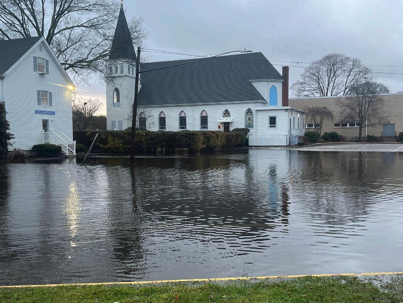
behind Saint Patrick’s Church in December 2023. (Photo Credit: Rick Newton) The flood depths seen here can be expected to increase with SLR.
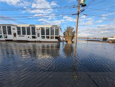
January

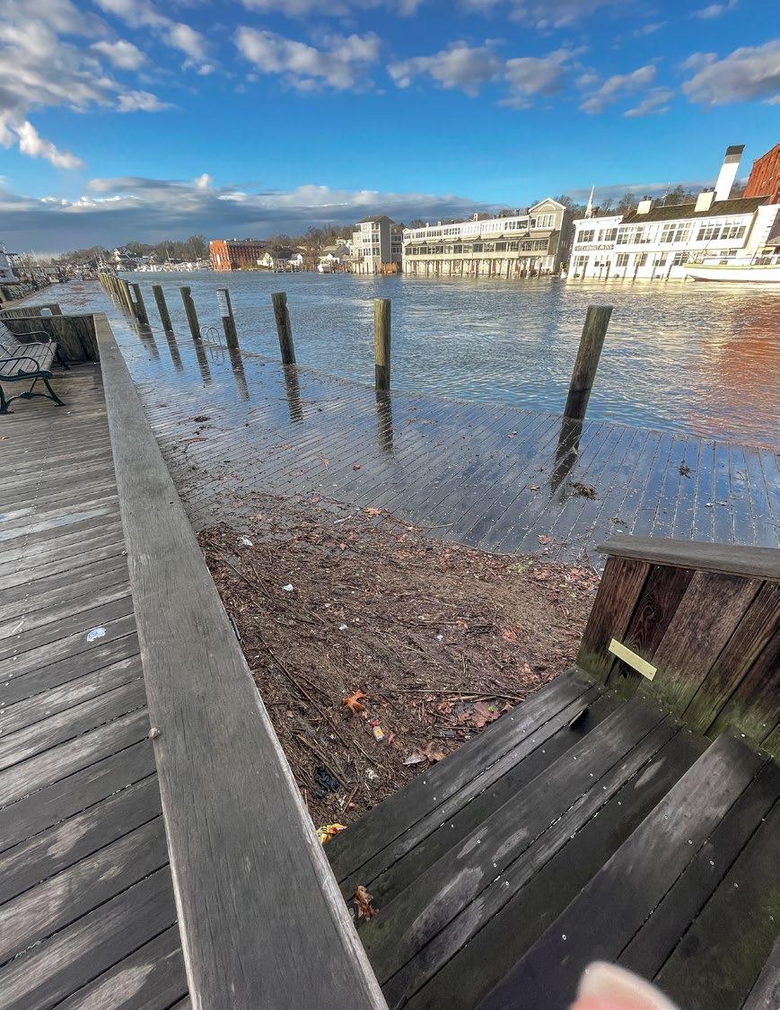
December 2023
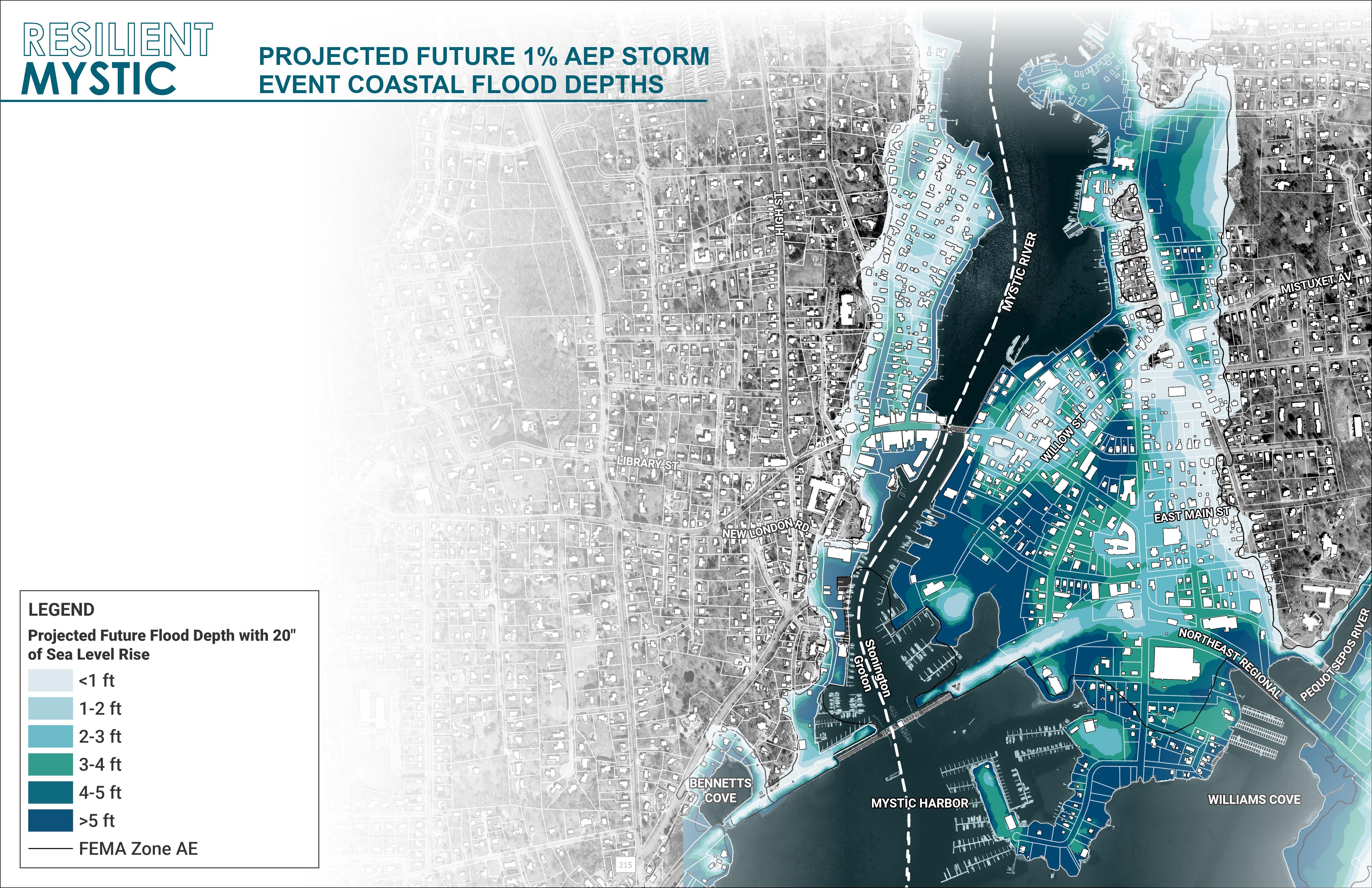
Under more intense 1% AEP flood conditions with 20 inches of sea level rise, high velocity waves of three feet or more would cover approximately 171 acres, with especially damaging effects to the portions of Downtown Mystic lining the banks of the Mystic River. Properties in Murphy Point and the Mystic shipyard would be submerged under more than five feet of water, posing a potential threat even to structures that have already been elevated well above the Base Flood Elevation.
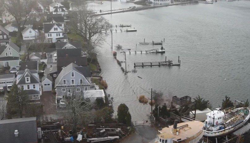
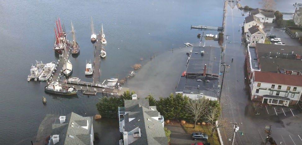
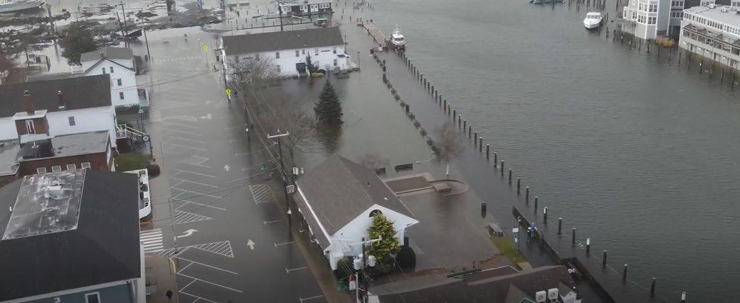
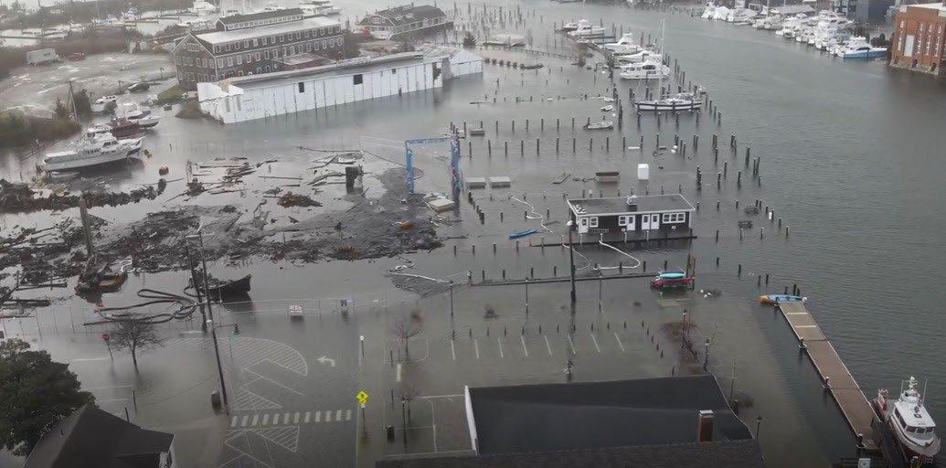
Winter Storm Elliott, technically a Bomb Cyclone, brought record storm surge in December 2022, although its extent fell short of 1% AEP levels. Pictures of the flooding that occurred along Downtown Mystic's shoreline from this lesser event indicate that the impact of flooding from a stronger storm could be even more impactful on surrounding infrastructure.
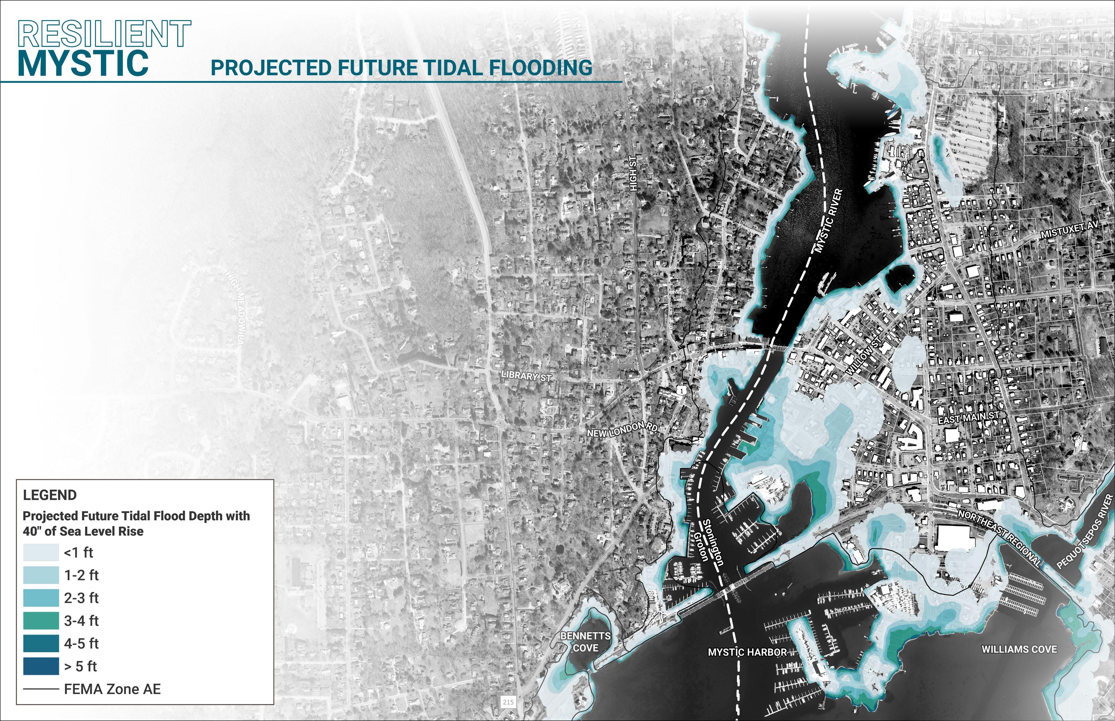
Future coastal flood conditions occur not only during periodic coastal storms but are also driven by the tide on a more ongoing daily basis. Connecticut is subject to twice-daily high tides, with the average higher of these known as the Mean Higher High Water (MHHW); anything seaward of this line will be routinely exposed to water in an area known as the intertidal zone. While there is still uncertainty in how much sea level rise Connecticut will face by the end of the 21st century, CIRCA has issued guidance that the upper bound of the likely range of sea level rise is approximately 3.3 feet, or 40 inches, over the present MHHW line. In this scenario, daily tides overtake the periphery of Murphy Point and flow overland between the wetland at Seaport Marine/Washington Street and Church Street, impacting several blocks of southern Downtown Mystic.
Compared to a storm surge event, the frequency of tidal flooding makes it nearly impossible to evacuate and recover from. Likewise, tidal processes make it challenging to rely on moveable storm surge barriers to keep water at bay, since these structures are built to be closed only occasionally for extreme water levels.
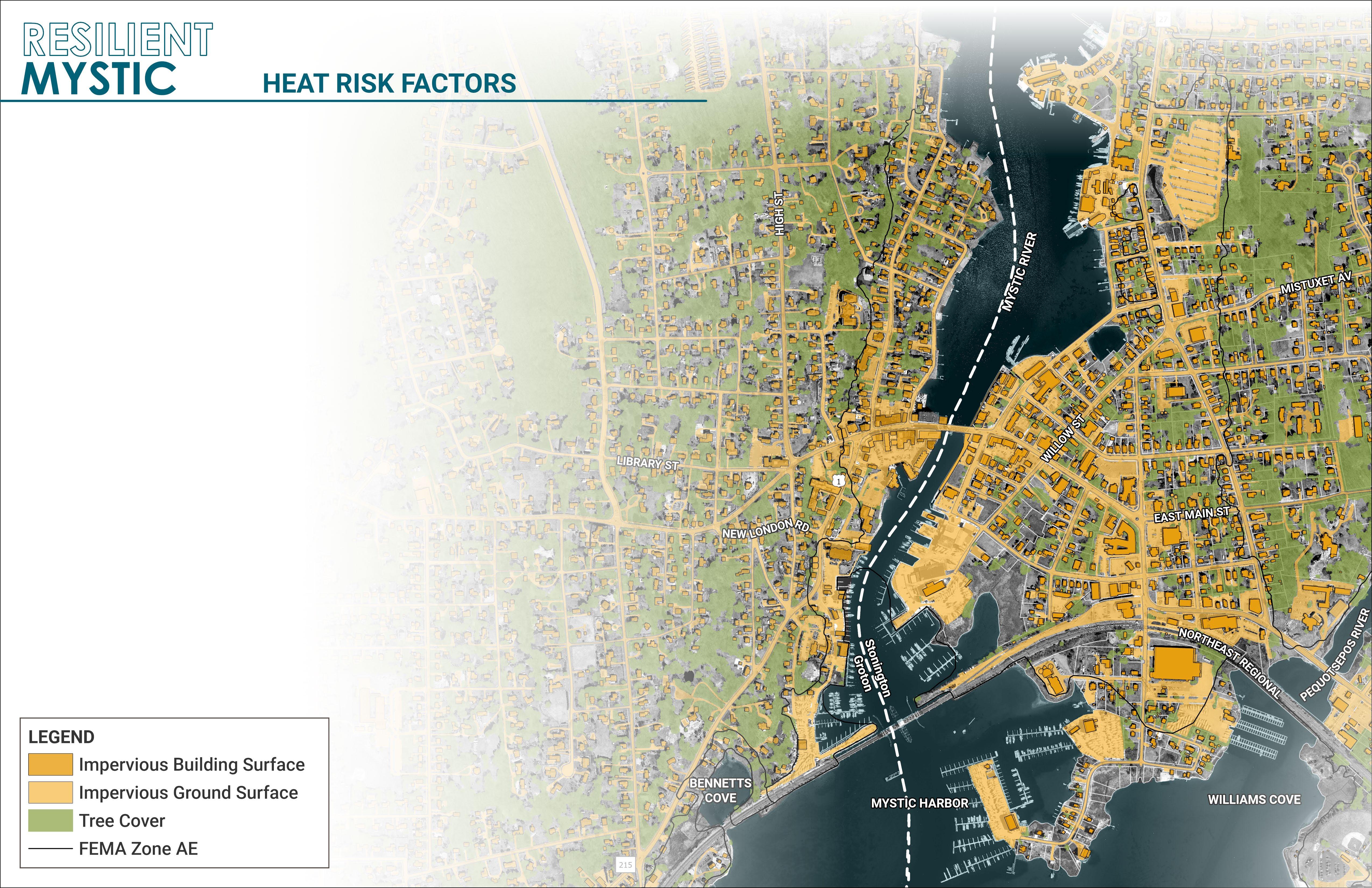
Heat waves bring public health risks such as dehydration, heat stroke, and even kidney failure. During a heat wave, the ground surface temperature can be much hotter than ambient air temperature, with impermeable surfaces such as sidewalks, streets, and roofs retaining greater heat than water or trees. Mystic is Stonington’s most heavily urbanized neighborhood, with approximately 56% of the project area covered in concrete or asphalt. All these risks can also compound the hazards of coastal flooding, since impassable roads may prevent people from reaching Stonington’s cooling centers at the high school and police station, several miles from Mystic.
Climate change is already amplifying the duration and frequency of extreme heat events. This issue is only expected to increase, with the average number of days reaching 90 degrees Fahrenheit annually doubling from approximately nine at present to 20 or more by 2050.
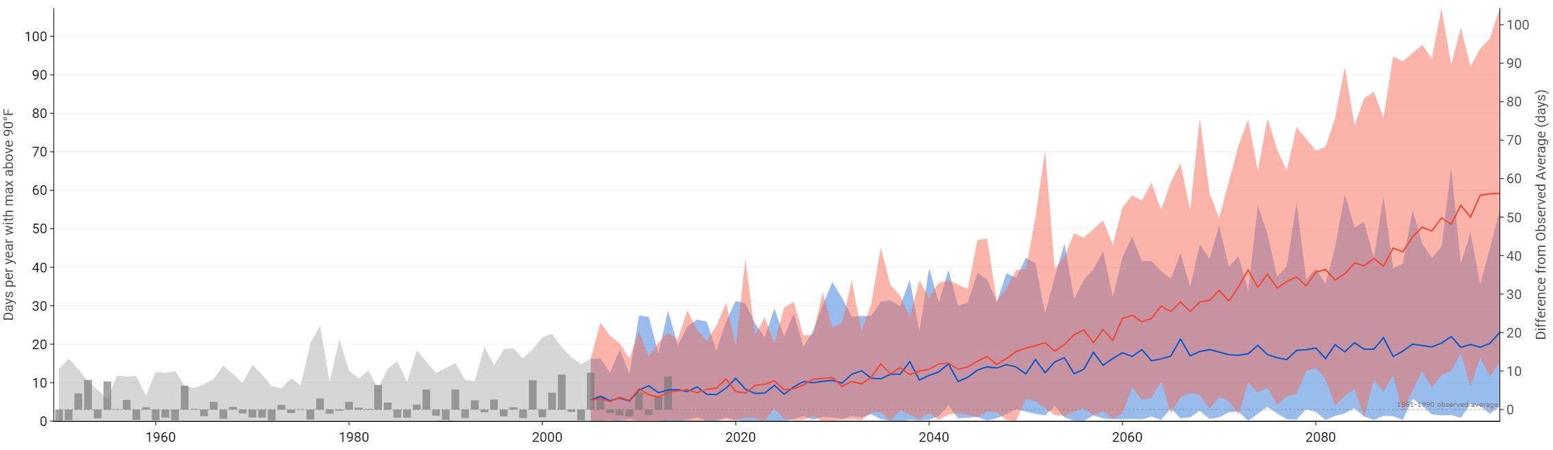
The number of days reaching 90° F annually in eastern Connecticut is expected to increase over time due to climate change. In this graph, the red line follows an emissions scenario in which humans continue to increase emissions (RCP8.5), while the blue line represents a scenario in which global greenhouse gas emissions are aggressively reduced in the near term (RCP4.5). (U.S. Climate Resilience Toolkit Climate Explorer 2024).
Knowing the potential dangers of extreme heat, CIRCA developed a web-based mapping tool, the Climate Change Vulnerability Index (CCVI), to allow users to visualize heat vulnerability across the State of Connecticut. The CCVI viewer combines several elements to identify areas of vulnerability, including built, social, and ecological factors. According to the CCVI, Downtown Mystic is highly vulnerable to heat when compared to other nearby areas of Stonington. In the figure below, darker shades indicate higher vulnerability.
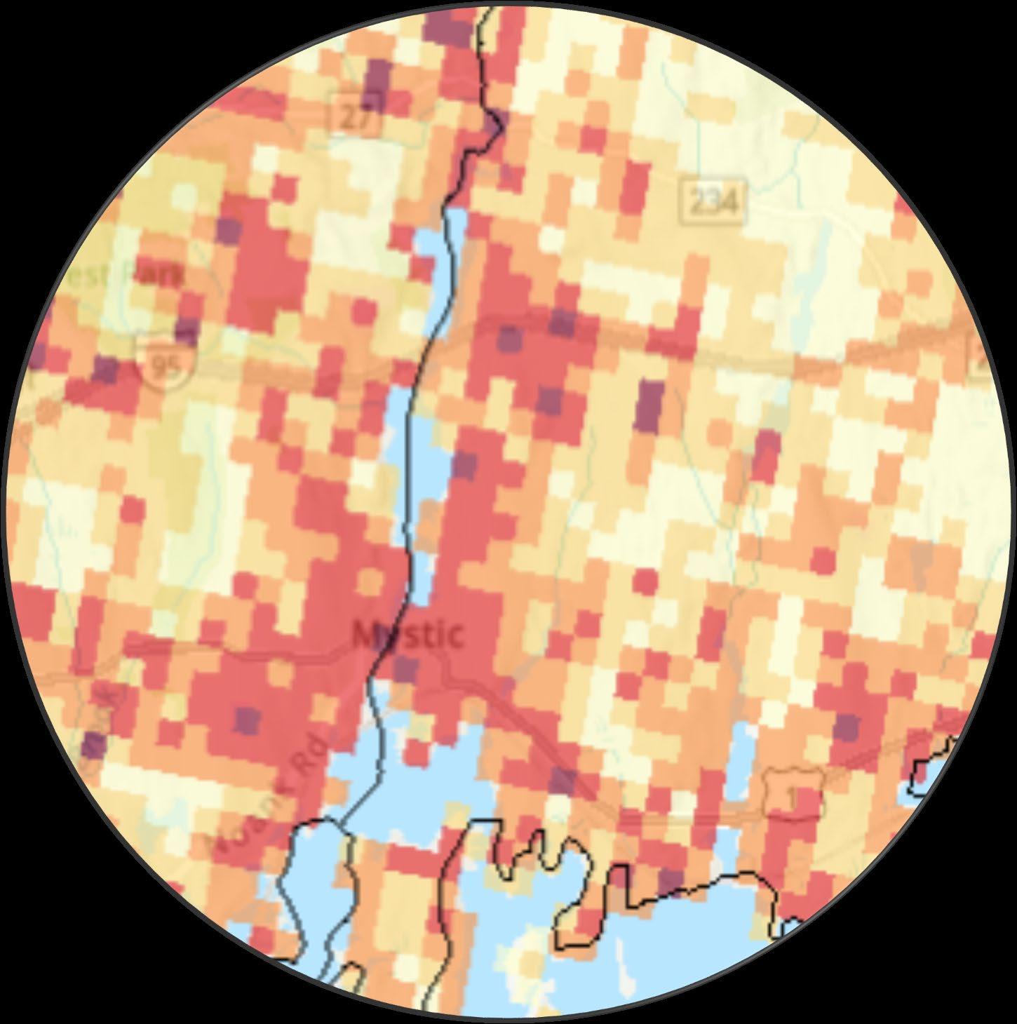
Mystic (circled) as seen through the CCVI viewer.
How much or how little individuals, communities, and populations experience extreme heat.
Examples of factors that contribute to Exposure include:
• Maximum land surface temperature
• Emissivity
• Proximity to traffic volume
• Impervious surface
• Building density
The degree to which an individual, community, or population is affected by exposure to extreme heat.
Examples of factors that contribute to Sensitivity include:
• Average number of emergency visits for asthma, per 10,000 population
• Household median income
• Over age 5 with a disability
• Percent over age 65 and under age 5
• Percent population unemployed
• Speaks English less than well/not at all
• Outdoor employment
• Single parent households
ADAPTIVE CAPACITY
Factors that help individuals, communities, or populations mitigate or recover from the effects of heat exposure.
Factors that contribute to Adaptive Capacity include:
• Percent tree cover
• Percent population with no health insurance
• Percent of owner-occupied housing units
• Proximity to swimming areas
• Proximity to healthcare facilities
• Proximity to shelter
• Proximity to a cooling center
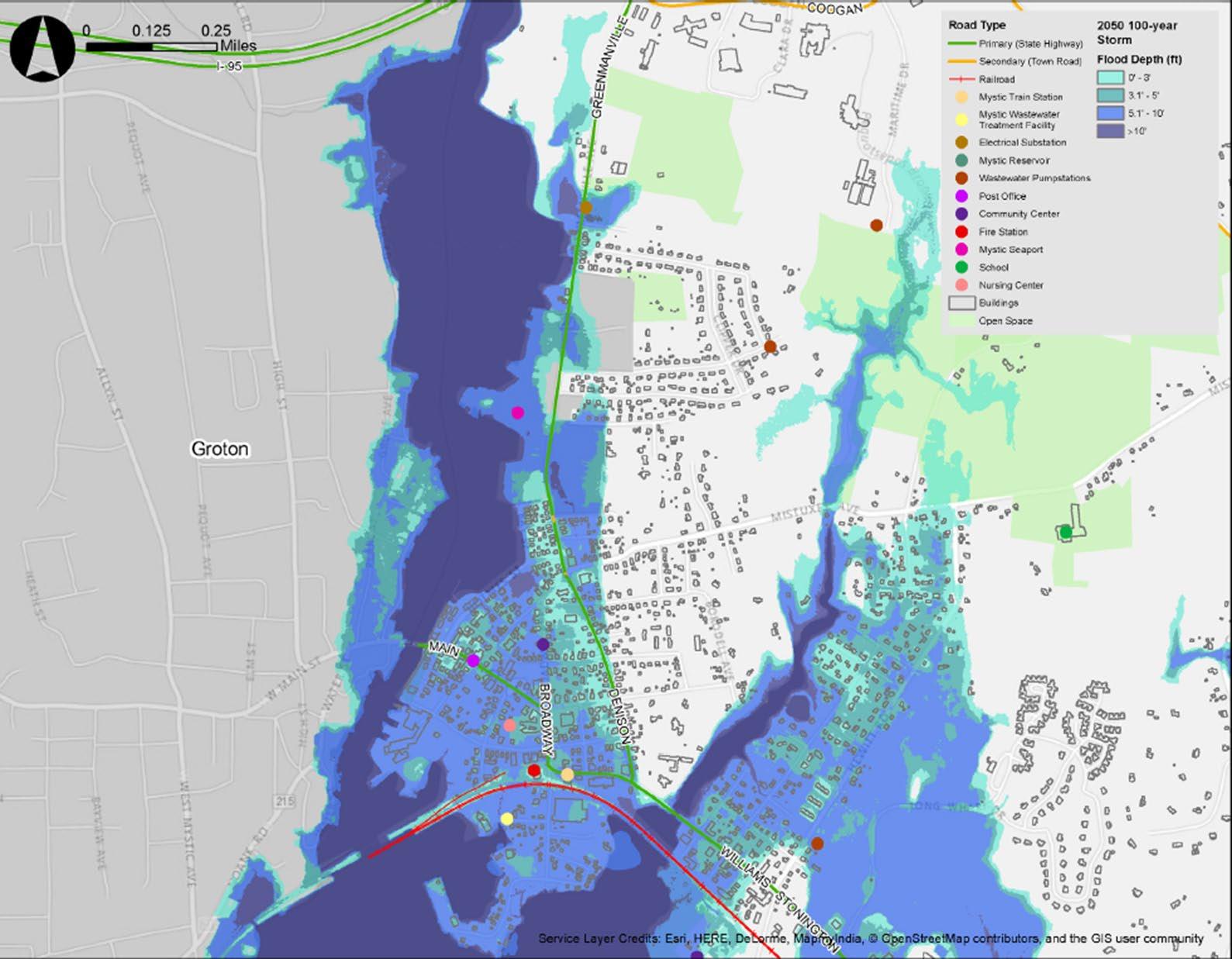
Flooding in Mystic can cause physical damages to structures and their contents, human impacts such as residential displacement and injuries, direct or indirect business impacts, and reduced functionality of public and essential facilities such as fire stations, rehabilitation care facilities, and churches. This map shows the buildings in Mystic that are vulnerable to the future 10% AEP flood event, with impacted buildings categorized based on existing use (i.e., residential, commercial, and industrial). The future 10% AEP flood event with 20 inches of sea level rise is expected to impact hundreds of residential and commercial buildings, as well as nearly two dozen industrial structures.
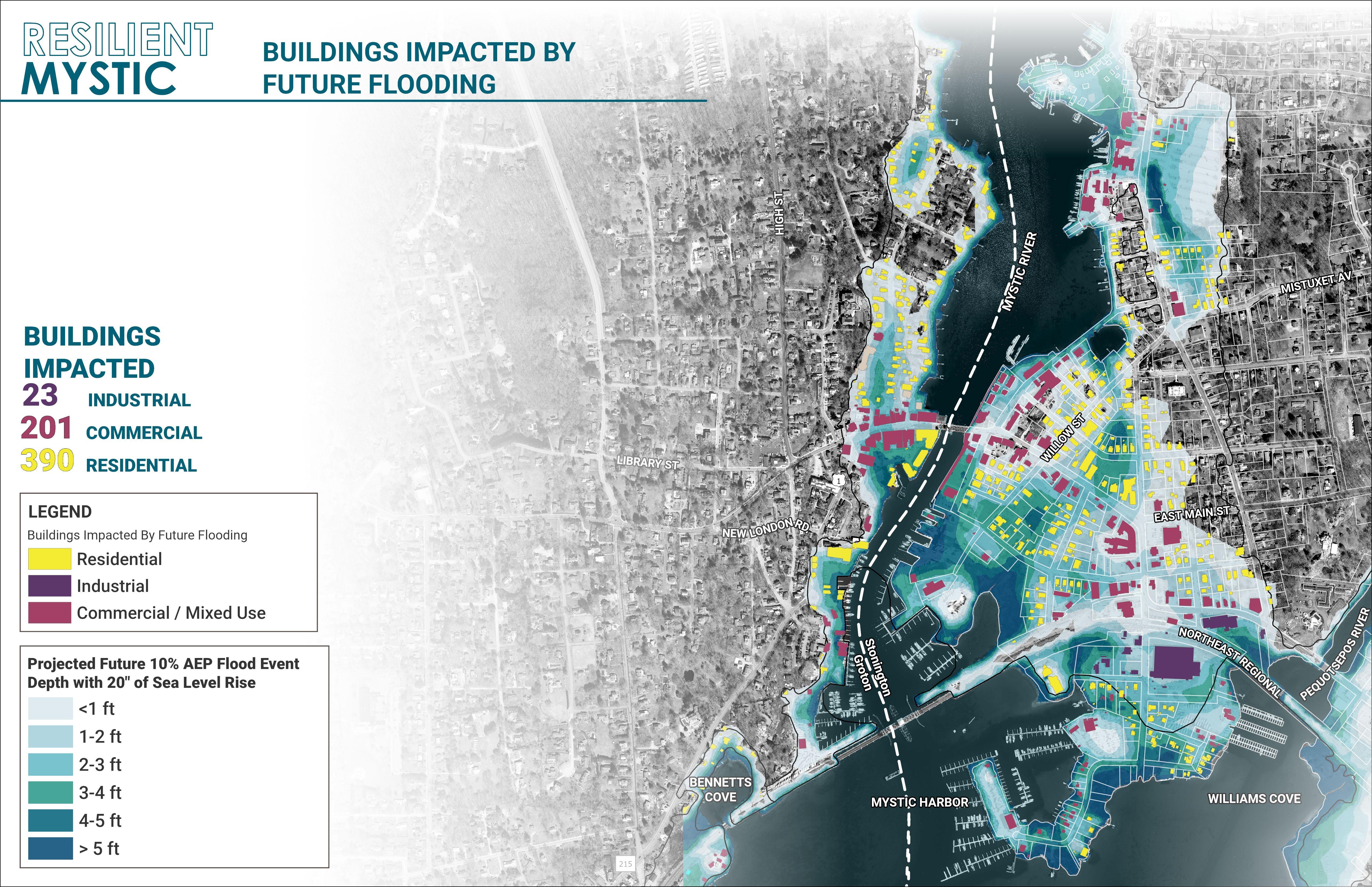
NOTE: Indicated water levels depict depth over ground.
Coastal flooding in Downtown Mystic brings severe impacts to critical roadways and transportation corridors, including evacuation routes, state and local roads, and the Northeast Regional railroad tracks.
Today, Amtrak passengers take the train to visit Mystic, with three to five Northeast Corridor trains stopping there daily. High-velocity floods can wash out train tracks from below, while impacts to the train station and related switch or signal equipment could affect the timeliness or availability of railroad service. If flood affects Routes 1 and 27 as major transportation corridors, it could seriously cripple Downtown Mystic’s regional connectivity.
Local evacuation routes currently direct travelers north to I-95, one of the nation’s busiest interstate highways. Simultaneously, traffic caused by flood diversions or damage to I-95 could bring traffic in Mystic to a standstill. Given the degree of flood impacts to Mystic’s road network, advance notice for evacuees would be required during a flood of this magnitude. This would also apply to those who do not live in Mystic but rely upon these evacuation routes, such as residents of Mason’s Island, who use a causeway to Mystic as a connection to the mainland.
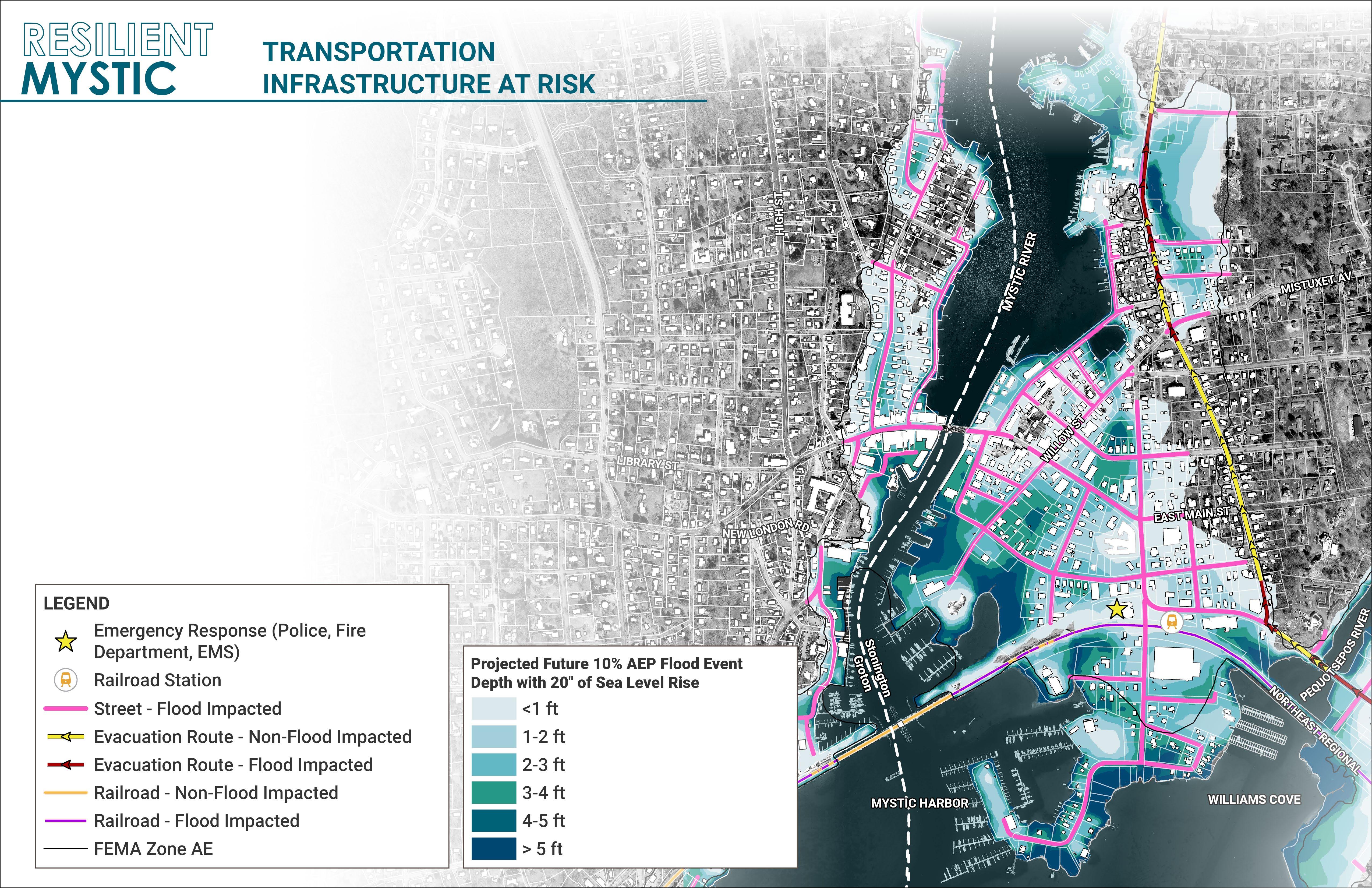

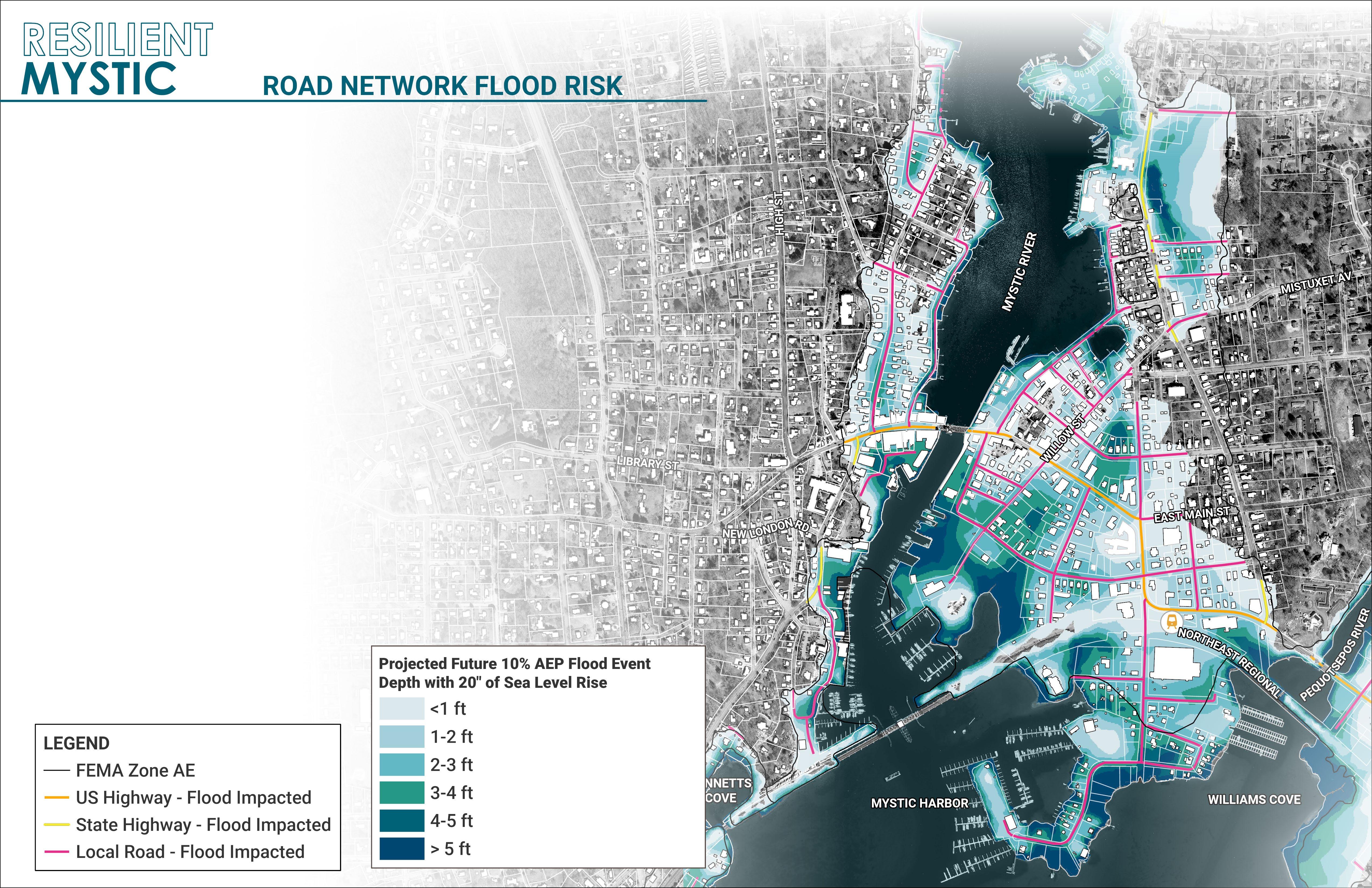
State routes 27 and 1 are the most prominent roads traveling in and out of Mystic, with both corridors made more vulnerable by their lowlying elevation and proximity to the coast. Route 1, also known as Main Street and Roosevelt Avenue in the project area, traverses the Bascule Bridge connecting Groton to Stonington before traversing the coastline east to the rest of Stonington. Route 27 (Denison Avenue) runs parallel to the Mystic River, connecting the southern reaches of Downtown Mystic to the Mystic Seaport Museum and I-95.
Together, these two routes connect many of Downtown Mystic’s critical facilities and entry into/egress from the area. Maintaining the viability of these two transportation corridors will be an important priority for Downtown Mystic moving forward. In formulating a plan to enhance resilience along these transportation corridors, it is important to consider how the geometry of the road network may complicate alterations to road surfaces. For example, elevating roads in specific locations may increase stormwater runoff potential for adjacent properties and/or require alignment with several other intersecting streets.
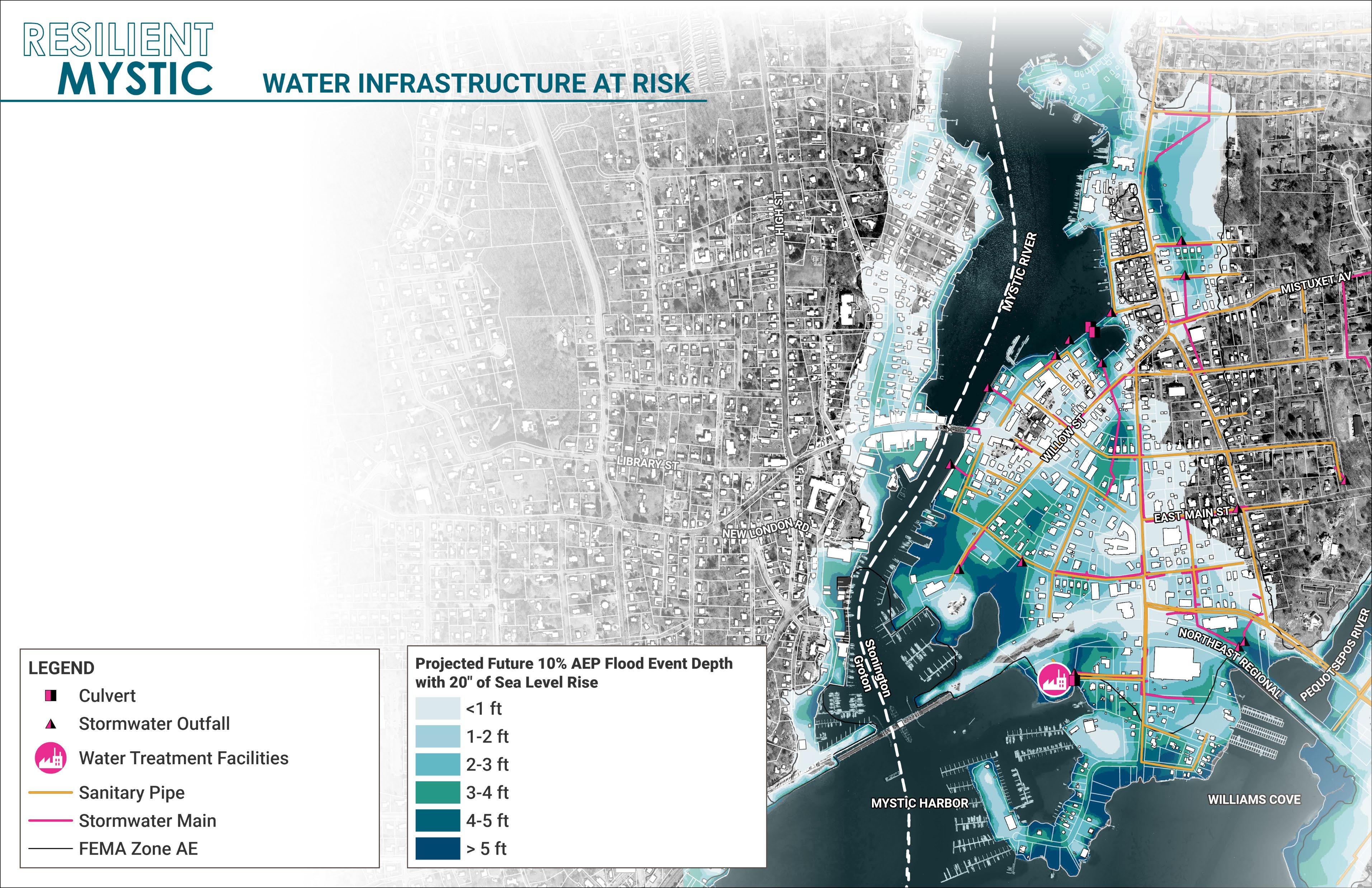
The Stonington Water Pollution Control Authority manages wastewater infrastructure within the town, while the Engineering Department maintains the stormwater drainage system and Aquarion Water Company oversees public drinking water supplies. Stormwater and wastewater are separated, with the drainage system collecting and conveying runoff to the Mystic River and Long Island Sound under the CTDEEP Municipal Separate Storm Sewer System (MS4) general permit.
Coastal storms can impact these interrelated municipal water systems in several ways. First, Mystic’s Wastewater Treatment Plant is located within a FEMA 1% flood zone at the mouth of the Mystic River. Flood events can impact wastewater treatment operations and bring ocean water through sanitary manholes and pipes, causing spikes in the volume of wastewater sent to the Wastewater Treatment Plant. This could potentially overwhelm the sanitary sewer system and treatment plant during and after a significant flood event. Second, elevated water levels from flooding prevent stormwater systems from draining to the ocean, and stormwater outfalls can sometimes act as a conduit sending water back onto urban streets from water bodies. Sea level rise can worsen this pattern, regularly infiltrating storm and sanitary sewer pipes, which further reduces system capacity.
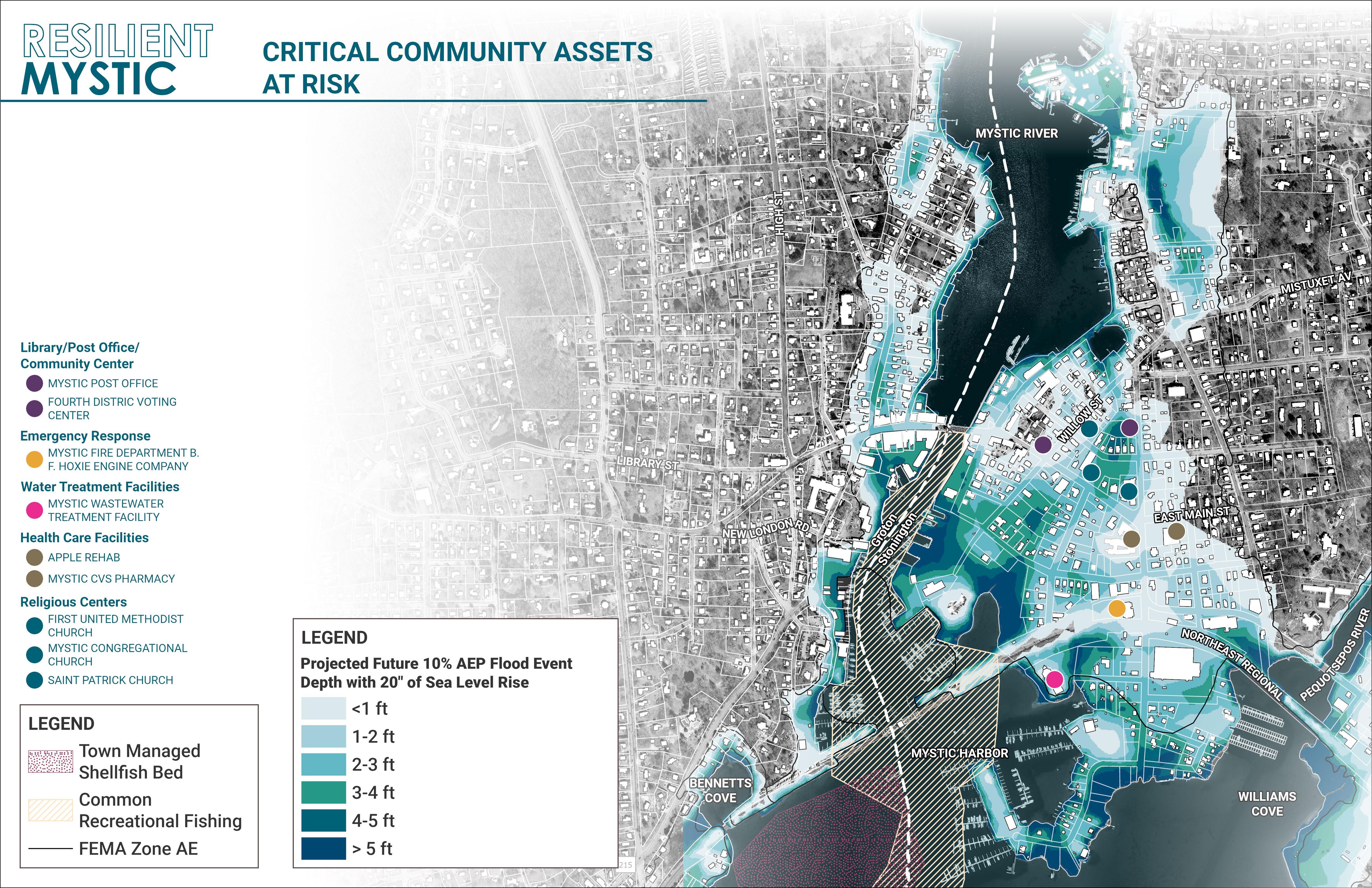
Critical community assets are public resources that improve the health or general quality of life of Mystic’s residents. In many cases, these are publicly held assets such as emergency response facilities, wastewater treatment facilities, and other institutions essential to the municipality's fabric. Ecological resources and private institutions like churches can also help anchor community identity and collective wellbeing. In Mystic, recreation and tourist assets (not mapped here) also sustain the regional economy by attracting visitors. In the future 10% AEP flood event, impassable roads may isolate these critical facilities from each other and from the public.
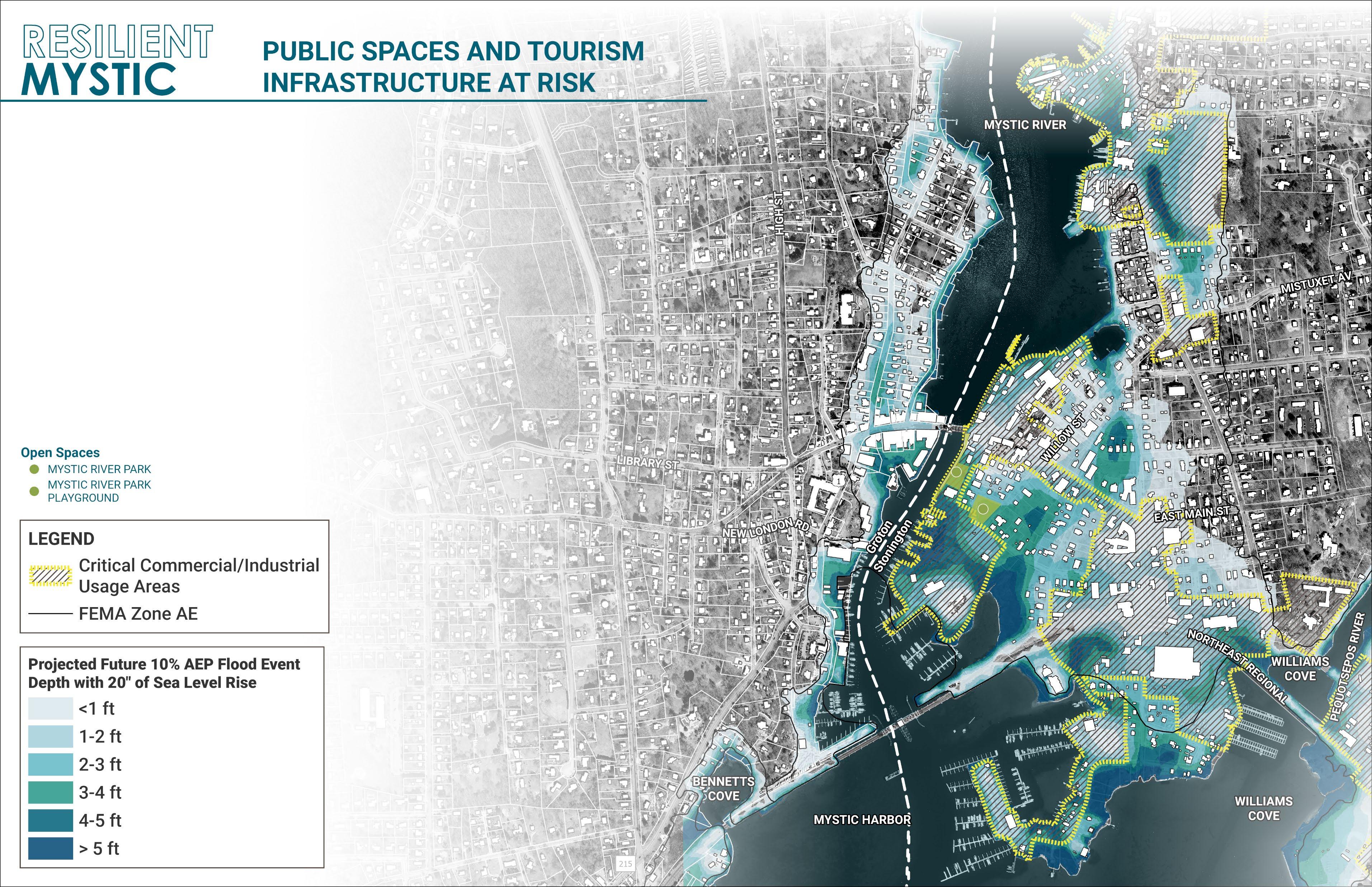
Downtown Mystic's unique character as a 19th century New England village attracts tens of thousands of tourists throughout the year, but especially in the summer season. With a pedestrian-friendly Main Street filled with boutique shops and restaurants, Mystic's businesses collectively create a foundation for a successful tourism economy. Public spaces, including Mystic River Park and Playground, as well as the flagpole square at the corner of Holmes Street and Main Street contribute to the character of Downtown and provide locations for special events, such as concerts and outdoor movies in the summer. Additionally, Cottrell Street is closed to vehicular traffic and transformed into a pedestrian-only space to accommodate larger events, including the Mystic Outdoor Art Festival held in August each year.
All buildings within the National Registry’s Historic Districts are inventoried and receive the designation of either “Contributing” or “Non-Contributing.” Non-contributing structures were generally built more recently than the district’s period of historical significance or were substantially modified such that their historical character has been lost.
Historic buildings populate a significant portion of the project area and its immediate environs, including several historic homes, churches, businesses, the Mystic Bridge itself, and the Mystic Seaport Museum which houses several additional historic landmarks, including several ships moored offshore. Historic structures can seek exemptions from FEMA NFIP requirements, which typically require buildings undergoing “substantial improvements” to conform to elevation and floodproofing standards.
These well-preserved and popular landmarks were historically situated close to the shoreline to facilitate shipbuilding, transport, and commerce. As a result, coastal flooding has the potential to seriously damage these structures or their associated resources (docks, boardwalks, storage areas). Large-scale loss of historic structures can impact the economic viability of the area to tourism and damage to historic structures may be much more costly than damage to modern ones.
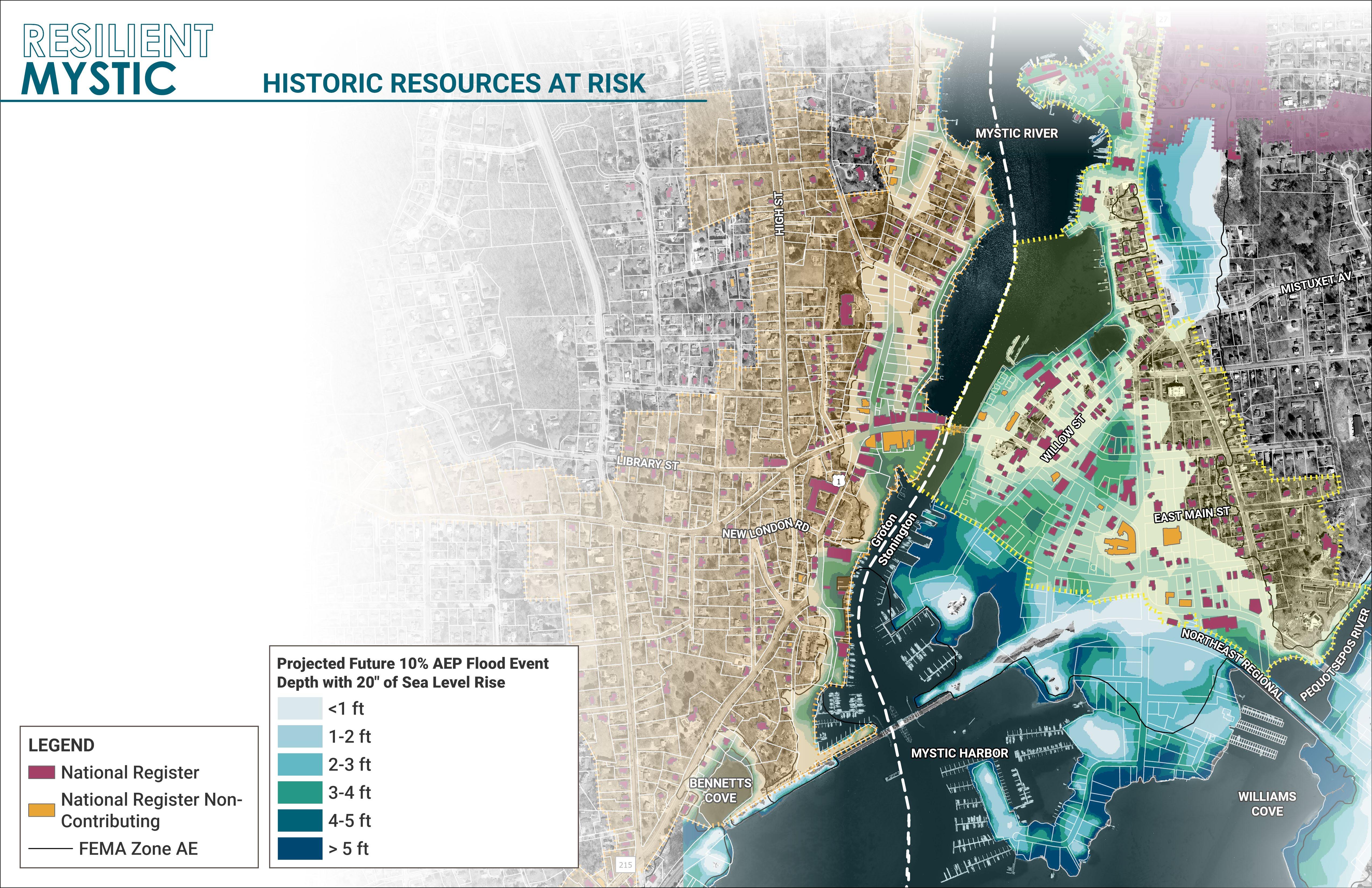
The National Register of Historic Places is the federally recognized list of historically and culturally significant locations. Both the Mystic River (Groton) and Mystic Bridge (Stonington) National Historic Districts were designated in 1979. Together, these historic districts cover an area of approximately 400 acres, making Downtown Mystic a rare U.S. example of a nearly fully preserved 19th-century village.
While the Town of Groton has protected the local character of the Mystic River Historic District in its zoning regulations to prevent exterior changes to the structures it contains, the Town of Stonington maintains an Architectural Design Review Board (ADRB), which uses its discretion to review new or significant business (re)development projects. The intention of this Review Board is to ensure that development proceeds consistent with the historic nature of nearby areas.
This 19th-century village character, which defines Mystic as a unique place, adds complexity to adaptation strategies. Maintaining Mystic's historic character will need to be balanced with the need to make changes to structures and the landscape to address flooding risk.
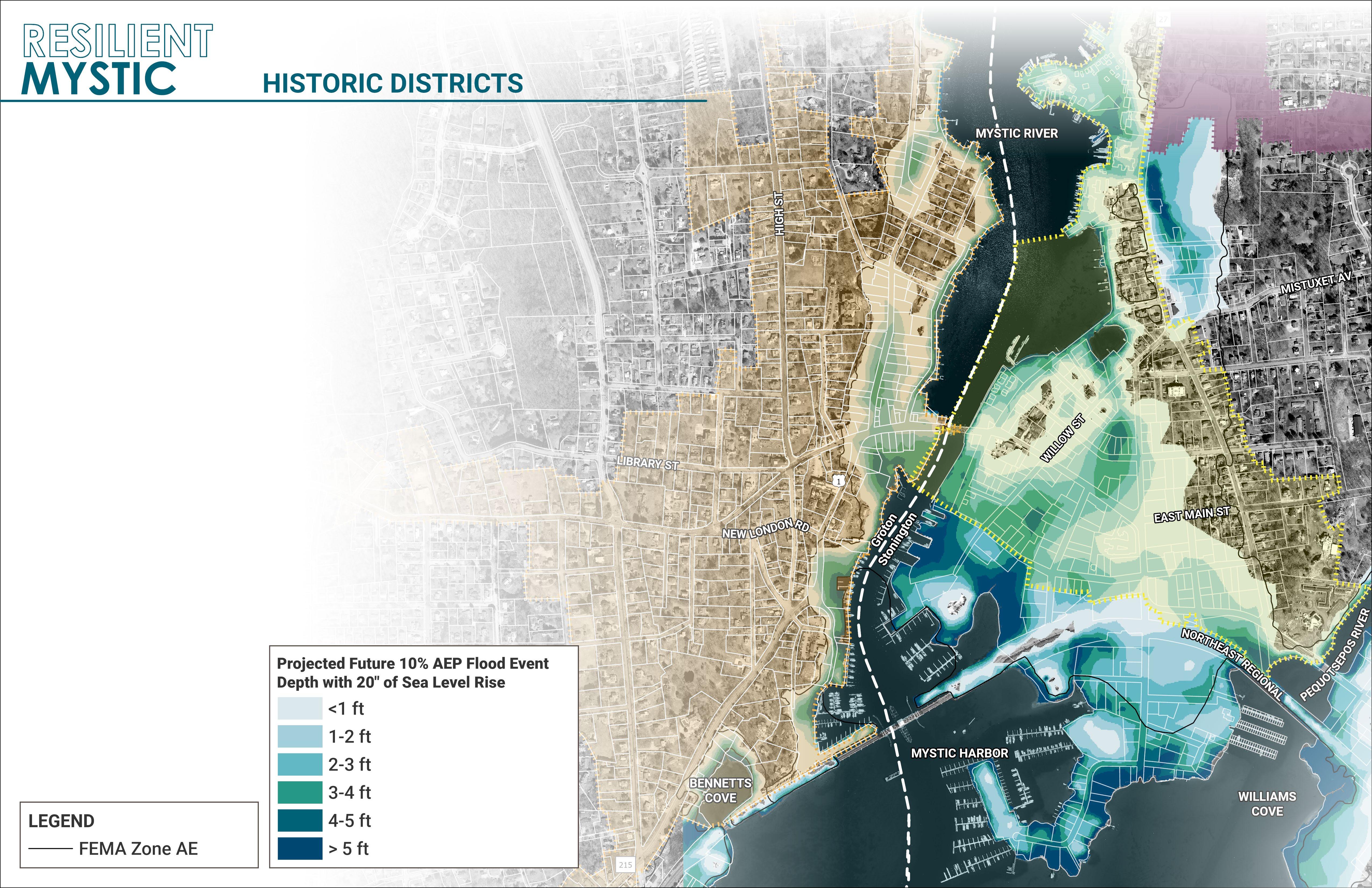
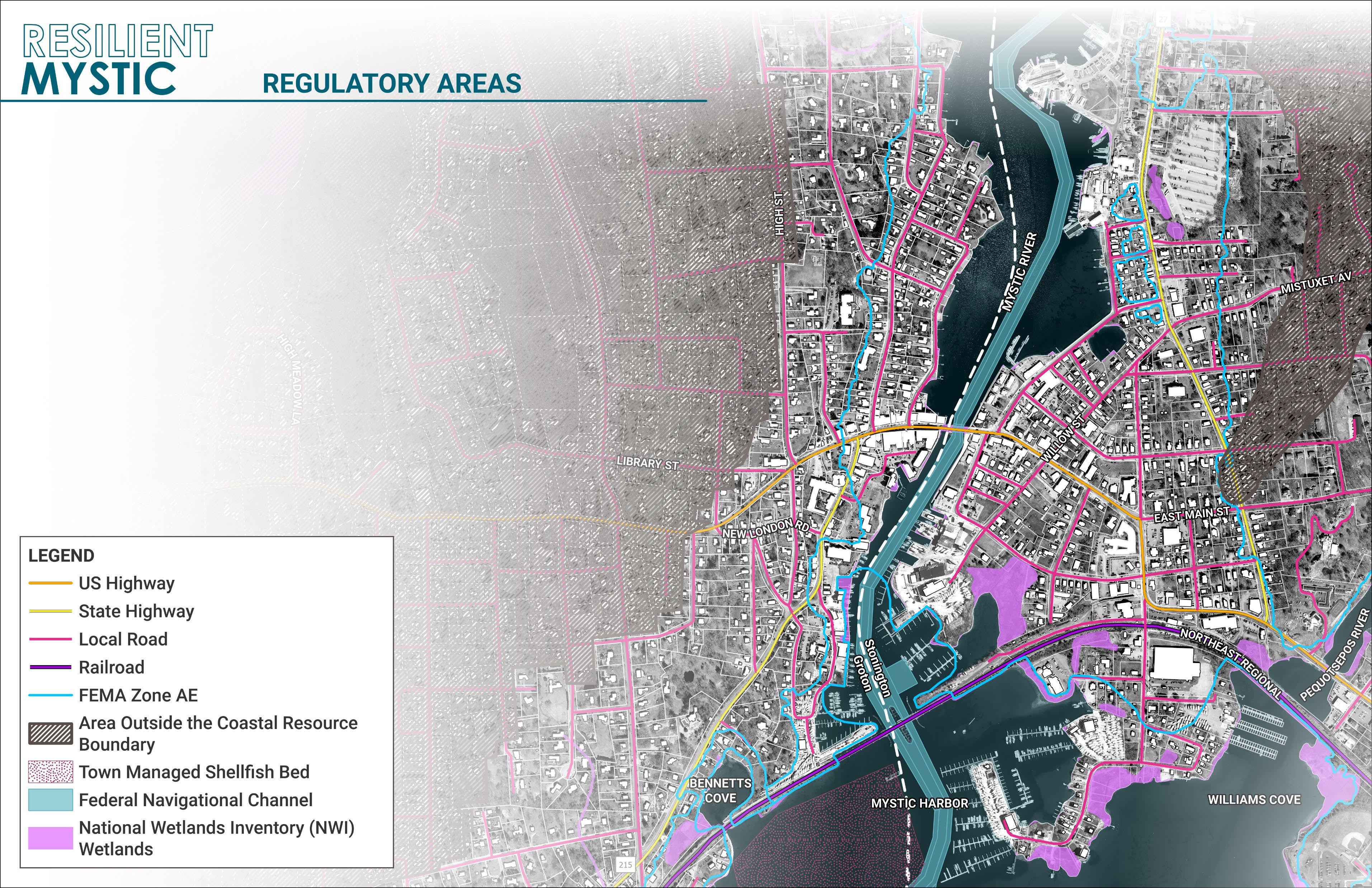
‘Regulatory Areas’ are locations where public entities restrict certain areas for specific purposes, such as navigation or conservation. These restrictions offer valuable information about the placement and nature of potential climate adaptation measures proposed in Downtown Mystic. Climate resilience projects with implications for state roads, for example, must be undertaken in collaboration with the Connecticut Department of Transportation, while green infrastructure measures that extend out into the Mystic Harbor must contend with regulatory barriers that prohibit development within a certain distance of the federal navigational channel. The project team used this information to guide the development of climate adaptation strategies for Downtown Mystic.
Community-driven conversations guided adaptation concepts for Resilient Mystic, with the project team identifying key stakeholders, conducting targeted outreach, and integrating community input directly into recommendations. Through a strategic combination of outreach methods and timelines, this iterative design process refined the adaptation concept ideas over the course of weeks and months from Fall 2024 to Spring 2025. Major community outreach efforts consisted of regular check-ins with the Citizen and Technical Advisory Committee (CTAC), tabling at public events, a three-day series of public workshops, and supplemental online materials as detailed below:
• The Citizen and Technical Advisory Committee held regular check-ins throughout the project and was comprised of Town Board and Task Force representatives, community members, political representatives, and leaders of local organizations. The group convened twice in the fall of 2024 to discuss project goals, review progress on coastal climate risk analysis, and establish focus areas. The CTAC met again throughout the Community Design Workshop and reconvened in April 2025 to review revised adaptation concepts.
• The project team hosted local “roadshow” tabling events in November 2024 and January 2025 to boost public awareness of the Community Design Workshop and solicit community input on asset mapping and preferred adaptation outcomes.
• A three-day in-person Community Design Workshop was hosted February 23-26, 2025. A set of online materials was also offered to complement these in-person events.
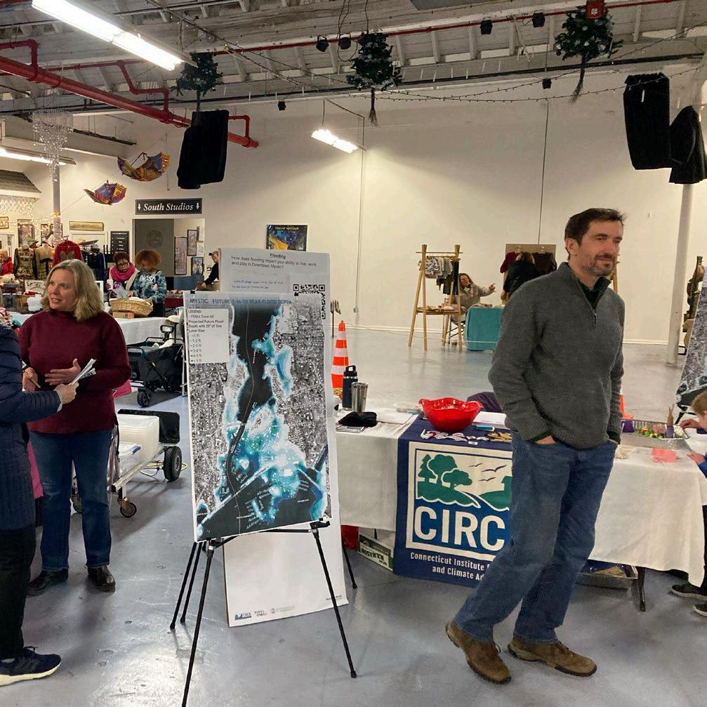
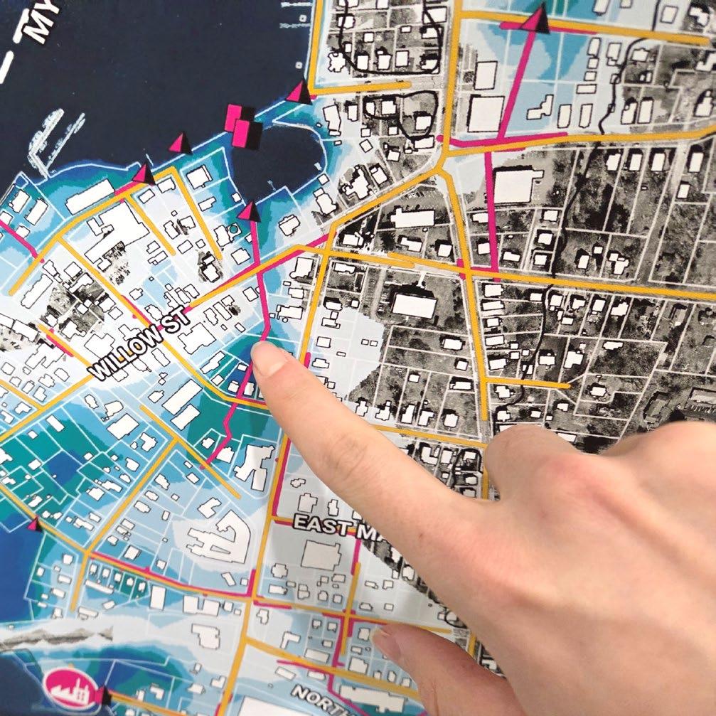
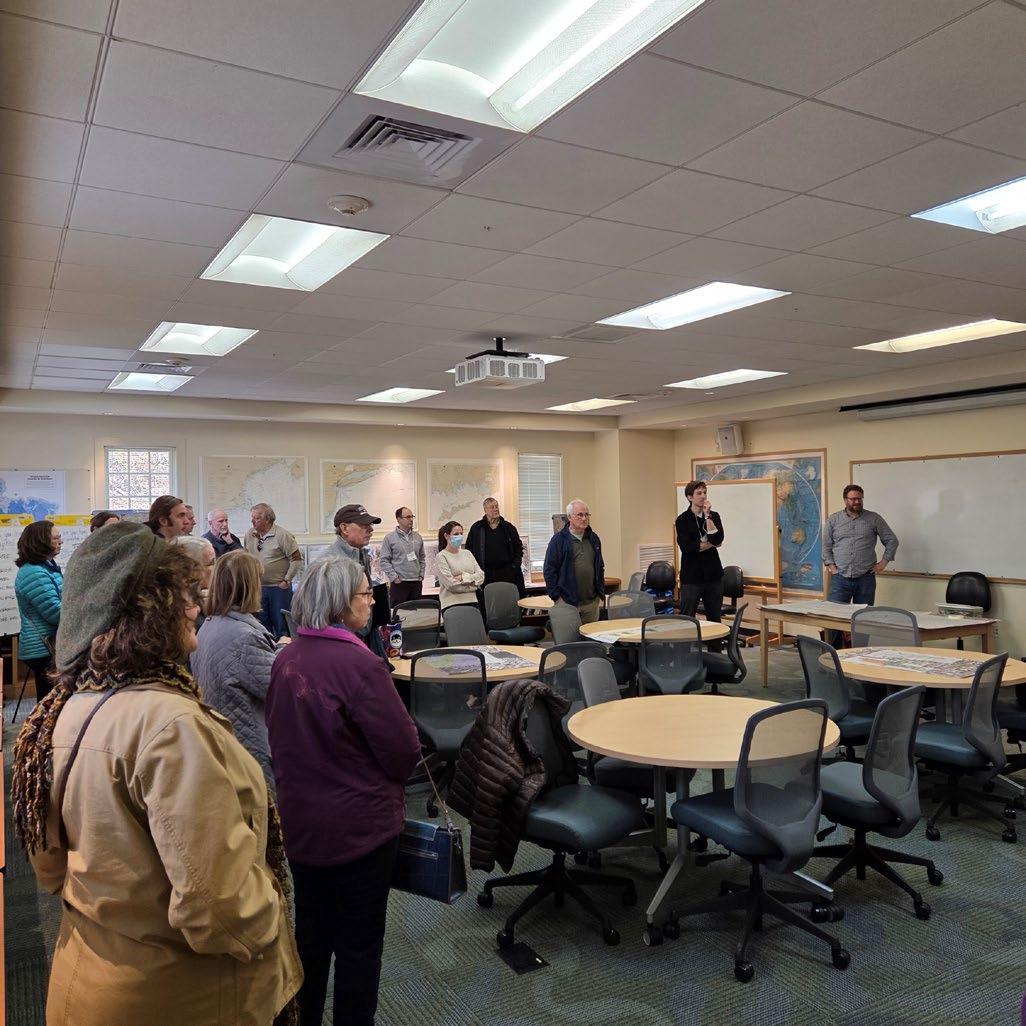
The support of the CTAC has been critical in guiding the direction and delivery of Resilient Mystic, representing a cross-section of local community and civic leaders. The CTAC came together numerous times before, during, and after the Community Design Workshop to offer feedback, distribute materials such as community surveys, and share major project updates.
Danielle Chesebrough First Selectwoman, Town of Stonington
Deborah Downie Selectwoman, Town of Stonington
Clifton Iler Town of Stonington
Molly Evak Town of Stonington
Shannon McKenzie Mystic Seaport Museum
Megan Granato Town of Groton
Maggie Favretti Alliance for the Mystic River Watershed
Tim Clark TNC representative, Southeastern Connecticut
Helen Zincavage SECCOG
Kim Hargrave Denison Pequotsepos Nature Center
Dennis Main Avalonia Land Trust
Tobias Glaza Old Mystic History Center
Raheim Eleazer Mashantucket Pequot Tribal Nation
Brenda Geer Eastern Pequot Nation
Rick Newton Stonington Climate Change Task Force
David Rathbun Stonington Flood Prevention, Climate Resilience, and Erosion Control Board
Dennis Unites Stonington Flood Prevention, Climate Resilience, and Erosion Control Board
Robert Mohr Stonington Flood Prevention, Climate Resilience, and Erosion Control Board
Christopher Houlihan Stonington Flood Prevention, Climate Resilience, and Erosion Control Board
Kathryn Burchenal Stonington Flood Prevention, Climate Resilience, and Erosion Control Board
Nathan Phelps Stonington Flood Prevention, Climate Resilience, and Erosion Control Board
Eric Garofano Stonington Flood Prevention, Climate Resilience, and Erosion Control Board
Howard Reichart Stonington Inland Wetlands & Water Courses Commission
Lou Allyn Mystic Harbor Management Commission
Chuck Sheehan Town of Stonington
Dan Smith Stonington Water Pollution Control Authority
Julia Leeming Julia Leeming Architect
Dominic Celtruda Mystic Fire District Executive Committee Member
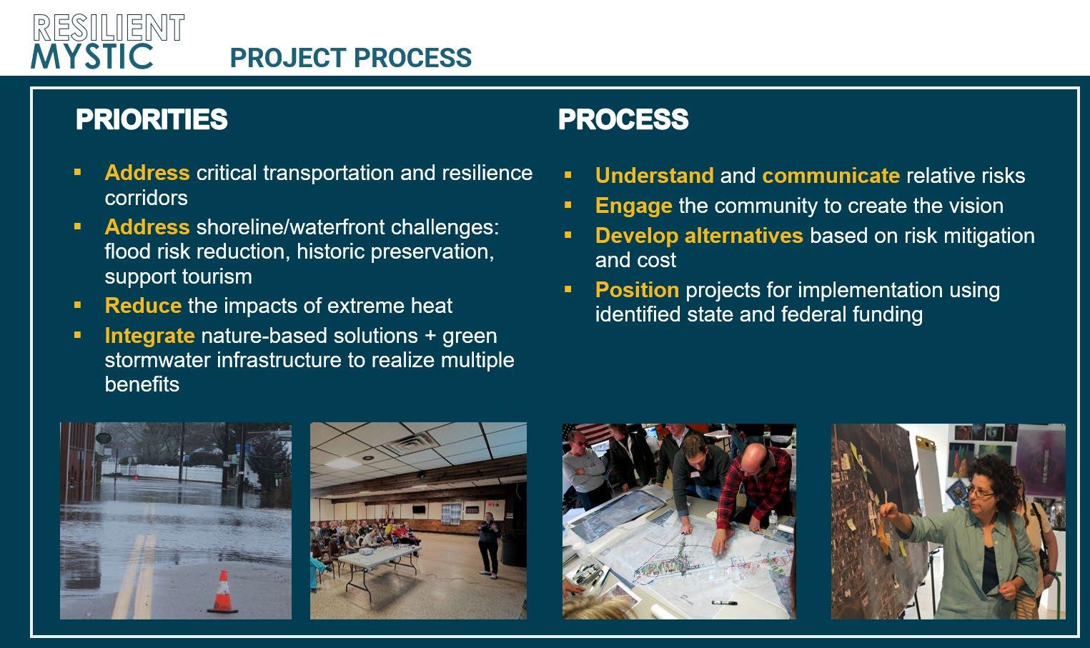
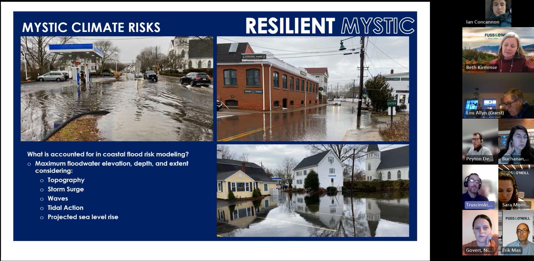
The Town of Stonington has showcased its commitment to proactive climate planning by organizing a municipal Task Force and Board dedicated to advancing responses to local flooding and climate change issues. In addition, Stonington Town Selectpersons have championed local environmental causes throughout their tenures. The project team met with these local government representatives from Summer 2024 onward to coordinate this project with other ongoing initiatives and priorities for the Town.
A list of Town Selectpersons, members of the Flood Prevention Board, and members of the Climate Change Task Force is provided below. By design, many of these representatives also appeared as members of the CTAC, providing additional opportunities to shape project plans in different roles on the Resilient Mystic project.
Town of Stonington Project Representatives
Danielle Chesebrough First Selectwoman
Deborah Downie Selectwoman
Ben Tamsky Selectman
Clifton Iler Town Planner
Climate Change Task Force
Rick Newton
MaryEllen Mateleska
Dennis Unites
Susan Hibbard
Lyndsey Pyrke-Fairchild
Julia Parry
Sharon Lynch
Michael Serra
Jane Dawson
Chris Johnson
Flood Prevention, Climate Resilience, and Erosion Control Board
David Rathbun
Dennis Unites
Robert Mohr
Christopher Houlihan
Kathryn Burchenal
Nathan Phelps
Robert Ulrich
Eric Garofano (Alternate)
Several stakeholder focus groups were held the week prior to the Community Design Workshop to align understandings of local climate vulnerabilities and solicit input on the upcoming in-person outreach events in Downtown Mystic. Digital focus group meetings held prior to the in-person workshop included those with:
In this meeting, the project team shared intentions for the upcoming three-day Community Design Workshop as well as defining flood and heat risk as they manifest within the project area. The group also reviewed strategies to invite further public engagement and share key takeaways following the conclusion of the workshop.
Officials acknowledged flooding risk to the Wastewater Treatment Plant and the Apple Rehab facility. The group reviewed relocation options, evacuation routines, and Standard Operations Procedures for critical facilities and essential roadways.
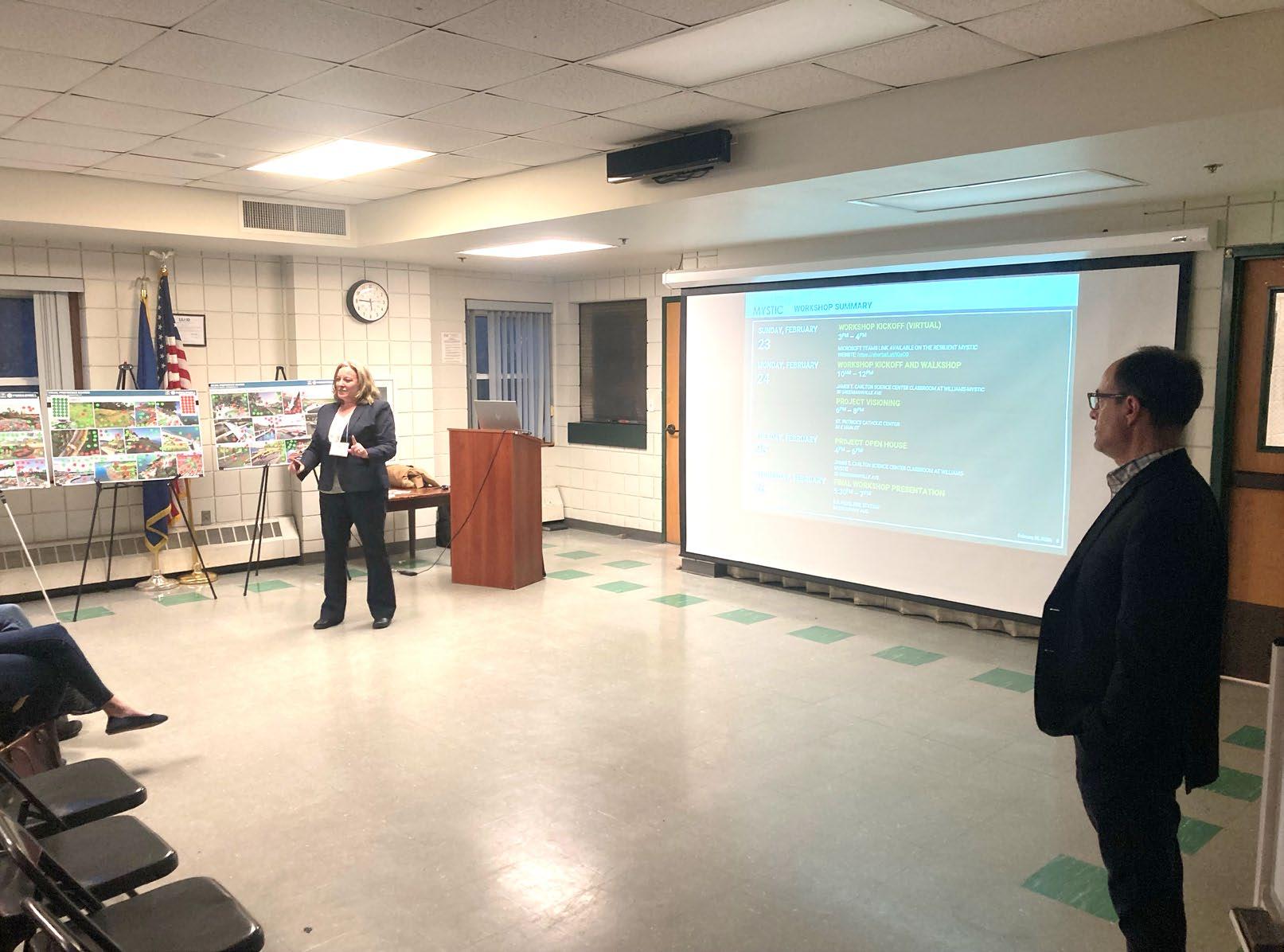
To ensure the workshop content was accessible to those who could not attend the full Community Design Workshop during the work week, the project team hosted a pre-workshop kickoff presentation describing the anticipated workshop schedule, summarizing the project goals and timeline, reviewing current and future climate risks, and introducing the coastal flood mitigation toolkit.
A recording of the presentation is available on the Resilient Mystic website: https://shorturl.at/SZ7XN
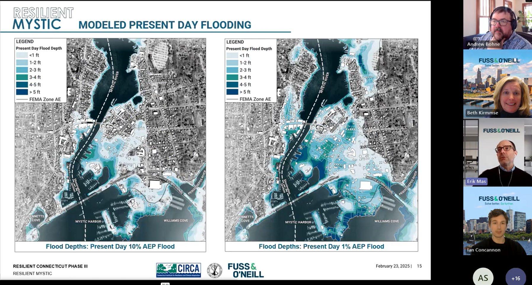
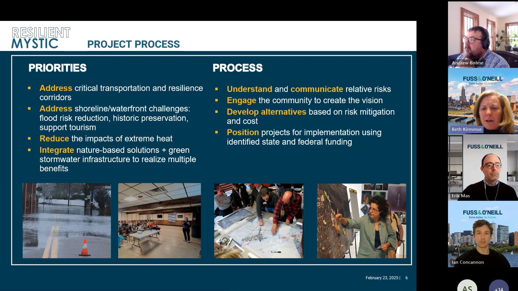
The Community Design Workshop kicked off with a presentation summarizing current and future climate risks in Downtown Mystic assessed by the project team, along with community resources at risk due to climate change and case studies of successful coastal climate adaptation in urban areas.
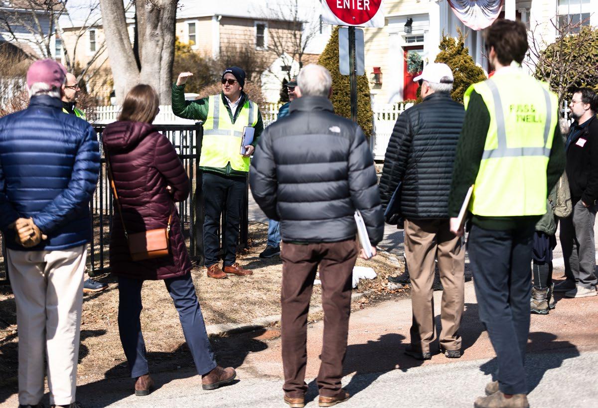
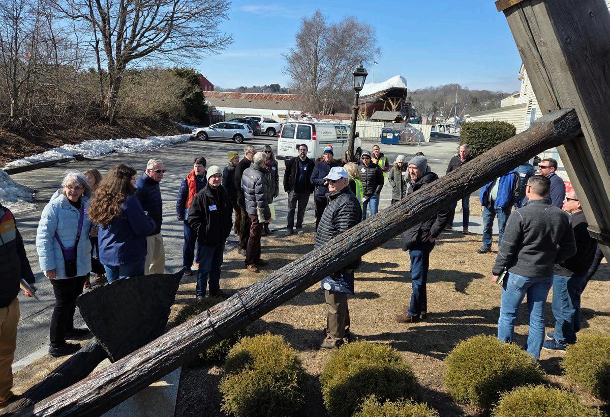
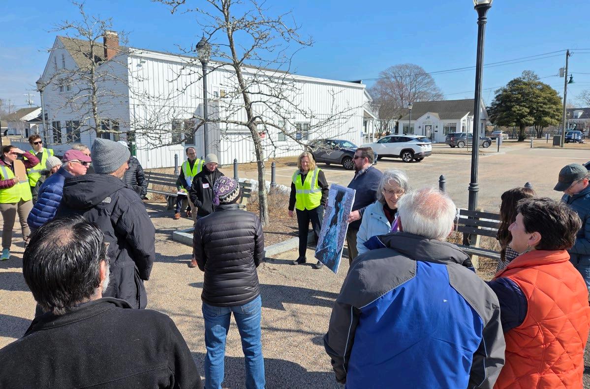
Following the workshop, community members embarked on a walking tour of Downtown Mystic. The group discussed possibilities for streetscape changes, well-known locations of flood vulnerability, and the intersection of climate resilience and historic resources, among other topics.
The project team engaged with leaders of local faith communities to discuss shared climate risks and opportunities in Downtown Mystic. These conversations explored how houses of worship could enhance their structural resilience against extreme weather events while potentially serving as community resource hubs during climate emergencies.
The project team consulted with key municipal officials, including the Department of Public Works, Town Planner, Grant Coordinator, First Selectperson, And Town Engineer.
Discussions centered on potential funding sources for favored adaptation options, as well as land ownership and access issues at vulnerable locations. While Town of Stonington employees expressed openness to strategic retreat from especially risky areas, they anticipated potential challenges in coordinating these efforts with potentially larger numbers of private property owners. Business Owners
Individual business owners met with the project team throughout the workshop to discuss options for envisioning changes to the community that would allow Mystic to persist.
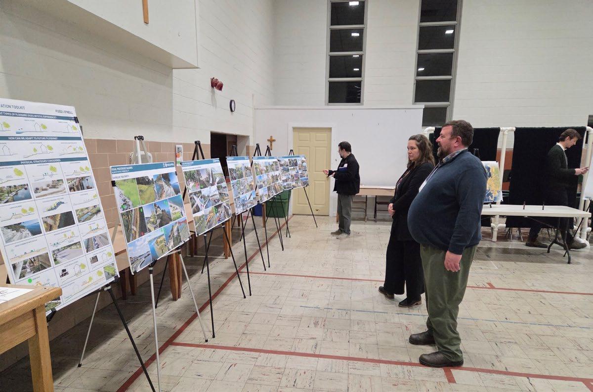
This session continued the dialogue begun in the morning kickoff, inviting community attendees to vote on their preferred vision for climate resilience in Downtown Mystic using preference boards that included adaptation alternatives including floodable green space, waterfront access, and living shoreline treatments.
This meeting focused on the possibility of Routes 1 and 27 serving as elevated resilient corridors for evacuation, resilient utilities, and coinciding structural elevations. Additionally, the Board discussed the various focus area zones that had begun to emerge in conversations over the previous days.
The team conducted a special outreach session with representatives of the Stonington WPCA to learn about existing and potential plans to mitigate the risks posed by flooding at the Wastewater Treatment Plant on Murphy Point.
Local tourism and environmental education institutions came together to discuss climate change risks, share institutional plans, and identify priority actions, with the goal of building stakeholder commitment, and inform community resilience planning.
The CTAC convened multiple times to recap emerging workshop themes and outline potential resilience districts and corridors in Downtown Mystic.
On February 25, 2025, the project team attended the Youth Climate Summit at the Mashantucket Pequot Museum & Research Center to engage youth surrounding the project area to hear what resilience measures they would hope to see in the project area, with Resilient Mystic relevant to the summit’s theme of ‘Living Sustainably’.
Project team members met with Williams-Mystic students and faculty to discuss how their work intersected within the field of coastal environmental policy and planning.
At this informal drop-in session, visitors approached project members to ask questions and co-develop climate adaptation concepts and design ideas.
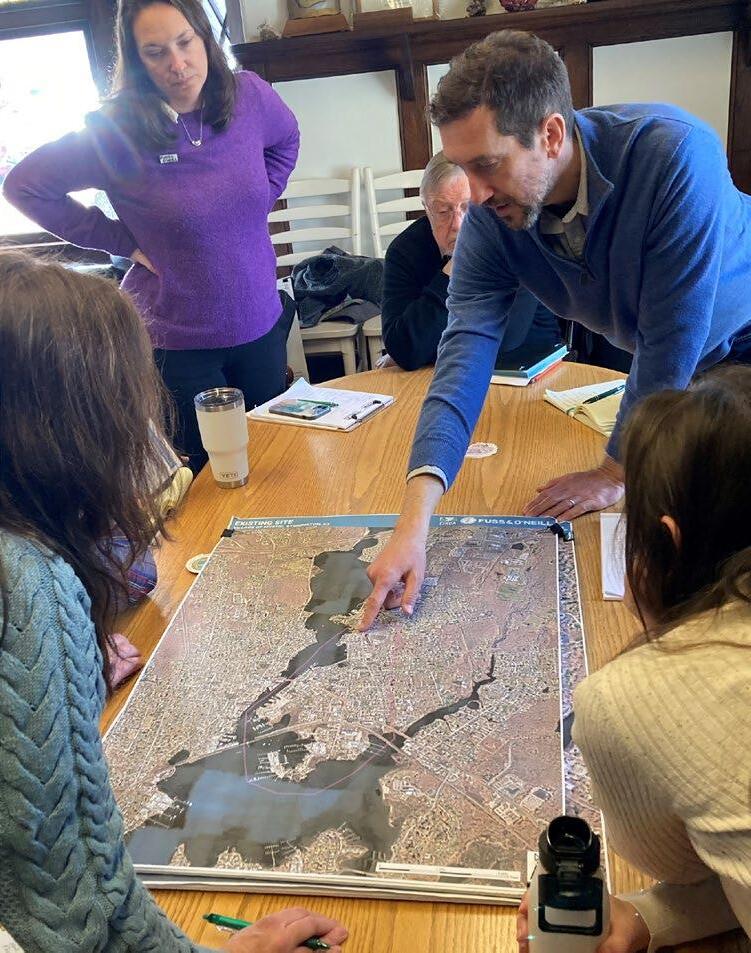
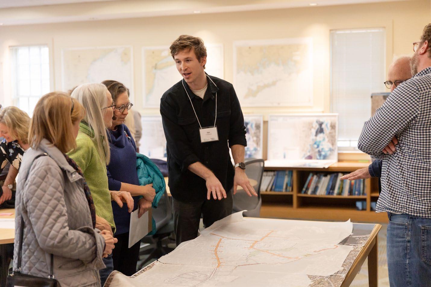
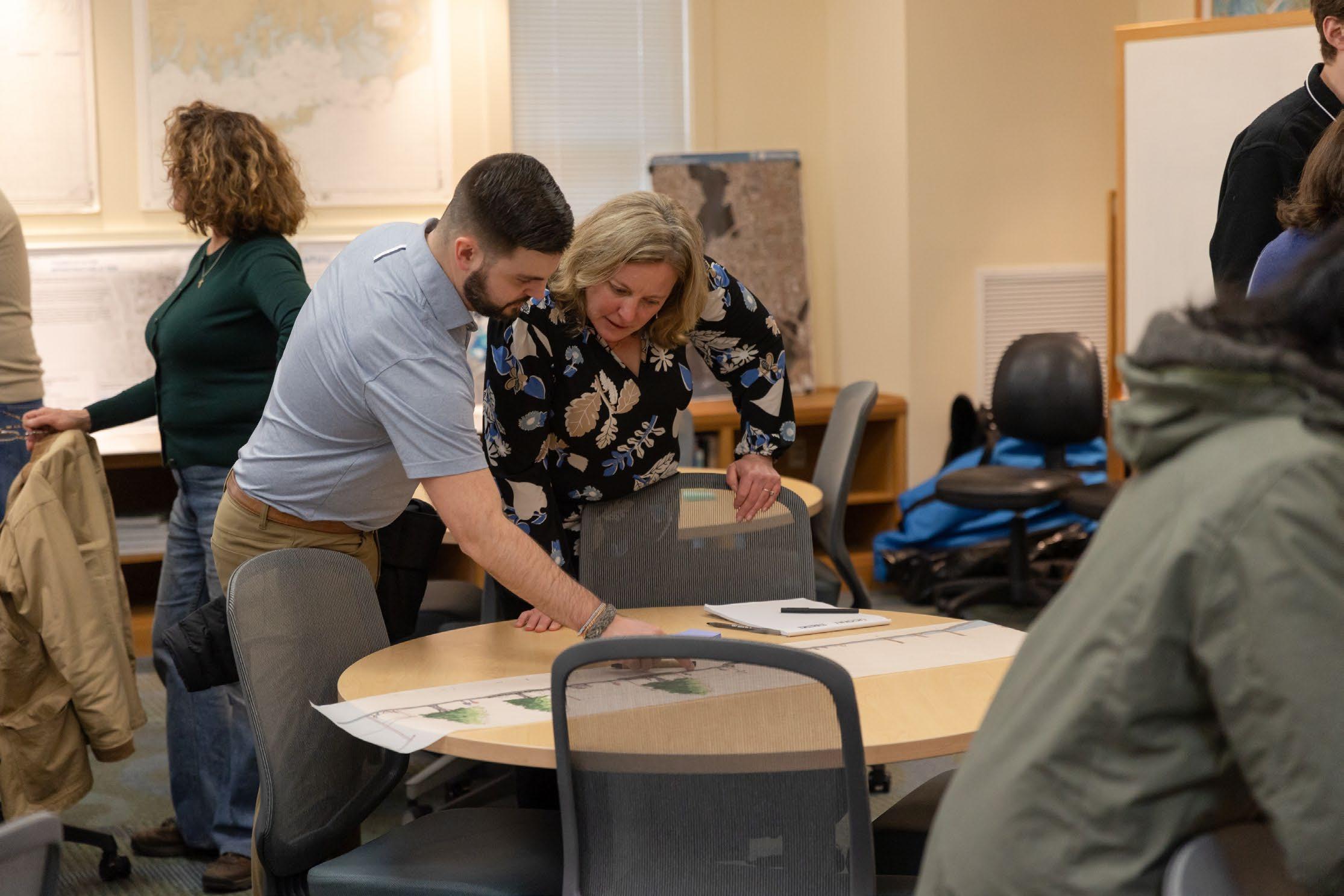
The February 26 final workshop presentation summarized the ground covered over the previous three days while elaborating on the climate adaptation concepts in key ‘Focus Areas,’ with a particular emphasis on resilient transportation corridors, repurposing open space for flood resilience, shoreline redesign, and strategies to open the conversation around building acquisition or relocation in especially flood-prone areas.
Together, these related, overlapping climate adaptation concepts covered the majority of Downtown Mystic, addressing current and future land uses, business needs, ecological health, and climate conditions. These early ideas helped pave the way for the eventual recommendations presented in the Adaptation Concepts section of this report.
In-person workshops were supplemented with online materials, where workshop attendees were invited to submit photos of flood observations along with community preferences in areas of Downtown Mystic. This information proved invaluable in determining what changes to consider within the project area in response to coastal flooding and sea level rise.
The website URL and related links can be found here: https://shorturl.at/KIeO0
A range of approaches were evaluated to address present-day and future coastal flood risk in Downtown Mystic, including:
• Best practices for the Town of Stonington to identify drainage issues, perform community outreach, and guide property owners in reducing the flood vulnerability of buildings across the project area
• Large-scale flood barrier (flood walls and berms) to protect against flooding from the shoreline
• Targeted waterfront and shoreline measures to reduce flood risk, attenuate wave action, and reduce coastal erosion (nature-based solutions, living shorelines, elevated bulkheads, etc.)
• Wet and dry floodproofing of buildings
• Elevation of roads (resilient corridors), buildings, and critical systems above the Design Flood Elevation
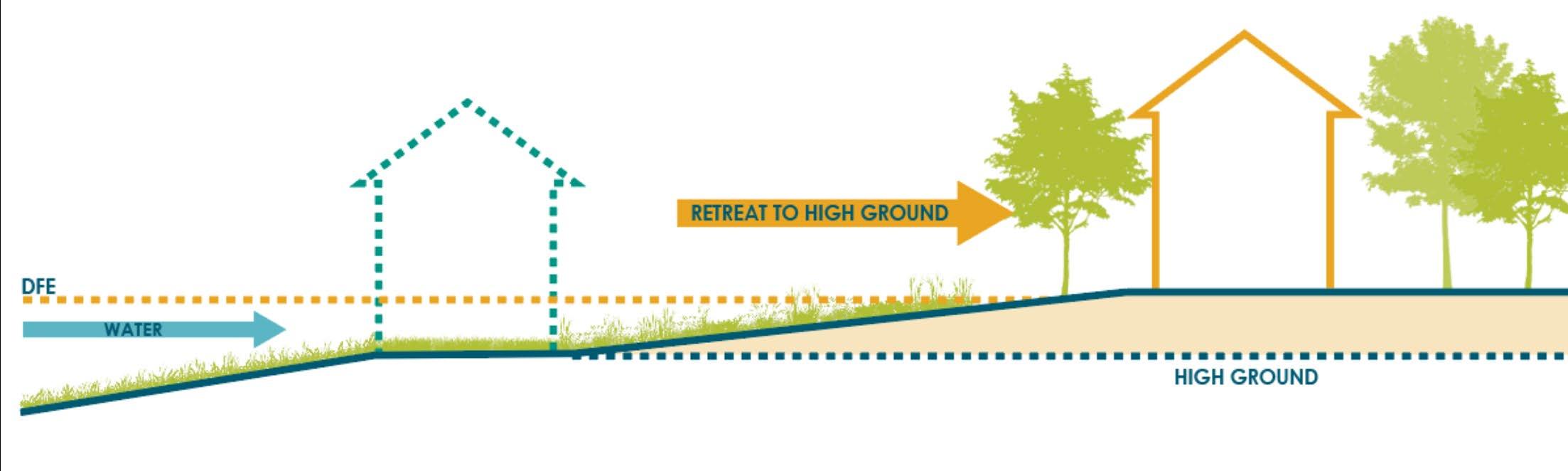
• Strategic acquisition and relocation of buildings to higher ground
• Redundant or alternate emergency routes
• Green stormwater infrastructure to reduce stormwater runoff from impervious surfaces, absorb floodwaters, and reduce heat island effect
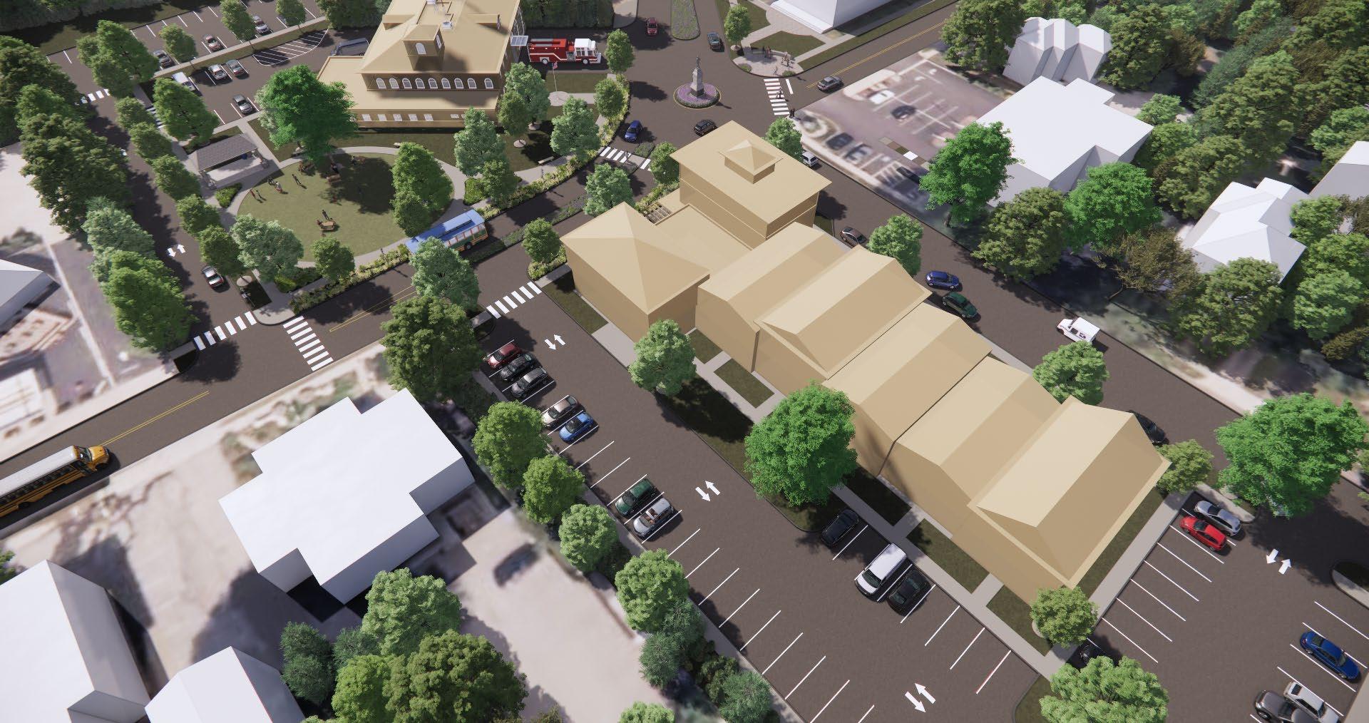
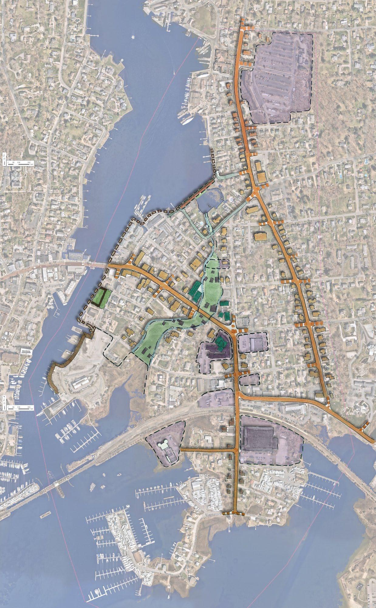
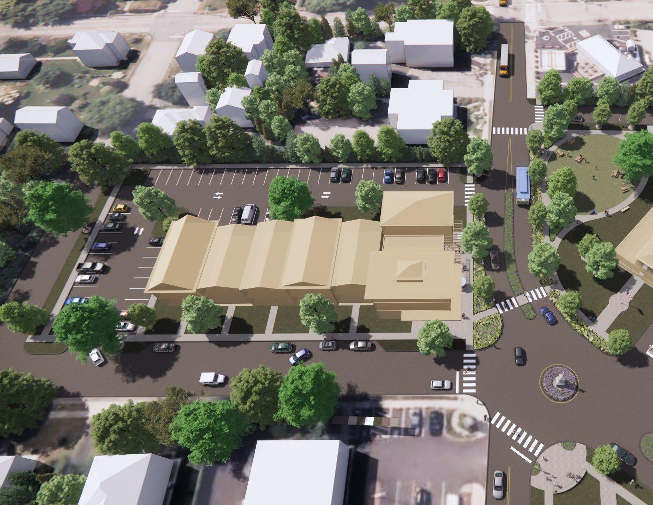
The results of the current and future conditions analysis and community engagement process helped inform an overall vision for Downtown Mystic that adapts to living with the water. Centered around the concept of Route 1 elevated above the coastal floodplain from the Bascule Bridge to the road’s intersection with Route 27, the plan recognizes that while coastal flooding cannot be fully stopped, Mystic still has options for how the water is managed. This Route 1 Resilient Corridor would serve a dual purpose both as an evacuation route during coastal storm events and as a location for forward-looking development, including a dense, multiuse streetscape that preserves the historic character and economic vitality of Mystic.
Surrounding the Resilient Corridor, critical facilities will have been elevated or floodproofed to remain serviceable, while vulnerable built structures will have been removed or relocated to create a swath of public recreational space winding north from Washington Street to Holmes Street. This area would provide an exemplary model of Managed Relocation, assisting property owners with the transition of this land into the public trust overseeing its use as recreational space and flood storage. Along with these proposed changes to the interior of Downtown Mystic, the plan explores possible ways by which the shoreline could be adapted to mitigate flooding up to a 10% AEP storm with 20" of sea level rise an approach that would temper the degree to which the interior of Downtown Mystic would need to change to accommodate the sea.
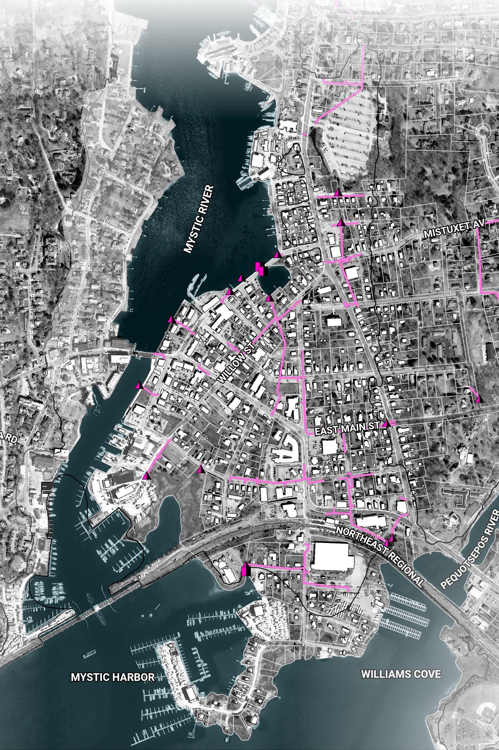
The first section of this chapter focuses on general best practices recommended for the Town of Stonington to undertake across the project area, which support the enactment of more detailed concepts at identified locations. The second section of this chapter focuses on these more detailed location-specific concepts, which are also numbered for reference in the figure at right.
LOCATION-SPECIFIC CONCEPTS
To prepare for the inevitability of rising waters, Stonington might consider adopting district-wide resilient zoning and building design standards. For example, the zoning regulations might be adjusted to permit a full range of mitigation strategies for individual properties. Height restrictions that restrict properties from elevating structures above flood levels should be revised. The Town should consider adopting specific guidance for the treatment of historic structures to enable elevation and/or relocation as a way to retain the historic vernacular. Additionally, Stonington will need to evaluate the existing stormwater system holistically across the entirety of Downtown.
Given the complexity of different building types across the project area, it is more effective to consider the range of concepts that may apply in different circumstances across the entire district instead of putting forth specific recommendations on a site-bysite basis. The diagrams on this page summarize a range of possible strategies to reduce structural damages from coastal flooding. While some of these strategies are generally recommended according to building type and location, the ultimate decision on which approach to take rests on site-specific constraints and feasibility. For example, it may be impractical for many commercial-industrial buildings to elevate given their size, while the threshold of risk tolerance in residential buildings is much lower. A decision-making tool on how best to select from among these strategies is presented on the following page.
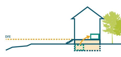
This strategy can be combined with structural elevation on piles, which removes living space from the floodplain. Relocating critical systems to higher floors within structures reduces the impacts of flooding on critical services and reduces recovery times. This tool increases the resilience of essential services in homes and businesses.
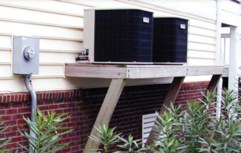
Wet floodproofing allows water to enter and pass through a structure. The structure must be anchored, utilities must be elevated or enclosed in waterproof structures, and the structural material must be able to withstand inundation. Sealing higher levels to infiltration and installing flood vents allows for flood water to move into and through lower levels while limiting infiltration in the rest of the structure. FEMA requires wet floodproofing for residential structures in Special Flood Hazard Areas like Downtown Mystic.
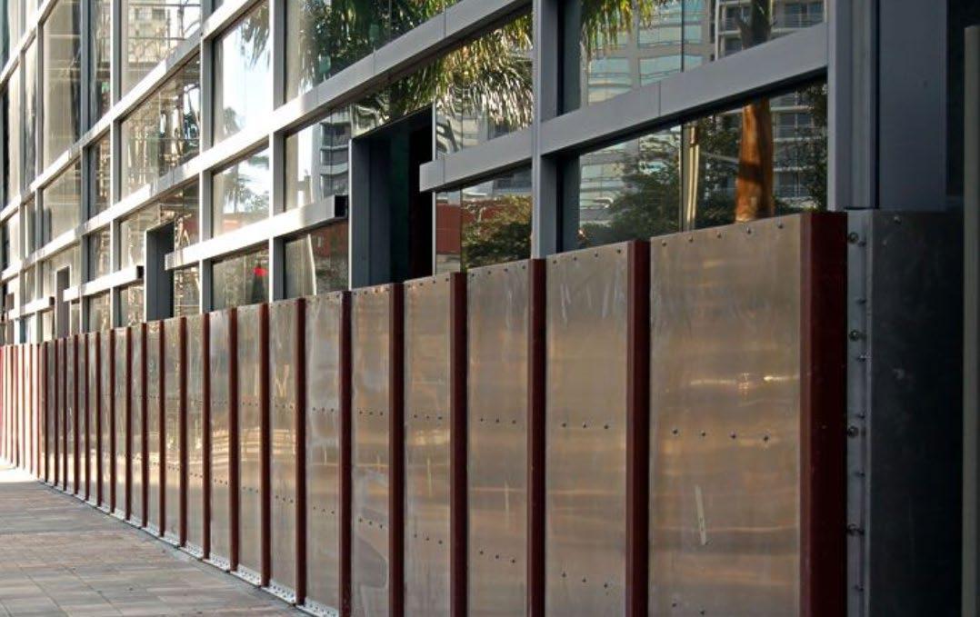
Dry floodproofing involves fully blocking out floodwaters with both permanent and deployable components. Structures must be constructed with the integrity to withstand hydrostatic pressures from floodwaters and the exterior of the building must be sealed with waterproofing membranes. All thresholds below the Base Flood Elevation (BFE) must be sealed with watertight shields. Backflow preventors must be installed in floor drains, sewer lines and all conduits that penetrate the foundation. Sump pumps should be used to manage any seepage. As in wet floodproofing, utilities should be elevated or housed in a waterproof enclosure. All floodproofing measures should be regularly inspected and maintained.
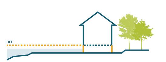
Strategic acquisition and relocation is the voluntary acquisition of parcels to reduce long-term flood damage and implement targeted flood protection projects at key flood pathway locations. This strategy can be selectively considered where perimeter protection or adaptation are too costly, detract from other essential aspects of resilience, or where the property owner does not wish to sustain continued losses from flood damage or bear the costs of mitigation measures.
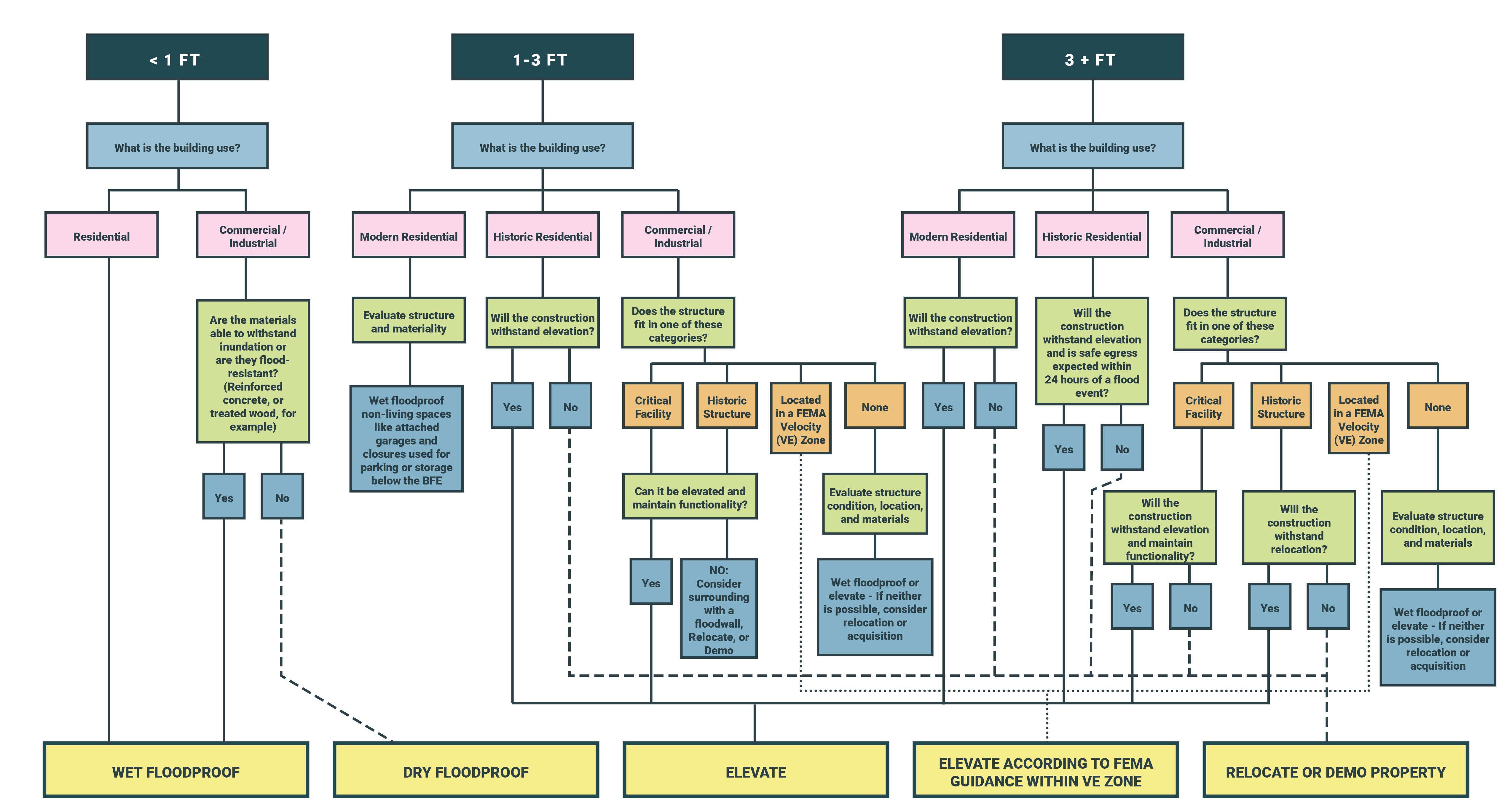
This flow chart presents a framework for selecting an adaptation strategy for buildings in Downtown Mystic. This tool weighs exposure to a potential flood event, along with the nature and purpose of the structure, to derive recommendations to floodproof, elevate, or relocate assets away from the water. Special considerations include the structure’s exposure to powerful coastal waves of three feet or more (i.e., falling within the FEMA VE Zone), location within a Historic District, and designation as a critical facility (locations deemed critical to the continuity of the community before, during, and after a natural disaster). While this decision matrix provides an effective place to begin a review of buildings within the project area, the preferred adaptation strategy ultimately rests on individual property owners’ preferences in addition to site-specific considerations such as number of stories, onsite utility type and location, presence of openings such as doors or windows, and structure age and material. See Appendix B for details specific to elevating structures.
Comprehensive and effective local regulations provide the foundation upon which other resilience measures can be built, making it vital that the zoning framework be consistent with the goal of supporting an elevated corridor. The process of updating the Stonington zoning regulations is already underway by the Town Planning Board, who have compiled a set of recommendations for public feedback. While the final set of zoning updates may change, many of the proposed policies would help focus development in Mystic towards appropriate forms and locations given the threat of sea level rise and climate change.
In general, the following zoning recommendations are proposed:
1. Ensure that planned zoning updates are compatible with plans for the establishment of the Resilient Corridor and associated actions. For example, updated parking requirements should not preempt the possibility of infill development along Main Street.
2. The definition of “sending” and “receiving” zones as used in Transfer of Development Rights policies should align with the Climate-Informed Science Approach identified in this report.
3. Using the Flow Chart depicted on the previous page, establish a Coastal Resilience Overlay District to incorporate more stringent design requirements for structures expected to be impacted by three feet or more of future flooding.
4. Establish a Village District within the mixed-use Resilient Corridor that incorporates an Architectural Review of new development in keeping with historic scale and character.
5. Provide greater flexibility in regulations related to Open Space Development to increase the variety and density of housing stock.
6. Expand the extent and definition of the mixed-use zone along the Route 1 and eventually, along Denison Avenue.
7. Establish a Resilience Improvement District as defined by the limits of the FEMA 1% AEP flood extent to finance capital projects addressing climate change mitigation or resilience. If desired, this district can be erected jointly with the Town of Groton.
Buildings that are designated as a historic resource are subject to certain restrictions on the actions that can be taken to reduce their vulnerability to climate hazards. Climate change is shaping new approaches to historic preservation, forcing communities to find ways to alter buildings’ elevations, locations, or materials without compromising what makes them such valuable community assets. Based on the factors considered in the flowchart presented on page 52 and CIRCA’s 2019 Resilient Historic Resources: Best Practices for Planners guidance document, the Town of Stonington should consider pursuing the following recommendations to enable the protection of its historic district and contributing structures:
Develop and maintain a database of properties listed or eligible for the State Register of Historic Places (SRHP) or National Register of Historic Places. Designate a Town staff member to maintain detailed records on the properties before, during, and after a disaster.
Conduct early consultation with the State Historic Preservation Office (SHPO) to discuss which historic resources are at risk and to what extent they could potentially be impacted. Coordinate with SHPO and the Stonington Historical Society on outreach to property owners, informing them of the threats facing their properties as well as potential solutions and funding opportunities.
Through collaboration with SHPO and the Stonington Historical Society, develop a list of example adaptive solutions that reduce vulnerability (i.e., elevation and floodproofing) while maintaining the historic character of the structure.
Early coordination with SHPO is highly encouraged to ensure the best collaborative solution possible. In addition to applicable permits listed in Appendix D, SHPO review under Section 106 of the National Historic Preservation Act (NHPA) is required for all proposed projects involving federal funding, licensing, permitting, or federal land management. SHPO review is also required for projects when there is state involvement, as SHPO is a mandated review agency in the Connecticut Environmental Policy Act review process. SHPO reviews applications for preservation and rehabilitation work on a case-by-case basis in compliance with established standards. Property owners consult with SHPO through a four-step Environmental Review Process to determine how to mitigate adverse effects to historic resources.
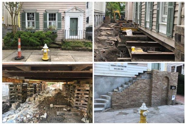
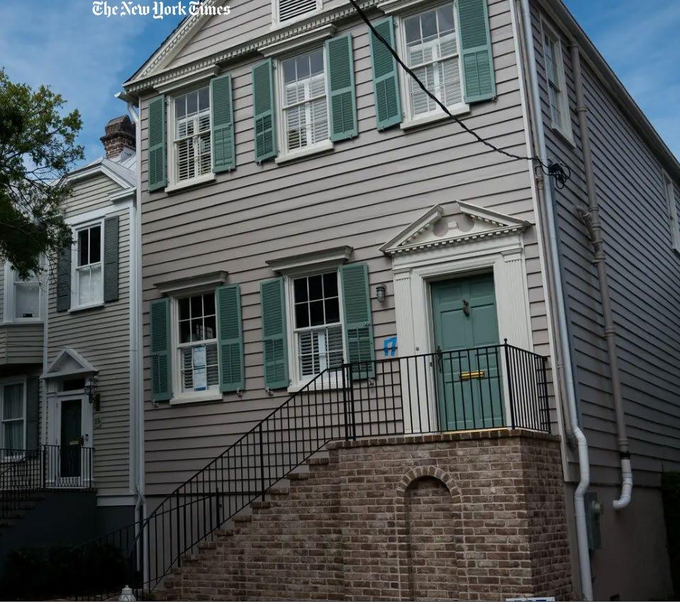
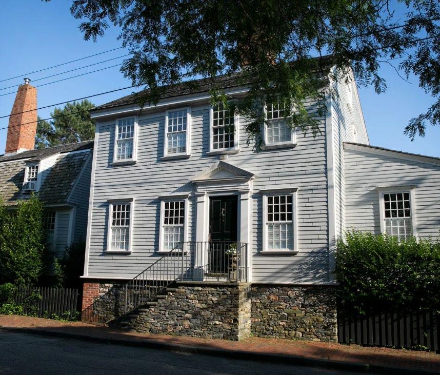
A comprehensive evaluation of the project area’s stormwater system is needed, with particular attention to Holmes Street, Washington Street, within the vicinity of the Mystic Fire Station, and out to Murphy Point. This assessment should focus on the system’s capacity to effectively capture and convey stormwater under both rainfall and tidal conditions (i.e., compound flooding) using a hydrologic and hydraulic (H&H) model supported by detailed field survey data, existing and future precipitation data, and projected sea level rise. The assessment would involve the following scope of work:
1. Data Collection/Field Assessment
• Stormwater system pipe network location would be field verified as well as the locations of manholes, catch basins, and outfalls.
• Data on rim elevations, pipe inverts, pipe size, material, and conditions, outfall inverts, and overland flow ground elevations would be collected.
2. H&H Modeling
3. Prioritization of Infrastructure Improvement Locations
4. Conceptual/Schematic Design of Infrastructure Projects
The assessment would result in a GIS database of the stormwater system and would help identify and prioritize locations for improvements that could potentially be more economical and nearterm than other proposed concepts in this report. Modeled results will inform priority locations for green infrastructure, potential stormwater detention basins, and locations where backflow preventors can be utilized at low-lying stormwater outfalls. After prioritization, the Town will be able to start designing infrastructure projects with the data collected from the field assessment.
The approximate budgetary cost for this assessment is $300K.
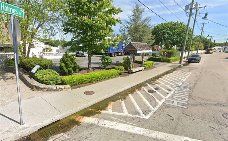
HolmesStreetcatchbasinshowingsignsof backflow from the Mystic River(GoogleStreetview)
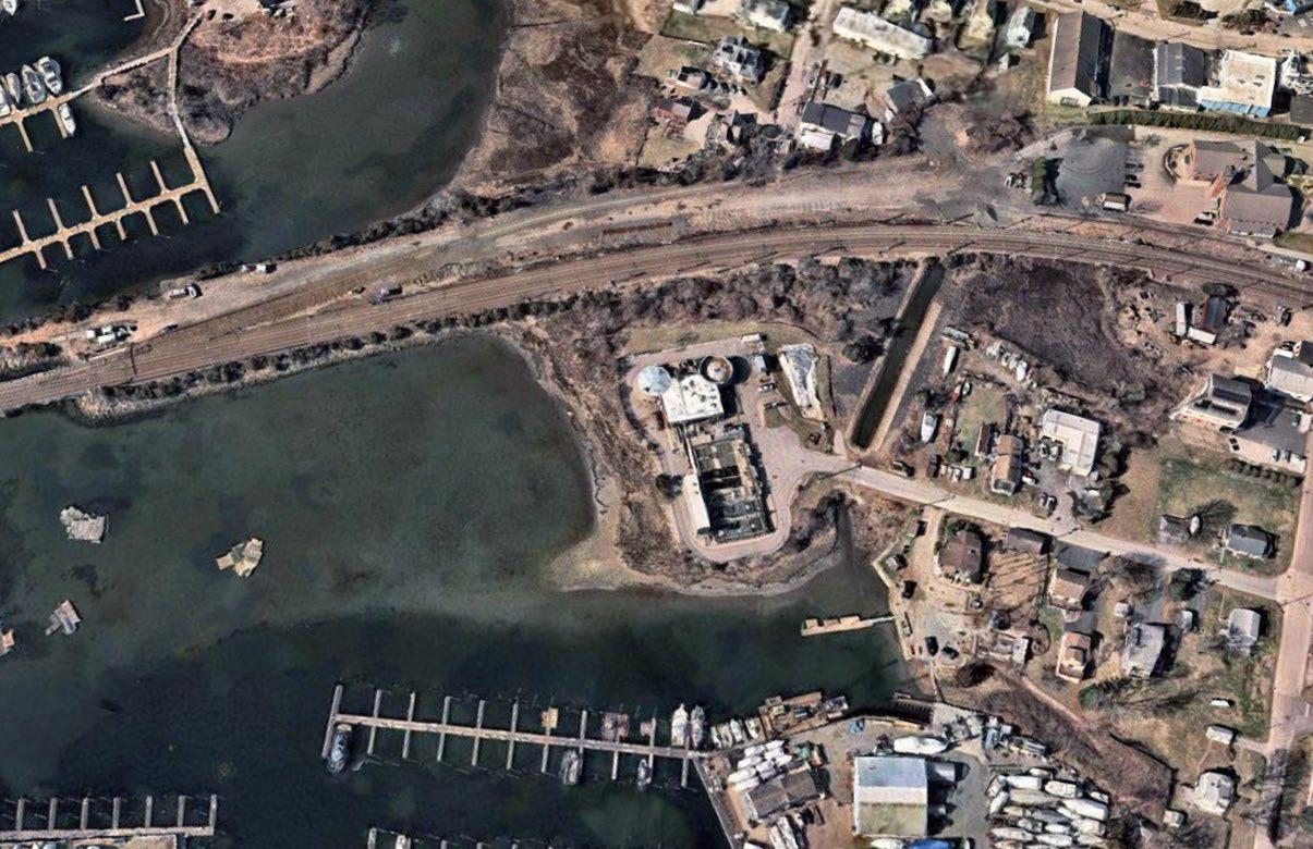
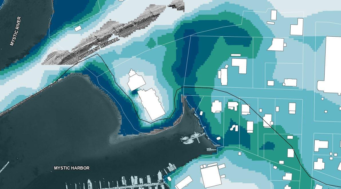
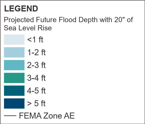
The Mystic Wastewater Treatment Facility (WWTF) is one of three wastewater treatment plants operated by the Town of Stonington, serving the entirety of the Mystic neighborhood. Located within the VE Zone, several key components of the facility have already been retrofitted in response to ongoing coastal and precipitation-driven flooding including elevating the emergency generator seven feet above adjacent grade. Despite these efforts, flooding remains a serious threat with flood depths of one to three feet expected during the future 10% storm with 20 inches of SLR. Stonington is currently updating is wastewater facilities plan, which will consider decommissioning and relocating the Mystic WWTF.
The WWTF sits at approximately 5 feet above sea level (NAVD 88), with the lowest point at the facility entrance located on Edgemont Street. During heavy rain or high tide events, this low-lying section often floods, isolating the WWTF from the rest of Mystic. The future 10% storm with 20 inches of SLR could result in 2 to 4 feet of flooding at this low point. This vulnerability underscores the need for a comprehensive and robust flood protection strategy to prevent erosion and pipe damage, power outages, or temporary loss of function.
Three approaches were used to determine the flood elevation to which the WWTF should be protected for future flood events: the Freeboard Value Approach (FVA), the 0.2% Annual Chance Flood Approach, and the Climate Informed Science Approach (CISA). After applying the three approaches, the highest, or most conservative elevation, was chosen to ensure that planning measures are not under-predicting future sea levels. Therefore, the 0.2% Annual Chance Flood elevation of 18.5 ft was used to evaluate potential floodproofing solutions. To effectively protect the WWTF from worsening flood conditions, a 13.5 ft tall floodwall is recommended, based on the 0.2% Annual Chance Flood Approach. See the adjacent table for the elevations associated with each approach.
Three alternatives to protect the WWTF from flooding were evaluated:
1. Temporary (deployable) floodwall
2. Semi-permanent (deployable) floodwall
3. Permanent floodwall
A temporary floodwall is designed to be installed before a storm event occurs and removed and stored during calm weather. Similarly, a semipermanent floodwall is designed to be installed when flooding is anticipated. However, portions of a semi-permanent floodwall may remain assembled for longer periods of time to make the deployment of the full floodwall a quicker process. A permanent floodwall is a fixed structure that is installed once, with potential need for maintenance throughout its useful life.
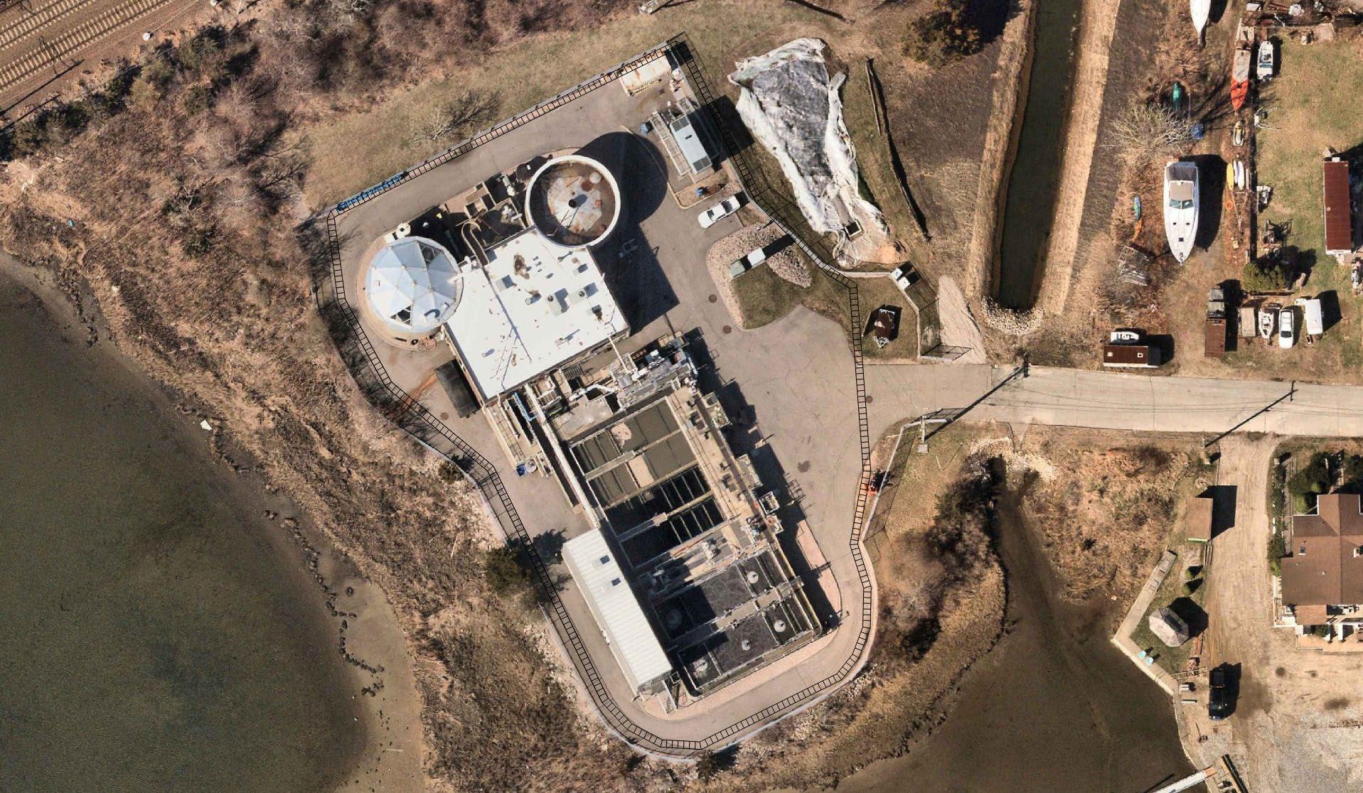
A floodwall should form a full perimeter around the WWTF and its external components (i.e., generator and transformer), so that all facility assets are protected and accessible in the event of a flood. The permanent floodwall would require a floodgate mechanism to allow access to the WWTF during normal operations. This concept and the semi-permanent wall both require pumps to manage stormwater. See the following pages for perspective renderings of each alternative.
While temporary and semi-permanent solutions offer lower upfront costs and greater flexibility, only the permanent floodwall ensures year-round protection without dependence on forecasts, time, and human power for deployment. In terms of materials and installation, a temporary floodwall is the least expensive option, while a permanent floodwall is the most expensive. See Appendix C for documentation of the planning-level cost estimates.
If the Town anticipates operating this facility for a relatively short time horizon, the temporary floodwall option could provide the best value for investment among the presented concepts in part because the deployable floodwall could be reused at another location if the WWTP were to be decommissioned at its current location.
Temporary (Deployable)
Floodwall
• Limited permitting process
• Can
Permanent Sheet Pile Floodwall and Floodgate
• Protects to the FEMA 0.2% Annual Chance Flood
• Potentially can be reused in another location (based on manufacturer recommendations)
• Portions can potentially be left in place to prevent nuisance flooding
• Protects to the FEMA 0.2% Annual Chance Flood
• No storage space required
•
• No deployment or advanced warning time required • Lengthier
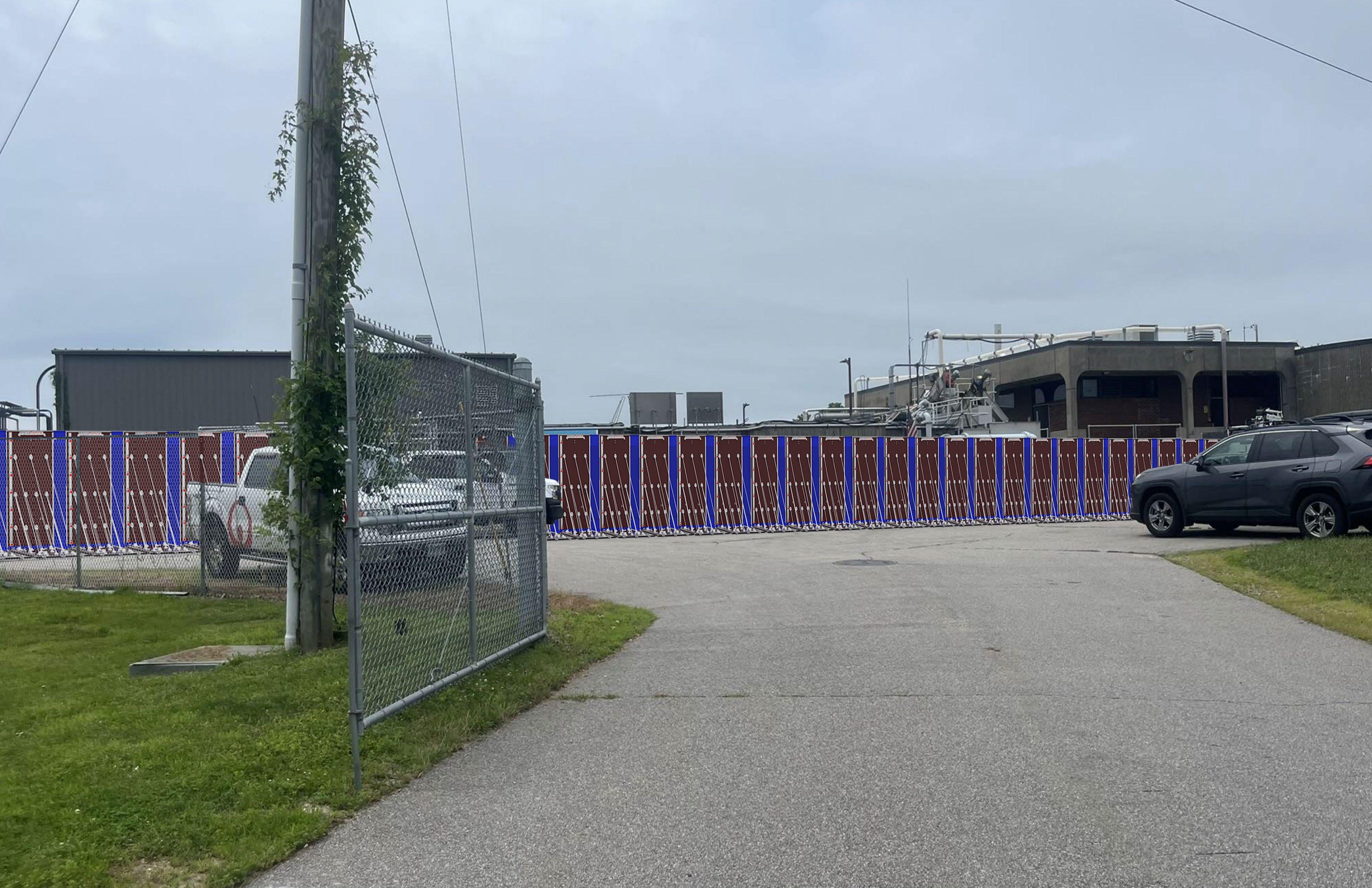
A temporary floodwall can reach a maximum height of 9.5 ft, due to concerns with the structural integrity and its ability to withstand force from floodwater at a greater height. This is below the recommended height of 13.5 ft to achieve flood protection against the 0.2% Annual Chance Flood event. This rendering shows what a temporary floodwall may look like when fully deployed around the WWTF. The temporary floodwall restricts access to the facility until after floodwaters recede.
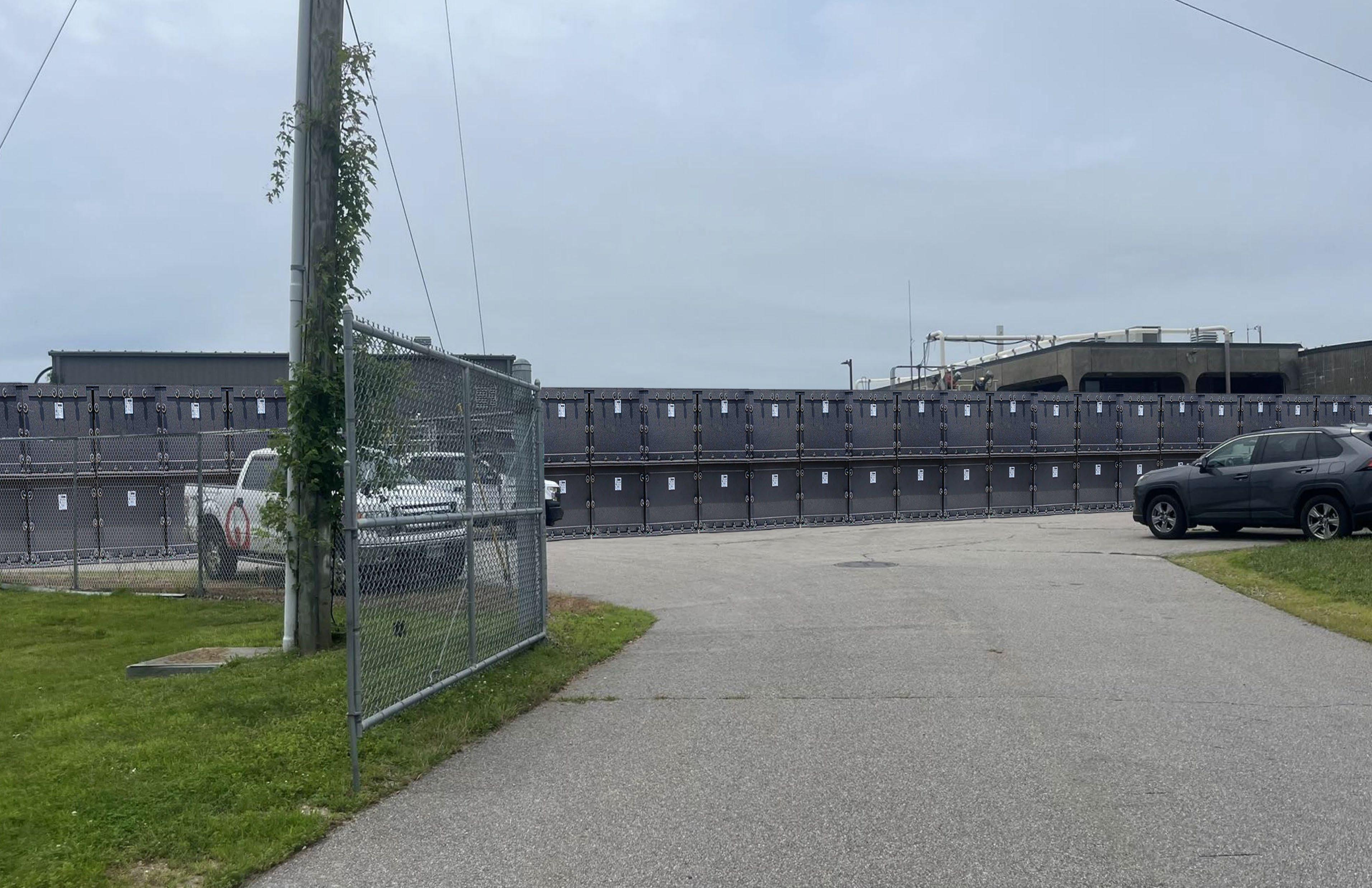
In this application, only the cementitious material and mounting bracket assembly remain installed between deployments.
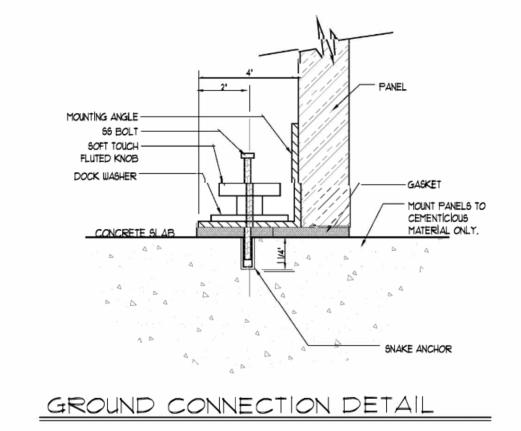
A semi-permanent floodwall can achieve a height of 13.5 ft, protecting against the 0.2% Annual Chance Flood event. This rendering shows what a semi-permanent floodwall may look like when fully deployed around the WWTF. Like in the temporary structure, this floodwall does not include a gate. Access to the facility is enabled after a flood events occurs by removing a section.
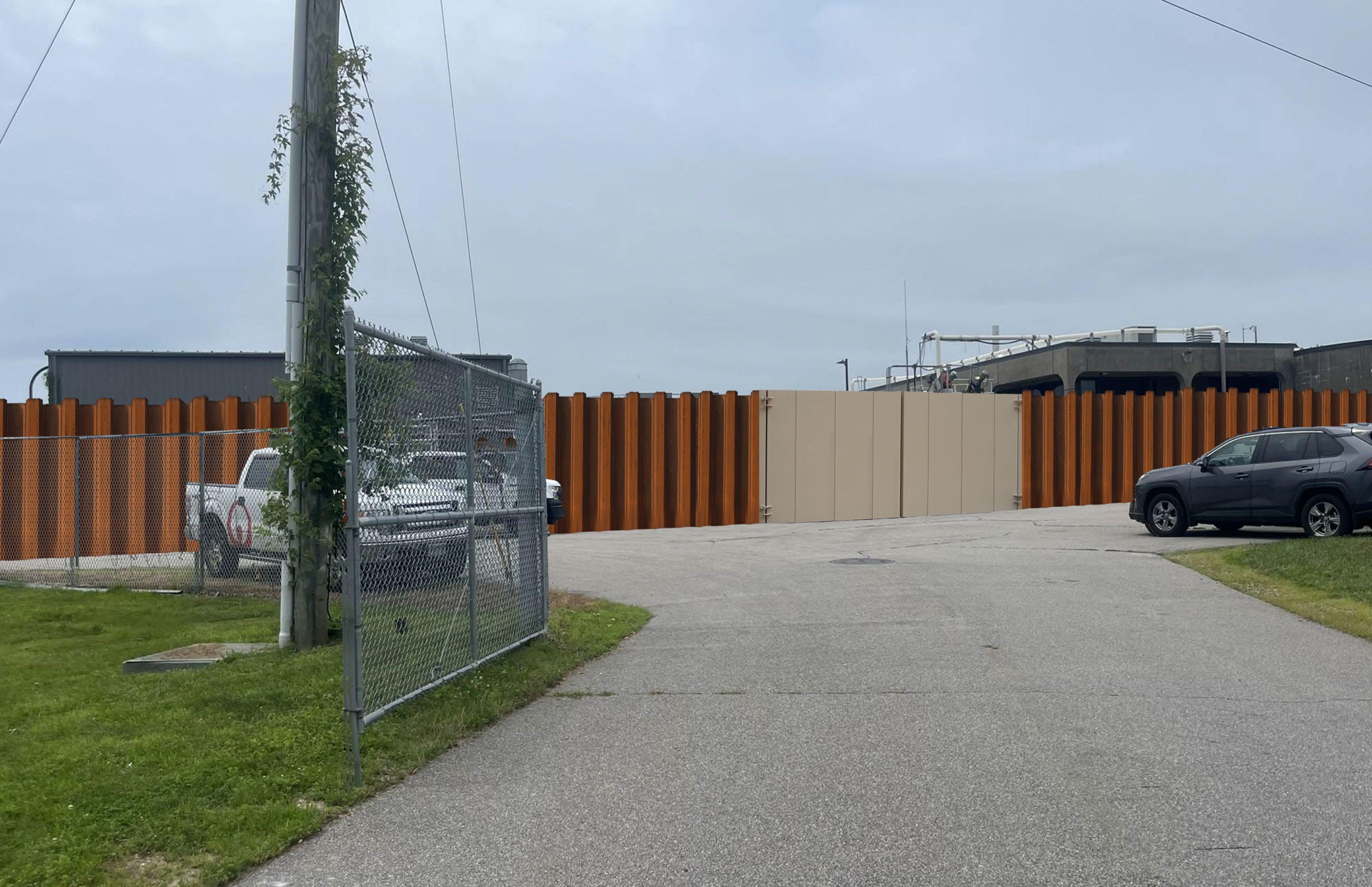
A permanent floodwall, made of steel sheet pile, can achieve a height of 13.5 ft, protecting against the 0.2% Annual Chance Flood event. This rendering shows what a permanent floodwall may look like when installed around the WWTF. This solution would require a floodproof gate to allow access in and out of the WWTF. Additionally, it would be necessary to bury approximately 70% of the sheet pile (+/-27') below grade to achieve the strength necessary to withstand hydrostatic pressure during flood conditions. It would be necessary to accommodate existing subgrade utilities and the process of creating those penetrations would add to the cost of installation.
In addition to a perimeter floodwall, mitigating the roadway depression at the entrance of the WWTF on Edgemont Street is crucial for maintaining access to the facility during flooding. Elevating this section of road and enlarging the culvert structure may be necessary. Conceptually, this would include:
1. Raising the road elevation from approximately 5 ft to a target level of approximately 11–14 ft (i.e., raising the road by approximately 6-9 ft). (*Note: the length of the road segment that would be elevated would be directly proportional to the height of the elevation so that the vertical alignment could be made to taper to meet existing conditions while allowing for a navigable slope.)
2. Tapering side slopes to maintain access and drainage
3. Installing a larger culvert to accommodate higher flow capacity
Reusing the WWTF location as a pump station in the future should also be considered, which may support broader flood resilience and drainage strategies in the area.
In line with similar regional projects, such as the Branford, CT and Westerly, RI floodwalls, permitting through CT DEEP’s Coastal Zone Management Program and potentially the U.S. Army Corps of Engineers (USACE) would be required. Notably, permitting processes may change with anticipated amendments to Connecticut's coastal zone rules in October of 2025, which historically favored temporary solutions. See Appendix D for additional details on the anticipated permitting pathway.
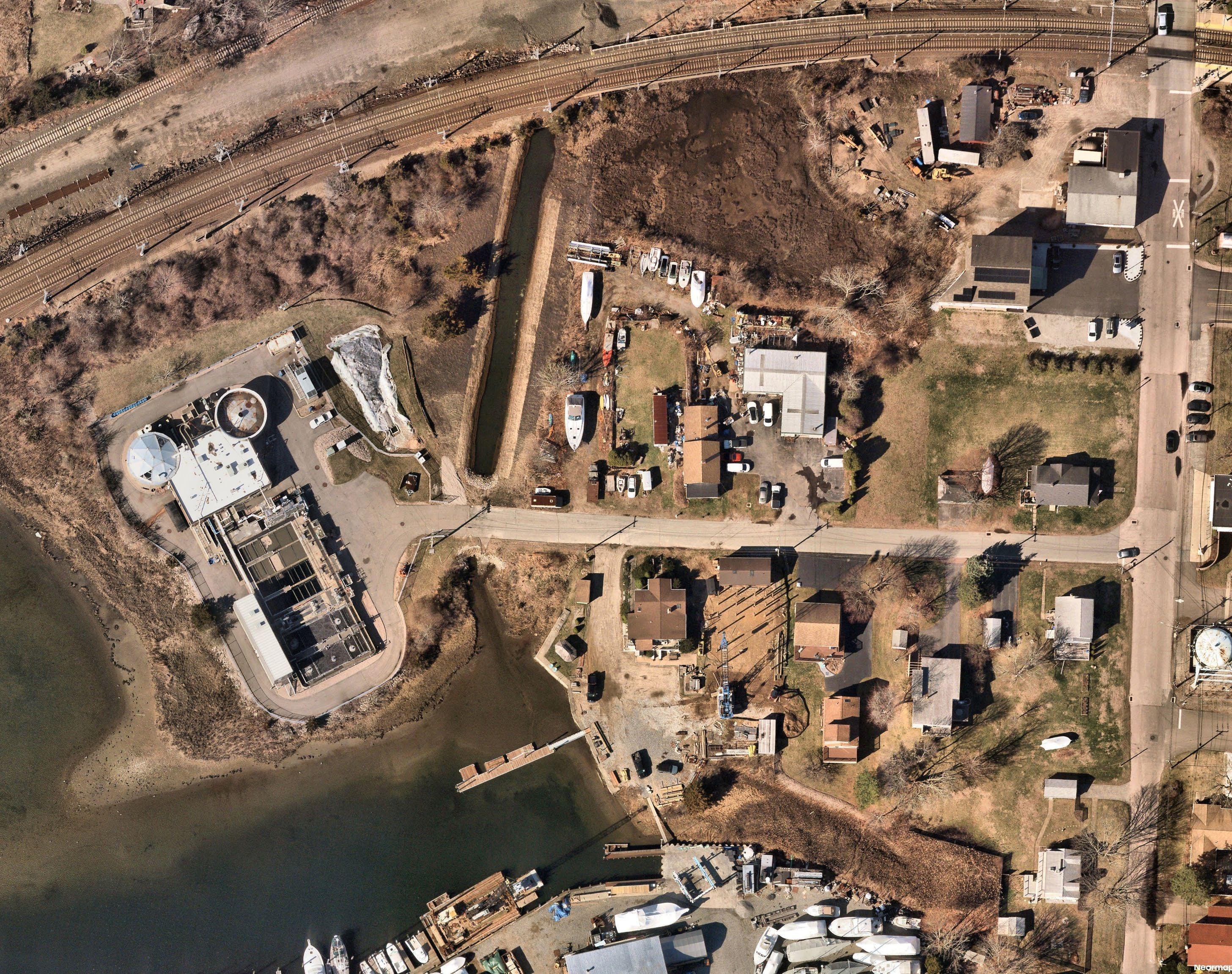
CULVERT TO BE ENLARGED
APPROXIMATE SEGMENT OF EDGEMONT STREET TO BE RAISED
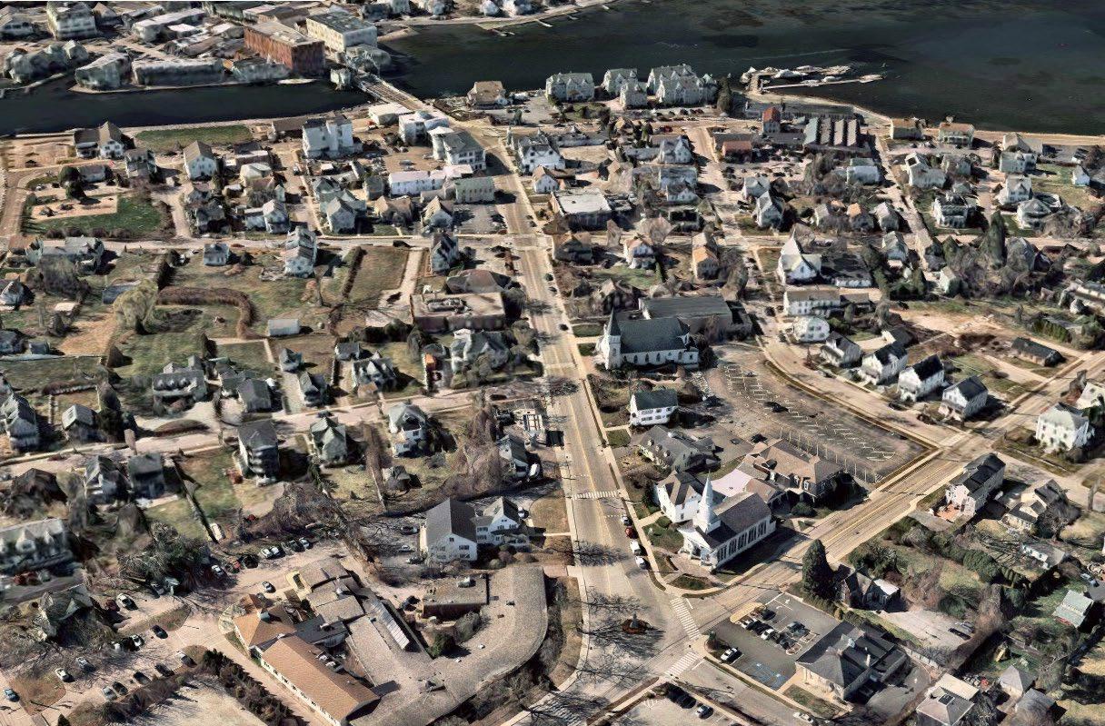
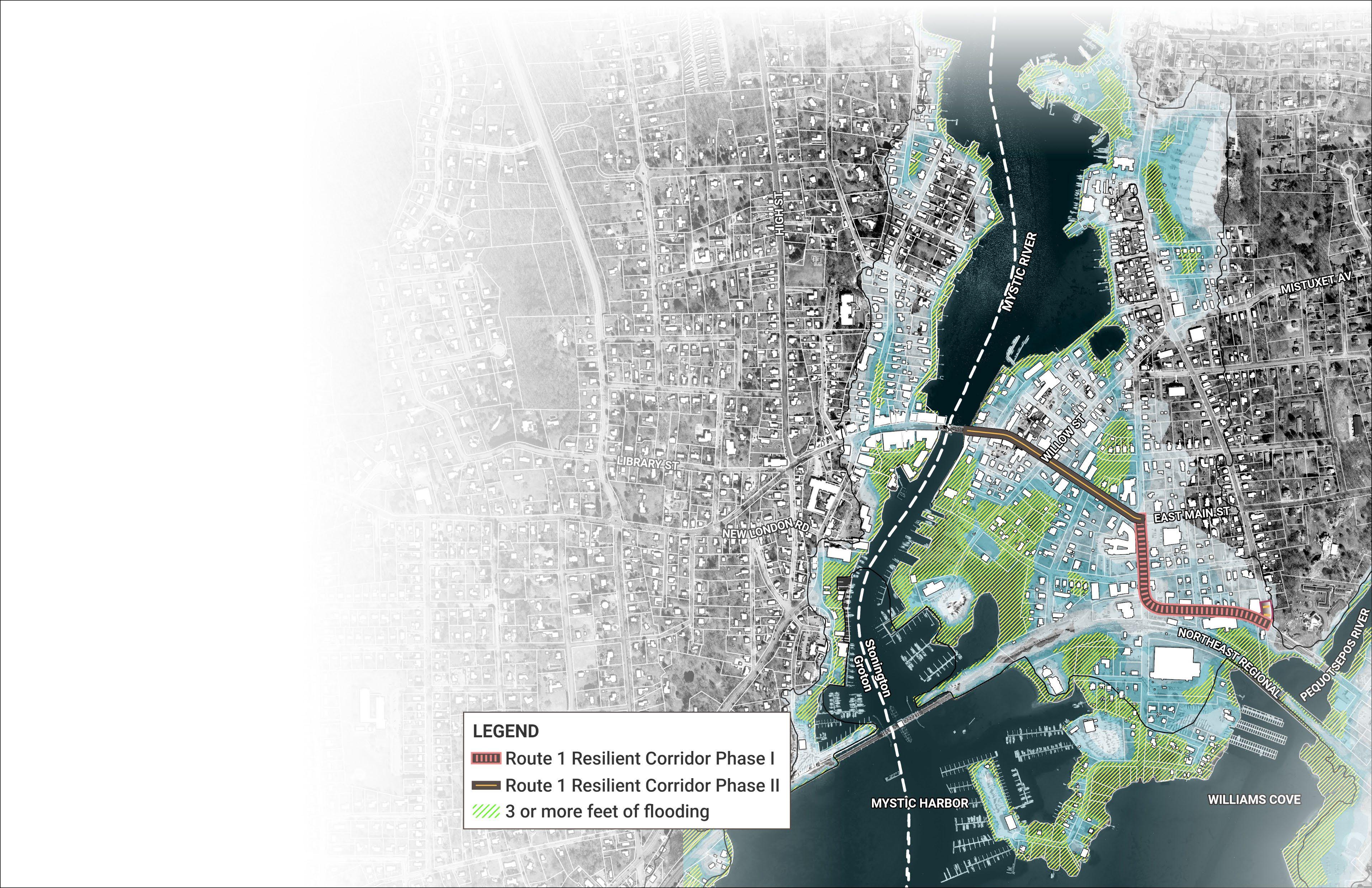
Route 1 (also known as Main Street within the project area) is a lowlying state-owned road that functions as a primary transportation artery through Downtown Mystic. Flooding along Route 1 poses risks to Stonington’s connection with Groton and public safety, with emergency responders reporting that flooding has already forced the relocation of critical firefighting equipment during storm events. To address this, it is essential that Stonington initiate discussions with the Connecticut Department of Transportation (CTDOT) to discuss the possibility of elevating Route 1, transforming it with CTDOT’s support into a Resilient Corridor.
This concept would elevate Main Street in two phases, beginning with the segment between the intersection of East Main Street, Broadway Avenue and Denison Avenue. This stretch is comparatively less vulnerable to flooding and would enable a resilient connection to divert traffic away from the shoreline to Route 27. The second phase would address the segment of Route 1 between the Bascule Bridge and Broadway Avenue where expected coastal flooding is comparatively deeper and/or more frequent.
To maintain reliable access during both coastal and pluvial flood events, the proposed vertical profile of the Resilient Corridor aims to achieve an elevation of two feet above the modeled CIRCA 10% AEP flood depth with 20 inches of sea level rise. This translates to elevations of 2 to 6 feet above current grade. Performing this elevation would require negotiating several vertical conflicts, including utility poles and other utility infrastructure. Furthermore, it will be important to address surcharge issues and improve local drainage while work is being performed on the road to avoid worsening tidal or stormwater flood issues in the area.
As the Town pursues a phased elevation of Main Street to create a resilient transportation corridor, a corresponding strategy should be developed for properties lining the corridor. Homes and businesses along this route will face increasing flood risk while also experiencing difficulties accessing Main Street if left at a lower elevation than the adjacent road. Instead, property owners along the Resilient Corridor should consider elevating structures within their current footprints, either proactively or after a precipitating event such as a major storm triggering the need for structural renovations.
Building elevations should be performed in accordance with all relevant local, state, and federal guidelines and statutes, including the following elevation standards:
• Climate-Informed Science Approach – This method applies the best available hydrologic and hydraulic data to assess current and future flood risk in this case, CIRCA’s future coastal flood modeling. Trained floodplain managers or Town representatives would then support property owners in understanding expected future flood depths, starting with the 10% AEP storm scenario with 20 inches of sea level rise.
• Freeboard Value Approach – Stonington currently requires structures to be elevated one foot above the 100-year Base Flood Elevation (11 ft NAVD 88 in the FEMA AE Zone, 14 ft in the FEMA VE Zone), while the Connecticut Department of Energy and Environmental Protection recommends elevating noncritical buildings to the BFE plus two feet. Stonington is currently considering increasing its freeboard requirements.
• 500-Year Floodplain: If the 500-year flood elevation (in this case, 18.5 feet NAVD 88) exceeds those of the CISA or the Freeboard Value Approach, this benchmark may be used instead. This conservative approach is most often used for critical facilities.
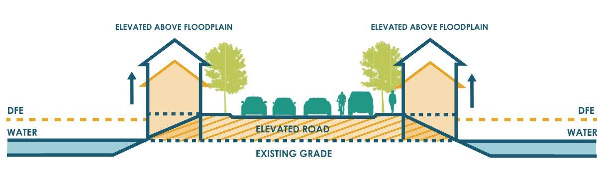
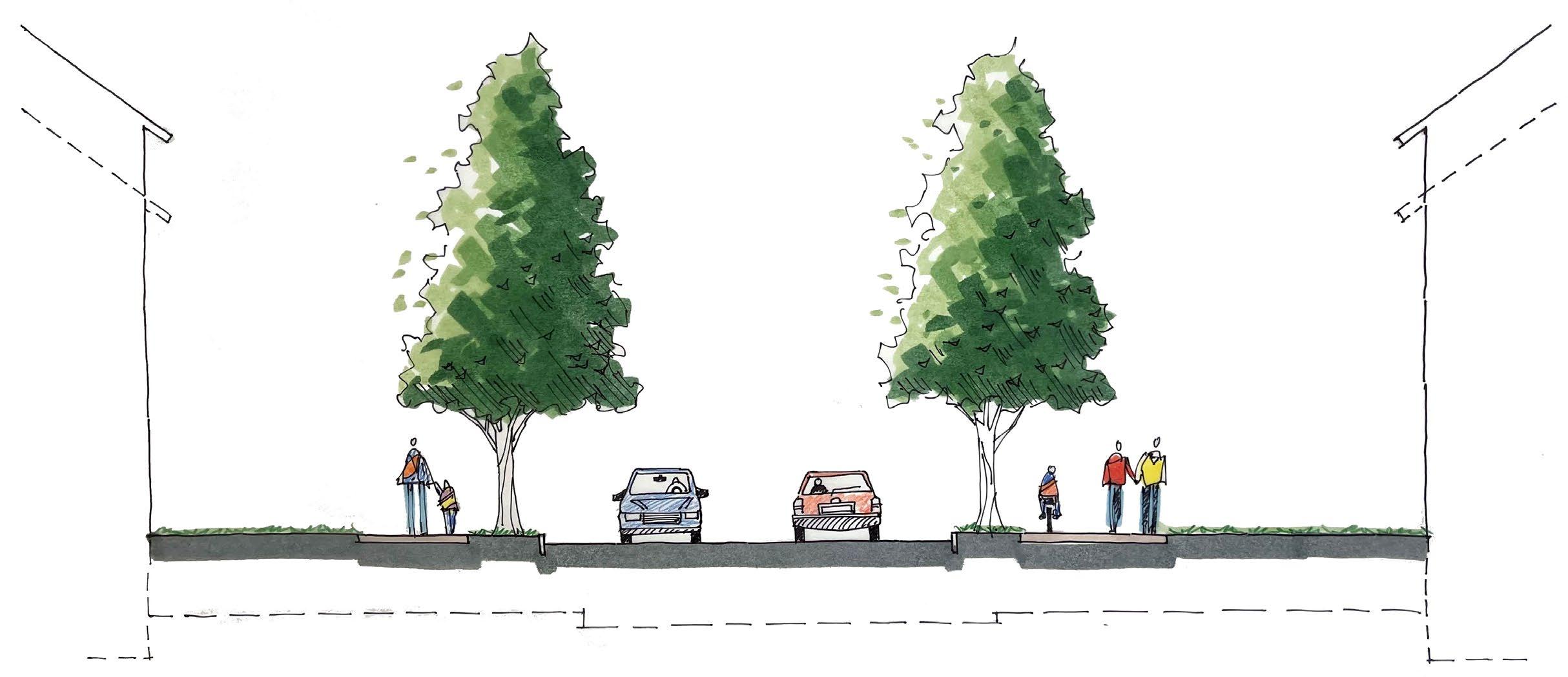
Two cross-sections demonstrating road elevation options within the Resilient Corridor with accompanying structure elevations. Streetscape additions could include an off-street shared-use path, green infrastructure, and building elevations tying into the raised road.
Phase I of the Resilient Corridor emphasizes changes to the road’s vertical profile that would preserve access to the Mystic Fire Station, Apple Rehab, and CVS Pharmacy. Each of these locations provides critical medical and/or emergency response services to the surrounding area, increasing the need for the surrounding road to remain passable during storm events. By the same logic used at the Wastewater Treatment Plant, the Mystic Fire Station would ideally be elevated to the FEMA 500-year flood elevation of 18.5 ft NAVD 88. Apple Rehab and CVS are not formally defined as critical facilities, which means they can instead be elevated to the Design Flood Elevation of 13 ft NAVD 88. Several other sites in the vicinity that currently provide surface parking would be candidates for infill development, or as destinations for relocated structures.
It is possible that the newly elevated road would exacerbate pockets of flooding between it and the adjacent properties, where the grade is lower and stormwater currently drains to the street. As a result, it will be important to assess and manage precipitation runoff to ensure water is able to flow out of the neighborhood toward the Mystic River. In addition, some sites set back from the road may consider sitespecific floodproofing measures. The Town should proactively engage with property owners whose access may be affected by changes to the streetscape’s topography, beginning with locations where the altered street elevation could make it difficult for vehicles or pedestrians to enter or exit these sites. As part of this engagement, staff should conduct on-site assessments to visually evaluate the available space for a smooth transition from the elevated roadway to adjacent buildings.
APPROXIMATE
SEGMENT OF ROUTE 1 TO BE RAISED
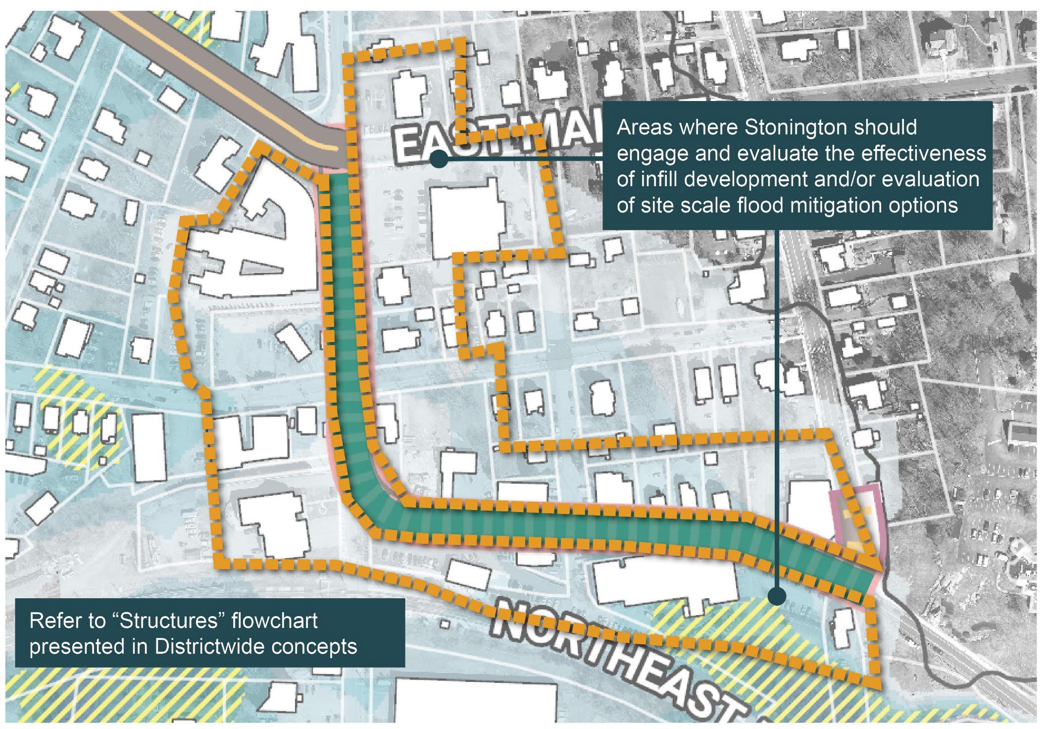
With Phase I focusing on the usability of critical locations along Route 1 in the project area, Phase II would target further actions to cultivate a vibrant commercial corridor within the elevated stretch between the Bascule Bridge and Broadway Avenue. This stretch of road currently hosts services such as restaurants, shops, office buildings, houses of worship, and a gas station. General guidance on potential climate adaptation for each of these locations is provided in the flowchart guiding structural adaptation within the Districtwide Concepts section of this chapter. In the graphic presented at right, areas are identified where further coordination with property owners is needed.
During the Community Design Workshop, religious leaders from congregations on Church Street expressed interest in learning about how to address flooding on their properties. In these and other locations, some structures are already elevated, but basements and auxiliary buildings may require floodproofing or relocation if elevation is not possible. Properties within the green hatched area identified at right are vulnerable to flood depths of three feet or more under future storm conditions, which will require further evaluation of the full range of flood mitigation options including elevation, wet flood proofing, and voluntary acquisition and/or relocation. Each of these ideas relies on updates to local ordinances, including parking requirements and height restrictions, to enable the recommended response.
Finally, the extent of the Phase II road elevation depends on if and how shoreline hardening is adopted as described in Concept 3; if mild to moderate (<2 ft depth) flooding is mitigated closer to the Mystic River shoreline, it may be possible to limit the length of road elevation in Phase II to the stretch between Willow Street and Broadway Avenue.
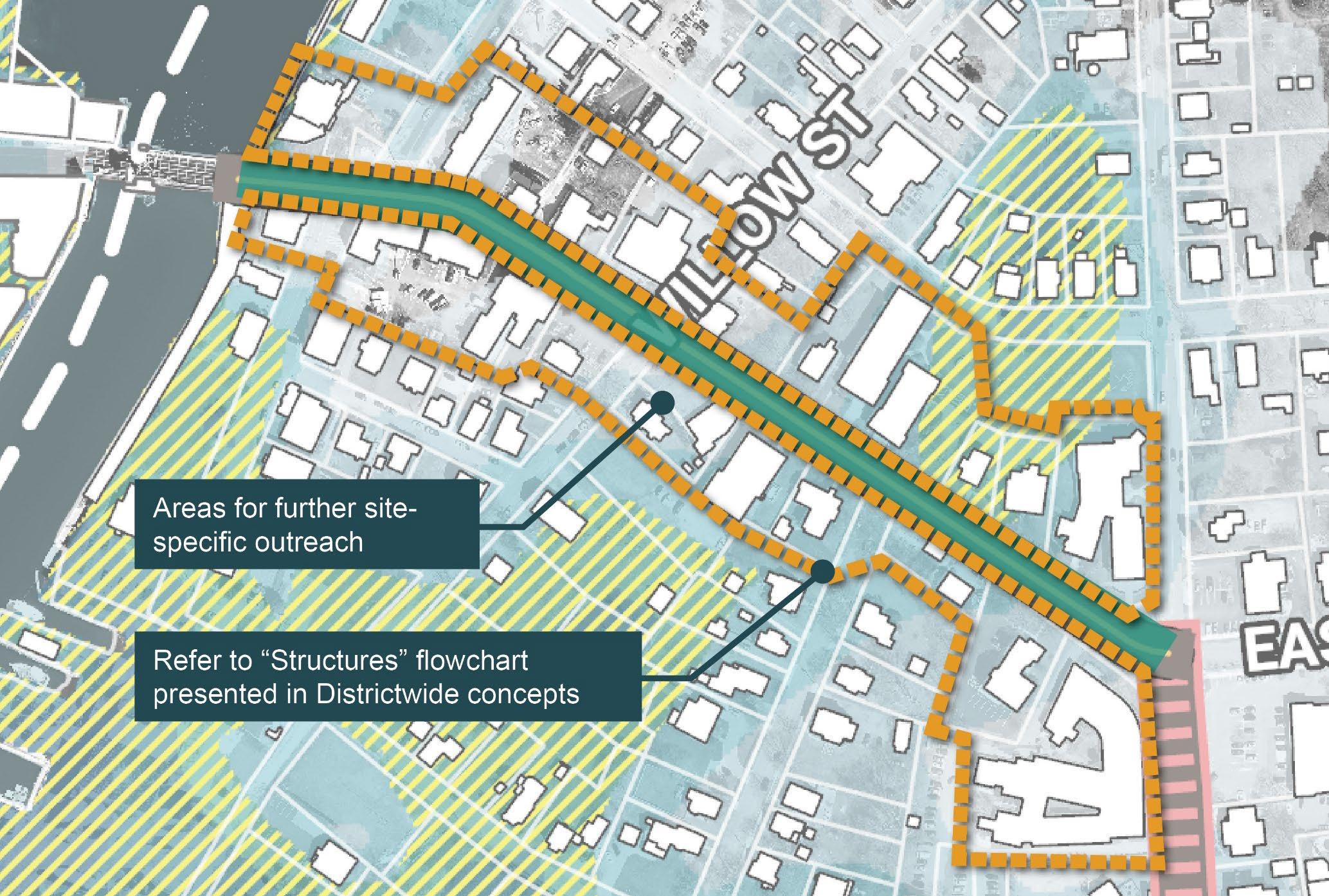
After elevating the corridor, there is a risk that existing structures are rendered inviable because the newly elevated streetscape overshadows or is otherwise inaccessible from the ground floor of the surrounding buildings. In some cases, it is possible to elevate existing structures to meet the road, preserving the relationship between buildings’ ground floor and the adjacent street. In other cases, the existing first floor might already be elevated, in which case ramps and stairs can be modified to maintain easy first floor access.
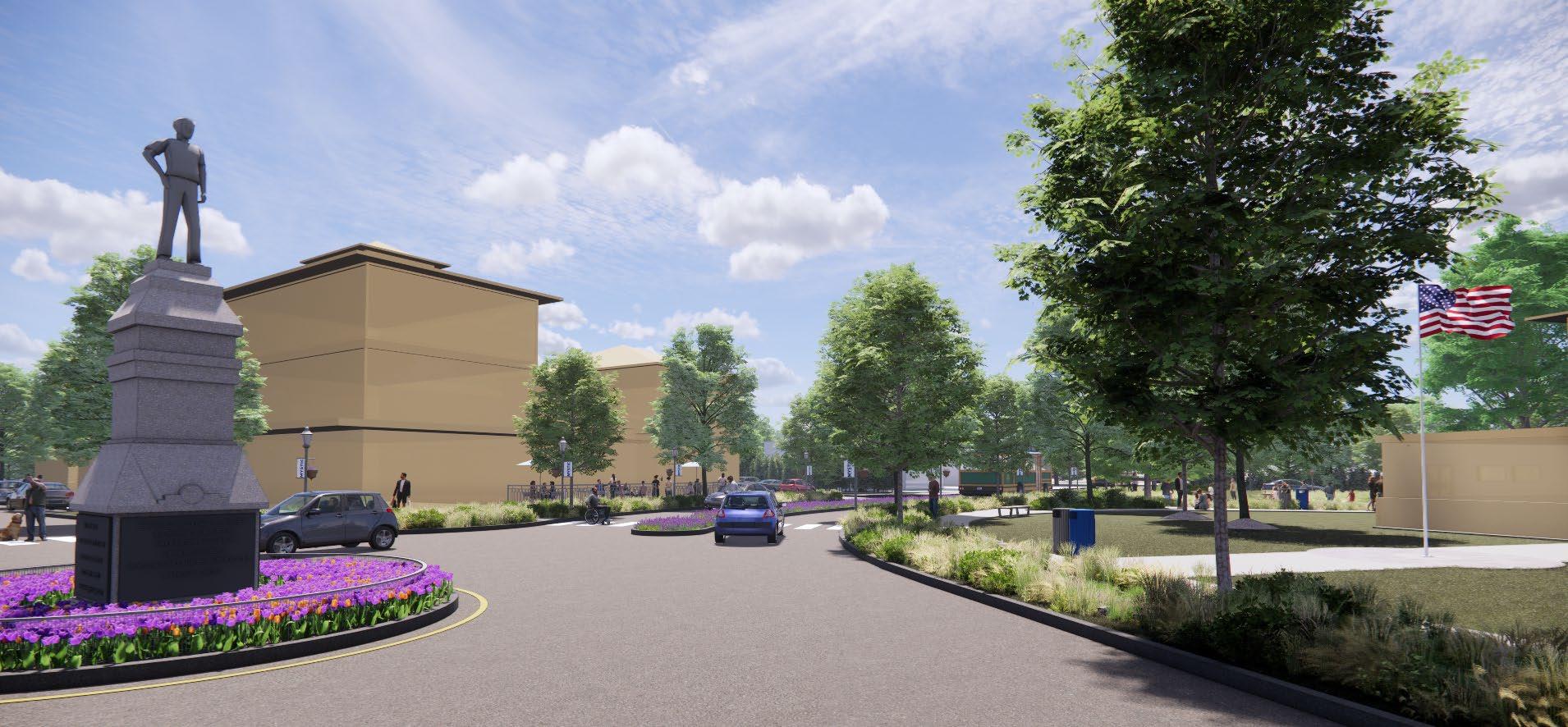
In areas where building ground floors remain floodable, street-level activity can still thrive through temporary “pop-up” uses. Outdoor cafés, market-style vendors, and small businesses can be set up along the street on a seasonal or rotating basis. These uses are commonly deployed in urban areas like Boston, Bristol, Rhode Island, or Portland, Maine to activate the streetscape and contribute to the dynamic character of the downtown area. Similarly, Downtown Mystic could cultivate a Resilient Corridor that welcomes shops not housed in permanent structures, allowing them to adapt quickly when flood events occur.



Stormwater gardens with native, salt-tolerant plantings can withstand occasional inundation from saltwater, adding capacity for managing water volumes in low-level flood events, whether those originate from coastal surge, tidal flooding, or extreme precipitation events. Additional capacity for detaining floodwater in a gantry system under the elevated roadway should also be considered as a potential method for increasing the capacity to absorb floodwater.
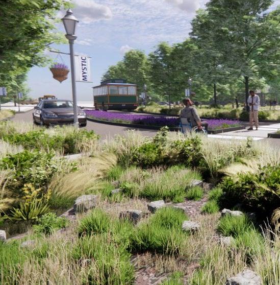
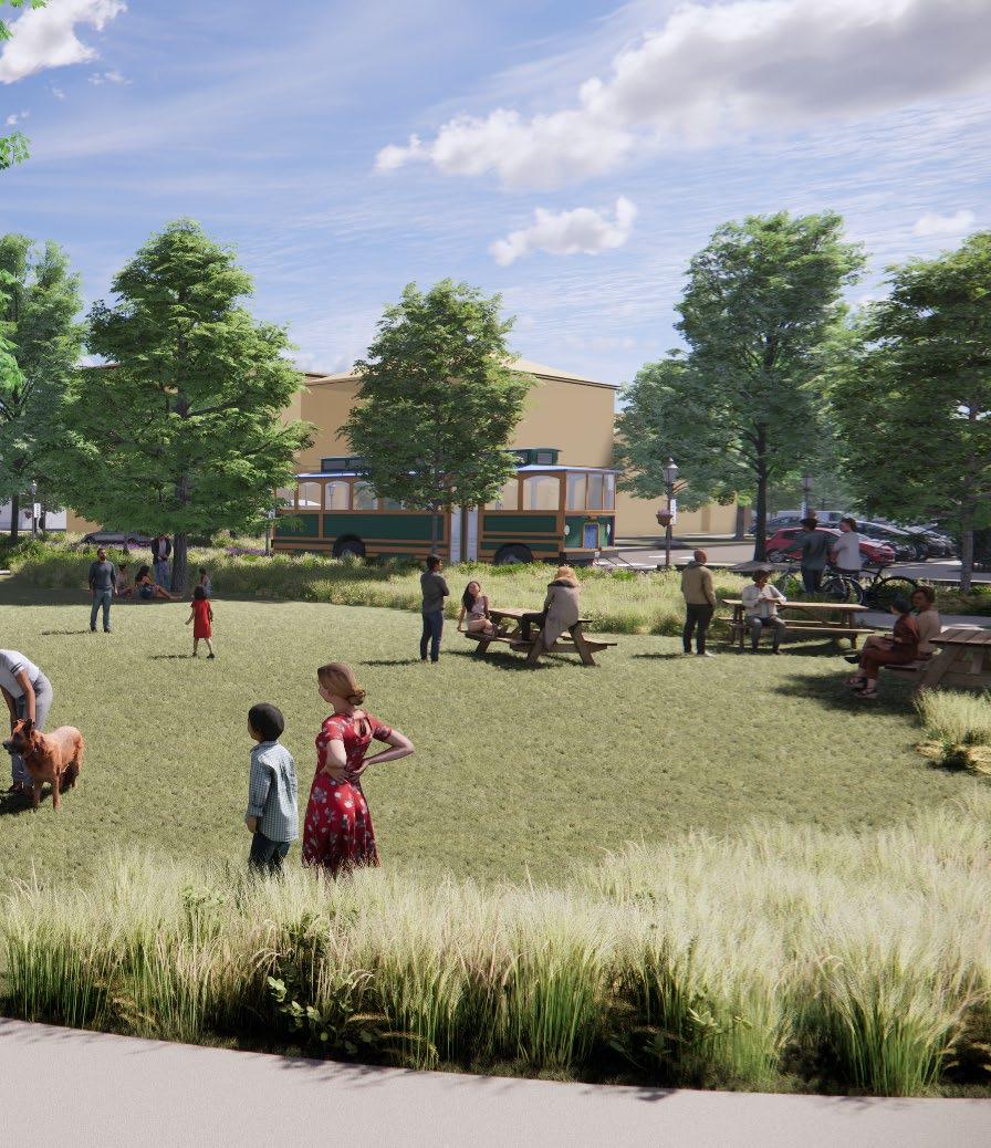
Frequently flooded areas can implement pedestrian pathways for visitors to walk and enjoy nature. Other areas closer to the Route 1 Resilient Corridor could be programmed for other uses when they are not inundated, such as a shaded park with educational elements, or venues for pop-up markets, concerts, or outdoor sports.
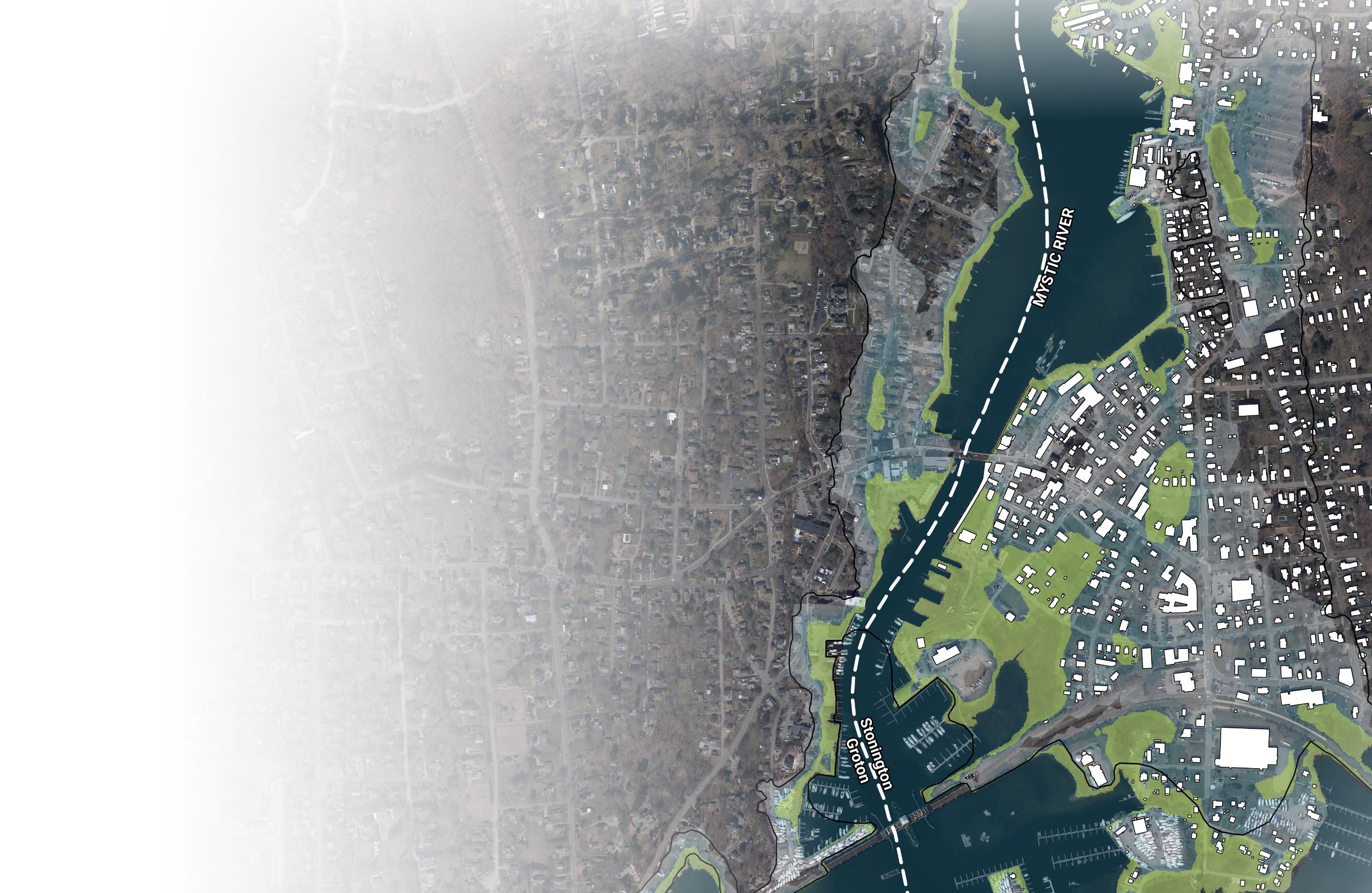
Major flood impacts of three feet or greater are expected by 2050 at 63 commercial properties, three industrial facilities, and 110 residential buildings within the project area. Given the likelihood of these major flood impacts, the Town needs to develop a plan to engage property owners across the affected area to discuss the suite of options at their disposal. If property owners conclude that a voluntary buyout program would be in their best interest, the Town would then be able to pursue a floodable open space program in concert with a managed buyout and/or relocation process.
Additional information about potential avenues to repurpose land that has been ceded to the public trust can be found in Appendix F.
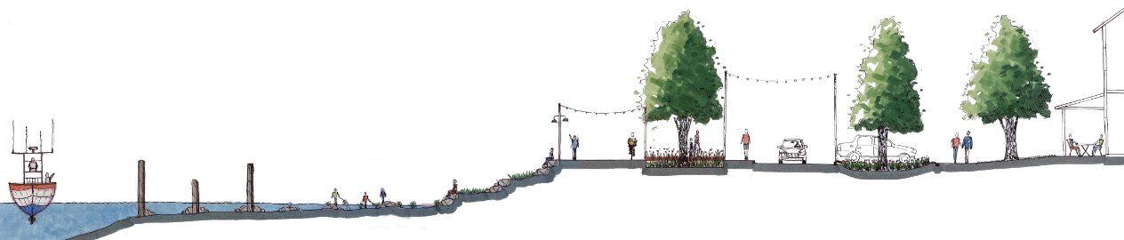
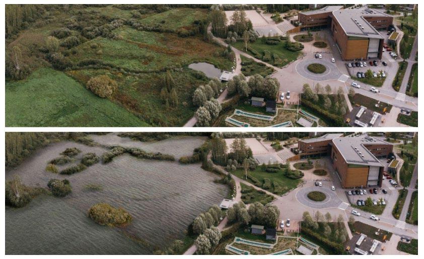
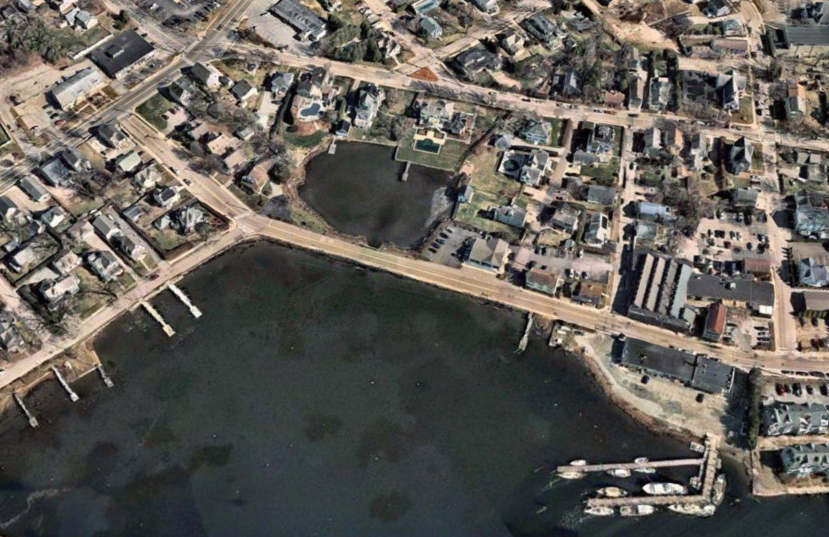
Whether stretching across Mystic Harbor or following the shoreline of Mystic itself, any flood barrier capable of mitigating the future 1% AEP flood would permanently alter the character of the surrounding area. For example, a shoreline defense structure (such as a floodwall) would need to be 8-11 feet tall to prevent overtopping in future 1% AEP storm conditions. Installing such a structure would not only eliminate a physical and visual connection to the river but also separate the Stonington side of Mystic from its counterpart in Groton undermining the identity of a Town made famous for its Downtown connected by the Bascule Bridge. Furthermore, such a wall would need to be extended across virtually all the Downtown Mystic waterfront to seal off any potential gaps that would allow water to enter the neighborhood. A wall of this size would carry dramatic costs to permit and construct and would require extensive pump systems to drain stormwater from behind the wall into the river. The image at right shows the extent of a hypothetical shoreline defense structure necessary to mitigate the 1% AEP storm with 20 inches of sea level rise to illustrate the difficulties associated with engineering such a barrier.
Given these challenges, any shoreline defense strategy should be designed in response to smaller, more frequent coastal storms such as the future 10% AEP storm.
Design Flood Elevation (DFE)
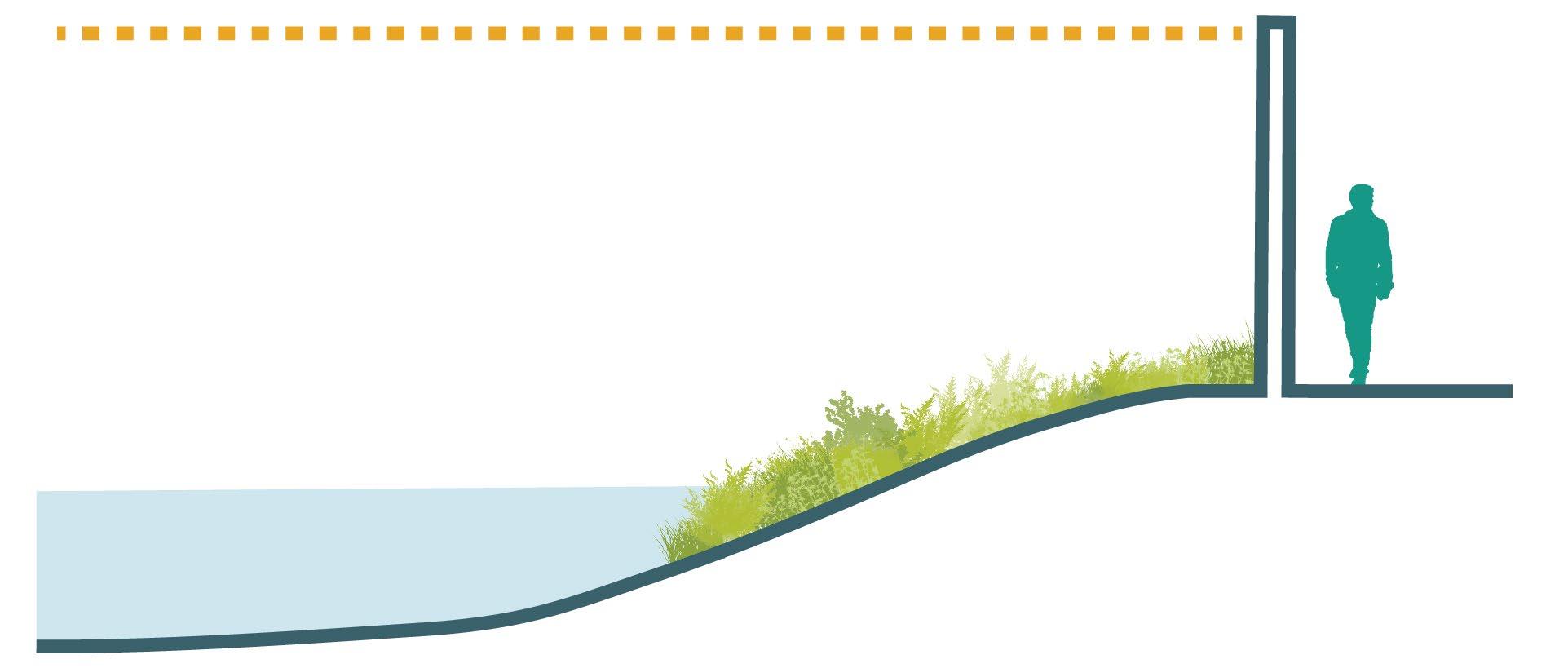
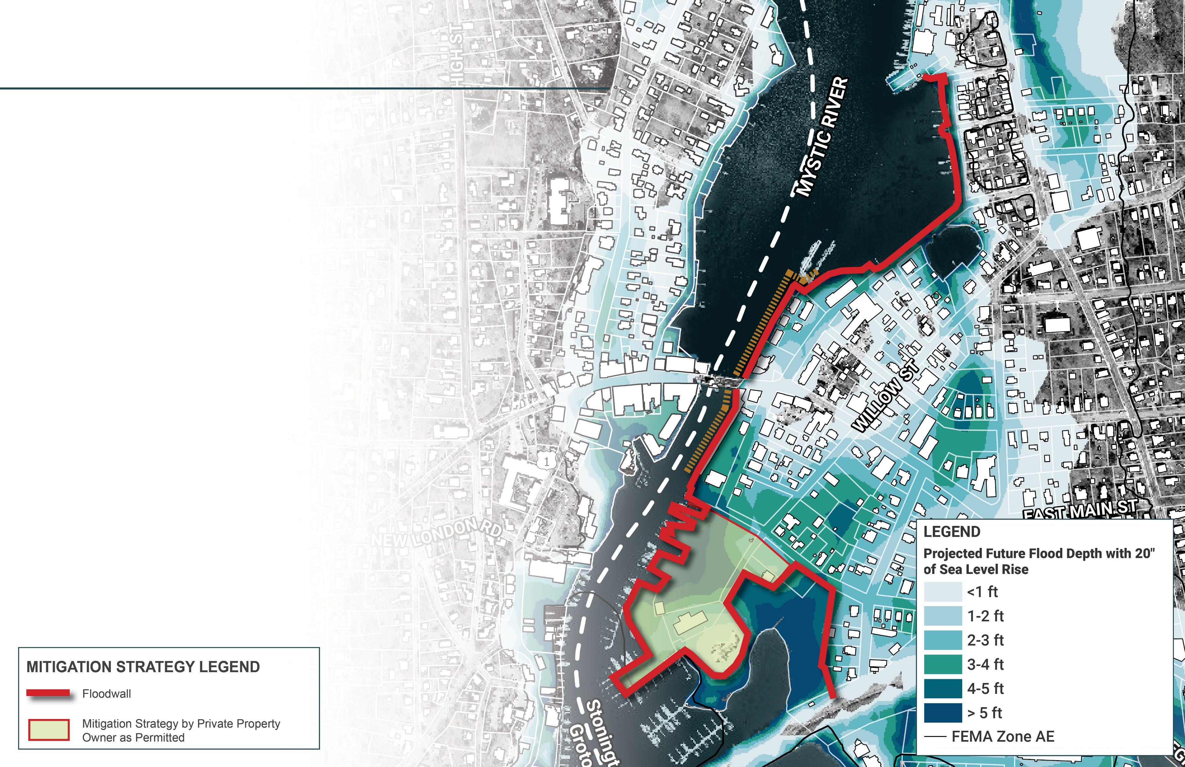
AVERAGE GROUND EL.: 3-FT WALL HEIGHT: 10-FT
AVERAGE GROUND EL.: 3-FT WALL HEIGHT: 10-FT
AVERAGE GROUND EL.: 2-FT WALL HEIGHT: 11-FT
AVERAGE GROUND EL.: 5-FT WALL HEIGHT: 8-FT
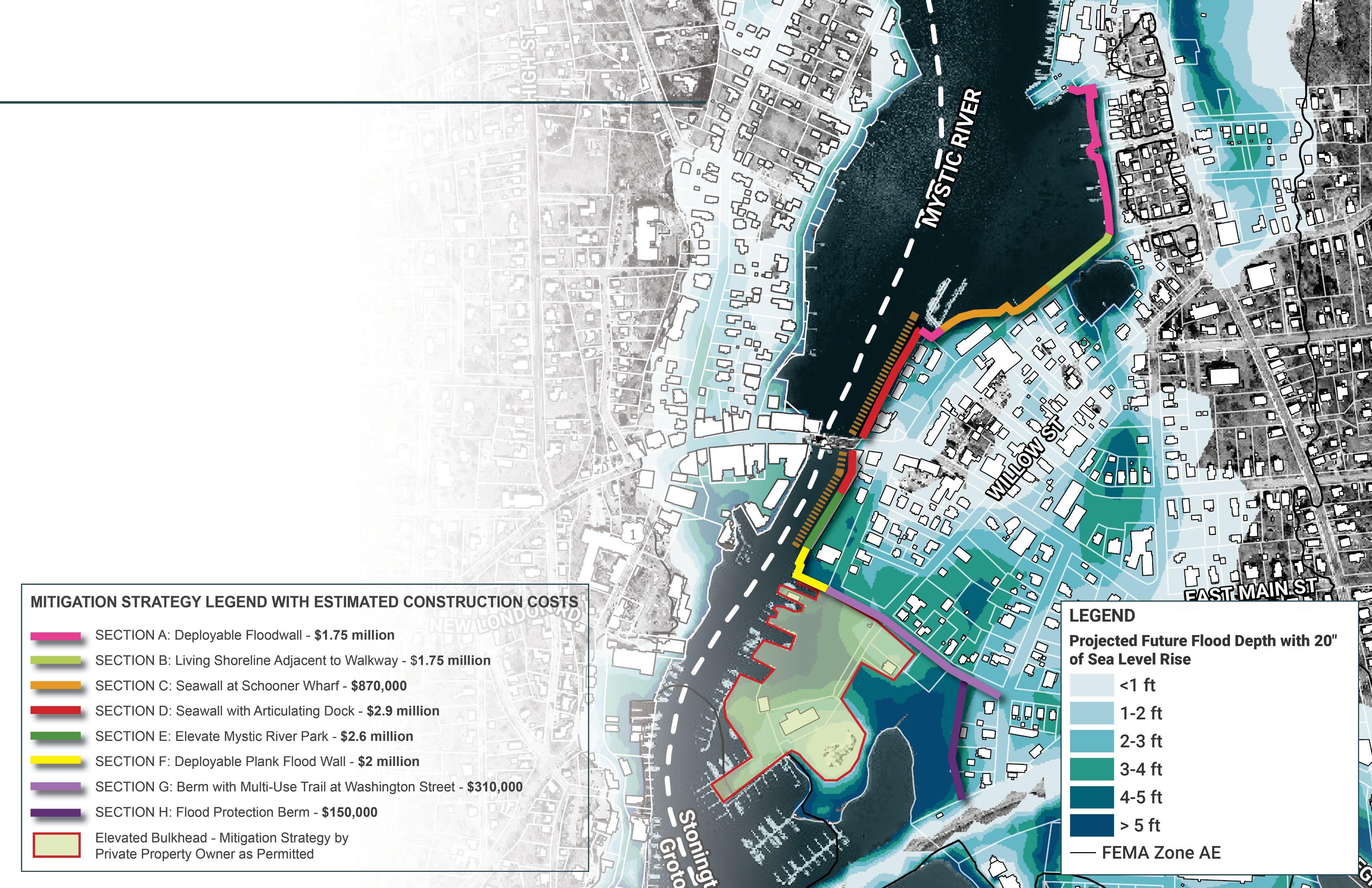
With the Resilient Corridor intended to absorb additional development from more flood-prone areas of Mystic, certain locations along the waterfront could also be suitable venues for elevated barriers intended to attenuate flooding up to the 10% AEP storm with 20 inches of sea level rise. This hardened shoreline would integrate numerous smaller projects across parks, roads, and existing seawalls and bulkheads to provide a first line of defense against flooding. Despite failing to comprehensively mitigate more severe flood scenarios, this approach could allow Stonington to avoid the most common impacts of coastal flooding while assessing the feasibility of the Resilient Corridor concept with external partners.
While the Resilient Corridor strategy is intended to provide a long-term approach to living with the water while pursuing resilient, mixed-use development, the suite of strategies detailed here would keep most assets in place while mitigating damage from minor flood events before pursuing major actions like acquisitions. The timing and scale of the Resilient Corridor can also be modified as needed depending on the shoreline's treatment, which may alter how coastal flooding affects Mystic. It would still be necessary to upgrade the storm system with backflow preventors, and pumps could be required to expel stormwater from behind these barriers and into the Mystic River.
Components of this shoreline adaptation system are listed in the legend below along with corresponding cost estimates. These cost estimates are intended to provide municipal officials a baseline sense of the relative costs and benefits of different adaptation strategies.
A 5.5-ft deployable wall along Bay Street could be set out in advance of a flood event and removed when the hazardous condition subsides. A temporary floodwall is preferable to a permanent floodwall in this setting because a permanent 5.5-ft tall structure would obstruct the relationship between residents and pedestrians and the river.
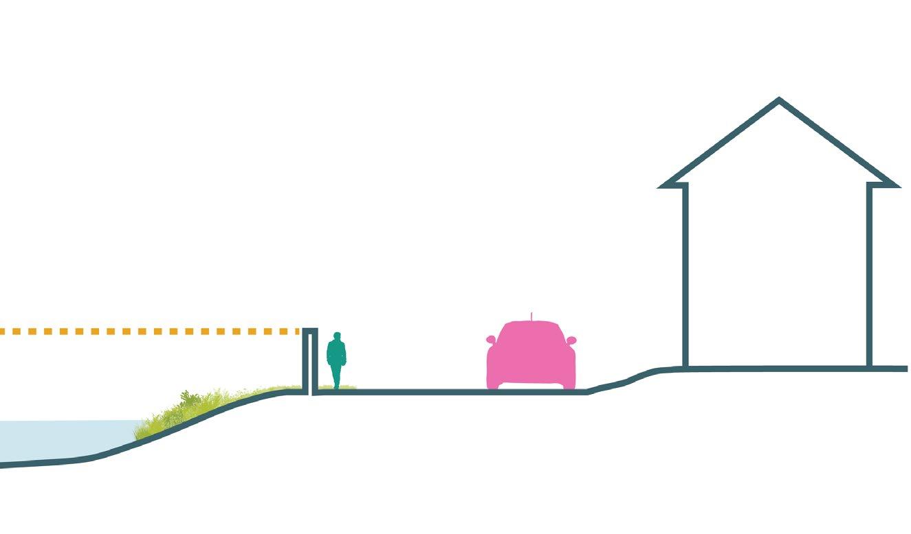
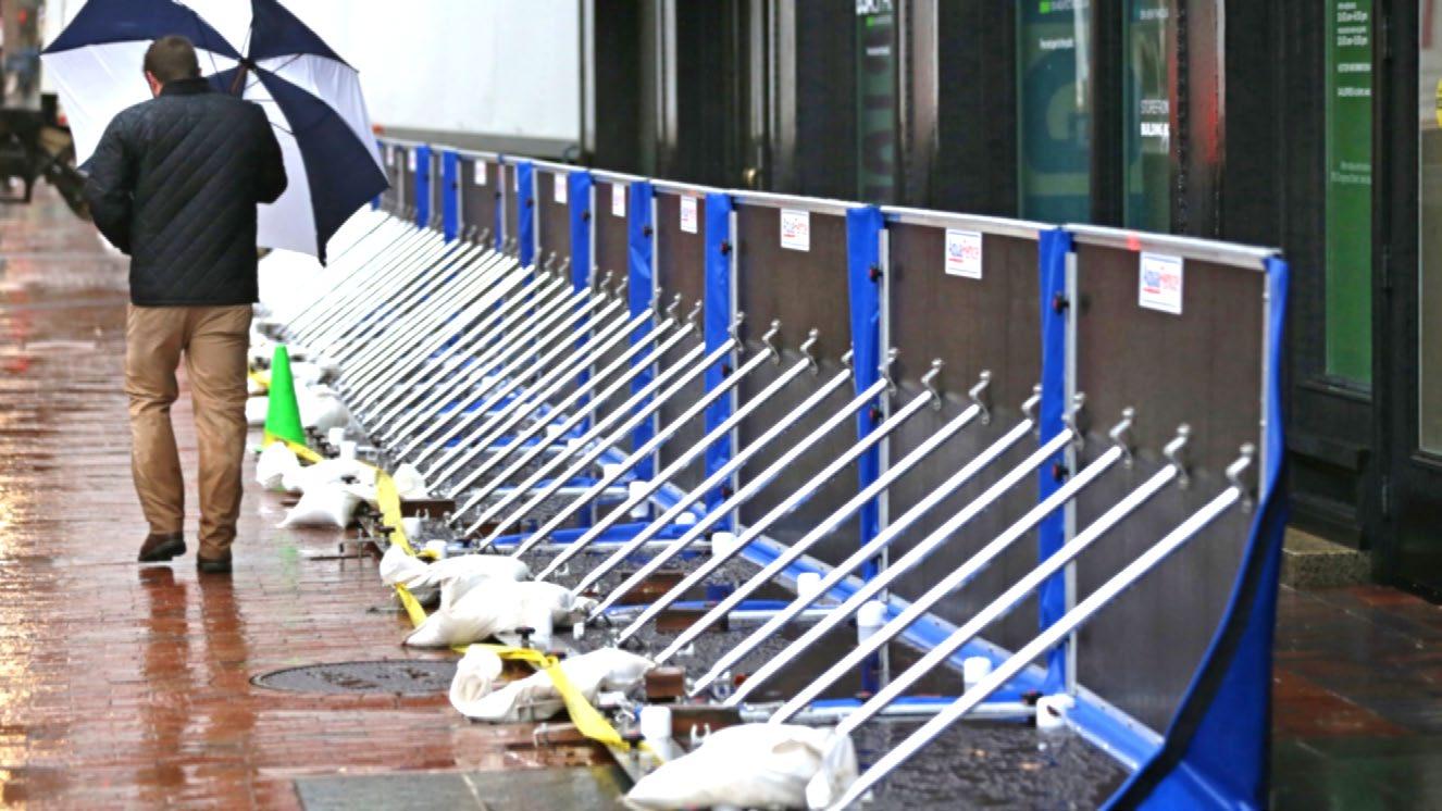
Flood modeling shows that Holmes Street will be subject to daily tidal inundation at some point in the 21st century. By replacing the bulkhead that supports the road at the Frazier Street and Bay Street intersection with a pedestrian boardwalk and a partially submerged living shoreline berm, the Town could avoid the high costs of maintaining a causeway in this vulnerable location. The living shoreline would reduce flood risk to the homes bordering the cove south of Holmes Street, while the elevated boardwalk would provide enhanced pedestrian connectivity from Main Street to Greenmanville Avenue. A tide gate embedded in the living shoreline berm would be required to mitigate against flood conditions while permitting tidal flushing of the cove to the south during non-flood conditions.
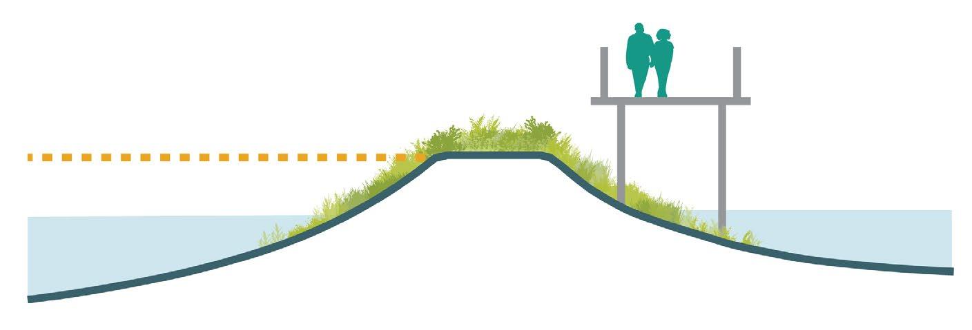
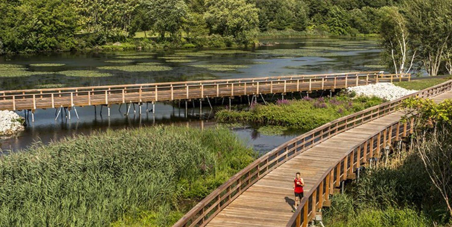
A 3.5-ft high seawall around the perimeter of the schooner Wharf parking lot would be needed to mitigate against the future 10% AEP storm in this area. Unlike the wall required along Bay Street, which is at a lower elevation, this wall would be set atop grade at the parking lot, which is higher than Bay Street. A permanent wall could be feasible in this location as it would be low enough for adults to see over it.
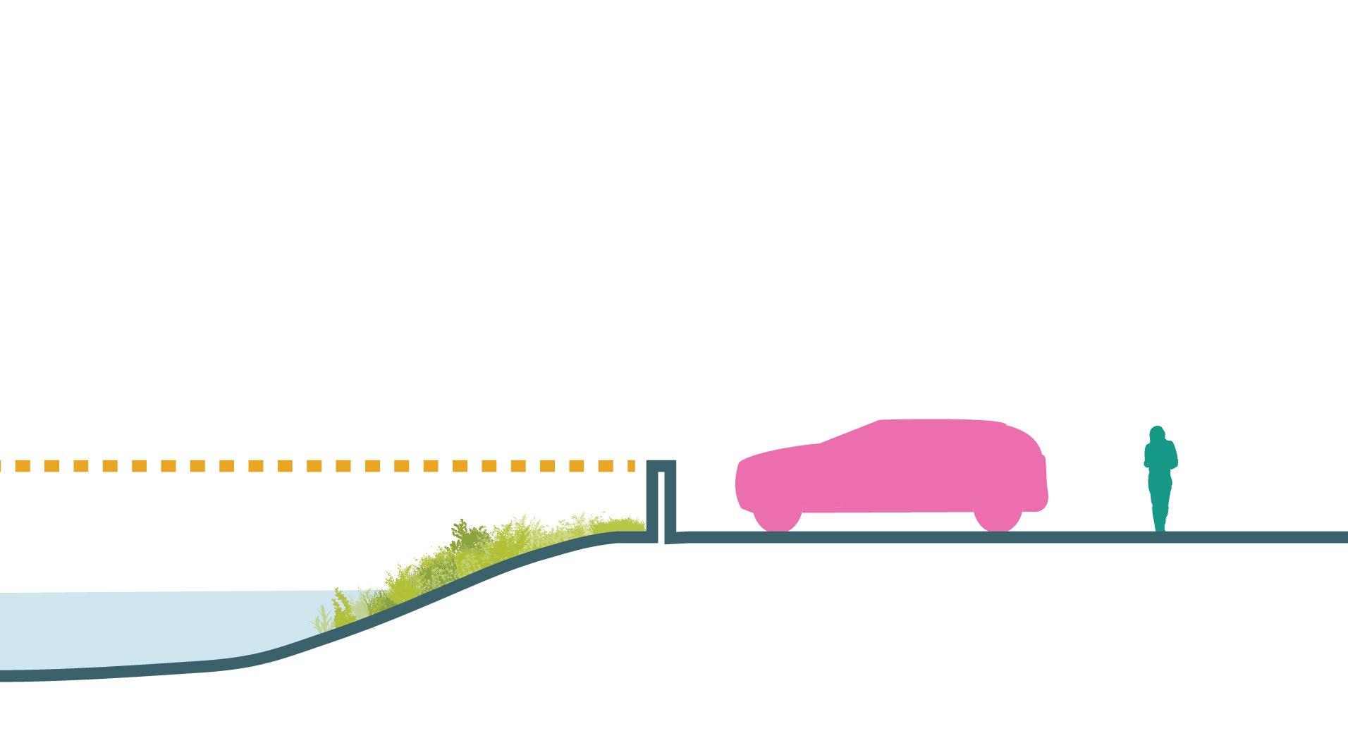
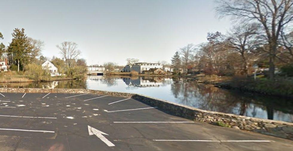
A wall that is roughly 8 feet tall would be required to mitigate the future 10% AEP storm along the stretch of shoreline that passes behind the condos on Holmes Street. Still, it might be possible to construct a permanent wall in this location because the living spaces at the condos are elevated, which means that the wall would not obstruct views of the river from residences. The dock at the river's edge will need to be changed from a fixed structure to one that articulates in response to water levels.
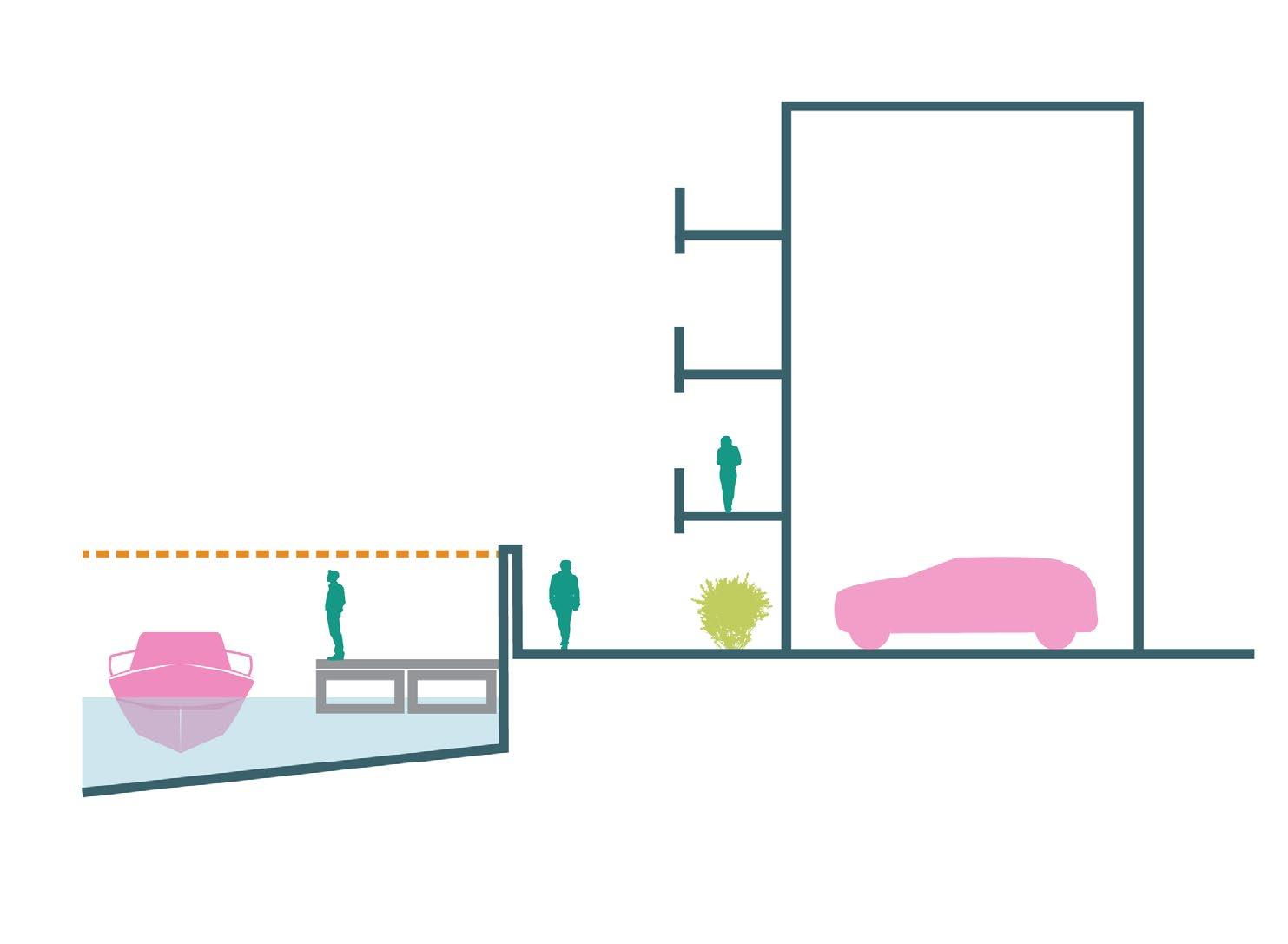
Design Flood Elevation
Not only is the green in Mystic River Park an important space for community gatherings such as concerts, floating light parades, and outdoor movies, visitors and residents alike are drawn to it for the views of the river and the opportunity to walk along side it. Instead of adding a permanent or temporary wall along the water's edge, which would disrupt the relationship to the river, the entire park might be elevated while also replacing the existing fixed dock with a floating dock that will move in response to the water's level. In this design, the boundary between the raised green and the dock would be articulated with a series of steps and ramps to provide access to the elevated green, all of which would be designed to endure inundation. When dry, these elements could be used for stadium seating for people to view the river and provide access from the elevated park to the floating dock.
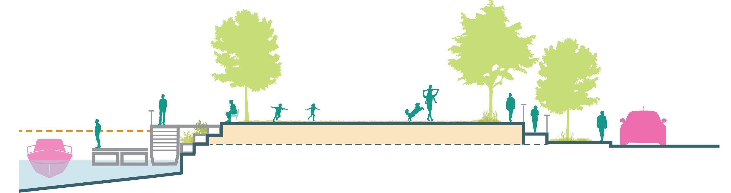
PROTECTED AREA
Design Flood Elevation
EXISTING GRADE
ARTICULATING DOCK
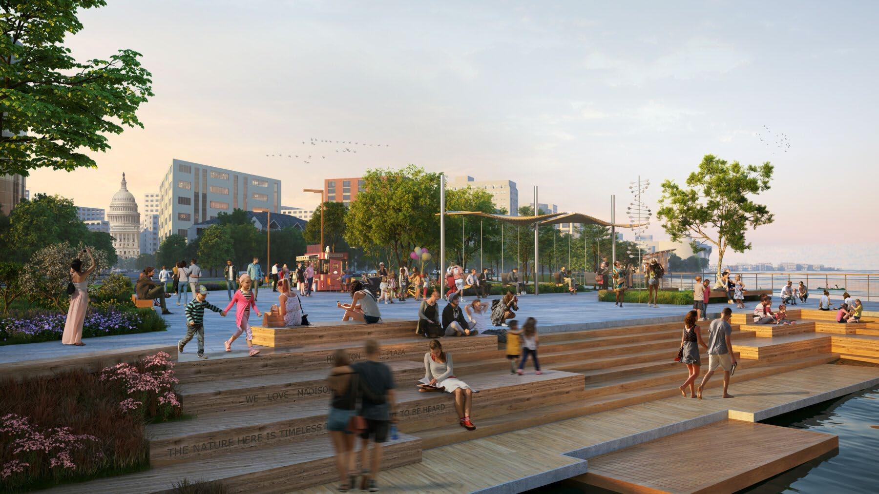
COTTRELL STREET
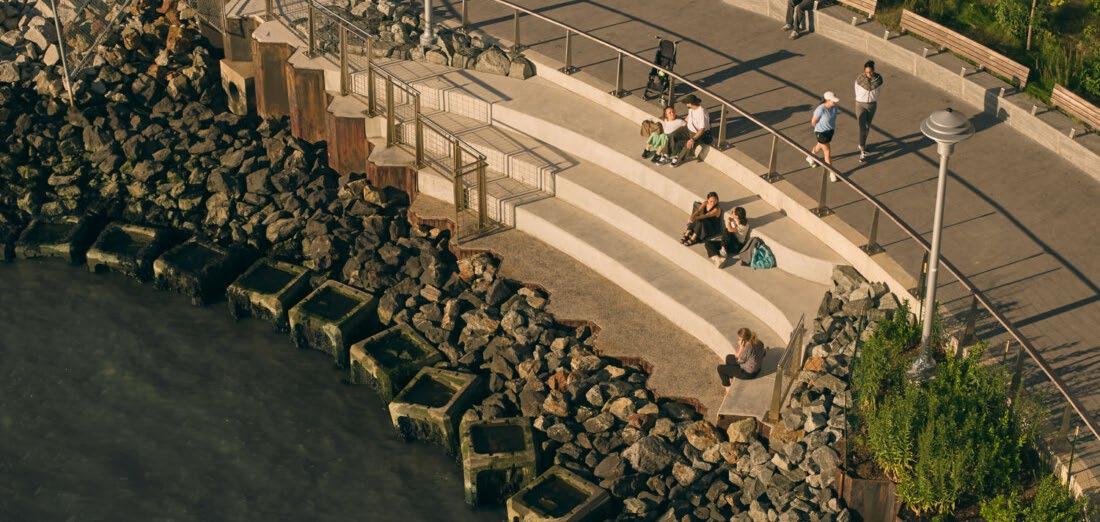
SECTION F:
DEPLOYABLE PLANK FLOOD WALL AT SOUTHERN END OF MYSTIC RIVER PARK
At the southernmost corner of Mystic River Park, the recommended concept would take the form of a semi-permanent flood wall such as the one pictured in which the posts are permanently installed and planks are placed between them to create an impermeable barrier during flood events.
Design Flood Elevation PROTECTED AREA
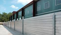
In this concept, the eastbound lane of Washington Street would be repurposed as a berm crowned by a pedestrian walkway. While this change would reduce traffic to one westbound lane, the berm would provide a barrier against moderate flood events, thereby reducing the need for some properties to consider relocation or acquisition on the north side of the street. Lessening the impact of flooding might create opportunities for those properties to consider elevation instead.

Design Flood Elevation
PROTECTED AREA
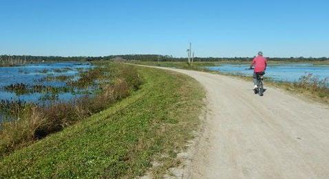
To prevent floodwaters from reaching the properties to the east and north of the established marsh south of Washington Street, Stonington could consider negotiating easements along the western edge of properties along Jackson Avenue for use in siting a berm for flood protection. To mitigate a 10% AEP storm, the berm in this location would need to reach a height of approximately 3.9 feet, which would not block views of the marsh from existing structures.
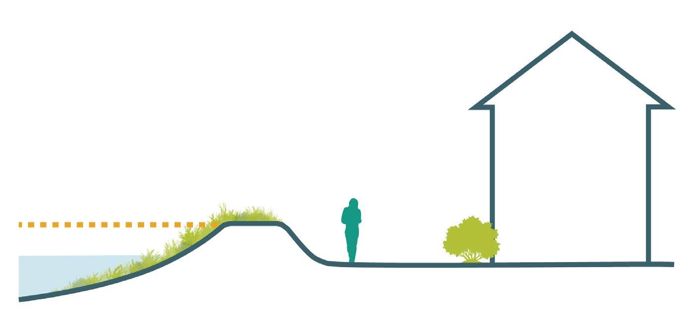
Design Flood Elevation
PROTECTED AREA
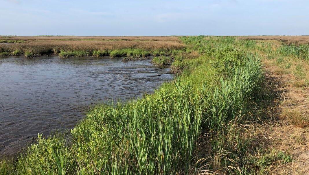
ASSUMPTIONS:
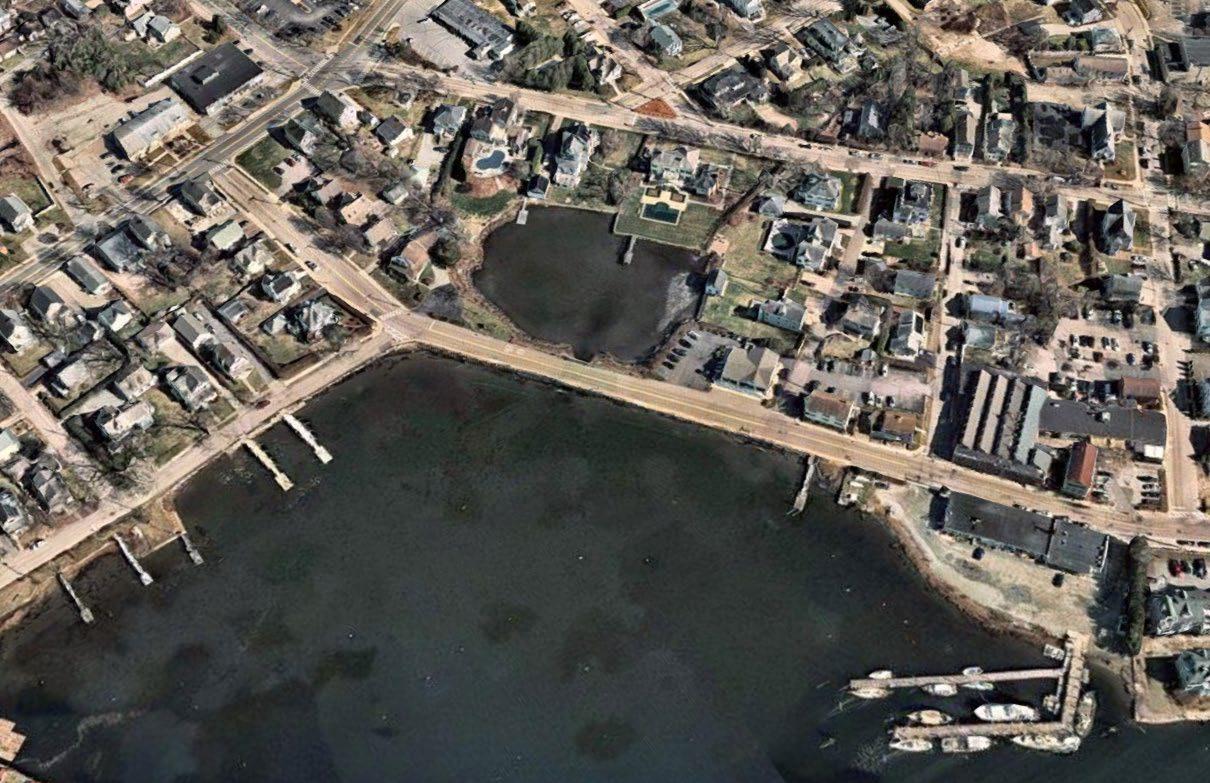
The Route 27 corridor adjacent to the Mystic Seaport Museum presents additional transportation vulnerabilities for Mystic as identified through community engagement. This state-owned road serves as an evacuation route away from the shoreline, while the adjacent south parking lot owned by the Mystic Seaport Museum (MSM) provides parking for major events and general visitor use. Elevation efforts for Route 27 must be carefully evaluated in reference to tidal, storm surge, and precipitationdriven flooding to avoid creating a barrier to stormwater drainage from inland areas, which could worsen localized flooding. The proposed concept would expand an area of floodable open space near the MSM south lot while establishing a “Resilience Hub” that converts surface parking into a shared structured parking facility serving both the museum and Downtown Mystic.
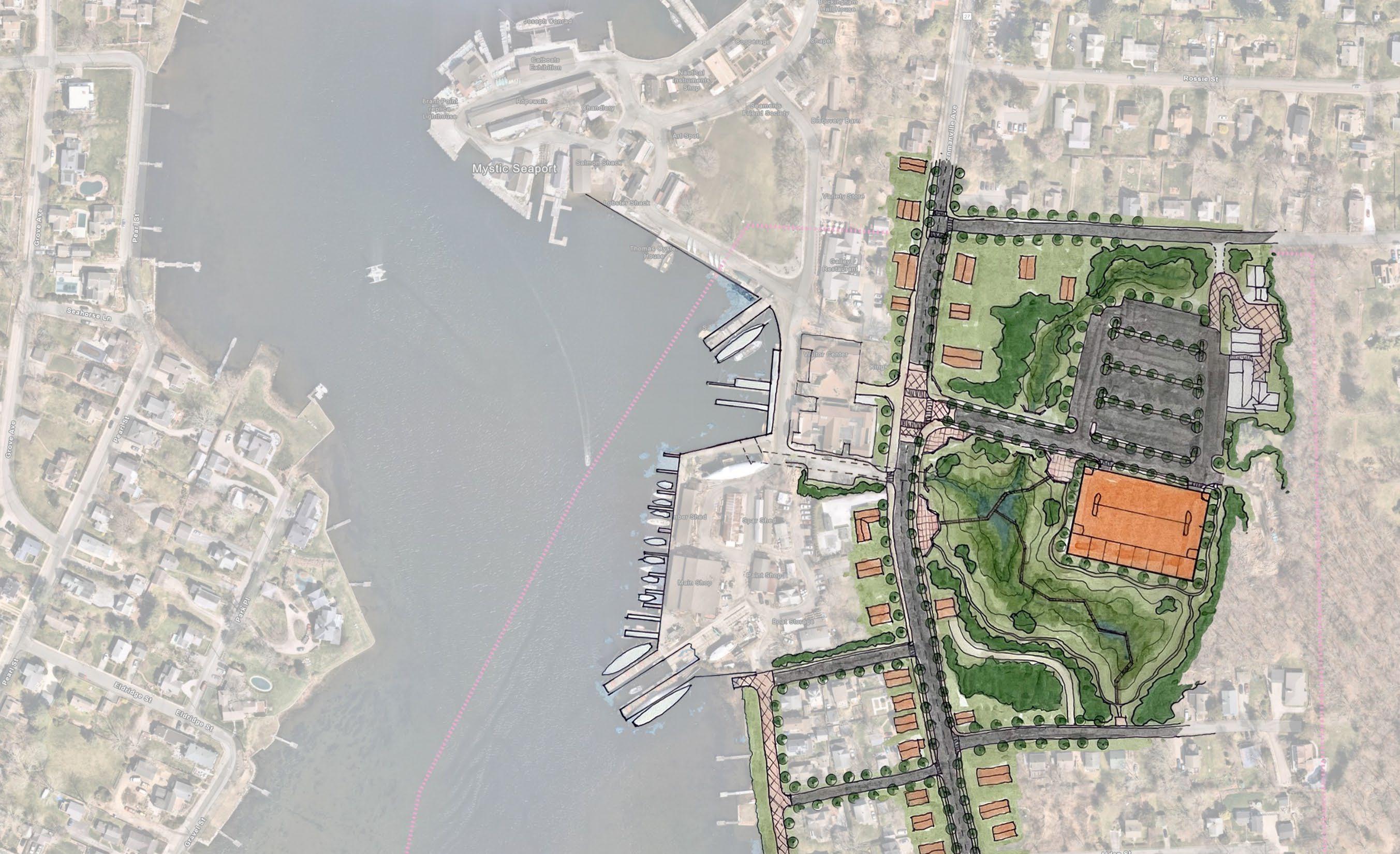

Floodable bottom floor with community resilience hub flex space / Parking deck roof capped with resilient solar microgrid feed SHADE TREES
POSSIBLE MIDSLOPE CONNECTION TO CARLTON
SCIENCE
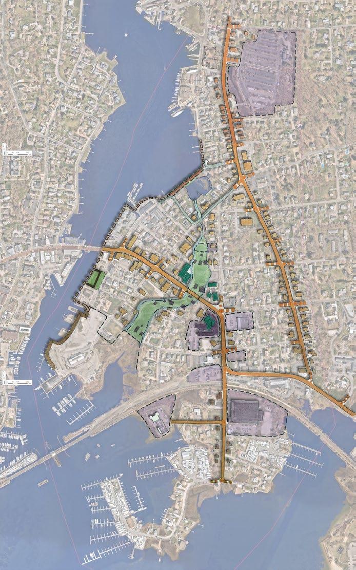
Route 27 (Greenmanville Avenue) represents an important north/south connector between Downtown Mystic and Interstate 95. Elevating this section of Greenmanville Avenue, along with other low points susceptible to flooding, will be necessary to retain this route's ability to provide safe inland egress during storm events. Other low points on Route 27 where flooding impedes egress would also need to be addressed in addition to this location.
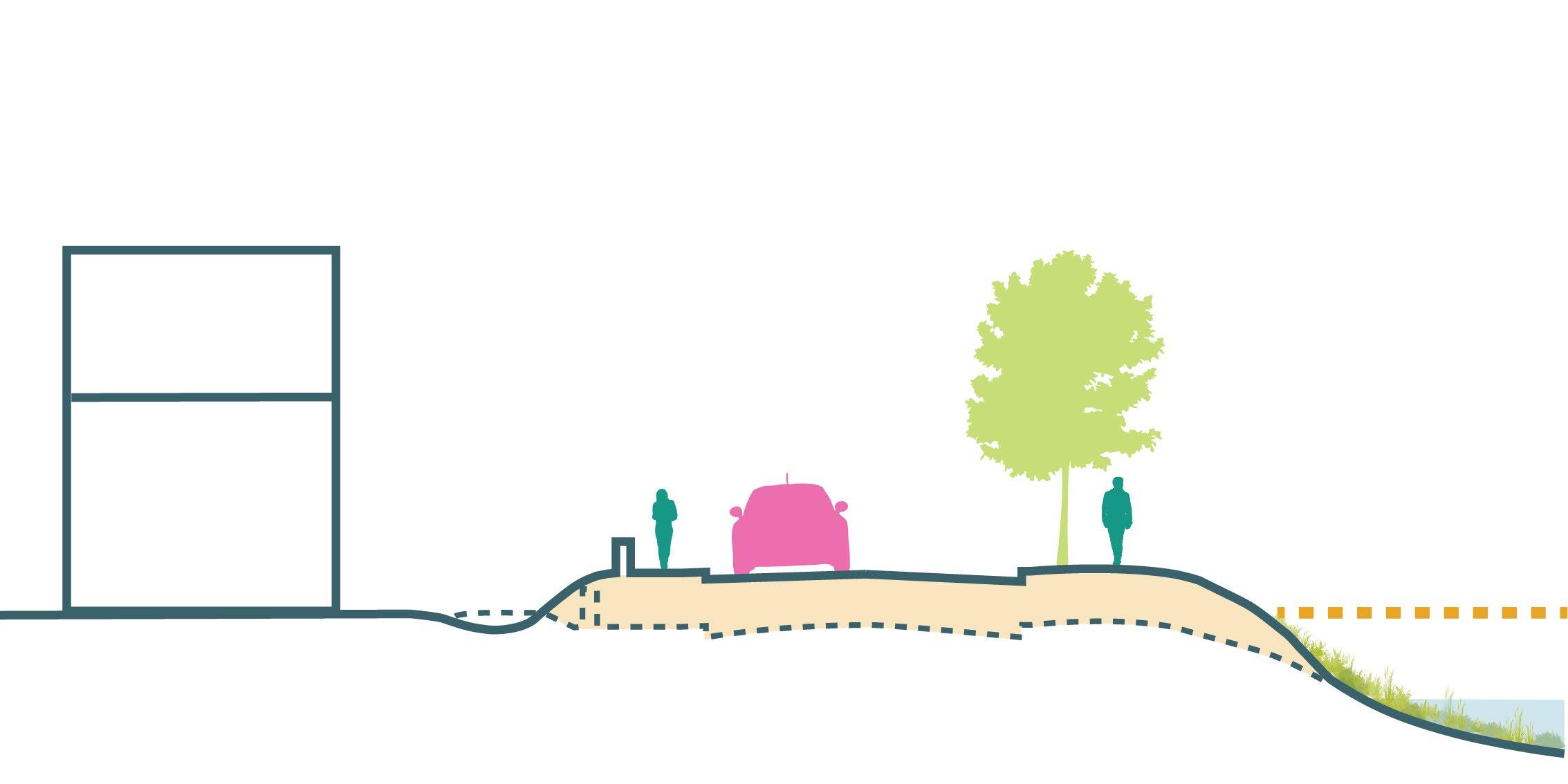
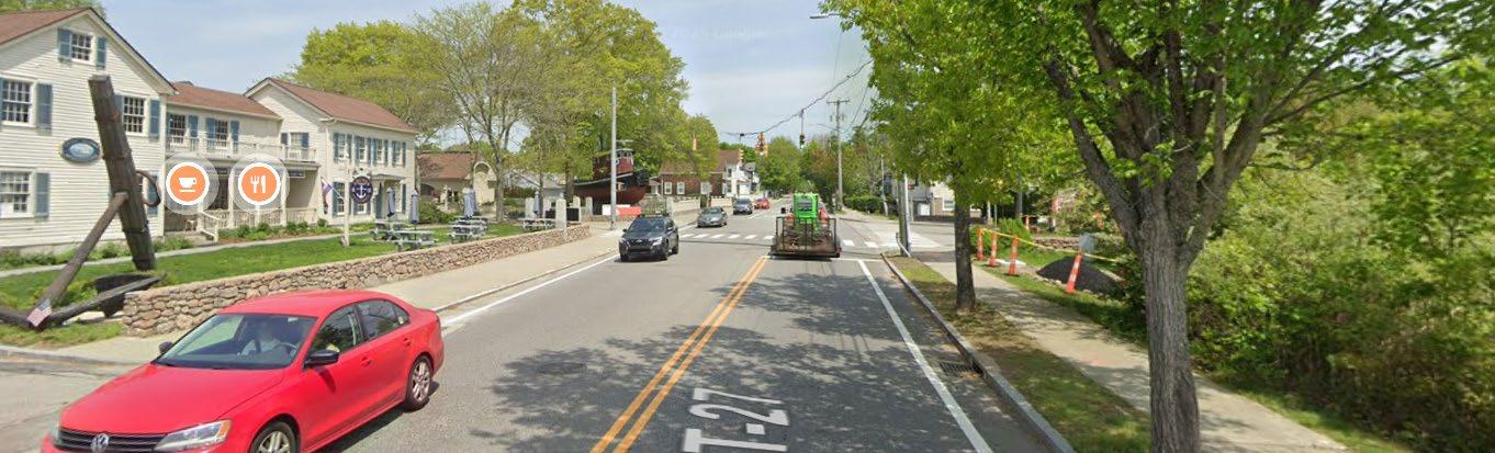
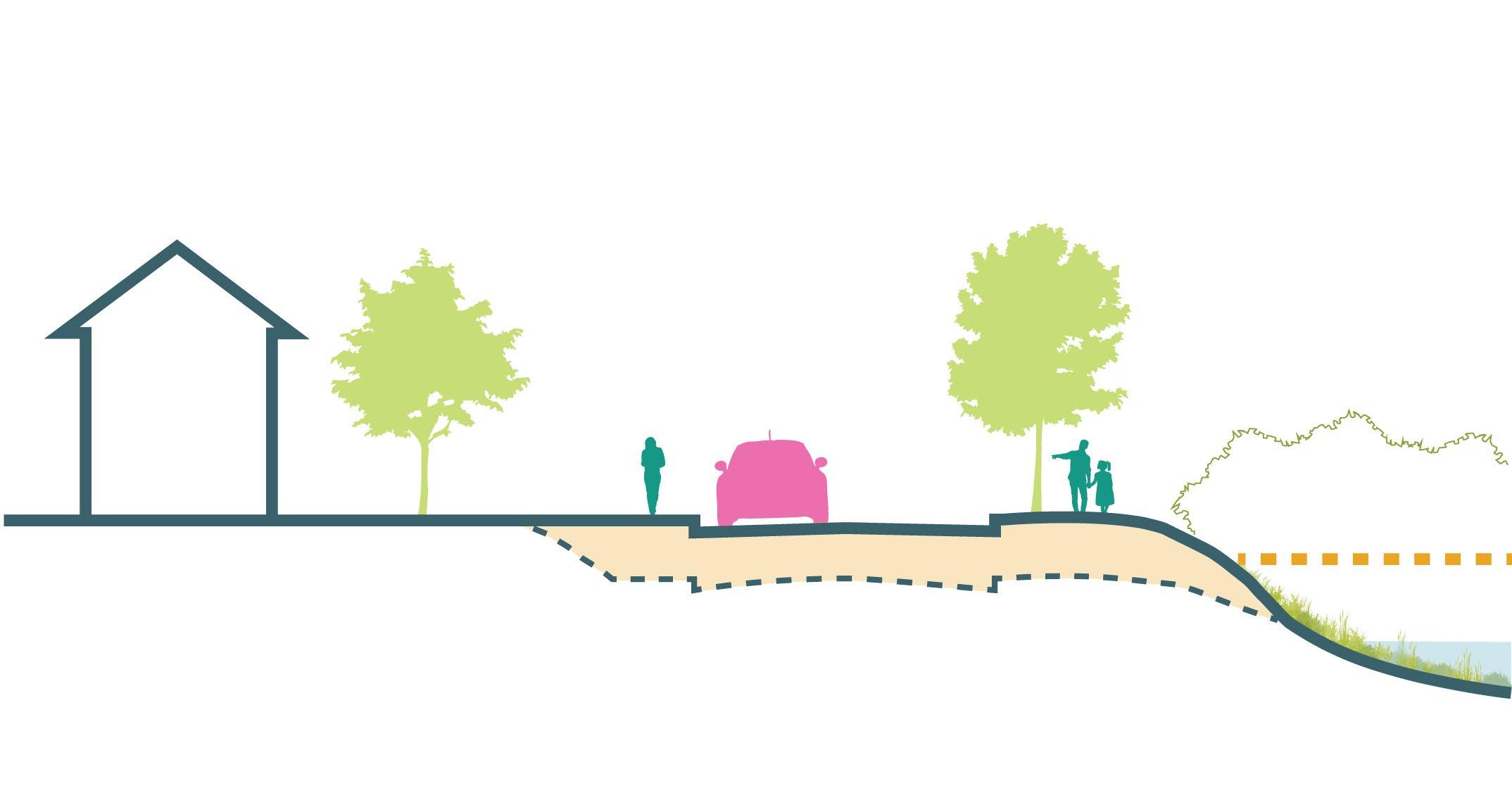
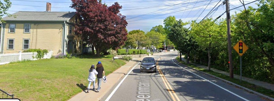
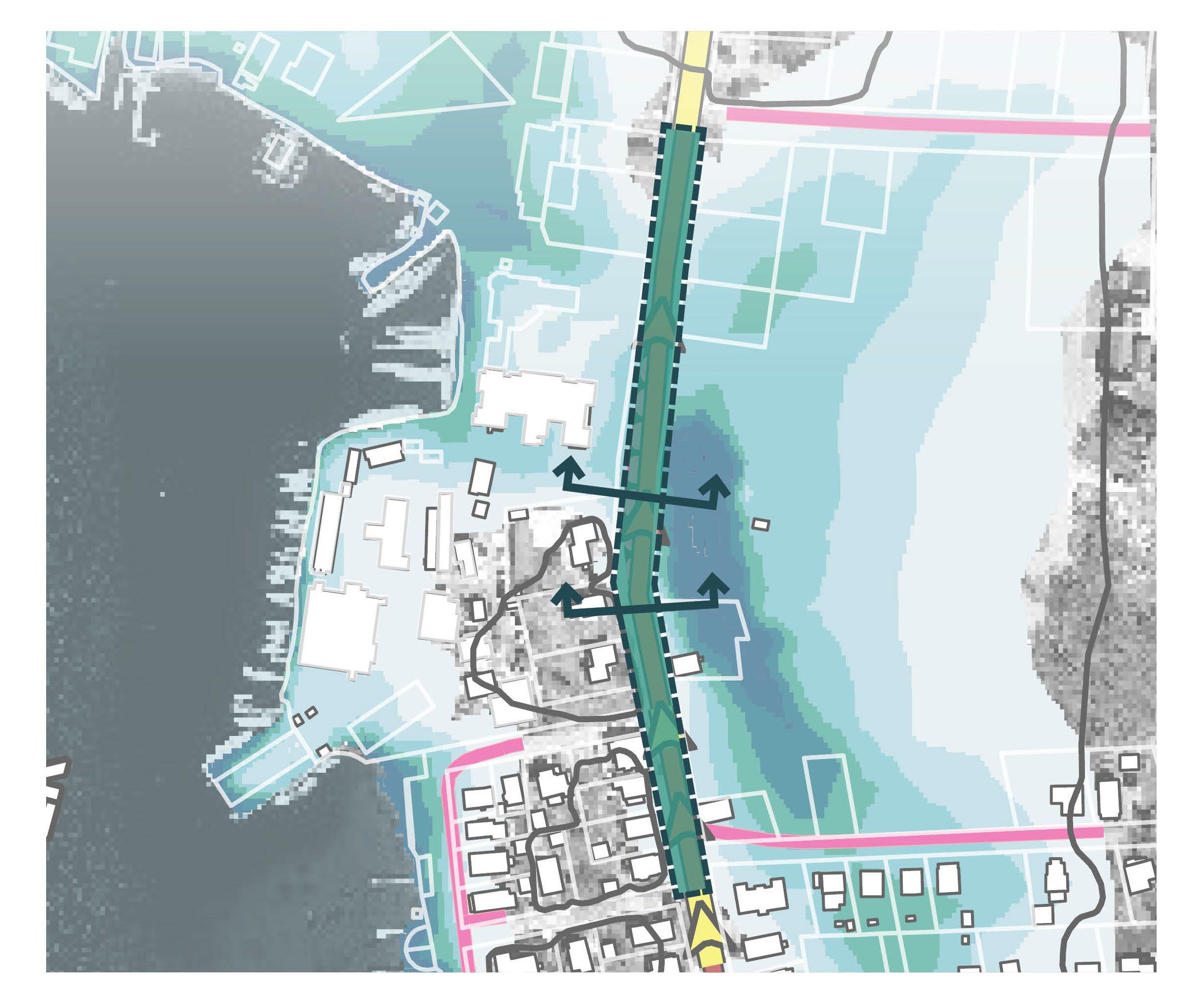
APPROXIMATE SEGMENT OF ROUTE 27 TO BE RAISED
Route 27, known as Denison Avenue in this location, stretches from the intersection with Mistuxet Avenue in the north to the intersection with Route 1 in the south. Unlike Route 1, this stretch of road is not expected to be impacted by flooding in the 10% AEP flood event with 20" of sea level rise. Currently a residential zone, this street in Downtown Mystic offers a redevelopment opportunity at a higher elevation than Route 1. To accommodate the migration of Downtown Mystic to higher ground within the proximity of the main tourist center of Main Street, the Town of Stonington might consider rezoning this portion of Route 27 for mixed use infill development to support the emergence of a vibrant streetscape tying into commercial establishments similar to those centered around the Bascule Bridge.
Positioned at the bottom of a steep slope that rises to its east, Denison Avenue would be an ideal location to integrate green stormwater infrastructure into the public right of way. Features such as bioswales, fileter strips, stormwater tree planters, and vegetated basins should be placed to intercept and detain stormwater runoff, preventing it from intensifying flood conditions in the lower lying areas of Downtown Mystic to the west of this road.
When strategically integrated into a streetscape, green stormwater infrastructure provides many co-benefits beyond mitigating stormwater flooding including extreme heat mitigation, stormwater quality improvements, pedestrian and bicycle safety improvements, improved sense of place, and increased habitat for pollinators.
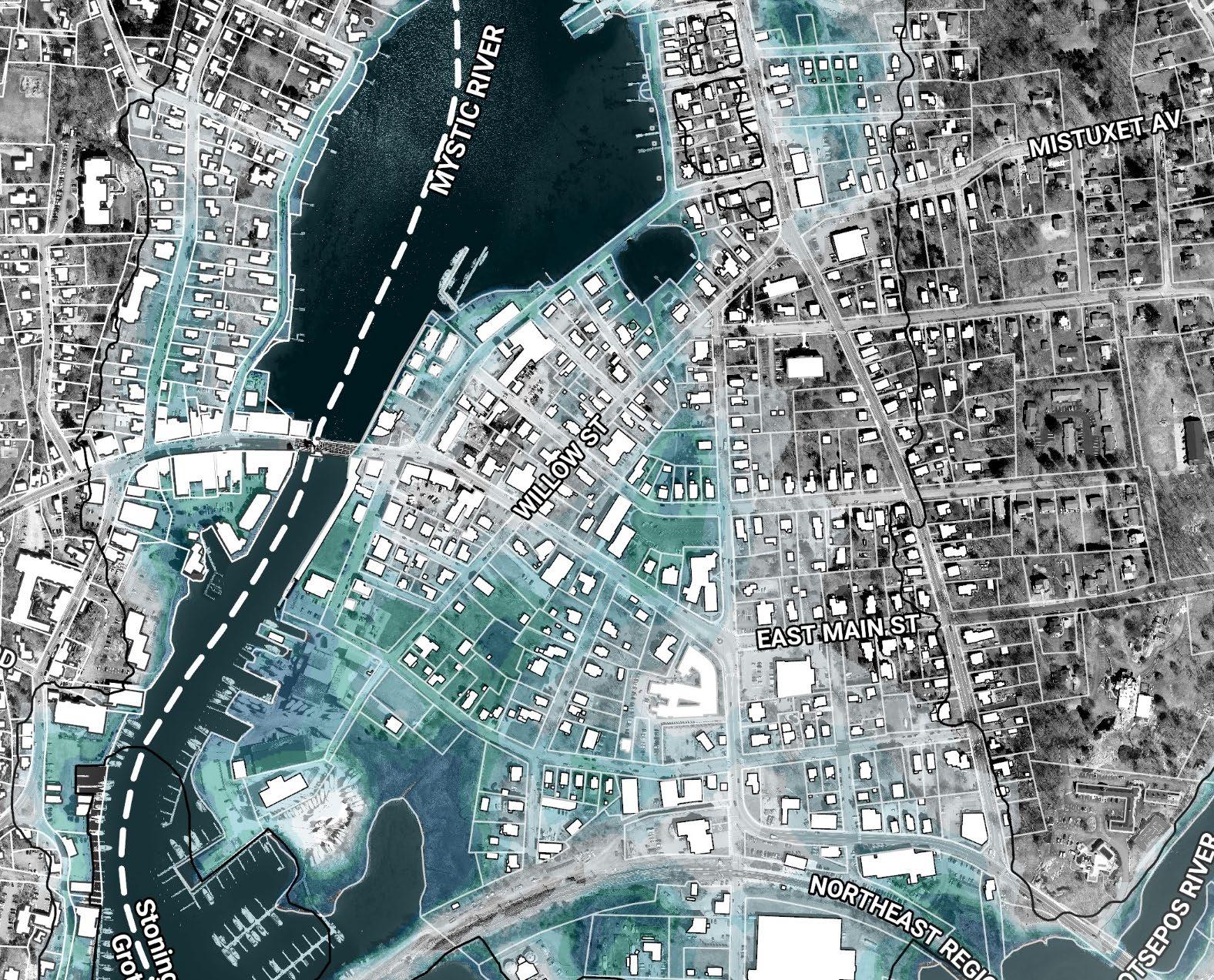
RESILIENT REDEVELOPMENT AREA
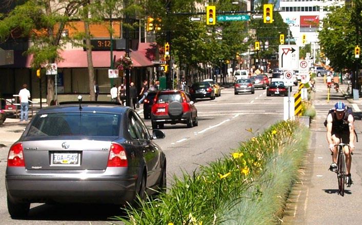
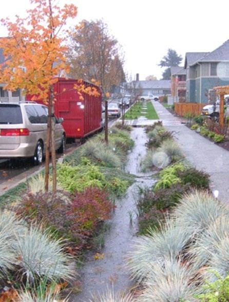
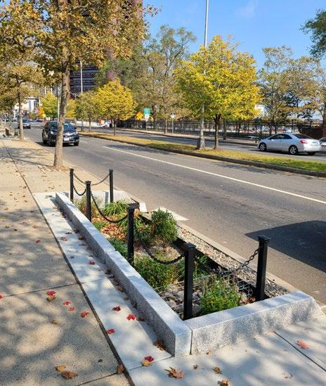
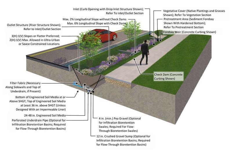
Examples of Green Stormwater Infrastructure in the Public Right-of-Way
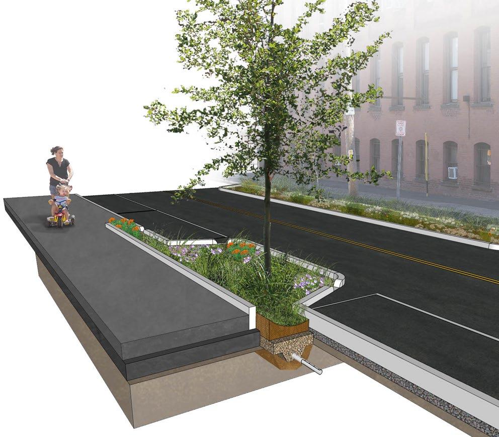
The following table provides an overview of the suggested timing and actions for phased implementation of resilience strategies and concepts for Downtown Mystic. The information presented in the table is broken down by broad phases, including implementation challenges, regulatory feasibility, and potential funding sources.
The most important near-term actions include the completion of the Wastewater Facilities Master Plan, which will clarify how implementation of Concept 1 may proceed depending on the timeline for the removal of the Mystic Wastewater Treatment Plant. This can occur while updates to regulatory zoning are being finalized, which will inform the direction of the conversation regarding the Route 1 Resilient Corridor. Other near-term priorities include conducting outreach with property owners who fall within the identified future areas of
three or more feet of flooding; floodproofing vulnerable elements of Mystic Fire Station; and contacting CTDOT to review possible ways to initiate the Phase I Resilient Corridor concept. If there are areas in town where there is already widespread interest in implementing small-scale concepts such as shoreline adaptations outlined in Concept Three, the Town can undertake traffic studies or further assessment to make progress on constructing these concepts.
Many of the medium- to long-term actions in this table depend on a triggering event such as a severe storm requiring substantial repairs at buildings across Downtown Mystic. Once this occurs, Stonington should be ready to provide guidance and/or financial support for structural renovations, elevation, or relocation if necessary with incentives for inland or high elevation destinations such as Route 1.
CONCEPT IMPLEMENTATION TIMEFRAME PRIMARY ACTIONS IMPLEMENTATION
Floodwall and Road Elevation at Wastewater Treatment Facility Near Term 0-5 years
Route 1 Resilient Corridor Phase 1: Broadway Avenue to Denison Avenue Mid Term 5-10 years
• Conduct detailed planning and refine concept for floodwall around WWTF and access road elevation (Edgemont Street)
• Design, permitting, and construction
• Complete Wastewater Facilities Master Plan process to identify long-term solution for wastewater management for Downtown Mystic
• Conduct detailed planning and refine concept
• Update zoning regulations to permit the development of a dense, mixed-use Resilient Corridor
• Perform outreach to private businesses and homeowners
• Identify key developable parcels for infill development
• Design, permitting, and construction
• Partner with individual property owners, or groups of property owners to develop detailed plans for mitigation techniques, obtain permits, and coordinate installation
• Extreme coastal wave heights could overtop flood wall during storm events
• Elevation of Route 1 (State Route) will require CTDOT buy-in and lead role
• Modified grade and/or footprint of elevated road may impact and/or require elevation of adjacent properties
• May require acquisition of additional right-of-way, potentially involving the purchase of private property.
• May require relocation of existing utilities (water, sewer, gas, electric lines, etc.)
• Possible need to preserve existing usage of these areas
• Coordination with residents who may use these roads to access their homes
• Must be implemented holistically around the shoreline to be successful and avoid exacerbating issues for areas without mitigation strategies along the water's edge
REGULATORY FEASIBILITY POTENTIAL FUNDING SOURCES
• Temporary or semi-permanent (deployable) floodwall potentially easier to permit than more permanent options
• Permanent floodwall would require more significant CTDEEP and USACE coastal permitting process.
• Compliance with local zoning regulations and land-use plans, potentially requiring amendments
• Historic preservation regulatory considerations
• CT DEEP Clean Water Fund (CWSRF)
• FEMA Hazard Mitigation Assistance Grant Programs
• CT DEEP and USACE coastal permitting
• Permitting processes may favor hard infrastructure over potentially more sustainable nature-based solutions
• Local flood management permitting
• Compliance with local zoning regulations and land-use plans, potentially requiring amendments
• Historic preservation regulatory considerations
• USDOT Rebuilding American Infrastructure with Sustainability and Equity (RAISE) Discretionary Grant Program
• USDOT Promoting Resilient Operations for Transformative, Efficient, and Cost-Saving Transportation (PROTECT) Grant Program;
• FEMA Hazard Mitigation Assistance Grant Programs
• DECD Community Investment Fund (CIF)
• CT DEEP Climate Resilience Fund
• Resilience Improvement Districts/Tax Increment Financing
• NFWF National Coastal Resilience Fund
• Municipal Bonds
Managed Relocation & Floodable Open Space
Long Term 10-20 years
• Voluntary relocation of vulnerable and/or damaged buildings
• Acquisition of land for ownership by the public trust
• Strategic transition of acquired properties into walkable and/or multi-use (floodable) passive recreational and/or event spaces
• Requires extensive public buy-in and financial resources to acquire land between Murphy’s Point and Main Street
• Can exacerbate existing inequalities, disproportionately impacting marginalized communities
• CT DEEP and USACE coastal permitting
• Local flood management and inland wetlands permitting
• Compliance with local zoning regulations and land-use plans, potentially requiring amendments
• Historic preservation regulatory considerations
• FEMA Hazard Mitigation Assistance Grant Programs
• USDA Emergency Watershed Protection – Floodplain Easement Program (EWP-FPE)
• NFWF National Coastal Resilience Fund
• Resilience Improvement Districts/Tax Increment Financing
• Transfer od Development Rights
Route 1 Resilient
Corridor Phase 2: Bascule Drawbridge to Broadway Avenue
Mid to Long Term 5-20 years
Elevation of LowLying Locations along Route 27
Mid to Long Term 5-20 years
• Conduct detailed planning and refine concept
• Update zoning regulations to permit the development of a dense, mixed-use Resilient Corridor
• Consider tie-ins to Washington and Holmes Street
• Perform outreach to private businesses and homeowners
• Identify key developable parcels for infill development
• Design, permitting, and construction
• Elevate selected locations of Route 27 to facilitate egress along the north/south route which is a primary evacuation corridor connecting Mystic to I95
• At the South Lot of the Mystic Seaport, convert surface parking into expanded salt marsh area and consider adding a parking structure
• Elevation of Route 1 (State Route) will require CTDOT buy-in and lead role
• Modified grade and/or footprint of elevated road may impact and/or require elevation of adjacent properties
• May require acquisition of additional right-of-way, potentially involving the purchase of private property.
• May require relocation of existing utilities (water, sewer, gas, electric lines, etc.)
• Redeveloping the South Lot to increase flood capacity and house a parking structure will require partnership with the Museum, who owns the property.
• Compliance with local zoning regulations and land-use plans, potentially requiring amendments
• Historic preservation regulatory considerations
• Compliance with local zoning regulations and land-use plans, potentially requiring amendments
• Historic preservation regulatory considerations
• USDOT Rebuilding American Infrastructure with Sustainability and Equity (RAISE) Discretionary Grant Program
• USDOT Promoting Resilient Operations for Transformative, Efficient, and Cost-Saving Transportation (PROTECT) Grant Program;
• FEMA Hazard Mitigation Assistance Grant Programs
• USDOT Rebuilding American Infrastructure with Sustainability and Equity (RAISE) Discretionary Grant Program
• USDOT Promoting Resilient Operations for Transformative, Efficient, and Cost-Saving Transportation (PROTECT) Grant Program;
• FEMA Hazard Mitigation Assistance Grant Programs
GENERAL PLAN REVIEW
• CIRCA – Floodplain Building Elevation Standards for Critical Facilities and Activities (2022)
• CTDEEP - Analysis of Shoreline Change in Connecticut (2014)
• Town of Groton - Downtown Mystic Resiliency and Sustainability Plan (2024)
• SECOG - Multi-Jurisdictional Hazard Mitigation and Climate Adaptation Plan Update (2023)
• Mystic Seaport Museum - Sea Level Rise Strategic Facility Plan (2021)
• Nature Conservancy - (Inland Interventions for Coastal Resilience in Mystic, Connecticut (2019)
• Mystic Harbor Management Commission - Mystic Harbor Management Plan (2023)
• Nature Conservancy - Shoreline Interventions for Coastal Resilience (2019)
• Town of Stonington - Coastal Resilience Plan (2017)
• Town of Stonington - Downtown Mystic Parking Study (2021)
• Town of Stonington - Flood Awareness Newsletter (2023)
• Town of Stonington - Plan of Conservation and Development (2015)
• Town of Stonington - Zoning Regulations (Last amended 2024)
HISTORIC PRESERVATION PLAN REVIEW
• Connecticut State Historic Preservation Office - Historic Preservation and Resiliency Planning in Connecticut (2019)
• Connecticut State Historic Preservation Office - Resilient Historic Resources: Best Practices for Planners (2012)
• Town of Stonington - Historic Preservation Strategies Report (2019)
• U.S. Secretary of the Interior - Guidelines on Flood Adaptation for Rehabilitating Historic Buildings (2021)
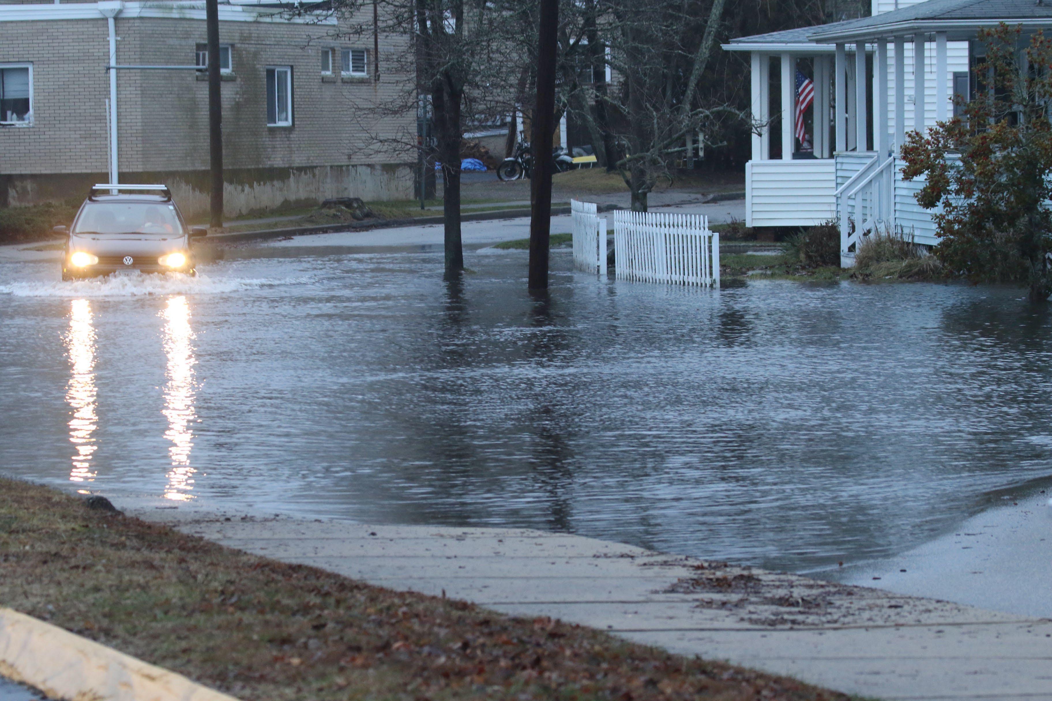
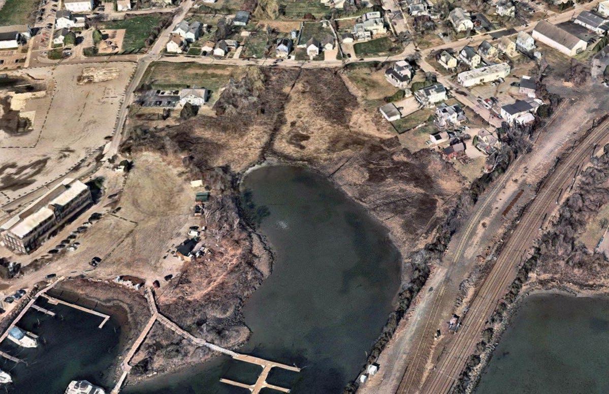
Once a structure is selected to be elevated, the standard to which its lowest horizontal component must be elevated is assessed. The recommended elevation depends on a structure’s primary use, depth of expected flooding, and regulatory requirements, with some discretion left to the property owner depending on risk tolerance, data availability, and available financing. In Stonington, local freeboard standards are being reconsidered through the Planning Department's current effort to update the zoning code.
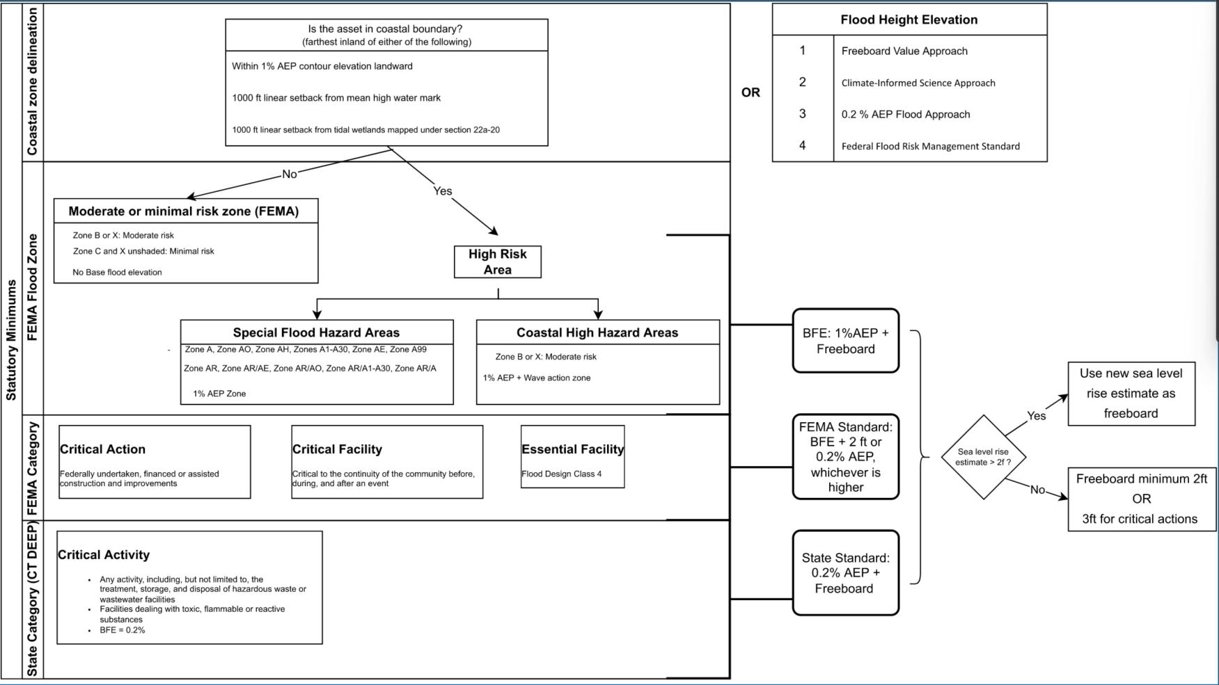
Decision-Making Framework for Building Elevation from CIRCA Report on Building Elevation Standards
C
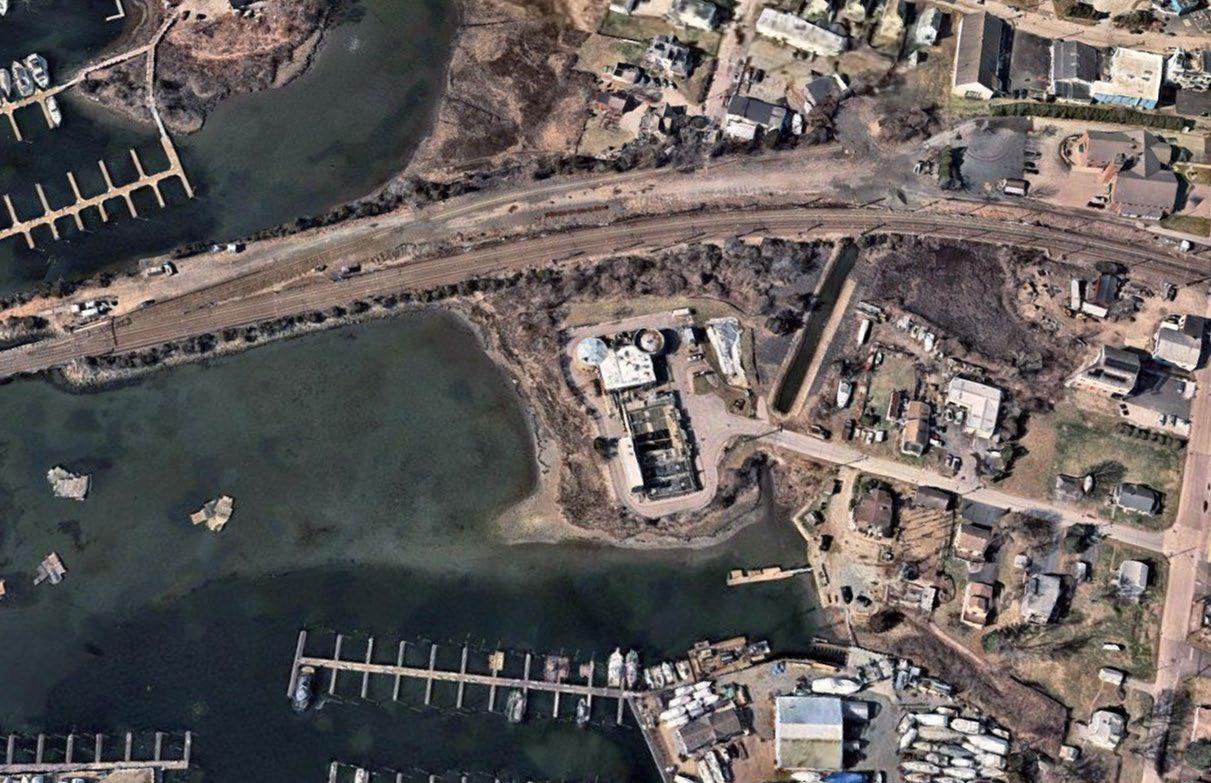
From: Ben Liptak <ben.liptak@aquafence.com>
Sent: Wednesday, July 23, 2025 4:15 PM
To: Rebecca Madsen
Cc: Chelsea Zakas; Sarah Borkman
Subject: Re: Quote Request - Deployable Flood Barrier, Stonington, CT
This Message is from an external sender.
Rebecca,
Yes, it's certainly possible to protect the entire area with a single perimeter wall instead of three separate systems! This approach often streamlines deployment and can optimize project efficiency.
Based on this revised scope of a single perimeter of approximately 775 linear feet, here is an updated preliminary estimate for your budgeting purposes:
• Consolidated "Campus" Protection Plan
o Scope: Approximately 775 LF Campus Protection for all 3 Facilities (WWTF, Transformer, and Generator) via V2700 (9' Protection Height) FloodWall.
o Price: $970,000.00 - $1,070,000.00 + tax
o Storage: 30 Crates (3' 10" x 9' 4" x 4' 4")
o Deployment: 5 hours for a team of 12
Please review and let me know if you have any questions!
Ben Liptak
Senior Vice President, Sales
+1 (815) 257-2918 ben.liptak@aquafence.com www.aquafence.com

AquaFence Inc. 95 River Street, Ste 408 Hoboken, NJ
On Tue, Jul 22, 2025 at 4:36 PM Rebecca Madsen <Rebecca.Madsen@fando.com> wrote:
Hi Ben,


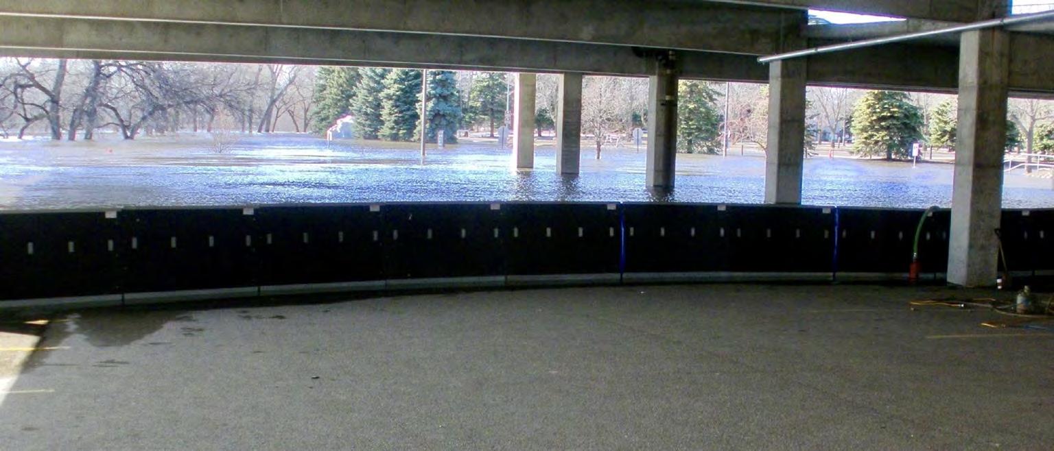
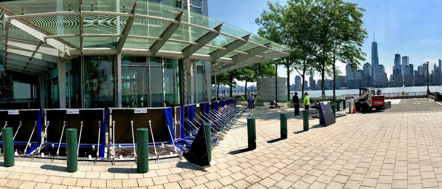
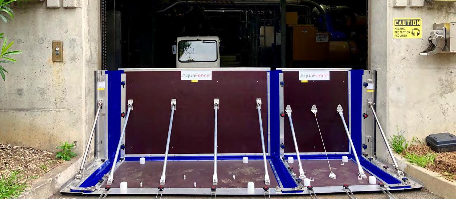
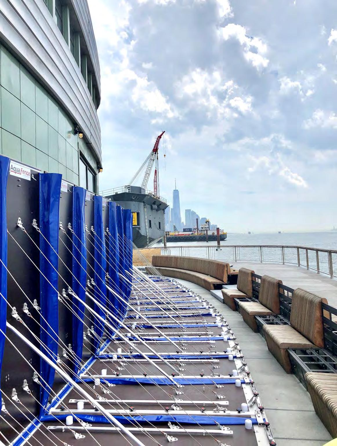
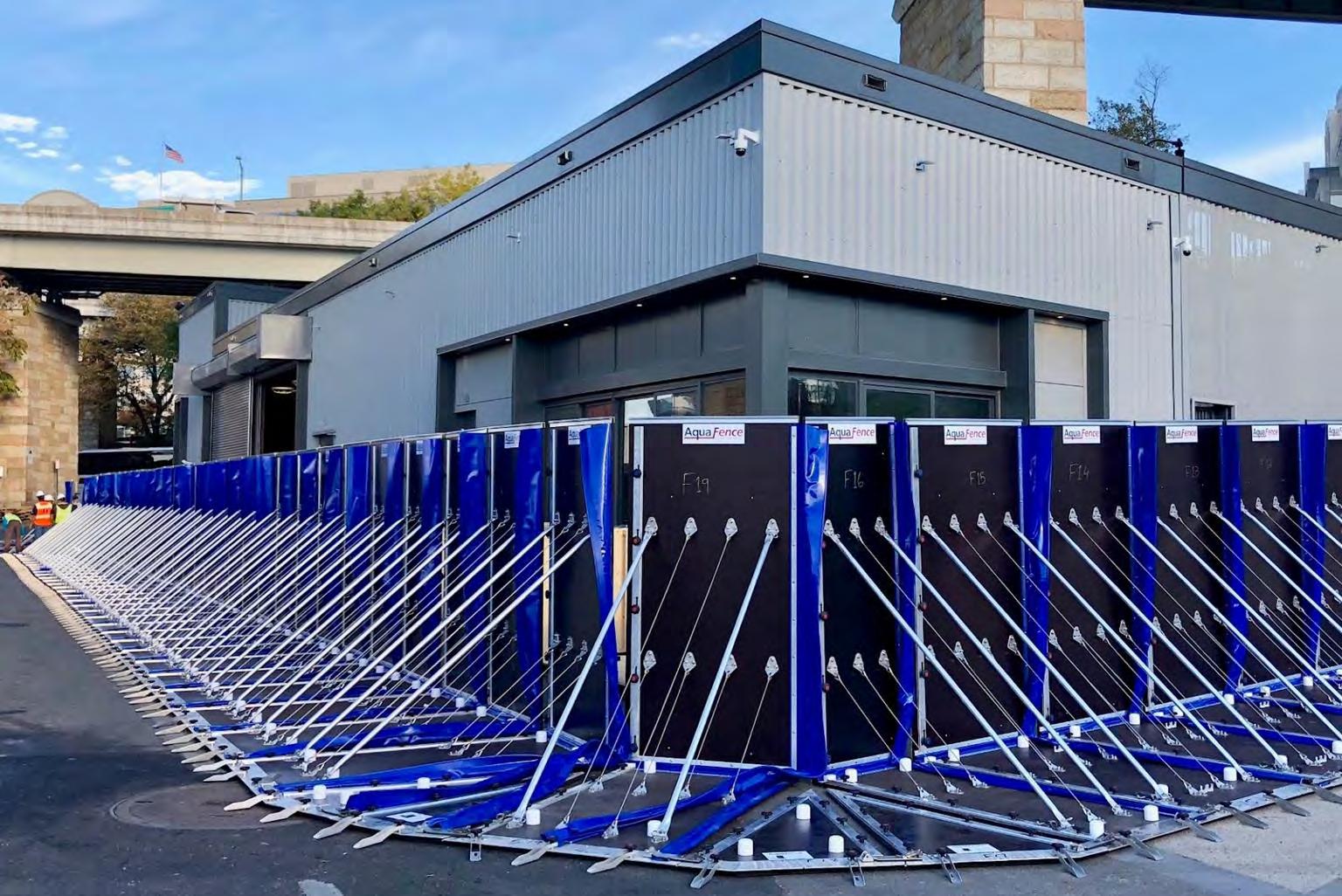
The AquaFence is a US Army Corps of Engineers tested flood protection barrier that can be:
• Deployed 100 times faster than sandbags without special training or heavy machinery
• Easily disassembled and stored for future floods
• 100% reused without any waste creation
• Delivered in protection heights ranging from 2.5’ to 9’ (0.75 to 2.7 meters)
• Used nationwide as FEMA compliant dry floodproofing
Invented and patented in Norway in 1999, the mission at AquaFence has always been to offer state of the art flood barriers that are easy to install during emergency situations, yet out of sight at all other times.
Originally developed in cooperation with multiple international flood protection programs as well as global insurance companies, AquaFence is now protecting hospitals, municipalities, transportation hubs, industrial buildings and significant real estate worldwide.
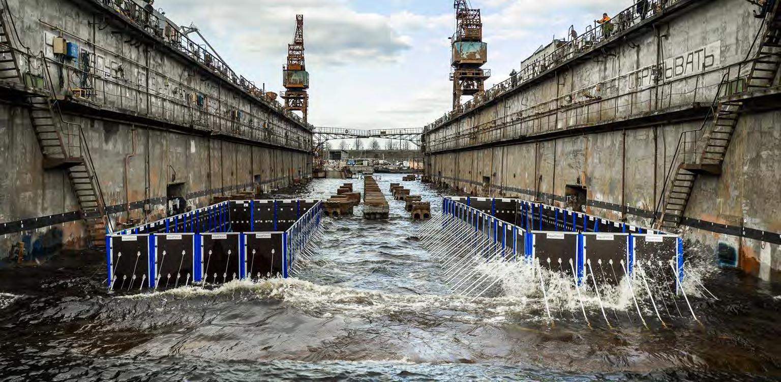
The AquaFence Flood Barrier is a modular system where multiple interconnected panels are used to form a flood wall around a structure or area. Each panel is individually self-stabilized by the weight of the water on the system, creating a barrier that is highly resistant to a variety of flood loads with minimal anchoring and preinstallation site work. The system can be reused dozens of times and only requires a fresh water rinse after each use.
The AquaFence patented Flood Barrier is designed with safety factors above industry standard and has been extensively tested in AquaFence as well as third party test facilities. All parts are made of durable materials, with examples of the system being used, in some cases fully submerged in water, for several years at a time. It has also been tested to withstand extreme temperatures. The system is compliant with building codes such as ASCE 7-16, ASCE 24-14, IBC 2015, and more.
Due to the ease of installation, AquaFence flood barriers can be installed even at low probability of flooding. The modularity of the system allows egress points to be created by leaving single modules out of the barrier. With egress in and out, the area at risk can stay open up until the last minute before flooding occurs, at which point the remaining modules are installed to complete the barrier.
When the AquaFence system is not in use, the panels are stored in custom, space efficient crates, which can be stacked up to four high.
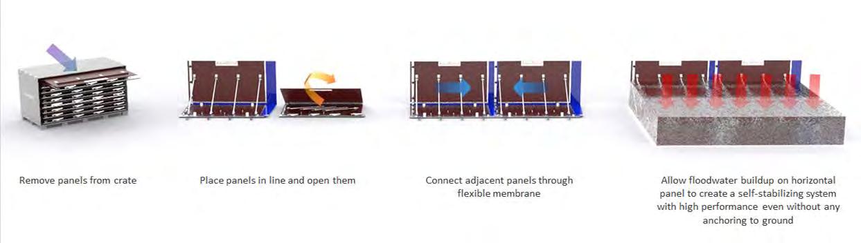
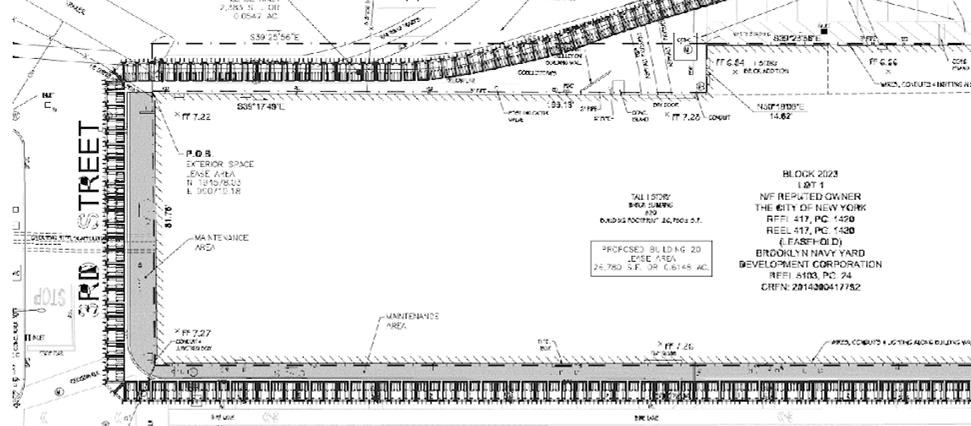
AquaFence Flood Barriers are highly engineered systems delivered with detailed documentation ranging from plan and shop drawings to stamped calculations A site-specific flood barrier from AquaFence is typically designed based on a combination of building plans, elevation drawings and site visits by AquaFence engineers
The AquaFence flood barriers can be highly customized to account for unique site parameters typical of urban environments such as sidewalks, drainage systems, alleyways, etc. All customized designs undergo detailed engineering analysis to ensure a high level of performance.
The AquaFence system is compliant with International and American building codes such as IBC 2015, ASCE 7-16 and ASCE 24-14
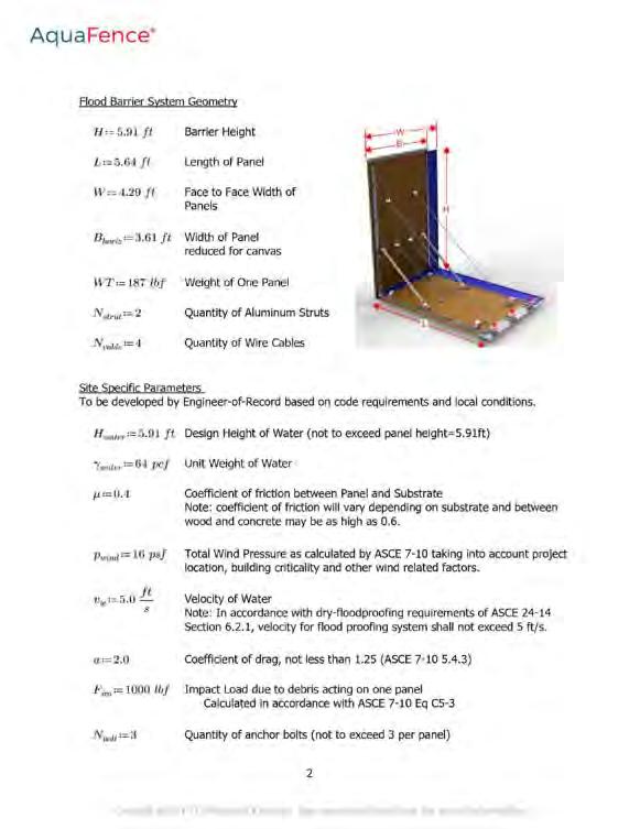
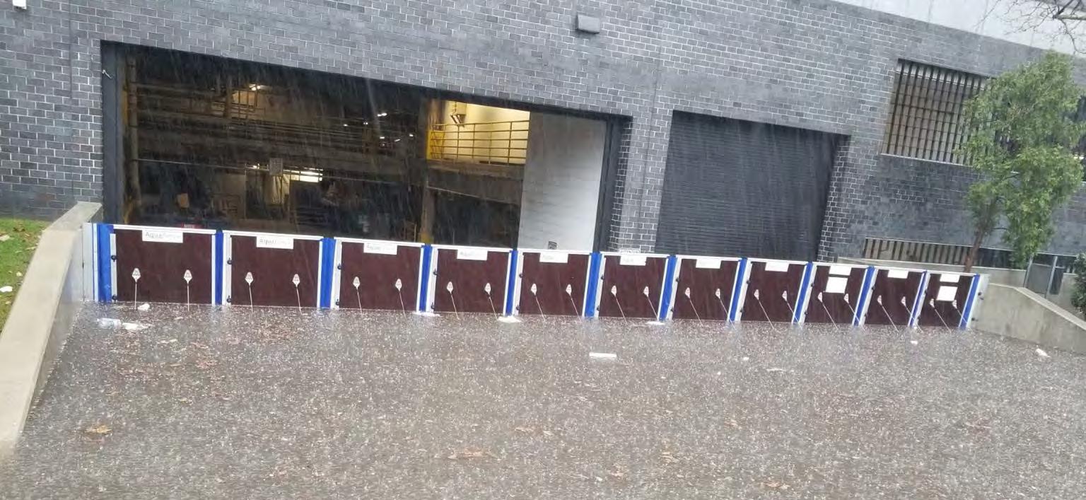
The Integrated Flood Shield is a FEMA compliant customized solution designed to floodproof openings and exposures of buildings and other critical assets. These systems are designed for both new and existing buildings and are delivered with a FEMA compliant Emergency Response Plan created in cooperation with building management
The self-stabilizing nature of AquaFence systems ensures that the loads on the flood barrier are not transferred back to the building itself, therefore having minimal impact on the building exterior A handful of ½” (12 mm) drop-in anchors are typically used on either end of the barrier to ensure a tight seal between the AquaFence system and the protected building or structure. These anchors are capped when not in use and are the only trace of the system once it has been disassembled In cases where the AquaFence concludes at a surface that can not be anchored into, e.g. flood proof glass, a customized method utilizing the reaction force from the ground can be used to create the necessary seal against the structure
AquaFence Integrated Flood Shields can be used on the inside or outside of buildings to divert water away from critical assets
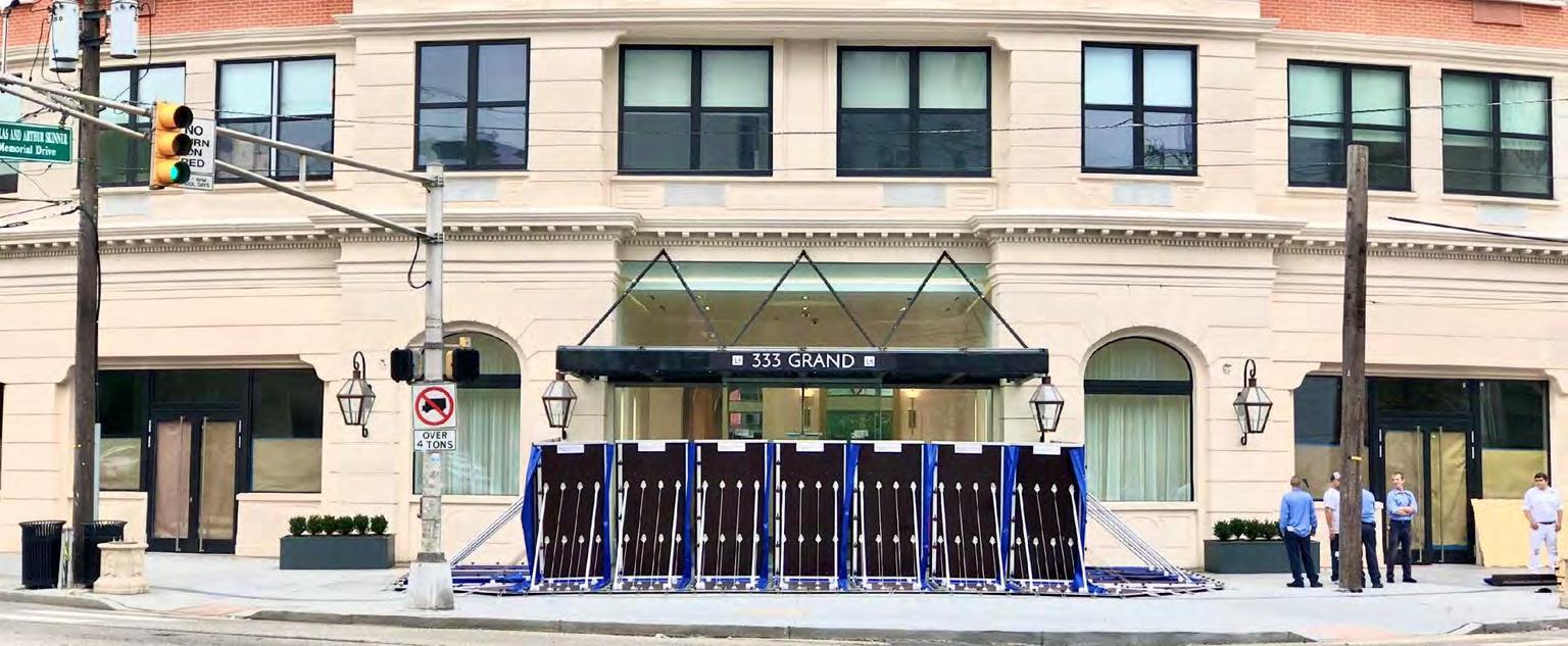
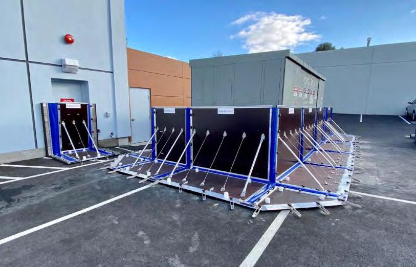
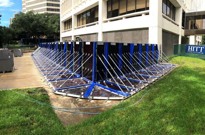
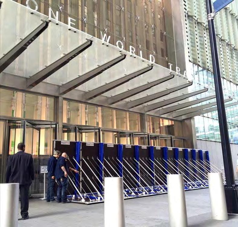
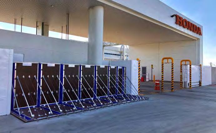
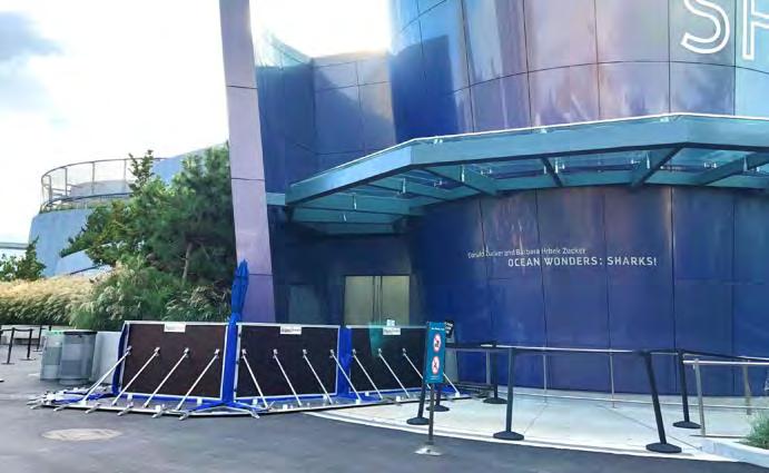
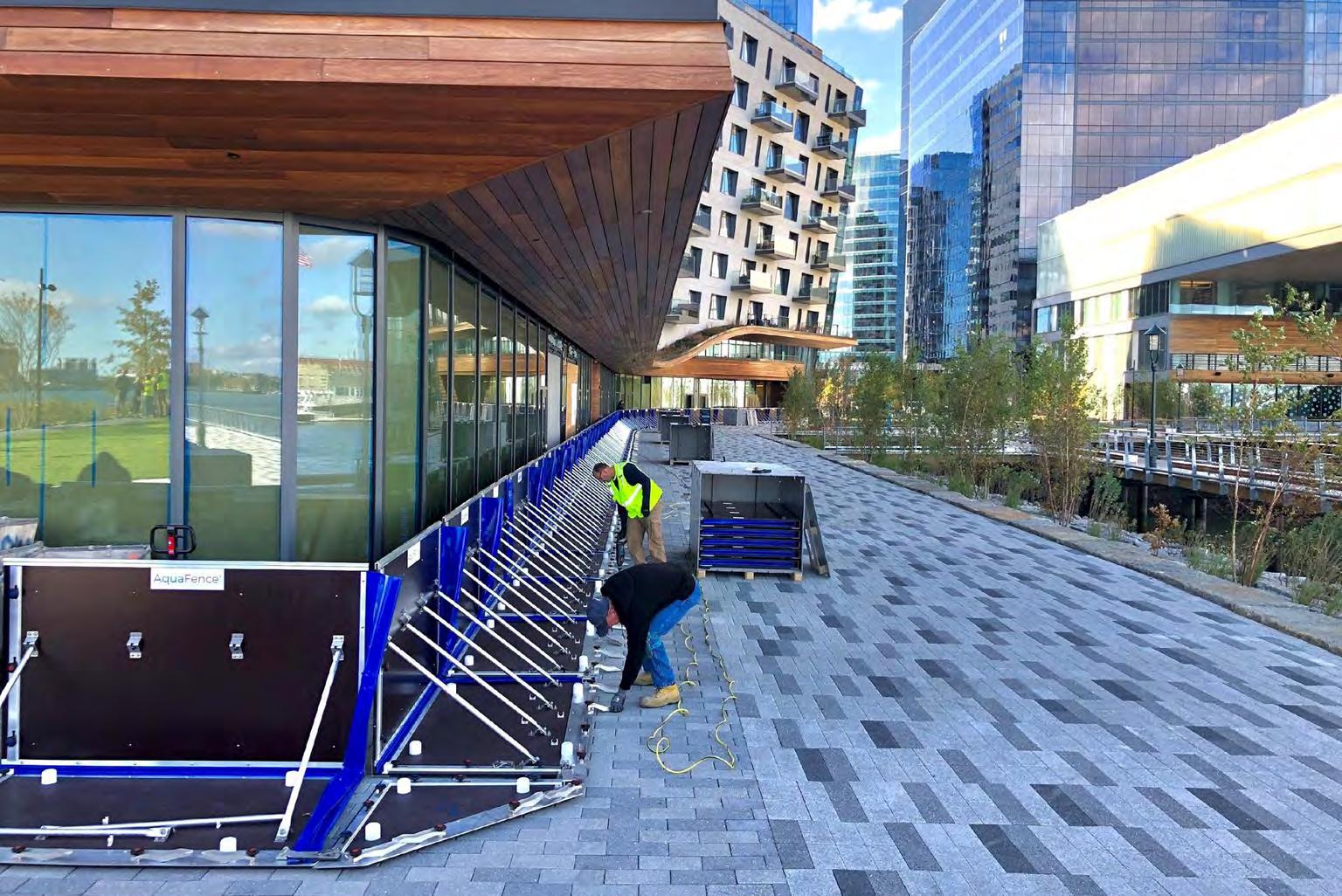
The AquaFence Perimeter Flood Barrier is designed to circle properties ranging in size from single plots of land, to entire cities In most urban environments, this flood barrier can be used without any advanced site work.
Perimeter Flood Barriers from AquaFence can be designed to change height as the elevation changes along the line of protection. They can also be designed to be deployed with several different starting points, allowing multiple teams to work simultaneously and speed up deployment times. This flexibility allows certain sections of the barrier to be left out in the hours leading up to a flood, permitting egress in and out of the area until the last minute.
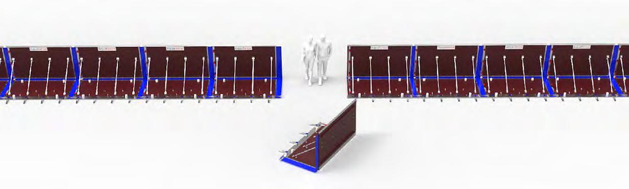
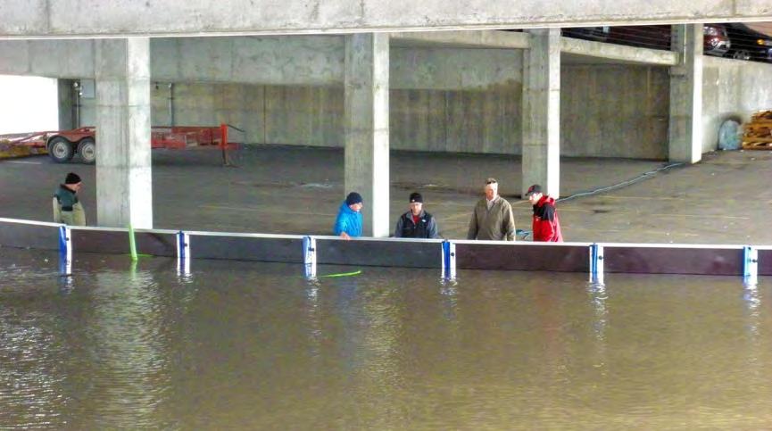
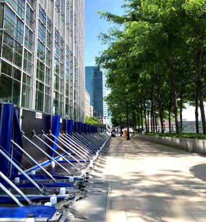
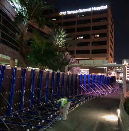
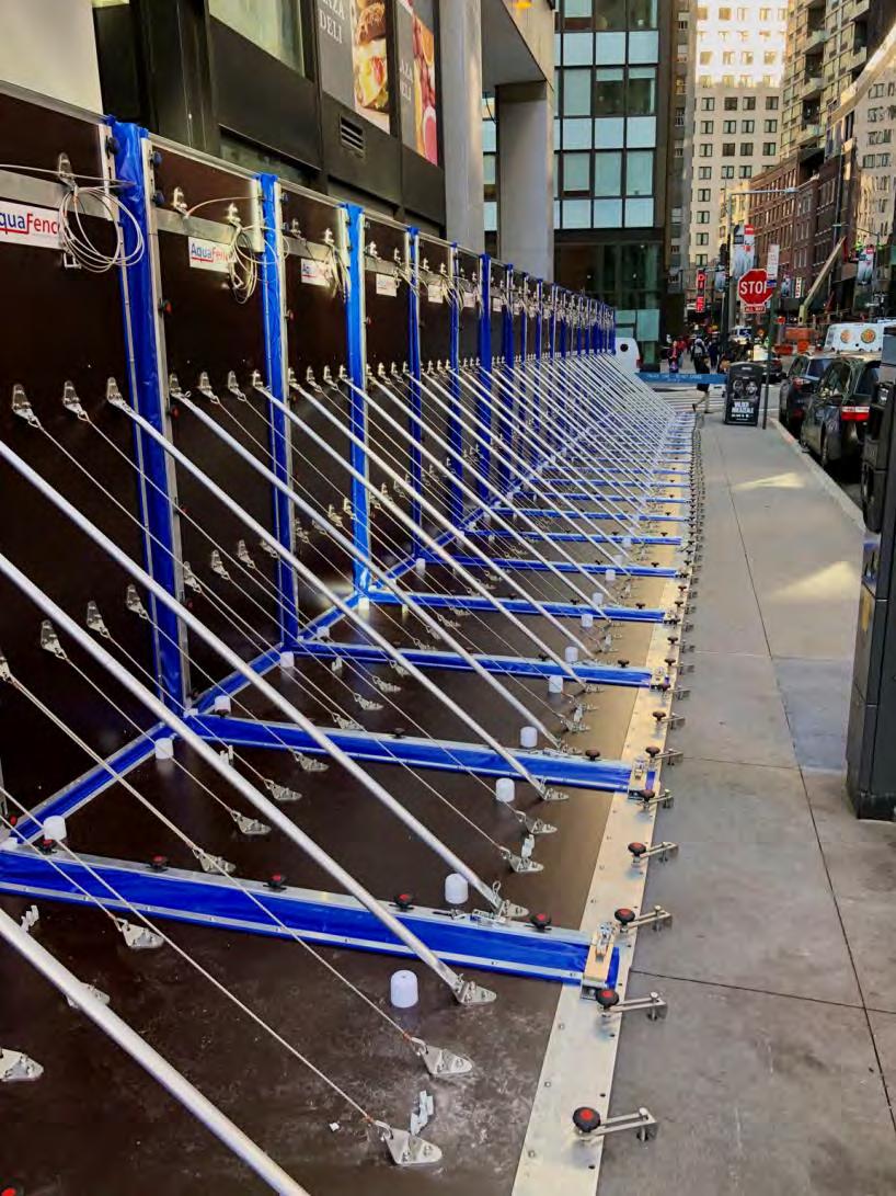
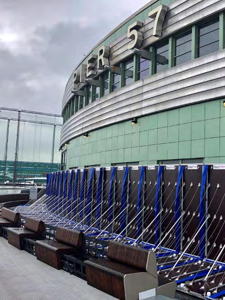
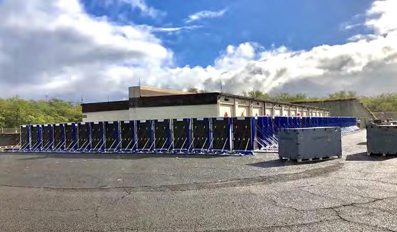
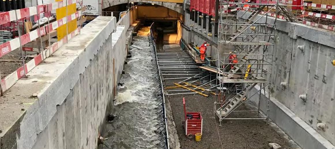
The flexibility and reusability of the AquaFence system makes it highly suitable for applications such as diverting water away from areas undergoing maintenance, renovation or new construction It can be installed quickly, and moved from location to location as a project progresses.
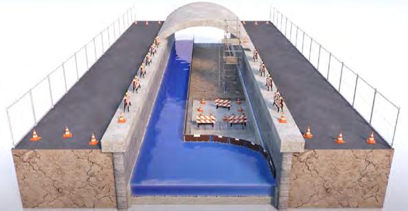
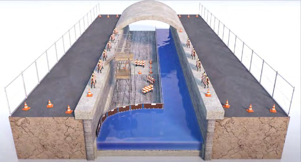
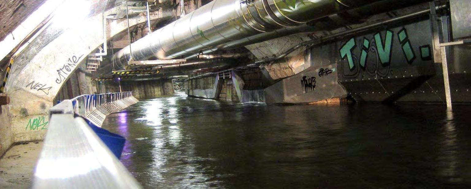
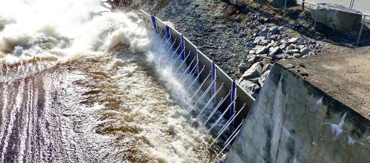
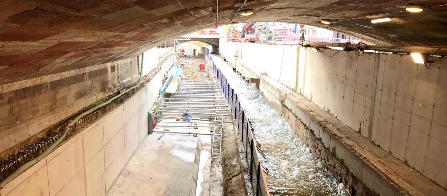
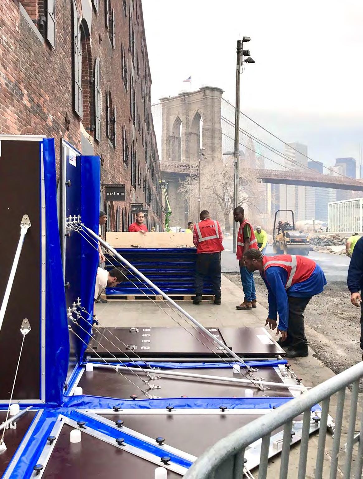
No heavy equipment is required to deploy the AquaFence and all installation procedures can be done by hand. Indicative deployment speeds are displayed in the table below, based on best practices In large scale deployments, utilizing a fork lift or pallet jack and/or multiple teams to deploy different sections simultaneously can significantly increase deployment times.
Each AquaFence system is delivered with a deployment plan developed in cooperation with building management 4 Person Team
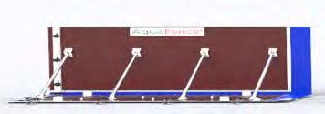

All AquaFence models are built with durable materials designed to be used in water over long periods of time. These materials include:
• Marine Grade Plywood
• 316 Stainless Steel
• PVC Canvas
• 6060 T6 and 6063 T6 Aluminum
• Polyethylene Closed Cell Gaskets
Additional, model specific, details can be found in the table above
All AquaFence panels can be angled between 2° and 5° in relation to the adjacent panel. When higher angles are needed, corner panels allow sharp turns to be made.
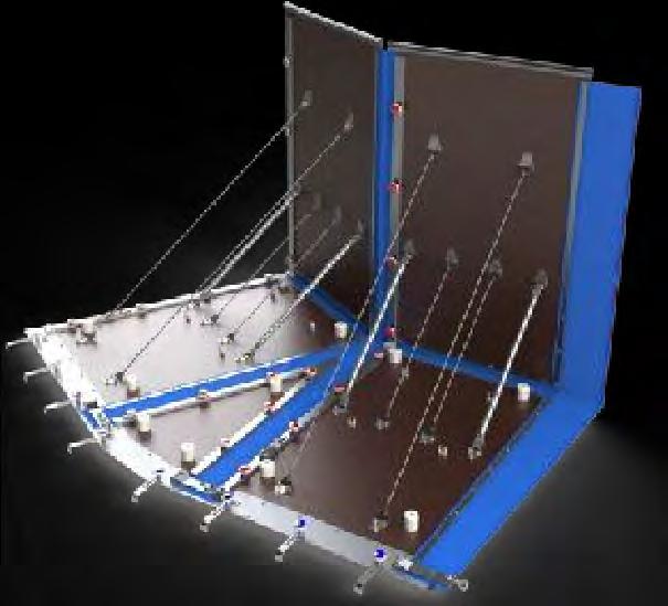
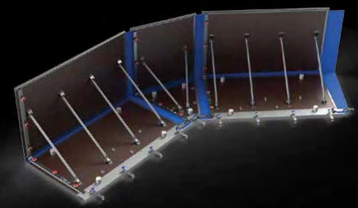
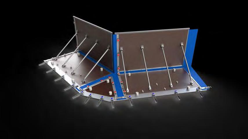
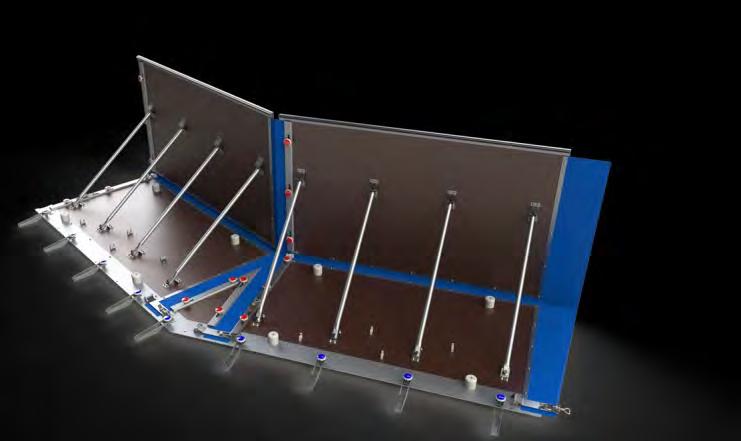
variety of
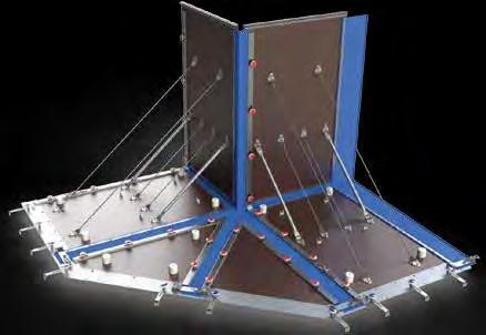
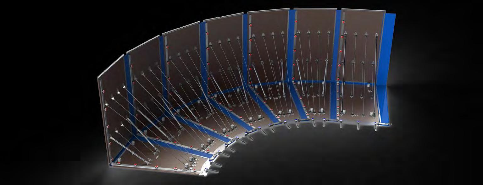
Side Connectors are used to connect the AquaFence flood barriers to walls and fixed structures. They can be connected both parallel or perpendicular as shown in the illustrations below. All Side Connectors are equipped with a gasket that compresses up against the surface they connect to This gasket is designed to conform to, and create a seal against, any irregularities in that surface. Custom design solutions are implemented when needed.
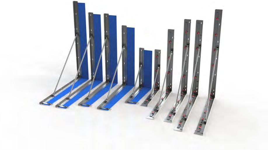

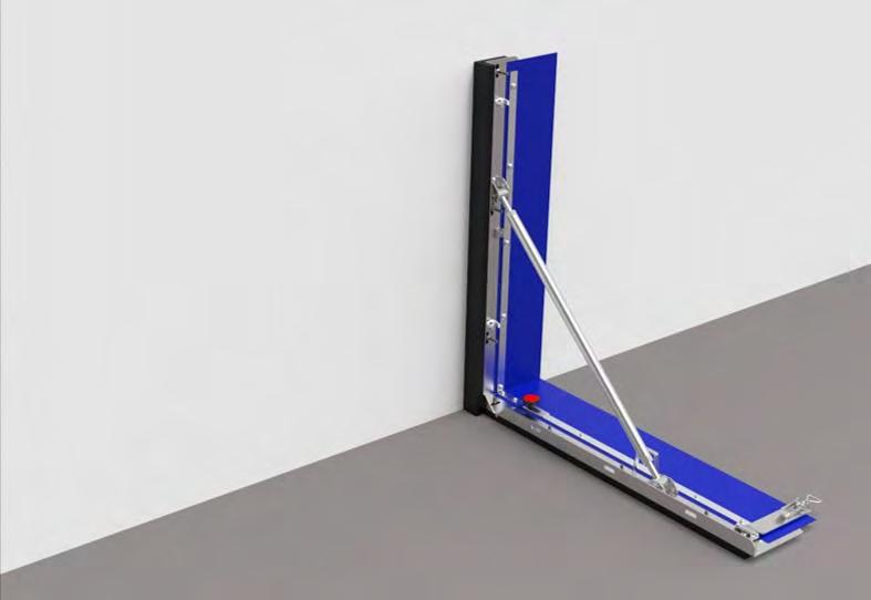
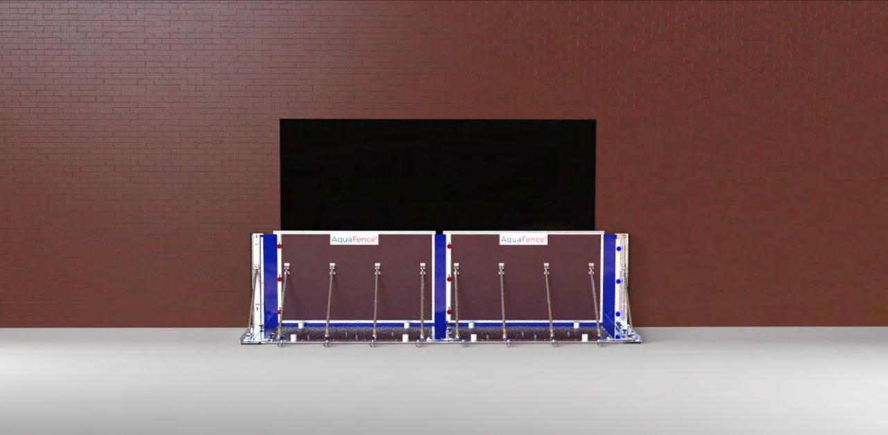
The AquaFence FloodBarricade is an integrated flood barrier that can be used to protect short spans such as doorways, windows, and air-vents Each FloodBarricade is designed for the exact opening it is used to protect and is highly customizable to accommodate site-specific needs. It is rapidly deployable, exhibits industrial-grade performance, and leaves very little trace of it on the building when not installed.
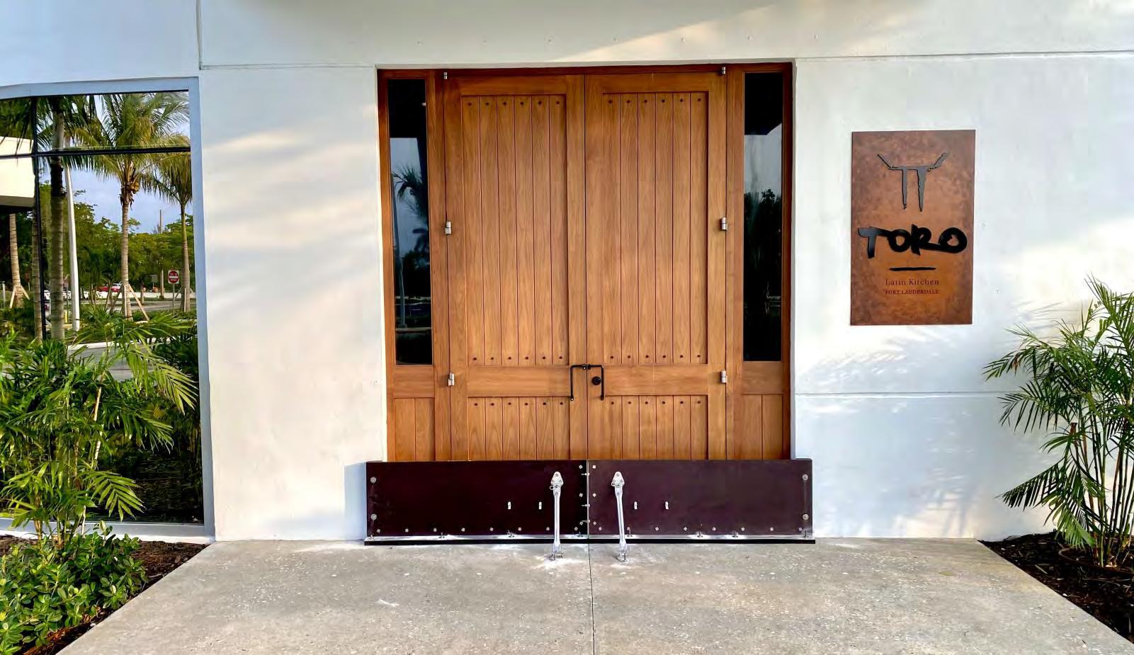
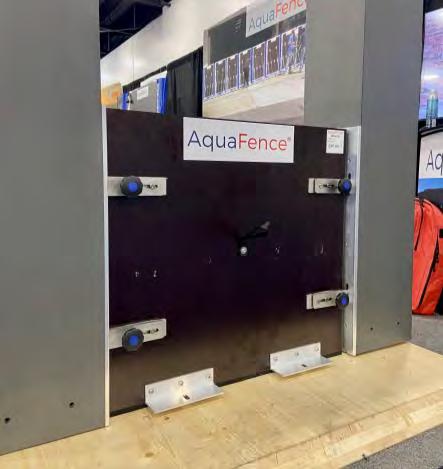
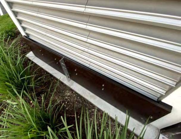
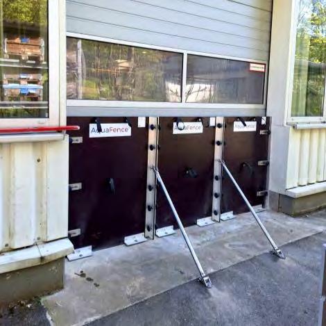

AquaFence requires tie-down anchors to secure the toe of the AquaFence panels to asphalt or concrete pavements. Anchor bolts can be stored with the panels for quick deployment.
Shown here are several anchors frequently used for the AquaFence system
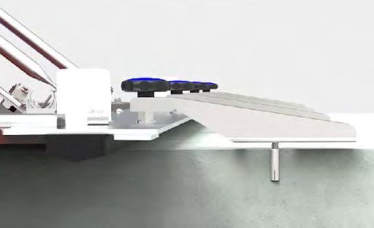

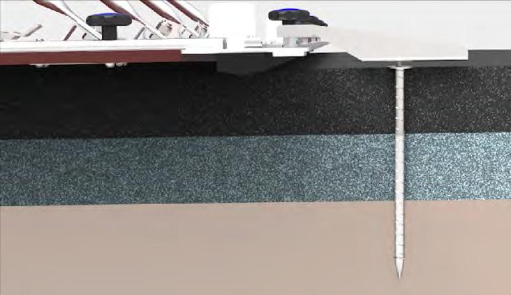
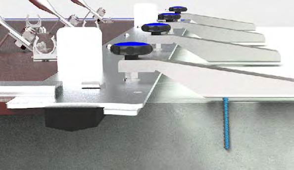
AquaFence delivers custom solutions to overcome obstacles and special cases that can not be solved with standard products. All customized designs undergo detailed engineering analysis to ensure a high level of performance. Some examples of such designs are shown below.
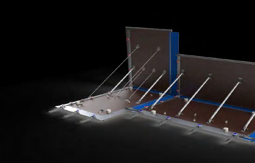
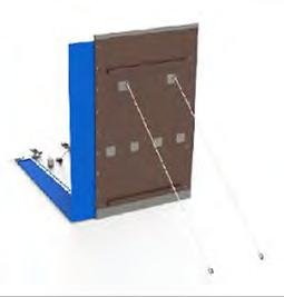
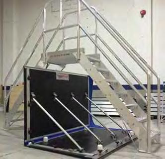
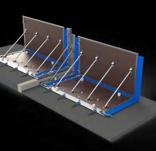
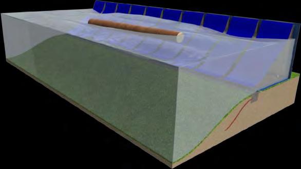
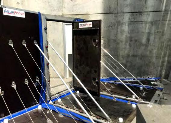
All AquaFence systems are delivered with comprehensive installation guides, operation and maintenance manuals, as well as video libraries designed to easily train new teams as well as refresh old ones on how to use the system.
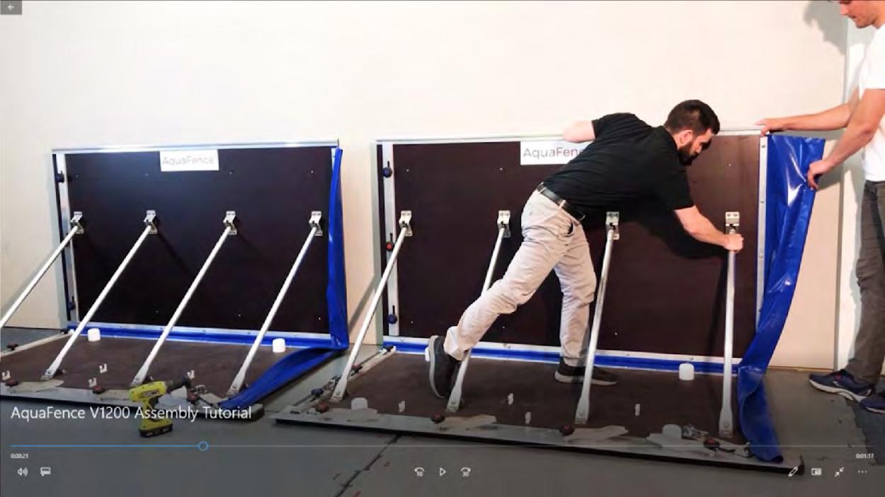
AquaFence Flood Barriers are delivered in stackable, reusable, and weather resistant crates. Where height allows, crates can be stacked up to four high. General dimensions are 4’ 4” wide x 7’4” deep x 4’ 4” high (1,3m x 2,25m x 1,3m) allowing ten crates to fit in an average 9’ x 20’ (2,7m x6m) parking spot when stacked two high. The weight of an empty crate is approximately 250 lbs. (115 kg.)
In cases where space dictates it favorable to store the AquaFence panels outside of the crates, they can be stood up on their side and efficiently stored as shown in the image below.
Storage crates per protected distance:
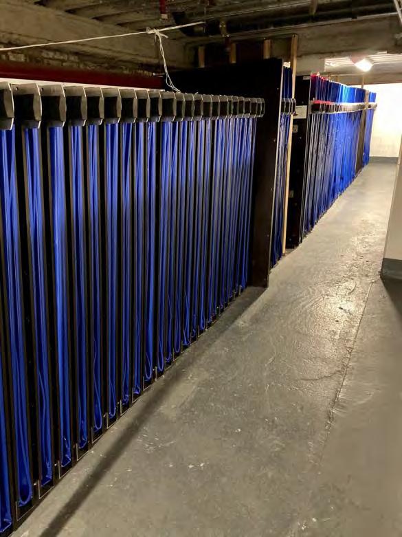
The AquaFence team will work with building management to create detailed deployment and response plans. Each property owner will be trained annually on installation, and AquaFence will issue a certificate for employees or contractors who participate. The AquaFence team will also create a detailed deployment plan with itemized panels and components that will include setting expectations on the timing to deploy based on flood warning areas.
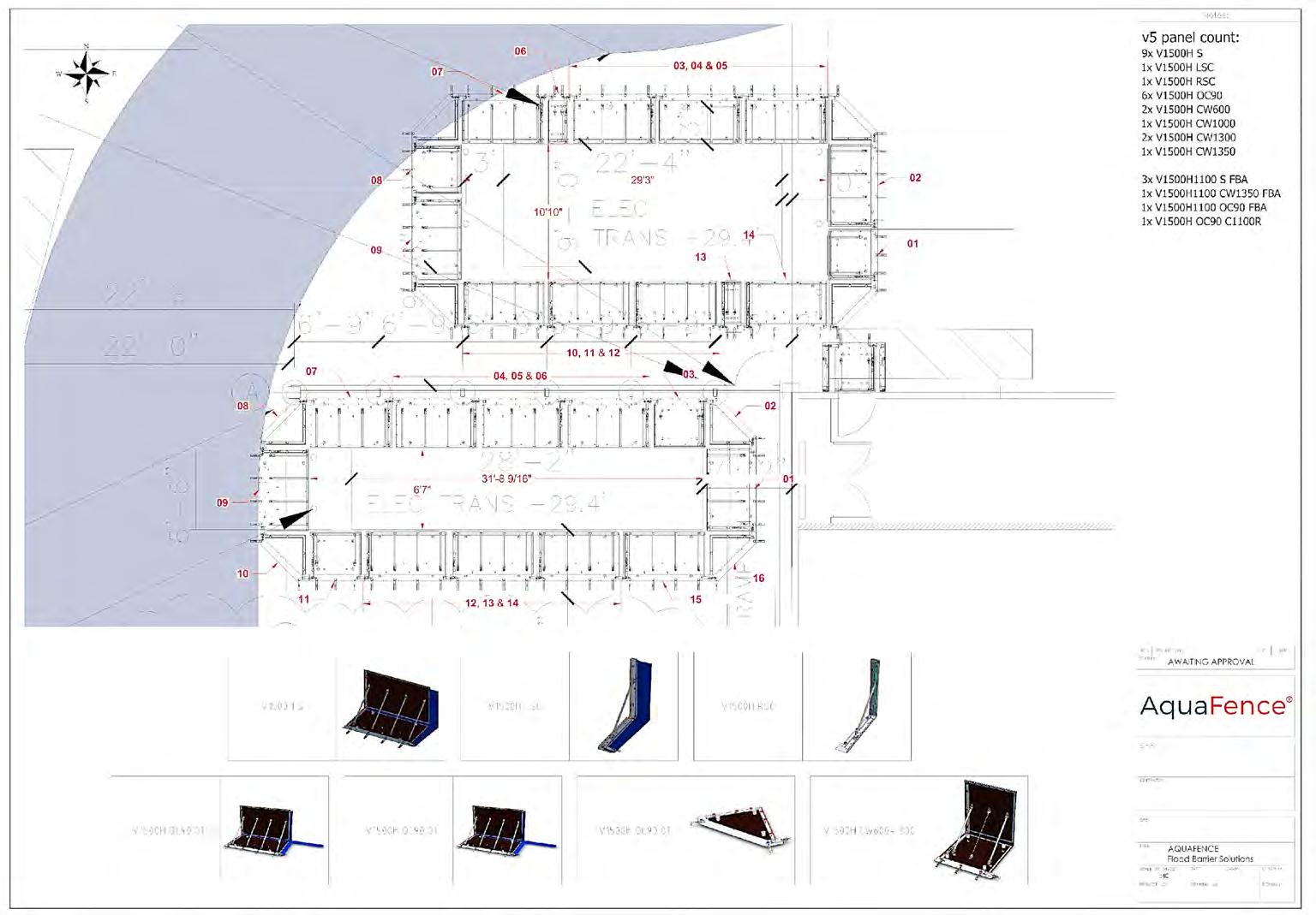

A globally recognized testing system whose approval is backed by scientific research and testing, the FM approval platinum shield certifies AquaFence products to the highest flood protection standards.



The United States Army Corps of Engineers is a U.S. federal agency under the Department of Defense and a major Army command made up of some 37,000 civilian and military personnel, making it one of the world's largest public engineering, design, and construction management agencies Generally associated with dams, canals and flood protection in the United States, USACE is involved in a wide range of public works throughout the world The corps’ mission is to "Deliver vital public and military engineering services; partnering in peace and war to strengthen our Nation's security, energize the economy and reduce risks from disasters.“ Please contact AquaFence to request a full copy of the Army Corp test booklet.
Association of State Flood Plain Managers (ASFPM) The mission of ASFPM is to promote education, policies and activities that mitigate current and future losses, costs and human suffering caused by flooding, and to protect the natural and beneficial functions of floodplainsall without causing adverse impacts
The Hamburg University of Technology (TUHH) conducted a performance review of the AquaFence flood barrier, testing it for hydrostatic, hydrodynamic and impact loading The performance of the system under these loads was characterized as excellent. TUHH also approved the AquaFence flood barrier for a minimum lifecycle of 60 separate deployments

AquaFence USA, Inc.
95 River St. Ste. 408 Hoboken, NJ 07030 USA
infousa@aquafence.com +1 (201) 210 - 8658 www.aquafence.com
AquaFence AS
Business Village, Grundingen 6 0250 Oslo, Norway info@aquafence.com
+(47) 69 20 71 70
AquaFence Spain
Calle Juan Bravo 32, 1º dcha., 28006 Madrid, Spain
+(49) (0)211/ 731 55 900
AquaFence Japan
Tsuyyoshi.Kikukawa@aquafence.com
+81 (0) 80 4012 4528
AquaFence SIA, Inc.
Dzirnavu 73-2, Riga LV-1011, Latvia
info@aquafence.com
+(371) 28 44 99 09
AquaFence Germany
Benrodestrasse 94
D-40597 Düsseldorf
+(49) (0)211/ 731 55 900
AquaFence Thailand
888/143 Mahatun Plaz Building Ploenchit Road, Lumpini
Pathhumwan Bangkok 10330
+(66) 2 627 3080
WETSIDEDRYSIDE
SIDEWALKBOLTFLUSHWITHTOPOF CONCRETESLABTOCAPANCHORS WHILENOTINUSE HEXHEADCAP SCREWANDWASHER PIVOTING ANCHORARM +/-23DEGREES
S.S.DROP-IN ANCHOR(NOTE2)
AQUAFEMCE FLOODWALL INUPRIGHT POSITION (NOTE1)
THEAQUAFENCEEPDMGASKETWILLNOTFULLYSEALSHARP INDENTATIONSWITHWELL-DEFINEDEDGES,SUCHASCONTROL JOINTS.TOENSUREPROPERSEALING,THESEJOINTSSHOULDBE FILLEDATTHELOCATIONOFTHEAQUAFENCESYSTEM, CREATINGARELATIVELYSMOOTHSURFACEFORTHEGASKETTO COMPRESSANDFORMASECURESEAL.
LEFTSIDECONNECTOR (LSC)CONNECTED BACKWARDTOWALL
CONCRETEWALL(OROTHER SMOOTHSTRUCTURALSURFACEE.G. BRICK,STEEL,ORFILLEDCMU)
S.S.FINISHEDHEXNUT
S.S.FLATWASHER
S.S.DROP-IN ANCHOR(NOTE2)
RIGHTSIDECONNECTOR (RSC)CONNECTED SIDEWAYSTOWALL
POLYETHYLENE GASKET AQUAFENCESIDE CONNECTOR
ADJACENTAQUAFENCEFLOODWALLPANELSCANBEANGLEDUP TO+/-2DEGREESRELATIVETOEACHOTHER.MAINTAINELEVATION CHANGESWITHAMAXIMUMGRADIENTSHIFTOF0.6DEGREESPERFOOT
SUMPPUMPSRECOMMENDEDATLOW POINTBEHINDSYSTEMTOACCOUNT FORSEEPAGEANDRAINFALL/RUNOFF (SEENOTE5)
BACKFLOWVALVESTO PREVENTFLOODWATER FROMBYPASSINGTHE BARRIER.
OFTHEAQUAFENCE CONNECTIONPOINTS
WINDSTRAPSAREREQUIRED. AQUAFENCERECOMMENDSS-HOOKCAM BUCKLESTRAPS,TIGHTENEDTOAFIRM, HAND-TIGHTLEVELFORPROPERTENSION.
CONCAVE

720 Lucerne Avenue, Suite 567
Lake Worth, Fla. 33460
Phone: (561) 578-4220 Attn: Rebecca Madsen
Email: sgill@floodriskamerica.com
1
closed information, addendum change orders, revisions, additions and/or modifications to the design documents and engineer and fasten each panel in order to design the most efficient as-built construction conditions may require this quote to be revised. and functional system to protect your building from flooding.
PANEL BENEFITS INCLUDE: MATERIALSABBREVIATIONS:
ESTIMATE DETAILS:
• LIFETIME PRODUCT WARRANTY INCLUDED! *MANUFACTURED IN THE U.S.A. h-p (H-Post)
• No returns / No refunds *LIFETIME PRODUCT WARRANTY fhh-p (full height H-Post)
• ESTIMATE is valid for 60 days from above date
• Engineering Reports are not included unless requested & cost added to this estimate
• Shipping and/or Installation are included only if quoted herein
PAYMENT TERMS:
*LIGHTWEIGHT & EASY TO DEPLOY eh-p (end H-Post)
*FM APPROVED h-b (H-Beam)
*FEMA COMPLIANT t-p (T-Post)
*FLORIDA BUILDING CODE APPROVED u-c (U-Clamp)
*NO TOOLS REQUIRED FOR DEPLOYMENT m-a/s-f (Mounting Angle/Side Flange)
• 25% due at contract signingz-p (Z-Post)
• 60% due upon shop drawings approval c-j (Compression Jack)
• 15% due upon delivery hdc-j (Heavy-Duty Compression Jack) s-a (Sill Angle)
Signature below initiates creation of a formal contract to provide materials/installation as noted above.
Approved by date
Thank you for considering Flood Risk America for your flood protection needs. FRA can assist you with the assurance that the floodproofing design, installation and construction meet the minimum required FEMA standards, while helping to avoid costly floodproofing errors, expedite permitting time and reduce construction costs.
Make Checks Payable to: FLOOD RISK AMERICA, 720 Lucerne Ave, Suite 567, Lake Worth, Fla. 33460
Flood Risk America thanks you for your business!
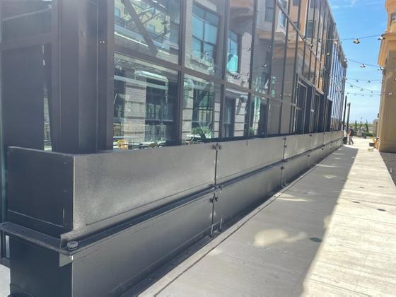


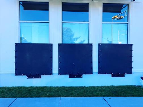
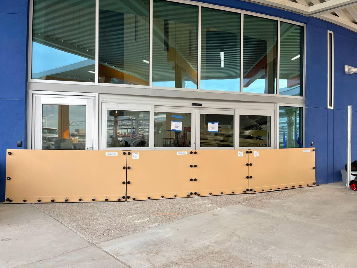

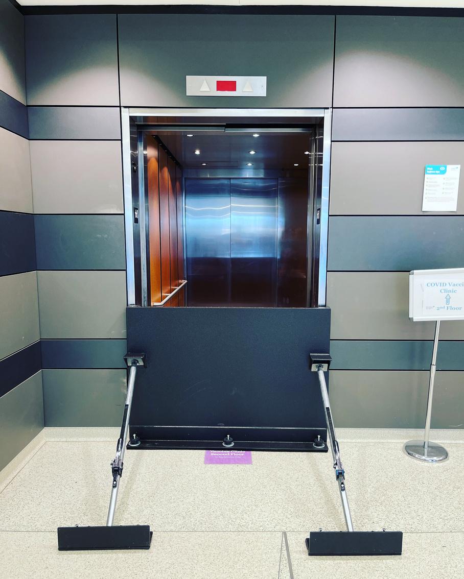
The FRA Panel can be customdesigned to create a box for unmovable equipment such as generators, fuel tanks, electrical boxes, waste management systems, and all types of vulnerable equipment.
Light-weight
Marine-Grade Material
Lifetime Warranty
Made in USA
Custom- Fabricated
Withstands 13,000 PSI
Cost-effective
Easy to Deploy
FM Approved
Color Options Available
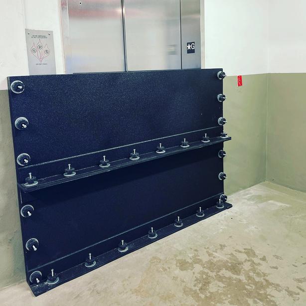
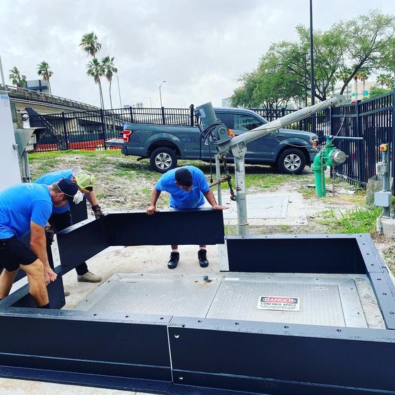
The FRA Panel was first designed to protect elevators from flooding, but it is now widely used to protect every vulnerable area of a property from flooding.
Our Products are Custom Made in America by Us

FM APPROVED
Meets and Exceeds ANSI 2510 Requirements for Impact and Seepage

Superior bracing support to connect for longer lengths

Endorsed by:

Easy-Turn knob for fast deployment and tooless system
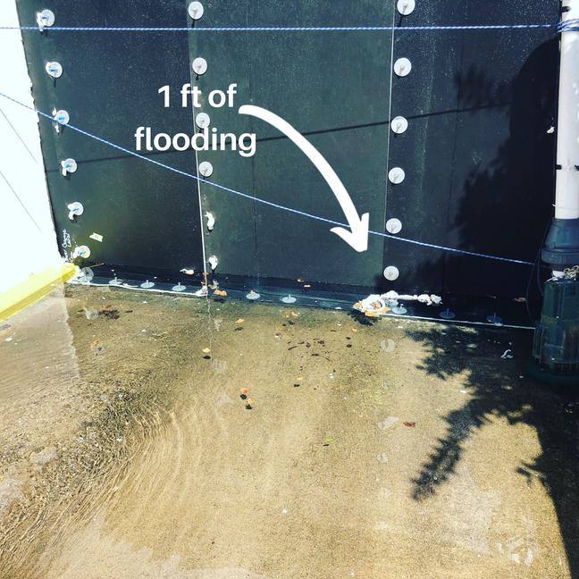

STORAGE-HANDLING
DONOTSTOREFLOODPANELSINAMANNERTHATVi1LlCOMPRESSORDNMGEGASKETS ORTHATWillCAUSEDNMGETOTHEPANELS,Cl-v\NNELS,ANGlES,ORANCHORING HARDWARE.FLOODRISKM\ERICASISNOTRESPONSIBlEFORANfDNMGETOTHEPANELS, GASKETS,CHANNELS,ANGlES,ORANCHORINGHARDWARECAUSEDBYSTORAGE CONDITIONS.
INSTALlATION
REFERTOAllMANUFACTURERS'INSTALLATIONNOTESANDDRAVi1NGS.INSTALLPLUMB SQUAR�ANDlfVELINSURINGCONTINUOUSANDEVENGASKETCONTACT.DONOTDRILL ORPENETRATEANfSURFACEOFBAruRERSVi1THOUTCONSULTINGMANUFACTURER.USE ONLYFASTENERSPROV1DEDBYTHEMANUFACTURER(UNLESSOTI-IERVi1SENOTED).
MAINTENANCE-INSPECTION PERIODICINSPECTIONANDMAINTENANCEOFFLOODBAruRERINSTALLATIONSINCLUDING SEALANT,GASKETS,ANCHORS,ANDOPERATINGHARDWAREISTHERESPONSIBILITYOFTHE OWNE�
STRUCTURALRE'v1EW STRUCTURALANALYSISOFTI-IEBUllDING'SCAPACITYTOWITHSTANDAllFLOODBARRIER SERV1CELOADSTHATARETRANSFERREDTOTHESTRUCTURESHALLBEPERFORMEDBYTHE STRUCTURE'SEORAND15BASEDONSERVICELOADSASINDICATEDONTHESEPLANS.FLOOD RISKM\ERICAISNOTRESPONSIBlETOENSURETHEBUILDING'SABILITYTOHANDLETI-IE IMPOSEDLOADSANDSHALLNOTBERESPONSIBlEFOREXISTING/ASBUILTFIElD CONDITIONSTHATVM:IFROMTI-IESEPLANS. PERFORMANCE
FLOODBARRIERSAREDESIGNEDTOCONTROLSHORTTERMHYDROSTATIC HYDRODYNAMIC ANDDEBRIS�PACTLOADSUPTOTHEDESIGNEDWATERHBGHTNOTEDONTHESE DRAVi1NGSALONGWITHAllLOADREQUIREMBNTSASNOTEDINFEMATECHNICALBULITTIN 3-JANUM:12021&ASCE24-14.AllLOADSARETRANSFERREDTOTHEBUllDINGSTRUCTURE. ALWAYSAllOWFORCONTROLOFANYlEAKAGEORCONDENSATIONTHATVi1llOCCUR DURINGFLOODINGCONDITIONS.INAPPLICATIONSWHERETHEFLOODPANELGASKETS CONTACTTHEEXISTINGBUILDINGSTRUCTURE,FLOORS,ETC.AllSURFACESMUSTBESOUND, FLAT/lfVE�ANDVi1THOUTBLEMISHFORBESTPERFORMANCE.
DESIGNCRITERIA
DESIGNLOADS:
PANELSAREDESIGNEDTOVi1THSTANDTHEFOLLOWING;
1)HYDROSTATICLOADSTOELEVATIONASINDICATEDONDRAVi1NGSBASEDON HYDROSTATICWATERLOAD(64PCF).
2)HYDRODYNAMCLOADSONVERTICALSURFACESOFMOVINGFLOODWATERSAT5FEET PERSECOND
3)DEBRISIMPACTLOADOFA1,000lbOBJECTFORA1SECONDDURATION
ANCHORAGE
AllANCHORDESIGNSAREBASEDONATTACHINGTOSTRUCTURECAllEDOUTINTHE DRAVi1NGS.FLOODRISKM\ERICAPANELSARETOBEANCHOREDINTOCEMENTITIOUS MATERVII..ANfSUBSTRATEOTHERTHANTHATASNOTEDVOIDSTHEWARRANTYOFTHE PANELSANDTHEANCHORINGSYSTEMFLOODRISKAMERICAISNOTRESPONSIBLEFOR FASTENINGOFPRODUCTINTOLESSTHANIDEALFIELDCONDmONSORMOUNTINGTOA STRUCTUREOTHERTHANWHATISDETAILEDONTI-IEDRAWINGS.
DUETOVARIABILITYTOEXISTINGMOUNTINGSTRUCTUREFLOODRISKM\ERICAISNOT RESPONSIBLEFORSTRUCTURALFASTENERDESIGNTHATVM:/FROMTHESEDRAVi1NGSOR INTOLESSTHANIDEALFIELDCONDITIONS.FLOODRISKAMEruCAPRODUCTSFASTENING SYSTEMSAREDESIGNEDBASEDONCONCRETEOR8"GROUT-FlllEDCMUMASONRY(}STM C90)MOUNTINGSTRUCTURE,UNLESSOTI-IERVi1SEINDICATEDONTHESEDRAVi1NGS.ANY ANCHORINGSUBSTRATETHATVARIESFROMTHESEREQUIREMENTSSHALLBEEVALUATEDBY FRAENGINEERSANDFRASHALLBECOMPENSATED FORTHEENGINEERINGOFANCHORS MOUNTEDINTOSAIDVARIEDSUBSTRATES
IFFIElDCONDITIONSDIFFERFROMTHESEPLANS,FLOODRISKM\ERICAREQUIRESTHAT MODIFICATIONSOFTHEANCHORMOUNTINGTOTHESTRUCTUREBEDESIGNEDAND REVIEWEDBYBUllDING'SEO�BASEDONACTUALFIELDCONDmONS,PRIORTOAPPROVING TI-IESEDRAWINGS.
REFERTOANCHORMANUFACTURESTECHNICALDATAMANUALFORINSTALLATION L�ITATIONSANDREQUIREMENTS.
SillGASKETPERFORMANCEDEPENDANTONCONDmONOFFLOORCONTACTAREAFLOOR CONTACTAREASHOUlDBESOUND,FLAT/lfVE�ANDWITHOUTBLEMISHFORBESTGASKET PERFORMANCE
FRAPANELBENEFITS:
LIGHT-WEIGHT
LIFETIMEWARRANTY
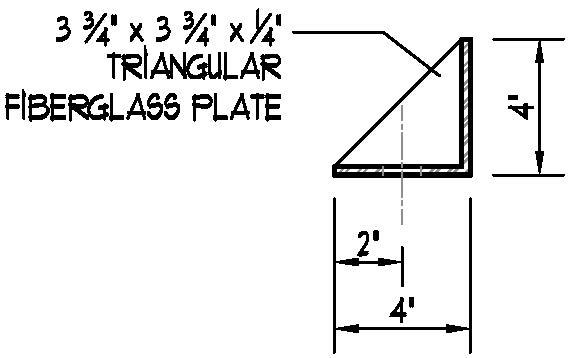
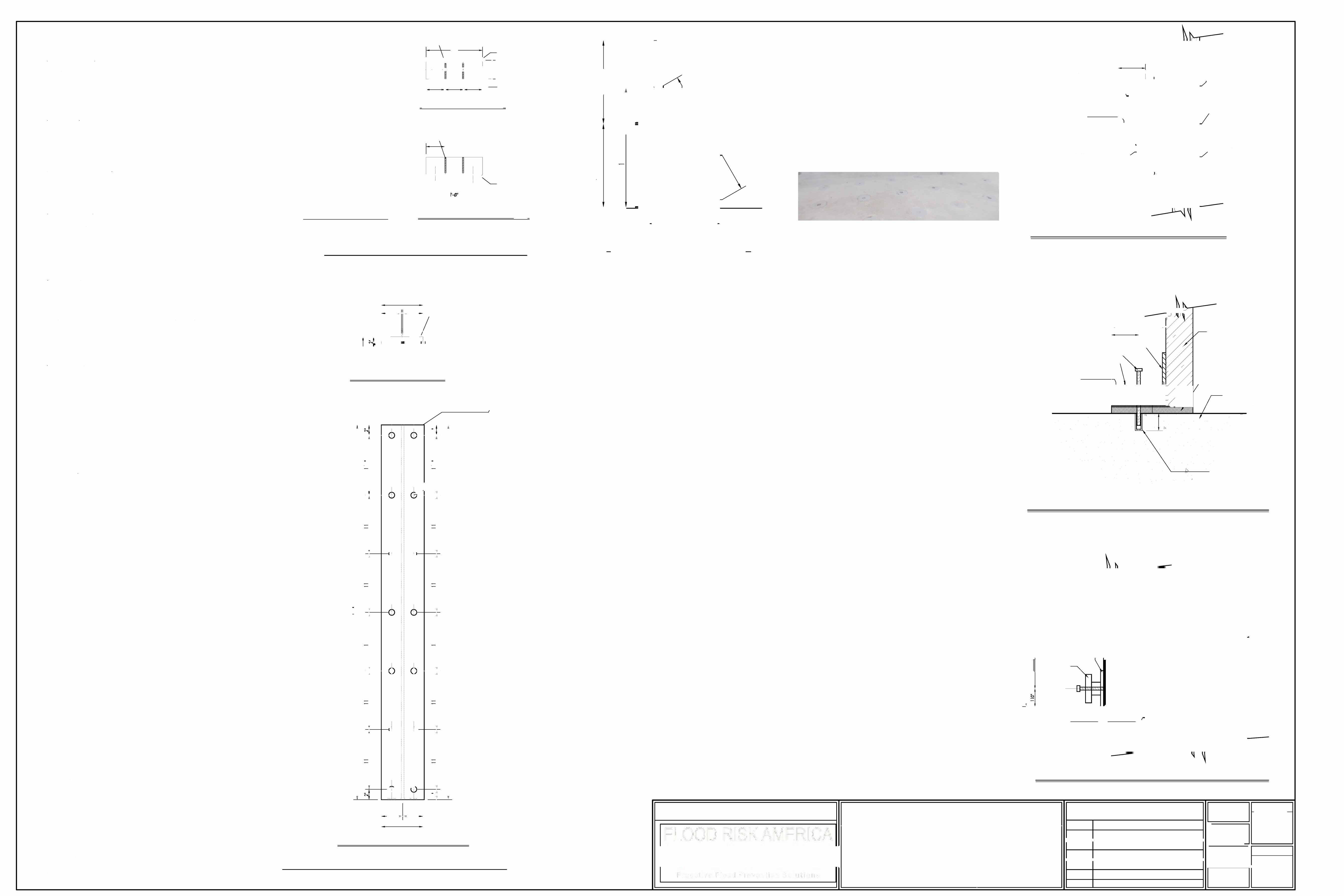
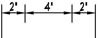
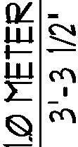
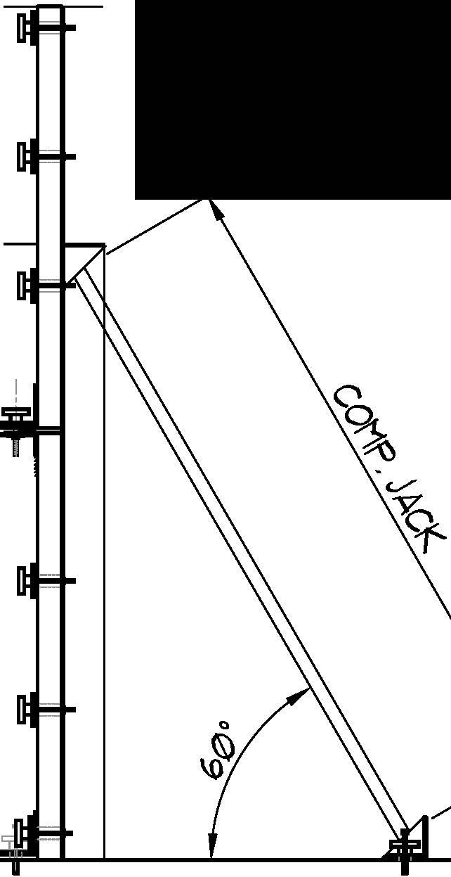
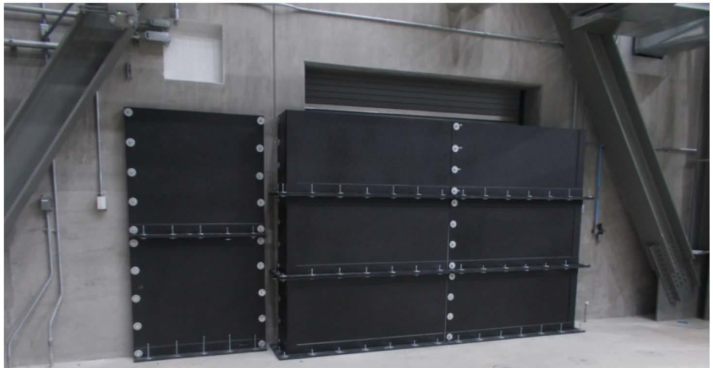
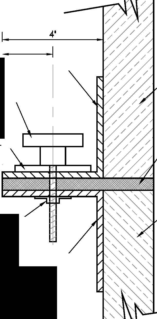
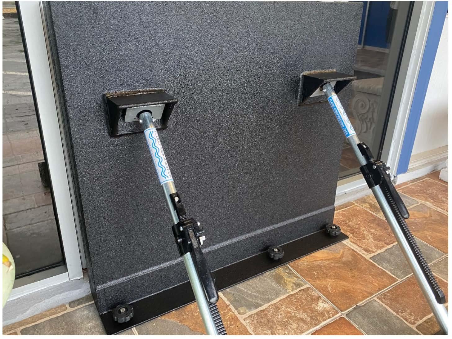

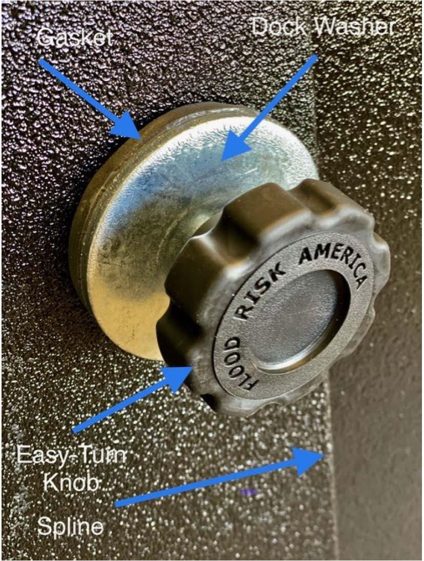



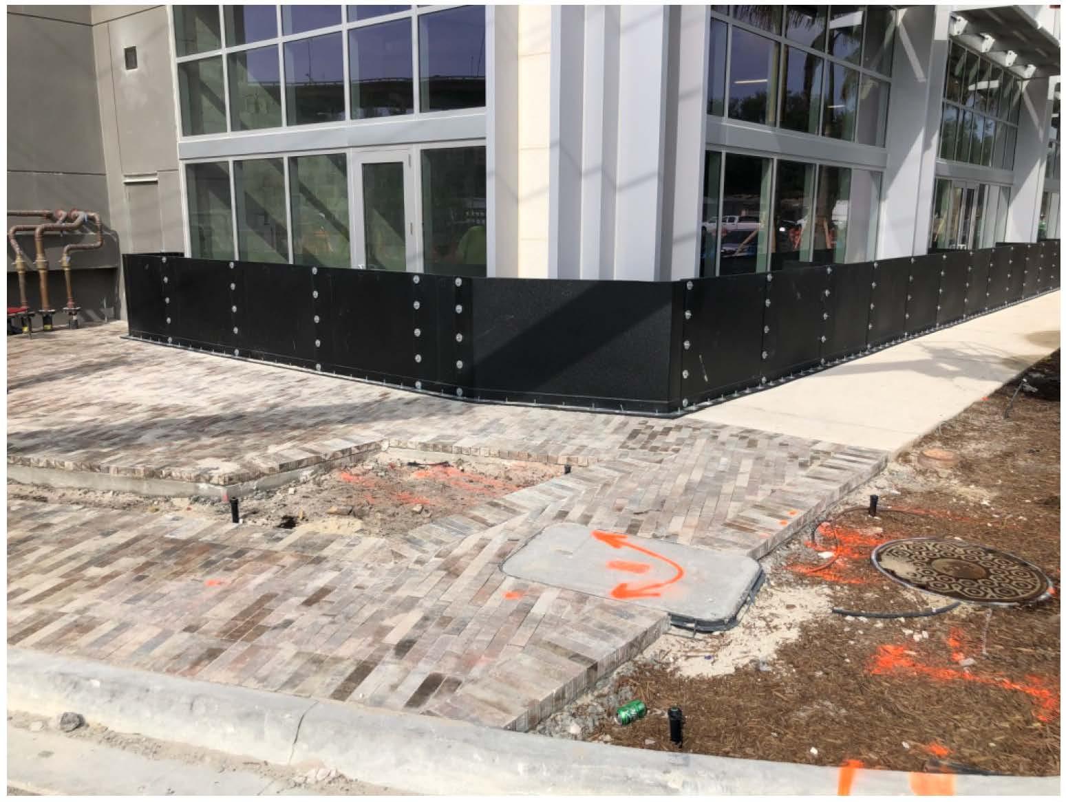
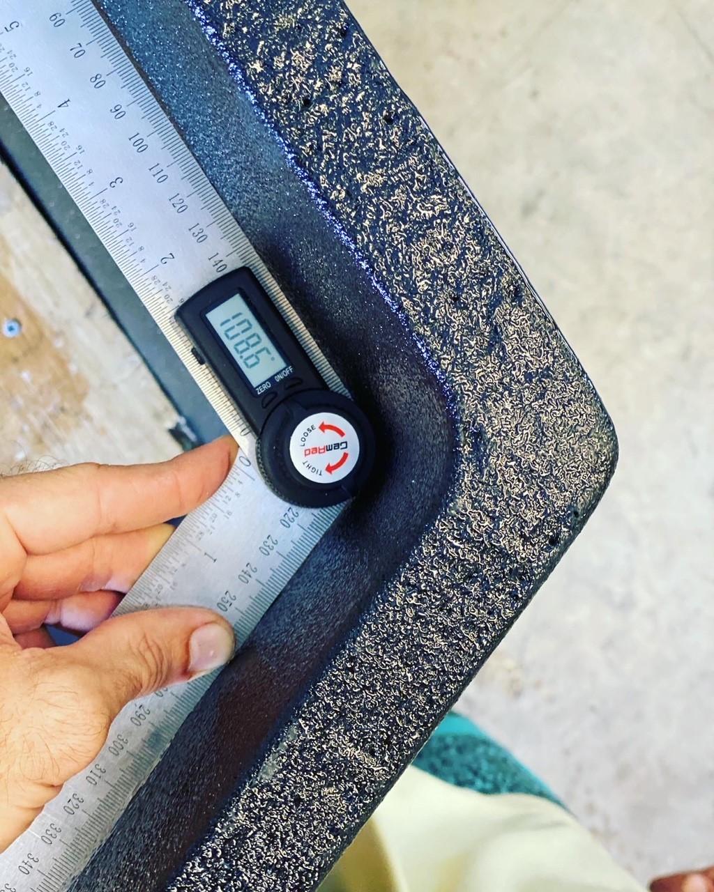
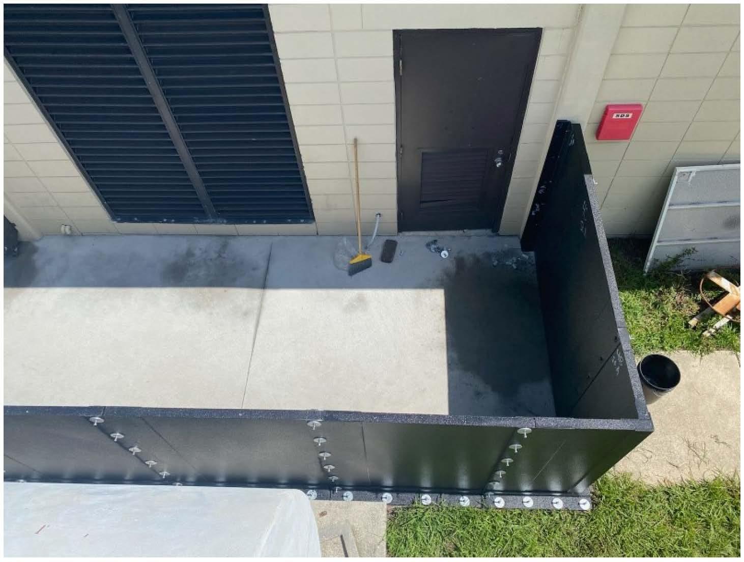
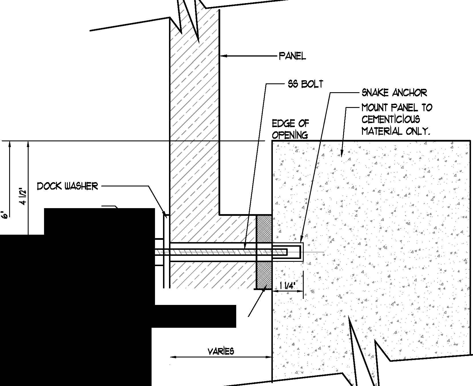


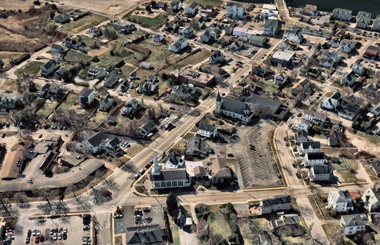
Mystic Floodwall Permits 8/11/2025
Project Notes / Assumptions:
• Edgemont St WWTF in Stonington
• Existing grade is 5’ – above the CJL/HTL
• Zone AE with Base elevation of 11 ft
• Next 5-10 years they'll take the facility offline and reroute the facility somewhere else less vulnerable to flooding
• Currently experience flooding - tidal nuisance flooding
• Existing wall and raised structures have been minor improvements
• 100-yr storm is ~18.5 elevation
• Looking at a floodwall (13.5 ft) around the entire facility. Thinking permanent sheetpile or temporary floodwall
• You'll need to demonstrate that any construction won't increase flooding elsewhere. No risk to adjacent properties
• DEEP/USACE/Species/local floodplain ordinance & NFIP
• Stonington CJL – 2.0’
• RC-120 zone
Notes:
X indicates permit is likely required; * indicates a permit may be required based on additional factors; - indicates a permit is likely not required
1Other permits or approvals may be required for utility work, traffic control, air quality, noise, or hazardous materials management and are not included in this summary.
2Permit requirements are based on preliminary project concepts and current information. Final permits may vary based on detail ed design, construction methods, and site conditions.
3Regulatory requirements and agency interpretations may chance over time and could affect permitting needs. Early and ongoing coordination with local, state, and federal agencies is recommended to confirm permit applicability and address evolving project conditions.
Agency Anticipated Permit1
Stonington Planning and Zoning Commission
Coastal Site Plan Review
Stonington Planning and Zoning Commission
Special use Permit and Flood Plain Determination
Stonington Inland Wetland and Watercourses Commission Wetlands Permit
Notes:
Floodwall Alternatives2
Temporary Semi-Permanent Permanent
Local Permitting
The project site lies within the Coastal Area Management Overlay District (CAMOD) and may require a Coastal Site Plan Review (CSPR) for all proposed alternatives. This review is required regardless of proximity to the Coastal Jurisdiction Line (CJL) and applies to any regulated activity within the coastal boundary. Early coordination is recommended to confirm submittal requirements and ensure consistency with the Connecticut Coastal Management Act (CCMA).
The project site is located within a Special Flood Hazard Area (SFHA) and subject to the Flood Hazard Overlay District. A Planning and Zoning permit may be required for the proposed alternatives. The type of permit (e.g., Special Use Permit) will depend on the design, height, and permanence of the proposed structure. All options must comply with local floodplain regulations and Federal Emergency Management Agency (FEMA) and National Flood Insurance Protection (NFIP) standards, including elevation, anchoring, and no-adverseimpact criteria. Early coordination with the Town is recommended to confirm requirements
A Wetlands Permit may be required for any activity occurring within mapped wetlands,
X indicates permit is likely required; * indicates a permit may be required based on additional factors; - indicates a permit is likely not required
1Other permits or approvals may be required for utility work, traffic control, air quality, noise, or hazardous materials management and are not included in this summary.
2Permit requirements are based on preliminary project concepts and current information. Final permits may vary based on detailed design, construction methods, and site conditions.
3Regulatory requirements and agency interpretations may chance over time and could affect permitting needs. Early and ongoing coordination with local, state, and federal agencies is recommended to confirm permit applicability and address evolving project conditions.
Notes:
Agency Anticipated Permit1
Floodwall Alternatives2
Temporary Semi-Permanent Permanent watercourses, or the 100-foot Upland Review Area. This applies to all proposed alternatives if construction, access, or staging occurs in regulated areas. A wetland delineation by a qualified wetland scientist is recommended to confirm the presence of wetlands. Early coordination with the Inland Wetlands and Watercourses Commission (IWWC) is advised to determine permit triggers based on final design and site layout.
A Section 401 Water Quality Certification (WQC) is required if the project causes discharge or disturbance to federally regulated waters or wetlands and triggers a US Army Corps of Engineers (USACE) Section 404/10 permit. Temporary impacts such as construction access, dewatering, placement of fill, or installation/removal activities in jurisdictional areas must also be considered. Additionally, stormwater discharges, temporary equipment crossings, and modifications to existing structures in waters can trigger a 401 WQC. The proposed alternatives are not expected to impact waters of the United States if all construction remains landward of the Coastal Jurisdiction Line and outside regulated wetlands and watercourses. Therefore, a 401 WQC may
X indicates permit is likely required; * indicates a permit may be required based on additional factors; - indicates a permit is likely not required
1Other permits or approvals may be required for utility work, traffic control, air quality, noise, or hazardous materials management and are not included in this summary.
2Permit requirements are based on preliminary project concepts and current information. Final permits may vary based on detailed design, construction methods, and site conditions.
3Regulatory requirements and agency interpretations may chance over time and could affect permitting needs. Early and ongoing coordination with local, state, and federal agencies is recommended to confirm permit applicability and address evolving project conditions.
Agency Anticipated Permit1
CT Department of Energy and Environmental Protection Aquifer Protection Area
CT Department of Energy and Environmental Protection Coastal Permitting
CT Department of Energy and Environmental Protection Flood Management Certification
Notes:
Floodwall Alternatives2
Temporary Semi-Permanent Permanent
Notes3
not be required; however, confirmation with CT DEEP and USACE during design is recommended, especially if temporary or permanent impacts extend waterward.
There are no Aquifer Protection Areas at the project location.
CT DEEP regulates work in tidal wetlands and in tidal, coastal, or navigable waters waterward of the CJL. A coastal permit is not required if all structures and construction activities, including temporary access or staging, remain entirely landward of the CJL and outside of tidal wetlands. This applies to all proposed alternatives, provided impacts remain upland. However, temporary impacts such as access, excavation, or equipment placement that extend waterward of the CJL may trigger permitting. Coordination with CT DEEP during design is strongly recommended to confirm permit applicability based on the final project footprint and construction methods.
A Flood Management Certification (FMC) is required for projects located within a floodplain that involve a state agency action, such as state funding, construction by a state entity, or issuance of another state permit (e.g., SDF, 401 WQC). This requirement applies to all proposed alternatives if they are state-funded or trigger
X indicates permit is likely required; * indicates a permit may be required based on additional factors; - indicates a permit is likely not required
1Other permits or approvals may be required for utility work, traffic control, air quality, noise, or hazardous materials management and are not included in this summary.
2Permit requirements are based on preliminary project concepts and current information. Final permits may vary based on detail ed design, construction methods, and site conditions.
3Regulatory requirements and agency interpretations may chance over time and could affect permitting needs. Early and ongoing coordination with local, state, and federal agencies is recommended to confirm permit applicability and address evolving project conditions.
Mystic
Agency Anticipated Permit1
CT Department of Energy and Environmental Protection
General Permit for the Discharge of Stormwater from Construction Activities
CT Department of Energy and Environmental Protection
Notes:
Natural Diversity Database (NDDB) Consultation
Floodwall Alternatives2
Temporary Semi-Permanent Permanent
Notes3
other DEEP permits. FMC also applies if the project affects natural or constructed stormwater drainage systems. Final determination should be coordinated with CT DEEP during design development to confirm whether FMC will be triggered based on project scope and permitting.
This General Permit applies to any construction activity that disturbs one acre or more of land. It applies when earth disturbance including access, staging, and excavation meets or exceeds this threshold. For disturbances between one and five acres, permit registration with CT DEEP is not required if the municipal land-use commission reviews and issues written approval of the erosion and sediment control plan in accordance with CGS section 22a-329. For five acres or more, CT DEEP registration and formal plan certification are required. Total disturbed area should be estimated during design and early coordination with the Town and CT DEEP is recommended.
No NDDB mapped areas exist at the project site. Therefore, no impacts to state-listed endangered, threatened, or special concern species are anticipated, and no NDDB consultation is required for any of the project
X indicates permit is likely required; * indicates a permit may be required based on additional factors; - indicates a permit is likely not required
1Other permits or approvals may be required for utility work, traffic control, air quality, noise, or hazardous materials management and are not included in this summary.
2Permit requirements are based on preliminary project concepts and current information. Final permits may vary based on detail ed design, construction methods, and site conditions.
3Regulatory requirements and agency interpretations may chance over time and could affect permitting needs. Early and ongoing coordination with local, state, and federal agencies is recommended to confirm permit applicability and address evolving project conditions.
Mystic
Agency Anticipated Permit1
CT Department of Energy and Environmental Protection Water Diversion –Non-Consumptive
Floodwall Alternatives2
CT Department of Energy and Environmental Protection
National Pollutant Discharge Elimination System (NPDES)
WWTF Discharge Permit
CT State Historic Preservation Office (SHPO)
Notes:
Notes3
Temporary Semi-Permanent Permanent alternatives. It is recommended to re-confirm NDDB status if project limits or design change.
A CT DEEP Water Diversion – Non-
Consumptive permit is required for projects that collect surface water runoff, such as stormwater drainage, from a drainage area greater than 100 acres. Further analysis and consultation with CTDEEP is recommended to determine whether this permit is needed.
Wastewater Treatment Facilities (WWTFs) in Connecticut are regulated under NPDES permits issued by CT DEEP. These permits control the quality and quantity of treated effluent discharged to surface waters to protect water quality and public health. Any changes to treatment processes, discharge points, or flow volumes may require permit modifications or reissuance. Compliance with effluent limits, monitoring, and reporting is mandatory. Floodwall construction typically does not require a NPDES permit update unless it affects discharge operations or treatment processes. Confirmation with CT DEEP during final design is recommended to determine if permit modifications are necessary.
Section 106 Consultation
X indicates permit is likely required; * indicates a permit may be required based on additional factors; - indicates a permit is likely not required
Section 106 consultation with the Connecticut State Historic Preservation Office (SHPO) is
1Other permits or approvals may be required for utility work, traffic control, air quality, noise, or hazardous materials management and are not included in this summary.
2Permit requirements are based on preliminary project concepts and current information. Final permits may vary based on detailed design, construction methods, and site conditions.
3Regulatory requirements and agency interpretations may chance over time and could affect permitting needs. Early and ongoing coordination with local, state, and federal agencies is recommended to confirm permit applicability and address evolving project conditions.
Agency Anticipated Permit1
Floodwall Alternatives2
Temporary Semi-Permanent Permanent
Notes:
Tribal Notifications
Notes3
required if the project involves federal or state funding, permits, or approvals and has the potential to affect historic properties or districts. If triggered, an evaluation of potential effects on historic or archaeological resources must be conducted in accordance with the National Historic Preservation Act. A Section 106 Consultation may apply to all proposed alternatives if a federal or state nexus is present.
Tribal Notifications under Section 106 consultation are required if the project involves federal or state funding, permits, or approvals. The effects of the project on historic properties, including those of cultural significance to federally recognized tribes, must be evaluated. Tribes with interests in New London County include the Mashantucket Pequot Indian Tribe, Mohegan Tribe of Indians of Connecticut, Narragansett Indian Tribe, and Wampanoag Tribe of Gay Head (Aquinnah). Early coordination with these tribes may be required for all proposed alternatives if Section 106 is triggered. Federal
A FEMA No Rise Certification is required only for projects located within designated floodways where work may impact floodway flow or elevations. The project site is well outside any
X indicates permit is likely required; * indicates a permit may be required based on additional factors; - indicates a permit is likely not required
1Other permits or approvals may be required for utility work, traffic control, air quality, noise, or hazardous materials management and are not included in this summary.
2Permit requirements are based on preliminary project concepts and current information. Final permits may vary based on detail ed design, construction methods, and site conditions.
3Regulatory requirements and agency interpretations may chance over time and could affect permitting needs. Early and ongoing coordination with local, state, and federal agencies is recommended to confirm permit applicability and address evolving project conditions.
Agency Anticipated Permit1
Federal Emergency Management Agency Conditional Letter of Map Revision (CLOMR)
Federal Emergency Management Agency Letter of Map Revision (LOMR)
Floodwall Alternatives2
Temporary Semi-Permanent Permanent
Notes3
FEMA-designated floodway, and no floodway impacts are proposed for any of the alternatives. Therefore, a No Rise Certification is not required.
A CLOMR is required if the project causes an increase of 0.01 feet or more in base flood elevation within the floodplain. This permit is issued by FEMA prior to construction to ensure NFIP compliance. Further hydraulic analysis is needed, particularly for semi-permanent and permanent options, to determine whether CLOMR is necessary. Temporary floodwall impacts should also be evaluated. Early coordination with FEMA is recommended as design advances.
A LOMR is typically required after the project is completed. It is a request for a revision to the FEMA Flood Map to reflect changes caused by the completed project, such as modifications to flood elevations, floodway widths, or other hydrological conditions. The semi-permanent and permanent alternatives would require further analysis during final design to determine if map revisions are necessary. Temporary floodwall impacts should also be evaluated. Early coordination with FEMA is recommended as design advances.
Notes:
X indicates permit is likely required; * indicates a permit may be required based on additional factors; - indicates a permit is likely not required
1Other permits or approvals may be required for utility work, traffic control, air quality, noise, or hazardous materials management and are not included in this summary.
2Permit requirements are based on preliminary project concepts and current information. Final permits may vary based on detail ed design, construction methods, and site conditions.
3Regulatory requirements and agency interpretations may chance over time and could affect permitting needs. Early and ongoing coordination with local, state, and federal agencies is recommended to confirm permit applicability and address evolving project conditions.
Agency Anticipated Permit1
United States Army Corps of Engineers
Section 404 Permitting
United States Army Corps of Engineers
Notes:
Section 408 Permitting
The USACE Section 404 permit regulates the discharge of dredged or fill material into waters of the United States, including wetlands and coastal waters landward and waterward of the High Tide Line. Based on preliminary alternatives, no such discharge is currently anticipated. However, without final design and a detailed wetland delineation, potential impacts to jurisdictional waters and wetlands cannot be fully assessed. Activities such as placement of fill for permanent floodwalls or sheet piles, installation of anchors within wetlands, construction of temporary access, staging, or cofferdams in jurisdictional waters, or dredging and dewatering during construction could trigger Section 404 permitting requirements. A wetland delineation by a qualified professional is recommended to confirm site conditions. Early coordination with USACE is advised as design progresses.
Section 408 authorization from the US Army Corps of Engineers is required only if a proposed project alters, occupies, or impacts a federally authorized civil works project, such as a levee, dam, or navigation channel. The project site is not located near any USACE infrastructure and is not expected to affect any such features. Therefore, a Section 408 permit
X indicates permit is likely required; * indicates a permit may be required based on additional factors; - indicates a permit is likely not required
1Other permits or approvals may be required for utility work, traffic control, air quality, noise, or hazardous materials management and are not included in this summary.
2Permit requirements are based on preliminary project concepts and current information. Final permits may vary based on detail ed design, construction methods, and site conditions.
3Regulatory requirements and agency interpretations may chance over time and could affect permitting needs. Early and ongoing coordination with local, state, and federal agencies is recommended to confirm permit applicability and address evolving project conditions.
Agency Anticipated Permit1
United States Fish and Wildlife Services (USFWS)
National Oceanic and Atmospheric Administration (NOAA)
Endangered Species Act (ESA) Section 7 Consultation
ESA Section 7 Consultation
Floodwall Alternatives2
Notes3
Temporary Semi-Permanent Permanent is not required for any of the current proposed alternatives.
If federal permits or funds are required, a U.S. Fish and Wildlife Service (USFWS) Information for Planning and Consultation (IPaC) review is required to assess potential impacts on federally listed species, designated critical habitat, or other sensitive resources under Section 7 of the ESA. If the project is determined to impact federally listed species, further review and consultation with the USFWS may be required.
USFWS mapping indicates the potential presence of federally listed species within the proposed limit of work including the Northern Long Eared Bat (Myotis septentrionalis), Tricolored Bat (Perimyotis subflaavus), and Roseate Tern (Sterna dougallii dougallii).
Section 7 consultation with NOAA under the ESA is required if the project involves federal permits or funding and may affect marine or anadromous species or their designated critical habitat. If in-water work is proposed during final design, consultation may be required to evaluate potential impacts. Further coordination with NOAA is recommended if the scope includes tidal or coastal water impacts.
Notes:
X indicates permit is likely required; * indicates a permit may be required based on additional factors; - indicates a permit is likely not required
1Other permits or approvals may be required for utility work, traffic control, air quality, noise, or hazardous materials management and are not included in this summary.
2Permit requirements are based on preliminary project concepts and current information. Final permits may vary based on detail ed design, construction methods, and site conditions.
3Regulatory requirements and agency interpretations may chance over time and could affect permitting needs. Early and ongoing coordination with local, state, and federal agencies is recommended to confirm permit applicability and address evolving project conditions.
Historic coastal communities are centers for architectural heritage, community traditions and frequently are economic drivers for tourism. Because of this importance, they are often designated as historic districts by the Federal, State and local governments and change of the historic structures and overall historic character is strictly regulated. This system of historic preservation has been in place for over 60 years and is now part of most communities' decision making processes. Stonington has several districts listed on the National Register of Historic Places including the Mystic Bridge Historic Districts which was added to the Register in 1971.
These historic areas are now confronting the existential threat from the accelerating pace of sea level rise and the increasing frequency and intensity of coastal flooding. Historic coastal communities were often established centuries ago on low-lying land with gravity-driven drainage systems, are uniquely vulnerable to this encroaching water, which now routinely inundates streets, damages infrastructure, and threatens the historic structures themselves.2
This escalating crisis now forces a confrontation between the traditional principles of historic preservation and the urgent need for climate adaptation. For decades, the field of preservation has been guided by a philosophy of maintaining material integrity and original context in situ. Foundational documents like The Secretary of the Interior's Standards for Rehabilitation emphasize retaining a property's historic character by avoiding the removal of distinctive materials or the alteration of features and spatial relationships that define it.5 However, the physical interventions now required for survival elevating buildings, floodproofing foundations with modern materials, or even relocating entire structures can run directly counter to these long-held imperatives.7 This conflict has sparked a necessary and urgent re-evaluation of what it means to "save" a historic resource. In this new reality, rigidly maintaining a structure as is in its historically significant location could amount to a "death sentence".7
In response, a more nuanced and pragmatic approach to preservation is emerging, one that embraces a spectrum of adaptation strategies. We have provided the best practices
being developed and implemented in America's historic coastal communities through the strategic frameworks of "Protect, Adapt, Retreat" 9 and the National Park Service's "Resist-Accept-Direct" (RAD) model.11 These frameworks provide a modern lens for decision-making, acknowledging that there is no single solution. Instead, effective resilience is a dynamic, multi-scalar strategy that must be tailored to the unique environmental, cultural, and political context of each community. It requires a sophisticated integration of engineering, policy, finance, and sustained community will.
These strategies are categorized and preserved across three critical scales: the collective defense of entire districts, the strategic relocation of individual assets, and the empowerment of property owners to adapt their own buildings. Through an examination of pioneering efforts in Annapolis, Charleston, Nantucket, Newport, and Baltimore, this analysis will illuminate a path forward for preserving our shared heritage on the brink of profound environmental change.
The first line of defense for many historic coastal communities involves large-scale, collective interventions designed to protect entire districts, critical infrastructure, and significant portions of a city's economic and cultural core. These strategies operate at a scale beyond the capacity of individual property owners, requiring coordinated public investment and planning. The evolution of these strategies reveals a clear trend away from singular, monolithic solutions toward more complex, hybrid models that blend traditional "gray" engineering with "green" nature-based approaches. This integration not only enhances the physical effectiveness of the defense but also improves its social and political viability, creating public amenities that build broad community support.
Large-scale, engineered or "gray" infrastructure seawalls, floodgates, levees, and high-capacity pump systems has long formed the backbone of coastal protection. These structures offer a high degree of protection against predictable flood levels and storm surge, making them an essential component of resilience in densely developed urban areas. However, they are characterized by extremely high capital costs, significant environmental and aesthetic impacts, and lengthy, complex federal and local approval processes. The most ambitious contemporary examples demonstrate a move toward integrating these massive structures more thoughtfully into the urban fabric and combining them with other approaches.
A premier example of this approach is the Charleston Peninsula Coastal Storm Risk Management (CSRM) Project. Following a comprehensive four-year feasibility study, the U.S. Army Corps of Engineers (USACE) has proposed a monumental $1.1 billion project to shield the historic Charleston peninsula from catastrophic storm surge.13 The centerpiece of the plan is a perimeter storm surge wall, designed to a height of 12 feet NAVD88, that would encircle the low-lying portions of the peninsula. This wall is a complex piece of engineering, designed to be strategically aligned to minimize impacts on cultural resources and private property while allowing for the continued operation of the port and marinas. It incorporates a series of pedestrian, vehicle, and tidal flow gates that would remain open during normal conditions and close in advance of a storm, along with multiple hydraulic pump stations to manage rainwater that gets trapped inside the barrier during a storm event.13
The evolution of the Charleston plan itself offers a crucial lesson in best practices. Through an iterative design process heavily influenced by public and agency feedback, the project's estimated cost was significantly reduced from an initial $1.75 billion to $1.1 billion, while its calculated benefit-cost-ratio soared from 2.2:1 to an impressive 10.8:1.13
A key factor in this optimization was the deliberate incorporation of Natural and Nature-
Based Features (NNBF). The final recommended plan includes the construction of oyster reef-based living shorelines in select locations to complement the hard infrastructure. These living shorelines are designed to reduce wave energy, prevent erosion at the base of the seawall, and preserve existing wetlands, demonstrating a sophisticated understanding that gray infrastructure performs better when integrated with natural systems.13
A similar, though more narrowly focused, effort is the Baltimore Coastal Storm Risk Management Study. Also a USACE project initiated in the wake of Hurricane Sandy, this study prioritizes the protection of regionally critical infrastructure. Its tentatively selected plan recommends the construction of structural floodwalls and closure structures to safeguard the entrances to the I-95 and I-895 tunnels and their associated ventilation buildings.14 Even within this infrastructure-centric plan, however, there is a clear recognition of the need for a blended approach. The plan explicitly incorporates non-structural measures, such as building-level floodproofing, for the historic residential neighborhoods of Fells Point, Canton, and Inner Harbor, which are vulnerable but not suitable for a monolithic wall.15 These cases underscore that even the most robustly engineered defenses are most effective and acceptable when they are part of a larger, multi-faceted strategy.
A powerful trend in coastal resilience is the move toward integrating nature-based solutions (NBS) and public amenities directly into flood defense systems. This approach, often termed "green" or "hybrid" infrastructure, seeks to "live with water" rather than simply walling it off. Strategies like creating living shorelines, restoring wetlands, and designing elevated parks that can accommodate flooding provide critical ecological and social co-benefits. They can improve water quality, create habitat, sequester carbon, and enhance public access and recreation.1 These added benefits often make such projects more politically popular, socially equitable, and easier to fund than their gray infrastructure counterparts.
The Annapolis City Dock Resiliency Project stands as a national model for this hybrid approach. The historic heart of Annapolis has been plagued by an exponential increase in "sunny day" or nuisance flooding, with the city on track for over 120 distinct flood events in a single year, disrupting businesses and daily life.3 The city's solution is a masterclass in synergistic design. The project's most visible feature is the transformation of a waterfront asphalt parking lot an impermeable heat island into an elevated public park. This new green space is raised to an elevation of 6.5 feet above sea level, acting as a landscaped, publicly accessible flood barrier.19
This "green" defense is fortified with a robust "gray" backbone. To protect against more
severe storm surge, the park is integrated with automated, pop-up flood gates that rise to provide a total of 8 feet of protection. The system also includes a new, high-capacity stormwater pumping station and backflow preventers installed in street drains to stop tidal water from backing up into the city's infrastructure the primary cause of its nuisance flooding.19 The project is not merely a defensive measure; it is a fundamental reimagining of the city's waterfront. The need to solve the flooding problem became the catalyst for a much broader urban revitalization effort: removing a parking lot, creating a world-class park, constructing a new and more efficient parking garage nearby, and vastly improving the pedestrian experience and public access to the water.19 This bundling of objectives created a far more compelling value proposition for the public and for funders, reframing the project from a sunk cost for defense to a strategic investment in the city's future quality of life and economic health. Communities should look to this model not just as a way to build a wall, but as a once-in-a-generation opportunity to achieve multiple community goals simultaneously.
This approach is being replicated in other historic communities. In Nantucket, the completed Easy Street Park serves as a small-scale model of integrating flood mitigation with public space, featuring an elevated boardwalk, permeable decking, and native salt-tolerant vegetation to manage stormwater and withstand periodic inundation.22 The island is also pursuing broader green infrastructure initiatives, including restoring wetlands, creating rain gardens to filter runoff, and building bioswales vegetated troughs that absorb and manage stormwater.23 In South Baltimore, the Middle Branch Resiliency Initiative represents one of the largest urban wetland restoration projects in the country. It aims to restore over 50 acres of habitat and 11 miles of shoreline, in part by beneficially reusing dredged material from the harbor to create new intertidal wetlands. These restored wetlands will act as a natural sponge, absorbing storm surge and filtering runoff, while also providing new recreational access and reconnecting neighborhoods to their waterfront.25
The clear lesson from these pioneering projects is that the most successful and resilient district-scale solutions are not purely gray or purely green, but a thoughtful hybridization of the two. The green elements provide daily public benefits, ecological services, and aesthetic value, which builds crucial community support and political will. The gray elements provide the robust, quantifiable level of protection required to withstand severe but infrequent storm events. This symbiotic relationship makes large-scale, transformative projects more fundable, permittable, and, ultimately, more embraced by the communities they are designed to protect.
Large-scale infrastructure projects, whether gray, green, or hybrid, cannot be implemented in a policy vacuum. Their success depends on a robust and supportive
framework of planning, governance, and financing. Creating this framework is a critical best practice that enables communities to move from ad-hoc reactions to a strategic, long-term resilience posture.
A foundational element of this framework is the formal integration of cultural resource protection into hazard mitigation planning. To be eligible for certain federal mitigation funds, a community must have a FEMA-approved Local Hazard Mitigation Plan (LHMP).27 Historically, these plans focused on public safety and infrastructure, often overlooking historic resources. Pioneering communities are changing this. Annapolis's award-winning "Weather It Together" program was a city-led initiative to explicitly address the vulnerability of its historic assets. This process culminated in the creation of a detailed Cultural Resource Hazard Mitigation Plan (CRHMP), a supplement to the main LHMP that assesses risk to historic properties and outlines preservation-focused mitigation strategies.29 This proactive planning positions the city to better compete for funding and ensures that preservation is a core consideration in all resilience efforts. Similarly, Newport's 2022 Hazard Mitigation Plan Update formally identifies goals and actions to reduce long-term risk to the city's unique built heritage.31
Financing these multi-million or billion-dollar projects requires a creative and multilayered approach. Federal and state grants are indispensable. FEMA's Hazard Mitigation Assistance (HMA) programs, including BRIC and the Flood Mitigation Assistance (FMA) program, are primary sources for major capital projects.27 NOAA's National Coastal Resilience Fund MAY BE another key resource, particularly for projects that restore or expand natural infrastructure like coastal marshes and oyster reefs.33
However, federal and state funds rarely cover the full cost and often require a local match. To bridge this gap, communities are developing innovative financing mechanisms. The Annapolis City Dock project provides a compelling model, leveraging a Public-Private Partnership (P3). The city entered into an agreement with a private consortium to rebuild and operate the nearby Hillman Garage; a significant concession payment from this partnership is a primary funding source for the non-revenuegenerating park and resilience work.21 This demonstrates how revenue from one municipal asset can be used to capitalize resilience investments in another.
Another emerging governance tool is the creation of special resilience districts or authorities. Annapolis explored establishing a Resilience Finance Authority to provide a dedicated vehicle for financing its projects.35 Nantucket went a step further, gaining voter approval to establish Coastal Resilience Districts. This zoning tool allows the town to segment the island based on unique challenges and strategically allocate resources for targeted resilience projects.22 However, a subsequent proposal to impose betterment fees on property owners within these districts was rejected, highlighting the significant
political challenges that remain in determining who pays for collective protection.22 This ongoing debate underscores the need for transparent and sustained community engagement to build consensus not only on the physical design of a project, but also on its long-term funding and maintenance model.
Community Project Name
Primary Strategy
Annapolis, MD City Dock Resilienc y Project
Hybrid Park/Barri er
Key Features
Elevated public park, automated flood gates, stormwate r pump station, backflow preventers , new welcome center 19
Lead Agencies/ Partners
Funding Model Project Status
City of Annapolis, Historic Annapolis, USNA, P3 Partner (AMRP) P3 Concessio n Payment, Federal/St ate Grants (FEMA, MD) 32 Under Constructi on 34
Charleston , SC Peninsul a CSRM Study Perimeter Storm Surge Wall
Nantucket, MA Washingt on Street Resilienc e Framewo rk
12-ft storm surge wall, hydraulic pumps, tidal gates, living shorelines (oyster reefs), nonstructural measures (elevation/ floodproofi ng) 13
Elevated Coastal Barrier/Pat h Flood protection structure beneath an elevated multi-use
US Army Corps of Engineers, City of Charleston Federal CostShare (65% Federal, 35% Local) 13
Feasibility/ Design Complete; Awaiting Congressi onal Authorizati on 13
Town of Nantucket, Nantucket Land Bank Town Funding, State/Fed eral Grants 22
Phased Implement ation; Francis St. Beach Pilot Underway
Baltimore, MD
Baltimore CSRM Study
Critical Infrastruct ure Protection
path, ADAaccessible deck, stormwate r park, wetland expansion 22
Structural floodwalls and closure structures for key transportat ion assets (tunnels), nonstructural floodproofi ng for historic neighborh oods (Fells Point) 14
US Army Corps of Engineers, MD Dept. of Transporta tion
Federal CostShare Report Complete; Awaiting Congressi onal Authorizati on 14
Among the suite of adaptation strategies, managed retreat the deliberate and coordinated movement of people, buildings, and infrastructure out of harm's way is the most definitive and often most contentious.37 For historic resources, it presents the ultimate preservation dilemma. Relocation can save a structure from certain destruction by rising seas, but it does so by severing the intrinsic link between the building and its original location, a connection that is a fundamental component of its historic significance and integrity.7 Despite these profound challenges, a growing number of communities are being forced to consider retreat not as a last resort, but as a necessary, proactive strategy for long-term survival.
The concept of managed retreat exists on a spectrum of interventions. In its softest form, it involves non-structural policy tools like enhancing zoning setbacks or limiting new development in high-hazard areas. In its most direct form, it involves the physical relocation of structures or the acquisition and demolition of properties in vulnerable areas through voluntary buyout programs.10 Communities like Nantucket have formally integrated this spectrum into their planning, defining "Relocate (retreat)" as one of three co-equal strategies alongside "Protect" (keep water out) and "Adapt" (live with water).9
The implementation of retreat is fraught with cultural, psychological, and ethical challenges. For many communities, a deep, place-based identity is tied to the very landscape that is now threatened. The idea of abandoning ancestral homes or community landmarks can be perceived as an existential threat, leading to strong cultural resistance. Research on Maryland's Eastern Shore suggests that communities often favor technological solutions like shoreline hardening because they avoid the cognitive dissonance and perceived loss of identity associated with relocation.41
Furthermore, the process raises critical questions of equity. If retreat is not managed proactively and equitably, it can devolve into a chaotic and unjust displacement, where those with the fewest resources are left behind in increasingly vulnerable and underserved areas. Therefore, best practices in managed retreat emphasize the need for proactive, community-driven planning that not only addresses the logistics of moving but also prepares "receiving communities" to accommodate relocated populations with affordable housing and robust infrastructure, ensuring the process reinforces social and financial resilience rather than exacerbating inequality.40
While the physical relocation of historic structures is an extraordinary measure, there are notable precedents that inform current practice. The decision to pursue retreat is often shaped by a community's unique history, the significance of the resource at risk, and the feasibility of other options.
Nantucket, Massachusetts, presents a unique case where the act of moving buildings is deeply woven into the island's cultural and historical narrative. From the earliest days of settlement, Nantucketers have moved structures—first to follow commerce from the original settlement of Sherburne to the Great Harbor, and later to save buildings from shoreline erosion or to allow for new construction.43 The island moves more buildings annually than any other town in Massachusetts.43 Iconic landmarks bear witness to this history. The Dreamland Theatre, for instance, began its life as a Quaker meeting house, was moved to become part of a hotel, and was then floated across the harbor to its
current location.43 More dramatically, the 500-ton Sankaty Head Lighthouse was moved 400 feet inland in 2007 to save it from an eroding bluff.43 This long-standing cultural precedent makes the concept of retreat a less alien and more pragmatic option for Nantucket than for many other communities. It suggests that, for some places, mobility and adaptation are themselves part of the historical story. This allows the act of moving a building to be framed not as a failure of preservation or a loss of integrity, but as the next logical chapter in a long history of resilience.
On a national scale, the 1999 relocation of the Cape Hatteras Lighthouse in North Carolina by the National Park Service stands as the seminal federal precedent for managed retreat of a major cultural landmark.11 Faced with accelerating shoreline erosion that threatened to topple the iconic structure, the NPS undertook a monumental engineering effort to move the 4,830-ton lighthouse 2,900 feet inland. The project was a resounding success and demonstrated that, with sufficient political will and financial resources, even the most significant and seemingly immovable structures could be relocated to ensure their preservation for future generations.
More recently, the state of South Carolina has emerged as a national leader in formalizing managed retreat as a statewide policy. The South Carolina Office of Resilience (SCOR), established to address climate impacts, published a groundbreaking strategic plan in 2023. The plan starkly estimates that as many as 700,000 flood-prone homes may eventually need to be bought out and demolished, and it maps the coastal areas where these buyouts are most needed.48 The state is now actively implementing voluntary buyout programs in flood-ravaged communities like Socastee. Under this program, the state purchases homes from willing sellers, demolishes the structures, and permanently deed-restricts the land as open green space, which then serves as a natural flood buffer for the properties that remain.48
However, the South Carolina experience also reveals the profound challenges of implementing such programs. The process is often slow, with federal funding arriving years after a disaster, a period during which homeowners must endure life in a damaged property. This delay creates a deeply inequitable system. Homeowners with greater financial means can afford to wait for the government buyout, while those who are less financially secure are often forced to sell their properties at a steep discount to real estate investors. These investors, who are not emotionally tied to the home and can absorb the financial risk, may then make minor repairs and rent or sell the property to new, often uninformed, residents.48 This leads to a "checkerboard" pattern of retreat, where empty, government-owned lots are interspersed with occupied private homes. This fragmentation undermines the ecological goal of creating a contiguous greenway for flood absorption and fails to fully protect the remaining community. It also means the buyout program, intended to help the most vulnerable, perversely benefits those with
the resources to wait, while those without are forced into distressed sales. This experience demonstrates that a purely voluntary, post-disaster buyout model is fundamentally flawed and that a more effective and equitable approach requires proactive, pre-disaster funding and a more holistic support system for residents.
Successfully implementing a managed retreat strategy, particularly one involving property acquisition or relocation, requires a robust set of policy and financial tools. Historically, communities have relied heavily on post-disaster federal funding, which is often slow and reactive. The primary sources have been FEMA's Hazard Mitigation Grant Program (HMGP) and HUD's Community Development Block Grant–Disaster Recovery (CDBG-DR) program.38 While essential, reliance on these programs alone is insufficient for the proactive, long-term planning that managed retreat requires.
To overcome these limitations, communities and states are exploring more innovative and proactive funding and policy levers. In Barnstable County, Massachusetts, which includes Cape Cod, planners have proposed using local revenue streams to fund land acquisition for retreat. One proposal is to dedicate a portion of the funds generated by the Community Preservation Act (CPA)—a local property tax surcharge used for open space, historic preservation, and affordable housing—to purchase vulnerable coastal properties and convert them to open space.51 Another proposal involves using revenue from a county-level real estate deed excise tax to create a dedicated funding stream for managed retreat projects.51 These local funding mechanisms provide a more reliable and flexible source of capital than waiting for a federal disaster declaration.
Beyond funding, a range of legal and planning tools are essential for guiding development away from hazardous areas and facilitating retreat over the long term. These non-structural approaches include:
● Zoning and Overlay Districts: Municipalities can update their zoning codes to restrict or prohibit new construction in the most vulnerable coastal zones.
● Setback Requirements: Increasing the required distance between new construction and the shoreline can ensure that new assets have a longer lifespan before being threatened by erosion or sea level rise.
● Conservation Easements: Public agencies or land trusts can purchase or accept donations of conservation easements on coastal properties. These legal agreements can prevent future development while allowing the land to remain in private ownership, facilitating a gradual transition of the coastline back to a natural state.40
These tools, when combined with proactive funding and equitable community engagement, can form the foundation of a comprehensive managed retreat strategy
that reduces future risk while respecting the rights and needs of affected residents.
Considerations for Increasing Coastal Resilience in Historic Communities: Best Practices for Mystic, CT (08/13/2025)
While district-scale defenses and strategic retreat address the larger landscape of risk, the resilience of a historic community ultimately rests on the adaptation of its individual buildings. This granular, property-by-property approach forms the foundation of community-wide resilience. Success at this scale depends on a three-part framework: clear and consistent technical guidance that balances preservation with safety; the evolution of local regulatory bodies to approve necessary but sensitive alterations; and a robust suite of financial incentives and support programs to empower property owners to take action.
The foundational document guiding the adaptation of individual historic buildings in the United States is the National Park Service's Guidelines on Flood Adaptation for Rehabilitating Historic Buildings 5 Developed in consultation with FEMA and preservation experts, this publication provides a comprehensive framework for how to make historic structures more resilient to flooding in a manner that is consistent with The Secretary of the Interior's Standards for Rehabilitation, the national benchmark for appropriate historic treatment.5
The core principle of the NPS Guidelines is that any adaptation treatment selected should be the one that minimizes changes to the building's historic character while still effectively reducing its flood risk.5 The document provides a detailed, "Recommended" versus "Not Recommended" format for a wide range of strategies, creating a clear decision-making tool for property owners, architects, and local review boards. The key adaptation strategies detailed in the guidelines include 5:
● Temporary Protective Measures: These are actions taken in advance of a flood event, such as deploying temporary flood barriers or shields over doors and windows, using sandbags, and relocating valuable collections and furnishings to higher floors or off-site.
● Site and Landscape Adaptations: This involves modifying the property's landscape to manage water. Recommended actions include creating earthen berms or low floodwalls, grading the site to direct water away from the foundation, and using green infrastructure like rain gardens and permeable pavers to absorb stormwater on-site. Restoring natural systems like living shorelines is also encouraged.
● Protection of Utilities: A critical and often overlooked step is to relocate or protect building systems. This includes moving electrical panels, HVAC equipment, water heaters, and fuel tanks to floors above the anticipated flood level or enclosing them
in watertight structures. Installing backflow prevention devices in sewer lines is also essential.
● Dry Floodproofing: This strategy aims to make the portion of the building below the flood level completely watertight. It involves applying waterproof coatings or membranes to foundation walls and sealing all openings, including doors, windows, and utility penetrations. This approach is only recommended for buildings with solid masonry walls that are structurally capable of withstanding the immense hydrostatic pressure of standing floodwater.
● Wet Floodproofing: In contrast to dry floodproofing, this method allows floodwaters to intentionally enter and exit an unoccupied lower level (like a basement or crawlspace) through strategically placed flood vents. This equalizes the pressure on the foundation walls, preventing collapse. This strategy requires that the flood-prone area be constructed entirely of flood-damage-resistant materials and that all utilities be elevated out of the space.
● Basement Infill, Elevation, and Relocation: For buildings facing more severe risk, the guidelines address more drastic measures, including filling in a basement to eliminate the vulnerable space, elevating the entire structure on a new or extended foundation, or, as a final option, moving the historic building to a safer location.
These NPS guidelines have become the national standard, providing the critical technical basis upon which local communities are building their own specific policies and design standards.
Among all individual adaptation measures, elevating a historic building is one of the most effective at reducing flood risk, but it is also the most visually and architecturally disruptive. Lifting a structure fundamentally alters its proportional relationship to the ground, the streetscape, and its neighbors, creating a significant challenge for maintaining historic character.52 For decades, many local historic district commissions (HDCs) were resistant to elevation for this very reason. However, the relentless increase in flooding has forced a pragmatic evolution in thinking. The most proactive communities have shifted from a posture of resistance to one of proactive guidance, developing detailed design standards to ensure that when elevation is necessary, it is done as sensitively as possible.
This evolution is a direct result of a change in the role of the historic district commission itself. Traditionally viewed as aesthetic gatekeepers charged with preventing inappropriate alterations, HDCs in coastal communities are recognizing that their core mission to preserve historic resources for future generations is now threatened by inaction. They understand that preventing adaptation in the face of certain flooding
could lead to the "demolition by neglect" or catastrophic loss of the very buildings they are meant to protect. This has led them to embrace a new role as stewards of a resilient future, collaborating with planners, engineers, and property owners to find solutions. They are now asking how an elevation can be accomplished in a way that best preserves historic context, rather than simply stating that it cannot be done.
Newport, Rhode Island, is a leader in this evolution. Spurred by the advocacy and educational efforts of the Newport Restoration Foundation's "Keeping History Above Water" initiative, the city's Historic District Commission undertook a significant policy shift.53 After years of pushing back on elevation requests, the HDC unanimously adopted a comprehensive set of
Design Guidelines for Elevating Historic Buildings in 2020, explicitly acknowledging the "new normal" of climate change.52 These guidelines are now a mandatory part of the review process for any elevation project in a flood zone. They provide clear, specific standards that aim to mitigate the visual impact of raising a building. Key requirements include 56:
● Height Limitation: Elevation is limited to the Base Flood Elevation (BFE) plus one foot of "freeboard" for safety.
● Foundation Design: New foundation materials must match or be compatible with the historic foundation. Salvaged materials are encouraged. Flood vents, required for wet floodproofing, should be located on secondary facades and can be masked with decorative grilles.
● Site Design: Landscaping is used strategically to reduce the perceived height of the new foundation, with the introduction of low planter walls and terraced plantings. Historic pathways and fences must be retained and adapted.
● Architectural Preservation: Primary entrances must be maintained in their historic locations, and character-defining features like chimneys should be retained and elevated with the structure whenever feasible.
Charleston, South Carolina, has followed a similar path. The city's Board of Architectural Review (BAR) also evolved from a position of discouraging elevation to formally approving it and developing its own Design Guidelines for Elevating Historic Buildings. 58 The city has held public workshops to vet the guidelines, which, like Newport's, focus on maintaining the character of the streetscape, using appropriate materials, and preserving key architectural elements.59
The historic district of Fells Point in Baltimore highlights the need for typology-specific guidance. The dense, attached brick rowhouses that characterize the neighborhood present unique structural and aesthetic challenges for adaptation that differ from the freestanding homes in Newport or Charleston.61 In response, Baltimore's Commission
for Historical and Architectural Preservation (CHAP) developed the Fells Point Flood Mitigation Guidelines, providing owners with a tailored set of options, such as interior floor elevation and specialized floodproofing techniques, that are compatible with the rowhouse form.61
Even with clear technical guidance, the high cost of adaptation remains a significant barrier for many individual property owners. To overcome this, communities must deploy a combination of financial incentives, streamlined regulatory pathways, and direct technical assistance to encourage and enable widespread action.
Financial incentives can take many forms and are most effective when "layered" from multiple sources:
● Historic Tax Credits: The Federal Historic Tax Credit and various State Historic Revitalization Tax Credit programs, such as Maryland's, can be powerful tools to offset the cost of a larger rehabilitation project that includes flood adaptation measures.63 To qualify, the work must comply with the Secretary's Standards, which now incorporate the NPS Flood Adaptation Guidelines, creating a clear link between preservation-sensitive adaptation and financial benefit.
● Local Property Tax Credits: Some local governments offer their own incentives. Anne Arundel County, Maryland, for example, provides a property tax credit of up to 25% of qualified rehabilitation expenses for designated historic landmarks, capped at $50,000 over a five-year period. This local credit can be combined with state and federal credits, significantly improving the financial feasibility of a project.65
● Grants and Low-Interest Loans: Grant programs are often targeted at specific types of projects or owners. The Anne Arundel County Watershed Restoration Grant Program, a partnership with the Chesapeake Bay Trust, provides grants up to $300,000 to nonprofits and community associations for projects like living shorelines and rain gardens.68 For individual homeowners, particularly those with lower incomes, Property Rehabilitation Programs can provide critical support. The program run by the Arundel Community Development Services (ACDS), for instance, offers zero or low-interest deferred-payment loans to low- and moderateincome homeowners for essential health and safety repairs, which can include fixing leaking roofs or addressing other issues that increase flood vulnerability.70
Beyond financial aid, providing clear, accessible information and technical assistance is paramount. Individual property owners are not preservation experts or engineers; they need a clear roadmap to navigate the complex process of adapting a historic home There is a vast amount of technical information available from agencies like FEMA and the NPS, but it is often fragmented and difficult for a layperson to apply to their specific
situation. The most successful communities are those that invest in bridging this information gap by creating localized, user-friendly "translator" documents and programs.
The Resilience Guidance for Charleston, developed by the Preservation Society of Charleston in partnership with the city, is the gold standard for this type of resource.58 This comprehensive guide is not written for experts, but for residents. It is organized intuitively by building components landscaping, roofing, windows, building systems, interiors and addresses multiple hazards, including flooding, wind, and heat. For each component, it provides a checklist of potential improvements with clear information on their relative cost, the level of professional expertise required (from DIY to licensed contractor), and the local permit review process.58 This empowers property owners to take incremental, affordable steps to improve their home's resilience.
Similarly, Annapolis's "Weather It Together" program serves as a model for communitywide education and engagement. While it does not offer direct grants to individuals, it creates the essential foundation of public awareness and political will. The program uses innovative tools, like an interactive online story map, to dynamically illustrate the flooding threat to the historic downtown, incorporating participatory surveys and photo crowdsourcing to involve residents directly in the planning process.29 By making the risk tangible and the planning process transparent, such programs build the public support necessary for both large-scale public projects and widespread individual action. The investment in creating these "roadmaps" and fostering this dialogue is one of the most effective strategies a community can pursue to translate awareness into on-the-ground adaptation.
Jurisdiction Incentive Type
Maryland (State) State Income Tax Credit Maryland Historic Revitalization Tax Credit
Anne Arundel County, MD Local Property Tax Credit Historic Preservation Tax Credit Program
20% credit on qualified rehabilitation expenditures. Capped for commercial projects; uncapped for homeowners.63
25% credit on qualified rehabilitation expenses for residential/comm ercial properties. 5% for new construction. Max $50,000 over 5 years.65
Anne Arundel County, MD Grant Program Watershed Restoration Grant Program
Anne Arundel County, MD Low-Interest Loan Property Rehabilitation Program (ACDS)
Grants up to $300,000 for projects like living shorelines, rain gardens, and other green infrastructure to improve water quality.68
Low or 0% interest, deferred payment loans up to $40,000 for health, safety, and code-related repairs.70
South Carolina (State) State Income Tax Credit Historic Rehabilitation Tax Credits A state tax credit is available for the rehabilitation
Considerations for Increasing Coastal Resilience in Historic Communities: Best Practices for Mystic, CT (08/13/2025)
Notes
Owner-occupied homes and incomeproducing commercial properties. Must be a "certified historic structure".63
Must be a designated "Landmark" or in a Landmark District. Requires preservation easement.65
Non-profits, community associations, faith-based organizations, etc. Not for individual homeowners directly.68
Low- and moderateincome homeowners who own and occupy the property. Income limits apply.70
Available for both owneroccupied
Charleston, SC Technical Assistance / Guidance
Rhode Island (State)
of historic structures. residences and incomeproducing properties.
Resilience Guidance for Charleston A comprehensive guide for property owners on resilience strategies for flooding, wind, heat, and earthquakes, with cost and permitting information.58
Various State-level programs and funding
Massachusetts (State)
Various State-level programs and funding
Rhode Island offers various programs supporting resilience, often through the RI Infrastructure Bank and CRMC, focused on municipal and non-profit projects.76
Massachusetts offers programs like the MVP Program and Coastal Resilience Grants to fund local planning and projects.78
Available to all residents, owners, and tenants in the city.58
Primarily for municipalities and organizations, but benefits homeowners through improved community-wide resilience.
Primarily for municipalities and organizations.
The escalating pressures of climate change have placed America's historic coastal
Considerations for Increasing Coastal Resilience in Historic Communities: Best Practices for Mystic, CT (08/13/2025)
communities at a critical juncture, demanding a fundamental shift from a preservation philosophy of static conservation to one of dynamic adaptation. The experiences of Annapolis, Charleston, Nantucket, Newport, and Baltimore reveal that there is no singular "silver bullet" solution. Instead, successful and sustainable resilience is built upon a multi-layered, integrated, and adaptive strategy that is tailored to the unique character and challenges of each place. Synthesizing the pioneering efforts of these communities yields a clear set of overarching best practices that can guide other historic seaports as they navigate this uncertain future.
First, integrated planning is non-negotiable. The traditional silos separating hazard mitigation, historic preservation, land use planning, and capital improvement programming must be dismantled. As demonstrated by Annapolis's Cultural Resource Hazard Mitigation Plan, cultural resources must be explicitly and proactively incorporated into FEMA-required hazard mitigation plans from their inception.30 This ensures that the preservation of heritage is not an afterthought but a core objective of all resilience efforts, and it positions communities to compete more effectively for federal funding.
Second, this planning must be supported by proactive policy and regulatory reform Local ordinances including zoning regulations, building codes, and, most critically, historic district guidelines must be continuously reviewed and updated to remove barriers and create clear, predictable pathways for adaptation.64 The evolution of historic district commissions in Newport and Charleston from preventing alterations to providing detailed design guidelines for measures like elevation is a model for this necessary shift.57
Third, hybrid infrastructure should be the new standard for district-scale protection. The most effective, equitable, and politically viable projects are those that thoughtfully combine the robust protection of engineered "gray" defenses with the manifold environmental and social co-benefits of "green" nature-based solutions. The Annapolis City Dock project, which leads with the public amenity of a park fortified by engineered gates and pumps, shows how resilience can be a catalyst for broader urban revitalization, creating a powerful value proposition that builds community consensus.19
Fourth, the immense cost of adaptation requires layered and creative financial strategies. Communities must aggressively pursue a diverse portfolio of funding, layering federal and state grants with local revenue, private investment, and innovative mechanisms like Public-Private Partnerships and dedicated resilience authorities.34
Fifth, communities must actively work to empower individual property owners. It is not enough to simply make technical information available. The most effective approach is to act as a "translator," digesting complex federal and state regulations into
accessible, localized "roadmaps" like Charleston's Resilience Guidance. 58 This technical assistance, coupled with a suite of financial incentives like tax credits and targeted grants, can bridge the gap between awareness and action at the individual property level.
Finally, all of these efforts must be built on a foundation of sustained and inclusive community engagement. Building long-term resilience is as much a social and political endeavor as it is a technical one. The success of projects from Charleston's seawall to Annapolis's City Dock has depended on years of public outreach, stakeholder workshops, and transparent dialogue to build the broad consensus needed for transformative change.16
Ultimately, preserving the legacy of our historic coastal communities in an era of rising seas requires a new kind of stewardship one that honors the past not by freezing it in time, but by courageously and creatively adapting it for the future.
Works cited
1. How coastal cities can build climate resilience as the clock ticks - MIT Sloan, https://mitsloan.mit.edu/ideas-made-to-matter/how-coastal-cities-can-buildclimate-resilience-clock-ticks
2. Coastal Impacts | U.S. Climate Resilience Toolkit, https://toolkit.climate.gov/coastal-impacts
3. Annapolis, Maryland: Planning to Prevent Storm Damage in a Historic Colonial Town, https://www.ucs.org/resources/annapolis-maryland-planning-preventstorm-damage-historic-colonial-town
4. Annapolis - National Trust for Historic Preservation, https://savingplaces.org/places/annapolis
5. Guidelines On Flood Adaptation For Rehabilitating Historic Buildings, https://www.nps.gov/orgs/1739/upload/flood-adaptation-guidelines-2021.pdf
6. National Park Service Guidelines on Flood Adaptation for Rehabilitating Historic Buildings - HUD Exchange, https://files.hudexchange.info/resources/documents/National-Park-ServiceGuidelines-on-Flood-Adaptation-for-Rehabilitating-Historic-Buildings.pdf
7. HISTORICAL PRESERVATION LAWS AND LONG-TERM CLIMATE ADAPTATION: - UGA Marine Extension and Georgia Sea Grant, https://gacoast.uga.edu/wpcontent/uploads/2019/06/HISTORICPRESandCLIMCHANGE-FINAL-SPRING2019.pdf
8. Historic Preservation and Sea Level Rise - Environmental, Social ..., https://esg.wharton.upenn.edu/news/historic-preservation-and-sea-level-rise/
9. How Nantucket Is Preparing for Rising Seas - Inside Climate News, https://insideclimatenews.org/news/06062025/nantucket-sea-level-rise-coastalresilience/
10. Coastal Resilience Methods | Nantucket, MA - Official Website, https://www.nantucket-ma.gov/2970/Coastal-Resilience-Methods
11. Coastal Adaptation Strategies: Case Studies - Climate Change (U.S. National Park Service), https://www.nps.gov/subjects/climatechange/coastaladaptationstrategies.htm
12. Climate Change (U.S. National Park Service), https://www.nps.gov/subjects/climatechange/index.htm
13. Feasibility Study - U.S. Army Corps of Engineers, Charleston District, https://www.sac.usace.army.mil/Missions/Civil-Works/Charleston-PeninsulaCSRM-Project/Feasibility-Study/
14. Baltimore Coastal Storm Risk Management Study, https://www.nab.usace.army.mil/Missions/Civil-Works/Baltimore-Coastal-Study/
15. Baltimore Metropolitan Coastal Storm Risk Management Feasibility Study, https://www.nab.usace.army.mil/Portals/63/docs/Civil%20Works/Balt%20CSRM/N AB%20-%2005%20-%20BaltCSRM%20-%20Draft%20Report%20%20Draft%20Feasibility%20Report%20and%20EA.pdf
16. Four Steps to Building Resilient Coastal Cities | Black & Veatch, https://www.bv.com/perspectives/four-steps-to-building-resilient-coastal-cities
17. News Flash • Press Release: City Dock Resiliency Plans May - Annapolis.gov,
https://www.annapolis.gov/CivicAlerts.asp?AID=1884
18. Sea Level Rise and Tidal Flooding in Annapolis, Maryland | Union of Concerned Scientists, https://www.ucs.org/resources/sea-level-rise-and-tidal-floodingannapolis-maryland
19. Resiliency in Coastal Communities - BCT Design Group, https://www.bctdesigngroup.com/resiliency-in-coastal-communities/
20. Sea Level Rise at Annapolis City Dock - YouTube, https://www.youtube.com/watch?v=LMU0IsqChvU
21. City of Annapolis and Sea Level Rise | Military Compatibility - Maryland.gov, https://militarycompatibility.maryland.gov/Resources/EnvironmentalResources/Case-Study-City-of-Annapolis-and-Sea-Level-Rise.pdf
22. Nantucket's Coastal Resilience Plan: Part Two, https://fishernantucket.com/nantucket-coastal-resilience-plan/
23. How Nantucket Is Preparing for Rising Seas: Coastal Resilience in Action - Earth Sorry, https://www.earthsorry.com/nantucket-is-preparing-for-rising-seas/
24. Channeling Water: Nature-Based Solutions to Combat Stormwater FloodingNantucket Land Bank, https://www.nantucketlandbank.org/channeling-waternature-based-solutions-to-combat-stormwater-flooding/
25. Baltimore Project Brings Together Environmental Resilience and Community Development - Maryland News, https://news.maryland.gov/dnr/2024/06/03/southbaltimore-project-brings-together-environmental-resilience-and-communitydevelopment/
26. Middle Branch Resiliency Initiative Wetland Restoration Project Launches in South Baltimore, https://sbgpartnership.org/middle-branch-resiliency-initiative-wetlandrestoration-project-launches-in-south-baltimore/
27. Building Resilient Infrastructure and Communities | FEMA.gov, https://www.fema.gov/grants/mitigation/learn/building-resilient-infrastructurecommunities
28. Flood Protection and Preparedness - Baltimore Office of Sustainability, https://www.baltimoresustainability.org/flood-preparedness-2/
29. Weather It Together | Annapolis, MD, https://www.annapolis.gov/885/Weather-ItTogether
30. management - Maryland Historical Trust, https://mht.maryland.gov/Documents/plan/floodpaper/2_Preservation%20Emer%2 0Mgt%20-%202018-06-30a.pdf
31. 2022 Newport Hazard Mitigation Plan Update, https://www.cityofnewport.com/CityOfNewport/media/CityHall/Departments/Plan%20-%20Eco%20Dev/Newport-HMP-March-2022.pdf
32. Press Release: City of Annapolis Awarded $3.7 Million in Flood and Stormwater Mitigation Grants, https://www.annapolis.gov/CivicAlerts.aspx?AID=1816
33. National Coastal Resilience Fund (11.419) | FEMA.gov, https://www.fema.gov/emergency-managers/practitioners/recovery-resilienceresource-library/national-coastal-resilience
34. About the Project - Access Annapolis, https://accessannapolis.com/about-theproject/
35. Downtown Capital Projects | Annapolis, MD,
Considerations for Increasing Coastal Resilience in Historic Communities: Best Practices for Mystic, CT (08/13/2025)
https://www.annapolis.gov/1738/Downtown-Capital-Projects
36. How Nantucket Is Preparing for Rising Seas – Inside Climate News - Coastal Care, https://coastalcare.org/2025/06/how-nantucket-is-preparing-for-rising-seasinside-climate-news/
37. Managed Retreat - ArcGIS StoryMaps, https://storymaps.arcgis.com/stories/1e473397b27e44b29fc2bdc32e6d14a7
38. Introduction to Managed Retreat in Rhode Island - the NOAA Institutional Repository, https://repository.library.noaa.gov/view/noaa/70274/noaa_70274_DS1.pdf
39. Managed Retreat Toolkit » Introduction - Georgetown Climate Center, https://www.georgetownclimate.org/adaptation/toolkits/managed-retreattoolkit/introduction.html?full
40. Managed Retreat for RI Climate Impacts Commission - State of Rhode Island General Assembly, https://www.rilegislature.gov/commissions/CCI/commdocs/9.2%20%20Managed%20Retreat%20for%20RI%20Climate%20Impacts%20Commission. pdf
41. Ecomyopia on the Chesapeake: social and cultural barriers to climate-induced managed retreat - Frontiers, https://www.frontiersin.org/journals/climate/articles/10.3389/fclim.2025.1483086/ful l
42. Managed Retreat Toolkit » Crosscutting Policy Considerations - Georgetown Climate Center, https://www.georgetownclimate.org/adaptation/toolkits/managedretreat-toolkit/crosscutting-policy-considerations.html?chapter
43. Island History of Moving Structures - Yesterdays Island, Todays Nantucket, https://yesterdaysisland.com/island-history-moving-structures/
44. Houses On The Move - Nantucket Preservation Trust, https://nantucketpreservation.org/houses-on-the-move-668/
45. Famous and Notable Buildings on Nantucket Courtesy of Nantucket Visitor Services 25 Federal Street Nantucket, MA 02554 - Nantucket-ma.gov, https://www.nantucket-ma.gov/DocumentCenter/View/23602/inFamous-Buildingson-Nantucket
46. Building Moving and Nantucket, https://nantucketrealestate.com/building-movingand-nantucket/
47. Coastal Adaptation Strategies: Case Studies - National Park Service, https://www.nps.gov/subjects/climatechange/upload/Coastal-Adaptation-CaseStudies-508.pdf
48. South Carolina Is Considered a Model for 'Managed Retreat' From Coastal Areas Threatened by Climate Change, https://insideclimatenews.org/news/03092024/south-carolina-managed-retreatcoastal-areas-climate-change/
49. The Promise and Challenges of Managed Retreat - Inside Climate News, https://insideclimatenews.org/news/14092024/managed-retreat-promises-andchallenges/
50. Is Compulsory Managed Retreat Our Future? Examining the U.S. Army Corps of Engineers' Eminent Domain Policy - New America,
Considerations for Increasing Coastal Resilience in Historic Communities: Best Practices for Mystic, CT (08/13/2025)
https://www.newamerica.org/future-land-housing/briefs/is-compulsory-managedretreat-our-future/
51. Funding Managed Retreat in Barnstable County - the NOAA Institutional Repository, https://repository.library.noaa.gov/view/noaa/49224/noaa_49224_DS1.pdf
52. Newport, Rhode Island - ArcGIS StoryMaps, https://storymaps.arcgis.com/stories/3d467962c3c34b9da9b4a0b4d329ae4e
53. Protecting Newport's Historic Properties from Climate Change, https://www.newportthisweek.com/articles/protecting-newports-historic-propertiesfrom-climate-change/
54. Keeping History Above Water - Newport Restoration Foundation, https://www.newportrestoration.org/programs-initiatives/keeping-history-abovewater/
55. Keeping History Above Water - CNU.org, https://www.cnu.org/what-we-do/buildgreat-places/keeping-history-above-water
56. POLICY STATEMENT and DESIGN GUIDELINES ... - City of Newport, https://www.cityofnewport.com/CityOfNewport/media/City-Hall/BoardsCommissions/Commissions/Historic%20District%20Commission/HDC-PolicyStatement-Design-Guidelines-for-Elevating-Historic-Buildings-Jan-21-2020APPROVED.pdf
57. Elevating History - City of Newport, https://www.cityofnewport.com/en-us/cityhall/departments/planning/historic-preservation/elevating-history
58. Resilience Guidance for Charleston - Preservation Society of Charleston, https://www.preservationsociety.org/what-we-do/preservation-initiatives/resilienceguidance-for-charleston/
59. Process for Elevation Projects | Charleston, SC - Official Website, https://www.charleston-sc.gov/2333/Elevating-Your-Structure
60. To Elevate or Not To Elevate? Protecting Historic Structures from Flooding, https://scdah.sc.gov/sites/scdah/files/Documents/Historic%20Preservation%20(SH PO)/Events/Statewide%20Historic%20Preservation%20Conference/ElevateOrNot _Meadors.pdf
61. Fells Point - Star-Spangled Banner National Historic Trail (U.S. ..., https://www.nps.gov/stsp/learn/fells-point.htm
62. Climate Resiliency - Historical and Architectural Preservation - City of Baltimore, https://chap.baltimorecity.gov/climate-resiliency
63. MHT - Maryland Historic Revitalization Tax Credit Program, https://mht.maryland.gov/Pages/funding/tax-credits.aspx
64. Revising Floodplain Regulations for the Increased Protection of Historic Structures from Flooding - Annapolis.gov, https://www.annapolis.gov/DocumentCenter/View/2187/Revising-FloodplainRegulations-for-the-Increased-Protection-of-Historic-District-PDF
65. Historic Preservation Tax Credit Program | Anne Arundel County Government, https://www.aacounty.org/planning-and-zoning/preservation-planning/planningresearch-incentives/historic-preservation-tax
66. Historic Preservation Tax Credit Frequently Asked Questions FAQs - Anne Arundel County, https://www.aacounty.org/sites/default/files/2023-03/FAQs.pdf
Considerations for Increasing Coastal Resilience in Historic Communities: Best Practices for Mystic, CT (08/13/2025)
67. Local Incentives - Preservation Maryland, https://preservationmaryland.org/issues/local-incentives/
68. Anne Arundel County, City of Annapolis Announce Watershed Restoration Grant Program, https://www.aacounty.org/news-events/news/anne-arundel-county-cityannapolis-announce-watershed-restoration-grant-program
69. Over $1.3 Million Announced to Support Watershed Protection and Restoration Projects in Anne Arundel County and the City of Annapolis - Chesapeake Bay Trust, https://cbtrust.org/wp-content/uploads/Press-Release-June-2024-AnneArundel-Watershed-Restoration-Grant.pdf
70. Property Rehabilitation - Arundel Community Development Services, Inc., https://acdsinc.org/housing-resources/homeowners/property-rehabilitation/
71. A New Guide to Climate Resiliency in Charleston, South Carolina, https://savingplaces.org/stories/a-new-guide-to-climate-resiliency-in-charlestonsouth-carolina
72. RESILIENCE GUIDANCE FOR CHARLESTON - SC Department of Archives and History, https://scdah.sc.gov/sites/scdah/files/Documents/Historic%20Preservation%20(SH PO)/Technical%20Assistance/ResilienceGuidanceCharleston.pdf
73. Preservation Society releases guide to improve community resilience - Charleston City Paper, https://charlestoncitypaper.com/2024/07/24/preservation-societyreleases-guide-to-improve-community-resilience/
74. Landmark at Risk: Protecting the Historic Seaport of Annapolis, Maryland, https://www.adaptationclearinghouse.org/resources/landmark-at-risk-protectingthe-historic-seaport-of-annapolis-maryland.html
75. Maryland Historic Revitalization Tax Credit, https://preservationmaryland.org/issues/maryland-sustainable-communities-taxcredit/
76. Resilience & Sustainability - City of Newport, https://www.cityofnewport.com/CityHall/Departments/Resilience-Sustainability
77. Rhode Island Statewide Coastal Resilience Plan, https://www.riib.org/wpcontent/uploads/2024/12/Statewide-Coastal-Resiliency-PlanRFP_DEM_FINAL.pdf
78. New Flooding Adaptation & Building Elevation Design Guidelines ..., https://nantucketpreservation.org/new-flooding-adaptation-building-elevationdesign-guidelines-adapted-8438/
79. Feasibility Study and Design for Flood Mitigation on Easy Street - Nantucketma.gov, https://www.nantucket-ma.gov/3036/Feasibility-Study-and-Design-forFlood-M
80. Historic District Climate Adaptation Guidelines, https://www.chestertown.gov/media/8951
81. How to adapt your city to sea level rise and coastal flooding - C40 Knowledge Hub, https://www.c40knowledgehub.org/s/article/How-to-adapt-your-city-to-sealevel-rise-and-coastal-flooding
With the Resilient Corridor serving as a destination for increased density, property owners with structures located in vulnerable lowlying areas closer to the shoreline and at higher risk for tidal or flooding from regular storm events might consider relocating those structures. The Town of Stonington should explore a program that identifies and assists property owners eligible for voluntary retreat of structures and work with property owners with undeveloped parcels fronting the resilient corridor to incentivize infill development. Lands left vacant due to retreat might be repurposed as multi-functional open space. These locations would serve as flood storage during storms and extreme high tides while providing public recreational spaces. Floodable open space provides room for passive and active recreation improves ecological services, and can enhance aesthetic value. While property acquisitions might not actually occur until property owners themselves elect to move away from the shoreline, the Town can still take actionable steps now to be facilitate retreat from the shoreline, including:
• Initiating an outreach process with property owners to identify existing interests in mitigating vulnerabilities
• Establishing zoning and development incentives such as a Coastal Resilience Overlay District, Setback Requirements, or a Transfer of Development Rights scheme to encourage development in desired areas
• Setting up a public trust to compensate owners who wish to relocate
• Preparing public easements to absorb properties once they have been cleared
• Conducting buyouts with destinations identified for relocated properties
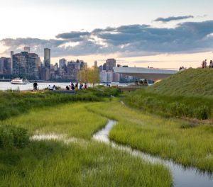
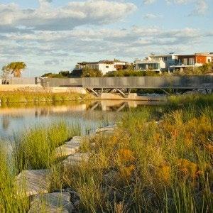
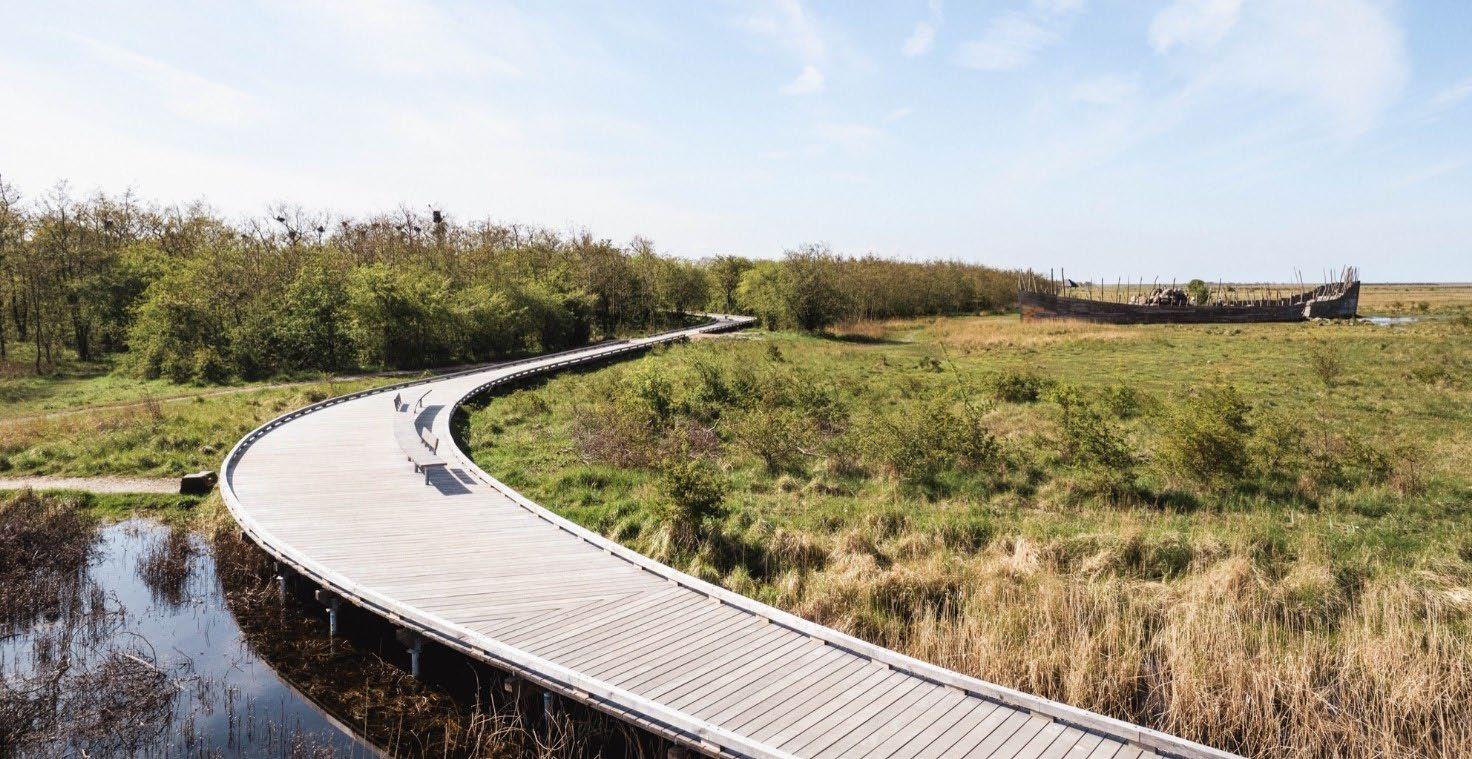
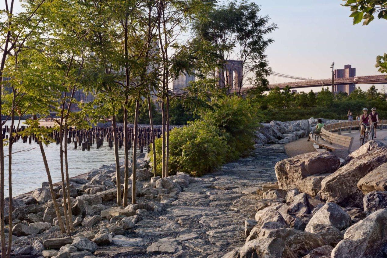
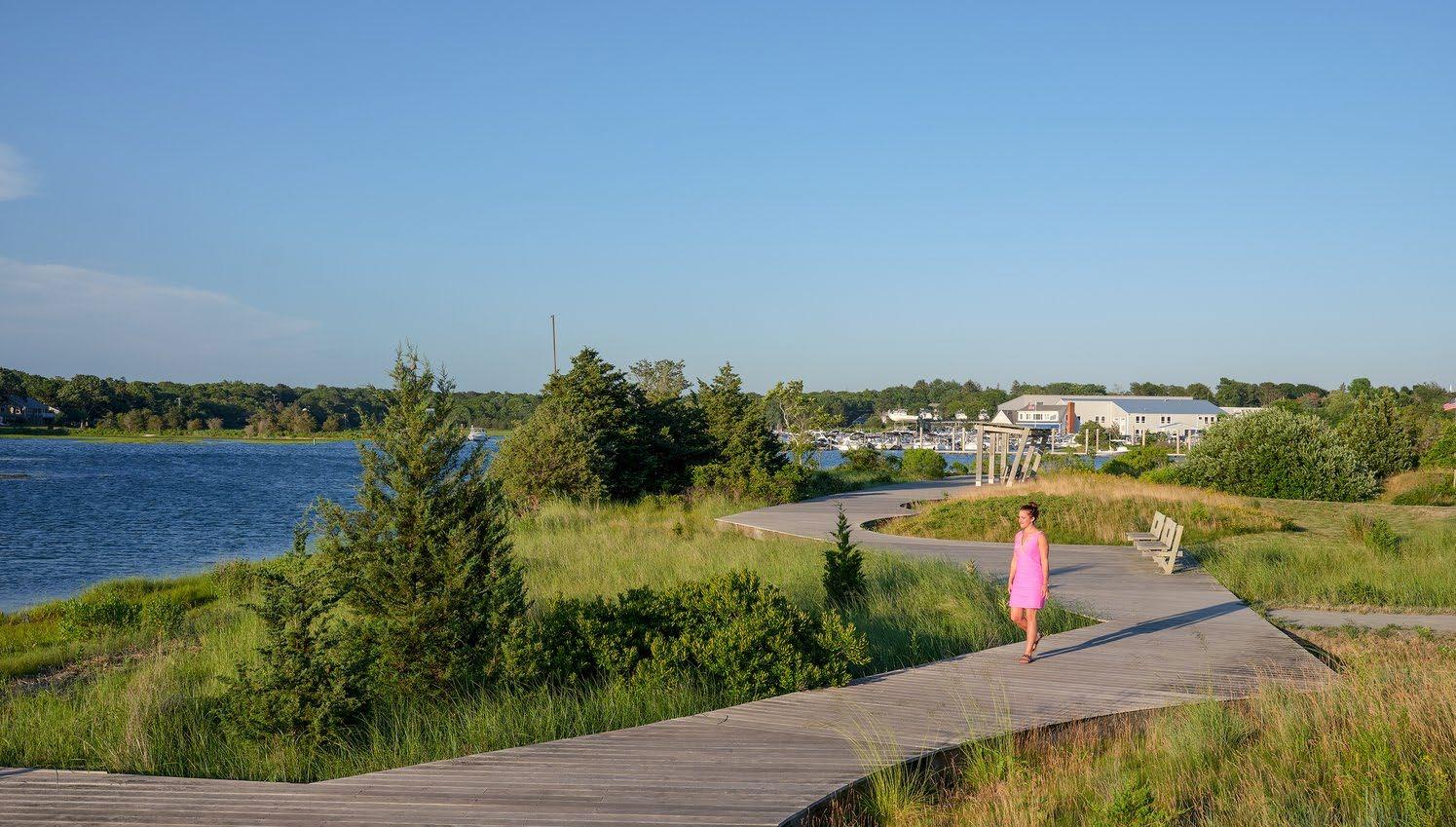
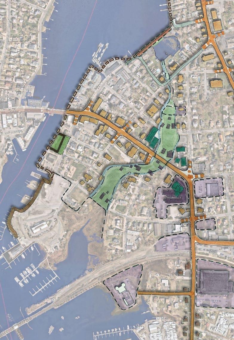
This study recommends that the Town of Stonington consider establishing a Resilience Improvement District for Downtown Mystic and encourages the Town to consider working with the Town of Groton to establish a District that spans both banks of the Mystic River.
Public Act No. 25-33, signed into law on June 10, 2025 authorizes towns to establish Resiliency Improvement Districts. To establish the District, the Municipality must prepare a master plan including the vision for adaptations and mitigations to the effects of climate change, a financial plan, and at least one public hearing. Similar to increment financing districts, a Resilient Improvement District would permit Stonington to establish a framework to specifically finance projects that increase the community's resilience to climate hazards within the District. Establishing a District would enablethe Town to levy taxes on property in Downtown Mystic as a way of paying for improvements aswell as to bond projects that will fund the implementation of mitigations and adaptations to floodrisks For example, Stonington might use the District financing options to raise capital that establishes shoreline mitigations to the 10% AEP storm, or to advance projects that result in a resilient corridor along Routes 1 and 27, or otherwise address the threats that Downtown Mystic faces from tidal, storm surge, and pluvial flooding. Additionally, it is possible to establish Resilience Improvement Districts that span municipal boudnaries, which is key for Downtown Mystiic, as the vulnerable low-lying areas that comprise Downtown lie within both the Town of Stonington and the Town of Groton. By working together through a Resilience Improvement District, the two municipalities would be able to coordinate projects that resulted in harmonious solutions and benefit residents and businesses on both sides of the Mystic River.
It is also recommended that the Town of Stonington establish a Climate Resilience Overlay District to add an additional set of regulations pertaining to building standards that will guide the future development of the Downtown area and foster climate resilience measures. Regulations set in place by the Overlay District will help to strengthen the development of a resilient corridor of densely developed, elevated structures along Main Street and will encourage community members who own property outside of the resilient corridor to elevate, relocate, or retreat. The Town can use the overlay zone to regulate wet floodproofing techniques, setbacks, elevations standards, impervious and pervous surface ratios, to guide the mitigation of risk overall in the Downtown area through the permitting process.
Public Act 21-29, passed in 2021, authorized municipalities to implement overlay zones, floating zones, planned development districts, and cluster zones as a part of the zoning code. Additionally, the Connecticut Coastal Management Act (P.A. 79-535) authorized the creation of Coastal Overlay Zones to regulate coastal development and to specifically limit the impact of flooding and erosion. By coupling the Coastal Overaly Zone with design requirements that address resilient design and that improve the overall resliience of the Downtown area, the overlay zone could be aligned with the Town's strategic vision for mitigating the effects of climate change and sea level rise.
- Levy taxes
- Raise Bonds
- Can be set up to transcend municipal boundaries to promote coordinated responses to climate risk
-
Sets regulations specific to the vulnerable area - Can be flexible and responsive to changing needs
IMAGE AND BACKGROUND RESEARCH CREDITS
Bailey, O.H., and J.C. Hazen. View of Mystic River and Mystic Bridge, Conn. [Boston, 1879] Map. https://www.loc.gov/item/74693238/.
University of Connecticut Library Map and Geographic Information Center. Connecticut Aerial Photography Resources. (2016). UConn.edu. https://magic.lib.uconn.edu/mash_up/aerial_index.html.
Connecticut Institute for Resilience and Climate Adaptation. “Climate Change Vulnerability Index” (2021). https://experience.arcgis.com/experience/a364a5f4870c4dc7ba53c681543521af/.
Connecticut Institute for Resilience and Climate Adaptation. “Regional Adaptation/Resilience Opportunity Areas” (2024). https://resilientconnecticut.media.uconn.edu/wpcontent/uploads/sites/3830/2024/08/Mystic-Merged.pdf
Fausset, R., & Flavelle, C. “In Charleston, S.C., Saving Historic Homes Means Hoisting Them in the Air.” (August 5, 2021). The New York Times.
Parris, Adam S., Peter Bromirski, Virginia Burkett, Daniel R. Cayan, Mary Evans Culver, John Hall, Radley M. Horton et al. "Global sea level rise scenarios for the United States National Climate Assessment." (2012).
R. Christopher Goodwin & Associates, Inc., Dewberry, & Milone & MacBroom. (2019). Resilient Historic Resources: Best Practices for Planners – Guidance For Connecticut Municipalities In An Era Of Climate Change. Connecticut State Historic Preservation Office, Department of Economic and Community Development.
U.S. National Oceanic and Atmospheric Administration. “U.S. Climate Resilience Toolkit Explorer” (2024). https://crt-climate-explorer.nemac.org/about/.
GIS DATA SOURCES
FEMA Flood Zones
NOAA Land Cover
CIRCA Flood Extents and Depths
CTDOT Road Centerlines
CTDEEP Mapped Wetland Inventory
CTECO Elevation Contour Lines
Nearmap Base Map Images
Department of Agriculture
Town of Stonington
Building Footprints
Open Space
Parcels
Water Infrastructure
Town Boundary
Town of Groton
Building Footprints
Parcels
Town Boundary