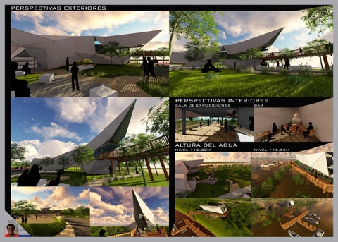
PERSPECTIVAS EXTERIORES
PERSPECTIVAS INTERIORES SALA DE EXPOSICIONES
ALTURA DEL AGUA NIVEL +12,00M
Citera, Facundo
UTNº2
BAR
NIVEL +15,55M
VISTAS
VISTA LONGITUDINAL NORESTE
VISTA LONGITUDINAL SUROESTE
CORTE
CORTE A-A
Citera, Facundo
UTNº2
PLANIMETRÍA 10,80
11,,40
12,10
12,80
13,50
14,20
14,90
15,60
16,30
10,80
11,,40
12,10
12,80
13,50
14,20
14,90
15,60
A
Bar
16,30
17,00 Sala de exposición
17,15
+20,00
Sala de exposición
Hall
14,10
Depósito
Hall
Depósito
14,00
Adm. Alquiler canoas
14,10
Auditorio.
14,00
PLANTA NIVEL +20,00 Esc. 1:200
A
14,00
14,10
PLANTA NIVEL +14,00 Esc. 1:400
PLANTA DE TECHOS Esc. 1:400
14,00
ESTRUCTURA ENVOLVENTE
Citera, Facundo
UTNº2
PLANTA NIVEL +17,00 Esc. 1:200
axonometría Esc. 1:400