Explorations Explora Torres del Paine Conservation Reserve
Explorations at Explora Torres del Paine Conservation Reserve
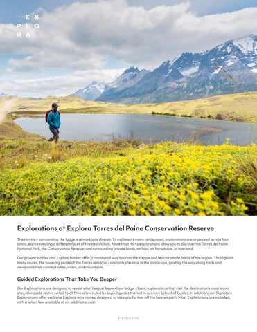
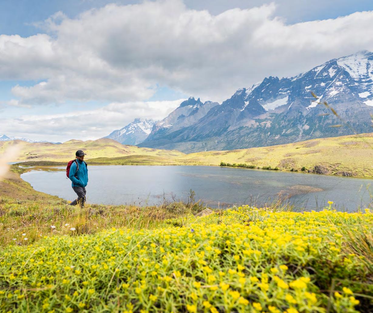
The territory surrounding the lodge is remarkably diverse. To explore its many landscapes, explorations are organized across four zones, each revealing a different facet of the destination. More than thirty explorations allow you to discover the Torres del Paine National Park, the Conservation Reserve, and surrounding private lands, on foot, on horseback, or overland.
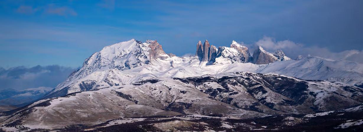
Our private stables and Explora horses offer a traditional way to cross the steppe and reach remote areas of the region. Throughout many routes, the towering peaks of the Torres remain a constant reference in the landscape, guiding the way along trails and viewpoints that connect lakes, rivers, and mountains.
Guided Explorations That Take You Deeper
Our Explorations are designed to reveal what lies just beyond our lodge: classic explorations that visit the destination’s most iconic sites, alongside routes suited to all fitness levels, led by expert guides trained in our own School of Guides. In addition, our Signature Explorations offer exclusive Explora-only routes, designed to take you further off the beaten path. Most Explorations are included, with a select few available at an additional cost.
Zones & Explorations
The Reserve
Hike
El Pasado
Renacer
Exploradores
Mirador del Obelisco
Huella de las Chinas
Santa Gemita
Into the Wild Horseback
Fronteras
Cañadón Las Torres
Puente Malo
Tough Life
Florence
High Mountain
Sierra Contreras
Self-guided
Río Zamora
Los Bosques
La Pampa
Cuenca Paine
Hike
Mirador Masle
Sarmiento
Laguna Larga
El Humedal
Nordenskjöld
Vega Castillo
Level of Difficulty
EASY
Gentle terrain with some elevation changes, suitable for a slow walking pace.
La Loma Aonikenk
Desembocadura
Overland
Estepa Patagónica
Encuentros con el Puma
Paine Massif
Hike
Valle Francés
Cuernos
Base Torres
High Mountain
Valle del Silencio
Overland
Glaciar Grey
Sierra Baguales
Hike
Bandurria
Laguna Rodas
Fósiles
El Centinela
High Mountain
Cerro Redondo
Vuelta a Baguales
Overland
Baguales
Signature Explorations
Signature Explorations are exclusive routes that have been designed by our explorations team to show the true essence of each destination. These explorations allow you to connect deeply with the natural environment and the local culture, offering a unique adventure far from the typical tourist paths.
MODERATE
Terrain featuring moderate ascents and descents, characterized by rolling hills.
ADVANCED
The terrain consists of steep inclines and descents, requiring a swift walking pace. The explorer may also face challenges along the trail, such as rocky sections, river crossings, or vertigo-inducing areas.
The Reserve
Step directly into Explora’s private Conservation Reserve, a protected 6,000-hectare territory that connects Torres del Paine National Park to the wider landscapes of Patagonia. Here, steppe, lakes, and native wildlife coexist within a territory actively managed under a philosophy of restoration and conservation. Walk, ride, or follow self-guided trails through lagoons, valleys, and former sheep ranches whose history is still written into the land. This is where Explora’s restoration work unfolds, where native wildlife is returning, and where every exploration becomes part of a living commitment to regenerating the landscape. A place to slow down, and to understand what it means to travel as part of a place, rather than apart from it.
HIKE
El Pasado
Distance: 4.9 km / 3.1 mi
Following historic routes traced by gauchos and ranchers of the province, we will walk while observing the Zamora River from above. In the distance, the Torres del Paine stand out on the horizon from a wide and striking perspective.
Half Day | Easy
Exploradores
Distance: 6.8 km / 4.2 mi
A walk that allows you to explore the former grounds of an estancia that today forms part of the Torres del Paine Conservation Reserve. Its vast landscapes offer views of the Torres del Paine and the Sierra Baguales in the distance, along with traces of guanacos, condors, and pumas that have returned to inhabit this area.
Half Day | Easy
Huella de las Chinas
Distance: 7.7 km / 4.8 mi
This exploration follows the course of the Las Chinas River, a natural corridor that has guided guanacos, hunters, and explorers for centuries. The trail crosses the Patagonian steppe, traces the riverbank, and reaches the waterfall that precedes its confluence with the Zamora River. From here, the Torres del Paine are also visible on the horizon, part of a landscape steeped in history.
Half Day | Moderate
Renacer
Distance: 5.6 km / 3.5 mi
Setting out from the lodge, the trail crosses a nothofagus forest to reach the heart of the reserve, where Laguna Jara awaits — an ecosystem that shelters both resident and migratory birds, including the Chilean flamingo.
Half Day | Easy
Mirador del Obelisco
Distance: 7.3 km / 4.5 mi
This walk ascends Cerro Obelisco through steppe, shrubland, and lenga beech forest, revealing views of the Paine massif and the Torres. To the north, the sheer walls of the Obelisco rise up, their rocky layers traced by soaring condors. After taking in the landscape, the descent brings you back on foot to the lodge.
Half Day | Moderate
Into the Wild
Distance: 17.2 km / 10.7 mi
This exploration offers a closer look at the conservation and research work carried out within the Reserve. Through trails that cross steppe, wetlands, and meadows, we discover how camera traps are used to study wildlife — from small mammals and birds to guanacos and pumas. A way of reading and understanding the land through science.
Full Day | Moderate
Santa Gemita
Distance: 13.8 km / 8.6 mi
This exploration leads into one of the former estancias that today form part of the Conservation Reserve. After crossing the Las Chinas River twice, the route advances through wide stretches of steppe to reach the old outpost of Santa Gemita, a shelter tied to Patagonian tradition.
At these isolated outposts, it was customary to leave firewood, water, and food for the travelers who would come after. Along the walk, views also open toward Laguna Azul and the Torres del Paine.
Full Day | Moderate
HIGH MOUNTAIN
Sierra Contreras
Distance: 11.8 km / 7.3 mi
A mountain exploration that ascends toward one of the summits marking the boundary of the Reserve in the Sierra Contreras. The sierra formerly belonged to the estancias Santa Gemita and El Mercado, whose traces still form part of the ranching history of the area.
The ascent crosses open slopes and ledges frequented by condors. From the summit, panoramic views of the reserve and the national park unfold.
Full Day | Advanced
HORSEBACK
Fronteras
Distance: 6.4 km / 4 mi
A horseback exploration, at a walking pace, through the Torres del Paine Conservation Reserve. Accompanied by a guide and a gaucho, we ride toward Laguna Jara, and from the highest point we can take in the vega wetland below — an area that shelters guanacos and a variety of Patagonian birds.
Half Day | Easy
Cañadón Las Torres
Distance: 10.7 km / 6.6 mi
A wide open valley that draws the eye toward the Torres, setting the direction of the journey. Ancient grazing grounds are slowly giving way to the regeneration of native forest, a quiet process that reveals itself with every stretch of the trail. At an unhurried pace, we move through meadows, small lagoons, and natural viewpoints. The Torres appear and disappear among the hills.
Half Day | Easy
Puente Malo
Distance: 7.1 km / 4.4 mi
A ride at trot and gallop through the heart of the Reserve, circling a wetland known as La Vega. This area concentrates much of the reserve’s wildlife thanks to the permanent presence of water. During the ride it is possible to spot local wildlife and cross the remains of an old bridge, which gives this exploration its name.
Half Day | Moderate
Florence
Distance: 23.8 km / 14.8 mi
A horseback exploration at trot and gallop. Alongside the guide and the gaucho, we ride through the three former estancias that gave rise to the current Torres del Paine Conservation Reserve. We cross rivers, open pampa, hills, and patches of forest. After fording the Las Chinas River, a steep ascent is followed by an equally demanding descent.
Full Day | Advanced
SELF-GUIDED
Río Zamora
Distance: 9.6 km / 6 mi
We follow ancient tracks that cross the reserve and allow us to delve into the history of the territory. From the heights, the Zamora River runs along the valley floor, while the Sierra Contreras stretches across the horizon, vast and distant.
Half Day | Easy
La Pampa
Distance: 12.2 km / 7.6 mi
We set out from the lodge toward the heart of the reserve, reaching Laguna Jara — a natural refuge for resident and migratory birds, including the Chilean flamingo. A route that allows you to immerse yourself in the wildlife of the territory and observe how water, steppe, and fauna converge within a single landscape.
Half Day | Easy
Tough
Life
Distance: 12.4 km / 7.7 mi
A horseback exploration at trot and gallop. Alongside the guide and the gaucho, we ride through the Conservation Reserve, crossing the grounds of the former estancias 2 de Enero and El Mercado. Along the way, we discover traces of the gaucho life that left its mark on these lands.
Half Day | Advanced
Los Bosques
Distance: 9.8 km / 6.1 mi
We traverse the former grounds of an estancia, today part of the Torres del Paine Conservation Reserve. In the distance the Torres del Paine rise; closer at hand, the tracks of guanacos, condors, and pumas that have returned to inhabit this territory.
Half Day | Easy
Cuenca Paine
Discover the southeastern sector of Torres del Paine National Park, an open territory of Patagonian steppe and interconnected lakes, where wildlife, wetlands, and sweeping views of the massif define the landscape. This is the part of the park where the horizon opens up, and where Patagonian life reveals itself more slowly and intimately. Explore on foot or by vehicle through sectors such as Laguna Azul, Lake Sarmiento, and Laguna Amarga, alongside wetlands like Vega Castillo. Follow wildlife corridors where guanacos graze freely, spot an extraordinary variety of birds, and cross landscapes where the granite towers appear on the horizon as a distant, watchful presence.
Mirador Masle
Distance: 3.5 km / 2.2 mi
Ascending through the slopes above the steppe, the exploration gains elevation to reveal one of the most iconic views of Torres del Paine: Laguna Azul in the foreground and, in the distance, the towers rising above the massif. From this vantage point, you take in the same perspective that captivated the first travelers who documented Patagonia in the late 19th century.
Half Day | Easy
Laguna Larga
Distance: 4.8 km / 3 mi
This exploration offers one of the widest panoramic views of Torres del Paine. From here it is possible to identify the three great mountain groups — Paine Grande, the Cuernos, and Almirante Nieto — along with valleys such as the Francés and the Bader. The route combines open landscapes, Patagonian wildlife, lagoons, and geological features of interest.
Half Day | Easy
Nordenskjöld
Distance: 6.3 km / 3.9 mi
A trail with gentle ascents and descents leading to views of Lake Nordenskjöld, whose intensely colored glacial waters stretch out before the imposing Cuernos del Paine, the Francés valley, and Paine Grande.
Half Day | Easy
Sarmiento
Distance: 4 km / 2.5 mi
Thrombolites are white rocky formations found along the shores of Lake Sarmiento — evidence of some of the oldest organisms in the history of the planet, dating back more than 3.5 billion years. With the Paine mountains, the park’s largest lake, and the Patagonian steppe as a backdrop, this exploration offers a glimpse into the origins of life on Earth.
Half Day | Easy
El Humedal
Distance: 6.3 km / 3.9 mi
The walk circles an expansive wetland formed by ancient lagoons and flooded areas that today shelter a rich diversity of Patagonian birds, drawn by the constant presence of water and vegetation. The combination of wetlands and sweeping views across the Paine landscape makes this exploration a quiet experience, ideal for wildlife observation and nature photography.
Half Day | Easy
Vega Castillo
Distance: 7.8 km / 4.8 mi
One of the most diverse wetlands in the southern sector of Torres del Paine, formed by remnant lagoons from the Last Glacial Maximum. These waters became trapped between ancient moraines, giving rise to a landscape where totora reeds, forest, steppe, and lagoons of varying depths interweave.
Half Day | Easy
La Loma
Distance: 3.7 km / 2.3 mi
This exploration crosses an open stretch of steppe at the edge of the park, used in winter by guanacos as a breeding ground. The trail ascends slopes marked by ancient fires, revealing tracks and traces of the wildlife that has historically inhabited this area.
From the ridge, a new perspective of the Paine massif opens up. The descent leads to Vega de los Ñandúes, a wetland rich in Patagonian birdlife.
Half Day | Moderate
Desembocadura
Distance: 13.3 km / 8.3 mi
This exploration crosses the open landscapes between Estancia Vega Castillo and the confluence of the Las Chinas River with Lake Toro. At this meeting point, extensive wetlands and small lagoons form, concentrating a rich diversity of birds and wildlife. The route traverses a particularly varied landscape, where steppe, wetlands, totora reeds, and forest interweave.
Full Day | Moderate
OVERLAND
Estepa Patagónica
In this exploration we travel by vehicle through the most open areas of the park. Vast lakes such as Nordenskjöld and Sarmiento, dozens of lagoons that are home to diverse birds, waterfalls, and iconic mountains all form part of the landscape. Throughout the journey, distant views of the Torres del Paine unfold and, with luck, sightings of local wildlife.
Half Day | Easy
Aonikenk
Distance: 7.7 km / 4.8 mi
The Aonikenk were the indigenous people who inhabited Patagonia before the arrival of the estancieros — hunter-gatherers who moved across the land following the guanacos, leaving traces of their passage throughout this territory.
During the walk, it is also possible to discover fresh signs of pumas, condors, and guanacos.
Half Day | Moderate
Encuentros con el Puma
*This exploration is coordinated with specialized third-party services, subject to availability and an additional cost.
An exploration that invites you to observe, in a responsible manner, pumas in their natural habitat. Accompanied by expert guides, we explore the sweeping landscapes of Patagonia with the possibility of encountering this emblematic feline. Conducted in partnership with specialized external services, subject to availability.
Full Day | Easy
Paine Massif
Approach the iconic granite massif from an entirely different starting point.This zone covers the northwestern sector of Torres del Paine National Park, where the massif rises from the landscape to form some of Patagonia’s most emblematic landmarks: the Torres del Paine, the Cuernos del Paine, and Glaciar Grey. Climb to the base of the Torres, follow the legendary Valle Francés, and take in the towering walls of the Cuernos. Access combines overland routes with navigation across Lake Pehoé, revealing the massif from angles that classic circuits rarely show. These are the park’s most iconic experiences, guided at Explora’s pace: with reflection, without haste, and with room for what the land itself wants to reveal.
Valle Francés
Distance: 18.5 km / 11.5 mi
A walk into the heart of the Paine mountains, tracing the valley that divides the imposing Cuernos and Paine Grande. Along the way, we take in close-up views of granite walls and glaciers, while crossing extensive areas of shrubland and forest.
Full Day | Moderate
Base Torres
Distance: 22 km / 13.7 mi
Mountainous terrain and forest, with a continuous ascent alongside the Ascencio River to a glacial moraine of approximately 300 meters of elevation gain. Crossing that combination of landscapes, you reach the renowned viewpoint beside the lagoon, where a privileged view of the imposing Torres del Paine unfolds.
Full Day | Advanced
Valle del Silencio
Distance: 29.4 km / 18.3 mi
This exploration ventures into a less-traveled valley of the Paine massif, following the route toward Campamento Japonés and the Valle del Silencio. The route offers views of the Torres from a perspective reserved almost exclusively for climbers, in a remote and silent setting. From here, other imposing mountains also come into view, such as Fortaleza, whose enormous walls often go unnoticed in the shadow of the Torres.
Full Day | Advanced
Cuernos
Distance: 20.4 km / 12.7 mi
This exploration traces the landscape between Lake Nordenskjöld and the imposing Cuernos del Paine, drawing close to the base of one of the most iconic mountains on the planet.
At the foot of the massif, the trail reveals up close the immense scale of its granite walls and distinctive dark summits — a combination of sweeping views and direct proximity to the mountain.
Full Day | Moderate
Glaciar Grey
The exploration combines an overland journey with a navigation toward one of the most iconic glacial landscapes in Torres del Paine. From Playa Grey, a short walk through forest and lakeshore leads to the catamaran that ventures into the waters of Lake Grey, surrounded by icebergs calved from the glacier.
Full Day | Easy
Sierra Baguales
Venture into one of Patagonia’s most remote and least explored territories. Located northeast of the Conservation Reserve, near the border between Chile and Argentina, Sierra Baguales is a landscape of ancient geological formations, vast open valleys, and fossils that predate the Andes themselves — a place where the oldest chapters of the earth emerge with each season. Explore interior valleys, climb to natural viewpoints, and cross the region overland to reach lagoons, peaks, and panoramic horizons that reveal the territory’s deep geological history. Wildlife roams freely across these plains, and the sense of remoteness is almost absolute. This is Patagonia with the volume turned down and the scale turned up.
Distance: 5.9 km / 3.7 mi
This exploration traverses one of the most remote and striking landscapes of the Sierra Baguales. The trail follows the Bandurrias River valley, crossing hills shaped by ancient seas that covered this territory millions of years ago. Along the walk, a series of paddocks reveals the estancia history of the area.
Half Day | Easy
Fósiles
Distance: 13 km / 8.1 mi
This exploration crosses one of the most fascinating paleontological areas of the Sierra Baguales. As we advance along the trail, we delve into the geological history of the territory, discovering how this landscape changed profoundly over time. In its rocks, it is possible to observe marine and plant fossils — evidence of ancient environments that once existed in this part of Patagonia.
ull Day | Moderate
Distance: 18.5 km / 11.5 mi
A mountain exploration in the Sierra Baguales that crosses landscapes dominated by ancient basaltic lavas, evidence of volcanic eruptions that transformed this region millions of years ago. As we gain elevation, the terrain becomes increasingly remote, with sweeping views across the Patagonian pampas and the mountains that mark the border with Argentina.
Distance: 8.1 km / 5 mi
This exploration leads to one of the most open natural viewpoints in the Sierra Baguales, with sweeping views across the Baguales valley. The route ventures into remote landscapes dominated by high pampas, meadows, and mountains shaped by ancient glaciers and the Patagonian wind.
Full Day | Advanced
Laguna Rodas
Distance: 7.4 km / 4.6 mi
The route begins deep in the Sierra Baguales, advancing toward the lagoon before descending along the course of the Baguales River toward Estancia Las Cumbres. Along the way, the landscape reveals wide pampas, watercourses, and mountains shaped by ancient glaciers, in a setting marked by the wind and a constant sense of remoteness.
Half Day | Easy
Full Day | Advanced HIGH MOUNTAIN
Vuelta a Baguales
Distance: 15.8 km / 9.8 mi
Following the trails of Estancia Las Cumbres, the exploration ascends toward the upper reaches of this Patagonian mountain range. The route crosses the valleys of Cerro Redondo to circle around Cerro Torreón, passing near ancient high-mountain passes historically used as a link between Chile and Argentina. One of the most remote and immersive explorations in the territory.
Full Day | Advanced
Bandurria
El Centinela
Cerro Redondo
Baguales
Distance: 3 km / 1.9 mi
An overland journey into the Sierra Baguales through some of the most remote landscapes in Patagonia. Along the route, mountains and ravines reveal different layers of the area’s history, until reaching Estancia Las Cumbres. From there, we walk through the surrounding terrain to grasp the scale and remoteness of this territory.