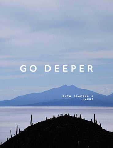
GO DEEPER IN NT TO O I
AT TA AC CA AM MA A & & A UY YU UN NI I U
TRAVESÍA SAN PEDRO DE ATACAMA & UYUNI Exploraciones | E xpl orati ons
XX
Bienvenido a la Travesía Explora Atacama-Uyuni. Este viaje conecta el desierto de Atacama en Chile con el Salar de Uyuni en Bolivia, y puede realizarse en cualquiera de sus dos direcciones. Recorre una de las rutas más remotas y prístinas del planeta: un paso milenario transitado por caravaneros prehispánicos y aún hoy recorrido por los habitantes del altiplano, que mantienen viva su relación con este territorio extremo. A lo largo del camino desafiamos la altitud y atravesamos paisajes que revelan el poder y la belleza de una geografía radical, capaz de moldear toda forma de vida. La Travesía se desarrolla entre Mountain Lodges ubicados estratégicamente para explorar distintos ecosistemas y comunidades del altiplano. Desde cada uno de ellos, y también durante los trayectos que los conectan, realizamos exploraciones que permiten comprender en profundidad la diversidad natural y cultural de este territorio.
Welcome to the Travesia Explora Atacama - Uyuni. This journey connects the Atacama Desert in Chile with the Uyuni Salt Flat in Bolivia and can be undertaken in either direction. It follows one of the most remote and pristine routes on the planet —an ancient passage once traveled by pre-Hispanic caravans and still used today by the people of the Altiplano, who keep their connection with this extreme landscape alive. Along the way, we face the altitude and cross territories that reveal the power and beauty of a radical geography —one that has shaped every form of life that inhabits it. The Travesía unfolds through Mountain Lodges strategically located to explore key ecosystems and communities of the Altiplano. From each lodge, and along the overland routes that link them, we set out on explorations that deepen our understanding of the region’s natural and cultural diversity. 3
EXPLORACIONES | EXPLORATIONS
TRAYECTO ATACAMARAMADITAS
VOLCANES Y LAGUNAS JOURNEY
TRAYECTO RAMADITASCHITUCA
JOURNEY
VOLCANOS AND
JOURNEY
ATACAMA-RAMADITAS
LAGOONS
RAMADITAS-CHITUCA
OVERLAND |
CAMINATAS
OVERLAND
Atacama - Ramaditas
13
|
OVERLAND |
HIKES
Laguna Ramaditas
16
Lagunas Altiplánicas
23
Laguna Honda
16
Yardangs
24
Yardangs
19
OVERLAND
|
OVERLAND
Lagunas Andinas
20
MONTAÑISMO | MOUNTAINEERING Volcán Ascotán
6
OVERLAND
21
EXPLORACIONES | EXPLORATIONS
PUEBLOS ALTIPLÁNICOS
TRAYECTO CHITUCA-JIRIRA
SALAR DE UYUNI
ANDEAN
JOURNEY
UYUNI SALT
VILLAGES
CHITUCA-JIRIRA
FLAT
OVERLAND |
CAMINATAS
CAMINATAS
|
HIKES
Las Apachetas
28
Jawincha
28
OVERLAND
|
OVERLAND
Pueblos Andinos
31
Pueblos Antiguos
31
35
|
HIKES
Pastores
38
Chiltaico
38
Jirira
39
Qhapaq Ñan
39
Isla Pescado
40
Wila Khollu
40
Alkaya
41
MONTAÑISMO | MOUNTAINEERING
MONTAÑISMO | MOUNTAINEERING Irruputunku
Salar
OVERLAND
32
Colores del Tunupa BICICLETA
|
42 BIKE
Ayke
43
Pueblos del Salar
43
Isla K’ajchi
44
Tara
44
Manto Blanco
47
OVERLAND
|
OVERLAND
La Pukara
48
Apu
48
Ancestros
49
Inti
50
Killa
50
7
INTERESES
| INTEREST
Aves | Birds
Salares
Fauna | Wildlife
Fuentes termales
| Geothermal springs
Flora | Flora
Sitio arqueológico
| Archeological site
Geología | Geology
Recomendado para la familia
|
Salt-flats
Family friendly
TEMPORADA | SEASON
Seca | Dry Abr - Dic | Apr - Dec
Lluviosa | Rain Ene - Mar
|
Ene - Mar
LEYENDA | CAPTION
8
Distancia
Distance
Distancia total recorrida a pie en cada una de las exploraciones.
Total distance hiked in each exploration.
Ganancia acumulada
Accumulated gain
La suma total de metros o pies subidos durante la exploración.
Total amount in meters or feet gained throughout the exploration.
Pérdida acumulada
Accumulated loss
Suma total de metros o pies perdidos durante la exploración.
Total amount in meters or feet desdended throughout the exploration.
Altitud máxima
Maximum altitude
Altitud máxima alcanzada durante la exploración. La medida es en metros sobre el nivel del mar (m.s.n.m.).
Maximum altitude reached during the exploration. The measurement is in feet above sea level (f.a.s.l.).
Altitud mínima
Minimum altitude
Altitud mínima alcanzada durante la exploración. La medida es en metros sobre el nivel del mar (m.s.n.m.).
Minimum altitude reached during the exploration. The measurement is in feet above sea level (f.a.s.l.).
|
NIVEL | LEVEL
Fácil
Easy
Terreno con pocas subidas y bajadas. Puede realizarse a un ritmo de caminata lento.
Gentle terrain with some elevation changes, suitable for a slow walking pace.
Moderado
Moderate
Terreno con subidas y/o bajadas moderadas, como colinas suaves.
Terrain featuring moderate ascents and descents, characterized by rolling hills.
Difícil
High
Terreno con subidas y/o bajadas empinadas que requieren un ritmo caminata rápido. También es posible encontrar desafíos como zonas rocosas cruces de río y zonas que pueden dar vértigo.
The terrain consists of steep inclines and descents, requiring a swift walking pace. The explorer may also face challenges along the trail, such as rocky sections, river crossings, or vertigo-inducing areas.
Experto
Very high
Terreno con subidas y bajadas exigentes que pueden requerir avance con las manos y/o terreno fuera del sendero. También requiere un ritmo de caminata rápido.
The terrain includes challenging climbs and descents that may necessitate hand-over-hand navigation and off trail hike, requering a brisk walking pace.
TIPO DE EXPLORACIÓN
| T Y P E O F E X P L O R AT I O N
Classic Lugares icónicos en el destino. Es posible que te encuentres a más personas.
Iconic spots at the destination. You might encounter more people on the trail.
Signature Exploración diseñada y operada exclusivamente por Explora.
An exploration exclusively designed and operated by Explora.
Specialized Requiere habilidades y/o condiciones especiales para llevarla a cabo. Como uso de equipamiento técnico en montaña.
It requires specific skills and/or physical conditions to undertake. May involve use of specialized mountain equipment.
9
Tipo
Exploración
Categoría
Duración
Dificultad
Que ver?
Página
Type
Exploration
Category
Duration
Difficulty
What to see?
Page
Laguna Ramaditas
HD
16
Laguna Honda
Signature
FD
16
Yardangs
Signature
FD
19
Las Apachetas
Signature
FD
28
Jawincha
Signature
FD
28
FD
38
Pastores Chiltaico
Signature
FD
38
Jirira
Signature
FD
39
Qhapaq Ñam
Signature
HD
39
HD
40
HD
40
FD
41
Isla Pescado Wila Khollu
Signature
Alkaya
Volcán Ascotán
Signature/ Specialized
FD
21
Volcán Irruputunku
Specialized
FD
32
Colores del Tunupa
Signature/ Specialized
FD
42
HD
43
Ayke Pueblos del Salar
Signature
HD
43
Isla K’Ajchi
Classic
HD
44
Tara
Classic - Signature
HD
44
Manto Blanco
Classic
HD
47
Atacama - Ramaditas*
Classic
FD
13
Lagunas Altiplánicas*
Classic
FD
23
Yardangs*
Classic
FD
24
Salar*
Signature
FD
35
Lagunas Andinas
Classic
FD
20
Pueblos Andinos
Signature
HD
31
Pueblos Antiguos
Signature
HD
31
La Pukara
Signature
HD
48
HD
48
Apu Ancestros
Classic - Signature
HD
49
Inti
Classic - Signature
-
50
-
50
Killa
* Exploración overland que corresponde al trayecto entre diferentes lodges. * Overland exploration, referring to the journey that links our different lodges. 11
TRAYECTO ATACAMA - RAMADITAS JOURNEY ATACAMA - RAMADITAS Atacama - Ramaditas Full Day | 8 h Classic
234,9 km | 146 m
4.913 m.s.n.m. | 19.119 f.a.s.l.
2.1 km | 1.3 mi
2.422 m.s.n.m. | 7.946 f.a.s.l.
33 mts | 109 ft
-34 mts | -110 ft
El trayecto entre San Pedro de Atacama y Ramaditas atraviesa una vasta sección del altiplano andino, caracterizada por volcanes, lagunas y campos geotermales. Tras cruzar la frontera, realizamos una caminata junto a las lagunas Blanca y Verde y luego ascendemos a un mirador con vistas al imponente volcán Licancabur. Desde allí continuamos hacia los géiseres de Sol de Mañana, donde el vapor y el
The journey from San Pedro de Atacama to Ramaditas crosses a vast section of the Andean altiplano, characterized by volcanoes, lagoons, and geothermal fields. After crossing the border, we take a walk along the Blanca and Verde lagoons and then ascend to a viewpoint overlooking the imposing Licancabur Volcano. From there, we continue toward the Sol de Mañana geysers, where the steam and sulfur
olor a azufre revelan la energía del lugar.
smell reveal the underground energy of the area.
La jornada incluye también una caminata en
The day also includes a walk around Laguna
torno a la laguna Colorada, hábitat de flamencos altiplánicos y reconocida por los tonos rojizos y blancos que contrastan con la cordillera. Luego almorzamos en medio de la inmensidad del altiplano y continuamos hacia el Mountain Lodge de Ramaditas, enclavado en una de las zonas más remotas y sobrecogedoras
Colorada, habitat of high-Andean flamingos and known for its red and white tones that contrast with the surrounding mountains. We then have lunch in the immensity of the altiplano before continuing toward the Mountain Lodge of Ramaditas, set in one of the most remote and striking regions of the area.
de la región.
Intereses | Interests
Temporada | Season
13
14
ZONA VOLCANES Y LAGUNAS
En un mundo lleno de ruido, el silencio sigue teniendo su propio territorio.
CUENCA DEL SALAR
CAMINATAS
|
HIKES
Laguna Ramaditas
HD
Laguna Honda
FD
Yardangs
FD
In a world filled with noise, silence continues to claim its own space.
OVERLAND
|
OVERLAND
Lagunas Andinas
Aquí, en lo alto del Altiplano, el
Here, high on the Altiplano, sound
sonido pertenece únicamente a la
belongs solely to nature: the wind
naturaleza: el viento que silba entre
whistling through the rocks, the
las rocas, el eco distante de una
distant call of an alpaca, the dry
alpaca, el crujido seco de la tierra
crunch of earth beneath our steps.
FD
MONTAÑISMO | MONTAINEERING Volcán Ascotán
FD
bajo nuestros pasos. We stand on the world’s second Estamos en la segunda meseta más
highest plateau, a territory shaped
alta del mundo, un territorio
by the deep forces of the Earth.
moldeado por la fuerza profunda
Ancient eruptions left striking
de la Tierra. Antiguas erupciones
marks—formations carved by wind
dejaron huellas imponentes:
and time. Active volcanoes outline
formaciones esculpidas por el
the horizon, and lagoons of varying
viento y el tiempo. Volcanes activos
colors shelter flamingos and other
delinean el horizonte, y lagunas de
high-Andean birds. In the midst of
distintos colores albergan
this hyper-arid landscape, life
flamencos y otras aves altiplánicas.
endures.
En medio de esta hiperaridez, la vida resiste.
In Ramaditas, silence is not an absence; it is a presence. A presence
En Ramaditas, el silencio no es
of nature speaking without words,
ausencia: es presencia. La de una
where human life retreats and the
naturaleza que habla sin palabras,
landscape finds its own voice.
donde la vida humana se repliega y el paisaje adquiere su propia voz.
15
CAMINATAS
|
HIKES
Laguna Ramaditas
Partimos desde el Mountain Lodge
Half Day | 1 h 15 m
laguna Ramaditas, una laguna de
para caminar por el borde sur de la altura cuyo tono intenso contrasta con los colores terrosos de las montañas del altiplano. Este sector formó parte de una antigua red de rutas usadas por pastores y caravaneros, que encontraban aquí un punto natural de descanso en sus desplazamientos por el altiplano.
15 min
We start from the Mountain Lodge and walk along the southern shore of
3,6 km | 2,2 mi
43 mts | 141 ft
-61 mts | -200 ft
Laguna Ramaditas, a high-altitude lagoon whose vivid color contrasts
4.146 m.s.n.m. | 13.602 f.a.s.l.
with the earthy tones of the altiplano
4.116 m.s.n.m. | 13.504 f.a.s.l.
of an ancient network of routes used
mountains. This area was once part by herders and caravaners, who found here a natural resting point
Temporada | Season
Intereses | Interests
during their journeys across the high plains.
Laguna Honda
Iniciamos la caminata desde el
Full Day | 6 h
una zona de pequeñas colinas de
Signature
origen volcánico que albergan
Mountain Lodge de Ramaditas hacia
lagunas de colores variados. El recorrido permite leer la geología del altiplano y observar cómo los cambios de altitud modifican la vegetación, con laderas donde aparecen llaretas y otras especies adaptadas a estas alturas.
20 min 10 km | 6,2 mi
319 mts | 1.047 ft
-324 mts | -1.063 ft
We start walking from the Mountain Lodge toward an area of small volcanic hills that host several multicolored lagoons. The route allows us to read the geology of the
4.219 m.s.n.m. | 13.842 f.a.s.l.
altiplano and observe how changes in
4.075 m.s.n.m. | 13.369 f.a.s.l.
altitude shape the vegetation, with slopes where llareta and other
Intereses | Interests
16
Temporada | Season
high-Andean species appear.
CAMINATAS
|
HIKES
Yardangs
Esta exploración nos conduce a los
Full Day | 4 h
material volcánico originado por
yardangs: grandes cuerpos de antiguas erupciones y esculpido
Signature
durante siglos por el viento del altiplano. Sus formas alargadas y afiladas evocan catedrales de roca y muestran con claridad la fuerza de la erosión eólica en este territorio.
This exploration leads us to the yardangs: large bodies of volcanic 1 h 15 min
1h 15 min
6,6 km | 4,1 mi
and sculpted over centuries by the 259 mts | 850 ft
-259 mts | -850 ft
winds of the altiplano. Their elongated, sharp-edged forms evoke stone cathedrals and clearly reveal
4.747 m.s.n.m. | 15.574 f.a.s.l.
the strength of wind erosion in this territory.
4.564 m.s.n.m. | 14.974 f.a.s.l.
Intereses | Interests
material created by ancient eruptions
Temporada | Season
19
OVERLAND
|
OVERLAND
Lagunas Andinas Full Day | 6 h
Salimos en jeep desde el Mountain Home de
We depart by jeep from the Mountain Home in
Ramaditas para recorrer las lagunas Cachi y
Ramaditas to explore the Cachi and Pastos
Pastos Grandes, formadas por antiguas
Grandes lagoons, shaped by ancient caldera
erupciones de caldera. Caminamos por sus
eruptions. We walk along their shores observing
orillas observando aves altoandinas y rasgos
high-Andean birdlife and geological features of
geológicos del paisaje. Luego seguimos hacia el
the landscape. We then continue to Cerro
cerro Chulluncani y su laguna antes de regresar
Chulluncani and its lagoon before returning to
al campamento.
camp.
4.122 m.s.n.m. | 13.524 f.a.s.l.
4.746 m.s.n.m. | 15.571 f.a.s.l.
Intereses | Interests
20
Temporada | Season
MONTAÑISMO
|
MOUNTAINEERING
Volcán Ascotán
Ascendemos hasta la cumbre del
Full Day | 9 h
colapsada deja a la vista un interior
volcán Ascotán, cuya estructura multicolor de tonos minerales que le
Signature/ Specialized
ha dado el nombre de “Jardín de Ascotán”. Durante el ascenso recorremos laderas donde crecen llaretas, pastos altoandinos y otras especies adaptadas a la altura. Desde la cima se despliegan vistas amplias del altiplano y de las lagunas que lo acompañan. 20 min
We ascend to the summit of Volcán 10,7 km | 6,6 mi
1.488 mts | 4.882 ft
-1.163 mts | -3.816 ft
Ascotán, whose collapsed crater exposes a multicolored interior of mineral tones that earned it the name
5.488 m.s.n.m. | 18.005 f.a.s.l.
“Garden of Ascotán.” Along the ascent we walk through slopes where
4.075 m.s.n.m. | 13.369 f.a.s.l.
llareta, high-Andean grasses, and Intereses | Interests
Temporada | Season
other altitude-adapted species grow. From the summit, wide views open over the altiplano and the lagoons that surround it.
21
TRAYECTO RAMADITAS - CHITUCA JOURNEY RAMADITAS - CHITUCA Lagunas Altiplanicas Full Day | 6 h Classic
154.2 km | 95,8 m
4.347 m.s.n.m. | 14.262 f.a.s.l.
3 km | 1.9 mi
3.678 m.s.n.m. | 12.067 f.a.s.l.
67 mts | 220 ft
-56 mts | -185 ft
Partimos desde Ramaditas, avanzando por un
We depart from Ramaditas, following a natural
corredor natural que marca la transición entre
corridor that marks the transition from the high
las altas planicies del altiplano y las zonas de
plateaus of the Altiplano into lower areas where
menor altitud, donde aparecen los primeros
the first settlements of high-altitude herders and
asentamientos de pastores y agricultores de
farmers appear. This journey crosses some of the
altura. Este trayecto recorre algunos de los
most emblematic landscapes of the Bolivian
paisajes más emblemáticos del altiplano
Altiplano. The route combines high-Andean
boliviano. El camino combina territorio
terrain, ancient lava flows, and the lagoons of
altoandino, antiguas coladas de lava y las
Honda, Char-Khota, and Hedionda, each with its
lagunas Honda, Char-Khota y Hedionda, cada
own colors and distinctive character. Along their
una con colores y características propias. En sus
shores it is common to see flamingos and other
orillas es común observar flamencos y otras aves
Altiplano birdlife feeding on the mineral-rich
altiplánicas que aprovechan la riqueza mineral
waters.
de estas aguas. The journey continues toward the Turquiri La ruta continúa hacia la laguna Turquiri, donde
Lagoon, where we take a short walk along its
realizamos una caminata corta junto a su
wetlands. Traditional camelid herding is still
bofedal. En este humedal aún se practica el
practiced here—a living reminder of the deep,
pastoreo tradicional de camélidos, un testimonio
enduring connection between Andean
vivo del vínculo entre las comunidades andinas y
communities and their territory.
su territorio.
Intereses | Interests
Temporada | Season
23
TRAYECTO RAMADITAS - CHITUCA JOURNEY RAMADITAS - CHITUCA Yardangs Full Day | 8 h Signature
163 km | 101,2 m
4.744 m.s.n.m. | 15.564 f.a.s.l.
6.6 km | 4,1 mi
3.678 m.s.n.m. | 12.067 f.a.s.l.
259 mts | 850 ft
-259 mts | -850 ft
El tramo entre Ramaditas y Chituca marca la
The journey from Ramaditas to Chituca marks the
transición desde los altos plateaus hacia una
transition from the high plateaus into a zone
zona donde el altiplano se vuelve más fértil y
where the altiplano becomes more fertile and
habitado. En el camino, el paisaje cambia de
inhabited. Along the way, the landscape shifts
manera gradual: la vegetación rala de las
gradually: the sparse vegetation of the extreme
alturas extremas da paso a terrazas de cultivo y
highlands gives way to agricultural terraces and
pequeñas comunidades que mantienen una
small communities that maintain a strong
fuerte relación con la tierra.
connection to the land.
La caminata nos lleva a observar los yardangs:
The walk leads us to observe yardangs: large
grandes cuerpos de material volcánico
bodies of volcanic material formed by ancient
formados por antiguas erupciones y esculpidos
eruptions and sculpted over centuries by the
durante siglos por los vientos del altiplano. Estas
winds of the altiplano. These elongated,
estructuras alargadas y de aristas marcadas
sharp-edged forms evoke stone cathedrals and
evocan catedrales de piedra y revelan con
clearly reveal the power of wind erosion in this
claridad la fuerza de la erosión eólica en este
landscape.
paisaje.
Intereses | Interests
24
Temporada | Season
ZONA PUEBLOS ALTIPLÁNICOS
Desde Chituca, el Altiplano se revela en su dimensión más humana: comunidades que
CAMINATAS
|
HIKES
Las Apachetas
FD
Jawincha
FD
viven al ritmo de la tierra, entre rutas ancestrales y un entorno que conserva la
OVERLAND
Pueblos Andinos
HD
esencia de la vida andina.
Pueblos Antiguos
HD
From Chituca, the Altiplano reveals its most human dimension: communities living in rhythm with the
|
OVERLAND
MONTAÑISMO | MOUNTAINEERING Irruputunku
FD
land, along ancestral routes and within an environment that preserves the essence of Andean.
Chituca es un antiguo asentamiento
Chituca is an ancient pastoral
pastoril con vistas privilegiadas
settlement with privileged views over
tanto al Altiplano como al salar de
both the Altiplano and the Uyuni Salt
Uyuni. Este Mountain lodge ofrece
Flat. This Mountain lodge offers
distintas alternativas para
several alternatives to delve deeper
adentrarse aún más en los paisajes
into the region’s cultural landscapes,
culturales de la región, explorando
exploring local villages while gaining
aldeas locales mientras se
a broader understanding of the
profundiza en la comprensión
geography that defines this vast
geográfica de este vasto territorio.
territory.
Explorar este paisaje también
Exploring this landscape also means
significa adentrarse en sus rutas
delving into its ancient routes and
históricas y en las formas de vida
the enduring ways of life shaped by
que han perdurado en el altiplano.
the highlands. You might follow old
Es posible seguir antiguos caminos
herding paths once used by the
de pastoreo utilizados por los
region’s earliest inhabitants as trade
primeros habitantes como vías de
and exchange routes between
intercambio entre comunidades
Andean communities, visit remote
andinas, visitar pequeños pueblos
villages where quinoa is still
donde aún se cultiva la quinua y se
cultivated and traditions remain
conservan tradiciones ligadas a la
rooted in the land, or walk among
tierra, o recorrer sitios
archaeological sites that reveal the
arqueológicos que revelan la
deep history of this territory. Along
profundidad histórica de este
trails and traces of memory, the
territorio. Entre senderos y
landscape speaks for itself.
memoria, el paisaje habla con voz propia.
27
CAMINATAS
|
HIKES
Las Apachetas
Exploración que nos lleva a recorrer
Full Day | 3 h 30 m
altiplano. Comenzamos caminando
Signature
hasta encontrar una antigua ruta
antiguos caminos de pastores del
pastoril que atraviesa la pampa abierta y nos conduce a Ikala, un pueblo hoy abandonado que sirvió como refugio para los habitantes de San Pedro de Quemes cuando su 20 min
pueblo fue incendiado. This exploration follows old herders’ paths across the altiplano. We begin
1h
walking along an ancient pastoral route that crosses the open plateau 6 km | 3,7 mi
164 mts | 538 ft
-55 mts | -180 ft
village that once sheltered the inhabitants of San Pedro de Quemes
3.858 m.s.n.m. | 12.657 f.a.s.l.
after their town was burned.
3.695 m.s.n.m. | 12.123 f.a.s.l.
Intereses | Interests
and leads us to Ikala, an abandoned
Temporada | Season
Jawincha
Caminaremos desde el pueblo
Full Day | 7 h 30 m
Jawincha. En el trayecto pasamos
Signature
por antiguos asentamientos y
escondido de Ikala hacia el valle de
refugios pastoriles, además de zonas tradicionales de cultivo de quínoa. Visitamos también un sector con petroglifos y pictogramas, vestigios que reflejan la historia de los pueblos andinos. 1 h 20 min
We walk from the hidden village of Ikala toward the Jawincha valley.
20 min
Along the way we pass old settlements, herders’ shelters, and 14,3 km | 8,9 mi
540 mts | 1.772 ft
-383 mts | -1.257 ft
an area with petroglyphs and
4.041 m.s.n.m. | 13.258 f.a.s.l.
pictographs, remnants that reflect the history of Andean communities.
3.684 m.s.n.m. | 12.087 f.a.s.l.
Intereses | Interests
28
traditional quinoa fields. We also visit
Temporada | Season
OVERLAND
|
OVERLAND
Pueblos Andinos Half Day | 5 h Classic
Iniciamos en jeep hacia el valle de las Rocas,
We set out by jeep to the Valley of Rocks, where
donde realizamos una caminata corta entre
we enjoy a short walk among volcanic formations.
formaciones volcánicas. Luego continuamos
We then continue to San Juan del Rosario to visit
hacia San Juan del Rosario para visitar la
the Necropolis, an archaeological site with
Necrópolis, un sitio arqueológico con chulpas
chullpas —ancient stone funerary structures—.
—antiguas estructuras funerarias de piedra—.
From there, we proceed to Lakaya, an ancient
Desde allí seguimos hasta Lakaya, un antiguo
pukara that reflects the area’s pre-Hispanic
pukara que evidencia la ocupación prehispánica
occupation. Finally, we return by jeep to the
del sector. Finalmente, regresamos en jeep al
Mountain Home.
Mountain Home.
3.668 m.s.n.m. | 12.034 f.a.s.l.
3.754 m.s.n.m. | 12.316 f.a.s.l.
Intereses | Interests
Temporada | Season
Pueblos Antiguos Half Day | 3 hrs Signature
Viajamos en jeep hasta el pueblo escondido de
We travel by jeep to the hidden village of Ikala,
Ikala, que recorremos a pie para comprender su
exploring it on foot to understand its role as a
rol como refugio tras el incendio de San Pedro de
refuge after the fire in San Pedro de Quemes. We
Quemes. Luego descendemos hacia este antiguo
then descend to this historic settlement to learn
poblado para conocer su historia y arquitectura
about its past and its Altiplano architecture. From
altiplánica. Desde allí seguimos al valle de
there, we continue to the Jawincha valley to
Jawincha, donde observamos petroglifos y
observe petroglyphs and pictograms before
pictogramas antes de emprender el regreso al
returning to the Mountain Home.
Mountain Home.
3.855 m.s.n.m. | 12.648 f.a.s.l.
Intereses | Interests
3.668 m.s.n.m. | 12.034 f.a.s.l.
Temporada | Season
31
MONTAÑISMO
|
MOUNTAINEERING
Irruputunku
Ascenderemos por la cara sur del
Full Day | 5 hrs
llevará a rodear el cráter y alcanzar
volcán siguiendo un sendero que nos un punto elevado en su sector norte.
Specialized
Desde allí obtendremos una vista panorámica del altiplano y podremos observar la fumarola teñida de un intenso amarillo por la alta concentración de azufre. En el trayecto atravesaremos bosques de 2h
2h
queñoas, un árbol que crece de forma excepcional en estas altitudes extremas.
We ascend the southern slope of the 5,5 km | 3,4 mi
727 mts | 2.385 ft
-727 mts | -2.385ft
around the crater and up to a high
5.083 m.s.n.m. | 16.677 f.a.s.l.
point on its northern side. From there, we gain a panoramic view of the
4.449 m.s.n.m. | 14.596 f.a.s.l.
Intereses | Interests
volcano along a trail that leads us
altiplano and observe the fumarole, Temporada | Season
vividly yellow due to its high sulfur content. Along the way, we pass through stands of queñua, a hardy tree capable of growing at remarkable altitudes.
32
TRAYECTO CHITUCA - JIRIRA JOURNEY CHITUCA - JIRIRA Salar Full Day | 8 h Classic
153 km | 95 mi
3.733 m.s.n.m. | 12.247 f.a.s.l.
3.654 m.s.n.m. | 11.988 f.a.s.l.
3 km | 1.9 mi
87 mts | 285 ft
-143 mts | -469 ft
1.6 km | 1 mi
124 mts | 407 ft
-122 mts | -400 ft
El trayecto hacia el Mountain Lodge de Jirira, al
The journey toward the Mountain Lodge in Jirira,
otro lado del salar, comienza con una caminata
on the far side of the salt flat, begins with a walk
por los alrededores de Chituca, un pequeño
around Chituca, a small pastoral village of the
poblado pastoril del altiplano. Luego
altiplano. We then continue by jeep toward the
continuamos en jeep hacia el Salar de Uyuni, con
Uyuni Salt Flat, stopping at the Cueva de las
una parada en la Cueva de las Galaxias, donde
Galaxias, where ancient volcanic formations and
antiguas formaciones volcánicas y la erosión han
erosion have created unusual and striking shapes.
creado estructuras de formas inusuales. Upon entering the salar, we cross its vast white Al ingresar al salar, avanzamos por su vasta
expanse toward Isla Pescado, where we hike
planicie blanca hasta Isla Pescado, donde
among giant cacti to a high viewpoint overlooking
caminamos entre cactus gigantes hasta un
the salt flat and the surrounding ranges. After
punto alto con vistas panorámicas del salar y las
lunch in the middle of this immensity, we continue
cordilleras. Tras el almuerzo en esta inmensidad,
north toward Jirira, at the foot of Tunupa Volcano.
seguimos rumbo norte hacia Jirira, al pie del volcán Tunupa.
Intereses | Interests
Temporada | Season
35
ZONA SALAR DE UYUNI
A los pies del Tunupa, la inmensidad del salar revela la escala verdadera del Altiplano. Aquí, el
CAMINATAS
|
HIKES
Pastores
HD
tiempo se dilata, el horizonte se expande y el
Chiltaico
HD
paisaje invita a una contemplación profunda del
Jirira
HD
Qhapaq Ñan
FD
Isla Pescado
HD
Wila Khollu
HD
Alkaya
FD
mundo mineral y ancestral que nos rodea. At the foot of Tunupa, the vastness of the salt flat reveals the true scale of the Altiplano. Here, time stretches, the horizon widens, and the landscape invites a deep contemplation of the mineral and ancestral world that surrounds us.
MONTAÑISMO | MOUNTAINEERING Colores de Tunupa
BICICLETA
|
FD
BIKE
Ayke
HD
Junto al Salar de Uyuni, el más extenso
Beside the Salar de Uyuni—the largest
Pueblos de Salar
HD
del planeta, se abre un mar blanco de
salt flat on Earth—stretches a blinding
Isla K’ajchi
HD
sal que desafía la escala, la orientación
white sea that defies scale, orientation,
y la mirada. En sus bordes, el Mountain
and perception. At its edge, the Mountain
Tara
HD
Lodge de Jirira se asienta en las laderas
Lodge of Jirira rests on the slopes of
Manto Blanco
HD
del volcán Tunupa, una montaña
Mount Tunupa, a multicolored volcano
multicolor cargada de simbolismo
steeped in ancestral meaning. Its name
ancestral. Su nombre honra al dios
honors the Andean god of lightning, and
andino del rayo, y según las tradiciones
according to local traditions, rituals and
locales, en sus faldas se realizaban antiguamente rituales y ofrendas
OVERLAND
|
OVERLAND
La Pukara
HD
offerings were once held on its flanks in
Apu
HD
reverence to his power.
Ancestros
HD
Inti
-
Killa
-
vinculadas a su poder. From here, it’s possible to explore not only Desde aquí, es posible explorar no solo
the commanding presence of Tunupa but
la imponente presencia de Tunupa, sino
also the surrounding highland villages,
también los pueblos que lo rodean, con
where stories, knowledge, and ways of
sus historias, saberes y modos de vida
life remain closely tied to the land. The
arraigados en el altiplano. La cultura
living culture of these communities
viva de estas comunidades revela una
reflects a deep connection to the
relación profunda con el territorio:
territory—shaped by high-altitude
marcada por la agricultura en altura, las
agriculture, Andean traditions, and the
prácticas andinas y la adaptación a un
resilience to thrive in an extreme
entorno extremo.
environment.
37
CAMINATAS
|
HIKES
Pastores
Bordeamos el Salar de Uyuni para
Half Day | 1 h 30 m
es posible ver grupos de llamas,
llegar a una zona de pastoreo donde ovejas y cabras. El recorrido pasa por antiguas estancias y sectores aún utilizados por las familias locales. Es una caminata contemplativa que ofrece una mirada directa a la vida rural andina.
We walk along the edge of the Uyuni Salt Flat to reach a traditional grazing 45 min
1 hr
area where groups of llamas, sheep, and goats can often be seen. The route passes through old estancias and
2,3 km | 1,4 mi
18 mts | 59 ft
-23 mts | -74 ft
others still in use. It is a contemplative
3.681 m.s.n.m. | 12.077 f.a.s.l.
walk that offers a direct look at rural life in the Andean highlands.
3.664 m.s.n.m. | 12.021 f.a.s.l.
Intereses | Interests
resting sites, some abandoned and
Temporada | Season
Chiltaico
Desde una antigua planta de azufre en
Half Day | 2 h
ascenso hacia la cumbre del cerro
Signature
Chiltaico. Desde lo alto se abre una
la Cordillera de los Andes iniciamos el
vista amplia hacia el volcán Licancabur y los límites entre Bolivia y Argentina, además del conjunto de volcanes circundantes. Una buena introducción al ambiente de alta montaña.
1 hr
From an old sulfur plant in the Andes Mountains, we begin our ascent toward 1 hr 3,8 km | 2,4 mi
25 mts | 83 ft
-313 mts | -1.027 ft
Volcano, the borders between Bolivia and Argentina, and the surrounding the high-mountain environment.
3.665 m.s.n.m. | 12.024 f.a.s.l.
38
top, we gain a broad view of Licancabur
volcanic chain. A solid introduction to
3.956 m.s.n.m. | 12.979 f.a.s.l.
Intereses | Interests
the summit of Cerro Chiltaico. From the
Temporada | Season
SALAR DE UYUNI
Jirira
Desde el Mountain Lodge de Jirira
Half Day | 2 h
península que se adentra en el Salar
iniciamos una caminata por la de Uyuni. El recorrido muestra la
Signature
transición entre tierra firme y superficie salina, con cambios notorios en textura, color y forma. Es una oportunidad para entender cómo el salar se forma y evoluciona en contacto con su entorno. From the Mountain Lodge in Jirira, we start a walk along the peninsula that reaches into the Uyuni Salt Flat. The route reveals the transition from
3,3 km | 2,1 mi
95 mts | 312 ft
-95 mts | -312 ft
solid ground to the salt surface, where the landscape shifts in texture, color, and form. It is an opportunity to
3.715 m.s.n.m. | 12.188 f.a.s.l.
understand how the salar forms and
3.665 m.s.n.m. | 12.024 f.a.s.l.
evolves in contact with its surroundings.
Intereses | Interests
Temporada | Season
Qhapaq Ñan
Caminamos por un tramo del
Full Day | 5 h
que articuló el Tawantinsuyu y
Signature
conectó comunidades a lo largo del
Qhapaq Ñan, la gran red vial andina
mundo andino. El sendero, marcado por apachetas, evidencia la presencia incaica y preincaica en la región. En el recorrido podremos observar fauna altiplánica y un paisaje que aún conserva la memoria del tránsito ancestral.
1 hr 30 min
1 hr
We walk along a section of the Qhapaq Ñan, the great Andean road
7,8 km | 4,9 mi
447 mts | 1.467 ft
-472 mts | -1.549 ft
network that structured the Tawantinsuyu and connected communities across the Andean
4.107 m.s.n.m. | 13.474 f.a.s.l.
world. The trail, marked by
3.667 m.s.n.m. | 12.031 f.a.s.l.
apachetas, reflects both Inca and pre-Inca presence in the region.
Intereses | Interests
Temporada | Season
Along the way we may observe high-Andean wildlife in a landscape that still preserves the memory of ancestral travel.
39
CAMINATAS
|
HIKES
Isla Pescado
Recorremos a pie una de las islas más
Half Day | 1 h 30 m
prominente con vegetación del
grandes del salar, una formación altiplano. Desde sus laderas es posible elevarse en medio del salar y observar la inmensidad del horizonte. El característico crujido de la sal acompaña buena parte de la caminata. We explore on foot one of the largest islands of the salar, a prominent formation with characteristic 1 hr
1 hr
high-Andean vegetation. Its slopes rise above the salt flat, offering a clear
2,5 km | 1,5 mi
173 mts | 568 ft
-176 mts | -577 ft
sense of the immensity of the horizon. The distinct sound of the salt accompanies much of the walk.
3.784 m.s.n.m. | 12.415 f.a.s.l. 3.655 m.s.n.m. | 11.991 f.a.s.l.
Intereses | Interests
Temporada | Season
Wila Khollu
Desde el Mountain Lodge de Jirira
Half Day | 4 h
complejo volcánico de Huayrana. A
iniciamos un ascenso hacia el antiguo medida que ganamos altura se abren
Signature
vistas amplias del salar, de los poblados que bordean su periferia y del volcán Tunupa. Una exploración que combina geología, paisaje y la historia humana asociada al territorio.
From the Mountain Lodge in Jirira, we begin an ascent toward the ancient volcanic complex of Huayrana. As we gain altitude, wide views open over the salar, the small villages along its edge, 4,4 km | 2,7 mi
286 mts | 938 ft
-286 mts | -938 ft
combines geology, landscape, and the
3.925 m.s.n.m. | 12.877 f.a.s.l.
human history associated with the region.
3.700 m.s.n.m. | 12.139 f.a.s.l.
Intereses | Interests
40
and Tunupa Volcano. This exploration
Temporada | Season
SALAR DE UYUNI
Alkaya
Nos trasladamos en vehículo hasta el
Full Day | 4 hr
altiplano boliviano. Allí observamos
sitio arqueológico de Alkaya, en el chulpas, antiguas torres funerarias construidas en piedra que reflejan las creencias de las comunidades prehispánicas. La visita permite comprender la relación entre territorio, memoria y tradición en la cultura andina.
We travel by vehicle to Alkaya, an 1 hr
1 hr
archaeological site located in the Bolivian altiplano. Here we observe chulpas—stone funerary towers that
1,3 km | 0,8 mi
106 mts | 348 ft
-106 mts | -348 ft
reflect the beliefs and customs of pre-Hispanic communities. The visit
3.907 m.s.n.m. | 12.818 f.a.s.l.
offers insight into the relationship between territory, memory, and
3.820 m.s.n.m. | 12.533 f.a.s.l.
tradition in Andean cultures. Intereses | Interests
Temporada | Season
41
MONTAÑISMO
|
MOUNTANEERING
Iniciamos un ascenso hacia un punto elevado del cerro Tunupa, una montaña vinculada a una de las leyendas más emblemáticas del mundo andino. En el recorrido destacan sus laderas de colores minerales únicos y diversos, moldeados por la actividad volcánica. Desde esta altura se observa la cuenca del salar y numerosos volcanes de la Cordillera de los Andes.
Colores de Tunupa Full Day | 7 h Signature/Specialized
1 hr
1 hr
5,7 km | 3,5 mi
712 mts | 2.336 ft
-712 mts | -2.336 ft
5.193 m.s.n.m. | 17.037 f.a.s.l. 4.550 m.s.n.m. | 14.928 f.a.s.l.
Intereses | Interests
42
Temporada | Season
We begin an ascent toward a high point on Cerro Tunupa, a mountain linked to one of the most emblematic legends of the Andean world. Along the route, its slopes display unique and varied mineral colors shaped by volcanic activity. From this elevation, we can observe the salt-flat basin and numerous volcanoes of the Andes.
BICICLETAS
|
BIKES
Ayke
Iniciamos la exploración en bicicleta
Half Day | 1 h 30 m
recorriendo el borde terrestre del
desde el Mountain Lodge de Jirira, Salar de Uyuni. En el trayecto observamos antiguos modos de vida altiplánicos y vestigios de asentamientos adaptados a este entorno. La ruta finaliza en el Pucará de Ayke, un sitio arqueológico con restos de construcciones defensivas y miradores naturales hacia el salar. We begin this bike exploration from the Mountain Lodge in Jirira, riding along the land border of the Uyuni
19,6 km | 12,2 mi
183 mts | 600 ft
-183 mts | -600 ft
Salt Flat. Along the way, we observe traces of traditional Altiplano life and
3.715 m.s.n.m. | 12.188 f.a.s.l.
settlements adapted to this environment. The route ends at the
3.662 m.s.n.m. | 12.014 f.a.s.l.
Ayke Pukara, an archaeological site with remains of defensive structures
Temporada | Season
Intereses | Interests
and natural viewpoints over the salar.
Pueblos del Salar
Recorremos en bicicleta pequeños
Half Day | 4 h
Partimos hacia Tajamari y luego a
Signature
Guajala, un sector agrícola con
pueblos que bordean el salar.
cultivos y canales de regadío. Continuamos hasta Caquena y finalmente a Chiltaico y su pequeña escuela rural. Pedalear esta ruta permite dimensionar las distancias y el carácter aislado de estas comunidades.
1 hr
30 min
We ride through small villages located along the edge of the salt flat. The route leads from Tajamari to
28,9 km | 18 mi
350 mts | 1.148ft
-360mts | -1.181 ft
crops and irrigation canals, and then
3.800 m.s.n.m. | 12.467 f.a.s.l.
on to Caquena and the village of Chiltaico, with its small rural school.
3.660 m.s.n.m. | 12.008 f.a.s.l.
Intereses | Interests
Guajala, an agricultural area with
Traveling by bike allows us to Temporada | Season
appreciate the distances and isolated character of these communities.
43
BICICLETAS
|
BIKES
Isla K’ajchi
We start biking from the Mountain
Half Day | 4 h
section of the first quinoa fields
Classic
before entering the Uyuni Salt Flat.
Lodge in Jirira, crossing the land
We continue toward Isla K’ajchi—“salt” in Quechua—an isolated point in the middle of the salar that offers wide views and distinctive crystallization patterns.
From the Mountain Lodge in Jirira, we set out by bike across the land section of the first quinoa field before entering the Uyuni Salt Flat and 14 km | 8,7 mi
119 mts | 390 ft
-119 mts | -390 ft
riding over its crystalline surface. The route leads us to K’ajchi Island,
3.712 m.s.n.m. | 12.178 f.a.s.l.
whose name means “salt,” a remote
3.655 m.s.n.m. | 11.991 f.a.s.l.
offering a striking view of its vastness
spot in the middle of the salar and the geometric patterns formed
Intereses | Interests
by the salt crust.
Temporada | Season
Tara
Nos trasladamos en vehículo hasta
Half Day | 3 h
la exploración en bicicleta.
el borde del salar, donde iniciamos Pedaleamos hasta la Isla Pescado,
Classic - Signature
un punto elevado que permite dimensionar la magnitud del Salar de Uyuni. Desde allí regresamos en bicicleta por la misma ruta.
We transfer by vehicle to the edge of the salar, where we begin the bike ride. We pedal toward Isla Pescado, an elevated point that allows us to 1 hr
1 hr 29,2 km | 18,1 mi
104 mts | 341 ft
-89 mts | -293 ft
3.672 m.s.n.m. | 12.047 f.a.s.l. 3.655 m.s.n.m. | 11.991 f.a.s.l.
Intereses | Interests
44
Temporada | Season
understand the scale of the Uyuni Salt Flat. From there, we return along the same route by bike.
SALAR DE UYUNI
Manto Blanco
Nos trasladamos en vehículo hacia el
Half Day | 1 h
la Isla Pescado. Desde ese punto
Classic
iniciamos el recorrido en bicicleta
centro del Salar de Uyuni, cerca de
hacia la isla, pedaleando sobre la superficie salina y apreciando la amplitud del paisaje. El regreso se realiza en vehículo.
We transfer by vehicle to the center of the Uyuni Salt Flat, near Isla Pescado. From this point we begin the bike ride toward the island, pedaling across the 1 hr
30 min 8 km | 5 mi
1 mts | 3 ft
-1 mts | -3 ft
salt surface and taking in the openness of the landscape. The return is done by vehicle.
3.667 m.s.n.m. | 12.031 f.a.s.l. 3.655 m.s.n.m. | 11.991 f.a.s.l.
Intereses | Interests
Temporada | Season
47
OVERLAND
|
OVERLAND
La Pukara Half Day | 4 hrs Signature
Salimos en vehículo desde el lodge hasta un
We drive from the lodge to a viewpoint overlooking
mirador con amplias vistas del Salar de Uyuni.
the vast expanse of the Uyuni Salt Flat. From there,
Desde allí caminamos hacia la Pukara, una antigua
we walk toward the Pukara, an ancient stone
fortificación ubicada sobre el pueblo de Tahua.
fortification located above the village of Tahua.
Aún se conservan restos de sus muros de piedra,
Remnants of its walls are still preserved, offering
que permiten comprender su función defensiva y
insight into its defensive role and the history of local
parte de la historia del asentamiento andino. Esta
Andean settlements. This exploration combines
exploración combina altura, paisaje y un sitio
elevation, landscape, and an archaeological site that
arqueológico clave para entender el territorio.
helps us understand the territory.
4.206 m.s.n.m. | 13.799 f.a.s.l.
Intereses | Interests
3.685 m.s.n.m. | 12.090 f.a.s.l.
Temporada | Season
Apu Half Day | 3 h Signature
Ascendemos en vehículo hasta una planicie de
We drive up to a high-altitude plateau where queñua
altura donde crecen queñoas y llaretas, vegetación
trees and llareta cushion plants grow, both
propia de estos ecosistemas andinos. El paisaje
characteristic of these Andean environments. The
adquiere un carácter más silencioso y solemne a
landscape becomes quieter and more solemn as we
medida que avanzamos entre las queñoas, con el
move among the queñuas, with Tunupa Volcano and
volcán Tunupa y el Salar de Uyuni dominando el
the Uyuni Salt Flat dominating the horizon. This
horizonte. El recorrido permite apreciar la vida en
exploration offers a close look at life at altitude, the
altura, la resistencia de estas especies y, con suerte,
resilience of these species, and—at times—the
la presencia de aves altoandinas que completan la
presence of high-Andean birdlife.
escena. 4.628 m.s.n.m. | 15.184 f.a.s.l.
Intereses | Interests
48
3.666 m.s.n.m. | 12.028 f.a.s.l.
Temporada | Season
SALAR DE UYUNI
Ancestros Half Day | 3 h 45 m
Recorremos en vehículo una serie de pequeños
We travel by vehicle through a series of small villages
pueblos ubicados en torno al borde del salar.
located along the edge of the salt flat. The
Iniciamos la exploración en dirección a Tajamari y
exploration begins toward Tajamari and continues to
continuamos hacia Guajala, un sector agrícola con
Guajala, an agricultural area with crops and
cultivos y antiguos canales de regadío. Luego
traditional irrigation canals. We then head to
avanzamos hasta Caquena, que podremos recorrer
Caquena, which we can walk through to observe local
a pie para observar la vida local y la ganadería
life and Andean livestock practices. The route also
andina. La ruta incluye también una visita al pueblo
includes a visit to the village of Chiltaico and its small
de Chiltaico y a su pequeña escuela rural.
rural school.
3.800 m.s.n.m. | 12.467 f.a.s.l.
Intereses | Interests
3.657 m.s.n.m. | 11.998 f.a.s.l.
Temporada | Season
49
OVERLAND
|
OVERLAND
Inti 1 h 30 m Classic - Signature
Nos trasladamos en vehículo desde el lodge hacia el
We drive from the lodge toward the Uyuni Salt Flat to
Salar de Uyuni para llegar a un punto estratégico en
reach a strategic point in the middle of the salar
medio del salar antes del amanecer. Desde allí
before sunrise. From there, we watch the sun —Inti in
observamos la salida del sol —Inti en quechua—
Quechua— rise over the horizon as the first light
mientras los primeros rayos iluminan la superficie,
reveals the colors, shadows, and textures of the salt
revelando cambios de color, sombras y matices
surface. This exploration focuses on reaching the right
sobre la costra salina.
place at the right time to observe dawn in one of the most open landscapes of the Altiplano.
3.708 m.s.n.m. | 12.165 f.a.s.l.
Intereses | Interests
3.655 m.s.n.m. | 11.991 f.a.s.l.
Temporada | Season
Killa 1 h 30 m Classic - Signature
Nos adentramos en vehículo en el Salar de Uyuni
We drive into the Uyuni Salt Flat to observe the
para observar la puesta del sol. La luz cambia de
sunset. As the light fades, the white expanse reflects
intensidad sobre el extenso mar blanco, mientras el
shifting tones while the sky turns red and orange.
cielo adquiere tonos rojizos y anaranjados. Según la
Depending on the lunar phase and conditions, it may
fase lunar y las condiciones del momento, es posible
also be possible to see the moon —Killa in Quechua—
también apreciar la salida de la luna —Killa en
rising over the horizon, offering a different
quechua— sobre el horizonte, ofreciendo una
perspective of the salar.
perspectiva distinta del salar.
3.708 m.s.n.m. | 12.165 f.a.s.l.
Intereses | Interests
50
3.655 m.s.n.m. | 11.991 f.a.s.l.
Temporada | Season