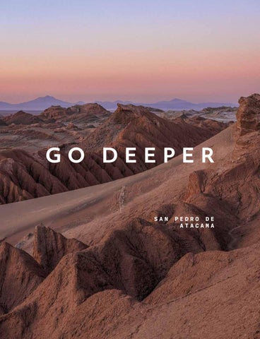
GO DEEPER SAN
PEDRO DE ATACAMA
XX
SAN PEDRO DE ATACAMA Exploraciones | E xpl orati ons
XX
Bienvenido al lodge Explora en San Pedro de Atacama. Nuestras exploraciones en la región se dividen en seis zonas, cada una con características geográficas, culturales y naturales únicas. Cada exploración ha sido diseñada para gradualmente develar la esencia del territorio por descubrir, ya sea a pie, en bicicleta o desde el observatorio Explora. Recomendamos comenzar con exploraciones en la zona de la Cuenca del Salar donde se encuentra nuestro lodge, siguiendo con exploraciones en la Reserva de Conservación Puritama, la zona de las Quebradas Intermedias, Altiplano y finalmente la zona de Montaña. Te invitamos también a explorar la zona cielo durante cualquiera de las noches.
Welcome to the Explora lodge in San Pedro de Atacama. Our explorations in the region are divided into six zones, each with unique geographic, cultural, and natural characteristics. Every exploration is thoughtfully designed to gradually reveal the soul of the territory — whether on foot, by bicycle, or from the vantage point of the Explora observatory. We recommend beginning in the Salt Flat Basin, where our lodge is located, and continuing through the Puritama Conservation Reserve, the Intermediate Ravines, the Altiplano, and finally, the Mountain zone. And when night falls, we invite you to look up and explore the Sky zone—where the experience expands into the cosmos.
3
EXPLORACIONES | EXPLORATIONS
CUENCA DEL
QUEBRADAS
RESERVA DE
SALAR
INTERMEDIAS
CONSERVACIÓN PURITAMA
CAMINATAS
|
|
CAMINATAS
HIKES
|
HIKES
Huayra
14
Matancilla
30
Tambores
36
Quebrada de Chulacao
14
Domeyko
30
Puritama
36
Cuchabrache
15
Peñaliri
31
Incahuasi
37
CABALGATAS HORSEBACK
|
OVERLAND
RIDES
Quebradas
Dunas de la Chula
16
Selenita
16
Lari
17
Rio Salado
17
Valle de Marte
19
Puribeter
19
BICICLETAS
|
BIKES
Catarpe
20
San Isidro
20
E-
BIKES
|
E-BIKES
Vilama
21
BICICLETAS BIKES
OR
O
E-
BIKES
E-BIKES
Ckuta
22
Oasis
22
Tambo
23
OVERLAND
6
CAMINATAS
HIKES
|
OVERLAND
Cordillera de la Sal
24
Kunza
24
Cejar
25
Gran Salar
25
La Molienda
27
|
|
OVERLAND
OVERLAND 33
|
OVERLAND
Puri
39
Ckausama
39
EXPLORACIONES | EXPLORATIONS
ALTIPLANO
MONTAÑA
CAMINATAS
MONTAÑISMO
|
HIKES
Volcán Blanco E-BIKES
42
|
E-BIKES
Caspana OVERLAND
42 |
CIELO
|
ASTRONOMÍA | STARGAZING
MOUNTAINEERING
Astronomía
Kimal
48
Toco
48
Láscar
49
Sairecabur
49
Licancabur
50
54
OVERLAND
Reserva Tatio
44
Altiplano
44
Nómade
45
Lagunas Altiplánicas
45
7
INTERESES
| INTEREST
Aves | Birds
Fuentes termales
| Geothermal springs
Fauna | Wildlife
Sitio arqueológico
| Archeological site
Flora | Flora
Sitio histórico
| Historical site
Geología | Geology
Cielo Nocturno
|
Salares
Apto para la familia | Family friendly
|
Salt-flats
Night sky
TEMPORADA | SEASON
Seca | Dry
Lluviosa | Rain
May - Oct
Nov - Apr
LEYENDA | CAPTION
8
Distancia
Distance
Distancia total recorrida a pie en cada una de las exploraciones.
Total distance hiked in each exploration.
Ganancia acumulada
Accumulated gain
La suma total de metros o pies subidos durante la exploración.
Total amount in meters or feet gained throughout the exploration.
Pérdida acumulada
Accumulated loss
Suma total de metros o pies perdidos durante la exploración.
Total amount in meters or feet desdended throughout the exploration.
Altitud máxima
Maximum altitude
Altitud máxima alcanzada durante la exploración. La medida es en metros sobre el nivel del mar (m.s.n.m.).
Maximum altitude reached during the exploration. The measurement is in feet above sea level (f.a.s.l.).
Altitud mínima
Minimum altitude
Altitud mínima alcanzada durante la exploración. La medida es en metros sobre el nivel del mar (m.s.n.m.).
Minimum altitude reached during the exploration. The measurement is in feet above sea level (f.a.s.l.).
NIVEL | LEVEL
Fácil
Easy
Terreno con pocas subidas y bajadas. Puede realizarse a un ritmo de caminata lento.
Gentle terrain with some elevation changes, suitable for a slow walking pace.
Moderado
Moderate
Terreno con subidas y/o bajadas moderadas, como colinas suaves.
Terrain featuring moderate ascents and descents, characterized by rolling hills.
Difícil
High
Terreno con subidas y/o bajadas empinadas que requieren un ritmo caminata rápido. También es posible encontrar desafíos como zonas rocosas cruces de río y zonas que pueden dar vértigo.
The terrain consists of steep inclines and descents, requiring a swift walking pace. The explorer may also face challenges along the trail, such as rocky sections, river crossings, or vertigo-inducing areas.
Experto
Very high
Terreno con subidas y bajadas exigentes que pueden requerir avance con las manos y/o terreno fuera del sendero. También requiere un ritmo de caminata rápido.
The terrain includes challenging climbs and descents that may necessitate hand-over-hand navigation and off trail hike, requering a brisk walking pace.
TIPO DE EXPLORACIÓN
| T Y P E O F E X P L O R AT I O N
Classic Lugares icónicos en el destino. Es posible que te encuentres a más personas.
Iconic spots at the destination. You might encounter more people on the trail.
Signature Exploración diseñada y operada exclusivamente por Explora.
An exploration exclusively designed and operated by Explora.
Specialized Requiere habilidades y/o condiciones especiales para llevarla a cabo. Como descensos o terrenos técnicos en bicicleta, uso de equipamiento técnico en montaña y cabalgatas avanzadas.
This exploration requires specific skills. It may include technical descents, demanding terrain for cycling, the use of specialized mountain gear, or advanced horseback riding.
Para las cabalgatas categorizadas como “Specialized”, es necesario realizar primero una cabalgata en el picadero para familiarizarse con nuestros caballos.
For Specialized horseback rides, guests must first complete a paddock session to become familiar with our horses. 9
Tipo
Exploración
Categoría
Duración
Dificultad
Que ver?
Página
Type
Exploration
Category
Duration
Difficulty
What to see?
Page
Quebrada de Chulacao
Classic
HD
14
Huayra
Classic
HD
14
Cuchabrache
Signature
HD
15
Tambores
Signature
HD
36
Puritama
Classic - Signature
HD
36
Matancilla
Signature
HD
30
Domeyko
Signature
HD
30
FD
31
Peñaliri Incahuasi
Signature
FD
37
Volcán Blanco
Signature
FD
42
FD
48
Kimal Toco
Classic
HD
48
Láscar
Classic
FD
49
Sairecabur
Specialized
FD
49
Licancabur
Specialized
2 FD
50
Dunas de la Chula
Signature
HD
16
Selenita
Signature
HD
16
Lari
Signature
HD
17
Rio Salado
Signature
HD
17
Valle de Marte
Signature - Specialized
HD
19
Puribeter
Specialized
FD
19
Catarpe
Classic
HD
20
HD
20
San Isidro Vilama
Specialized
HD
21
Caspana
Signature - Specialized
FD
42
Ckuta
HD
22
Oasis
HD
22
Tambo
Specialized
HD
23
Cordillera de la Sal
Classic
HD
24
HD
24
Kunza Cejar
Classic
HD
25
Gran Salar
Classic
HD
25
La Molienda
Classic
HD
27
Puri
Signature
HD
39
Quebradas
Classic
HD
33
Reserva Tatio
Classic
HD
44
Altiplano
Classic
FD
44
FD
45
FD
45
FD
39
HD
54
Nómade Lagunas Altiplánicas
Classic
Ckausama
Astronomía
Signature
11
CUENCA DEL SALAR
Espejado e infinito, el salar de Atacama interrumpe abruptamente el continuo cromático del desierto. Con cada paso, el crujido de la sal es arrebatado por el viento, que invita a adentrarse en el territorio e ir más allá. Mirrored and endless, the Atacama salt flat breaks the desert’s chromatic continuity in an abrupt gesture. With every step, the crunch of salt is swept away by the wind, inviting you to venture deeper into the territory—and beyond.
CAMINATAS
|
HIKES
Huayra
HD
Quebrada de Chulacao
HD
Cuchabrache
HD
CABALGATAS HORSEBACK
| RIDES
Dunas de la Chula
HD
Selenita
HD
Lari
HD
Rio Salado
HD
Valle de Marte
HD
Puribeter
FD
BICICLETAS
|
BIKES
Catarpe
HD
San Isidro
HD
E-
BIKES
|
E-BIKES
Vilama
La parte más baja de esta zona
The lowest part of this area corres-
corresponde al salar de Atacama
ponds to the Atacama Salt Flat
(2.350 m.s.n.m.), una cuenca sin
(2,350 m a.s.l.), a closed basin that,
salida al mar que acumuló las
over millions of years, has collected
aguas y sedimentos provenientes de
the waters and sediments coming
los volcanes y montañas circundan-
from the surrounding volcanoes and
tes durante millones de años.
mountains.
Hoy, el salar alberga un ecosistema
Today, this vast salt flat harbors a
complejo, incluyendo tres de las seis
complex ecosystem, home to three
especies de flamencos existentes en
of the world’s six flamingo species.
el mundo. También dentro de esta
Within the same region, the Salt
zona, la cordillera de la Sal se eleva
Mountain Range rises to the west in
hacia el oeste en un espectáculo
a dramatic geological display:
geológico: montañas coronadas
mineral-streaked ridges glowing
por sedimentos minerales, contras-
against the sky and the stillness of
tadas contra el cielo y la calma
the desert at dusk.
HD
BICICLETAS BIKES
OR
O
E-
BIKES
Ckuta
HD
Oasis
HD
Tambo
HD
OVERLAND
|
E-BIKES
|
OVERLAND
Cordillera de la Sal
HD
Kunza
HD
Cejar
HD
Gran Salar
HD
La Molienda
HD
vespertina del desierto. We also recommend exploring the Finalmente, recomendamos explo-
oasis of San Pedro, a vibrant enclave
rar el oasis de San Pedro, un
where local traditions remain alive in
enclave de vida en el que tradicio-
the hands and stories of its people.
nes locales se mantienen vivas en las manos de su gente.
13
CAMINATAS
|
HIKES
Huayra
Salimos en vehículo hacia el Valle de Marte, en plena Cordillera de la Sal, para realizar una caminata que nos regalará vistas panorámicas de las distintas cordilleras de la región, acompañados por el característico viento del lugar. Descenderemos por dunas de arena y continuaremos a pie a través del valle, donde el vehículo nos esperará para emprender el regreso.
Half Day | 2 h Classic
20 min 15 min
3,8 km | 2,4 mi
59 mts | 194 ft
-204 mts | -669 ft
2.790 m.s.n.m. | 9.154 f.a.s.l. 2.614 m.s.n.m. | 8.576 f.a.s.l.
Intereses | Interests
Temporada | Season
A los pies de la Cordillera de la Sal se extiende el Valle de Catarpe, un lugar de contrastes por donde fluyen las aguas del río San Pedro. Caminaremos inmersos en uno de sus cañones: un laberinto de altas paredes con formas serpenteantes esculpidas por la erosión del agua. Al final del recorrido, llegaremos a un mirador que ofrece vistas privilegiadas del desierto y las cordilleras que lo rodean.
Quebrada de Chulacao Half Day | 2 h Classic
20 min
20 min
5,4 km | 3,4 mi
156 mts | 512 ft
-156 mts | -512 ft
2.582 m.s.n.m. | 8.471 f.a.s.l. 2.515 m.s.n.m. | 8.251 f.a.s.l.
Intereses | Interests
14
We head out by vehicle toward the Mars Valley, in the heart of the Salt Mountain Range, for a hike that offers sweeping views of the region’s various mountain ranges, accompanied by the area’s distinctive wind. We’ll descend through sand dunes and continue on foot across the valley, where the vehicle will be waiting to take us back.
Temporada | Season
At the foot of the Salt Mountain Range lies the Catarpe Valley, a land of striking contrasts carved by the waters of the San Pedro River. We’ll walk through one of its canyons—a labyrinth of towering walls shaped into sinuous forms by water erosion. The hike ends at a lookout point with sweeping views of the desert and the surrounding mountain ranges.
CUENCA DEL SALAR
El valle de Catarpe presenta un contraste de colores entre el rojizo de sus paredes y el verde de su flora . Desde este valle, caminaremos hacia la cima de la cordillera de la Sal, recorriendo antiguos senderos, desde donde tendremos amplias vistas que nos permitirán entender la formación del territorio y la vida de los habitantes del valle.
Cuchabrache Half Day | 3 h Signature
20 min
7,8 km | 4,8 mi
20 min
348 mts | 1.142 ft
-322 mts | -1.056 ft
2.693 m.s.n.m. | 8.835 f.a.s.l. 2.504 m.s.n.m. | 8.215 f.a.s.l.
Intereses | Interests
Temporada | Season
The Catarpe Valley flaunts the contrast between its reddish cliffs and green local flora. We will walk ancient caravan trails from the valley to the top of the Salt Mountain Range, where expansive views will help us comprehend the formation of the territory and the lives of valley inhabitants.
15
CABALGATAS
|
HORSEBACK
RIDES
Cabalgaremos hacia la cordillera de la Sal hasta llegar a sus dunas moldeadas por el proceso erosivo del viento. Desde allí tendremos vistas panorámicas de Los Andes y el oasis. Luego, nos adentraremos por un lecho de río seco donde podremos ver como el agua ha expuesto los minerales que componen esta cordillera.
Dunas de la Chula Half Day | 2 h 30 m Signature
9,2 km | 5,7 mi
114 mts | 374 ft
-114 mts | -374 ft
2.481 m.s.n.m. | 8.140 f.a.s.l. 2.410 m.s.n.m. | 7.907 f.a.s.l.
Temporada | Season
Intereses | Interests
Tras 45 minutos en vehículo hacia la Cordillera de la Sal, comenzamos la cabalgata en un sector llamado Vallecito, cercano al valle de la Luna. Cabalgamos entre formaciones de sal y yeso, donde el terreno cruje bajo los cascos y el paisaje revela la singular geología de esta cordillera mineral. Al finalizar, regresamos al hotel en vehículo .
Selenita Half Day | 2 h Signature
45 min
45 min
5,5 km | 3,4 mi
64 mts | 210 ft
-64 mts | -210 ft
2.474 m.s.n.m. | 8.117 f.a.s.l. 2.440 m.s.n.m. | 8.005 f.a.s.l.
Intereses | Interests
16
We will ride toward the Salt Mountain Range to the sand dunes shaped by wind erosion to enjoy panoramic views of the Andes and the oasis. Then, we will ride through a dry riverbed, observing how the water has exposed the minerals that comprise this mountain range.
Temporada | Season
After a 45-minute drive to the Salt Mountain Range, we begin our horseback ride in a sector known as Vallecito, near the Moon Valley. We ride through formations of salt and gypsum, where the ground crunches beneath the hooves and the landscape reveals the unique geology of this mineral range. We return to the hotel by vehicle at the end of the ride.
MONTAÑA
Comenzamos el recorrido en vehículo hasta los alrededores del Valle de Marte, donde iniciamos nuestra cabalgata por paisajes desérticos y erosionados. Los tonos rojizos de las formaciones rocosas evocan escenarios remotos mientras avanzamos entre dunas y quebradas. Con la Cordillera de los Andes como guía, llegamos a caballo hasta el hotel.
Lari Half Day | 2 hr Signature
20 min
8 km | 5 mi
127 mts | 417 ft
-273 mts | -896 ft
2.635 m.s.n.m. | 8.645 f.a.s.l. 2.431 m.s.n.m. | 7.976 f.a.s.l.
Intereses | Interests
Temporada | Season
Esta cabalgata recorre uno de los cursos de agua que dan vida a San Pedro de Atacama. Partimos desde lo alto de la Cordillera de la Sal y descendemos hacia el cauce del río Salado, cruzando sus aguas y observando cómo el paisaje se vuelve más fértil hasta el inicio del valle de Catarpe.
Rio Salado Half Day | 3 h Signature
20 min
40 min
10,2 km | 6,3 mi
223 mts | 732 ft
-214 mts | -702 ft
2.694 m.s.n.m. | 8.839 f.a.s.l. 2.431 m.s.n.m. | 7.976 f.a.s.l.
Intereses | Interests
We begin the journey by vehicle toward the surroundings of the Valley of Mars, where we start our horseback ride through desert and eroded landscapes. The reddish tones of the rock formations evoke distant horizons as we ride through dunes and ravines. Guided by the Andes, we return to the lodge on horseback.
Temporada | Season
This horseback ride follows one of the waterways that bring life to San Pedro de Atacama. We start high in the Cordillera de la Sal and descend toward the Salado River, crossing its waters and watching the landscape grow greener as we reach the entrance of the Catarpe Valley.
17
CUENCA DEL SALAR
Salimos desde el hotel en dirección al valle de Marte donde cabalgaremos entre paisajes típicamente desérticos: dunas, formaciones sedimentarias rojizas y explanadas de arcilla. Esta exploración es ideal para hacerse una idea de la geografía y origen de la cordillera de la Sal.
Valle de Marte Half Day | 3 h Signature/ Specialized
12,1 km | 7,5 mi
237 mts | 778 ft
-237 mts | -778 ft
2.556 m.s.n.m. | 8.386 f.a.s.l. 2.428 m.s.n.m. | 7.966 f.a.s.l.
Intereses | Interests
Temporada | Season
Al sur del oasis conoceremos la historia y ruinas arqueológicas del ayllu de Beter, para luego llegar a la Reserva Elemental de Puribeter. Este sitio resguarda la naturaleza y cultura del oasis de San Pedro de Atacama, aquí almorzaremos y caminaremos por el parque, para luego volver a montar con dirección al ayllu de Solor y posterior retorno al hotel.
Puribeter Full Day | 5 h Specialized
19,7 km | 12,2 mi
115 mts | 377 ft
-115 mts | -377 ft
2.431 m.s.n.m. | 7.976 f.a.s.l. 2.385 m.s.n.m. | 7.825 f.a.s.l.
Intereses | Interests
We leave the hotel to go to the Mars Valley, where we horseback ride among typical desert landscapes: dunes, reddish sedimentary rock formations and clay grounds. This exploration is perfect to get an idea of the geography and origin of the Salt Ridge.
Temporada | Season
South of the oasis, we will learn about the archaeological ruins in the Beter community and their history, then visit the Puribeter Elemental Reserve, where we will have lunch and walk through the park. We will continue to the Ayllu of Solor before returning to the hotel.
19
BICICLETAS
|
BIKES
La Garganta del Diablo es una quebrada dentro de la cordillera de la Sal con senderos zigzagueantes entre llamativas formaciones rocosas. Pedalearemos hacia el río San Pedro y seguiremos su cauce hasta el valle de Catarpe, para luego adentrarnos dentro de esta increíble quebrada.
Catarpe Half Day | 2 h 30 m Classic
17,9 km | 11,1 mi
244 mts | 801 ft
-244 mts | -801 ft
2.546 m.s.n.m. | 8.353 f.a.s.l. 2.431 m.s.n.m. | 7.976 f.a.s.l.
Intereses | Interests
Temporada | Season
Half Day | 3 h 30 m
325 mts | 1.066 ft
-325 mts | -1.066 ft
2.584 m.s.n.m. | 8.478 f.a.s.l. 2.431 m.s.n.m. | 7.976 f.a.s.l.
Intereses | Interests
20
*This exploration is done on traditional bicycles, not e-bikes.
Entre quebradas de tierra rojiza que forman un laberinto natural se encuentra la iglesia de San Isidro, construcción histórica del valle de Catarpe. Esta ruta recorre este antiguo valle agrícola, permitiéndonos comprender el estilo de vida de los habitantes de este lugar.
San Isidro
25,5 km | 15,8 mi
Devil’s Throat is a Salt Mountain Range canyon with zigzagging trails between striking rock formations. We will pedal to the San Pedro River, follow its course to the Catarpe Valley and then enter this incredible canyon.
Temporada | Season
Amidst gullies of reddish earth that create a natural labyrinth lies San Isidro Church, a historic structure in the Catarpe Valley. This route through the ancient agricultural valley enables us to understand the life style of local inhabitants.
E-BIKE
|
E-BIKE
CUENCA DEL SALAR
Esta exploración te llevará hasta el mirador del Pukará de Vilama, para descubrir los restos de una fortaleza Likan Antay, que fue vital para proteger las tierras fértiles y el delta del río Vilama, ofreciendo una visión de las antiguas estrategias defensivas de la región.
Vilama Full Day | 4 h Specialized
37,4 km | 23,2 mi
822 mts | 2.697 ft
-822 mts | -2.697 ft
2.727 m.s.n.m. | 8.947 f.a.s.l. 2.430 m.s.n.m. | 7.972 f.a.s.l.
Intereses | Interests
This exploration leads to the Vilama Pukara viewpoint, where you'll uncover the remains of a Likan Antay fortress, once vital for safeguarding fertile lands and the river delta of the Vilama River—offering a glimpse into the region’s ancient defensive strategies.
Temporada | Season
21
BICICLETAS O E-BIKES BIKES OR E-BIKES
|
Ríos de sal, cordilleras rojizas y explanadas de arcilla son parte de los alucinantes paisajes que encontramos en la zona sur del valle de la Luna. Pedalearemos por terrenos arenosos disfrutando de formaciones geológicas propias de este sector del desierto.
Ckuta Half Day | 3 h 30 m
35 min
29 km | 18 mi
251 mts | 823 ft
-240 mts | -787 ft
Salt rivers, reddish mountain ranges and clay plateaus are part of the breathtaking landscapes in the southern Moon Valley. We will pedal over sandy terrain, enjoying the geological formations unique to this desert region.
2.488 m.s.n.m. | 8.163 f.a.s.l. 2.366 m.s.n.m. | 7.762 f.a.s.l.
Intereses | Interests
Temporada | Season
Recorremos en bicicleta distintos sectores del oasis de San Pedro de Atacama, donde se conservan vestigios de antiguos asentamientos de la cultura Likan Antay. Visitamos lugares como el asentamiento de Tulor, en el ayllu de Coyo, la Reserva Elemental Puribeter y la Biblioteca del Desierto, en una ruta que cruza historia, territorio y vida local.
Oasis Half Day | 3 h
26,7 km | 16,6 mi
146 mts | 479 ft
-146 mts | -479 ft
2.431 m.s.n.m. | 7.976 f.a.s.l. 2.376 m.s.n.m. | 7.795 f.a.s.l.
Intereses | Interests
22
Temporada | Season
We explore different areas of the San Pedro de Atacama oasis by bike, visiting places that preserve traces of ancient Likan Antay settlements. The route includes sites such as the Tulor settlement in the Coyo ayllu, the Puribeter Elemental Reserve, and the Desert Library—an experience that weaves together history, landscape, and local life.
CUENCA DEL SALAR
Los tambos eran antiguos refugios de descanso para los chaskis, mensajeros del imperio inca. Pedalearemos hacia el valle de Catarpe y luego hacia las cornisas, desde donde podremos apreciar los restos de un centro administrativo inca que marcaba la entrada a San Pedro. Recorriendo senderos angostos y rocosos, tendremos increíbles vistas al valle y las cordilleras.
Tambo Half Day | 4 h Signature/ Specialized
30 km | 18,6 mi
568 mts | 1.864 ft
-568 mts | -1.864 ft
2.690 m.s.n.m. | 8.825 f.a.s.l. 2.431 m.s.n.m. | 7.976 f.a.s.l.
Intereses | Interests
Temporada | Season
Tambos were ancient inns for chaskis, Incan-empire messengers. We will pedal toward the Catarpe Valley and then toward the ridges to see the remnants of the Inca administrative center that marked the entrance to San Pedro. Riding along narrow, rocky trails, we will have incredible views of the valley and the mountain ranges.
23
OVERLAND
|
OVERLAND
Cordillera de la Sal Half Day | 3 h 30 m Classic
Dunas, arcillas rojizas y ríos de sal conforman la Cordillera de la Sal, un relieve único creado por antiguos sedimentos de sal y yeso. La exploración recorre en vehículo el sector sur del Valle de la Luna y Vallecito, combinando paradas y breves caminatas. Un paisaje modelado por el viento y preservado por el clima hiperárido del desierto.
2.383 m.s.n.m. | 7.818 f.a.s.l.
2.610 m.s.n.m. | 8.563 f.a.s.l.
Intereses | Interests
Dunes, reddish clays, and salt rivers shape the Salt Mountain Range — a unique landform created by ancient deposits of salt and gypsum. The exploration travels by vehicle through the southern area of the Moon Valley and Vallecito, combining stops with short walks. A landscape sculpted by the wind and preserved by the desert’s hyper-arid climate.
Temporada | Season
Kunza Half Day | 3 h 30 m
Kunza, lengua del pueblo atacameño que se mantuvo viva hasta el siglo XIX, pero que sufrió su extinción con el proceso de hispanización. En esta exploración conoceremos parte de la historia y cultura atacameña con una visita al Museo Arqueológico y con un recorrido por la aldea de Tulor, uno de los primeros asentamientos de la zona.
2.392 m.s.n.m. | 7.848 f.a.s.l.
Intereses | Interests
24
Kunza, the Atacameño language, remained alive until the 19th century, when it suffered extinction as a result of Hispanicization. On this expedition, we will learn about part of Atacama’s history and culture, visit the archaeological museum and the Tulor village, one of the area’s first settlements.
2.383 m.s.n.m. | 7.818 f.a.s.l.
Temporada | Season
CUENCA DEL SALAR
Cejar Half Day | 2 h 30 m Classic
Dentro del salar y con vistas despejadas a las tres cordilleras, esta laguna de agua salinizada y rodeada de estromatolitos, es una belleza natural que nos permite conectar con una de las formas de vida más antiguas del planeta. Además, podremos disfrutar de la experiencia de flotar en sus aguas producto de la alta concentración de sal en estas. * Exploración no disponible el día martes.
2.339 m.s.n.m. | 7.674 f.a.s.l.
2.492 m.s.n.m. | 7.969 f.a.s.l.
Intereses | Interests
Set in the heart of the salt flat, with sweeping views of the three mountain ranges, this saline lagoon—surrounded by ancient stromatolites—is a natural wonder that invites us to connect with one of the planet’s earliest forms of life. Its high salt content also allows us to experience the unique sensation of effortlessly floating in its waters. * Exploration not available on Tuesday.
Temporada | Season
Gran Salar Half Day | 4 h 30 m Classic
Uno de los puntos de afloramiento de agua dentro del salar de Atacama, es la laguna Chaxa, un ecosistema altamente salinizado. Este lugar es ideal para la observación de aves, ya que alberga una gran diversidad de especies donde destacan tres de los seis tipos de flamencos en el mundo.
2.474 m.s.n.m. | 8.117 f.a.s.l.
Intereses | Interests
One Salar de Atacama water outcropping, the Chaxa Lagoon, is home to a highly salinized ecosystem. It is ideal for bird watching, as it is home to a great diversity of species, including three of the world’s five types of flamingos.
2.383 m.s.n.m. | 7.818 f.a.s.l.
Temporada | Season
25
CUENCA DEL SALAR
La Molienda Half Day | 4 h 30 m Classic
Exploración que recorre los senderos interpretativos de Puribeter, donde la cultura y la naturaleza andina se entrelazan. Durante el recorrido podrás observar y compartir con llamas, caballos y corderos, animales fundamentales para la vida de las comunidades del altiplano. El sendero atraviesa un bosque de chañar y revela la estrecha relación entre las personas, los animales y el desierto.
2.474 m.s.n.m. | 8.117 f.a.s.l.
Intereses | Interests
Exploration that follows the interpretive trails of Puribeter, where Andean culture and nature come together. Along the way, you’ll observe and interact with llamas, horses, and sheep — animals that have long been essential to life in the highlands. The trail passes through a chañar forest, revealing the deep connection between people, animals, and the desert landscape.
2.431 m.s.n.m. | 7.976 f.a.s.l.
Temporada | Season
27
QUEBRADAS INTERMEDIAS
Talladas por el agua, estas quebradas enlazan el altiplano y el salar, resguardando vida en su interior.
CAMINATAS
|
HIKES
Matancilla
HD
Domeyko
HD
Peñaliri
FD
OVERLAND Quebradas
|
OVERLAND HD
Carved by water, these ravines link the highlands and the salt flat, sheltering life within.
Esculpidas por la acción del agua y
Shaped by wind and water over
el viento a lo largo de millones de
millions of years, the ravines in this
años, las quebradas de esta zona
area cut through the desert like deep
recorren el desierto como profun-
incisions, marking the transition
das incisiones que marcan el
between the Altiplano and the salt
tránsito entre el altiplano y el salar.
flat.
Numerosas quebradas enlazan
Numerous ravines link these two
ambos territorios, mientras muros
territories, where volcanic stone
de piedra volcánica y cursos de
walls and watercourses lined with
agua bordeados por pastos silves-
wild grasses discreetly irrigate the
tres irrigan discretamente el
surroundings. In this landscape,
entorno. En este paisaje, florecen
medicinal plants and flowers—used
flores y plantas medicinales utiliza-
by pastoralist communities since
das por comunidades pastoriles
ancient times—continue to thrive.
desde tiempos ancestrales.
29
CAMINATAS
|
HIKES
Matancilla Half Day | 3 h Signature
1 hr 30 min
5 km | 3,1 mi
1 hr 15 min
206 mts | 676 ft
-263 mts | -863 ft
3.231 m.s.n.m. | 10.600 f.a.s.l. 3.134 m.s.n.m. | 10.282 f.a.s.l.
Temporada | Season
Intereses | Interests
Half Day | 3 h 15 m Signature
1 hr
50 min
73 mts | 240 ft
-292 mts | -958 ft
2.934 m.s.n.m. | 9.626 f.a.s.l. 2.715 m.s.n.m. | 8.907 f.a.s.l.
Intereses | Interests
30
The meeting point of the three desert mountain ranges, the Andes, the Salt and the Domeyko, produce an extremely mineral-rich, multicolored valley adorned with striking rock formations created by millions of years of tectonic movement, volcanic activity and erosion. We will walk through a canyon that was once a caravan route for gathering and bartering, then immerse ourselves in Rainbow Valley.
La cordillera de Domeyko es un gran laberinto de cañones donde los diferentes minerales que la componen le otorgan variados colores. Caminaremos por espacios modelados por ríos estacionales, transitando entre enormes paredes de arcilla y descendiendo por escalones donde deberemos usar nuestras manos.
Domeyko
5,6 km | 3,5 mi
La zona de encuentro entre las tres cordilleras del desierto, Andes, Sal y Domeyko, dan origen a un valle multicolor, extremadamente rico en minerales y con llamativas formaciones rocosas producto de millones de años de movimientos tectónicos, actividad volcánica y erosión. Caminaremos por una quebrada que sirvió de ruta caravanera para recolección y trueque, para luego sumergirnos en el valle del Arcoíris.
Temporada | Season
The Domeyko Mountain Range form a vast labyrinth of canyons comprised of various minerals that lend different colors to the formations. We will walk through spaces sculpted by seasonal rivers, moving between massive clay walls using our hands to descend large steps.
QUEBRADAS INTERMEDIAS
Un viaje entre dos pisos ecológicos para presenciar como la naturaleza cambia producto de la altura. Desde Machuca, pueblo rodeado de vida silvestre producto de los humedales del sector, caminaremos por antiguos senderos hasta Río Grande. Atravesaremos terrazas de cultivo andinas y una quebrada con gran presencia de cactus.
Peñaliri Full Day | 6 hrs Signature
1 hr
1hr 10 min
16 km | 9,9 mi
273 mts | 896 ft
-1.056 mts | -3.465 ft
4.012 m.s.n.m. | 13.163 f.a.s.l. 3.218 m.s.n.m. | 10.558 f.a.s.l.
Intereses | Interests
A trip between two altitudinal zones to observe first-hand how nature changes as a function of altitude. From Machuca, a town surrounded by wildlife thanks to local wetlands, we will walk along ancient trails to the Río Grande. We will cross Andean agricultural terraces and a canyon full of cacti.
Temporada | Season
31
OVERLAND
|
OVERLAND
QUEBRADAS INTERMEDIAS
Quebradas Half Day | 4 h Classic
Los petroglifos son una de las manifestaciones más antiguas desarrolladas por los grupos humanos. En la estancia de Yerbas Buenas, antiguo asentamiento transitorio de caravanas, podremos ver diferentes estilos de petroglifos que nos cuentan la historia del lugar. Continuaremos hacia el valle del Arcoíris, el que destaca por su colorido debido a los diferentes minerales que lo componen.
3.174 m.s.n.m. | 10.413 f.a.s.l.
Intereses | Interests
Petroglyphs are among the oldest forms of expression by human groups. At Yerbas Buenas, an ancient transient settlement for caravans, we will be able to see various styles of petroglyphs that tell us the history of the place. We will proceed to Rainbow Valley, known for the colorfulness it derives from the different minerals that comprise it.
3.117 m.s.n.m. | 10.226 f.a.s.l.
Temporada | Season
33
RESERVA DE CONSERVACIÓN PURITAMA
Donde hay agua hay vida. La Reserva de Puritama nos conecta con el contraste de la ausencia y la abundancia, poniendo de manifiesto la revolución de vida que genera el
CAMINATAS
|
HIKES
Tambores
HD
Puritama
HD
Incahuasi
FD
OVERLAND
|
OVERLAND
Puri
HD
Ckausama
FD
paso del agua. Where there is water, there is life. The Puritama Reserve connects us with the contrast between absence and abundance, highlighting the life revolution that the passage of water generates.
En 1988, una década antes de la
In 1988, a decade before the
construcción de nuestro lodge en
construction of our lodge in Ataca-
Atacama, los fundadores de
ma, the founders of Explora acqui-
Explora adquirieron el terreno que
red the land that would later become
hoy contiene la Reserva de Conser-
the Puritama Conservation Reserve.
vación Puritama. En ese entonces
At the time, Atacama was still an
Atacama era un destino aún
unknown destination, reached by
desconocido al cual llegaban unos
just a handful of commercial flights
pocos vuelos comerciales a la
each week.
semana. Today, the Puritama Conservation Hoy la Reserva de Conservación
Reserve is an established 8,000-hec-
Puritama es un proyecto consolida-
tare project—created and managed
do de 8.000 hectáreas, creado y
by Explora as an unprecedented
administrado por Explora en un
effort to protect, celebrate, and
esfuerzo sin precedentes por
develop Atacama’s natural and
proteger, promover y desarrollar el
cultural heritage through sustainable
patrimonio natural y cultural de
travel.
Atacama a través del turismo sustentable.
35
CAMINATAS
|
HIKES
Esta caminata explora el centro de la Reserva de Conservación Puritama, área que se caracteriza por la gran variedad de cactus. En nuestro recorrido, observaremos desde lo alto la quebrada de Jorquencal, un cañón de contrastes, lleno de vegetación, de vida y de refugios arqueológicos. Descenderemos por un terreno rocoso hasta llegar a las aguas termales de Puritama.
Tambores Half Day | 2 h 15 m Signature
45 min 45 min
4,5 km | 2,8 mi
118 mts | 387 ft
-233 mts | -764 ft
3.732 m.s.n.m. | 12.244 f.a.s.l. 3.537 m.s.n.m. | 11.604 f.a.s.l.
Intereses | Interests
Temporada | Season
Puritama Half Day | 3 h Classic/ Signature
50 min
35 min
5,1 km | 3,2 mi
327 mts | 1.073 ft
-58 mts | -192 ft
3.538 m.s.n.m. | 11.608 f.a.s.l. 3.269 m.s.n.m. | 10.725 f.a.s.l.
Intereses | Interests
36
Temporada | Season
This hike explores the center of the Puritama Conservation Reserve, known for its great variety of cactus species. On our way, we will get a bird’s eye view of the Jorquencal Gorge, full of vegetation, life and archaeological shelters. We will descend through rocky terrain until we reach Puritama Hot Springs.
Desde las cornisas del cañón de Guatin, iniciaremos una exploración por la Reserva de Puritama hasta llegar a sus aguas termales. Comenzamos junto a enormes cactus milenarios para luego descender y encontrarnos con las aguas del río y la vegetación que nace de ellas. Continuamos nuestro recorrido inmersos en las grandes paredes de ignimbrita.
From the cliffs of the Guatín Canyon, we will embark on our exploration of the Puritama Reserve, which will end at its thermal waters. We begin our journey alongside giant ancient cacti, then descend to the waters of the Puritama River and the vegetation that thrives on its banks. We will continue our journey between the towering ignimbrite.
RESERVA DE CONSERVACIÓN PURITAMA
Recorreremos en profundidad la zona norte de la Reserva de Conservación Puritama. Comenzamos en un antiguo caserío a los pies de los volcanes de los Andes, para luego perdernos entre la vegetación e historia de la quebrada de Jorquencal, lugar de estudio de uno de los felinos más desconocidos, escasos y amenazados del mundo. Terminaremos disfrutando en las aguas termales.
Incahuasi Full Day | 6 h Signature
1hr 20 min
50 min
14,3 km | 8,9 mi
181 mts | 594 ft
-832 mts | -2.730 ft
4.195 m.s.n.m. | 13.763 f.a.s.l. 3.537 m.s.n.m. | 11.604 f.a.s.l.
Intereses | Interests
Temporada | Season
We will deeply explore the northern part of the Puritama Conservation Reserve. We begin in an ancient hamlet at the foot of the volcanoes of the Andes, and then get lost in the vegetation and history of the Jorquencal Canyon, a place of study of one of the most unknown, rare and endangered felines in the world. We will finish enjoying the hot springs.
37
OVERLAND
|
OVERLAND
RESERVA DE CONSERVACIÓN PURITAMA
Puri Half Day | 3 h Signature
En la exploración Puri recorremos los ríos Vilama y Puritama, fuentes vitales de agua en el desierto de Atacama. Paradas en miradores panorámicos nos llevan hasta una breve caminata por el Cañón de Puritama, donde emergen una vegetación singular y antiguas huellas humanas. El recorrido finaliza con un baño reparador en nuestras exclusivas piscinas en las Termas de Puritama.
3.474 m.s.n.m. | 11.398 f.a.s.l.
3.540 m.s.n.m. | 11.614 f.a.s.l.
Intereses | Interests
On the Puri exploration, we follow the Vilama and Puritama rivers—vital water sources in the Atacama Desert. Stops at panoramic viewpoints lead to a short walk through the Puritama Canyon, where unique vegetation and ancient human traces emerge from the landscape. The experience concludes with a restorative soak in our exclusive pools at the Puritama Hot Springs.
Temporada | Season
Ckausama Full Day | 6 hrs Classic
Esta exploración recorre dos de los lugares con mayor vida en el desierto producto de la presencia de agua, la zona del Tatio y la Reserva de Conservación Puritama. Podremos ver la transición entre dos pisos ecológicos, experimentar la cordillera viva a través de los géiseres y disfrutar de las aguas termales en la quebrada de Puritama.
4.206 m.s.n.m. | 13.799 f.a.s.l.
Intereses | Interests
This expedition covers two of the desert’s most vibrant areas, given the presence of water: the Tatio region and the Puritama Conservation Reserve. We will observe the transition between two altitudinal zones, experience the lively mountain range through the geysers and relax in the thermal waters of the Puritama Canyon.
3.160 m.s.n.m. | 10.367 f.a.s.l.
Temporada | Season
39
ALTIPLANO
El altiplano existe allá arriba, anidado entre las montañas y el cielo. En su interior, un mundo nuevo espera impávido a los exploradores que se aventuran a descubrirlo. Para nosotros, se trata de un territorio al que las palabras simplemente no le hacen
CAMINATAS
|
HIKES
Volcán Blanco E-BIKES
FD
|
E-BIKES
Caspana OVERLAND
FD |
OVERLAND
Reserva Tatio
HD
Altiplano
FD
Nómade
FD
Lagunas Altiplánicas
FD
justicia. The altiplano exists up there, somewhere between the mountains and the sky. Within, a whole new world silently awaits the intrepid explorers that venture its way. For us, this is a territory that words simply fall short of.
La zona Altiplano –o Puna como se
The Altiplano—locally known as the
la conoce localmente– se extiende
Puna—unfolds between 3,800 and
entre los 3.800 y 4.300 m.s.n.m. Se
4,300 meters above sea level. It is a
trata de una meseta elevada,
high plateau crowned by imposing
coronada por imponentes monta-
mountains, volcanoes, and geysers.
ñas, volcanes y géiseres. La falta de
Thin air, intense solar radiation, and
oxígeno, intensa radiación solar y
extreme temperatures keep this
temperaturas extremas, mantienen
territory isolated and shielded from
este territorio desconectado y
the rest of the world, drawing only a
protegido del resto del mundo,
few travelers—those compelled by
llamando solo a unos pocos viajeros
its raw, uncommon beauty.
atraídos por la belleza indómita e inusual que lo caracterizan.
41
CAMINATAS
|
HIKES
Junto al campo geotérmico del Tatio se encuentra el río Blanco, curso de agua tibia rodeado de geysers que le otorgan características minerales y biológicas especiales. Caminaremos junto al río maravillándonos con este particular ecosistema hasta llegar a un humedal donde podremos presenciar la vida silvestre por sobre los 4.000 msnm.
Volcán Blanco Full Day | 4 hrs Signature
1 hr 30 min
1 hr 45 min
6,9 km | 4,3 mi
208 mts | 682 ft
-270 mts | -886 ft
4.379 m.s.n.m. | 14.367 f.a.s.l. 4.226 m.s.n.m. | 13.865 f.a.s.l.
Intereses | Interests
E-BIKE
|
Temporada | Season
Alongside the Tatio geothermal field runs the Blanco River, a warm watercourse surrounded by geysers that give it special mineral and biological characteristics. We will walk along the river, marveling at this unique ecosystem, until we reach the wetlands, where we can observe wildlife at more than 13,000 ft above sea level.
E-BIKE
Caspana
La exploración Caspana sigue antiguas rutas caravaneras que conectaban las planicies de Tocorpuri con Caspana y el Alto Loa. El recorrido atraviesa los contrastes del altiplano, entre volcanes imponentes y cauces estacionales que cruzan un paisaje de altura.
Full Day | 4 hrs Signature/ Specialized
1 hr 40 min
2 hr 15 min 29,5 km | 18,3 mi
342 mts | 1.122 ft
-1.420 mts | -4.659 ft
4.484 m.s.n.m. | 14.711 f.a.s.l. 3.248 m.s.n.m. | 10.656 f.a.s.l.
Intereses | Interests
42
Temporada | Season
The Caspana exploration follows ancient caravan routes that once connected the plains of Tocorpuri with Caspana and the Alto Loa region. The route crosses the highland’s contrasting landscapes, moving between towering volcanoes and seasonal watercourses that shape this elevated terrain.
OVERLAND
|
OVERLAND
Reserva Tatio Half Day | 5 hrs Classic
Ubicados a 4.200 m s. n. m. y rodeados de volcanes, los géiseres del Tatio conforman el campo geotérmico de origen volcánico más alto del mundo. Desde más de ochenta fumarolas emergen columnas de vapor que revelan la energía interna de la Tierra. Durante esta exploración recorreremos el área geotérmica y sus alrededores, observando la flora y fauna características del altiplano andino.
4.190 m.s.n.m. | 7.976 f.a.s.l.
4.206 m.s.n.m. | 13.799 f.a.s.l.
Intereses | Interests
Located at 13,780 ft a.s.l. and surrounded by volcanoes, the El Tatio Geysers form the world’s highest geothermal field of volcanic origin. From more than eighty fumaroles rise columns of steam that reveal the Earth’s inner energy. During this exploration, we will walk through the geothermal area and its surroundings, observing the characteristic flora and fauna of the Andean Altiplano.
Temporada | Season
Altiplano Full Day | 6 hrs
Un viaje por el altiplano rojizo rodeado de volcanes y acompañado por salares de altura. Esta exploración nos lleva a lo profundo de la Cordillera de los Andes, donde este infinito territorio solo se ve interrumpido por bloques de ignimbrita erosionados por el viento, dando como resultado grandes columnas que hoy se conocen como los monjes de la Pacana.
4.690 m.s.n.m. | 15.387 f.a.s.l.
Intereses | Interests
44
This journey through the reddish highland plateaus, surrounded by volcanoes and high-altitude salt flats, takes us deep into the Andes. The endless terrain is interrupted only by ignimbrite blocks that the wind has eroded into large columns known as the Monks of the Pacana.
2.431 m.s.n.m. | 7.976 f.a.s.l.
Temporada | Season
ALTIPLANO
Nómade Full Day | 8 hrs
La quebrada de Kezala es un museo abierto, sus paredes llenas de petroglifos nos cuentan la historia de los antiguos habitantes y nos permiten interpretar sus vivencias y su interacción con la naturaleza. Haremos un recorrido por el lugar para luego continuar sumergiendonos aun mas en la cordillera, rodeados de un anfiteatro de volcanes y visitando la laguna altiplanica de Lejía.
2.431 m.s.n.m. | 7.976 f.a.s.l.
4.170 m.s.n.m. | 13.681 f.a.s.l.
Intereses | Interests
The Kezala Canyon is an open-air museum. Its walls are filled with petroglyphs that tell us the history of the ancient inhabitants, allowing us to interpret their experiences and interactions with nature. We will tour the site, then go further into the mountain range to surround ourselves with impressive volcanoes and visit the high-altitude Lejía Lagoon.
Temporada | Season
Lagunas Altiplánicas Full Day | 6 h 30 m Classic
La Cordillera de los Andes no sólo nos regala innumerables volcanes, sino que también salares y lagunas en lo alto del altiplano. En esta exploración visitaremos las lagunas Miscanti y Miñiques, dos grandes ojos de agua ubicados a 4.200 m.s.n.m y también el salar de Aguas Calientes, cuyo blanco contrasta con el rojo de las rocas de ignimbrita que lo rodean.
3.948 m.s.n.m. | 12.953 f.a.s.l.
Intereses | Interests
The Andes give us countless volcanoes, salt flats and high-altitude lagoons. This expedition takes us to the Miscanti and Miñiques Lagoons, two large bodies of water at 4,200 meters above sea level, and the Aguas Calientes Salt Flat, whose white color contrasts with the red of the surrounding ignimbrite rocks.
2.431 m.s.n.m. | 7.976 f.a.s.l.
Temporada | Season
45
MONTAÑA
Estos colosales macizos no solo son acopios minerales, sino además lienzos de expresión cultural pasada y presente. Ejes de misterio, las montañas de Atacama
MONTAÑISMO
|
MOUNTAINEERING
Kimal
FD
Toco
HD
Láscar
FD
Sairecabur
FD
Licancabur
FD
enmarcan su territorio, permaneciendo vigilantes de todos quienes le exploran. These colossal massifs not only hoard minerals, but also encompass cultural expressions of people; past and present. Axes of mystery, Atacama’s mountains frame its territory, remaining vigiant of all whom explore it.
Las mejores vistas de Atacama se
Some of the most remarkable views
alcanzan desde algunas de sus
in Atacama are found atop its
cumbres más representativas: los
emblematic summits: the Toco,
volcanes Toco, Láscar, Sairecabur y
Láscar, Sairecabur, and Licancabur
Licancabur —todos por sobre los
volcanoes—each rising above
5.000 m s. n. m.—, junto al cerro
16,400 feet above sea level—along
Kimal, que domina el paisaje desde
with Cerro Kimal, which stands
el oeste del oasis.
prominently to the west of the oasis.
La altitud desafiante de esta zona
The challenging altitude of this
exige resistencia física y prepara-
region demands physical endurance
ción, por lo que la paciencia y la
and proper preparation, where
disciplina son clave. A cambio, cada
patience and discipline become
ascenso ofrece una perspectiva
essential. In return, each ascent
única del mundo desde las alturas.
offers a unique perspective of the world from above.
47
MONTAÑISMO
|
MOUNTAINEERING
Una de las leyendas atacameñas más emblemáticas para sus habitantes tiene por protagonista a esta montaña. Ascenderemos hasta su empinada cumbre ubicada en la cordillera de Domeyko, para desde lo alto vislumbrar la cuenca del Salar y otros míticos volcanes de la Cordillera de los Andes.
Kimal Full Day | 6 hrs
2 hr 40 min
2 hr 40 min
4,1 km | 2,5 mi
601 mts | 1.972 ft
-601 mts | -1.972 ft
4.263 m.s.n.m. | 13.986 f.a.s.l. 3.667 m.s.n.m. | 12.031 f.a.s.l.
Intereses | Interests
This mountain is the protagonist of one of the most emblematic Atacameño legends. We will ascend to its steep summit in the Domeyko mountain range. From the top, we will look out over the Salar basin and see other mythical volcanoes in the Andes.
Temporada | Season
Desde una antigua planta de azufre ubicada en la Cordillera de los Andes, comenzaremos un ascenso hasta la cumbre de este cerro que nos regala una vista increíble del volcán Licancabur. Desde lo alto podremos identificar los límites de Bolivia y Argentina, y de todos los volcanes circundantes.
Toco Half Day | 3 h 45 m Classic
* Esta exploración requiere de aclimatación. 45 min
1 hr
4,4 km | 2,7 mi
327 mts | 1.073 ft
-327 mts | -1.073 ft
5.610 m.s.n.m. | 18.406 f.a.s.l. 5.282 m.s.n.m. | 17.329 f.a.s.l.
Intereses | Interests
Temporada | Season
From an old sulfur plant in the Andes, we will begin our ascent to the summit of this hill, which offers an incredible view of Licancabur Volcano. From the summit, we will see the borders with Bolivia and Argentina and all the surrounding volcanoes. * This exploration requires acclimatization.
48
MONTAÑA
El Láscar es uno de los volcanes activos de la zona. Su ascenso permite apreciar de cerca el cráter y obtener una vista panorámica de los volcanes circundantes y la cuenca del salar de Atacama tras una subida arenosa y de pendiente gradual.
Láscar Full Day | 5 hr Classic/ Specialized
* Esta exploración requiere de aclimatación. 1 hr 45 min
5,3 km | 3,3 mi
1 hr 45 min
594 mts | 1.949 ft
-594 mts | -1.949 ft
5.592 m.s.n.m. | 18.346 f.a.s.l. 5.006 m.s.n.m. | 16.424 f.a.s.l.
Intereses | Interests
Temporada | Season
Lascar is one of the active volcanoes in the area. The ascent offers a close view of its crater and a panoramic outlook of the surrounding volcanoes and the Atacama Salt Flat after a gradual climb over sandy terrain. * This exploration requires acclimatization.
Entre grandes rocas y peñascos, los exploradores ponen a prueba su resistencia en la imponente Montaña de la Lluvia. Desde su base —donde se encuentra una de las minas de azufre más altas de la zona— iniciamos el ascenso, trazando nuestra mejor ruta hacia la cima.
Sairecabur Full Day | 5 h Specialized
* Esta exploración requiere de aclimatación. 1 hr 45 min
2 hrs
6,9 km | 4,3 mi
459 mts | 1.506ft
-459 mts | -1.506 ft
5.984 m.s.n.m. | 19.633 f.a.s.l. 5.654 m.s.n.m. | 18.550 f.a.s.l.
Intereses | Interests
Among large rocks and boulders, explorers test their endurance on the imposing Rain Mountain. From its base —home to one of the area’s highest old sulfur mines— we begin the ascent, tracing our best route to the summit.
Temporada | Season
* This exploration requires acclimatization.
49
MONTAÑISMO
|
MOUNTAINEERING
Licancabur 2 FD | 11 h 30 m Classic/ Specialized
1 hr 20 min
1 hr 20 min
8,0 km | 4,9 mi
1.298 mts | 4.259 ft
-1.298 mts | -4.259 ft
5.916 m.s.n.m. | 19.409 f.a.s.l. 4.623 m.s.n.m. | 15.167 f.a.s.l.
Intereses | Interests
Temporada | Season
En esta remota zona de los Andes, las montañas no son solo formaciones geológicas: son entidades vivas, sagradas, morada de los dioses. El Licancabur —o Montaña del Pueblo— se alza imponente a casi 6.000 m.s.n.m., como un guardián ancestral en la cosmovisión del pueblo Likan Antai. Tras varias jornadas de exploraciones diseñadas para aclimatar y preparar el cuerpo, comenzamos el cruce hacia Bolivia, donde nos espera el campamento base al pie del volcán. Desde ahí, al alba del día siguiente, iniciaremos el ascenso. * Esta exploración requiere una estadía mínima de 7 noches (6 noches en Atacama y 1 en Bolivia).
In this remote corner of the Andes, mountains are not merely geological formations—they are living, sacred entities, dwelling places of the gods. Licancabur, or “Mountain of the People,” rises to nearly 6,000 meters above sea level, standing as an ancestral guardian in the worldview of the Likan Antai people. After several days of high-altitude explorations designed to gradually acclimatize and prepare the body, we begin our journey across the border into Bolivia, where a base camp awaits at the foot of the volcano. From there, at dawn the following day, we will begin our ascent. * This exploration requires a minimum stay of 7 nights (6 in Atacama and 1 in Bolivia).
50
CIELO
Mirar a las estrellas es viajar en el tiempo,
ASTRONOMÍA
redefiniendo nuestra cosmovisión del
Astronomía
|
STARGAZING -
mundo y nuestro rol en el mismo. To look up at the stars is to travel in time, redefining our cosmovision of the world and our role in it.
Los cielos nocturnos de Atacama
The night skies of Atacama are a
son un espectáculo constante. Al
constant spectacle. As darkness
anochecer, el firmamento cobra
falls, the heavens come alive with the
vida con la luz de la Vía Láctea—co-
glow of the Milky Way—locally
nocida localmente como el Río
known as the Celestial River. The
Celestial. La nitidez de estos cielos
clarity of these dark skies allows
oscuros permite trazar todo tipo de
countless constellations to be traced
constelaciones en la inmensidad
across the vast expanse of stars.
estrellada. Just as we look to the sky today, the Así como hoy contemplamos el
ancient Atacameños did the same,
cielo, los antiguos atacameños
seeking divine signs and guidance in
también lo hicieron, buscando allí
the firmament. At the center of the
señales y respuestas divinas. En el
Celestial River lies Yakana, or the
centro del Río Celestial se encuentra
Llama constellation, seen nursing its
la Yakana, o constelación de la
young. To its right, other figures can
Llama, que aparece amamantando
be made out: the Partridge, the
a su cría. A su derecha, pueden
Frog, and the Snake—celestial
distinguirse otras figuras: la Perdiz,
guides that, for generations, have
la Rana y la Serpiente, cuyos relatos
helped Andean shepherds and
han guiado por generaciones a
farmers navigate the land and
pastores y agricultores andinos,
prepare for sudden seasonal floods.
advirtiéndoles sobre las repentinas inundaciones estacionales.
53
ASTRONOMÍA
|
STARGAZING
Astronomía Night | 45 m Signature
En San Pedro de Atacama, la noche revela un cielo inmenso y estrellado, que por generaciones ha guiado la vida de los pueblos andinos. La Vía Láctea —o Río Celestial, como la llaman en la zona— cruza de horizonte a horizonte, donde figuras de personas y animales emergen no de las estrellas, sino de las sombras entre ellas. Cada noche es una invitación a mirar hacia arriba. Comenzamos en nuestra terraza al aire libre, donde bajo mantas y con una bebida caliente en mano, contemplamos el cielo a simple vista, tal como lo hicieron los antiguos habitantes del desierto. Luego, utilizamos un smartscope para observar objetos del espacio profundo —nebulosas, cúmulos y galaxias invisibles al ojo humano— antes de cerrar la noche en nuestro observatorio, donde un telescopio avanzado nos acerca aún más al universo. Incluso durante la luna llena, cuando su luz inunda el paisaje, el cielo mantiene su poder de asombro y conexión con los antiguos ciclos naturales. Este conocimiento ancestral, transmitido por la observación del firmamento, sigue marcando el ritmo de la vida agrícola y pastoril en estas tierras.
2.431 m.s.n.m. | 7.976 f.a.s.l.
Intereses | Interests
54
In Atacama, night reveals a vast, star-filled sky that has guided Andean communities for generations. The Milky Way—known locally as the Celestial River—stretches from horizon to horizon, where shapes of people and animals emerge not from the stars themselves, but from the shadows between them. Each evening is an invitation to look up. We begin on our open-air deck, wrapped in blankets and holding a warm drink, gazing at the sky with the naked eye—just as the ancient desert dwellers once did. Then, with the help of a smartscope, we explore deep space objects—nebulae, star clusters, and galaxies invisible to the human eye—before concluding the night in our observatory, where a powerful telescope brings us even closer to the universe. Even under the full moon, when its light washes over the desert, the sky retains its power to inspire and connect us to ancient natural cycles. This ancestral knowledge, passed down through generations of skywatching, continues to shape the agricultural and pastoral rhythms of life in these highlands.
2.431 m.s.n.m. | 7.976 f.a.s.l.
Temporada | Season