
32 minute read
Bolivia synopsis ……………………………………………….………… Pag


BOLIVIA, the heart of South America. So it is known the country because of its position in the continent. In fact, Bolivia lies in a very strategic position in South America with a unique potential to attract more visitors. Bolivia has a large geographical diversity that could allow travelers to see from low jungle in the Amazonas to high snow peaks in the Andes and everything in between. From historic cities showing the power of the Spanish crown through archaeological sites where pre-Hispanic cultures lived. From adventure to culture, from natural wonders to modern architecture. From living traditions to delicious gastronomy. Bolivia waits for visitors and visitors wait for information about the country. On a new effort to promote the country, EUROLATINO, a tour operator based in Germany and specialized in bringing travelers to Latin America, has organized its operational arm in La Paz in order to facilitate the visitors´ experience while visiting not only Bolivia but the neighbouring countries as well (Peru, Chile, Argentina, Brazil). Come closer to Bolivia, come to the heart of South America and live your adventure.
City of La Paz
Advertisement


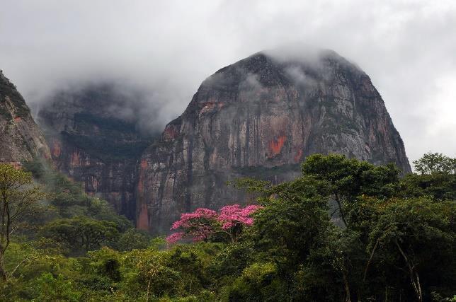
Madidi Nat´l Park

La Paz is the administrative capital of Bolivia with more than 1 million inhabitants and the main artery of tourism to the country. From La Paz it is possible to get to the highest mountains or tho the deepest jungle in just few hours. But the most spectacular offer the city has for you is the modern cable car system with actually 6 routes connecting different neighbourhoods without suffering of traffic jam and the most valuable pearl: It offers you spectacular views of the area with more than 900 meters height difference. How about playing golf at 12.000 feet above sea level? Only in La Paz!
The Salar de Uyuni, with an extension of more than 10,000 km2, is the largest salt expanse in the world that several years ago has become a favorite place to visit in Bolivia. Despite being surrounded by the imposing mountains of the Andes, it is one of the flattest surfaces on earth catching the attention of everyone who visits it, inviting to see landscapes that surpass the human imagination throughout the year. The salt lake continues to be a destination in which the traveler can have the feeling of being totally alone, in contact with nature and the purest sky that can exist.
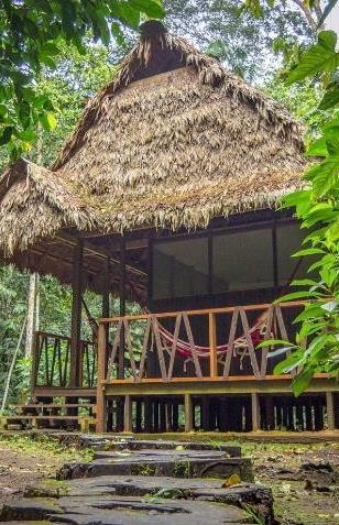

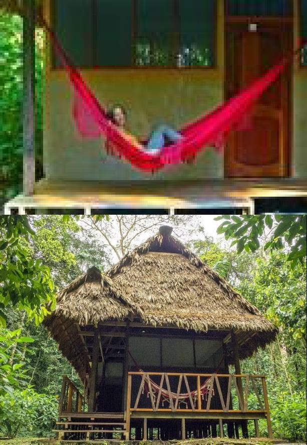
Established in 1995, Madidi National Park is a jungle paradise situated in the in the upper Amazon river basin of Bolivia. Home to a record breaking number of animal species and plants, the park is not only one of the most diverse ecological hot spots on the planet but one of the largest protected areas in Bolivia. Together with Madidi Jungle Ecolodge, our mission is to offer you an unforgettable and unique adventure, so you can experience all the wonder and the wildlife #F0F7ECof the jungle. We also seek to improve the living conditions of our indigenous community and support the conservation and protection of the existing biological diversity.
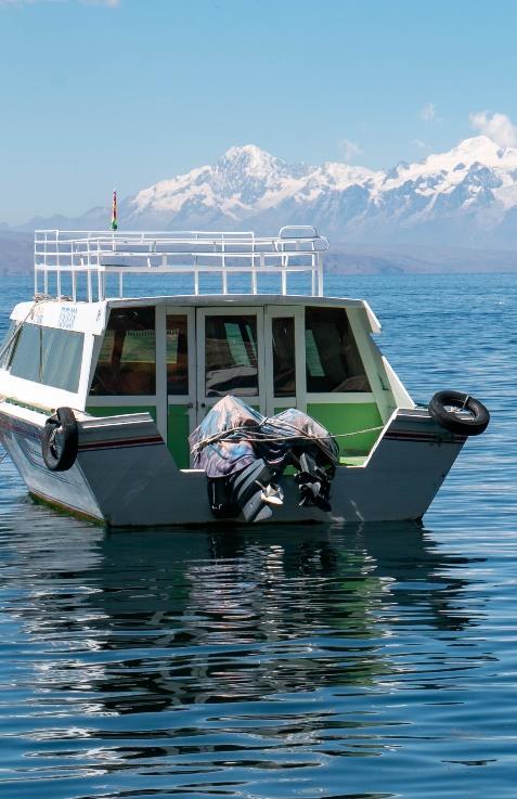
The Lake Titicaca. Highest navigable lake of the world, the second main artery of tourism in Bolivia. Who does not have heard about this mythical Lake? A must for every visit in Bolivia, Titicaca is surrounded by the snow-capped mountains of the Andes Cordillera which gives impressive views that you will never forget. Visits at the Islands bring you into the past where the Incas dominated the region before the Spaniards came. Last but not least, explore the syncretism of the catholic religion with the native beliefs.
Uyuni Salt Lake
Lake Titicaca
ESTADO PLURINACION DE BOLIVIA PLURINATIONAL STATE OF BOLIVIA
Bolivia; officially known as the Plurinational State of Bolivia is a landlocked country located in western-central South America. The capital is Sucre while the seat of government is located in La Paz. The largest city and principal economic and financial center is Santa Cruz de la Sierra, located on the Llanos Orientales (Tropical lowlands) a mostly flat region in the East of Bolivia. It is constitutionally a unitary state, divided into nine departments. Its geography varies from the peaks of the Andes in the West to the Eastern Lowlands, situated within the Amazon Basin. One-third of the country is within the Andean mountain range. Population: 10.400.000 inhabitants Area: With 1.098.581 km2, Bolivia is the 5th largest country in South America and the 27th largest in the world. Density: 9.94 inhabitants / km2 Geographic location: It limits to the Northeast with Brazil, to the Southeast with Paraguay, to the South with Argentina, to the Southwest with Chile and to the Northwest with Peru. Bolivia is the Latin American country with the highest inhabited altitudes . Capital city: Sucre is the official capital of the country, which houses the judicial power. However, since the 1890´s is La Paz the administrative city of Bolivia housing the administrative power and the congress. Official language: The official language is Spanish. With the new constitution, Aymara, Quechua and Guaraní are also considered as official languages (more than 50% of the population speak one or more of these languages. There are also more than 33 secondary languages or dialects throughout the country, especially in the Amazon Basin. Time Zone: UTC -4
National Holidays:
August 6, Independence Day of Spain January 22nd day of foundation of the Plurinational State Official National Holidays: 1 January, New Year, February / March, Carnival, 1 May, Labor Day, 12 October, Decolonization Day, 2 November, All Saints Day, 25 December, Christmas GDP per capita: 4,996 USD Currency: Boliviano (BOB). Banknotes have denominations of 10, 20, 50, 100 and 200 Bolivianos. Main industries: food, consumer durables, textiles, publishing, metallurgy EXPORTS: $ 9.04 billion (2011) IMPORTS: $ 7.6 billion (2011)

GROWTH RATE: 5% (2012) Payment: Credit cards (American Express, Diners Club, Master Card, Visa). Visa and Master Card are the most accepted. Certain transactions can be carried out with checks of national banks and foreign certificates as well as in US dollars. ISO CODE: 068 / BOL / BO Internet domain: .bo Phone international code: +0591
Geography
Bolivia is located in the heart of South America. The country spreads from the central parts of the Andes Chaco to the Amazon. The geographical center is located in the area of Puerto Estrella above the river Río Grande in the province Ñuflo de Chaves in the department of Santa Cruz. The Andean attract a wide berth by the West in Bolivia and thus determine the three geographical zones of the country: the mountains and the Altiplano in the west, the subtropical Yungas and temperate valleys of the eastern foothills of the mountains and the tropical lowlands (llanos) in the east of the country (Oriente). Altiplano: This highest-altitude zone extends to over 3000 meters above sea level in two large, parallel mountain ranges (cordilleras) of the Andes. The western Andes (Cordillera Occidental) runs along the borders with Peru and Chile. The eastern mountain range (Cordillera Oriental) is very wide and runs from Peru to Argentina. Here are some of the highest mountain peaks in America. The average temperature is between 15 and 20 degrees Celsius. At night, temperatures drop drastically until freezing. At noon, it is dry with increasing sunshine. Every month there is frost and snow. Main cities: La Paz, Potosí, Oruro.

The Cordillera Occidental is a chain of dormant volcanoes and solfataras, volcanic vents emitting sulfurous gases. Bolivia's highest peak, the snowcapped Nevado Sajama 6,542 m (21,463 ft), is located here. The entire cordillera is of volcanic origin and an extension of the volcanic region found in southern Peru. Most of the northern part of this range has an elevation of about 4,000 m (13,123 ft); the southern part is somewhat lower. Rainfall, although scanty everywhere, is greater in the northern half, where the land is covered with scrub vegetation. The southern area receives almost no precipitation, and the landscape consists mostly of barren rocks. All of the Cordillera Occidental region is sparsely populated, and the south is virtually uninhabited. The Altiplano, the high plateau between the previous range and the Cordillera Oriental, comprises four major basins formed by mountainous spurs that jut eastward from the Cordillera Occidental about halfway to the Cordillera Oriental. Along the Altiplano's eastern side is a continuous flat area, which has served as Bolivia's principal northsouth transport corridor since colonial times. The entire Altiplano was originally a deep rift between the cordilleras that gradually filled with highly porous sedimentary debris washed down from the peaks. This sedimentary origin explains its gradual slope from north to south; greater rainfall in the north has washed a larger quantity of debris onto the platform floor. The most prominent feature of the Altiplano is the large lake at its northern end, Lake Titicaca. At 3,811 m (12,503 ft) above sea level, it is the highest commercially navigable body of water in the world. With a surface area of 9,064 km2 (3,500 sq mi), it is larger than Puerto Rico and is South America's second largest lake by surface area. Lake Titicaca is also deep, about 370 m (1,214 ft) at its deepest, with an average depth of 215 m (705 ft); its volume of water is large enough to maintain a constant temperature of 10 °C (50 °F). The lake actually moderates the climate for a considerable distance around it, making crops of maize and wheat possible in sheltered areas.


Lake Titicaca drains southward through the slow-moving, reed-filled Desaguadero River to Lake Poopó. In contrast to the freshwater Lake Titicaca, Lake Poopó is salty and shallow, with depths seldom more than 4 m (13 ft). Valleys and Yungas: the subandine zone of valleys and Yungas (Rainforest) is between the Altiplano and the Amazon lowlands. The climate is temperate. Wet winds from the northeast blow against the mountains, so there is plenty of moisture and rain in the area. With increasing altitude, the temperatures drop, from an altitude of 2000 meters above sea level. Main cities: Cochabamba, Sucre, Tarija. The Great Plain and the Amazon: 59 percent of the national territory is a lowland located north of the Cordillera Oriental, from the foot of the Andes to the Río Paraguay River. The lowlands are covered by extensive forests with a rich flora and fauna. The tropical-humid climate has an average temperature of 30 degrees Celsius. Winds from the Amazon bring rainy rainfall. From May, dry winds provide low rainfall and cloudless skies. In winter, strong winds from the south (surazos) provide for a few cool days. The eastern lowlands include all of Bolivia north and east of the Andes. Although comprising over two-thirds of the national territory, the region is sparsely populated and, until recently, has played a minor role in the economy. Differences in topography and climate separate the lowlands into three areas. The flat northern area, made up of Beni and Pando Departments and the northern part of Cochabamba Department, consists of rainforest. Because much of the topsoil is underlain by claypan, drainage is poor, and heavy rainfall periodically converts vast parts of the region to swamp. The central area, comprising the northern half of Santa Cruz Department, has gently rolling hills and a drier climate than the north. Forests alternate with savanna, and much of the land has been cleared for cultivation. Santa Cruz, the largest city in the lowlands, is located here, as are most of Bolivia's petroleum and natural gas reserves. The southeastern part of the lowlands is part of the Gran Chaco. Virtually rainless for nine months of the year, this area becomes flooded for the three months of heavy rains. The extreme variation in rainfall supports only thorny scrub vegetation and cattle grazing, although recent discoveries of natural gas and petroleum near the foothills of the Andes have attracted some settlers to the region. Most of Bolivia's important rivers are found in the water-rich northern parts of the lowlands, particularly in the Alto Beni (Upper Beni), where the land is suitable for crops such as coffee and cacao. The northern lowlands are drained by wide, slow-moving rivers, the three largest of which—the Mamoré, Beni, and Madre de Dios—all flow northward into the Madeira River in Brazil and eventually into the River Amazon. Riverboats along the Beni and the Mamoré carry both passenger and freight traffic; rapids on the Madeira prevent river traffic farther into Brazil. Near the Paraguayan border, shallow sandy streams carry the seasonal runoff into the Pilcomayo or Paraguay rivers. Also, the Pantanal, the world's largest wetland of any kind, has some of its area in Bolivia. Weather: There are no marked seasons in Bolivia. As a matter of fact, there are only two seasons in the country, the rainy season which covers from November to March and the dry season, covering from April through end of October. The climate is temperate, with large variations depending on the region and its altitude ranging between 10 ° and 25°. It presents great contrasts between day and night, especially in mountainous areas. Llanos. A humid tropical climate with an average temperature of 30° C (86° F). The wind coming from the Amazon rainforest causes significant rainfall. Starting in May, there is low precipitation because of dry winds, and most days have clear skies. Even so, winds from the south, called surazos, can bring cooler temperatures lasting several days.
Altiplano. Desert-Polar climates, with strong and cold winds. The average temperature ranges from 15 to 20° C (59- 68° F). At night, temperatures descend drastically to slightly above 0° C (32° F), while during the day, the weather is dry and solar radiation is high. Ground frosts occur every month, and snow is frequent. Valleys and Yungas. Temperate climate. The humid northeastern winds are pushed to the mountains, making this region very humid and rainy. Temperatures are cooler at higher elevations. Snow occurs at altitudes of 2000 meters. Chaco. Subtropical Semi-arid climate. Rain and humidity in January and the rest of the year, with warm days and cool nights.
Statistics
Geographic coordinates: 9 ° 00 ' - 23 ° 00' S and 57 ° 30 ' 70 ° 00' W. Terrain: rugged Andes Mountains with a highland plateau (Altiplano), hills, lowland plains of the Amazon Basin Elevation extremes: lowest point: Rio Paraguay 90 m highest point: Nevado Sajama 6,542 m (21,463 ft) Natural resources: tin, natural gas, petroleum, zinc, tungsten, antimony, silver, iron, lead, gold, timber, hydropower Land borders: Argentina (942 km), Brazil (3,403 km), Chile (942 km), Paraguay (753 km), Peru (1,212 km) Extension: The maximum distances are around 1530 kms from north to south and 1450 kms from west to east.
Gastronomy
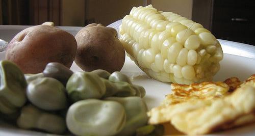
Bolivian cuisine is very much diverse. Every geographic zone is characterized with their own gastronomy, highlighting their production. To enhance certain dishes, llajhua (a spicy sauce made with tomatoes and hot peppers) is added. Both Bolivian beer and wine and chicha (strong alcoholic corn drink) are very good, but we must bear in mind that local alcohol is very strong.
Culture
In dress, language, architecture, music and lifestyle, Bolivia is characterized by a culture with broad folkloric roots, traditions of the ancestral inhabitants of America, which has been modified and mixed with Spanish traditions . Holidays and religious connotations are celebrated with large parties. The population descended from Spaniards, has adopted some of these customs.
Health
Bolivia has very poor health conditions. In the 80s there was one doctor for every 1600 inhabitants. Infant mortality is one of the highest in South America; Malaria, dysentery and tuberculosis are common diseases in this country. There have been recent serious outbreaks of yellow fever. Medical services and hospitals in rural areas are particularly inadequate. It has a Health Program, which currently covers less than half of the real needs of the working population.


TOURIST ATRACTIONS
Bolivia is a rich country in touristic offers. From North through South, from East through West, in every region you will find interesting offers for you and your clients. I would say, Bolivia is a gift of God who gave us the best natural environment, the best fauna and flora and the best climate conditions. Unfortunately, all these have negative remarks, such as lack of promotion of the country, few interest from governments through the years on investment, bad road communication which should be very important due to long distances, lack of education in human resources to name a few. However, whatever is made until now is remarkable, based namely in the private enterprise. The current government has created to EMPRESA BOLIVIANA DE TURISMO with the goal to improve tourism in off-the beaten communities, which is more orientated to local tourism as to foreigners. As we already mentioned before, Bolivian promotion orientates to the position the country has and is considered as the heart of the south. GOLATINO BOLIVIA and EUROLATINO support strongly this initiative and following this concept, we believe that Bolivian tourism has four important vessels or columns. Together with these columns, we will describe the most important attraction in every department as follows: LA PAZ
La Paz is the third largest city in Bolivia, after the metropolis of Santa Cruz (1,453,549 inhabitants) in the lowlands and the neighboring city of El Alto (848,840 inhabitants). The agglomeration of La Paz has an estimated two million inhabitants, called Paceños or Paceñas, and includes, among others, the cities of El Alto, Viacha and Achocalla. The city is located in the municipal district of La Paz at about 3600 m in the approximately 400 meters deep canyon of the Río Chokeyapu, which is cut into the surrounding plateau of the Altiplano and opens to a basin with a protected and pleasant climate.
On the plateau west of La Paz, the city of El Alto emerged, which is now larger than La Paz with 848,840 inhabitants (2012 census); There is located the international airport La Paz-El Alto. The difference in altitude between the southern parts of the valley further down with many villas and the outskirts at the upper end of the basin is just under 1000 m, which leads on the descent from El Alto (4100 m.) down to the lowest part of La Paz (3200 m.), to one of the most spectacular views of Bolivia. There is a clear relationship between the altitude of the neighbourhoods and the social status of their inhabitants: the higher the situation, the poorer the inhabitants. With an average decrease in temperature of 0.6 ° C per 100 m, the difference between the lowest and highest residential areas is at least 6 ° C annual mean; altitude sickness is also a major problem for out-of-towners in the upper districts. The city is dominated by the mighty Illimani (6,439 m) with its four peaks. With a little imagination you can see in the rocks on its slopes a picture of an Indio with wife, child and a llama. The touristic offer of the city is mainly concentrated on the old quarters of the city, the colonial part. But the most amazing feature at the Indian markets which every visitor should visit. Walk through the markets to see some of the more than 200 varieties of potatoes, fish, meat, vegetables, amazing variety of colourful corn, livestock and more. Your visit will not be completed without admiring the diversity of people there, which makes the highlight of the markets. But pay attention, photography is not allowed, not directly however. Continue enjoying La Paz with the superb modern Cable Car system built in the recent years and connecting different neighbourhoods very quickly because it avoids the heavy traffic jam of the city. Actually, there are six lines -still counting- and become the most fascinating way to visit the city since you will literally fly above the houses. In clear days, see the snow- capped mountains surrounding La Paz with the Illimani as its most important highlight, but Mururata and Huayna Potosi give the city a special flair. All lines are named after colours.


Usually, every guided city tour in La Paz will include a visit to the Valley of the Moon, bizarre land formations made out of clay and dated more than 10000 years old. These formations are so spectacular that many travellers have compared it with a moonscape: On arrival in the Valle de la Luna, you feel like you are on another star, because that's how we imagine the surface of the moon. The name Valle de la Luna is really appropriate for the valley with its bizarre-looking rock formations, which are highlighted even more by their different colour shades. If you want to see more of the stunning rocky landscape on your trip to the Valle de la Luna, then you should definitely follow the very well signposted footpath. A walk on the path is recommended in dry weather and with sturdy shoes, so that the feet are protected from contact with the partially sharp stones. You will also see a sparse vegetation between the rock formations that underlines the impression of an alien valley. Especially interesting is the further change on site. Every rainy season between January and March changes the Valle de la Luna a bit, sometimes stone towers fall over, in other places new caves are formed or the shades vary a bit. The Valle de la Luna is a fascinating scene of the local forces of nature and therefore represents a special destination for nature lovers and amateur photographers. Further on south direction, you can find another wonder of the nature, the Valle de las Animas. I can remember this site 30 years ago being an abandoned canyon without any interest for nobody. When you got into the canyon and the wind blew, you could hear like a whispering, and that has given the name to this area, the Valle of the Souls. And probably that was the reason why people didn´t want to visit it. Probably they were not souls in pain but surely today the wind continues attracting more visitors to this unusual canyon. Do you have interest in golf? Spend your free time in La Paz Golf course with 18 holes of par 71, internationally known as the highest grass court in the world at 3,342 meters above sea level. We offer you the opportunity to have a trial/orientation day there, for a few hours, even for beginners. This is not only to improve your swing but to try the get the largest shot in history. The island tee box of the 12th hole is reached by not one, but two bridges. With an enormous canyon to the rear of this precarious position, the tee shot requires a 180-yard forced carry across a mass of beige and browned coloured rocky outcrops to a welcoming verdant fairway in the distance. Remarkably, the thin high-altitude air provides less resistance, which means players can drive noticeably further and straighter. This element can be a little off-putting for the first-time visitor, but thankfully, knowledgeable caddies are on hand to recommend the right club for every occasion. By the way, we also offer experienced golfers and travellers, the opportunity to book a package including among the typical visits in La Paz, a few days playing your favourite sport. We offer you return transport, green fees, and equipment as part of the tour. On the other side, at 12.000 feet (4.100 meters) above sea level, a new attraction is growing up very much in La Paz, locking even more tourists to one of the poorest areas of Bolivia: The Cholets, the new Bolivian architecture, symbol of Aymara opulence. The owners of these constructions have been successful in commerce, mines, gastronomy, among other activities and the promote themselves this neo-Andean Baroque architecture that can cost up to a million dollars. The word 'cholets', is formed by the symbiosis between cholo - as the mestizo population is called, sometimes derogatory- and chalet, word used to highlight a fancy and expensive house. We offer you as well, a half-day tour visiting these uncommon buildings even with shopping malls, volleyball courts and synthetic turf football, as well as pharaonic dance floors to rent.

LAKE TITICACA
The second column of our heart of the soul is the best known and for a long time the top one of the Bolivian tourist destinations is the Lake Titicaca. Located at 3850 meters above sea level, Lake Titicaca is the highest navigable lake in the world and shared between Bolivia (45% of the total area) and Peru (55%). If we compare Lake Titicaca with Lake Constance located between Germany. Switzerland and Austria, the largest lake in Western Europe, the Bolivian lake is about 13 times bigger than the European lake. Its longest distance is 265 km from north to south and the widest 90 km. The narrowest part of the lake, the Strait of Tiquina with only 800 meters, divides the lake in two parts, the northern and largest side known as Chucuito and the smallest and southern part known as Huinay Marka. There is no visitor to Bolivia who doesn´t plan to see the Lake. A typical day-tour on the Lake Titicaca starting from La Paz will include -among many photo stopsvisits in Copacabana, the most important town at the shores of the Bolivian Lake and catholic shrine. The basilica built in the 15th century houses the figure of Virgin Maria, known as “La Mamita” and venerated even beyond borders. This sculpture carved on Maguey (cactus leaves) and covered with ceramic is the patron of Bolivia. Besides the church, Copacabana hos not too much to offer and zourist take the chance to visit the Islands nearby. The Isla del Sol ("Island of the sun") is one of the largest islands of the lake. Geographically, the terrain is harsh; it is a rocky, hilly island. There are no motor vehicles or paved roads on the island. The main economic activity of the approximately 800 families on the island is farming, with fishing and tourism augmenting the subsistence economy. There are over 180 ruins on the island. Most of these date to the Inca period circa the 15th century AD. Many hills on the island contain agricultural terraces, which adapt steep and rocky terrain to agriculture. Among the ruins on the island are the Sacred Rock, a labyrinth-like building called Chicana, Kasa Pata, and Pilcocaina. In the religion of the Incas, it was believed that the sun god was born here, grounded by Manco Kapac and Mama Ocllo. Next site to visit is the Island of the Moon. According to legends that refer to Inca mythology, the Isla de la Luna (Spanish for "island of the moon") is where Viracocha commanded the rising of the moon. Ruins of a supposed Inca nunnery (Mamakuna) occupy the oriental shore. The structures seen on the island today were built by the Inca (ca. 1450–1532) directly over the earlier Tiwanaku ones.

MADIDI NATIONAL PARK

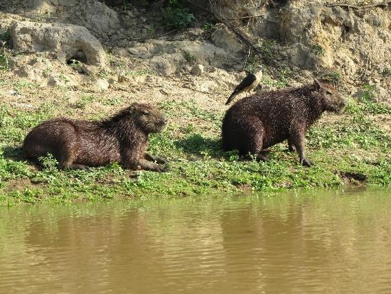
The National Park stretches from the eastern foothills of the snow-capped Andean Cordillera (68 ° 45 'W) to the western part of the tropical Amazon River Basin (67 ° 30') with the Río Madidi and Río Tuichi Rivers. With an extension of 135 km in east-west direction and a mean width of 50 km, it covers an area of 18,958 km². Its easternmost point is near the town of Rurrenabaque on the Río Beni. The national park is located in a height zone from 180 to 5,760 meters above sea level. The climate is diverse and ranges from the cold high mountain climate of the Andes to the temperate climate in the lowlands of the north. The average temperature is between 25°C and 33°C and between 10 and 20°C between October and January. We offer you the possibility to visit the Madidi National Park starting from La Paz, either flying with Amaszonas Airlines or driving through the Andean Cordillera. Once you get to Rurrenabaque, the entrance to the park, our partner there will pick you up at take you the the ecolodge we work with. After 3 hours you will reach the banks of the Madidi National Park offering you the opportunity to experience the real magic of the jungle and interact with the natural environment. We make efforts to offer you a sustainable and environmentally friendly experience to discover the amazing jungle flora and fauna. Walking through easy-to-access trails and guided with native guides, you will discover the best of the rain forest. You´ll observe stunning plants and animals, learn about medicinal plants, get to know the various types of trees, the ecological cycles and gain authentic, local knowledge. In order to provide the best possible service, our groups are between 4 and 5 visitors maximum. Among other activities, we offer you Night Hikes to experience nocturnal wildlife and listen to the enigmatic sounds of the jungle after dark. This activity is ideal for those interested in amphibians, reptiles and insects, such as the tarantula. Birdwatching is also considered during your visit in the Bolivian rain forest. Research conducted in Madidi National Park estimates that there are approximately 1,200 species of birds within the protected area including macaws, parrots, toucans, harpy eagles, king vultures, wild turkeys, woodpeckers, kingfishers and many other smaller species. This means it´s one of the very best places for bird observation in the world. After just 1h walking from the Ecolodge, located on the Aguapolo River, you will find a natural Macaw cliff. During the first or last day of your tour, you will also have the chance to visit Caquiahuara, a natural nesting wall used by the red and green macaws and other species of parrots (depending on season). Piranha fishing is available all year round in small streams and lagoons close to the lodge. Groups will use hooks, nylon lines and meat as bait for the fish. The most common fish are piranha, cat fish, golden salmon and giant piranha (pacu). The fish are not harmed, and are returned to the water. During the hikes you will have the possibility to observe a variety of wildlife including: black spider monkeys, capuchin monkeys, howler monkeys, squirrel monkeys, tapirs, wild pigs, deer, capybaras, turtles, caimans, lizards and other smaller species. The wild cats, like pumas, jaguars and ocelots are the most difficult to see, but they could surprise us! During the dry season the River Tuichi is a great place for tubbing, an exciting ride in rubber inner tubes along the fast-paced rapids of the river as well as the calmer waters. Along the way, you will have the chance to relax and enjoy the pristine surroundings.


UYUNI SALT LAKE
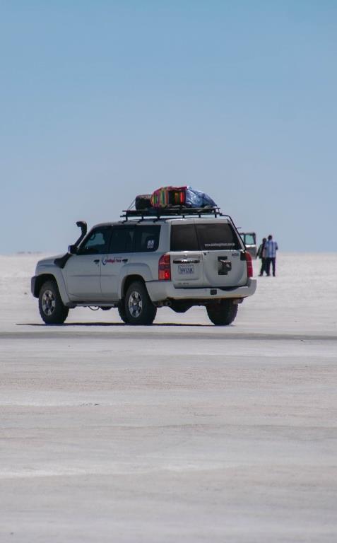
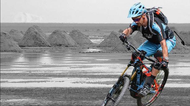
The fourth column of our heart of the south is nowadays one of the most visited destinations in Bolivia. The Uyuni Salt Lake is the world’s largest salt flat, left behind by prehistoric lakes evaporated long ago. Here, a thick crust of salt extends to the horizon, covered by quilted, polygonal patterns of salt rising from the ground. From November through April, during the rainy season, the lake overflows and a thin layer of water transforms the flats into the largest mirror in the world due to the reflection of the sky. This beautiful region serves for the extractions of salt and lithium—the element used in batteries powering laptops, smart phones and electric cars. In addition to this task that moves the local economy, you can find here the world's first salt hotel. Actually, there are many more salt hotels attending the high tourists´ demand. The Salar de Uyuni spreads over 10 582 km2, which is roughly 100 times the size of the Bonneville Salt Flats in the United States. Lake Poopó is a neighbor of the much larger Lake Titicaca. During the wet season, Titicaca overflows and discharges into Poopó, which, in turn, floods Salar De Coipasa and Salar de Uyuni. One major tourist attraction is at an antique train cemetery. It is 3 miles outside Uyuni and is connected to it by the old train tracks. The town served as a hub for the trains carrying minerals en route to Pacific Ocean ports. The rail lines were built by British engineers at the end of the 19th century and formed a sizeable community in Uyuni. The trains were mostly used by the mining companies. In the 1940s, the mining industry collapsed, partly because of mineral depletion. Many trains were abandoned, producing the train cemetery. There are proposals to build a museum from the cemetery. Per antonomasia, Uyuni Salt Lake will refer also to the marvels of the Eduardo Avaroa National Park which are obligated visit for those staying a few days in the region. Not far from the famous Salar de Uyuni, Eduardo Avaroa is the most visited protected region in the entire country. This high-altitude expanse boasts a surreal collection of colorful lagoons, snow-capped volcanoes, hallucinogenic rock formations, bubbling hot springs, scorching hot geysers and windswept deserts. The largest of the three coloured lagoons is the 6km wide Laguna Colorada. Algae growing in the water dye it a vivid blood red, which is contrasted with bone white islands made of the mineral borax. Owing to the Laguna Colorado's height above sea level (4,278m) and the surrounding landscape of salt, very little wildlife can be found here for most of the year. In Novemeber, however, flocks of three different species of flamingo make it their home for the breeding season. Amongst the smaller lagoons are the green Laguna Verde and sky blue Laguna Celeste. Both derive their colour from various copper mineral deposits in the water, which makes them beautiful but not ideal for swimming in. The Laguna Verde is situated at the foot of the spectacularly symmetrical Licancabur volcano and a short distance from natural hot springs. Our offers to the Uyuni Salt Flats and the Eduardo Avaroa National Park will include starting in October 2018, tours riding modern E-Bikes and connecting different spots and giving you amazing experiences. E-bikes will help you to be active on this unfriendly environment due to the altitude.


CARNIVAL OF ORURO
Nominated as a Masterpiece of the Oral and Intangible Heritage of Humanity by the UNESCO, the Carnival of Oruro is to Bolivia what the Octoberfest is for Germans, the most popular folk´s festival of the year. Between February and March every year, 40 days before the Holy Week, thousands of visitors prepare their visit to the carnival of Oruro where another thousands of believers prepare their costumes to dance in honour of the “Mamita del Socavón”, the Miners´ Virgin Mary. The mixture of catholic believes and Indian religious traditions gives this festivity a special touch of adventure, happiness and relax. And many tourists are aware of this, increasing the number of foreign travellers coming to this festival. And what is to expect here? Many people would prefer to come to Rio de Janeiro where the most popular carnival in the world takes place, but Oruro will change your mind. This small city in the Bolivian highlands, awakes with the sound of drums and trumpets during the festivity and looks very elegant through beautiful customs made by expert artisans. The music diversity is also enormous, and you will be willing to learn some of the steps you will see here. A spectacle for the eyes and ears that you cannot miss. Also, the mixture of Catholicism and Andean Religion makes this festival one of the once-ina-life-time experiences not to be missed. The fight within good and evil, represented on the “Diablada”, Dance of the Devil by the Devil and the Archangel Michael will astonish you, not only because of the choreography but beautiful costumes. It will be very difficult to describe in a few words the magic, and variety found in this typical Bolivian festival that attracts hundreds of thousands of tourists and involves more than 20,000 dancers and 10,000 musicians from all over the country who cover 8 kilometers dancing and making music. The Diablada, the Morenada, the Sicuris, Tobas, Caporales, Llamerada, Cullaguada, Los Negritos and many others are the incredibly rich and proudly Bolivian folkloric music and dance. A picture can tell more than thousand words. And specially this proverb cannot be more accurate in this case. Look at the few pictures included in this document to have an idea what you will get visiting this festival. EUROLATINO has prepared a full package to visit this festival, including of course the highlights of the Andes: Atacama Desert, Uyuni Salt Lake, Lake Titicaca and Machu Picchu.
We would like to present to you some ideas for your next trip to Bolivia as well as fixed departures for the next season 2023. Feel free to ask us for more details, for a training in the destination you want to sale and for material you may need for your marketing and/or homepage. We will be very happy to support your sales.
The EUROLATINO Team


