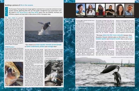
Building a picture of life in the oceans The European Tracking Network brings together scientists from across the continent to track aquatic species, gathering data that can then guide management and conservation work. We spoke to Kim Birnie-Gauvin and Ross McGill about how the STRAITS, NorTrack and DTOtrack projects will help build a fuller picture of life in European seas. Dr Aytaç Özgül
Claudia Meneses
Dr Jan Reubens
Dr Kim Birnie-Gauvin
Dr Lydie Couturier
Dr Ricardo Sanchez Leal
The team behind the international European Tracking Network (ETN) uses a variety of methods to track the movements of aquatic species across the seas, gathering data that can then guide efforts to conserve and protect them. One particularly important method is acoustic telemetry, where receivers are placed in the water to pick up pings from tagged fish when they swim by. “When a tagged fish is detected, you get a time-stamp and you know that fish was in the vicinity of the receiver, at that date and time,” outlines Kim BirnieGauvin, a Senior Researcher at the Technical University of Denmark, part of the ETN team. Acoustic telemetry is a well-established method, but Birnie-Gauvin says the technology has improved over time, opening up new possibilities in research. “The tags now last longer, perform better and can record more data. They can record things like temperature and the depth of the fish for instance,” she explains.
STRAITS project As communications manager of the EU-backed STRAITS project, Birnie-Gauvin is now part of a team of researchers using acoustic telemetry to gather and collate data on fish movements, which is a highly effective means of monitoring underwater biodiversity. While a trawl survey shows which fish are present in the sea at a particular place and time, Birnie-Gauvin says acoustic telemetry provides far richer data. A juvenile ocean sunfish, by Sebastian Kraft.
24
A humpback whale breaching, by Joanne O’Brien.
“Our mission is to track aquatic animals across Europe to better understand, protect and manage them” “We know where the fish move naturally between key points. Acoustic telemetry gives us information over much broader spatial and temporal scales than a trawl survey,” she says. Researchers promoted acoustic telemetry as an efficient, effective way of monitoring the seas, and receivers have now been set up at four strategically important locations across Europe. “We have set up arrays of receivers in the Strait of Gibraltar, the Turkish Straits, the North Channel, and the Danish Straits,” outlines Birnie-Gauvin. These four locations are all pinch points which fish have to pass in order to move between different parts of the seas. The Strait of Gibraltar for example is something like 12 kilometres wide at its narrowest point, and fish moving between the Atlantic and the Mediterranean have to pass through it.“It’s a very strategic place to put the receivers,” stresses Birnie-Gauvin. The STRAITS team, comprising researchers from 10 partner organisations, is now monitoring each of these four major gateways in a coordinated effort, gathering data on a wide variety of species. “At the North Channel, we focus on salmonid species, such as salmon and sea trout. We’ve tagged salmon smolts that were just 12 cm long, and the data
shows us that in some cases they’ve travelled 400 kilometres from where they were tagged,” says Ross McGill, Project Manager at Lough’s Agency in Ireland, who works on infrastructure for ETN. “Our Danish colleagues work with species like Atlantic bluefin tuna, some of which
have been tagged in Denmark and then end up in the Mediterranean.” This was not a surprising finding, as it is known that bluefin tuna go to the Mediterranean to spawn, but the sheer numbers that are being detected is highly striking. This then opens up new questions for researchers to probe.“Are all these bluefin tuna spawning in the same place? Or are there other spawning grounds that we don’t know about?” asks Birnie-Gauvin. Researchers have also found that some fish travel in the other direction, from waters around France and Belgium through the North Sea all the way up to the Danish Straits, in sufficient numbers that Birnie-Gauvin says they can’t be automatically regarded as outliers. “It’s not necessarily that high numbers of fish make this journey, but it’s enough for us to ask whether they also do other things that we might not know about,” she continues. “In general, most fish behave in line with expected patterns, but there’s always a few that do something unexpected.” The ETN team’s research has led to new insights into these kinds of fish movement patterns, which can then guide the development of more effective conservation and management measures for endangered species.
mysteries in marine biology. One major species of interest in the STRAITS project is the eel for example, which travels vast distances to the Sargasso Sea to spawn. Much remains to be learned about the lifecycle of eels however, and with the European population now classified as critically endangered, it’s essential to gather more reliable data on their movements. “We don’t actually know much about the escapement of eels from the Baltic
“We know where the fish move naturally between these key points. Acoustic telemetry gives us information over much broader spatial and temporal scales than a trawl survey.” implications; while a Marine Protected Area (MPA) has been established around the Outer Hebrides to protect flapper skates, this is not enough on its own. “We know now that these fish move around fairly widely, so we need to think about managing them beyond this confined area,” outlines McGill. A greater volume of data on fish movement patterns can also be used to test theories about the behaviour of certain species and help resolve some of the most persistent
Sea through the Danish Straits, or from the Mediterranean through the Strait of Gibraltar,” says Birnie-Gauvin. The STRAITS project is playing an important role in this respect, says McGill. “Acoustic telemetry technologies provide us with insights into different species and their ecology, which advances knowledge on a biological and ecological level. We’re always thinking about the real-world impact of this knowledge, and how it can help us manage our oceans and resources better,” he stresses.
Jumping dolphins, by Joanne O’Brien (name embedded in this photo).
An Atlantic bluefin tuna being tagged and measured, by Kim Birnie-Gauvin.
EU Research
One example is the flapper skate, which were previously thought to be residential fish that tended not to move around a lot, until tagging data showed otherwise.“We saw from the data that flapper skates migrated great distances from their spawning grounds in the Outer Hebrides across the North Channel. They moved around Irish estuary systems before returning to their spawning grounds,” outlines McGill. This has important management
www.euresearcher.com
25
Extending coordinated tracking across the Northeast Atlantic A jumping Atlantic salmon, by the Loughs Agency.
NorTrack project This is also a central motivating factor behind the NorTrack project, in which ETN is coordinating a team of researchers working to map biodiversity hotspots in the Northeast Atlantic and investigate how that overlaps with planned infrastructure developments in the area. There are plans to establish large numbers of wind farms in the Northeast Atlantic, including many relatively far offshore, as countries strive to reduce their dependence on fossil fuels and move towards a more sustainable energy model. “Lots of countries in Europe are looking towards offshore wind to meet their energy demands, and the technology is improving all the time,” says McGill. Wind farms and other infrastructure developments will inevitably have an impact on marine life, yet they are not properly monitored at the moment, an issue that McGill and his colleagues are working to address. “We need to standardise the monitoring of these areas, as a baseline preand post-development,” he continues. The aim here is not to come down either for or against wind farms, but rather to provide reliable data on their impact, which can then provide a basis to inform wider debate about development and the associated effects on fish. Some evidence suggests that wind farms may act as refuges for certain species, while they are likely to have a more negative impact on others, but Birnie-Gauvin says more data is required before firmer conclusions can be reached. “We simply won’t know unless we monitor biodiversity around these areas,” she stresses. The eight partners in NorTrack are working to establish a cooperative Marine Observation Platform, which can then open a window into biodiversity in these areas,
Turning tracking data into a Digital Twin of the North Sea
“We’re trying to come up with a toolbox of methods that we can apply on different species.” and allow researchers to monitor how fish move around infrastructure such as wind farms. Monitoring marine life and gathering data is by nature challenging, simply because of the harshness of the environments and the complexities involved, but the ETN team is developing new methods for the task. “We’re trying to come up with a toolbox of methods that we can apply on different species,” says McGill. Researchers are also working to use this data to build a fuller picture of marine life in the North Sea, which will then be highly valuable for marine spatial planners, not just in terms of guiding decisions on wind farms but across the blue economy more generally. The oceans are rich in resources, including fish, minerals and biocatalysts, and while
there is a lot of interest in using them, this must be balanced with an understanding of the ecological impact of development. “We’re taking more from our oceans than we have previously, which is where acoustic telemetry technologies come into play. It’s about using our data better,” continues McGill. Project Funding
NorTrack is funded by Biodiversa+, the European Biodiversity Partnership under the 2022-2023 BiodivMon joint call for research proposals, co-funded by the European Commission (GA N°101052342) and with the funding organisations Environmental Protection Agency of Ireland, Innovation Fund Denmark, Research Council of Norway, Agence Nationale de la Recherche, Office Français de la Biodiversité, Belgian Science Policy Office, and Swedish National Space Agency.
DTOTrack project This is a central focus of the DTOTrack project, in which researchers aim to use the available data to develop a digital twin of the North Sea, as part of a wider effort to understand the oceans in more depth. “The European Digital Twin Ocean is a Europewide effort that’s been going for a couple of years now,” outlines McGill. A lot of physical, oceanographic data is currently available on things like water temperature, salinity levels and currents, but there is a relative lack of biological data. The ETN team aims to fill this gap, which McGill says could then lead to deeper insights into biodiversity in the seas. “We can then start to model not only the environmental conditions of the seas, but we can also look at the effects of any changes on different species,” he says. Reliable models can then allow researchers to project forward and look at likely changes in behaviour under different scenarios. “If you have a historical dataset of herring movement through the North Sea, and it’s rich enough, at a good temporal and spatial scale, you can start to ask questions when you plug it into these models. What would be the net effect on the population if sea temperatures rise by one degree? What would be the impact of increased or decreased salinity? Or more fishing in a particular area?” asks McGill. The digital twin will be a valuable tool in probing these kinds of questions, and in helping marine spatial planners understand the likely impact of new developments, contributing to the wider goal of maintaining biodiversity in the oceans. The DTOTrack project is not working in isolation here, with the European Commission A fish being released after tagging, by France Energies Marine.
A starry smooth hound, by Bram Conings.
26
EU Research
www.euresearcher.com
providing the architecture and the computational power, which researchers and governments can then plug into. “The EC is creating a federated system, but researchers need to supply the data,” explains McGill. This is very much work in progress, and while the aim in DTOTrack is to produce an operational prototype of a digital twin of the North Sea based on fish movements by the conclusion of the project in May 2027, McGill anticipates that it will be updated and improved in future. “New iterations and updated versions will be developed, based on evolving user needs, new data streams and technology advances,” he says. This ongoing development will help ensure that the digital twin is adapted to emerging needs, reflecting a desire to lay the foundations for the researchers of the future, and help them understand the oceans in even greater detail. Clear, reliable data on biodiversity in the oceans today will hold great value for the scientists of tomorrow, providing them with a historical perspective on the extent of change, something which Birnie-Gauvin keeps very much in mind. “We want the data to be available for our successors. In 100 years’ time the oceans will look very different to what they do today,” she says. Project Funding
DTOTrack is funded by the Sustainable Blue Economy Partnership under the 2023 call for research proposals, a European Partnership funded by the European Union, and with the following funding organisations: Marine Institute Ireland, Innovation Fund Denmark, Research Council of Norway, Federal Ministry of Education and Research (BMBF) represented by Project Management Jülich, Forschungszentr um Jülich GmbH, Agence Nationale de la Recherche, Office français de la biodiversité, Belgian Science Policy Office, Swedish National Space Agency, Dutch Ministry of Agriculture, Nature and Food Quality, Dutch Ministry of Infrastructure and Water Management, and the Dutch Research Council.
EUROPEAN TRACKING NETWORK The Northeast Atlantic Marine Tracking Network (NorTrack) DIGITAL TWIN OF THE OCEAN: ANIMAL TRACKING (DTOTrack) Strategic Infrastructure for Improved Animal Tracking in European Seas (STRAITS)
Project Objectives
The STRAITS project is setting up marine infrastructure across key European seas to track animal movements. The NorTrack network monitors species in the Northeast Atlantic, and the DTO-Track project uses tracking data to create a digital twin of the North Sea. All of these contribute to the European Tracking Network, which is a platform for monitoring aquatic animals to support biodiversity and policy efforts.
Project Funding
STRAITS is funded by the European Research Executive Agency under the European Commission’s Horizon Framework (2021-2027) research and innovation programme (Grant Agreement no. 101094649).
Contact Details
Kim Birnie-Gauvin Technical University of Denmark E: kbir@aqua.dtu.dk : https://www.youtube.com/ watch?v=wuuldHLCDj4 W: www.europeantrackingnetwork.org W: https://www.europeantrackingnetwork. org/en/straits W: https://www.europeantrackingnetwork. org/en/dtotrack
Ross McGill
Ross McGill is a Senior Project Manager at the Loughs Agency with extensive experience leading international, EUfunded marine research projects. PMP and PRINCE2 certified, he has managed STRAITS, NorTrack and DTOTrack, coordinating multidisciplinary partnerships to advance marine research, biodiversity monitoring and conservation.
27