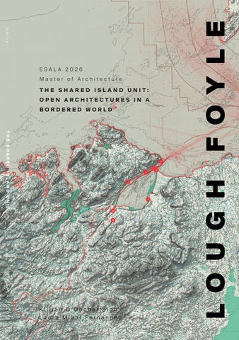
2025-26 Shared Island Unit: Open Architectures in a Bordered World
ESALA 2026
Master of Architecture
THE SHARED ISLAND UNIT:
OPEN ARCHITECTURES IN A BORDERED WORLD
Killian O’Dochartaigh
Laura Miani Fernandez
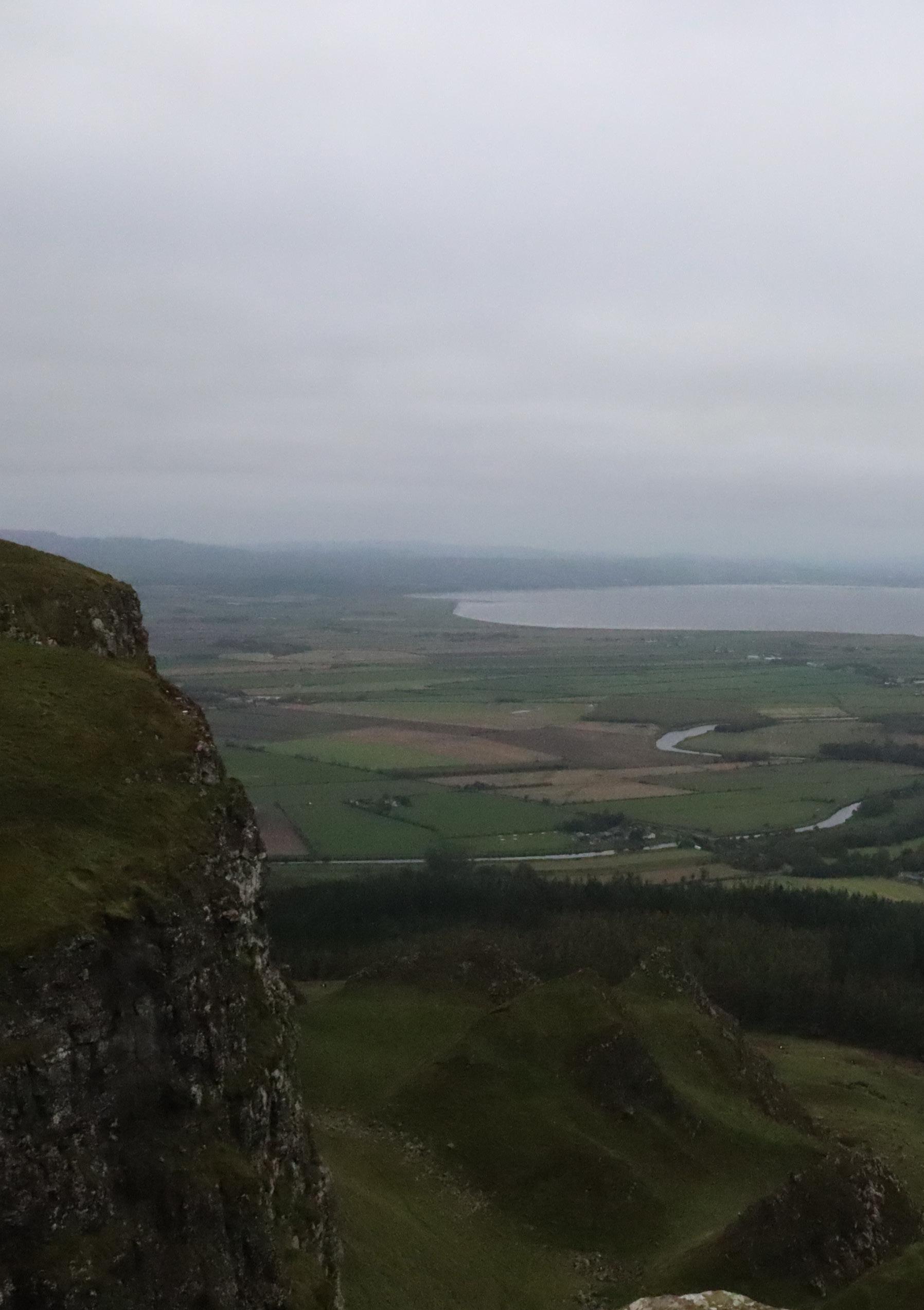
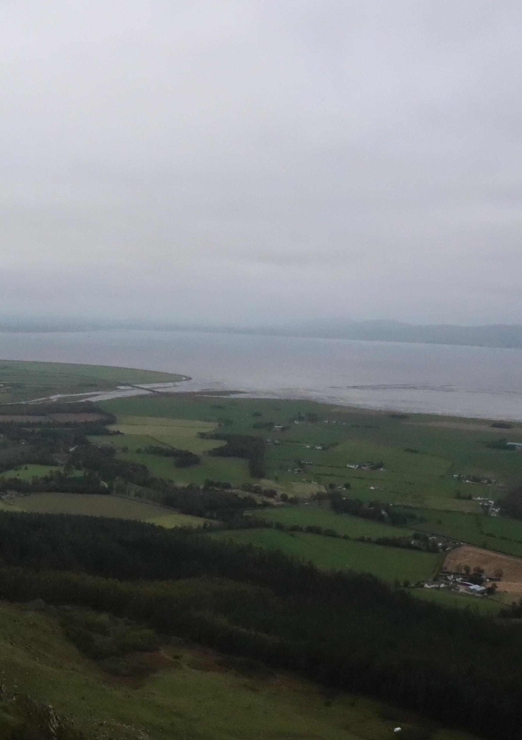
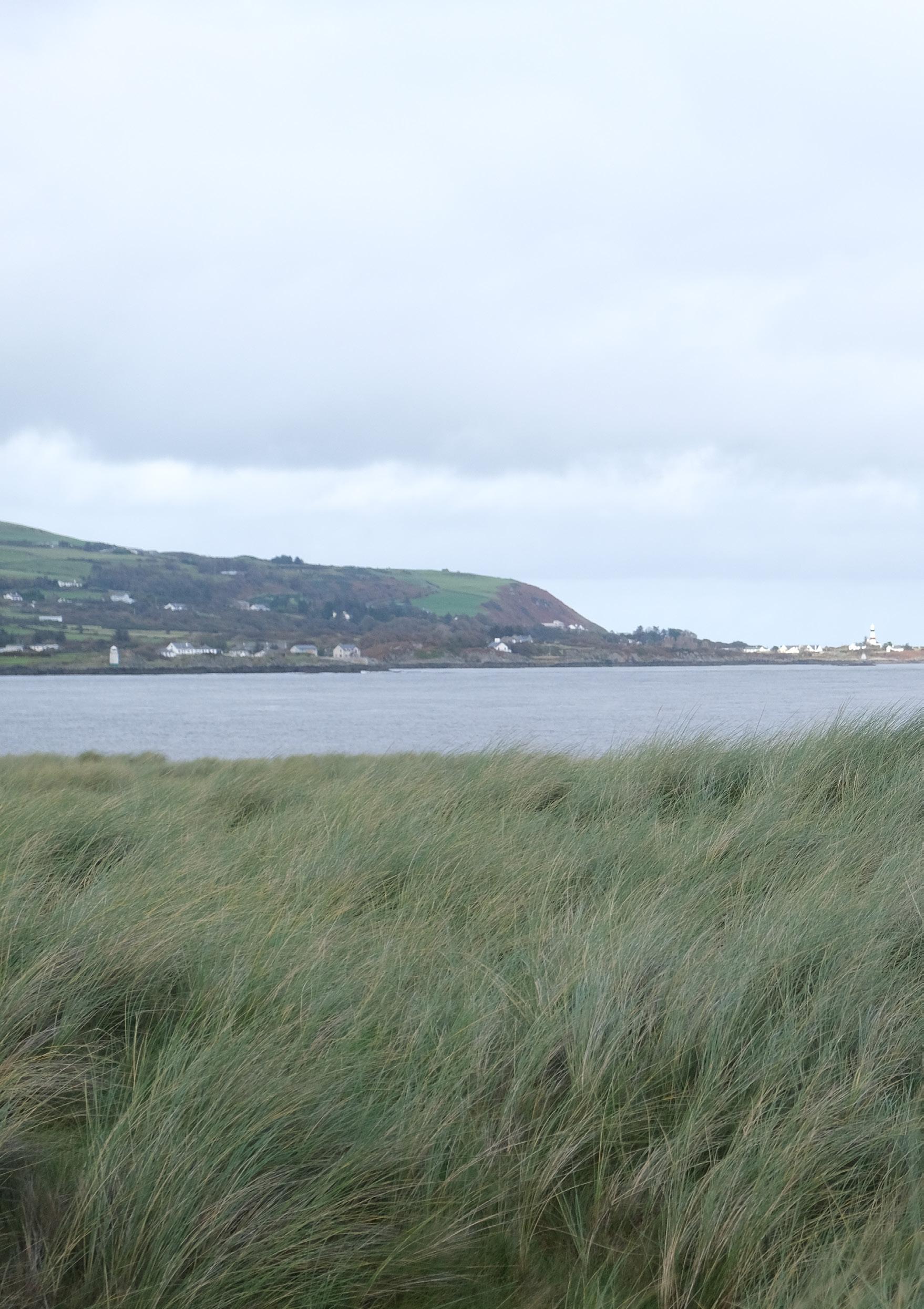
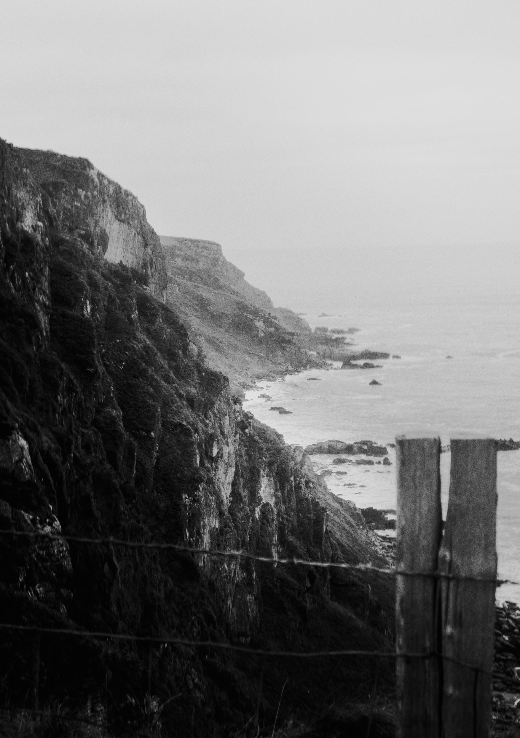
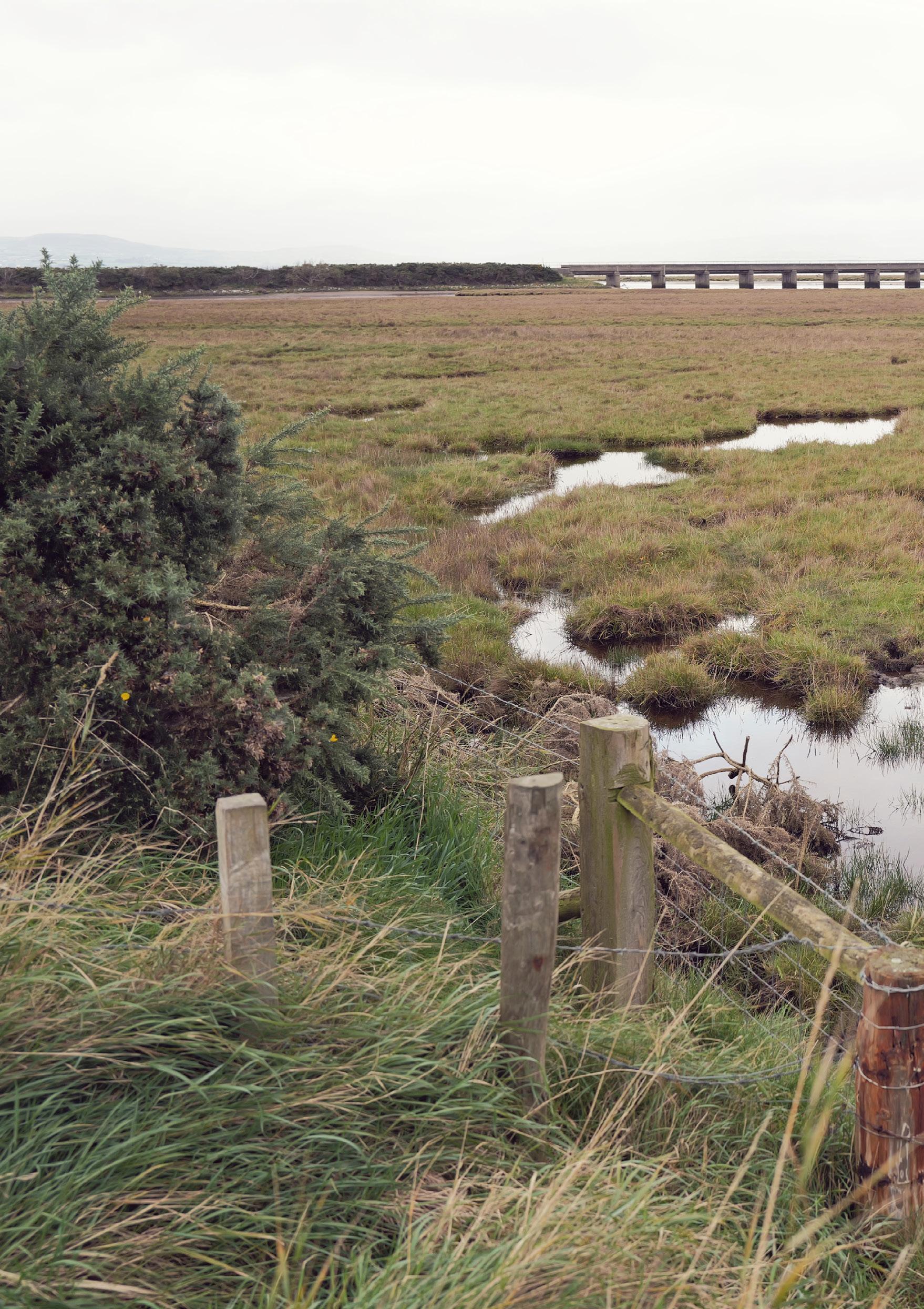
View of Lough Foyle from Binevenagh
This catalogue is part of a collection published by the Edinburgh School of Architecture and Landscape Architecture (ESALA), Edinburgh College of Art, University of Edinburgh. It documents student design work produced in the Master of Architecture (MArch) programme in 2025-26. Each catalogue describes one of the following design studios in the MArch programme. The full collection is available to view online at issuu.com/esala.eca.
Catalogues 2025-26:
Crossing Tangier: Architectures of Enjoyment
Doing Enough with Less: Rigorous Simplifcation Grounding Athens, Vol. 1
Moving Water II. North Sea Edge Radical Harvest: Earth/Care/Reuse, Vol. 3
The Shared Island Unit: Open Architectures in a Bordered World
Published in 2026 by The University of Edinburgh, under the Creative Commons Attribution Non-Commercial Non-Derivative 4.0 International License (CC BY-NC-ND 4.0).
O’Dochartaigh, Killian, and Laura Miana Fernandez. The Shared IslandUnit:OpenArchitecturesinaBorderedWorld. Edinburgh: University of Edinburgh, 2026.
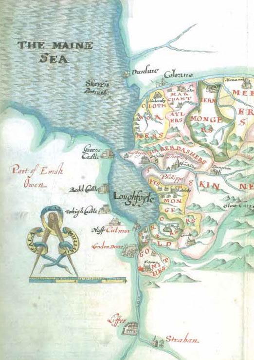
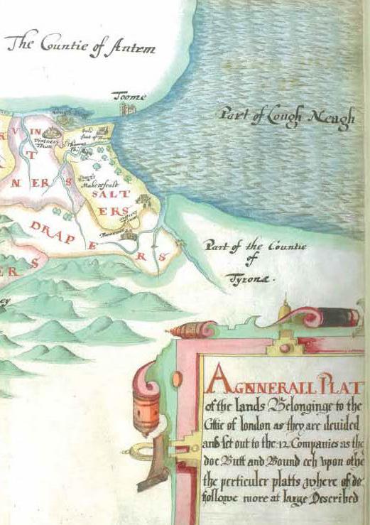
The Plantation of Ulster Ravens Plantation map showing Lough Foyle by City of London (Companies), courtesy of Lambeth Palace Library
Area of Special Scientific Interest (ASSI)
The intertidal area of Magilligan ASSI in Lough Foyle
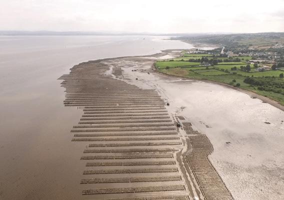
Oyster Fishery Native oyster fshery at Quigley’s Point in Lough Foyle
THE SHARED ISLAND UNIT: OPEN ARCHITECTURES IN A BORDERED WORLD
e Shared Island studio investigated Lough Foyle, a tidal estuary shaped by colonial histories, contested sovereignties, ecological complexity, and unresolved borders.
Located between Northern Ireland and the Republic of Ireland, the lough occupies a unique geopolitical condition in which territorial boundaries remain ambiguous and continuously negotiated. Students were asked to engage with the region not simply as a border landscape but as a place where environmental systems, political structures, and everyday life were deeply entangled.
e studio draws its title from ideas of a “Shared Future” in Northern Ireland and from Ezra Azcan’s concept of “Open Architectures,” which views architecture as a participatory and adaptable practice capable of challenging exclusionary territorial and social boundaries.1 Students explored how architecture might respond to the uncertainties of the border while supporting forms of collective life and ecological stewardship.
Historical and environmental research formed an essential foundation. Students examined the colonial transformation of the region through the Plantation of Ulster, the establishment of sheries and resource extraction economies, the partition of Ireland in 1921, and the militarisation of the landscape during the Second World War and the Troubles.
1 Northern Ireland Assembly Research and Library Service, Lough Foyle – Ownership, Licensing, and Levy Issues Relating to Shellfsh, Paper 32/11 (Belfast: Northern Ireland Assembly, 2010); Esra Akcan, “Writing Open Architecture as a Book on Human Rights (and Against Nation-States),” Footprint: Delft Architecture Theory Journal 16, no. 2 (2022): https://doi.org/10.7480/footprint.16.2.6423
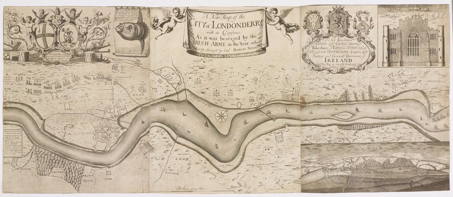
Map of the Siege of Londonderry, 1689
Etching & engraving from three joined copperplates, surveyed by Captain Francis Nevill
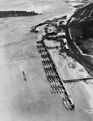
Surrendered U-Boats
Surrendered U-boats at Lisahally, Northern Ireland, June 1945
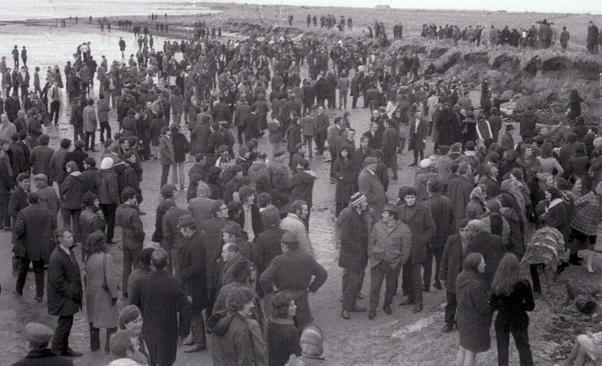
Civil Rights Protestors
Civil Rights protestors on Magilligan Beach, Christmas day 1971
ey also investigated the Lough’s signi cance as an internationally recognised ecological system, supporting important habitats, sheries, wetlands, and migratory bird populations.
e studio considered contemporary challenges including environmental degradation, contested shing rights, industrial pollution, energy infrastructures, and cross-border governance. Lough Foyle was approached as a place where questions of sovereignty, citizenship, ecology, and resource management intersected. Rather than seeking de nitive solutions, students were encouraged to examine how architecture could work within conditions of uncertainty and transformation.
Structured across two semesters in the rst students developed conceptual and methodological frameworks throug1h eldwork, mapping, drawing, lm, and design speculation. e second expanded these investigations into detailed architectural propositions. roughout the year, students engaged with local organisations, environmental groups, community stakeholders, guest critics, and specialist workshops in lmmaking, mapping, fabrication, and representation. Architecture was treated not as an isolated object but as a situated practice operating across social, political, and ecological systems.
Our studio was guided by three interconnected methodological approaches: wet ontologies, transects, and public engagement. 2 Water was understood not merely as a physical resource but as a medium through which questions of territory, power, ecology, and time could be reconsidered. e estuarine environment of Lough Foyle provided a framework for understanding architecture within constantly shifting material and political conditions.
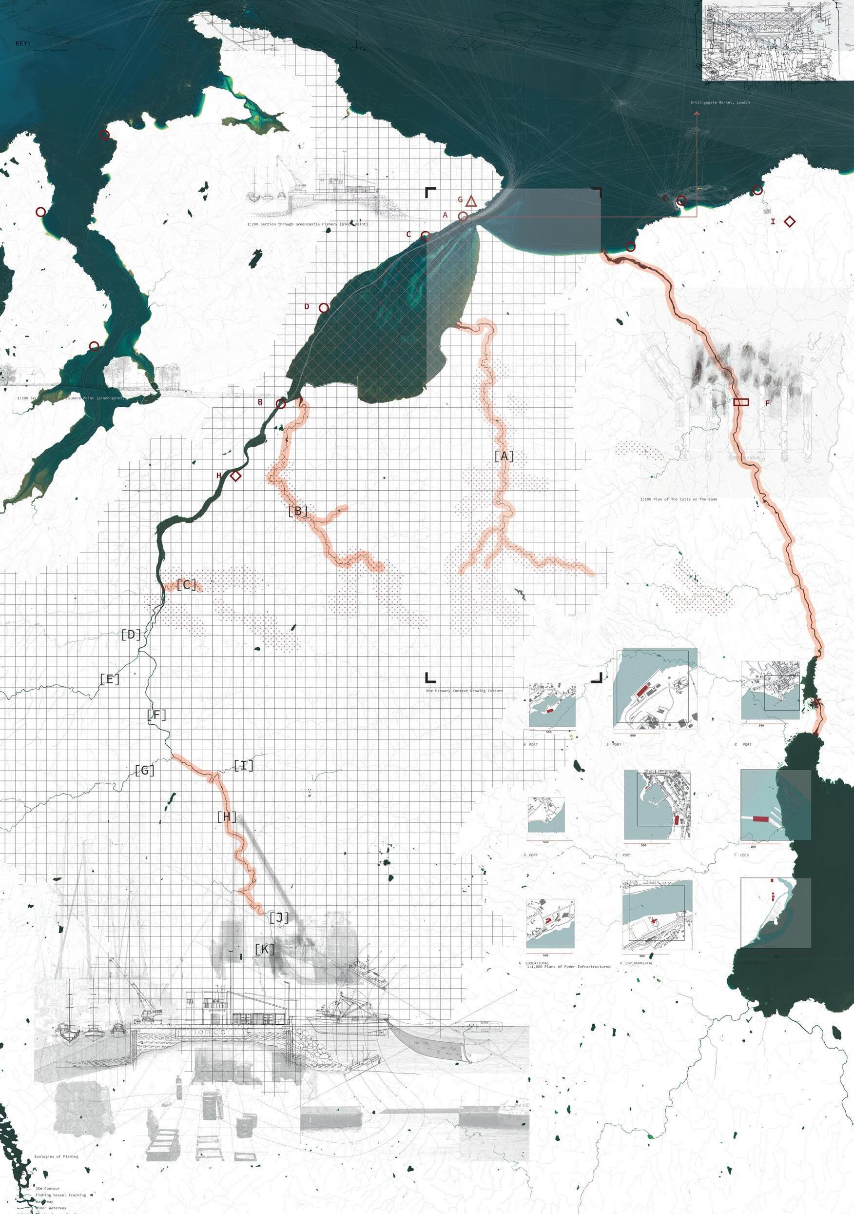
e principal research method was the transect. rough walking, surveying, mapping, lming, and drawing, students traced relationships between land, water, infrastructure, ecology, and governance. Transects were used both as analytical tools and representational devices, revealing connections across multiple scales and exposing hidden environmental, economic, and cultural forces operating within the landscape.
During Semester 1, students worked collaboratively to produce extensive
2 Steinberg, Philip, and Kimberley Peters. “Wet Ontologies, Fluid Spaces: Giving Depth to Volume through Oceanic Thinking.” Environment and Planning D: Society and Space 33, no. 2 (April 1, 2015): 247–64. https://doi.org/10.1068/d14148p
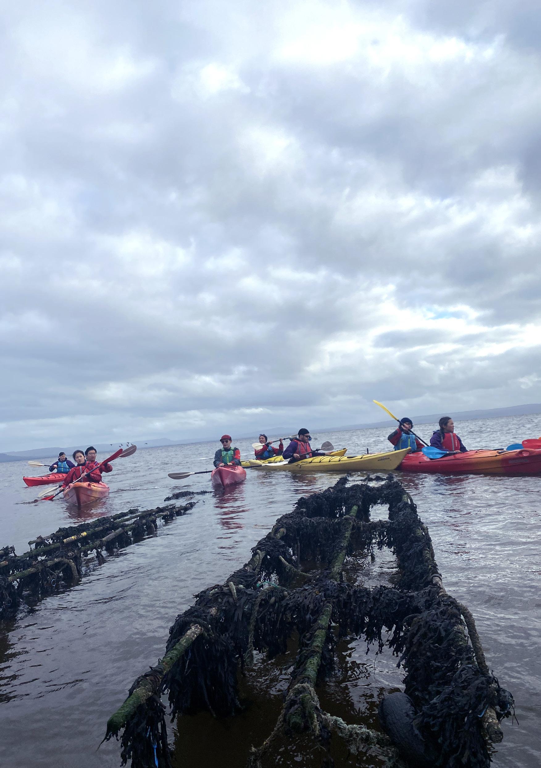
Wet Ontologies
Kayaking on Lough Foyle during the study trip
transectional cartographies of their selected sites around Lough Foyle. ese investigations combined archival research, digital mapping, photography, drawing, modelling, and eldwork. A study visit to Derry enabled direct engagement with local communities, environmental agencies, sheries organisations, and contested sites throughout the watershed. Students revised their initial research through observation, measurement, conversation, and documentation, producing cartographic assemblages that communicated both visible and invisible conditions shaping the region.
e second stage of Semester 1 translated these cartographies into architectural propositions. Students developed spatial strategies and smallscale architectural interventions that responded to territorial conditions, ecological processes, material systems, and social realities. Projects explored architecture as an open and adaptable framework capable of supporting multiple uses and futures. Design development focused on site, form, tectonics, materiality, and programme while maintaining strong connections to the wider socio-ecological territory.
Semester 2 extended these investigations into thesis projects through three overlapping themes: Territories, Assemblies, and Publics. Students re ned programme, spatial organisation, environmental performance, and material systems while developing increasingly resolved architectural proposals. Ecological processes, hydrological systems, and environmental conditions were treated as active drivers of design rather than external constraints.
Public engagement formed a signi cant component of the semester. Students developed relationships with communities, organisations, and stakeholders connected to Derry and Lough Foyle through conversations and presentations. Representation, exhibition design, and communication were also treated as architectural practices, shaping how projects entered wider civic and political discussions. e year concluded with a collective exhibition and publication that brought individual projects into dialogue with broader questions concerning borders, ecology, and shared futures.
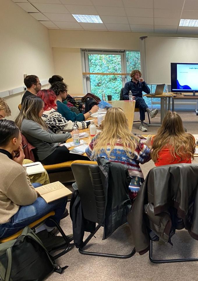
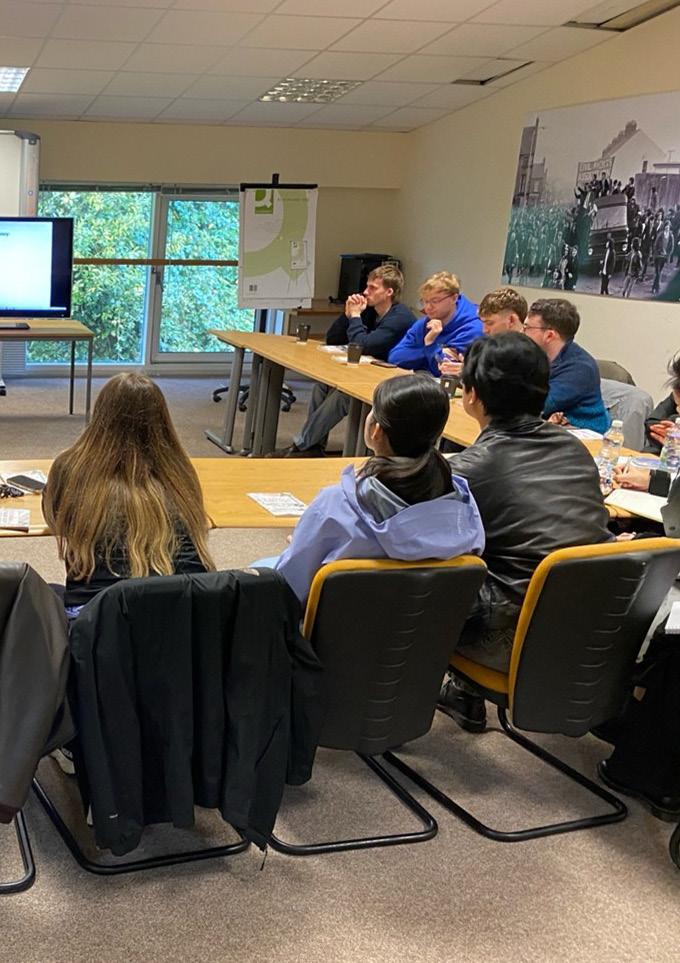
The Lough Foyle Agency Meeting with Marine Scientist, Ben Holly of the Lough Foyle Agency, during the study trip
e nal projects approached Lough Foyle as a dynamic socio-ecological territory rather than a xed geopolitical boundary. Collectively, the work examined how architecture could engage with landscapes characterised by uncertainty, contested ownership, environmental vulnerability, and overlapping systems of governance.
Several projects investigated questions of land reclamation, hydrology, and ecological restoration. ese proposals challenged inherited colonial relationships to territory by reimagining productive landscapes through wetland ecologies, paludiculture, and adaptive forms of inhabitation. Architecture was used to negotiate changing relationships between land and water while recovering material practices associated with local cultural traditions.
Other projects focused on industrial infrastructures and global resource networks operating within the lough. Ports, logistics systems, energy production, and extractive industries were examined as landscapes of both economic dependence and environmental transformation. Architectural interventions explored how existing infrastructures might be adapted to support new forms of occupation, public access, and ecological transition while responding to the needs of workers and surrounding communities.
A further group of projects addressed circulation, repair, and exchange across political and environmental boundaries. rough investigations of waste streams, drifting materials, transport networks, and informal economies, students proposed architectures that mediated between natural processes, regulatory systems, and social practices. ese projects questioned how materials, resources, and identities moved across borders and how architecture might support more equitable forms of redistribution and stewardship.
Across the studio, students treated architecture as a framework for negotiation rather than resolution. eir proposals explored relationships between human and non-human actors, foregrounded ecological interdependence, and challenged xed understandings of territory, citizenship, and belonging.
Collectively, the projects propose open architectures capable of operating within the complex environmental, political, and cultural realities of the border landscape while imagining more shared and adaptive futures for Lough Foyle and the wider region.
Killian O’Dochartaigh and Laura Miani Fernandez
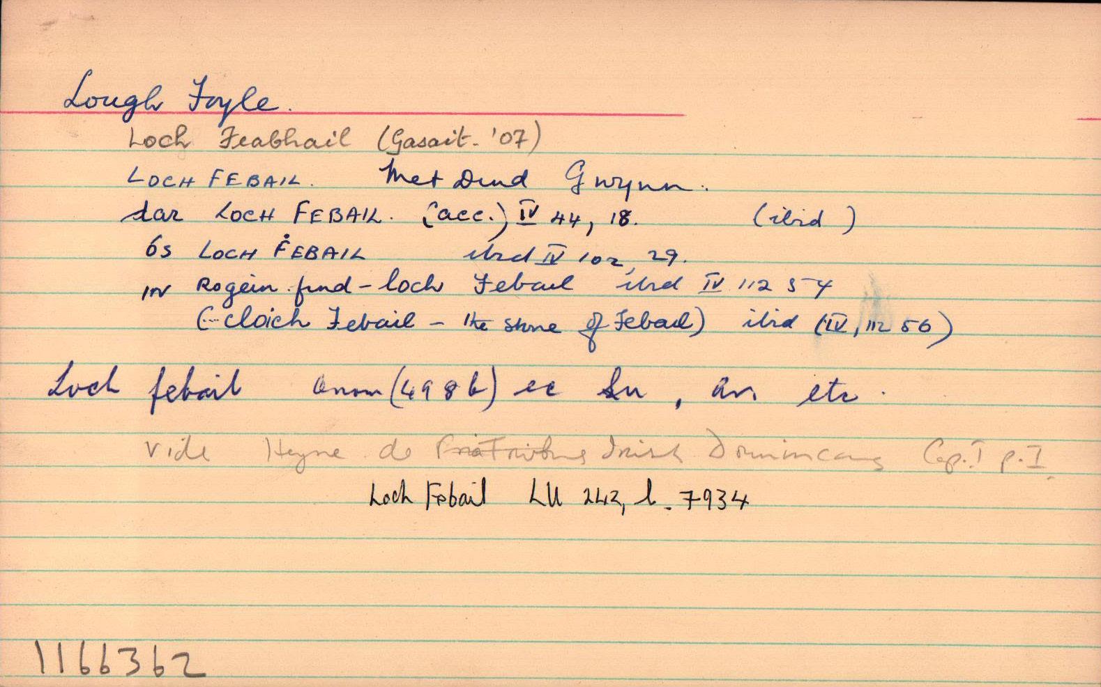
Loch Feabhail (Lough Foyle)
Irish placename record for Loch Feabhail (Lough Foyle), sourced from the Placenames Database of Ireland (Logainm.ie)
KILLIAN
LAURA MIANI
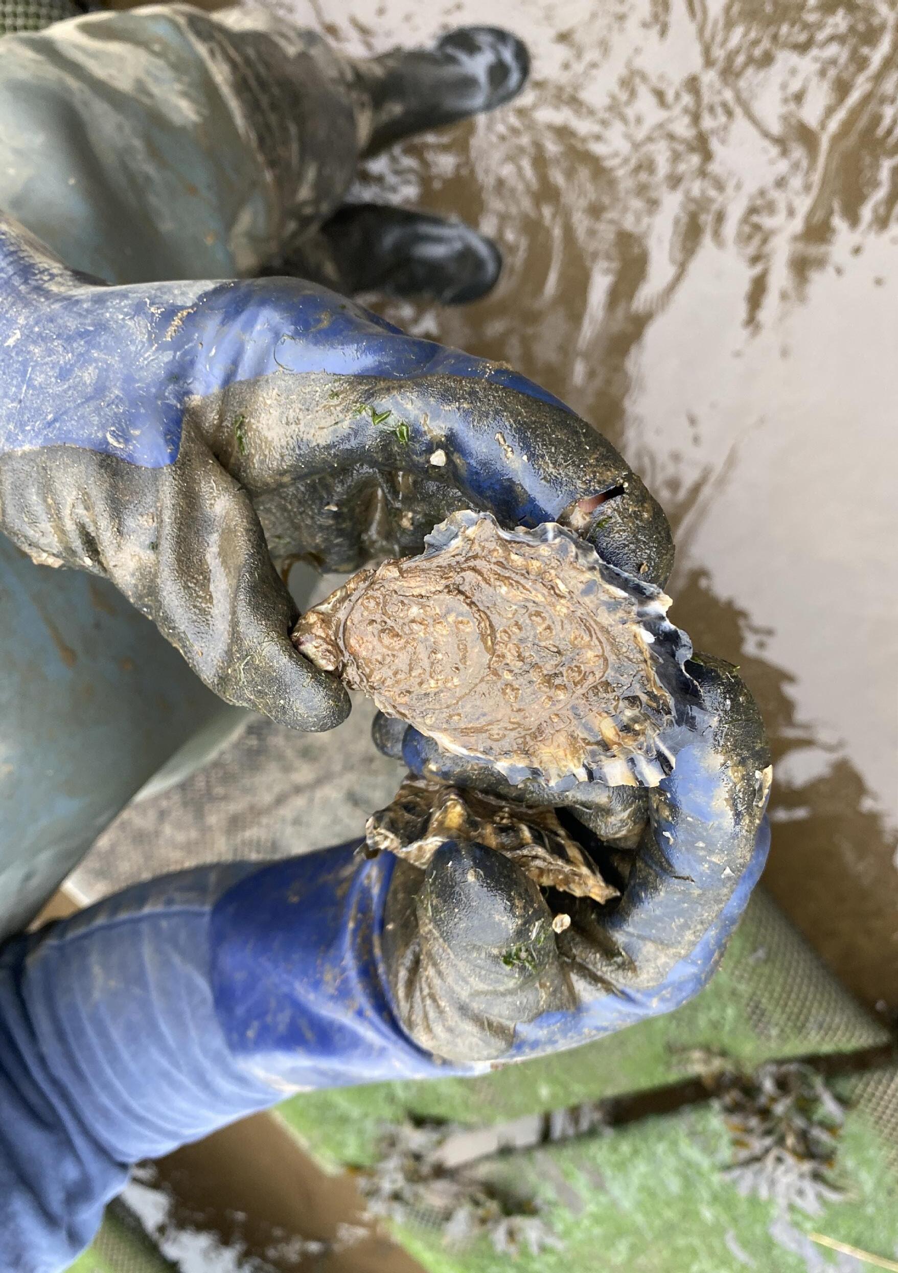
Native Oyster Farming
Interactive conversation with Lucas McStout of Bia Oysters during the study trip.
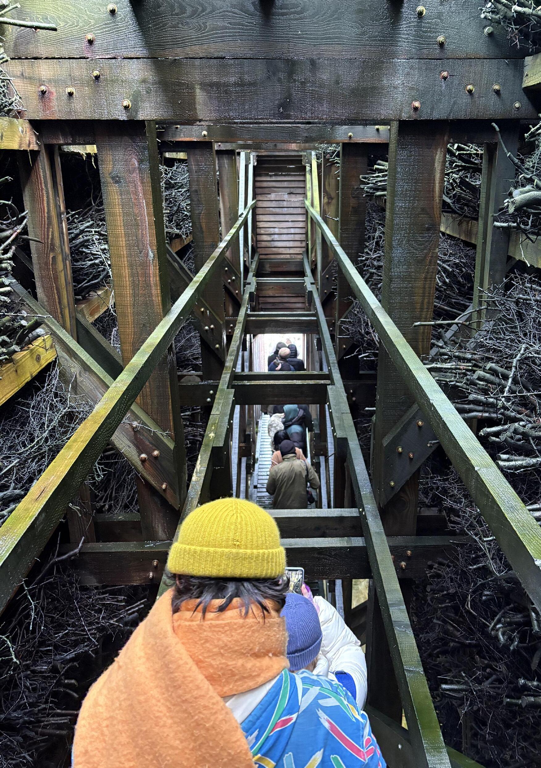
Inside the graduation tower
The bowels of a Blackthorn Salt graduation tower, Ayr
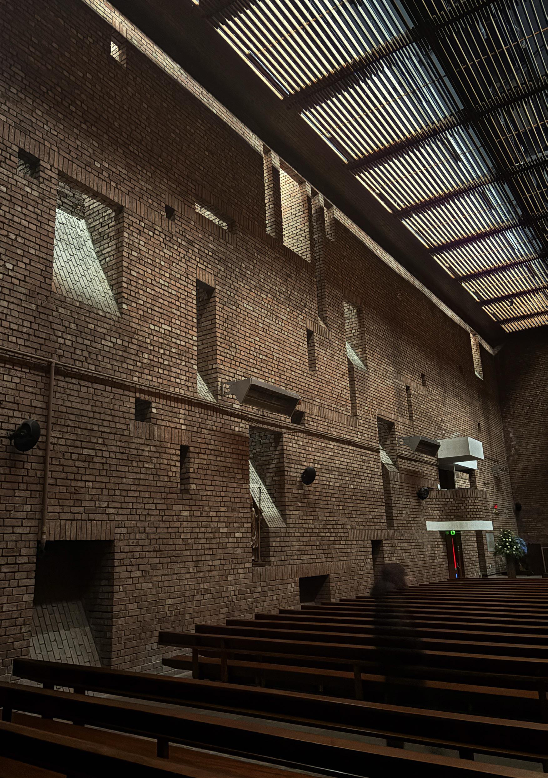
Visited in January 2026
St Brides Church, East Kilbride, Gillespie, Kidd and Coia, 1964
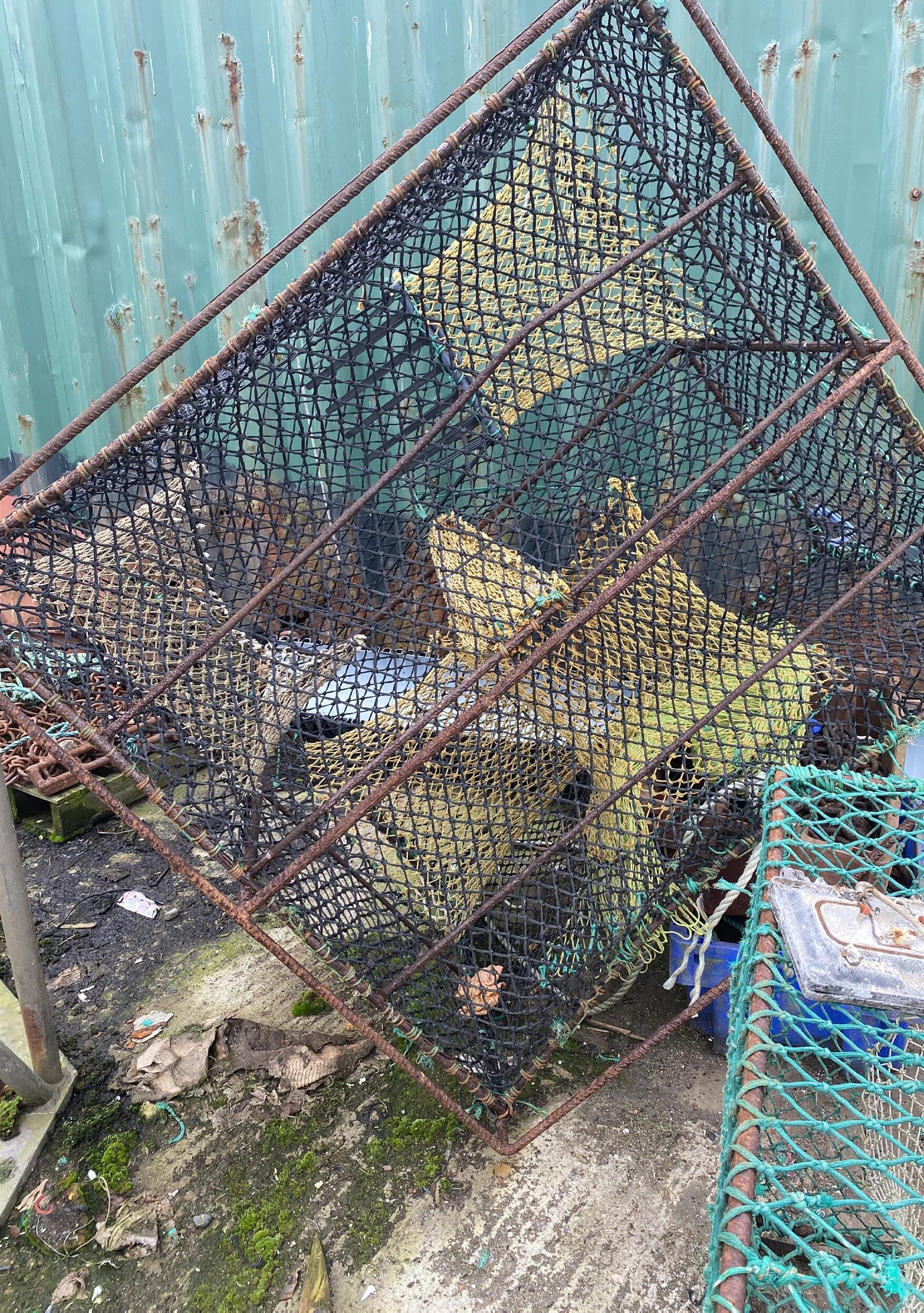
Fishing Equipment
Greencastle Fisheries
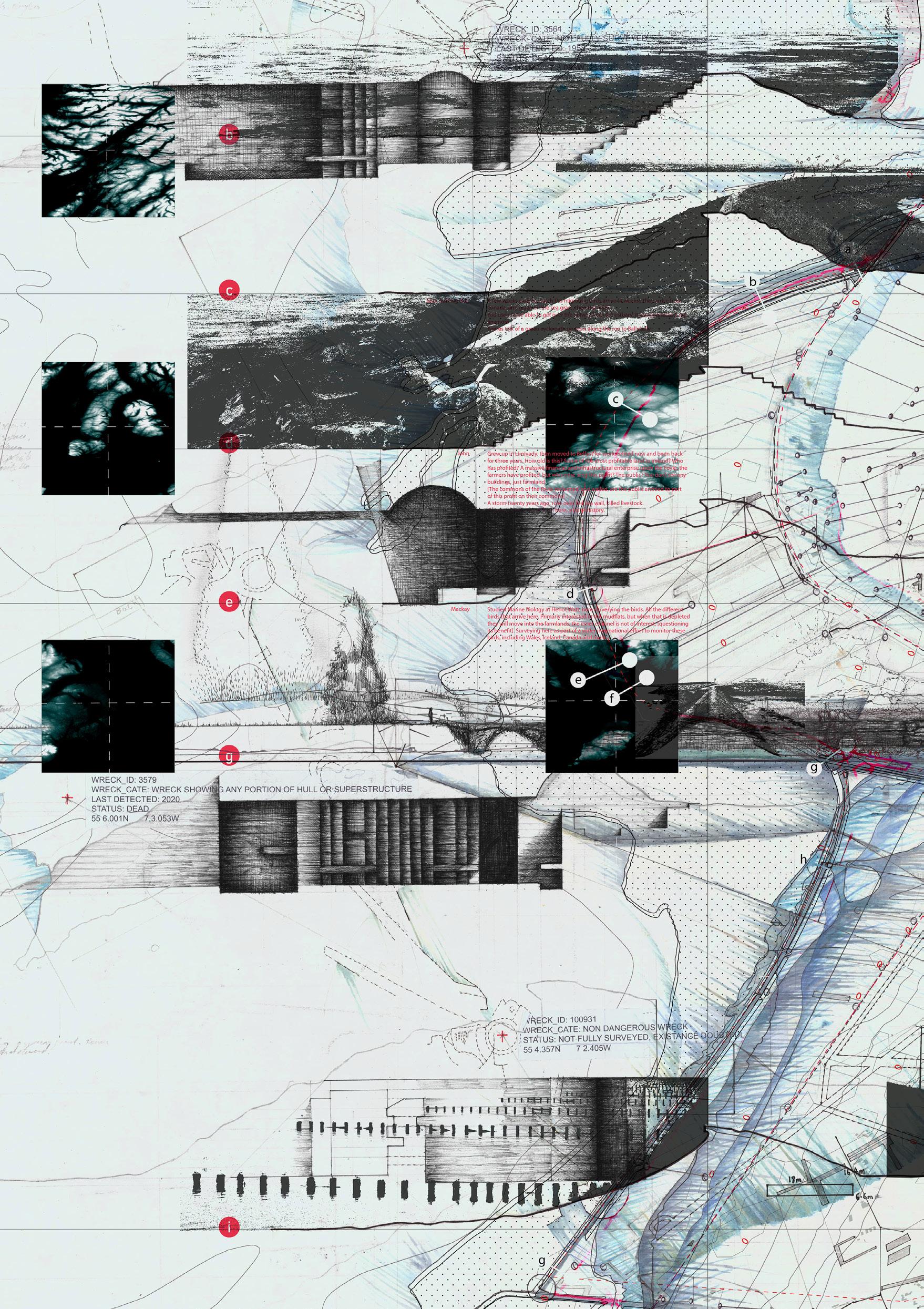
Charting obscurities
Alexander Ritchie
Ecologies of sand dunes
Yixuan Zhang
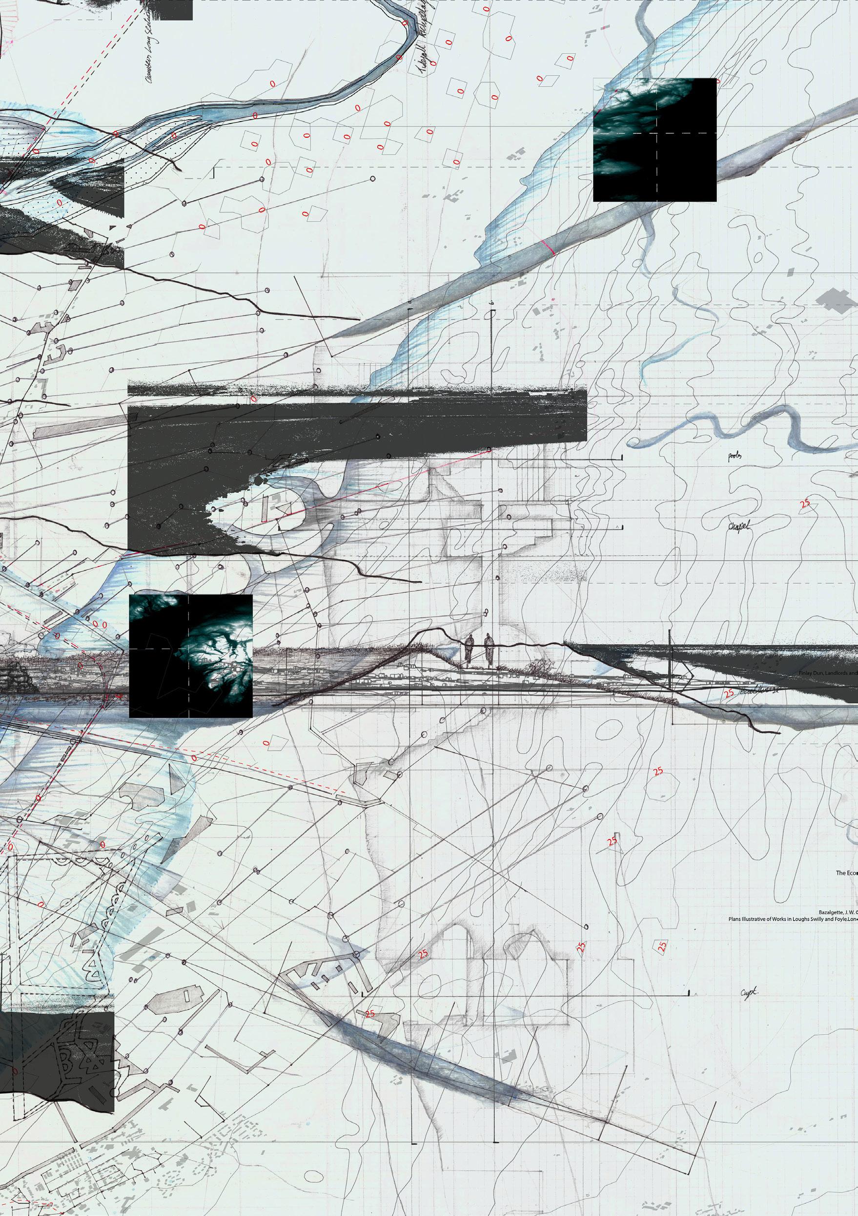
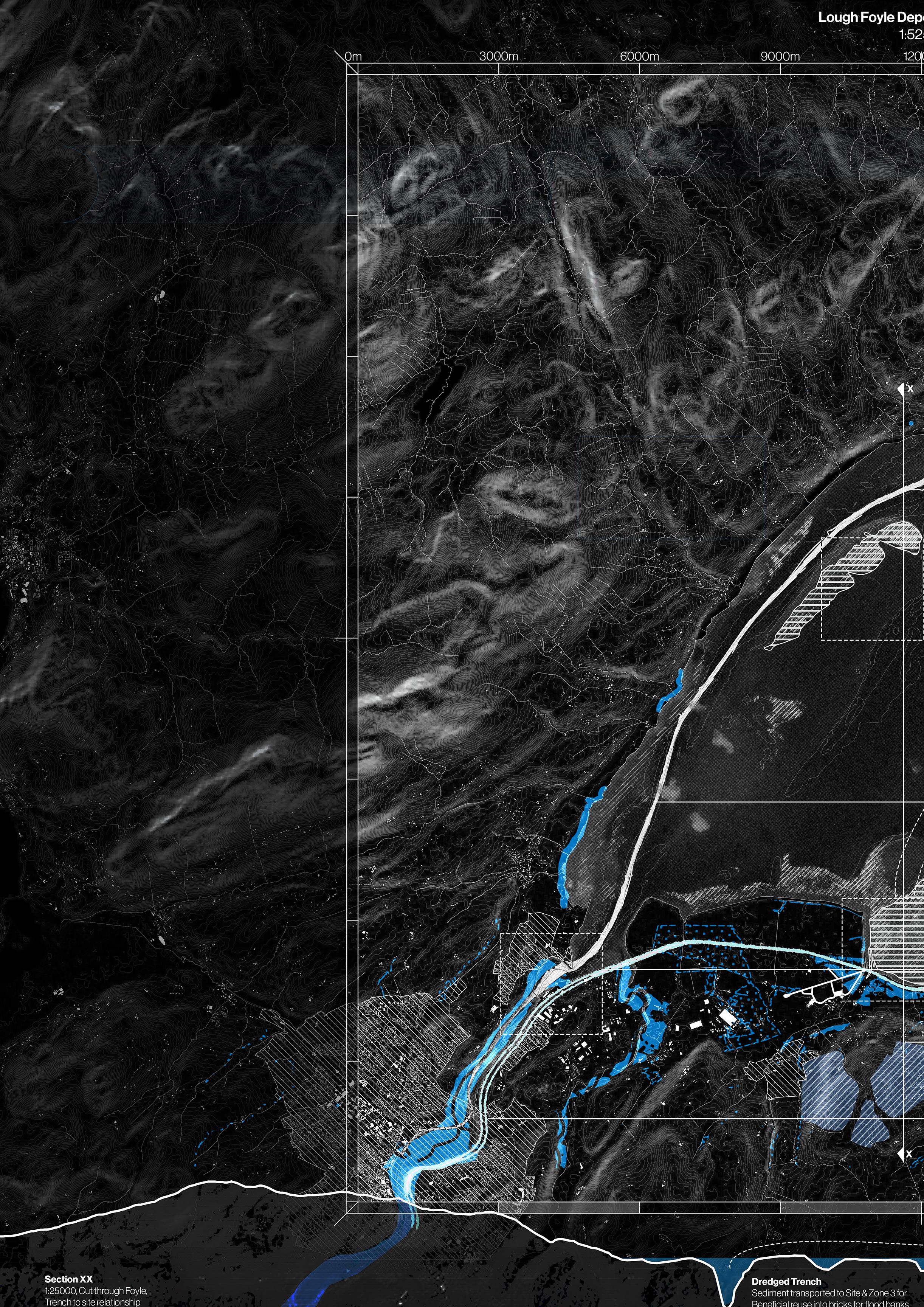
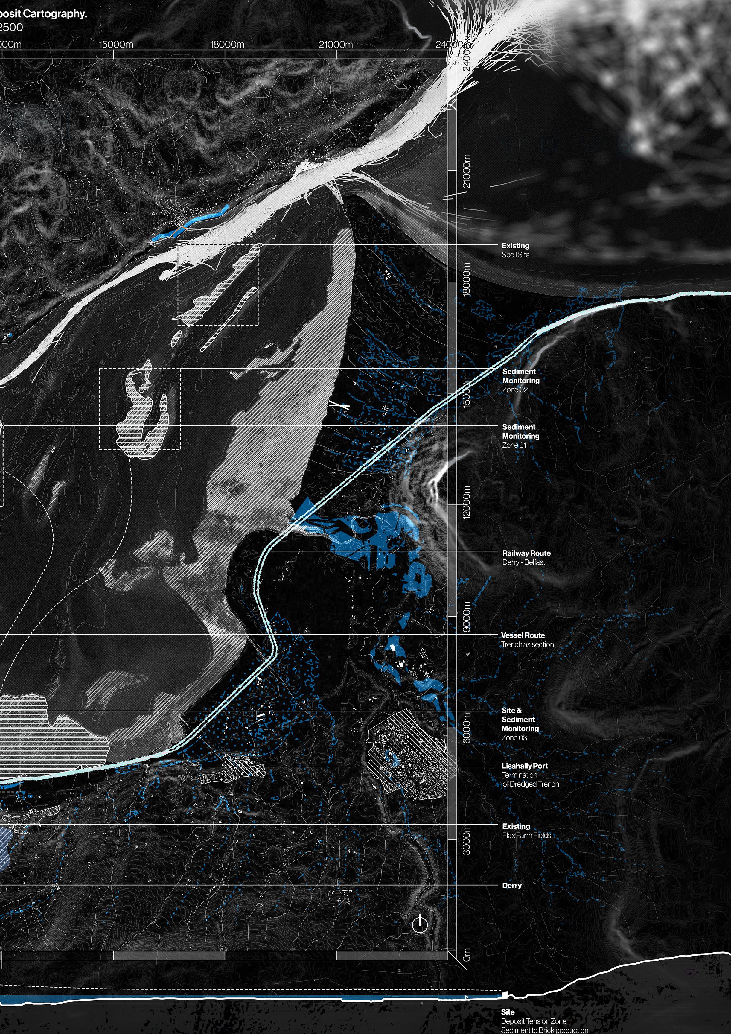
Foyle Deposit Cartography
Lough
Joshua Howard
choreographies
The
of Lisahally Port
Shuyan Zhang
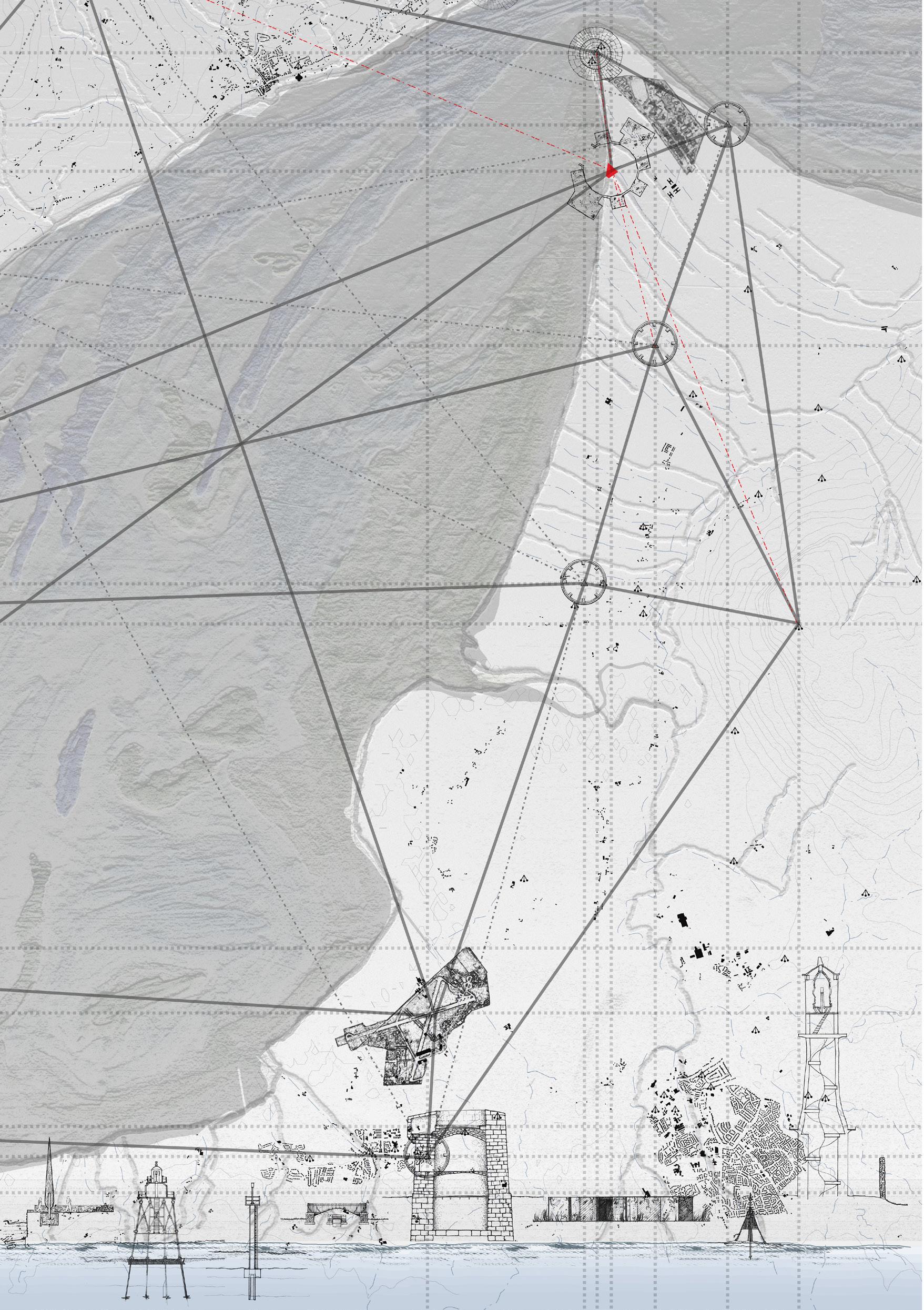
Wayfinding on Lough Foyle
Celia-Doina Oprea & Molly Sinclair
Ecologies of Atlantic Salmon decline in the Lough Foyle watershed Enrico Luo & Lucas Theis
Rocklarking for a submerged mind
Luke Pearce
YIXUAN ZHANG
ANGUS HARROW
CELIA - DOINA OPREA
FERGAL VOORSANGER - BRILL
FIORI KOUSTAS
ALEXANDER RITCHIE
DIANA HUYNH
ENRICO LUO
LUCAS THEIS
JOSHUA HOWARD
HANNAH LEE
ELLIOTT HART
SHUYAN ZHANG
RUOXIN TAN
HAIXIN WANG
LEON FENG
YUXIAO XUE
MOLLY SINCLAIR
WILLIAM MAXWELL
YINGWHEN ZHU
PEARCE
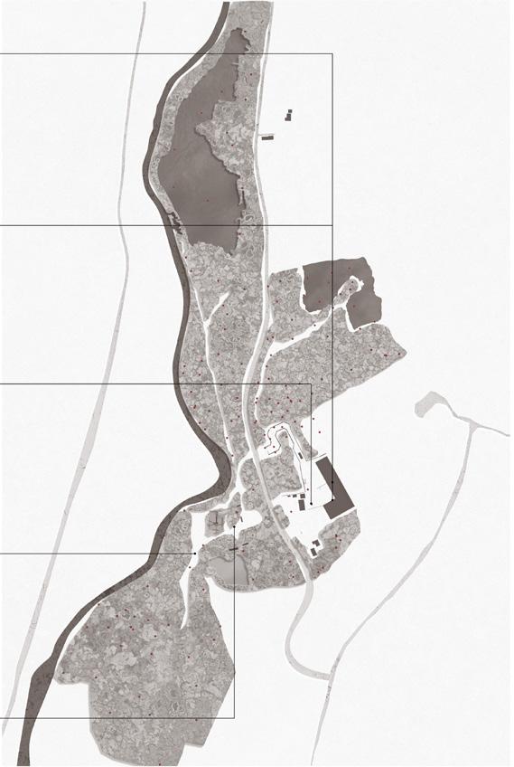
Project Locations around Lough Foyle
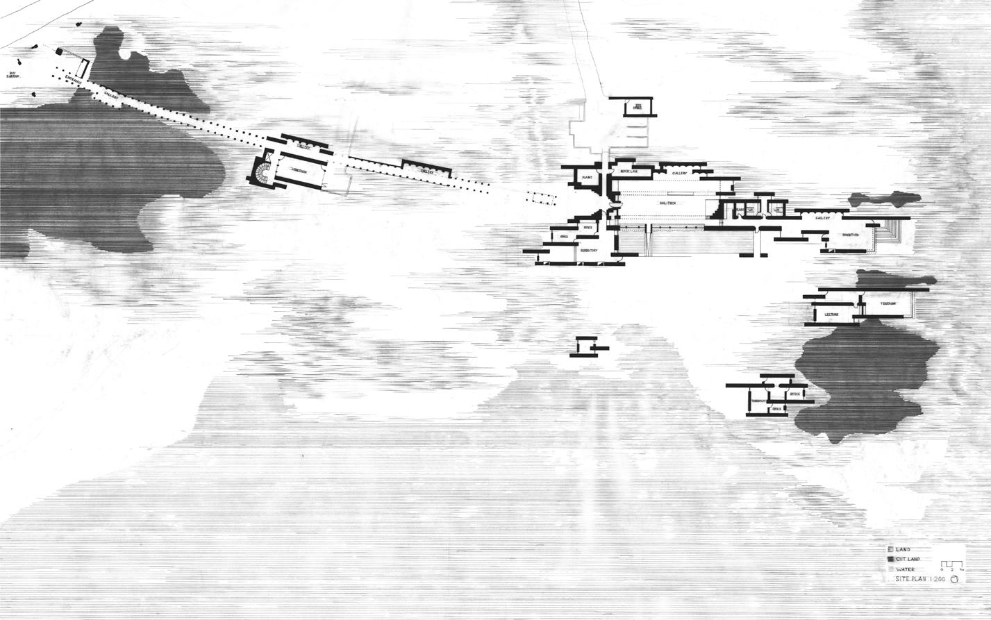
Project Plans
The Mouth of Lough Foyle from Magilligan Point
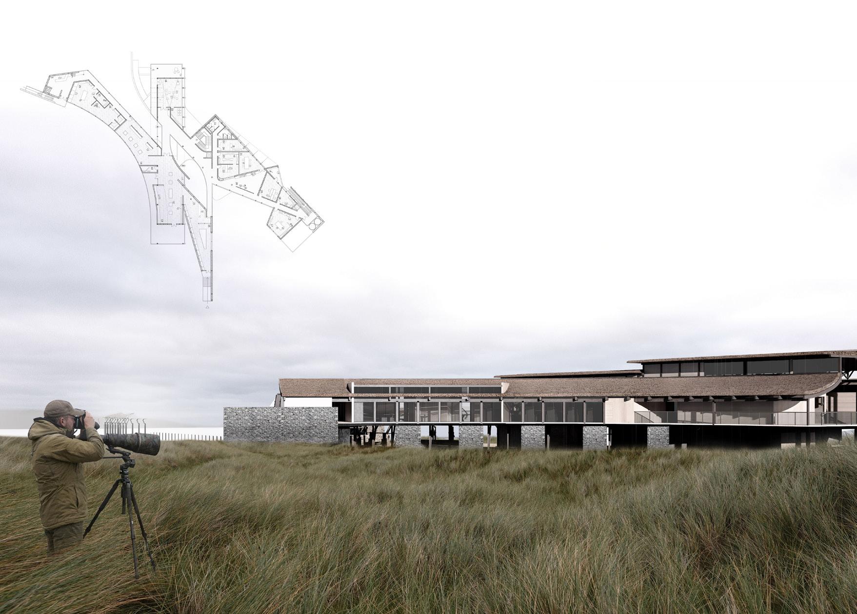
Site: Magilligan Point, County Derry Programme: Sea-Based Viewing Platform; Sand Ridge Outpost Station; Ecological Research & Conservation Centre integrating Exhibition, Education & Research
01
BUILT TO DISAPPEAR
A COASTAL ARCHITECTURAL SYSTEM SHAPED BY TIME & EROSION
YIXUAN ZHANG
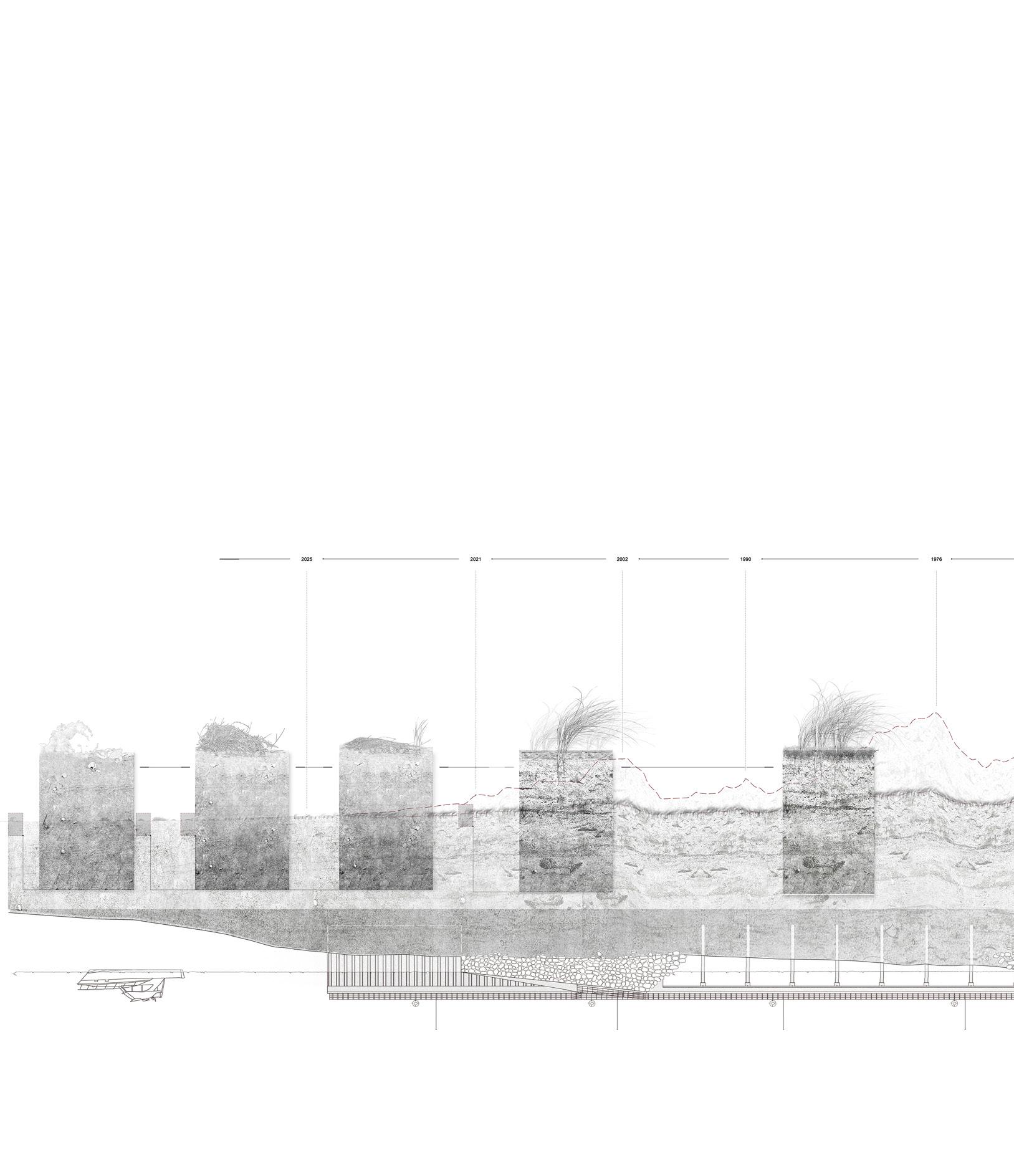
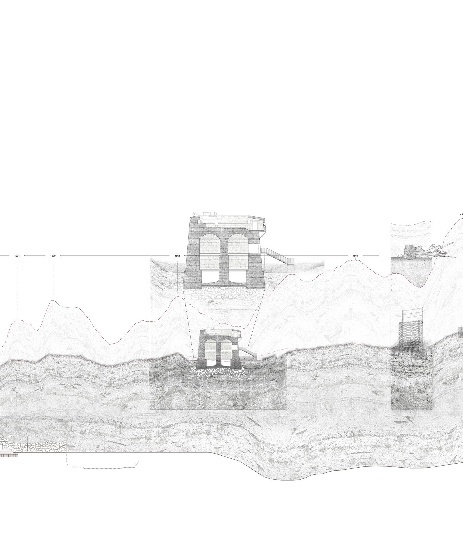
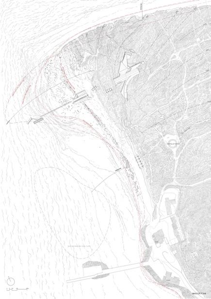
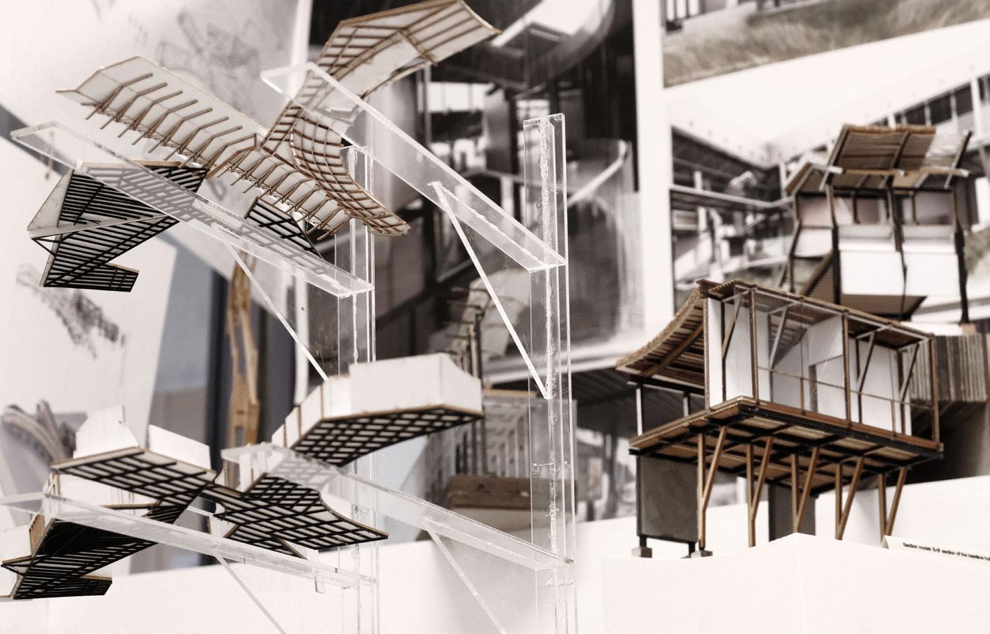
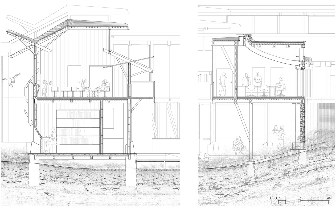
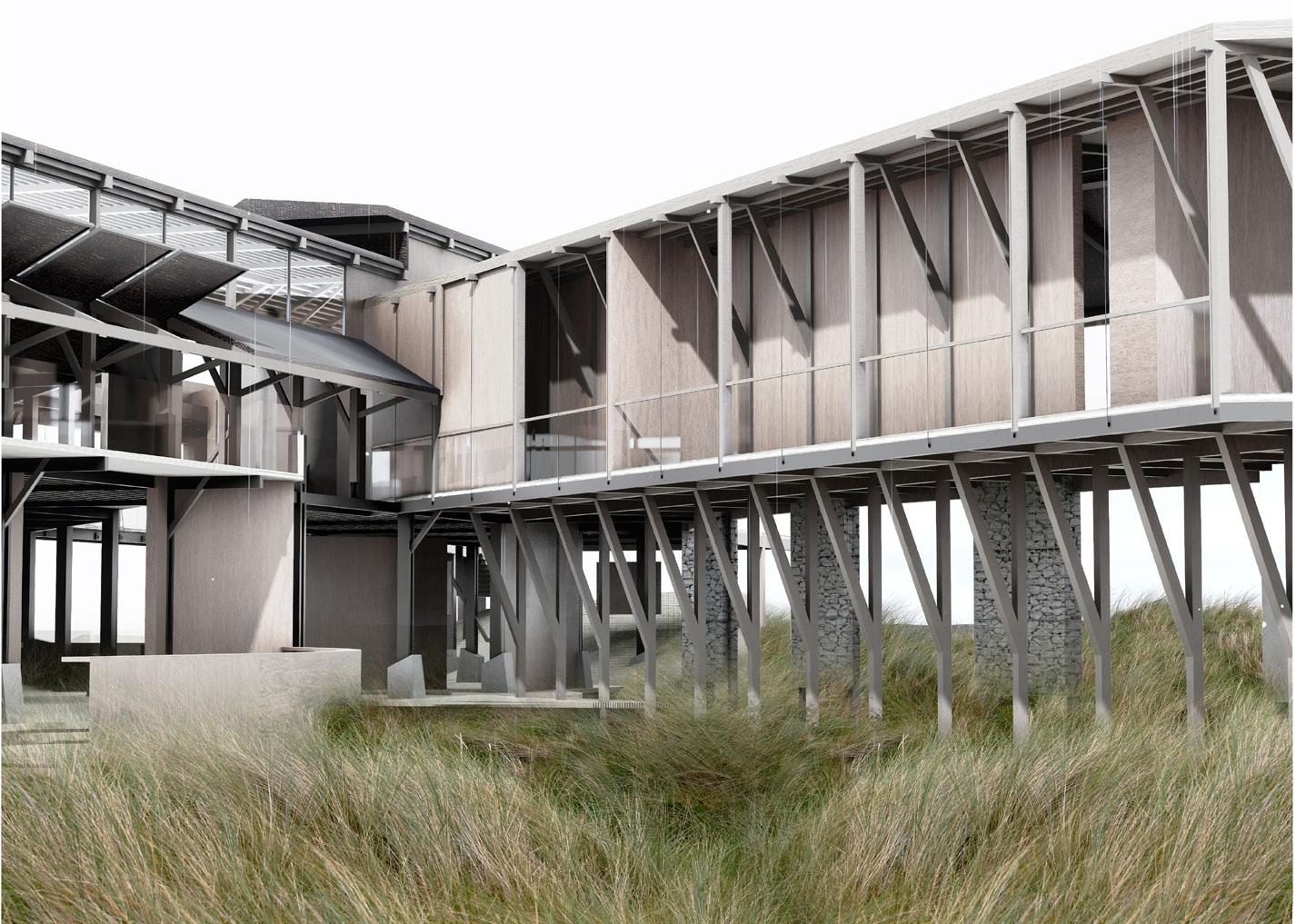
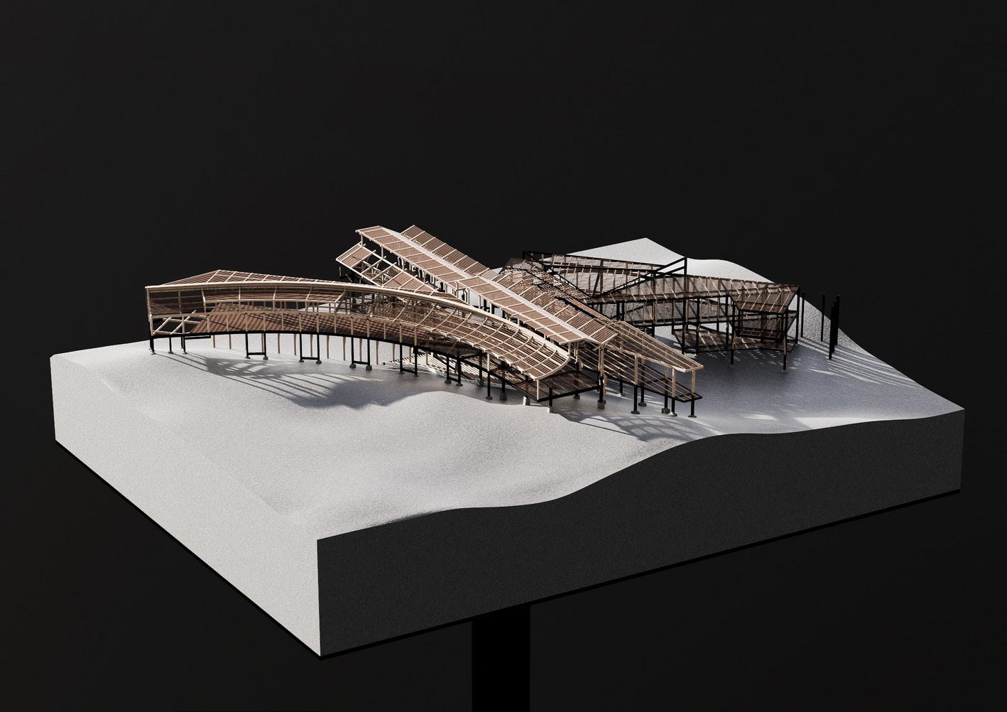
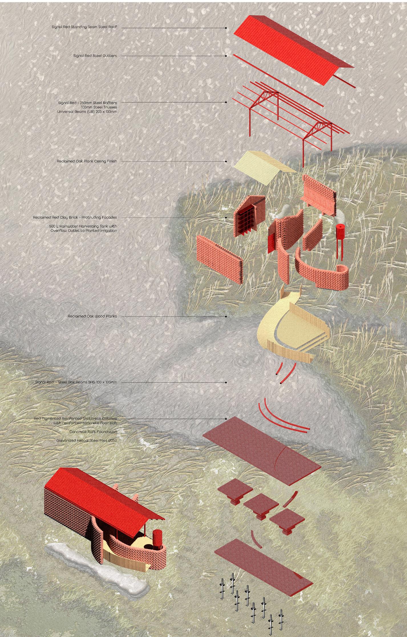
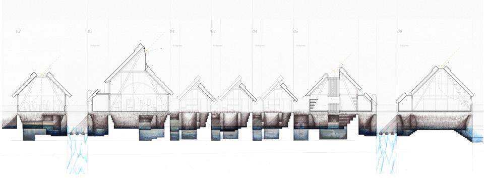
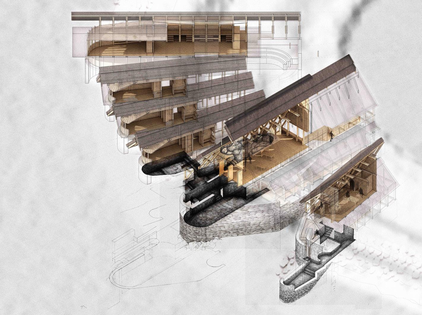
Magilligan Point, a coastal depositional landscape shaped by the Lough Foyle and Atlantic currents, is continuously rewritten by tides, storm surges, sedimentation, and erosion. ese processes generate a “liquid margin,” where sand ridges emerge as provisional records, marking a coastline in constant ux. Along this boundary, human and natural forces interact: sediments and shells accumulate to form ridges, while currents erode both anks; defensive infrastructures attempt to stabilise the shore but are gradually undone at a micro scale. Taking Jill Stoner’s de nition of the relationship between architecture and nature as a point of departure,3 this project responds to Magilligan Point’s dynamism by proposing a coastal architectural system driven by time and natural processes, adopting withdrawal as a fundamental stance and rejecting control. e system comprises three interconnected nodes: a sea-based birdwatching platform that responds to tides and wave surges; a frontline observation station aligned with forming ridges for research and interpretation; and a mature-ridge baseline hub supporting exhibition, education, and long-term monitoring. Frontline nodes prioritise replaceable interfaces and occupancy by non-human species, while the rear hub maintains long-term research, public engagement, and ecological observation. Minimal, graded interventions ensure safety and accessibility while facilitating sediment capture, vegetation growth, and wildlife habitation. In this framework, architecture becomes a temporal medium— lifted by tides, advanced by sand ridges, and ultimately inhabited by nature.
3 Jill Stoner, Toward a Minor Architecture. (The MIT Press, 2012), 96.
Tidal impacts on sand dune evolution (previous left)
Exploded 1:200 model (previous top)
Nestling within the grasses (previous bottom)
1:50 sections (above)
Grounding the hub (below)
Structural tectonics (above)
Mediating land & sea (below)
Site: Magilligan Point, County Derry Programme: Music Venue; Amphitheatre; Community Rehearsal Space; Coastal Infrastructure
THE INSTRUMENT OF THE UNSEEN
A PLATFORM STRETCHING FROM TOWER TO FOYLE
ANGUS HARROW
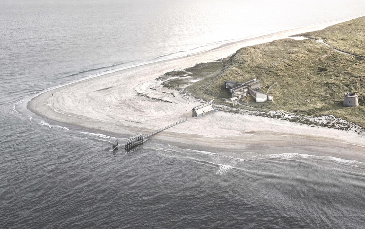
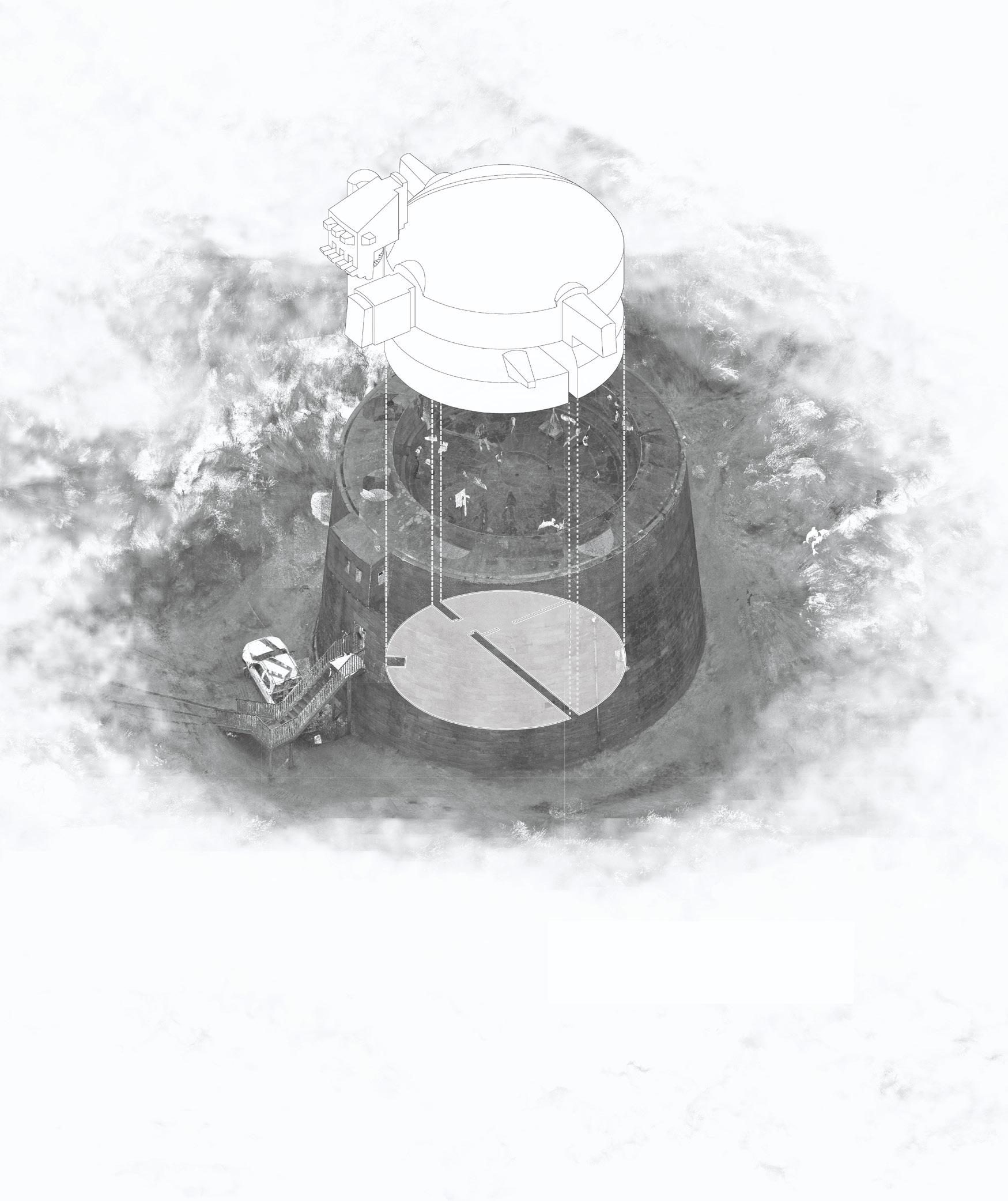
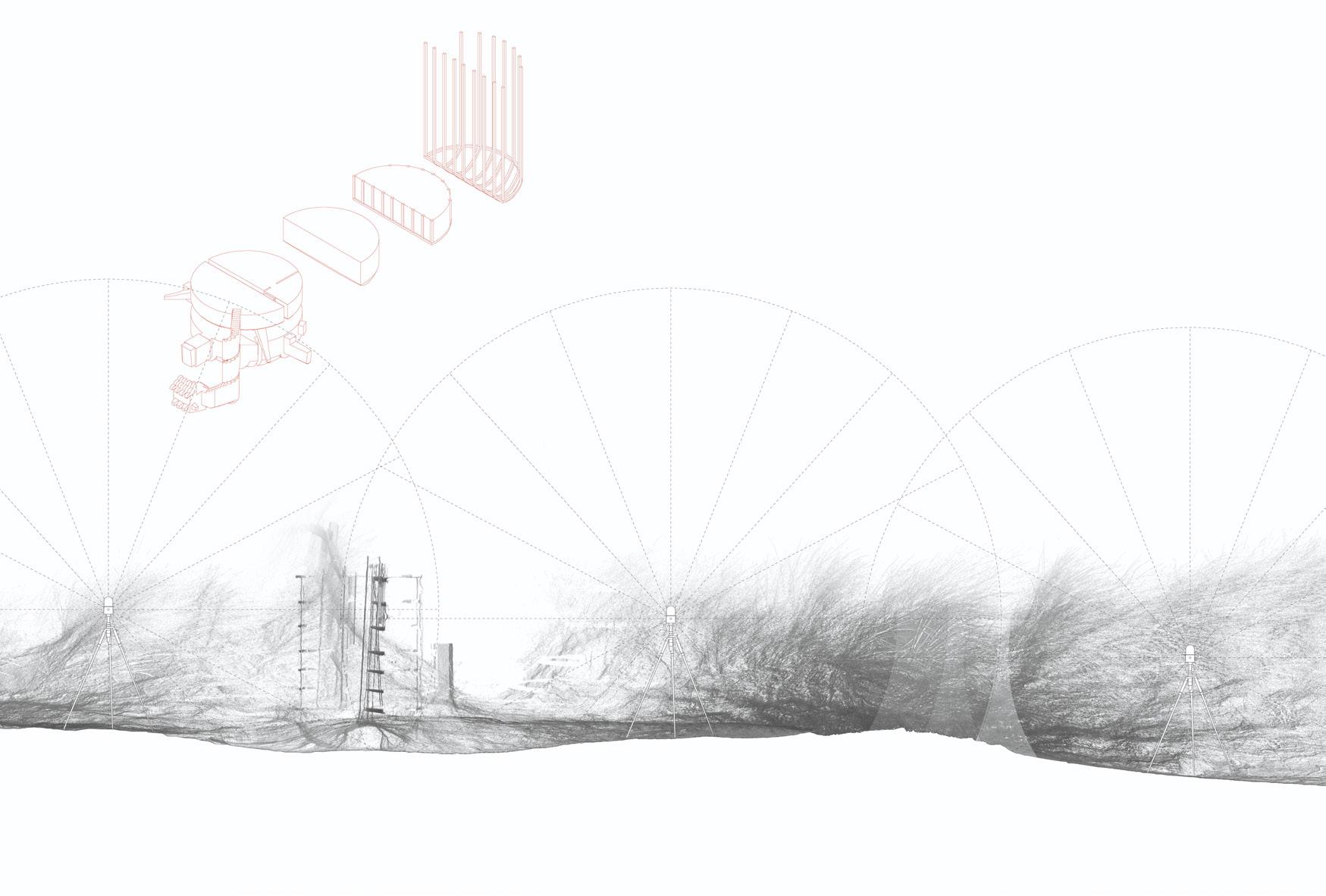
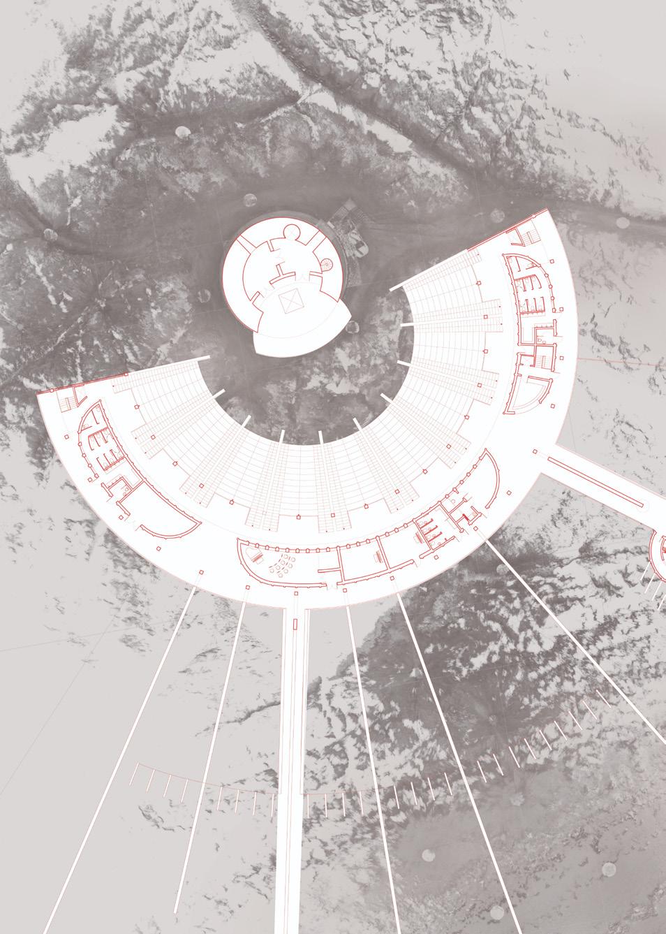
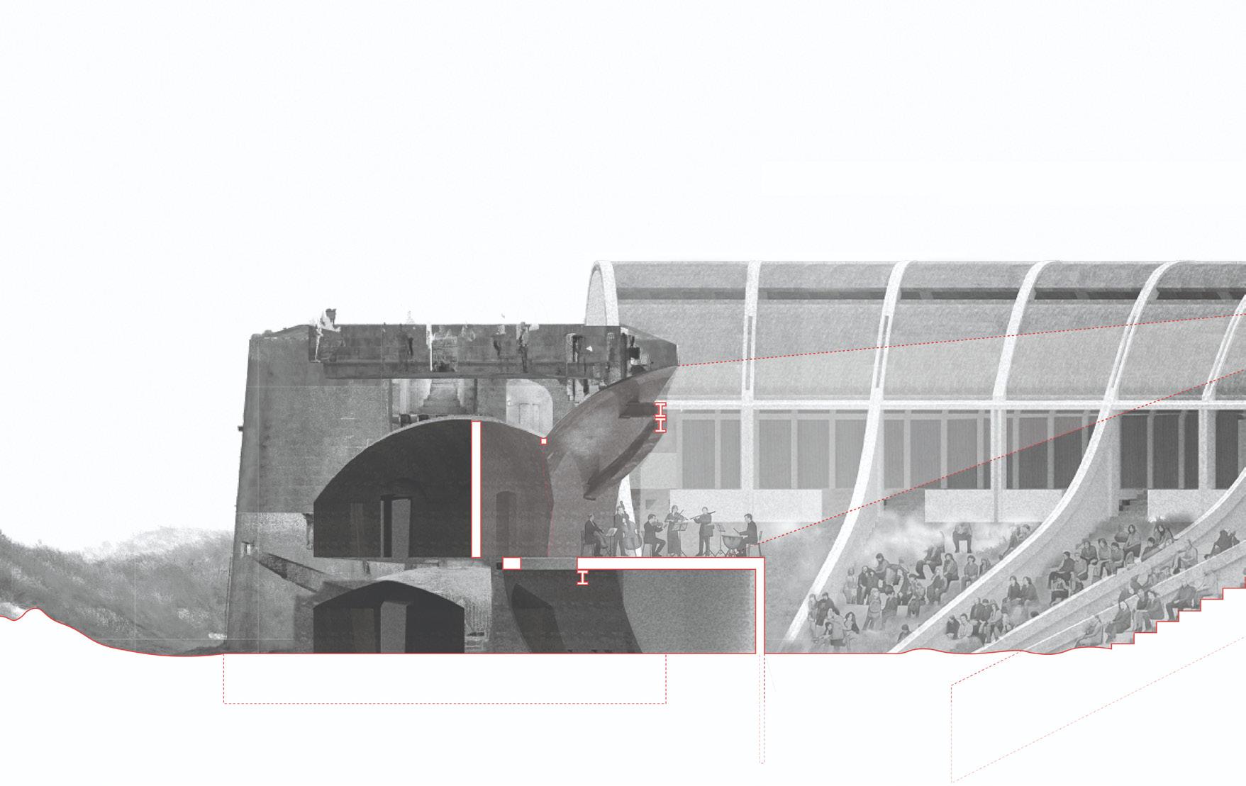
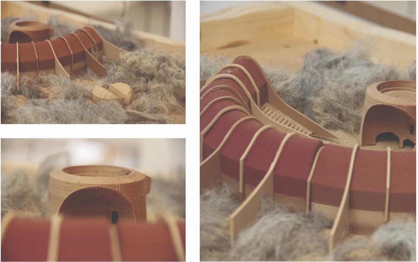
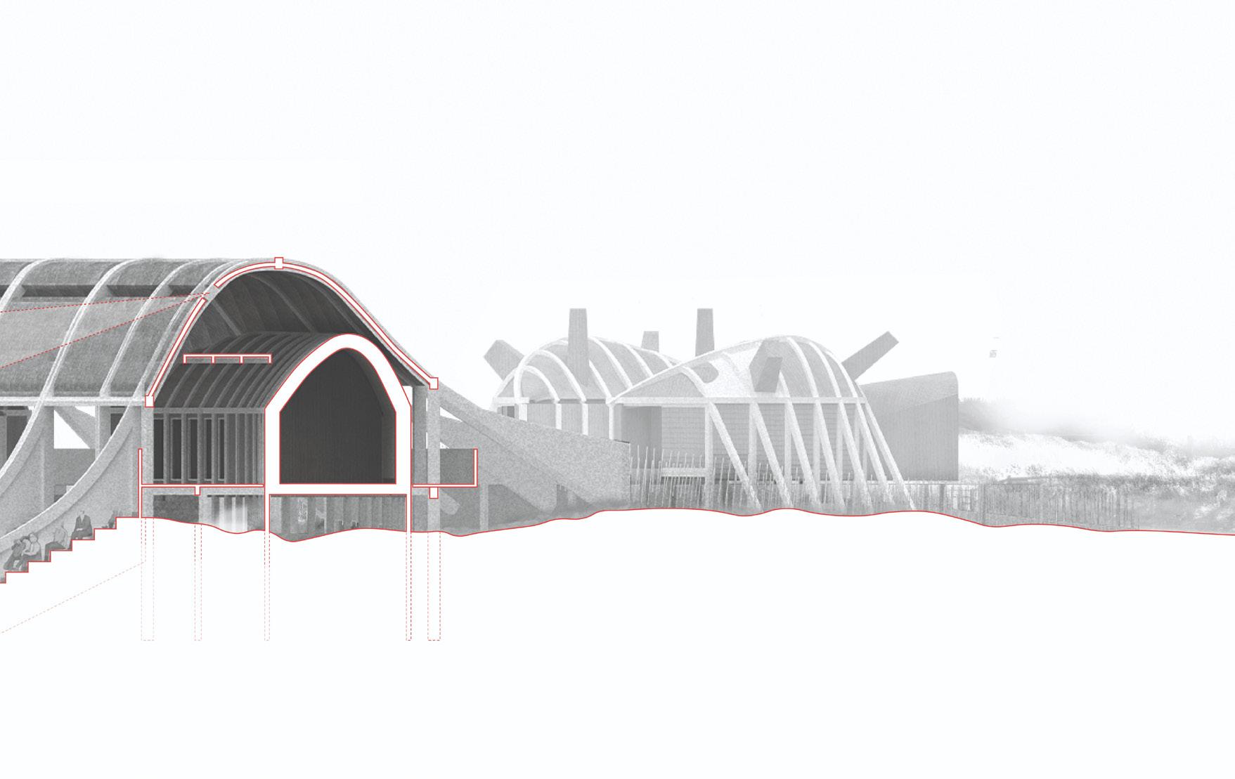
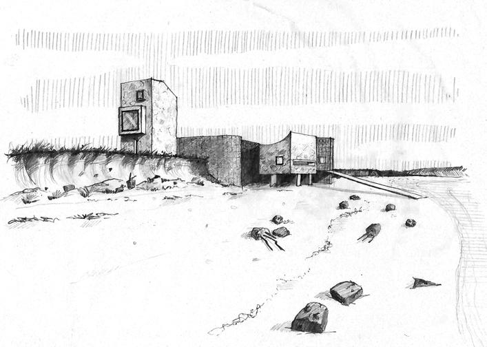
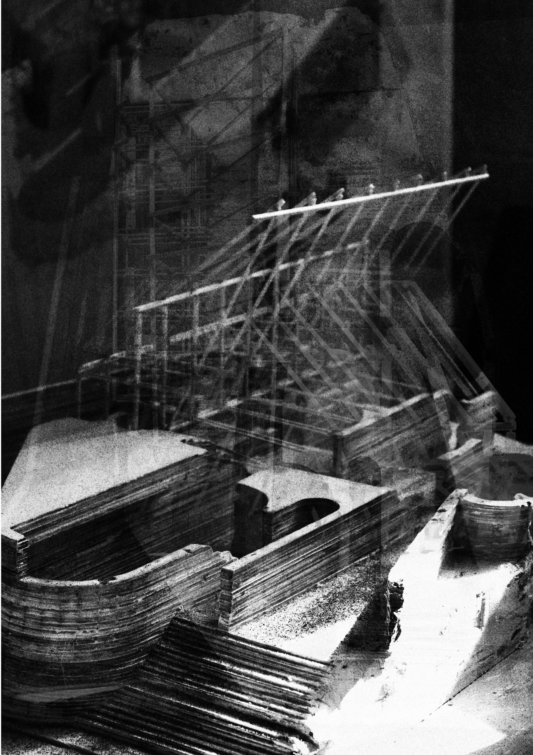
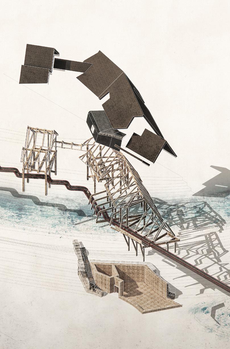
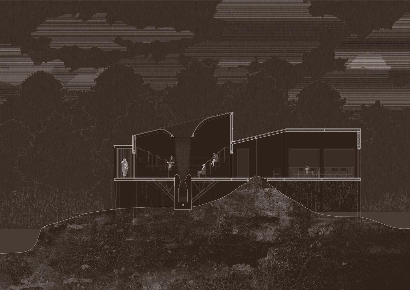
is proposal transforms Magilligan Point, a disputed peninsula on the UK/ROI border surrounded by prison and military land, from an isolated military site into a public cultural destination. At its centre is a Martello tower built in 1812. Initially the focus was on small-scale acoustic interventions, including a beach hut and listening chamber to echo the sound qualities of the surrounding dunes. e scheme expanded into a larger civic venue with an amphitheatre, stage tower, rehearsal pods, and pavilion. Using LIDAR scanning and drone photogrammetry, hidden details of the site were uncovered, including the tower’s internal structure and patterns of coastal erosion that were impossible to fully understand from the ground.A spherical cut through the northern half of the tower exposes layers of construction that had remained hidden for over 200 years, turning the structure itself into a performance stage. Timber groynes placed in line with the natural erosion ow help trap sand, gradually forming and sustaining the amphitheatre seating. Raised pods beneath a thatched pavilion provide rehearsal and support spaces for visiting artists and local musicians, while beach huts o er shelter for people using the coastline. e environmental approach relies on passive design, local materials of thatch and timber, and lightweight foundations minimising disruption to the dunes. Rather than resisting the changing coastline, the project works with it, embracing the idea that architecture should adapt and evolve alongside natural processes. e venue also creates a link between the Martello towers at Magilligan and Greencastle across Lough Foyle through shared events and performances.
Exploding the tower (previous top)
Envisioning LIDAR (previous bottom)
Amphitheatre plan (left)
Section through performance (below)
Sitting within the dunes (above)
Site: Magilligan, County Derry Programme: Post-Carceral Halfway Home; Support Facilities
POST - CARCERAL THRESHOLDS
TOWARDS AN ARCHITECTURE OF JUST TRANSITIONS
CELIA - DOINA OPREA
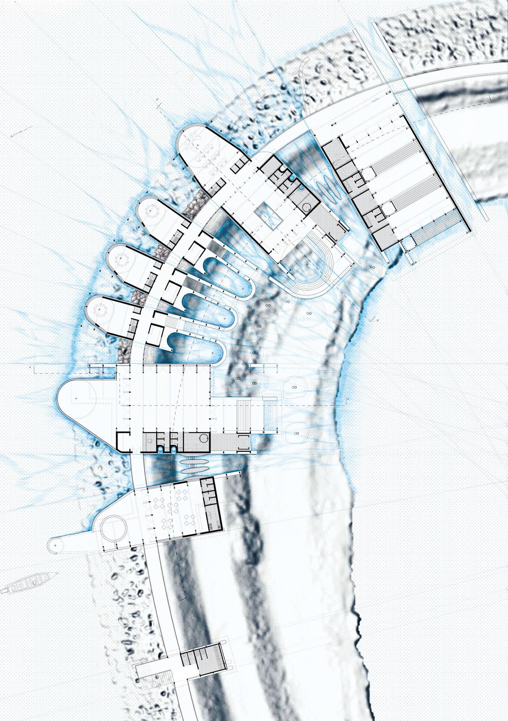
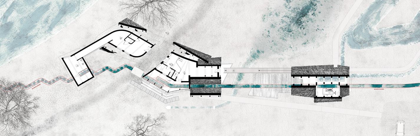
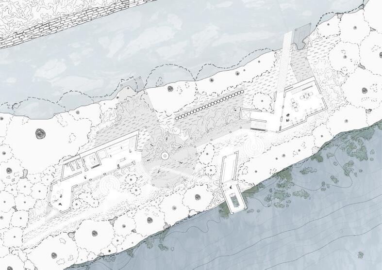
is project investigates architecture’s role in supporting the transition from incarceration to everyday life. Situated on the edge of Lough Foyle beside Magilligan Prison, the proposal occupies the site of a former gun battery, engaging with a landscape shaped by defence, surveillance, and institutional control. Rather than reinforcing these histories, the project explores how architecture can facilitate care, autonomy, and social reintegration. e proposal responds to the challenges faced by individuals leaving prison, particularly within a remote setting where access to housing, communication, employment, and support networks is limited. A halfway home is introduced as an intermediary environment that bridges the gap between con nement and independent living. Temporary accommodation is combined with support facilities and creative workspaces, creating opportunities for stability, skill development, and social connection.
e architecture is structured through four interconnected spatial conditions that accommodate varying needs and experiences throughout the reintegration process. ese spaces encourage rest, participation, learning, and self-expression, allowing residents to gradually rebuild routines and relationships. Positioned between the prison, the coastline, and the surrounding community, the project reimagines a site historically associated with exclusion as one that fosters belonging, resilience, and new beginnings through everyday acts of dwelling, making, and collective engagement.
Touching the beach (previous left)
1:50 model sitting atop the gun positions (previous)
Charting the journey post-incarceration (above)
Plans & landscaping (right)
Sections of dwelling & meeting (below)
Arrival (top)
Retreating to the sea (above)
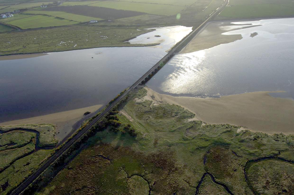
Derry mainline bridging the River Roe Estuary
Site: Roe Estuary Nature Reserve, County Derry Programme: Higher Education Institute
THE NOW SCHOOL
WETLAND ECOLOGY VISITORS CENTRE, ARTIST RESIDENCE
FERGAL VOORSANGER - BRILL
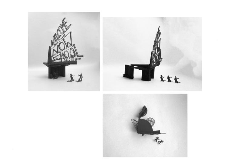
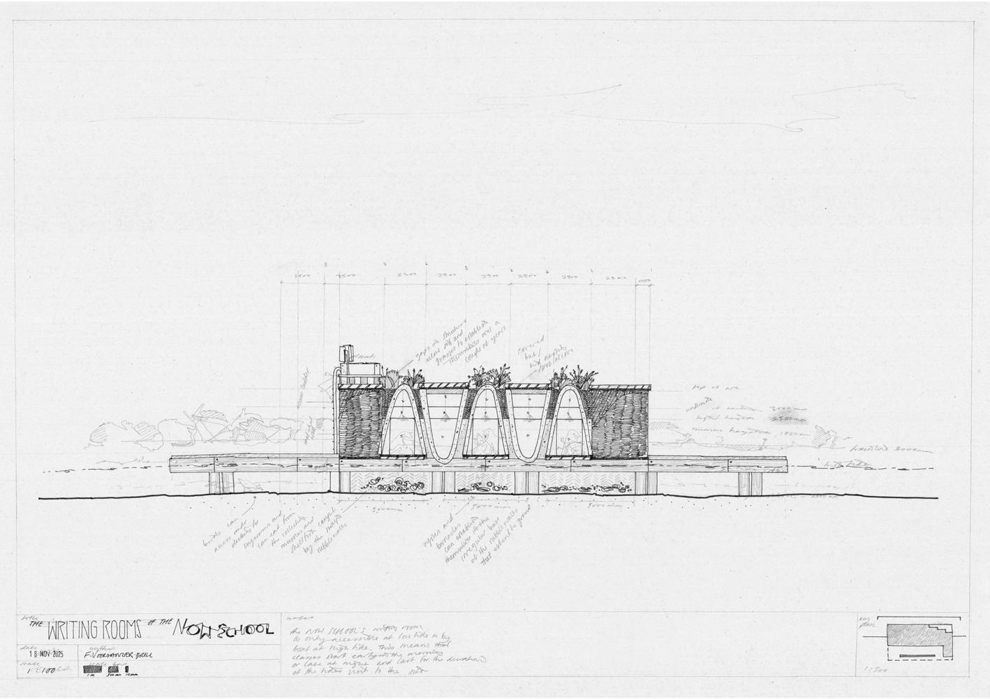
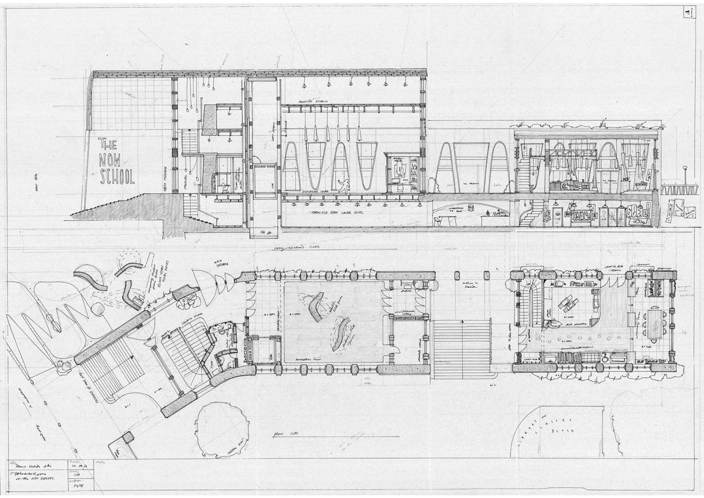
e work produced between autumn 2025 and spring 2026 focuses on the NOW SCHOOL. An imagined project sited at the mouth of the Roe River which opens onto the Lough Foyle, an enclosed brackish bay in the North of the Island of Ireland.
e school is a higher education institute in direct response to the UK’s intentional removal of infrastructure to the north-west region of NI in an attempt to depopulate and reduce wealth accumulation in the region.
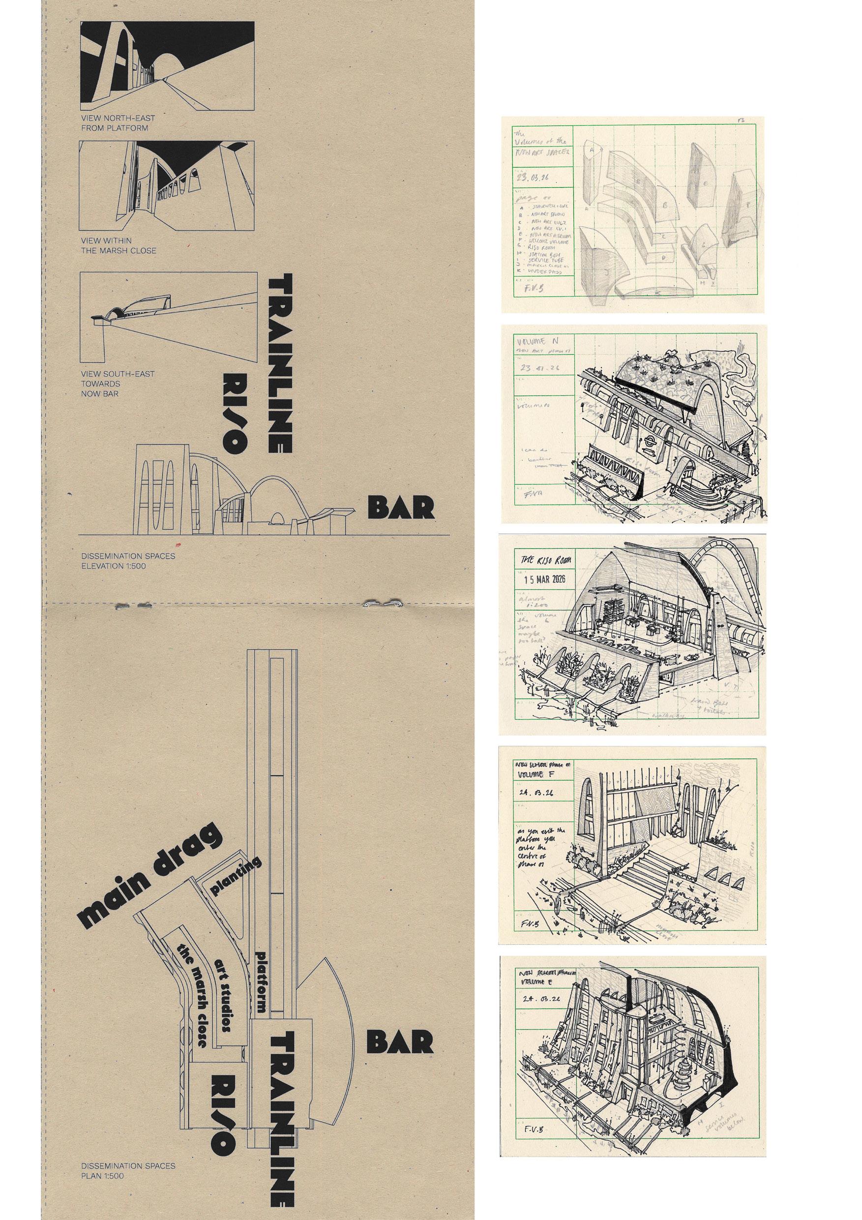
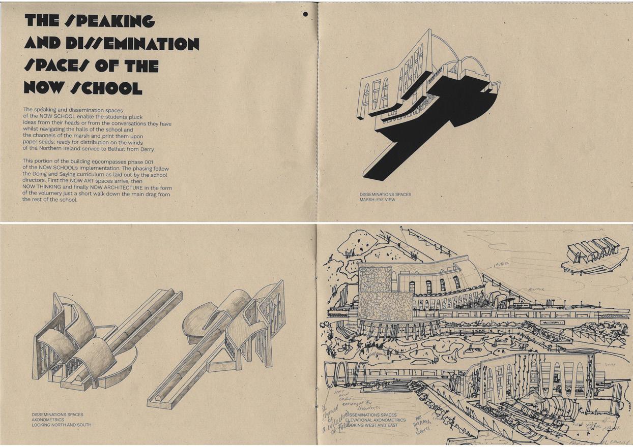
e NOW SCHOOL takes the form of satellite classrooms, taking inspiration from Irish hedge schools, and teaches NOW Art, Architecture and inking by rooting its pedagogy in ecological thinking and the marsh that it is sited within. It has two directors, one cycling human director who teaches the students how to be competent individuals and one permanent director, e Roe River Saltmarsh, who teaches the students how to be capable collectives. e school is formed by a menagerie of structures scattered across the marsh. Its foundational course is its Diploma in Doing and Saying.
dissemination
The NOW School (previous left)
The writing rooms (previous top)
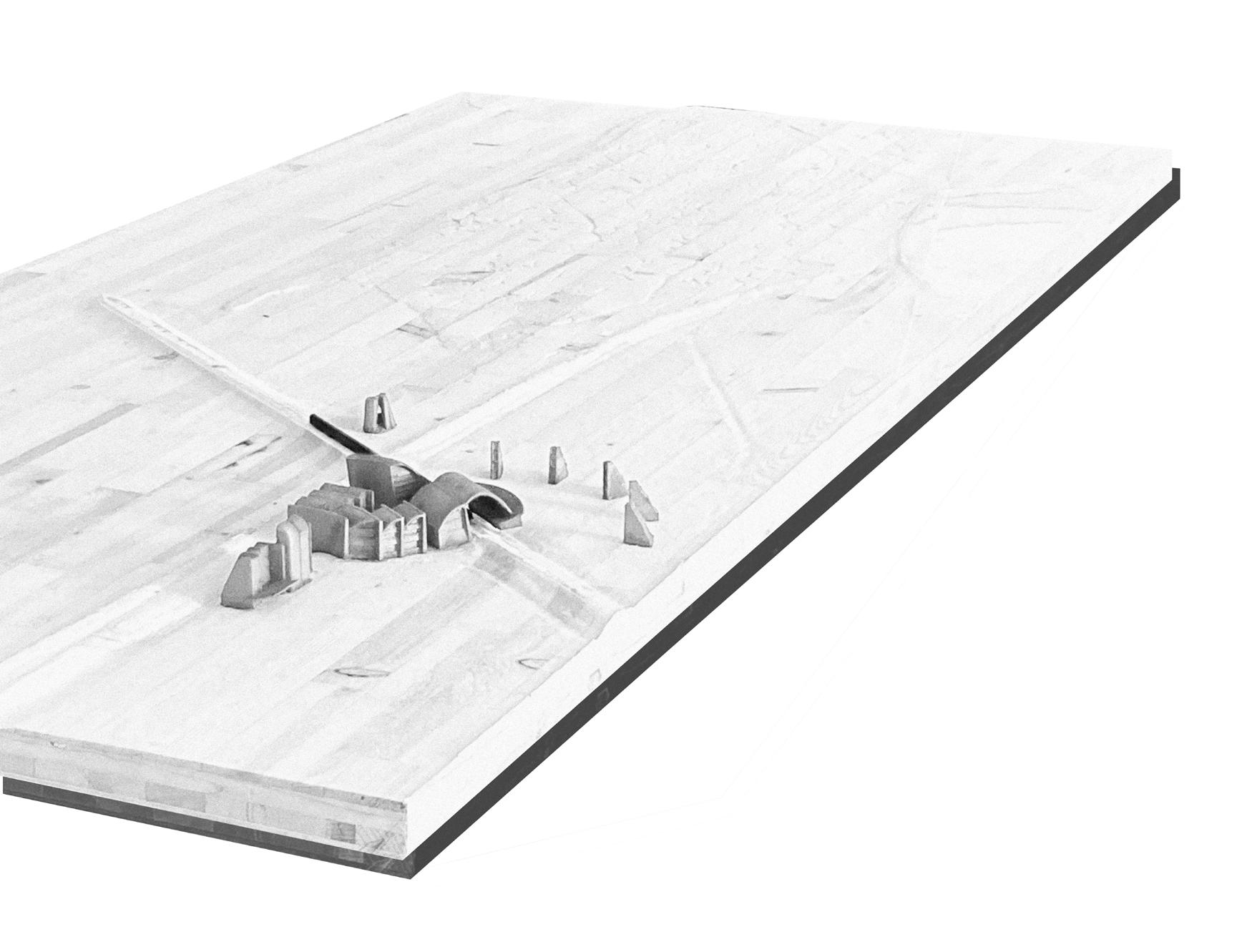
Site model showing scheme & existing railway (previous bottom)
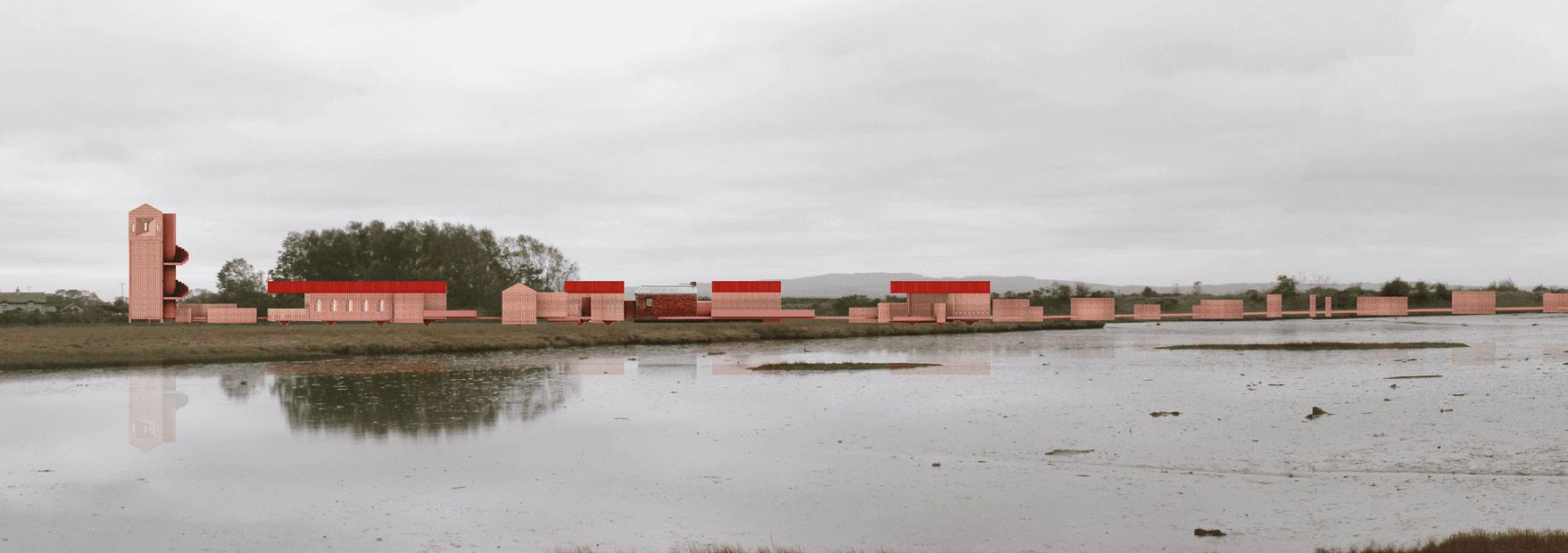
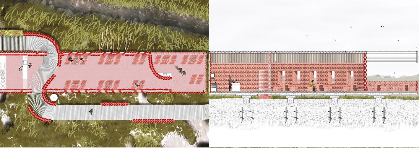
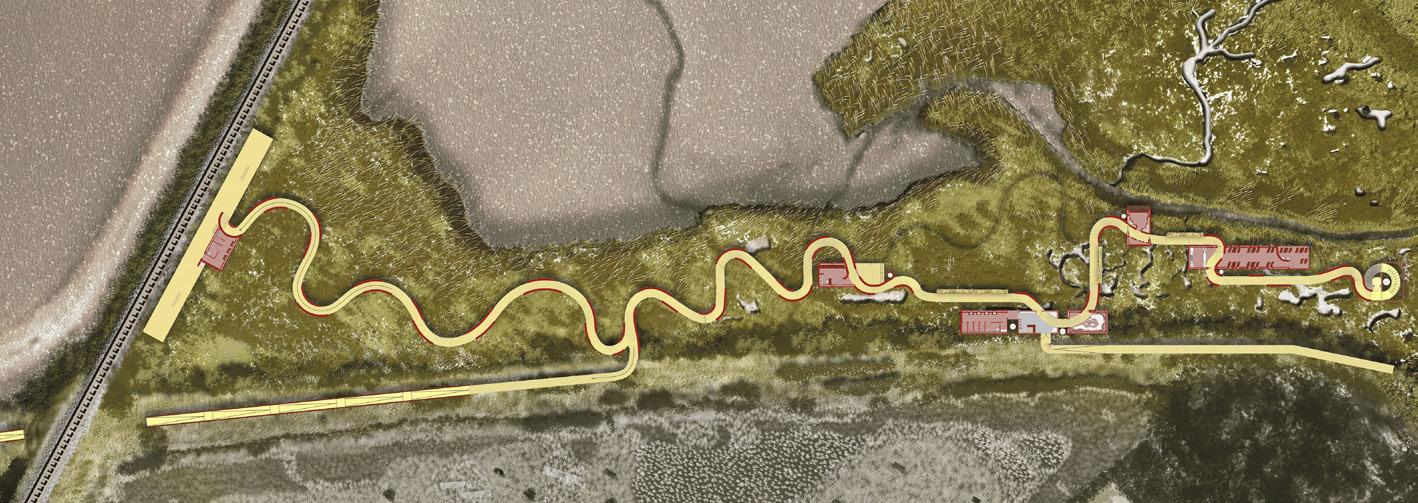
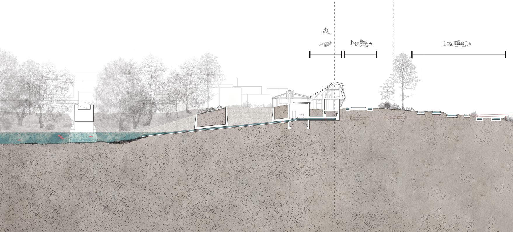
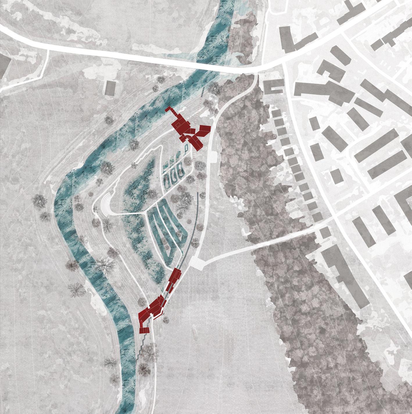
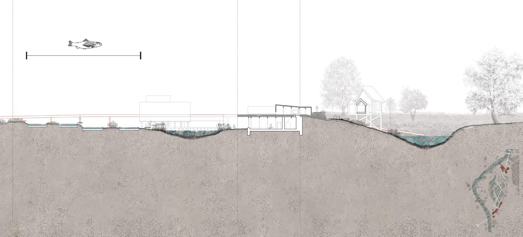
Wandering & Wading proposes a civic route that draws the people of Derry toward the Roe Estuary marsh edge, inviting them to experience it as a living system of wetness, shifting ground, and tidal time. e project choreographs an ethic of approach through pace, pause, and threshold, so the marsh is met in gradients: close where the ground can carry visitors, distant where it is fragile, and always on terms set by wet ground.
e project treats the journey as architecture. Arrival by rail becomes the rst act of attention, as the existing interruption of the railway is transformed into a legible seam beneath the tracks, where the migratory birdwatching trail continues into protected territory.
Along this wandering trail, a sequence of chambers calibrates the encounter between body and estuary. e Wading House prepares visitors for the wetland through shelter, wellies, and raincoats before they step onto wet ground. e Salmon House is repurposed as a place of arrival and orientation, introducing visitors to the sensorial chambers and ecological histories alongside e Marsh Archive, a space for teaching, recording, and observing the marsh. e Creek Aperture frames the creek’s textured edges, while openings within the structure allow migratory birds to lter through.
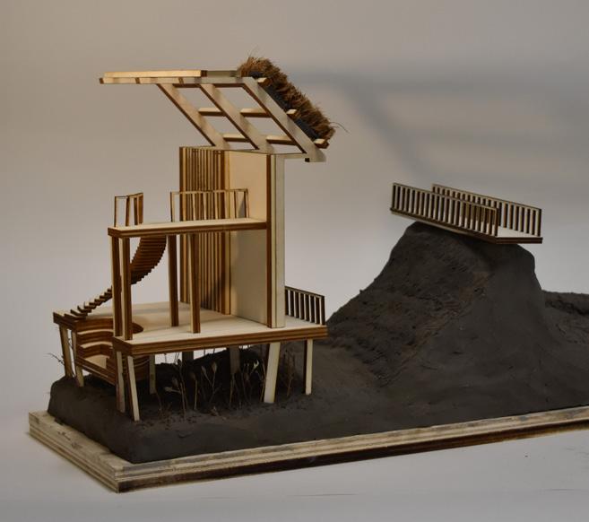
A pause follows at e Salt Burrow, where tea brewed from herb gardens becomes a ritual of tasting place before the ascent to e Salt Watchtower. Here, the trail culminates in an elevated instrument for reading the marsh: framing its shifting geometries, tracking tidal movement, and observing seasonal bird migration.
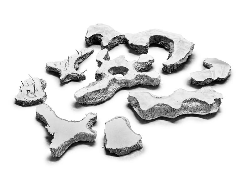
Clay casts of marsh pools (previous left)
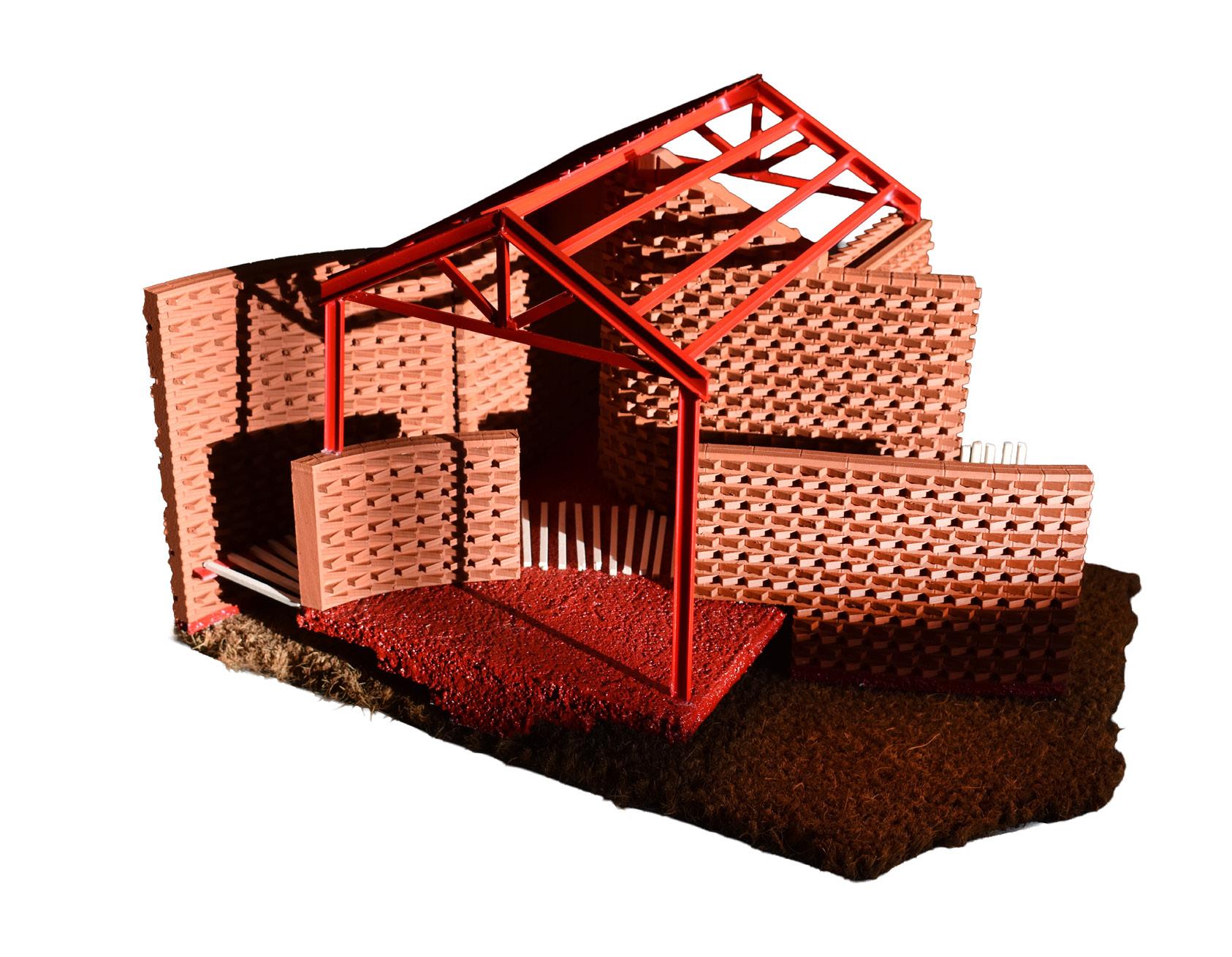
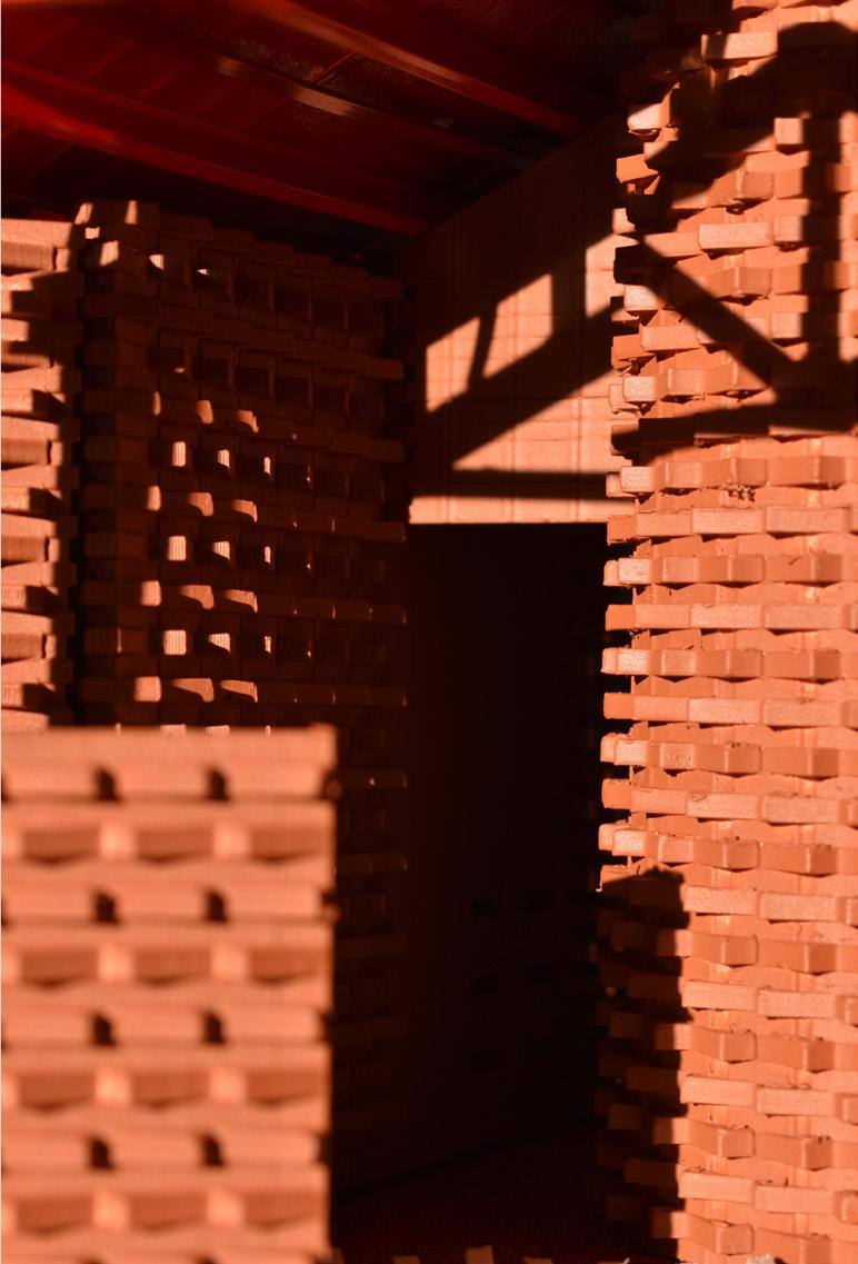
Undulating brick model (previous top)
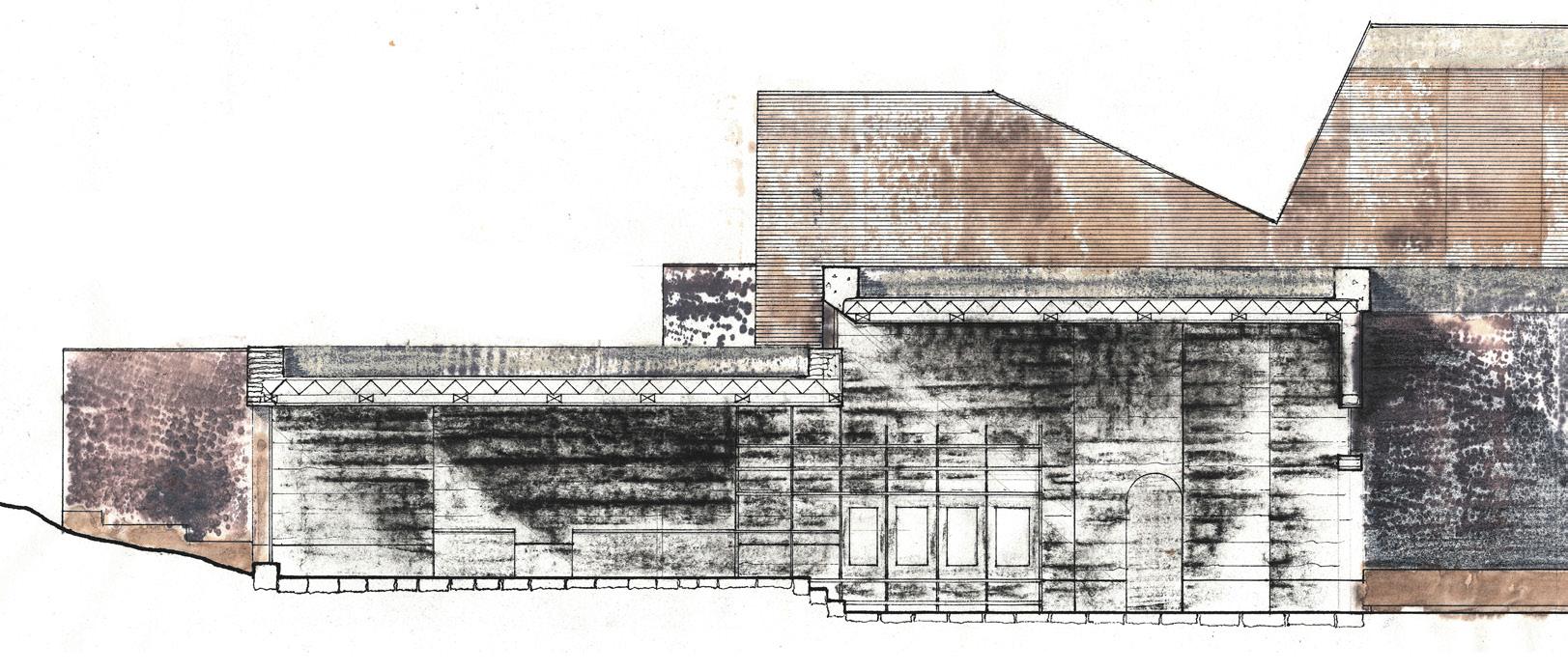
Long elevation (previous bottom)
Plan & section (above)
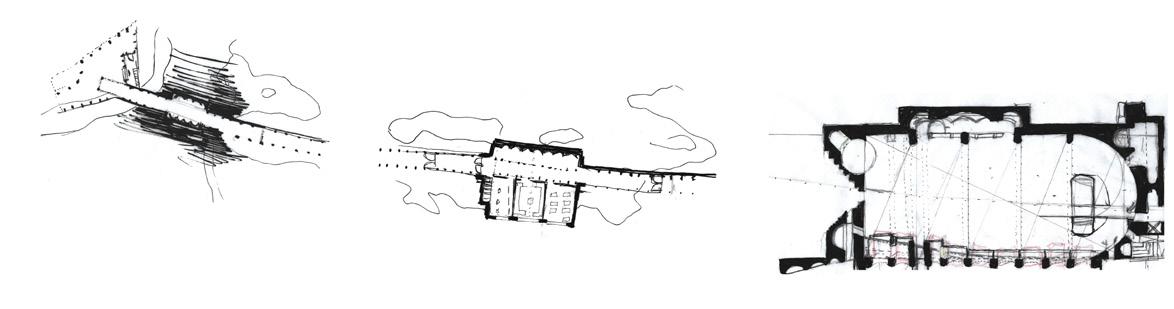
Shadows on the facade (right)
A wandering journey (below)
Architectural systems (far right)
Site:
Myroe Sea-Wall, County Derry Programme: Publics; Research; Education; Wetland Material Cultivation
LITTORAL IMAGININGS
INTERTIDAL UNCERTAINTIES AS THE AUTHOR OF MATERIALITY, RESEARCH & SHARED PUBLICS
ALEXANDER RITCHIE
Lough Foyle, an aqueous territory between the Republic of Ireland and the United Kingdom, where a palimpsest of borders, colonial legacies, and quantifying impulses inscribe themselves thinly across a deep landscape of tidal ux, ecological attrition, and infrastructural decay.
e method of the border emerges as a response to uncertainty: ambiguous volumes of water are subjected to hard engineering. Land is raised from ambiguity, subsumed into regimes of ownership. e sea-wall, an artefact of ordinance, materialises this ambition. Yet, the uncertainty of climate change challenges this paradigm. Sea levels will rise, while unpredictable weather surges already transgress the perceived certainties of the wall.
us, the project asks: rather than employing ever greater technologies to control a dynamic ecology, uncertainty may be embraced as a generator, enabling new forms of social, ecological, and spatial mutuality within a total ecology.
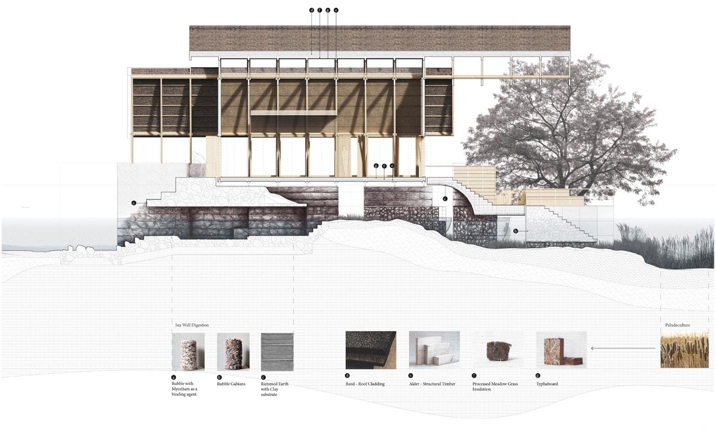
e wall is reimagined not as a border, but a zone of exchange—a locus where revived intertidal salt marshes are cultivated, and the former border becomes an island territory, nurturing opportunities for publics, education, research, and materiality across intertidal states. Architecture is thus sought as a situated practice, endemic to a di use and uncertain network of relations, rather than a master of site.
AN AGRICULTURAL SCHOOL & PERIWINKLE RESTAURANT IN A FLOODED LANDSCAPE
DIANA HUYNH
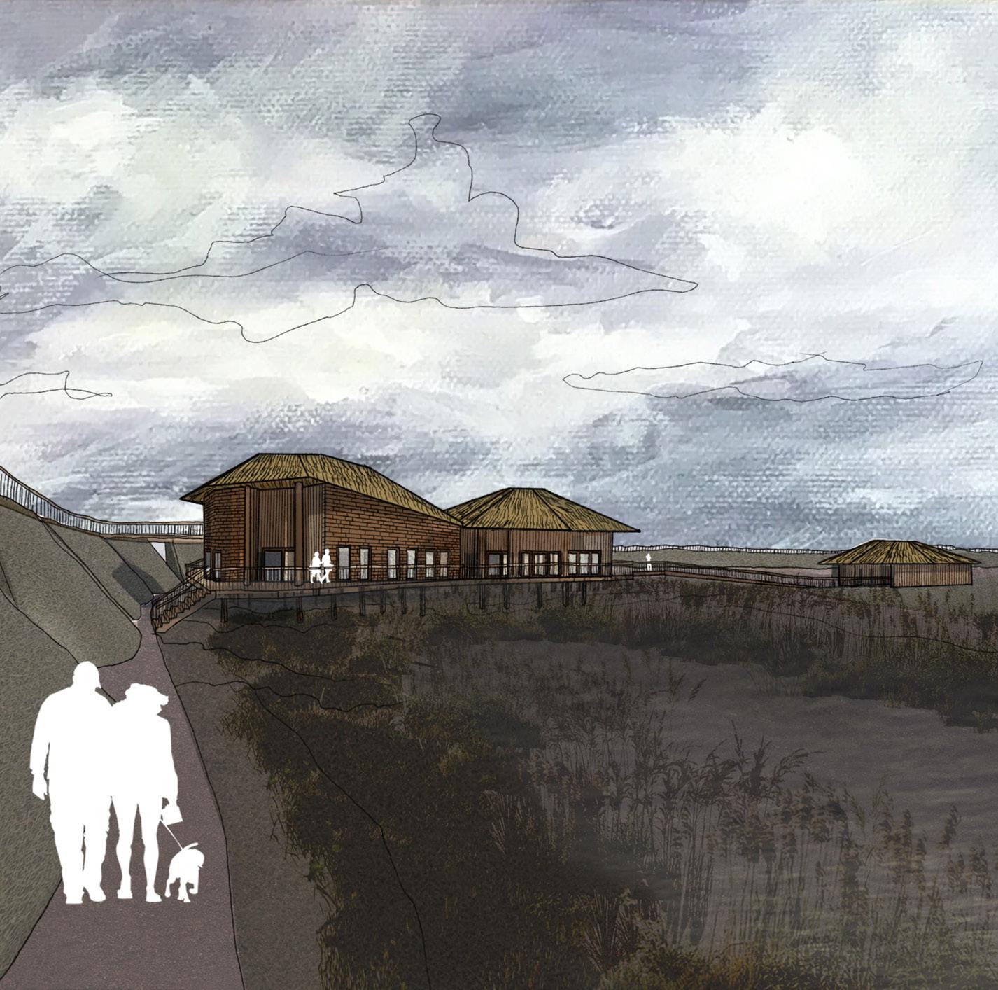
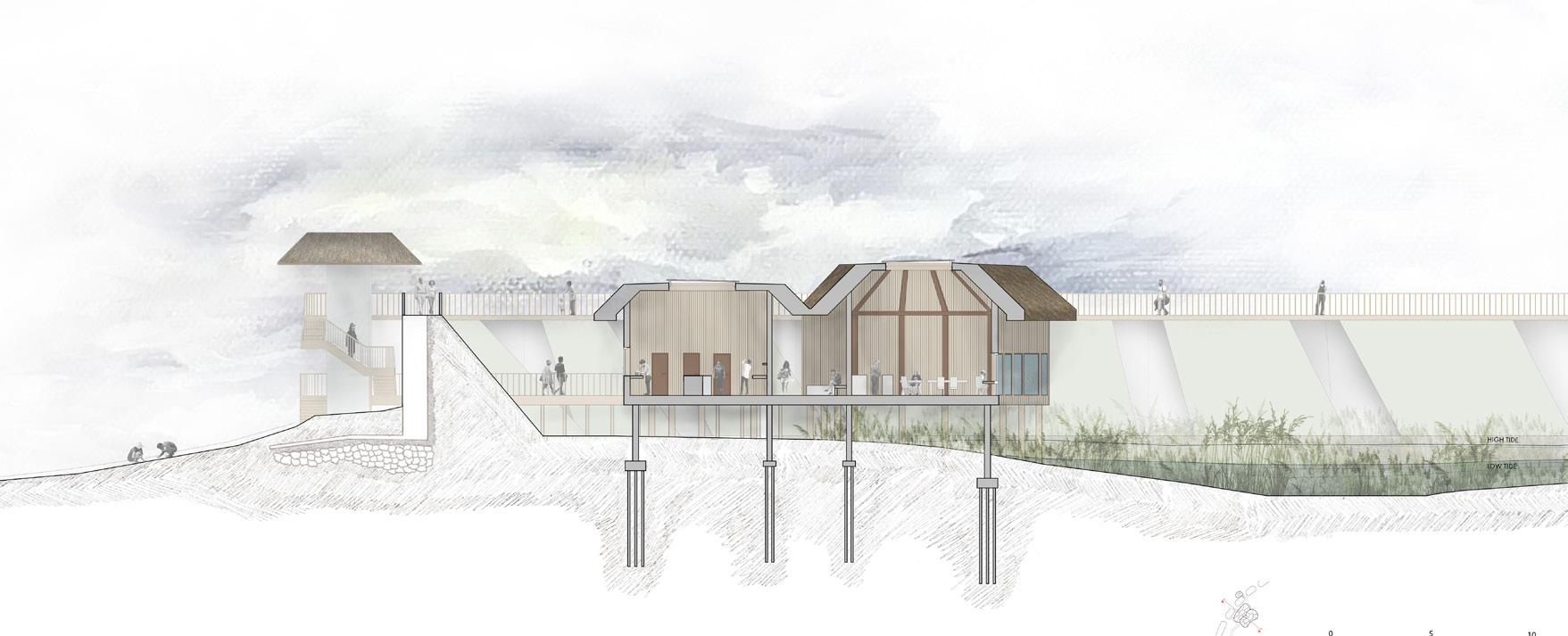
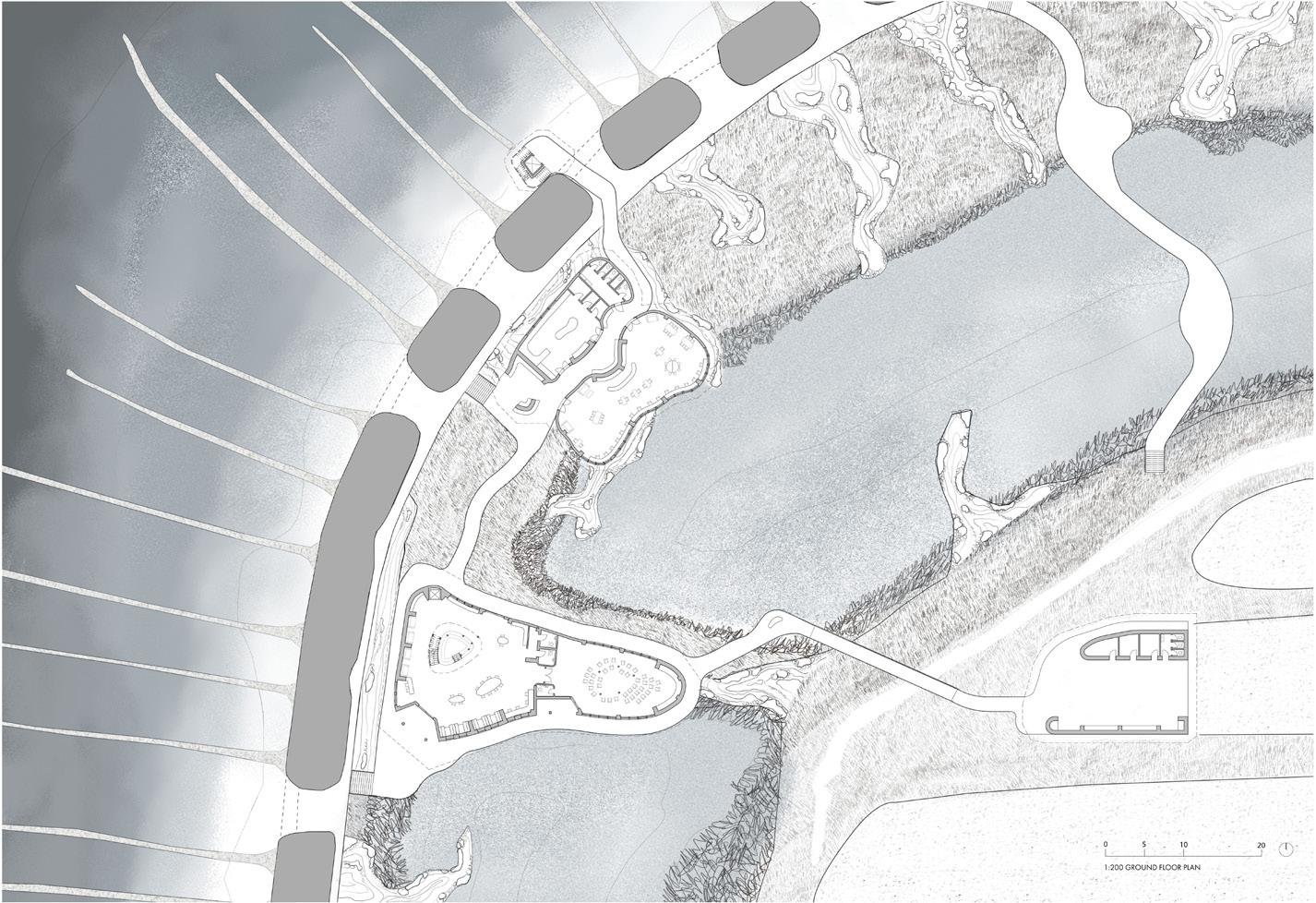
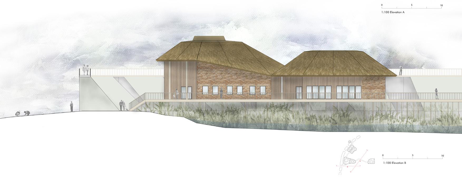
Located along the southern edge of Lough Foyle, the site is de ned by a manmade dyke seawall originally built for ood defence and agricultural land reclamation. In response to climate change, rising sea levels, and the climate emergency, this project challenges the permanence of conventional coastal defences. Rather than maintaining a rigid barrier between land and sea, the proposal explores gradually allowing water to reclaim parts of the reclaimed landscape, creating a more adaptive and ecologically responsive environment.
Inspired by resilient natural species such as the periwinkle snail, the project investigates how adaptive design strategies can improve the long-term sustainability of coastal interventions. Central to the proposal is the exploration of paludiculture, or wetter farming, as a future model for agriculture that balances ooding with productive cultivation. e thesis examines how ecological restoration and agricultural use can coexist through a softer, more permeable approach to landscape design.
e project also considers how the existing dyke can be reimagined and materially reused within an organic, evolving intervention. Existing qualities of the site, including its wildlife, tranquillity, and recreational use by local visitors, are preserved and enhanced through improved accessibility and visitor-focused spaces.
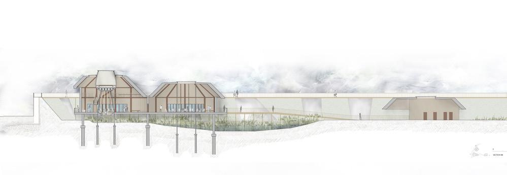
Long elevation through the dyke (previous left)
Walking the dyke (previous top)
Water reclaiming the land (previous bottom)
Connecting to the water (above)
Grounding the architecture (right)
Elevation through the dyke (below)
Aerial view (top right)
Landscape strategy (bottom right)
DIANA HUYNH
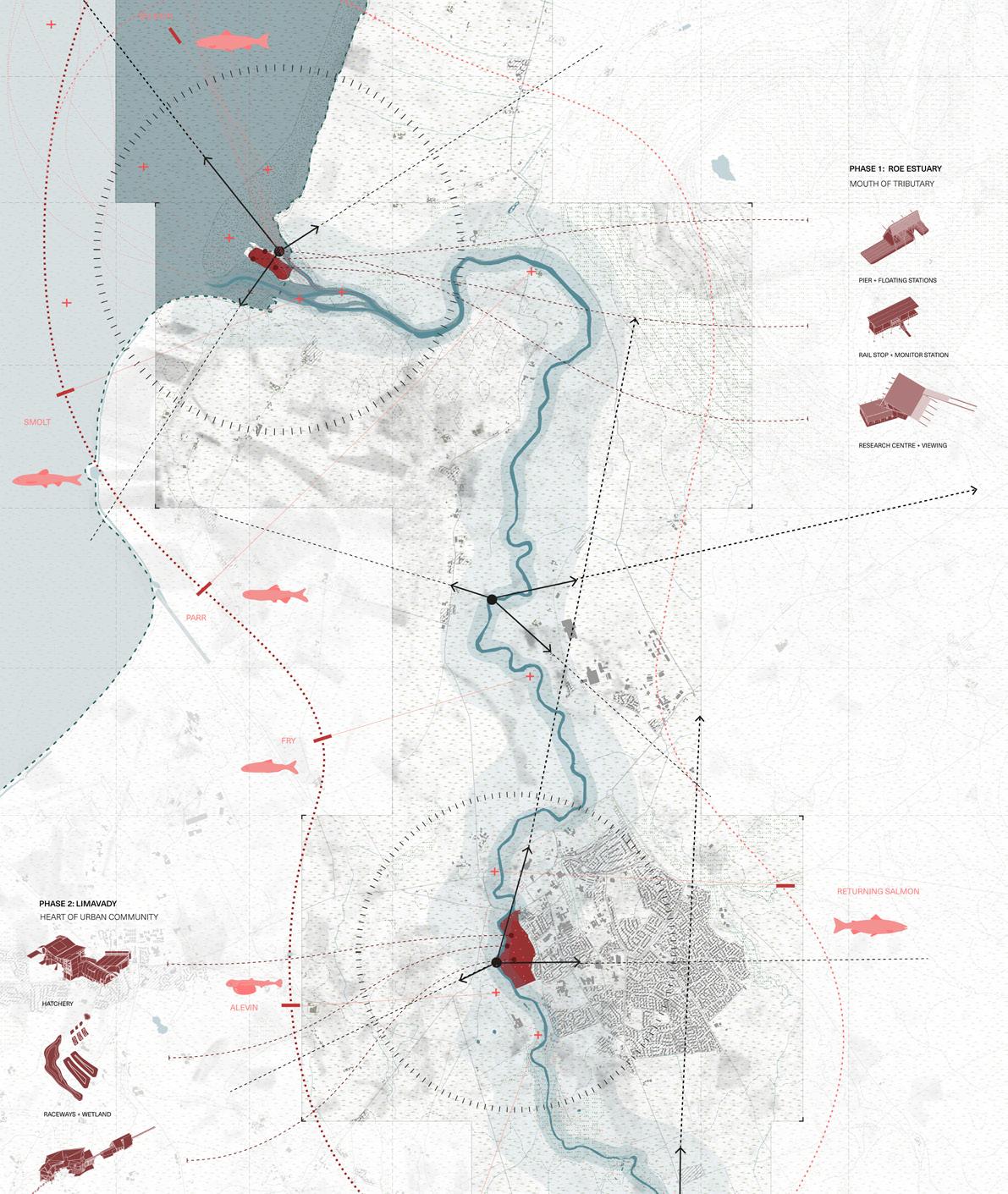
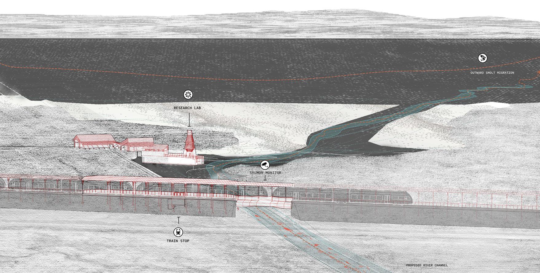
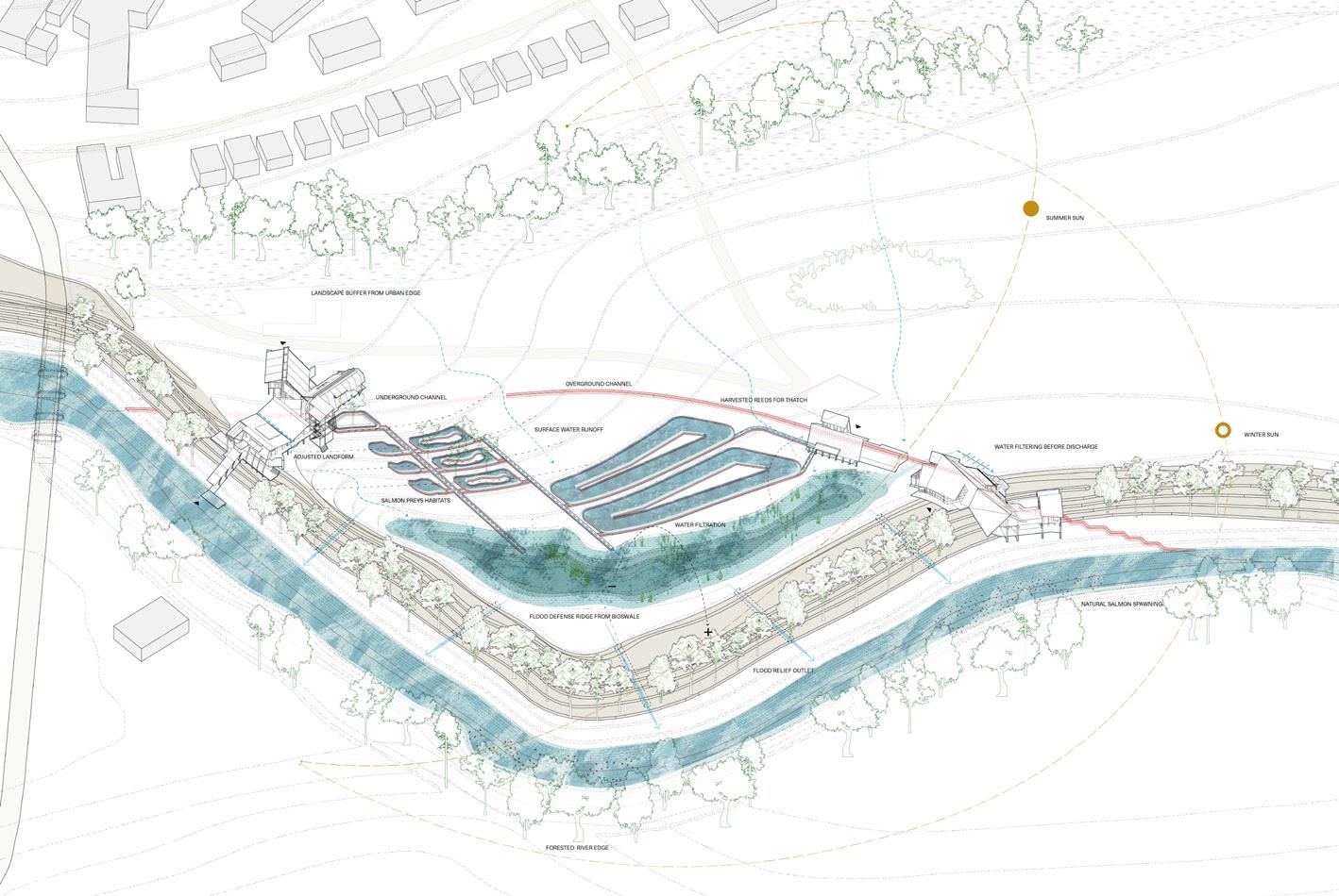
Site: e River Roe, Estuary & Upstream, County Derry Programme: Atlantic Salmon Research & Monitoring Centre; Worker Accommodation; Floating Monitoring Devices; Salmon Hatchery & Education Centre; Riparian Observatory
08
SALMON ATLAS
BORDERS, CURRENTS & THE POLITICS OF FLOW
ENRICO LUO LUCAS THEIS
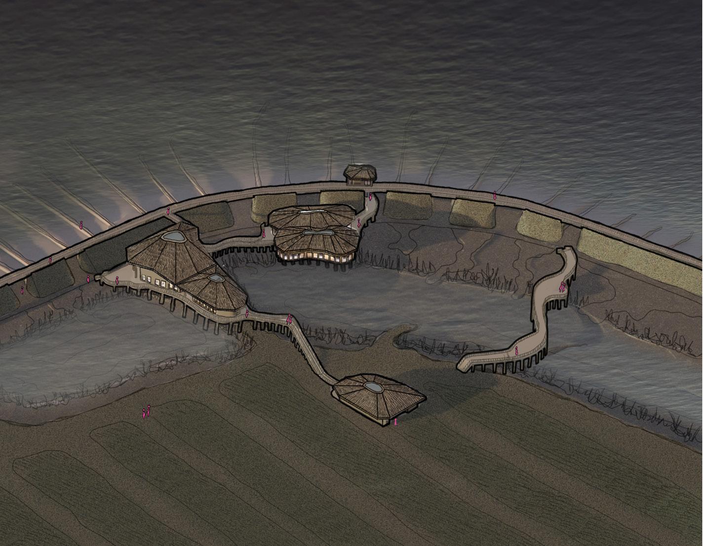
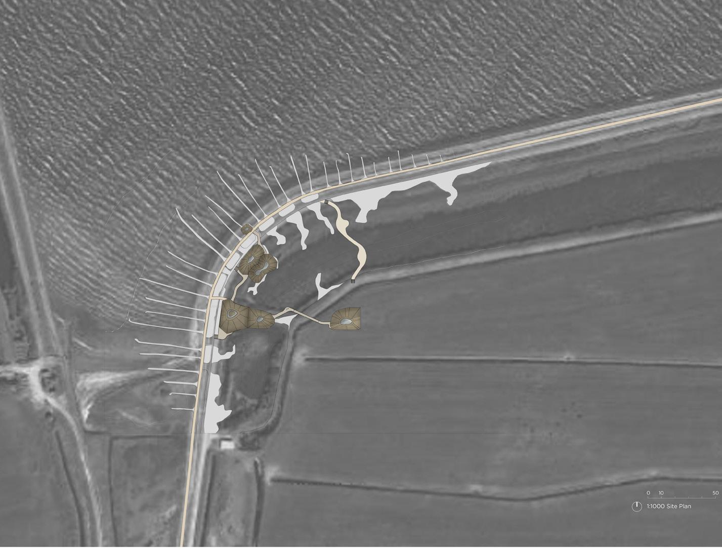
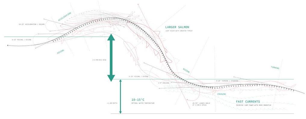
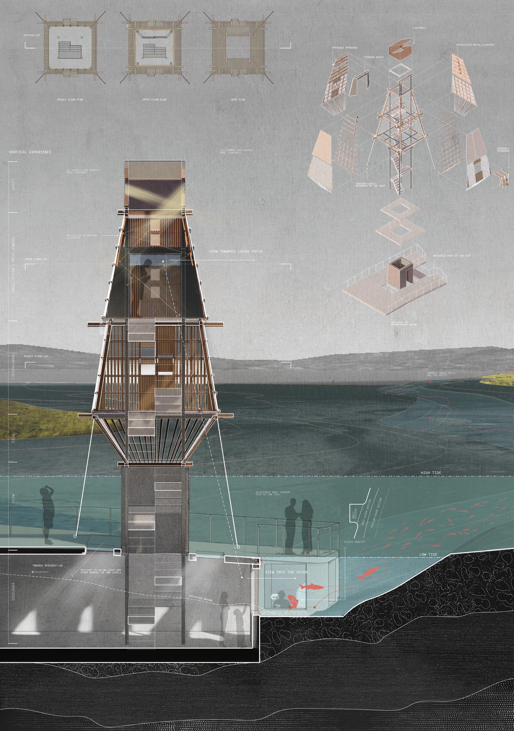
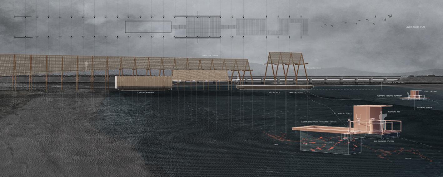
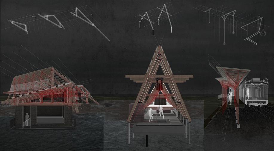
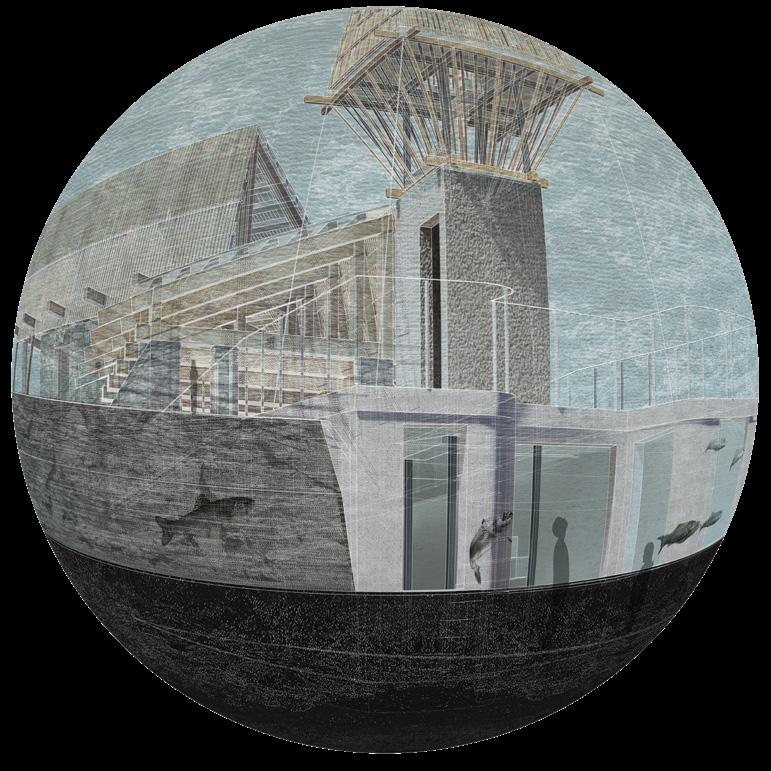
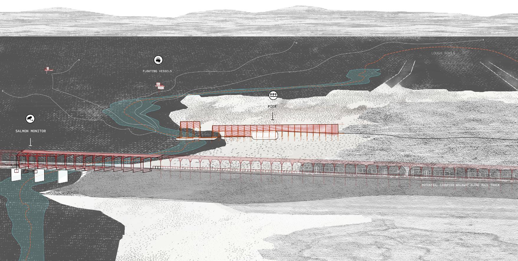
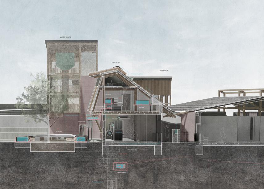
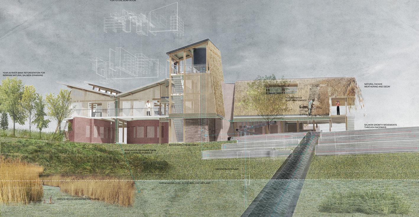
Salmon Atlas: Borders, Currents, and the Politics of Flow unfolds from the River Roe into the vast territories of the Lough Foyle and Atlantic Ocean, along the migratory pathways of the Atlantic Salmon. As an ecological indicator, the Salmon’s decline unveils the friction between imposed human-made interventions and the uid dynamics of natural systems, re ecting broader patterns of environmental degradation driven by human exploitation.
rough the lens of the Salmon as a free-spirited, borderless cultural symbol traversing watery networks, the thesis explores the tensions between interconnected systems of land, water, and imposed infrastructures. Reconciling the ‘wisdom’ of the Salmon, the project reframes architecture as a mediator that accommodates a multispecies approach to uid network lifecycles. rough the proposition of Salmon-centric interventions addressing their full growth and migration cycle, the project envisions a re-established reciprocal relationship between humans and non-humans.
Contextualised architectural strategies are elevated into a scalable theoretical framework across local waterways towards the tributary networks of the North Atlantic. Architecture is depicted as an ecological actor to restore the environment and promote sustainable resilience under current climate urgencies.
Choreography of leaping salmon (previous left)
Viewing the salmon near & far (previous right)
The pier reaching out into the estuary (top)
Modularity of interventions (above)
Observing the observer salmon eye view (right)
Phasing with the lifecycle of the salmon (far right)
Axes of salmon monitoring (below)
Dealing with the hatchery water (above)
A migration channel for the salmon (left)
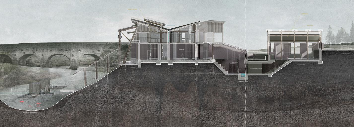
Growth of the salmon; 1:200 long section (below)
A watery landscape on the urban periphery; 1:500 landscape plan (right)
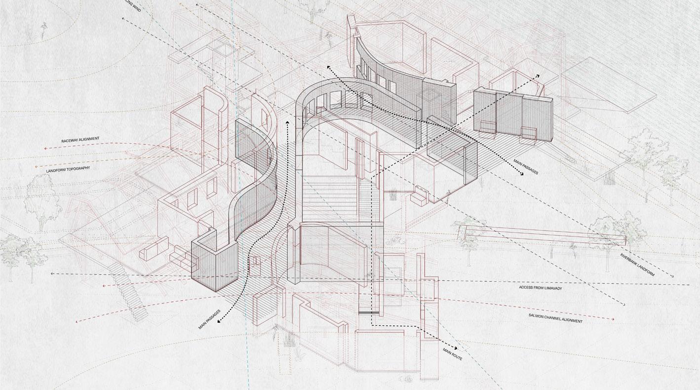
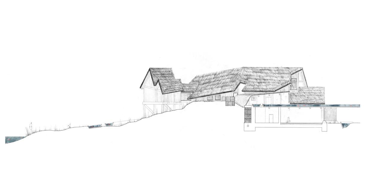
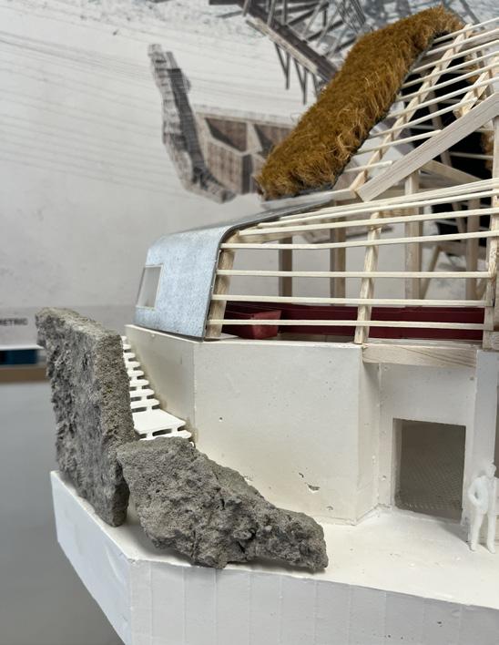
Site: Upstream River Roe, Limavady, County Derry Programme: Atlantic Salmon Hatchery; Education Centre; Anglers Social Club
08 a
SPAWNING GROUNDS
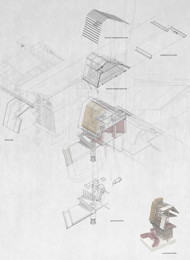
A LIVING HATCHERY FOR LEARNING THROUGH SHARED ECOLOGIES
A RIPARIAN OBSERVATORY FOR TAGGING, TRACKING, & ECOSYSTEM PERCEPTION
LUCAS THEIS
Following the salmon channel (above)
The channel piercing the tectonic (right)
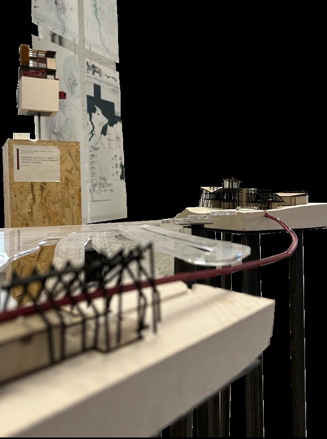
Fragmental model (below)
Various water-types & circulations (top right)
Embedding the channel (far right)
Approaching the tagging facility (bottom right)
Mobuoy Dump
Site: Southern Lough Foyle Edge, bordering the City of Derry Airport Programme: Flow Axis; Dredged Material Collection & Recycling; Airport Railway Connection
FLOW STATES
DREDGEWORKS FOR THE FUTURE OF THE FOYLE
JOSHUA HOWARD
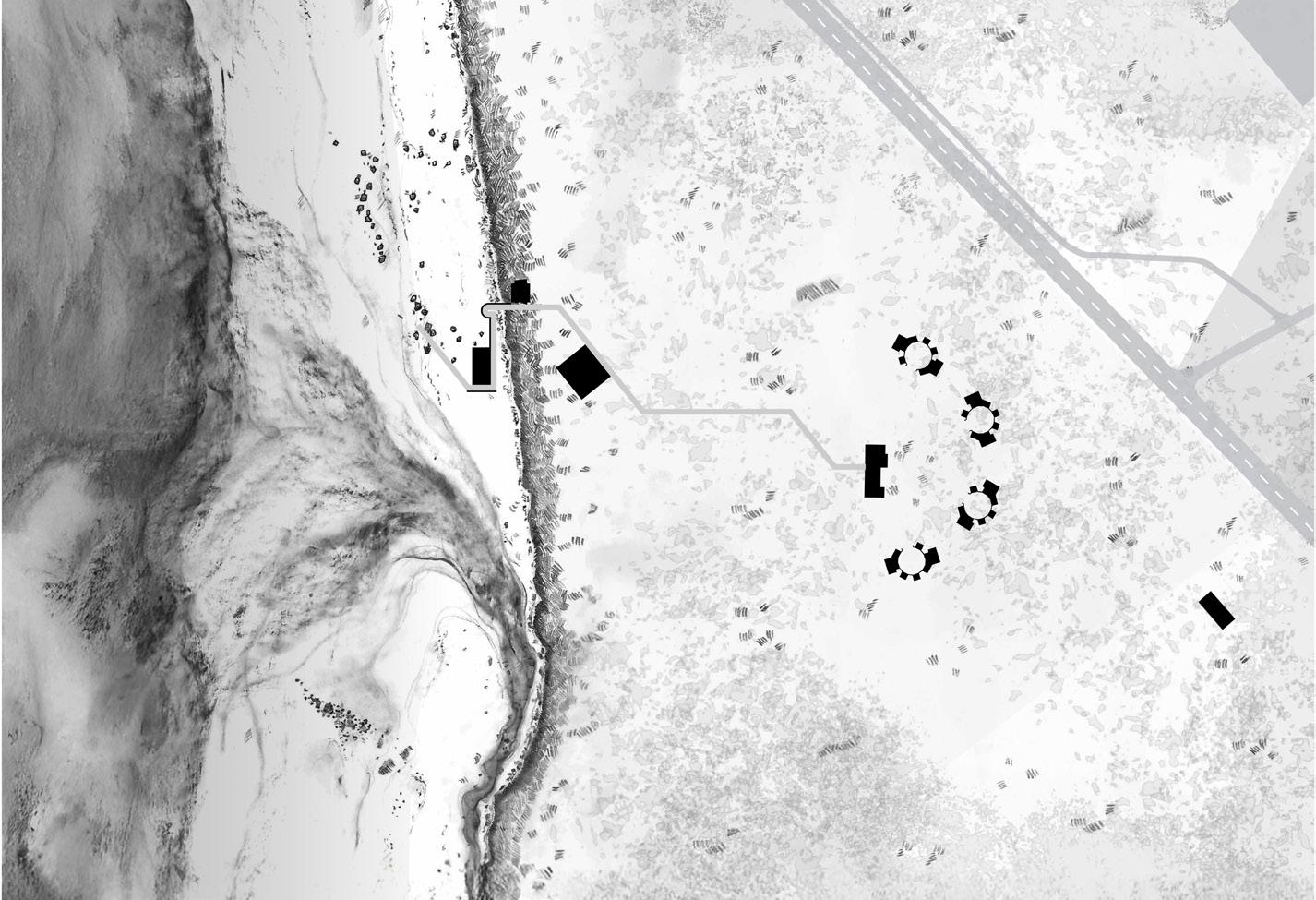
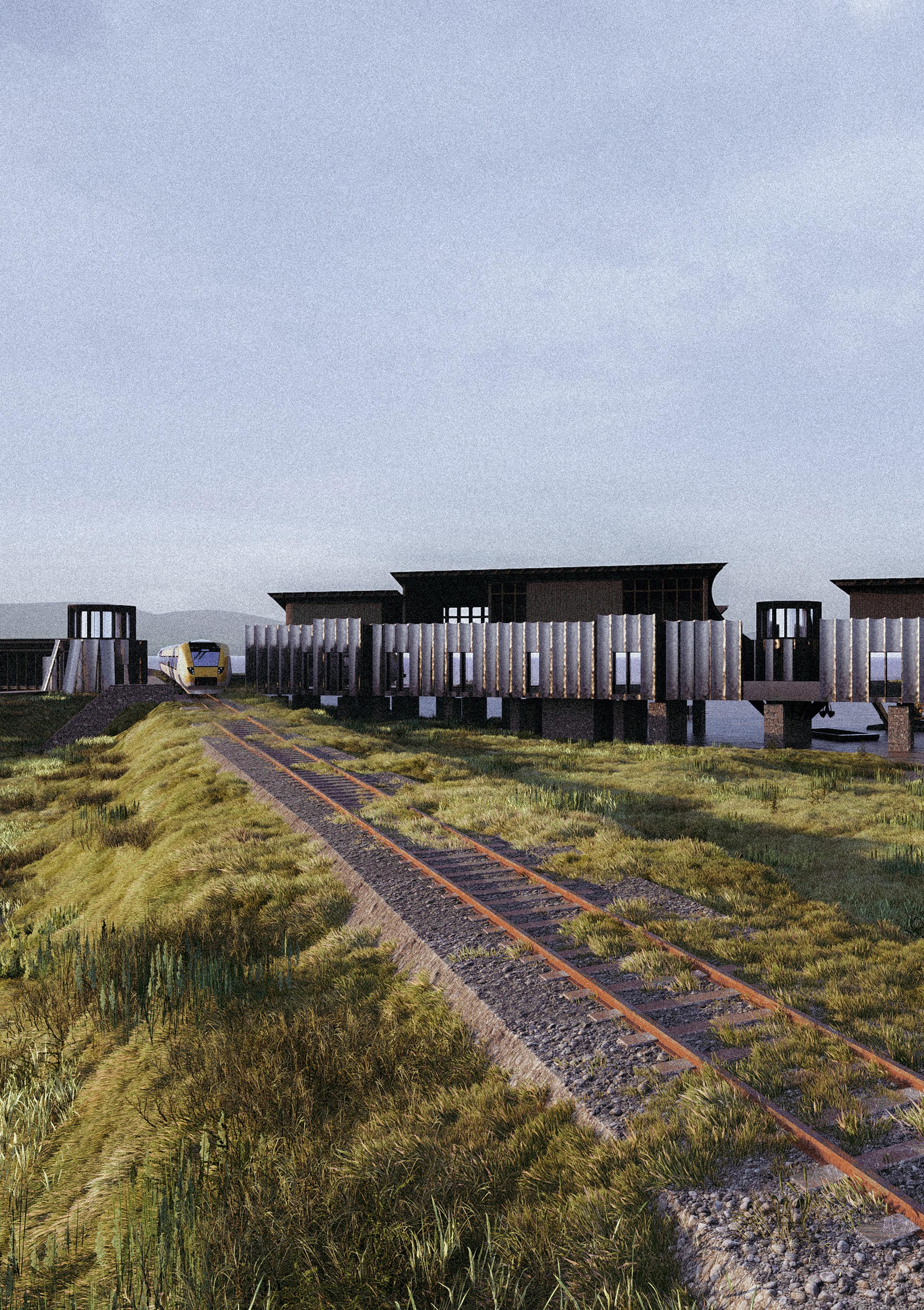
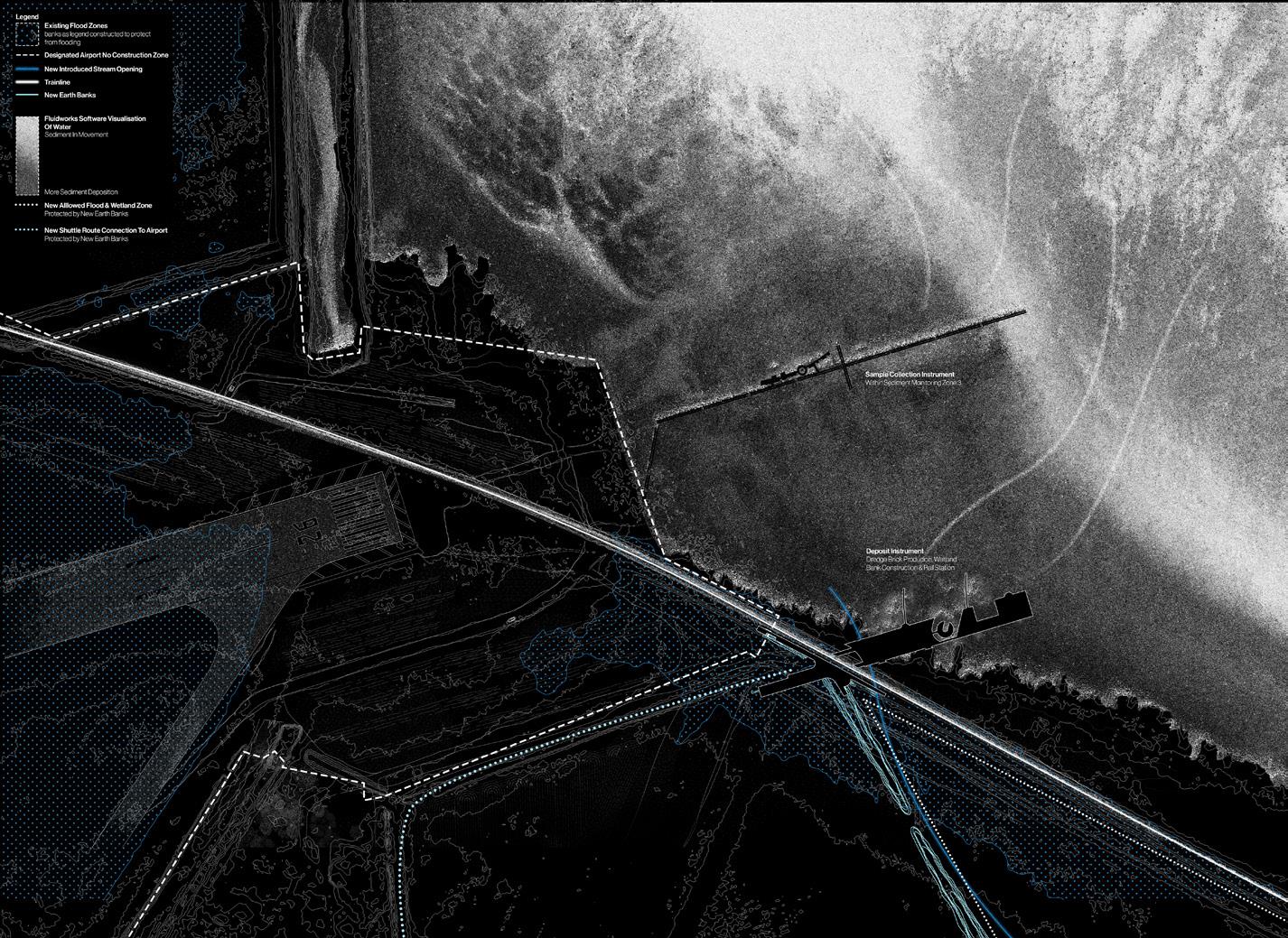
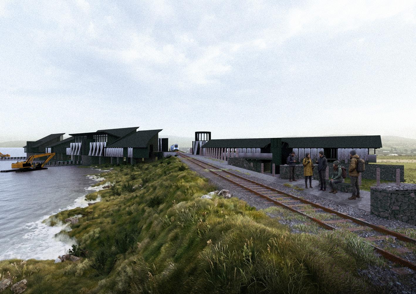
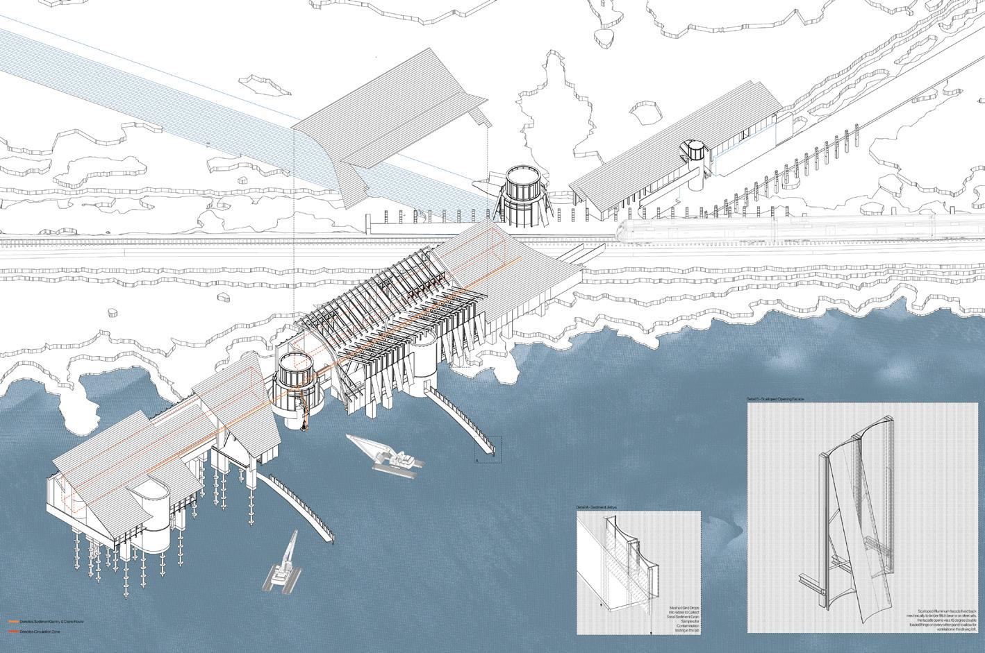
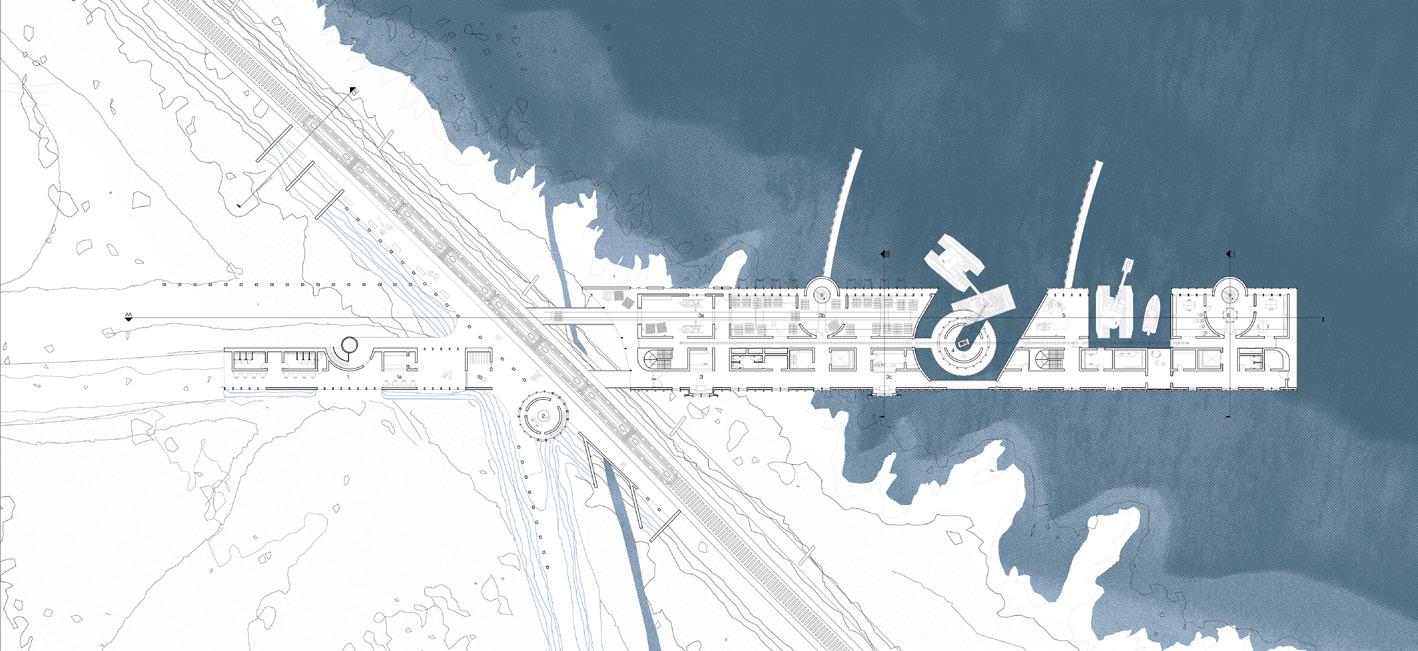
Organised along a single linear axis, the Flow Axis’ form is derived directly from the infrastructural language of the site, the runway, the jetty and the railway that run parallel to the lough’s edge. A deliberate alignment with the logics of movement and infrastructure that have shaped this ground, a constructed form that reads as belonging to the same family as the engineered edges it sits among.
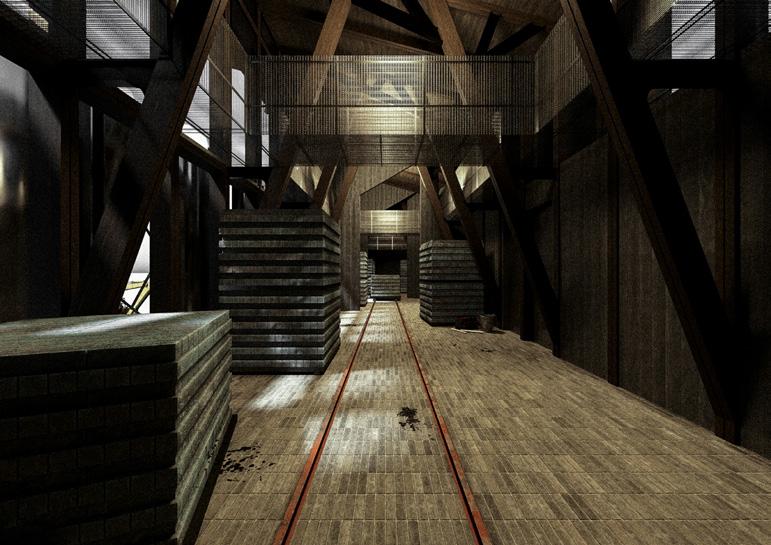
e axis intersects the existing railway line, and in doing so establishes a new moment of connection between the city of Derry and the airport. e building provides a rail station at this intersection, making the relationship between the two human deposits, the railway corridor and the airport, legible and direct for the rst time. Arrival and departure are drawn into the same linear instrument. at instrument also operates in the opposite direction. Where one end faces the human deposit, the other faces the lough. Here the building functions as a machine: receiving sediment from the navigation channel, processing and compressing it into earth blocks, and deploying those blocks as the impermeable core of new ood embankments along the water’s edge. e building does not sit apart from the landscape it addresses. It produces it, slowly, block by block, bank by bank, across the thirty- ve year timeline that the project shares with the ecology it is trying to establish.
Railway piercing through (previous)
Situated between infrastructures (far left)
Waiting & watching (bottom left)
Storage (left)
Flow tectonics (below)
Axis movements (bottom)
10
RESONANT GROUND
AN ASSEMBLY FOR THE REMEDIATION OF ENVIRONMENTAL CRIMES AT MOBUOY
HANNAH LEE
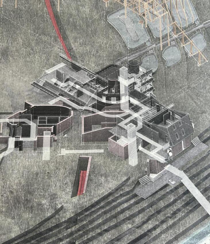
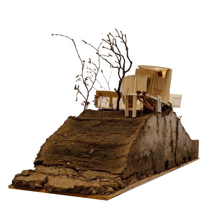
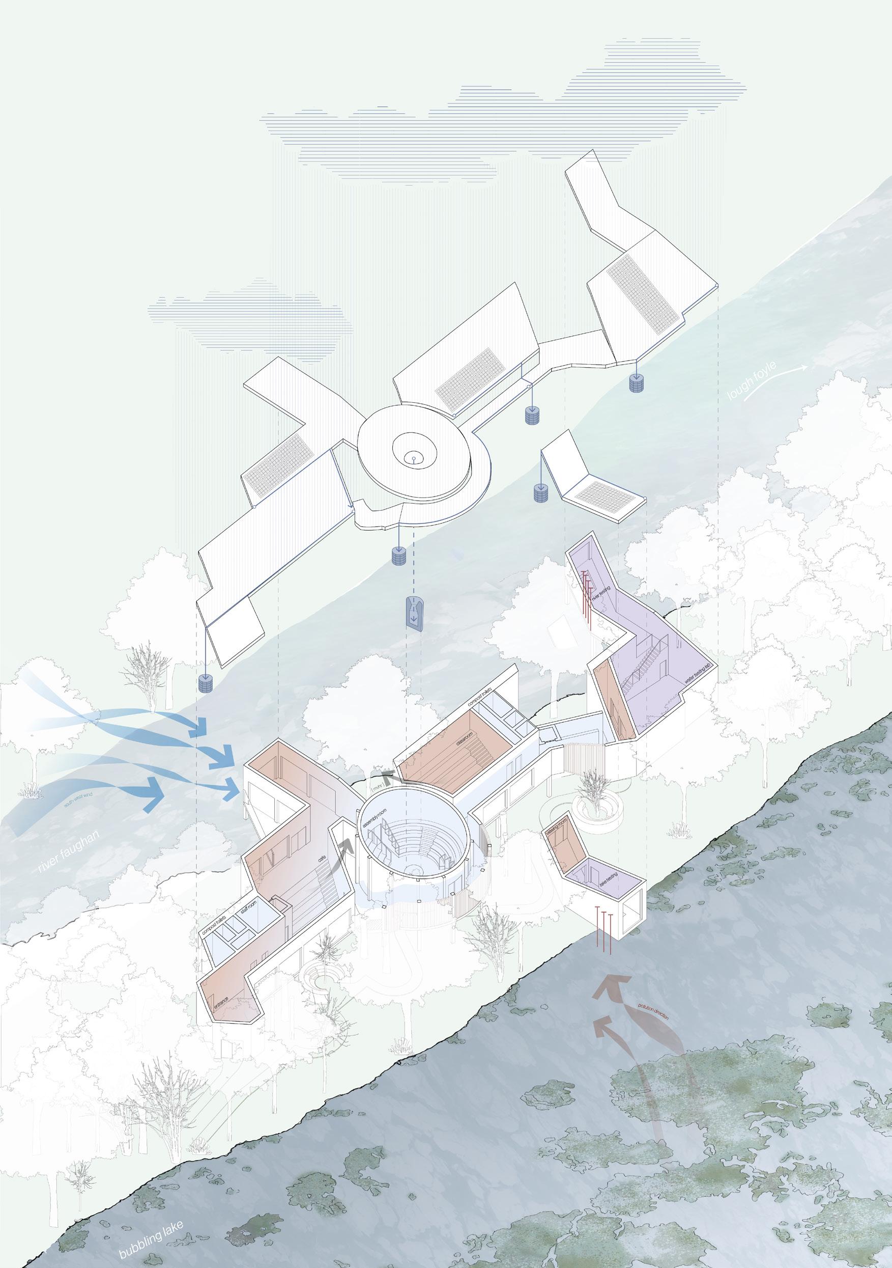
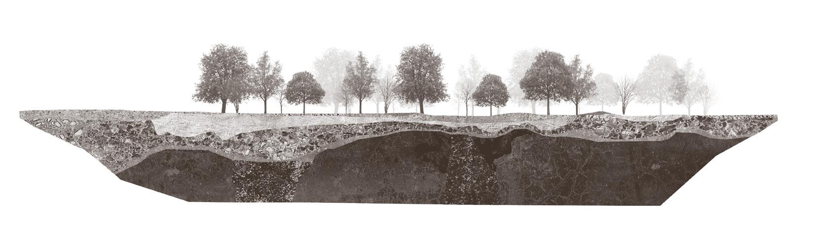
Mobuoy Dump is a site of environmental crime enabled by regulatory failure and the absence of a public platform for accountability. e contamination of land and water occurred without a voice through which communities, ecosystems, and non-human could be heard. is project aims to uncover the environmental crime from the past, and use the voices of the dump to change the future.
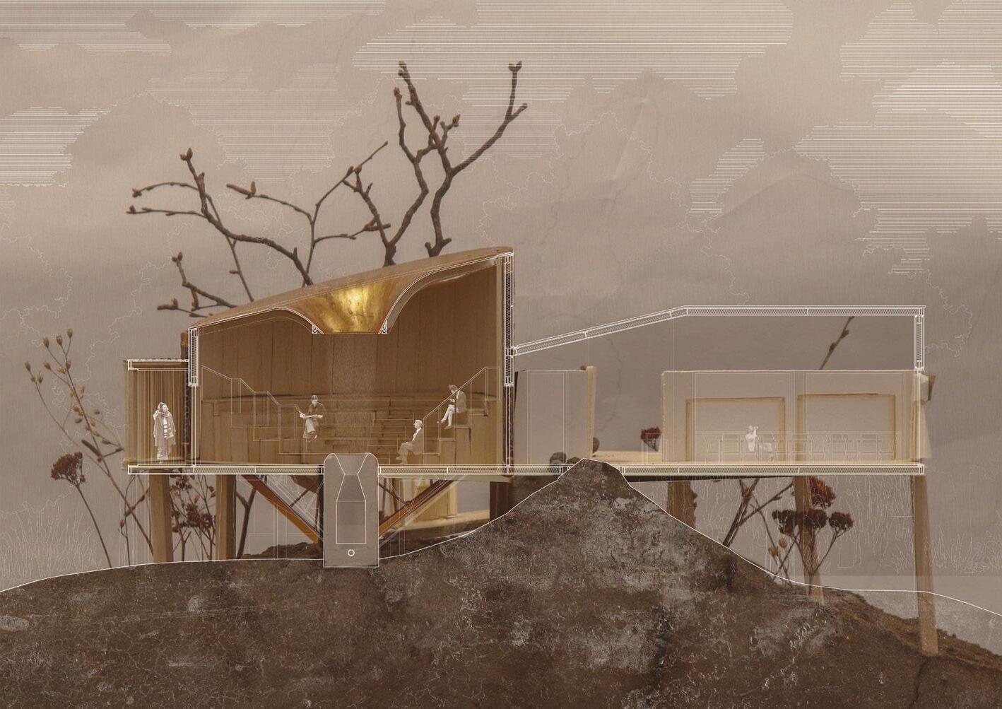
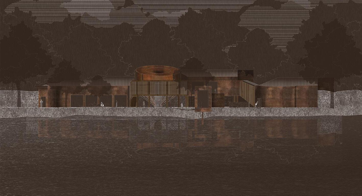
e project includes river and lake water testing spaces that are integrated into the landscape, allowing environmental monitoring to be seen and understood by the public. An assembly chamber sits at the heart of the proposal, providing a place for open discussion and collective decisionmaking around environmental responsibility and site remediation.
Educational spaces support long-term learning, helping communities understand the impacts of pollution, how environmental crimes occur, and the importance of shared care for the environment.
rough these programmes, the project transforms a landscape of concealment into one of transparency, participation, and care. Architecture is positioned not as a neutral backdrop, but as a mediator between science, politics, and public life-giving form to a previously suppressed narrative and restoring a voice to both people and place.
Site: Mobuoy Dump, County Derry Programme: Assembly; Water Testing; Education Spaces
Perching atop the bank (previous left)
A dialogue between two conditions, exploded axonometric (previous right)
Overlayed model section (top)
Long elevation (above)
Assembly section (top)
Mobuoy dump landscape strategy (left)
Between two water, plan (above)
Waste implications & speculations (below)
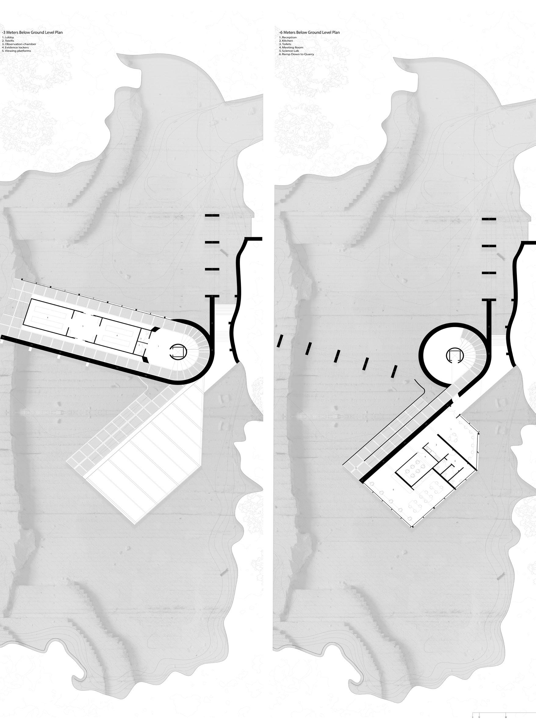
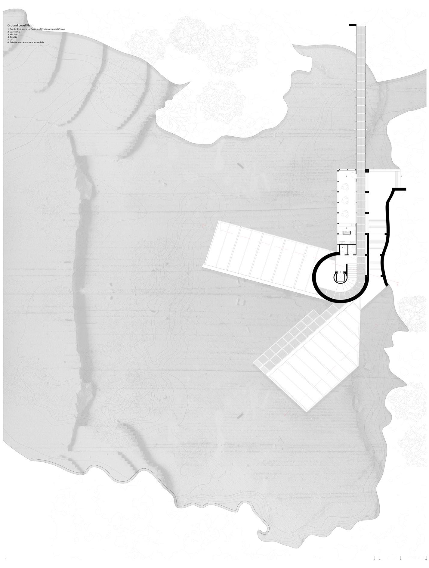
Site: Mobuoy Dump, County Derry Programme: Material Hub; Centre for Environmental Crime
OCCUPYING THE VOID
INSTITUTING ENVIRONMENTAL ACCOUNTABILITY
ELLIOTT HART
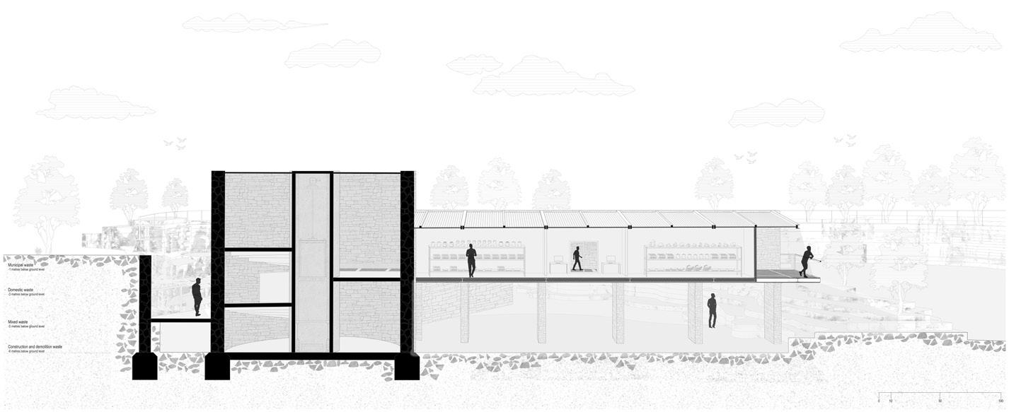
Mobuoy Dump, located east of Derry, was the site of a major environmental crime between 2003 and 2010. During this period, two companies worked together to illegally dispose of waste underground, causing severe damage to the land and surrounding river systems. is contamination impacted local wildlife, the wider environment, and the drinking water supply for Derry. While the full extent of the damage remains unknown, the case resulted in both company owners being charged and sentenced, marking the rst environmental crimes to lead to prison sentences. is 20-year history serves as a critical case study for future environmental crimes, highlighting the long-term consequences of improper waste management and educating visitors on the broader impact of improper everyday waste disposal. Drawing attention to the need for an intervention to ful l the requirement to prevent a similar situation occurring again.
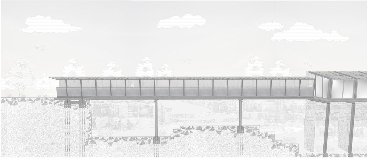
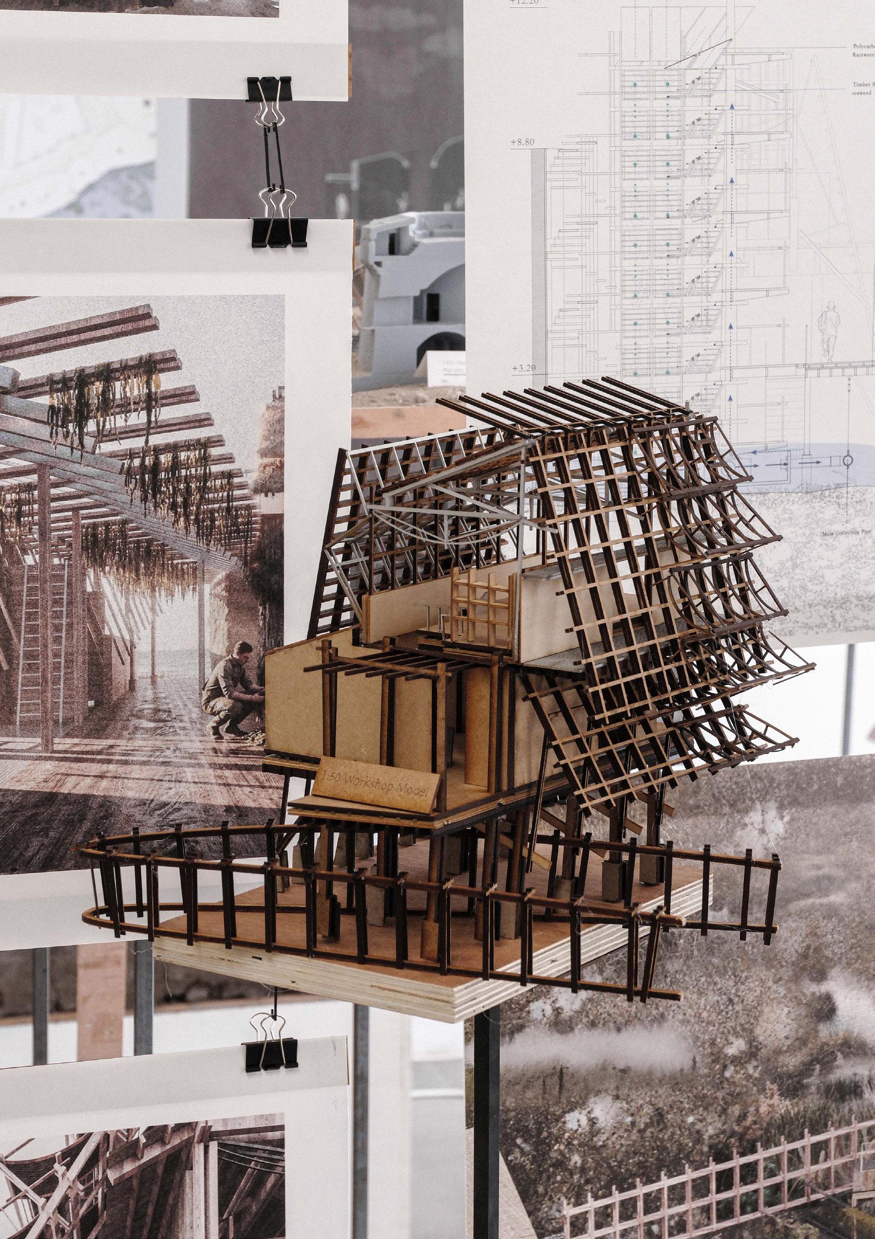
e project is divided into two parts: to the east, an existing structure has been repurposed into a material hub, providing a space for the people of Derry to deposit unwanted materials and redistribute them for further use. is transforms a site once associated with waste disposal into an opportunity for reuse and circular resource management. To the west, a Centre for Environmental Crime is embedded within a quarry which was formed as a result of the illegal dumping between 2003 and 2010. e building includes a cafeteria within an observation platform, an evidence chamber that archives and presents the site’s history, and a science laboratory dedicated to investigating the long-term environmental damage.
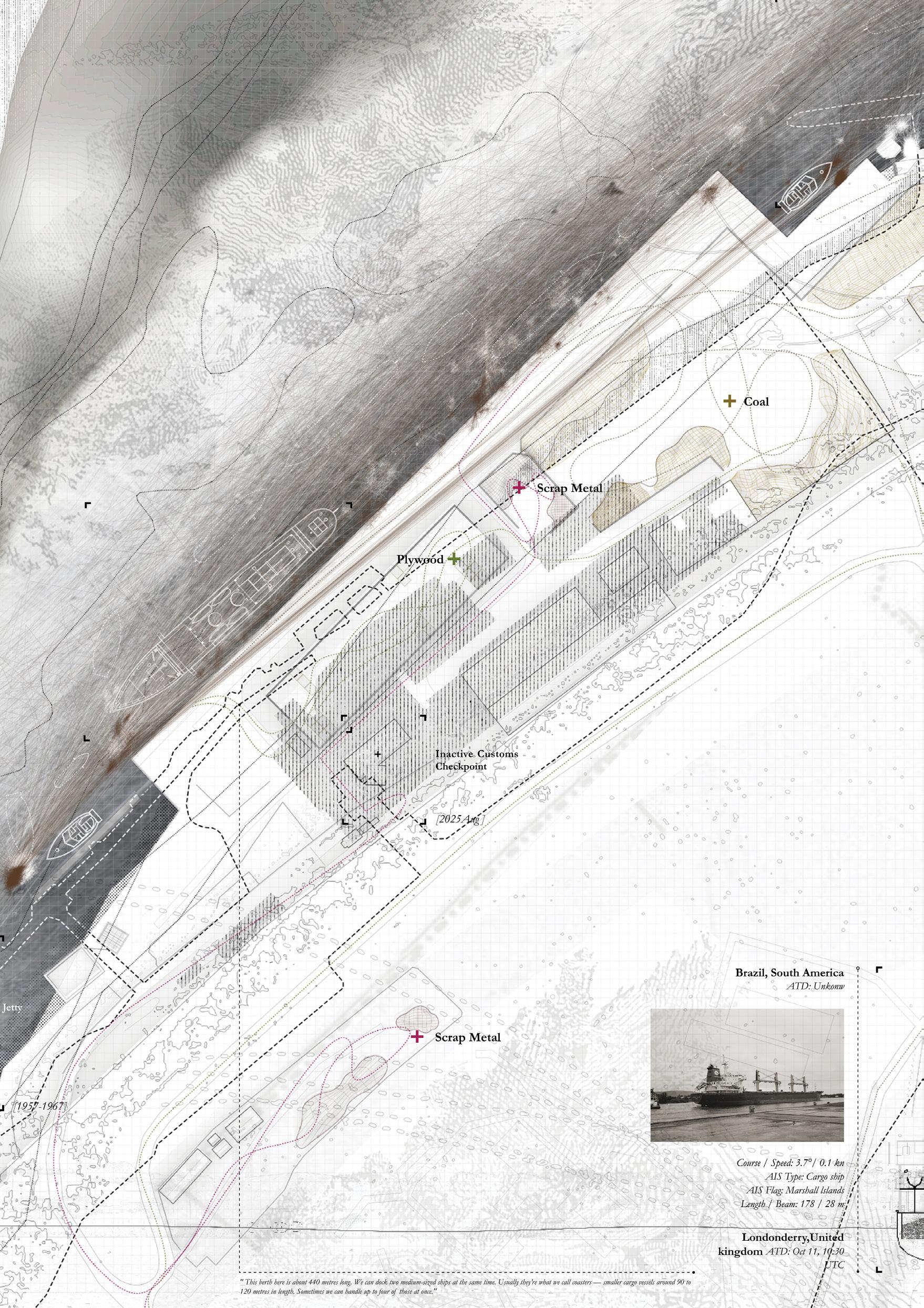
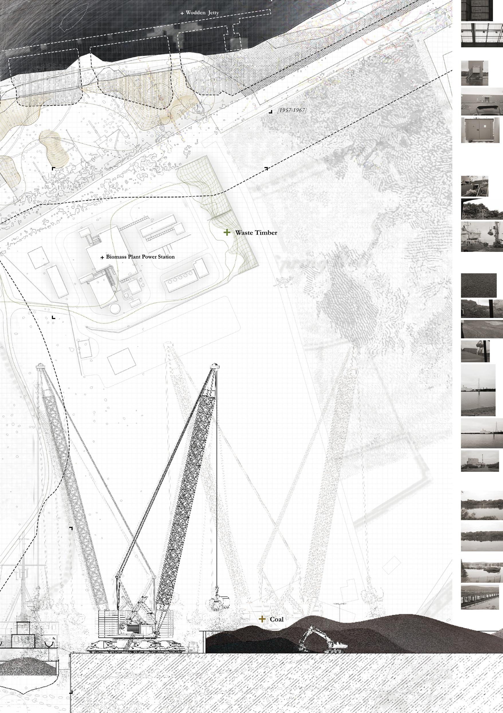
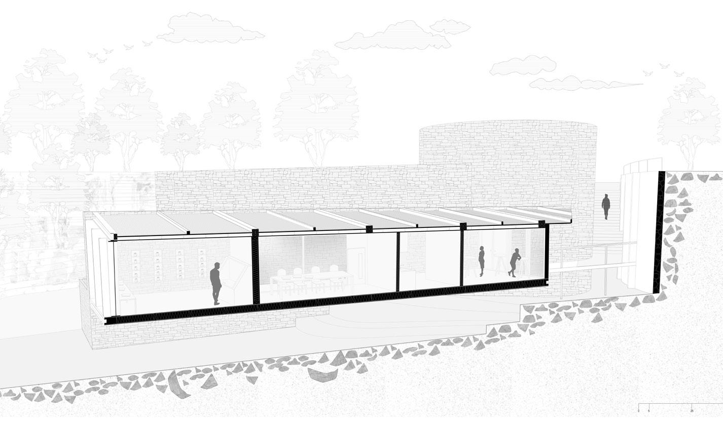
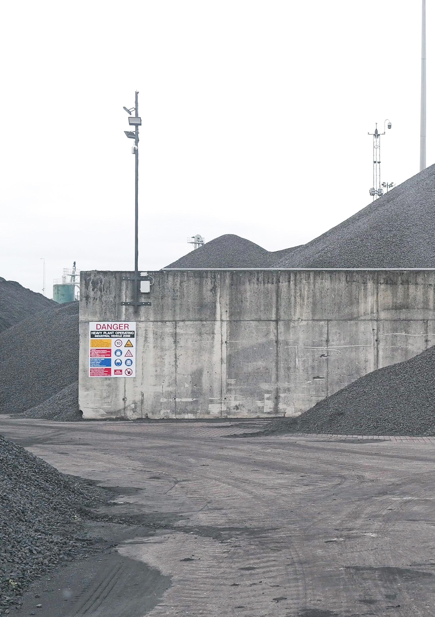
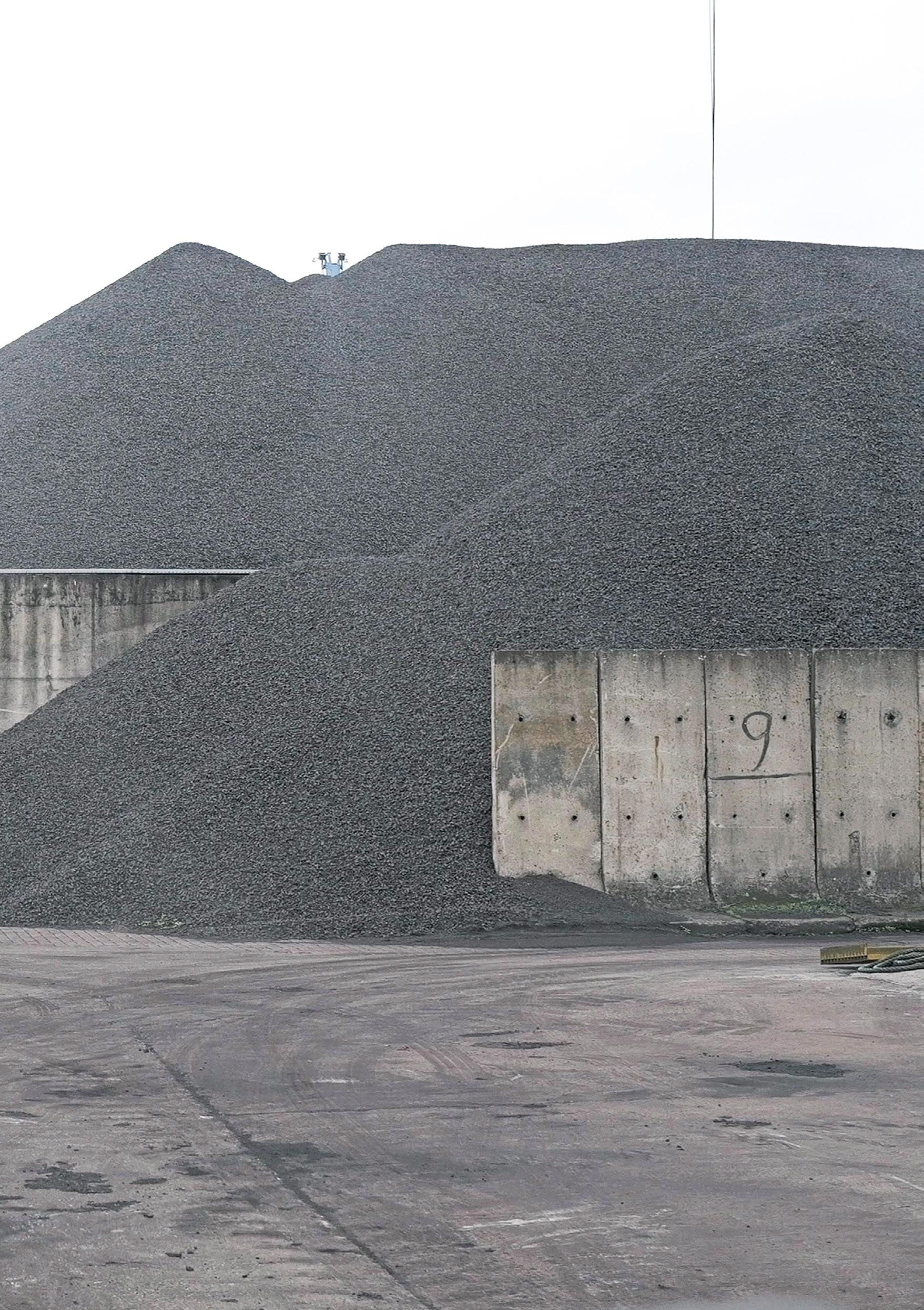
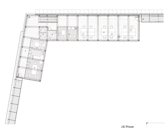
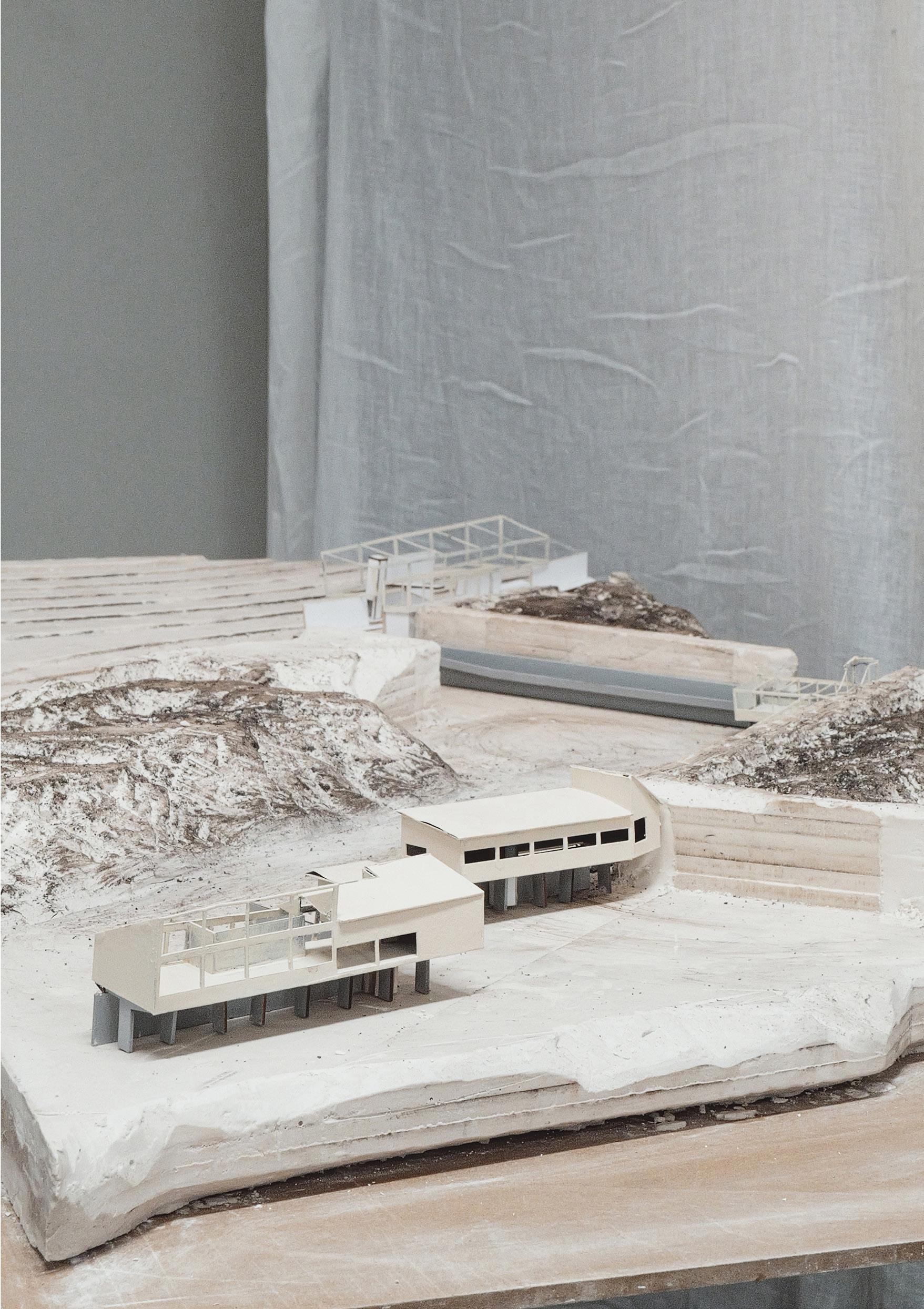
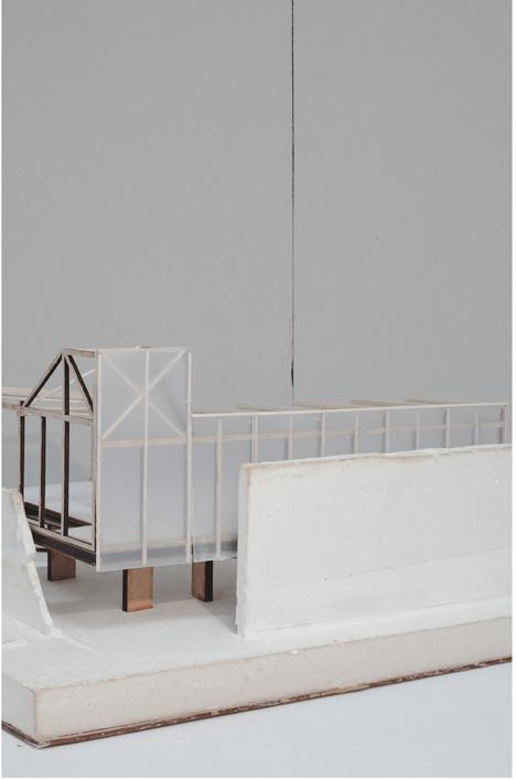
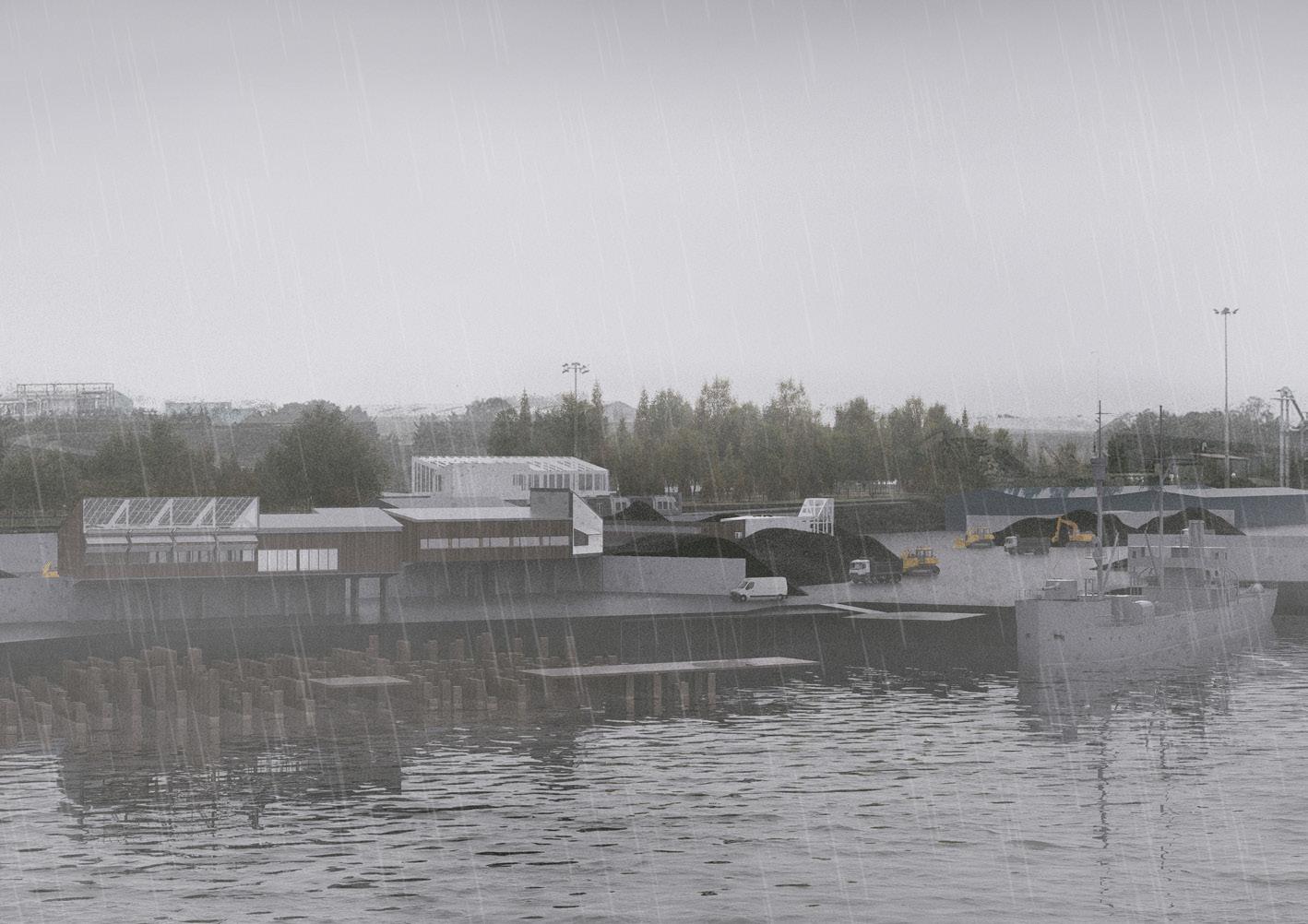
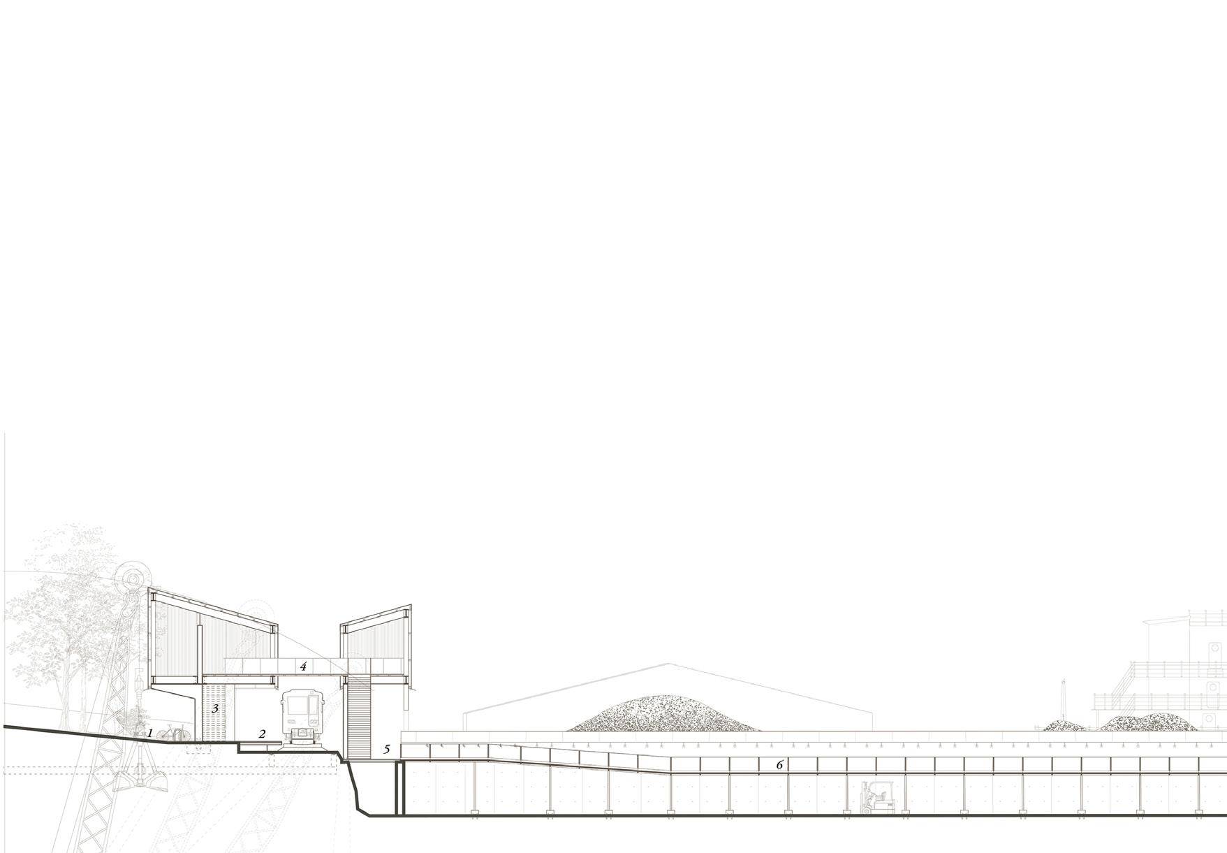
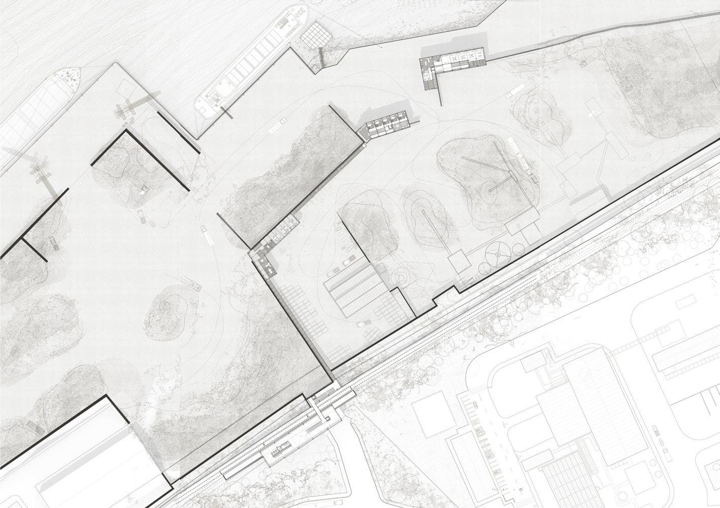
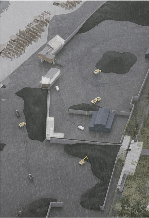
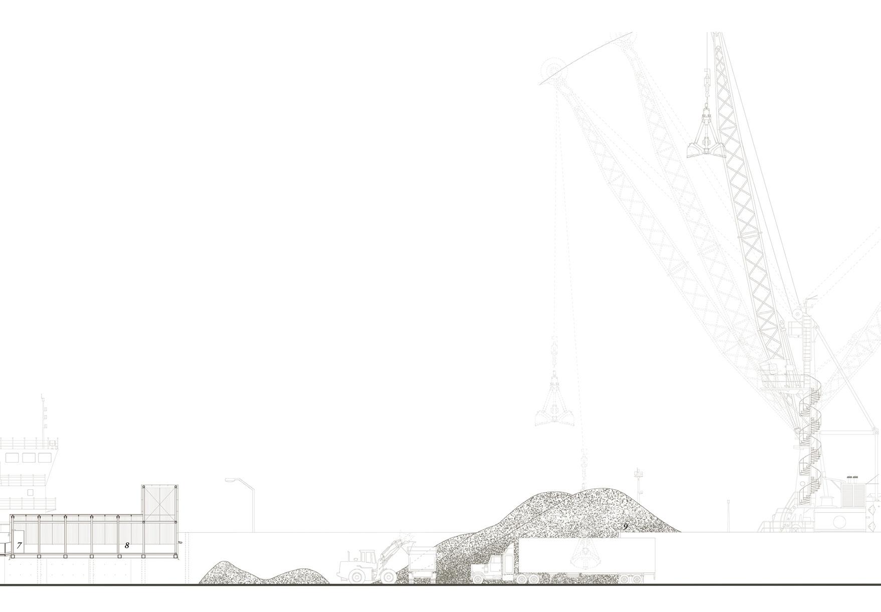
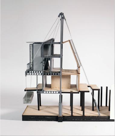
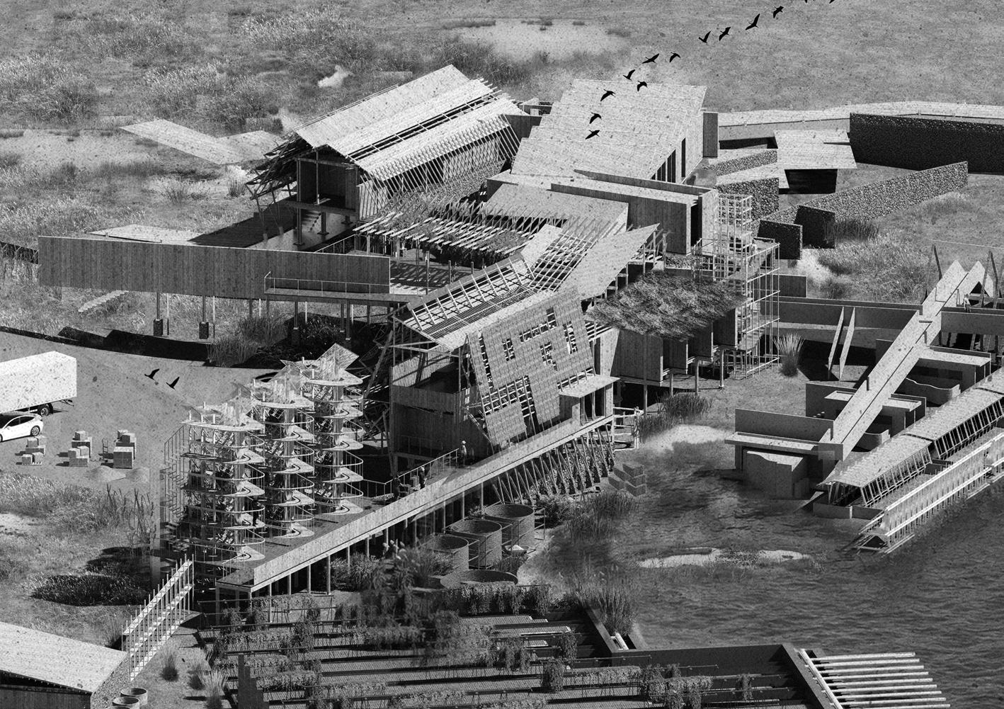
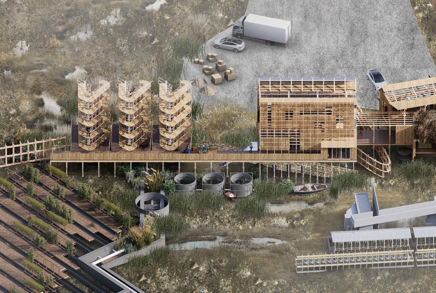
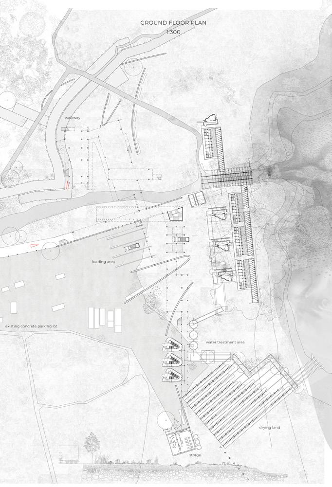
is project investigates Lisahally Port (Foyle Port) in Derry as a transscalar industrial landscape shaped by the ows of coal, materials, labour, and infrastructure. Using leakage as a research method, the project explores how architectural interventions might seep into existing port systems, creating spaces that support worker welfare while anticipating the gradual transformation of the industrial landscape. ‘Slack’ refers to fragments of ne coal, but also describes a condition of looseness or reduced tension within a system of forces. In maritime and industrial contexts, the term suggests the interval between movements - a temporary pause within an otherwise continuous operational rhythm. Within the coal port, these moments of slack emerge spatially: between loading, storage, and transport lie spaces that are not fully occupied by logistical activity.
By inhabiting the existing concrete retaining walls of the coal yard, the proposal introduces spaces for rest, washing, and observation for nightshift workers operating within the port’s 24/7 logistical environment. Rather than replacing industrial infrastructure, the project reinterprets these structures as spaces of pause within the operational rhythm of the port - spaces described here as slack spaces. At the same time, the project speculates on the long-term afterlife of the coal port. As coal gradually declines, these slack spaces begin to suggest an alternative future in which industrial logistics coexist with new public waterfront conditions, transiting the port towards a more hybrid and adaptive landscape.
Elbow plan (previous left)
Architecture & coal (previous right)
Tectonic model (right)
View to the port (below)
Port movements, long section (bottom)
Controlling accumulation (top right)
Choreographies of loading (right)
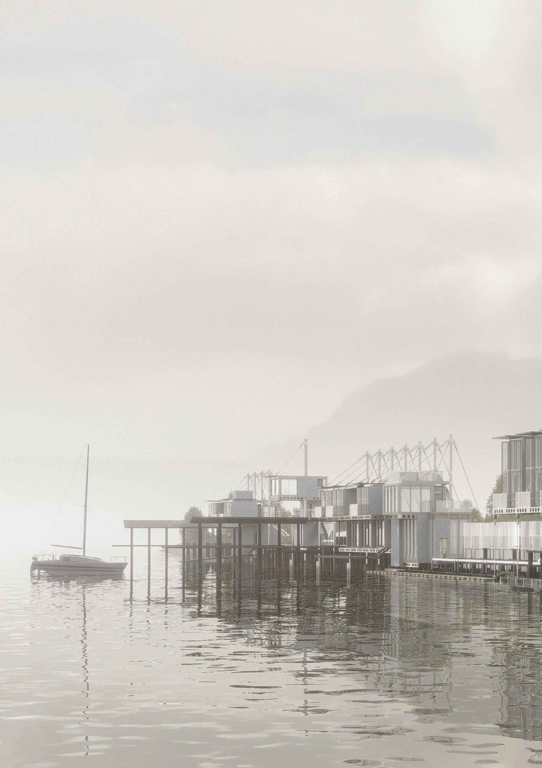
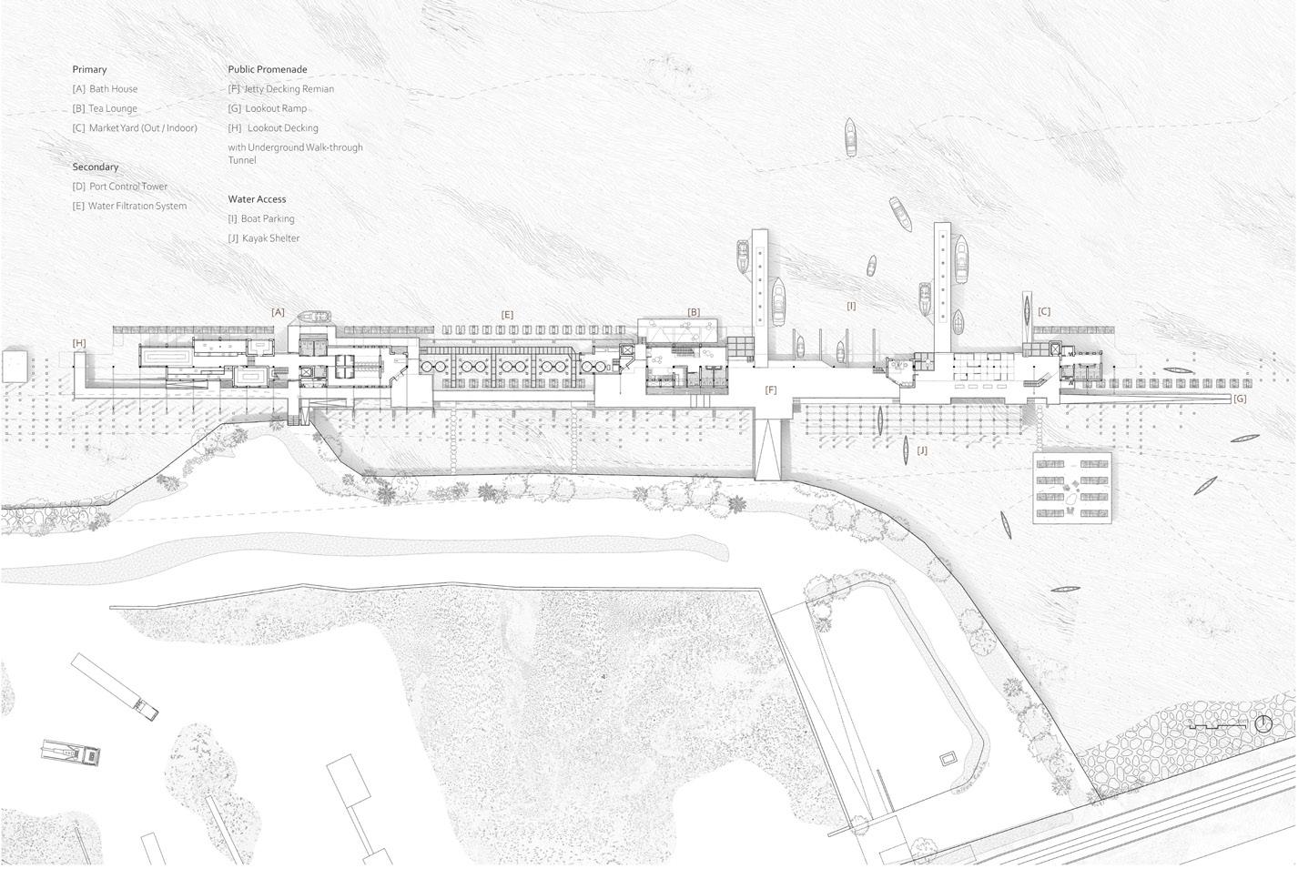
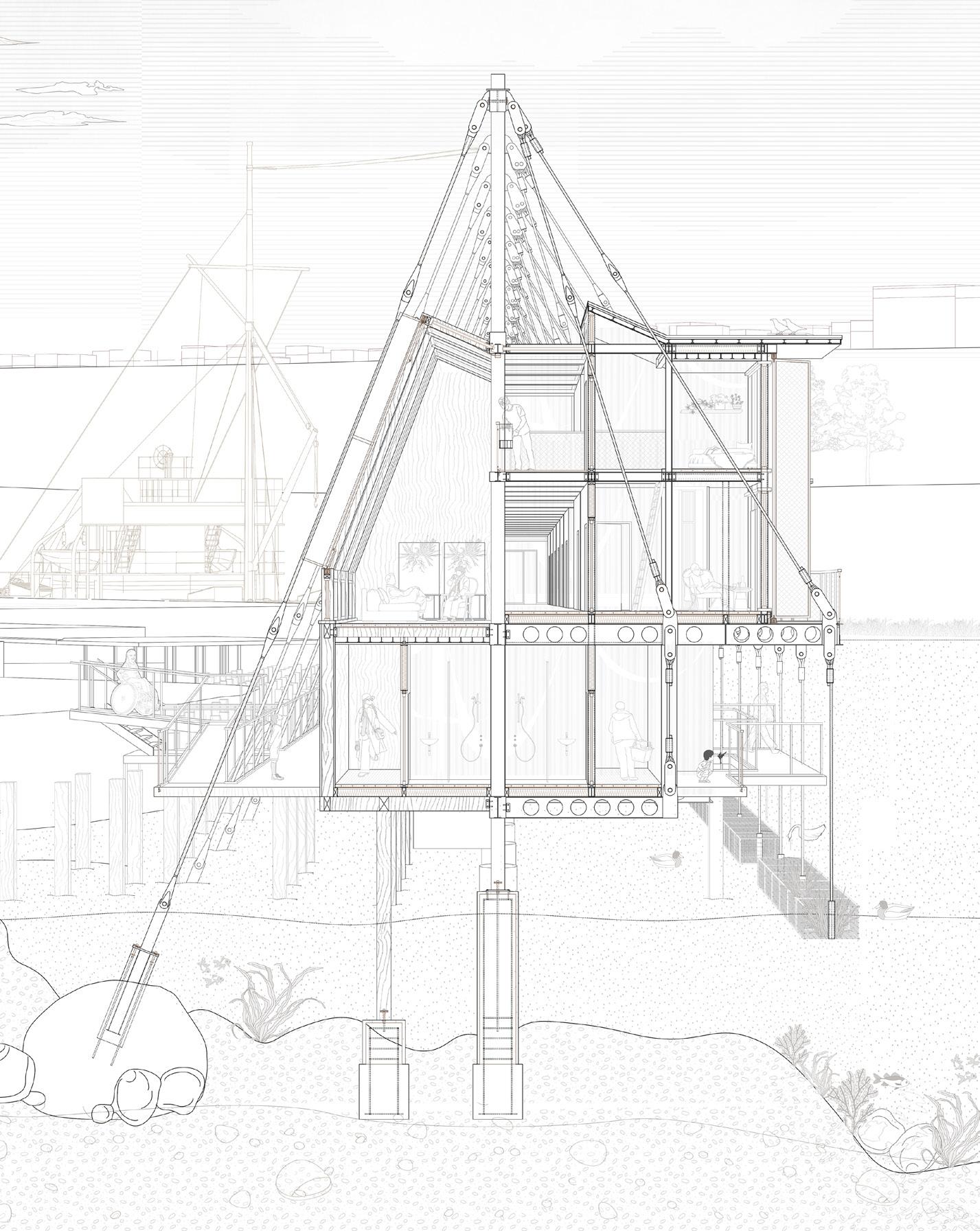
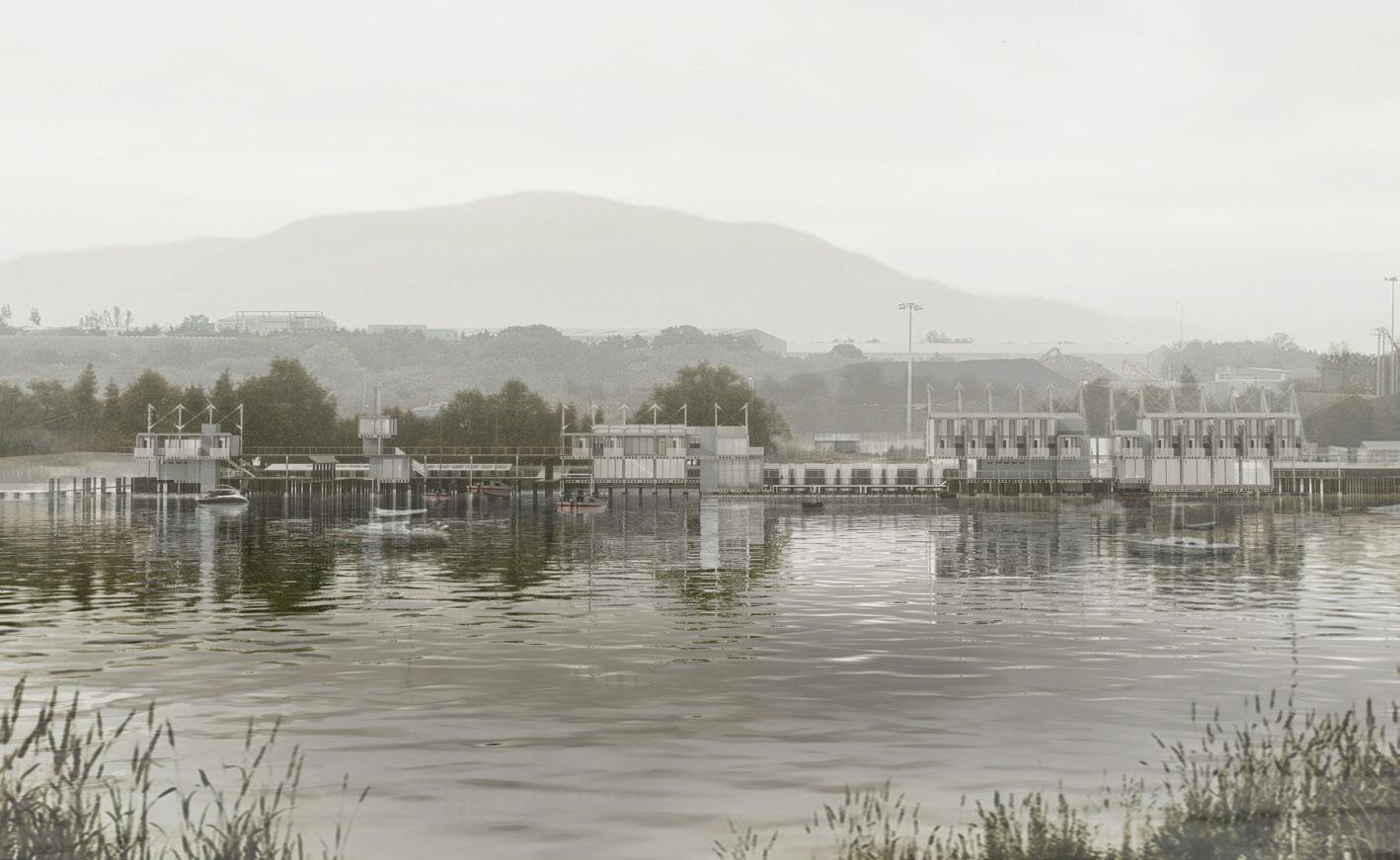
Site: Lisahally Port Timber Jetty, County Derry Programme: Adaptive Reuse; Public Promenade; Bath House; Tea Lounge; Market Yard; Water Reuse; Water-Access; Visible Water Infrastructure
RESCRIPTING THE JETTY
RECLAIMING THE LISAHALLY TIMBER JETTY THROUGH FILTRATION, REUSE & SHARED PUBLIC LIFE RUOXIN TAN
Rescripting the Jetty reclaims the deteriorating timber jetty at Lisahally Port as a public platform where water repair becomes visible and usable. e project starts with the jetty’s military and industrial afterlife: a linear ruin of piles, deck fragments and access points that once served logistics but now sit between working port territory and the tidal edge of Lough Foyle.
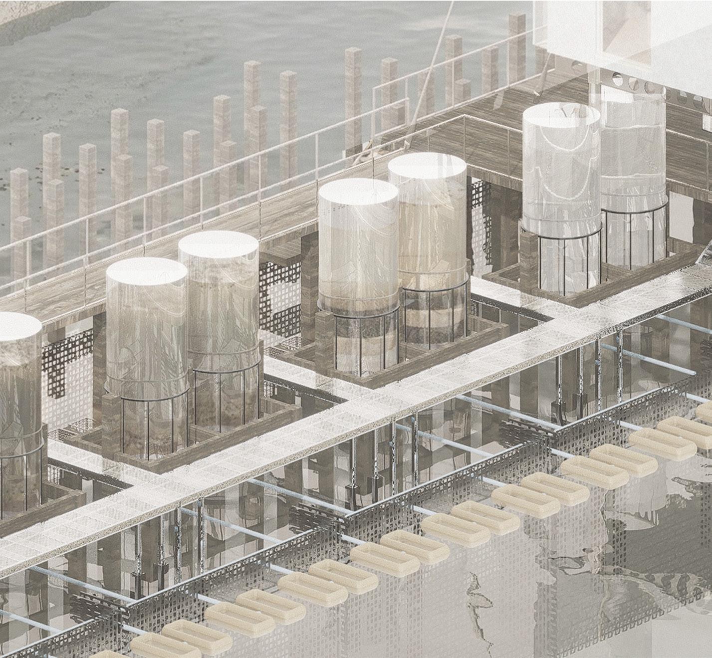
e proposal introduces a clear sequence from polluted to clean and from wet to dry, organising both movement and programme. A wet sampling and ltration corridor draws water from Lough Foyle, stages settlement and treatment, and returns cleaned water as a local resource; supporting washing, bathing, and tea-making. Rather than hiding services, the puri cation deck is elevated and separated from the main promenade so maintenance, education and public observation can coexist without disrupting operational ows.
e programme is distributed as a set of anchored nodes along the retained structure: a bathhouse for workers and visitors, a tea lounge as a shared meeting pocket, a market yard for exchange and seasonal events, and a small lab that links monitoring with making. Boat and kayak access extend the jetty’s role from infrastructure to civic edge, accommodating both present port use and a post-industrial future.
Architectural tension model (previous left)
Scheme plan (previous top right)
View of the jetty (previous bottom right)
Technical section (below)
View from across the water (top right)
Aerial view (bottom right)
Site: e UK-ROI Border, Culmore Programme: Architecture of Sediments & Traces
1)
GATHERED MATTER
THE MANIFESTO OF INTER-TIDEALECTICS
HAIXIN WANG LEON FENG
e long-term e ects of climate, tides, and infrastructure are gradually eroding people’s stable perceptions of “land and water,” “nature and manmade, “and “public and private.” In the intertidal zone, estuaries, and wetlands, these boundaries are not clearly de ned but constantly shifting through rises and falls, erosion, and deposition. Located in Londonderry, a city historically turbulent, this project, by studying the uncertainties of the coastline, does not attempt to solidify these unstable areas but rather explores an architectural language that responds to the changing sediments and traces left behind.
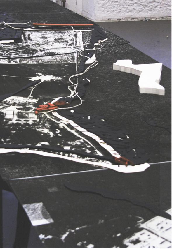
e project is situated on the boundary of the estuary near the Culmore community, adjacent to the Culmore wastewater treatment plant and a historic political boundary line. is area is both the region of most intense tides and a place neglected by humans. e tide wracks left on the shoreline after the tide recedes, a sedimentary layer mixed with seaweed, shells, plastic, woods, waste, and silt, becomes the most important research object of this project. It is not only a natural phenomenon but also a spatial record: a record of the ow of water, the cycle of matter, and the ow of deep-seated social relationships. Unlike a cold, indi erent political issue, tide wrack is constantly reconstructing the boundaries of a site. Our interpretation of the shared island stems from Deleuze’s understanding of the relationship between roots and soil and Deligny’s method of recording “wandering trajectories,” interpreting the site as a map written by unconscious movement and deposition. e map is no longer used to represent territory, but to record how actions leave traces.
Filter (left) Beacon (above)
Site: e UK-ROI Border, Culmore Programme: Tidal Change; Economic Value; Lost & Found; Recycling Centre
1) a
FILTERING
TIDEWRACK IN SUSPENSION
HAIXIN WANG
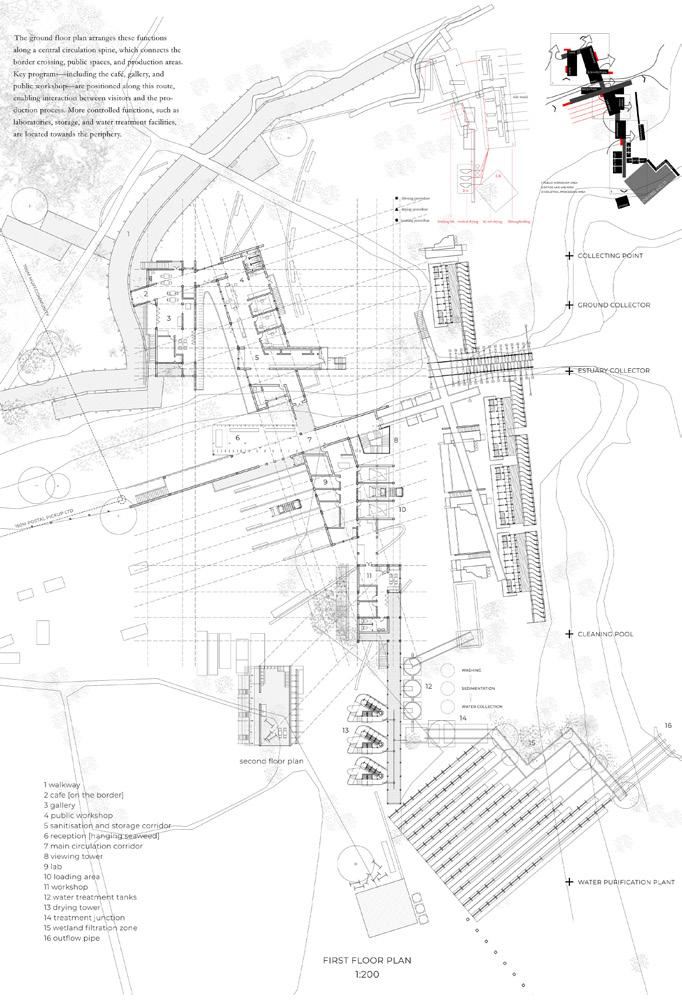
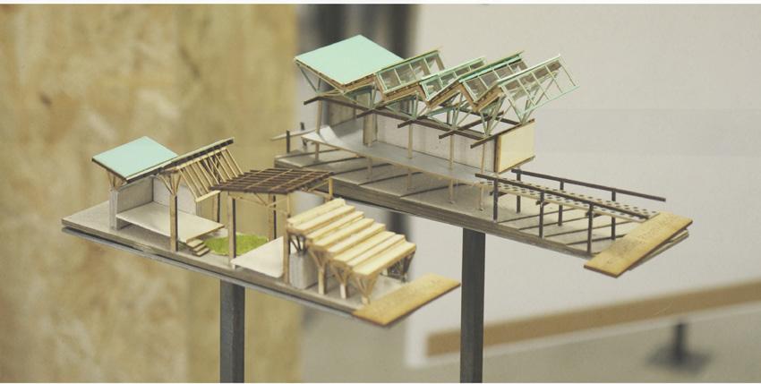
A continuous exchange between land and water shapes the landscape. Debris from past events, seaweed carried by shifting currents, and suspended objects drift back and forth between the lake and the shore, leaving behind subtle but persistent traces. Within this process, objects exist in a suspended and indeterminate state—neither fully belonging to land nor water, neither entirely private nor public, nor completely discarded. e lake acts as a carrier of this circulation, interrupting xed identities and placing objects in a continuous state of transition.
How do natural and political boundaries intervene in the recycling and circulation of goods? How can materials that carry ecological traces also acquire new social and economic identities? Previous work responded to this condition by engaging with the processes of collection, classi cation, and reuse. e Lost & Found Centre re-assigned identities to drifting objects, while the Lighten Beacon transformed tidal energy into communal infrastructure.
Building on this, the current project shifts focus on production and redistribution. Located at a former postal pickup site near multiple transport nodes, the proposal explores how collected materials can be repaired, processed, and reintroduced into circulation across the political boundary. In doing so, architecture operates as a mediator—negotiating between natural ows, infrastructural systems, and regulatory frameworks, while addressing the contra dictions embedded within cross-border material exchange.
Exploded axonometric (previous left)
Exhibited fragment model (previous right)
Aerial views (above)
Ground foor plan (top left)
First foor plan (top right)
View from below (above)
Across the foliage (right)
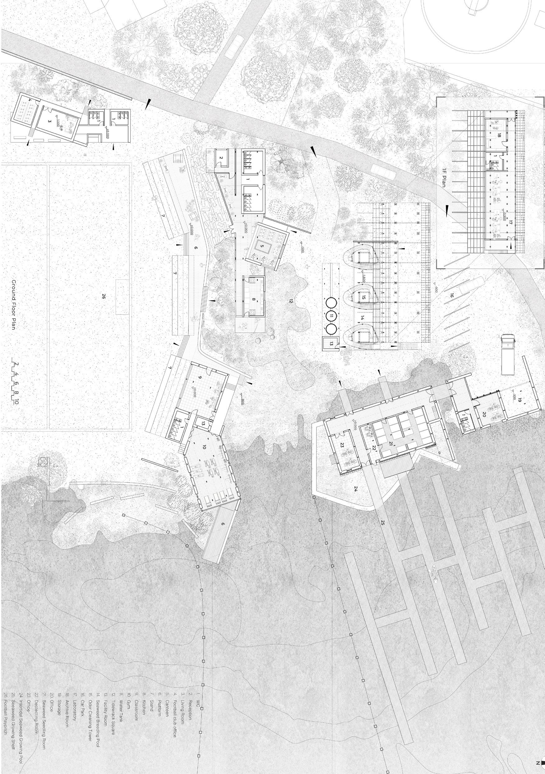
Site: e UK-ROI Border, Culmore Programme: Seaweed Cultivation; Football Club; Public Stand; Cafe
1) b
ACCUMULATING TIDEWRACK IN LIABILITY
LEON FENG
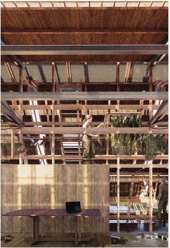
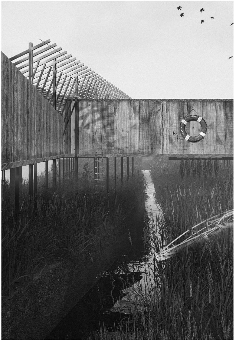
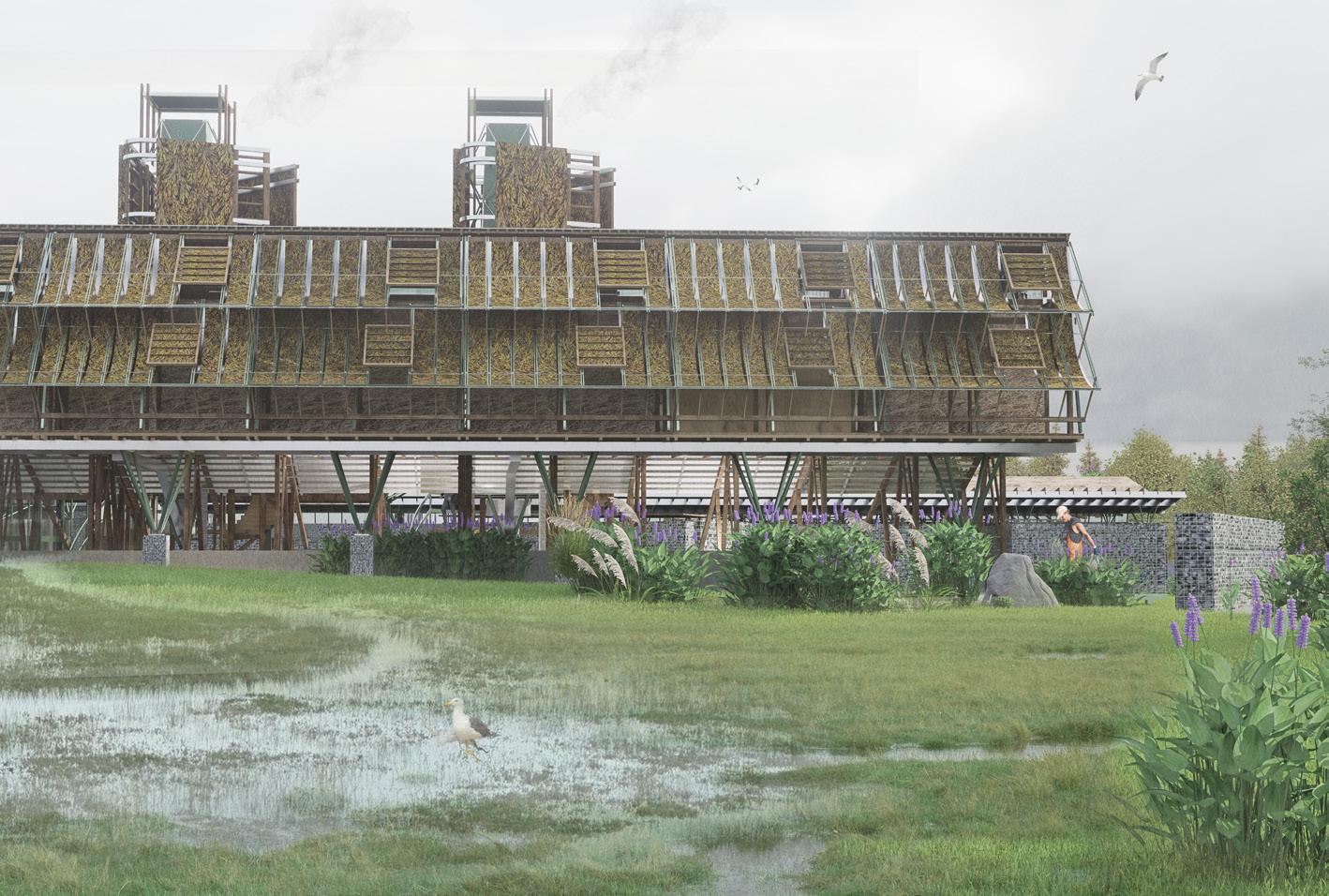
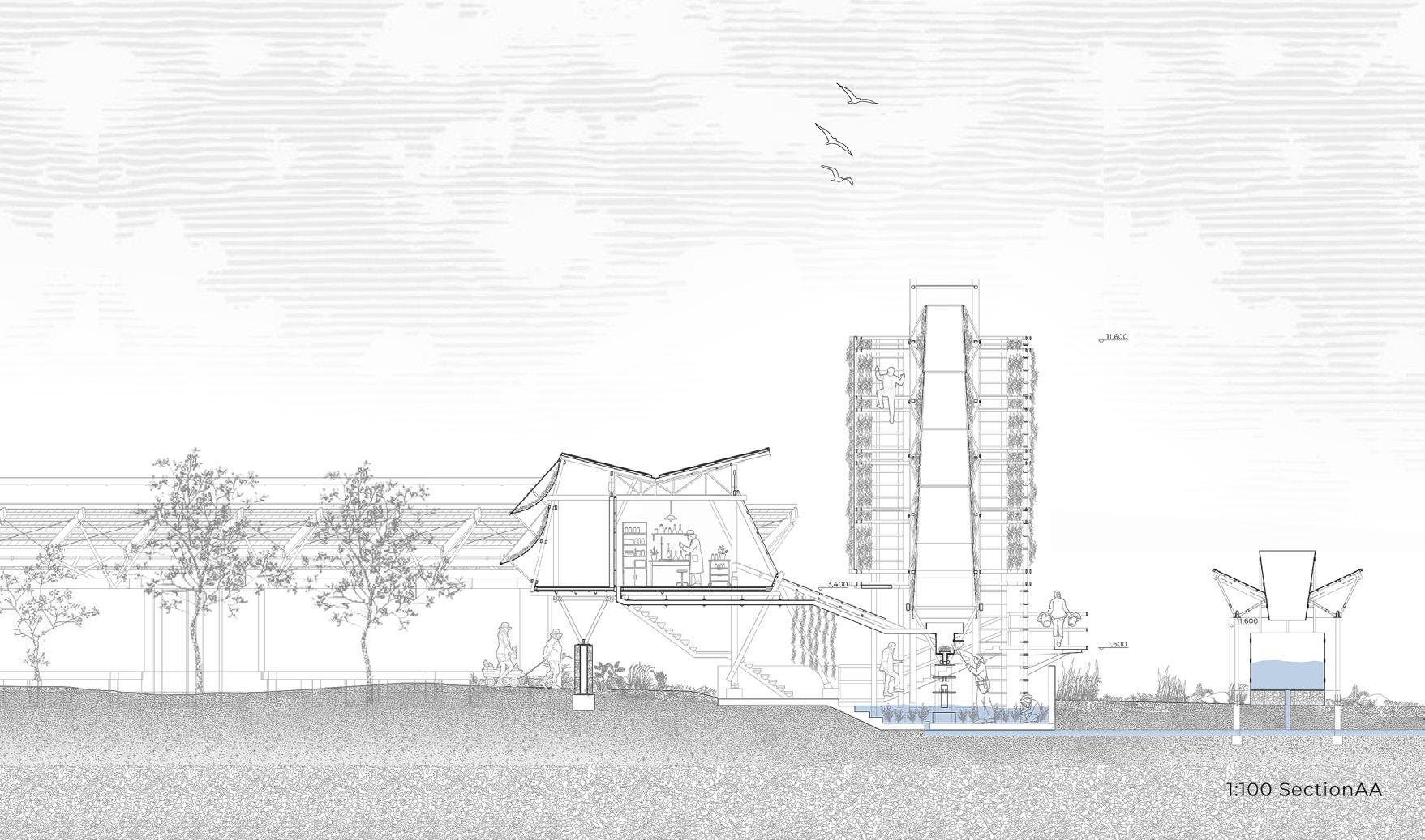
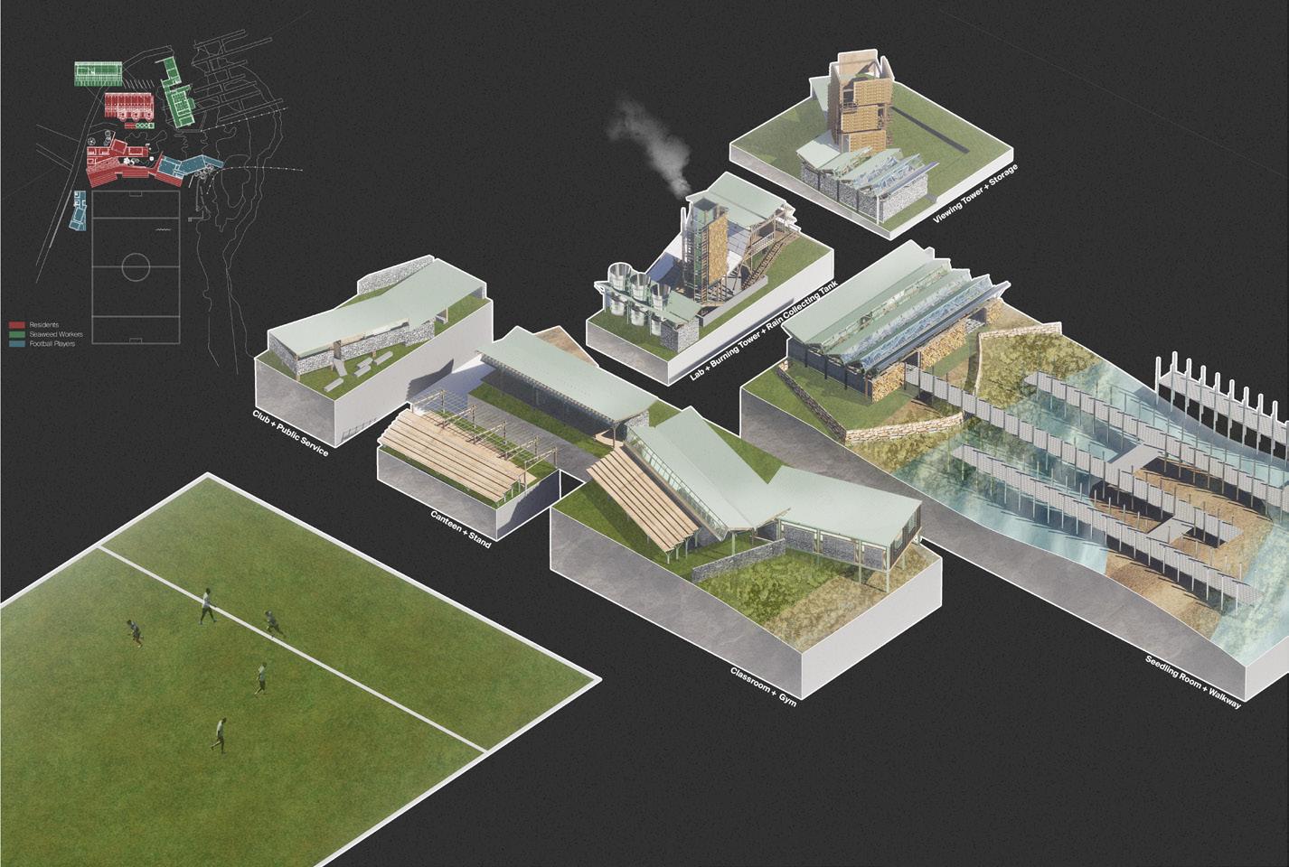
is project engages architecture with environmental liability through seaweed cultivation and tidewrack accumulation. Within the intertidal landscape of Culmore, the project located beside a wastewater treatment outfall at Lough Foyle, the site experiences nutrient discharge, odour pollution, and excessive seaweed growth, producing complex ecological conditions that directly a ect nearby communities and public spaces.
Central to the proposal is tidewrack, the accumulation of seaweed, sediment, and debris deposited through tidal movement. Understood as both ecological evidence and material trace, tidewrack reveals the hidden circulation of pollution, nutrients, and liability across the public. e project interprets tidewrack not simply as discarded matter, but as a living record of intertidal exchange and environmental transformation.
rough seaweed cultivation embedded within the intertidal zone, seaweed becomes an indicator of water health, a ltering agent for pollutants, and an ecological resource with productive value. Public programmes including sports facilities, gathering spaces, cafés, and educational environments invite local communities to engage with the changing coastal condition. By observing the growth, collection, and transformation of seaweed and tidewrack, the proposal encourages environmental awareness and reconsiders architecture as an adaptive infrastructure connecting ecology, public life, and responsibility.
Fragment models (previous left)
Ground foor plan (previous right)
Rendered elevation (above)
1:100 long section (below)
Axonometrics (top right)
Growing space (far right)
Site strategy (right)
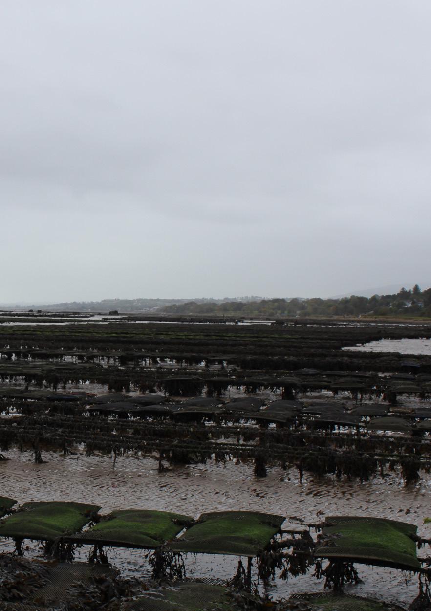
Tidal Oyster Wracks
Site: Redcastle, County Donegal Programme: Oyster Culture Centre; Oyster Factory; Research Lab
OYSTER MATTERS
A
FARMING & PUBLIC LIFE THRESHOLD ON THE BORDERED SHOES OF THE LOUGH FOYLE YUXIAO XUE
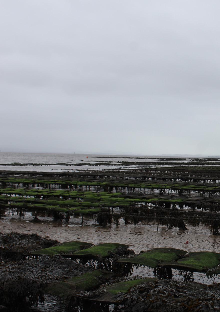
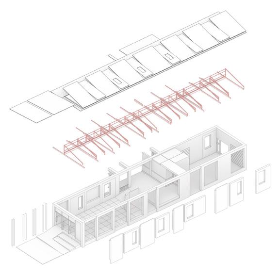
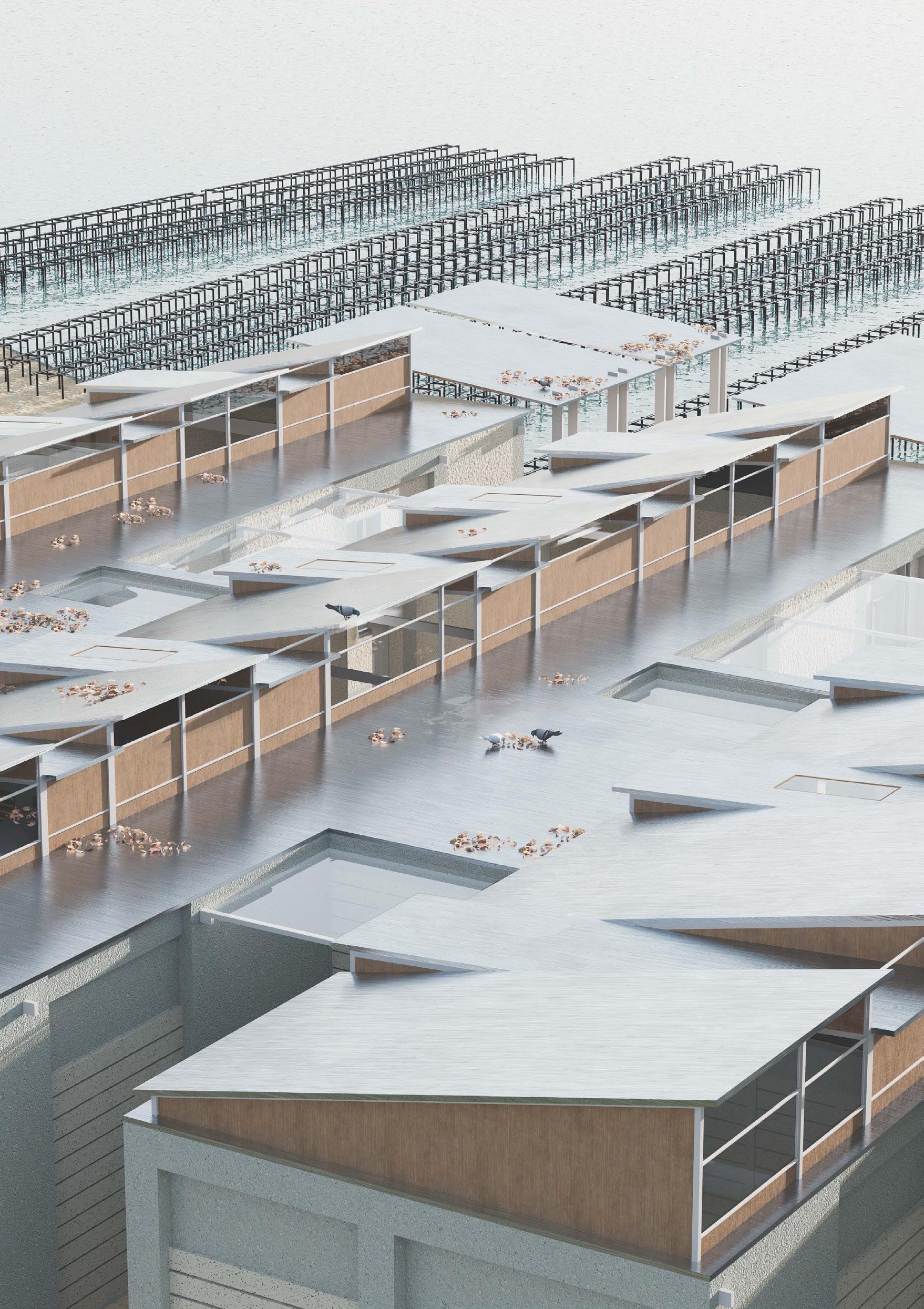
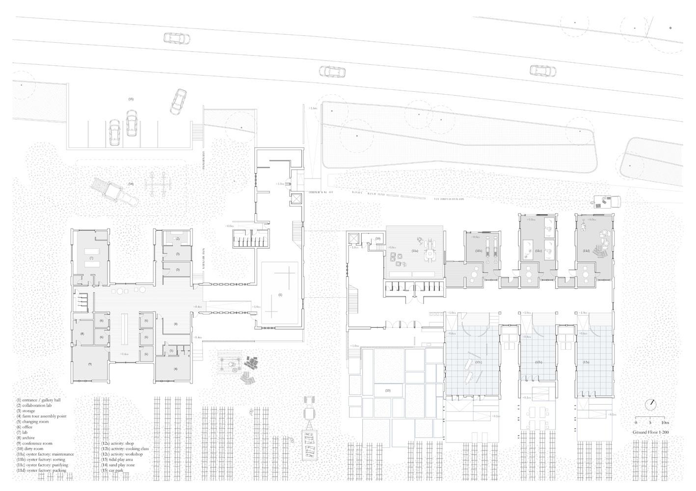
Motivated by a concern for how productive coastal landscapes are perceived and engaged with, this project addresses the growing disconnection between oyster farming infrastructure and public life at Lough Foyle. While oyster trestles continue to expand along the coastline as part of a wider food economy, they remain culturally distant from the local community in Derry, where oysters are rarely consumed and are often perceived as an intrusive presence along the shore. e project begins with this condition of visibility without engagement, and develops an architectural response that reconsiders how such landscapes might be shared. Rather than treating oyster farming solely as an industrial process, the proposal frames it as a spatial and cultural condition that can be made accessible, legible, and open to reinterpretation.
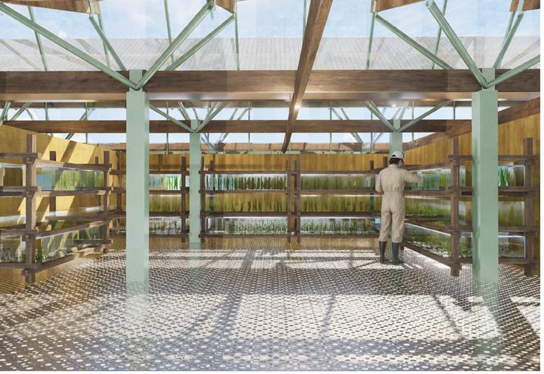
rough the design of an oyster culture centre located at the water’s edge, the project brings together production, observation, learning, and making. e building operates as both infrastructure and interface, providing a working environment for oyster processing while o ering a public framework through which these processes can be seen, understood, and experienced. e project extends beyond the building to engage directly with the intertidal ground and the oyster trestles themselves, transforming them into sites of encounter. Here, oysters are not only consumed, but also handled, studied, reused, and exhibited, shifting their role from commodity to cultural and material agent.
ARCHITECTURE FOR SOCIO-ECONOMIC COLLECTIVITY IN MOVILLE
MOLLY SINCLAIR
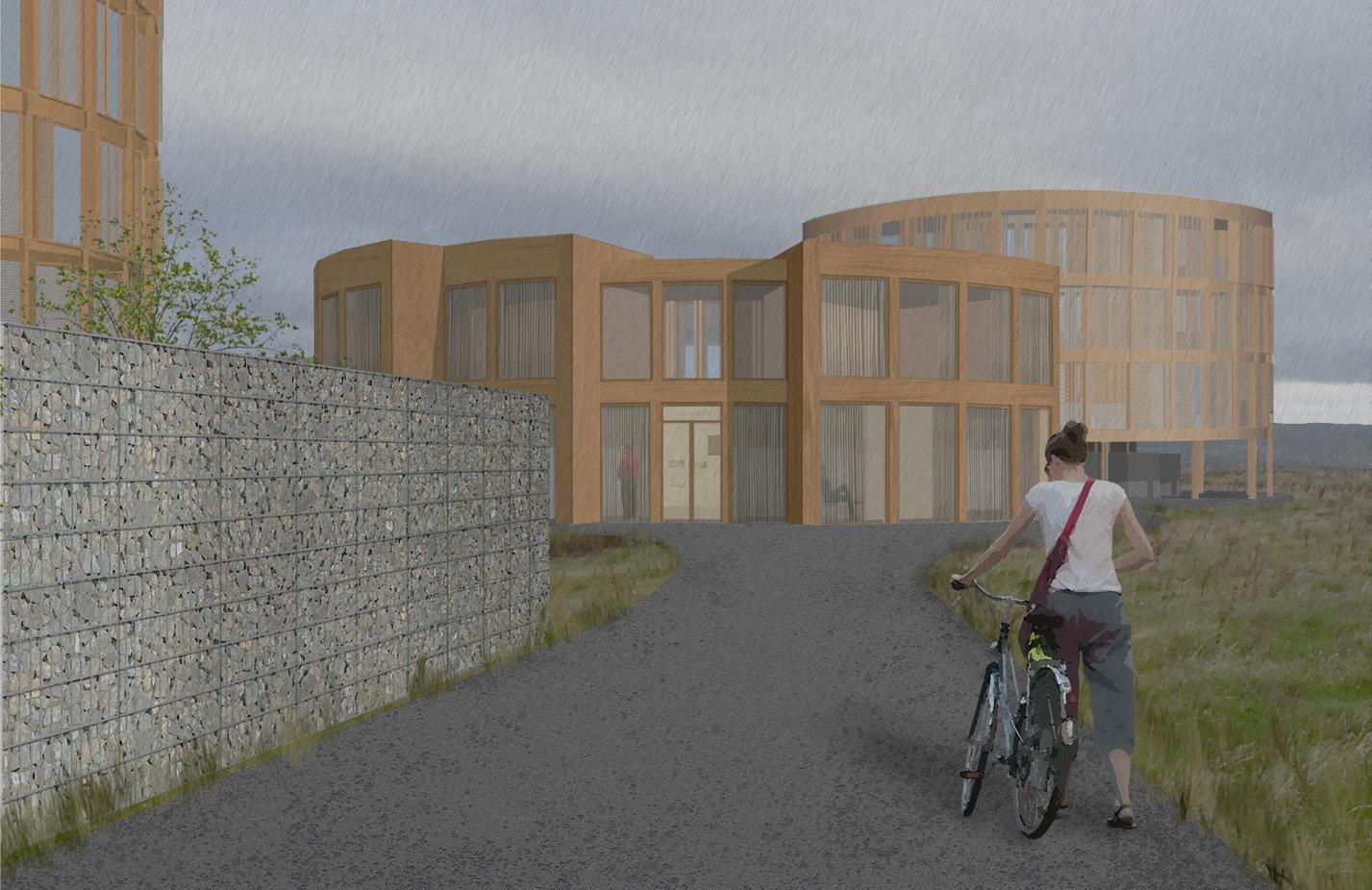
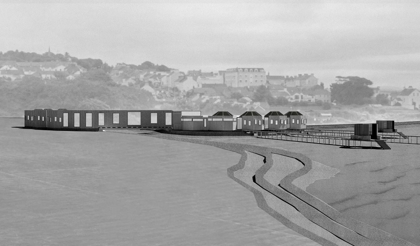
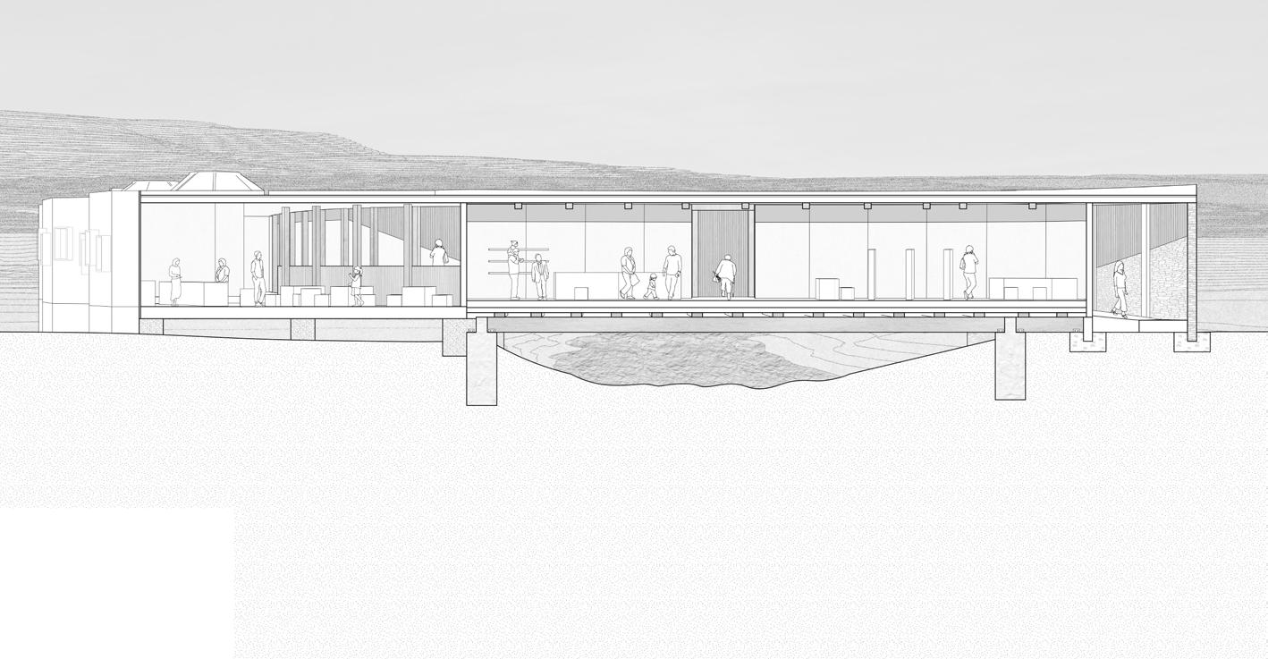
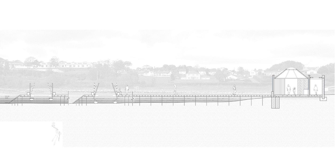
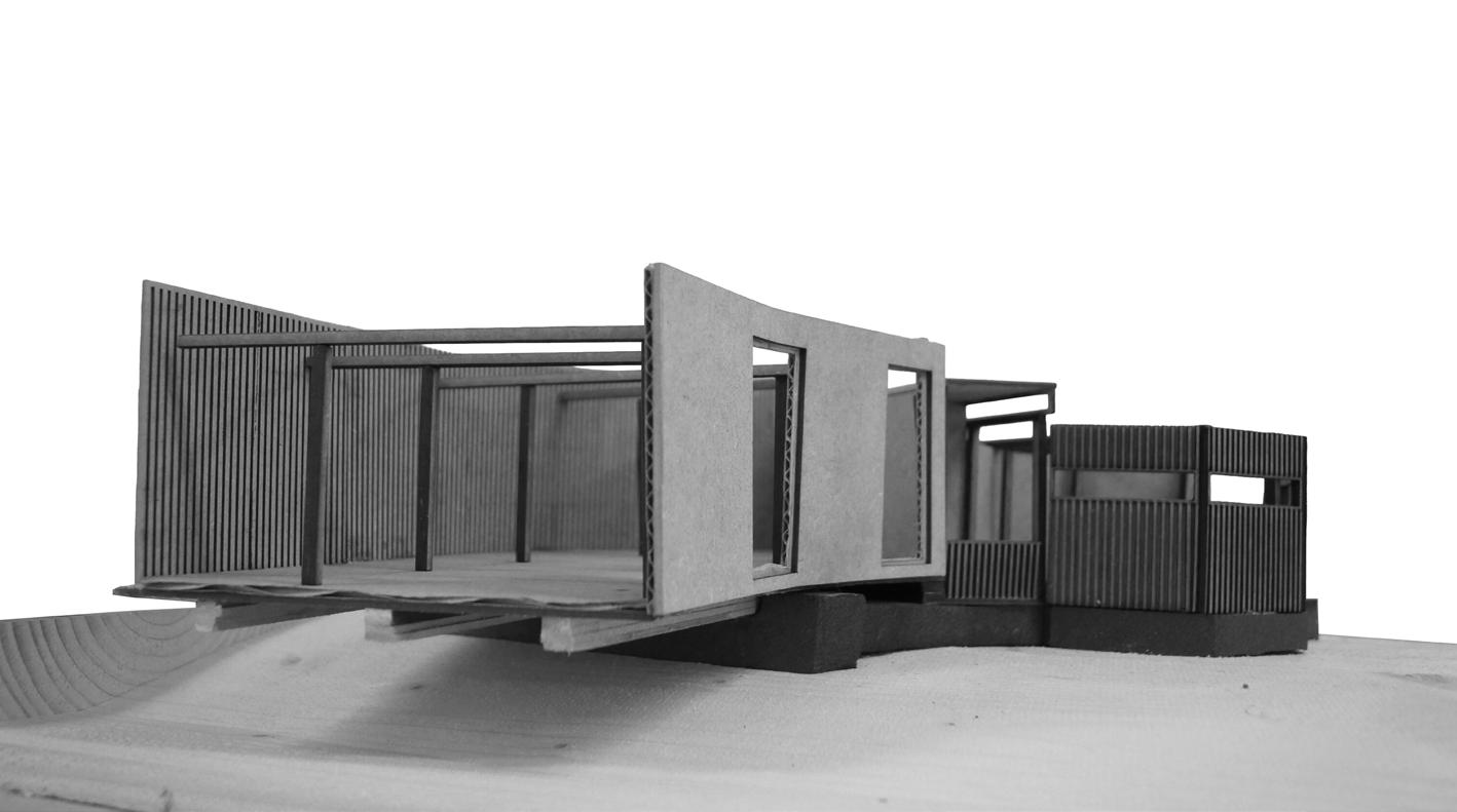
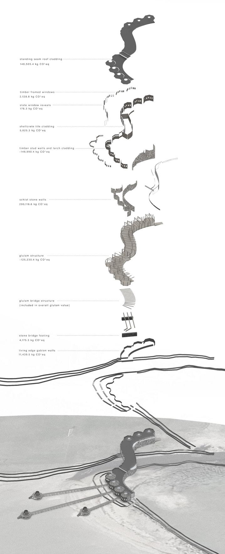
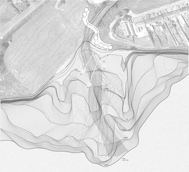
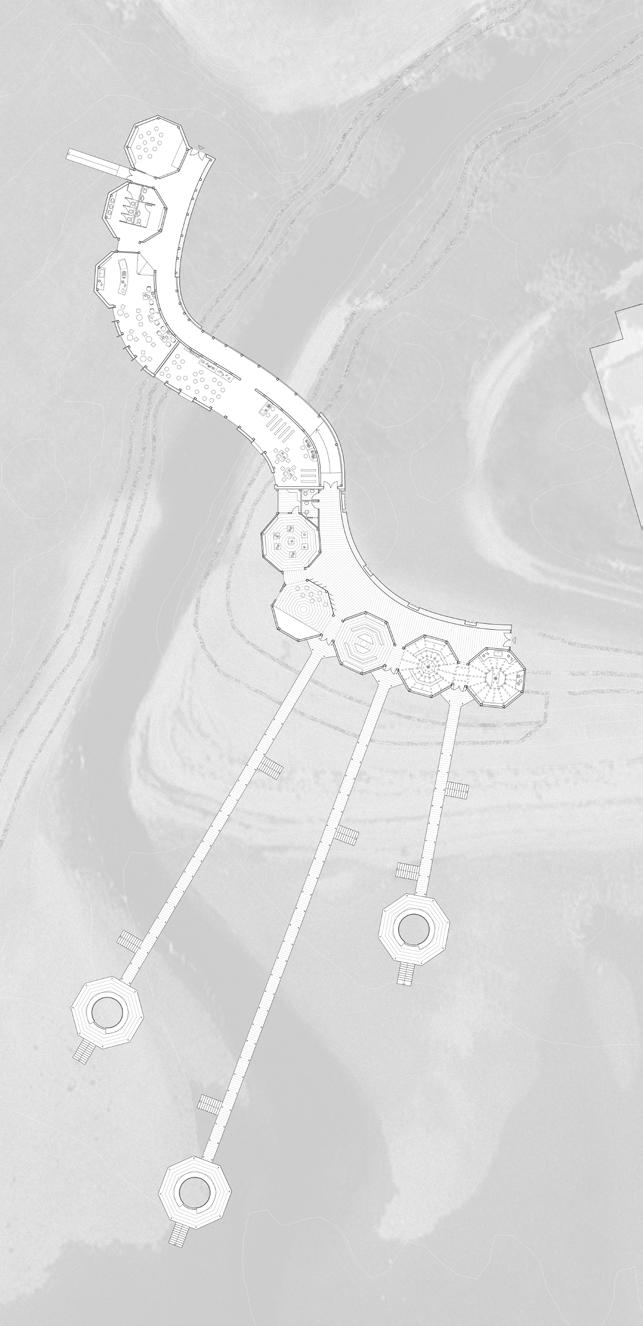
Moville is a heritage coastal town in the Republic of Ireland, where a large intertidal sand at sits adjacent to the strong currents of the primary shipping route through Lough Foyle. is makes its dynamic intertidal zone unique, in that many objects, and subsequently stories, are carried through wider waters and washed ashore. Combing for the Commons seeks to re-imagine the intertidal zone as a shared civic and ecological space, creating an architecture of socio-ecological stewardship which supports the formation of an intertidal community. Research into Moville and its situated publics indicate a lack of spaces for communities to come together. e project provides facilities for existing communities with links to the intertidal site, alongside spaces which encourage a new beachcombing public; which takes an interest in sifting through Moville’s tangible stories (brought about by its position in the contested watershed) and its intangible stories (related to maritime heritage and role in mass emigratory journeys).
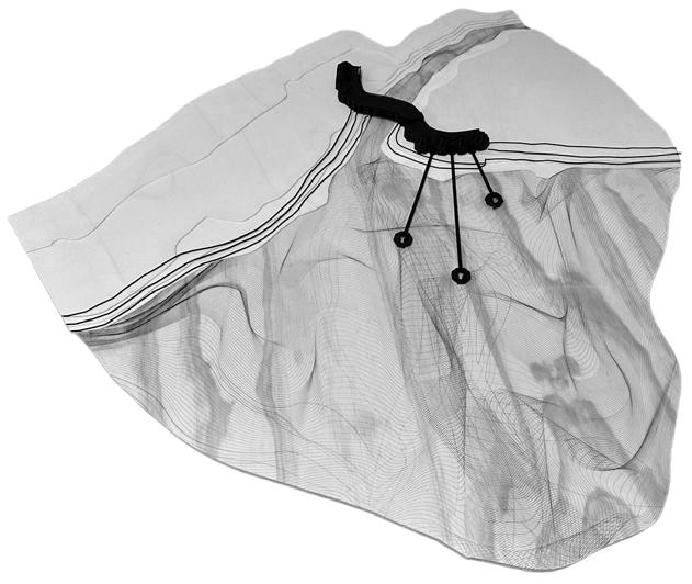
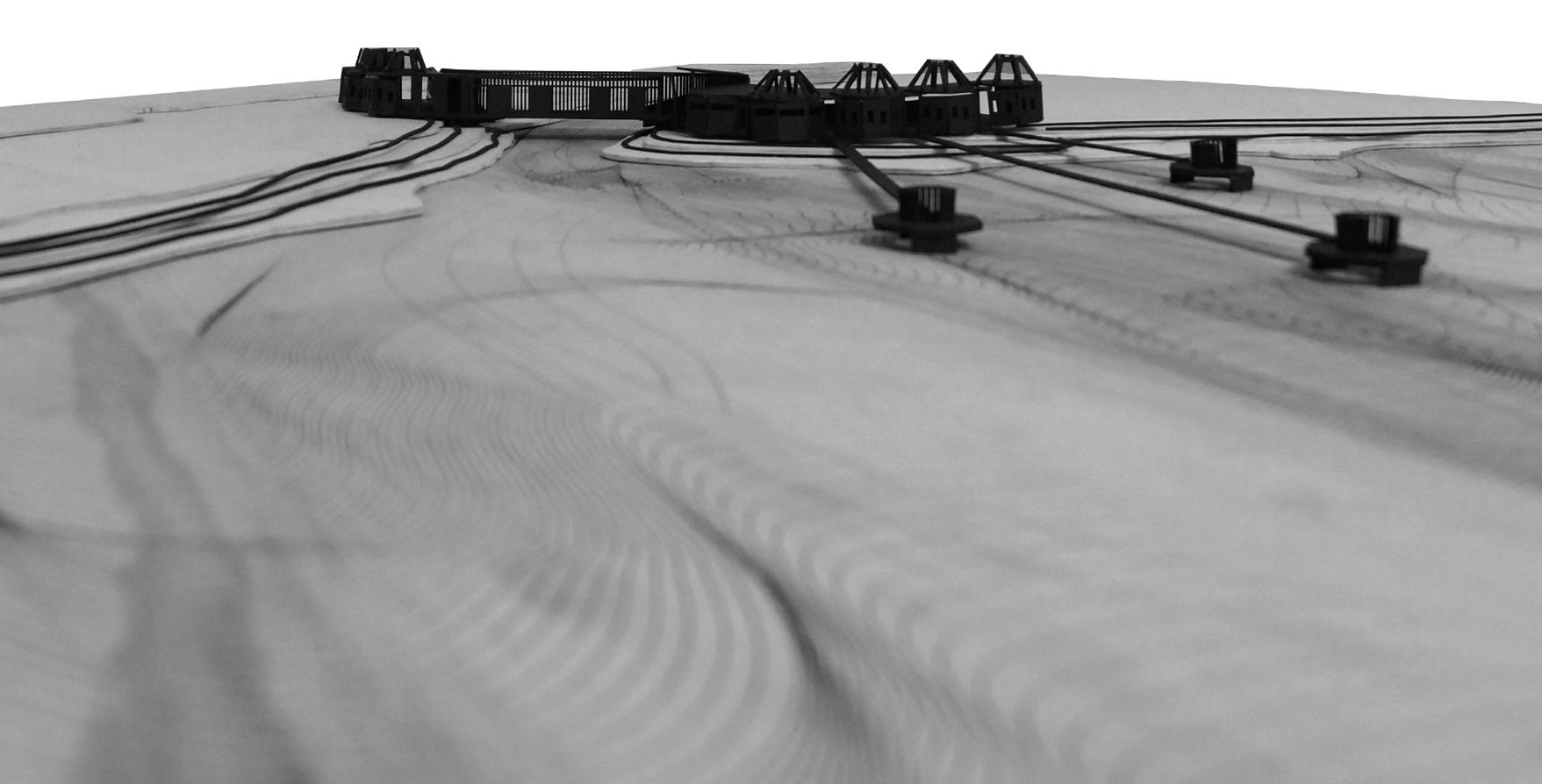
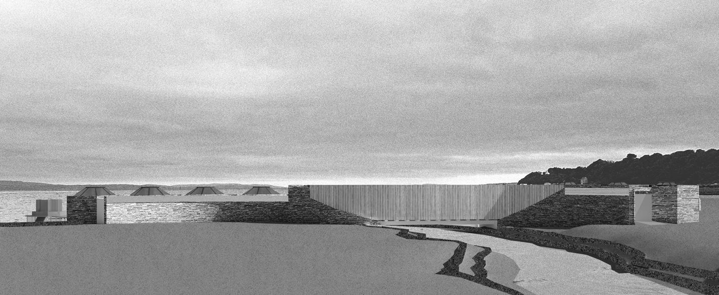
Located on the edges of a low lying coast at threat from rising sea levels, a combination of architectural and living edge landscape interventions seek to strengthen the coastal edge and encourage a more ecologically biodiverse habitat. Following the ow of the existing land contours, the building emerges from the living edges and acts as a bridging structure across a river delta, activating new links between Moville’s town and coastline. Considering the notion and act of beachcombing, the building holds smaller octagonal volumes along a bridging circulation spine - allowing for the meandering of people, light, sound and air.
1:200 site & massing model from above (previous left)
View from the intertidal zone; front elevation (previous top right)
Modelling connection to the intertidal (previous bottom right)
View from River Bredagh; back elevation (across top)
Context of a dynamic landscape between land & sea (right)
Structure & materiality (below)
1:100 plan (bottom right)
Site: Greencastle Fort, Greencastle, County Donegal Programme: Parliament; Chamber of Commerce; Public Square; Market & Food Stalls
1&
THRESHOLDS OF AGREEMENT
A PARLIAMENT FOR THE FOYLE
WILLIAM MAXWELL
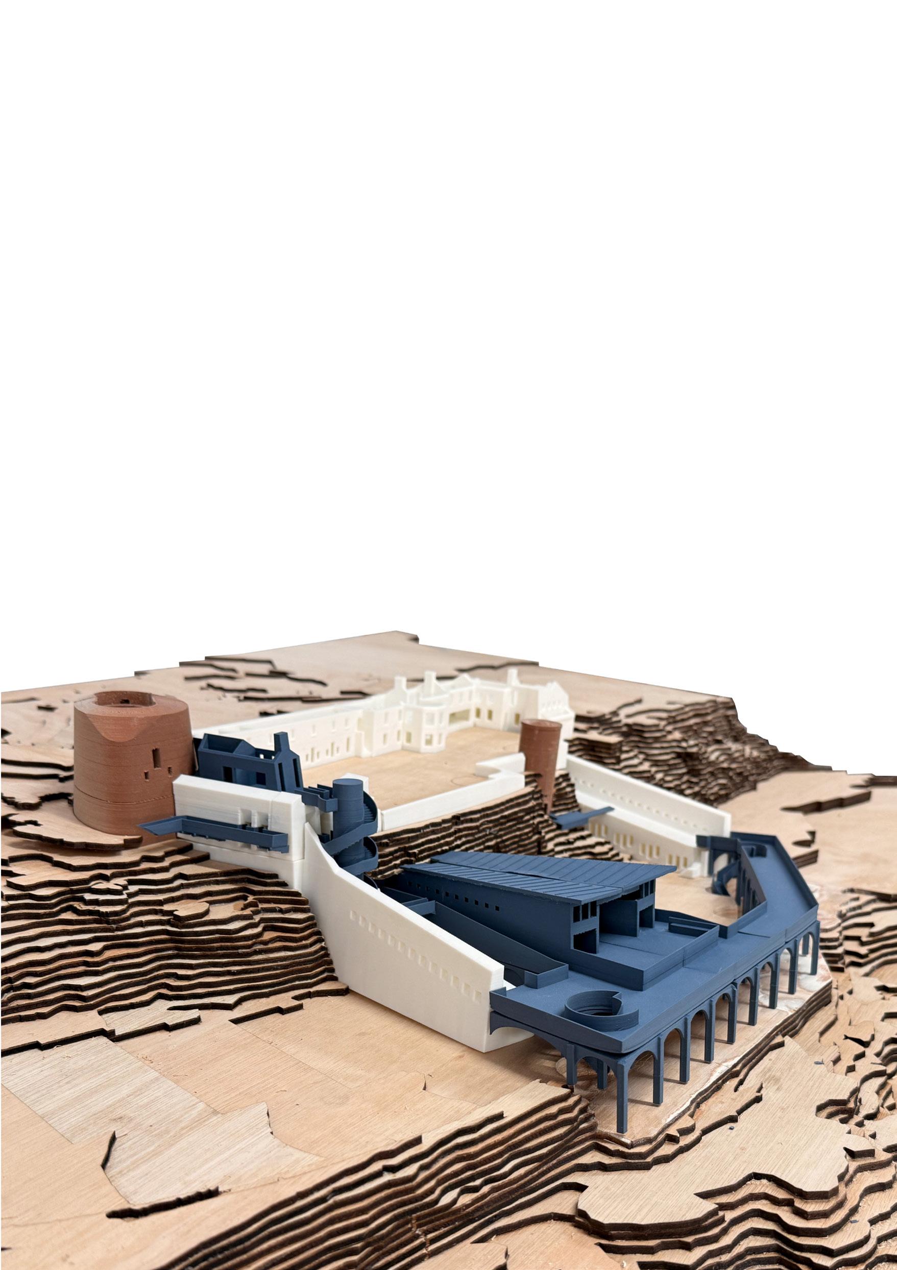
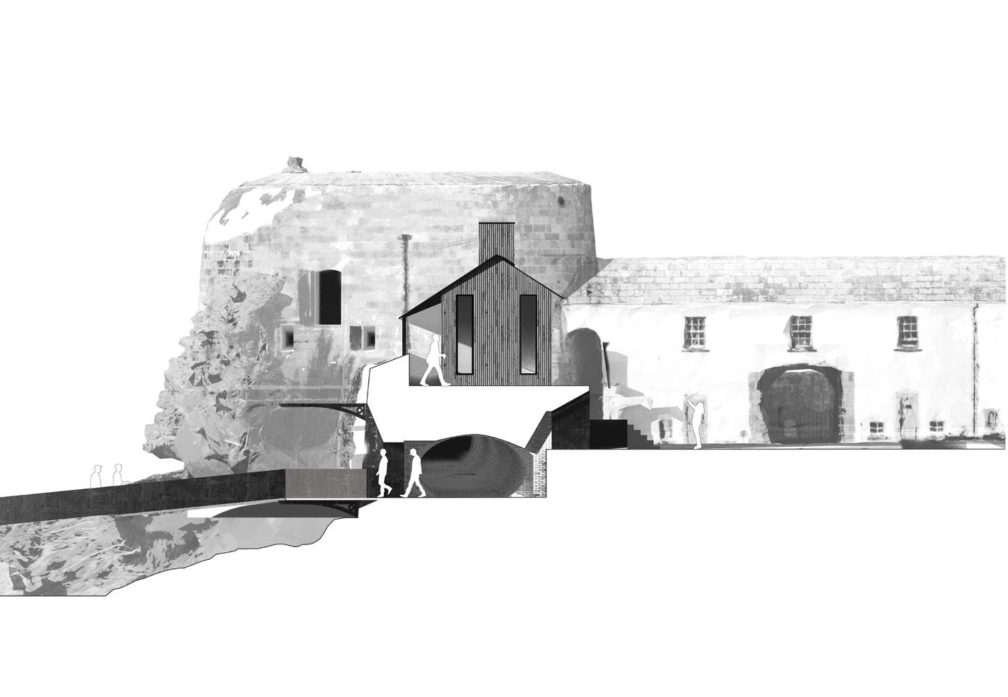
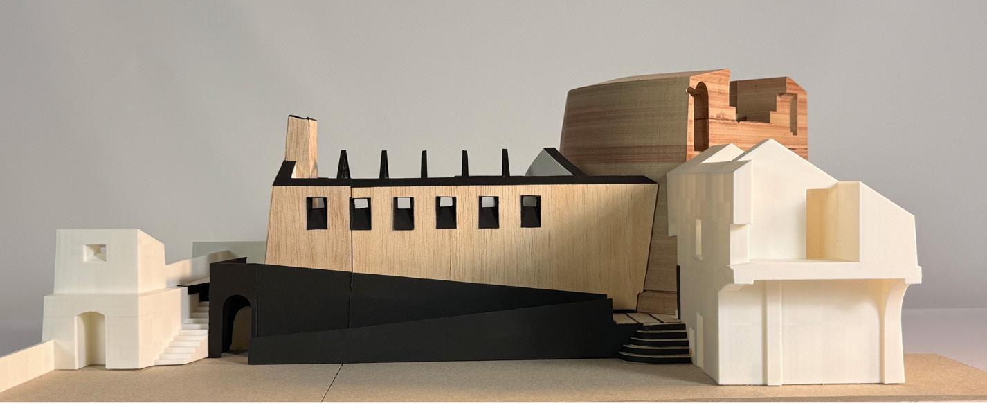
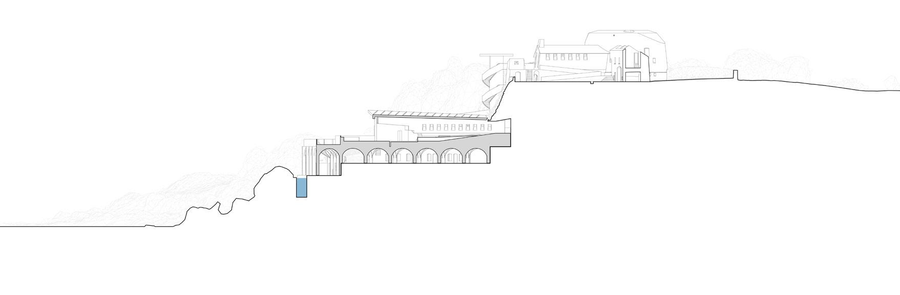
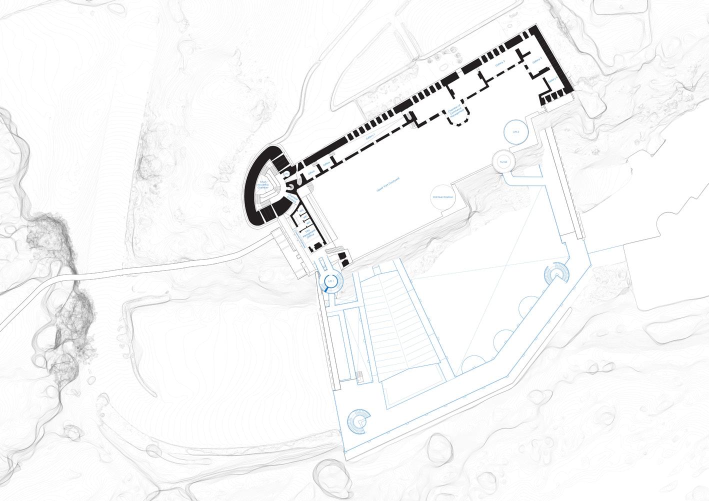
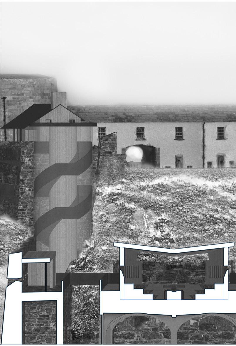
is project proposes a new civic architecture for the island of Ireland, sited at Greencastle Fort on the edge of Lough Foyle in County Donegal. Conceived as a hybrid institution combining a parliamentary assembly with a chamber of commerce, the project positions governance, trade, and public life within a shared territorial condition shaped by water, border histories, and environmental interdependence.
Greencastle Fort is a Napoleonic Era defensive garrison with a doublegun Martello Tower. e fort works in concert with the corresponding Martello tower at Magilligan Point in County Londonderry, across the border and the Foyle, in Northern Ireland. e programme of this project is developed through the site conditions and geometries, assembling spaces for deliberation, representation, and commerce alongside public landscapes that invite informal occupation, gathering, and observation. e parliamentary chamber and chamber of commerce are conceived not as isolated monuments, but as interrelated civic assemblies.
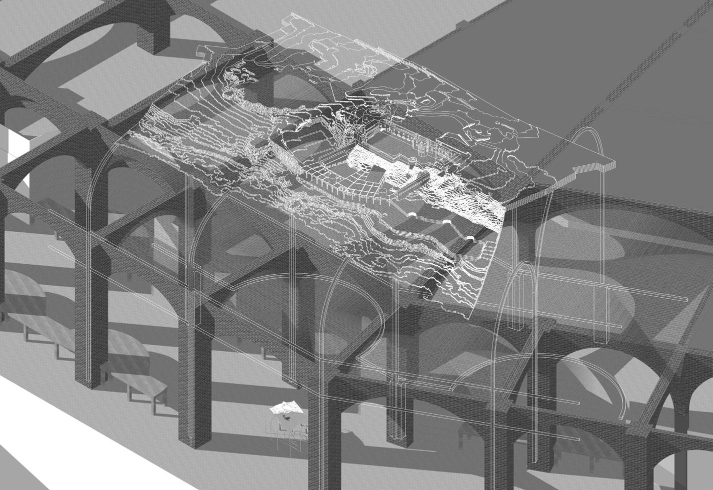
Materially and tectonically, the project reworks the mass and defensiveness of the historic fort into a contemporary architecture of openness, employing low-carbon construction strategies responsive to coastal exposure, weathering, and long-term environmental performance. Ultimately, the project argues for architecture as an active participant in the making of a shared island: not resolving political di erence, but staging new conditions for collective governance, economic exchange, and public encounter.
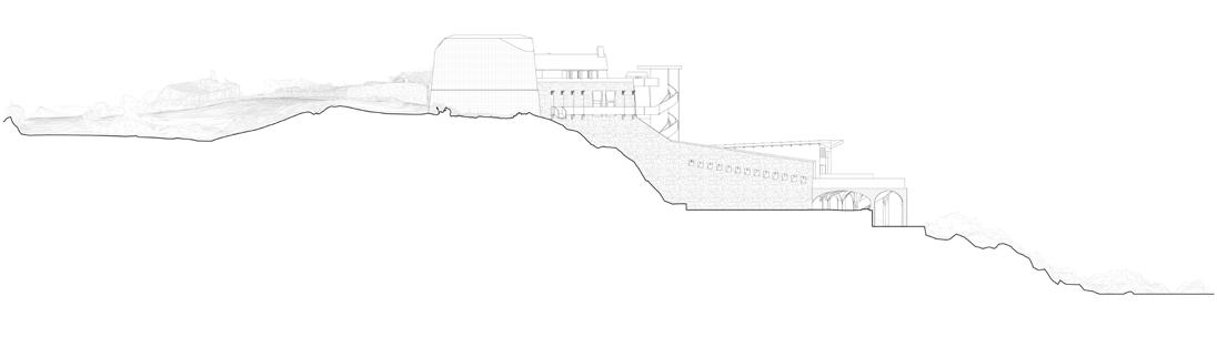
Long section (previous left)
Section through levels (previous top right)
1:200 model (previous bottom right)
Retroft model (top)
Visual of 1:200 model atop structural system (above)
Long section (below)
Parliament plan (top right)
1:50 section (right)
Meeting the cliff (far right)
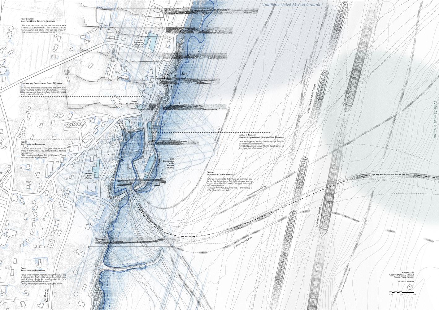
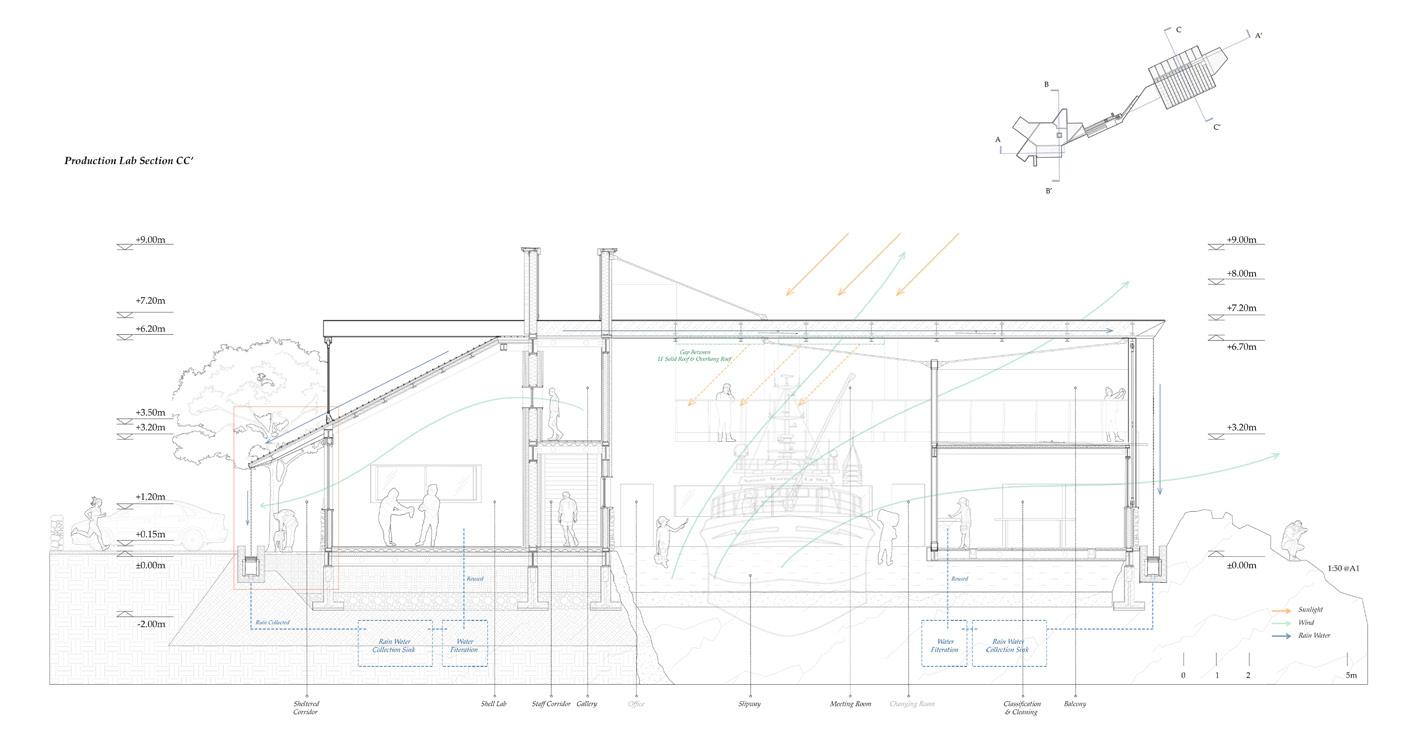
Site: Greencastle Harbour, Mouth of the Lough Foyle, County Donegal Programme: Shell sh Research & Material Innovation Lab; Community Hub; Public Waterfront Infrastructure; Shared Markets & Dining Spaces; Ecological Education & Exhibition
SHELLITORY
INTERTWINING A RESEARCH LAB & COMMUNITY HUB INTO THE SHIFTING COASTAL TERRITORIES
YINGWEN ZHU
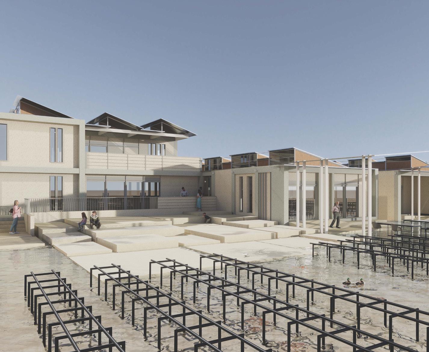
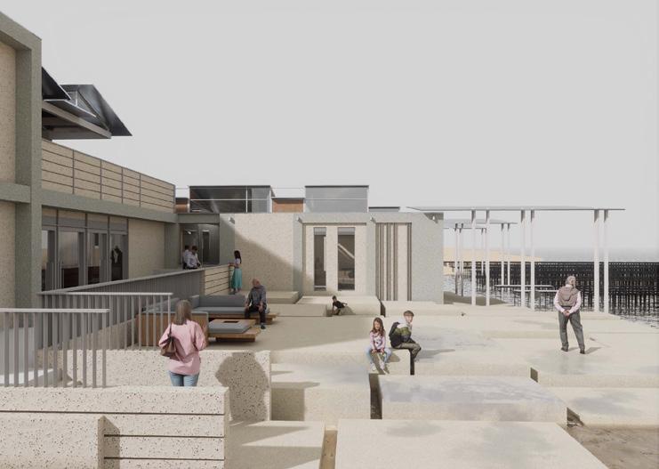
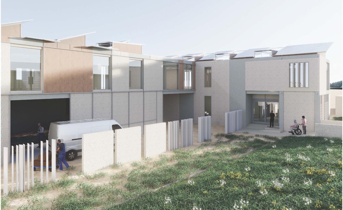
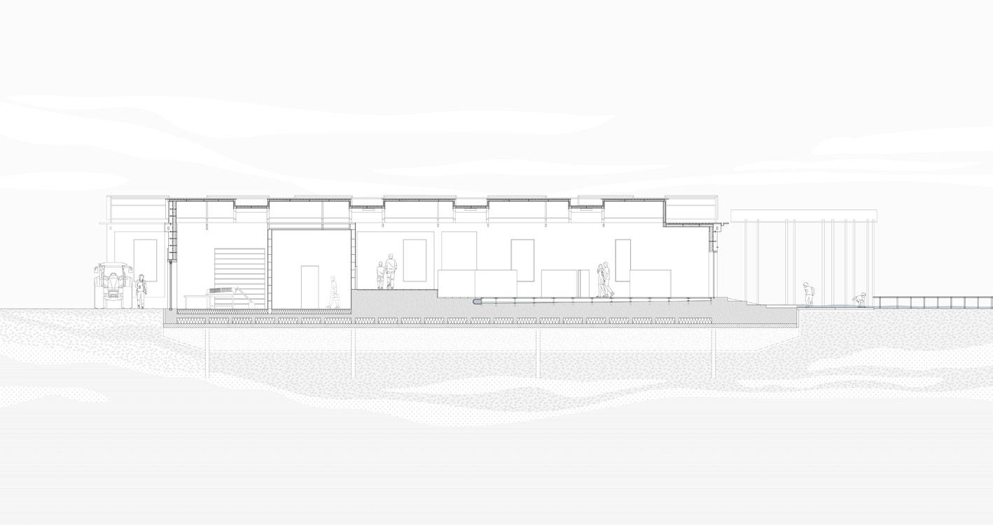
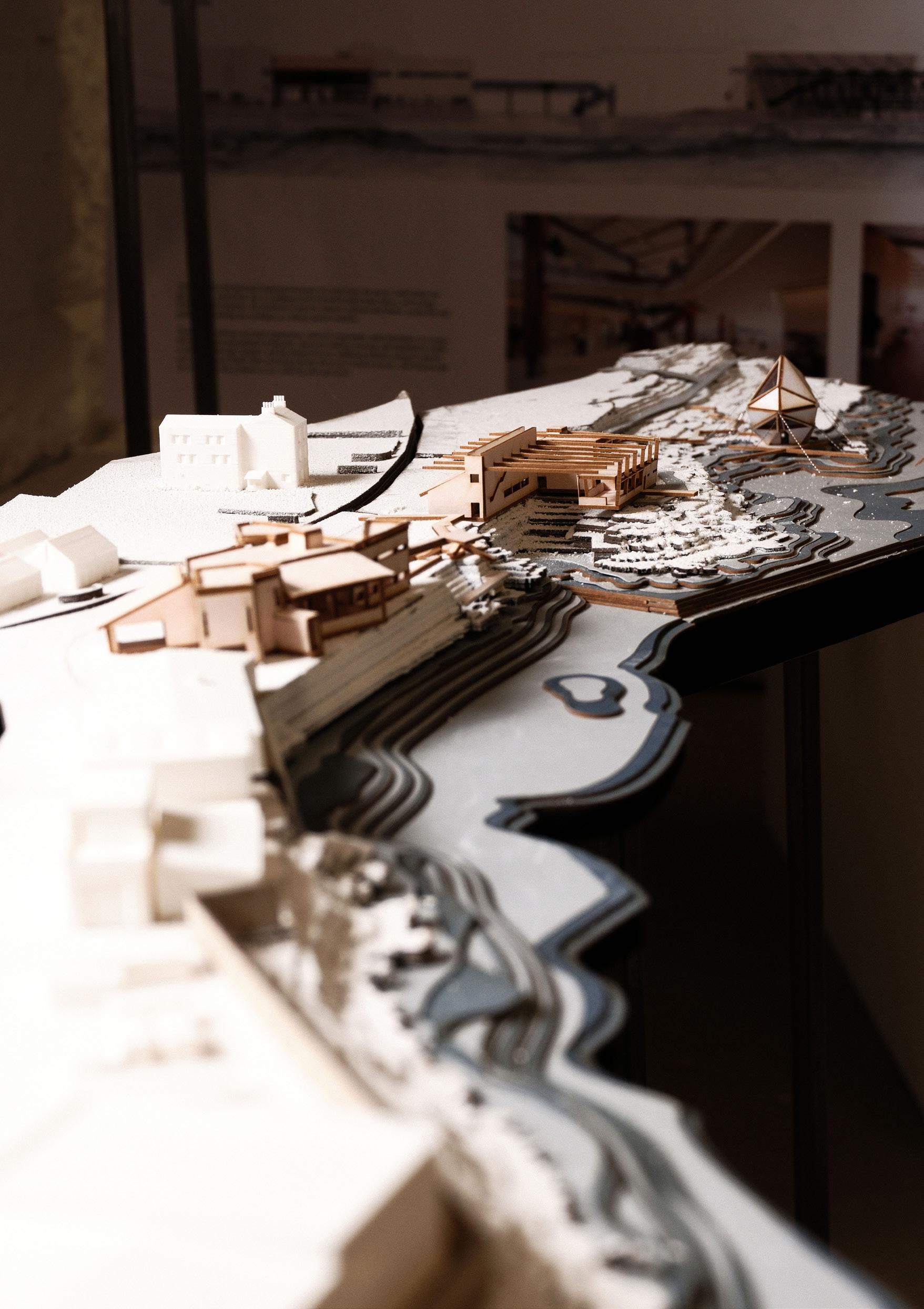
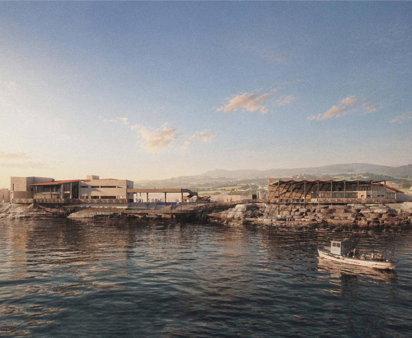
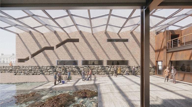
Situated on the working harbour edge of Greencastle, Shellitory recon gures a fragmented coastal boundary into a shared ground between production, community, and tidal landscape. Located where seawall, rocky shoreline, and abandoned slipway converge, the project responds to Greencastle’s shing economy, shell sh ecology, and shifting relationship between land and water. Rather than treating the coast as a xed line, it frames the harbour edge as a dynamic territory shaped by production, environmental change, and everyday occupation.
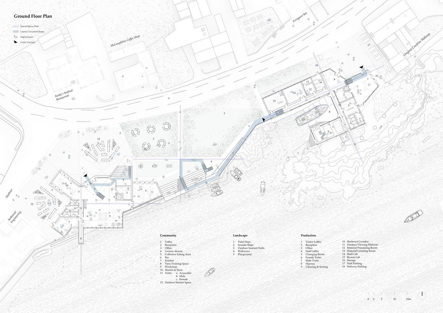
Drawing from the collective binding logic of mussel ecologies in the Lough Foyle, the project is organized as two distinct yet interconnected buildings: a production-oriented research and material innovation facility, and a public community hub for learning, gathering, and exchange. Linked by a continuous tidal ramp and waterfront circulation spine, these spaces allow industrial processes and civic life to coexist while maintaining spatial clarity.
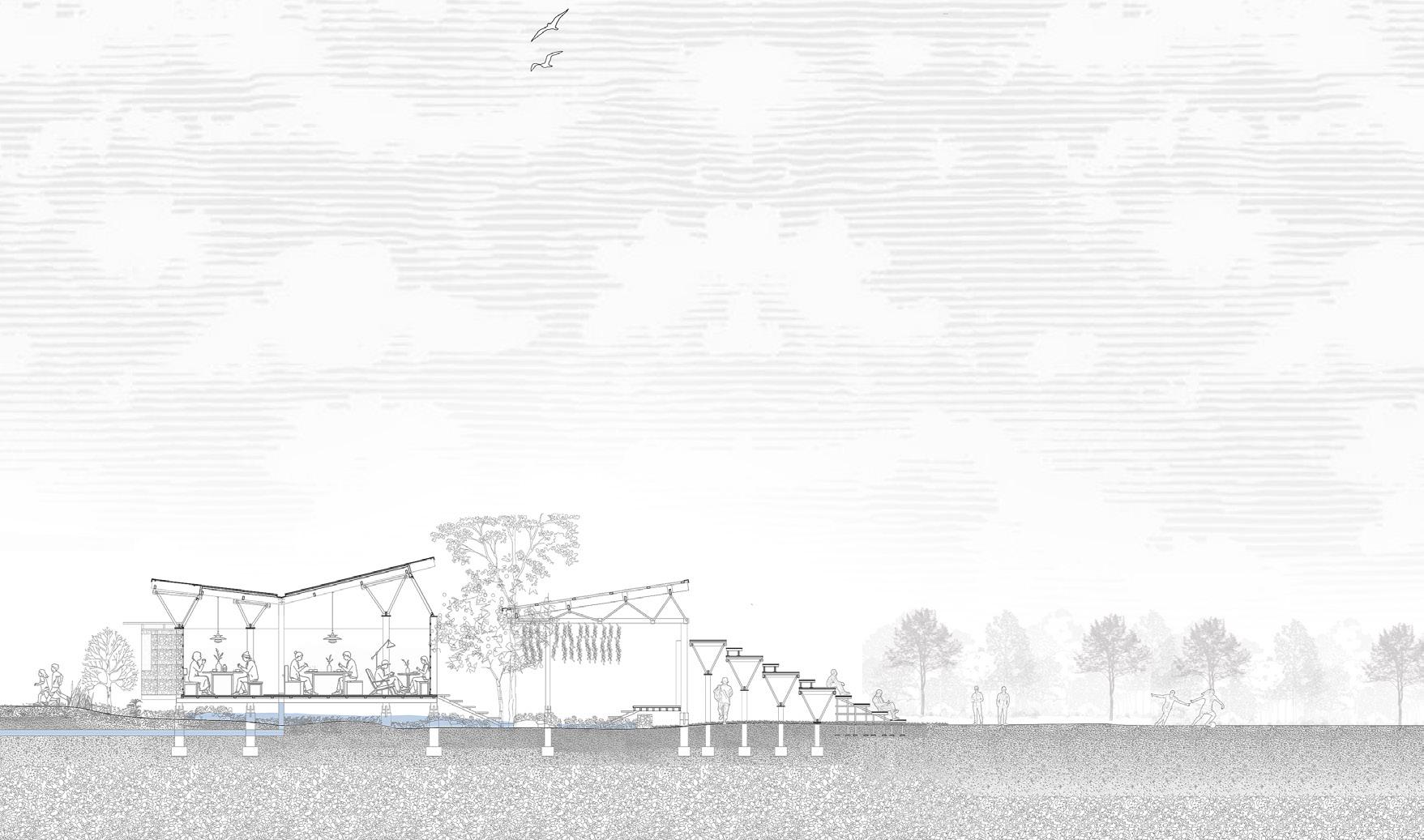
By retaining the slipway as an active tidal interface and extending movement across the site, Shellitory constructs architecture not as an isolated object, but as an open framework negotiating work and public life, sea and settlement, exposure and shelter. e project proposes a resilient shared coastal territory where environmental change, local industry, and collective experience are continuously intertwined.
Scheme model (previous left)
1:200 model (previous right)
View from Lough Foyle (left)
Ground foor plan (bottom left)
Canopy view (right)
Movements & tides (below)
Technical section (bottom)
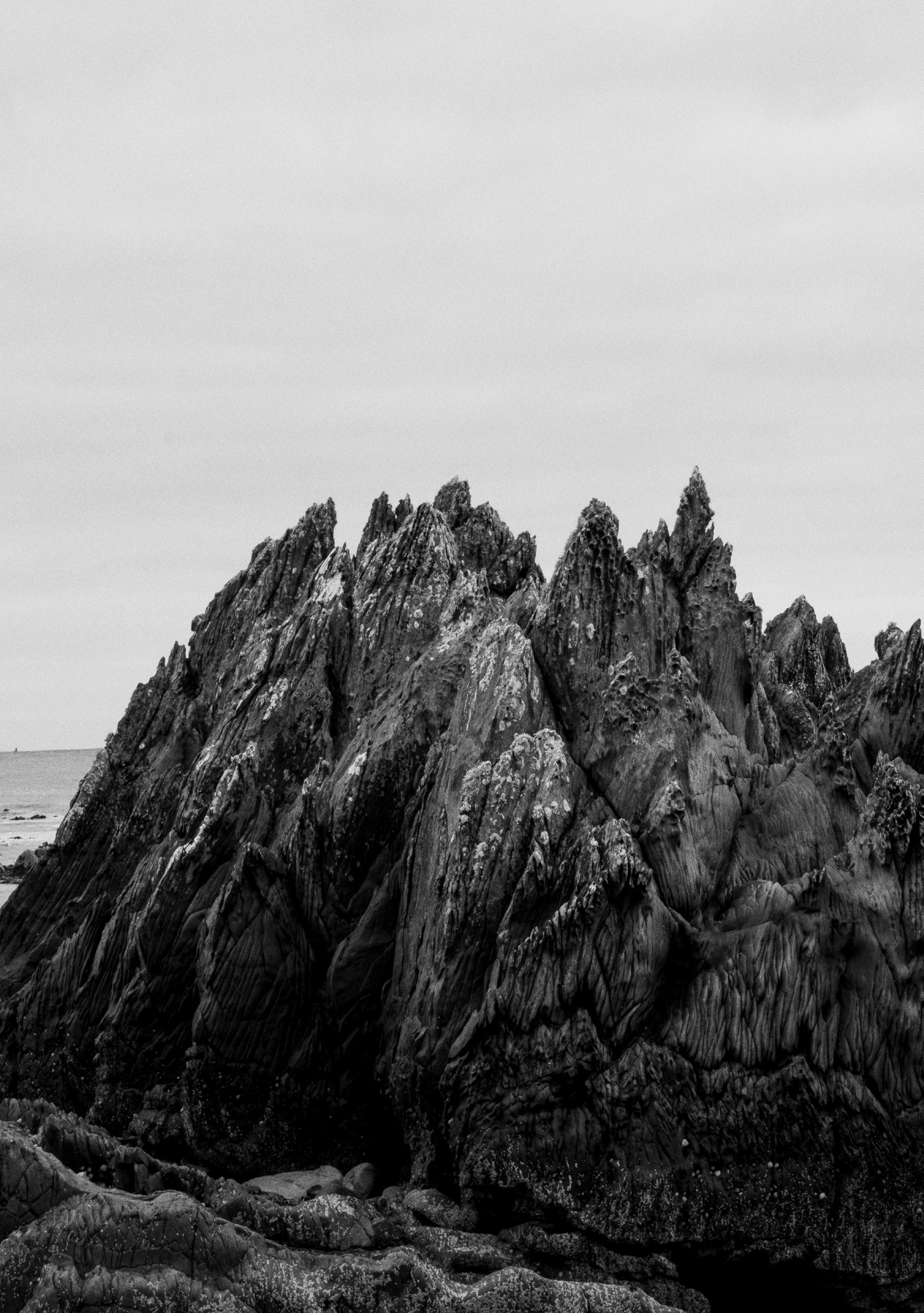
Inishowen Head
Schist Rock Formations on the Inishowen Coast, Dalradian Supergroup
Site: Shrove, County Donegal, Dalradian Supergroup Programme: Community Centre; Research Institute
CULTIVATING A DALRADIAN SENSIBILITY
CENTRE FOR DALRADIAN USE MISINTERPRETATION
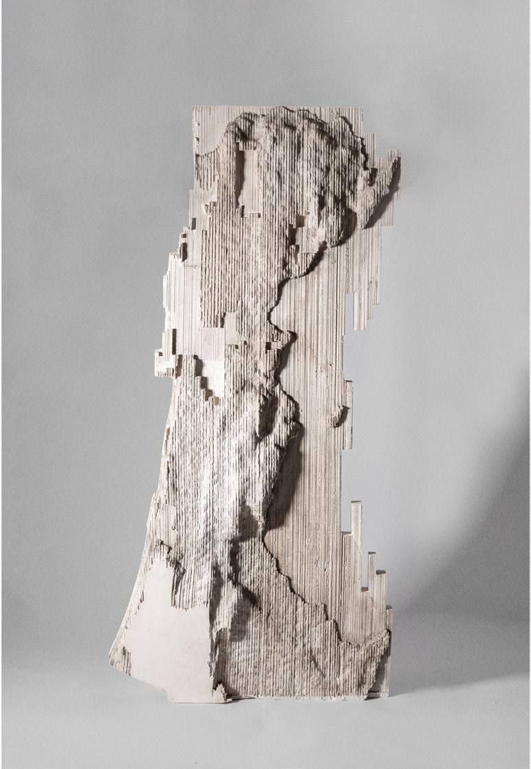
LUKE PEARCE
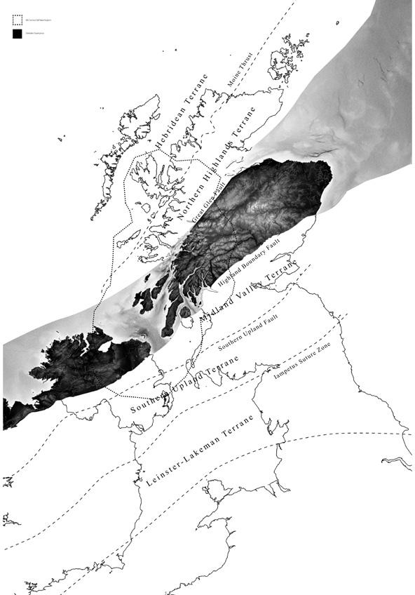
e Centre for Dalradian use Misinterpretation (CDUM) is the culmination of process and output from a year spent scaling the Dalradian landscape. is civic proposition re nes, reinterprets and establishes the ecology of people with their ground. e building acts as an aquifer of support and response for those a ected by the pressures of the Defective Block Crisis while simultaneously subverting our contemporary understanding of boarders. e building acknowledges the rock beneath it as a physical manifestation of Deep Time, there to be perceived and encounteredrevealing the contrast between the enduring processes of the Earth, the relative brevity of human occupation and our boundless impact.
ere are spaces for teaching, presentation, talking, therapy, archiving and administrative support. e CDUM will host artists and researchers to explore the state of human interaction with the Dalradian Landscape. Galleries distributed through the site present this work alongside work from the Dalradian Community. e building is both for and of the land. Made of local metamorphic Schist Rock, its form is strati ed. It is aligned with the grain of the ground beneath it. Apertures act like cracks in the seams. Visiting the Centre is to encounter of tension between permanence and impermanence; responsibility and misinterpretation.
Akcan, Esra. 2022. “Writing Open Architecture as a Book on Human Rights (and Against Nation-States).”
Footprint: Delft Architecture Theory Journal 16 (2).
Cooking Sections. 2020. Salmon: A Red Herring. London: Tate Publishing. Franch i Gilabert, Eva, and Mireia Luzárraga. 2025. 100 Words for Water: A Projective Ecosocial Vocabulary. Zürich: Lars Müller Publishers. Friel, Brian. 1981. Translations. London: Faber.
Haraway, Donna Jeanne. 2016. Staying with the Trouble: Making Kin in the Chthulucene. Durham: Duke University Press.
Hegarty, Neil. 2022. “Klondike.” In Impermanence, by Susannah Dickey and Jan Carson, 113–25. https://noalibis. com/product/impernanence-essays/
Ingold, Tim. 2010. “Footprints through the Weather-World: Walking, Breathing, Knowing.” The Journal of the Royal Anthropological Institute 16 (s1): S121–39.
Leary, Peter. 2016. “The Big Fish and the Little Fellow: Property Territory on Lough Foyle and River Foyle.” In [Book Title]. First edition. Oxford: Oxford University Press. Mezzadra, Sandro. 2013. Border as Method, or, the Multiplication of Labor. Edited by Brett Neilson. Durham: Duke University Press.
Steinberg, Philip, and Kimberley Peters. 2015. “Wet Ontologies, Fluid Spaces: Giving Depth to Volume through Oceanic Thinking.” Environment and Planning D: Society and Space 33 (2): 247–64.
Stoner, Jill. 2012. Toward a Minor Architecture. The MIT Press.
Tavares, André. 2024. Architecture Follows Fish: An Amphibious History of the North Atlantic. Cambridge, MA: MIT Press.
“DuPont to Clean up Run-Offpond Leaking into Faughan River,” Derry Journal, 2017, https://www.derryjournal. com/news/dupont-to-clean-up-run-offpond-leaking-into-faughan-739949.
Donna Deeney, “River Faces Pollution Tsunami at ‘Illegal’ Dump, Warn Experts,” Belfast Telegraph, 2014. Belfast Telegraph, “Pair Jailed over Huge Illegal Dump That May Have Netted Firms £40m. Waste Facility Next to River Was among Largest Unlawful Sites in Europe,” 2025.
Derry Now, “British Army Dismantling County Derry Lookout Post Due to ‘Signifcant Coastal Erosion,’” accessed March 26, 2025, https://www.derrynow.com/news/local-news/1659191/british-army-dismantling-county-derrylookout-post-due-to-signifcant-coastal-erosion.html.
IMAGE REFERENCES
Cover
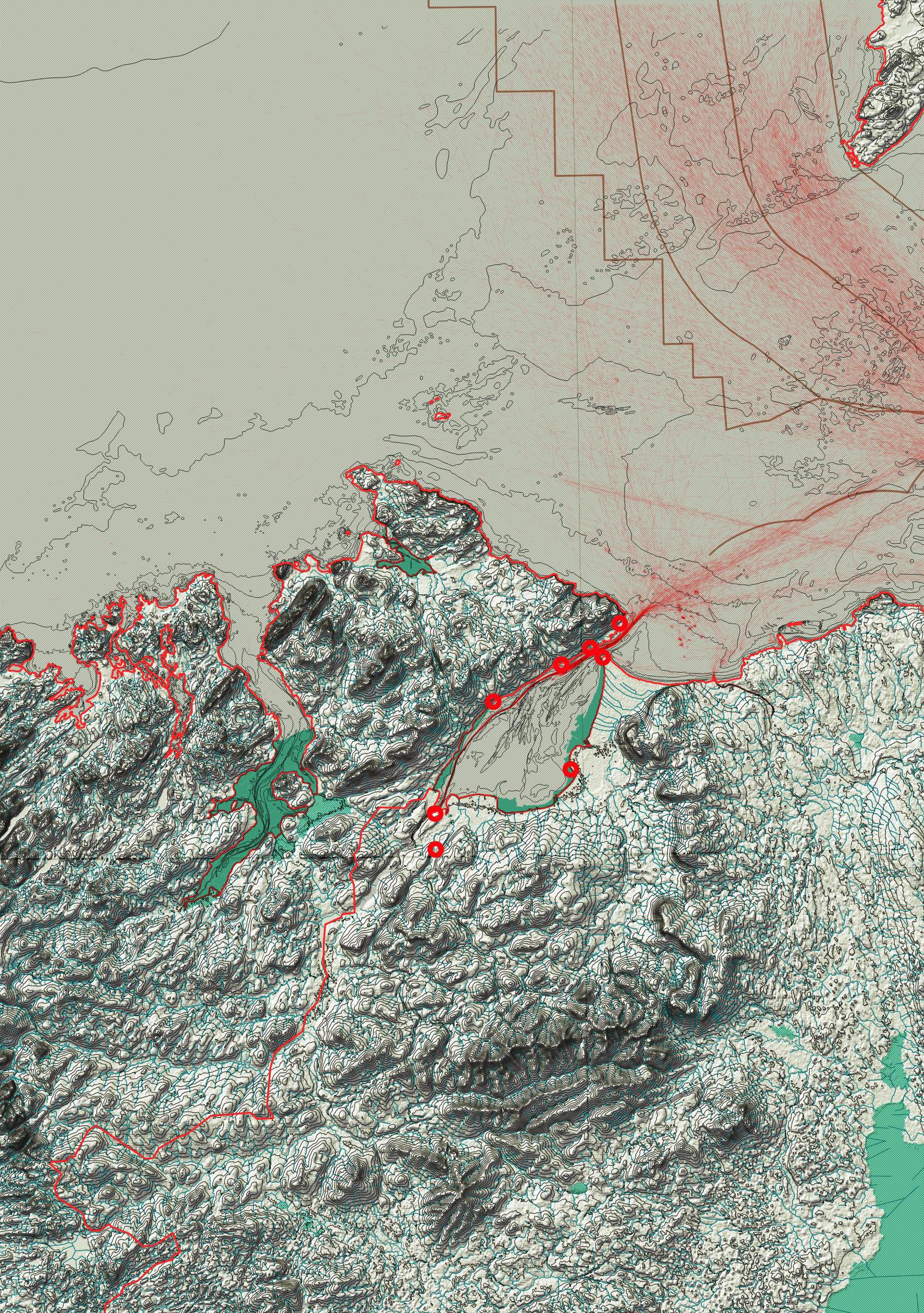
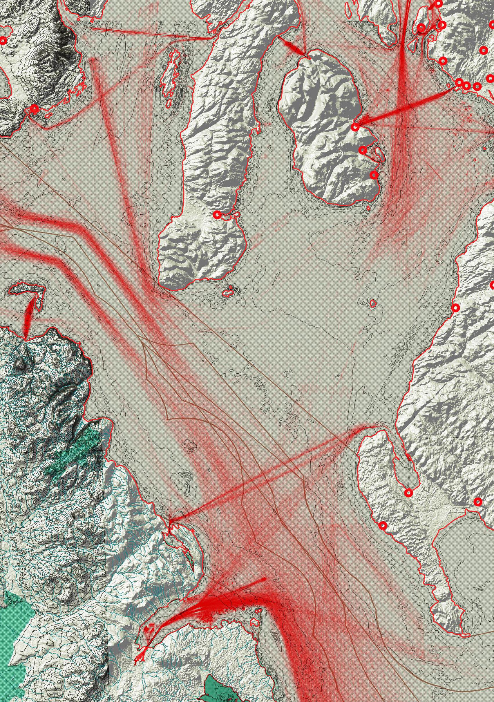
- Shipping vessel routes & exchanges between Ireland, the UK & beyond. Killian O’Dochartaigh.
Inside Front Cover
- View of Lough Foyle from Binevenagh. Lucas Theis
Prologue
- The Plantation of Ulster. Ravens Plantation map showing Lough Foyle by City of London (Companies. Lambeth Palace Library
- Area of Special Scientifc Interest (ASSI). The intertidal area of Magilligan ASSI in Lough Foyle.
- Oyster Fishery. Native oyster fshery at Quigley’s Point in Lough Foyle.
2 Map of Siege of Londonderry, 1689. Etching & engraving from three copperplates. Captain Francis Nevill
Surrendered U-Boats. Surrendered U-boats at Lisahally, Northern Ireland, June 1945. Royal Navy Offcial Photographer.
Civil Rights Protestors. Civil Rights protestors on Magilligan Beach, Christmas day 1971. Eamon Melaugh.
4 Wet Ontologies. Kayaking on Lough Foyle during the study trip. Killian O’Dochartaigh.
6 The Lough Foyle Agency. Meeting with Marine Scientist, Ben Holly of the Lough Foyle Agency, during the study trip. Killian O’Dochartaigh.
9 Loch Feabhail (Lough Foyle). Irish placename record for Loch Feabhail (Lough Foyle). Placenames Database of Ireland (Logainm.ie).
Photo Credits
10 Native Oyster Farming. Interactive conversation with Lucas McStout of Bia Oysters during the study trip. Killian O’Dochartaigh.
11 Inside the graduation tower. The bowels of a Blackthorn Salt graduation tower, Ayr. Killian O’Dochartaigh.
12 St Brides Church, East Kilbride, Gillespie, Kidd & Coia, 1964. Visited in January 2026. Killian O’Dochartaigh.
28 The Mouth of Lough Foyle from Magilligan Point. Luke Pearce.
42 Derry mainline bridging the River Roe Estuary. Lucas Theis
70 Mobuoy Dump. Killian O’Dochartaigh.
84 Lisahally Port Coal Yard. Shuyan Zhang.
104 Tidal Oyster Wracks. Lucas Theis
122 Inishowen Head. Luke Pearce
123 Schist Rock Formations on the Inishowen Coast, Dalradian Supergroup. Luke Pearce
128 Movements at Lisahally Port. Shuyan Zhang.
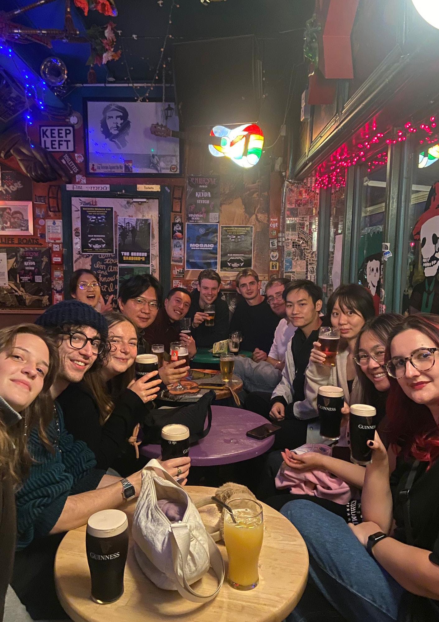
132 Enjoying some of The Black Stuff in Sandinos, Derry, during the study trip. Sandinos staff member.
Inside Back Cover
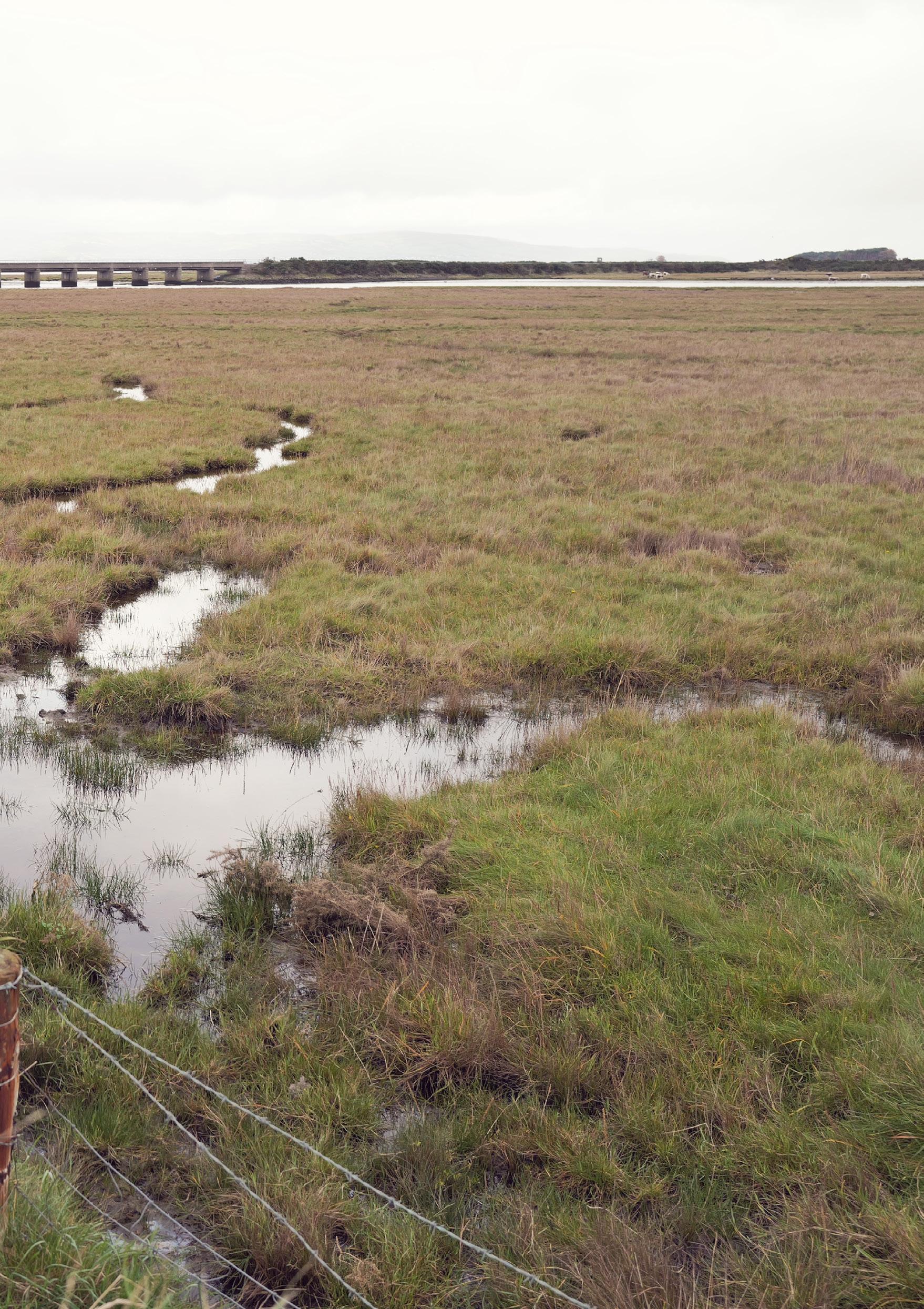
- Roe Valley Nature Reserve. Shuyan Zhang.
some
Enjoying
of The Black Stuff in Sandinos, Derry, during the study trip
ACKNOWLEDGEMENTS
Tutors
Killian O’Dochartaigh and Laura Miani Fernandez
Students
Yixuan Zhang, Angus Harrow, Celia-Doina Oprea, Fergal Voorsanger-Brill, Fiori Koustas, Alexander Ritchie, Diana Huynh, Enrico Luo, Lucas Theis, Joshua Howard, Hannah Lee, Elliott Hart, Shuyan Zhang, Ruoxin Tan, Haixin Wang, Leon Feng, Yuxiao Xue, Molly Sinclair, William Maxwell, Yingwen Zhu, Luke Pearce
Visitors
Jake Boswell (Fulbright Scotland Distinguished Scholar), Andy Bow (ESALA Honorary Fellow), Lilet Breddels (Archis), Matthew Butcher (UCL), Chris French, Laura Harty, Pepe Navarette Jiminez
Technicians
Malcolm Cruickshank, Paul Diamond, Paul Charlston, Louis Knight, Rachel Travers, Dave Taylor, Richard Collins, Alan Ramsay
Special thanks to Ben Holly (Lough Foyle Agency)
Dean Blackwood (Friends of the Earth, Northern Ireland) Alex Blanchard
Garbhann Downey (Derry University Group)
Kevin Hippsley (Derry University Group)
Conor McCourt (Foyle Fishing Co-op)
Lucas McStout (Bia Oysters)
Gregorie Marshall (Blackthorn Salt)
The Shared Island Unit: Open Architectures in a Bordered World, edited by Lucas Theis
The format of this catalogue has developed annually, evolving from the inaugural catalogue series produced for the ESALA MArch studios 2017-18, designed by Emma Bennett and Rachel Braude. Printed by J Thomson Colour Printers Ltd., Glasgow