
2 minute read
The History of Prospect Arena Site


History and Historical Use: PROSPECT HORSE ARENA, West 52nd Avenue & DeFrame, in the Fairmount Neighborhood. The parcel is approximately five acres as currently developed.
Originally, the Prospect Arena was located on the south side of West 44th Avenue & Fig Street. This land was needed by the plans for the Highway, so the County sold it, ordered the arena vacated. In July 1971 the County allocated $4,500 for removal and replacement of arena. Several horsemen’s groups volunteered to do the manual labor of moving posts and fencing to a new location.
Advertisement
On May 6, 1974 the County closed on the 5 acres at W. 52nd and DeFrame for a purchase price of $33,000. Moneys used were funds from the sale of the Fig Street land - $52,600 plus funds allocated for replacement - $4,500. The difference available for construction was $24,000.
Resurfacing of the arena in later years was accomplished with the use of the Ferguson Homes (development to the east of arena) escrow fund for trees to screen the arena; however, the neighbors to the east insisted that they did not want the arena screened from their view. The First Annual Darrell Skelton Memorial Benefit Show also raised some funds for the arena resurfacing.
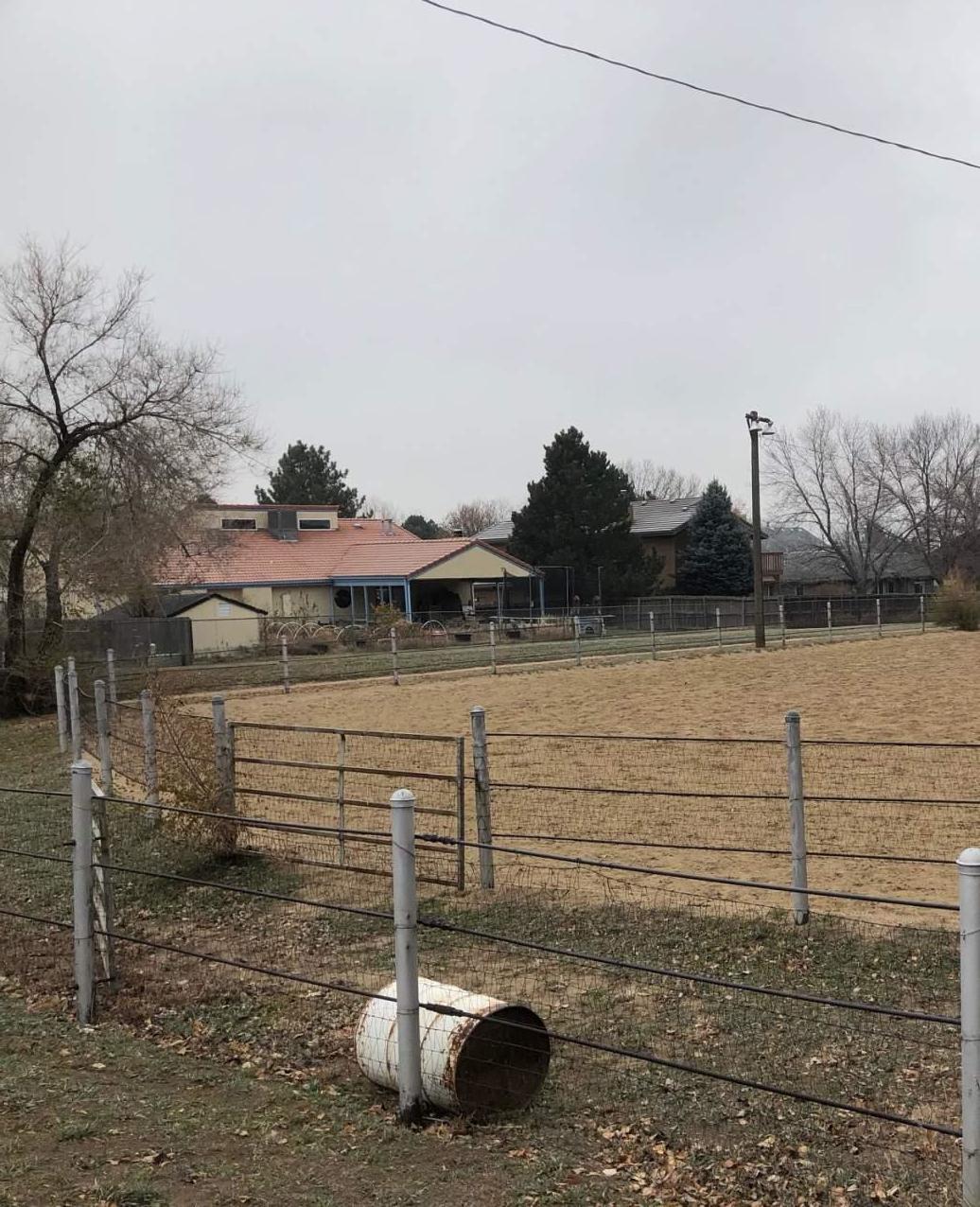
Scenes from within Prospect Arena today


There are no use restrictions in the Commissioner’s Deed to the District, or in the Felix Lebedzinski and Lena Lebedzinski Warranty Deed to Jefferson County, dated May 6, 1974 and recorded June 3, 1974 at Reception No. 643855, Book 2629, Page 672 (the County’s predecessor in interest to the entire Prospect Arena parcel).
Other Matters: Following the District’s removal and replacement of the lower culvert on the Alford-Selman Lateral Ditch (from which point the only downstream owner of ditch rights is Anthony Klug), the District entered into an agreement with Mr. Klug providing that he may not request any future improvements in the ditch from the District. This Agreement is dated April 7, 2009, and was recorded on April 10, 2009 at Reception No. 2009031510. After exploring the ferry landing, visitors may walk back up to the bank to explore the Tauchman House and the site of the former ferry keepers residence. The house is now a venue for small gatherings, meetings and other events. The yard around the house is shaded by large mature trees, making for a pleasant space where events in the house can overflow into the outdoors.

An existing playground, ornamental garden, and small gazebo also occupy space around the Tauchman House, along with a parking lot, basketball court, and restroom building. To the east of these features, beyond the lawn, is a grove of trees that runs northward from the river bank, across Tauchman Street, and past the Wastewater Treatment Plant. This once formed the eastern edge of the park. The southern edge runs along the top of the river bank, offering views of the river and the far shore. An extension of the Boones Ferry to Memorial Park Trail that runs under the freeway and connects via local streets to Memorial Park is planned through this area and the adjacent wooded area between it and


