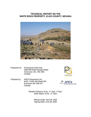
TECHNICAL REPORT ON THE WHITE ROCK PROPERTY, ELKO COUNTY, NEVADA
Prepared For:
Provenance Gold Corp. 2200 885 West Georgia Street Vancouver, BC, V6C 3E8 Canada
Prepared by:
APEX Geoscience Ltd. #100, 11450-160 Street NW Edmonton AB T5M 3Y7 Canada
Michael Dufresne, M.Sc., P. Geol., P.Geo. Jodie Gibson, M.Sc., P. Geol.
Effective Date: April 29, 2022 Signing Date: June 28, 2022
Technical Report on the White Rock Property, Nevada
Contents 1 Summary ................................................................................................................... 1 1.1 Authors and Site Inspection................................................................................ 1 1.2 Geology and Mineralization ................................................................................ 1 1.3 Historical Exploration .......................................................................................... 2 1.4 Exploration by Provenance Gold ........................................................................ 2 1.5 Recommendations ............................................................................................. 3 2 Introduction ................................................................................................................ 5 2.1 Issuer and Purpose ............................................................................................ 5 2.2 Authors and Site Inspection................................................................................ 5 2.3 Units of Measure ................................................................................................ 6 3 Reliance of Other Experts .......................................................................................... 7 4 Property Description and Location ............................................................................. 7 4.1 Description and Location .................................................................................... 7 4.2 Royalties and Agreements ............................................................................... 11 4.3 Environmental Liabilities, Permitting and Significant Factors ........................... 11 5 Accessibility, Climate, Local Resources, Infrastructure and Physiography .............. 12 5.1 Accessibility ...................................................................................................... 12 5.2 Site Topography, Elevation and Vegetation ..................................................... 12 5.3 Climate ............................................................................................................. 12 5.4 Local Resources and Infrastructure .................................................................. 13 6 History...................................................................................................................... 13 6.1 Historical Resources at the White Rock Property ............................................. 16 7 Geological Setting and Mineralization ...................................................................... 16 7.1 Regional and Property Geology ....................................................................... 16 7.2 Stratigraphy ...................................................................................................... 16 7.3 Mineralization ................................................................................................... 19 8 Deposit Types .......................................................................................................... 20 9 Exploration ............................................................................................................... 22 10 Drilling ...................................................................................................................... 24 10.1 White Rock Mountain Zone (Western Zone) .................................................... 24 10.2 Valley Mineralized Zone (Western Zone) ......................................................... 24 10.3 Central Ridge Area (Central Zone) ................................................................... 31 10.4 The Nose Area (Central Zone) ......................................................................... 32 10.5 White Rock Mineralization ................................................................................ 32 11 Sample Preparation, Analyses and Security ............................................................ 33 11.1 Sample Collection, Preparation and Security ................................................... 33 11.1.1 Historical Samples ...................................................................... 33 11.1.2 PAU Rock Chip Samples ............................................................ 33 11.1.3 PAU RC Chip Samples ............................................................... 33 11.1.4 RC chip sampling procedure ....................................................... 33 11.1.5 Geological logging of RC chips. .................................................. 34 11.2 Analytical Procedures ....................................................................................... 34 11.3 Quality Assurance – Quality Control ................................................................. 34 11.3.1.1 PAU Blanks ............................................................................ 34 April 29th, 2022
i
Technical Report on the White Rock Property, Nevada
11.3.1.2 PAU Standards ....................................................................... 35 11.3.2 PAU Field Duplicates .................................................................. 37 11.4 Adequacy of Sample Collection, Preparation, Security and Analytical Procedures ......................................................................................................................... 37 12 Data Verification....................................................................................................... 38 12.1 Data Verification Procedures ............................................................................ 38 12.1.1 Digital Data Verification ............................................................... 38 12.2 Validation Limitations ....................................................................................... 43 12.3 Adequacy of the Data ....................................................................................... 43 13 Mineral Processing and Metallurgical Testing .......................................................... 44 14 Adjacent Properties.................................................................................................. 44 15 Mineral Resource Estimate ...................................................................................... 44 16 Other Relevant Data and Information ...................................................................... 44 17 Interpretation and Conclusions ................................................................................ 44 17.1 Results and Interpretations............................................................................... 44 17.2 Risks and Uncertainties .................................................................................... 46 18 Recommendations ................................................................................................... 47 19 References .............................................................................................................. 49 20 Certificate of Author ................................................................................................. 51
Tables Table 4.1. Permit descriptions and status for the White Rock Property ........................ 12 Table 6.1 WRC-13 summary assay results ................................................................... 15 Table 9.1 2020 rock chip sample assay highlights ........................................................ 22 Table 10.1. 2021 Drillhole details at the White Rock Project (WGS-84-UTM Zone 11) . 25 Table 10.2. 2021 Drill intersection highlights (0.1 g/t Au cutoff) .................................... 27 Table 11.1. Standard Reference Materials Inserted Into the 2021 RC Assay Sample Stream............................................................................................................ 35 Table 12.1.1. 2021 drillhole WR-22 vs. historical hole RR-3: comparison of gold assays ....................................................................................................................... 39 Table 12.2. 2021 drillhole WR-23 vs. historical RR-38: comparison of gold assays ...... 40 Table 18.1 Budget for Recommended Exploration (US$) ............................................. 48
Figures Figure 4.1. General location of the White Rock Property. ............................................... 9 Figure 4.2. Claim Map of the White Rock Property. ...................................................... 10 Figure 6.1. Historical drilling at the White Rock Property. ............................................. 14 Figure 7.1 Geology of White Rock Property .................................................................. 17 Figure 7.2 Detailed Alteration of White Rock Property .................................................. 21 Figure 10.1. Historical and 2021 PAU drillholes at the White Rock Project. .................. 26 Figure 11.1. PAU Coarse Blanks .................................................................................. 35 Figure 11.2. PAU Standards MEG-Au 19.11 and 19.09 ................................................ 36 Figure 11.3. PAU Field Duplicates ................................................................................ 37
April 29th, 2022
ii
Technical Report on the White Rock Property, Nevada
Figure 12.1. 2021 drillhole WR-22 vs. historical hole RR-3: comparison of gold assays ....................................................................................................................... 42 Figure 12.2. 2021 drillhole WR-23 vs. historical RR-38: comparison of gold assays .... 43
Appendices Appendix 1: Claims List ................................................................................................. 53
April 29th, 2022
iii
Technical Report on the White Rock Property, Nevada
1 Summary This Technical Report (the “Report”) for the White Rock Property (“White Rock” or the “Property”) was prepared by APEX Geoscience Ltd. (“APEX”) to provide an independent evaluation of the exploration potential of the White Rock Property for Provenance Gold Corp (“Provenance”, “PAU” or the “Company”). This Technical Report has been prepared in accordance with the Canadian Securities Administration’s (CSA’s) National Instrument 43-101 (NI 43-101) Standards of Disclosure for Mineral Projects and guidelines for technical reporting Canadian Institute of Mining, Metallurgy and Petroleum (CIM) “Best Practices and Reporting Guidelines” for disclosing mineral exploration. The effective date of this Technical Report is April 29, 2022. The White Rock Property consists of 164 unpatented mineral claims covering a combined area of approximately 1,327 hectares (3,280 acres), located approximately 105 kilometers (65 miles) northeast of Wells, Elko County, Nevada. On June 12, 2020, PAU, through its subsidiary Provenance Gold USA, entered into a four (4) year option agreement with Nevada Select Royalty Inc., a wholly owned Nevada subsidiary of Ely Gold Royalties (EGR). Pursuant to the option agreement, EGR granted Provenance Gold USA the sole and exclusive right to purchase 100% of EGR’s right, title and interest to the Property. EGR retains a production net smelter returns royalty (NSR) of 2% on all mineral production from the unpatented mining claims as well as any additional ground staked within a two (2) mile area of interest. 1.1 Authors and Site Inspection The authors of this Technical Report are Mr. Michael B. Dufresne M.Sc., P. Geol., P. Geo., of APEX and Mr. Jodie Gibson M.Sc., P. Geo., who is an independent consultant. The authors are fully independent of Provenance and are Qualified Persons (QPs) as defined in NI 43-101. Mr. Dufresne takes responsibility for the preparation and publication of sections 1, 2, 4 to 8 and 14 to 19 of this Technical Report. Mr. Dufresne is a Professional Geologist with the Association of Professional Engineers and Geoscientists of Alberta (APEGA), a Professional Geoscientist with the Association of Professional Engineers and Geoscientists of British Columbia (EGBC). Mr. Gibson takes responsibility for Sections 9 to 13 and contributed to Sections 1, 4, 6, 7, 17 and 18 of this Technical Report. Mr. Gibson is a Professional Geologist with the Engineers & Geoscientists British Columbia (“EGBC”). Mr. Gibson visited the Property on October 6th, 2021. 1.2 Geology and Mineralization The White Rock Property lies at the northern end of the basin and range geological province of the western United States of America (USA). Flat lying to gently folded Paleozoic age sedimentary rocks are unconformably overlain by Tertiary age volcanic rocks in the prospect area. The unaltered Paleozoic sedimentary rocks consist of an alternating sequence of chert and fossiliferous limestone. A pale green coloured volcanic tuff of Tertiary age overlies the Paleozoic sedimentary sequence. This unit is in turn overlain by a characteristic red rhyolite volcanic tuff. April 29th, 2022
1
Technical Report on the White Rock Property, Nevada
The White Rock Property hosts gold mineralization and alteration patterns with similarities to low sulphidation precious metal epithermal systems. Such deposit types are well documented in Nevada, including Round Mountain, Midas, and Sleeper. These types of deposits can include disseminated and vein deposits of precious metals. PAU geologists have concluded that White Rock area could provide a couple of different types of precious metal mineralization including epithermal and sediment hosted systems. Previous operators on the White Rock Property postulated that elevated concentrations of arsenic, antimony and mercury, commonly within opaline breccia, may also represent the upper parts of a deep-seated Carlin-type gold system. Carbonate rocks, such as the Grandeur Formation limestone underlying the Property, are permissive hosts for Carlin– style mineralization. 1.3 Historical Exploration Mineral claims were reportedly first staked in the Grouse Creek Mountains by two prospectors Thomas and Brown in 1872. No records describing the type or grade of minerals that were explored for are available. Little historical exploration was recorded through to 1984 when Amax Exploration Inc. (Amax) staked claims in the area of the current White Rock Property, completing an exploration program of geological mapping, rock and soil sampling, and reverse circulation (RC) style drilling. From 1984 to 1990 Amax drilled a total of 4,471.5 meters (14,670 ft) in 51 drillholes on the prospect, identifying three zones of mineralization in the Eastern, Central, and Western Zones. Subsequent sporadic exploration by Thomas and Schmidt, Kennecott Exploration Inc, M.I.M. Exploration Pty. Ltd. (MIM), Terraco Energy Corporation, Golden Odyssey Mining Inc., and Timberline Resources Corp continued to locate and verify historical gold mineralization on the Property. 1.4 Exploration by Provenance Gold During the 2020 field season, PAU conducted a targeted mapping and sampling program in order to confirm previous historical surface results and to aid in selecting appropriate targets for drilling. A total of 41 rock chip or grab samples from outcrop or subcrop were collected across the Property in 2020. Surface sample locations of the key gold bearing lithologies were selected (including jasperoid breccia ± goethite, silicified siltstone breccia) to test the extent and possible variability of gold at surface. A total of 10 of the 41 samples returned gold values in excess of 0.2 grams per tonne (g/t), returning assays between 0.289 g/t Au up to 3.83 g/t Au. These sample results confirm the surface expression of alteration and mineralization at White Rock and were used to inform drill targets for 2021. Drilling by PAU commenced in July 2021. This initial drilling was intended to define the stratigraphic and structural controls and grades within the extensive central area of sediment-hosted gold mineralization. The target mineralization extends across a 3.2 km by 1.6 km area centered on a complex dome structure that is believed to have formed on the upper plate of a system of thrust faults. In addition, drilling was intended to confirm results from historical drillholes that intersected numerous thick intervals of gold April 29th, 2022
2
Technical Report on the White Rock Property, Nevada
mineralization, while confirming PAU's new understanding of the structural and stratigraphic controls of the gold mineralization. The drillhole assay results confirmed similar results to those reported by past operators and confirmed the location of a newly recognized open-ended gold mineralization feeder structure that extends across the core mineralized area of 3.2 km in length and 1.6 km in width (WR-45) while bottoming out in gold mineralization. In addition to the newly identified mineralized structure, recent step-out drilling continued to expand the gold mineralization in several directions from drillhole WR-23, which returned a drilled interval of 117 meters (384 feet) of gold mineralization. Large step-out drilling tested new areas including the Rhyolite Graben to the northwest, the Nose area to the south and the newly identified controlling mineralized structure. The Rhyolite Graben, located to the northwest and west of hole WR-23 was tested with two holes. Both intercepted gold mineralization, with hole WR-32 returning a drilled interval of 65.5 meters (215 feet) of 0.305 g/t gold which included 20 meters (65 feet) of 0.411 g/t gold. The hole bottomed out in anomalous gold mineralization at 115.8 meters (380 feet) and was lost. The intercept indicates that the sedimentary host rocks in the graben can host gold mineralization and similar associated rocks across the property in proximity to structures are a substantial new stratigraphic mineralization target. Mineralization at White Rock extends along the crest of a broad, high ridge (White Rock Mountain) in an area that is dominated by observable silicification. Observed fault systems on the Property strike both northeast and northwest. The northeasterly set, which seems to have a preferred orientation of 020° appears the most dominant. These faults form a series of horst- and graben-like structures on the eastern slopes of White Rock Mountain. These structures seem to have localized precious metal mineralizing fluids resulting in alteration and gold deposition in the structures and along nearby favourable sedimentary horizons. 1.5 Recommendations Based upon the site visit, the historical exploration work and the current exploration carried out by PAU as discussed in this Technical Report, it is the opinion of the authors that the White Rock Property is a “Property of Merit” warranting further exploration work including additional drilling. In order to better define the mineralization in term of grade, potential size and scale across the Property in advance of a mineral resource estimate, further exploration including substantial infill and step out drilling is required and recommended. In addition, there has been little metallurgical work conducted on the gold mineralization to date, therefore core holes to assist in understanding the geology and for metallurgy are strongly recommended. The follow-up exploration should include: •
April 29th, 2022
Additional 30 g cold shaker cyanide testing for all 2021 drill samples from the mineralized zones to establish: 3
Technical Report on the White Rock Property, Nevada
▪
•
Grades and quantities of potentially recoverable and leachable gold ▪ Specific kinetics and the leachability of the gold bearing host rocks ▪ Metallurgical variances within the material, including effects of copper and other substances that will affect acid consumption and the effectiveness of leaching ▪ Specific data on alkalinity, pH and O2 levels ▪ Rates of acid consumption A thorough audit and validation of the historical and current drillhole data, as well as all available surface data should be completed in order to provide additional data confidence for the drillhole database prior to any mineral resource estimate (MRE) work.
Based on the data compilation, re-interpretation of geology and new ground magnetic data, a follow-up drilling program is recommended to test the main zones along strike and down dip, as well as areas that have seen little drilling to date in order to delineate the gold mineralization over a wide area working towards the construction of a mineral resource estimate. Recommended drilling includes: •
•
A select number of core holes (10) for a total of about 2,000 m which would provide additional geological data (oriented structure data and alteration) in order to define critical controls on mineralization along with material for metallurgical testing. 50 - 60 RC drillholes for a total of 10,000 m to assess new target areas and infill gaps where current drill spacing is greater than 100 m.
A budget of approximately recommendations.
April 29th, 2022
US$2,550,000
is
anticipated
to
complete
the
4
Technical Report on the White Rock Property, Nevada
2 Introduction 2.1 Issuer and Purpose This Technical Report (the “Report”) for the White Rock Property (“White Rock” or the “Property”) was prepared by APEX Geoscience Ltd. (“APEX”) at the request of Provenance Gold Corp. (“PAU”). PAU is a a junior exploration company that is involved in the identification, acquisition, and exploration of mineral interests in the United States; PAU is listed on the Canadian Securities Exchange (CSE:PAU). The purpose of this report is to provide an independent evaluation of the exploration potential of the White Rock Property in Elko County, Northeast Nevada. This report makes recommendations to further define the mineralization currently known on the Property, and to explore for possible higher-grade mineralization along strike and at depth. This Technical Report has been prepared in accordance with the Canadian Securities Administration’s (“CSA”’s) National Instrument 43-101 (“NI 43-101”) Standards of Disclosure for Mineral Projects and guidelines for technical reporting Canadian Institute of Mining, Metallurgy and Petroleum (“CIM”) “Best Practices and Reporting Guidelines” for disclosing mineral exploration. The Effective Date of this Technical Report is April 29th, 2022. The Technical Report includes a summary of exploration activities conducted on the Property to date and recommendations for future work. The White Rock Property consists of 164 unpatented mineral claims covering a combined area of approximately 3,280 acres, located within Elko County, Nevada 2.2 Authors and Site Inspection The authors of this Technical Report are Mr. Michael B. Dufresne M.Sc., P. Geol., P. Geo., of APEX and Mr. Jodie Gibson M.Sc., P. Geo., who is an independent consultant. The authors are fully independent of Provenance and are Qualified Persons (QPs) as defined in NI 43-101. NI 43-101 defines a QP as “an individual who is a geoscientist with at least five years of experience in mineral exploration, mine development or operation or mineral project assessment, or any combination of these; has experience relevant to the subject matter of the mineral project and the technical report; and is a member or licensee in good standing of a professional association.” The authors have been involved in all aspects of mineral exploration and mineral resource estimations for precious and base metal mineral projects and deposits in Canada and internationally. Mr. Dufresne takes responsibility for the preparation and publication of sections 1 to 8 and 14 to 19 of this Technical Report. Mr. Dufresne is a Professional Geologist with the Association of Professional Engineers and Geoscientists of Alberta (APEGA; Membership Number 48439), a Professional Geoscientist with the Association of Professional Engineers and Geoscientists of British Columbia (“EGBC”; Membership Number 37074) and has worked as a geologist for more than 35 years since his graduation from university. Mr. Dufresne is a QP, has been involved in all aspects and stages of mineral exploration in North America, including exploration for epithermal and April 29th, 2022
5
Technical Report on the White Rock Property, Nevada
sediment hosted precious metal deposits in the western USA, and eastern and western Canada. Mr. Gibson takes responsibility for Sections 9 to 13 and contributed to Sections 1.1, 1.4, 1.5, 2.2, 4, 6, 7, 17 and 18 of this Technical Report. Mr. Gibson is a Professional Geologist with the EGBC (Membership Number 162701) and has worked as a geologist for more than 15 years. Mr. Gibson is a QP and has experience with exploration for precious and base metal deposits of various deposit types in North America. Mr. Gibson visited the Property on October 6, 2021, to verify current site access and conditions, and review the technical aspects of the Property. During the field visit, approximately 10% of the historical and PAU 2021 drillholes were located, and collar locations were verified with a handheld GPS. All locations corresponded to recorded coordinates. No verification samples were collected during the site visit. In the preparation of this report, the author/s have relied on information obtained through a review of public and private documents, reports and data. The authors, in writing this Report, used sources of information as listed in Section 19 “References”. Government reports were prepared by Qualified Persons holding postsecondary geology, or related university degree(s), and are therefore deemed to be accurate. For those reports that were written by others, who are not Qualified Persons, the information is assumed to be reasonably accurate based on data review and site visits conducted by the author(s). The authors take ownership of the ideas and values herein as they pertain to this current Technical Report. 2.3 Units of Measure With respect to units of measure, unless otherwise stated, this Technical Report uses: •
Abbreviated shorthand consistent with the International System of Units (International Bureau of Weights and Measures, 2006).
•
‘Bulk’ weight is presented in both USA short tons (“tons”; 2,000 lbs or 907.2 kg) and metric tonnes (“tonnes”; 1,000 kg or 2,204.6 lbs.).
•
Geographic coordinates are projected in the Universal Transverse Mercator (“UTM”) system relative to WGS84 Zone 11; and,
•
Currency in USA dollars (US $), unless otherwise specified (e.g., Canadian, C$; Euro dollars, €).
April 29th, 2022
6
Technical Report on the White Rock Property, Nevada
3 Reliance of Other Experts The Authors are not qualified to provide an opinion or comment on issues related to legal agreements, royalties, permitting and environmental matters associated with the White Rock Property. Accordingly, the authors of this Technical Report disclaim portions of this Technical Report, particularly in Section 4, Property Description and Location. This limited disclaimer of responsibility includes the following: •
The Qualified Persons incorporate and rely completely on contributions with respect to the details of the Option to Purchase agreement titled "Provenance Gold Option Agreement" dated June 12, 2020 in Section 4.1. This information was provided to the authors by Steven D Craig, Senior Geologic Consultant and Project Manager to PAU via Dropbox on March 17, 2022 and verbally during the preparation of the report.
•
The Qualified Persons relied partially on background information and details regarding the Nature and Extent of the Land Titles (Section 4.1). This information was provided to the authors via email on March 17, 2022 by Steven D Craig, Senior Geologic Consultant and Project Manager for PAU during the preparation of the report. While the authors have not attempted to verify the legal status of the White Rock Property, the authors reviewed the BLM LR2000 mineral claims registration system on April 25, 2022. The 164 unpatented claims were listed to be in good standing on the BLM LR2000. Claims WR 01 to WR 30 are listed as “Active”. Claims WR 100 to WR 233 are listed as “Filed” (Appendix 1).
•
The Qualified Persons relied on documents provided by PAU regarding permitting. This information was provided by PAU during the preparation of the report. The authors of this Technical Report used these documents exclusively to summarize information in Section 4.3 with respect to permitting and environmental status. One agreement forms the basis of the permitting for the White Rock Property. PAU has one Notice level permit for exploration which has been amended two times; the permit number is NVN 99904. The permit is dated September 29, 2020.
4 Property Description and Location 4.1 Description and Location The White Rock Property consists of 164 unpatented mineral claims covering a combined area of approximately 3,280 acres, located approximately 105 kilometers northeast of Wells, Elko County, Nevada (Figure 4.1). The Property is located in the Goose Creek Mountains, centered at 41˚ 44’ 06” North latitude, 114˚ 03’ 19” West longitude on the Death Creek Reservoir, Nevada US Geological Survey 7 ½’ quadrangle map sheet.
April 29th, 2022
7
Technical Report on the White Rock Property, Nevada
The Property is accessed from Wells, Nevada by following Interstate Highway 80 east, then turning north-easterly on state highway 233. This highway is followed across the Utah border, where it becomes State Highway 30. A turn is made to the northwest on to the Goose Creek Road, and from there a series of roads lead to the Property immediately west of the Utah – Nevada border. The White Rock Property lies within the Goose Creek Mining District. Lands in the district are administered by the Department of Interior, Bureau of Land Management (“BLM”) under the Federal Land Policy and Management Act of 1976. The White Rock Property consists of 164 contiguous unpatented mineral claims covering approximately 3,280 acres (Figure 4.2). The claims cover portions of Sections 4, 5, 6, 7, 8, and 9 in Township 44 North, Range 70 East, and Sections 31, 32 and 33 45 North, Range 70 East in Elko County, Nevada. The claims are registered in the name of Nevada Select Royalty Inc. of Reno, Nevada and held by PAU through an Option to Purchase Agreement. There are three blocks of private land which are located partially, or totally within the claim block. The private lands are not owned by PAU, nor are they part of the current Option to Purchase Agreement. A complete claim listing is provided in Appendix 1. Maintenance fees totaling $165 per claim are payable to the BLM on August 31 of each year. The county requires recording fees of $12.40 per claim each year. On June 12, 2020, PAU, through its subsidiary Provenance Gold USA (PG USA), entered into the Provenance Gold USA option agreement with Nevada Select Royalty Inc., a wholly owned Nevada subsidiary of Ely Gold Royalties (EGR). Pursuant to the option agreement, EGR grants PG USA the sole and exclusive right to purchase 100% of EGR’s right, title and interest in 30 unpatented mining claims covering approximately 600 acres and all related technical data, information and records acquired by EGR during the option period (Appendix 1).
April 29th, 2022
8
Technical Report on the White Rock Property, Nevada
Wells
Figure 4.1. General location of the White Rock Property.
April 29th, 2022
9
Technical Report on the White Rock Property, Nevada
Figure 4.2. Claim Map of the White Rock Property. April 29th, 2022
10
Technical Report on the White Rock Property, Nevada
To acquire 100% in the 30 unpatented mineral claims, cash payments totalling US$250,000 are required to be made as follows: (all amounts are in US dollars): Payments $10,000 on signing (paid); $25,000 by June 12, 2021(paid); $40,000 by June 12, 2022 (paid); $50,000 by June 12, 2023; and $125,000 by June 12, 2024 EGR retains a production royalty of 2% of NSR on all mineral production from the unpatented mining claims as well as any additional ground with staked within a two (2) mile area of interest. In October 2020, PAU staked an additional 134 mineral claims at White Rock registered under Nevada Select Royalties, expanding the land position to approximately 3,280 acres. These are located within the two-mile area of interest set out in the option agreement with EGR and are therefore subject to the 2% NSR. 4.2 Royalties and Agreements There are no known encumbrances on the White Rock Property. As part of the option agreement between EGR and PAU, EGR retains a production NSR royalty of 2% on all mineral production from the original 30 unpatented mining claims, and the additional 134 mineral claims as registered under Nevada Select Royalties, that are party to the option agreement. 4.3 Environmental Liabilities, Permitting and Significant Factors There are no known environmental liability issues on the White Rock Property. Previous exploration was conducted under an Exploration Notice provided by the BLM. Access roads constructed on the Property were not reclaimed at the request of local ranchers. All required historical reclamation has been completed on the White Rock Property. The BLM is responsible for the surface and subsurface mineral estate in the Goose Creek Mining District. Prior to conducting exploration, a Notice must be filed with the local BLM office in Elko, Nevada. The Notice describes the proposed exploration activities and any remedial reclamation that would be performed at the cessation of those activities. For any new physical disturbance, a reclamation bond in an amount prescribed by the BLM must secured prior to conducting any activities. PAU has one Notice level permit for exploration which has been amended two times to add additional drill sites and access (Table 4.1). The permit number is NVN 99904, and it allows a total of 36 drill sites and 4 acres of access and pad disturbance. The total bond amount for future reclamation that has been posted is US$13,251. This bond amount will April 29th, 2022
11
Technical Report on the White Rock Property, Nevada
be refunded after PAU completes all dirt work and demonstrates new plant growth has been achieved. Table 4.1. Permit descriptions and status for the White Rock Property Permit Original 1st Amendment 2nd Amendment Total
Date Approved 9/29/2020 6/30/2021 2/8/2022
Bond Posted US$8,414 US$9,465 US$13,251 US$13,251
Acres Approved 1.38 Acres 1.74 Acres 4.03 Acres 4.03 Acres
Drill Sites Approved 11 Sites 7 New Sites 18 New Sites 36 Drill Sites
There are currently no other significant factors and risks that may affect access, title or the right or ability to perform work on the Property that the authors are aware of.
5 Accessibility, Climate, Local Resources, Infrastructure and Physiography 5.1 Accessibility The White Rock Property is located in the Goose Creek Mountains of northeastern Nevada. The Property lies within Elko County, Nevada adjacent to the Utah border, approximately 105 kilometers northeast of Wells, Nevada. Access to the project area is by state highway 233 north from Interstate 80 for 70 kilometers to the Goose Creek Forestry Road, then west on a series of gravel roads for 40 kilometers to the eastern edge of the Property. This access route passes north into Utah, then west into Nevada near the Property boundary (Figure 4.1). 5.2 Site Topography, Elevation and Vegetation The White Rock Property lies at elevations ranging from 1,786 meters to 2,431 meters at the top of White Rock Mountain. Topography is moderate to mountainous terrain, with occasional cliffs. The highest point on the Property is the summit of White Rock Mountain at 2,431 meters. Vegetation of the White Rock area is typical of higher elevation portions of central Nevada. A moderate to locally heavy growth of pinion pine, juniper trees and sagebrush covers the Property. 5.3 Climate The immediate region is arid to semi-arid desert with temperatures up to 40C in the summer and average temperatures of minus 10C in the winter. Precipitation varies between four and 10 centimeters per year, with the majority of this accumulating as snow in the winter months. Due to the high elevations at the White Rock Property, snow conditions may inhibit exploration activities during the winter months.
April 29th, 2022
12
Technical Report on the White Rock Property, Nevada
5.4 Local Resources and Infrastructure Existing access to the project area is reasonable. Major mining centres such as Elko and Salt Lake City are within a few hours drive of the Property. Given the supportive mining regime in the state of Nevada, it is anticipated that sufficient experienced resources and manpower exists locally to support a mining project at the White Rock Property.
6 History Mineral claims were reportedly first staked in the Grouse Creek Mountains by two prospectors Thomas and Brown in 1872. No details about the prospecting programs or the minerals they targeted are available. In 1984, Amax Exploration Inc. (Amax) staked claims in the area of the current White Rock Property, completing an exploration program of geological mapping, rock and soil sampling, and reverse circulation (RC) style drilling. From 1984 to 1990 Amax drilled a total of 4,471.5 m (14,670 ft) in 51 drillholes on the prospect, identifying three zones of mineralization in the Eastern, Central, and Western Zones (Figure 6.1). These zones host broad expanses of moderate to highly anomalous gold mineralization within the Rex Chert Formation. Amax concluded the Central Zone had the highest potential (Candee, 1987). In 1990, geologists and prospectors Thomas and Schmidt located claims over the main areas of interest identified from the Amax work. The property was optioned to Kennecott Exploration Company who, between 1992 and 1994 drilled a total of 1,176.5 m (3,860 ft) in nine (9) reconnaissance holes to test for gold mineralization along various structures on the property. Two holes were drilled into the Western Zone. Drillhole WR-3 returned several intersections of anomalous gold including 342 parts per billion (ppb) Au over 21 m from 40 m to 61 m, 480 ppb Au over 37 m from 64 m to 101 m and 1,138 ppb over 18 m from 110 m to 128 m. Kennecott concluded that the White Rock Property was a stratigraphically controlled low-grade gold anomaly created by a diffuse hydrothermal system, and that the probability of finding economic mineralization on the property was quite low. Kennecott relinquished their option in early 1994 (Goodall, 2003). A consulting geologist for M.I.M. Exploration Pty. Ltd. (MIM) visited the property in 1995 and recommended acquisition of the White Rock Property based on the potential of a Carlin-type deposit setting (Williams, 1996). An agreement was reached with the property owners, Thomas and Schmidt, and MIM began exploration in the spring of 1996. Work included further geological mapping and a ground magnetometer survey. The project geologist proposed several drillholes to test for mineralization in the Meade Peak phosphatic shale tongue and Grandeur Formation carbonates. Additionally, a high priority target was identified that could be tested by a single 610 meter (2,001 ft) deep drillhole. The deep hole was to target the intersection of a low angle fault at the western margin of the graben adjacent to the White Rock Mountain mineralized fault. These recommendations were not undertaken, and the option was allowed to lapse (Goodall, 2003). April 29th, 2022
13
Technical Report on the White Rock Property, Nevada
Western Zone
Central Zone
Eastern Zone
Figure 6.1. Historical drilling at the White Rock Property. April 29th, 2022
14
Technical Report on the White Rock Property, Nevada
Terraco Energy Corporation (Terraco) acquired an option on the White Rock Property from prospectors Thomas and Schmidt in April 2003. Terraco completed three (3) deep RC rotary drillholes (WR-10 to WR-12) to test for potential carbonate hosted Carlin style gold mineralization (Figure 6.1). Two of the holes were abandoned due to drilling difficulties in poor ground conditions prior to reaching the target depth. The third drillhole was completed to the target depth of 605 m (1,985 ft) using a flooded reverse type drilling system. All 3 holes totalled 1,218 m (3,995 ft). Carlin style low grade gold values were negligible (Goodall and Edman, 2004). Subsequently, no further work was recommended, and the property was returned to the vendors. Golden Odyssey Mining Inc. acquired a 100% lease interest in the White Rock Property in January 2007. On October 23, 2007, the Company released the first results for core drillhole WR-13C (Figure 6.1). WR-13C was drilled at -45 degrees on a bearing of N60E to a depth of 74 m (243 ft). The purpose of the hole was to twin hole RR-41, an existing reverse circulation rotary (“RCR”) hole, to verify the reported historical results of a previous operator (Amax) for the Central Zone. A summary of the assay results for WR13C and a comparison of the two holes are presented in Table 6.1. Hole WR-13C results correlate well with hole RR-41 results in both extent and grade and the provided confirmation of the prior historical results. Table 6.1 WRC-13 summary assay results
From – To (ft) 8-230 32-143
WR-13C Thickness (ft)
Grade (g/t)
RR-41 From – To (ft
Thickness (ft)
Grade (g/t)
222 111
0.557 0.736
5-230 30-145
225 115
0.533 0.596
Drilling of a second core hole, WR-14C was completed on October 31, 2008. Total footage drilled was 69 m (225 ft) which was attempting to twin Kennecott hole WR-03 and confirm results for the Central Zone. Hole WR-14C encountered faulting and did not reach its target depth. The hole ended in gold mineralization and did not properly twin hole WR03. Golden Odyssey subsequently relinquished the lease at White Rock at the end of 2008. In January 2011 Timberline Resources Corp entered into a mining lease, with an option to purchase a 100% interest, for the White Rock Property from the claim owners Schmidt and Thomas. The company performed a modest work program on the White Rock Property in 2011 that included geological mapping and rock chip geochemical sampling. The White Rock Property was returned to the vendors on Sept 30th, 2014. In 2019, the Schmidt Estate did not file annual holding fees and therefore terminated their interest in the property. In September 2019, Nevada Select Royalty located 30 mining claims over the core gold occurrences. On June 12, 2020, PAU signed the Option agreement with Nevada Select Royalties, Inc.
April 29th, 2022
15
Technical Report on the White Rock Property, Nevada
6.1 Historical Resources at the White Rock Property There are no significant historical mineral resource or mineral reserve estimates on the Property.
7 Geological Setting and Mineralization The authors conducted a comprehensive review of the available geology reports including Goodall (2003), Thomas (1986), Candee (1987) and Williams (1996). Thomas (1986), Candee (1987) and Williams (1996) conducted property scale geological mapping over the Property area however a comprehensive geological survey of the district has not been completed. Due to the lack of a regional survey correlation of geological units across the region requires some extrapolation. Goodall (2003) standardized the nomenclature from the 3 mapping programs. The geological descriptions as presented by Goodall (2003) are considered to contain all relevant geological information for the project area based on a review of the property geology and drill chips during the site visit. The authors take responsibility for the property geology as presented below. 7.1 Regional and Property Geology The White Rock Property lies at the northern end of the basin and range geological province of the western USA. Flat lying to gently folded Paleozoic age sedimentary rocks are unconformably overlain by Tertiary age volcanic rocks in the Property area. The unaltered Paleozoic sedimentary rocks consist of an alternating sequence of chert and fossiliferous limestone. A pale green coloured volcanic tuff of Tertiary age overlies the Paleozoic sedimentary sequence. This unit is in turn is overlain by a characteristic red rhyolite volcanic tuff (Figure 7.1; Goodall, 2003). 7.2 Stratigraphy The stratigraphic sequence at the White Rock Property is disrupted by prominent northeast trending faults that define the boundaries of large graben blocks. These grabens expose both the older Paleozoic and Tertiary rock sequences. Northerly trending faults form horsts within the graben blocks such that an uplifted block of Paleozoic sediments forms the centre of the Property with Tertiary volcanic rocks to the west and east (Goodall, 2003). The following standardized stratigraphic descriptions are adapted from Goodall (2003) based on the mapping completed by Thomas (1986), Candee (1987) and Williams (1996):
April 29th, 2022
16
Technical Report on the White Rock Property, Nevada
Western Zone
Central Zone
Eastern Zone
Figure 7.1 Geology of White Rock Property
April 29th, 2022
17
Technical Report on the White Rock Property, Nevada
The oldest rocks exposed at the White Rock Property consist of a sequence of thin to medium bedded, light to medium grey limestone and dolomite. Cherty and sandy interbeds occur locally. These rocks are correlated with the Grandeur Formation (Pmg) of Paleozoic age and are exposed in the northern area of the Property. Overlying the Grandeur Formation limestone is a sequence of interbedded chert, cherty siltstone, quartzite, shale and minor conglomerate. The rocks are resistant, and form prominent cliff faces through the central area of the Property, including White Rock Mountain. These cherty sedimentary rocks form the Rex Chert member (Prc) of the Permian age Phosphoria Formation (Ppf). Medium grey cherty limestone, black massive calcareous limestone, cherty siltstone and dolomite of the upper Permian age Gerster Formation (Pg) are the youngest exposure of Paleozoic rocks on the Property. These rocks outcrop in the southeast portion of the area. Interbeds of silty limestone of the possible Thaynes Formation and green shales possibly of the Dinwoody Formation, both of Triassic age (Tru), are exposed in the southwestern portion of the Property. These fossiliferous limestones and platy sediments contain coarse primary pyrite crystals and weather a light grey colour. An early Tertiary age fanglomerate (Tfg) consisting of pebble to cobble sized clasts unconformably overlies the Mesozoic and Paleozoic rocks. Beds ranging in thickness from 10 to 20 feet occur as coarse, weathered surfaces in the southern area of the Property. This unit lacks volcanic clasts and therefore was deposited prior to the mid to late Tertiary volcanism. A tuffaceous sedimentary sequence (Ts) consisting of poorly consolidated tuffaceous conglomerates, sandstones, siltstones and lacustrine sediments are exposed along White Rock Creek in the southeastern area of the Property. It is likely these rocks were deposited during the Basin and Range development during the middle to late Tertiary. Numerous exposures of volcanic tuffs (Tt) occur throughout the prospect area. The rocks are pale green to white, aphanitic and recessive weathering. Scattered masses of float are distributed throughout the central Property area. Porphyritic, red rhyodacite flows (Trr) occur throughout the central portion of the Property. The unit is estimated at 60 meters thick and includes subhedral to euhedral quartz and plagioclase phenocrysts up to 1 centimeter in size. It is postulated that the distinct red colour of the glassy matrix is due to finely disseminated iron oxides. Outcrops of opaline breccia (Tob) have been noted in the northeastern and eastern areas of the Property. The unit consists of subangular fragments of silicified
April 29th, 2022
18
Technical Report on the White Rock Property, Nevada
limestone and siltstone in a white to grey opaline matrix. These breccias may, in part, be fault breccias silicified by late hot spring activity. The youngest rocks exposed in the project area consist of a light grey weathered rhyolite (Tbr) containing up to 15% biotite in an aphanitic matrix. The unit outcrops in the southwestern and southcentral areas of the Property. Total thickness of the unit is not known. Quaternary age surficial deposits occur over much of the Property and consist of alluvium, colluvium and talus varying in thickness to approximately 30 meters. Structurally, the observed fault systems on the Property strike both northeast and northwest. The northeasterly set, which seems to have a preferred orientation of 020° appears the most dominant set. These faults form a horst and graben structure, or pull apart basin, on the eastern slopes of White Rock Mountain. The structural manifestation of this interpretation is evident in the pattern of outcrop on the Property; Paleozoic sedimentary rocks are noted to occur on structural highs (horsts) on either side of the graben, while Tertiary volcanic rocks with lesser Paleozoic sedimentary rocks are noted to occur within the grabens. Tertiary rocks dip to the northwest on the western side of the horst, and to the southeast on the eastern side. The strike of the gently dipping Paleozoic rocks varies depending on where they are located relative to the three unique fault blocks (Goodall, 2003). Three distinct styles of alteration were noted on the White Rock Property. The primary alteration is silicification, which preferentially replaces the Paleozoic sedimentary rocks, forming fine to medium grained, whitish to translucent quartz. Quartz veinlets, with accompanying iron oxides and pyrite occur with the silicified zones. Silica replacement of Tertiary wall rocks has also been noted adjacent to mineralized structures. The secondary argillic alteration appears to be confined to Tertiary sedimentary rocks. Advanced argillic alteration consisting of a quartz+clay+alunite assemblage occurs in the reddish rhyodacite and tuffaceous sediments within the overlying Tertiary units (Goodall, 2003). 7.3 Mineralization Permian age sedimentary rocks, primarily chert, host low-grade fracture related epithermal gold-silver mineralization on the White Rock project. Three areas of shallow, structurally controlled mineralization have been identified on the Property to date; the Eastern, Central, and Western zones. The Central zone has been the focus of the majority of historical exploration. The target mineralization extends across a 3.2 km by 1.6 km area centered on a complex dome structure that is believed to have formed on the upper plate of a system of thrust faults, and encompasses all three zones. Mineralization within the Eastern zone does not appear to be extensive, while the Western zone, which hosts strong gold mineralization, remains undefined. Disseminated gold mineralization is postulated to occur at depth within the Grandeur Formation limestone and related sedimentary rocks. Additional gold mineralization appears to be also spatially associated with the more vertical bounding structures of the grabens and horsts to produce the April 29th, 2022
19
Technical Report on the White Rock Property, Nevada
currently recognized structurally and stratigraphically controlled mineralized zones on the White Rock Property (Figure 7.2). It is not clear whether the gold mineralization in these two settings represent a single event or multiple events, including potential remobilization. Elevated concentrations of epithermal pathfinder elements such as arsenic, antimony and mercury exist locally, and may indicate an upper-level expression of a low sulphidation, quartz-adularia epithermal system. Insufficient geochemical data has been reviewed by the authors to determine if any correlation exists between increases in the concentrations of the foregoing elements with increased precious metal values. In the past, approximately sixty RC drillholes have tested for shallow gold mineralization on the Property. This drilling has been conducted mainly in the Central and Eastern zones, with some drilling in the Western zone. An 1,850-foot-deep (564 m) mud rotary hole was completed to test for deep structurally controlled mineralization adjacent to faults or within the underlying carbonate sequence of rocks. While targeted structures were intersected in these deep holes, no significant mineralization was noted.
8 Deposit Types The White Rock Property hosts gold mineralization and alteration patterns with similarities to low sulphidation epithermal deposits. Such deposit types are well documented in Nevada, including Round Mountain, Midas, and Sleeper. These types of deposits can include disseminated and vein deposits of precious metals (Goodall, 2003). PAU geologists have concluded that White Rock represents a different type of epithermal mineralizing system. This class of systems is associated with large geothermal plumes of hydrothermal fluids that produce significant amounts of silicification 9and in some cases potassic alteration), which hosts the gold and trace elements, and are capped or fringed by large halos of argillic alteration. Examples of these types of epithermal deposits include the Cahuilla (California) and the Hycroft (Nevada) systems. Previous operators on the White Rock Property proposed that the elevated concentrations of arsenic, antimony, and mercury, commonly within the opaline breccia, may also represent the upper parts of a deep-seated Carlin-type gold deposit. Carbonate rocks, such as the Grandeur Formation limestone underlying the Property, are permissive hosts for Carlin–style mineralization. This is the deposit style that was Terraco’s primary focus of exploration at the White Rock Property when they held the lease (Goodall, 2003).
April 29th, 2022
20
Technical Report on the White Rock Property, Nevada
Western Zone
Eastern Zone Central Zone
Figure 7.2 Detailed Alteration of White Rock Property
April 29th, 2022
21
Technical Report on the White Rock Property, Nevada
9 Exploration During the 2020 field season, PAU personnel conducted a targeted mapping and sampling program in order confirm previous historical surface results and to aid in selecting appropriate targets for drilling. A total of 41 hand sized, rock chip samples were collected from outcrop or subcrop across the Property in 2020. Sample locations are shown on Figure 9.1. Samples were collected by an experienced consulting geologist with knowledge of epithermal alteration and mineralization styles. Surface samples were selected as representative of the key gold bearing lithologies present on the Property to test the extent and possible variability of gold at surface. These samples were selective and biased towards mineralized rocks and may not be representative of all the geological units on the Property. Samples consisted of jasperoid breccia ± goethite and silicified siltstone breccia. A total of ten of the 41 samples returned gold values in excess of 0.2 g/t up to a maximum of 3.83 g/t Au, and confirmed the extent of known gold mineralization across the property (Figure 9.1; Table 9.1). Table 9.1 2020 rock chip sample assay highlights Sample UTM UTM Au Sample Description Number East North (ppm) WR-1010 744761 4624771 0.289 Brecciated jasperoid with goethite and hematite WR-1001
774803 4624860
0.314 Jasperoid breccia with goethite along fault zone
WR-1012
744813 4624868
0.361 Jasperoid with goethite
WR-1029
745126 4624017
0.416 Silicified siltstone brecciated
WR-1028
745234 4624074
0.484 Brecciated brown siltstone
WR-1031
745093 4624077
0.595 Vuggy jasperoid breccia
WR-1015
744813 4624537
1.35 Siltstone with silicification, and goethite
WR-1027
745256 4624042
1.984 Jasperoid with goethite
WR-1018
744797 4624376
2.087 Goethite bx along fault siltstone
WR-1036
744741 4623952
3.83 Jasperoid breccia with goethite
April 29th, 2022
22
Technical Report on the White Rock Property, Nevada
Western Zone
Central Zone
Eastern Zone
Figure 9.1. Sample locations and results for White Rock Property 2020 grab samples. April 29th, 2022
23
Technical Report on the White Rock Property, Nevada
10 Drilling Drilling by PAU commenced in July, 2021. This initial drilling was intended to define the stratigraphic and structural controls and grades within the extensive central area of sediment-hosted gold mineralization. The target mineralization extends across a 3.2 km by 1.6 km area centered on a complex dome structure that is believed to have formed on the upper plate of a system of thrust faults. Drilling was intended to confirm results from historical drillholes that intersected numerous thick intervals of gold mineralization, while confirming PAU's new understanding of the structural and stratigraphic controls of the gold mineralization. A total of 35 RC drillholes were completed at White Rock in 2021 totalling 3,247.64 m (10,655 ft) (Figure 10.1, Tables 10.1, 10.2). A total of 2,361 RC chip samples collected along 5-foot intervals were collected during the program. Assay highlights from the PAU drill program are provided in Table 10.2 for intervals that returned assays with greater than 0.1 g/t Au. 10.1 White Rock Mountain Zone (Western Zone) Only one hole (WR-21) was drilled into this zone. The hole failed to intercept significant mineralization as it penetrated the bottom of the mineralized stratigraphy. Historical holes nearby and further up the mountain intercepted significant gold mineralization. 10.2 Valley Mineralized Zone (Western Zone) Hole WR-15 was drilled vertically to test disseminated gold mineralization in the sedimentary rocks that host the system (Figure 10.1, Tables 10.1, 10.2). The highest assay value in WR-15 was 2.35 g/t Au over 1.5 m (5 ft), which was intersected within an interval of 29 m (95 ft) that averaged 0.636 g/t Au. This was closely followed by another interval of 53 m (175 ft) that averaged 0.197 g/t Au. The upper interval contains a higher grade intercept of 7.6 m (25 ft) that averages 1.45 g/t Au. The anomalous gold mineralized zones have a cumulate thickness of 91.5 m (300 ft). This first hole was drilled to confirm historical exploration including anomalous drillhole intercepts, and to confirm continuity of mineralization along with providing some modern insight on the details of the mineralized system along the graben edge.
April 29th, 2022
24
Technical Report on the White Rock Property, Nevada
Table 10.1. 2021 Drillhole details at the White Rock Project (WGS-84-UTM Zone 11) Hole ID WR-15 WR-16 WR-17 WR-18 WR-19 WR-20 WR-21 WR-22 WR-23 WR-24 WR-25 WR-26 WR-27 WR-28 WR-29 WR-30 WR-31 WR-32 WR-33 WR-34 WR-35 WR-36 WR-37 WR-38 WR-39 WR-40 WR-41 WR-42 WR-43 WR-44 WR-45 WR-46 WR-47 WR-48 WR-49
April 29th, 2022
Dip -90 -50 -50 -50 -50 -50 -50 -90 -45 -60 -50 -90 -50 -90 -50 -50 -80 -60 -90 -50 -50 -50 -50 -90 -70 -50 -50 -50 -45 -45 -80 -50 -65 -45 -50
Azimuth 0 90 270 180 0 90 270 0 260 260 60 0 120 0 90 180 120 120 0 90 0 270 180 0 270 270 225 90 270 90 180 270 270 270 90
Depth (ft) 500 300 450 320 300 450 400 140 480 300 200 400 300 530 235 140 400 380 120 150 160 250 600 270 220 220 250 360 200 320 340 60 310 300 300
Depth (m) 152.4 91.4 137.2 97.5 91.4 137.2 121.9 42.7 146.3 91.4 61.0 121.9 91.4 161.5 71.6 42.7 121.9 115.8 36.6 45.7 48.8 76.2 182.9 82.3 67.1 67.1 76.2 109.7 61.0 97.5 103.6 18.3 94.5 91.4 91.4
Easting 744135 744138 744127 744129 744131 744180 743894 744800 744800 744801 744776 744776 744771 744761 744769 744769 744690 744692 744831 744832 744827 744827 744793 744791 744790 744790 744789 744797 744497 744508 744816 744811 744814 745116 745115
Northing 4625263 4625263 4625267 4625263 4625269 4625269 4625493 4624755 4624753 4624753 4624893 4624893 4624885 4624806 4624806 4624808 4624924 4624929 4624795 4624794 4624790 4624790 4624420 4624424 4624420 4624420 4624420 4624421 4624861 4624862 4624541 4624539 4624539 4624571 4624574
25
Technical Report on the White Rock Property, Nevada
Western Zone
Central Zone Eastern Zone
Figure 10.1. Historical and 2021 PAU drillholes at the White Rock Project.
April 29th, 2022
26
Technical Report on the White Rock Property, Nevada
Table 10.2. 2021 Drill intersection highlights showing results above 0.1 g/t Au.
Hole
Depth
Incline
Bearing
IntervalFt
ThicknessFt*
Au g/t
Au opt
High Assay Au g/t
Low Assay Au g/t
Number of samples in interval
Number of samples <0.1 Au g/t
Comments
WR-15
500
-90
0
120-215
95
0.636
0.0185
2.348
0.094
19
1
Twin WR-3
Including
160-185
25
1.452
0.042
2.348
0.974
5
235-410
175
0.197
0.0058
1.088
0.075
35
240-265
25
0.427
0.012
1.088
0.15
5
420-435
15
0.13
0.004
0.151
0.109
3
90
95-270
180
0.618
0.018
3.545
0.09
36
Including
95-135
40
0.83
0.024
3.545
0.103
8
Including
225-260
35
1.53
0.044
2.74
0.414
7
WR-16**
300
-50
4
1
WR-17**
450
-50
270
440-450
10
0.21
0.006
0.314
0.107
2
WR-18**
320
-50
180
295-320
25
1
0.029
3.206
0.189
5
WR-19**
300
-50
0
90-125
35
0.792
0.023
3.227
0.143
7
150-175
25
0.321
0.009
0.741
0.161
5
290-300
10
0.404
0.012
0.454
0.355
2
85-115
25
0.158
0.005
0.244
0.057
5
1
165-230
65
0.196
0.006
0.333
0.075
13
2
255-280
25
0.321
0.009
0.352
0.088
5
1 1
WR-20
450
-50
90
WR-21
400
-50
270
110-135
25
0.11
0.003
0.137
0.092
5
WR-22**
140
-90
0
0-40
40
0.357
0.01
0.712
0.122
8
60-65
5
1.337
0.039
1.337
1.337
1
85-140
55
0.25
0.007
0.423
0.155
11
0-75
75
0.256
0.007
0.417
0.111
95-360
265
0.388
0.011
1.51
0.112
53
Including
100-125
25
0.778
0.023
1.086
0.371
5
Including
160-180
20
0.397
0.012
0.631
0.231
4
WR-23
April 29th, 2022
480
-45
260
15
Rods stuck
Twin RR-3
Twin RR38
27
Technical Report on the White Rock Property, Nevada
Hole
Depth
WR-24**
WR-25**
WR-26
300
200
400
Incline
-60
-50
-90
Bearing
IntervalFt
ThicknessFt*
Au g/t
Au opt
High Assay Au g/t
Low Assay Au g/t
Number of samples in interval
Including
200-220
20
0.526
0.015
0.653
0.453
4
Including
260-310
50
0.65
0.019
1.51
0.143
10
260
0-40
40
0.454
0.013
0.9
0.178
8
90-300
210
0.293
0.009
1.288
0.04
42
Including
95-130
35
0.713
0.021
1.288
0.376
7
Including
230-240
10
0.407
0.012
0.413
0.401
2
60
55-95
40
0.301
0.009
0.478
0.122
8
105-125
20
0.14
0.004
0.213
0.107
4
140-165
25
0.144
0.004
0.245
0.098
5
1
0-55
55
0.157
0.005
0.437
0.09
11
1
80-150
70
0.293
0.009
0.807
0.141
14
175-190
15
0.117
0.003
0.125
0.105
3
200-330
130
0.241
0.007
0.62
0.105
26
235-255
25
0.435
0.013
0.62
0.282
5
345-380
35
0.156
0.005
0.191
0.126
7
10-15
10
0.82
0.024
1.413
0.228
30-55
25
0.237
0.007
0.389
0.114
5
70-210
140
0.257
0.007
0.94
0.076
28
Including
115-140
25
0.546
0.016
0.94
0.325
5
0
75-340
265
0.376
0.011
1.278
0.101
53
Including
205-260
55
0.729
0.021
1.278
0.366
11
355-405
50
0.242
0.007
0.488
0.113
10
0
Including
WR-27**
WR-28
300
530
-90
50
120
Comments
1
2
WR-29**
235
-50
90
115-235
120
0.276
0.008
0.578
0.08
24
WR-30**
140
-50
270
85-140
55
0.291
0.009
0.518
0.126
11
WR-31
400
-80
90
195-335
140
0.208
0.006
0.819
0.084
28
April 29th, 2022
Number of samples <0.1 Au g/t
3 Rods stuck
1
28
Technical Report on the White Rock Property, Nevada
Hole
Depth
Incline
Bearing
IntervalFt
ThicknessFt*
Au g/t
Au opt
High Assay Au g/t
Low Assay Au g/t
Number of samples in interval
WR-32**
380
-60
120
165-380
215
0.305
0.009
0.638
0.116
43
Including
175-240
65
0.411
0.012
0.638
0.201
13
Including
350-365
15
0.492
0.014
0.53
0.455
3
WR-33**
120
-90
0
75-120
45
0.39
0.011
0.799
0.197
9
WR-34**
150
-50
90
0-20
20
0.17
0.005
0.228
0.108
4
95-140
45
0.492
0.014
1.292
0.125
9
Including
95-120
25
0.96
0.028
1.292
0.508
5
Number of samples <0.1 Au g/t
Twin WR-7
WR-35**
160
-50
0
110-160
50
0.22
0.006
0.373
0.083
10
WR-36**
250
-50
270
115-250
135
0.242
0.007
0.611
0.106
27
Including
215-235
20
0.412
0.012
0.611
0.285
4
180
35-50
15
0.23
0.007
0.288
0.182
3
70-100
30
0.153
0.004
0.233
0.11
6
210-225
15
0.157
0.005
0.236
0.112
3
240-285
45
0.226
0.007
0.442
0.1
9
310-405
95
0.205
0.006
0.536
0.083
19
490-500
10
0.119
0.003
0.137
0.101
2
590-600
10
0.182
0.005
0.233
0.131
2
0
120-175
55
0.28
0.008
1.064
0.092
11
Including
135-160
25
0.476
0.014
1.064
0.281
5
200-225
25
0.156
0.005
0.216
0.106
5
245-265
20
0.216
0.006
0.297
0.177
4
65-90
25
0.152
0.004
0.269
0.102
5
125-150
25
0.217
0.006
0.35
0.086
5
1
195-220
25
0.17
0.005
0.308
0.081
5
1
WR-37
WR-38**
WR-39**
600
270
220
-50
-90
-70
270
WR-40**
220
-50
270
135-220
85
0.449
0.013
1.278
0.104
17
WR-41**
250
-50
225
145-195
50
0.289
0.008
1.068
0.071
10
April 29th, 2022
Comments
1
1
3
Rods stuck
1 29
Technical Report on the White Rock Property, Nevada
Hole
WR-42
Depth
360
Incline
-50
Bearing
90
IntervalFt
ThicknessFt*
Au g/t
Au opt
High Assay Au g/t
Low Assay Au g/t
Number of samples in interval
215-250
35
0.219
0.006
0.311
0.111
7
0-30
30
0.16
0.005
0.269
0.105
6
185-250
65
0.15
0.004
0.245
0.084
13
260-280
20
0.24
0.007
0.318
0.187
4
Number of samples <0.1 Au g/t
1
WR-43**
200
-45
270
40-200
160
0.017
0.005
0.258
0.063
32
3
WR-44
320
-45
90
95-145
50
0.137
0.004
0.217
0.08
10
1
WR-45
340
-80
180
55-275
220
0.517
0.015
1.848
0.095
44
Including
70-170
100
0.88
0.026
1.848
0.441
20
Including
120-160
40
1.11
0.032
1.848
0.705
8
270
0-60
60
0.367
0.011
1.778
0.075
12
Including
35-50
15
1.01
0.029
1.778
0.591
3
270
0-310
310
0.359
0.01
1.778
0.08
62
Including
35-135
100
0.535
0.016
1.778
0.185
20
Including
170-195
25
0.717
0.021
1.163
0.318
5
270
160-180
20
0.1
0.003
0.116
0.092
4
220-225
10
0.1
0.003
0.142
0.126
2
25
0.1
0.003
0.123
0.071
5
WR-46** WR-47
WR-48
60 310
300
-50 -65
-45
WR-49 300 -50 90 60-85 *True widths are not known at present **Hole ended prematurely due to drilling conditions
April 29th, 2022
Comments
1 1
3 1
30
Technical Report on the White Rock Property, Nevada
Hole WR-16 intersected a 55 m (180 ft) interval that averaged 0.618 g/t Au starting with 1.5 m (5 ft) of 3.55 g/t Au at 20 m (95 ft) and ending with a 6 m (20 ft) interval that averaged 2.3 g/t Au. The 55 m thick zone also contained 7 assay intervals over 1 g/t Au. The hole was stopped at 91 m (300 ft) due to difficult drilling conditions. The hole was collared near WR-15 and drilled due east at -50 degrees. The hole remains open to mineralization at depth. Based on historical data, PAU personnel believe another mineralized zone occurs below the one that was intersected by hole WR-16. The results in these holes suggest that there may be a stratabound zone that dips to the west beneath the volcanics and that the volcanics may have acted as an aquitard to the gold-bearing hydrothermal fluids migrating up along structures related to the grabens. The other four holes drilled in the Valley Zone experienced difficult drilling conditions due to severely broken ground and wide-open fractures. The ground conditions prevented the drilling from going deeper and the drillers were forced to terminate the holes while still in mineralization. The mineralization is expected to extend to greater depth based on results from nearby historical holes. For example, hole WR-18, had just entered the main mineralized zone and intersected the uppermost 7.6 meters (25 feet) of the mineralized zone when the hole was terminated. The first 7.6 meters (25 feet) of the zone averaged 1.0 g/t Au starting with 1.5 m (5 ft) assaying 3.2 g/t Au. 10.3 Central Ridge Area (Central Zone) Twelve holes, WR-22 to WR-36 and WR-45 to WR-47, were completed in the Central Ridge area, located more than a kilometer to the southeast of the White Rock Mountain (Western) Zone. Numerous historical holes in the Central Ridge area intercepted 50 to 100 m of mineralization along a north-south ridge that is 400 to 500 m wide and 1,000 m long at the surface. The widely spaced historical drilling intersected strong mineralization in every drillhole. Drillhole WR-23 located 800 m southeast of the Company’s initial confirmation drilling area, appears to be near the center of the initially recognized mineralization and alteration system. This mineralized system is interpreted to extend for at least another kilometer further to the southeast from hole WR-23. Hole WR-23 was drilled to a depth of 146 m (480 ft), with strong mineralization beginning at the surface and continuing to a depth of 117 m (385 ft). The hole intersected 85 m (280 ft) of mineralization averaging 0.369 g/t Au to a depth of 94 m (310 ft). Within that intersection, higher grade intervals include 0.778 g/t Au from 38 m (125 ft) to 46 m (150 ft). Drillhole WR-45 located north of the Nose area on Central Ridge intersected a feeder structure at 17 m (55 ft) depth and terminated in mineralization at 104 m (340 ft). The hole was terminated due to difficult ground conditions for drilling. Between 17 and 84 m (55 and 275 ft), the hole averaged 0.52 g/t Au, with higher grade intervals within this intersection from 21 to 52 m (70 to 170 ft) that averaged 0.88 g/t Au, and from 37 to 49 m (120 to 160 ft) that averaged 1.11 g/t Au. The hole ended in mineralization at 340 ft, with indications it may have been entering another zone of stronger mineralization. Combined
April 29th, 2022
31
Technical Report on the White Rock Property, Nevada
with the results in other holes around WR-45 there is also an indication that there may be a flatter stratigraphic component to the mineralized zone as well. 10.4 The Nose Area (Central Zone) The Nose area is located at the south end of Central Ridge and lies 350 m south of hole WR-23. Six angled holes (WR-37 to WR-42) were drilled from this one site in all directions. Even though five of the holes were lost before reaching their target depths, all holes entered the main gold horizon but were lost within the mineralization. An important hole was WR-40, which was drilled to the west, and intercepted 20 m (65 ft) of 0.449 g/t Au before being lost due to broken ground before it was able to penetrate the bulk of the projected gold zone. These results may confirm that higher grades may follow or be spatially associated with the main north-south fault on the west side of Central Ridge. 10.5 White Rock Mineralization White Rock Mineralization is unusual in that it extends along the crest of a broad, high ridge (White Rock Mountain) in an area that has been geologically pulled apart in an extensional setting. This appears to have created space for gold-bearing mineralized fluids but it has also created highly fractured ground conditions and presents difficulties for drilling. Currently, the mineralization is understood to be hosted in silicified limestone and sandy shales of unknown orientation. While this ridge setting is a positive with near surface gold mineralization, it has also resulted in the premature termination of many of the drillholes during the 2021 program, many of which did not reach their intended target depth. These highly fractured zones to a degree are an indicator for the gold-bearing zones. Based on the drilling results to date including the 2021 and historical drilling, the White Rock Property appear to be host to a large alteration and gold mineralized system, close to surface and with significant thicknesses. For the most part, most of the mineralization encountered has been oxidized. During 2021, two encouraging previously undrilled stepout areas in the Nose area as well as the new feeder structure (WR-45) have been identified and should be followed up with additional drilling.
April 29th, 2022
32
Technical Report on the White Rock Property, Nevada
11 Sample Preparation, Analyses and Security 11.1 Sample Collection, Preparation and Security 11.1.1 Historical Samples There is little information available for the sampling method and approach for the historical soil, rock, and core sampling. 11.1.2 PAU Rock Chip Samples A total of 41 rock chip samples were collected from outcrop or subcrop across the Property in 2020. Hand sized samples were collected from outcrop by PAU staff and contract geologists. Samples were selected as representative of the key gold bearing lithologies present on the Property to test the extent and possible variability of gold at surface. Samples weighed between 1.4 and 6.5 kg. Samples were bagged, zap strapped and labelled with a sample number. Samples were bagged and labelled before being hand delivered to Paragon Geochemical laboratory in Sparks, NV by truck. 11.1.3 PAU RC Chip Samples A total of 2,361 RC chip samples were collected from the 35 RC holes completed in 2021 including control samples inserted by PAU personnel. The samples were collected during drilling at the drill rig by a drill sampler. Samples were collected in 1.5 m (5 ft) composite intervals. 11.1.4 RC chip sampling procedure A sample bucket placed was underneath the cyclone ensuring a tight seal. Upon completion of a sample run (one 5 ft drill rod), the driller slowed or stopped the drill feed to ensure all samples reached the cyclone and the hole was blown clear. The driller directed remnant down-the-hole air pressure and informed the sampler that the bucket could be removed. The completed (full) sample bucket was weighed before being taken to the splitter. Two labelled sample bags (once small and one large) were loaded onto the splitter before the sample in the bucket was poured into the splitter. The sampler manually shook the splitter, and/or used a hammer to ensure there was no sample left in the splitter and that there had been efficient splitting of the sample. The bucket was cleaned with a rag to prepare for the subsequent sample. The large 24”x36” sample bag with the reject material was removed and stored in rows in sequential order. Sample bags must match and correspond with the depth of the drillhole. The small sample 12”x20” bag was removed, sealed with a zip tie, and placed in a white poly-woven rice shipment bag. Shipments were hand delivered to Paragon Geochemical laboratory in Sparks, NV by truck.
April 29th, 2022
33
Technical Report on the White Rock Property, Nevada
11.1.5 Geological logging of RC chips. During drilling the geologist used the 50 mm PVC spear to collect a representative sample from each of the large plastic bulk reject samples. The representative sample collected in the spear was dry sieved to remove excess fine drill dust. The remaining coarse drill cuttings were wet sieved to remove fine drill dust. A representative sub sample was collected and placed in the correct position corresponding with the drill depth in the chip tray for future reference. Once the chip tray was full, the geologist logged and recorded the geology, sulphide mineralogy and veining. 11.2 Analytical Procedures All samples were assayed at independent Paragon Geochemical assay laboratory in Reno, Nevada (ISO ISO/IEC 17025:2017). The samples were dried at 100°C, crushed to 70% passing 10 mesh (-2 mm), and riffle split. A 250 g split sample was pulverised to 85% passing 200 mesh. Samples were analysed using a 30 g fire assay with aqua regia digestion follow by atomic absorption spectroscopy (AQR digest/AAS). A 30 g fire assay, gravimetric finish was completed where appropriate. All RC chip samples were also analysed for Ag using 0.5 g - AAS, AQR digestion/AAS. 11.3 Quality Assurance – Quality Control The quality assurance / quality control program (QA/QC) used by PAU for the 2021 RC drilling program included control samples consisting of standards, blanks and duplicates inserted approximately every 30 m (100 ft). Control samples were randomly inserted into the sample stream prior to the samples being submitted to the laboratory. The RC drill sampling was completed in five-foot sample intervals. Drill samples were taken to Paragon Geochemical, an independent accredited assay laboratory (ISO ISO/IEC 17025:2017) in Sparks, Nevada for gold and silver fire assay. The rejects and pulps remain with Paragon in Sparks, Nevada. The QA/QC program was implemented as part of the sampling procedures for the exploration program. QAQC was monitored in real time as data was received from the laboratory. Any issues were addressed as needed. In 2021, a total of 2,361 RC chip samples were collected and submitted to Paragon for analysis. This included 90 standard samples, 53 coarse blank samples, and 99 field duplicates that were inserted into the sample sequence by PAU personnel. In addition, Paragon inserted laboratory internal standards to assess analytical quality and precision with no issues reported. 11.3.1.1 PAU Blanks A total of 53 coarse blank samples were inserted in the sample stream during the 2021 drill program (Figure 11.1). All the blanks were analyzed by 30 g fire assay (AQR digest/AAS), as were all the regular RC samples, the lower detection limit for which is 0.005 g/t Au. The coarse blank material was derived from a sack of clean white marble purchased from Home Depot. April 29th, 2022
34
Technical Report on the White Rock Property, Nevada
Only one of the blank samples assayed above the detection limit for gold returning an assay of 0.007 g/t Au. Based on these results it is concluded that there was no evidence of any significant contamination of samples, either between samples during preparation or from other sources within the laboratory, during the analysis of 2021 RC samples. 0.100 0.090 0.080 0.070
Au (g/t)
0.060 0.050 0.040 0.030 0.020 0.010 0.000
Date
Figure 11.1. PAU Coarse Blanks
11.3.1.2 PAU Standards Throughout the 2021 RC program 90 standard samples were inserted into the sample stream. Two commercially produced standard reference materials (SRM) acquired from Moment Exploration GeoServices (MEG) were used: MEG-Au.19.09 and MEG-Au.19-11. While several of the standards failed to 95% confidence, (2 standard deviations [2SD]), most samples fell within 3SD. The certified values and acceptable analytical ranges for the standard samples used during the 2021 drill program are tabulated below (Table 11.1, Figure 11.2). While both standards did show some failures, no laboratory issues were identified when screened. The QP’s find the results from the standards data reasonable and acceptable for use for the purposes of exploration at the White Rock Property.
Table 11.1. Standard Reference Materials Inserted Into the 2021 RC Assay Sample Stream. Standard
Certified Data
2021 Analytical Data
No. of
No. of
% Fail
Name
Au (g/t)
SD (gAu/t)
%RSD
Au (g/t)
SD (gAu/t)
%RSD
Analyses
Fails
MEG-Au.19.09 MEG-Au.19.11
0.711
0.022
3.1%
0.71
0.03
4.6%
7
17.1%
1.263
0.029
2.3%
1.27
0.07
5.8%
41 49
29
59.2%
90
36
Totals
April 29th, 2022
35
Technical Report on the White Rock Property, Nevada
2.000
PAU Standard Standard MEG-Au-19.11
1.900 1.800
Cert. Value - 1.3 +/-0.058 gAu/t
1.700
n=49 AVG = 1.27 gAu/t SDEV = 0.07 gAu/t %RSD = 5.8%
Au (g/t)
1.600 1.500
3SD 2SD
1.400 1.300 1.200
2SD 3SD
1.100 1.000
Date
1.500
PAU Standard Standard MEG-Au-19.09
1.400 1.300
Cert. Value - 0.711+/-0.022 gAu/t
1.200
n=41 AVG = 0.71 gAu/t SDEV = 0.03 gAu/t %RSD = 4.6%
Au (g/t)
1.100 1.000 0.900
3SD 2SD
0.800 0.700
2SD 3SD
0.600 0.500 0.400
Date
Figure 11.2. PAU Standards MEG-Au 19.11 and 19.09 April 29th, 2022
36
Technical Report on the White Rock Property, Nevada
A review of the SRM data received during the 2021 program shows that there appears to be a questionable amount of analytical precision in the assaying of the SRMs throughout the 2021 exploration program at Paragon. However, the 2021 analytical standard deviations and percent relative standard deviations of each standard very closely match the certified standard deviations and percent relative standard deviations. The data is deemed acceptable by the authors and QP’s for the purposes used herein. 11.3.2 PAU Field Duplicates In 2021, a total of 99 field drill RC duplicate chip samples were collected and sent to Paragon Geochemical for gold analysis. Review of the assay results of the duplicate samples show excellent correlation between the original and duplicate assays, with a correlation coefficient of 0.993 (Figure 11.3). The data is deemed acceptable by the authors and QP’s for the purposes used herein. PAU Field Duplicates 2.000
Duplicate Assay (gAu/t)
Correlation Coefficient = 0.993 (n = 99) 1.500
1.000
0.500
0.000 0.000
0.500
1.000
1.500
2.000
Original Assay (gAu/t)
Figure 11.3. PAU Field Duplicates
11.4 Adequacy of Sample Collection, Preparation, Security and Analytical Procedures Sample collection, preparation, security, and analytical procedures of the PAU 2021 RC drilling program are deemed adequate by the authors and QP’s for the purposes of exploration at the White Rock Property and purposes used herein. For future exploration programs it is recommended a broader range of standards are used to assess QA/QC. April 29th, 2022
37
Technical Report on the White Rock Property, Nevada
12 Data Verification Mr. Gibson visited the Property on October 6, 2021, to verify current site access and conditions, and review the technical aspects of the Property. During the field visit, approximately 10% of the historical and PAU 2021 drillholes were located, and collar locations were verified with a handheld GPS. All locations corresponded to recorded coordinates. No verification samples were collected during the site visit. 12.1 Data Verification Procedures 12.1.1 Digital Data Verification PAU acquired the historical exploration data from several previous vendors of the Property including the Paul Schmidt Estate, Timberline Resources, and Golden Odyssey. Data from Amax, Kennecott, MIM and Terraco were part of the Schmidt Estate transfer. The historical data included a prebuilt digital database completed by Timberline in 2014, as well as the Amax, Kennecott, and Terraco drillhole data, digital geological maps and sample data, in addition to paper hard copies of various geological maps, surface sample data, and drill logs. No original assay certificates have been located to date. The digital database has been verified against historical paper maps and logs. Hard copy paper data was available for approximately 80% of the drill holes. Digital data that was verified against paper copies includes collar locations, dip, azimuth, downhole geology, and sample numbers. All typographical errors were corrected and missing data was digitized and added to the database. No historical assay certificates were available to verify the historical assay results in the database. In addition, PAU personnel were able to locate and confirm most of the collar coordinates of the historical drillholes in the field except for one drillhole: RR-45. The location of the drillholes in the field corresponded with the locations recorded in the database and in historical documents. The QP has reviewed the sampling and logging procedures used by PAU during their exploration programs as described in sections 9 and 10. In the opinion of the QP, the procedures used by PAU personnel in the collection, handling and management of drill core and assay samples are appropriate for the current stage of exploration. All the assay certificates for the 2021 drilling and 2020 sampling programs were reviewed and compared to the database. No issues were identified. During the field visit, approximately 10% of the PAU 2021 drillholes were located, and collar locations were verified with a handheld GPS. No issues were identified. Due to the lack of original assay certificates for the historical drillholes, two of the drillholes completed by PAU in 2021 were designed to twin historical drillholes that had reported significant assay results to verify a portion of the historical data. WR-22 twinned historical hole RR-3 and WR-23 twinned historical hole RR-38. Tables 12.1 and 12.2 show a comparison of the downhole assays in the twinned holes.
April 29th, 2022
38
Technical Report on the White Rock Property, Nevada
Table 12.1.1. 2021 drillhole WR-22 vs. historical hole RR-3: comparison of gold assays WR-022
RR-3
Difference
To (ft)
From (ft)
Au (g/t)
Au (g/t)
2021 PAU to Historical
0
5
0.327
0.240
0.087
5
10
0.712
0.147
0.565
10
15
0.513
0.288
0.225
15
20
0.32
0.370
-0.050
20
25
0.344
0.514
-0.170
25
30
0.301
0.511
-0.210
30
35
0.216
0.202
0.014
35
40
0.122
0.216
-0.094
40
45
0.005
0.202
-0.197
45
50
0.064
0.213
-0.149
50
55
0.021
0.082
-0.061
55
60
0.021
0.045
-0.024
60
65
1.337
0.024
1.313
65
70
0.021
0.014
0.007
70
75
0.005
0.014
-0.009
75
80
0.011
0.010
0.001
80
85
0.063
0.010
0.053
85
90
0.274
0.045
0.229
90
95
0.191
0.117
0.074
95
100
0.423
0.247
0.176
100
105
0.352
0.295
0.057
105
110
0.293
0.209
0.084
110
115
0.326
0.086
0.240
115
120
0.217
0.178
0.039
120
125
0.155
0.086
0.069
125
130
0.175
0.117
0.058
130
135
0.207
0.202
0.005
135
140
0.234
0.329
-0.095
Average Difference
April 29th, 2022
0.080
39
Technical Report on the White Rock Property, Nevada
Table 12.2. 2021 drillhole WR-23 vs. historical RR-38: comparison of gold assays
To (ft) 0 5 10 15 20 25 30 35 40 45 50 55 60 65 70 75 80 85 90 95 100 105 110 115 120 125 130 135 140 145 150 155 160 165 170 175 180 April 29th, 2022
From (ft) 5 10 15 20 25 30 35 40 45 50 55 60 65 70 75 80 85 90 95 100 105 110 115 120 125 130 135 140 145 150 155 160 165 170 175 180 185
WR-023
RR-38
Au (g/t) 0.45 0.313 0.215 0.212 0.134 0.345 0.417 0.207 0.208 0.295 0.355 0.315 0.136 0.134 0.111 0.044 0.008 0.014 0.013 0.113 0.371 0.648 1.086 0.939 0.845 0.323 0.177 0.258 0.123 0.149 0.097 0.086 0.532 0.231 0.591 0.631 0.276
Au (g/t) 0.175 0.247 0.202 0.35 0.435 0.463 0.346 0.401 0.528 0.624 0.497 0.627 0.363 0.202 0.075 0.041 0.038 0.034 0.027 0.048 0.117 0.305 0.511 0.603 0.518 0.871 0.165 0.123 0.189 0.693 0.449 0.182 0.408 0.165 0.309 0.278 0.357
Difference 2021 PAU to Historical 0.275 0.066 0.013 -0.138 -0.301 -0.118 0.071 -0.194 -0.320 -0.329 -0.142 -0.312 -0.227 -0.068 0.036 0.003 -0.030 -0.020 -0.014 0.065 0.254 0.343 0.575 0.336 0.327 -0.548 0.012 0.135 -0.066 -0.544 -0.352 -0.096 0.124 0.066 0.282 0.353 -0.081 40
Technical Report on the White Rock Property, Nevada
To (ft) 185 190 195 200 205 210 215 220 225 230 235 240 245 250 255 260 265 270 275 280 285 290 295 300 305 310 315 320 325 330 335 340 345 350 355 360 365 370 375 April 29th, 2022
From (ft) 190 195 200 205 210 215 220 225 230 235 240 245 250 255 260 265 270 275 280 285 290 295 300 305 310 315 320 325 330 335 340 345 350 355 360 365 370 375 380
WR-023
RR-38
Au (g/t) 0.196 0.232 0.207 0.453 0.512 0.653 0.486 0.23 0.21 0.104 0.177 0.238 0.521 0.263 0.283 0.49 0.544 0.143 1.51 0.71 0.759 0.585 0.404 0.78 0.579 0.152 0.305 0.208 0.168 0.19 0.112 0.148 0.113 0.136 0.276 0.06 0.04 0.141 0.091
Au (g/t) 0.631 1.131 1.183 0.806 0.73 0.555 0.357 0.329 0.189 0.274 0.216 0.123 0.538 0.435 0.189 0.213 0.209 0.233 0.302 0.106 0.429 0.387 0.25 0.144 0.535 0.189 0.154 0.168 0.093 0.237 0.13 0.459 0.123 0.147 0.189 0.075 0.065 0.134 0.123
Difference 2021 PAU to Historical -0.435 -0.899 -0.976 -0.353 -0.218 0.098 0.129 -0.099 0.021 -0.170 -0.039 0.115 -0.017 -0.172 0.094 0.277 0.335 -0.090 1.208 0.604 0.330 0.198 0.154 0.636 0.044 -0.037 0.151 0.040 0.075 -0.047 -0.018 -0.311 -0.010 -0.011 0.087 -0.015 -0.025 0.007 -0.032 41
Technical Report on the White Rock Property, Nevada
To (ft) 380 385 390 395
From (ft) 385 390 395 400
WR-023
RR-38
Au (g/t) 0.117 0.043 0.029 0.03
Au (g/t) 0.086 0.045 0.065 0.062 Average Difference
Difference 2021 PAU to Historical 0.031 -0.002 -0.036 -0.032 0.000
The twinned assay data shows that there is a good correlation between the historical assays and the assays from the 2021 PAU drillholes with minor expected variation in the mineralized zone. Differences between the assays in the mineralized zones are likely due to the natural variability in gold systems, but also may be due to aspects such as hole location and deviation differences, as well as assay technique and different sampling procedures (Figures 12.1 and 12.2). In general, the main anomalous historical goldbearing intervals have been replicated in the modern drillholes.
1.6 1.4 1.2 1 0.8 0.6 0.4 0.2 0
From (ft)… 5… 10… 15… 20… 25… 30… 35… 40… 45… 50… 55… 60… 65… 70… 75… 80… 85… 90… 95… 100… 105… 110… 115… 120… 125… 130… 135… 140…
Assay: Au (g/t)
Drillhole WR-22 Vs. Historical RR-3 Comparison of Gold Assays
Sample: From (ft) WR-022
RR-3
Figure 12.1. 2021 drillhole WR-22 vs. historical hole RR-3: comparison of gold assays
April 29th, 2022
42
Technical Report on the White Rock Property, Nevada
Drillhole WR-22 Vs. Historical RR-3 Comparison of Gold Assays 1.6 1.4
Assay: Au (g/t)
1.2 1 0.8 0.6 0.4 0.2
0 15 30 45 60 75 90 105 120 135 150 165 180 195 210 225 240 255 270 285 300 315 330 345 360 375 390
0
Sample: From (ft) WR-23
RR-38
Figure 12.2. 2021 drillhole WR-23 vs. historical RR-38: comparison of gold assays
12.2 Validation Limitations Given the nature and age of the historical data and lack of original assay certificates in paper or digital form, no further paper or digital validation is possible. There were no limits on the validation of the data generated by the 2020 and 2021 PAU exploration programs. 12.3 Adequacy of the Data The QP’s reviewed the adequacy of the exploration information from the historical and recent exploration programs completed by PAU as well as the visual, physical, and geological characteristics of the Property and found no significant issues or inconsistencies that would cause one to question the validity of the data. The paper and digital data compiled from historical exploration programs was verified against current field work including the assay data from the two PAU drillholes that twinned historical holes and the re-gps’ed collar coordinates of all the drillholes where available. For historical drill collars that could not be located in the field, coordinates were verified against paper maps. Mr. Gibson visited the Property on October 6, 2021, to verify current site access and conditions, and review the technical aspects of the Property. The authors are satisfied, and take responsibility, to include the historical and recent exploration data including drill information as background information for this Technical Report. April 29th, 2022
43
Technical Report on the White Rock Property, Nevada
13 Mineral Processing and Metallurgical Testing No historical metallurgical test work on rocks from the White Rock Property has been reported. In 2021, PAU conducted gold cyanidation tests on 1 hour, 10 g pulp samples at Paragon Geochemical Laboratory for select samples from holes WR-15 and WR-45. Gold recovery in WR-15 ranged from 15.9% to 97.2% with an average of 58%. Gold recovery in WR-45 ranged from 20.1% to 99.1% with an average of 69%. Despite the small sample size, gold recovery appears reasonable in fractured and/or silicified rocks. Additional 30 g bench scale shaker cyanide testing is recommended for all mineralized zones/samples to establish: • • • • •
Grades and quantities of recoverable gold Specific kinetics of the leachability of the gold-bearing material Metallurgical variances within the material, including effect of copper and other substances that will affect acid consumption and the effectiveness of leaching Specific data on pH, alkalinity and O2 levels Rates of acid consumption
14 Adjacent Properties There are no adjacent properties that are comparable to the mineralization and alteration styles of the White Rock Property.
15 Mineral Resource Estimate No current mineral resource estimate has been completed on the White Rock Property.
16 Other Relevant Data and Information The authors are not aware of any other relevant information with respect to the White Rock Property.
17 Interpretation and Conclusions 17.1 Results and Interpretations During the 2020 field season, PAU personnel conducted a targeted mapping and sampling program in order confirm previous historical surface results and to aid in selecting appropriate targets for drilling. A total of 41 rock chip samples from outcrop or April 29th, 2022
44
Technical Report on the White Rock Property, Nevada
subcrop were collected across the Property. Surface samples were collected from the key gold bearing lithologies (including jasperoid breccia ± goethite, silicified siltstone breccia) to test the extent and possible variability of gold at surface. A total of 10 of the 41 samples returned gold values in excess of 0.2 g/t, returning assays between 0.289 g/t Au up to 3.83 g/t Au. The sample results confirm the surface expression of alteration and mineralization at White Rock and were used to inform drill target selection for the 2021 program. Drilling by PAU commenced in July 2021. This initial drilling program was intended to confirm and define the stratigraphic and structural controls and grades within the extensive central area of sediment-hosted gold mineralization. The target mineralization extends across a 3.2 km by 1.6 km area centered on a complex dome structure that is believed to have formed on the upper plate of a system of thrust faults. In addition, drilling was intended to confirm the results of a few select historical drillholes that intersected numerous thick intervals of bulk gold mineralization, while confirming PAU's new understanding of the structural and stratigraphic controls of the gold mineralization. The 2021 drillhole assay results confirm results reported by historical drill programs. The 2021 drilling also identified the location of a newly recognized open-ended gold mineralization in a potential feeder structure that extends across the core mineralized area of 3.2 km in length and 1.6 km in width in drillhole WR-45, which bottomed-out in mineralization. In addition to the newly identified structural controlled mineralization, recent step-out drilling continued to expand the gold mineralization in several directions from drillhole WR-23, which intersected an interval of 117 m (384 ft) of gold mineralization. Large step-out drilling tested new areas including the rhyolite graben to the northwest, the Nose area to the south and the newly feeder structure. The Rhyolite Graben, located to the northwest and west of WR-23 was tested with two holes. Both intersected gold mineralization with hole WR-32 returning 0.305 g/t Au over 65.5 m (215 ft) including 20 m (65 ft) intersecting 0.411 g/t Au. The hole bottomed in mineralization and was lost. A number of the 2021 drillhole gold intercepts indicate that that favourable host rocks beneath the exposed Tertiary volcanics in the grabens are host to gold mineralization and potentially become a substantial new target. Gold mineralization at White Rock extends along the crest of a broad, high ridge (White Rock Mountain) in an area that has been geologically pulled apart in an extensional setting. This appears to have created space for gold-bearing mineralized fluids but it has also created highly fractured ground conditions and presents difficulties for drilling. Currently, the mineralization is understood to be hosted in Permian silicified limestone and sandy shales of unknown orientation. While this ridge setting is a positive with near surface gold mineralization, it has also resulted in the premature termination of many of the drillholes during the 2021 program, many of which did not reach their intended target depth. These highly fractured zones to a degree are an indicator for the goldbearing zones. Based on the drilling results to date including the 2021 and historical drilling, the White Rock Property is a Property of Merit and appears to be host to a large alteration and gold April 29th, 2022
45
Technical Report on the White Rock Property, Nevada
mineralized system, close to surface and with significant thicknesses. For the most part, most of the mineralization encountered has been oxidized. During 2021, two encouraging previously undrilled step-out areas in the Nose area as well as the new feeder structure (WR-45) have been identified and should be followed up with additional drilling. Further drilling is required to map out the full extent of gold mineralization identified to date in the 3.2 km by 1.6 km alteration area at the crest of the ridge and below the grabens covered by Tertiary volcanics prior to constructing a mineral resource estimate. 17.2 Risks and Uncertainties The authors have considered risks and uncertainties that could reasonably be expected to affect exploration and development of the White Rock Property. The Property is subject to the typical external risks that apply to all mineral exploration projects, such as changes in gold prices, and volatility of supply and demand economics which can affect the availability of investment capital as well as changes in government regulations, community engagement and general environmental concerns. The authors are unaware of any unusual risk factors, other than risks normally associated with mineral exploration that might affect future exploration work and potential development of the Property.
April 29th, 2022
46
Technical Report on the White Rock Property, Nevada
18 Recommendations Based upon the site visit, the historical exploration work and the current exploration carried out by PAU as discussed in this Technical Report, it is the opinion of the authors of this Technical Report that the White Rock Property is a “Property of Merit” warranting further exploration work including additional drilling. In order to better define the mineralization in term of grade, potential size and scale across the Property in advance of a mineral resource estimate, further exploration including substantial infill and step out drilling is required and recommended. In addition, there has been little metallurgical work conducted on the gold mineralization to date, therefore core holes to assist in understanding the geology and for metallurgy are strongly recommended. The follow-up exploration should include: •
•
Additional 30 g cold shaker cyanide testing for all 2021 drill samples from the mineralized zones to establish: ▪ Grades and quantities of potentially recoverable and leachable gold ▪ Specific kinetics and the leachability of the gold bearing host rocks ▪ Metallurgical variances within the material, including effects of copper and other substances that will affect acid consumption and the effectiveness of leaching ▪ Specific data on alkalinity, pH and O2 levels ▪ Rates of acid consumption A thorough audit and validation of the historical and current drillhole data, as well as all available surface data should be completed in order to provide additional data confidence for the drillhole database prior to any mineral resource estimate (MRE) work.
Based on the data compilation, re-interpretation of geology and new ground magnetic data, a follow-up drilling program is recommended to test the main zones along strike and down dip, as well as areas that have seen little drilling to date in order to delineate the gold mineralization over a wide area working towards the construction of a mineral resource estimate. Recommended drilling includes: •
•
A select number of core holes (10) for a total of about 2,000 m which would provide additional geological data (oriented structure data and alteration) in order to define critical controls on mineralization along with material for metallurgical testing. 50 - 60 RC drillholes for a total of 10,000 m to assess new target areas and infill gaps where current drill spacing is greater than 100 m.
The exact number of holes and the total depth may be adjusted depending on initial results. The budget to complete the recommended exploration is approximately US$2.55 million dollars (Table 18.1). April 29th, 2022
47
Technical Report on the White Rock Property, Nevada
Table 18.1 Budget for Recommended Exploration (US$) Description CN testing on existing RC samples, $12.30/sample, ~900 samples Data Audit, Validation and 3D Modelling Advanced Permitting Diamond Drillholes – 2,000 m, 10 holes, total at $350/m RC Drillholes 10,000 m, 50-60 holes, $150/m Contingency ~ 10%
Cost $15,000 $50,000 $50,000
$700,000 $1,500,000 $235,000 Total Cost $2,550,000
APEX Geoscience Ltd. “Signed & Sealed”
“Signed & Sealed”
Michael B. Dufresne, M.Sc., P.Geol., P.Geo.
Jodie L. Gibson, M.Sc., P.Geo.
June 28th, 2022 Edmonton, Alberta, Canada
April 29th, 2022
48
Technical Report on the White Rock Property, Nevada
19 References Atkinson, W.W. (1996) White Rock Mountain Report. M.I.M. Exploration Pty. Ltd. Unpublished
Report. Berentsen, R.F., et al (1996) Discovery and geology of the Turquoise Ridge gold deposit. Mining Engineering, October 1996. Bonham, Harold F., (1986) Models for Volcanic-Hosted Epithermal Precious Metal Deposits, Nevada Bureau of Mines and Geology Candee, C. R. (1987) 1986 Progress Report Rattle Rock Prospect. Amax Exploration Inc. Unpublished Report Davis, David A., (1999), Gold and Silver Resources in Nevada: Nevada Bureau of Mines and Geology; Map 120 Goodall, Geoffrey (2003). NI 43-101 Summary Report and Exploration Proposal on the White Rock Gold Prospect, Elko County, Nevada. Terraco Gold Corporation. Gooodall, Geoffrey and Erdman, Linda (2004). 2003 Exploration Project, Summary Report, White Rock Property. Terraco Gold Corporation. Hayba, Daniel O., Bethke, Philip M., Heald, Pamela and Foley, Nora K., (1985) Geologic, Mineralogic, and Geochemical Characteristics of Volcanic-hosted Epithermal Precious-metal Deposits in Berger, B.R. and Bethke, P.M., editors, Geology and Geochemistry of Epithermal Systems, Reviews in Economic Geology, Vol. 2 Hofstra, Albert H., and Cline, Jean S. (2000) Characteristics and Models for Carlin-Type Gold Deposits. SEG Reviews, Vol. 13, 2000. pp 163 - 220 Jones, L., (1993) White Rock, Geologic summary, Kennecott – Unpublished Report Lauha, Eric, A., (1998) The West Bazza Pit and its Relationship to the Screamer Deposit, in Kizis, Joseph, A. editor, Shallow Expressions of Deep, High-Grade Gold Deposits, Geological Society of Nevada 1998 Fall Field Trip Guidebook Special Publication No. 28. Mathewson, D., and Beetler, J. (1998) Discovery History and Geology of the NW Rain and Tess Gold Deposits in Kizis, Joseph, A. editor, Shallow Expressions of Deep, High-Grade Gold Deposits, Geological Society of Nevada 1998 Fall Field Trip Guidebook Special Publication No. 28. McKee, Edwin H., (1996) Cenozoic Magmatism and Mineralization in Nevada in Coyner, A.R., and Fahey, P.L., editors, Geology and Ore Deposits of the American Cordillera: Geological Society of Nevada Symposium Proceedings Romberger, S.B., (1988) Disseminated Gold Deposits in Roberts, R.G. and Sheahan, P.A., editors, Ore Deposit Models. P. 21 to 30 Slack, John F., (1974) Jurassic Suprastructure in the Delano Mountains, Northeastern Elko County, Nevada. Geological Society of America Bulletin, v.85, p 269-272, February 1974.
April 29th, 2022
49
Technical Report on the White Rock Property, Nevada
Stewart, John H., (1980) Geology of Nevada: Nevada Bureau of Mines and Geology, Special Publication 4 Thomas, John A., (1985) The Rattle Rock gold prospect, Elko County, Nevada; Amax Unpublished Report. Thomas, John A., (1986) Rattle Rock Progress Report 1985, Drill Holes 1-8; Elko County, Nevada: Amax Unpublished Report. Thomas, John A., and Schmidt, Paul G. (1994) White Rock Gold Prospect Elko County, Nevada. Unpublished Report. Thomas, John A., and Schmidt, Paul G. (1997) White Rock Gold Prospect Elko County, Nevada. Unpublished Report. Tingley, Joseph V. and Bonham, Jr., Harold F. (1986) Sediment-Hosted Precious-Metal Deposits of Northern Nevada: Nevada Bureau of Mines and Geology; Report 40 Tingley, Joseph V., (2000) Major Precious Metal Deposits in The Nevada Mineral Industry 1999, Special Publication MI-1999, Nevada Bureau of Mines and Geology Williams, Cindy L., (?) Breccia Bodies in the Carlin Trend, Elko and Eureka Counties, Nevada: Classification, Interpretation and Roles in Ore Formation. Colorado State University, Unpublished Report? Williams, M.T. (1996) White Rock Project Nevada, U.S.A. Progress Report. M.I.M. Exploration Pty Ltd. Unpublished Report
April 29th, 2022
50
Technical Report on the White Rock Property, Nevada
20 Certificate of Author I, Michael Dufresne, M. Sc., P. Geol., P.Geo. do hereby certify that: 1. I am President and a Principal of APEX Geoscience Ltd., 11450 - 160 St NW #100, Edmonton, AB, Canada, T5M 3Y7. 2. I graduated with a B.Sc. Degree in Geology from the University of North Carolina at Wilmington in 1983 and a M.Sc. Degree in Economic Geology from the University of Alberta in 1987. 3. I am and have been registered as a Professional Geologist with the Association of Professional Engineers and Geoscientists (“APEGA”) of Alberta since 1989 and a Professional Geoscientist with the Association of Professional Engineers and Geoscientists (“APEGBC”) of British Columbia since 2012. 4. I have worked as a geologist for more than 35 years since my graduation from University and have extensive experience with exploration for, and the evaluation of, base and precious metal deposits of various types, including sediment hosted gold and epithermal precious metal deposits. 5. I have read the definition of “Qualified Person” set out in National Instrument 43‐101 (“NI 43‐101”) and certify that by reason of my education, affiliation with a professional association (as defined in NI 43‐101) and past relevant work experience, I fulfill the requirements to be a “Qualified Person” for the purposes of NI 43‐101. 6. I am responsible for Sections 1 to 8 and 14 to 19 of the Technical Report titled “Technical Report on the White Rock Property in Elko, County, Nevada”, with an effective date of April 29, 2022 (the “Technical Report”). I have not visited the White Rock Property. 7. To the best of my knowledge, information and belief, the Technical Report contains all relevant scientific and technical information that is required to be disclosed, to make the Technical Report not misleading. 8. I have read National Instrument 43-101 and Form 43-101F1, and the Technical Report has been prepared in compliance with that instrument and form. 9. I am independent of the issuer, the vendor and the Property applying all of the tests in section 1.5 of both NI 43-101 and 43-101CP. 10. I have not had any prior involvement with the Property that is the subject of the Technical Report. 11. I consent to the filing of the Technical Report with any stock exchange and other regulatory authority and any publication by them for regulatory purposes, including electronic publication in the public company files or their websites. Signing Date: June 28th, 2022 Edmonton, Alberta, Canada “Signed & Sealed”
Michael B. Dufresne, M.Sc., P.Geol., P.Geo.
April 29th, 2022
51
Technical Report on the White Rock Property, Nevada
I, Jodie L. Gibson, P. Geo., do hereby certify that: 1. I am an Independent Geologist located at 19069 72Ave, Surrey, BC Canada V4N 5Z8. 2. I graduated with a MSc. in Geology from Indiana State University in August of 2006. 3. I am and have been registered as a Professional Geologist with Engineers & Geoscientists British Columbia (“EGBC”) since 2011. 4. I have worked as a geologist for more than 15 years since my graduation from University and have extensive experience in syn- and epigenetic precious and base metal systems throughout the Northern Cordillera; including experience with sediment-hosted gold/Carlin type and low-sulfidation epithermal systems. 5. I have read the definition of “Qualified Person” set out in National Instrument 43‐101 (“NI 43‐101”) and certify that by reason of my education, affiliation with a professional association (as defined in NI 43‐101) and past relevant work experience, I fulfill the requirements to be a “Qualified Person” for the purposes of NI 43‐101. 6. I am responsible for Sections 9 to 13 of the “Technical Report on the White Rock Property in Elko, County, Nevada”, with an effective date of April 29, 2022, (the “Technical Report”). I visited the White Rock Property on October 6th, 2021, and can verify the Property, mineralization and the infrastructure at the White Rock Property. 7. To the best of my knowledge, information and belief, the Technical Report contains all relevant scientific and technical information that is required to be disclosed, to make the Technical Report not misleading. 8. I have read National Instrument 43-101 and Form 43-101F1, and the Technical Report has been prepared in compliance with that instrument and form. 9. I am independent of the issuer, the vendor and the Property applying all of the tests in section 1.5 of both NI 43-101 and 43-101CP. 10. I have not had any prior involvement with the Property that is the subject of the Technical Report. 11. I consent to the filing of the Technical Report with any stock exchange and other regulatory authority and any publication by them for regulatory purposes, including electronic publication in the public company files or their websites. Signing date: June 28th, 2022 Vancouver, British Columbia Canada “Signed & Sealed”
Jodie L. Gibson, MSc., P.Geo.
April 29th, 2022
52
Technical Report on the White Rock Property, Nevada
Appendix 1: Claims List Nevada Select Royalty-Unpatented Lode Mining Claims Elko County, Nevada Township 45 North, Range 70 East, Sections 31-33 Township 44 North, Range 70 East, Sections 4-6 Mt. Diablo Meridian Number of Claims: 30 Owner(s)
Location Date
County Doc. #
BLM Ser. #
BLM Lead File #
WR 01
Nevada Select Royalty, Inc.
2-Sep-19
760448
NMC1192549
NMC1192549
WR 02
Nevada Select Royalty, Inc.
2-Sep-19
760449
NMC1192550
NMC1192549
WR 03
Nevada Select Royalty, Inc.
2-Sep-19
760450
NMC1192551
NMC1192549
WR 04
Nevada Select Royalty, Inc.
2-Sep-19
760451
NMC1192552
NMC1192549
WR 05
Nevada Select Royalty, Inc.
2-Sep-19
760452
NMC1192553
NMC1192549
WR 06
Nevada Select Royalty, Inc.
2-Sep-19
760453
NMC1192554
NMC1192549
WR 07
Nevada Select Royalty, Inc.
2-Sep-19
760454
NMC1192555
NMC1192549
WR 08
Nevada Select Royalty, Inc.
2-Sep-19
760455
NMC1192556
NMC1192549
WR 09
Nevada Select Royalty, Inc.
2-Sep-19
760456
NMC1192557
NMC1192549
WR 10
Nevada Select Royalty, Inc.
2-Sep-19
760457
NMC1192558
NMC1192549
WR 11
Nevada Select Royalty, Inc.
2-Sep-19
760458
NMC1192559
NMC1192549
WR 12
Nevada Select Royalty, Inc.
2-Sep-19
760459
NMC1192560
NMC1192549
WR 13
Nevada Select Royalty, Inc.
2-Sep-19
760460
NMC1192561
NMC1192549
WR 14
Nevada Select Royalty, Inc.
2-Sep-19
760461
NMC1192562
NMC1192549
WR 15
Nevada Select Royalty, Inc.
2-Sep-19
760462
NMC1192563
NMC1192549
WR 16
Nevada Select Royalty, Inc.
2-Sep-19
760463
NMC1192564
NMC1192549
WR 17
Nevada Select Royalty, Inc.
2-Sep-19
760464
NMC1192565
NMC1192549
WR 18
Nevada Select Royalty, Inc.
2-Sep-19
760465
NMC1192566
NMC1192549
WR 19
Nevada Select Royalty, Inc.
2-Sep-19
760466
NMC1192567
NMC1192549
WR 20
Nevada Select Royalty, Inc.
2-Sep-19
760467
NMC1192568
NMC1192549
WR 21
Nevada Select Royalty, Inc.
2-Sep-19
760468
NMC1192569
NMC1192549
WR 22
Nevada Select Royalty, Inc.
2-Sep-19
760469
NMC1192570
NMC1192549
WR 23
Nevada Select Royalty, Inc.
2-Sep-19
760470
NMC1192571
NMC1192549
WR 24
Nevada Select Royalty, Inc.
2-Sep-19
760471
NMC1192572
NMC1192549
WR 25
Nevada Select Royalty, Inc.
2-Sep-19
760472
NMC1192573
NMC1192549
WR 26
Nevada Select Royalty, Inc.
2-Sep-19
760473
NMC1192574
NMC1192549
WR 27
Nevada Select Royalty, Inc.
2-Sep-19
760474
NMC1192575
NMC1192549
WR 28
Nevada Select Royalty, Inc.
2-Sep-19
760475
NMC1192576
NMC1192549
WR 29
Nevada Select Royalty, Inc.
2-Sep-19
760476
NMC1192577
NMC1192549
WR 30
Nevada Select Royalty, Inc.
2-Sep-19
760477
NMC1192578
NMC1192549
Claim Name
Nevada Select Royalty-patented Lode Mining Claims April 29th, 2022
53
Technical Report on the White Rock Property, Nevada Elko County, Nevada Township 45 North, Range 70 East, Sections 30-33 Township 44 North, Range 70 East, Sections 4-6 Township 45 North, Range 69 East, Sections 1, 12 Township 44 North, Range 69 East, Sections 4-9 Mt. Diablo Meridian Number of Claims: 134 Claim Name Claim Map Sheet 1 Claim Map Sheet 2
Owner(s) Nevada Select Royalty, Inc. Nevada Select Royalty, Inc.
Location Date
County Doc. #
N/A
780650
N/A
780650
BLM Ser. #
BLM Lead File #
NMC1220339
NMC1220339
NMC1220339
NMC1220339
WR 100
Nevada Select Royalty, Inc.
22-Oct-2020
780516
NMC1220339
NMC1220339
WR 101
Nevada Select Royalty, Inc.
22-Oct-2020
780517
NMC1220340
NMC1220339
WR 102
Nevada Select Royalty, Inc.
22-Oct-2020
780518
NMC1220341
NMC1220339
WR 103
Nevada Select Royalty, Inc.
22-Oct-2020
780519
NMC1220342
NMC1220339
WR 104
Nevada Select Royalty, Inc.
22-Oct-2020
780520
NMC1220343
NMC1220339
WR 105
Nevada Select Royalty, Inc.
22-Oct-2020
780521
NMC1220344
NMC1220339
WR 106
Nevada Select Royalty, Inc.
22-Oct-2020
780522
NMC1220345
NMC1220339
WR 107
Nevada Select Royalty, Inc.
22-Oct-2020
780523
NMC1220346
NMC1220339
WR 108
Nevada Select Royalty, Inc.
22-Oct-2020
780524
NMC1220347
NMC1220339
WR 109
Nevada Select Royalty, Inc.
22-Oct-2020
780525
NMC1220348
NMC1220339
WR 110
Nevada Select Royalty, Inc.
22-Oct-2020
780526
NMC1220349
NMC1220339
WR 111
Nevada Select Royalty, Inc.
22-Oct-2020
780527
NMC1220350
NMC1220339
WR 112
Nevada Select Royalty, Inc.
22-Oct-2020
780528
NMC1220351
NMC1220339
WR 113
Nevada Select Royalty, Inc.
22-Oct-2020
780529
NMC1220352
NMC1220339
WR 114
Nevada Select Royalty, Inc.
22-Oct-2020
780530
NMC1220353
NMC1220339
WR 115
Nevada Select Royalty, Inc.
22-Oct-2020
780531
NMC1220354
NMC1220339
WR 116
Nevada Select Royalty, Inc.
22-Oct-2020
780532
NMC1220355
NMC1220339
WR 117
Nevada Select Royalty, Inc.
22-Oct-2020
780533
NMC1220356
NMC1220339
WR 118
Nevada Select Royalty, Inc.
22-Oct-2020
780534
NMC1220357
NMC1220339
WR 119
Nevada Select Royalty, Inc.
22-Oct-2020
780535
NMC1220358
NMC1220339
WR 120
Nevada Select Royalty, Inc.
22-Oct-2020
780536
NMC1220359
NMC1220339
WR 121
Nevada Select Royalty, Inc.
22-Oct-2020
780537
NMC1220360
NMC1220339
WR 122
Nevada Select Royalty, Inc.
22-Oct-2020
780538
NMC1220361
NMC1220339
WR 123
Nevada Select Royalty, Inc.
22-Oct-2020
780539
NMC1220362
NMC1220339
WR 124
Nevada Select Royalty, Inc.
22-Oct-2020
780540
NMC1220363
NMC1220339
WR 125
Nevada Select Royalty, Inc.
22-Oct-2020
780541
NMC1220364
NMC1220339
WR 126
Nevada Select Royalty, Inc.
22-Oct-2020
780542
NMC1220365
NMC1220339
WR 127
Nevada Select Royalty, Inc.
22-Oct-2020
780543
NMC1220366
NMC1220339
WR 128
Nevada Select Royalty, Inc.
22-Oct-2020
780544
NMC1220367
NMC1220339
April 29th, 2022
54
Technical Report on the White Rock Property, Nevada WR 129
Nevada Select Royalty, Inc.
22-Oct-2020
780545
NMC1220368
NMC1220339
WR 130
Nevada Select Royalty, Inc.
22-Oct-2020
780546
NMC1220369
NMC1220339
WR 131
Nevada Select Royalty, Inc.
22-Oct-2020
780547
NMC1220370
NMC1220339
WR 132
Nevada Select Royalty, Inc.
22-Oct-2020
780548
NMC1220371
NMC1220339
WR 133
Nevada Select Royalty, Inc.
22-Oct-2020
780549
NMC1220372
NMC1220339
WR 134
Nevada Select Royalty, Inc.
21-Oct-2020
780550
NMC1220373
NMC1220339
WR 135
Nevada Select Royalty, Inc.
21-Oct-2020
780551
NMC1220374
NMC1220339
WR 136
Nevada Select Royalty, Inc.
21-Oct-2020
780552
NMC1220375
NMC1220339
WR 137
Nevada Select Royalty, Inc.
21-Oct-2020
780553
NMC1220376
NMC1220339
WR 138
Nevada Select Royalty, Inc.
21-Oct-2020
780554
NMC1220377
NMC1220339
WR 139
Nevada Select Royalty, Inc.
21-Oct-2020
780555
NMC1220378
NMC1220339
WR 140
Nevada Select Royalty, Inc.
21-Oct-2020
780556
NMC1220379
NMC1220339
WR 141
Nevada Select Royalty, Inc.
21-Oct-2020
780557
NMC1220380
NMC1220339
WR 142
Nevada Select Royalty, Inc.
21-Oct-2020
780558
NMC1220381
NMC1220339
WR 143
Nevada Select Royalty, Inc.
21-Oct-2020
780559
NMC1220382
NMC1220339
WR 144
Nevada Select Royalty, Inc.
22-Oct-2020
780560
NMC1220383
NMC1220339
WR 145
Nevada Select Royalty, Inc.
22-Oct-2020
780561
NMC1220384
NMC1220339
WR 146
Nevada Select Royalty, Inc.
21-Oct-2020
780562
NMC1220385
NMC1220339
WR 147
Nevada Select Royalty, Inc.
21-Oct-2020
780563
NMC1220386
NMC1220339
WR 148
Nevada Select Royalty, Inc.
21-Oct-2020
780564
NMC1220387
NMC1220339
WR 149
Nevada Select Royalty, Inc.
21-Oct-2020
780565
NMC1220388
NMC1220339
WR 150
Nevada Select Royalty, Inc.
21-Oct-2020
780566
NMC1220389
NMC1220339
WR 151
Nevada Select Royalty, Inc.
21-Oct-2020
780567
NMC1220390
NMC1220339
WR 152
Nevada Select Royalty, Inc.
21-Oct-2020
780568
NMC1220391
NMC1220339
WR 153
Nevada Select Royalty, Inc.
21-Oct-2020
780569
NMC1220392
NMC1220339
WR 154
Nevada Select Royalty, Inc.
21-Oct-2020
780570
NMC1220393
NMC1220339
WR 155
Nevada Select Royalty, Inc.
21-Oct-2020
780571
NMC1220394
NMC1220339
WR 156
Nevada Select Royalty, Inc.
21-Oct-2020
780572
NMC1220395
NMC1220339
WR 157
Nevada Select Royalty, Inc.
21-Oct-2020
780573
NMC1220396
NMC1220339
WR 158
Nevada Select Royalty, Inc.
21-Oct-2020
780574
NMC1220397
NMC1220339
WR 159
Nevada Select Royalty, Inc.
21-Oct-2020
780575
NMC1220398
NMC1220339
WR 160
Nevada Select Royalty, Inc.
21-Oct-2020
780576
NMC1220399
NMC1220339
WR 161
Nevada Select Royalty, Inc.
21-Oct-2020
780577
NMC1220400
NMC1220339
WR 162
Nevada Select Royalty, Inc.
21-Oct-2020
780578
NMC1220401
NMC1220339
WR 163
Nevada Select Royalty, Inc.
21-Oct-2020
780579
NMC1220402
NMC1220339
WR 164
Nevada Select Royalty, Inc.
21-Oct-2020
780580
NMC1220403
NMC1220339
WR 165
Nevada Select Royalty, Inc.
21-Oct-2020
780581
NMC1220404
NMC1220339
WR 166
Nevada Select Royalty, Inc.
21-Oct-2020
780582
NMC1220405
NMC1220339
WR 167
Nevada Select Royalty, Inc.
21-Oct-2020
780583
NMC1220406
NMC1220339
April 29th, 2022
55
Technical Report on the White Rock Property, Nevada WR 168
Nevada Select Royalty, Inc.
22-Oct-2020
780584
NMC1220407
NMC1220339
WR 169
Nevada Select Royalty, Inc.
22-Oct-2020
780585
NMC1220408
NMC1220339
WR 170
Nevada Select Royalty, Inc.
22-Oct-2020
780586
NMC1220409
NMC1220339
WR 171
Nevada Select Royalty, Inc.
22-Oct-2020
780587
NMC1220410
NMC1220339
WR 172
Nevada Select Royalty, Inc.
22-Oct-2020
780588
NMC1220411
NMC1220339
WR 173
Nevada Select Royalty, Inc.
22-Oct-2020
780589
NMC1220412
NMC1220339
WR 174
Nevada Select Royalty, Inc.
21-Oct-2020
780590
NMC1220413
NMC1220339
WR 175
Nevada Select Royalty, Inc.
21-Oct-2020
780591
NMC1220414
NMC1220339
WR 176
Nevada Select Royalty, Inc.
21-Oct-2020
780592
NMC1220415
NMC1220339
WR 177
Nevada Select Royalty, Inc.
21-Oct-2020
780593
NMC1220416
NMC1220339
WR 178
Nevada Select Royalty, Inc.
21-Oct-2020
780594
NMC1220417
NMC1220339
WR 179
Nevada Select Royalty, Inc.
21-Oct-2020
780595
NMC1220418
NMC1220339
WR 180
Nevada Select Royalty, Inc.
21-Oct-2020
780596
NMC1220419
NMC1220339
WR 181
Nevada Select Royalty, Inc.
21-Oct-2020
780597
NMC1220420
NMC1220339
WR 182
Nevada Select Royalty, Inc.
21-Oct-2020
780598
NMC1220421
NMC1220339
WR 183
Nevada Select Royalty, Inc.
21-Oct-2020
780599
NMC1220422
NMC1220339
WR 184
Nevada Select Royalty, Inc.
21-Oct-2020
780600
NMC1220423
NMC1220339
WR 185
Nevada Select Royalty, Inc.
21-Oct-2020
780601
NMC1220424
NMC1220339
WR 186
Nevada Select Royalty, Inc.
21-Oct-2020
780602
NMC1220425
NMC1220339
WR 187
Nevada Select Royalty, Inc.
21-Oct-2020
780603
NMC1220426
NMC1220339
WR 188
Nevada Select Royalty, Inc.
21-Oct-2020
780604
NMC1220427
NMC1220339
WR 189
Nevada Select Royalty, Inc.
21-Oct-2020
780605
NMC1220428
NMC1220339
WR 190
Nevada Select Royalty, Inc.
21-Oct-2020
780606
NMC1220429
NMC1220339
WR 191
Nevada Select Royalty, Inc.
21-Oct-2020
780607
NMC1220430
WR 192
Nevada Select Royalty, Inc.
21-Oct-2020
780608
NMC1220431
WR 193*
Nevada Select Royalty, Inc.
21-Oct-2020
780609
NMC1220432
WR 194
Nevada Select Royalty, Inc.
22-Oct-2020
780610
NMC1220433
WR 195
Nevada Select Royalty, Inc.
22-Oct-2020
780611
NMC1220434
WR 196
Nevada Select Royalty, Inc.
22-Oct-2020
780612
NMC1220435
WR 197
Nevada Select Royalty, Inc.
22-Oct-2020
780613
NMC1220436
WR 198
Nevada Select Royalty, Inc.
22-Oct-2020
780614
NMC1220437
WR 199
Nevada Select Royalty, Inc.
22-Oct-2020
780615
NMC1220438
WR 200
Nevada Select Royalty, Inc.
22-Oct-2020
780616
NMC1220439
WR 201
Nevada Select Royalty, Inc.
22-Oct-2020
780617
NMC1220440
WR 202
Nevada Select Royalty, Inc.
22-Oct-2020
780618
NMC1220441
WR 203
Nevada Select Royalty, Inc.
22-Oct-2020
780619
NMC1220442
WR 204
Nevada Select Royalty, Inc.
21-Oct-2020
780620
NMC1220443
WR 205
Nevada Select Royalty, Inc.
21-Oct-2020
780621
NMC1220444
WR 206
Nevada Select Royalty, Inc.
21-Oct-2020
780622
NMC1220445
April 29th, 2022
56
Technical Report on the White Rock Property, Nevada WR 207
Nevada Select Royalty, Inc.
21-Oct-2020
780623
NMC1220446
WR 208
Nevada Select Royalty, Inc.
21-Oct-2020
780624
NMC1220447
WR 209
Nevada Select Royalty, Inc.
21-Oct-2020
780625
NMC1220448
WR 210
Nevada Select Royalty, Inc.
21-Oct-2020
780626
NMC1220449
WR 211
Nevada Select Royalty, Inc.
21-Oct-2020
780627
NMC1220450
WR 212
Nevada Select Royalty, Inc.
21-Oct-2020
780628
NMC1220451
WR 213
Nevada Select Royalty, Inc.
21-Oct-2020
780629
NMC1220452
WR 214
Nevada Select Royalty, Inc.
21-Oct-2020
780630
NMC1220453
WR 215
Nevada Select Royalty, Inc.
21-Oct-2020
780631
NMC1220454
WR 216
Nevada Select Royalty, Inc.
21-Oct-2020
780632
NMC1220455
WR 217
Nevada Select Royalty, Inc.
21-Oct-2020
780633
NMC1220456
WR 218
Nevada Select Royalty, Inc.
21-Oct-2020
780634
NMC1220457
WR 219
Nevada Select Royalty, Inc.
21-Oct-2020
780635
NMC1220458
WR 220
Nevada Select Royalty, Inc.
21-Oct-2020
780636
NMC1220459
WR 221
Nevada Select Royalty, Inc.
21-Oct-2020
780637
NMC1220460
WR 222
Nevada Select Royalty, Inc.
21-Oct-2020
780638
NMC1220461
WR 223
Nevada Select Royalty, Inc.
21-Oct-2020
780639
NMC1220462
WR 224
Nevada Select Royalty, Inc.
21-Oct-2020
780640
NMC1220463
WR 225
Nevada Select Royalty, Inc.
21-Oct-2020
780641
NMC1220464
WR 226
Nevada Select Royalty, Inc.
21-Oct-2020
780642
NMC1220465
WR 227
Nevada Select Royalty, Inc.
21-Oct-2020
780643
NMC1220466
WR 228
Nevada Select Royalty, Inc.
21-Oct-2020
780644
NMC1220467
WR 229
Nevada Select Royalty, Inc.
21-Oct-2020
780645
NMC1220468
WR 230
Nevada Select Royalty, Inc.
21-Oct-2020
780646
NMC1220469
WR 231
Nevada Select Royalty, Inc.
21-Oct-2020
780647
NMC1220470
WR 232
Nevada Select Royalty, Inc.
21-Oct-2020
780648
NMC1220471
Nevada Select Royalty, Inc. 21-Oct-2020 WR 233 780649 • was mistakenly recorded with the BLM as claim name WR 100
NMC1220472
April 29th, 2022
57