TECHNICAL REPORT ON THE ELDORADO PROPERTY, MALHEUR COUNTY, OREGON
Prepared For:
Provenance Gold Corp. 2200, 885 West Georgia Street Vancouver, BC, V6C 3E8 Canada
Prepared by:
APEX Geoscience Ltd. 100, 11450-160 Street NW Edmonton AB T5M 3Y7 Canada Michael Dufresne, M.Sc., P. Geol., P.Geo. Jodie Gibson, M.Sc., P. Geol. Effective Date: October 20, 2022 Signing Date: October 20, 2022
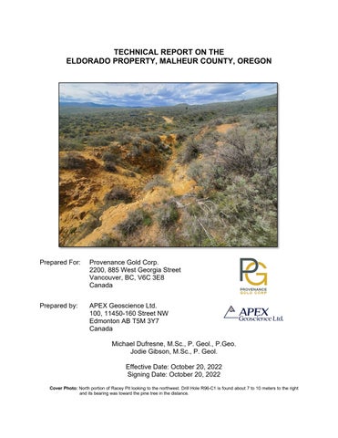
Cover Photo: North portion of Racey Pit looking to the northwest. Drill Hole R96-C1 is found about 7 to 10 meters to the right and its bearing was toward the pine tree in the distance.
Technical Report on the Eldorado Property, Malheur County, Oregon
Contents 1 Summary ................................................................................................................... 3 1.1 Authors and Site Inspection................................................................................ 3 1.2 Geology and Mineralization ................................................................................ 3 1.3 Historical Exploration .......................................................................................... 4 1.4 Exploration by Provenance Gold ........................................................................ 4 1.5 QP Site Visit ....................................................................................................... 5 1.6 Conclusions and Recommendations .................................................................. 5 2 Introduction ................................................................................................................ 7 2.1 Issuer and Purpose ............................................................................................ 7 2.2 Authors and Site Inspection................................................................................ 7 2.3 Sources of Information ....................................................................................... 9 2.4 Units of Measure ................................................................................................ 9 3 Reliance of Other Experts ........................................................................................ 10 4 Property Description and Location ........................................................................... 11 4.1 Description and Location .................................................................................. 11 4.2 Agreements and Royalties ............................................................................... 13 4.3 Environmental Liabilities, Permitting and Significant Factors ........................... 13 5 Accessibility, Climate, Local Resources, Infrastructure and Physiography .............. 15 5.1 Accessibility ...................................................................................................... 15 5.2 Site Topography, Elevation and Vegetation ..................................................... 15 5.3 Climate ............................................................................................................. 15 5.4 Local Resources and Infrastructure .................................................................. 15 6 History...................................................................................................................... 16 6.1 Summary of Historical Exploration ................................................................... 16 6.2 Historical Drilling ............................................................................................... 17 6.3 Historical Analytical Procedures ....................................................................... 19 6.3.1 Quality Assurance – Quality Control ....................................................... 20 6.4 Historical Mineral Resource Estimate ............................................................... 20 6.5 Historical metallurgical testing .......................................................................... 21 7 Geological Setting and Mineralization ...................................................................... 22 7.1 Regional and Property Geology ....................................................................... 22 7.2 Stratigraphy ...................................................................................................... 22 7.3 Structure ........................................................................................................... 25 7.4 Alteration .......................................................................................................... 26 7.5 Mineralization ................................................................................................... 26 8 Deposit Types .......................................................................................................... 26 9 Exploration ............................................................................................................... 27 10 Drilling ...................................................................................................................... 28 11 Sample Preparation, Analyses and Security ............................................................ 28 12 Data Verification....................................................................................................... 28 12.1 Verification Samples ......................................................................................... 28 12.2 Data Verification Procedures ............................................................................ 30 12.3 Validation Limitations ....................................................................................... 31 12.4 Adequacy of the Data ....................................................................................... 31 October 20, 2022
i
Technical Report on the Eldorado Property, Malheur County, Oregon
13 Mineral Processing and Metallurgical Testing .......................................................... 31 14 Mineral Resource Estimates .................................................................................... 32 23 Adjacent Properties.................................................................................................. 33 24 Other Relevant Data and Information ...................................................................... 33 25 Interpretation and Conclusions ................................................................................ 33 25.1 Geology and Mineralization .............................................................................. 33 25.2 Historical Exploration ........................................................................................ 33 25.3 Exploration by Provenance Gold ...................................................................... 34 25.4 QP Site visit ...................................................................................................... 34 25.5 Conclusions ...................................................................................................... 34 25.6 Risks and Uncertainties .................................................................................... 35 26 Recommendations ................................................................................................... 35 27 References .............................................................................................................. 38 28 Certificate of Author ................................................................................................. 40
Tables Table 4.1 Claims List ..................................................................................................... 11 Table 4.2. Permit descriptions and status for the Eldorado Property ............................ 14 Table 6.1. Summary of historical drilling completed at the Eldorado Property. ............. 17 Table 6.2. Assay certificate status for drillholes, trenches and locations. ...................... 20 Table 6.3. Resource Summary from Pincock, Allen and Holt (1990)............................. 21 Table 12.1. Eldorado Property rock chip sample results (Au) ....................................... 30 Table 12.2 Comparison of DHDS versus Found DH Locations in Field ........................ 31 Table 26.1 Budget for Recommended Exploration (US$) ............................................. 37
Figures Figure 2.1. General location of the Eldorado Property. ................................................... 8 Figure 4.1. Claim Map of the Eldorado Property. .......................................................... 12 Figure 6.1. Historical drilling at the Eldorado Property. ................................................. 18 Figure 7.1. Geology and structure of the Eldorado Property. ........................................ 23 Figure 12.1 Verification sample locations and results for Eldorado 2022 rock chip samples and location of verified drill hole locations. ..................................................... 29
October 20, 2022
ii
Technical Report on the Eldorado Property, Malheur County, Oregon
1 Summary This Technical Report (the “Report”) for the Eldorado Property (“Eldorado” or the “Property”) was prepared by APEX Geoscience Ltd. (“APEX”) to provide an independent evaluation of the exploration potential of the Eldorado Property for Provenance Gold Corp. (“Provenance”, “PAU” or the “Company”). This Technical Report has been prepared in accordance with the Canadian Securities Administration’s (CSA’s) National Instrument 43-101 (“NI 43-101”) Standards of Disclosure for Mineral Projects and guidelines for technical reporting Canadian Institute of Mining, Metallurgy and Petroleum (“CIM”) “Best Practices and Reporting Guidelines” for disclosing mineral exploration. The effective date of this Technical Report is October 20, 2022. The Eldorado Property consists of 19 unpatented mineral claims covering a combined area of approximately 137.4 hectares (339.5 acres), located approximately 60 kilometres (km; 38 miles) northwest of Vale in Malheur County, Oregon. On January 14, 2022, PAU, through its subsidiary Provenance Gold USA, entered into a five (5) year option agreement with Nevada Select Royalty Inc., a subsidiary of Gold Royalty Corp. (“GRC”). Pursuant to the option agreement, GRC granted Provenance Gold USA the sole and exclusive right to purchase 100% of GRC ’s right, title and interest to the Property. GRC retains a production net smelter returns (NSR) royalty of 3% on all mineral production from the Property. 1.1 Authors and Site Inspection The authors of this Technical Report are Mr. Michael B. Dufresne M.Sc., P. Geol., P. Geo., of APEX and Mr. Jodie Gibson M.Sc., P. Geo., an independent consultant. The authors are fully independent of Provenance and are Qualified Persons (“QPs”) as defined in NI 43-101. Mr. Dufresne takes responsibility for the preparation and publication of sections 1 to 8 and 14 to 19 of this Technical Report. Mr. Dufresne is a Professional Geologist with the Association of Professional Engineers and Geoscientists of Alberta (APEGA), a Professional Geoscientist with the Association of Professional Engineers and Geoscientists of British Columbia (EGBC). Mr. Gibson takes responsibility for Sections 9 to 13 and contributed to Sections 1.1, 1.4, 1.5, 2.2, 4, 6, 7, 17 and 18 of this Technical Report. Mr. Gibson is a Professional Geologist with the EGBC. Mr. Gibson visited the Property on May 13th, 2022. 1.2 Geology and Mineralization The Property lies along the southeastern slopes of east-central Oregon's Blue Mountains. The area is underlain by segments of Paleozoic and Mesozoic oceanic and island-arc terranes which accreted onto the North American continent during the late Mesozoic. Accretion was accompanied, or followed, by Mesozoic plutonism and later Miocene ash flow and basaltic volcanism. October 20, 2022
3
Technical Report on the Eldorado Property, Malheur County, Oregon
Locally the Eldorado Property is underlain by sedimentary, intrusive, and metamorphic rocks with patchy cover by younger volcanics. Meta-sediments represent lithologies thrusted eastward under a Mesozoic continental margin. These sediments were weakly modified by a calc-alkaline intrusion localized along pre-existing zones of structural weakness. Gold mineralization was introduced at this time. This section of early rocks was covered by regionally derived ash flow volcanics. The Eldorado magmatic/hydrothermal system is interpreted as a classic porphyry gold system. Mineralization is controlled by both strong fracture development and pyrite veining coincident with gold mineralization (Gatehouse, 1997). Pyrite veining, or its oxidized equivalent, is common throughout all of the drill holes. Gold is found in veinlets, stockworks, fractures, and hydrothermal breccias. Pyrite was identified as the dominant sulphide species at Eldorado however minor chalcopyrite and lesser sphalerite, galena, pyrrhotite, and marcasite were identified in polished sections. Native gold averaging 72 microns in diameter, and gold enclosed pyrite crystals was also observed in polished sections. 1.3 Historical Exploration Gold production at Eldorado began in 1874 with completion of the 216 km Eldorado ditch which carried water south from the Burnt River for the mining of placer gravels. Total production is unknown; Lindgren (1901) notes that the district attained maximum production of US$150,000 in 1875 (presumably all as placer). Placer gold clearly accounts for the majority of, if not all, production as there are only a few shallow lode diggings on the Property. Modern exploration began in 1980, which was driven by skyrocketing gold prices at that time. Drilling was completed on the Property between 1980 and 1997 by various operators including Westley Mines Ltd. (1980), N. A Degerstrom Inc. (1984), Ican Minerals Ltd. (1988, 1991, 1996), Billiton (1989) and North Mining (1997) The majority of drilling was rotary/percussion holes with 2 core holes drilled in 1996 by Ican and 4 core holes drilled in 1997 by North Mining. The drillhole database for the Property contains 242 drillholes including 236 rotary holes totalling 19,691.5 m (64,604.7 ft) and 6 core holes totalling 2,206.8 m (7,238.2 ft). Besides the large number of drill holes, these companies performed extensive geological mapping, rock chip sampling and trenching followed by ground magnetic, radiometric, and induced polarization (IP)-Resistivity geophysical surveys. Two separate metallurgical studies were completed which indicated that gold is recoverable in both the oxide and sulfide fractions. 1.4 Exploration by Provenance Gold Exploration activities by PAU at Eldorado have focused on historical data acquisition, field validation of drillhole locations, and review of all previously generated data by past operators. PAU has located and validated historical drillhole collars in the field. PAU has October 20, 2022
4
Technical Report on the Eldorado Property, Malheur County, Oregon
received an approved Bureau of Land Management (“BLM”) drilling permit and is awaiting approval from Oregon’s Department of Geology and Mineral Industries (“DOGAMI”) prior to commencing drilling at the Property. 1.5 QP Site Visit During the site visit Mr. Gibson collected rock chip samples over the Racey pits and other areas. Samples have returned assays of 0.084 to 4.837 g/t Au confirming the presence of mineralization of the Property. Additionally, Mr. Gibson verified the location of 12 of the historical holes during his site visit. Local variations between the current drillhole database and the verified field locations were observed. These discrepancies are consistent with observations by PAU. It is anticipated that these variations are due to coordinate translation issues from historical local grids to modern UTM coordinate datums. PAU staff are actively verifying the remainder of the historical drillhole collar locations where possible and updating the database accordingly. 1.6 Conclusions and Recommendations To conclude, the favorable geological setting of the Property, as well as mineralization intersected in historical drill programs indicates that there is potential for the presence of porphyry style gold mineralization at the Eldorado Property. Based on Mr. Gibson’s site inspection, as well as the authors’ review of historical and recent work completed at the Property, it is the opinion of the authors of this Report that the Eldorado Property is a property of merit that warrants future exploration. As a result, the authors recommend a staged exploration program for the Property, with Phase 2 exploration being dependent on the results of Phase 1. To better define the mineralization in terms of grade, potential size and scale across the Property in advance of a mineral resource estimate (“MRE”), further exploration including substantial infill and step out drilling is recommended. To verify historical metallurgical testing modern metallurgical testing is required. The completion of core drillholes to assist in understanding the geology and to provide metallurgical samples is strongly recommended. Phase 1 should include: • • • •
A thorough audit and validation of the historical and current drill hole data, as well as all available surface data should be completed to provide additional data confidence for the drill hole database prior to calculating an MRE. A reverse circulation (“RC”) drilling program should be conducted with focus on twinning multiple historical holes to confirm historical assay results and identify and measure subsurface water flow for future planning. Metallurgical test work should be completed to validate historical test work and to test heap leach characteristics from the RC cuttings. An initial MRE should be calculated based on data generated from Phase 1, which is to be the foundation for moving the project forward.
October 20, 2022
5
Technical Report on the Eldorado Property, Malheur County, Oregon
Phase 2 exploration is dependent on the results of the Phase 1 work. Based on the ongoing data compilation, re-interpretation of geology, and a positive MRE, a broad step out drilling program is recommended in Phase 2 to test the main zones along strike and down dip, as well as areas that have seen little drilling to date in order to delineate the gold mineralization over a larger area. Recommended drilling for Phase 2 includes: •
A 10-hole diamond core drilling program to obtain geological information and samples for metallurgical test work. Test work should include 30 gram (g) cold shaker cyanide testing for all PAU drilled holes when completed. This will help establish: o Grades and quantities of potentially recoverable and leachable gold. o Specific kinetics and the leachability of the gold bearing host rocks. o Metallurgical variances within the material, including effects of copper and other substances that will affect acid consumption and the effectiveness of leaching. o Specific data on alkalinity, pH and O2 levels. o Rates of acid consumption.
•
An additional 50 to 60 RC drillholes totalling approximately 10,000 m (32,800 ft) to assess new target areas and infill gaps where current drill spacing is greater than 100 m (330 ft). The exact number of holes and the total depth may be adjusted depending on initial results.
•
Following completion of all test work, a Preliminary Economic Assessment (“PEA”) is recommended to be completed.
The budget to complete the recommended exploration is approximately US$685,000 for Phase 1 and US$3.08 million dollars for Phase 2, for a total expenditure of approximately US$3.77 million dollars. This total includes contingency funds but not taxes.
October 20, 2022
6
Technical Report on the Eldorado Property, Malheur County, Oregon
2 Introduction 2.1 Issuer and Purpose This Technical Report (the “Report”) for the Eldorado Property (“Eldorado” or the “Property”) was prepared by APEX Geoscience Ltd. (“APEX”) at the request of the Issuer, Provenance Gold Corp. (“Provenance”, “PAU” or the “Company”). PAU is Canadian Securities Exchange (CSE: PAU) listed junior exploration company that is involved in the identification, acquisition, and exploration of mineral interests in the United States. On January 14, 2022, PAU, through its subsidiary Provenance Gold USA, entered into a five (5) year option agreement with Nevada Select Royalty Inc., a subsidiary of Gold Royalty Corp. (“GRC”). Pursuant to the option agreement, GRC granted Provenance Gold USA the sole and exclusive right to purchase 100% of GRC ’s right, title and interest to the Eldorado Property. GRC retains a production net smelter returns royalty (“NSR”) of 3% on all mineral production from the Property. The Eldorado Property is an early-stage exploration project located in Malheur County, approximately 60 kilometres (km) (38 miles) northwest of Vale, Oregon (Figure 2.1). The Property consists of 19 unpatented mineral claims covering a combined area of approximately 137.4 hectares (339.5 acres). The purpose of this Report is to provide an independent evaluation of the exploration potential of the Eldorado Property. This Report provides a technical summary of the relevant location, tenure, historical and geological information, a summary of the recent exploration work completed by the Issuer and recommendations for future work programs. This Report summarizes the technical information available up to the effective date of October 20, 2022. This Technical Report has been prepared in accordance with the Canadian Securities Administration’s (“CSA”’s) National Instrument 43-101 (“NI 43-101”) Standards of Disclosure for Mineral Projects and guidelines for technical reporting Canadian Institute of Mining, Metallurgy and Petroleum (“CIM”) “Best Practices and Reporting Guidelines” for disclosing mineral exploration. 2.2 Authors and Site Inspection The authors of this Report are Mr. Michael B. Dufresne M.Sc., P. Geol., P. Geo., of APEX and Mr. Jodie Gibson M.Sc., P. Geo., who is an independent consultant. The authors are fully independent of Provenance and are Qualified Persons (“QPs”) as defined in NI 43-101. NI 43-101 defines a QP as “an individual who is a geoscientist with at least five years of experience in mineral exploration, mine development or operation or mineral project assessment, or any combination of these; has experience relevant to the subject matter of the mineral project and the technical report; and is a member or licensee in good standing of a professional association.” The authors have been involved in all
October 20, 2022
7
Technical Report on the Eldorado Property, Malheur County, Oregon
Figure 2.1. General location of the Eldorado Property.
October 20, 2022
8
Technical Report on the Eldorado Property, Malheur County, Oregon
aspects of mineral exploration and mineral resource estimations for precious and base metal mineral projects and deposits in Canada and internationally. Mr. Dufresne takes responsibility for the preparation and publication of sections 1 to 8, and 14 to 27 of this Report. Mr. Dufresne is a Professional Geologist with the Association of Professional Engineers and Geoscientists of Alberta (APEGA; Membership Number 48439), a Professional Geoscientist with the Association of Professional Engineers and Geoscientists of British Columbia (EGBC; Membership Number 37074) and has worked as a geologist for more than 35 years since his graduation from university. Mr. Dufresne is a QP, has been involved in all aspects and stages of mineral exploration in North America, including exploration for epithermal and sediment hosted precious metal deposits in the western USA, and eastern and western Canada. Mr. Gibson takes responsibility for Sections 9 to 13 and contributed to Sections 1.1, 1.4, 1.5, 1.6, 2.2, 4, 6, 7, 25 and 26 of this Technical Report. Mr. Gibson is a Professional Geologist with the EGBC (Membership Number 162701) and has worked as a geologist for more than 15 years. Mr. Gibson is a QP and has experience with exploration for precious and base metal deposits of various deposit types in North America. Mr. Gibson visited the Property on May 13th, 2022, to verify current site access and conditions, and review the technical aspects of the Property. During the field visit, approximately 10% of the historical drill holes were located, and collar locations were verified with a handheld GPS. In addition, four verification samples were collected during the site visit. 2.3 Sources of Information In the preparation of this Report, the author/s have relied on information obtained through a review of public and private documents, reports, and data. The authors, in writing this Report, used sources of information as listed in Section 19 “References”. Government reports were prepared by Qualified Persons holding postsecondary geology, or related university degree(s), and are therefore deemed to be accurate. For those reports that were written by others, who are not Qualified Persons, the information is assumed to be reasonably accurate based on the data review and site visit conducted by the author(s). The authors take ownership of the ideas and values herein as they pertain to this current Report. 2.4 Units of Measure With respect to units of measure, unless otherwise stated, this Technical Report uses: •
Abbreviated shorthand consistent with the International System of Units (International Bureau of Weights and Measures, 2006).
October 20, 2022
9
Technical Report on the Eldorado Property, Malheur County, Oregon
•
‘Bulk’ weight is presented in both USA short tons (“tons”; 2,000 lbs or 907.2 kg) and metric tonnes (“tonnes”; 1,000 kg or 2,204.6 lbs.).
•
Geographic coordinates are projected in the Universal Transverse Mercator (“UTM”) system relative to WGS84 Zone 11; and,
•
Currency in USA dollars (US $), unless otherwise specified (e.g., Canadian, C$).
3 Reliance of Other Experts The authors are not qualified to provide an opinion or comment on issues related to legal agreements, royalties, permitting and environmental matters associated with the Eldorado Property. Accordingly, the authors of this Technical Report disclaim portions of this Technical Report, particularly in Section 4, Property Description and Location. This limited disclaimer of responsibility includes the following: •
The QPs incorporate and rely completely on contributions with respect to the details of the Option to Purchase agreement titled "Provenance Gold Option Agreement" dated January 14, 2022 in Section 4.1. This information was provided to the authors by Steven D. Craig, Senior Geological Consultant and Project Manager to PAU via Dropbox on March 17, 2022 and verbally during the preparation of this Report.
•
The QPs relied partially on background information and details regarding the Nature and Extent of the Land Titles in Section 4.1. This information was provided to the authors via email by Steven D. Craig, Senior Geological Consultant on March 17, 2022 and Project Manager for PAU during the preparation of this Report. While the authors have not attempted to verify the legal status of the Eldorado Property, the authors reviewed the BLM LR2000 mineral claims registration system on April 25, 2022. The 19 unpatented claims were listed to be in good standing on the BLM LR2000. Claims R-1 to R-19 are listed as “Active” (Table 4.1).
•
The QPs relied on documents provided by PAU regarding permitting. This information was provided by Steven D. Craig, Senior Geological Consultant and Project Manager for PAU during the preparation of this Report. The authors of this Technical Report used these documents exclusively to summarize information in Section 4.3 with respect to permitting and environmental status. One agreement forms the basis of the permitting for the Eldorado Property. PAU has one Notice level permit for exploration which has been approved and bonded; the permit number is OR-71360. The permit is dated June 13, 2022. The Oregon exploration permit, which is administered by the Department of Geology and Mineral Industries (DOGAMI), is in the process of internal review and final approval. The designation for this permit is DOGAMI ID #23-0291. Mr. Craig, as Project Manager, is the person responsible for writing and stewarding both permits through the agencies responsible for oversight.
October 20, 2022
10
Technical Report on the Eldorado Property, Malheur County, Oregon
4 Property Description and Location 4.1 Description and Location The Eldorado Property has also been known as Racey (a past property owner) and Shasta Butte (a local feature). PAU assigned the name Eldorado because of the Eldorado ditch that was built to supply water to the placer diggings in the area. The Eldorado Property consists of 19 unpatented mineral claims covering a combined area of approximately 137.4 hectares (339.5 acres), located approximately 60 km (40 miles) northwest of Vale, Malheur County, Oregon (Table 4.1; Figure 4.1). The Property is in the Blue Mountains of eastern Oregon, centered at 44˚ 25.209’ North latitude, 117˚ 43.659’ West longitude on the Bridgeport, Oregon US Geological Survey 7 ½’ quadrangle map sheet. Table 4.1 Claims List
Claim Name R 01 R 02 R 03 R 04 R 05 R 06 R 07 R 08 R 09 R 10 R 11 R 12 R 13 R 14 R 15 R 16 R 17 R 18 R 19
BLM Serial No.
County Serial No.
105264306 105264303 105264307 105264308 105264302 106264305 105264304 105264311 105264309 105264316 105264314 105264318 105264317 105264312 105264313 105264315 105264310 105264320 105264319
2021-5104 2021-5105 2021-5106 2021-5107 2021-5108 2021-5109 2021-5110 2021-5111 2021-5112 2021-5113 2021-5114 2021-5115 2021-5116 2021-5117 2021-5118 2021-5119 2021-5120 2021-5121 2021-5122
The Eldorado Property lies within the Malheur (Mormon Basin) Mining District. Lands in the district are administered by the Department of Interior, Bureau of Land Management (“BLM”) under the Federal Land Policy and Management Act of 1976. The Eldorado Property covers portions of Sections 19, 20, 29, and 30 in Township 13 South, Range 41 East. The claims are registered in the name of Nevada Select Royalty Inc. of Reno, October 20, 2022
11
Technical Report on the Eldorado Property, Malheur County, Oregon
Figure 4.1. Claim Map of the Eldorado Property.
October 20, 2022
12
Technical Report on the Eldorado Property, Malheur County, Oregon
Nevada and held by PAU through an Option to Purchase Agreement. A complete claim listing is provided in Table 4.1. Maintenance fees totalling $165 per claim are payable to the BLM on August 31 of each year. The county requires recording fees of $77.00 per document plus $5 per page per claim each year. 4.2 Agreements and Royalties On January 14, 2022, PAU, through its subsidiary Provenance Gold USA (PG USA), entered into the Provenance Gold USA option agreement with Nevada Select Royalty Inc., a wholly owned Nevada subsidiary of Gold Royalty Corp. (GRC). Pursuant to the option agreement, GRC grants PG USA the sole and exclusive right to purchase 100% of GRC’s right, title and interest in 19 unpatented mining claims covering approximately 339.5 acres and all related technical data, information and records acquired by GRC during the option period (Table 4.1). To acquire 100% in the 19 unpatented mineral claims, cash payments totalling US$2,000,000 are required to be made as follows (in US dollars): • • • • • •
$75,000 on signing (paid); $125,000 by the first anniversary; $400,000 by the second anniversary; $400,000 by the third anniversary; $500,000 by the fourth anniversary; and $500,000 by the fifth anniversary.
GRC retains a production royalty of 3% of net smelter returns (NSR) on all mineral production from the original 19 unpatented mining claims as registered under Nevada Select Royalties, as well as any additional land staked within a two (2) mile area of interest. There are no known encumbrances on the Eldorado Property. 4.3 Environmental Liabilities, Permitting and Significant Factors There are no known environmental liability issues on the Eldorado Property. Previous exploration was conducted under an Exploration Notice provided by the BLM and DOGAMI (Oregon Department of Geology and Mineral Industries). Generally, most trenches were reclaimed; however, various access roads constructed on the Property were not reclaimed as natural reseeding dominates the site. All other required historical reclamation has been completed on the Eldorado Property. The BLM is responsible for the surface and subsurface mineral estate in the Eldorado Property. Prior to conducting exploration, a Notice must be filed with the local BLM office in Vale, Oregon. The Notice describes the proposed exploration activities and any remedial reclamation that would be performed at the cessation of those activities. For any
October 20, 2022
13
Technical Report on the Eldorado Property, Malheur County, Oregon
new physical disturbance, a reclamation bond in an amount prescribed by the BLM must be secured prior to conducting any activities. PAU has one Notice level permit for exploration from the Bureau of Land Management (Table 4.2). The permit number is OR-71369, and it allows a total of 17 drill sites and 1.3 acres of access and pad disturbance. The total bond amount for future reclamation that has been posted is US$9,630. This bond amount will be refunded after PAU completes all reclamation of ground disturbance and demonstrates new plant growth has been achieved. DOGAMI also requires a permit (Table 4.2). Currently the permit application is moving through the approval process with all requested documents submitted for final approval, and it is anticipated to be granted soon. The permit number is 23-0219 and it requires a reclamation bond of $9,720, which was received by DOGAMI on September 19, 2022. Table 4.2. Permit descriptions and status for the Eldorado Property Permit
Date Approved
Bond
Acres
Drill Sites
BLM Notice #OR-71369
6/13/2022
US$9,630
1.38 Acres
17 Sites
DOGAMI # 23-0219
Underway
US$9,720
1.35 Acres
17 Sites
US$19,350
1.38 Acres
Total
There are currently no other significant factors and risks that may affect access, title or the right or ability to perform work on the Property that the authors are aware of.
October 20, 2022
14
Technical Report on the Eldorado Property, Malheur County, Oregon
5 Accessibility, Climate, Local Resources, Infrastructure and Physiography 5.1 Accessibility The Eldorado Property is located approximately 60 km (40 miles) northwest of Vale, Oregon. The Property is accessed from Vale via US Highway 26 east, turning northwest on Willow Creek Rd, north on Malheur City Rd., and west on Mormon Basin Rd to historic Malheur City. From there a series of dirt roads transect the Property to the north. 5.2 Site Topography, Elevation and Vegetation The Property area lies at an elevation of 1,219 m (4,000 ft) mean sea level (MSL) and is in the semi-arid high-desert plateau region of eastern Oregon. The terrain is mainly open steppe with mesas, broad valleys, and gently rolling hills to steeper uplands. Vegetation across the entire area consists of sagebrush, other brush, and desert grasses tolerant of semi-arid conditions. 5.3 Climate The immediate region is arid to semi-arid desert with temperatures up to 40 degrees Celsius (°C) (104 degrees Fahrenheit (°F)) in the summer and average temperatures of minus 10°C (14°F) in the winter. Precipitation varies between 20 to 30 centimetres (cm) per year, with the majority of this accumulating as snow in the winter months. Due to the elevation and location of the Eldorado Property, snow conditions may inhibit exploration activities during the winter months. Most exploration activities associated with fieldwork and drilling can likely be conducted within the late spring, summer and fall. 5.4 Local Resources and Infrastructure Existing access to the Property area is reasonable. Major city centres such as Boise, Idaho, are within two hours drive to the Property. An international airport is located 4.8 km (3 miles) south of the Boise city centre. Vale, Oregon, hosts a population of 1,874, according to 2010 United States census data. Most services are available in Vale, including food, lodging, a medical clinic, fire and ambulance emergency services. The Miller Memorial Airport is located 2.7 km (1.7 miles) to the southwest of the city centre. Given ongoing exploration and mining activities in Oregon and adjacent states of Idaho and Nevada, it is anticipated that sufficient experienced resources and manpower exists locally to support exploration on the Eldorado Property.
October 20, 2022
15
Technical Report on the Eldorado Property, Malheur County, Oregon
In the opinion of the authors, the Property is of sufficient size to accommodate potential exploration and mining facilities, including waste rock disposal and processing infrastructure. There are no other significant factors or risks that the authors are aware of that would affect access or the ability to perform work on the Property.
6 History 6.1 Summary of Historical Exploration Gold production in the Eldorado area began in 1874 with completion of the 216 km (134 mile) Eldorado ditch which carried water south from the Burnt River to support mining of placer gravels. Total production is unknown; Lindgren (1901) notes that the district attained approximate total production of US$200,000 from about 10,000 oz (presumably all as placer). Placer gold clearly accounts for the majority, if not all, of the production as there are only a few shallow lode diggings on/near the Property, and small-scale placer operations continue in the Eldorado area today. Modern exploration began around 1969 when the Eldorado Property was first staked by Mr. Racey, a local rancher and property owner. Modern gold exploration was driven by rising gold prices of that time. In 1980, the Racey Property was leased to Westley Mines Ltd. who conducted limited rock chip sampling and mapping followed by a 18 wide-spaced rotary drillholes. In 1984, N A Degerstrom Inc. leased the Property and completed 30 reverse circulation (RC) holes after a trenching program. The holes were drilled around the Racey pit area. In 1988-89, lcan Minerals Ltd. (Ican) followed up with a regional 88-hole RC drilling program and calculated an internal geological resource before joint venturing the Property to Billiton Minerals USA (Billiton) in 1989. Billiton drilled 67 holes and completed trench work, soil sampling, conducted ground magnetics geophysical surveying and flew aerial photography. The Property was returned to Ican in 1990 and they followed up with a 33hole RC program in 1991-1992, and a two (2) hole core program in 1996. Initial metallurgical test work was also conducted as part of the 1989 – 1990 Billiton programs (summarized in Section 6.4). North Mining Ltd. (North Mining) completed a compilation of historical technical data as well as preliminary 1:1,200 scale geological mapping and sampling that led to a Letter Agreement with Ican dated April 4, 1997. Subsequent work included mapping of an approximate 7 km2 (4.3 square miles) area at scale of 1:5,000 followed by continuous recording of ground magnetics at 25 m (82 ft) line spacing over 4 km2 (2.5 square miles). The magnetometer used was developed by North Mining with data collection by North Mining field crews. Zonge Engineering & Research, of Sparks, Nevada completed a ten line kilometre dipole - dipole Induced Polarization (IP) survey. Survey control-line layout October 20, 2022
16
Technical Report on the Eldorado Property, Malheur County, Oregon
for the ground magnetics, IP, as well as all additional survey work was tied to a local base station GPS point established by North Mining crews. In late summer of 1997, an additional 110 lode claims were staked, most of which were located west of the Ican leased ground and none of these are part of the current property. Other portions of this staking covered fractions or small parcels of unstaked public domain within fee land tracts. Following approval from the Bureau of Land Management, Vale District Office, Vale, Oregon, a four (4) hole core drilling program was completed between September 22, and November 18, 1997. Concurrent with the drilling, 598 soil samples at 50 m and 100 m (164 ft and 328 ft) spacing were collected using a small Ford tractor with a 1.2 m (3.9 ft) auger attachment. North Mining crews also ran ground radiometrics over portions of the 4 km2 (2.5 square miles) area covered by the ground magnetics survey. North dropped out of the agreement in early 1998 following their drilling program. The property laid idle and no work was done while it remained in Ican’s control for several years following the last drilling in 1997 due to collapse of the gold prices. It is not known when Ican dropped their interests in the Eldorado Property, but it continued to be owned by various groups until PAU acquired the Property in 2022. 6.2 Historical Drilling The total historical drilling database for the Eldorado Property includes 242 drillholes including 236 rotary holes totalling 19,691.5 m (64,604.7 ft) and 6 core holes totalling 2,206.8 m (7,238.2 ft; Table 6.1). The majority of the drilling was focused on the central and northern portions of the Property. The hole depths ranged from 9 to 392 m (30 to 1,286 ft) in depth with an average depth of 89 m (292.3 ft). The collar locations of the historical drilling are presented in Figure 6.1. A total of 13,490 samples collected along 2, 3, or 5-foot intervals were collected during the drilling programs. Table 6.1. Summary of historical drilling completed at the Eldorado Property. Year
Company
Number and Type of Drill Hole
Metreage
Hole Series
1980
Westley Mines
18 RC Holes
903.7 m (2,964.9 ft)
80-series (80-1 to 18)
1984
Dagerstrom
30 RC Holes
792.5 m (2,600.1 ft)
MRC-series (MRC-1 to 30)
1988
Ican
88 RC Holes
6,254.0 m (20,518.4 ft)
R-1 to R-88
1989
Billiton
67 RC Holes
8,842.6 m (29,011.2 ft)
RA-89 to RA-156
1991
Ican
33 RC Holes
2,898.7 m (9,510.2 ft)
RA157 to RA-189
1996
Ican
2 Core Holes
761.4 m (2,498.0 ft)
R-96-C 1 to 2
1997
North Mining
4 Core Holes
1444.8 m (4,740.2 ft)
SB-series (SB-3 to 6)
October 20, 2022
17
Technical Report on the Eldorado Property, Malheur County, Oregon
Figure 6.1. Historical drilling at the Eldorado Property.
October 20, 2022
18
Technical Report on the Eldorado Property, Malheur County, Oregon
Westley Mines Ltd. completed an 18 hole, wide-spaced drilling program designed to test a number of areas in 1980. The program used a rotary drill rig. A review of assay results from this drill program indicates that downhole contamination may have occurred. Based on this observation PAU has decided not to include the assay data from this drill program in future project assessments. PAU is assessing the possibility of twinning some of the historical holes from this program in areas that have identified drilled mineralization. In 1984 NA Degarstrom completed 30 RC drillholes targeting a small and shallow deposit. The drilling was completed adjacent to the small lode, open pit area with three holes drilled to test a target to the west. They had limited success but decided to not continue their program. In 1988 Ican Minerals completed an initial 88 RC drillhole program. An additional 67 RC drillholes were completed in 1988-1989 by Billiton under the joint venture agreement. These holes tested multiple targets spread over an area 4,000 feet long by 2,500 feet wide. In 1991, following the end of the joint venture with Billiton, Ican completed an additional 33 RC drill holes in 1991 to expand mineralization defined by Billiton. Later in 1996 Ican drilled their last two holes as deep angle core holes which followed significant mineralized trends. One of lcan’s core holes (R-96-C-1) returned a continuous assay interval of 1.28 g/t Au over 798 ft (261.8 m) at a 0.1 g cut-off value. This hole penetrated beneath the Racey Pit and demonstrated strong grade continuity, including 14.6 g/t Au over 6 ft (1.8 m) core length. The true width of mineralized intercepts is unknown. North Mining completed a four-hole core drilling program in 1997. North Mining's drill program was designed to bracket and expand the gold intercept from Ican Minerals' hole R-96-C-1 which intersected 1.51 g/t Au over 196.9 m. Drill site selection was supported by geologic mapping, ground magnetics, auger soil sampling, relogging R-96-C-1 as well as selected historical rotary holes, and a compilation of historical drilling data. The review of the data indicated that core hole R-96-C-1 had tested the favorably structurally prepared intersection of two fault zones crossing beneath the Racey open pits: - a north-south trending structural corridor over 100 m wide - observed in surface mapping, further defined by ground magnetics and physiographic character with - a N70 - 80 E structural fabric, the Shasta Trend, - which is in-part mappable but largely defined by trend of mineralized intercepts compiled from historical drilling. 6.3 Historical Analytical Procedures Assays for drillholes, soil grid assays, and trench assays were all completed in reputable labs (Chemex, Bondar Clegg), which produced reliable results. Most of the assay information was saved onto spreadsheets and these spreadsheets were easily forwarded to the next operating company. Unfortunately, over the years there was a loss of the original paper reporting documents. The audit and verification of the historical assay October 20, 2022
19
Technical Report on the Eldorado Property, Malheur County, Oregon
data by PAU is ongoing. A summary of the assay certificate status for drill holes, trenches and locations is presented in Table 6.2. Table 6.2. Assay certificate status for drillholes, trenches and locations. Drillholes without Assay Certificates
Trenches without Assay Certificates
Holes with Missing Collars/Surveys
Trenches with Missing Locations
R-001 to R-082; R-084; R086; R-088; R-109; R-112 to R-127; R-129 to R-130; R134 to R-135; R-137 to R148; R-150 to R-151; R-153 to R-164; R-96-C-1 and 2; RC-001 to RC-030; SB-6-90 to SB-13-90.
MPT-1 to MPT-13; MPT-20 to MPT-28; MPT3-9 to MPT3-12; MPT26A; MPT80-9; ICAN-1 to ICAN-9; ICAN-11 to ICAN-13.
R-165 to R-166; RC-001 to RC-004; 80-01 to 80-18.
MPT-13; MPT-20 to MPT-28; MPT-26A; MPT-80-9; ICAN1 to ICAN-13.
The historical documents available to the Issuer report the type of analytical procedure used for the assaying or other lab procedures. The industry standard for gold assays as reported by at least four assay laboratories were fire assay with an atomic absorption (AA) finish. It was not reported if the gold charge was 10 or 30 grams. Trace element analysis was usually reported as an aqua regia digestion followed by AA. Full disclosure is not possible as numerous assay certificates have been lost. 6.3.1 Quality Assurance – Quality Control The only QA-QC information identified from the available historical assay certificates were duplicate assays of an interval with anywhere from up two separate re-assays. Generally, these assays reported similar numbers. Reports from the 1980 to 1997 programs do not discuss any QA/QC protocol. 6.4 Historical Mineral Resource Estimate A historical mineral resource estimate for the Eldorado deposit was reported to Billiton (Coolen, 1990) by Pincock, Allen and Holt (1990) of Lakewood Colorado. Pincock was contracted to calculate the resource estimate using Micromodel software. Billiton used a selected drillhole database of only 158 holes using only the lcan and Billiton drill data. The database contained 9,853 assays that were composited to 2,320 assay intervals for 20-foot bench plans. They completed at least 12 different computer runs using an inverse distance squared method, a tonnage factor of 12.5 cubic feet per ton and cut-off grades that ranged from 0.008 to 0.3 opt Au. The historical mineral resource estimate as reported by Pincock et al (1990) for the Eldorado deposit is 52,896,000 tons grading 0.0169 ounces per ton (0.578 g/t) at a cutoff grade of 0.008 opt within the larger mineralized area (Table 6.3). The estimate predates and does not comply with CIM Definition Standards on Mineral Resources and Mineral Reserves (2010) as required by NI 43-101 and has no comparable resource classification. October 20, 2022
20
Technical Report on the Eldorado Property, Malheur County, Oregon
Table 6.3. Resource Summary from Pincock, Allen and Holt (1990). Cut-off Grade (opt)
Tons
Average Grade (opt)
Total Au oz
0.008
52,896,000
0.0169
893,942
0.01
38,416,000
0.0199
764,478
0.02
10,272,000
0.374
384,173
The authors of this Technical Report have not done sufficient work to classify this historical estimate as a current mineral resource. The authors are treating this estimate as a “historical resource” and the reader is cautioned not to treat it, or any part of i, as current mineral resources. There is insufficient information available to properly assess the data quality, estimation parameters and standards by which the estimates were categorized. The mineral resource estimate was calculated prior to the implementation of the standards set forth in NI 43-101 and Canadian Institute of Mining (“CIM”) Definition Standards for Mineral Resources and Mineral Reserves (May, 2014) and CIM Estimation of Mineral Resources & Mineral Reserves Best Practices Guidelines (November, 2019). The historical resource summarized above have been included simply to demonstrate the mineral potential of the Eldorado Property. A thorough review of all historical data performed by a Qualified Person, along with additional exploration work to confirm results, would be required in order to produce a current mineral resource estimate for the Eldorado Property. 6.5 Historical metallurgical testing Historical metallurgical test work has been completed at the Eldorado Property for Ican by Dawson Metallurgical Laboratories of Murray, Utah in 1989 and for Billiton by Mountain States R & D International of Sparks, Nevada IN 1990 (Dawson, 1989; Darrah, 1990). Dawson composited five unoxidized sulphide-bearing samples into a 13.15 kg test sample that assayed 0.036 opt gold. Pyrite was found to be the most common sulphide. Approximately 90% of the gold was recovered by two-stage gravity-floatation wherein the sample was initially ground to 35 mesh and tabled. The table rejects were subsequently reground to 58% minus 200 mesh and reprocessed by flotation. Significant free gold was observed in both the gravity and floatation concentrates. The Mountain States laboratory conducted a series of bottle roll tests on composite sulphide samples from the Property. Three composite test samples yielded recoveries on unground rock that yielded 71%, 76%, and 77% recoveries. Grinding increased recoveries to 92%, 86%, and 83%. The laboratory stated that most of the gold was liberated at 50 to 100 mesh. While modern metallurgical testing needs to be completed on the Property, the historical testing suggests that heap leaching of the sulphide portion of the mineralized material will produce good recoveries of gold. October 20, 2022
21
Technical Report on the Eldorado Property, Malheur County, Oregon
7 Geological Setting and Mineralization The following review of the geological setting and mineralization of the Eldorado Property (7.1 to 7.5) is summarized from Eliopulos (1998). 7.1 Regional and Property Geology The Eldorado Property area is underlain by segments of Paleozoic and Mesozoic oceanic and island-arc terranes accreted onto the North American continent during the late Mesozoic, accompanied or followed by Mesozoic plutonism (Evans, 1993; Lees, 1994. A single age date from the intrusive underlying Shasta Butte yielded a younger Eocene age of 48.8 +/-2.7 Ma (Billiton, 1990). Plutonism was followed by ash flow and basaltic volcanism described and mapped by Evans (1992) as the lower to middle Miocene Dooley Volcanics. These are well exposed on the Dooley Mountain 7.5' quadrangle, 15 km (9.3 miles) northwest of Eldorado, and likely represented by ash flow and basalt outcroppings on/near the Eldorado Property. The Eldorado Property is underlain by sedimentary, intrusive, and metamorphic rocks with patchy cover by younger volcanics. Meta-sediments represent lithologies thrusted eastward onto a Mesozoic continent. These sediments were weakly modified by calcalkaline intrusions localized along pre-existing zones of structural weakness. The section was covered by regionally derived ash flow volcanics. Figure 7.1 shows the geology of the area around the Property. 7.2 Stratigraphy The oldest rocks in the Eldorado area are a package of meta-sediments, metavolcanics, and unmetamorphosed equivalents which comprise an accreted oceanic and island-arc terrane of possible affinity with the Triassic Huntington Formation (Ebel and Schurman, 1990) or part of the Baker terrane as noted in Evans (1993). This sedimentary package also represents a protolith for rock mapped as hornfels. Lithologies recognized on the Property include sandstone/meta-arkose, argillite, shale, limestone, and interlayered chert-argillite-serpentinite. Within the Eldorado area argillites appear to be overlain by the (meta-) sandstone, succeeded by interlayered chert-argilliteserpentinite. Limestone, if present, occurs in layers of varying thickness above
October 20, 2022
22
Technical Report on the Eldorado Property, Malheur County, Oregon
Figure 7.1. Geology and structure of the Eldorado Property.
October 20, 2022
23
Technical Report on the Eldorado Property, Malheur County, Oregon
the argillite. These lithologies very likely represent separate tectono-stratigraphic thrusted - accreted packages that show minimal deformation locally, but are strongly deformed (as noted by Evans, 1993) within the Baker Terrane approximately 20 km (12.4 miles) to the northwest. Strong deformation is observed locally as overturned folds within massive chert-argillite outcrops east of Shasta Creek in the northern part of the Eldorado area and as incompetent shale squeezed and folded by competent meta-sandstone in bottoms of dry gullies draining east into Shasta Creek north of the Malheur City-Bridgeport Road junction. Sandstone/meta-arkose and the chert-argillite-serpentinite succession occupy the uplands in the north-central part of the map area north of the intrusive units (Figure 7.1). The elastic lithologies may display a crude foliation grading toward quartz-sericite schist, similar to Evans' (1993) descriptions within the Brannan Gulch 7.5' quadrangle, approximately 20 km (12.4 miles) northwest of Shasta Butte. Gray to tan, generally undeformed argillite-shale makes up the more subtle terrain west of the intrusive units and is also present as roof pendants toward the south margin of the Eldorado map area. Argillites are characterized by uniform, near vertical 50° to 70° cleavage overprinted on northwest striking, shallow southeast dipping bedding. Competent argillite may host massive, white quartz stringers and veinlets. The most significant of these is the 2 to 30 centimetres (cm) wide, 60° striking, 50° southeast dipping quartz vein investigated by the historical 46 m (151 ft) deep Red-White-Blue shaft located approximately 300 m (984 ft) southwest of the Malheur City cemetery. The Eldorado Property is underlain by a moderately weathered, auriferous intrusive stock, diorite to quartz diorite in composition (Williams, 1989) named the Shasta Butte stock. The stock intrudes Mesozoic accreted sediments which commonly develop as roof pendants ranging up to 500 m (1,640 ft) in exposed plan dimension. A Tertiary age is informally assigned to the Shasta Butte stock based on a 48.8 +/- 2.7 Ma date determined for Billiton Minerals in 1990 (site of material used for dating is not known). Arguably, Shasta Butte's proximity to the Idaho Batholith may indicate a correlative 65 Ma intrusive event. Both field description and petrographic designation (Williams, 1989; Khin, 1997) classify the stock as a diorite. Diorite is typically grayish when fresh to light greenish where propylitized, containing as much as 25% blackish hornblende crystals 2 to 8 millimetres (mm) long, up to 35% offwhite to fresh plagioclase crystals 1 to 3 mm long usually within a very fine grained to aphanitic grayish/greenish matrix. The stock reflects minor compositional differences, usually within limonite altered zones which almost universally coincide with the presence of 1 % to 3% quartz crystals. The limonite zones include goethite "specks" after fine grained +/- 0.5 mm disseminated pyrite with up to 5% abundance. Textural changes within the stock are more common, and are usually represented by changes in grain size of the mafic and feldspar crystals. The most significant and easiest to recognize textural change is the presence of a coarsely plagioclase porphyritic variety (4 to 10 mm crystals). October 20, 2022
24
Technical Report on the Eldorado Property, Malheur County, Oregon
Based on historical core logs, it is interpreted that the stock represents a more complex body containing a variety of dioritic breccia types: igneous - tectonic - annealed. Fractured-annealed breccia is a preferential gold host. Dikes, diorite in composition and usually finer grained, are most common on Cemetery Ridge. Dike contacts may be faulted, or indistinct as though representing an alteration front rather than an intrusion. Changes in intensity of propylitic alteration with varying additions of silification produce mottled textures or "bleaching" which can be mistaken for differences in rock type. Textural changes largely reflect changes in grain size or changes in abundance of mafic or feldspar crystals. Toward the northwest edge of the Eldorado map area, pumice-rich, crystal poor, densely welded ash flow tuff crops out as part of broader volcanic terrain probably correlative with the lower to middle Miocene Dooley Volcanics exposed some 15 km (9.3 miles) northwest of Shasta Butte (Evans, 1993). Although no contact relations were observed between ash flow tuff and basalt, it is assumed that fine grained basalt capping the small hill at the south central edge of the Eldorado map area, as well as other local basalt outcroppings, represent younger volcanics. Basalts are known to thicken toward Rich Gulch southwest of the area and may be sourced or correlative with basalt located at Cow Valley 12 km (7.5 miles) south of Shasta Butte. 7.3 Structure Placer gold at Shasta Butte was liberated from a very well jointed, fractured, often stockwork, diorite stock, yet there were few discrete major mappable faults or shears observed during historical mapping campaigns. However, both IP and magnetic surveys conducted on the Property identified a significant north trending structural "corridor'' measuring approximately 100 to 150 m (330 to 490 ft) wide that lies between the Racey pits area and Quartz Creek. In general, the structural corridor occupies a physiographic depression generally coincident with recessive topography worked by the historical placer miners. The corridor is also defined by quartz veined and stockwork quartz diorite/diorite plugs. The Eldorado property is one of a number of gold districts aligned along an approximate northeast trend, which is probably an old zone of structural weakness which served as a locus for later intrusion and gold mineralization. Within the approximate central part of the Eldorado mapping area between Shasta Gulch and Quartz Creek, northeast striking diorite-hosted narrow shears make up part of the regional structural grain. A northeast grain ten of metres wide becomes evident proximal to the Racey pits area from compilation of historical rotary drilled gold The lcan Minerals drill hole R-96-C1 was located at the intersection of the northeast trend with the aforementioned north striking structural corridor. This drillhole returned 1.28 g/t Au over 798 feet (243 m) at a 0.1 gram cut-off demonstrated the significance of structural intersections on the Property.
October 20, 2022
25
Technical Report on the Eldorado Property, Malheur County, Oregon
7.4 Alteration Alteration on the Eldorado Property consists of a northeast trending zone(s) of propylitic altered diorite with hornfels and local endoskarn within meta-sediments. Potassic alteration and silicification also occur in the same rocks, particularly along structural corridors, and appear to be closely related to gold mineralization based on historical drillhole descriptions. 7.5 Mineralization Examinations of polished sections from historical drilling identified pyrite as the dominant sulphide phase accompanied by minor chalcopyrite and lesser sphalerite, galena, pyrrhotite, and marcasite (Honea, 1989). This study described the presence of native gold up to 72 microns (average) in diameter as well as gold that enclosed pyrite crystals. Conclusions from this 1989 study coupled with observations from surface mapping and core logging, indicate a strong fracture control along with pyrite veining coincident with gold mineralization. Historical core logs and descriptions of historical drillholes indicate that all anomalous gold values intersected on the Eldorado Property to date are related to tectonism of some sort: veinlets, stockworks, fractures, or breccia, typically with disseminated to vein hosted pyrite. The highest-grade gold values generally are associated with potassic alteration and/or silicification, with lower gold grades occurring in propylitic altered units.
8 Deposit Types The Eldorado Property hosts gold mineralization and alteration patterns with similarities to porphyry gold systems (Rytuba and Cox, 1991). In general, porphyry systems are described as relatively deep, (paleodepth of approximately 1 km - 6 km) low grade, and high tonnage deposits composed of mineralization sourced from fluid-rich porphyry intrusive rocks. These magmas typically form during active subduction or in post-subduction environments underneath of volcanic arcs and are classified based on generative magma chemistries ranging from alkalic to calc-alkalic systems. Alteration halos surrounding porphyry deposits can extend up to several kilometres away from the porphyry center and are characteristic of this deposit type. Alteration in porphyry systems is governed by the temperature and pH of the fluids as they migrate away from the porphyry center. Alteration within and immediately around the porphyry intrusive is potassic alteration with potassium feldspar, shreddy biotite, and actinolite alteration of the country rocks and the host porphyry where the system is at the maximum pressure and temperature. As the fluids migrate away from the porphyry center, they cool and form alteration assemblages dominated by sericite and sericite-chlorite alteration. October 20, 2022
26
Technical Report on the Eldorado Property, Malheur County, Oregon
The outer portions of the porphyry system often show chlorite-epidote-carbonate (propylitic) extending kilometres away from the mineralized porphyry center. As the system collapses and shuts down, meteoric waters will form argillic alteration on the surface. Fluids that migrate to the surface will generally become more acidic due the change in pressure and advanced argillic alteration and a lithocap environment will form above the porphyry intrusion. Gold porphyry systems are similar to porphyry copper deposits but are copper deficient and typically contain less than 1% total sulphides. Typical host rocks vary from granite to diorite. Pervasive potassic–phyllic alteration zones accompany the gold mineralization, which is disseminated in quartz-rich stockworks, veinlet swarms, and breccias. Lower grade mineralization can also occur in adjacent propylitic altered units. Tonnages for these systems are typically large, but average grades are low (<1 g/t Au), and they are distinct from other gold deposit models because of the low Cu to Au ratio and, pending the deposit, the association of Au, bismuth (Bi), tungsten (W), and/or molybdenum (Mo) (Hollister, 1992).
9 Exploration Since acquiring the Property in January 2022 efforts by PAU have been focused on reviewing, digitizing, and field validating the historical exploration data and acquiring exploration permits from the BLM and DOGAMI to conduct drilling on the Property. PAU completed a data compilation of all available historical data for the Property. PAU acquired historical exploration data for the Property from several previous vendors of the Property including digital files from a North Mining Company consulting geologist, four file boxes of Ican and Billiton paper records from Cal Herron, consulting geologist for Ican – all of these records have been scanned and converted into digital files and the final report from North Mining which included several data disks including one disk that contained a drillhole database. Half (6) of the data discs were found to be corrupted. Verification of the location of historical drillhole collars in the field by PAU is ongoing. To date, the locations of 30 holes have been verified in the field by the Company. Minor variations have been observed between the acquired drillhole database and the verified field locations. It is anticipated that these variations are due to coordinate translation issues between historical local grids and a modern UTM coordinate system. PAU staff are actively verifying the remainder of the historical drillhole collar locations where possible. The drillhole database collar locations are updated accordingly. No further exploration has been conducted on the Eldorado Property by PAU to date.
October 20, 2022
27
Technical Report on the Eldorado Property, Malheur County, Oregon
10 Drilling As of the Effective Date of this Report, PAU has not completed any drilling at the Eldorado Property. Refer to Section 6 for a summary of historical drilling completed at the Property.
11 Sample Preparation, Analyses and Security As of the Effective Date of this Report, PAU has not completed any sampling at the Eldorado Property. Section 6.3 presents a summary of available information on analytical procedures for historical sampling and drilling programs completed on the Property.
12 Data Verification Mr. Gibson visited the Property on May 13, 2022, to verify current site access and conditions, and review the technical aspects of the Property. During the field visit, 12 of the historical drillholes were located, and collar locations were verified with a handheld GPS (Figure 12.1). Additionally, seven verification samples were collected during the site visit to confirm the gold mineralization on the Property. 12.1 Verification Samples Sample sites were selected based on the presence of alteration and/or limonite or pyrite. Multiple chips averaging 1 to 3 cm were hammered off an outcrop and placed in a bag, in which each weighed about 1 kg. Sample bags were labeled on the outside with the sample number. The site location was recorded with a hand-held Garmin GPS and field notes recorded details of the rock that was sampled. Samples were delivered to Paragon Geochemical (“Paragon”) in Reno, Nevada. A standard was included in the sample batch and requested on the submittal sheet. Samples were kept in a locked vehicle until delivered directly to the lab. The samples collected were prepared and analyzed at Paragon in Reno, Nevada, USA. Paragon is an accredited laboratory that complies with the data quality objectives of the International Standards Organization (ISO/IEC 17025:2017) and is independent of PAU and the authors of this Technical Report. The lab received and recorded the submittal and set them into their work schedule. The samples were dried at 100°C, crushed to 70% passing 10 mesh (-2 mm), and riffle split. A 250 g split sample was pulverised to 85% passing 200 mesh. Samples were analysed using a 30 g fire assay with aqua regia digestion follow by atomic absorption spectroscopy (AQR digest/AAS). A 30 g fire assay, gravimetric finish was completed where appropriate. All RC chip samples were also analysed for Ag using 0.5 g - AAS, AQR digestion/AAS. October 20, 2022
28
Technical Report on the Eldorado Property, Malheur County, Oregon
Figure 12.1 Verification sample locations and results for Eldorado 2022 rock chip samples and location of verified drill hole locations.
October 20, 2022
29
Technical Report on the Eldorado Property, Malheur County, Oregon
One standard was inserted into the rock chip sample stream in order to provide Quality Assurance – Quality Control (QA/QC). A MEG Inc. gold MEG-Au.19.09 standard was used (standardized gold value of 0.71 ppm Au). The standard performed well, returning 0.69 ppm Au (Table 12.1), with 95% confidence ranging from 0.667 to 0.756 ppm Au. Assay results confirmed that the breccia samples reported the highest grades with the other rock types being mineralized. Figure 12.1 and Table 12.1 shows the location of the verification samples and table listing the sample results. Table 12.1. Eldorado Property rock chip sample results (Au) Sample
UTM East
UTM North
Au ppm
Ag ppm
Comments
R-101
442185
4918817
0.133
0.4
Breciated (HBXd), abundant limonite surrounding rock fragments
R-102
442078
4918826
4.837
1.9
Fine grained (FG) intrusive, weak argillic with limonite on fractures
R-103
442077
4918744
3.763
2
Pit, HBX, abundant limonite, possible potassium (K) alteration
R-104
442070
4918799
0.896
1.1
Pit, FG intrusive, K stable, limonite on fractures
R-105
442068
4918790
1.167
0.02
Pit, FG intrusive, K stable, limonite on fractures
R-106
441765
4918566
0.767
1.8
Small pit in flats, very fine grained Intrusive, limonite
R-107
442353
4919082
0.084
0.02
DH cuttings on top of hill w limonite and silica (off-Property).
R-108
0.69
MEG-Au.19.09 Standard
12.2 Data Verification Procedures The original data set was obtained from several past workers that saved geological information and from the North Mining final summary report (Eliopulos, 1998). The historical digital database was retrieved from a CD and it was verified by the QPs against available historical paper assay sheets, maps and logs. Hard copy paper data was available for approximately 25% of the drill holes and it was reviewed and verified. Digital data that was verified against paper copies includes collar locations, dip, azimuth, downhole geology, and sample numbers. Historical assay certificates were available to verify the historical assay results for 20% of the drillhole database and all these were reviewed. All typographical errors were corrected and missing data was digitized and added to the database. Mr. Gibson verified the location of 12 of the historical holes during his site visit on May 13, 2022. There are local variations between the current drillhole database and the verified field locations. Offsets between the North Mining database to what was found in the field averaged about 40 meters. Table 12.2 compares the field recorded UTM collar locations against the collar locations recorded in the drillhole database. These discrepancies are consistent with observations by PAU. It is anticipated that these variations are due to coordinate translation issues from historical local grids to modern UTM coordinate datums. PAU staff are actively verifying the remainder of the historical drillhole collar locations where possible and updating the database accordingly.
October 20, 2022
30
Technical Report on the Eldorado Property, Malheur County, Oregon
In order to have full confidence in the drillhole database, the QPs recommend that a number of the historical holes should be twinned and the assays between the original and the twin drillholes should be compared. This drilling is planned to be completed in the spring of 2023. Table 12.2 Comparison of DHDS versus Found DH Locations in Field Drill ID 80-9 R-10 R-17 R-27 R-47 R-75 R-94 R-164 R-177 R-182 R-183
DHDB 442319 441729 441859 441756 441868 441524 442213 441866 441772 441720 441771
WGS 84 4919043 4918578 4918754 4918606 4918819 4918224 4917921 4918592 4918559 4918555 4918580
Field GPS 442359 441747 441879 411773 441887 441857 442107 441880 441792 441737 441787
4919073 4918540 4918721 4918572 4918792 4918490 4918115 4918555 4918528 4918520 4918547
Field Evidence of DH Cutting pile and historical map ID tag and cement collar Cuttings pile ID tag and cement collar Cuttings pile Cuttings pile Cement collar and map Cuttings pile Cement ID tag and cement collar Cement collar and map
12.3 Validation Limitations Given the nature and age of the historical data and lack of original assay certificates in paper or digital form, no further paper or digital validation is possible. 12.4 Adequacy of the Data The QPs reviewed the adequacy of the exploration information and the visual, physical, and geological characteristics of the Property and found no significant issues or inconsistencies that would cause one to question the validity of the data. Verification of the paper and digital data compiled from historical exploration programs is ongoing. When collar coordinates have been field verified the database is updated accordingly. For historical drill collars that have not been located in the field, coordinates were verified against paper maps. Mr. Gibson visited the Property on May 13, 2022, to verify current site access and conditions, and review the technical aspects of the Property. The authors are satisfied, and take responsibility, to include the exploration data including drill information as background information for this Technical Report.
13 Mineral Processing and Metallurgical Testing PAU has not yet completed metallurgical testing at Eldorado. October 20, 2022
31
Technical Report on the Eldorado Property, Malheur County, Oregon
14 Mineral Resource Estimates No current mineral resource estimate has been completed on the Eldorado Property. ------
Sections 15-22 are not included as this Technical Report for the Eldorado Property is a geological introduction report. ------
October 20, 2022
32
Technical Report on the Eldorado Property, Malheur County, Oregon
23 Adjacent Properties There are no adjacent properties that are comparable to the mineralization and alteration styles of the Eldorado Property.
24 Other Relevant Data and Information The authors are not aware of any other relevant information with respect to the Eldorado Property.
25 Interpretation and Conclusions 25.1 Geology and Mineralization The Eldorado Property is located approximately 60 km (40 miles) northwest of Vale in Malheur County, Oregon. The Property lies along the southeastern slopes of east-central Oregon's Blue Mountains. The area is underlain by segments of Paleozoic and Mesozoic oceanic and island-arc terranes which accreted onto the North American continent during the late Mesozoic. Accretion was accompanied or followed by Mesozoic plutonism and later Miocene ash flow and basaltic volcanism. The local geology of the Eldorado Property is underlain by sedimentary, intrusive, and metamorphic rocks with patchy cover by younger volcanics. Meta-sediments represent lithologies thrusted eastward under a Mesozoic continental margin. These sediments were weakly modified by a calc-alkaline intrusion localized along pre-existing zones of structural weakness. Gold mineralization was introduced at this time. This section of early rocks was covered by regionally derived ash flow volcanics. The Eldorado magmatic/hydrothermal system is interpreted as a classic porphyry gold system. Mineralization is controlled by both strong fracture development and pyrite veining coincident with gold mineralization (Gatehouse, 1997). Pyrite veining, or its oxidized equivalent, is common in all historical drillholes. Gold is found in veinlets, stockworks, fractures, and hydrothermal breccias. Although pyrite is the dominant sulphide species found at Eldorado, minor chalcopyrite and lesser sphalerite, galena, pyrrhotite, and marcasite (Honea, 1989) have been identified in polished sections. Native gold with an average diameter of 72 microns, and gold enclosed pyrite crystals, were also observed in polished sections. 25.2 Historical Exploration Gold production at Eldorado began in 1874 with completion of the 216 km Eldorado ditch which carried water south from the Burnt River for the mining of placer gravels. Total production is unknown; Lindgren (1901) notes that the district attained maximum production of US$150,000 in 1875 (presumably all as placer). Placer gold accounts for October 20, 2022
33
Technical Report on the Eldorado Property, Malheur County, Oregon
the majority of, if not all, production as there are only a few shallow lode diggings on the Property. Modern exploration began in 1980, which was driven by skyrocketing gold prices at that time. Drilling was completed on the Property between 1980 and 1997 by various operators including Westley Mines Ltd. (1980), N. A Degerstrom Inc. (1984), Ican Minerals Ltd. (1988, 1991, 1996), Billiton (1989) and North Mining (1997) The majority of drilling was rotary/percussion holes with 2 core holes drilled in 1996 by Ican and 4 core holes drilled in 1997 by North Mining. The drillhole database for the Property contains 242 drillholes including 236 rotary holes totalling 19,691.5 m (64,604.7 ft) and 6 core holes totalling 2,206.8 m (7,238.2 ft). Besides the large number of drill holes, these companies performed extensive geological mapping, rock chip sampling and trenching followed later by ground magnetic, radiometric, and IP-Resistivity geophysical surveys. Two separate metallurgical studies were completed which indicated that gold is recoverable in both the oxide and sulphide fractions. 25.3 Exploration by Provenance Gold Exploration activities by PAU at Eldorado have focused on historical data acquisition, field validation of drillhole locations, and review of all previously generated data by past operators. PAU has located and validated historical drillhole collars in the field. PAU has received an approved Bureau of Land Management (“BLM”) drilling permit and is awaiting approval from Oregon’s Department of Geology and Mineral Industries (“DOGAMI”) prior to commencing drilling at the Property. 25.4 QP Site visit Mr. Gibson collected rock chip samples over the Racey pits and other areas. Samples have returned assays of 0.084 to 4.837 g/t Au confirming the presence of mineralization of the Property. Additionally, Mr. Gibson verified the location of 12 of the historical holes during his site visit. Local variations between the current drillhole database and the verified field locations were observed. These discrepancies are consistent with observations by PAU. It is anticipated that these variations are due to coordinate translation issues from historical local grids to modern UTM coordinate datums. PAU staff are actively verifying the remainder of the historical drillhole collar locations where possible and updating the database accordingly. 25.5 Conclusions Based upon a review of available information, historical exploration, PAU’s rock chip sampling program and Mr. Gibson’s recent site inspection, the authors consider the Eldorado Property as a property of merit prospective for the discovery of porphyry-type gold mineralization. This is supported by the favourable geological setting of the Property October 20, 2022
34
Technical Report on the Eldorado Property, Malheur County, Oregon
and historical drilling results of previous operators that intersected gold mineralization on the Property. PAU is still in the early stages of conducting a full review and understanding of all of the data that has survived over the last two decades of inactivity and conducting multiple field reviews of drillhole collar locations. The modern era of exploration began in about 1980 and continued until about 1998. The companies involved in the historical exploration at Eldorado were all credible and experienced mining/exploration companies. The QPs reviewed the adequacy of the exploration information and the visual, physical, and geological characteristics of the Property and found no significant issues or inconsistencies that would cause one to question the validity of the data. 25.6 Risks and Uncertainties The authors have considered risks and uncertainties that could reasonably be expected to affect exploration and development of the Eldorado Property. The Property is subject to the typical external risks that apply to all mineral exploration projects, such as changes in gold prices, and volatility of supply and demand economics which can affect the availability of investment capital as well as changes in government regulations, community engagement and general environmental concerns. The authors are unaware of any unusual risk factors, other than risks normally associated with mineral exploration that might affect future exploration work and potential development of the Property. The Company is awaiting a permit from DOGAMI to conduct drilling activities on the Property. Currently the permit application is moving through the approval process with all requested documents submitted for final approval, and it is anticipated to be granted soon.
26 Recommendations Based upon the site visit and the historical exploration work as discussed in this Technical Report, it is the opinion of the authors of this Technical Report that the Eldorado Property is a property of merit warranting further exploration work including additional drilling and metallurgical test work. The proposed recommendations to advance the Property is scheduled to go forward with a Phase 1 program and then followed by a more advanced Phase 2 program, which involves large drilling programs culminating in a Preliminary Economic Assessment (PEA). Phase 2 exploration is dependent on the results of Phase 1. To better define the mineralization in term of grade, potential size and scale across the Property in advance of a mineral resource estimate (“MRE”), further exploration including substantial infill and step out drilling is recommended. To verify historical metallurgical testing modern metallurgical testing is required. The completion of core drillholes to assist in understanding the geology and to provide metallurgical samples is strongly recommended. Phase 1 should include: October 20, 2022
35
Technical Report on the Eldorado Property, Malheur County, Oregon
•
A thorough audit and validation of the historical and current drillhole data, as well as all available surface data should be completed in order to provide additional data confidence for the drillhole database prior to calculating an MRE.
•
A RC drilling program should be conducted with focus on twinning multiple historical drillholes in order to gain confidence in the historical assay results and identify and measure subsurface water flow for future planning.
•
Metallurgical test work should be completed to validate historical test work and to test heap leach characteristics from the RC cuttings.
•
An initial MRE should be calculated based on data generated from Phase 1, which is to be the foundation for moving the project forward.
Phase 2 exploration is dependent on the results of the Phase 1 work. Based on the ongoing data compilation, re-interpretation of geology, and a positive MRE, a broad step out drilling program is recommended in Phase 2 to test the main zones along strike and down dip, as well as areas that have seen little drilling to date in order to delineate the gold mineralization over a larger area. Recommended drilling for Phase 2 includes: •
A 10 hole diamond core drilling program to obtain geological information and samples for metallurgical test work. Test work should include 30 g cold shaker cyanide testing for all PAU drilled holes. This will help establish: o Grades and quantities of potentially recoverable and leachable gold. o Specific kinetics and the leachability of the gold bearing host rocks. o Metallurgical variances within the material, including effects of copper and other substances that will affect acid consumption and the effectiveness of leaching. o Specific data on alkalinity, pH and O2 levels. o Rates of acid consumption.
•
An additional 50 to 60 RC drillholes totalling approximately 10,000 m (32,800 ft) to assess new target areas and infill gaps where current drill spacing is greater than 100 m (330 ft). The exact number of holes and the total depth may be adjusted depending on initial results.
•
Following completion of all test work, a Preliminary Economic Assessment (“PEA”) is recommended to be completed.
The budget to complete the recommended exploration is approximately US$685,000 for Phase 1 and US$3.08 million dollars for Phase 2, for a total expenditure of approximately US$3.77 million dollars (Table 26.1). This total includes contingency funds but not taxes.
October 20, 2022
36
Technical Report on the Eldorado Property, Malheur County, Oregon
Table 26.1 Budget for Recommended Exploration (US$) Phase 1 Activity:
Estimated Budget US$
Twinning RC Drilling Program, 15 holes, 7,500 ft (2,420 m)
450,000
Assays
30,000
Metallurgy test work
30,000
Support Costs: consultants, expenses, supplies
40,000
Compilation, GIS
5,000
Complete technical report with resource
40,000
Land Payments
175,000,
15% Contingency
90,000
Total Budget
685,000 Phase 2 Activity:
Estimated Budget
Permitting, new land acquisition
50,000
Core Drilling Program, 10 holes, 5,000 ft (1,610 m)
400,000
Assays
40,000
RC Drilling Program, 60 holes, 30,000 ft (9,700 m)
1,350,000
Metallurgy test work
60,000
Support Costs: consultants, expenses, supplies
250,000
Compilation, GIS
20,000
Complete PEA technical report
60,000
Land Payments
450,000
15% Contingency
400,000
Total Budget
3,080,000
APEX Geoscience Ltd.
“Signed and Sealed”
“Signed and Sealed”
Michael B. Dufresne, M.Sc., P.Geol., P.Geo.
Jodie L. Gibson, M.Sc., P.Geo.
October 20, 2022 Edmonton, Alberta, Canada
October 20, 2022
37
Technical Report on the Eldorado Property, Malheur County, Oregon
27 References Coolen, M., 1990, Racey Project, Or, Modelling (sic.) Results and Resource Estimates, File: MICMOD3.WR1: unpublished private report for Billiton Minerals, USA, 8 p. Darrah, R. M., 1990, Bottle Roll Cyanide Leach Test Results by Mountain States R & D International, Inc., unpublished private report for Billiton Minerals USA, Inc, 20 p. Ebel, P. and Schurman, S., 1990, The Geology and Gold Mineralization of the Shasta Butte Project, Malheur and Baker Counties, Oregon: unpublished private report for Earth Sciences, Inc. and Beaver Resources, Inc., 29 p. Evans, James G.,1992, Geologic Map of the Dooley Mountain 71/2' Quadrangle, Baker County, Oregon: US Geological Survey Map GQ-1694. Evans, James G, 1993, Geologic Map of the Brannan Gulch 71/2' Quadrangle, Baker County, Oregon: US Geological Survey Map GQ-1744. Eliopulos, George, 1998, Summary Report of Activities, Shasta Butte Project, Malheur County, Oregon, USA: unpublished private report for North Mining, Inc, 18 p. Gatehouse, S., 1997, Trip Report Shasta Butte Region Oregon August 1997: unpublished private report for North Limited, 26 p. Hollister, Victor F., 1992 One a proposed plutonic porphyry gold deposit model, Nonrenewable Resources 1, pp. 293-302 Honea, R. M., 1989, Polished Section Examination: unpublished private report for Homestake Mining Company, 32 p. Khin, BaSaw, 1997, Petrographic Studies: unpublished private report for North Mining, Inc., 38 p. Lees, K. R., 1994, Magmatic and Tectonic Changes Through Time in the Neogene Volcanic Rocks of the Vale Area, Oregon, Northwestern USA: Doctor of Philosophy degree, The Open University, 191 p. Lindgren, Waldemar, 1901, The Gold Belt of the Blue Mountains of Oregon, p. 767-773. Pincock, Allen and Holt (an Engineering Firm), 1990, Computer Printout Sheets of the Mineral Resources of the Racey Property. Provenance Gold Corp., 2022, Provenance receives BLM approval for drilling its Eldorado Gold Property, news release dated July 20, 2022, available on September 6, 2022, at URL < https://www.provenancegold.com/latest > Rytuba, James J. and Cox, Dennis P., 1991, Porphyry Gold: A Supplement to U.S. Geological Survey Bulletin 1963 USGS Open-File Report 91 - 116. Thompson, P., 1989, Results of Laboratory Testing Performed on a Sulfide Bearing Composite from the Racey Project: unpublished private report for Ican Minerals, Inc., 12 p. October 20, 2022
38
Technical Report on the Eldorado Property, Malheur County, Oregon
Williams, S. A., 1989, Petrographic Studies: unpublished private report for Billiton Minerals USA, 7 p.
October 20, 2022
39
Technical Report on the Eldorado Property, Malheur County, Oregon
28 Certificate of Author I, Michael Dufresne, M. Sc., P. Geol., P.Geo. do hereby certify that: 1. I am President and a Principal of APEX Geoscience Ltd., 11450 - 160 St NW #100, Edmonton, AB, Canada, T5M 3Y7. 2. I graduated with a B.Sc. Degree in Geology from the University of North Carolina at Wilmington in 1983 and a M.Sc. Degree in Economic Geology from the University of Alberta in 1987. 3. I am and have been registered as a Professional Geologist with the Association of Professional Engineers and Geoscientists (“APEGA”) of Alberta since 1989 and a Professional Geoscientist with the Association of Professional Engineers and Geoscientists (“APEGBC”) of British Columbia since 2012. 4. I have worked as a geologist for more than 35 years since my graduation from University and have extensive experience with exploration for, and the evaluation of, base and precious metal deposits of various types, including porphyry hosted precious metal deposits. 5. I have read the definition of “Qualified Person” set out in National Instrument 43‐101 (“NI 43‐101”) and certify that by reason of my education, affiliation with a professional association (as defined in NI 43‐101) and past relevant work experience, I fulfill the requirements to be a “Qualified Person” for the purposes of NI 43‐101. 6. I am responsible for Sections 1 to 8 and 14 to 27 of the Technical Report titled “Technical Report on the Eldorado Property in Malheur County, Oregon”, with an effective date of October 20, 2022 (the “Technical Report”). I have not visited the Eldorado Property. 7. To the best of my knowledge, information and belief, the Technical Report contains all relevant scientific and technical information that is required to be disclosed, to make the Technical Report not misleading. 8. I have read National Instrument 43-101 and Form 43-101F1, and the Technical Report has been prepared in compliance with that instrument and form. 9. I am independent of the issuer, the vendor and the Property applying all of the tests in section 1.5 of both NI 43-101 and 43-101CP. 10. I have not had any prior involvement with the Property that is the subject of the Technical Report. 11. I consent to the filing of the Technical Report with any stock exchange and other regulatory authority and any publication by them for regulatory purposes, including electronic publication in the public company files or their websites. Effective Date: October 20, 2022 Edmonton, Alberta, Canada “Signed and Sealed” Michael B. Dufresne, M.Sc., P.Geol., P.Geo. October 20, 2022
40
Technical Report on the Eldorado Property, Malheur County, Oregon
I, Jodie L. Gibson, P. Geo., do hereby certify that: 1. I am an Independent Geologist located at 19069 72Ave, Surrey, BC Canada V4N 5Z8. 2. I graduated with a MSc. in Geology from Indiana State University in August of 2006. 3. I am and have been registered as a Professional Geologist with Engineers & Geoscientists British Columbia (“EGBC”) since 2011. 4. I have worked as a geologist for more than 15 years since my graduation from University and have extensive experience in syn- and epigenetic precious and base metal systems throughout the Northern Cordillera; including experience with sediment-hosted gold/Carlin type and low-sulfidation epithermal systems. 5. I have read the definition of “Qualified Person” set out in National Instrument 43‐101 (“NI 43‐101”) and certify that by reason of my education, affiliation with a professional association (as defined in NI 43‐101) and past relevant work experience, I fulfill the requirements to be a “Qualified Person” for the purposes of NI 43‐101. 6. I am responsible for Sections 9 to 13 and contributed to sections 1.1, 1.4, 1.5, 1.6, 2.2, 4, 6, 7, 25 and 26 of the “Technical Report on the Eldorado Property in Malheur, County, Oregon”, with an effective date of October 20, 2022, (the “Technical Report”). I visited the Eldorado Property on May 13th, 2022, and can verify the Property, mineralization and the infrastructure at the Eldorado Property. 7. To the best of my knowledge, information and belief, the Technical Report contains all relevant scientific and technical information that is required to be disclosed, to make the Technical Report not misleading. 8. I have read National Instrument 43-101 and Form 43-101F1, and the Technical Report has been prepared in compliance with that instrument and form. 9. I am independent of the issuer, the vendor and the Property applying all of the tests in section 1.5 of both NI 43-101 and 43-101CP. 10. I have not had any prior involvement with the Property that is the subject of the Technical Report. 11. I consent to the filing of the Technical Report with any stock exchange and other regulatory authority and any publication by them for regulatory purposes, including electronic publication in the public company files or their websites. Effective date: October 20, 2022 Vancouver, British Columbia Canada
“Signed and Sealed”
Jodie L. Gibson, MSc., P.Geo.
October 20, 2022
41