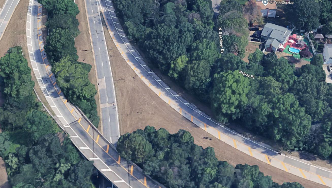
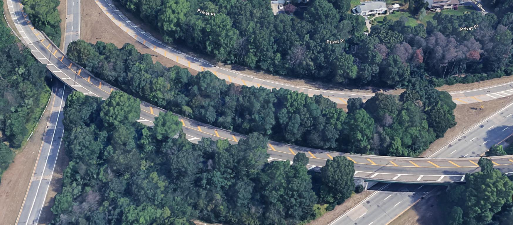
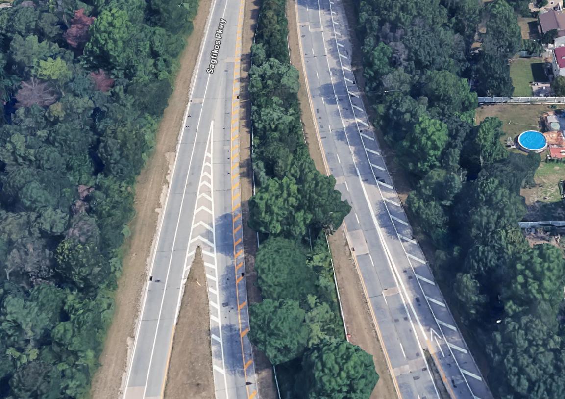
3D GOOGLE
SHOWING THE EXIT 41A ON-RAMP TO SAGITKOS NORTHBOUND. MAGENTA CIRCLE SHOWS DRONE LOCATION.
CONCRETE REPAIRS TO EXISTING ROADWAY TO BE COMPLETED OFF HOURS, SUNDAY THROUGH THURSDAY, FOR THE DURATION OF ONE MONTH OR AS WEATHER PERMITS.
ROADWAY SPECS
NUMBER OF LANES
2 LANES LANE AND SHOULDER WIDTH 11’-0” // 6”
ROADWAY MATERIAL ASPHALT/CONCRETE CURB TYPE ROLL/MOUNT. CURB OFF SHOULDER ACCESS LARGE/GRASS
INTERCHANGE DENSITY PERCENTAGE TRUCK/RV
LOCATION
SUBURBAN/URBAN
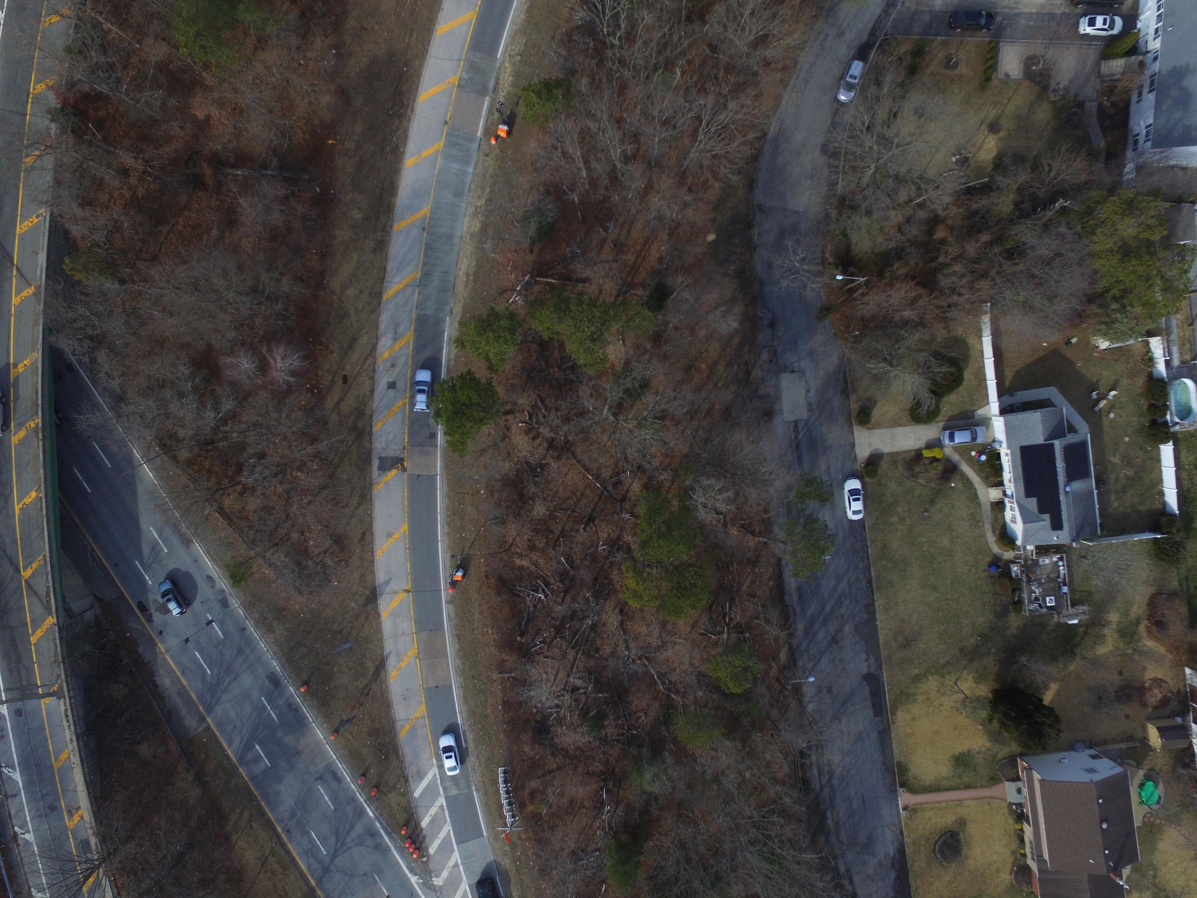
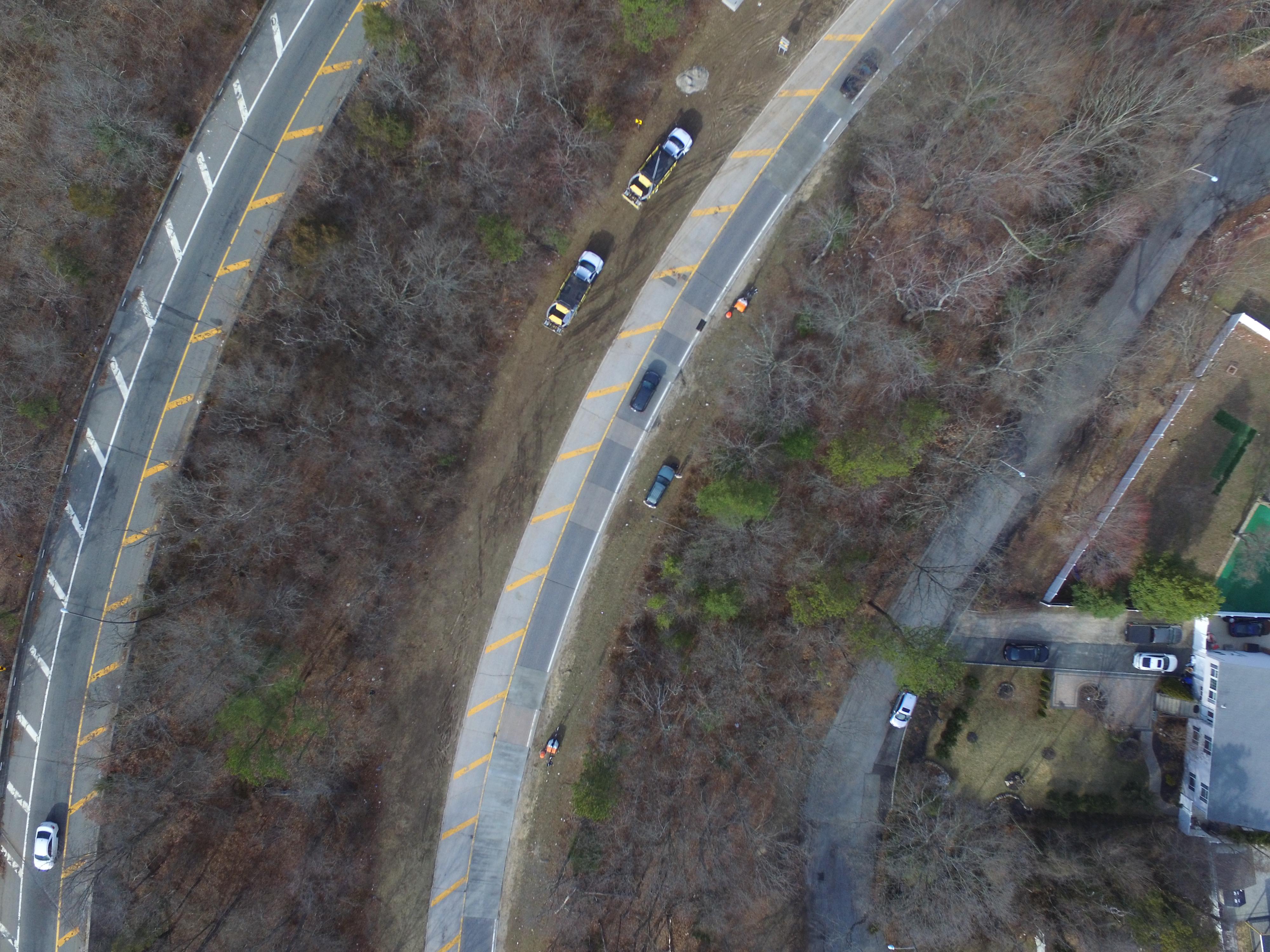
DRONE IMAGES
SHOWING THE EXIT 41A ON-RAMP TO SAGITKOS NORTHBOUND.
CONSTRUCTION VEHICLES STAGED ALONG THE LEFT SIDE OF EXIT RAMP, WITH CONES AND LIGHTING TO THE RIGHT OF THE SHOULDER.
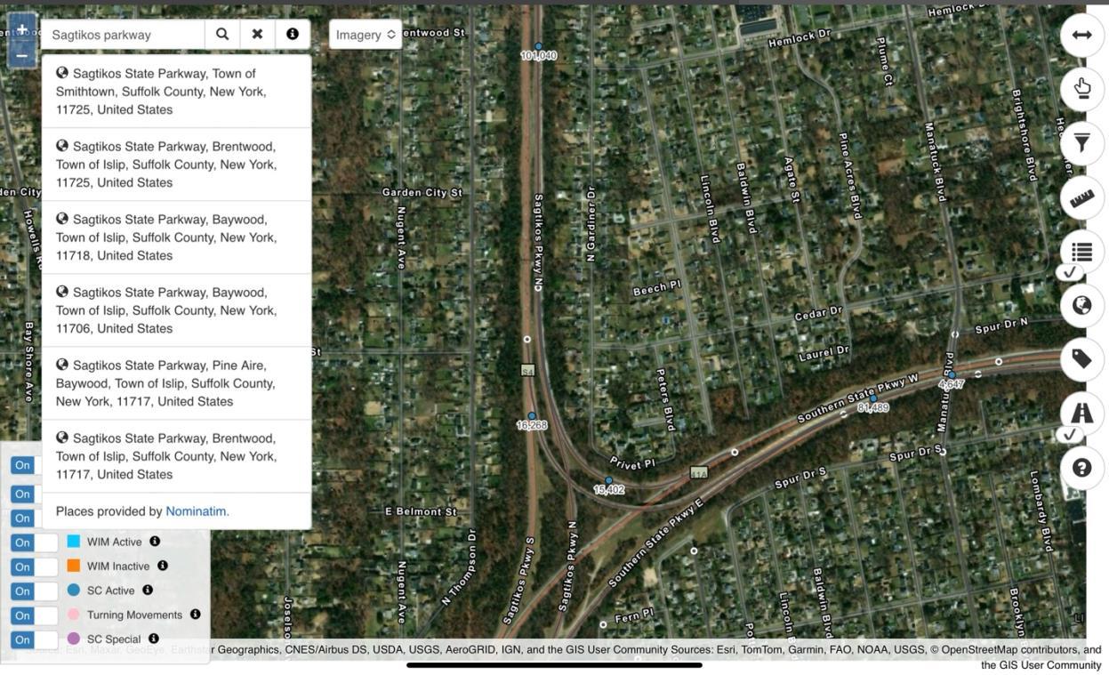
According to recent data from NYSDOT’s GIS traffic map, the Annual Average Daily Traffic (AADT) at a specific segment of the Sagtikos State Parkway just north of the Southern State Parkway interchange is approximately 101,040 vehicles per day. This high volume highlights the importance of the Sagtikos Parkway as a key north -south transportation corridor in western Suffolk County. The data reflects significant usage in this area, likely due to its connections with major east-west highways such as the Souther n State Parkway and the Long Island Expressway.
The AADT figure emphasizes the parkway’s role in supporting heavy daily commuter and regional traffic across Long Island.
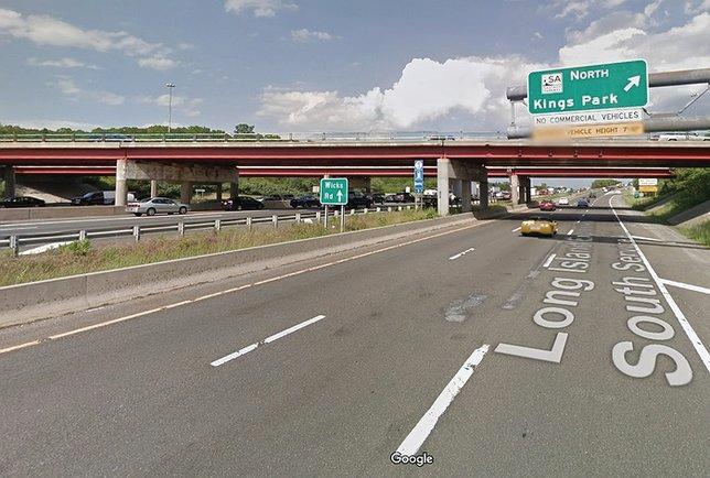
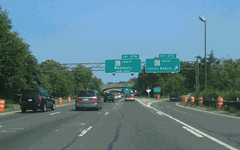
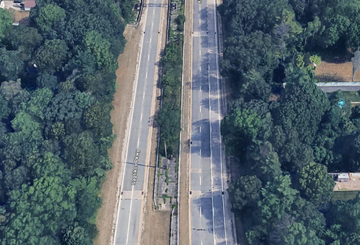
Above shows I495 Eastbound Exit toward Sagtikos Parkway North. Below shows plan view of Sagtikos Parkway.

Sagtikos Parkway Calculations
Number of lanes: 2 lanes
Lanes width: 11 ft
Shoulder width: 6 inches
Location: Suburban / Urban Interchange
CALCULATION
The calculations presented for the Sagtikos Parkway provide a clear application of the Highway Capacity Manual (HCM) methodology for basic freeway segments in a suburban/urban context.
Using a base free- ow speed (BFFS) of 70 mph, appropriate adjustments were applied for lane width (−1.9 mph), lateral clearance (−3.0 mph), number of lanes (−4.5 mph), and interchange density (−1.3 mph), resulting in an adjusted free- ow speed (FFS) of 59.3 mph. The computed passenger car ow rate per lane—2,450 pc/hr/ln—accounts for the peak hour factor (PHF = 0.92), number of lanes (2), and the heavy vehicle adjustment factor (which is 1.0 due to 0% truck percentage).
Dividing ow rate by FFS yields a density of 41.3 pc/mi/ln. According to HCM thresholds, this corresponds to Level of Service (LOS) E, which is consistent with high tra c volumes and limited maneuverability. The methodology is correct, and all relevant factors appear to be reasonably considered.

DAILY TRAFFIC FLOW SUMMARY
AADT: 101,040 vehicles on Sagtikos Parkway.
Morning peak: Sharp increase in tra c starts after 4:00 AM; major rise between 6:00–9:00 AM.
Peak hour (AM): Around 7:00–8:00 AM with approximately 8,083 vehicles/hour.
Midday tra c: Steady ow between 6,000–6,500 vehicles/hour.
Evening peak: Occurs from 4:00–6:00 PM.
Peak hour (PM): 5:00–6:00 PM with a high of about 8,588 vehicles/hour.
Evening decline: Tra c drops after 6:00 PM and stays light from 10:00 PM onward.
Tra c pattern: Re ects commuter-heavy use with congestion centered around standard work hours.
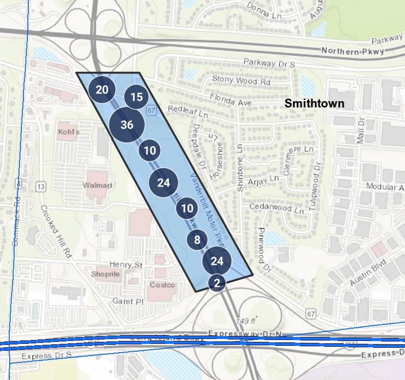
REPORTED ACCIDENTS
ALL ACCIDENTS REPORTED BETWEEN 2021 AND 2024 FOR THE SEGMENT OF SAGTIKOS PARKWAY SHOWN TO THE LEFT.
REFERENCES
Wikipedia contributors. (n.d.). Sagtikos State Parkway. Wikipedia. Retrieved May 4, 2025, from https://en.wikipedia.org/wiki/Sagtikos_State_Parkway
New York City Roads. (n.d.). Sagtikos State Parkway. Retrieved May 4, 2025, from http://www.nycroads.com/roads/sagtikos/
New York State Roads. (n.d.). Southern State & Sagtikos Parkway. Retrieved May 4, 2025, from https://nysroads.com/list-smsp.php
New York State Department of Transportation. (2024, July 8). Traveler advisory: Sagtikos Parkway construction update. Retrieved May 4, 2025, from https://www.dot.ny.gov/news/traveler-advisories/2024/2024-07-082