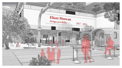
Eliott Moreau
education
professional
eliott.moreau@gmail.com (+1)609-917-4480 https://issuu.com/eliottmoreauportfolio/docs/ moreau_eliott_portfolio_2020
Tulane University – New Orleans, Louisiana, United States of America Class of 2022.
June - August 2021
AldayJover Arquitectura y Paisaje, Barcelona - Architecture Internship worked on research and terrain studies for a landscape development in Madrid, Spain.
Five-year bachelor program at the Tulane School of Architecture B.Arch Minor in Engineering Sciences
December - April 2021
Tulane COVID 19 Public Space Response Taskforce, New Orleans proposing design guidelines businesses to manage their outdoor public spaces during COVID restrictions.
Tulane University 5th Year Undergraduate Bachelor of Architecture Candidate
Current GPA: 3.687 / 4
June - August 2019
interest in urban design and theory involving the practice of interpreting public space
INEDIT Architectes, Paris - Architecture Internship worked on several projects tackling different scales. experience with urbanist laws and research in Paris.
awards/honors
June - July 2018
Agence Franc Architectes, Paris - Architecture Internship worked on residential project in Corsica, France. experience with residential building code in France.
2021 - U.S. Department of Energy - Solar District Cup (finalist)
June 2016
Lambert Lenack Architectes Urbanistes, Paris - Architecture Internship studied urban typology in central Paris to format a presentation for project proposal.
2015 - 2016
Translator – Johns Hopkins University Bloomberg School of Public Health translated transcripts from a reproductive health study in Ouagadougou, Burkina Faso from french to english.
2020 -
Mentor – Tulane School of Architecture Mentorship Program mentor for underclassmen in the school of architecture.
Spring 2021
Teaching Assistant – Tulane School of Architecture, Integrated Studio integrated studio (NAAB), developing an office building in New Orleans.
skills/abilities
Fall 2020
Teaching Assistant – Tulane School of Architecture, Advanced Third Year Studio studio focused on urban scale project and water management in New Orleans.
Software: Rhinoceros, Illustrator, Photoshop, InDesign, Grasshopper, Microsoft Office, Fusion 360 3Ds Max, AutoCAD, Revit
Spring 2020
Research Assitistant – Tulane School of Architecture, Urban Ports Studio (Margarita Jover) research studio focused on socio-ecological reform in the urban setting of a navigation canal in New Orleans.
Fall 2019
Teaching Assistant – Tulane School of Architecture, Digital Media 1 course designed to teach digital representaiton and representation theory.
2013 - 2017
Technical Theater – Towson, Maryland, United States of America. experience in set designing, light configuration, and stage organization. stage manager and director of a musical.
2021 - Tulane 2021 Engineering Capstone Design Expo Engineering Physics Award (winner) 2017 - Tulane University Presidential Scholarship 2017 - Tulane School of Architecture Portfolio Award 2016 - Towson High School Colophon Literary Arts Magazine Publication (Art) - American Scholaristic Association First Place
Languages : French (fluent), English (fluent), Spanish (conversational) Other interests : Drawing, Oil and Acrylic Painting, Fencing, Techincal Theater Design
Resume R esu ume / C CV V
table of contents
decentralized infrastructures spring 2021 - 4th year
page 03
superblock fall 2020 - 4th year
bosque metropolitano summer 2021
nuage spring 2019 - 2nd year
dramatic assembly fall 2019 - 3rd year
future of the office spring 2020 - 3rd year
solar district cup competition spring 2021 - 4th year
page 08
page 12
page 13
page 17
page 20
page 22
02
decentralized infrastructures democratizing public space
spring 2021 - 4th year professors Iñaki Alday , Pankaj Vir Gupta The project was developed as a part of the Yamuna River Project research studio between Tulane University and the University of Virginia. The YRP seeks to rejuvinate and ameliorate the Yamuna River and its surrounding communities in Delhi, India through strategic urban design and architectural interventions. The Yamuna River’s pollution is largely due to the Najafgarh drain, running west of the city through historically informal settlements of Delhi. This project is located in the neighborhood of Nilothi. Nilothi’s rapid urban growth was developed without formal planning and infrastructure. The tight streets prevent installing piped system and restrict efficient solid waste collection resulting in accumulations of trash in the streets and open drains. Untreated, this waste is accumulated in open drains and brough to the Najafgarh and supplementary drains, the leading pollutants of the Yamuna River. The density of Nilothi lacks public amenities and open green spaces, and instead produces pockets of vacant lots disconnected from a larger urban fabric.
These conditions of density and scale suggest that smaller interventions are more appropriate. Underdeveloped plots of land provide an opportunity for implementing small-scaled infrastructure in the heart of a dense urban fabric. In order to connect these civic amenities, a strategy of vegetated, low-speed mobility streets weave a network of public spaces. The green connections accumulate people and program, linking Nilothi to the newly treated supplementary drain and its linear park. Inserted as nodes, or public spheres, localized waste and sewage treatment facilities create a resilient and independent system to claim ownership and democratize public infrastructures and urban occupation. This project demonstrates the design vision for decentralized public infrastructures within dense urban settlements as a strategy to democratize public space.
03
urban plaza axonometric
public programs axonometric
site context axonometric
04
street perspective section
public plaza axonometric
Localizing infrastructures will increase the attention and ownership of such systems. Understanding the process and products of treatment plants can produce an economy with recycled goods and potential energy production. The Material Recovery Facility will function with participation from locals to deposit and pre sort waste in secondary locations around the neighborhood. Once processed at the MRF, the waste material can be sold in bulk to create a microeconomy and sustain the practice of waste management at a local scale. neighborhood waste strategy
05
mrf exploded axonometric
stp section
The treatment plants become embedded within the neighborhood, an active element creating urban engagement and interaction. Hybridizing programs emphasizes a coexistence of people within the same space, the foundation of an urban society.
neighborhood drainage strategy
06
stp exploded axonometric
superblock from disused port to urban resilience fall 2020 - 4th year professor Margarita Jover New Orleans was built as a port strategically placed at the mouth of the Lousiana River. Today, the Port’s activity has decreased, as the city has focused its economic developments on tourism. The Inner Harbor Navigation Canal (IHNC) paints a clear image of the city’s goals and the reality of its influence on U.S. naval trade routes. Today, 95% of the IHNC is dedicated to industrial real estate. As the port continues to grow slowly along the Mississippi river, The IHNC presents an opportunity for urban developement utilizing the port’s configuration. Retrofitting underutilized urban areas, infrastructures, and systems, the city may ecologically and socially evolve in a sustainable manner. This project has three main goals, first is to hybridize civil infrastructures to create a more resilient network. Second is to reinterpret street hierarchies with superblocks to promote pedestrian mobility and claim the street as public space. Third is to hybridize building programs to introduce civil infrastructure as social infrastructure.
Infrastructures are privatized in the United States, distancing the public from the systems that serve them. An integrated urban grid, focused on the public and efficient infrastructure can demonstrate what an engaged city looks like; a future for urban port cities. The productive superblocks adopt a resilient infrastructure system with microgrids. These are independently produced and managed systems that allow the superblock to avoid the city’s private partnership models. This way, citizens may produce, regulate, and distribute their resources in a democratic manner. The remunicipilization and self governacne of energy generation, transmition and distribution will reduce consumption.
07
block axonometric
oil and gas hybrid production
renewable source
poweplant / treatment
battery storage
resilient microgrid transmition line substation
substation
superblock axonometric
customer
energy distribution diagram
Reliance on private companies in the United States for infrastructures such as energy production and distribution creates a monopoly. New Orleans’ climate often creates power outages and damage to the infrastructure systems, forcing its citizens to pay for its repairs. The poorly managed and regulated infrastructures demonstrate a failure of large systems to adapt in local scales. The Gulf of Mexico contains a vast network of petrol infrastructures, In order to transition to renewable energy productions in the United States, many offshore rigs could be retrofited allow the installation of wind and solar harvesting.
inner harbor navigation canal masterplan
08
gulf of mexico resilence strategy
09
superblock plan
Public engagement is crucial to the success of the superblock. Signs and screens display the performance and efficiency of the block, as well as provide relevant informations. The integration of direct feedback for the public incentivizes better practice and engagement towards waste and energy managements.
10
street perspective
street perspective
typical block plan - ground floor
11
typical block section
bosque metropolitano site studies summer 2021 aldayjover arquitectura y paisaje During my internship at AldayJover Arquitectura y Paisaje, I worked on the Bosque Metropolitano Masterplan for the city of Madrid. I conducted site studies using digital software (such as Grasshopper for Rhino) and previous research to understand the topology of the site. The Manzanares River crosses the site and provides consistent flooding to area near the highway. As an ecological strategy to protect the biodiversity of the city, the team proposed to create floodable plaines which may be occupied during dry seasons. The axonometrics shown here depict a potential new flooding pattern at different intervals. The space remains open and accessible to the public with large spaces and elevated paths.
Manzanares River Flooding Plan
Slope Map Arroyo de la Gavia
No Flood
50 Year Flood
12
100 Year Flood
Manzanares River New Floodplain Axonometric
nuage collective housing model spring 2019 - 2nd year professor Sara Contreras A cloud is formed by the densification of water, and shapes by currents and pressure differences in the air. It is light yet creates a shaded mass above our heads. We see them move every day, changing shapes, morphing into unpredictable conditions. The collective housing model nuage adapts like the metamorphosis of the clouds into a system of light clt frames. The modularity of the frame may allow an expansion on any of its six sides. Housing units are customizable, and accessible through walkways under the same influence of the frame. Vertical cores connect the system, placed at even intervals across the block.
The cloud floats above a built topography, digging a trench in between the housing units and the surface. It may then be populated by various community functions such as an amphitheater, a market, parks, or playgrounds. The ground floor is accessible to three of the four streets enclosing the block, further enhancing its public domain. All the while, individuals passing through may experience the floating frames above their heads, light, yet dense, like a cloud.
13
groundfloor wormseye persepctive
14
block perspective section
block axonometric
15
typical floor plan
housing explorations spring 2019 - 2nd year professor Sara Contreras A series of small housing explorations were done in one and half week sequences to understand the properties of a horizontal, vertical, and sectional home. These studies were then used to complete the aggregation of collective housing units ‘nuage’ presented earlier in the portfolio.
16
sectional and vertical homes - section perspective
dramatic assembly stacking public and private theater spaces fall 2019 - 3rd year professor Irene Keil The river don in toronto floods an as much as 50% of the year. The masterplan proposal for this site near downtown toronto dedicates over 30% of the area to flood. This flood plain becomes a third landscape, inaccessible to the public. Protecting the landscape within an urban environment is crucial to promote biodiversity. The masterplan is composed of housing, retail, offices, a theater, and a transit hub for the regional ‘go’ line. The housing strips extend beyond the flood plain, but do not interact with them and instead cantilever over the protected bio-swell. Spaces in between buildings act as a public alleyway, extending storefronts into the public realm.
In between two commercial strips emerges a theater. A simple slit carves an entrance into the theater. The new formal qualities and accessibly of the theater demands partly unconventional programing. The stage is shifted and sheared along the entrance slit. The theater contains a main stage, but it is further broken into smaller performance or presentation spaces hidden throughout. Performances may be programmed according to the capacity of its theater. Finally, the roof of the building is converted into an open air performance space, creating a dialogue with the street and pocket it faces to interpret a new urban stage
17
site axonometric
river diagrams - history, flooding, connectivity, and vegetation
Located at a crossroads of urban typologies and development, the site presents the opportunity to connect a larger context of Toronto through water, vegetation, and public amenities.
figure ground height analysis
18
site plan
theater perspectives
theater exploded axonometric
19
theater sections
the future of the office is not an office integrated studio
spring 2020 - 3rd year professor Ruben Garcia Rubio (Project proposed pre COVID). More and more people choose to work from home. Remote work has become an accepted and sometimes encouraged method of work for certain companies. The possibility of communicating from anywhere in the world has made it possible to work from a distance. If this trend continues, and virtual connection becomes more prevalent, office buildings will be obsolete. What will these structures become? Adapting to a variety of future programs is crucial for the evolution of the city and its inhabitants. This proposal places forward a building typology which may change, becoming apartments, public entertainment space, retail, or whatever program in appropriate at the time.
The Prospect New Orleans Headquarters, in the French Quarter acknowledges the trends of virtual working. Inspired by a typology of lateral entrance found throughout the french quarter, the building is divided into three autonomous pieces. The independent structures use dry construction methods and are completely independent from one another, to allow maximum variability in density, form, and program in the future. This way, the future of an office may be an apartment, gallery, shop, storage facility, or anything else.
20
axonometric section with section details
second floor plan
21
office and gallery perspectives
TU bright
U.S. Dept of Energy’s Solar District Cup Collegiate Competition
spring 2021 - 4th year team: calli taitz, teagan cronin, max hinkle john harkins, eliott moreau At the University of Nebraska– Lincoln (UNL), solar installations are ideal on two campuses: City Campus and East Campus. City Campus is the heart of the University and hosts buildings such as the Love Library. Each location presented TU Bright with unique opportunities for implementing solar energy. We focused on a particular solution for each campus: a rooftop system for the East Campus, a ground mount system for the Agricultural Field, and a “green bling” system for the City Campus. Each of these proposed systems aligns with the goals and environment of each campus. The East Campus has a variety of stable buildings with high irradiance profiles. The Agricultural Field presents a flat land, ideal for a ground mount system. The City Campus is the central hub of the university, perfect for a solution to display their commitment to sustainability.
Solar Flower Perspective
For more detailed information, see https://tubright.wixsite.com/solar
UN Campus Model 1-32
22
Solar Flower Axonometric