3 minute read
URBAN HISTORY FROM MEDIOLANUM TO MILAN – EVOLUTION OF MILAN’S URBAN PLANNING AND MORPHOLOGY

Due to its strategic location, being placed on the north of Italy with a close relation to various parts of Europe, Milan and the region of Lombardy in general have been subjects of several battles over the centuries. Different population ruled the city at different times, starting from the Celts, which are the ones who founded Milan, to Romans, Goths, and Lombards, to Spaniards and Austrians. As mentioned, due to its position, Milan has emerged as an undisputed economic and cultural powerhouse, playing a major role in shaping Italy’s economy and innovation.
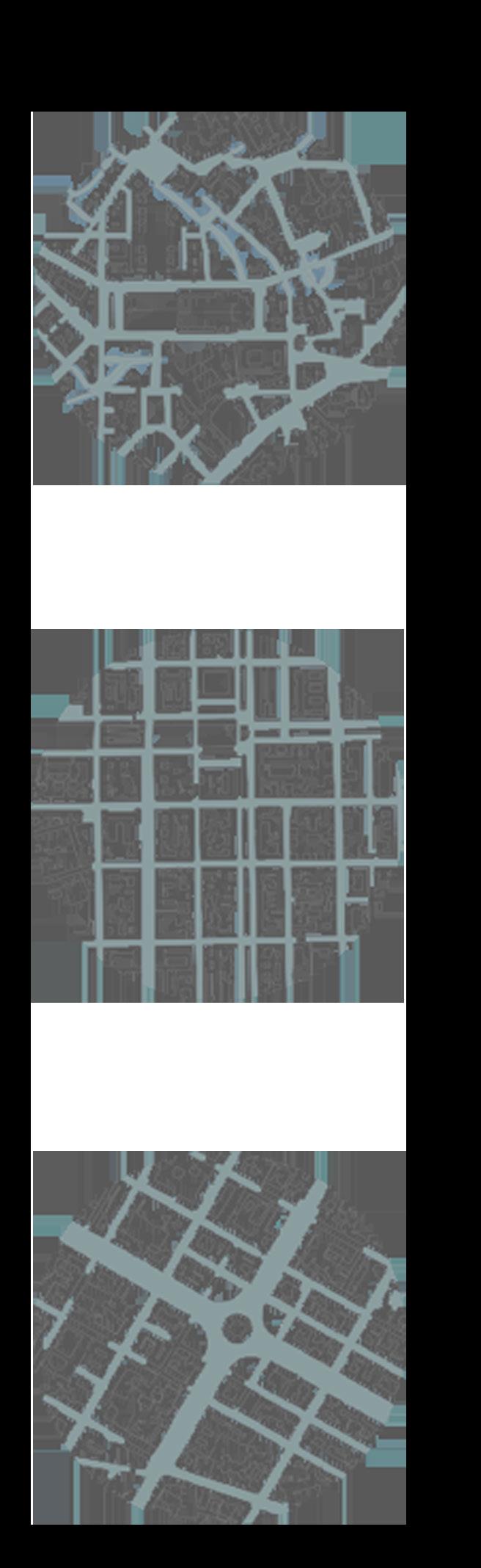
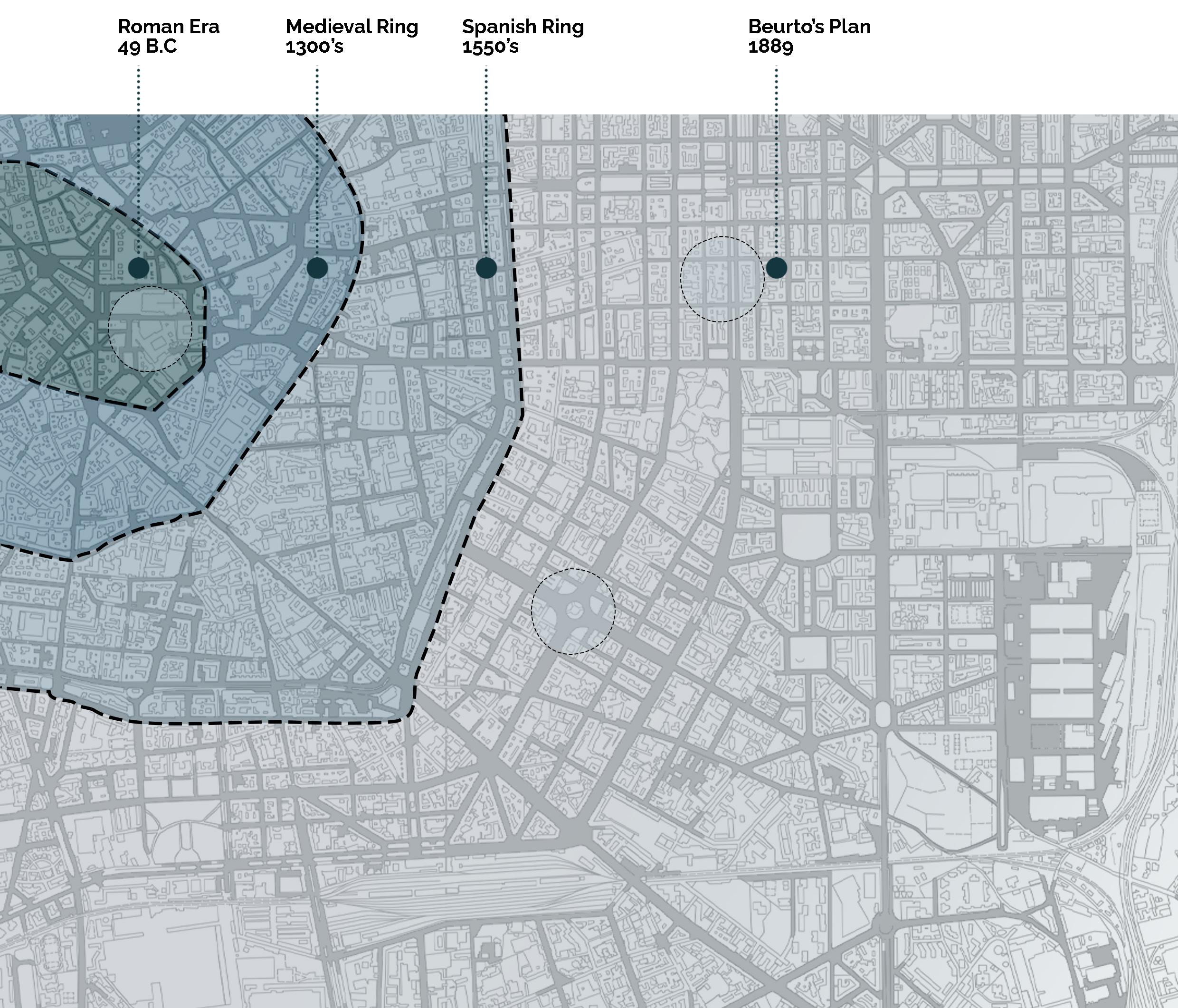
Looking at Milan’s mass plan, we can clearly identify the system of rings and circular defending walls which were built throughout different ages and centuries. While virtually little of these walls exist, their structure is mirrored in the city’s urbanistic layout. The oldest are the Roman walls, which were developed in 2 stages, the first in the Republican (49 B.C) and the second in the Imperial era (305 B.C).
Advertisement
Fast forwarding into history to the 12th century, we can clearly realize the limit of Milan’s walls during the Medieval age which were built as a defense against raids, to which today, several remnants remain, such as Porta Ticinese, Porta Nuova, remnants of the medieval Porta Romana…etc. These walls formed what is known today as “Cerchia dei Navigli”.
The third defending wall in Milan’s history dates back to 15th century, which was built during the Spanish rule of Milan, known as the “Mura Spagnole” (Spanish Wall). Such wall system was of about 11 km, much longer than that of the medieval fortifications. The perimeter of the Spanish walls essentially corresponds to what is now known as the “Cerchia dei Bastioni” (“Bastion Ring”).
To understand the evolution of Milan, it was necessary that we present and discuss Milan’s history and the effect these rings have had over the years. Despite the change of urban morphology, we can still see the ruins of the city’s most important monuments and several gates that have had an influence and significance to this day. However, the urban growth of the city which kept on spreading, led to the demolishing of these walls, leaving only part of them preserved until today serving as part of city’s heritage. Subsequently, the city expanded indefinitely, starting from the center branching out thanks to Beruto’s plan, forming a neverending-spread city, just a like a drop of oil which continuously spreads along.
Following numerous disputes and strong pressure that have arisen, an opportunity was seized to carry out a vast project that, which would solve various problems such as the area around Sforzesco Castle, but in a broader perspective. Moreover, due to the continuous need to create passages from the Spanish walls’ ring which was constituting a real barrier between the historic city and the surrounding territories, peripheral areas which were progressively transforming into industrial areas, Beruto was assigned and commissioned to prepare the first urban planning tool of the city.

RADIAL/LINEAR GRID
It wasn’t until 1889 that Beruto’s plan was approved, a plan that is still today one of the events in the urban history of Milan that has profoundly marked its destiny. Such plan concluded the destruction of the Spanish walls, and another ring was created which delimits the maximum expansion of the city. The main axes that converge toward the historic center were extended and projected towards the territories, and such expansion strip obtained, was marked by regular network of streets and squares. Large blocks were designed which guarantee the possibility of aligning the frontal facades of the building with the streets and creating internal courtyards, marking a Milanese building morphology. As the city expanded and new urban plans were proposed, different morphologies and neighborhoods designs’ approaches were observed, marking the evolution of Milan and new era for urbanistic planning for the city.
As well as, as the city expanded, different city grids and morphologies were observed. Starting from the Roman era,even during the Medieval and Spanish times, the city streets were often organic without a defined strategy. With the introduction of Beruto’s plan, that changed, allowing for continuous connections between districts through a linear grid street with a round-about for division and spread of differents nerves within the area. This will allow for never ending spread for the city of Milan, consisting of streets continuously connected.