6 minute read
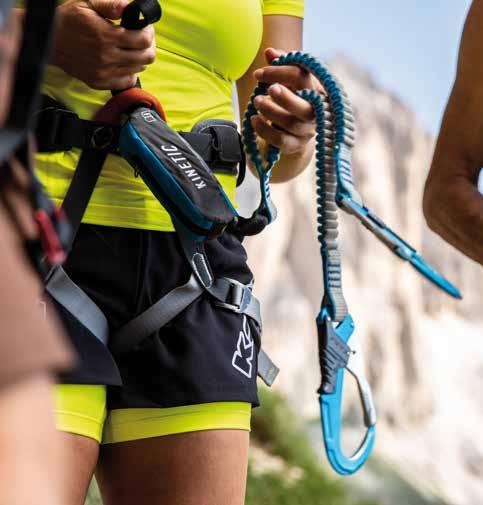
VIA FERRATA

from Trekking Guide
Via ferrata Passo Santner | Santnerpass
A classic route in the Dolomites surrounded by steep rock walls and towers with excellent views. A relatively short via ferrata with difficult alpine spots which require mountain experience.
Route: Mountain station cable car König Laurin II (2337 m), Fronza alle Coronelle/Kölner hut – path n. 542 to the beginning of the via ferrata – safe ascent (300m) – most difficult spot is the often iced canyon – Santnerpass hut (2734m). Descent on the path n. 542 – Re Alberto/Gartl hut (2621 m) – Vajolet hut (2243 m) – path n. 541 and n. 550 over the Passo Coronelle/Tschagerjoch to the starting point. Intermediate (B) – only for sure-footed climbers with climbing equipment and experience
intermediate (B) 4–5 h 1087 m of which 300 m via ferrata
Fronza alle Coronelle | Kölner hut, Laurins Lounge, Santnerpass hut 41 VIA FERRATA
42 VIA FERRATA
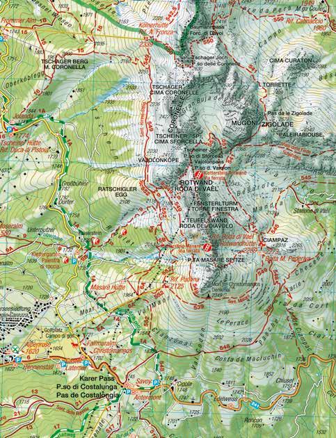
Via ferrata Masarè
Nice, varied via ferrata in the southern part of the Catinaccio/ Rosengarten massif with fantastic views of the Dolomites.
Route: Mountain station chairlift Paolina (2125 m), Paolina hut – path n. 539 – Christomannos monument (2349 m) – path n. 549 – to the Roda di Vael/Rotwand hut (2283 m), Pederiva hut (2275 m) – left steeply up to the start of the via ferrata – ascent over the chimneys and walls of rock to the Masarè peak (2585 m). Descent on path over the meadow in direction of the Torre Finestra (Window Tower) – directly on the rock face signposted descent to the Roda di Vael/Rotwand hut, Pederiva hut (wire cable, ladder) and back to the starting point. Variant: On via ferrata Roda di Vael/Rotwand – Passo Vajolon/ Vajolonpass and back to the Paolina hut. Difficult (C) – only for sure-footed climbers with climbing equipment and experience
difficult (C) 4,5–5 h 690 m of which ca. 120 m via ferrata
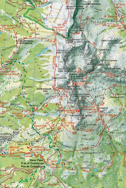
Via ferrata Roda di Vael | Rotwand
Technically not very hard, with one difficult spot. Famous for its beautiful panoramic views and mountain surroundings.
Route: Mountain station chairlift Paolina (2125 m), Paolina hut – Masarè path n. 552 – path n. 9 to the Passo Vajolon/Vajolonpass – begin of the via ferrata to the peak of Roda di Vael/Rotwand (2806 m). Descent over the via ferrata – Torre Finestra (Window Tower) – Parete del Diavolo (Devil’s Wall) – Roda di Vael/Rotwand hut (2283 m), Pederiva hut (2275 m) – path n. 549 and n. 539 back to the starting point. Intermediate (B) – only for sure-footed climbers with climbing equipment and experience
intermediate (B) 4–5 h 985 m of which 250 m via ferrata 43 VIA FERRATA
44 VIA FERRATA
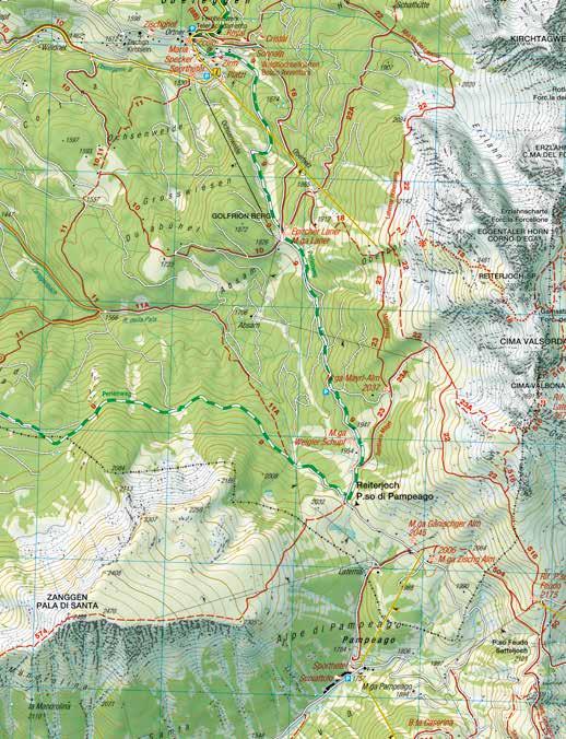
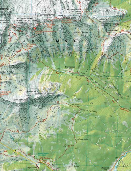
Via ferrata Campanili del Latemar
Long, but very panoramic hike with easy via ferrata between the Latemar Towers.
Route: Obereggen (1550 m ) – mountain station of chairlift Oberholz (2096 m) – path n. 18 to the Forcella dei Camosci (2590 m) – then path n. 516 – Forcellone del Latemar – to the start of the via ferrata – path n. 511 with wire rope to the summit of the Diamantidi Tower (2842 m). Descent on path n. 511 – east to the Bivak M. Rigatti – right path n. 18 to the Forcella dei Camosci – path n. 516 to Torre di Pisa hut – down on path n. 516, n. 22 and n. 23A to the Mayrl hut and the chairlift Oberholz. Intermediate (A-B) – only for sure-footed climbers with climbing equipment and experience
intermediate (A-B) 8 h 900 m of which 200 m via ferrata Alpine hut Oberholz, Torre di Pisa hut, Mayrl hut, Platzl Mountain Lounge, Loox
45 VIA FERRATA
MOUNTAIN PASS
MOUNTAIN PASS
1 Ticket - 18 lifts - 3 mountains
Holders of the Mountain Pass may use 18 lifts in the heart of the Rosengarten/Catinaccio, Latemar and Schlern/Sciliar any three or five days within a period of seven consecutive days
More information and prices from your host, at the tourist offices on tel. +39 0471 619 500 or at eggental.com/en/mountainpass
47 MOUNTAIN PASS
10 rules of safe hiking in the mountains
1. Plan your hiking excursions carefully: information about the length and difficulty is imperative for a safe experience in the mountains. Let the other members of your party or your host or the mountain hut proprietor know where you are going. 2. Before each excursion look at the latest weather forecast and keep your eye out for any changes in the weather during the excursion. Mountain hut proprietors can provide additional useful information about the immediate local weather situation. 3. Assess your fitness level objectively and choose a suitable excursion. Start early in the morning and build some extra time into your plan to make sure that you are already home before darkness falls. 4. Adopt a moderate and regular walking pace. Include sufficient breaks, especially if you are walking with children. 5. Make sure you have a sufficient supply of fluids! The most suitable drinks are water, tea or natural juices. As food for the hike, foods rich in nutrients are most suitable; these include foods like wholemeal bread, dried fruits and nuts. 6. Make sure that you have the appropriate equipment, and above all that you have sturdy footwear: a good pair of walking shoes provides secure support and protects the joints. 7. Choose light and breathable clothing and appropriate spare clothes. Never forget to pack in your rucksack clothing which offers protection against the cold and the rain. You should also always carry a first-aid kit. 8. Always have consideration for the weaker members of your party. Advise other hikers of any dangers and give first aid in the event of an emergency. 9. Treat nature with respect: avoid making noise, do not leave any rubbish and protect the vegetation. Take care of plants and animals that are protected species. 10. Always follow the path and stay on the marked walking trails and steep tracks. Consult your walking map from time to time and in case of doubt turn back in good time.
Emergency: 112 Weather: weather.provinz.bz.it or phone: +39 0471 270 555 49 10 SAFETY TIPS
Dear hiking friends!
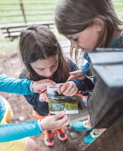
This small trekking guide is also a trekking card. All of the hiking tours described have been carefully selected. Collect the stamps at the stamp stations along the hikes to receive the gold or silver Eggental Hiking Award at the tourist offices in the Eggental region.
Points required: Silver Eggental Hiking Award: 50 points Gold Eggental Hiking Award: 110 points
For children up to 12 years and seniors over 65 years: Silver Eggental Hiking Award: 40 points Gold Eggental Hiking Award: 90 points
Enjoy hiking! Eggental Tourist Board
All information without guarantee. Subject to changes and printing errors.
Eggental Tourismus | Val d‘Ega Turismo Dolomitenstr. 4 | Via Dolomiti 4 I - 39056 Welschnofen | Nova Levante
Tel. +39 0471 619 500
info@eggental.com | eggental.com
#enjoyeggental