ISSUE 1
19 MAY 2022
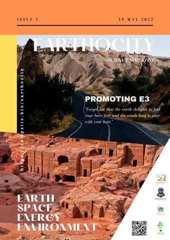
EARTHOCITY https://campsite.bio/earthocity
SCIENCE MAGAZINE
PROMOTING E3 "Forget not that the earth delights to feel your bare feet and the winds long to play with your hair."
EARTH SPACE ENERGY ENVIRONMENT
Contributors Contributors
Talal Ahmed
Geologist
Rawan AlMustafa
Geologist
Halima Merini
Eng. Iqra Hassan
Sidra Ahmad
Samra Hayat Khan
Miniar Louhichi
May Mrabet
Tazmeen Fatima
Bilal Ahmed
Devindi Wijekoon
Rida Fatima
Earth Science Engineer
Energy Engineer
Geologist
Geologist
Energy Engineer
Environmental Technologist
Hydrocarbon Engineer
Biotechnologist
Environmental Engineer
Biotechnologist
TABLE OF CONTENTS
EARTH & SPACE SCIENCES
ENERGY & ENVIRONMENTAL SCIENCES
Editor's Note
01
The Rio Tinto and its resemblence to Martian Soil
02
Pancake Rocks, Paparoa Island
04
Marine Ecosystem and resources
05
Neptune Great Darkspots
13
Gemstones of Pakistan
15
Nature based solutions for Climate Change
07
Electricity production from the plant
08
STUDENTS SECTION
Geological history, tectonic evolution, processes, and geomorphology of Pinnacles National Park
Visit
https://campsite.bio/earthocity
09
This
issue
of
Earthocity
science
magazine will also focus the field of marine biotechnology and its scope in future.
Editor’s Note Creating an interesting, informative, and easy-to-read magazine article is something that every publication needs to know, regardless of their specific themes and topics. In our science magazine we focused much on the new discoveries and hidden treasures of the earth. Our findings includes the domain of earth sciences, space sciences, energy sciences, marine biotechnology, ocean sciences, environmental and climate changes. We adopted the strategy to introduce this to the students and others. So we are on our way to this scientific journey.
Talal Ahmed
Usually, a magazine article can discuss
Editor & Contributor
APRIL 2022 | ISSUE 1
trending topics and themes, or more specific ones such as geography and other science facts, but here we have merge all the fields and we are trying to promote all as the concept of "E3." "Knowledge is an ocean, which has no end unless we work together for its betterment."
PAGE 1
PAGE 2
EARTH & SPACE SCIENCES SECTION
ISSUE 1
THE RIO TINTO (RED RIVER), SPAIN AND ITS RESEMBLANCE WITH MARTIAN SOIL SURFACE A PARTICULAR INTEREST FOR ASTROBIOLOGIST BY TALAL AHMED
The Rio Tinto (red river) is a river in southwestern Spain
The Rio Tinto Company was founded in 1873 to operate the
that begins in Andalusia's Sierra Morena Mountains. It
mines, and by the end of the twentieth century, it had grown
flows south-southwest until it reaches the Gulf of Cadiz in
to become one of the world's greatest mining firms, albeit it
Huelva. Copper, silver, gold, and other minerals have
no longer owns the Rio Tinto mines, which are currently held
been mined along the riverbank since ancient times.
by EMED Mining Ltd. The image was taken on July 16,
Iberians and Tartessians began mining the site around
2007, and it spans a 43.5 x 43.5 km region. It was taken from
3,000 BCE, followed by the Phoenicians, Greeks,
37.7 degrees north latitude and 6.6 degrees west longitude.
Romans, Visigoths, and Moors. The mines were rediscovered in 1556 after a period of abandonment, and the Spanish government resumed operations in 1724.
Figure 2 ASTER image of Rio Tinto, Space Image Credit: NASA/GSFC/METI/ERSDAC/JAROS. Figure 1 Flowing channel of Rio Tinto in Spain.
Rio Tinto is known for being very acidic (pH 2) as a result of the mining and its deep reddish tint is owing to iron dissolved in the water. Because of the high quantities of heavy metals in the river, acid mine drainage from the mines causes serious environmental problems.
While the acid has rendered the Rio Tinto unfriendly to most forms of life, it has made it more hospitable to sulfide-consuming bacteria and other extremophiles that help to accelerate the acidification process.
PAGE 3
EARTH & SPACE SCIENCES SECTION
These organisms produce ferric iron, a rust-colored material that gives the river its red tint. The combined effects of chemical weathering of rocks and bacterial activity in the water have lowered the river's typical pH to 2, which is about the same as vinegar.
Figure 3 Flowing water shows the concentration of sulphur and iron, that makes its color tint.
Mining in the area for thousands of years has likely accelerated natural acidity processes by increasing the amount of exposed sulphide ore. People have been mining in the area periodically for 5,000 years, and archaeologists consider it a major location during the Copper and Bronze Ages. Mining in the area continues today: the contemporary mine (shown below) resumed copper production in 2016 after being briefly shut in 2001.
Figure 4 The Rio Tinto, which is exceptionally red and acidic, the quest for life on Mars.
ISSUE 1
Hydrothermal activity on the seafloor deposited the ore body during the Carboniferous period (300–350 Ma). The Tartessans and Iberians began mining in the Rio Tinto area about 3000 BC and were followed by the Phoenicians, Greeks, Romans, Visigoths, and Moors. Approximately 5,000 years of ore extraction and chemical refining have taken place in the Rio Tinto region, principally for copper, silver, and gold, but also for iron, manganese, and other minerals. The region's terrain has been drastically altered by this long-running mining activity.
Figure 5 (A) Mapping of Corta Atalaya's major hydrothermal alteration (Rio Tinto). (B) and (C) Thin sections of portions of the San Miguel stockwork showing significant hydrothermal alteration (chloritization and silicification). (C: cross polarized light, 100; B: plane light, 100).
The Rio Tinto and its environs are of particular interest to astrobiologists since the region's soils are comparable to those found on Mars. The iron- and potassium-rich sulphate mineral jarosite is particularly prevalent along the river and on Mars. Because the jarosite and other minerals found in this section of Spain often retain bacterial activity signatures, astrobiologists believe that researching how extremophiles survive in and around the Rio Tinto could provide insight into how to look for signs of life on Mars.
Figure 7 The Tinto River's subsurface. PNAS (Public Library of Science) (CAB) These cyanobacteria can perform oxygenic photosynthesis and are among the planet's oldest microbes.
EARTH & SPACE SCIENCES SECTION
PAGE 4
ISSUE 1
PANCAKE ROCKS, PAPAROA NATIONAL PARK, WESTLAND, NEW ZEALAND BY RAWAN ALMUSTAFA
Paparoa National Park is located on the west coast of
The Paparoa Mountains major ancient granite and gneiss
New Zealand's South Island. The park was established in
rocks are more geologically similar to those in faraway
1987 and covers 430 square kilometers (166 sq mi). The
Fiordland than to the main range of the Southern Alps.
park stretches from the coast to the Paparoa Range's
This is because, during the previous 10 million years, the
highest peaks. To the north, a separate component of the
Alpine Fault has separated them from their original
park is centred on Ananui Creek. A limestone karst area is
neighbours.
protected by the park. There are various caves in the park, including Metro Cave / Te Ananui Cave, which is a commercial tourist attraction. In the Putai area, the Pancake Rocks are the most stunning feature. They were formed 30 million years ago from minute bits of deceased marine organisms and vegetation that dropped about 2 kilometers beneath the surface on the seafloor. The particles solidified into hard and soft layers due to the intense water pressure. The limestone was gradually elevated above the seabed by earthquake and seismic activity. The strange shapes were fashioned by mildly acidic rain, wind, and ocean. The park has a wide range of geology and landforms, including
mountainous,
environments.
lowland,
Stylobedding,
a
and
coastal
layering-weathering
process that has sculpted the limestone into heaps of thick pancakes at Dolomite Point. From the eastern end of the syncline to the peak of the main range, more than half of the park is best classified as mountainous. An array of hanging valleys, truncated spurs, towering bluffs, and cirques overlook deep glaciated valleys running north and south on their eastern side.
Figure 1 Pancake rocks of Paparoa national park.
The river gorges allow access to the park's karst interior, which are bounded by steep, forest-crowned limestone cliffs. Many of the tributaries, on the other hand, have narrow, steep gorges with waterfalls. The intricate underground system beneath is indicated by dry, mossy streambeds, karren, sinkholes (or dolines), blind valleys, and basins where water emerges from caves or disappears into sinks.
EARTH & SPACE SCIENCES SECTION
PAGE 5
ISSUE 1
MARINE ECOSYSTEM AND BENEFITS PROVIDED BY ITS RESOURCES BY SAMRA HAYAT KHAN
Out of all the ecosystems, the marine ecosystem is the
BENEFITS PROVIDED BY THE RESOURCES OF
largest of all as it covers more than 70% of earth’s
MARINE ECOSYSTEM
surface. The term marine ecosystem, in general, applies to
Bio-pigments
the oceans, seas, and other saltwater habitats as a whole.
The marine environment is explored as a potential source
With deeper examination, it has been revealed that is
of bio-pigment supply. Marine bio-pigments are non-toxic
separated into smaller, and unique ecosystems. The
to the environment and have been shown to be effective as
Marshlands, estuaries, ocean bottom, open ocean,
antibacterial, anticancer, antioxidant, and antitumor
intertidal regions, coral reefs, lagoons, and mangroves are
agents. The other benefits involve quick and low-cost
examples of such marine ecosystems.
procedures of extraction, higher yield, plus more cost and time effective manufacturing. Due to their medicinal and
The marine ecosystem preserves a treasure trove of
nutritional properties, bioactive pigments of marine origin
diverse habitats comprised of the richness and interaction
have drawn the interest of the cosmetics, pharmaceutical,
of marine organisms ranging from small microscopic
and food sectors.
critters to the enormous whale. In addition to the hidden
According to a report by Athanasios, B.; Zoumboulakis, P.
treasures of fascinating species, marine ecosystem also
nutraceutical industry is the biggest natural astaxanthin
provides
and
consumer which is produced from micro algae Cream F3,
biochemical components, and preserving coasts by storing
a melanin-infused cream derived from the marine bacteria
blue carbon. This article will connect us with the
Halomonasvenusta, demonstrated better SPF values,
incredible advantages we receive from the wealth of the
photoprotective effect, wound healing efficacy and
marine ecosystem and why we should be focusing on
antibacterial activity against skin infections
utilizing marine resources in sustainable ways.
(Poulose et al., 2020).
us
with
oxygen,
food,
medicinal
Bio catalyst The diverse biodiversity present in maritime habitats makes them rich natural troves of biocatalysts. These enzymes are notable for their salt tolerance, high thermal stability, pressure tolerance and cold adaptation.
EARTH & SPACE SCIENCES SECTION
PAGE 6
ISSUE 1
They also offer new chemical and conformational
Accidental large-scale releases have resulted in large-scale
characteristics that have gained the interest of biocatalysis
ecological crisis, having a devastating impact on the
practitioners in their research and development. These
marine ecology.
enzymes are being used in the pharmaceutical and
Naturally present obligate hydrocarbonoclastic bacteria are
chemical sectors, with significant promise in the future.
principally responsible for the organic remediation of
A marine-derived fungus, Emericellopsis sp., generates a
petroleum spills in marine settings (Yakimov et al., 2022)
range of chaetoglobosins with anti-cancer and antiBio drugs
acetylcholine effects. (Shao et al., 2022)
Marine pharmaceuticals are plentiful, and they include a
Bioenergy
varied range of structures with associated modes of action,
Solar energy provided by photosynthetic organisms might
and show promise for the development of novel and
be utilized to generate electrical current, giving clean
improved therapeutic techniques for a variety of chronic
energy
cells
conditions. Drugs derived from marine resources have
(BPECs) created from photosynthetic microorganisms
shown to offer great promise in the cure of different
may provide an alternative source of energy.
disorders, from acute to chronic.
A recent study suggested that microalgae from seawater
Anti-cancer medications such as cytarabine, Trabectedin,
can create bias-free photocurrents, opening the path for
and Eribulin mesylate have been approved for usage in
the sustainable directions of BPEC-based low-cost energy
clinical settings (Dayanidhi et al., 2021).
to
people.
Bio-photoelectrochemical
transformation systems (Shlosberg et al., 2022). According to a recent study, S. patens C. Agardh, a microalgae, offers potential as a biomass feedstock for fuel and chemical products (Li et al., 2012) Bioremediation Huge amounts of plastic garbage have been increasing in the ecosystem, producing substantial environmental issues and creating a big influence on worldwide biogeochemical cycling. Plastic waste has been identified as one of the most prevalent and long-lasting marine pollutants. As a result, the marine ecosystem has become
Figure 1 Bioactive Substance diversity in marine ecosystem. (Bhatnagar & Kim, 2010)
a hotspot for testing species with potential for plastic breakdown. A study suggest that Alternaria alternata FB1 is a marine fungus that quickly destroys polyethylene (Gao et al., 2022).
Maritime habitats and species are economically significant to all living beings. As a result of poor use of maritime regions and climate change, maritime ecosystems are rapidly deteriorating. Protecting the diversity, efficiency, and structural systems of marine ecosystems is a critical problem in ensuring future stability.
ENERGY & ENVIRONMENTAL SCIENCES SECTION
PAGE 7
ISSUE 1
NATURE BASED SOLUTIONS FOR CLIMATE CHANGE BY DEVINDI WIJEKOON
Simply, It's the use of nature's power to reduce the
Starting reforesting with an engineered structural plan for
emission,
the affected area and monitoring and maintaining it for
by
management
adapting engineered
natural with
environment-based modern
technology,
some time we will be able to minimize the climatic
“Natural climate solutions, involve conserving, restoring,
changes. Not only that, restoring coastal and inland
or better managing ecosystems to remove carbon dioxide
wetlands, reforesting mangroves in the coastal line to
(CO2) from the atmosphere. “There is much rapid growth
minimize the effects of the sea invading the land
of climate emergency cases, with more than a thousand
furthermore. And healthy agricultural practices will surely
around the world globally. If we analyze the cause of all
do that, but the different mind set of people may be a
of this, we have to summarize what happens due to a
reason to delay this task, we will surely need to overcome
sudden change in the climate. We come to the back where
that to go for a sustainable future with it. Nature-based
it starts without any solution. The biodiversity crisis is
solutions can help many people adapt to the effects of
another major crisis we face, around globally millions of
change and disasters whilst slowing warming and
plants and animal species are already extinct. The same
protecting
amount of species is already reaching that line to be
consequences,
extinct as the next victims in this climatic crisis. That
engineering-based approaches. People who have the power
happens due to reasons like extreme heat waves, sea
to make decisions should need to see those adaptations go
levels rising, and as main effects of industrialization.
to the beyond rather than thinking traditionally in each
According to “Bronson Griscom and colleagues recently
aspect. First, it will surely be difficult but it will need to be
estimated that cost-effective nature-based solutions could
achieved before at least 2050 if we need to live as it was
contribute about 20% of the mitigation needed between
before.
now and 2050 to keep global warming below 2°C, with that we have to work hard on this because the remaining 80% is our contribution to minimizing it with proper management. Nature-based solutions are affordable and provide a wide range of services to ecosystems with longterm benefits. We can minimize the effects of coastal and inland flooding, high temperature, strong wind protection and minimize the effects of erosion.
biodiversity, fewer
with
risks,
many and
more
lower
positive
costs
than
PAGE 8
ENERGY & ENVIRONMENTAL SCIENCES SECTION
ISSUE 1
ELECTRICITY PRODUCTION FROM THE PLANT APPROACH TO GREEN ENERGY TECHNOLOGY BY MINIAR LOUHICHI
Is it feasible? Is it possible? I said yes Let me talk with you about producing green electricity from the plant. The idea consists to produce green electricity from plants. Thanks to photosynthesis, plants produce electrons that can be recovered and create a difference in potential favoring the creation of an electric current. This system makes it possible to generate electricity so that the plant grows in a favorable water environment, whether on a large scale, such as in a mangrove, a rice field, a swamp or a peat bog, or simply in a pot installed in the garden. The excess is released into the soil by the roots, around which live micro-organisms that feed on it and release electrons. here we don't need to damage the plant, it's a non-intrusive system. This project makes it possible to reduce greenhouse gases as well as these environmental impacts, CO2 emissions because the production of green electricity no longer generates such emissions by comparing it with the use of fossil fuels as it is sustainable (day and night / without or with the presence of wind) by comparing it with the production of electricity from solar panels or wind turbines Think green think differently.
ISSUE 1
19 MAY 2022
EARTH, SPACE, ENERGY & ENVIRONMENT
EARTHOCITY
LIVE THE LIFE YOU LOVE
WOMEN IN STEM
STUDENTS SECTION
PAGE 9
ISSUE 1
GEOLOGICAL HISTORY, TECTONIC EVOLUTION, PROCESSES, AND GEOMORPHOLOGY OF PINNACLES NATIONAL PARK BY MARIA FAHEEM, FARIA AKRAM & TAHIRA JALAL
Pinnacle National Park, California's youngest and most gorgeous national park, is a strange little realm of pointy, peaky, rocky caves and soaring condors, nestled in an area tourists rarely see. Yet lately its visitor's numbers are thriving. Is this where we should all be going? Pinnacle is one of the recent past additions to the national park system in the United States. The Pinnacles rocks are adhered to be part of the Pinnacles-Neenach Volcanic Field that transpired 23 million years ago near presentday Lancaster, California, more or less 195 miles southeast. The giant San Andreas Fault cleft the volcano and the Pacific Plate glided north, carrying the Pinnacles. It was extruded through many vents and deposited onto the granitic basement, forming a vast volcanic field. Millions of years of erosion left a rugged landscape of rocky spires and crags, or pinnacles. Boulders fell into canyons and valleys, creating talus carves. (Hauser, 2014) The unique and fascinating “Pinnacles” for which this amazing park is named are a tale of subducting and grinding tectonic plates, volcanic fields, earthquakes, and erosion. (Linda Mullally, David Mullally, 2015) Pinnacles Volcanic Field, estimated to be 14 miles long and 8,000 feet high, erupted 23 million years ago volcanoes were not where the Pinnacles are now today but are at 195 miles to the southeast.How did these strange rocks end up here?
Figure 1 Pinnacle National Park with volcanic rock formations California U.S.
Geological History The Pinnacle Volcano erupted from not less than five vents during the Miocene, extruding a wide variety of other places it made its way along horizontal fissures to form underground lake which ultimately solidified as a sill. Once the Farallon plate had been effectively overridden, subduction ended. The coastal volcanoes dried up and began to erode as no more magma there to fuel them. A transform boundary, the San Andreas Fault zone stretched more than six hundred miles from the Gulf of California to the Mendocino coast of San Francisco. It extends the two plates which were directly in its path “The Pinnacle Volcanic Field”.
PAGE 10
STUDENTS SECTION
ISSUE 1
As sliver of California began its strike-slip displacement
Faults
journey northwest, it took with it two-thirds of the
Within or near the Park, there are three significant faults
Pinnacles’ volcanic mass.
(Miner's Gulch, Pinnacles, and Chalone Creek), as well as a
(Service, Pinnacles, 1985)
number of smaller faults and fractures. The Chalone Creek
Simply said, the grinding and shifting of the Pacific and
Fault, which runs parallel to the primary drainage along the
North American plates resulted in the formation of the
park's east side and is still active, is assumed to mark the
famous San Andreas Fault in California, which splits the
location of the San Andreas Fault during the Miocene when
Pinnacles/Neenach volcano. The strike-slip motion on the
the Neenach Volcano erupted.
San Andreas faults has separated the two sides of the
The San Andreas Fault at Pinnacles California is represented
volcanic stack over millions of years, with the prominent
by the Chalone creek fault, historically it is believed to have
Pinnacles moving north and leaving the rubble residue
been the main line of the San Andreas Fault, today located 4
Neenach roughly 200 miles to the south. (Linda Mullally,
miles to the East Chalone Creek fault has shifted a huge
David Mullally, 2015)
chunk of the Pinnacle National Monument lands to the
Along the fault zone Neenach Volcano, which erupted 23
Westside, the drainage canals cut through the block when it
million years ago near present-day Lancaster, is home to
lifted higher, resulting in the Bear Guluch and Balconies..
the Pinnacles. The Pacific Plate's movement along the San
Deep, narrow gorges have resulted through faulting and
Andreas fault broke a portion of rock from the volcano's
earthquakes, where rocks have fallen from higher strata and
main body and pushed it 195 miles (314 kilometers) to
are lodged between the walls at varying heights above the
the northwest. The pinnacles are thought to have come
canyon bottom. The dark, cold talus "Caves" that are so
from this volcano because of the unusual breccias that can
popular with visitors are the result of this phenomenon.
only be found in the Neenach Volcano formations. The
(Service U. S., 1975).
San Andreas Fault, which originally separated the original volcano, is a testament to its durability and importance, as evidenced by the Pinnacles' displacement from its original location. Since the Pinnacles Volcanics were transported to this area, the San Andreas Fault has moved 8 km (5 mi) to the east. The original location of the San Andreas is the current location of the Chalone Creek Fault. A large chunk of sandstone jammed the San Andreas and caused it to move to the east
Figure 2 Formation of volcanic field at surface of spreading ridge (Matthews and Webb1982).
Figure 3 Map showing displacement of Pinnacles volcanic along the San Andreas Fault
PAGE 11
STUDENTS SECTION
ISSUE 1
Geomorphology
The San Andreas Fault tore the western half of this volcanic
Pinnacles National Monument has two main areas of
field from its birthplace 195 miles south (near Lancaster,
caves: the Bear Gulch Caves, near headquarters, and the
tilting and eroding it over millions of years as it migrated
Balconies Caves, near the Chaparral Campground. The
northward to its current location at Pinnacle National
two largest caves are about 180 m (600 ft) and 460 m
Monument. Water and wind gradually eroded rhyolitic tuff
(1,500 ft) in length. The caves were formed by stream
and other pyroclastics, as well as the pyroclastics
erosion along vertical joints associated with strands of the
themselves. (Frank W.Davis,David M. Stoms,Patrick
San Andreas Fault and by toppling of “cyclopean
A.Jantz, 2013)
boulders” during large earthquakes (Hinds 1952, Rogers 2003, Rogers et al. 2003). Numerous cracks and joints developed as the hot avalanche debris that forms the rhyolite breccia and other volcanic rocks. Movements along the Gabilan Range boundary faults also twisted the volcanic pile and created additional fractures. Weathering eruptive products, mainly of rhyolitic composition. Dikes and domes marks the vent positions in the estimated one third of the volcano that has not been removed by erosion. Volcanic sediment derived from the Pinnacles Volcano grades into the nearshore Miocene age marine deposits. Steam explosions near the end of the eruptive cycle blasted out rock fragments and blobs of lava. Avalanching and mixing of the debris on the steep western slopes of the volcano developed a volcanic breccia in which most of the landforms of Pinnacles would later form. Volcanic spires Pinnacles are made up of strata of volcanic rock that have been shattered, slanted, and heavily worn. The volcanic layer was formed in the year 2000. When quartz-rich lavas were forced to the surface through fractures in the basement of quartz diorite and granite 23 million years ago, they blossomed out over a wide region to form a volcanic field. Later volcanic activity causes Pyroclasts to build up on top of the previous lava flows.
Figure 4 The Pinnacles' High Peaks consist of strong, wellconsolidated breccia. The breccias layer is thought to have formed due to material slumping off the volcano's flanks near the vents, causing landslides. Recent fracturing, faulting, and erosion have sculpted these rock layers into vertical cliffs and spires several hundred feet high.
Caves The caves at Pinnacles National Park are unlike any other caves in the world. Instead of walking through underground tunnels, you'll be exploring steep canyons crammed with enormous boulders. Talus caves are the name given to these types of caverns. The Pinnacles' erosion has created talus caves, which are unlike the continent's most typical limestone caves or lava tube caves. Large boulders tumble down from spires and cliffs, plunging into deep valleys and forming massive talus jumbles. Caves form when the greatest interstitial spaces in these heaps of varying-sized rocks are substantially protected from daily temperature extremes. The caverns that are the largest formation where the cave floor is kept open by massive boulders.
PAGE 12
STUDENTS SECTION
ISSUE 1
The best example of this type of geological activity is the 520-foot-long Balconies Cave. When volcanic tuff boulders capped the gorge, the most impressive cave in the monument, the 1700-foot-long Bear Gulch Cave, was formed in the same way. (Frank W.Davis,David M. Stoms,Patrick A.Jantz, 2013) Particularly in the rhyolite breccia, widened the cracks and formed broad columns that were later narrowed into pinnacles, balanced rocks and other bizarre forms. Unusual, weirdly shaped landforms called hoodoos found at Pinnacles. The streams that developed had sinuous courses and undercut their banks; where the rocks were least resistant, the undercutting was at its maximum and remarkable “caves” were formed. Other caves were formed by rocks tumbling down into the narrow canyons and wedging between the walls. Weathering, masswasting, and stream erosion worked hand in hand in the fashioning of the fascinating, sometimes grotesque features. It was a world of gentle canyons and fractured ridges, breathtaking vistas and eerie silence, glowing colors and inhospitable soil. (Eugene P. Kiver, David V. Harris, 1999)
Figure 6 Cave in Pinnacles national park.
Analysis No active volcanism is occurring at Pinnacles National Monument. Nevertheless calling Pinnacles a “volcanic park” seems appropriate based on its geologic past. Perhaps the most significant volcanic feature is the correlation of the Pinnacles and Neenach volcanic formations; this correlation has become a “classic example” of plate tectonics for the scientific community. As highlighted in the “Park and Geologic Setting” section of this scoping summary, these two rock formations were once part of the same volcano; they lie respectively west and east of the San Andreas Fault zone and are now separated by 314 km (195 mi). Ten rock types with nearly identical field, petrographic, and chemical characteristics are present in each formation in essentially the same stratigraphic order (Matthews 1976). The various rock types are also distinctive volcanic features
Figure 5 Landscape showing features of Pinnacle peak.
at the national monument: vitric lapilli tuff, flow-banded rhyolite, perlite, pumice lapilli tuff, hypo crystalline hypersthene andesite, augite-olivine andesite, andesite tuff, porphyritic dacite, agglomerate, and porphyritic rhyolite (Matthews 1976).
EARTH & SPACE SCIENCES SECTION
PAGE 13
ISSUE 1
NEPTUNE GREAT DARK SPOTS BY TALAL AHMED
Neptune's weather is among the strangest in the solar
So it's in this tumultuous area. However, they are unable to
system. The sun's eighth planet has the fastest winds of
establish a link between the two. It's still a complete mystery to
any planet, cutting through the atmosphere at speeds of up
me. "The dark vortex also came to a halt in January and began
to 1,100 miles per hour, or 1.5 times the speed of sound.
moving northward again." "Perhaps shedding that fragment was
Scientists are still baffled as to why its atmosphere is so
enough to halt its progress towards the equator." The
turbulent. Their most recent sighting of Neptune added to
researchers are still analyzing more data to see if dark spot jr.
their confusion.
lingers through the rest of 2020.
In 2018, the Hubble Space Telescope discovered a storm
The massive vortex, which is larger than the Atlantic Ocean,
with a diameter of 4,600 miles. According to the most
was being pushed south by atmospheric forces near the equator
recent Hubble observations, it appears to have drifted
toward certain doom when it abruptly reversed course and
toward the equator but then swooped back up north. It
began drifting northward.
also has a smaller companion storm, dubbed Dark Spot
This visible-light image was captured by Hubble's Wide Field
Jr., which scientists believe is a piece of the main storm
Camera 3 on Jan. 7, 2020, around the same time a slightly
that broke off. These inky vortexes stand out against the
smaller dark spot mysteriously appeared nearby. After a few
planet's dizzying cerulean blue, but while they're beautiful
months, that location vanished. The smaller feature could have
to look at, their lifespans are brief, making them even
been a shard of the larger storm that shattered as it approached
more difficult to study.
the equator.
Hubble observations also revealed that the dark vortex's
In September 2018, Hubble discovered the massive storm in
perplexing path reversal happened at the same time as the
Neptune's northern hemisphere. The feature spans about 4,600
appearance of a new spot, dubbed "dark spot jr." The new
miles. The smaller spot's estimated width is 3,900 miles. The
spot, which was about 3,900 miles across, was slightly
large storm is Hubble's fourth transient dark spot discovered
smaller than its older sibling. It was near the side of the
since 1993. Two dark features in Neptune's southern
main dark spot facing the equator, which is where some
hemisphere were first imaged by NASA's Voyager 2 spacecraft
simulations predict a disruption. The appearance of the
in 1989 as Voyager flew by the distant planet. By the time
smaller spot, on the other hand, came at an unusual time.
Hubble looked at Neptune in 1994, the storms had vanished. In
“The astronomers
1994 and 1996, Hubble discovered two new dark spots in the
thought the bigger one was being
disrupted when they first saw the small spot," but "Because the small one is closer to the equator, I didn't think another vortex was forming."
planet's northern hemisphere.
PAGE 14
EARTH & SPACE SCIENCES SECTION
It's not clear how these storms come to be. In comparison to surrounding regions in the gas giant's atmosphere, their clouds may be rising to higher altitudes. Neptune's predominant blue color is caused by the distant planet's methane-rich atmosphere absorbing red light.
Figure 1 A massive dark storm [top centre] and the emergence of a smaller dark spot nearby [top right] are visible in this Hubble Space Telescope image of the dynamic blue-green planet Neptune. Credits: NASA
ISSUE 1
EARTH & SPACE SCIENCES SECTION
PAGE 15
ISSUE 1
GEMSTONES OF PAKISTAN BY BILAL AHMED SARWAR Gemstones are precious minerals and stones use as jewelry or adornment. They can classify on different bases like Formation (Natural Gemstones, Synthetic Gemstones, Simulated Gemstones, etc.), beauty & appearance, durability & hardness, rarity, fashion and superstition. Pakistan has a huge potential for gems. The Himalayas, Hindukush, and Karakoram ranges are the center of gemstones. “It can be said that Northern areas of Pakistan are as much beautiful from inside as from outside.”
Figure 1 Emerald gem.
Pakistan considered as home to many varieties of minerals, some of which are very prominent such as
The third important gem is quartz. These crystals can be
Ruby,
Quartz.
used in best jewelry for attraction as diamond. . Pakistan
Peshawar is the main trading hub for Gemstones.
has many quartz crystals deposits. The violet quartz or
Gemstones Corporation of Pakistan (GEMCP) under the
amethyst is the birthstone for the February born and to
administrative control of Ministry of Petroleum & Natural
symbolize durability, friendship and stead fastness in love.
Emerald,
Sphere,
Tourmaline
and
Resources. The kinds of gem Pakistan produces include Emeralds, Topaz, Ruby and Tourmaline. Apart from these, other gems in low quantity include Aquamarine and Peridots. Introduction to main gems of Pakistan Platinum group is linked with mafic and ultramafic rocks, and in placers as well. A tiny amount of gold was recovered by panning in the upper Indus and its offshoots. Pakistani emerald is a rare and highly precious variety of the natural emerald gemstone, recognized for its lively deep green appearance, distinctive smoothness and faultless transparency. It is counted amongst the world’s most beautiful emerald gemstones. This gemstone can be worn to gain success in career, financial stability and good health. It is also the birthstone for the people born in the month of May.
Figure 2 Quartz crystal.
PAGE 16
EARTH & SPACE SCIENCES SECTION
ISSUE 1
Ruby is a pink to the blood-red colored gemstone. The
Topaz has a definite, uniform sky-blue color, usually without
word ruby comes from ruber, Latin for red. The deposits
any overtones. Often pale, it can be bright or very rarely an
are being mined and the reserves are estimated at about
intense blue. lt sometimes has a slight gray or even greenish
24.9 million grams (Malik 1995).
tinge, giving it a lifeless appearance.
Figure 5 Topaz gem. Figure 3 Ruby gem.
Tourmaline is classified as a semi-precious stone and the gemstone comes in a wide variety of colors. Tourmaline is found in granite and granite pegmatites and in metamorphic rocks such as schist and marble.
Figure 6 Map of Pakistan showing distribution of different precious minerals and gemstones..
Figure 4 Tourmaline gem.
EARTH & SPACE SCIENCES SECTION
PAGE 17
Mining areas of Pakistan
ISSUE 1
Hyderabad, Testun, Dassu, Net Tahirabad, and Goyungo (Shigar area, Baltistan district); Topaz (best golden colour
Northwest Frontier Province
here), aquamarine, tourmaline, morganite, rare earth minerals,
This province includes Swat (Malakand division) –
apatite, quartz, and new find emerald. Appu Aligund, Fuljo,
Emerald, various types of quartz, and epidote, Dir
Braldu, Bashu, and Karma (Baltistan district) – Tourmaline,
(Malakand division) – Corundum and quartz, Mansehra
aquamarine, garnets,diopside, ruby, pargasite, emerald, topaz,
(Hazara division) – Corundum and smoky quartz,
amethyst, scheelite, and quartz, also Khappalu and near
Kohistan (Hazara division) – Peridot and Peshawar
Siachin area (Gaanshai area, Baltistan district) – Aquamarine,
district
amethyst, and fine golden rutile quartz.
(Frontier
province)
–
Quartz
with
astrophyllite/riebeckite fiber inclusions, xenotime, and Baluchistan Province
bastnaesite.
Minerals and gems from this province includes Kharan
Federally Administered Tribal Area
district – Brookite, anatase, quartz and Chaman (near Quetta)
This province includes gems and minerals from
– Diamond quartz, window quartz, quartz on prehnite-base,
Mohmand Agency – Emerald, clinozoisite, sphene, and
and faden quartz included by chlorite.
epidote; Bajaur Agency – Emerald, garnet, and orangecolor
scapolite;
Khyber
Agency
–
Quartz
with
astrophyllite/riebeckite fibers inclusions, xenotime, and bastnaesite; North and South Waziristan Agencies – Faden quartz, diamond quartz, phantom quartz, chloriteincluded quartz, and window quartz. Northern Areas The area contains gems and minerals from Chilas (Diamer district) – Alluvial diopside, zircon, rutile quartz, aquamarine, and tourmaline; Gilgit, Hunza, and Shigar (Gilgit district) – Aquamarine, topaz (golden and white), Emerald (new find), ruby, pollucite, rutile quartz, morganite, apatite, spinel, and pargasite, Shengus, Stak Nala, and Tormiq Nala (Baltistan Skardu Road, Baltistan district); Aquamarine, topaz, tourmaline, apatite, sphene, morganite, and quartz, Shigar Proper (near Skardu, Baltistan district) – Apatite, zoisite, rutile quartz, epidote, and morganite, Childee, Kashmal, and Yuno (Shigar area, near Skardu, Baltistan district); Aquamarine, emeraldcolour tourmaline, apatite, morganite, topaz, and quartz.
EARTHOCITY SCIENTIFIC MAGAZINE earthocityby2 earthocityby2@gmail.com
Featuring Writers Talal Ahmed Bilal Ahmed Sarwar Rawan Al Mustafa Miniar Louhichi Samra Hayat Khan Devindi Wijekoon Maria Faheem Faria Akram Tahira Jalal