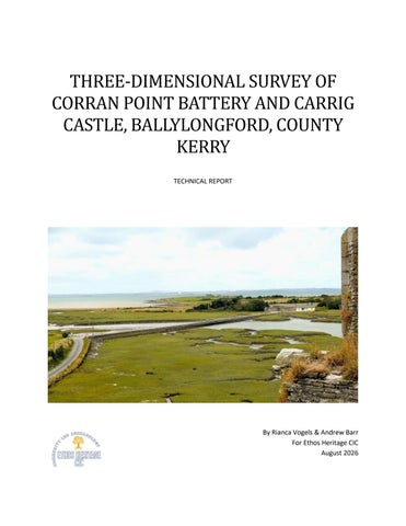
THREE-DIMENSIONAL SURVEY OF CORRAN POINT BATTERY AND CARRIG CASTLE, BALLYLONGFORD, COUNTY KERRY TECHNICAL REPORT
By Rianca Vogels & Andrew Barr For Ethos Heritage CIC August 2026
Table of Contents List of figures ......................................................................................................................................... ii List of tables ......................................................................................................................................... iii 1. Introduction .............................................................................................................................................. 1 2. Methodology ............................................................................................................................................. 2 3. Survey equipment and specifications ....................................................................................................... 3 4. Survey procedures .................................................................................................................................... 4 4.1 Corran Point Battery Survey ............................................................................................................... 4 4.2 Carrig Castle Survey ............................................................................................................................ 5 4.3 Environmental Conditions .................................................................................................................. 5 4.4 Ground Control and Georeferencing .................................................................................................. 6 4.5 Post-Survey Data Handling.................................................................................................................. 6 5. Processing workflow ................................................................................................................................. 7 5.1 Corran Point Battery Processing ......................................................................................................... 7 5.1.1 Agisoft Metashape Standard ................................................................................................... 7 5.1.2 WebODM............................................................................................................................... 10 5.2 Carrig Castle Processing .................................................................................................................... 13 5.2.1 Agisoft Metashape Standard ................................................................................................. 13 5.2.2 WebODM............................................................................................................................... 16 5.3 Quality Assurance ............................................................................................................................. 18 5.3.1 Quality Assurance Procedure..................................................................................................... 18 5.3.2 Corran Point Battery .................................................................................................................. 19 5.3.3 Carrig Castle ............................................................................................................................... 19 5.3.4 Processing Assessment .............................................................................................................. 21 6. Quality metrics and accuracy assessment .............................................................................................. 22 6.1 Corran Point battery ......................................................................................................................... 22 6.1.1 Reprojection Error ................................................................................................................. 22 6.1.2 Ground Resolution and Point Density ................................................................................... 22 6.1.3 Georeferencing Accuracy ...................................................................................................... 22 6.1.4 Relative Accuracy and Internal Consistency ......................................................................... 23 6.2 Carrig castle....................................................................................................................................... 23 6.2.1 Reprojection Error ................................................................................................................. 23 6.2.2 Ground Resolution and Reconstruction Density ................................................................... 23 6.2.3 Georeferencing Accuracy ...................................................................................................... 23 6.2.4 Relative Accuracy and Internal Consistency ......................................................................... 24 6.3 Comparative summary ...................................................................................................................... 24 7. Results ..................................................................................................................................................... 25 7.1 Corran Point Battery ......................................................................................................................... 25 7.2 Carrig Castle ...................................................................................................................................... 26 7.3 Georeferencing and Spatial Use ....................................................................................................... 28 Page i of 35 © Ethos Heritage CIC
Date Prepared 15 August 2026
8. Data Products .......................................................................................................................................... 30 8.1 GIS Integration .................................................................................................................................. 30 8.2 Model Access .................................................................................................................................... 31 9. Recommendations and Future Work ...................................................................................................... 32 9.1 Carrig Castle Repeat Survey .............................................................................................................. 32 9.2 Future Monitoring and Survey Control ............................................................................................. 32 9.3 QGIS Integration and Historical Mapping ......................................................................................... 33 9.4 Data Export and Long-Term Management ....................................................................................... 33 10. Conclusion ............................................................................................................................................. 34 References .................................................................................................................................................. 35
List of figures Figure 1 DJI Mavic 2 Pro drone (image source: DJI) ...................................................................................... 2 Figure 2 DroneDeploy flight plan for Corran Point Battery showing grid waypoints at 160 ft AGL ............. 4 Figure 3 DroneDeploy flight plan for Carrig Castle showing grid waypoints at 110 ft AGL .......................... 5 Figure 4 Camera positions and image coverage for the Corran Point Battery Agisoft reconstruction ........ 7 Figure 5 Dense point cloud of Corran Point Battery (17.1 million points).................................................... 8 Figure 6 Screenshot of textured 3d mesh model of Corran Point ................................................................ 8 Figure 7 Digital Elevation Model of Corran Point Battery showing topographic relief ................................ 9 Figure 8 Agisoft Metashape Standard Orthophoto ...................................................................................... 9 Figure 9 Image alignment map for the Battery survey showing camera locations and coverage.............. 10 Figure 10 Orthophoto Corran Point WebODM (6 August 2026, 1.08 cm/pixel GSD) ................................. 11 Figure 11 Image overlap map for Battery survey ....................................................................................... 12 Figure 12 Image overlap map for the castle survey showing camera locations and coverage .................. 13 Figure 13 Dense point cloud of Carrig Castle (8.6 million points) .............................................................. 14 Figure 14 Textured 3D mesh model of Carrig Castle tower ........................................................................ 14 Figure 15 Digital Elevation Model of Carrig Castle showing tower position and enclosure ....................... 15 Figure 16 Agisoft Metashape Standard Orthophoto .................................................................................. 15 Figure 17 Image alignment map for Castle survey showing camera locations and coverage .................... 16 Figure 18 Orthophoto Carrig Castle (6 August 2026, 0.78 cm/pixel GSD) .................................................. 17 Figure 19 Image overlap map for Castle survey showing acquisition coverage ......................................... 18 Figure 20 Comparison of Carrig Castle camera positions and flight-record data ....................................... 19 Figure 21 Orthophotograph of Corran Point Battery.................................................................................. 25 Figure 22 Oblique view of the textured Agisoft reconstruction of Corran Point Battery ........................... 26 Figure 23 Orthophotograph of Carrig Castle .............................................................................................. 27 Figure 24 Oblique view of the selected Agisoft reconstruction of Carrig Castle ........................................ 27 Figure 25 Higher-resolution Agisoft processing trial of Carrig Castle ......................................................... 28 Figure 26 Preliminary integration of the Carrig Castle textured three-dimensional model....................... 30
Page ii of 35 © Ethos Heritage CIC
Date Prepared 15 August 2026
List of tables Table 1 Alignment statistics .......................................................................................................................... 7 Table 2 Battery Alignment Statistics (WebODM)........................................................................................ 10 Table 3 Alignment statistics ........................................................................................................................ 13 Table 4 Castle Alignment Statistics (WebODM).......................................................................................... 16 Table 5 Comparative Quality Metrics ......................................................................................................... 24
Page iii of 35 © Ethos Heritage CIC
Date Prepared 15 August 2026
1. Introduction This report documents the acquisition, processing, and assessment of three-dimensional survey data from two archaeological sites in Ballylongford, County Kerry: Corran Point Battery, a Napoleonic coastal artillery fortification, and Carrig Castle. Both surveys were conducted using unmanned aerial systems (UAS) and photogrammetric processing techniques on 6 August 2026. The work forms part of a broader heritage mapping initiative aimed at developing three-dimensional records of archaeological monuments in Ballylongford, with potential applications to condition monitoring, erosion assessment, and heritage management. The surveys fulfil multiple objectives: to generate detailed baseline records for future conservation monitoring; to document the visible condition of the monuments; to inform heritage management decisions; to facilitate future archaeological investigation; and to create digital assets for public interpretation and community engagement.
Page 1 of 35 © Ethos Heritage CIC
Date Prepared 15 August 2026
2. Methodology A non-intrusive photogrammetry-based methodology was employed to generate metric survey data without physical intervention or disturbance. Photogrammetric recording is an established approach to heritage documentation, providing a non-contact method of recording archaeological sites and standing structures (Marín-Buzón et al. 2021). Photogrammetry uses overlapping photographs acquired from different positions to reconstruct threedimensional geometry through image matching and triangulation. The resulting data can be used to generate products including point clouds, three-dimensional surface models and orthographic imagery. The method is particularly suited to archaeological documentation because it enables detailed spatial recording without physical contact with the monument, while producing digital outputs suitable for subsequent analysis, visualisation and public communication (Douglass et al. 2015). Data acquisition employed a standardised methodology across both sites to facilitate comparison between the resulting datasets and provide a reproducible basis for future repeat survey.
Figure 1 DJI Mavic 2 Pro drone (image source: DJI)
Page 2 of 35 © Ethos Heritage CIC
Date Prepared 15 August 2026
3. Survey equipment and specifications Survey Platform: DJI Mavic 2 Pro electrically powered quadcopter UAS, with a take-off weight of 907 g. The aircraft incorporates GNSS (GPS/GLONASS), inertial and barometric positioning systems, and a threeaxis stabilised camera gimbal (DJI n.d.). Sensor: Hasselblad L1D-20c camera with a 1-inch CMOS sensor and 20-megapixel effective resolution (5472 × 3648 pixels). The camera has a 10.26 mm focal length lens with variable aperture from f/2.8 to f/11 (DJI n.d.). Image capture was set to JPEG format at maximum resolution. Flight Planning and Control: DroneDeploy cloud-based platform. Missions were planned using automated grid-based waypoint generation with specified altitude, overlap parameters, and speed constraints. Autonomous flight was executed via pre-programmed mission with real-time manual override capability. Remote Control: DJI Mavic 2 remote controller with connected smartphone providing flight-control interface, live camera view and telemetry display. Power: DJI Intelligent Flight Batteries. UAS Registration and Pilot Competency: The DJI Mavic 2 Pro was registered through the French Direction générale de l’Aviation civile (DGAC). The remote pilot held a valid EASA A1/A3 Open Category remotepilot competency certificate issued by the French DGAC. Post-Processing: Agisoft Metashape Standard (version 2.3.1, build 22416) was run locally on a Windows 11 (64-bit) workstation with an Intel Core i7-5820K processor @ 3.30 GHz, 31.9 GB RAM and NVIDIA GeForce GTX 1080 GPU (8 GB VRAM). WebODM/ODX (version 3.8.1) was run locally on a Windows 11 (64bit) workstation with an Intel Core i5-9400F processor @ 2.90 GHz, 16 GB RAM and NVIDIA GeForce RTX 2060 GPU (6 GB VRAM).
Page 3 of 35 © Ethos Heritage CIC
Date Prepared 15 August 2026
4. Survey procedures 4.1 Corran Point Battery Survey Date: 6 August 2026 Image acquisition: approximately 11:38 to 12:10 IST Altitude: 160 ft (48.8 m) AGL Survey area: Approximately 4 acres Images: 204 Flight Duration: 32 minutes Ground Resolution: 0.5 inches per pixel (1.08 cm/pixel)
Figure 2 DroneDeploy flight plan for Corran Point Battery showing grid waypoints at 160 ft AGL
The battery survey employed a rectangular grid flight pattern via DroneDeploy, covering the blockhouse tower, parapet walls, moat, and surrounding earthworks. Altitude was maintained at 160 ft AGL using barometric control and GNSS positioning. Image overlap parameters were set at 75% forward and 60% side overlap. Camera settings: aperture f/2.8, ISO 100-400 (automatic exposure), JPG compression. Gimbal configured for nadir viewing with camera frame aligned to flight direction to optimise overlap geometry.
Page 4 of 35 © Ethos Heritage CIC
Date Prepared 15 August 2026
4.2 Carrig Castle Survey Date: 6 August 2026 Image acquisition: approximately 19:35 – 19:54 IST Altitude: 110 feet (33.5 metres) AGL Survey area: Approximately 1 acre Images: 113 Flight Duration: 19 minutes Ground Resolution: 0.4 inches per pixel (0.78 cm/pixel)
Figure 3 DroneDeploy flight plan for Carrig Castle showing grid waypoints at 110 ft AGL
The castle survey employed the same automated grid-based methodology and overlap parameters as Corran Point Battery. The planned flight altitude was reduced to 110 ft (33.5 m) AGL in response to increasing wind condition. The flight path encompassed the castle structure and immediate surroundings using the same overlap parameters.
4.3 Environmental Conditions Both surveys were conducted on 6 August 2026 under partly cloudy conditions with good visibility and no precipitation. Weather conditions were monitored using the AirData UAV application and through direct observation. Winds were relatively light during the earlier Corran Point Battery survey but increased Page 5 of 35 © Ethos Heritage CIC
Date Prepared 15 August 2026
before the Carrig Castle survey, informing the decision to reduce the planned flight altitude. Contemporaneous screenshots or exported weather records were not retained; consequently, precise meteorological values are not reported. Tidal conditions were observed to be mid-to-high tide, with saltmarsh and shallow water visible around the sites.
4.4 Ground Control and Georeferencing Georeferencing was based on the onboard GNSS (GPS/GLONASS) coordinates recorded in the image EXIF metadata during flight. No independently surveyed Ground Control Points (GCPs) or check points were deployed during either survey. Image coordinates therefore provided the spatial reference during photogrammetric processing. Absolute and relative positioning metrics calculated during processing are assessed in Section 6.
4.5 Post-Survey Data Handling Following each survey, image data were downloaded from the drone and transferred to a dedicated working directory. The Corran Point Battery and Carrig Castle datasets were organised separately by survey mission, with the original image files retained as an unmodified backup. Working copies were used for subsequent photogrammetric processing. Where necessary, individual working images were adjusted to compensate for overexposure prior to processing. Additional ground-based and alternative-camera photographs were subsequently trialled during Agisoft processing to determine whether they improved the Carrig Castle reconstruction. These supplementary images did not improve the resulting reconstruction and were not incorporated into the selected model.
Page 6 of 35 © Ethos Heritage CIC
Date Prepared 15 August 2026
5. Processing workflow Both surveys were processed independently using two photogrammetric workflows: Agisoft Metashape Standard (version 2.3.1) and WebODM/ODX (version 3.8.1), allowing comparison of processing results across different software platforms.
5.1 Corran Point Battery Processing 5.1.1 Agisoft Metashape Standard Image Alignment: Sparse feature detection and matching was executed using Metashape's automated alignment workflow. Alignment accuracy was set to "Medium" for rapid initial processing. Alignment parameters: key point limit 50,000 per megapixel; tie point limit 4,000; generic preselection enabled; reference preselection sequential. Adaptive camera model fitting was enabled to account for lens distortion variations.
Figure 4 Camera positions and image coverage for the Corran Point Battery Agisoft reconstruction
Alignment Performance: The dataset contained 207 images, of which 204 successfully aligned, producing 228,078 tie points and an RMS reprojection error of 1.15 pixels. Table 1 Alignment statistics
Number of images:
207
Camera stations: Tie points: Projections: Reprojection error:
204 228,078 712,243 1.15 pix
Page 7 of 35 © Ethos Heritage CIC
Date Prepared 15 August 2026
Figure 5 Dense point cloud of Corran Point Battery (17.1 million points)
Depth Map Generation & Point Cloud: Dense depth estimation was computed using Metashape's depthfrom-stereo workflow at Medium quality, with filtering set to Mild and a maximum neighbour count of 16. The resulting dense point cloud contained 17,107,462 points. Mesh and Texture Generation: Surface mesh was reconstructed using volumetric surface reconstruction with interpolation, comprising 4,473,422 faces and 2,237,086 vertices. Textures were generated by projecting original RGB imagery onto the reconstructed surface using natural blending. Texture resolution: 16,384 × 16,384 pixels.
Figure 6 Screenshot of textured 3d mesh model of Corran Point
Page 8 of 35 © Ethos Heritage CIC
Date Prepared 15 August 2026
A Digital Elevation Model (DEM) was derived from point cloud to generate colour-coded height visualisation highlighting topographic variation.
Figure 7 Digital Elevation Model of Corran Point Battery showing topographic relief (warmer colours = higher elevation)
Processing Summary: Total processing time was 39 minutes and 46 seconds, the final output totalled approximately 460 MB.
Figure 8 Agisoft Metashape Standard Orthophoto
Page 9 of 35 © Ethos Heritage CIC
Date Prepared 15 August 2026
5.1.2 WebODM Image Alignment: Sparse feature detection and matching was executed using WebODM's ODX (version 3.8.1) photogrammetric pipeline. Alignment parameters: 10,000 detected features per image; automatic keypoint limit and tie point matching using structure-from-motion workflow.
Figure 9 Image alignment map for the Battery survey showing camera locations and coverage
Alignment Performance: Battery survey yielded 343,247 sparse tie points from 204 aligned images (out of 204 captured, 100% reconstruction rate), with average reprojection error of 1.18 pixels (norm: 0.14). Table 2 Battery Alignment Statistics (WebODM) Reconstructed Images Reconstructed Points (Sparse) Detected Features Reconstructed Features Average Reprojection Error
204 over 204 shots (100.0%) 343,247 over 347,436 points (98.8%) 10,000 features 6,177 features 1.18 pixels (norm: 0.14)
Average Track Length Average Track Length (> 2) Area Covered Processing Time
3.58 images 4.96 images 0.027172 km² 21 m 45 s
Page 10 of 35 © Ethos Heritage CIC
Date Prepared 15 August 2026
Depth Map Generation & Point Cloud: Dense point cloud was computed through automated structurefrom-motion and multi-view stereo matching. Ground resolution: 1.08 cm/pixel at the captured flight altitude. Mesh and Texture Generation: Surface reconstruction was performed from aligned image set using ODX's bundled meshing algorithms. Textures were generated by projecting original RGB imagery onto the reconstructed surface. Orthophotography & DEM: Orthographic An orthophotograph and digital elevation model were generated from the reconstruction.
Figure 10 Orthophoto Corran Point WebODM (6 August 2026, 1.08 cm/pixel GSD)
Page 11 of 35 © Ethos Heritage CIC
Date Prepared 15 August 2026
Processing Summary: Total processing time was 21 minutes and 45 seconds. Dataset area covered: 0.027172 km² (approximately 6.7 acres). Camera calibration was performed automatically by ODX during alignment; optimised focal length and distortion coefficients indicate adaptive lens distortion correction applied during processing.
Figure 11 Image overlap map for Battery survey showing acquisition coverage and multi-view geometry
Page 12 of 35 © Ethos Heritage CIC
Date Prepared 15 August 2026
5.2 Carrig Castle Processing 5.2.1 Agisoft Metashape Standard Image Alignment: Sparse feature detection and matching was executed using Metashape's automated alignment workflow. Alignment accuracy was set to "Medium" for rapid initial processing. Alignment parameters: key point limit 50,000 per megapixel; tie point limit 4,000; generic preselection enabled; reference preselection sequential. Adaptive camera model fitting was enabled to account for lens distortion variations.
Figure 12 Image overlap map for the castle survey showing camera locations and coverage (blue = overlapped regions)
Alignment Performance: the selected Castle reconstruction aligned 113 of the 116 images included in the project, producing 54,604 tie points with an RMS reprojection error of 1.36 pixels. Table 3 Alignment statistics
Number of images:
116
Camera stations: Tie points: Projections: Reprojection error:
113 54,604 370,064 1.36 pix
Page 13 of 35 © Ethos Heritage CIC
Date Prepared 15 August 2026
Depth Map Generation & Point Cloud: Dense depth estimation was computed using Metashape's depthfrom-stereo workflow at Medium quality, with filtering set to Mild and a maximum neighbour count of 16. The resulting dense point cloud contained 8,636,655 points.
Figure 13 Dense point cloud of Carrig Castle (8.6 million points)
Mesh and Texture Generation: Surface mesh was reconstructed using volumetric surface reconstruction with interpolation, comprising 1,589,635 faces and 794,997 vertices. Textures were generated by projecting original RGB imagery onto the reconstructed surface using natural blending to minimise seaming artefacts. Texture resolution was adaptively tiled to maintain detail on the complex castle structure.
Figure 14 Textured 3D mesh model of Carrig Castle tower
Page 14 of 35 © Ethos Heritage CIC
Date Prepared 15 August 2026
Digital elevation model was derived from point cloud to generate colour-coded height visualisation highlighting topographic variation.
Figure 15 Digital Elevation Model of Carrig Castle showing tower position and enclosure (colour-coded elevation or plan rendering)
Processing Summary: Total processing time was approximately 30 minutes, and the final output totalled approximately 110MB.
Figure 16 Agisoft Metashape Standard Orthophoto
Page 15 of 35 © Ethos Heritage CIC
Date Prepared 15 August 2026
5.2.2 WebODM Image Alignment: Sparse feature detection and matching was executed using identical WebODM/ODX methodology.
Figure 17 Image alignment map for Castle survey showing camera locations and coverage
Alignment Performance: Castle survey yielded 135,932 sparse tie points from 113 aligned images (out of 113 captured, 100% reconstruction rate), with average reprojection error of 1.20 pixels (norm: 0.16). Table 4 Castle Alignment Statistics (WebODM) Reconstructed Images Reconstructed Points (Sparse) Detected Features Reconstructed Features Average Reprojection Error
113 over 113 shots (100.0%) 135,932 over 137,152 points (99.1%) 10,000 features 7,089 features 1.20 pixels (norm: 0.16)
Average Track Length Average Track Length (> 2) Area Covered Processing Time
5.62 images 7.94 images 0.004564 km² 15 m 19 s
Depth Map Generation & Point Cloud: Dense point cloud was computed using ODX's multi-view stereo matching algorithms optimised for the smaller target footprint. Ground resolution: 0.78 cm/pixel at the captured flight altitude.
Page 16 of 35 © Ethos Heritage CIC
Date Prepared 15 August 2026
Mesh and Texture Generation: Surface reconstruction was performed from aligned image set. Textures were generated by projecting original RGB imagery onto the reconstructed surface using natural blending. Orthophotography & DEM: Orthographic projections were generated from aligned images and reconstructed model. Digital elevation model was derived to visualise the castle structure's spatial relationships.
Figure 18 Orthophoto Carrig Castle (6 August 2026, 0.78 cm/pixel GSD)
Page 17 of 35 © Ethos Heritage CIC
Date Prepared 15 August 2026
Figure 19 Image overlap map for Castle survey showing acquisition coverage and multi-view geometry
Processing Summary: Total processing time was 15 minutes and 19 seconds. Dataset area covered: 0.004564 km² (approximately 1.1 acres). Camera calibration was performed automatically by ODX during alignment; optimised focal length and distortion coefficients indicate adaptive lens distortion correction applied during processing.
5.3 Quality Assurance 5.3.1 Quality Assurance Procedure Outputs from both photogrammetric processing workflows were reviewed to identify reconstruction artefacts, incomplete geometry and inconsistencies between processing results. Image alignment and reprojection statistics were examined alongside visual inspection of the reconstructed point clouds, surface models and textured meshes. Particular attention was given to areas displaying incomplete geometry, surface distortion or poor texture reconstruction. Results from Agisoft Metashape and Page 18 of 35 © Ethos Heritage CIC
Date Prepared 15 August 2026
WebODM were compared to determine whether observed limitations originated from the processing workflow or from the underlying image acquisition.
5.3.2 Corran Point Battery The Corran Point Battery dataset produced a coherent reconstruction across the surveyed area in both Agisoft Metashape and WebODM. Agisoft aligned 204 of the 207 images contained within the project and generated 228,078 tie points, with an RMS reprojection error of 1.15 pixels. The dense point cloud contained 17,107,462 points and the resulting mesh comprised 4,473,422 faces and 2,237,086 vertices. WebODM successfully reconstructed all 204 images submitted to its processing workflow, producing 343,247 reconstructed sparse points and an average reprojection error of 1.18 pixels. No major processing failures were identified within the principal survey area. Both processing workflows produced coherent reconstructions of the battery and surrounding terrain, with no comparable localised reconstruction deficiency identified.
5.3.3 Carrig Castle The Carrig Castle dataset presented greater reconstruction difficulties than Corran Point Battery. One end of the monument was incompletely reconstructed, while coverage of some elevated architectural elements was also limited. Review of the camera positions indicates that images were acquired across the area affected by the incomplete reconstruction; the deficiency therefore cannot be attributed to a simple absence of source imagery. Review of the flight record identified a separate irregularity during the automated mission close to one side of the tower. Comparison with the camera positions and resulting reconstruction indicates that this irregularity does not correspond spatially with the principal area of incomplete reconstruction. No direct causal relationship between the recorded flight irregularity and the reconstruction deficiency can therefore be established (Figure 20).
Figure 20 Comparison of Carrig Castle camera positions and flight-record data. The camera-position plot (left) demonstrates image acquisition across the survey area, including the area subsequently affected by incomplete reconstruction. The flight record (right) identifies an irregularity close to one side of the tower; however, this does not correspond spatially with the principal area of incomplete reconstruction.
Page 19 of 35 © Ethos Heritage CIC
Date Prepared 15 August 2026
The castle survey was undertaken at approximately 110 ft (33.5 m) AGL. Wind conditions had begun to increase during the later survey period and, in response, the planned flight altitude was reduced prior to acquisition. This was an operational decision intended to maintain greater control of the aircraft under the changing conditions. While the reduced altitude increased the potential ground resolution of individual images, it also reduced the ground footprint captured by each photograph. The predominantly nadir acquisition provided fewer viewing angles for vertical and elevated architectural surfaces. Immediately following completion of the mapping mission, the aircraft battery experienced a power malfunction. The survey was therefore concluded without an additional flight that could have provided supplementary imagery. In particular, no additional higher-altitude or oblique imagery could be acquired to improve coverage of the monument. Although the reduced flight altitude was subsequently considered less suitable for complete photogrammetric recording of the structure, the decision had been made in response to the increasing wind conditions and prior to the battery malfunction. Several processing trials were subsequently undertaken in Agisoft Metashape to determine whether changes to the reconstruction parameters could improve the resulting model. The initial reconstruction produced imagery and surface geometry that were below the standard required for the intended documentation. A second reconstruction, processed at Medium quality, produced the most usable overall representation and was therefore selected as the Agisoft model presented in this report. Two further reconstructions were undertaken at higher processing resolutions. These trials did not recover reliable geometry within the incompletely reconstructed area, with the same general deficiency persisting despite the increased processing resolution. A comparable deficiency was also present in the independently processed WebODM reconstruction. The persistence of the problem across multiple Agisoft processing trials and WebODM indicates that increasing processing resolution alone could not resolve the limitations of the dataset. The selected Agisoft reconstruction aligned 113 of the 116 images included within the project and contained 54,604 tie points, with an RMS reprojection error of 1.36 pixels. The dense point cloud contained 8,636,655 points and the resulting mesh comprised 1,589,635 faces and 794,997 vertices. WebODM reconstructed all 113 images submitted to its workflow, producing 135,932 reconstructed sparse points with an average reprojection error of 1.20 pixels. Despite successful reconstruction of the submitted imagery, the same general area of the monument remained incomplete. The available evidence therefore indicates that the incomplete reconstruction was not caused by a simple absence of images from the affected area and was not resolved by alternative processing workflows or increased processing resolution. The acquisition strategy nevertheless appears not to have provided sufficient image geometry to reconstruct all parts of the monument successfully. A higher flight altitude, providing a larger image footprint, combined with supplementary nadir and oblique imagery would provide more complete multiview coverage during a repeat survey. The Medium-quality Agisoft reconstruction presented in this report was selected as the most useful representation of the available survey data. Its selection does not indicate that Medium processing produced inherently greater geometric accuracy than the higher-resolution trials. Rather, it provided the Page 20 of 35 © Ethos Heritage CIC
Date Prepared 15 August 2026
most coherent overall reconstruction obtainable from the available imagery while retaining the limitations of the original survey dataset.
5.3.4 Processing Assessment Both processing workflows produced a coherent reconstruction of Corran Point Battery, while the same general deficiency persisted in the Carrig Castle dataset across WebODM and multiple Agisoft processing trials. The Carrig Castle model should therefore be regarded as a partial record rather than a complete architectural survey. The comparison also demonstrates that processing statistics alone do not establish reconstruction completeness. The implications for survey quality and accuracy are considered further in Section 6.
Page 21 of 35 © Ethos Heritage CIC
Date Prepared 15 August 2026
6. Quality metrics and accuracy assessment Quality assessment was undertaken using processing statistics generated independently by Agisoft Metashape Standard and WebODM/ODX. The principal metrics considered were image alignment success, reprojection error, ground sampling distance (GSD), reconstruction density and georeferencing accuracy. These metrics describe different aspects of model quality and should not be considered interchangeable. Reprojection error and reconstruction statistics primarily describe the internal quality and consistency of the photogrammetric solution, while ground sampling distance describes the spatial resolution of the source imagery and resulting products. Absolute positional accuracy is dependent upon the method used to georeference the reconstruction. As described in Section 4.4, no independently surveyed GCPs or check points were deployed during either survey. Absolute positional accuracy could not therefore be independently validated. The accuracy values reported below are consequently derived from the processing software and onboard GNSS data and should not be interpreted as independently verified survey accuracy.
6.1 Corran Point battery 6.1.1 Reprojection Error The selected Agisoft reconstruction produced an RMS reprojection error of 1.15 pixels from 228,078 tie points. WebODM produced a comparable average reprojection error of 1.18 pixels from 343,247 reconstructed sparse points. The reprojection errors reported by both processing workflows are of a similar magnitude and are consistent with successful image matching across the reconstructed dataset. Both workflows produced coherent reconstructions of the principal survey area.
6.1.2 Ground Resolution and Point Density WebODM calculated an average ground sampling distance of 1.08 cm/pixel for Corran Point Battery. This is slightly finer than the approximately 1.27 cm/pixel anticipated during flight planning. The selected Agisoft reconstruction generated a dense point cloud containing 17,107,462 points. The resulting surface mesh comprised 4,473,422 faces and 2,237,086 vertices. These figures describe the density of the reconstructed dataset. Point count and mesh density should not, however, be interpreted as direct measures of positional accuracy.
6.1.3 Georeferencing Accuracy WebODM calculated a total GPS error of 1.31 m for the Corran Point Battery dataset and estimated absolute horizontal and vertical accuracy values of CE90 1.561 m and LE90 1.237 m, respectively. These values are derived from the onboard GNSS data and were not independently validated using surveyed GCPs or check points. The reported values describe the estimated absolute positioning of the reconstruction within its geographic reference system and should be distinguished from the substantially finer GSD and internal geometric detail of the model. The dataset is suitable for locating the monument within its wider landscape context and for integration with GIS datasets, regional mapping and historical Page 22 of 35 © Ethos Heritage CIC
Date Prepared 15 August 2026
spatial data. However, in the absence of independently surveyed control, it should not be treated as providing independently verified centimetre-level absolute positioning.
6.1.4 Relative Accuracy and Internal Consistency WebODM reports relative horizontal CE90 of 0.098 m and relative vertical LE90 of 0.149 m for the Corran Point Battery reconstruction. Together with the reprojection errors reported independently by Agisoft and WebODM, these values indicate good internal consistency within the reconstructed dataset. They do not, however, represent independently validated absolute positional accuracy. The model therefore provides a suitable baseline record for future comparison, subject to appropriate co-registration of repeat datasets. Where future monitoring seeks to quantify relatively small changes in surface position, erosion or structural condition, repeat datasets should be carefully co-registered. The use of stable reference points or independently surveyed GCPs would improve the reliability of quantitative change detection between survey periods.
6.2 Carrig castle 6.2.1 Reprojection Error The selected Agisoft reconstruction produced an RMS reprojection error of 1.36 pixels from 54,604 tie points. WebODM produced an average reprojection error of 1.20 pixels from 135,932 reconstructed sparse points. These values indicate successful image matching and bundle adjustment within the reconstructed portions of the dataset. As demonstrated by the processing trials discussed in Section 5.3.3, acceptable reprojection statistics do not indicate that the monument was completely reconstructed. The same general area remained deficient across multiple processing trials despite source images having been acquired across the affected part of the monument.
6.2.2 Ground Resolution and Reconstruction Density WebODM calculated an average ground sampling distance of 0.78 cm/pixel for Carrig Castle. This is finer than the approximately 1.02 cm/pixel anticipated during flight planning and reflects the comparatively low acquisition altitude. The selected Agisoft reconstruction generated a dense point cloud containing 8,636,655 points. The resulting surface mesh comprised 1,589,635 faces and 794,997 vertices. These values demonstrate the fine image resolution and substantial reconstruction density achieved within the dataset. However, neither GSD nor reconstruction density provides a measure of reconstruction completeness. As identified in Section 5.3.3, one area of the monument remained incompletely reconstructed despite images having been acquired across the affected part of the site.
6.2.3 Georeferencing Accuracy WebODM calculated a total GPS error of 0.85 m for the Carrig Castle dataset. Estimated absolute horizontal accuracy was CE90 0.833 m, while estimated absolute vertical accuracy was LE90 1.230 m. As with Corran Point Battery, these values describe the estimated absolute positioning of the dataset based upon onboard GNSS rather than independently surveyed ground control. The dataset is suitable for Page 23 of 35 © Ethos Heritage CIC
Date Prepared 15 August 2026
locating the monument within its geographic context and integration with GIS and other landscape-scale spatial datasets. It should not be treated as providing centimetre-level absolute positioning.
6.2.4 Relative Accuracy and Internal Consistency WebODM reports relative horizontal CE90 of 0.065 m and relative vertical LE90 of 0.087 m for Carrig Castle. These values, together with reprojection errors of 1.36 pixels in the selected Agisoft reconstruction and 1.20 pixels in WebODM, indicate good internal consistency within successfully reconstructed areas. The distinction between reconstruction quality and reconstruction completeness is particularly important for Carrig Castle. These numerical quality metrics do not negate the reconstruction limitations identified in Section 5.3.3, and the current model should therefore remain classified as a partial record of the monument.
6.3 Comparative summary Both datasets produced photogrammetric reconstructions with broadly comparable internal processing metrics, but their overall completeness and suitability for documentation differ. Corran Point Battery produced a coherent reconstruction across the principal survey area and provides a suitable baseline dataset for future comparative monitoring. Carrig Castle achieved a finer ground sampling distance and lower WebODM relative accuracy estimates, reflecting the lower flight altitude and smaller survey area. However, these numerical advantages should not be interpreted as demonstrating a superior overall survey. One area of the monument remained incompletely reconstructed, while representation of elevated architectural elements was also limited. The castle dataset therefore contains high-detail information within successfully reconstructed areas but remains incomplete as a record of the monument as a whole. Table 5 Comparative Quality Metrics Metric Flight Altitude Planned GSD WebODM calculated GSD Agisoft aligned images Agisoft tie points Agisoft RMS reprojection error Agisoft dense point cloud Agisoft mesh faces WebODM average reprojection error WebODM GPS error Absolute horizontal CE90 Absolute vertical LE90 Relative horizontal CE90 Relative vertical LE90 Overall reconstruction
Corran Point Battery 160 ft (48.8 m) approx. 1.27 cm/pixel 1.08 cm/pixel 204 228,078 1.15 px 17,107,462 4,473,422 1.18 px 1.31 m 1.561 m 1.237 m 0.098 m 0.149 m Complete across principal survey area
Carrig Castle 110 ft (33.5 m) approx. 1.02 cm/pixel 0.78 cm/pixel 113 54,604 1.36 px 8,636,655 1,589,635 1.20 px 0.85 m 0.833 m 1.230 m 0.065 m 0.087 m Partial; reconstruction deficiencies
Page 24 of 35 © Ethos Heritage CIC
Date Prepared 15 August 2026
7. Results The two surveys produced georeferenced photogrammetric datasets comprising three-dimensional surface information, textured models and orthographic outputs. The completeness of the resulting datasets differed between the two sites, as discussed in Sections 5 and 6.
7.1 Corran Point Battery The Corran Point Battery survey produced a coherent three-dimensional record of the principal monument and its surrounding terrain. Image coverage extended across the blockhouse, defensive earthworks and associated landscape, allowing the relationship between the surviving structural remains and surrounding topography to be represented within a single spatial dataset.
Figure 21 Orthophotograph of Corran Point Battery generated from the WebODM reconstruction at an average ground sampling distance of 1.08 cm/pixel
The orthographic output provides a planimetric representation of the survey area from which the principal surviving elements of the battery can be distinguished. The blockhouse forms the most prominent standing structural component, while the curved seaward defensive works and surrounding earthworks are visible within the wider site layout. The three-dimensional reconstruction provides complementary information on the vertical and surface morphology of these features. Surviving wall elevations, openings and variations in masonry surface are represented in the textured model, while the point cloud and elevation data record variations in ground level across the monument and surrounding terrain.
Page 25 of 35 © Ethos Heritage CIC
Date Prepared 15 August 2026
Figure 22 Oblique view of the textured Agisoft reconstruction of Corran Point Battery, showing the surviving blockhouse and surrounding features
The blockhouse is represented with sufficient detail to distinguish major architectural openings and surviving wall surfaces. Areas of structural loss and exposed interior space are also visible within the reconstruction. The model therefore provides a three-dimensional record of the externally visible condition of the structure at the time of survey. The wider survey coverage also records lower-relief elements that are less readily represented through conventional ground photography. Variations in the surrounding terrain and surviving earthworks can be examined through the orthophotograph, point cloud and elevation-derived outputs. No major reconstruction deficiencies were identified within the principal Battery survey area. The Corran Point Battery dataset therefore provides the more complete of the two site records and establishes a coherent baseline representation of the monument as recorded on 6 August 2026.
7.2 Carrig Castle The Carrig Castle survey produced a detailed but incomplete three-dimensional record of the monument and its immediate surroundings. Within successfully reconstructed areas, the surviving structure is represented at a high level of visual and geometric detail.
Page 26 of 35 © Ethos Heritage CIC
Date Prepared 15 August 2026
Figure 23 Orthophotograph of Carrig Castle generated from the WebODM reconstruction, with an average ground sampling distance of 0.78 cm/pixel
The lower flight altitude resulted in a finer average ground sampling distance than that achieved at Corran Point Battery. Individual masonry elements, wall surfaces and changes in surface texture are consequently represented clearly within successfully reconstructed portions of the dataset.
Figure 24 Oblique view of the selected Agisoft reconstruction of Carrig Castle, showing the level of detail achieved within the successfully reconstructed parts of the monument
Page 27 of 35 © Ethos Heritage CIC
Date Prepared 15 August 2026
The reconstruction records the principal external wall surfaces and immediate ground surface around the monument. The textured model provides a detailed visual record of the masonry visible from the acquired camera positions and allows the surviving structure to be examined from viewpoints not available in individual source photographs.
Figure 25 Higher-resolution Agisoft processing trial of Carrig Castle showing the area of incomplete reconstruction
The dataset is, however, incomplete. As described in Section 5.3.3, one area remained incompletely reconstructed despite source images having been acquired across the affected part of the monument. Representation of elevated architectural elements was also limited. Comparable reconstruction deficiencies occurred in both the Agisoft and WebODM processing outputs.
7.3 Georeferencing and Spatial Use Both datasets were georeferenced using positional information recorded by the onboard GNSS system. The resulting models, orthographic outputs and associated spatial datasets can therefore be positioned within GIS environments and related to other geographically referenced information. As established in Section 6, the absolute positional accuracy of the datasets is limited by the absence of independently surveyed GCPs or check points. The georeferencing is suitable for positioning the monuments within their wider landscape context and for comparison with regional mapping, aerial imagery and other spatial datasets at an appropriate scale. The internal detail of the photogrammetric reconstructions is substantially finer than their absolute GNSS positioning. Consequently, future quantitative comparison of small-scale changes should not rely solely upon the absolute coordinates of independently processed survey datasets. Repeat surveys intended for detailed condition or change monitoring should be coregistered using stable reference features or, where greater positional control is required, surveyed Page 28 of 35 © Ethos Heritage CIC
Date Prepared 15 August 2026
ground control and independent check points. Taken together, the survey results demonstrate two different outcomes from the same general photogrammetric approach. Corran Point Battery provides a comparatively complete site-scale baseline dataset, while Carrig Castle demonstrates that fine ground resolution and good internal processing metrics do not necessarily result in complete three-dimensional reconstruction.
Page 29 of 35 © Ethos Heritage CIC
Date Prepared 15 August 2026
8. Data Products Processing in Agisoft Metashape and WebODM generated a range of digital outputs for both survey areas. These include three-dimensional point clouds, textured surface models, orthographic imagery and elevation-derived data. The original survey imagery and photogrammetric project files have also been retained to enable future reprocessing and export where required. The Corran Point Battery dataset provides the most complete range of usable outputs. Products derived from the Carrig Castle survey remain subject to the reconstruction limitations described in Sections 5.3.3 and 7.2. At the time of writing, the datasets remain under active development and have not yet been prepared as a final archive or formal package of exported deliverables. Appropriate export formats will therefore be selected according to subsequent analytical, archival and presentation requirements.
8.1 GIS Integration Integration of the photogrammetric outputs with QGIS is currently being explored for both survey areas. The purpose of this work is to establish a workflow through which the three-dimensional survey data can be combined with existing spatial datasets, including aerial imagery and historic mapping, allowing the monuments to be examined within their wider archaeological and historical contexts. Preliminary integration of the Carrig Castle three-dimensional model has been undertaken within the QGIS 3D environment. The model can be rendered alongside existing geospatial imagery and terrain data; however, refinement of its spatial positioning and alignment is still in progress.
Figure 26 Preliminary integration of the Carrig Castle textured three-dimensional model within the QGIS 3D environment, displayed alongside geospatial imagery. Spatial positioning of the model is still being refined.
Page 30 of 35 © Ethos Heritage CIC
Date Prepared 15 August 2026
This work remains at an early stage and should not be interpreted as a completed spatial analysis. The current implementation instead demonstrates the feasibility of incorporating the photogrammetric model into a wider GIS environment and identifies the need for further refinement of model positioning before detailed spatial comparison is undertaken. Particular emphasis in subsequent work will be placed on Corran Point Battery, where the more complete photogrammetric dataset provides greater potential for comparison with historic mapping and other spatial sources. This will allow the relationship between surviving features and the documented historical layout of the battery to be investigated spatially. The results of this ongoing GIS work are therefore not included as an analytical component of the present survey. Once the positioning and integration workflow has been refined, the photogrammetric datasets can provide a basis for subsequent GIS-based archaeological analysis, historical map comparison and spatial documentation.
8.2 Model Access Online access to the three-dimensional models is currently being prepared. Once published, the models will be made available through the Ethos Heritage CIC digital platforms. In the interim, access to the available models and associated survey outputs may be requested by contacting Ethos Heritage CIC.
Page 31 of 35 © Ethos Heritage CIC
Date Prepared 15 August 2026
9. Recommendations and Future Work The surveys demonstrate the potential of UAS photogrammetry for three-dimensional documentation of archaeological monuments at Ballylongford, while also identifying several areas in which future acquisition, processing and data management can be improved. The following recommendations are intended to support continued development of the datasets and provide a consistent basis for future survey.
9.1 Carrig Castle Repeat Survey A repeat survey of Carrig Castle is recommended to address the reconstruction limitations identified during the present survey. The current dataset provides detailed documentation of successfully reconstructed areas but does not constitute a complete three-dimensional record of the monument. Future acquisition should employ a higher flight altitude than the 110 ft (33.5 m) used during the present survey, providing a larger image footprint and greater image redundancy across the monument. Sufficient forward and side overlap should be maintained throughout the automated mapping mission, with supplementary imagery acquired where necessary to provide multiple viewing angles of complex architectural elements. Additional imagery should also be acquired specifically for the elevated architectural elements. A combination of nadir and oblique imagery would provide improved multi-view coverage of vertical wall surfaces, wall tops and other features that are poorly represented by a predominantly nadir mapping flight. The present survey demonstrated the importance of critically reviewing automated flight-planning outputs when recording complex standing structures. Flight altitude, image footprint, planned overlap and monument geometry should therefore be considered together during mission planning, with additional imagery incorporated where necessary to provide multiple viewing angles. As identified in Section 5.3.3, future surveys should include an immediate post-flight review of image distribution and flight records to identify acquisition irregularities. Where operational and safety conditions permit, supplementary nadir or oblique imagery should be acquired before leaving the site where the initial dataset does not provide sufficient representation of complex or elevated architectural elements
9.2 Future Monitoring and Survey Control Corran Point Battery provides a suitable baseline dataset for future photogrammetric documentation because of the comparatively complete reconstruction achieved during the present survey. Repeat acquisition using comparable flight parameters would allow subsequent datasets to be examined against the 2026 record. Where future surveys are intended primarily for visual documentation and landscapescale comparison, onboard GNSS positioning may remain sufficient. Where quantitative monitoring of relatively small changes is required, additional spatial control should be considered. The use of surveyed GCPs and independent check points would improve absolute positional control and provide an independent means of assessing survey accuracy. Alternatively, stable features identifiable across successive datasets may support careful co-registration for relative comparison where permanent ground control is impractical. Page 32 of 35 © Ethos Heritage CIC
Date Prepared 15 August 2026
Future repeat surveys should record flight parameters, camera settings, environmental conditions and processing parameters consistently to maximise comparability between survey periods.
9.3 QGIS Integration and Historical Mapping Further development of the QGIS workflow is recommended for both datasets. Initial testing with the Carrig Castle model has demonstrated that the three-dimensional photogrammetric data can be incorporated into the QGIS 3D environment, although refinement of model positioning remains in progress. Corran Point Battery should be prioritised for subsequent GIS analysis because of the completeness of its photogrammetric reconstruction and the potential for comparison with historical mapping. Georeferenced historic maps can be used alongside the contemporary survey data to investigate the spatial relationship between surviving features, documented former structures and changes to the surrounding landscape. This stage should distinguish clearly between features directly recorded by the 2026 survey and archaeological interpretations derived through comparison with historical or other external sources.
9.4 Data Export and Long-Term Management Following completion of the developing analytical workflow, final survey products should be exported in appropriate, widely supported formats according to their intended use. This should include formats suitable for GIS analysis, point-cloud preservation, three-dimensional visualisation and long-term digital storage. The complete project archive should retain the original unmodified survey photographs, processed working imagery where applicable, photogrammetric project files, exported final products, processing reports, flight information and associated technical documentation. Processing metadata should be retained alongside exported datasets so that future users can identify the software, processing parameters, coordinate information and limitations associated with each product. Where possible, preservation formats should be selected to minimise dependence on proprietary software and allow future migration or reprocessing. Retaining the original imagery and processing projects is particularly important, as improvements in photogrammetric software may allow the datasets to be reprocessed or analysed differently in the future.
Page 33 of 35 © Ethos Heritage CIC
Date Prepared 15 August 2026
10. Conclusion The UAS photogrammetric surveys undertaken at Corran Point Battery and Carrig Castle on 6 August 2026 successfully generated three-dimensional digital records of both monuments, although the completeness of the resulting datasets differed substantially between the two sites. Corran Point Battery produced the more complete survey dataset. Both Agisoft Metashape and WebODM produced coherent reconstructions of the principal survey area, generating a detailed record of the surviving monument and surrounding terrain. The resulting dataset provides a baseline for continued archaeological documentation and offers potential for integration with historical mapping and other spatial data through the developing QGIS workflow. Carrig Castle demonstrated both the potential and the limitations of automated UAS photogrammetry for recording complex standing architecture. The imagery produced detailed reconstruction across much of the monument, but one area remained incomplete and representation of elevated architectural elements was limited. Review of the camera positions confirmed that imagery had been acquired across the incompletely reconstructed area, while multiple Agisoft processing trials and the independent WebODM reconstruction produced comparable deficiencies. The precise cause of the incomplete reconstruction could not therefore be established conclusively from the available data. The resulting model provides a useful partial record of the monument but should not be regarded as a complete architectural survey. Processing the datasets independently in Agisoft Metashape and WebODM provided a useful means of comparing the consistency of the resulting reconstructions and identifying deficiencies that persisted across different processing workflows. The comparison demonstrated that favourable numerical processing metrics do not by themselves establish completeness; successful reconstruction also depends upon the suitability of the acquired imagery and its geometry. The surveys also established a practical workflow that can be refined for future archaeological mapping in Ballylongford. The experience gained during acquisition, processing, quality assessment and preliminary GIS integration provides a basis for improving future survey planning, particularly through more critical assessment of automated flight plans, appropriate use of nadir and oblique imagery, immediate post-flight review of acquired imagery, and the use of additional survey control where higher absolute positional accuracy is required. Overall, the project demonstrates that relatively accessible UAS and photogrammetric methods can provide detailed and reusable digital documentation of archaeological monuments when acquisition strategy, processing limitations and positional accuracy are critically assessed and transparently reported. The 2026 datasets provide both a digital record of the two surveyed sites and a methodological foundation for continued development of three-dimensional archaeological documentation within the wider Ballylongford heritage mapping initiative.
Page 34 of 35 © Ethos Heritage CIC
Date Prepared 15 August 2026
References DJI. n.d. Support for Mavic 2. DJI. Accessed 15 August 2026. DJI Mavic 2 support page DOUGLASS, M., LIN, S. & CHODORONEK, M. 2015. ‘The Application of 3D Photogrammetry for In-Field Documentation of Archaeological Features’. Advances in Archaeological Practice 3(2): 136– 152. DOI: 10.7183/2326-3768.3.2.136. MARÍN-BUZÓN, C., PÉREZ-ROMERO, A., LÓPEZ-CASTRO, J.L., BEN JERBANIA, I. & MANZANO-AGUGLIARO, F. 2021. ‘Photogrammetry as a New Scientific Tool in Archaeology: Worldwide Research Trends’. Sustainability 13: 5319. DOI: 10.3390/su13095319.
Page 35 of 35 © Ethos Heritage CIC
Date Prepared 15 August 2026