Huttons Ambo Landscape Project 2024: Interim Excavation Report By Rianca Vogels
Huttons Ambo Landscape Project 2024 Interim Report Site code/reference number: HA24 Rianca Vogels – Ethos heritage Date of submission
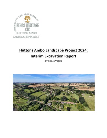
Figure 1 Overview of Huttons Ambo Copyright A. Barr
Date prepared
© Ethos Heritage CIC Page 2
Contents Figures ....................................................................................................................................................... 4 Tables ........................................................................................................................................................ 4 Acknowledgements................................................................................................................................... 5 1.
Site Location and Background............................................................................................................... 6
2.
Methodology......................................................................................................................................... 8
3.
Excavation Results............................................................................................................................... 13
4.
Finds Summary and Initial Analysis ..................................................................................................... 23
5.
Geophysics .......................................................................................................................................... 27
6.
Preliminary Discussion and Interpretation ......................................................................................... 29
7.
Conclusions and Recommendations ................................................................................................... 30
8.
Bibliography and references ............................................................................................................... 33
9.
Appendices .......................................................................................................................................... 35
Figures Figure 1 Copy right .... ................................................................................................................................... 1 Figure 2 Location of Huttons Ambo .............................................................................................................. 6 Figure 3 Huttons Ambo Village (High and Low Hutton) ................................................................................ 7 Figure 4 Magnetometry results and interpretation...................................................................................... 9 Figure 5 Resistivity results and interpretation .............................................................................................. 9 Figure 6 Magnetometry results and interpretation.................................................................................... 10 Figure 7 Resistivity results and interpretation ............................................................................................ 10 Figure 8 Overview of location Trench 100 .................................................................................................. 14 Figure 9 Post excavation drone shot of Trench 100 ................................................................................... 14 Figure 10 Visual of unutilised Trench 200 ................................................................................................... 15 Figure 11 Overview of location Trench 300, 400 and 500 .......................................................................... 15 Figure 12 Post excavation shot of Trench 300 ............................................................................................ 16 Figure 13 Post excavation drone shot Trench 400 ..................................................................................... 17 Figure 14 Post excavation drone shot of Trench 500 ................................................................................. 18 Figure 15 Overview of location Trench 600, 700 and 800 .......................................................................... 19 Figure 16 Post excavation drone shot Trench 600 ..................................................................................... 19 Figure 17 Location of Trench 600, 700 and 800 in relation to one another and the tree .......................... 20 Figure 18 Post excavation drone shot Trench 800 ..................................................................................... 21 Figure 19 Resistivity results per square ...................................................................................................... 27 Figure 20 Magnetometry results per square .............................................................................................. 28 Figure 21 of metal objects recovered through metal detecting. ................................................................ 42
Tables Table 1 General Finds per Area with weight............................................................................................... 25
Acknowledgements The Huttons Ambo Archaeology Project would like to express sincere thanks to all participants, volunteers, and supporters who contributed their time, energy, and enthusiasm to the 2024 field season. The success of this year’s work, including the first geophysical survey of the Scheduled Monument, was made possible through the combined efforts of an exceptional team whose dedication to learning and collaboration continues to define the project’s spirit. We gratefully acknowledge the following participants: Alan Berck-May, Alyson B. Whitacre, Amy Hirsch, Andrew Barr, Anthony Tulip, Astrid Brozén, Ben Rowlett, Beverley Oliver, Billy Phillips, Bradley Stovell, Carys Elspeth Anderson, Charlotte Adams, Charlotte Pinkham-Nielsen, Chloe Gostick, Clive Marshall, Cora Turner, Dana Dagostino, Diane Cobbold, Dora Laszlo, Ellen Ridley, Emma Friberg, Eva Alexander, Filip Blomqvist Lager, Frank Aloi, Frida Lisandra Ekberg Toscano, Genevieve Rainey, Georgia Lee, Grit Gaskell, Harriet ("Lulu") Orpin, Herminia Rodrigiez, Hilmar Brigham Anderson, Ian Marsh, Ingrid Beatrice Margareta Borg, Isac Löfgren, Isabel Seiran Davies, Iwan Griffiths, Jacqui Peploe, Jeanette Hall, Judy Potts, Julie Hall, Kay Gaskell (and Child 2), Kristofer Wilhelm Eriksson, Laura Temple, Lily Ella Barnard, Lisa Murdoch, Lois Torley, Louis Gaskell, Luke Aloi, Maia Rowlett, Marie Chater, Matty Cambridge, Matthew Love, Maxwell Southern, Megan Lawrance, Melina Katsoulakis, Nadine Rohman, Naila Loqueman, Olivia Friberg, Paul Roberts, Peter Hall, Philippa Hartley, Rachael Simpson-Jones, Rebecca Marsh, Rick Alexander, Rob Reynolds, Robert John Schottler, Robert McGregor, Samantha Dunger, Sarah Johanne Sunne, Sid Rowlett, Sophie Williams, Stephen Morris, and Vera Birgitta Oddsdotter Bogen. Special thanks are extended to local residents Andrew Eastwood, Tara, David Green, Rona, and Andrew Jackson for their continued support and engagement throughout the season. The project also wishes to thank the Huttons Ambo History Group, the wider village community, and the Village Hall Committee for their invaluable assistance, hospitality, and encouragement. We would also like to thank the staff team for their leadership, guidance, and expertise: Emma Samuel, Dairmaid Walshe, Richard Coates, Sara Falk, Måns Ekström, Disa Lindholm, Tobias Andreasson, Summer Smith, Leon Corneille-Cowell, Charlotte McAllister, Georgina Lee, and Sarah Sunne. Their commitment ensured the smooth running of the excavation, training, and outreach activities. Finally, the project acknowledges Rianca Vogels, Site Director, for overseeing the fieldwork, research design, and on-site management throughout the 2024 season, and the Ethos Heritage Board consisting of Emma Samuel, Dairmaid Walshe, and Richard Coates for their continued leadership and vision in guiding the development of the Huttons Ambo Archaeology Project and its community-led research ethos.
1. Site Location and Background 1.1 Huttons Ambo is a civil parish in North Yorkshire, situated approximately 14 miles northeast of York and 3 miles southwest of Malton. The excavation area is centred around Grid Reference SE760678 (Lat/Lon: 54.10049, -0.839274) on the southern side of the A64, approximately 5 km from Malton.
Figure 2 Location of Huttons Ambo
1.1.1
1.1.2
1.1.3
1.1.4
The parish consists of two settlements, High Hutton and Low Hutton, positioned between the River Derwent and the Howardian Hills. The landscape is characterized by rolling hills and fertile valleys, influencing historical land use and settlement patterns. Elevations range from 260 feet (79 m) in High Hutton to 170 feet (52 m) in Low Hutton, with the land descending further to 50 feet (15 m) along the riverbanks. The underlying geology consists of Corallian Beds and Inferior Oolite, providing well-drained soils suitable for agriculture. Huttons Ambo is bordered by the River Derwent to the east and south and by the Cram Beck to the west. The area covers approximately 2,898 acres, with 1,285 acres used as arable land for wheat, oats, and barley, 1,371 acres as permanent pasture, and 166 acres covered by woods and plantations. The site is well-connected, with the A64 York-to-Scarborough road passing nearby and two exits providing access to the village. The York and Scarborough branch of the North Eastern Railway runs through the southern part of the parish, with the nearest train station located in Malton. A bus stop on the A64 serves regular routes, while a limited weekday service runs through the village itself. Although woodland is present near High Hutton, the excavations are focused in Low Hutton,
31 October 2025
© Ethos Heritage CIC Page 6
where farmland and pasture dominate the landscape. The site also includes a scheduled monument, though no excavation will take place within its designated boundaries. Huttons Ambo is a civil parish in North Yorkshire, situated approximately 14 miles northeast of York and 3 miles southwest of Malton. The excavation area is centred around Grid Reference SE760678 (Lat/Lon: 54.10049, -0.839274) on the southern side of the A64 5km from Malton. The site is located between the River Derwent and the Howardian Hills, with underlying sandstone and limestone formations. The landscape consists of rolling hills and fertile valleys, influencing historical land use and settlement patterns.
Figure 3 Huttons Ambo Village (High and Low Hutton)
1.2 Huttons Ambo lies within the Vale of York, where the soil composition is heavily influenced by underlying Jurassic limestone and sandstone, as well as glacial drift deposits. The area features a mix of well-draining, calcareous soils derived from limestone, alongside more fertile, loamy soils formed from glacial till. These variations in soil type have impacted past land use, with lighter, free-draining soils favouring settlement and cultivation, while heavier clay-rich deposits in lower-lying areas may have been less suitable for agriculture. 1.2.1 The presence of alluvial soils near the River Derwent suggests periodic flooding, which could have contributed to both soil enrichment and erosion, influencing long-term human activity and site preservation. 1.3 Huttons Ambo appears in the Domesday Book (1086) as “Hotun” and has a history of medieval land ownership linked to the Colswayn, Bardolf, and Mynchon families. The site shows evidence of longterm human activity, with indications of occupation from the Iron Age through the medieval period. 1.3.1 Previous excavations in 2023 uncovered Roman and medieval pottery, as well as substantial stone remains, suggesting the presence of significant structures. The site lies near the major 31 October 2025 © Ethos Heritage CIC Page 7
Roman pottery production centre at Crambeck, and Huttons Ambo itself lends its name to a distinctive type of medieval pottery produced in the 13th century—large, unglazed storage jars. The current excavations aim to provide further insight into the Huttons Ambo pottery industry and its location. 1.3.2
Non-invasive surveys, including magnetometry, resistivity, LiDAR, and drone imaging, have identified anomalies that may correspond to buried features. A scheduled medieval moat and hall exist within the broader project area, though no excavation will be undertaken on that site.
1.4 Excavations in the 1950s revealed evidence of 12th- or 13th-century fortified buildings at the south end of Low Hutton, near the river. These investigations, led by Thompson and Smith (1957), uncovered a fortified medieval hall at Hutton Colswain, now designated as a Scheduled Ancient Monument (SE7631067380). While the site is referenced in several publications, specific research on Huttons Ambo itself remains limited. 1.4.1 In 2023, a series of non-invasive surveys were conducted, including topographical, magnetometry, and resistivity surveys, which identified Roman occupation in the form of coins, pottery, and ditches. Additionally, LiDAR data covering the region has contributed to mapping potential buried features, and drone imagery is planned as part of the ongoing project. 1.4.2
The most recent excavations, carried out by Ethos Heritage CIC, uncovered significant quantities of Iron Age and Roman pottery, as well as burnt daub, which suggests the presence of a possible structure. These findings align with anomalies detected in the 2023 geophysical survey, supporting the hypothesis of a more extensive settlement in the area.
2. Methodology 2.1 The 2024 excavation season, undertaken from 27th July to 11th August, marked the first phase of fieldwork in the ongoing Hutton's Ambo Landscape Project. Building on the results of earlier non-invasive surveys and preliminary test pitting, the season was designed to investigate a series of archaeological features identified through geophysics, topographic analysis, and previous small-scale excavation. The overarching aim was to evaluate the presence, extent, and character of archaeological remains in key areas of interest and to refine the interpretations of settlement patterns and land use from the Iron Age to the post-medieval period. 2.1.1 Key research aims: 2.1.1.1 Establishing the date and function of features identified in geophysical surveys. 2.1.1.2 Assessing the state of preservation of archaeological deposits. 2.1.1.3 Investigating the relationship between identified features, structures, and activity areas. 2.1.1.4 Evaluating potential evidence for industrial activity, particularly the production of medieval Huttons Ambo ware. 2.1.2 The excavation strategy was informed by magnetometry, resistivity, and topographical surveys, which identified a number of linear features, ditches, and areas of high archaeological potential. The 2023 excavations yielded significant finds, including Iron Age 31 October 2025
© Ethos Heritage CIC Page 8
2.1.3
and Roman pottery, burnt daub, and possible structural remains, providing a basis for further targeted investigation. The excavation aims to contribute to broader regional research questions concerning rural settlement, land use, and industry in this part of North Yorkshire. Comparative analysis with known sites in the region will assist in contextualizing the findings and refining the chronology of activity at Huttons Ambo.
2.2 The placement of trenches for the 2024 excavation was determined based on the results of previous non-invasive surveys, including magnetometry, resistivity, and LiDAR analysis, as well as findings from the 2023 excavation season. These datasets highlighted key areas of interest, which informed a targeted approach for investigating potential structures, anomalies, and occupation zones. 2.2.1 Six areas were selected for investigation: 2.2.2 Two trenches were positioned to examine potential structural remains identified through geophysical surveys and excavation results from the previous season. (see figure 4 & 5)
Figure 4 Magnetometry results and interpretation
Figure 5 Resistivity results and interpretation
2.2.3
Two trenches were placed over geophysically identified anomalies, which may represent significant archaeological features. (See figure 6 & 7)
31 October 2025
© Ethos Heritage CIC Page 9
Figure 6 Magnetometry results and interpretation
Figure 7 Resistivity results and interpretation
2.2.4
One additional trench was positioned to test a historical reference to the location of a potential quarry site, in the same area. (See figure 6 & 7) 2.2.5 Additionally, a seventh trench was opened but not yet investigated. This trench remains an area of interest for possible future excavation, depending on the results of the current season. 2.3 The excavation followed a stratigraphic excavation strategy, with deposits removed in sequence to ensure the controlled recovery of archaeological material. Three large open-area excavations were mechanically stripped of turf and topsoil under archaeological supervision, while additional trenches were hand-excavated, particularly in the garden of The Hollies. Excavation is to proceed down to the level of naturally occurring deposits, with features excavated in accordance with standard sampling strategies. 2.3.1 A target sampling strategy is to be employed to ensure the recovery of statistically representative datasets while preserving deposits for future investigation where necessary: 2.3.1.1 Stake-holes, buildings, industrial features, and funerary contexts were subject to 100% excavation. 2.3.1.2 Post-holes were initially 50% excavated, increasing to 100% if structural relationships were identified. 31 October 2025
© Ethos Heritage CIC Page 10
2.3.1.3 Pits (≤1.5m diameter) were 50% excavated, with full excavation where warranted. 2.3.1.4 Larger pits (>1.5m diameter) were sampled at 25%, ensuring full-profile recovery. 2.3.1.5 Enclosure and field boundary ditches were sampled at 20%, reduced to 10% for larger features. 2.3.1.6 All ditch terminals, intersections, and structural elements were fully investigated. 2.3.2
2.3.2.1 2.3.2.2 2.3.2.3 2.3.2.4
With regards to recording methods: A single-context recording system was used throughout, with stratigraphic relationships established through section drawings, site plans, and context sheets (See appendix 1). Plans were drawn at 1:100, 1:50, or 1:20 scale, depending on feature complexity. Sections were drawn at 1:10 or 1:20 scale. A Leica total station and dumpy level were used for precise spatial recording and elevation measurement. A comprehensive photographic record was maintained using a minimum 12.1-megapixel digital camera.
2.3.2.5 Photogrammetry was conducted on selected features to create 3D models for postexcavation analysis. 2.3.2.6 Trench centre coordinates were derived from GPS data embedded in nadir drone photography (DJI Mini 4 Pro, gimbal pitch -90°, zero ground speed). Where multiple flights were available, coordinates were averaged across a minimum of three stationary nadir shots taken on separate days. Horizontal accuracy is estimated at ±1.5–5m, consistent with consumer-grade GPS without RTK correction. Coordinates are expressed as OS National Grid References (OSGB36) converted from WGS84 using EPSG:27700. 2.3.3
Additionally, strategies were utilised to ensure maximum finds recovery utilising metal detection. All excavation areas and spoil heaps were systematically scanned using metal detectors to ensure the recovery of small finds. Artefacts were recorded in accordance with CIfA and MoRPHE standards, with special finds assigned Recorded Find numbers and entered onto pro forma sheets. Finds of particular significance were recorded in situ using the total station to ensure precise spatial data.
2.4 A range of non-invasive survey methods was applied during the 2024 excavations to assess the archaeological potential of the site and guide trench placements. This included resistivity and magnetometry surveys, drone photography and photogrammetry, and metal detection across excavation areas and surrounding fields. 2.4.1 Resistivity and magnetometry surveys were conducted during the 2024 excavations, both in the fields surrounding the Scheduled Monument and, for the first time, within the monument itself, following permission from Historic England. 2.4.2 These surveys identified linear features, ditches, and possible structural remains, which influenced excavation strategies and trench placements. 2.4.3 Drone photography and photogrammetry were used during the 2024 excavations to create high-resolution maps of the excavation area and surrounding landscape. 31 October 2025
© Ethos Heritage CIC Page 11
2.4.4
These methods assisted in identifying potential archaeological features and provided an accurate topographical record of the site. 2.4.5 Metal detection was applied across excavation areas and surrounding fields during the 2024 excavations to ensure the recovery of small finds and potential metalworking evidence. 2.4.6 Excavated spoil heaps were systematically re-scanned to maximize artefact retrieval. 2.4.7 The environmental and artefact sampling strategy for the 2024 excavations included provisions for: 2.4.7.1 Sediment samples (minimum 10L) from targeted deposits for assessing biological preservation conditions. 2.4.7.2 Bulk sediment samples (40–60L) from burnt deposits, organic-rich fills, and potential industrial areas. 2.4.7.3 Spot samples for pollen, phytolith, and microbotanical analysis, where applicable. 2.4.8
However, excavation did not progress to a stage where environmental samples were required, and no material was collected during the 2024 excavations.
2.5 Finds recovered during the 2024 excavations were processed on-site following standard archaeological procedures. All artefacts were washed, dried, and sorted by material category before being placed in labelled finds bags containing the site code, trench number, context number, and finds type. Items requiring special conservation measures, such as those needing water storage to prevent deterioration, were stabilized and stored appropriately. Currently, all finds remain in storage following preservation guidelines until they can be sent for specialist analysis. 2.5.1 Finds were recorded in multiple registers to ensure comprehensive documentation. A general finds register was maintained, with all artefacts also noted on the context sheets. Metaldetected finds were recorded separately in a dedicated register, while bone material was logged in its own bone database and register. Additionally, any artefacts classified as recorded finds were entered both in the context sheets and a specific recorded finds register. 2.5.2 As this was the first season of excavation, finds have been prepared for further analysis but have not yet been sent to specialists. Preliminary assessments suggest that pottery and metal artefacts will require expert examination, though further internal analysis is needed before final selections can be made. No scientific dating samples, such as radiocarbon or OSL, were taken during this phase, and no environmental samples were collected, as excavation did not progress to a stage where they were required.
31 October 2025
© Ethos Heritage CIC Page 12
3. Excavation Results 3.1 A total of eight trenches were opened during the 2024 excavations, of which seven were excavated (Areas 100, 300, 400, 500, 600, 700, and 800), while Area 200 remained unexcavated. The trench locations were selected based on geophysical survey results, historical records, and topographical features. 3.1.1 Several trenches were modified during excavation due to environmental factors and site conditions. Trench 100, 400, and 500 were initially designed as 10x10m open areas excavated by machine, but were subsequently reduced to 5x10m due to soil conditions and excavation feasibility. 3.1.2
The excavation methodology varied between trenches, with a combination of trowel excavation and mattocking where appropriate. In some cases, such as Trench 300, the focus was on investigating a natural landscape depression, while others, like the area known as the Hollies (area 600, 700 and 800), aimed to expand on previous test pits from earlier seasons.
3.2 Area 100 (NGR: SE 76258 67969) was originally opened as a 10x10m square trench, aligned with its sides facing north, east, south, and west. During excavation, it was decided to reduce the trench size, focusing on the eastern 5m, while leaving the full 10m west section intact, as it had already been stripped by machine (see figure 8 & 9). 3.2.1 Excavation revealed a wall running east-west, positioned roughly 1m away from the trench division. The western side of the trench showed the wall continuing and disappearing into the section, indicating that the structure extends beyond the excavated area. The wall was composed of stones of mixed sizes, some of which exhibited worked surfaces, indicating deliberate construction. Its thickness varied between 60 cm and just over 1m, but the structure appeared fragmented rather than fully intact. A foundation or base level of the wall was still present, but the natural deposit had not yet been reached, nor had any associated floor surfaces been uncovered. 3.2.2 To the south of the wall, smaller stones and pebbles were present, but their function remained unclear at the end of the excavation. Further investigation will be necessary to establish their significance. 3.2.3 In the northern part of the trench, four or five features were identified towards the end of the project, located close to the trench edge and disappearing into the section. These have not been clearly defined or excavated but may represent postholes or pits. Their relationship to the wall is currently unclear. While they may relate to the structure, there is a strong possibility that they represent an earlier phase of activity. This interpretation is supported by the results of the 2023 test pitting, which uncovered Roman pottery and burnt daub in the same area. It is suspected that these newly identified features correspond with that earlier evidence. 3.2.4 Finds from Area 100 included approximately 4.2 kg of pottery, as well as building materials (CBM), and a small quantity of faunal remains (approx. 150g, predominantly Ovis genus). Additional artefacts included fragments of clay pipe, glass, flint, nails, slag, two FE objects,
31 October 2025
© Ethos Heritage CIC Page 13
3.2.5
and pieces of coal. The provisional date for the structure is 13th–14th century, based on preliminary analysis, though further excavation and specialist study will be required to confirm this.
Figure 8 Overview of location Trench 100
Figure 9 Post excavation drone shot of Trench 100
3.3 Area 200 (NGR: SE 76270 67974) was opened but not excavated during the 2024 excavations (See fig 10). The trench remains an area of interest for future seasons, pending further assessment of site-wide results and excavation priorities. Trench 200 coordinate is an estimated position derived from its known relationship to Trench 100 (approximately 10m east of the NE corner). No dedicated drone nadir photography was available for this trench.
31 October 2025
© Ethos Heritage CIC Page 14
Figure 10 Visual of unutilised Trench 200
3.4 Area 300 (NGR: SE 76303 67856) was located to the north-east of the open field (Figure 11), placed over a natural depression in the landscape. Measuring 4.5 x 2 metres, the trench was opened to investigate the possibility that this depression was part of a historic quarry area. This interpretation was supported by the disturbed character of the deposits and the mixed material recovered during excavation.
Figure 11 Overview of location Trench 300, 400 and 500
3.4.1
3.4.2
The trench was excavated primarily by trowel, with occasional use of mattocks and mini mattocks. No clearly defined manmade features or cuts were uncovered, though root and animal disturbance was noted—likely due to the trench’s proximity to a large tree (See figure 12). Approximately 1kg of pottery was recovered, the majority of which has been provisionally dated to the 13th–14th centuries. Other finds included around 40g of animal bone (primarily
31 October 2025
© Ethos Heritage CIC Page 15
3.4.3
Oryctolagus), 90g of ceramic building material (CBM), two shards of glass, a nail, slag, a piece of wood, lithics, a few pieces of coal, an iron (FE) object, and a mini hammerhead. The combination of artefactual material and soil disturbance is consistent with quarrying activity, though further excavation would be required to confirm the extent and function of this area.
Figure 12 Post excavation shot of Trench 300
3.5 Area 400 (NGR: SE 76274 67836) was originally opened as a 10x10m excavation area (Fig. 13). Due to dry weather conditions and the predominantly clay soil, the trench was reduced to 5x10m, with excavation focusing on the eastern section, near a large tree in the field. 3.5.1 Excavation was carried out primarily using mattocks, with trowels used where necessary. While some of the geophysical anomalies identified prior to excavation may have appeared, the dry soil conditions made them difficult to discern with certainty. 3.5.2 No significant soil changes or clear stratigraphic disturbances were noted. The observed changes in texture and colour were subtle, making it difficult to define specific layers or features without further analysis. 3.5.3 The trench yielded a diverse assemblage of finds, including just over 2kg of pottery and over 1kg of building materials, which comprised CBM, plaster, and worked stone. Additional artefacts included three fragments of clay pipe, several glass shards, over 250g of coal, a small amount of charcoal, flint and lithics, as well as a selection of nails. 3.5.4 A total of eight FE objects were uncovered, along with slag, a piece of Jet, a single piece of wood, lead, and a fossil. A small quantity of unidentified bone (just under 10g) was also recorded. 3.5.5 It is of particular interest that some of the pottery recovered from this trench includes a decorated shard of Roman Oxford Ware, provisionally dated to 240–300 AD, and Grog Tempered Iron Age Ware, dated to approximately 50 BC – 50 AD. These finds suggest multiperiod activity and provide important chronological markers for interpreting the stratigraphy and potential phases of occupation 31 October 2025 © Ethos Heritage CIC Page 16
Figure 13 Post excavation drone shot Trench 400
3.6 Area 500 (NGR: SE 76280 67820) was originally opened as a 10x10m excavation area (Fig. 14). Due to dry soil conditions and the predominantly clay soil, the trench was reduced to 5x10m, with excavation focusing on the northern area, near a large tree in the field. 3.6.1
3.6.2 3.6.3
3.6.4 3.6.5
Excavation was carried out primarily using mattocks, with trowels used where necessary. Before the trench was abandoned, a few possible features began to appear, including one situated roughly in the middle of the trench and consisting of a concentration of stones and CBM-like fragments. This may potentially indicate a floor surface, although further excavation would be required to confirm this. No obvious soil changes were noted during excavation, and the anomalies observed remain inconclusive pending further investigation. Finds from Trench 500 included just under 400g of pottery, 99 pieces of coal weighing nearly 200g, and 23 shards of glass totalling 49g. Other material recovered included one flint piece, three fossils, one lithic, 17 nails, one piece of slag, 174g of CBM, and a single clay pipe fragment. Faunal remains were scarce, with only 5g of bone recovered, the majority of which was unidentifiable, apart from 1g of Oryctolagus. Of particular interest is the recovery of one coin (4g), a bottle head (46g), and seven iron (FE) objects, which together weighed 206g. Preliminary on-site assessment of the coin did not yield datable information and it has been retained for specialist identification.
31 October 2025
© Ethos Heritage CIC Page 17
Figure 14 Post excavation drone shot of Trench 500
3.7 Area 600 (NGR: SE 76265 67522) was originally excavated as a 1x1m test pit during the 2023 excavations. During the 2024 season, the trench was extended by 1m to the northwest and 1m to the southeast in order to further investigate a wall identified within the test pit. The purpose of this extension was to determine whether the wall represented a boundary feature or part of a structural wall, as well as to assess which side, if any, was internal or external in the case of a building. The exact location of the trench is shown in Fig. 15. 3.7.1 The wall was found to extend across the trench, and an initial comparison of material distributions on either side revealed notable differences. Context (602), located northwest of the wall, contained 33.5kg of plaster, whereas context (604), on the south-eastern side of the wall, yielded only 5.7kg. While this difference is of interest, the sample size remains too small to draw significant conclusions at this stage. 3.7.2 One particularly intriguing aspect of the excavation is that the alignment of the wall in Trench 600 does not correspond exactly with the wall found in Trenches 700 and 800. This misalignment may suggest that it represents a separate structure, a remodelling phase, or an anomalous architectural feature within a continuous wall. Further excavation will be required to clarify its relationship to the other trenches. 31 October 2025
© Ethos Heritage CIC Page 18
Figure 15 Overview of location Trench 600, 700 and 800
3.7.3
3.7.4
3.7.5
Finds from both sides of the wall in Trench 600 included 253g of pottery, 40kg of plaster (once it was recognized as significant and collected), and 367g of CBM. A total of 282g of faunal remains were recovered, spanning various species, along with 21g of charcoal and 550g of coal. Other artefacts included 23 shards of clay pipe (26g), four pieces of slag (18g), six shards of glass (15g), one piece of flint (5g), one piece of lead (6g), and six nails (24g). Additionally, seven iron (FE) objects, weighing a total of 108g, were recorded. Despite the material recovered, Trench 600 did not provide clear evidence for dating or function, as the excavation area remained too small for definitive interpretation. However, the identification of a similar wall in Trenches 700 and 800 reinforces its significance and warrants further investigation.
Figure 16 Post excavation drone shot Trench 600
31 October 2025
© Ethos Heritage CIC Page 19
3.8 Area 700 (NGR: SE 76268 67523) was originally excavated as a test pit in an earlier phase of work. During the 2024 excavations, it was cleaned, bottomed, and recorded, but no further excavation was conducted. The exact location of the trench is shown in Fig. 15, while Fig. 17 indicates the position of a nearby tree that influenced excavation decisions. 3.8.1 No significant observations were made regarding soil composition, layers, disturbances, or anomalies. However, the wall identified in Trench 600 appears to be present in Trench 700, though at a slightly different angle. Based on surface observation, it appears to be in a similar condition to the portion uncovered in Trench 600. 3.8.2 The test pit was not enlarged due to its proximity to a large tree, which limited the available excavation area. Additionally, the decision was made to retain a bulk section between Trenches 700 and 800 to allow for future stratigraphic reference. 3.8.3 A small number of finds were recovered from Trench 700, including 52g of pottery, 258g of CBM, 65g of plaster, 23g of coal, one glass shard (1g), five iron (FE) objects (59g), and two pieces of walnut shell (1g). 3.8.4 As with Trench 600, the excavation area remains too small to allow for any significant conclusions regarding the date or function of the features encountered. However, the presence of what appears to be the same wall in both trenches suggests a larger structural element that warrants further investigation in future seasons.
Figure 17 Location of Trench 600, 700 and 800 in relation to one another and the tree
3.9 Area 800 (NGR: SE 76270 67527) was originally excavated as a test pit in an earlier phase. During the 2024 excavations, it was extended to 5.5m in length and 3m in width, following a northeast-southwest alignment along a hedge in a garden (Fig. 18). The trench was expanded to expose as much of the wall as possible and to determine whether it functioned as a boundary or structural wall. If part of a structure, the aim was to establish which side was interior and which was exterior. Unlike Trench 700, which had excavation constraints, Trench 800 was expanded the most as there was sufficient space to do so. 3.9.1 A hedge is located very close to where the wall was discovered, meaning that the wall cuts 31 October 2025
© Ethos Heritage CIC Page 20
3.9.2
along the trench section near the hedge. The wall was present in Trench 800 and followed the same alignment as in Trench 700, while structurally resembling the walls uncovered in Trenches 600 and 700. The larger trench size allowed for additional observations on surrounding deposits. Beneath the topsoil, a stonerich layer was encountered. Its significance is currently unknown, and it remains unclear whether this represents a floor surface or a rubble deposit. This layer was most concentrated near Trench 700, while the north-eastern side and south-western corner of Trench 800 became devoid of stones more quickly.
Figure 18 Post excavation drone shot Trench 800
3.9.3
3.9.4
3.9.5
Two distinct features were uncovered. Feature [813] was a shallow feature that produced one pottery fragment (6g) and one piece of CBM (46g). Feature [812] was a pit that yielded 178g of pottery (9 pieces), 550g of CBM, one glass shard, some coal, 1g of animal bone, a 5g nail, two copper alloy (CU) pins (2g), and a large iron (FE) object (555g). A large stone was found at the base of the pit, though its function remains unclear. Excluding the finds from the features, the general finds assemblage from Trench 800 included 3.5kg of pottery, 5.6kg of CBM, and 5.2kg of worked stone, including a large worked stone thought to be part of a window. Additionally, 4.14kg of fired CBM and 14kg of plaster were recovered, along with 1.4kg of animal bone from various species. The trench also contained 38 shards of glass (197g), one marble (9g), two bottle heads (49g), and one piece of obsidian (12g). Twelve clay pipe fragments (31g), six pieces of flint (69g), one lithic, and one fishing tool (85g) were also found. Other finds included 96 pieces of coal (438g), ten charcoal fragments (1g), two fossils (2g), and one oyster shell (27g). A single snail shell (1g) and three pieces of plastic (16g) were recorded. Additionally, 299g of slag was recovered, along with 31 nails (33g), one horseshoe (297g), and one shoe heel (54g). A total of 45 FE objects (440g) were identified, along with four buttons (25g).
31 October 2025
© Ethos Heritage CIC Page 21
3.9.6
Three recorded finds were documented: a wooden comb (3g), one Cu pin (1g), and an Au cufflink (2grams). 3.9.7 Based on the finds and preliminary analysis, the structure associated with the wall in Trench 800 is tentatively dated to between the 16th and 18th century. Further excavation and specialist analysis will be necessary to refine this dating and better understand the function of the structure. 3.10 As this was the first season of excavation, interpretations remain preliminary, and further excavation is required to confirm site-wide phasing and structural relationships. However, based on the trenches investigated, the site appears to contain at least three distinct periods of activity, with evidence suggesting medieval activity (13th–14th century) in Trench 100, prehistoric to Romano-British activity in Trenches 400 and 500, and post-medieval occupation (16th–18th century) in The Hollies (Trenches 600, 700, and 800). 3.10.1 Medieval Activity (13th–14th Century) – Trench 100 3.10.1.1 The structural remains uncovered in Trench 100, including a stone-built wall; suggest the presence of a medieval building dating to the 13th–14th century. The wall’s foundation appears intact, though its function and full extent remain unclear. The presence of 4.2kg of pottery, including diagnostic medieval types, supports this dating. 3.10.1.2 At present, no associated floor surfaces have been identified, and the wall disappears into the western section of the trench, indicating that it extends beyond the excavated area. Further excavation will be required to determine whether this was part of a larger building, a boundary feature, or another structure. 3.10.2 Prehistoric to Romano-British Activity – Trenches 400 and 500 3.10.2.1 Trenches 400 and 500 yielded finds suggestive of prehistoric to Romano-British occupation, though the lack of structural evidence makes precise dating difficult at this stage. 3.10.2.2 In Trench 400, the recovery of Iron Age pottery, combined with a mixed assemblage of other artefacts, suggests occupation dating between the prehistoric and Roman periods. The presence of building materials (CBM, worked stone, and plaster) hints at structural activity, but no definitive structural features were identified. Trench 500 produced few finds and no clear stratigraphic layers, though the presence of a possible floor surface remains an avenue for further investigation. 3.10.2.3 The presence of both prehistoric and Roman-era material suggests that this area may have been occupied, reused, or disturbed over multiple phases, though further excavation will be required to clarify the nature of activity at the site. 3.10.3 Post-Medieval Activity (16th–18th Century) – The Hollies (Trenches 600, 700, and 800) 3.10.3.1 The walls uncovered in Trenches 600, 700, and 800 suggest a post-medieval building, preliminarily dated to the 16th–18th century based on associated finds. This area, referred to as The Hollies, appears to contain a substantial structure, though its function remains uncertain. 3.10.3.2 Trench 800 provided the most extensive exposure of the wall, which aligns with the feature observed in Trench 700 but appears slightly misaligned with Trench 600. This could indicate a remodelling phase, an architectural anomaly, or multiple adjoining structures. The 31 October 2025
© Ethos Heritage CIC Page 22
presence of a large quantity of CBM, plaster, and worked stone, including a possible window fragment, suggests a well-constructed building rather than a simple enclosure or agricultural boundary. 3.10.3.3 The finds assemblage from The Hollies, including glass, metal objects, clay pipes, and domestic artefacts, supports an occupation date in the post-medieval period. Further excavation will be necessary to determine the structure’s function and whether it was a domestic, industrial, or agricultural building. 3.11 Future Research and Open Questions 3.11.1 With multiple potential phases of activity identified across the site, key areas for future research include clarifying the extent and function of the medieval structure in Trench 100, confirming whether Trenches 400 and 500 represent distinct prehistoric and Romano-British phases, investigating whether The Hollies (600, 700, 800) represents a single post-medieval building or multiple structures, and determining how these phases relate to known historical activity in the area. 3.11.2 Future excavation will be required to further define the site’s development and refine its chronological framework.
4. Finds Summary and Initial Analysis 4.1 A total of 89.741 kg of artefacts were recovered across the excavation trenches. The artefacts have been categorized into pottery, building materials, organic remains, registered finds (RFs), and other small finds, including glass, flint, and metal objects. A breakdown of the quantities per trench is provided in Table 1. 4.1.1 Pottery accounts for 11.708 kg of the recovered assemblage and was found in all excavation areas. The highest concentrations were recorded in Area 100 (4.273 kg) and Area 800 (3.711 kg), with additional significant amounts in Areas 300 (1.004 kg), 400 (2.013 kg), and 500 (0.395 kg). The pottery assemblage will require further specialist analysis to establish typologies, production origins, and potential chronological phases. 4.1.2 A total of 8.676 kg of (CBM) was recovered, the majority from Area 800 (6.224 kg), which also yielded 0.414 kg of fired CBM. In addition, 54.349 kg of plaster was collected, predominantly from Area 600 (40.009 kg) and Area 800 (14.273 kg). Worked stone (6.033 kg) was found in Areas 400 and 800, with some fragments potentially relating to architectural features. 4.1.3 Organic materials included coal (1.699 kg), charcoal (0.025 kg), and a small amount of wood, oyster shell, and snail shell. The highest coal concentrations were found in Area 600 (0.55 kg) and Area 800 (0.446 kg). Organic material preservation was limited, and further analysis may be required to determine potential environmental indicators. 4.1.4 Several notable registered finds were recovered, including a gold cufflink from Area 800 (0.002 kg), a copper pin from Area 800 (0.003 kg), a single coin from Area 500 (0.004 kg), and a wooden comb from Area 800 (0.003 kg). A total of 1.871 kg of iron objects was recovered, with the highest amounts from Area 800 (0.995 kg) and Area 100 (0.188 kg). This includes nails, unidentified iron objects, and a horseshoe (0.297 kg) from Area 800. 4.1.5 A variety of smaller finds were identified, including 0.325 kg of glass, primarily from Area 800 31 October 2025 © Ethos Heritage CIC Page 23
(0.199 kg), as well as 0.081 kg of clay pipe fragments scattered across multiple trenches. Lithics (0.071 kg) were most concentrated in Area 400 (0.148 kg), with flint tools and flakes totalling 0.276 kg. Slag weighing 0.521 kg was found across multiple areas, suggesting potential metalworking activity. Additionally, unique finds such as a fishing tool (0.085 kg), an obsidian fragment (0.012 kg), and a shoe heel (0.054 kg) were recovered. 4.1.6 The finds suggest a range of activities across the site, with notable evidence for post-medieval structural remains in Areas 600–800, medieval occupation in Area 100, and possible prehistoric or Romano-British phases in Areas 400–500. Further specialist analysis will be necessary to refine these interpretations and establish a more detailed chronology. A complete breakdown of the finds by trench can be found in Table 1. 4.2 As the artefacts recovered during the 2024 excavation season have not yet undergone formal specialist analysis, any discussion of notable artefacts and their significance remains preliminary. However, several artefact categories stand out as potentially important for refining the site chronology and understanding its use. 4.2.1 Pottery assemblages from multiple trenches may provide insight into occupation phases. The presence of medieval and post-medieval ceramics suggests continued activity in certain areas, while a small quantity of Iron Age pottery from Trench 400 may indicate earlier occupation. The recovery of Oxford ware further supports potential connections to regional or longdistance trade networks. 4.2.2 Several metal objects were identified across the site, including nails, ferrous objects, and a horseshoe from Area 800. A gold cufflink and a copper-alloy pin from the same trench may provide insight into post-medieval personal adornment or social status. The discovery of a coin in Trench 500 offers potential dating evidence, although further analysis will be required to determine its period of issue and circulation. 4.2.3 Structural materials, including plaster, worked stone, and large quantities of CBM, were recovered in Trenches 600–800, supporting the interpretation of a substantial post-medieval structure. The presence of plaster and worked stone in Trench 400 suggests possible earlier phases of building activity. 4.2.4 Industrial activity is tentatively suggested by the presence of slag, particularly in Trenches 800 and 400, which may indicate metalworking or related processes. Additionally, the presence of a fishing tool and various personal items such as buttons and a wooden comb in Trench 800 contribute to an emerging picture of domestic or craft-related activity. 4.2.5 Future specialist analysis will be required to establish firm dating, typologies, and functional interpretations of these artefacts. The significance of certain finds, particularly the potential Iron Age pottery, coinage, and high-status metal objects, will need to be assessed in relation to the broader site chronology.
31 October 2025
© Ethos Heritage CIC Page 24
Table 1 General Finds per Area with weight Find Type Bone Pottery Building Material CBM Fired CBM Plaster Worked Stone Organic Charcoal Coal Oyster Shell Snail Shell Walnut Shell Wood RFs Au Cufflink Coin Cu Pin FE Object Wood Comb Other Bottle Head Button Clay Pipe Fishing Tool Flint Fossil Glass Hammerhead Horse Shoe Jet Lead Lithics Marble Nail Obsidian Plastic Shoe Heel Slag Grand Total (kg)
4.3
Area 100
Area 300
Area 400
Area 500
Area 600
Area 700
Area 800
Unstrat
Total (kg)
0.134 4.273
0.038 1.004
0.006 2.013
0.005 0.395
0.282 0.253
0.052
1.443 3.711
0.022 0.007
1.930 11.708
1.112 0.078
0.084
0.29
0.174
0.367
0.258
0.167
40.009
0.065
6.224 0.414 14.273 5.295
8.676 0.492 54.349 6.033
0.021 0.55
0.023
0.002 0.738
0.115
0.094
0.003 0.26
0.01
0.001
0.194
0.001 0.446 0.027 0.001
0.017
0.001
0.002 0.004 0.188
0.084
0.063
0.206
0.108
0.059
0.046 0.015
0.008
0.001
0.026
0.048 0.001 0.029
0.148 0.001 0.03
0.006 0.002 0.049
0.005
0.002 0.053
0.015
0.001
0.003 0.995 0.003
0.168
0.049 0.025 0.031 0.085 0.069 0.002 0.199 0.297
0.023
0.017
0.006 0.008 0.013
0.006 0.007
0.011
0.325
0.041
0.122
0.113
0.024
0.116 6.457
0.019 1.446
0.015 3.727
0.021 1.223
0.018 41.684
0.459
0.009 0.335 0.012 0.016 0.054 0.299 34.32
0.033 0.425
0.025 1.699 0.027 0.001 0.001 0.011 0.002 0.004 0.003 1.871 0.003 0.095 0.025 0.081 0.085 0.276 0.006 0.325 0.053 0.297 0.006 0.014 0.071 0.009 0.96 0.012 0.016 0.054 0.521 89.741
Due to the short duration of the 2024 excavation season, which lasted only two weeks, no environmental samples were taken at this stage. Future excavation seasons may consider implementing a sampling strategy, particularly in areas where deeper stratigraphy or wellpreserved deposits could yield valuable environmental data. 4.3.1 Faunal remains were recovered across multiple trenches, totalling 1.93 kg of animal bone (see Table 1). The highest concentrations were found in Area 800 (1.443 kg) and Area 600 (0.282 kg), with smaller amounts recorded in Areas 100, 300, 400, and 500. 4.3.2 A preliminary species identification was conducted, revealing a range of domestic and wild
31 October 2025
© Ethos Heritage CIC Page 25
species. The assemblage includes cattle (Bos), sheep/goat (Ovis), pig (Sus), horse (Equus), chicken (Gallus), rabbit (Oryctolagus), hedgehog (Erinaceidae), and fox (Vulpes). The majority of the identified remains belong to domestic livestock, particularly cattle, sheep/goat, and pig, suggesting a dietary or economic function. A small number of wild species, including fox and hedgehog, were also present, though their significance remains unclear at this stage. 4.3.3 Evidence of butchery was observed on several bones, particularly in Areas 600 and 800, where multiple cattle (Bos) and sheep/goat (Ovis) bones exhibited cut marks. Some pig (Sus) bones also showed signs of processing. The presence of burnt bone was not recorded, but further analysis may determine if any material has been subject to heat exposure. 4.3.4 While the faunal material remains unprocessed beyond this preliminary assessment, the presence of domestic species and butchery evidence suggests food processing or disposal activities. Future excavation seasons may benefit from a targeted environmental sampling strategy and a more detailed zooarchaeological study to investigate potential shifts in dietary habits, husbandry practices, or craft-related bone working. 4.4 No scientific dating methods were applied during the 2024 excavation season. While radiocarbon dating, dendrochronology, or other scientific techniques may be considered in the future, this will depend on the recovery of sufficient sample material from well-sealed contexts, both in terms of volume and quality. At present, it remains uncertain whether appropriate samples will become available for analysis in subsequent excavation seasons. 4.4.1 For now, the dating of features and phases relies on artefactual evidence, including pottery typologies, structural materials, and associated finds. Future excavation seasons may refine this chronology further, and if suitable material is recovered, targeted scientific dating methods may be implemented to provide absolute dates for key features. 4.5 Metal detecting was integrated into the excavation strategy for the 2024 season, to support artefact recovery in the trenches and surrounding fields. Scans were carried out systematically across trenches; spoil heaps, and surrounding fields. Equipment employed included a Minelab Manticore, Minelab Equinox 800, and Garrett 400i, supported by a Garrett Pro Pinpointer AT. Targets were marked in the field and verified by trench supervisors. Artefacts from excavation contexts were recorded in accordance with Ethos Heritage procedures, while finds from spoil heaps were registered as unstratified (See appendix 2). 4.5.1 In total, 55 objects were recovered through detecting activities which span a broad chronological range, including medieval, post-medieval, and modern material. 4.5.2 A 13th-century buckle was recovered stratified within Trench 100, marking the only artefact located through metal detecting in direct association with an excavated context. 4.5.3 Among the most notable artefacts were two lead pistol balls (1600–1800), a pipe tamper with a seal matrix (1600–1800), and multiple coins ranging from the 18th to 20th centuries, including a George III penny (1806), a Queen Victoria half-penny (1898), and a George VI threepence (1945). Several Tombac buttons (1760–1800) were recovered across different locations, suggesting a possible late 18th-century presence in the area. A NAAFI-marked fork (1940s) and a military webbing buckle (circa 1940s) further support 20th-century activity. 4.5.4 Although the artefacts recovered through metal detecting are largely from later periods, they 31 October 2025
© Ethos Heritage CIC Page 26
provide insight into site use and activity. The presence of earlier lead pistol balls and a copperalloy pipe tamper with a seal matrix suggests potential links to post-medieval occupation. Future analysis, including comparison with excavation-based artefacts, may refine interpretations of land use and historical activity in the area (See appendix 2 for the full report).
5. Geophysics 5.1
Between 26 July and 11 August 2024, a geophysical survey was undertaken on the Scheduled Monument at Huttons Ambo, North Yorkshire. This was the first time such a survey had been conducted in this area and aimed to enhance understanding of potential sub-surface features within and around the monument. 5.1.1 Two complementary methods were employed: magnetometry and resistivity (See figure 19 & 20), supported by total station mapping to provide accurate reference points and topographic data. Separate reference systems were established for the field and the monument due to differences in height and visibility. The survey area was divided into 20 × 20 m grids, each measured using Pythagoras and recorded via total station for precision.
Figure 19 Resistivity results per square
31 October 2025
© Ethos Heritage CIC Page 27
5.1.2
The resistivity survey was conducted at 0.5 m intervals to a depth of approximately 0.5 m, generating around 560 readings per grid. The magnetometry survey collected data at 1 m intervals, with calibration adjusted to walking speed, producing approximately 280 readings per grid. The total station recorded contour data defining the outer ditch, slopes, and summit of the monument, creating a detailed topographic model.
5.1.3
All datasets were processed through Snuffler to merge and refine the results before import into QGIS for analysis. Readings affected by nearby metal fencing were identified as anomalies and excluded. The 2024 survey successfully produced coherent magnetometry, resistivity, and topographic datasets that now serve as a baseline for future archaeological investigation and interpretation of the Huttons Ambo monument. The magnetometry results indicate a marked contrast between the monument interior and the surrounding fields, with a high density of anomalies concentrated within the scheduled area. The northern field strips show comparatively uniform responses with isolated anomalies. The resistivity survey similarly highlights differential responses across the monument. Full processing and interpretation of both datasets will be included in the postexcavation assessment report.
5.1.4
5.1.5
Figure 20 Magnetometry results per square
31 October 2025
© Ethos Heritage CIC Page 28
6. Preliminary Discussion and Interpretation 6.1 The interpretation of archaeological features and site use at Huttons Ambo has been informed by the 2024 excavation results. The excavation season confirmed structural evidence in Trench 100, which was a key research objective. The identification of a wall in Trench 100 supports the hypothesis of a medieval or post-medieval building in this area. While much remains to be uncovered, this feature provides an important reference point for future investigation. 6.1.1 Some unexpected findings emerged during excavation. The potential surface layer in Trench 500 and pit [802] in Trench 800 were unanticipated and require further study. The function and extent of these features are unclear, but their presence suggests additional excavation will be necessary to determine their relationship to other structures and stratigraphy. 6.1.2 The site presents evidence for multiple periods of occupation, as suggested by the geophysical survey data. While the exact relationship between different features remains uncertain, the site's proximity to the River Derwent, Malton, and York likely played a significant role in its development. Structural materials such as worked stone, CBM, and slag indicate potential domestic, industrial, or agricultural activity, though further artefact analysis is needed to confirm specific site functions. 6.2 The dating and chronological framework of the site is currently reliant on artefactual evidence, as no scientific dating methods were applied in the 2024 season. The combination of structural remains and recovered artefacts suggests that activity at the site spans multiple periods, though precise dating remains uncertain. The wall in Trench 100 suggests a medieval or post-medieval building, with associated pottery potentially dating to the 13th–14th century. Trenches 400 and 500 may contain prehistoric, Iron Age, Roman, or Romano-British features, including a possible pit alignment that requires further investigation. The structural remains in The Hollies (Trenches 600–800) appear post-medieval, dating between the 16th and 18th centuries, though their precise function and extent remain unknown. 6.2.1 If appropriate material, such as sealed contexts or organic samples, is recovered in future excavations, radiocarbon dating or other techniques may be considered to refine the site's chronology. 6.3 Comparison with known sites in the region suggests that the archaeological evidence at Huttons Ambo aligns with the broader pattern of long-term occupation in the Vale of York and surrounding areas. The region is known for activity spanning from prehistoric through Roman, medieval, and post-medieval periods, so the presence of multi-phase evidence at Huttons Ambo is consistent with expectations. 6.3.1 While regional settlement patterns are well-documented, the discovery of such varied material in a small village setting highlights the potential for significant occupation in areas that may not typically be associated with extensive settlement evidence. Further excavation and analysis will be required to determine how the site fits within regional trends. 6.4 The potential significance within the broader archaeological context remains to be fully determined, but the 2024 excavation results contribute to a growing understanding of rural settlement development and land use over time. Although it is too early to connect this site to broader historical developments with certainty, the presence of prehistoric features, medieval structures, and postmedieval buildings suggests a complex occupation history. 6.4.1 Future excavations and post-excavation analysis will be crucial in determining whether the 31 October 2025
© Ethos Heritage CIC Page 29
site represents a long-term settlement, a series of short-term occupations, or a mix of different land-use phases. Continued research into the site's artefact assemblages, structural remains, and landscape context will refine interpretations and establish its role within the wider archaeological framework.
7. Conclusions and Recommendations 7.1 The 2024 excavation season at Huttons Ambo successfully identified significant archaeological features across multiple trenches, confirming the presence of structures and material culture from different periods. The most notable discoveries include the confirmation of structural evidence in Trench 100, the identification of potential prehistoric features in Trenches 400 and 500, and the substantial postmedieval structural remains in The Hollies (Trenches 600–800). 7.1.1 In Trench 100, the exposure of a medieval or post-medieval wall aligned with pre-excavation expectations, while the discovery of a possible surface layer in Trench 500 and pit [802] in Trench 800 were unanticipated and require further investigation. One of the most striking findings was in The Hollies, where the wall in Trenches 600–800 was more substantial than expected, with a large amount of plaster and a massive worked window stone suggesting a high-status or wellconstructed building. Although a greater understanding of the site has been achieved, further excavation and analysis will be necessary before definitive conclusions can be drawn about the function and phasing of these features. 7.1.2 Time constraints, as is typical in archaeological fieldwork, were a limiting factor. Additionally, unexpected soil conditions in Trenches 400 and 500 affected excavation methodology. These challenges will be addressed in future excavation seasons. The 2025 season will focus on reopening and expanding key areas, as well as investigating new locations based on the 2024 findings. 7.2 Building on the 2024 discoveries, the following excavation strategy has been planned for 2025: 7.2.1 Trench 100: The eastern part of the trench will be lowered to the same depth as the western side, leaving a 1m bulk between the already exposed section of the wall and the area to be excavated. The trench will be extended by 5m to the north and 5m to the west to expose more of the structure. 7.2.2 Trench 400: The 5 × 10m area from the 2024 season will be reopened and further investigated to clarify its features and stratigraphy. 7.2.3 Trench 500: This trench will not be reopened in 2025. Instead, a new trench will be placed over the ditch and bank to investigate its purpose. This trench will be 2m wide, and while its exact location is yet to be determined, it will be near Trenches 400 and 500 to ensure weather protection options. 7.2.4 Trench 600: The trench exposed a wall misaligned with the one uncovered in Trenches 700 and 800. As a tree obstructs direct excavation between 600 and 700, a new exploratory trench will be opened on the other side of the hedge to determine whether the wall continues. This should help establish whether these represent two separate buildings, a remodelled structure, or an architectural anomaly. 7.2.5 Trench 800: This trench will be reopened and extended to the north-east to further expose the 31 October 2025 © Ethos Heritage CIC Page 30
wall and locate the building's corner. If the corner is not reached before hitting the hedge, a small trench (maximum 2 × 2m) will be placed on the other side of the hedge. The trench will also be extended to the south-east by up to 7m to determine the building's function and potentially locate the opposite wall. 7.2.6 The Hollies (Lawn Area): A short excavation project during Easter will involve test pits on the lawn in front of The Hollies to assess potential building activity. If significant remains are identified, a larger trench may be opened in the summer, or excavation could be postponed until the 2026 season to allow for adequate planning. 7.2.7 The planned excavation strategy aims to address key research questions from the 2024 season while expanding investigations into areas with high archaeological potential. The findings from the next season will further refine the understanding of site phasing, activity patterns, and structural development. 7.3 Post-excavation analysis will play a crucial role in refining interpretations of the 2024 excavation results. The finds recovered from the trenches represent multiple periods of activity, but further study is required before definitive conclusions can be drawn. The key areas of post-excavation work will include: 7.3.1 Artefact Analysis: A detailed study of the ceramic assemblage will be undertaken to refine dating and identify potential local or regional production sources. There is a growing suspicion that a large quantity of the pottery may belong to Hutton Ambo Ware, a locally produced ceramic type from the 13th century, of which only three pieces have been formally recorded so far. Further analysis will be necessary to confirm this hypothesis. The building materials, including CBM, plaster, and worked stone, require further assessment to determine their structural significance, particularly in relation to the substantial remains in The Hollies. The metal finds, including coins, buttons, and personal items, will also be analyzed to clarify chronological and functional aspects of the site. 7.3.2 Faunal Remains: Preliminary species identification has been completed, but further analysis is needed to understand dietary habits, animal husbandry practices, and potential industrial activities. Butchery marks and species distribution will be assessed in more detail. 7.3.3 Spatial and Contextual Analysis: The relationship between artefacts and features will be examined in greater depth, particularly in Trench 100, The Hollies, and Trenches 400 and 500, to determine whether patterns emerge in building function, domestic activity, or industrial processes. 7.3.4 Scientific Dating and Material Sampling: Although no scientific dating techniques were applied during the 2024 season, the potential for future radiocarbon dating or other methods remains open. Sealed contexts or high-quality organic samples will be targeted in future excavations to provide absolute dating where possible. 7.3.5 Comparison with Regional Data: The excavation results will be placed in the broader regional archaeological context, comparing the site's development with known settlements in the Vale of York and surrounding areas. This comparative analysis will help establish whether the patterns observed at Huttons Ambo align with wider settlement trends. 7.3.6 Post-excavation work is expected to provide a clearer understanding of the site's chronology, structural evolution, and potential occupation phases. These analyses will inform excavation 31 October 2025
© Ethos Heritage CIC Page 31
7.3.7
strategies in 2025 and beyond, ensuring that future work builds upon the findings of the 2024 season. All finds and site records are currently held in secure storage by Ethos Heritage CIC. Discussions regarding permanent deposition are ongoing with local stakeholders, with options including local display or transfer to a regional museum. A formal deposition agreement will be confirmed prior to finalisation of the post-excavation assessment.
31 October 2025
© Ethos Heritage CIC Page 32
8. Bibliography and references Advisory Panel on the Archaeology of Burials in England/Historic England, 2017 Guidance for best practice for treatment of human remains excavated from Christian burial grounds in England, 2nd edition. Brown, D. H., 2011, Archaeological archives: A guide to best practice in the creation, compilation, transfer and curation, Published by IfA on behalf of the Archaeological Archives Forum, 2nd edition Chartered Institute for Archaeologists, 2014a. Standard and guidance for an archaeological watching brief Chartered Institute for Archaeologists, 2014b. Standard and guidance for the collection, documentation, conservation and research of archaeological materials Chartered Institute for Archaeologists, 2014c. Standard and guidance for the creation, compilation, transfer and deposition of archaeological archives. English Heritage, 2019. Animal bones and archaeology. Recovery to archive. Swindon English Heritage, 2012. Waterlogged organic finds. Guidelines on their recovery, analysis and conservation English Heritage, 2011, Environmental archaeology. A guide to the theory and practice of methods from sampling and recovery to post excavation, 2nd edition. Swindon English Heritage, 2010. Waterlogged wood. Guidelines on the recording, sampling, conservation and curation of waterlogged wood. Swindon English Heritage, 2008. PPN3: Archaeological Excavation (MoRPHE). Swindon English Heritage, 2006a. Archaeomagnetic dating. Guidelines on producing and interpreting archaeomagnetic dates. Swindon English Heritage, 2006b. Guidelines on the X-radiography of archaeological metalwork. Swindon English Heritage, 2004a. Human bones from archaeological sites. Guidelines for producing assessment documents and analytical reports. Swindon English Heritage, 2004b. Dendrochronology. Guidelines on producing and interpreting dendrochronological dates. Swindon Evans, D., 1999. Notes for archaeological contractors proposing to work in the area covered by the Humber SMR Lyall. J., 2023. - Results of magnetometry survey at Huttons Ambo. 31 October 2025
© Ethos Heritage CIC Page 33
Mitchell, P. D. and Brickley, M., (eds) 2017. Updated guidelines to the standards for recording human remains, CIfA/BABAO Museums and Galleries Commission, 1992. Standards in the museum care of archaeological collections, Museums and Galleries Commission Walker, K., 1990, Guidelines for the preparation of excavation archives for long term storage, UKIC Archaeology Section Watkinson, D. and Neal, V., 1998. First aid for finds, RESCUE and the archaeology section of the United Kingdom institute for conservation, 3rd edition. London Digital References British Geological Survey 2019. Geology of Britain viewer, http://mapapps.bgs.ac.uk/geologyofbritain/home.html [Accessed 27/01/2020] Research Strategy https://assets.publishing.service.gov.uk/government/uploads/system/uploads/attachment_data/file/70 7598/DCMS_ARI_2018.pdf
31 October 2025
© Ethos Heritage CIC Page 34
9. Appendices
31 October 2025
© Ethos Heritage CIC Page 35
Appendix 1 Context Register
31 October 2025
© Ethos Heritage CIC Page 36
Appendix 2 Metal Detecting Finds
Metal Detecting Finds - Huttons Ambo 2024 ID
OS Grid Ref
Pieces
Weight (g)
Object
Date range
HA24 MD1
SE 76235 67959
1
30
Fork
1940's
HA24 MD2
SE 76291 68108
1
18
Pipe tamper with seal matrix
1600-1800
HA24 MD3
SE 76291 67998
1
5
Suspension loop
Medieval/ Post Medieval
HA24 MD4
SE 76257 68019
1
4
Suspension loop
HA24 MD5
SE 76262 68004
1
6
Suspension loop
HA24 MD6 HA24 MD7 HA24 MD8 HA24 MD9 HA24 MD10 HA24 MD11 HA24 MD12 HA24 MD13
SE 76251 68020 SE 76277 67969 SE 76286 67954 SE 76292 67990 SE 76261 68017 SE 76300 67967 SE 76264 67990 SE 76297 67972
1
5
Queen Victoria Half Penny
1898
1
2
Tombac button
1760-1790
1
3
Tombac button
1785-1800
1
3
Tombac button
1760-1790
1
6
Tombac button
1785-1800
Plain tombac button. Dia 32.5mm
1
4
Tombac button
1785-1800
Plain tombac button. Dia 20.5mm
1
3
Tombac button
1785-1800
Silvered plain tombac button. Dia 20mm
1
1
Tombac button
c18-c19
Plain tombac button. Dia 12mm
HA24 MD14
SE 76299 67982
1
2
Button
c19-c20
HA24 MD15
SE 76272 67998
1
2
Button
HA24 MD16
SE 76226 68014
1
3
General Service Button
1902-1952
HA24 MD17
SE 76249 68002
2
17
Part of pocket watch & winder
c20
HA24 MD18 HA24 MD19 HA24 MD20
SE 76231 68001 SE 76290 67933 SE 76229 67964
1
9
1
16
1
15
HA24 MD21
SE 76245 68000
1
7.3
31 October 2025
George V Penny coin George III Penny coin George III Penny coin George III Half Penny Commerce Token
1936 1806 1806-1808
circa 1814
© Ethos Heritage CIC Page 37
Description Silver plated fork marked NAFFI (Navy, Army, Air Force Institute) Copper alloy pipe tamper with seal matrix ( * WS *). Likely a corkscrew inside. Cast copper alloy loop with partial plattened section. Dia 25.4mm Cast copper alloy loop with horizontal striation markings. Dia 25.6mm (Similar to MD5) Cast copper alloy loop with horizontal striation markings. Dia 26.6mm (Similar to MD4) Copper alloy Queen Victoria half penny dated 1898. Third Portrait. Plain tombac button. Dia 18 mm Plain tombac button. Dia 19.5 mm Plain tombac button. Dia 16.5 mm
Treble Gilt. Makers mark unreadable *ENCERS. Dia 17.5mm Metal button with traces of brown leather covering. Dia 22mm Armed Forces general service button. Kings Crown. Dia 23mm Part of pocket watch and watch winder. Found alongside a live .303 blank round. 1936 George V penny Fourth Issue, minted Soho Mint, Birmingham Date not visible. Fourth Issue, minted Soho Mint, Birmingham. Possibly Commerce Token. Dia 28.4mm
Can be recorded on PAS
Needs FLO to confir m
Y
Y
Y
Y
Y
SE 76261 68015
1
7
HA24 MD23
SE 77870 64586
1
6
HA24 MD24
SE 76248 68022
1
5
HA24 MD25
SE 76400 68085
2
7g
Broken fragment of toy gun
HA24 MD26
SE 76400 68085
1
19
Iron nail
HA24 MD27
SE 76300 68043
1
1
Tack
1800-1900
HA24 MD28
SE 76205 67986
1
2
Rivet
c20
HA24 MD29
SE 76205 67986
2
150
2 x Bullets
c20
HA24 MD30
SE 76250 67995
1
18
Cap
c20
HA24 MD31
SE 76205 67986
1
21
Dart
c20
HA24 MD32 HA24 MD33 HA24 MD34
SE 76281 67992 SE 76297 67964 SE 76279 67990
1
11
Pistol ball
1600-1800
Lead pistol ball. Dia 12mm.
1
11
Pistol ball
1600-1800
Lead pistol ball. Dia 12mm.
1
24
Folded lead
HA24 MD35
SE 76319 67954
1
27
Horse Bridle part
c20
HA24 MD36
SE 76310 68047
1
3
Horse bridle part
c20
HA24 MD37
SE 76210 68000
2
40
Horse Bridle part
c20
HA24 MD38
SE 76250 68006
1
8
Horse Bridle part
c20
HA24 MD39
SE 76305 67973
1
5
Furniture fitting
c19-c20
HA24 MD40
SE 76343 67890
1
21
Furniture fitting
c20
31 October 2025
George III Half Penny coin
Detail completely gone. Appears to be consistent with coinage of George III.
HA24 MD22
George VI Threepenny coin Belgium 25 centime coin
1760-1820
1945
Dated 1945
1940
Dated 1940
c19
cast decorated stock of a rifle. About 27x10mm. Decorated with flower type patterns. Found with MD26. Rusted Iron nail in shape of a cross. Found with MD25 Pressed metal concavo-convex head with remains of square shank. Possibly from leather. Copper alloy rivet. Found with two large bullets MD29 and dart MD31 Two large calibre bullets. 14.9mm dia.67.6mm long. Found with MD31 dart and MD28 rivet. Dome shaped cap with cross hatched markings for grip. Hollow with a screw thread on the interior. 19.7mm dia. 29.5mm length. Copper alloy part of a sports throwing dart with cross hatched crip.
Small piece of folded lead.
© Ethos Heritage CIC Page 38
Copper alloy. Oval loop with smaller oval loop attached at 90 degrees. Likely from a horse bit. Thin copper alloyoval shaped loop, 39x32mm dia. Likely from horse tack. Copper alloy D shaped buckle from horse bridle with iron pin fragment. 51x46mm. Likely from horse bridle. Copper alloy D shaped buckle. 33x25mm. Likely from horse bridle. Copper alloy. Hollow round ball shaped with an open flattened face with a screw thread shank protruding from it. Dia 17mm. Appearance of a small drawer knob. Copper alloy furniture knob. Evidence of silver plating on face with what appears to a an Owl and the letters 'BES'. Grooved grip around edge. Dia 15mm. Conical protusion 10mm with small screw thread
HA24 MD41
SE 76270 67992
1
1
Furniture fitting
c19-c20
HA24 MD42
SE 76228 67955
3
15
Buckle
c20
HA24 MD43
SE 76267 68016
1
17
Buckle
c20
HA24 MD44
SE 76307 68059
1
1
Buckle fragment
c18
HA24 MD45
SE 76290 67856
1
8
Clock hand
c19-c20
HA24 MD46
SE 76291 67858
1
1
Tack/Button face/Mount?
Post Medieval
HA24 MD47
SE 76273 67972
1
168
Iron hinge
c20
31 October 2025
© Ethos Heritage CIC Page 39
Thin copper alloy furniture fitting on the shape of a leaf. Some parts have been broken off from original form. Copper alloy with a silver coloured platinmg buckle. 26x50mm. Central bar with serrated edge. Copper alloy buckle from military webbing circa 1940's. 61 x29mm rectangular shape with 20mm gap on one edge. Small L shaped fragment of Georgian shoe buckle. Copper Alloy. 9x9mm Clock hand. Circular flower shape tapering off to a point. Rectangular hole to attach to mechanism and 5 small open decorative holes visible. Evidence of gold gilding. 70x20mm Thin circular copper alloy object 16mm diameter with three rings to give it a conical shape. Concave/Convex with no fittings visible. Large iron hinge with two equal sized rectangles hinged in the centre. 131mm x 49mm
Y
Y
Appendix 3 Metal Detecting by Andrew Barr Method During the project metal detectors were utilised both within the trenches being excavated and in the surrounding fields as part of field school training. The metal detectors used were a Minelab Manticore, Minelab Equinox 800 and a Garrett 400i along with a handheld Garrett Pro Pinpointer AT. Trenches and spoil heaps were scanned regularly and systematically during the project as well as periodically at the request of trench supervisors when there had been a significant change to a trench such as bulk removal of material such as large stones. The locations of ferrous and non-ferrous targets were marked and brought to the attention of trench supervisors and participants were advised to expect a metal object in the area they were digging. Very few finds were made in the spoil heaps and were mainly fragments of iron nails along with a modern copper coin found during the first scan of the removed turf. Participants had the opportunity to learn how to use metal detectors. Subjects covered included how metal detectors work, UK legislation including the Treasure Act, recording finds, the Portable Antiquities Scheme and how metal detecting and field walking surveys are practically carried out. Training sessions were typically 3-4 hours long to allow as many people as possible to experience detecting. The area used for the training was approximately 7 ha and comprised two pasture fields that LiDAR data suggested had been previously ploughed. A small area by the river was flood plain. An initial metal detector survey identified that there was a high concentration of ferrous objects in the training area. Several of these targets were recovered and considered to be archaeologically insignificant and not recorded. Participants were encouraged to identify ferrous and non-ferrous targets by sound and learnt how different objects and materials sound by digging them out. As they gained experience and due to limited time, the non ferrous sounding targets were typically dug. Participants walked freely around the fields typically working as a team to discuss signals and finds and they were encouraged to identify any patterns to the find locations. Artefacts were removed from the ground using short spades and trowels with the assistance of using the handheld pinpointer. Identifiable finds were bagged and recorded using the NCMD app on a mobile phone. Objects considered to be archaeologically insignificant, mostly modern ferrous objects, were collected and later discarded to reduce interference during any potential future survey. Care was taken to fill in and level all holes after the removal of material. No artefacts were removed from a depth greater than the extent of the plough soil (c.300mm). The processing of artefacts commenced during the course of the project, artefacts were cleaned and the number and weight in grams of pieces of all material types was recorded. On completion of the training sessions, all artefacts were retained by Ethos Heritage for future processing and use.
Recording 31 October 2025
© Ethos Heritage CIC Page 40
The location of metal detecting finds made within the trenches was recorded using Total Station and documented as recorded finds in line with Ethos Heritage’s procedures. Finds made within the spoil heap were recorded as unstratified. Objects recovered during the training sessions were recorded using the National Council for Metal Detecting (NCMD) app on a mobile phone. The software runs on Android and IoS. The app allows a photograph of the find to be made along with notes about the location. It also records the location of the find including a 10 digit OS grid reference, W3W and Lat/Long of the find spot. The OS reference of the find spot was recorded on the find bag. Two artefacts found during the training sessions were recorded on the Portable Antiquities Scheme database as it was considered that they were not made as a direct result of the excavations nor in the excavation area. Archaeological interpretation of metal detecting finds The metal detecting training resulted in the recovery of 55 objects. These were individually recorded and numbered on site. Figure 21 shows a plot of all metallic artefacts recovered during metal detecting activity outside of the trenches. Military activity in Huttons Ambo Several metal objects were recovered during the project strongly suggesting a military presence in the area in WW2. These included general service buttons, army shirt/trouser buttons, webbing buckles, NAAFI cutlery, East Yorkshire Regiment cap badge and coins from the time including a Belgian coin dated 1940. In the NW corner of the field containing Trench 1 were the remnants of the concrete base of a Nissen hut plus broken glass and iron bolts. A considerable amount of ammunition from WW2 was recovered including live rounds, live blank rounds, spent rounds, fragments of casings and bullets. These were typically not recorded due to the sheer quantity found. Ammunition and fragments of casings were primarily .303 calibre (live and blank) used by the British Army, the headstamps were not always visible due to corrosion however they dated from 1940-1943. Manufacturer marks were RC (Raleigh Cycles in Nottingham), WRA (Winchester Repeating Arms Co., New Haven, Connecticut) and WCC (Western Cartridge Co., East Alton, NY). A mixture of propellants was observed including black powder, nitrocellulose flakes and cordite. Several 9mm x 19mm rounds of live ammunition were recovered however no bullets or empty casings were found. The .303 casings were consistent with being fired from a Lee Enfield No4 Mk1 rifle which was the standard issue weapon to British and Commonwealth forces in WW2. Two 15mm bullets used by a tank mounted BESA heavy machine gun were found in the same hole along with a dart body. There was no evidence on the bullets to suggest they had been fired and no casings were found, these may have been trophies of war or training aids considering the find spot was close to the foundations of a Nissen hut.
31 October 2025
© Ethos Heritage CIC Page 41
Figure 21 Plot of metal objects recovered through metal detecting.
Local residents who were alive during WW2 recalled the Army being in the village and believed there may have been a Royal Artillery search light battery nearby. They confirmed that Nissen huts were in several fields which in connection with NAAFI cutlery suggest that troops were billeted in the village during WW2. There are no Nissen huts still standing. The area surrounding Trench 1 and the NW corner of the field had the greatest concentration of WW2 ammunition suggesting that activity was limited to a specific area of the field. Other ammunition: Post medieval lead pistol balls (9 & 12mm dia) were found in several areas of the fields consistent with hunting rather than military use. Modern shotgun cartridges and .22 rimfire bullets and casings were found in certain areas of the field suggesting favoured firing points for hunting and pest control.
31 October 2025
© Ethos Heritage CIC Page 42
Medieval Objects: Medieval objects included three cast copper alloy rings with tooling marks which are generally believed to be from horse harnesses or suspension loops were found in the area adjacent to Trench 1. They are common detecting finds however none have been found in in context with other objects or materials to determine their use. A 13th century buckle was found in Trench 1 at a depth beyond the range of metal detectors. The depth of the medieval contexts may explain other medieval objects were not located. Post Medieval Objects: 49% of the assemblage was of post-medieval date with a few items spanning the medieval to postmedieval periods as detailed above. Coins from the reign of George III (1760-1820) along with Tombac buttons and shoe buckles from Georgian era clothing were found along the route of a current track across the field running North to South. This is not a marked footpath however it suggests that people have been using the track since at least Georgian times. Other post medieval objects of note include a copper alloy ring pipe tamper with a seal matrix on it and the initials * WS* was found along the length of the track (PAS: SUR-DE7605 refers). This type of object is dated 1600-1800. A conical cap from a stud dated 17001900 was also found along the track (PAS: SUR-DEB926 refers). The recovery of such a proportion of post medieval objects is likely due to them still being at a depth in the top soil where they can easily be located using a metal detector. Modern objects: Several modern objects were recovered including decimal coinage and pre decimal from the early 1900’s. Other objects included hinges, tacks and nails from modern farming use. Many of the modern objects were from the WW2 era and consistent with the military use of the land.
31 October 2025
© Ethos Heritage CIC Page 43