2 minute read
DULUTH RELICS


A Bus Trip Down Memory Lane
It seemed like an odd thing to sell, even for an online rummage sale site. The title read “Oak Framed Duluth Transit Authority System Map.” Curious, I checked out the ad. Someone wanted $15 for an old bus route map. I scoffed and continued browsing.
Yet the next day, I found myself handing over $15 while the map’s former owners told me what they knew about it. The map originally hung in the lobby of the old Duluth Water & Gas payment office. When the office moved to Garfield Avenue, the couple acquired the map, and it had hung in their basement ever since. It was now time for them to redecorate, so the map was mine.
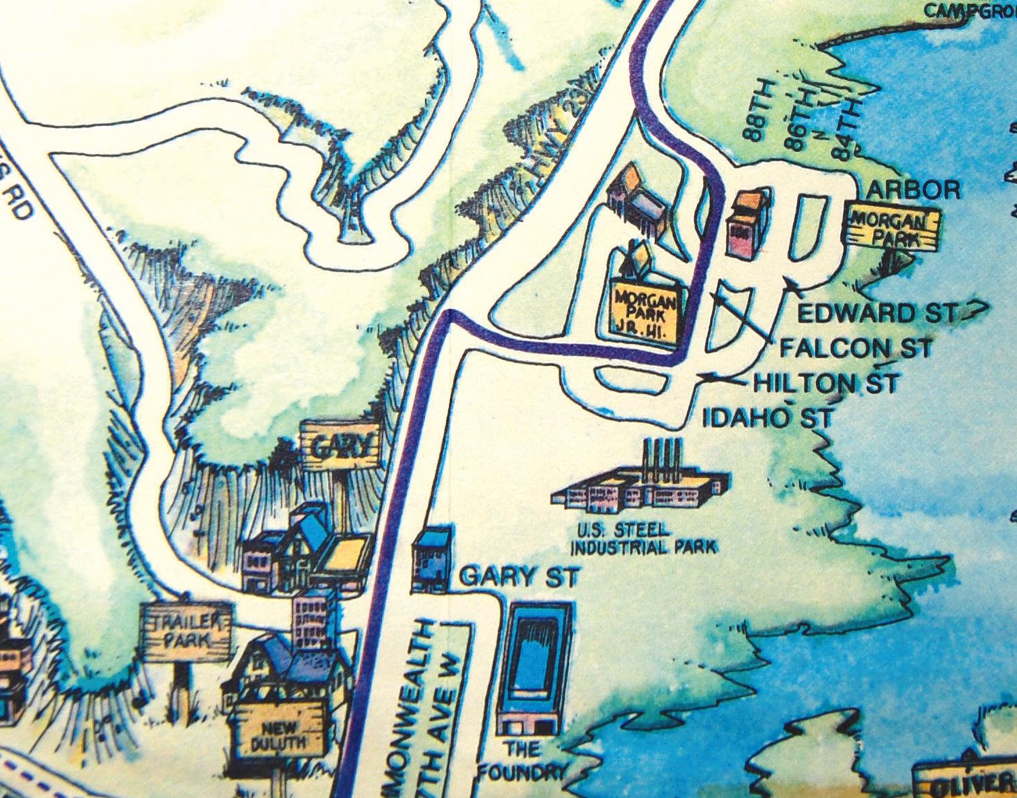
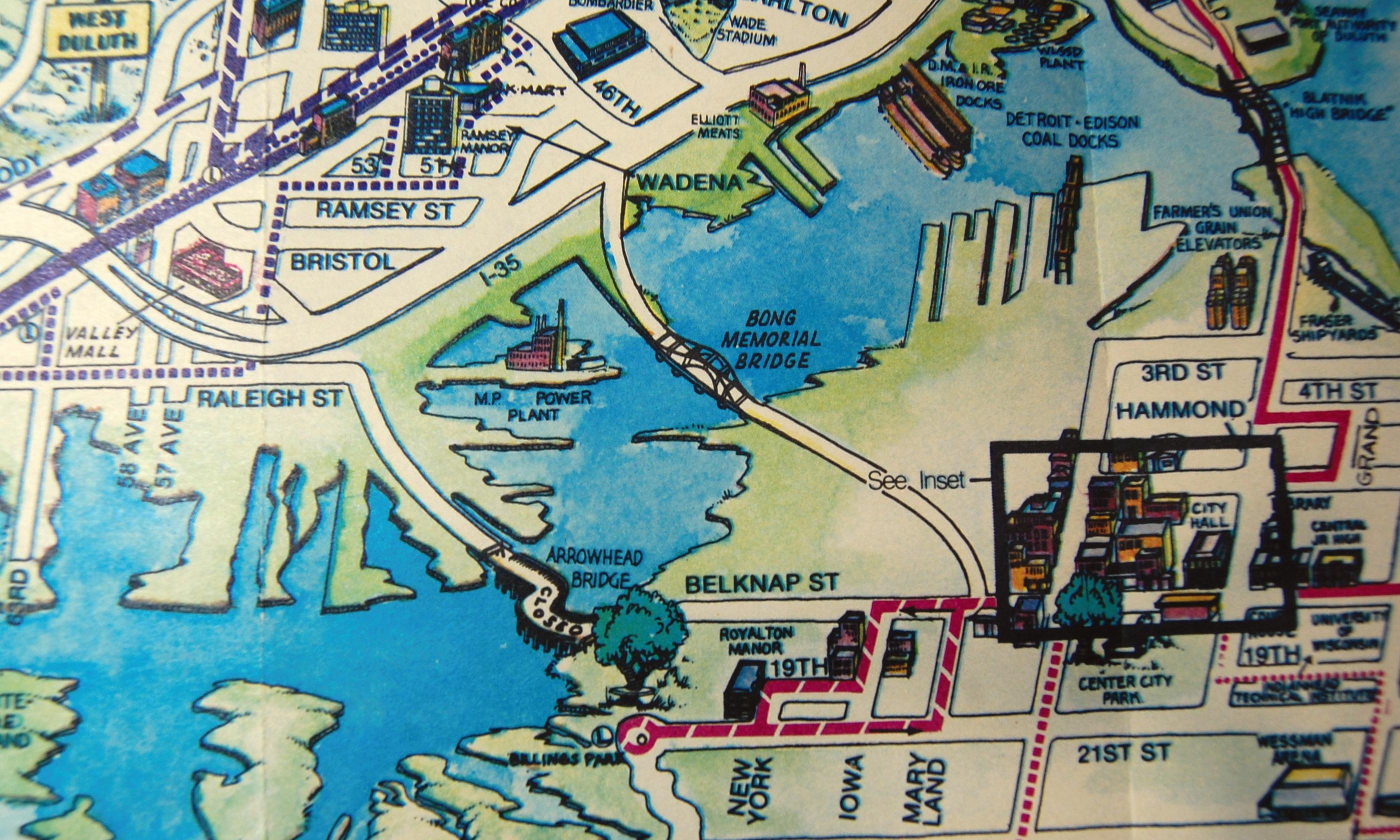
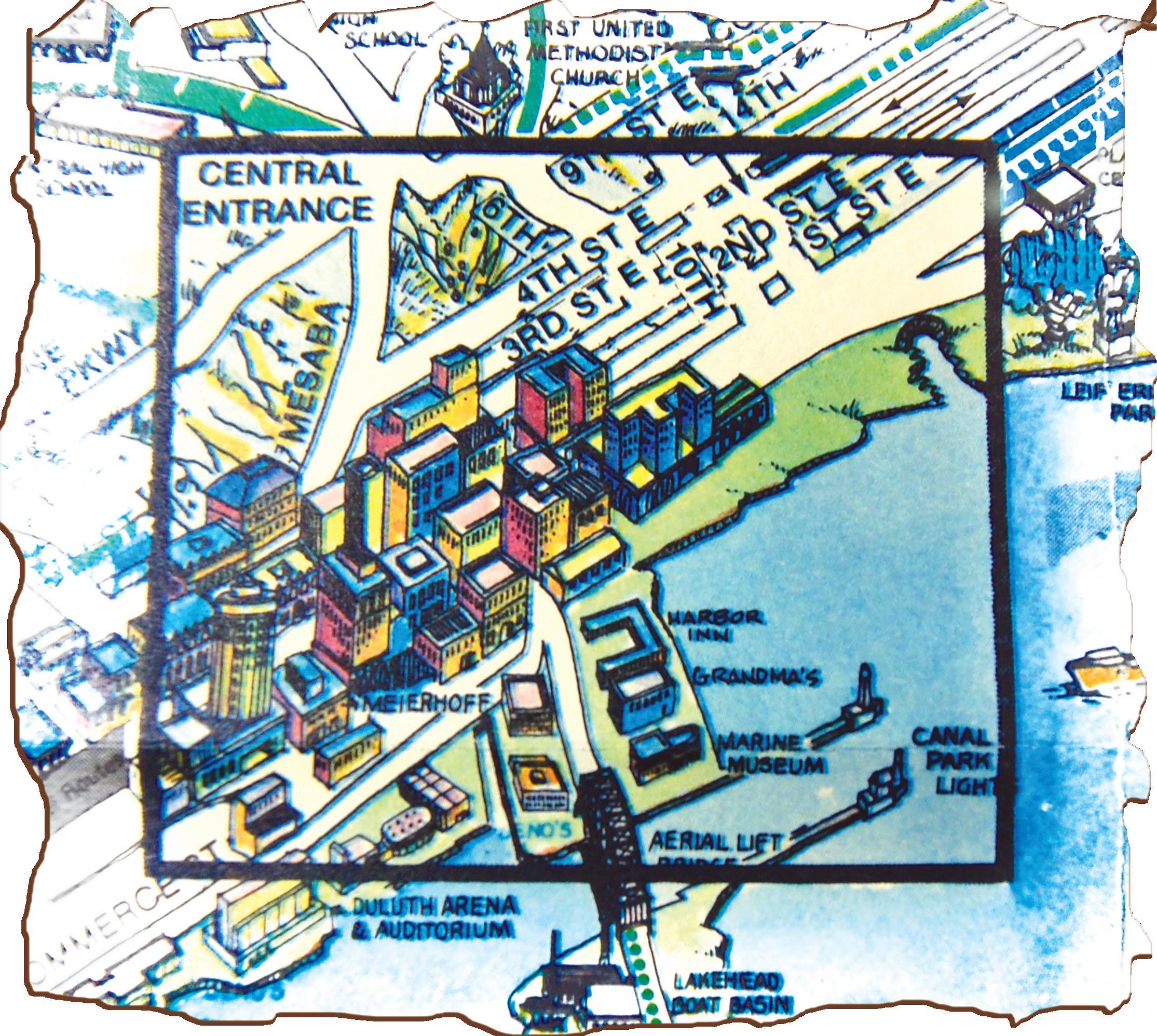
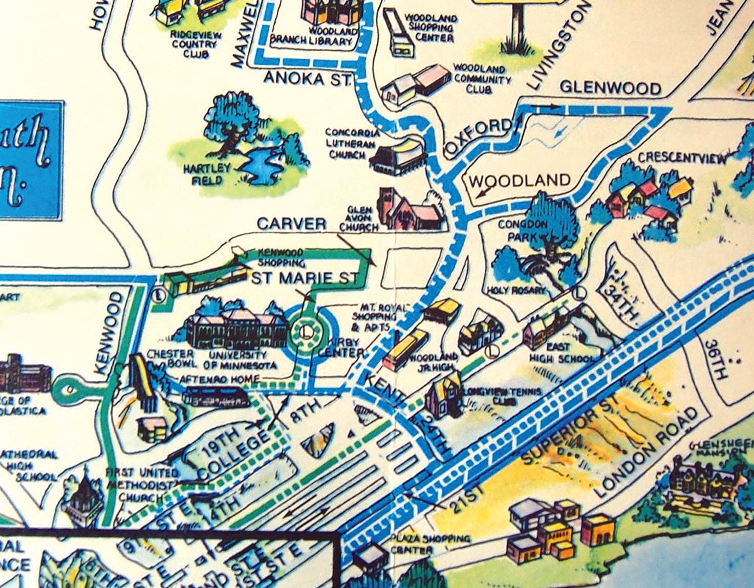
Once I had my new treasure home, I carefully removed it from the frame to get a better look. I discovered it had been trimmed to fit the frame, and with it, any reference to a year or artist. It became a puzzle for me to solve, images from the past jumping out to help settle on a date: Marshall High School is labeled Cathedral (renamed in 1987), and the Elliot Meat Packing Company in Lincoln Park still looks to be in operation (closed in 1984). Both Grandma’s Restaurant (opened in 1976) and the Marine Museum (built in 1974, now named the Lake Superior Maritime Visitor Center) are in place. continued on page 6 continued from page 5
The most obvious clue is the presence of both the Richard I. Bong Bridge and the rickety old Arrowhead Bridge just upstream, marked on the map as closed. The Arrowhead Bridge closed to traffic the same day the Bong opened in October of 1984, its center span dismantled by March 1985. Which means the map — which shows a complete, but closed bridge — probably was drawn in late 1984 or early 1985.
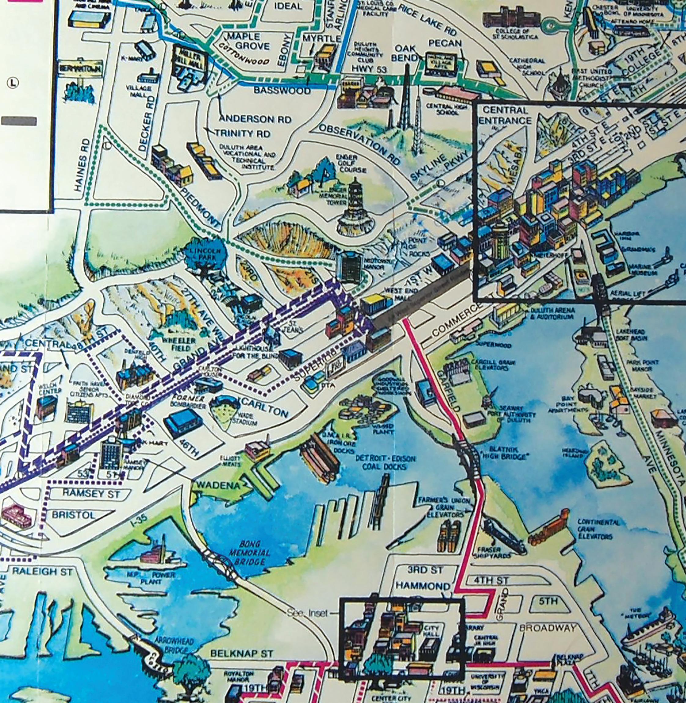
Heath Hickok, director of marketing of the Duluth Transit Authority, agreed. “Another clue is the DTA began its Port Town Trolley service in 1984, and it’s advertised on the back of the map,” he said. He said he hasn’t seen this map before, but recognized the style as one from a bygone era. Route maps created during this time often were hand-drawn, so it was common to fill in the empty spaces with drawings of landmarks, such as this map’s addition of Enger Tower, Spirit Mountain and Hawk Ridge.
“Today, our maps tend to focus more on functionality and are created directly from Geographic Information System software,” Hickok said. He layed out the DTA’s current route map for comparison, bright and bold — eye-catching, even — but generally devoid of landmarks. “The simplicity makes it easier for a person to plan their correct bus route,” he said. We agreed the modern version is much easier to read, even if it’s missing some of the charm and whimsy of the 1980s era map.
We admired some of the lost landmarks on the map, then marveled at how little has changed. The route list on the back of the old map claims 22 routes, similar to today’s 24. Though the number of routes hasn’t changed much, many have grown and evolved to meet Duluth’s changing needs. The DTA just added five new routes, for example, servicing areas not even shown on the 1980s map, such as the new Route 20, which runs from downtown to the airport, stopping at United Healthcare on Rice Lake Road along the way.
“I look at this old map,” Hickok said, “and I see a snapshot of Duluth from 30 years ago. It makes me hope that 30 years from now, someone will discover today’s route map and find it holds just as many memories.”
Kathleen Murphy is a Duluth freelance writer who enjoys a good sale and anything Duluth.