2 minute read
Regional Profile


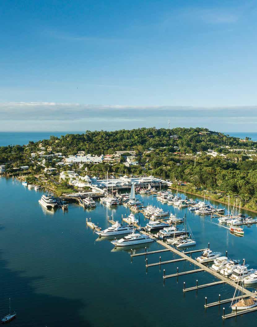
Shire profile
Located just a short drive north of Cairns, Douglas Shire covers an area of 2,445 square kilometres featuring the world’s best natural beauty from Wangetti in the south to the Bloomfield River in the north. Douglas Shire’s unique positioning between the World Heritage Listed Wet Tropics Rainforest and the Great Barrier Reef have made the region a world-class tourism destination.
Advertisement
Tourism is the cornerstone of the region’s economy and the largest employing industry in Douglas Shire, supporting 2,596 jobs and injecting more than $611 million per year into the local economy. In addition to the Shire’s iconic sugar cane industry, the region also boasts unique export potential of tropical fruits, seafood, and indigenous foods.
Douglas is home to over 12,000 residents, with almost 60% living in the two main population centres of Port Douglas and Mossman.
Port Douglas is the tourist gateway to the region, while Mossman is the administrative, health, industrial and agricultural hub. Other principle urban centres include the beachside communities of Wonga Beach, Newell Beach and Cooya Beach. The remaining residents live in decentralised communities scattered along the 100km stretch of coast road; tucked into the rainforest or in small rural townships in the valleys of the Shire’s hinterland.
History of the Shire
The First Peoples of the Douglas region are the Kuku Yalanji whose country extends from the Mowbray River in the south to Cooktown in the north and Palmer River in the west. From the Mowbray River, south to Cairns are the traditional homelands of the Yirrganydji people. The Kuku Yalanji and Yirrganydji are rainforest people whose connection to the region extends back 50,000 years to be among the earliest human occupants in Australia.
European habitation in the Douglas Shire began in the 1870s as George Elphinstone Dalrymple led the first extensive exploration of the region. Dalrymple thought the country “surrounded by a panorama of great beauty … a perfect picture of rich tropical country”. Within the decade gold miners supplied from Port Douglas, timber cutters logging the much-prized red cedar, cattle graziers, and farmers of vegetables, maize and sugar had all begun to make their mark. Farming expanded along the coastal belt as extensive areas of lowland rainforest were cleared and settlements were established throughout the area.
Cultural diversity is integral to Douglas Shire’s history. According to the 1886 census, almost two-thirds of the district’s population were of Chinese heritage. By the 1890s, the sugar cane industry depended on Chinese and South Sea Islander (Kanaka) labour. These populations were joined by Hindu, Punjabi and Japanese migrants in the 1900s.
The Shire of Douglas existed as a local government entity from 1880 until 2008 when it was amalgamated with Cairns City to create the Cairns Regional Council. Five years later, Queensland Minister for Local Government granted residents a poll in which a majority of electors (57.61%) voted in favour of de-amalgamation. The Douglas Shire Council started for the second time on 1 January 2014 with a new Mayor and four new non-divisional Councillors.
DOUGLAS SHIRE
Image Credit: Tourism Tropical North Queensland


