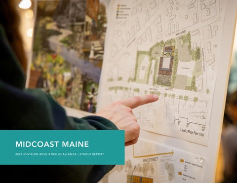
MIDCOAST MAINE 2025 ENVISION RESILIENCE CHALLENGE | STUDIO REPORT
MIDCOAST MAINE 2025 ENVISION RESILIENCE CHALLENGE | STUDIO REPORT
2025 Envision Resilience Challenge Studio Report Published May 2026 Prepared by Envision Resilience Curated by Sandra Akufo Front cover photo by Angie Devenney Copy edited by Julie Bogart
© 2026 Envision Resilience All rights reserved. This publication, including all images, graphics, student work and written content, is the property of Envision Resilience or its licensors and is protected under applicable copyright law. No part of this report may be reproduced, republished or transmitted without the prior written permission of Envision Resilience. Disclaimer: All scenarios, conceptual sketches, analyses and opinions contained in this report reflect the views of third parties. They are provided for illustrative and educational purposes only. No representation, warranty or guarantee of accuracy, completeness or fitness for any particular purpose is made or implied. This report does not constitute engineering, architectural or other professional advice and is not intended to be used as a basis for planning, investment, permitting or other decisions.
This report is the outcome of the 2025 Envision Resilience Midcoast Maine Challenge, a multidisciplinary and multi-university design studio addressing the urgent challenges related to climate change in Bath and Harpswell, Maine. Graduate and undergraduate students studying architecture, urban planning, public art and landscape architecture partnered with local stakeholders through an iterative process that produced speculative designs for adapting neighborhoods, parks, businesses and waterfronts to mitigate rising sea levels, address housing challenges and tackle other stressors related to a warming planet. This document compiles the research, design strategies, interventions and community-informed visions that blend environmental resilience with social equity, cultural heritage and economic vitality.
TA B L E O F C O N T E N T S
INTRODUCTION A Letter From Our Director About Envision Resilience
03 05
THE CHALLENGE Land Acknowledgement 2025 Challenge Timeline Challenge Brief Sites of Study Site Visits Site Research & Mapping
11 13 15 17 23 25
COLLABORATORS University Partners Expert Contributors Community Engagement
49 55 59
STUDENT WORK Place-Based Design Design Proposals Public Exhibitions
63 65 141
CONCLUSION Looking Back Acknowledgements
147 149
APPENDIX Envision Resilience Team Glossary of Terms Additional Information
153 155 157
INTRODUCTION
The future is built in the present, through conversation, creativity and community. The Envision Resilience Challenge understands how to bridge the gap between today and 10 years from now by connecting up-and-coming practitioners with communities facing real-world climate challenges. Bringing people together—from different backgrounds and disciplines—is how we can spark fresh ideas and achieve the promise of a resilient future. — Wendy Schmidt Founder, Envision Resilience
A LETTER FROM OUR DIRECTOR Design thinking is an integral and necessary step in the generative process of tackling climate’s biggest challenges. Architects, landscape architects, planners, urban designers and artists—particularly students of these disciplines—are adept at showing us the tools, surfacing local knowledge and ideating on visions for adaptive and resilient communities. By way of this studio report, we invite you to explore how designers can embrace climate change in the built and unbuilt environment with creativity, care and responsibility. We encourage you to step into these design renderings, developed by students for the Midcoast towns of Bath and Harpswell, as if they were in your own backyard, favorite park or neighborhood. As part of the 2025 Envision Resilience Midcoast Maine Challenge, local leaders embraced the notion of visionary yet practical solutions developed in collaboration with graduate and undergraduate students who were both local and “from away.” Faculty leads offered systems thinking research and innovation, encouraging students to think big and bold. Their ideas were grounded in local Maine solutions and stories, from site visits to Mainebased TimberHP and the University of Maine’s Advanced Structures and Composites Center to community fisheries meetings and boat rides with Harpswell’s harbormaster. Throughout this report you will find brilliant examples of student visions infused with community candor. Nature-based solutions celebrate Harpswell’s rich fishing heritage, while flood infrastructure reimagines how Bath might think about parking downtown in a way that simultaneously manages stormwater. From native planting choices that serve as natural barriers of resistance and Maine-sourced wood fiber insulation, to greenways that increase multimodal access and enhance ecological functions and the 3D printing of accessory dwelling units (ADUs), student teams leaned into the practical and local notion of reciprocity. But perhaps just as important, if not moreso, you will find stories of connection, moments of shared visioning and hope for a future that is adaptive and beautiful. Collectively, we have the solutions. And as we reflect on five years of programmatic work throughout the Northeast, we feel more galvanized and hopeful than ever. To the students and faculty, thank you for inspiring all of us to imagine resilient pathways forward. And to the communities of Bath and Harpswell, thank you for trusting us with this process and daring to imagine a more resilient future.
Claire Martin Executive Director, Envision Resilience
03
A LETTER FROM OUR DIRECTOR
A LETTER FROM OUR DIRECTOR
04
ABOUT ENVISION RESILIENCE MISSION Envision Resilience works to advance innovative planning and design in the face of climate change through student and community partnerships. By connecting current and future professionals working across disciplines, the organization creates opportunities for communities to reimagine climate challenges and inspire resilient solutions. Envision Resilience, founded by Wendy Schmidt, is part of the philanthropic organizations and initiatives created and funded by Eric and Wendy Schmidt to work toward a healthy, resilient, secure world for all.
ENVISION RESILIENCE CHALLENGE The signature program of Envision Resilience, the Envision Resilience Challenge is an annual place-based, multi-university design studio that takes place in communities at the forefront of climate challenges. Graduate and undergraduate students studying architecture, urban planning and landscape architecture partner with communities to produce speculative designs for adapting neighborhoods, parks, businesses and waterfronts in the face of climate change. With each new Challenge, Envision Resilience has addressed the pressing environmental issues facing communities— from rising seas and increased flooding, to transportation and access, housing and food security. As Envision Resilience Challenge alumni step into the professional world, they bring with them the experience of designing in community—collaborating with residents, thinking across disciplines and shaping a more optimistic, adaptive future.
05
ABOUT ENVISION RESILIENCE
STUDENT & COMMUNITY PARTNERSHIPS
In 2020, Remain launched the inaugural Envision Resilience Challenge on Nantucket as a response to the increase in rising sea levels. Founded in 2008 and funded by Wendy Schmidt and her husband Eric, Remain supports the local economy, community and environmental vitality of the island of Nantucket. The Envision Resilience Challenge was developed with the belief that visions of a more resilient future could inspire the Nantucket community to think differently—perhaps more optimistically—about living with more water. More than five years, 20 university partners and 500 students later, the program has grown into its own organization, powered by an expanding network of resilient designers, planners, local leaders, residents and practitioners. The 2025 Envision Resilience Midcoast Maine Challenge, inspired by forward-thinking leadership and progressive efforts that demonstrate the vision and action needed to create a more resilient future, marked the fifth year of programming.
Following a year of groundwork by Envision Resilience as well as a faculty site visit in June 2025, students spent the fall 2025 semester immersing themselves in the culture, values and history of Bath and Harpswell, Maine, developing innovative designs that addressed challenges such as coastal flooding, working waterfront vulnerability, housing scarcity, food systems, infrastructure resilience and ecosystem health. These design proposals were then presented to the community through a series of exhibitions, programming and public engagement. The depth of research behind the student designs reflects the leadership of local stakeholders advancing long-term planning efforts, as well as the time and insight generously shared with students by Midcoast Maine communities.
ABOUT ENVISION RESILIENCE
06
CHALLENGE HISTORY & OVERVIEW When the Envision Resilience Challenge launched on Nantucket in the winter of 2021, with myriad COVID-19 constraints, it was intended to be a one-year program. But across 14 time zones— guided by the wisdom of the leading faculty of practice and inspired by the Town of Nantucket and its ambitious island-wide coastal resilience plan—students seized the opportunity to connect deeply with a community in the midst of tackling climate change head on. Students were encouraged to think beyond current policy and zoning regulations and instead produce speculative designs for what a future Nantucket might look like. Design concepts reimagined public spaces with a focus on green infrastructure and native ecology, housing on the water’s edge that accommodated multigenerational living and key transportation corridors that reroute heavy traffic to accommodate increased water. Some students even considered the adaptive reuse of the downtown oil tanks as well as thoughtful retreat and returning land to nature in vulnerable locations. From Nantucket, the model was then brought to Narragansett Bay, Rhode Island (2022), New Bedford and Fairhaven, Massachusetts (2023) and Portland and South Portland, Maine (2024).
2021 NANTUCKET
07
2022 NARRAGANSETT BAY
2023 NEW BEDFORD & FAIRHAVEN
ABOUT ENVISION RESILIENCE
2024 PORTLAND & SOUTH PORTLAND
2025 MIDCOAST MAINE
CHALLENGE PROGRAMMING
CHALLENGE BRIEF
SPEAKER SERIES
Phase I starts 10 to 12 months before the fall design studio begins. The team is on the ground listening, learning and building relationships with key stakeholders and community members. This process results in a Challenge Brief—a set of problem statements and guiding principles circulated as a call for proposals.
The Envision Resilience Speaker Series brings renowned experts to deliver inspiring and informative lectures on climate resilience through the lens of everything from finance and historic policy to human dynamics and decision-making. Lectures are open to teams and students and recordings are publicly available.
COMMUNITY PARTNERS
MIDTERM & FINAL REVIEWS
Throughout the stakeholder outreach, a community advisory group is assembled—local leaders who can speak to the issues facing the community, as well as the values, culture and history of that community, that are essential to the integrity and applicability of design outcomes. They also provide professional development experience for students.
The early research and partnership building that the Envision Resilience team does allows the student teams to dive in deep early in the semester. Envision Resilience serves as the liaison to community members, facilitates site visits and funds studio stipends for travel, materials and research. This is in addition to a curriculum that includes access to a resource library, expert speakers and a final jury of practitioners.
FACULTY WORKSHOPS Phase II is the design studio itself, kicking off with a faculty workshop on site. The Envision Resilience team coordinates site visits, community meetings and workshops for faculty to finesse site selection and research proposals and build their own relationships with the community in advance of student site visits.
The program gives design students the opportunity to work across disciplines and across universities, tackle real-world challenges and gain professional development in design and planning. Fostering the next generation of thought leaders, designers and planners to think differently and more holistically about adaptation and climate challenges is a key pillar of the work.
SITE VISITS
PUBLIC EXHIBITIONS
Envision Resilience funds travel and accommodation for each participating university team to visit the site, meet with key stakeholders and community partners, experience the local community and ground-truth their research. Convening multiple university teams at once allows for networking and cross-university collaboration.
Phase III occurs when the student design thinking and research is rolled out to the community through a series of exhibitions. Public art is a core pillar of the work in storytelling about adaptive design in the face of climate change. This has been done through a light installation, murals and an exhibition of artists telling the story of resilience through curated pieces.
ABOUT ENVISION RESILIENCE
08
THE CHALLENGE
I love that you recognize resiliency as essential in the context of climate change. We as human beings caused these problems, so we must also be part of the solution.
— Tom Chung Principal, Leers Weinzapfel Associates
LAND ACKNOWLEDGEMENT The Envision Resilience Challenge sites to date are traditional territory of the Maliseet, Mi'kmaq, Narragansett, Nauset, Passamaquoddy, Penobscot, Pokanoket, Tommokomoth, Wabanaki, Wampanoag and other Algonquian-speaking peoples. We pay respect to their communities of past, present and future. The Indigenous Knowledge Systems Initiative (IKSI) was initiated in 2023 as part of the Envision Resilience Challenge Design Studio curriculum to respectfully acknowledge Indigenous historical and contemporary ties to the sites of study. IKSI resources include the Envision Resilience Tribal Land Acknowledgement, the IKSI Tribal Land Acknowledgement Syllabus and the IKSI Working Syllabus for each Challenge site. IKSI supports Indigenous knowledge and Native science, alongside western resources, as a vital body of knowledge and partners with Indigenous designers in the fields of architecture and landscape architecture. As architects, planners, designers and visionaries of built environments, it is contextually relevant and imperative to include the Indigenous peoples’ history with sites of built and unbuilt projects. Understanding the Indigenous and colonial heritage of the Envision Resilience Challenge sites restores and enriches each site’s identity and further informs designers to create site-specific solutions reflective of its community, history and land. Acknowledging the inherent relationship tribes have with their landbase and being aware of the current tribal context actively supports tribal sovereignty and generates awareness of ongoing ramifications of Challenge sites’ colonial history. We seek to protect the common ground and work toward informed climate solutions for all communities, including tribal communities.
11
LAND ACKNOWLEDGEMENT
“Designing adaptive solutions to a changing climate requires considering knowledge systems upbuilt over a millennia, reevaluating our relationship to the environment and shifting our understanding of what we can offer sites and communities today.” — Anjelica S. Gallegos Advisor, Envision Resilience
LAND ACKNOWLEDGEMENT
12
2025 CHALLENGE TIMELINE The Envision Resilience Challenge is a community engagement and design studio initiative spanning more than 18 months that includes three distinct phases of programming.
Spring 2025 University selection and faculty workshop on site in Bath and Harpswell
Winter 2024 to 2025 Community partner cohort assembled
OCTOBER 2024
Fall 2024 Research, stakeholder outreach and community engagement
PHASE I
13
2025 CHALLENGE TIMELINE
Winter 2025 Challenge Brief and call for proposals circulated
March 2026 Multi-month exhibition of adaptive proposals for Bath and Harpswell, “Envision Resilience: Designs for Living in a Changing Climate,” opens at Bowdoin College’s Schiller Coastal Studies Center in Harpswell
Summer 2025 Fall semester begins and design studio kicks off
March 2026 Exhibition opening at Union + Co in Bath
December 2025 Final jury review of design proposals by leading practitioners
AUGUST 2026 October 2025 Midterm jury review of research and design process by community partners
Fall 2025 Site visits and community workshops in Maine in combination with virtual speaker series
Spring 2026 Student design thinking and research is rolled out to the community through a series of exhibitions held throughout Bath and Harpswell at Patten Free Public Library, Orr’s Island Library, Cundy’s Harbor Library and Union + Co
March 2026 Exclusive networking program for Envision Resilience Challenge students and faculty at the Maine Maritime Museum in Bath
PHASE III
PHASE II
2025 CHALLENGE TIMELINE
14
CHALLENGE BRIEF The 2025 Envision Resilience Midcoast Maine Challenge called on multidisciplinary student teams of architects, landscape architects, planners, engineers, environmental scientists and artists to reimagine the coastal communities of Bath and Harpswell and propose creative, place-based responses to the evolving impacts of climate change. These include coastal flooding, warming waters, habitat loss, pressures on working waterfronts, housing scarcity, infrastructure vulnerability and shifting local economies. All design strategies were expected to address the natural, ecological, social and built environments as interconnected systems, drawing from Maine’s Climate Action Plan, Maine Won’t Wait, and local planning efforts while engaging directly with the region’s maritime heritage, material practices and community priorities. Increasing storm intensity, sea level rise and ecological change are compounded by challenges including sustaining fisheries and aquaculture, supporting workforce and affordable housing, strengthening regional connectivity and protecting critical coastal and inland habitats. The Challenge Brief posed questions including: How can Midcoast communities adapt to climate change while sustaining their working waterfronts and cultural identities? How can design support resilient local economies rooted in fishing, shipbuilding, agriculture and tourism? How might nature-based systems and adaptive reuse strategies reshape relationships between land, water and infrastructure? How can interdisciplinary design approaches help small coastal towns balance growth, equity and environmental stewardship?
15
CHALLENGE BRIEF
THEMATIC AREAS The Challenge Brief’s call elicited student work that addressed a diverse array of pressing environmental challenges shaping the regions of Bath and Harpswell, Maine. These student design interventions and studio approaches can be arranged and organized into the following six broad thematic focus areas.
HOMES THAT SUPPORT COMMUNITY
REIMAGINED COASTLINES & SHORELINES
COMMUNTITY IDENTITY & CULTURAL HERITAGE
RESILIENT INFRASTRUCTURE
LIVING WITH NATURE
LEARNING BY DOING
CHALLENGE BRIEF
16
SITES OF STUDY BATH & HARPSWELL Shaped by a shared dependence on the coast yet distinct in character, Bath and Harpswell reflect two interconnected expressions of Midcoast Maine’s maritime identity—one rooted in industrial shipbuilding along the Kennebec River, the other in dispersed island communities sustained by fishing and aquaculture. Together, they embody the cultural, economic and ecological relationships that define the region’s working waterfronts. In Bath, historic shipyards and emerging development pressures sit alongside increasing risks from sea level rise, storm surge and inland flooding driven by river systems and extreme precipitation. Opportunities such as the adaptive reuse of former industrial sites and the redesign of key corridors as green and blue infrastructure point to new ways of integrating resilience into the urban fabric.
However, planned housing expansion and workforce growth introduce questions of connectivity, affordability and how new development can reinforce the city’s identity. In Harpswell, an expansive and highly exposed coastline faces erosion, warming waters and the vulnerability of critical access roads, boat landings and coastal infrastructure. Nature-based approaches such as living shorelines and marsh restoration offer potential to stabilize edges while maintaining access for fishing and aquaculture industries. Preserving the town’s scenic character while adapting to increasing environmental pressures remains a central challenge. Across both communities, climate impacts are closely tied to housing availability, workforce needs and the long-term viability of marine-based economies. As these pressures intensify, Bath and Harpswell highlight the urgency, and opportunity, of rethinking how coastal towns adapt. From reimagining underutilized waterfront sites and strengthening ecological systems to preserving access for fishermen and supporting year-round communities, both places point toward futures that balance resilience, livelihood and identity in the face of a changing climate.
17
SITES OF STUDY
“It was a joy to have the students bring their energy to Bath. Their ideas were uninhibited and creative, totally unafraid of big challenges! We’re excited to watch the seeds they’ve planted take root and catalyze our future planning conversations.” — John Zittel Co-Chair, Bath Climate Action Committee
SITES OF STUDY
18
A CLOSER LOOK
BATH’S HOUSING
As Midcoast Maine’s coastal communities navigate the increasing pressures of climate change alongside evolving local economies and development patterns, Bath and Harpswell are poised for adaptation. The following sites and systems were identified for design studio teams as opportunities to explore adaptive, placebased and resilient futures.
Housing demand in Bath is increasing alongside the expansion of Bath Iron Works, raising questions about affordability, workforce needs and long-term livability. Planned development along the Congress Avenue corridor offers an opportunity to rethink how housing connects to open space, mobility and community life. How can new housing support both growth and identity in Bath?
BATH With a legacy rooted in shipbuilding and a working waterfront along the Kennebec River, Bath has long been shaped by its relationship to industry and water. Today, the city faces a new set of questions: How can Bath adapt to rising seas and stronger storms while sustaining its economic base? What does growth look like in a city balancing workforce expansion, housing needs and historic identity? How can Bath evolve without losing what defines it?
BATH WATERFRONT Bath’s waterfront sits at the intersection of industry, ecology and public life, with access to both the Kennebec River and Merrymeeting Bay. As sea levels rise and storm events intensify, critical infrastructure and historic sites face increasing vulnerability. Opportunities such as the Stinson Cannery—a former shipyard and sardine facility—present potential for adaptive reuse as hubs for marine innovation, research and community. Beyond individual sites, Bath’s urban fabric offers opportunities to rethink water management. Corridors such as Elm and Water Streets could be transformed into “green/blue fingers,” channeling stormwater through integrated landscapes that connect upland areas to the harbor. These systems could simultaneously manage flooding, improve ecology and create new public spaces that strengthen ties between neighborhoods and the waterfront.
19
SITES OF STUDY
HARPSWELL
HARPSWELL WATERFRONT
Defined by its peninsulas, islands and working waterfronts, Harpswell is deeply connected to the ocean. Fishing, lobstering and aquaculture remain central to daily life, but the town’s geography also makes it especially vulnerable to climate change. As sea levels rise and storms intensify, what does it mean to sustain a “working waterfront community”? How can Harpswell preserve access, livelihoods and identity while adapting to a changing coastline?
Harpswell’s extensive coastline—stretching across Bailey Island, Orr’s Island and Harpswell Neck—is both its greatest asset and its greatest vulnerability. Key infrastructure, including boat landings, working waterfronts and access roads, is increasingly impacted by king tides, erosion and storm surge. Nature-based strategies such as living shorelines and marsh restoration offer opportunities to stabilize coastal edges while maintaining access for fishermen and aquaculture industries. Priority sites including Mitchell Field, Potts Point and Bailey Island provide testing grounds for these approaches, where ecological resilience and economic activity must coexist. How can shoreline design support both habitat restoration and the continuity of marine-based livelihoods?
HARPSWELL ACCESS & IDENTITY Harpswell’s dispersed geography presents challenges of access, connectivity and equity across its islands and peninsulas. Maintaining reliable connections between communities, waterfronts and services is essential, particularly as climate impacts intensify. At the same time, preserving the town’s scenic character and cultural identity remains critical. Sites such as Stover’s Point and Long Reach Preserve illustrate how these priorities can come together—offering opportunities to thoughtfully integrate recreation, education and habitat protection. How can Harpswell strengthen access for residents and visitors while safeguarding the qualities that define it? And how can design support year-round communities that remain rooted in place while adapting to environmental change?
SITES OF STUDY
20
ON THE MAP: BATH Challenge participants at the Maine College of Art & Design, Northeastern University, University of Maine at Augusta and the University of Massachusetts Amherst focused largely on areas within Bath, including its downtown and the city’s north and south ends. More specifically, students zeroed in on a variety of sites, including but not limited to: Hyde Park, Midcoast Youth Center & Skate Park, Chocolate Church Arts Center, Kennebec River, Stinson Cannery, Morse High School and the Bath waterfront.
21
SITES OF STUDY
ON THE MAP: HARPSWELL Challenge participants at the University of Virginia focused their site investigations and design proposals exclusively on Harpswell. Some students at the Maine College of Art & Design also based their projects in the town. Together, these efforts reflect a concentrated engagement with Harpswell’s coastal and community landscapes. In Harpswell, students explored interventions across a range of sites, including Garrison Cove, Anna Tondreau Preserve, Johnson Field Preserve, Cundy Harbor Wharf and Mitchell Field.
SITES OF STUDY
22
SITE VISITS For the 2025 Envision Resilience Midcoast Maine Challenge, participating university teams conducted a series of site visits across Bath, Harpswell and surrounding coastal communities to better understand the region’s environmental, economic and social context. This included visits to material production spaces, municipal facilities, community-based organizations, public spaces and more.
SITE VISIT SPOTLIGHT: TIMBERHP Northeastern University students traveled to Madison, Maine to visit TimberHP, a manufacturer of renewable, recyclable and carbon-sequestering wood fiber insulation. Located in a revitalized former paper mill, TimberHP is the first domestic producer of wood fiber insulation in North America. Students toured the factory and assembly operations while also engaging with regional partners including OPAL Architecture and NotchSB. This visit played a critical role in shaping the material strategies of their eventual design proposals.
23
SITE VISITS
SITE VISITS
24
SITE RESEARCH & MAPPING GETTING THE LAY OF THE LAND DIAGRAMS
MAPS
Students synthesized their research into a series of diagrams that clarified complex relationships across Bath and Harpswell. These visual studies distilled layered information—ecological processes, risk factors and social dynamics—into clear, readable frameworks. Diagrams became tools for both understanding and communication and allowed students to highlight key patterns and reveal connections that might otherwise go unnoticed. By working with diagrams, students could test ideas and communicate insights efficiently. The diagrams provided a shared language for students to discuss challenges and potential strategies.
Students explored Bath and Harpswell through a wide range of maps, visualizing complex systems and identifying areas of vulnerability, opportunity and change. From large-scale regional analyses to fine-grained neighborhood studies, the maps became essential tools for discovery and collaboration. They helped students see patterns across ecological, social and built environments. By translating data into visual form, the maps informed discussion and decision-making. These exercises shaped how students interpreted the site. Maps guided the development of place-based design strategies throughout the semester.
MODELS & MEDIA
SKETCHES
Physical models and research films allowed students to translate their learnings of Bath and Harpswell into tangible and narrative forms. Across schools, models became hands-on tools for testing spatial concepts related to water, land and built structures, while films captured lived conditions, local knowledge and community dynamics. Working through these approaches encouraged iterative thinking and collaboration among peers. Together, they offered alternative ways to explore potential interventions in both concrete and experiential terms. These processes revealed possibilities that may be overlooked in drawings alone.
Sketches offered students a way to observe and interpret the unique character of Bath and Harpswell firsthand. Quick field studies and more detailed explorations allowed them to document forms, patterns and relationships on site. These drawings became essential tools for visual thinking, helping students translate observations into spatial understanding. They also supported discussion and reflection within the studio. By working directly with hand-drawn sketches, students could refine their perceptions of the environment. Sketching encouraged an attentiveness to detail that informed every subsequent design decision.
The Site Research & Mapping section features selected samples of work and does not capture the full breadth of university activities.
25
SITE RESEARCH & MAPPING
In studio, University of Virginia students pin up a wide range of maps and visualized field research to explore and analyze site context.
SITE RESEARCH & MAPPING
26
SITE RESEARCH & MAPPING: NORTHEASTERN UNIVERSITY
WATERSHED MAPS (PP. 28–30) Northeastern University’s studio used watershed maps to trace the Kennebec River from upland forests to coastal communities, linking regional systems to local conditions. The maps layer hydrology, infrastructure and development patterns to show how upstream land use, dams and corridors influence downstream flood risk, framing design decisions within a connected ecological system.
SITE MODELS (PP. 31–32) Students fabricated models that explored how their design proposals interact with topography, water and the existing urban fabric. Using layered materials and iterative studies, they tested flood pathways, grading and building placement.
ECOLOGICAL DIAGRAMS (PP. 33–34) These ecological diagrams map relationships between species, habitats and shifting salinity zones from river to forest. Some track migratory fish, wildlife and food webs to show how climate change alters habitat ranges. These diagrams highlight ecological interdependence and inform design strategies that support biodiversity and adaptive landscape connections.
VULNERABILITY MAPS (PP. 35–38) By combining sea level rise, heat and income data, these vulnerability maps reveal overlaps between environmental exposure and social vulnerability, helping prioritize equitable, targeted resilience strategies for neighborhoods and critical infrastructure.
27
SITE RESEARCH & MAPPING
HUMAN & WATER CORRIDORS Faith Nguyen
PREDOMINANT MATRICES OF THE KENNEBEC WATERSHED Richard Pinch
SITE RESEARCH & MAPPING
28
CORRIDORS & ANCHORS Joseph Quan
29
THE KENNEBEC RIVER WATERSHED Lillian Smeraldo
SITE RESEARCH & MAPPING
KENNEBEC RIVER DEVELOPMENT Sabiha Miahjee
WATERSHED LAND COVER & STREAMS Celia Osborn
SITE RESEARCH & MAPPING
30
WATERFRONT RESILIENT HOUSING Juliana Rodriguez
31
ACCESSORY DWELLING UNITS FOR BATH Marcella Hesser
SITE RESEARCH & MAPPING
OLD MORSE HIGH SCHOOL REUSE & DOWNTOWN BATH SITES Abigail Freshwater, Olive Lewis, Tracy Nguyen & Juliana Rodriguez
SENIOR CO-LIVING Olive Lewis
SITE RESEARCH & MAPPING
32
FOOD WEB DYNAMICS FROM RIVER TO FOREST Kavita Sharma
33
SITE RESEARCH & MAPPING
LOSS OF FRESHWATER-DEPENDENT HABITAT DUE TO SEA LEVEL RISE Sabiha Miahjee
SITE RESEARCH & MAPPING
34
BATH & SITE VULNERABILITY Isabella Bernard
35
SITE RESEARCH & MAPPING
SITE RESEARCH & MAPPING
36
BATH FLOODING RISK & VULNERABILITY Richard Pinch
37
SITE RESEARCH & MAPPING
SITE RESEARCH & MAPPING
38
SITE RESEARCH & MAPPING: UNIVERSITY OF MASSACHUSETTS AMHERST
NARRATIVE FILMS (PP. 39–40) Students from University of Massachusetts Amherst undertook an ambitious, place-based research project centered on Bath, Maine, producing a series of short, exploratory narrative films. Each student delved deeply into a different dimension of the city, examining topics such as Indigenous histories, regional transit networks, working waterfronts and evolving local food systems. The films blend research with storytelling, incorporating interviews, archival materials and on-site footage to capture the layered character of Bath. The accompanying film posters reflect this diversity of inquiry, visually conveying the breadth of perspectives and subjects explored. Together, the collection highlights both the complexity of Bath as a living community and the students’ ability to translate rigorous research into compelling, humancentered narratives. These films demonstrate how an immersive approach can deepen understanding and amplify local voices and lived experiences. Scan this code to watch the narrative films.
39
HILLS TO HARBOR Samantha Solano
THE WAY OF THE WABANAKI Bridget Healy
SITE RESEARCH & MAPPING
RIVER RISING Oriya Falk
THE WAY OF WATER Lia Potter
TICKET TO RIDE Lilly Etlinger
BIG BEAUTIFUL BATH Michael Nevins
LOCALLY SOURCED Nina Fritsch
LAURENTIDE Eileen Heck
VOICES OF THE SHORE Liz Helmin
SHIP’S CRADLE Nick Dombrowski
SITE RESEARCH & MAPPING
40
SITE RESEARCH & MAPPING: UNIVERSITY OF VIRGINIA
SITE MODELS (PP. 42–44) University of Virginia (UVA) students produced a wide range of site models that translate coastal landscapes into precise, tactile forms. From CNC-milled topographies to conceptual assemblies using wood and other materials, these models explore grading, circulation and ecological strategies while testing how design interventions engage terrain, water and community use across scales.
IDEOGRAM (P. 45) Student Harry Grams’s ideogram documents a process of “designing from what is,” grounding investigation in direct observation, memory and lived experience. Through layered sketches, site plans, photographs and resident quotes, the ideogram captures Mitchell Field as both a physical landscape and a cultural place shaped by change. By assembling multiple ways of seeing, the ideogram reflects a site understood through accumulation and interpretation, where meaning ultimately emerges from the overlap of environmental conditions, human stories and evolving landscape systems.
SKETCHES (P. 46) UVA students’ observational sketches capture coastal conditions through careful, on-site drawing. From rocky shorelines and marsh edges to sectional studies of tides and aquaculture infrastructure, these sketches record spatial relationships, material textures and changing water levels. They serve as analytical tools, grounding design work in close attention to place, scale and lived environmental dynamics.
41
SITE RESEARCH & MAPPING
HARPSWELL LANDSCAPE University of Virginia
This model was donated to the town of Harpswell and, at the time of this report’s publication, is housed at the Schiller Coastal Studies Center.
SITE RESEARCH & MAPPING
42
HARPSWELL NECK Nolan Brennan
43
VEGETATIVE CRIBBING Michael John Minutoli
SITE RESEARCH & MAPPING
LOBSTER TRAP MODEL (PLAN) Andie McMann
CIRCULATION STUDY Sara Soba
MITCHELL FIELD AFTER REGRADING Harry Grams
SITE RESEARCH & MAPPING
44
DESIGNING FROM WHAT IS: A PROCESS ROOTED IN PLACE Harry Grams
45
SITE RESEARCH & MAPPING
MITCHELL FIELD & CUNDY’S HARBOR Lila Donahue
COOK'S COVE William Riedlinger
SITE RESEARCH & MAPPING
46
COLLABORATORS
Partnering with Envision Resilience offered the City of Bath an extraordinary opportunity to elevate our climate goals by bringing in fresh academic perspectives and design innovation. Their multidisciplinary student teams helped us reimagine coastal resilience, green infrastructure and community-led solutions that are tailored to our city’s unique maritime heritage and climate challenges. Our community leaders are very grateful to have engaged in this program, and we look forward to working together to translate cutting‑edge ideas into practical, community-driven action. — Rod Melanson Director of Sustainability & Environment, City of Bath
UNIVERSITY PARTNERS MEET THE CHALLENGE PARTICIPANTS THE 2025 COHORT Participants in the 2025 Envision Resilience Midcoast Maine Challenge included local partners University of Maine at Augusta’s architecture program, led by Patrick Hansford, and Maine College of Art & Design (MECA&D), led by Addy Smith-Reiman. Rounding out the cohort was Northeastern University College of Arts, Media and Design (CAMD), led by Sara Jensen Carr, Ph.D., and Michelle Laboy; University of Virginia School of Architecture, led by Michael Luegering and C.L. Bohannon, Ph.D.; and University of Massachusetts Amherst Department of Landscape Architecture and Regional Planning, led by Samantha Solano.
49
UNIVERSITY PARTNERS
MAINE COLLEGE OF ART & DESIGN STUDIO INFORMATION COURSE Public Art Studio | The “P” in Public Art
STUDIO DISCIPLINE(S) Fine Art, Urban Design, Urban Planning
STUDENT TEAM Chandler Fountain, Anna Mayer, Maggie Novatka, Niccole Real, Willow Troise, Sophia White
Addy Smith-Reiman, AICP
MEET THE PROFESSOR For more than 20 years, Addy Smith-Reiman, AICP, has led projects that celebrate local identity, shared history and future use. As the former executive director of the Portland Society for Architecture, she developed design competitions and public programs that engaged a broad audience with land use planning, urban design, and policies that shape the built environment, and is a founding member of BirdSafe Maine, a statewide collaboration to raise awareness about the bird-window collision problem and encourage adoption of available solutions, through research, policy, design solutions, and education. Currently, she is an educator, developing multigenerational programs that introduce participants to planning, architecture and landscape architecture, and is the co-director of the Spatial Design Academy at the University of Southern Maine. She holds a B.A. from Sarah Lawrence College and master’s degrees in regional planning and landscape architecture from Cornell University.
UNIVERSITY PARTNERS
50
NORTHEASTERN UNIVERSITY STUDIO INFORMATION COURSES (1) From Forest to City: Timber Workforce Housing (2) Landscape Ecologies for Coastal Communities
STUDIO DISCIPLINE(S) (1) Architecture (2) Landscape Architecture, Landscape Ecology
STUDENT TEAM
(1) Michelle Laboy, P.E., AIA Assoc. LEED BD+C
(2) Sara Jensen Carr, Ph.D., ASLA
MEET THE PROFESSOR PROFESSORS Michelle Laboy, P.E., AIA Assoc. LEED BD+C is an associate professor of architecture at Northeastern University. She is founding principal of FieLDworkshop, a Boston-based practice focused on regenerating cultural and ecological urban spaces. Trained in engineering, architecture and planning, her work integrates design with infrastructure and sustainability. A two-time AIA Latrobe Prize recipient, she is the author of The Architecture of Persistence (2021) and has presented her research internationally. Sara Jensen Carr, Ph.D., ASLA is an associate professor at Northeastern University whose work explores the connections between urban landscapes, architecture and human health. She is the author of The Topography of Wellness (2021), an award-winning book on how health and disease have shaped American cities. A nationally recognized scholar, her work has been featured in major media outlets, and she collaborates with communities, nonprofits and local governments on participatory design and public realm research.
51
UNIVERSITY PARTNERS
Isabella Bernard, Megan Conte, Abigail Freshwater, Marcella Hesser, Natalie Hill, Jonathan Kripke, Anna Levesque, Olive Lewis, Andrew McDonald, Sabiha Miahjee, Sofi Mihajlovic, Faith Nguyen, Minh Nguyen, Tracy Nguyen, Celia Osborn, Julia Park, Richard Pinch, TJ Posillico, Joseph Quan, Jack Resnic, Juliana Rodriguez, Kavita Sharma, Francesca Smith, Hannah Shaw, Alex Sheahan, Lillian Smeraldo, Joshua Wada, Caroline Zidik
UNIVERSITY OF MAINE AT AUGUSTA STUDIO INFORMATION COURSE From Vacationland to Climate Change Haven
STUDIO DISCIPLINE(S) Architecture, Urban Design, Professional Practice (Community Service)
STUDENT TEAM Isaac Austin, Julian Clements, Joshua Cridler, Julia Davidson, Spencer Gibson, Micah LaSalle, Aidan Norton Patrick A. Hansford
MEET THE PROFESSOR Patrick Hansford is an architect, planner and educator. Originally from Troy, Ohio, he completed his undergraduate studies at Bowling Green State University and earned a master’s degree in architecture from Miami University in Ohio. He began his career with several award-winning design firms, including an internationally contracted multidisciplinary practice, before founding his own firm, Patrick Hansford Associates, in 1994. In 2019, he transitioned his practice to the academy. He is currently an assistant professor of architecture and architecture program coordinator at the University of Maine at Augusta. During the 2025 academic year, he received the University of Maine at Augusta Distinguished Scholar Award. In 2015, Bowling Green State University recognized him with the College Alumni Award for his professional achievement and community service. Patrick is a registered architect in six states and continues to maintain an active professional practice.
UNIVERSITY PARTNERS
52
UMASS AMHERST STUDIO INFORMATION COURSE Hills to Harbor: Landscape Resilience in Bath, ME
STUDIO DISCIPLINE(S) Landscape Architecture, Landscape Planning
STUDENT TEAM Nick Dombrowski, Lilly Etlinger, Oriya Falk, Nina Fritsch, Bridget Healy, Eileen Helck, Elisabeth “Liz” Helmin, Michael Nevins, Lia Potter
Samantha Solano
MEET THE PROFESSOR Samantha Solano is a landscape architect and assistant professor of landscape architecture at the University of Massachusetts, Amherst where she teaches courses in advanced representation and design. Her research and design methodologies are centered on using critical mapping to reveal the unrecognized, informalized and unrepresented narratives hidden throughout landscape with a particular focus and emphasis on equity, ecology and design. Samantha is a co-editor of the book Landscape Approach: From Local Communities to Territorial Systems (2022). She is the co-founder of the Visualizing Equity in Landscape Architecture Project (VELA) that received the 2021 Award of Excellence in Research from the American Society of Landscape Architects. She obtained her master’s degree in landscape architecture from Harvard University’s Graduate School of Design and is a member of the Black Landscape Architects Network and the International Landscape Collaborative.
53
UNIVERSITY PARTNERS
UNIVERSITY OF VIRGINIA STUDIO INFORMATION COURSE People, Community and Place—Civic Infrastructure with Harpswell, Maine
STUDIO DISCIPLINE(S) Landscape Architecture, Community Engagement, Infrastructure Planning
STUDENT TEAM
C.L. Bohannon, Ph.D., FASLA
Michael Luegering, RLA
Nolan Brennan, Jeida Brooks, Lila Donahue, Harrison Grams, Jaewoo Kang, Andie McMann, Lindsey Messer, Michael Minutoli, Sarah O'Donnell, William Riedlinger, Sara Soba, Catelyn Southwell, Bolei Zhang Research assistants: Nikki Estrada, Hayoung Ju
MEET THE PROFESSORS C.L. Bohannon, Ph.D., FASLA, is an associate professor in the Landscape Architecture Department and senior associate dean of faculty affairs and community engagement. C.L. is a nationally recognized scholar and educator in the areas of community-engaged design and pedagogy, social and environmental justice, and African American landscapes, especially in the American South. During his 18 years of teaching experience, he has introduced design students to these inequities and developed a pedagogy and praxis for redress through the interdisciplinary study of community. Michael Luegering, RLA, is an active practitioner, researcher and educator. Michael’s design perspective is framed by his study of landscape architecture, urban design and urban planning, as well as his research in the vernacular of the American pasture and his Kentucky upbringing. Michael is a founder and design principal at LVF Landscape Architects, where he develops projects from civic plazas to nature-based infrastructure. He is a licensed landscape architect in New York and Virginia and serves as co-director of the Natural Infrastructure Lab. UNIVERSITY PARTNERS
54
EXPERT CONTRIBUTORS TAPPING LOCAL & INDUSTRY KNOWLEDGE COMMUNITY PARTNERS Envision Resilience partners form an interdisciplinary, place-based advisory committee in each Challenge site. They include local experts, community leaders, business owners, conservationists, planners, scientists and others who have deep knowledge of the history, ecology, culture and needs of the communities. Their role is to guide and support student and faculty teams throughout the semester: helping clarify community priorities, ground proposals in local context, provide feedback on feasibility and impact and ensure design approaches reflect lived experience and values. Their participation ensures projects are visionary, as well as meaningful, equitable and relevant to the people who will live with them.
Bath's director of sustainability, Rod Melanson, and director of community and economic Development, Misty Parker, lead the students on a walking tour of the city's Riverwalk.
JURORS Envision Resilience jurors are a diverse group of professionals, scholars and practitioners—architects, planners, environmental designers, public policy experts and thought leaders in resilience, climate adaptation and design. They review student proposals at midterm and at the end of the semester, evaluating them for creativity, rigor, relevance, innovation and alignment with community and environmental values. Jurors bring an external, informed perspective that balances technical feasibility with artistic vision and social equity. Their feedback, awards and critique help elevate work, spotlight promising ideas and support students’ learning while helping communities see what kinds of design solutions might shape a resilient future. Community partner Dave Hackett leads the UVA and MECA+D students on a site visit to Hackett Preserve in Harpswell.
55
EXPERT CONTRIBUTORS
EMMA BALAZS Lands & Stewardship Director Harpswell Heritage Land Trust
TIM BLAIR Co-Chair Bike and Pedestrian Committee
DONNA BISSETT Land Trust Program Manager Maine Coast Heritage Trust
CURTIS BOHLEN Director Casco Bay Estuary Partnership (CBEP)
GAYLE BOWNESS Director, Community Climate Action Gulf of Maine Research Institute
TOM CHUNG Principal Leers Weinzapfel Associates
MONIQUE COOMBS Director of Community Programs Maine Coast Fishermen’s Association
JENN CURTIS Director of Planning City of Bath
AISHA DENSMORE-BEY Principal Aisha Densmore-Bey, Designer
JAMIE DORR Executive Director & Founder Midcoast Youth Center & Skatepark
MATT GILLEY Selectmen, Assessor & Overseer Town of Harpswell
KATIA HAJDUK Event & Administrative Associate Maine Coast Heritage Trust
BRANDON HALL Programs Director Harpswell Heritage Land Trust
JAMIE HARK Landscape Designer Acorn Engineering
EXPERT CONTRIBUTORS
LUCY HUMPHREYS Senior Designer Matthew Cunningham Landscape Design
56
SEAN IRELAND Principal Windward Development
DEBORA KELLER Executive Director Bath Housing
GALEN KOCH Audio Producer & Sound Artist Freelance
MIKE MALLON Senior Program Director Midcoast Youth Center & Skatepark
LAURA MARETT Principal SCAPE
MARGARET MCINTIRE Town Planner Town of Harpswell
MARY ANN NAHF Chair Harpswell Conservation Commission
ROBIN ELMSLIE OSLER Principal EOA / Elmslie Osler Architect
LILI OTT Co-Chair Harpswell Aging at Home
57
EXPERT CONTRIBUTORS
BECKY KOLAK Executive Director Kennebec Estuary Land Trust
ROD MELANSON Director of Sustainability & Environment City of Bath
HOLLY PARKER Director, Schiller Coastal Studies Center Bowdoin College
CHRISTOPHER LATOUCHE Founder & Creative Director RGL
MARC MEYERS City Manager City of Bath
MISTY PARKER Director of Economic & Community Development City of Bath
SETH PARKER Director of Real Estate Development Bath Housing
LUCY PERKINS Director of Climate Resilience Siler Climate Consulting
PAUL PERKINS Co-Chair Bath Climate Action Committee
PAUL PLUMMER Harbor Master Port of Portland
MANDY REYNOLDS Co-Founder Union + Co
BILL SNELLINGS Co-Chair Harpswell Aging at Home
STEPHANIE SUN Program Manager, Community Climate Action Gulf of Maine Research Institute
BRANDON SURTAIN Asst. Director of Community Engagement Small Center for Collaborative Design
SOPHI SWAIM Designer David Matero Architecture
JESSE THOMPSON Partner & Principal Simons Architects
JONATHAN TRAFICONTE Principal Schwartz/Silver Architects
KIRSTIE TRULUCK Director of Development Midcoast Youth Center & Skatepark
ANN YOACHIM Professor of Practice in Design Tulane University
JOHN ZITTEL Co-Chair Bath Climate Action Committee
SIENNA ZUCO Climate Services Project Manager Gulf of Maine Research Institute
EXPERT CONTRIBUTORS
58
COMMUNITY ENGAGEMENT WHERE EVERY VOICE IS HEARD GROUNDING IDEAS The designs featured in this report are more than imaginative exercises—they are grounded in the lived realities of Bath and Harpswell. Over the course of the semester, students immersed themselves in these communities, walking the sites, speaking with residents and engaging in workshops that encouraged open dialogue. Partners with deep local knowledge guided teams to understand history, culture and context, ensuring that proposals were relevant and responsive. Each design reflects a collaborative process—an effort to translate community needs and aspirations into ideas that honor place while preparing for a resilient future.
CONTINUING THE CONVERSATION Even after the fall studio semester concludes, the conversation continues. Students present their work back to the community through exhibitions and public discussions, creating space for dialogue, feedback and shared reflection. The hope is that these events allow residents to see themselves in the designs, offer perspectives and shape how ideas might evolve. For Envision Resilience, this feedback is invaluable for informing future Envision Resilience Challenges and deepening community partnerships. For students, it provides an opportunity to learn how their work resonates beyond the classroom, grounding their design education in real-world experiences they will carry into their careers.
59
COMMUNITY ENGAGEMENT
“The teams' commitment to understanding not just place, but the people of the place— meeting them where they are and, through building trust, inviting them into the design process—was at the core of their success. In a moment of social and political division we can still, and must, build connections through our shared commitment to our place and each other as neighbors.” — Holly Parker Director, Schiller Coastal Studies Center, Bowdoin College
“I was so impressed by the depth of place-based research and the commitment to relationship-building with the community prior to even beginning the design work. That takes great intention and care and that deep foundation work is represented in the designs.” — Emma Balazs Lands & Stewardship Director, Harpswell Heritage Land Trust
“We loved the energy, fresh perspective and keen insights from the students and faculty members. They gave us a chance to see what could be. The caliber of the behind-thescenes organization was top-notch. Any community would benefit from the chance to work with Envision Resilience.” — Debora Keller Executive Director, Bath Housing
COMMUNITY ENGAGEMENT
60
STUDENT WORK
I think that Envision Resilience is a great design challenge because instead of shying away from the challenges of climate change and sea level rise, we are facing it firsthand in ways we can find different solutions to—adapt to it instead of fearing it. — Caroline Zidik Architecture Student, Northeastern University
PLACE-BASED DESIGN ADDRESSING LOCAL CHALLENGES Working directly with community organizations, nonprofits, municipalities and leaders and visionaries in climate science, landscape architecture, sustainability, architecture and design, Envision Resilience merges student design thinking and innovation with long-term planning efforts to support green infrastructure initiatives, resilient and inclusive communities and positive climate futures.
63
PLACE-BASED DESIGN
THEMATIC AREAS The student design outcomes reflecting multiscale approaches—both of sites and time—are intended to serve as a catalog of research, tools, concepts and designs. The goal is that, while not being prescriptive or exhaustive, the student visions can further existing projects and spark new ideas in the face of increased storms, flooding and other stressors throughout the communities.
HOMES THAT SUPPORT COMMUNITY
RESILIENT INFRASTRUCTURE
Student projects imagine and represent daily life: neighbors meeting in parks, children walking to school and the elderly aging in place—all within supportive communities connected by walkable streets and shared spaces. By integrating housing with public amenities and local ecology, they envision a future Midcoast that is prepared for environmental challenges while supporting long-term livability, intergenerational connection and social cohesion.
Students imagined infrastructure that bends rather than breaks, accommodating water, weather and time as ongoing forces. Through engaging, responsive and, at times, even playful strategies that drew from the surrounding context and emphasized adaptability and layered capacity, essential systems were designed to endure shifting environmental conditions while sustaining everyday patterns of movement and exchange.
REIMAGINED COASTLINES & SHORELINES
LIVING WITH NATURE
Students explored ways landscapes and streetscapes can respond to flooding and rising tides, from wetlands and canals to terraced landforms and “living edges” that absorb tidal energy and support habitats. Collectively, these interventions aim to maintain human access for commercial, recreational and educational purposes while preserving natural processes and ecological functions.
Through research and analysis, mapping and sketching, and community engagement, students approached changing climates as an opportunity. They responded to natural spaces in Midcoast Maine—backyards, public parks, riverwalks—as numerous pathways to engage with the trees, ponds, tidal flats and vegetated corridors that provide recreational, educational and ecological functions.
COMMUNITY, IDENTITY & CULTURAL HERITAGE
LEARNING BY DOING
Through their study of local stories, industries and materials, students envisioned a future where cultural heritage informs architecture and urban design, ensuring that social resilience is as valued as physical resilience and that community identity remains rooted in its people and practices. In this imagined future, shared spaces bear witness to the commemoration of local labor and community memory while providing opportunities for gathering, education and celebration.
The Challenge is as much about connecting as it is about learning. Students used design as a way to test ideas, incorporate local feedback and iterate on design concepts. Modeling allows designers to learn more about the landscapes they work in and engage more deeply with the community itself. Each studio team visited Bath or Harpswell to get to know the residents and leaders. These visits grounded students’ understanding of each municipality and their unique lived experiences in the models they created.
PLACE-BASED DESIGN
64
MAINE COLLEGE OF ART & DESIGN THE “P” IN PUBLIC ART Since 2019, the Public Art Studio at Maine College of Art & Design has championed a distinctive, community-centered approach to public art practice. Offered through the Sculpture Department as part of the Public Engagement minor, the course is taught every other year and partners with communities across Greater Portland. Students began with site-based research, engaging local stakeholders and learning planning strategies to better understand the social, cultural and civic context of place. From this work, they developed a toolkit or master plan to support future public art initiatives through a multidisciplinary lens. The studio was guided by a central question: What was the “P” in public art—people, place, policy or practice? Students were introduced to a diverse canon of public art in the United States and abroad, supplemented by guest lectures (in-person and online), site visits, and conversations with planners, urban designers and elected officials. The first major assignment was a peer-to-peer request for proposal (RFP). Each student identified a thesis or call to action within the host community and developed an RFP. Proposals were then exchanged, and students responded to a peer’s prompt with a fully realized project plan. This included in-depth site research, a project narrative with renderings or models, a budget, partnership strategy, and an execution plan addressing permits, insurance and logistics. Projects were presented to a jury of community members, arts professionals and alumni. Building on this work, students developed a toolkit or master plan that identified opportunities for artists within the host community, along with key partners, potential barriers and timelines for implementation. Additionally, students participated in a design panel alongside art partners from the Envision Resilience New Bedford Challenge, sharing insights on community and public art with one another and with a broader audience. The course culminated in a public presentation, fostering dialogue and engagement with the community. *This section features selected samples of work and does not include the full breadth of the Maine College of Art & Design’s design proposals.
FEATURED THEMATIC AREAS
HOMES THAT SUPPORT COMMUNITY
65
REIMAGINED COASTLINES & SHORELINES
COMMUNITY, IDENTITY & CULTURAL HERITAGE
DESIGN PROPOSALS
LIVING WITH NATURE
RESILIENT INFRASTRUCTURE
LEARNING BY DOING
DESIGN PROPOSALS
66
BATH IN OUR HANDS Chandler Fountain
COMMUNITY
SALT DOUGH WORKSHOPS
Bath is a community with deep pride, strong heritage and a vibrant creative spirit, but our youth are struggling. Young people ages 11–18 are facing rising rates of adverse childhood experiences (ACEs) and mental health challenges, and many lack simple, accessible outlets for expression and emotional relief. At the same time, Bath is a place that rallies around its kids. We have organizations like the Midcoast Youth Center and the Chocolate Church Arts Center doing incredible work to support and uplift young people.
Salt dough is one of the most accessible art forms—just flour, salt and water—simple enough to make at home, yet powerful enough to spark creativity, grounding and joy. The idea is not just to give teens an afternoon activity, but to give them a tool they can bring home, share with friends and keep using long after the workshop ends. The goal is a ripple effect: one young person learns a skill, teaches another and slowly a network of creative coping grows throughout the community. The process is simple and intentional: We gather teens in a welcoming space. We learn to make the dough together. Then we create: small sculptures, ornaments, tokens, even simply enjoying the process of mixing food dye into the dough. Paints and sealants let them decorate and personalize their work. Every teen leaves not only with something they made, but also with the recipe and the confidence to make it again on their own.
67
DESIGN PROPOSALS
PROCESS This project fits beautifully within Bath’s ecosystem of community events—Heritage Days, the Art Walk, Midcoast Youth Center dinners, and the Chocolate Church Arts Center programming. There are countless opportunities for future expansion, from drop-in art nights to public mini-exhibits or collaborative community sculptures. The workshop is incredibly affordable, around $100 per session, yet the benefits are long-term: emotional grounding, confidence, creative expression and peer-to-peer skill sharing. We even had the support and partnership to bring the first workshop to life. With the Midcoast Youth Center helping with space, youth outreach and integration into existing programming, we were able to offer a creative outlet that is accessible, repeatable and meaningful.
GOALS Salt dough clay workshops give youth the confidence to make, share and keep creating. Through the empowerment of young creatives, we are shaping not just clay, but a sense of belonging and independence.
MARINELIFE AQUARIUM
DESIGN PROPOSALS
FLEX GATHERING AND EDUCATION
68
HARPSWELL TAPESTRY Anna Mayer
OBSERVATIONS “What makes Harpswell a resilient community already?” “How can I highlight what makes this community special and target important issues?” “Everyone is very proud of their land and very connected to the coast line.”
PROCESS Research (predicted climate change maps) Sketches Dye and sewing samples Drafting and finishing Partner with the community to have it in their community center
“There are 216 miles of shoreline”
PROJECT OVERVIEW The Harpswell Tapestry highlights the big beautiful coastline of Harpswell that so many rely on for income, work and home.
INTENDED OUTCOMES Inspire stewardship of the land Serve as a reminder to the community Visual art piece for the community
Climate change, rising tides, and warming waters
69
DESIGN PROPOSALS
DESIGN PROPOSALS
70
PARK! Maggie Novatka
OBSERVATIONS
NARRATIVE
Bath is a beautiful city known for its history of shipbuilding with a thriving art community; however, there is a lack of acceptance, tolerance and embrace of youth in the community. There is a heavy acceptance of families with young children as well as the elderly, but not teenagers and young adults. It is quite disjointed. With an everconcerning issue of mental health, especially for this age demographic, there needs to be change; there needs to be inclusion.
My grand idea for the Envision Resilience Challenge for Bath is to make a park: essentially a permanent outdoor recreation area specifically geared toward teenagers, a place for them to hang out, belong and be embraced. It would operate with a 24-hour life cycle just like teenagers’ lives do. Why? There is a lack of acceptance, tolerance and embrace of youth in the community. There is a heavy acceptance of families with young children as well as the elderly, but not teenagers and young adults. It is quite disjointed. The community does events but they are geared more specifically toward families with young children. With an ever-concerning issue of mental health, especially for this age demographic, there needs to be change; there needs to be inclusion. I come from a place that does not want teenagers in our town and it hurts, and made me want to move away (I did). The only place we had to go was the Walmart parking lot. I think every city/town/community deserves more. Bath deserves more and so do the teens.
71
DESIGN PROPOSALS
PROCESS
INTENDED OUTCOMES
There would be two main partners: the Midcoast Youth Center and the Patten Free Library. The grand opening would be this upcoming summer at Midcoast. This park would include: a pool table, a ping-pong table, large-scale battleship, four-square, tetherball, chalkable safety bollards and last but not least, a projector and screen. This allows enough variety where even teens who do not enjoy the idea of outdoor activities would still be engaged. If all goes well, there would be a second grand opening at the Patten Free Library that would include: a pool table, ping-pong table and large-scale battleship. The budget is looking to be right around $150,000. The outreach for ensuring the objects align with teens includes in-person and social media surveys of teens and what they are wanting to see.
A park with a 24-hour life cycle for teens and people of all ages to connect and spend time together To feel included and embraced To have fun!
MARINELIFE AQUARIUM
DESIGN PROPOSALS
FLEX GATHERING AND EDUCATION
72
ROOTS & S’WINGS Niccole Cormier-Real
OBSERVATIONS In Bath, Maine, a meaningful story unfolds, bringing together past, present and future. Once upon a time, a tree took root in Bath’s soil, growing tall and strong as it watched over generations—quietly witnessing the evolving spirit of its own city. When its time as a tree was over, it became a cross, standing as a symbol of hope and continuing to watch over the community. Now, local craftsmen are giving this tree new life, turning the cross into public art by creating a main swing and additional swing seats for the community to enjoy, ensuring this tree’s story continues to grow with us. In this way, the tree’s journey mirrors our own, constantly adapting to changing times as it witnesses a community evolve.
73
DESIGN PROPOSALS
PROJECT VISION
LOCATIONS
Roots and S’wings represents Bath’s commitment to honoring heritage while
Main swing—Bath waterfront downtown
empowering youth. Community members and young people turn memories into joyful experiences as local youth use the cross’s wood to make swing seats for playgrounds across the city. Swings that embody resilience. At the heart of Roots and S’wings, a main swing, crafted from the cross, will be placed downtown as the project’s icon, sharing this story with all who encounter it. This centerpiece, together with youth-made swings across Bath, further expands the project’s reach, celebrating community spirit, heritage and creativity, showing how the city’s legacy grows through connection and renewal. Roots and S’wings transforms the cross into swings, connecting Bath’s history with the hopes and dreams of its youth. The project’s guiding spirit is one of inclusion, renewal and shared purpose, celebrating everyone’s role in shaping the city’s future. By using local materials and the talent of local makers, Roots and S’wings ensures that both the swings and the project’s heart are deeply rooted in Bath.
Possible second swing—higher elevation site Additional swing seats—existing playgrounds throughout Bath
GOALS & IMPACT Foster community engagement and pride Celebrate Bath’s heritage and sustainability Extend impact citywide through youth-made swing seats In the gentle arc of each swing, we are reminded that while roots keep us grounded, it’s our wings—our courage to dream and support each other—that allow us to soar
In partnership with Bath Housing, the City of Bath, and the Bath Regional Career and Technical Center, Niccole will continue her project as her BFA thesis.
MARINELIFE AQUARIUM
DESIGN PROPOSALS
FLEX GATHERING AND EDUCATION
74
FOUND IN FOOD Willow Troise
OBSERVATIONS Bath is a small suburban town located in Midcoast Maine. Like many towns along the coast of Maine, it boasts a proud maritime history and a strong agricultural presence. With its quaint appeal and the towns surrounding it slowly becoming too expensive to live in, Bath is seeing an increase in its younger population after being a relatively slow-growing destination for several years prior. As such, there is social tension between the younger and older generations of the town, made only more palpable by economic gaps that occur due to age and racial factors. The older generation seems to be resistant and presumptuous of its younger neighbors, adding to preexisting mental health struggles of the younger generation. Despite this, though, Bath is a town that cares about its locality with many adored community-based programs that emphasize the arts.
75
DESIGN PROPOSALS
PROJECT VISION The Fluxists were an experimental creative community, practicing during the 1960s and ‘70s. This community is known for developing event scores: a set of written instructions that can be realized at any time, embracing the materials of the everyday. Event scores highlighted the fluidity and openness of art, expanding the formerly privileged definitions of what art is and how it can be made. Found in Food is based in the same practice and adds an element of record-keeping. The results of these event scores—or prompt cards—are based on communal recipe-sharing and food-making as a practice. Together, the prompt and the results are an interactive event-planning practice.
POTENTIAL PARTNERS Individuals of Bath Patten Free Library Bath Historical Society Brackett’s Market IGA Bath Farmer’s Market Midcoast Youth Center Bath Food Bank Chocolate Church Arts Center
GOALS & IMPACT Found in Food opens the door to create and strengthen interpersonal relationships with the people around its participants. Small-scale relationship-building acts as the foundation for feeling connected to the grander place surrounding its participants. By forming connections, individuals build a supportive community around them, thereby bolstering mental wellness and a sense of belonging, hopefully for the lifetimes of those who experience it. MARINELIFE AQUARIUM
DESIGN PROPOSALS
FLEX GATHERING AND EDUCATION
76
SIGNALS OF TIME Sophia White
PROCESS Collect community stories Translate themes into four textile flag designs Fabricate flags from upcycled denim and ship materials Install flags on poles or maritime rigging near the Virginia ship or at the Maritime Museum Document and archive the stories and public responses in guestbook
POTENTIAL PARTNERS Workers and retired craftsmen from Bath Iron Works Wabanaki Alliance Bath Historical Society and Maine Maritime Museum
PROJECT VISION Signals of Time is a series of four upcycled denim signal flags installed along the Kennebec River in Bath, Maine. Each flag reflects themes of movement, community, transformation and resilience. Using denim, canvas, sailcloth and hemp rope, the project creates a weather-activated remembrance that honors Bath’s maritime craft and layered history with the Wabanaki tribes. The project’s visual language begins with the Virginia, the first ocean-going vessel built by English colonists in Maine. Its chevrons, rigging marks and directional symbols are not taken as historic replicas but as catalysts for imagining how Bath’s past continues to steer its present. Each flag in Signals of Time becomes a “signal” in the maritime sense. A marker of fresh direction, intention and relationship, yet also a signal that invites people to notice where they stand inside a long arc of change.
Bath-area educators, youth groups or communities that can donate denim
77
DESIGN PROPOSALS
MOVEMENT
TRANSFORMATION
Movement is the project’s foundation: the movement of ships downriver, of tides that have marked time longer than the region has been settled, and of communities that have lived, worked, migrated and collaborated around this waterfront. The flags animate this same motion lifting, bending, shifting with wind and weather. Mirroring the flow of the Kennebec and the industries it powered.
Transformation is reflected in Bath’s ability to reinvent itself: from the Wabanaki homelands to a short-lived shipbuilding settlement, from wooden vessels to steel naval craft, from maritime labor towns to contemporary arts and cultural communities. The project recognizes that Bath’s identity is never fixed; it shifts like current and tide. The flags capture the symbols stitched from past and present, materials that weather and change, and a visual system that can grow as the community grows.
COMMUNITY
MEMORY & IMPACT
Community is both subject and collaborator. Bath is shaped not only by its builders, sailors and families, but also by its present-day residents who carry forward new forms of making, belonging and cultural exchange. Signals of Time centers community stories, both historic and
Signals of Time invites viewers to consider how places are built, not only by hands and tools, but also by shared memory, movement and the continual transformation of Bath’s communities.
contemporary, and proposes public engagement where residents help interpret, activate and evolve the flags over time. FLEX GATHERING AND EDUCATION
DESIGN PROPOSALS
78
NORTHEASTERN UNIVERSITY FROM FOREST TO CITY: TIMBER WORKFORCE HOUSING (LABOY) This studio examined Maine’s growing timber industry, from traditional to emerging practices, to develop innovative and resilient workforce housing for a coastal region in transition. Students analyzed the potential for new housing types using new timber products from sustainably managed forests in the region to increase affordability and climate adaptability while reducing embodied carbon. Starting with mapping the forest ecology and progressively moving down in scale to the sites and then construction details in new housing types, students developed proposals for various sites as part of a master plan for the city of Bath. The studio explored nature-based solutions, such as passive site strategies that mitigate climate hazards and improve human health. Students worked at different scales, from creating affordable and sustainable housing for the current workforce in small infill sites along green corridors that regenerate riparian ecosystems, to transforming abandoned industrial sites along the coast into sustainable mixed-use developments that support a new blue economy and regenerate marine ecosystems in the region.
LANDSCAPE ECOLOGIES FOR COASTAL COMMUNITIES (CARR) The effects of climate change will require a radical rethinking about how we build and plan towns and landscapes, especially at our oceanic coastlines. Recent reports show that New England is warming faster than almost any other region on the planet. This will particularly affect coastal communities in the region, from urban to rural. To build with resilience in mind goes far beyond trying to hold the sea at bay, but how to reshape the built environment with both vision and care, and to reconnect human habitats to the larger landscapes they are rooted in. To that end, this course is an introduction to the regional ecologies of New England, from the watershed to the site scale and how they have shaped local economies and settlements. Students applied those lessons to green infrastructure proposals that addressed climate vulnerabilities in the city of Bath and explored ecological design and landscape visualization in greater detail. *This section features selected samples of work and does not include the full breadth of Northeastern University’s design proposals.
FEATURED THEMATIC AREAS
HOMES THAT SUPPORT COMMUNITY
79
REIMAGINED COASTLINES & SHORELINES
COMMUNITY, IDENTITY & CULTURAL HERITAGE
DESIGN PROPOSALS
LIVING WITH NATURE
RESILIENT INFRASTRUCTURE
LEARNING BY DOING
DESIGN PROPOSALS
80
GREEN INFRASTRUCTURE FRAMEWORK Leads: Marcella Hesser, Anna Levesque, TJ Posillico, Joshua Wada Support: Megan Conte, Abigail Freshwater, Olive Lewis, Sofi Mihajlovic, Minh Nguyen, Tracy Nguyen, Juliana Rodriguez
This work builds on a green infrastructure framework for Bath developed collaboratively across the studio. The framework identifies sites for timber housing within the city’s ecological network. It establishes a shared strategy for future development. The following principles guide its implementation.
1
6
Development Principles 1.Maximize the use of locally sourced timber products assembled as prefabricated systems to accelerate the speed of construction, increase affordability, store more carbon and support the sustainable management of regional forests.
2
2.Pursue development that supports legacy and emerging industries in Maine and enables Bath to respond to a changing climate. 3.Prioritize compact development within existing infrastructure to minimize urban sprawl and optimize land use.
5
4.Connect housing to an expanded network of intensive green infrastructure to manage stormwater, mitigate heat and improve habitat connectivity. 5.Create a diverse range of housing types on walkable sites near job centers and community assets to reduce traffic impacts and support active, vibrant neighborhoods. 6.Pursue passive design strategies to improve human wellbeing, reduce energy use and support passive survivability during weather disruptions.
81
4
DESIGN PROPOSALS
3
rd
r
va
D
ar
rd
ai
–
g
Tr
Rd
hi W
sk hi W
sk
ea
ea
g
– y er et m
l
H
fo Cr
– e
Co
ng
re
ss
St er nt Ce
Ce
re
Av
et
St on ds ar ch Ri
aw
or N
W –
th Pa nt ro rf
ve Ri
th
hi as
or id rr Co et re St h ig H
St
ng
St
to
n
St
GREEN INFRASTRUCTURE
SITES Minor Trails Existing Potential Green Spaces Primary Corridor Secondary Corridor Additional Areas
Kennebec River
PROPOSED HIGH PRIORITY SITES
N
KEY Route 1 Proposed Sites City Sites of Interest Green Infrastructure Areas Existing Sites of Interest Affordable Housing Important Job Sites Areas Impacted by Heat Areas Impacted by Flooding Potential ADUs in Major Job Centers (Zoomed Out Map) Parcels Eligible for ADUs
PROPOSED SITES
DESIGN PROPOSALS
1
Forest Housing
2
Soft Coastal Regeneration
3
High School Reuse
4
Parking Lots Reimagined
5
Stitching the Scar
82
COMPOUNDING COMMUNITY Marcella Hesser
This proposal envisions a resilient infill development that weaves housing, food production and ecological systems into a cohesive urban fabric. By “stitching” together buildings, landscape and community programs, the project supports both environmental performance and social connection. The site integrates a mix of residential uses —including a senior center, senior housing, multi-family units and ADUs—with community “plug-ins” such as greenhouses, garden beds, farm stands, beehives and small animal enclosures. Bioswales manage stormwater, pollinator gardens support biodiversity and bike paths encourage lowemission mobility, while layered plantings balance privacy and openness. At the building scale, the design emphasizes efficiency through passive strategies and low-impact materials. Light-frame construction with wood fiber insulation and radiant floor heating is paired with southfacing orientation, solar panels, sunrooms and clerestory windows. Narrow building widths enable cross-ventilation, and glass patio doors strengthen the connection between indoor and outdoor spaces. Together, these elements create a sustainable, community-oriented model for urban infill.
83
DESIGN PROPOSALS
DESIGN PROPOSALS
84
MICROFORESTS AND MICROHOUSING A Framework for Forest Living Anna Levesque
This proposal explores microhousing within newly planted microforests, combining modular cross-laminated timber (CLT) construction with urban reforestation to create a distinctive living environment for a young workforce. Residents inhabit spaces positioned between the understory and canopy, fostering a close relationship with an emerging urban forest. The microforests—dense, biodiverse plantings that become self-sustaining within 2–3 years—help mitigate the urban heat island effect, manage stormwater runoff and support passive solar strategies for the housing. Housing is composed of 17-by-20-foot prefabricated CLT modules, constructed with locally sourced timber and wood fiber insulation. These units can be manufactured in retooled mills in Maine, supporting the regional forest economy while enabling faster construction, reduced site disturbance, improved quality control and greater cost and energy efficiency. The modules are elevated to align with High Street and supported by glulam columns, allowing the forest floor to remain permeable and creating a treehouse-like experience. A raised path loops through the site, connecting marsh areas with bioretention and reforestation zones, reinforcing the project’s integration of housing and landscape.
85
DESIGN PROPOSALS
DESIGN PROPOSALS
86
MICROFORESTS AND MICROHOUSING (CONT.)
87
DESIGN PROPOSALS
DESIGN PROPOSALS
88
URBAN RE-FOREST HOUSING Faith Nguyen
89
DESIGN PROPOSALS
This project supports the “Reforesting Housing and Connecting the Corridor” strategy by developing a layered ecological framework that integrates urban forestry, stormwater management and habitat restoration. Through reforestation zones, bio-retention systems and marsh edge interventions, the design enhances biodiversity, mitigates urban heat island effects and filters runoff before it reaches downstream wetlands. A network of permeable paths, elevated boardwalks and a converted rail-trail corridor strengthens pedestrian and ecological connectivity, linking housing, forest and wetland systems. By aligning planting strategies with native species and wildlife habitats, the project transforms green infrastructure into a performative landscape that supports long-term environmental resilience in Bath.
DESIGN PROPOSALS
90
URBAN RE-FOREST HOUSING (CONT.)
91
DESIGN PROPOSALS
DESIGN PROPOSALS
92
BIW MODULAR WORKFORCE HOUSING Sofi Mihajlovic This proposal reimagines a privately owned site across from Bath Iron Works (BIW) as a model where parking and housing share the same footprint rather than compete for land. The ground plane is lifted to accommodate parking below, using precast concrete double T systems that create a durable, efficient structure with partial daylighting and natural ventilation along exposed edges. This maintains required parking capacity while improving environmental performance through planted buffers and reduced heat absorption. Housing is constructed using a modular light wood framing system that can be fabricated locally with Maine timber, supporting regional industry while enabling faster construction, cost efficiency and flexibility in unit design. The approach creates an opportunity for partnership between BIW and local housing organizations to deliver affordable workforce housing within walking distance of the shipyard, without sacrificing parking revenue or functionality. At the street level, small commercial spaces line Washington Street, while a continuous public path weaves through the site with playgrounds and green space. Together, these elements transform an underutilized surface lot into a mixed-use, socially productive part of the city.
93
DESIGN PROPOSALS
DESIGN PROPOSALS
94
SOFT COAST MIXED USE Joshua Wada
Bath’s riverfront has long been defined by maritime industry—from early shipbuilding and steamship operations to sardine processing under Bath Canning. Since the early 2000s, however, the site has remained largely inactive following a fire and closure, now used only intermittently for boat storage. Despite this, it holds strong potential for a renewed industrial identity rooted in Bath’s working waterfront.
This proposal reactivates the site through a combination of mixeduse industrial development and environmental adaptation. It supports emerging maritime industries while strengthening Maine’s forest economy through the use of locally sourced mass timber. Prefabricated timber systems and wood fiber insulation enable efficient construction, reduce embodied carbon, and improve long-term environmental performance through passive design and high-performance envelopes. A hybrid mass timber and steel system creates a flexible industrial framework, with CLT upper levels for workspace, open truss-supported floor plates, and elevated ground-level steel structure allowing adaptable space for aquaculture, manufacturing and boat storage above the floodplain.
95
DESIGN PROPOSALS
Site planning shifts development to the western edge, freeing the waterfront for a semipublic landscape that extends a green corridor and connects to nearby housing. Restored shoreline conditions replace hardened edges with planted gradients that absorb stormwater, support habitat and improve coastal resilience. Together, the project demonstrates how working waterfronts can evolve to support low-carbon industry, ecological restoration and long-term adaptability.
DESIGN PROPOSALS
96
CONSTRUCTED WETLAND Andrew McDonald
This design proposes a constructed wetland system at Bath’s riverfront that integrates stormwater management with habitat restoration and public engagement. Organized across zones of varying water depth—from forebays to marsh edges—the landscape supports diverse native plant species that stabilize soils, filter pollutants, and create habitat for pollinators, birds and other wildlife. Through layered planting and accessible pathways, the project transforms infrastructure into a visible ecological system that improves water quality while enhancing biodiversity and waterfront experience.
97
DESIGN PROPOSALS
DESIGN PROPOSALS
98
UNIVERSITY OF MAINE AT AUGUSTA FROM VACATIONLAND TO CLIMATE CHANGE HAVEN As climate change continues, there is an expectation that Maine will become a climate change haven. The influx of people will put pressure on housing, infrastructure and public services, and will impact the natural landscape and coastlines if not planned properly. In actuality, Midcoast Maine is already seeing these pressures. During the COVID-19 pandemic, Maine saw an influx of people migrating to the state largely due to remote work. From 2020 to 2024, the median house price in Maine rose 50%, reaching $390,200 as of December 2024. Coastal towns like Camden saw their median price skyrocket to $910,000, while Harpswell’s median house price is now $995,000. This studio focused on identifying where and how new development and redevelopment can occur in Bath, Maine, with an emphasis on affordable housing and support for local small businesses. The work began with research into contemporary production methods—specifically mass timber, panelization and large-scale 3D printing—as a means of reducing construction costs while maintaining quality and adaptability in housing design. Students collaborated to develop a master plan for the Congress Avenue corridor, proposing strategies for growth within the Hyde Park area. The plan introduces a mix of office, retail and residential uses to strengthen and extend the existing commercial corridor along Congress Avenue. Along the northern edge of the master plan, a new affordable housing development is proposed using 3D printing technology, offering an alternative approach to cost-effective residential construction. Owner-occupied, market-rate townhouses are incorporated to support economic diversity and long-term neighborhood stability. The southern edge of the site is anchored by a new public park and community center, providing shared civic space and reinforcing connections between new development and the existing community. *This section features selected samples of work and does not include the full breadth of the University of Maine at Augusta’s design proposals.
FEATURED THEMATIC AREAS
HOMES THAT SUPPORT COMMUNITY
99
REIMAGINED COASTLINES & SHORELINES
COMMUNITY, IDENTITY & CULTURAL HERITAGE
DESIGN PROPOSALS
LIVING WITH NATURE
RESILIENT INFRASTRUCTURE
LEARNING BY DOING
DESIGN PROPOSALS
100
HYDE PARK REDEVELOPMENT University of Maine at Augusta
This project proposes a phased, communitycentered redevelopment of Hyde Park in Bath that treats resilience as an integrated relationship between housing, economy, ecology and social life.
HYDE PARK EXISTING CONDITIONS HYDE PARK DOWNTOWN
WALKING PATH
PROPERTY EDGE
- Built 1942 - Single-family, duplex and multiplex units with green space. - Designed to southern climate
HYDE PARK
- Shaw’s Shopping Center - Built 1978
BATH IRON WORKS (BI W)
- Suburban style - Car-oriented
By layering mixed-use density, missingmiddle housing and civic space within a walkable urban framework, the plan responds to Bath’s current housing crisis
- Present signs of economic distress - Two sites segregated from one another
SHAW’S SHOPPING CENTER
while strengthening long-term adaptability and economic stability. Modern construction systems such as mass timber, panelization and 3D printing are employed not as formal
LEGEND P
5
1. COMMERCIAL 3
2. MIXED-USE
2
HYDE PARK TO SHAWS TRAIL CONNECTION
3. HOUSING 4. COMMUNITY
gestures, but as research-driven tools to reduce carbon impact, shorten construction timelines and expand access to affordable
3
5. PARK SPACE P. PUBLIC PARKING S. SOLAR ARRAY
2
housing. Material choices draw from regional identity and local industry, reinforcing Bath’s
P P 5
5
1
heritage while supporting future growth.
1
P 4
P
Through careful phasing, shared public
P
space and pedestrian-focused design, the project envisions a resilient neighborhood that reconnects fragmented land, supports diverse populations and aligns with Envision Resilience’s mission to create equitable,
S
P S
0’
200’
PEDESTRIAN FOOTBRI DGE
N
FINAL MASTER PLAN
durable communities capable of thriving amid environmental and economic change. DOWNTOWN
ISAAC AUSTIN
JOSH CRIDLER
AIDAN NORTON
BATH IRON WORKS (BI W)
PEDESTRIAN FOOTBRI DGE
JULIA DAVIDSON
WALKING PATH TO BIW
ROUTE 1 HIGHWAY
SPENCER GIBSON MICAH LASALLE
0’
JULIAN CLEMENTS
101
DESIGN PROPOSALS
400’
N
TRANSPORTATION DIAGRAM
MIXED LIFESTYLES Isaac Austin
A colorful break from the everyday grid, this interjection is defined by color and connected by levels of public-focused space. These public spaces interrupt architecturally as well as communally to create new connections and perspectives to established patterns. Each structure helps cultivate a diverse neighborhood ecosystem rooted in shared experience. Ultimately, this is not just a place to dwell, but a vibrant pause in the urban fabric where distinct lives overlap and
MARKET RATE ASSISTED COMMUNITY
EXTERIOR EVENT
enrich one another. The proposal includes: 58 housing units 9 locally owned businesses
WORKFORCE WORK LIVE PARKING 0’
Integrated ADA parks
60’
N
FIRST FLOOR
NORTH PARK
Community event spaces Integrated underground parking CLT structural frame Equal access to natural light Renewable locally sourced materials Assisted living units Permeable ground treatments Acoustic insulated wall assemblies
COMMUNITY PLAZA
NORTHWEST AXON
NORTHWEST RENDER STAIR DRAWINGS
SOUTHEAST AXON
DESIGN PROPOSALS
PERSPECTIVE SECTION
102
HYDE VILLAGE Josh Cridler
This proposal seeks to create a unique, dynamic community experience using affordable, sustainable and easily replicated forms to meet a demand for housing in Bath, Maine. This proposal includes: 126 affordable housing, onebedroom units for lease 31.5 DU/acre Two building types of 2–3 stories 3D printed structures Renewable wood cladding
AERIAL VIEW FROM NW
CENTRE
ST.
Permeable pathways for stormwater management VILLAGE COURTYARD PARKING GARAGE
BICYCLE STORAGE AND POST OFFICE
SIX UNIT PLANS & SECTIONS
SECTION A
SECTION B
SECOND FLOOR
THIRD FLOOR
SITE PLAN
UNIT SIZE:625 SQ.FT.
Dynamic negative space from specific aggregation of simple forms for circulation and gathering
0’
3D PRINTING PROCESS - Highway transport width restrictions are limiting factors for size of print
THREE UNIT PLANS & SECTIONS
SECTION C
SECTION C
UNIT SIZE:550 SQ.FT.
- Printing material is bio-based polymer composed of wood fiber and bio-resin - Material is fully recyclable at end of use - Units can be printed within 40 hours - Creates airtight, strong structural shell
0’
103
20’
FIRST FLOOR
SECOND FLOOR
DESIGN PROPOSALS
- Connected and finished using traditional construction methods and materials
Advanced Structures and Composites Center, UMAINE, Orono
50’
N
ROW HOMES Julia Davidson
This project regenerates the landscape by integrating housing with a central ecological park and pond. The design enhances daily life. This proposal includes: Two-story row homes Panelized, modular construction 66 units ( 2 bedrooms each, optional additions) 6.6 acre site area 10 dwelling units per acre Owner occupied spaces Large central communal spaces
AUTUMN ROW HOMES
PARK AND STORMWATER POND SECTION A
SECTION B
SECTION C 6’
0’
SECTIONS
FRONT VIEW
WINTER PARK
0’
8’
PLANS
DESIGN PROPOSALS
0’
70’
N
SITE PLAN
104
BATH TRADE CENTER Spencer Gibson
This project seeks to create both economic and personal opportunities. By giving businesses flexible, engaging spaces to practice and develop, and by giving individuals the chance to learn both marketable and enjoyable skills, both the community and the individual will become more resilient to changing times.
A
0’
120’
B
0’
The design is a shell building, supported by a 20 by 20 mass timber grid. The grid allows for businesses to divide the space as to their needs, making adaptations and adjustments easy, and cutting back on material waste.
This proposal includes: Mass timber construction 24,000 SF of retail 25,000 SF of offices 14,400 SF of vocational area and makers’ space Flexible and adaptable program Walkable site
The development proposes a vocational construction techniques program to create workers to address the construction labor front of the housing crisis. Here the design of the building shifts to accommodate the specific needs of that program, and the large quantities of space that it will need.
The facade uses curved openings to help achieve balance within the otherwise rectillinear design.
Section A
105
0’
DESIGN PROPOSALS
The structural grid extends onto the sidewalk, creating a covered arcade for pedestrian travel. The covered arcade engages patrons by creating a more intimate moment of entry to each space, and the exposed structure creates a series of thresholds as one moves across the center. These thresholds further activate the sidewalk, and as they are crossed they create a series of opportunities for both the patrons and businesses.
10’
Section B
0’
10’
BATH MAINE COMMUNITY CENTER Micah LaSalle
This project intends to provide resiliency to Bath’s local community and heritage through visual, natural and community connections. This proposal includes: 14,000-SF community center Pedestrian focused with direct connection to the new park Threshold between housing and nature Flexible space to accommodate any
INTERIOR
GARDENS
event Timber construction and re-used ship paneling Permeable pathways
6’
BATH COMMUNITY CENTER NATURE CONNECTION
VISUAL CONNECTION
SOUTH VIEW
COMMUNITY CONNECTION
SECTION A
8’
0’
BUS STOP
SPORT COURTS
PLAYGROUND
AUDITORIUM
CAFE
GARDEN
EXTERIOR GATHERING SPACE AMPHITHEATER A COMMUNITY CENTER
CIRCULATION
A
PEDESTRIAN BRIDGE
BUS STOP RETAINING POND
FLEX SPACE
N
GARDEN
PARKING
SITE PLAN MASTER PLAN
0’
DESIGN PROPOSALS
64’
N
PLAN 0’
12’
N
106
WORK-LIVE APARTMENTS Aidan Norton
This proposal connects people through daily tasks, such as work, and through shared spaces in the form of gathering areas, offices and apartments. This proposal includes: Ground-floor office space for lease with 2–4 stories of apartments available for lease 88 units 28 three-bed units 32 two-bed units 28 one-bed units 39.1 dwelling units per acre Mass timber Central community space WORK-LIVE APARTMENTS
CO
NG
RESS
AVE
SECOND FLOOR PLAN
A
Connecting corridor creating coalescence from people moving between two buildings
BALCONY VIEW SINGLE UNIT PLAN 600 SQ. FT
0’
107
DOUBLE UNIT PLAN 820 SQ. FT
CENTRAL PLAZA TRIPLE UNIT PLAN 1,050 SQ. FT
5’
DESIGN PROPOSALS
A
0’
50’
0’
50’
N
GROUND FLOOR PLAN
SECTION A
HYDE PARK GROCERY STORE Julian Clements
This project aims to bring people to the ` newly developed community and those traveling on the highway to a central location where they can retrieve their essentials and relax from their busy day-to-day lives This proposal includes: Essential grocery-store-provided fresh food and everyday necessities to the residents of Bath Mass timber framing 50,000-SF floor plan SITE PLAN 0’
200’
N
Exterior seating
COVERED WALK WAY
6’
Bakery / Deli
NEIGHBORING COMMUNITY
Cafe
Produce
Cash Registers Interior Seating
Store Floor
HIGHWAY TRAFFIC
Mechanical
Phar macy FRONT OF STORE
Loading Dock Storage
FLOOR PLAN 0’
40’
N
N SECTION CLT FRAMING DIARAGM
DESIGN PROPOSALS
0’
Storage
Store Floor
Vestibule
30’
108
UMASS AMHERST HILLS TO HARBOR: LANDSCAPE RESILIENCE IN BATH, MAINE The city of Bath is a topographically rich landscape sharing a vulnerable coastline with the fluctuating Kennebec River. This edge relationship has sustained Bath with a rich industry in shipbuilding and provided ecologically diverse grounds for recreation and habitat. However, Bath’s landscape is under threat due to the compounding effects of climate change with projected sea level rise and flooding drawing remarkable vectors of vulnerability across the city. This landscape architecture studio interrogated these urgencies by speculating on landscape strategies that navigate between protection and retreat and the residual landscape fabrics that emerge as a result. Beginning with narrative video essays, students captured various critical conditions impacting the city of Bath to distill experience and evidence through the art of storytelling and engagement. These short films served as the preemptive device to begin the design response. Students grappled with three sites along the Kennebec River: (1) North Bath, consisting of the former Stinson Cannery and the wastewater treatment facility; (2) downtown Bath, with its historic center and industry interface; and (3) south Bath, comprising the Maine Maritime Museum and several waterfront residences. The design responses range from the grounded to the fantastical—providing a provocative reading of what resilience means and how designers can offer alternatives beyond fortification and protection. Largely, the studio welcomed the water and envisioned what new realities society must confront at the scales at which they will happen. Our framing is grounded in change—human history is evidence of this—and that to move toward the times ahead we must accept that resilience is not about sustaining the status quo—no, it's optimistically about dreaming and becoming something new. *This section features selected samples of work and does not include the full breadth of the University of Massachusetts Amherst’s design proposals.
FEATURED THEMATIC AREAS
HOMES THAT SUPPORT COMMUNITY
109
REIMAGINED COASTLINES & SHORELINES
COMMUNITY, IDENTITY & CULTURAL HERITAGE
DESIGN PROPOSALS
LIVING WITH NATURE
RESILIENT INFRASTRUCTURE
LEARNING BY DOING
DESIGN PROPOSALS
110
IF WISHES WERE FISHES Ecological Alternatives to Combined Sewer Overflow Stormwater Management Nina Fritsch
This project reimagines stormwater infrastructure as a visible, productive and ecologically integrated system within the North End of Bath, Maine. Centered on the adaptive reuse of the former Stinson Cannery site, the project addresses the dual challenges of sea level rise and combined sewer overflow (CSO) pollution, an issue that currently impacts thousands of residences, businesses and public properties in the city.
stormwater using recycled materials as building materials that facilitate theflow of stormwaterinto areas of amelioration
out of commission lobster traps
lobster trap gabion baskets form a retaining wall
Rather than relying on conventional underground systems, the proposal
rubble from existing site
introduces a layered ecological approach to stormwater remediation. Water is slowed and collected through terraces and swales, filtered through constructed wetlands, and
proposed design
ultimately purified via aquaculture systems. This final stage not only improves water quality before discharge into the Kennebec River, but also reactivates the site’s historic relationship to the fishing industry by cultivating bait fish that contribute both economically and ecologically. Material reuse and cultural continuity are central to the design. Retired lobster traps are repurposed into permeable gabion retaining walls filled with on-site rubble, transforming discarded materials into functional infrastructure. These interventions make the flow and treatment of water legible within the landscape, turning hidden systems into public, educational features.
storm water can flow through the gabion baskets and be collected for remediation
recycled lobster trap gabion basket
By merging infrastructure, ecology and local heritage, the project proposes a resilient and expandable model for climate adaptation— one that restores environmental health, supports economic activity and reconnects the community to its working waterfront.
111
kennebec river
stormwater wetland ponds + baitfish aquaculture ponds
DESIGN PROPOSALS
stormwater flows down from the washington st neighborhood during a storm event
DESIGN PROPOSALS
112
RESILIENCE CRUISER Michael Nevins
113
DESIGN PROPOSALS
“Resilience Cruiser” reimagines decommissioned naval vessels built in Bath as mobile infrastructure for disaster response, transforming instruments of warfare into tools of resilience. Challenging the cycle of building, retiring and destroying ships, the project proposes returning retired cruisers to Bath to be retrofitted as deployable support systems for communities facing climate-related disasters. Stripped of weapons and reprogrammed for civic use, the ships provide emergency shelter, food and water distribution, energy, communications, and operational coordination—supporting all of FEMA’s critical lifelines during flood events. Designed as flexible, plug-in infrastructure, these vessels can serve both Bath and vulnerable coastal regions nationwide. By repurposing the products of the military-industrial system, the project reframes industrial legacy as an opportunity for environmental and social resilience.
DESIGN PROPOSALS
114
VOICES OF THE SHORE Reflect, Rewind, Rewild, Remediate Elisabeth “Liz” Helmin “Voices of the Shore” explores how storytelling can guide the transformation of the former Stinson Cannery site into a resilient, rewilded coastal landscape. The project weaves together three narratives— the site’s industrial past, the lives of the people who worked there, and the return of native plant and animal communities—to inform a phased design strategy that responds to sea level rise. Through the creation of a flood-adaptive park, the proposal integrates habitat restoration with public programming, including boardwalks, gathering spaces and recreational areas that evolve over time. By reconnecting people to the waterfront and amplifying layered histories, the project positions landscape as both a living archive and an active tool for environmental recovery, community engagement and long-term resilience.
115
DESIGN PROPOSALS
DESIGN PROPOSALS
116
RESILIENCE, RECREATION & RETREAT Bridget Healy
This project explores a phased approach to climate adaptation in Bath’s South End neighborhood, where rising sea levels will require managed retreat. Rather than severing community connection to the river, the project proposes a layered landscape strategy that includes levees, elevated boardwalks and floodable public spaces that remain usable over time. As properties become inundated, circulation is restructured and a land-swap strategy relocates displaced residents inland while converting vulnerable waterfront parcels into conserved recreational space. The project balances environmental change with continued public access, reframing retreat as an opportunity to create a resilient, connected and evolving coastal landscape.
0
50
117
100
200
400
DESIGN PROPOSALS
DESIGN PROPOSALS
118
THE ISLAND EFFECT Lia Potter
The project’s map analyzes different categories of existing town parcels and identifies how much of each is lost to projected 2100 sea level rise flooding. All shown parcels may partially intersect with the 2100 floodline or be completely underwater, so results vary. The highest loss occurs among commercial and residential parcels, with 49% of the projected flooded properties being commercial and 22% residential. The masterplan proposes a flood-adaptive framework that uses the 2100 floodline to define a new urban edge. A continuous boardwalk and protective infrastructure create both a barrier and a public amenity, while a canal along the western edge introduces new ecological, recreational and economic opportunities. Rewilded wetlands replace existing parking areas, and reconfigured streets improve pedestrian access and connectivity to the waterfront. At the street and waterfront scale, the proposal transforms everyday urban conditions. The canal becomes a multifunctional space for recreation, ecology and rest, while the eastern edge along the Kennebec River supports interaction between pedestrians and small boats. Together, these interventions create a more dynamic and accessible public realm that integrates water into daily urban life. Section drawings demonstrate how the design accommodates flooding across key streets, balancing elevation, access and continuity of use. Comparisons to cities such as Venice, Cork and Amsterdam position the proposal within a broader lineage of water-adaptive urbanism. These references reinforce the project’s approach of layering infrastructure, public space and landscape to create a resilient waterfront condition.
119
DESIGN PROPOSALS
Taken together, the work proposes a shift in how waterfronts are understood, moving away from fixed edges toward evolving systems shaped by environmental change. By foregrounding adaptability and longterm thinking, the project opens up new possibilities for how cities can inhabit uncertain futures. It suggests a move away from static, defensive solutions toward approaches that anticipate change and allow space for transformation over time. In doing so, the waterfront becomes less a boundary and more a site of ongoing negotiation between land and water.
DESIGN PROPOSALS
120
THE SOUTH END PIER DISTRICT Revitalizing the South End of Bath, Maine Lilly Etlinger
This project proposes a waterfront redevelopment that positions Bath’s South End as both an economic and ecological hub in response to sea level rise. It combines new economic drivers—such as a reimagined cruise ship stop, oyster farming, retail, dining and aquatic recreation—with resilient landscape strategies, including wetlands, marshes, levees and living shorelines. As rising waters threaten existing infrastructure, the proposal reroutes traffic inland and introduces alternative transportation networks like water taxis and enhanced public transit. Floating docks, adaptable piers and flood-responsive public spaces maintain access to the waterfront over time. By integrating workforce housing, tourism and environmental systems, the project creates a climate-adaptive destination that strengthens connectivity and supports long-term resilience. This project aims to:
Create economic boosters for Bath including the additions of aquatic recreation, a reimagined cruise stop destination, oyster farming, a restaurant district, shopping district and a South Bath welcome center. Revitalize the landscape by creating new wetlands and marshes, and harden and soften the landscape to work with rising sea levels and increased storm water from more frequent storms. Reroute traffic from Washington Street, which will be lost to rising sea levels, and move the main route to Middle Street, and reconnect the South End of Bath by multiple means of transportaion such as altered bus routes with more stops and water taxis, and create a destination for townsfolk and travelers to visit. Provide affordable housing for workers.
121
DESIGN PROPOSALS
DESIGN PROPOSALS
122
UNIVERSITY OF VIRGINIA PEOPLE, COMMUNITY AND PLACE—CIVIC INFRASTRUCTURE WITH HARPSWELL, MAINE Stories play an important role in the development and survival of cultures. Stories also provide significant information about language, history and the environment. Stories can be in written form, such as maps and text, or in verbal form, like oral histories and folk music. In all forms, stories and histories are connected in our daily lives and contribute to the make-up of our society, from entire cities to local communities. This studio balances questions of historic legacy, conservation and preservation with the theoretical underpinnings of infrastructure, ruins and adaptation. In addition, we look at why and how migration has been discussed as it relates to coastal evolution. In envisioning migration as a landscape continuum rather than a series of destinations, how do we critically design while reflecting on J.B. Jackson's book, The Necessity for Ruins? In it, he states, “The old farmhouse has to decay before we can restore it and lead an alternative lifestyle in the country; the landscape has to be plundered and stripped before we can restore the natural ecosystem…That is how we reproduce the cosmic scheme and correct history.” The term “civic” is just as loaded as “infrastructure,” especially in the context of coastal adaptation. The current “gloom and doom” approach to describing environmental change (in text, verbal and graphic forms) has created a collective paralysis. As noted in Orrin Pilkey’s The Corps and the Shore, “The federal government became involved in coastal management incrementally...new policies and programs governing coastal management have been, primarily, disaster-driven.” This studio asks: How do we design, optimistically and strategically, for an uncertain future, and how might we envision the preemptive co-creation of civic infrastructure in conjunction with natural systems? How do we learn about the many assets and capabilities the community has, and help synthesize and strategically inject our own knowledge to build a collective, optimistic resilience? *This section features selected samples of work and does not include the full breadth of the University of Virginia’s design proposals.
FEATURED THEMATIC AREAS
HOMES THAT SUPPORT COMMUNITY
123
REIMAGINED COASTLINES & SHORELINES
COMMUNITY, IDENTITY & CULTURAL HERITAGE
DESIGN PROPOSALS
LIVING WITH NATURE
RESILIENT INFRASTRUCTURE
LEARNING BY DOING
DESIGN PROPOSALS
124
IT’S SUPPOSED TO BE FUN—ISN’T IT? Michael John Minutoli
This design begins at the site of the last elementary school in Harpswell, Maine—at the entrance to the Anna Tondreau Preserve. The exchange of play and the form-giving nature of cribbing allow for this concept to work in versatile ways. Crafting support structures to slow down erosion and construct playgrounds, all sharing the same geometries. A tapestry of parallel lines, of wood used from fallen trees in situ and planting methods focused on sensory delight to foster potent memories. The design nestles itself into the name “It’s Supposed to Be Fun— Isn’t It?” as an offering to remind oneself of the role of play in the day-to-day, and toward the methodology of the design process. The play structures informed by play theory are crucial to the memory-making landscape for the youths who attend the school, and aid as a healing landscape for the elders who occupy the adjacent community. This merging of worlds offers key insight into how expressive designs can be born from a practice that centers itself on play and the betterment of the wellbeing of the community, both young and old.
125
DESIGN PROPOSALS
DESIGN PROPOSALS
126
This project reimagines the shoreline of the Anna Tondreau Preserve as a living garden shaped by tide, forest and community. Drawing inspiration from traditional clam gardens, stone terraces built by Indigenous peoples to cultivate shellfish and stabilize beaches, the design adapts their ecological logic into contemporary coastal infrastructure.
WEAVING TIDE & FOREST A Garden with Harpswell Jeida Brooks
The shoreline becomes a collaborative commons where tidal mounds, pools and terraces slow water, trap sediment and create habitat. These forms invite people to linger, explore and witness ecological processes as part of everyday life. Reforestation ties the mudflat back to upland systems, stabilizing soils, restoring hydrology and buffering marshes against erosion. Tree trunks and stones are reused as structural elements, echoing Indigenous shoreline practices while reducing erosion and shaping sediment movement. This is not a project for Harpswell, but with Harpswell. By framing the coast as a garden, the design emphasizes care, reciprocity and shared stewardship. It cultivates resilience through ecological restoration and cultural engagement, weaving human joy with ecological rhythms. Ultimately, the vision is a shoreline that breathes with the tide, nourishes shellfish and marshes, and sustains community belonging. It is a garden of memory, sustenance and resilience for generations.
127
DESIGN PROPOSALS
DESIGN PROPOSALS
128
SPAN HARPSWELL, THE BANDED LANDSCAPE Nolan Brennan
Harpswell is one of the oldest towns in Maine by median age, and nearly all of its older residents intend to remain in place as they grow older. This project asks how design can mediate mounting concerns of affordability and social isolation to create new opportunities for classic intergenerational exchange. Set within a broader east–west band of intervention across Harpswell, the site occupies a critical nexus identified in the town’s Comprehensive Plan, where climate-driven water dynamics converge with protected inland resources and long-term housing needs. Rather than holding water at bay, the proposal works with periodic flooding and seasonal saturation, shaping terraced landforms that slow runoff, recharge groundwater and form inhabitable thresholds between land and sea. Informed by the findings of Harpswell Aging at Home, the project prioritizes smaller, adaptable dwellings linked by walkable paths, shared outdoor rooms and close access to everyday social life. These spatial proximities echo long-standing traditions of neighbors helping neighbors, fostering visibility, care and independence while easing reliance on long-distance travel. Housing is organized to support Harpswell’s aging population, while offering similar unit types for young families, members of the working waterfront community and new residents seeking to establish roots in town. By aligning housing form, landscape structure and water management, the project ultimately reframes aging in place as an ecological practice: one grounded in attentiveness to land, water and the continuity of community.
129
DESIGN PROPOSALS
DESIGN PROPOSALS
130
SPAN HARPSWELL, THE BANDED LANDSCAPE (CONT.)
131
DESIGN PROPOSALS
DESIGN PROPOSALS
132
ACCESS, SET IN STONE How Easements Can Become the Cornerstone of Harpswell Neighborhoods Lindsey Messer Site
Living Fence - Cockspur Hawthorn & Virginia Creeper
Easements, often treated as awkward legal leftovers, can become coveted and defining social assets within Harpswell’s coastal neighborhoods. Working with the town’s rocky shoreline, this proposal carves boat access into existing bedrock to support clammers while creating places locals want to live beside. Proximity to easements becomes desirable, shaping a shoreline where reciprocity, access and a shared sense of place come together.
Hedge - Medora Juniper, Virginia Rose & Bush Cinquefoil
0’
36 M.R.S . §§
M
.S.
§§
113
1–
1140-B
| B u ll e ti n N
o. 21 letin N Bul
36
CONSERVATION .R
11 01 | 21 11
TAX
–
MAINE
1
PROGRAMS
6 o. 3
A Tax Incentive for Preserving Access to Maine’s Tidal Working Shores Working Waterfront • Open Space
WORKING WATERFRONT CURRENT USE TAX PROGRAM HOW THE PROGRAM WORKS The Working Waterfront Program allows eligible land supporting commercial fishing or aquaculture to be taxed on its current working value rather than its highest and best use. This results in a lower assessed value and reduced property taxes for qualified parcel
OPEN SPACE TAX PROGRAM HOW THE PROGRAM WORKS
4
The Open Space Tax Law allows land to be valued based on its current use as open space, rather than its highest and best market value.
WHO QUALIFIES? WHO QUALIFIES? Parcel must abut tidal water up to the head of tide or include intertidal land. Land must be used primarily ( >50% ) or predominantly ( >90% ) for: -Access to water/intertidal zone for commercial fishing or aquaculture -Gear storage and maintenance -Boat berthing or service areas -On-shore support of fishing operations
Land can qualify if it is preserved to provide a public benefit through: -Conserving scenic or historic resources -Enhancing public recreation or access -Promoting game management -Preserving wildlife habitat -Supporting regional landscapes or ecosystems -Protected by a conservation easements
6
*Note- this list is not exhaustive, see Bulletin No. 21 for more details* Minimum acreage: No minimum (except managed forest = 10+ acres) If only a portion meets these requirements, that area alone may be classified, provided the remainder isn’t used inconsistently with fishing. There is no minimum acreage requirement. Maximum enrollment: 15,000 acres per landowner statewide
HOW MUCH CAN YOU SAVE? HOW MUCH CAN YOU SAVE? Primary Use: 20% Reduction Land used more than 50% for commercial fishing activity Predominant Use: 30% Reduction Land used more than 90% for commercial fishing activity
Public Access + Permanently Protected: 75% Reduction Land both permanently protected and open for public use.
Primary Use
Deed Restriction +
+
Up to 70%
Public Access Open Space: 45% Reduction Land open to daytime, nonmotorized public access for recreation, education, or nature observation.
RROOWW//EEaasseemmeenntt
Right-of-Way /Access Easement: Additional 10% Reduction Legally binding easement guaranteeing commercial access to the intertidal zone
Maximum combined reduction: 70% of municipal assessed value Predominant Use
Forever Wild Open Space: 70% Reduction Land permanently protected and kept substantially unaltered except for low-impact recreation, hunting, fishing, or clamming.
=
Harpswell’s shoreline access is vital to its working waterfront. The Working Waterfront classification protects these launch corridors and storage areas from conversion, helping preserve the town’s economic and cultural shoreline fabric.
White indicates areas where there is overlap between substatial rocky outcrops and mud flats while black indicates exisiting landings
133
Permanently Protected Open Space: 50% Reduction Land under a perpetual conservation easement or owned by a conservation nonprofit preventing building development.
Permanent Deed Restriction: Additional 30% Reduction Recorded restriction preventing conversion to any non-fishing use
OR
5’
10’
Ordinary Open Space: 20% Reduction Land preserved or restricted for public benefit such as scenic value, wildlife habitat, or recreation.
Public Access + Forever Wild: 95% Reduction Land that is permanently protected, kept substantially unaltered, and open for public use.
2
3
5
Managed Forest Open Space: 30% Reduction 10+ acres of forest with a management and harvest plan prepared by a licensed forester.
8
Managed Forest + Permanently Protected: 60% Reduction Forest land under a perpetual conservation easement.
Planting Palette 1
Obedient plant Physostegia virginiana
2
Lupine Lupinus perennis
3
Medora Juniper Juniperus scopulorum 'Medora'
4
Marsh Marigold Caltha palustris
5
Sea thrift Armeria maritima
6
Littleblue stem Schizachyrium scoparium
7
Buttonbush Cephalanthus occidentalis
8
Cockspur Hawthorn Crataegus crus-galli
9
Creeping Juniper Juniperus horizontalis
Managed Forest + Public Access: 55% Reduction Forest land open to nonmotorized public use. Managed Forest + Permanently Protected + Public Access: 85% Reduction Forest land both permanently protected and publicly accessible with an approved management plan.
7
Maximum combined reduction: 95% of municipal assessed value
DESIGN PROPOSALS
9
Steps, Ramp, & Wells
The coveted easement
A view from the water
50’ Satb ack
6” crushed granite/quartzite, mixed with crushed shell and sand. Source from rocky outcrop excavation
Road Detail 8% Max Slop e for Road
Geocell Geotextile fabric Compacted subgrade
A place to gather
The 50’ shoreline setback is used to soften property lines and create a continuous coastal edge. Inspired by the work of Beatrix Farrand, the planting plan balances beauty and function by stabilizing soils, reducing erosion and runoff, and preserving views to the water.
Gathering area being used by adjacent resident and clammer - getting the fresh catch
A place to park and clean your gear
0’
5’
0’
2.5’
5’
10’
Textures of primitive boat launch
Chisel + Hammer Pecking
Bush Hammered Finish
Smoothed Stone
MHW
The ramp surface shifts with the changing reach of the tide. At the top, hand-chiseled marks give the rock a rough, tactile grip where trucks first descend. Midway down, a bush hammered texture takes over, its cratered surface dispersing runoff and limiting algae growth. At the toe, the stone is left smooth, allowing the sea to continue to polish it for small vessels to gently enter the water at low tide
MLW
DESIGN PROPOSALS
134
LOBSTER | LEGACY LANDSCAPES Andie McMann
Site
This project aims to bridge the social divide occurring within the community of Harpswell by creating a unifying public waterfront space that places value back on the lobster industry and its legacy. By embedding recycled lobster traps within the topography of Johnson Field Preserve, a cherished social hot spot is imbued with a deeper meaning through a cultural materiality. When layered, these traps offer varying experiential moments in addition to providing ecological benefits to the cove, such as filtering runoff and generating a living coastline (replacing gabion cages with a local untapped material). This, reinforced with native planting, creates a public space that invites in all members of the Harpswell community, rooting each experience in an essential element that makes up the cultural fabric of the town.
135
DESIGN PROPOSALS
MLW
DESIGN PROPOSALS
136
LOBSTER | LEGACY LANDSCAPES (CONT.)
MLW
137
DESIGN PROPOSALS
MLW
DESIGN PROPOSALS
138
RITUAL BEGETS MEMORIAL Teaching as Witnessing Cate Southwell Site
139
DESIGN PROPOSALS
The working waterfront at Cundy Harbor Wharf is shaped by daily repetition— boats leaving before sunrise, gear being moved, traps repaired, totes lifted and boats grounded by the tide for cleaning and seasonal preparation. These routines mark the site through wear, accumulation and seasonal change rather than formal design. As shoreline access becomes increasingly privatized, much of this labor is hidden from those living beside it, weakening understanding of the livelihood that sustains the harbor. This project does not redesign the wharf, but works alongside it, using landscape to register the traces of labor over time. A public coastal path moves near—but never through—working zones, allowing moments of proximity without intrusion. Tidal basins alongside these berms gather the detritus of what the day leaves behind, wash-off material from boat cleaning and the wharf as well, marking layers of use and the slow advance of the sea while the berms are softening storm impact on wharf structures. They hold what cannot always be seen, allowing later viewers to understand that something meaningful is repeatedly occurring here, even when lobstermen are out at sea. The coastline and the wharf can hold the traces of labor, identity and change: not by erasing work, but by registering it. In doing so, the work endures, and the landscape itself becomes a teacher for those willing to witness.
DESIGN PROPOSALS
140
PUBLIC EXHIBITIONS DESIGNS FOR LIVING IN A CHANGING CLIMATE “Envision Resilience: Designs for Living in a Changing Climate” opened in March 2026 as a call to action, inspiring residents of Bath, Harpswell and the entire Midcoast to reimagine the future of neighborhoods, working waterfronts, public parks, housing stock and existing infrastructure in a more hopeful, resilient way—all through the lens of the iterative student design work. Curated by local artist Brian Smith and supported with illustrations by Felipe Alvarez de Toledo and Tamra Carhart, this public exhibition of the 2025 Envision Resilience Midcoast Maine Challenge featured a collection of designs by graduate and undergraduate students studying architecture, landscape architecture, urban planning and the fine arts that are equally visionary and tactile, innovative and implementable, exploratory and rooted in Maine’s hardy and spirited history and culture. Together with local community leaders, these burgeoning designers and artists have engaged in an inquisitive and iterative creative process that harnesses interdisciplinary visioning, nature-based solutions and novel approaches to living with the impacts of climate change. The exhibition ran through August 2026 at multiple Midcoast venues, including the Patten Free Public Library (Bath, Maine), Orr’s Island Library (Orr’s Island, Maine), Cundy’s Harbor Library (Harpswell, Maine) and Union + Co (Bath, Maine), making the designs accessible to communities across the region. To kick off the exhibitions, free and public opening showcases were held in Harpswell on March 12 and in Bath on March 13, giving community leaders and residents an early look at the visionary projects.
141
PUBLIC EXHIBITIONS
PUBLIC EXHIBITIONS
142
HARPSWELL OPENING EVENT SCHILLER COASTAL CENTER | MARCH 12, 2026
143
PUBLIC EXHIBITIONS
BATH OPENING EVENT UNION + CO | MARCH 13, 2026
PUBLIC EXHIBITIONS
144
CONCLUSION
Resilience is a multiscalar, multivariable challenge.
— Michelle Laboy Associate Professor, Northeastern University
LOOKING BACK FALL SEMESTER REFLECTIONS
A DEFINING EXPERIENCE The 2025 Challenge builds on Envision Resilience’s continued work in Maine, shifting focus from larger urban centers to the smaller, interconnected communities of Bath and Harpswell. Working across these Midcoast towns expanded the Challenge’s scope—bringing new complexity around rural connectivity, working waterfronts and regionally scaled systems. This year strengthened partnerships with local residents and organizations, while growing a network of universities engaged in place-based climate design. It further demonstrated the adaptability of the Challenge model across community scales and reinforced the importance of grounding design in local knowledge, lived experience and regional identity.
147
A key outcome of the 2025 Envision Resilience Midcoast Maine Challenge is a diverse body of design work that reflects the region’s interconnected systems. Proposals explored housing strategies tied to workforce demand and long-term resilience, alongside shoreline interventions that address erosion and flooding. This year also marked an expanded emphasis on physical representation, with multiple studios integrating art-based approaches into their process. Models, installations and material studies played a central role in testing ideas and communicating them across disciplines. These varied forms of output helped create tangible, site-specific proposals that reflect the unique conditions of Bath and Harpswell.
LOOKING BACK
I appreciate how you ground the work by centering people’s stories, sharing insights from Bath experts and community partners, and engaging on-site.
What an incredible opportunity to come and meet people from the city, community members and developers who are invested in seeing real change. At times, you kind of live in a bubble, so it's nice to get outside of that and to work in the real world.
ANN YOACHIM PROFESSOR OF PRACTICE IN DESIGN, TULANE UNIVERSITY
NINA FRITSCH STUDENT, UMASS AMHERST
By sketching and drawing, exploring landscapes cherished for generations in Harpswell, and engaging with both experts and local residents, we gained experiences that were deeply formative and essential to our work.
Thanks for all the good energy and visionary thinking that you all and the students brought to Bath. It is great to see that today's students are learning about and creatively addressing the climate challenge, and I think we all feel a little less alone because of your great gift to Bath.
MICHAEL LUEGERING ASSISTANT PROFESSOR, UNIVERSITY OF VIRGINIA
PAUL PERKINS CO-CHAIR, BATH CLIMATE ACTION COMMITTEE
LOOKING BACK
148
ACKNOWLEDGEMENTS THANK YOU! The Envision Resilience Midcoast Maine Challenge was made possible through the collective energy, knowledge and generosity of an extraordinary network. We are grateful to everyone who contributed time, expertise and imagination, helping create a space where bold ideas and dialogue could flourish. This work reflects the power of partnership and the belief that together we can envision—and continue building—a more resilient future.
ADVISORS & PARTNERS
JURORS
ORGANIZATIONS
Emma Balazs Matt Barter Tim Blair Donna Bissett Curtis Bohlen Gayle Bowness Monique Coombs Jenn Curtis Andrew Deci Jamie Dorr Judith East Kristi Eiane Matt Gilley Katia Hajduk Brandon Hall Jamie Hark Lucy Humphreys Ruth Indrick Sean Ireland Debora Keller Galen Koch Becky Kolak Hannah Lackoff Heather Logan Mike Mallon Elizabeth Manning Margaret McIntire Rod Melanson Marc Meyers Mary Ann Nahf Lili Ott Holly Parker Misty Parker Seth Parker
Tom Chung Aisha Densmore-Bey Jamie Dorr Lucy Humphreys Christopher Latouche Laura Marett Robin Elmslie Osler Brandon Surtain Sophi Swaim Jesse Thompson Jonathan Traficonte Ann Yoachim
Acorn Engineering Advanced Imaging Inc. Barter Art House Bath Bike and Pedestrian Committee Bath Climate Action Commission Bath Housing The Brunswick Hotel Casco Bay Estuary Partnership City of Bath Cundy’s Harbor Library David Matero Architecture Gulf of Maine Research Institute Hampton Inn Bath Harpswell Aging at Home Harpswell Conservation Commission Harpswell Heritage Land Trust H2Outfitters Kaplan Thompson Architects Kennebec Estuary Land Trust Lisa Marie’s Made in Maine Maine Coast Fishermen’s Association Maine Coast Heritage Trust Maine Maritime Museum Maine Sound and Story Matthew Cunningham Landscape Design LLC Midcoast Youth Center Orr’s Island Library Patten Free Library PrintSynergy Solutions Rasor Landscape Architecture Schiller Coastal Studies Center Siler Climate Consulting Sundrenched
149
Lucy Perkins Paul Perkins David Perrier Paul Plummer Darren Ranco Mitchell Rasor Mandy Reynolds Bill Snellings Stephanie Sun Sophi Swaim Jesse Thompson Chris Timm Kristie Truluck Anne Wilkes Alex Zipparo John Zittel Siena Zuco
ASSISTANTS Nikki Estrada Hayoung Ju
FACULTY C.L. Bohannon Sara Carr Patrick Hansford Michelle Laboy Michael Luegering Addy Smith-Reiman Samantha Solano
SPEAKERS Tom Chung Kira Bre Clingan Aisha Densmore-Bey John Grove Andrei Harwell Adele Houghton Galen Koch Christoper Latouche Laura Marrett Matt O’Malia Robin Elmslie Osler Ben Peterson Alan Plattus Brandon Surtain Elizabeth Whittaker Jonathan Traficonte Ann Yoachim
ACKNOWLEDGEMENTS
TimberHP Town of Harpswell Union + Co
STAFF Wendy Schmidt, Founder Sandra Akufo Carolyn Cox Kate Deans Karen Denne Anne Dougherty Anjelica S. Gallegos Morris “Marty” Hylton III Cecil Barron Jensen Wendell T. Joseph Jenn King Claire Martin Bob Miklos Swati Pandey Charlotte Van Voorhis Claire McElwain Williams
SUPPORT Felipe Alvarez de Toledo Tamra Carhart Angie Devenney Heather MacLeod Brian Smith Juliette Sutherland
STUDENTS MAINE COLLEGE OF ART & DESIGN
UNIVERSITY OF MAINE AT AUGUSTA
Niccole Cormier-Real, Roots & S’wings
Isaac Austin, Mixed Lifestyles
Chandler Fountain, Bath in Our Hands
Julian Clements, Hyde Park Grocery Store
Anna Mayer, Harpswell Tapestry
Joshua Cridler, Hyde Village
Maggie Novatka, Park!
Julia Davidson, Row Homes
Willow Troise, Found in Food
Spencer Gibson, Bath Trade Center
Sophia White, Signals of Time
Micah LaSalle, Bath Maine Community Center Aidan Norton, Work-Live Apartments
NORTHEASTERN UNIVERSITY Isabella Bernard, Landscape Ecologies for Coastal Communities Megan Conte, Pleasant Density Abigail Freshwater, Morse High School Courtyard Housing & Marketplace Marcella Hesser, Compounding Community Natalie Hill, Landscape Ecologies for Coastal Communities Jonathan Kripke, Landscape Ecologies for Coastal Communities Anna Levesque, Microforests and Microhousing Olive Lewis, Senior Co-Living Andrew McDonald, Landscape Ecologies for Coastal Communities Sabiha Miahjee, Landscape Ecologies for Coastal Communities Sofi Mihajlovic, BIW Modular Workforce Housing
UNIVERSITY OF MASSACHUSETTS AMHERST Nick Dombrowski, Embracing the New Coastline: A Green Corridor for Bath Maine Lilly Etlinger, The South End Pier District Oriya Falk, A Return to Pier Culture Nina Fritsch, If Wishes Were Fishes Bridget Healy, Resilience, Recreation & Retreat Eileen Helck, Shaped by Water: Impressions of Change on Bath, Maine Elisabeth “Liz” Helmin, Voices of the Shore: Reflect, Rewind, Rewild, Remediate Michael Nevins, Resilience Cruiser Lia Potter, The Island Effect
Minh Nguyen, High Street Lofts Tracy Nguyen, Morse High School Microhousing Faith Nguyen, Landscape Ecologies for Coastal Communities
UNIVERSITY OF VIRGINIA
Celia Osborn, Landscape Ecologies for Coastal Communities
Nolan Brennan, Span Harpswell, The Banded Landscape
Julia Park, Landscape Ecologies for Coastal Communities
Jeida Brooks, Weaving Tide & Forest: A Garden with Harpswell
Richard Pinch, Landscape Ecologies for Coastal Communities
Lila Donahue, Walk Around, Drink It In
TJ Posillico, Connecting the Corridor
Harry Grams, Reservoir of Refuge
Joseph Quan, Landscape Ecologies for Coastal Communities
Jaewoo Kang, Dune Dynamics for Garrison Cove
Jack Resnic, Landscape Ecologies for Coastal Communities
Andie McMann, Lobster | Legacy Landscapes
Juliana Rodriguez, Water-Front Resilient Housing
Lindsey Messer, Access, Set in Stone
Kavita Sharma, Landscape Ecologies for Coastal Communities
Michael John Minutoli, It’s Supposed to be Fun—Isn’t It?
Hannah Shaw, Landscape Ecologies for Coastal Communities
Sarah O’Donnell, Playing with Change
Alex Sheahan, Landscape Ecologies for Coastal Communities
William Riedlinger, Constructing Legacy Through Cook’s Cove
Lillian Smeraldo, Landscape Ecologies for Coastal Communities
Sara Soba, The Inland L.P.A.
Francesca Smith, Landscape Ecologies for Coastal Communities
Cate Southwell, Ritual Begets Memorial: Teaching as Witnessing
Joshua Wada, Soft Coast Mixed Use
Bolei Zhang, Beneath the Sea’s Surface
Caroline Zidik, Landscape Ecologies for Coastal Communities
ACKNOWLEDGEMENTS
150
APPENDIX
The following materials provide context, references and supporting documentation to supplement the main content of this report.
ENVISION RESILIENCE TEAM
WHO WE ARE We are designers, conveners, artists, urban strategists, historic preservations, academics, dreamers and doers. We all hail from a place, a community, a home that we steward and care for. It is this collective understanding of community paired with the belief in resilient and adaptive climate futures that drives our work.
153
ENVISION RESILIENCE TEAM
WENDY SCHMIDT Founder Envision Resilience
CECIL BARRON JENSEN Executive Director Remain
CLAIRE MARTIN Executive Director Envision Resilience
KATE DEANS Operations Manager Envision Resilience
WENDELL T. JOSEPH Design Studio Manager Envision Resilience
CHARLOTTE VAN VOORHIS Community Engagement Manager Envision Resilience
SANDRA AKUFO Research Associate Envision Resilience
BOB MIKLOS Advisor Envision Resilience
CAROLYN COX Advisor Envision Resilience
MORRIS “MARTY” HYLTON III Advisor Envision Resilience
ANJELICA S. GALLEGOS Advisor Envision Resilience
ENVISION RESILIENCE TEAM
154
GLOSSARY OF TERMS CHALLENGE BRIEF A document outlining the focus, core principles and sites of the Envision Resilience Challenge. Faculty respond with proposals and selected studios use it as the foundation for their design work.
CHALLENGE SITE(S) Designated geographic locations where climate impacts and resilience opportunities are studied. Sites anchor student research and proposals, linking design thinking to specific communities and landscapes.
COMMUNITY PARTNER A subject-matter expert or local community mentor who provides guidance, feedback and perspective to student teams throughout the Challenge, helping to connect academic research with community priorities and real-world applications.
DESIGN PROPOSAL A student-generated vision for climate adaptation that integrates research, local knowledge and creative problem-solving, offering potential strategies for resilience in the designated Challenge sites.
DESIGN STUDIO The academic setting in which undergraduate and graduate student teams develop Challenge responses, blending coursework, collaboration, research and design practices under faculty guidance.
ENVISION RESILIENCE Host organization of the Envision Resilience Challenge, working to advance innovative planning and design in the face of climate change through student and community partnerships.
155
GLOSSARY OF TERMS
ENVISION RESILIENCE CHALLENGE The signature program of Envision Resilience, the Envision Resilience Challenge is an annual place-based, multi-university design studio that takes place in communities at the forefront of climate challenges throughout the Northeast.
INDIGENOUS KNOWLEDGE SYSTEMS INITIATIVE (IKSI) A program within Envision Resilience that uplifts Indigenous knowledge, voices and leadership, emphasizing the value of long-held cultural perspectives in shaping community-based climate adaptation.
JUROR An invited reviewer who evaluates student proposals, offering critique, perspective and recognition based on experience in design, climate science, policy or community leadership.
RESILIENCE The collective capacity of communities, ecosystems and infrastructure to adapt, recover and thrive amid climate change impacts, emphasizing equity, creativity and long-term sustainability.
REVIEW A structured opportunity for students to present their proposals to faculty, advisors, jurors and community partners, receiving feedback to refine their work. In the Challenge, these reviews take place at midterms and the end of the semester.
TRIBAL LAND ACKNOWLEDGEMENT A formal statement recognizing the Indigenous peoples whose ancestral lands encompass the Challenge sites, honoring their enduring presence, stewardship and sovereign rights.
GLOSSARY OF TERMS
156
ADDITIONAL INFORMATION REFERENCES While a complete compilation of maps, tools, reports and reference materials can be found at envisionresilience.org, the full scope of research, conversations and community knowledge that informed and shaped the Envision Resilience Challenge and its outcomes is too comprehensive to document. Of note, the state’s climate action plan, Maine Won’t Wait, played a central role in shaping the 2025 Envision Resilience Challenge. Strategies and targets provided a clear framework, informing student research that was rooted in statewide goals. Drawing from this plan allowed for alignment of the Challenge’s resulting local site-specific proposals with broader state priorities, strengthening the connection between design exploration and Maine’s long-term resilience and planning efforts.
PUBLICATIONS Envision Resilience is currently archiving, documenting and publishing all studio work to date (2021–2025). Once published, the studio reports will be readily available and accessible online.
STAY INVOLVED You can stay up to date with programs, announcements and publications by signing up for the Envision Resilience newsletter at envisionresilience.org as well as following us on social media.
157
ADDITIONAL INFORMATION
ADDITIONAL INFORMATION
158