3 minute read
June Planning for Southerlies


By: CAPT. PAT RAINS
June is a good time to think ahead. Airplane pilots always keep in mind, “Where, in case of emergency, is the nearest safe place to land?” Likewise boaters traveling in Mexican waters in June should stay conscious of all the safe places to land – well, drop the hook or grab a slip.
Advertisement
Wherever we’re planning to be underway down here over the summer months, we probably know that some degree of southerly weather is coming our way. Hopefully they’re gentle southerly breezes that refresh all the lovely little anchorages scattered around the Sea of Cortez. Or they might be hurricane furies roaring up from the tropics.
Whichever end of the wind scale, we can expect some level of south wind and its equivalent wave action.
Outside Of Baja
This issue, let’s look at what anchoring shelter might be available on the outside of Baja, south to north, because no slips are found between Los Cabos and Ensenada. NOAA predicted that El Nino is returning this month. Some boats are heading north in June anyway, toward their U.S. home ports or just to cooler latitudes – like Alaska.
M agdalena Bay: Two hilly barrier islands, Isla Santa Margaritas and Isla Magdalena, shield the 35-mile long inte- rior of this bay. Four places to think about are (1.) Puerto Magdalena, better known as Man of War Cove, (2.) the north side of low Belcher’s Point four miles north of Mag Bay’s entrance, and (3.) Puerto Cortes, the Mexican Marine’s dock and anchorage area that’s located 13.5 n.m. down from the entrance. It has lighted range markers on the hills in case you need them.
For shallow-draft vessels only, (4.) the narrow, twisty Soledad Channel runs for 35 miles in the sheltered lee close east of Isla Magdalena’s north end. Lined by mangroves and sand dunes, the 4’ to 10’ deep channel meanders from Puerto San Carlos up to Lopez Mateos fishing village and pops out through Boca de Soledad 30 n.m. north of Punta San Lazaro. Pick a private spot a couple miles from either town to keep cell phone service.
Turtle Bay: The south half of this 4-mile long bay is shielded by the Punta Tortola peninsula and a string of four tall rocks running NNW. Unfortunately, the bay’s very south end (El Rincon) is very shoal, less than five feet for two miles off the beach, also heavily mined with aquaculture gear. So anywhere east of Roca Entrada and lighted Roca Ataud gives us the best possible south-storm protection but still in 15’ to 30’ of water.
Keep in mind that Mag Bay and to a lesser extent Turtle Bay have gotten smacked by later season tropical storms. They are definitely not hurricane holes.
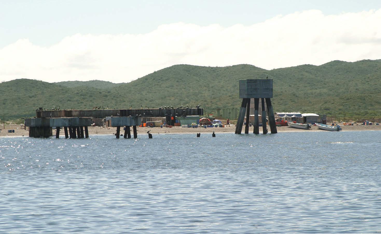
Cedros Island: On the island’s southeast side, Cedros Town’ municipal harbor is enclosed by beefy breakwaters, leaving a 350’ wide entrance opening to the southeast. The far southwest corner would give best shelter, of course, but it is shoal about 450’ out from the gently sloping beach. So one either anchors in 15’ to 25’ in the middle of the harbor, or rafts alongside one of the 100’ steel shrimp boats that are bound to have previously secured themselves to the big concrete cargo platform on the harbor’s northeast sea wall. Or one could always anchor outside, just due north of the bend in the harbor’s northeast sea wall.
S an Quintin Bay: The huge outer anchorage is wide open to south conditions, but for shallow-draft vessels, there’s a natural channel leading inside the enclosed bay that has charted depths of 14’ or more for 6.5 n.m. – except for one 5.2’ spot on the west side, and of course that’s right outside the entrance.


Soledad Channel: Shallow-draft vessels can find south-wind shelter by navigating the narrow, twisty Soledad Channel that runs 35 n.m. behind the north end of Isla Magdalena.
The wise move is to hire a local panguero to lead you inside, at least just past t he 5.2 spot. Good shelter can then be reached only three miles in, to anchor off the north side of the broad sandbar called Punta Azufre. Tourist pangas zoom in and out from the popular Old Mill fishing resort.
Isla San Martin: If the outer bands of a hurricane have chased you this far north, a small sandspit juts .3 n.m. off the southeast side of Isla San Martin, forming a rustic fishing anchorage (20’ to 30’ over gravel). Called Hassler’s Cove, this spot has provided shelter from the big seas whipped up by stiff south winds. However, the curving rocky sandspit is only about 10’ tall and already shows a couple low spots from previous storms.
From sea level, this volcanic island looks like a Chinese coolie hat with a low spreading brim and thin pointy top. So, not much shelter is gained from the island itself. If aquaculture gear takes up t oo much of Hassler’s Cove, it might be better to press on the welcoming shelter of Ensenada harbor.
Next time, let’s look inside the Sea of Cortez the season’s best, most pleasant south-wind anchorages.


