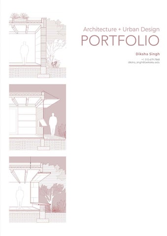
Architecture + Urban Design
PORTFOLIO Diksha Singh +1 510-679-7868 diksha_singh@berkeley.edu
DIKSHA SINGH DIKSHA SINGH
Urban Designer | Architect Urban Designer | Architect
Urban DesignPortfolio Portfolio | Architecture Portfolio Urban Design | Architecture Portfolio 510-679-7868 | diksha_singh@berkeley.edu | linkedin.com/in/dikshasinghberkeley 510-679-7868 | diksha_singh@berkeley.edu | linkedin.com/in/dikshasinghberkeley
Strategic urban designer andand architect with over years 7 ofyears experience leading complex master plans, master zoning reform Strategic urban designer architect with7 over of experience leading complex plans, zoning initiatives, and large-scale mixed-use developments across the U.S. and India. My work sits at the intersection of intersectio initiatives, and large-scale mixed-use developments across the U.S. and India. My work sits at the urban design, planning, and architecture, and the thread running through all of it is people: how they move, gather, urban design, planning, and architecture, and the thread running through all of it is people: how they move, feel safe, and belong in the places built around them. I am committed to creating spaces for communities while feel safe,design and belong in the built around them. I am committed to creating spaces for communities w balancing innovation and places constructability. balancing design innovation and constructability.
CORE EXPERTISE
SOFTWARE PROFICIENCIES
● District & Downtown Master Planning CORE EXPERTISE
● ● ● ● ● ● ● ●
●● ●●
●
Urban Design Guidelines & Technical District & Downtown Master Planning Documentation Urban Design Guidelines & Technical Form-Based Codes (FBC) Documentation Objective Design & Development Standards Form-Based Codes (FBC) (ODDS) Community & Public Facilitation Objective Engagement Design & Development Standards Mixed-Use (ODDS) & Transit-Oriented Development
● ●
Community Engagement & Public Facilitation Mixed-Use & Transit-Oriented Development
●
● ●●
AdobeSOFTWARE Creative Suite PROFICIENCIES Autodesk AutoCAD ● Adobe Creative Suite Revit ● Autodesk AutoCAD Sketch-up Arc GIS● Revit ● Sketch-up MS Suite Lumion● Arc GIS Rhino Grasshopper + Ladybug ● MS Suite
EDUCATION
● ●
Lumion Rhino Grasshopper + Ladybug
Master of Urban Design, University of California, Berkeley, College of Environmental Design
2022
LEED Green Associate EDUCATION
GBCI#: 0011540826 Master of Urban Design, University of California, Berkeley, College of Environmental Design Bachelor of Architecture, Sushant School of Architecture, India
LEED Green Associate Registered Architect from the Council of Architecture, India GBCI#: 0011540826 EXPERIENCE Bachelor of Architecture, School of Architecture, India Urban Design Associates | Sushant UDA
Registered Architect from the Council of Architecture, India PA
2017
Pittsburgh,
Senior Urban Designer September 2024 - July 2025 ● Led district-scale master plans and redevelopment strategies, integrating policy, economic feasibility, and EXPERIENCE community engagement into implementable urban frameworks. Urban Design Associates | UDA Pit ● Directed innovative urban design strategies grounded in zoning analysis, economic viability, and stakeholder PA priorities. ● Developed development guidelines that aligned municipal vision with long-term growth and September 2024 Senior Urbanstrategic Designer pathways. ● implementation Led district-scale master plans and redevelopment strategies, integrating policy, economic feasibility, an ● Produced comprehensive planning documentation, including design frameworks, policy analysis, and technical community engagement into implementable urban frameworks. reports. ● Directed innovative urban design strategies grounded in zoning analysis, economic viability, and stakehol ● Led public engagement processes, designing and facilitating workshops, open houses, and stakeholder priorities. to build consensus presentations
●
●● ●
●
● ●
Developed strategic development guidelines that aligned municipal vision with long-term growth and implementation pathways. Key Projects Produced South comprehensive planning documentation, including design frameworks, policy analysis, and tech Downtown Bend 2045 Plan - Community feedback driven design for the future of Downtown South Bend, IN. Choice Neighborhood, City of New Bern - Creating a comprehensive master plan that guides neighborhood reports. revitalization, supports FEMA-related recovery efforts, prepares the community open to apply for HUD’s Led public engagement processes, designing andand facilitating workshops, houses, andChoice stakeholder Neighborhood (CN) Implementation grant. presentations to build consensus
Key Projects Downtown South Bend 2045 Plan - Community feedback driven design for the future of Downtown South Choice Neighborhood, City of New Bern - Creating a comprehensive master plan that guides neighborhoo revitalization, supports FEMA-related recovery efforts, and prepares the community to apply for HUD’s C
Opticos Design
San Francisco, CA Senior Designer (Zoning Reform Fellow) October 2022 - June 2024 ● Contributor to regional and municipal zoning reform initiatives focused on expanding housing through form-based codes and objective design standards. ● Authored and tested multiple Form-Based Codes and objective development standards across diverse jurisdictions. ● Conducted site-based testing, policy analysis, and visual simulations to ensure standards were clear, feasible, and defensible. ● Led interdisciplinary workshops with architects, planners, and community representatives to prototype design solutions, build consensus, and align project goals across teams. ● Translated complex regulatory frameworks into accessible handbooks and graphics for municipal adoption. Key Projects ● ABAG Objective Design Standard Handbook - Assisted in the creation of a handbook for residential and mixed-use projects for the ABAG region based on a detailed place-type study of the region. The Handbook provides a set of best practices and recommendations for Bay Area cities, towns, and counties to use when preparing objective design standards for housing and mixed-use projects. ● Objective Design and Development Standards for Puget Sound Region - Illustrated technical analysis reports, including sketches for conceptual urban design and FBC documents.
WRT Planning + Design Urban Design Intern ● Supported downtown redevelopment and affordable housing studies across the Bay Area. ● Contributed to objective design standards research and regulatory documentation.
San Francisco, CA June – August 2022
DADA Partners
Delhi, India Project Architect and Urban Designer July 2017 - June 2021 ● Led design development and execution of residential and commercial projects. Oversaw schematic design, working drawings, 3D modeling, BOQs, and coordination with consultants. ● Led large-scale urban districts and mixed-use developments ranging from 15 to 250 acres, managing projects from concept through execution. ● Directed master planning, zoning analysis, land assembly strategies, and phased development frameworks. ● Coordinated multidisciplinary consultant teams and client stakeholders to deliver cohesive, build-ready solutions. Prepared regulatory approval packages, urban design guidelines, and implementation documentation.
Key Projects in India ● Riverhills Masterplan, Mahalunge, Pune - Led the architectural design of an 80-acre Mixed-Use Riverfront neighborhood master plan to create a dense, socially diverse city where economic and social activities overlap. The project won multiple awards, including The Global Future Design Awards 2020 - Urban Design Category ● Godrej Reserve Township, Bangalore. Directed the 100-acre master plan and execution of a responsible social, economic, and sustainable design solution. The township won the HUDCO Design Awards inthe Urban Design Category 2020 and The Global Future Design Awards 2020 – Landscape Category ● Portico House. Won Building of the Year Award 2022 by ArchDaily Magazine
architecture
The Elemental House is conceived as a celebration of material authenticity, where each element is expressed in its most natural and unrefined state. This approach preserves the inherent character of the materials, resulting in a home that feels rustic, warm, and breathable. Drawing from traditional Indian architecture, the design incorporates a central courtyard with a water body, creating a serene focal point and enhancing natural ventilation.
Location: Delhi, India Architecture| Residential
elemental house
Design Team : Mukul Arora, Diksha Singh, Jahanvi
RESIDENTIAL
Professional Contribution: Conceptual design, Producing working drawings, Site Management
Gross built area: 4000 sqft
The construction follows a clear and deliberate sequence of elements: beginning with the plinth, followed by rammed earth load-bearing walls, then wooden doors and windows, and subsequently exposed concrete beams and slabs. The composition is completed with corten steel detailing. Downturn beams are intentionally left exposed and arranged in a consistent rhythm at 4’-0” intervals, reinforcing the structural language of the house.
building on site
The rammed earth walls, illustrated in the drawings and sections, are constructed in a combination of 9-inch and 16-inch thicknesses. All services—including electrical, plumbing, and air conditioning—were meticulously pre-planned and integrated within the walls during construction. This ensured that the integrity of the rammed earth surfaces remained undisturbed, eliminating the need for any post-construction modifications.
The flooring is finished with a beige microconcrete overlay applied onsite, complementing the earthy palette of the structure. The landscape design further enhances the natural aesthetic through a thoughtful combination of cobblestones and stone slabs, creating a cohesive and grounded environment.
celebrating the materials
architecture conventional type
modulation 01 : sky bought to the lower level
modulation 02 : earth pulled up to the upper floors
Designing a new studio space for a long established and leading environmental graphics firm meant creating a spatial experience that provided continuity with their work ethic and yet explored new inter-relationships that could foster creative thinking
Location: Delhi, India
LIVE-WORK DESTINATION RESIDENTIAL
Architecture| Residential Design Team : Mukul Arora, Diksha Singh, Nivedita Sehgal, Saurabh Syal Client : Anthony Lopez Gross built area: 4000 sqft Professional Contribution: Producing working drawings Coordination
Urban Plot is programmed as a sustainable live-work setup with the lower two levels as the studio space and the upper two as a residence. The two-level office for a non-hierarchical design studio called for strong integration between the two floors. A central void acts as an interactive heart for the office.
ground floor : spacial organisation diagram
ground floor plan
basement floor : spacial organisation diagram
basement plan
The eastern light well, bringing light to the lower two levels of the live-work unit The metalgrate bridge connects the front and back yard The eastern light well, bringing light to the lower two levels of the live-work unit The metalgrate bridge connects the front and back yard
the connecting void
934"
934"
934"
934"
934"
934"
A'
℄ 321"
5"
EQ
℄
EQ
℄
AXONO MET
SCALE: 1:10
114"
℄
3'-341"
6'-6"
(DIVIDED INTO 8 EQUAL PARTS)
PLAN OF STEEL WORK SCALE: 1:25
START OF M.S RISER
M.S. PLATE ANCHORED TO R.C.C SLAB AS/ REQ.
COLUMN EDGE
BOTTOM OF 'C'-CHANNEL
COLUMN EDGE
16
STRUCTURAL M.S BASE PLATE AS/ REQ. ANCHORED TO COLUMN
15 14
2" ITE) S
7'-
S/
(A
13 3
10
ISMC 150 CHANNEL
"
4
12 11
STRUCTURAL M.S FLATS WELDED OVER 12MM THK STEEL PLATE FOR BRACING TOP OF 'I'-SECTION BEAM CANTILEVERED 6"- 'I'SECTION BEAM AS SUPPORT FOR LANDING
8"
℄
STRUCTURAL M.S BASE PLATE AS/ REQ. ANCHORED TO COLUMN/BRICKWROK
10
3'-314"
9 8
12mm TH STRUCTURAL M PLATE LANDIN REINFORCED WI 1 3 2"X4" M.S FLA
7
STRUCTURAL M.S BASE PLATE AS/ REQ. ANCHORED TO COLUMN
STRUCTURAL M.S FLATS WELDED OVER 12MM THK STEEL PLATE FOR BRACING
6
5 5'-714"
M.S BRACKETS FOR ADDITIONAL SUPPORT TO CANTILEVERED 'I'SECTION BEAM COLUMN EDGE
934"
341"
A'
934"
EQ
FLATS
12mm THK. STRUCTURAL M.S RISER WELDED AS/DETAIL TO M.S. TREAD
CANTILEVERED SECTION BEAM A SUPPORT FO LANDIN
4 3 2
12mm THK. STRUCTURAL M.S TREAD WELDED AS/DETAIL TO M.S. RISER
R.C.C FILL 1
PRODUCE R.C.C FILL SECTION BB' AS SUPPORT
staircase section detail WORK SECTION AA': metal OF STEEL
SCALE: 1:25
SCALE: 1:25
PRODUCED BY AN AUTODESK EDUCATIONAL PRODUCT
C
1 21 " THK. WOOD AS / SPEC
BUTT JOINT
6"x 3" S CANTILEVERED "I"SECTION BEAM AS SUPPORT FOR LANDING 2" (OUTER DIMENSION) REINFORCEMENT FOLD IN LANDING PLATE M.S RAILING AS/ DETAIL
1 21 " THK. WOOD AS / SPEC
BUTT JOINT
MITER JOINT
MITER JOINT
12mm THK. METAL PLATES
12mm THK. METAL PLATES WITH WELDED AT EDGE WELDED AT EDGE WITH MITER JOINT MITER JOINT
MITER JOINT
MITER JOINT
typical tread elevation TYPICAL TREAD ELEVATION D TYPICAL TREAD ELEVATION D SCALE: 1:5 SCALE: 1:5 1 21 " THK. WOOD AS / SPEC
3'-2" EQ
EQ
3 1/2"
3 1/2"
EQ
3 1/2"
EQ
12mm THK. TREAD PART OF FOLDED PLATE STRUCTURE
1 3 2" X4" FLATS
FOR REINFORCING FOLDED PLATE 1 3 STRUCTURE 2" X4" FLATS
1 21 " THK. WOOD AS / A SPEC
1 4 DEEP GROOVE
12mm THK. TREAD PART OF FOLDED PLATE STRUCTURE
FOR REINFORCING FOLDED PLATE typical tread detail STRUCTURE
3 1/2"
1 4 DEEP GROOVE
TYPICAL TREAD DETAIL C SCALE: 1:5
TYPICAL TREAD DETAIL C SCALE: 1:5
FIRST FLOOR
17
F.F.L LVL +13'-11"
16 15
*all 17presented drawings, illustrations are produced by me. 14
3'-2"
14
3'-1"
11
3'-2" 2'-11"
12 15
10
13
9
12
FIRST F
F.F.L LVL
16 13
734"
BY AN AUTODESK EDUCATIONAL PRODUCT
staircase details
PRODUCED BY AN AUTODESK EDUCATIONAL PRODUCT
3'-2"
7'-1"
3'-2"
3'-2" 6'-8 14"
MID LANDING F.F.L LVL + 8'- 9 41 "
MID-LANDING B
13
14
15
16
10"
10"
R.
FLIGHT C
10"
10"
10"
314"
6'-7"
10"
9
℄
8
7
MITERED WELD JOINT 1 4" DEEP GROOVE
EDGE OF R.C.C SLAB 314"
9"
5'-0"
(DIVIDED INTO 6 EQUAL PARTS)
9"
12
9
11
734"
10
M.S PLATE ANCHORED TO R.C.C SLAB AS/ REQ.
10
5
3
4
2
3'-2"
FLIGHT A
934"
934"
934"
934"
3d view : railing angle
341"
A'
321"
5"
EQ
℄
EQ
℄
114"
℄
3'-3 " 1 4
8
934"
EQ
934"
4
6'-6"
(DIVIDED INTO 8 EQUAL PARTS)
ORK
MITERED WOOD JOINT
3
934"
1 21" THK. WOODEN RISER AS/ SPECS.
THK. STEEL PLATE TREAD SUPPORT
9"
934"
1 21" THK. WOODEN TREAD AS/ SPECS.
1 2"
1 EQ
6
12
R.C.C FILL AS SUPPORT
11
PRODUCED BY AN AUTODESK EDUCATIONAL PRODUCT STRUCTURAL M.S. BASE PLATE AS/ REQ. ANCHORED TO COLUMN/BRICK WORK
railing detail
AXONO METRIC VIEW OF MID LANDING JUNCTION
SCALE: 1:10
START OF M.S RISER M.S. PLATE ANCHORED TO R.C.C SLAB AS/ REQ.
M.S. PLATE ANCHORED TO R.C.C SLAB AS/ REQ. R.C.C SLAB
COLUMN EDGE
COLUMN EDGE
16
STRUCTURAL M.S FLATS WELDED OVER 12MM THK STEEL PLATE FOR BRACING
13 3
10
"
4
12
12mm THK. STRUCTURAL M.S RISER WELDED AS/DETAIL TO M.S. TREAD
11 8"
℄
3'-3 " 1 4
FIRST FLOOR
14
2" ITE) S
7'-
S/
F.F.L LVL - 1'-10 21 "
T.OS LVL - 1'-10 21 "
15
(A
FIRST FLOOR
STRUCTURAL M.S BASE PLATE AS/ REQ. ANCHORED TO COLUMN/BRICKWROK
10 9 8
12mm THK. STRUCTURAL M.S PLATE LANDING REINFORCED WITH 1 3 2"X4" M.S FLATS
7 6
STRUCTURAL M.S FLATS WELDED OVER 12MM THK STEEL PLATE FOR BRACING
EL WORK
12mm THK. STRUCTURAL M.S RISER WELDED AS/DETAIL TO M.S. TREAD 12mm THK. STRUCTURAL M.S TREAD WELDED AS/DETAIL TO M.S. RISER
CANTILEVERED 'I'SECTION BEAM AS SUPPORT FOR LANDING
4 3 2
R.C.C FILL 1
GROUND FLOOR
SECTION BB' OF STEEL WORK
F.F.L LVL + 3'-0"
SCALE: 1:25
PRODUCED BY AN AUTODESK EDUCATIONAL PRODUCT
5'-714"
5
Main Staircase: connecting the foyer to First floor Aim was to create a sleek look that can be admired from the main gate. To make it sturdy, a 12mm metal plate reinforced with flat MS pieces was folded and then cladded with hard wood planks.
urban design
B ro ad S t
P o ll o c k S t
DRAFT | July 21, 2025
LOOKING FORWARD Greater Five Points Transformation Plan Update Process In 2024, the New Bern Housing Authority (NBHA) began a process to update the Greater Five Points Transformation Plan. Eight months of robust community, resident, and stakeholder engagement helped to guide and refine this update, aligning the recommendations with the current needs of the community and funding sources.
W a lt B
Residents envision a vibrant waterfront redevelopment of the Trent Court site.
e
ll a m y D FEMA Requirements r iv e FEMA funding is allocated to help demolish vacant buildings and build new streets and housing on the Trent Court site. However, This plan is before this money can be spent, FEMA requires that NBHA organized into develop a plan for the future. Through this process, NBHA is LOOKING FORWARD working with the New Bern Historical Preservation Society and 3 Categories: Greater Five Points Transformation Plan Update Process the North Carolina State Historic Preservation Office (SHPO). For In 2024, the New Bern Housing Authority (NBHA) began a more information about the historic nature of Trent Court, please process to update the Greater Five Points Transformation Plan. reference the 2016 Greater Five Points Transformation Plan. Eight months of robust community, resident, and stakeholder engagement helped to guide and refine this update, aligning the Implementation Grant HUD Choice Neighborhoods recommendations with the currentIn needs of thetocommunity and addition the FEMA funding, HUD’s Choice Neighborhoods funding sources. Implementation (CNI) grant is another significant potential
This plan is organized into 3 Categories:
PEOPLE Supporting positive outcomes in health, employment, and education for Trent Court residents
Residents and community mem
NEIGHBORHOOD
Increasing access PEOPLE to trails, parks, funding source for this transformation. To be competitive for FEMA Requirements transportation, future CNI grants, this plan update has been organizedSupporting into the positive FEMA funding is allocated to help demolish vacant buildings and New residential streets will ha economic development, outcomes in health, plan on: is three categories thatThis HUD focuses provide shade. Residents communityfor members over the course of eight build new streets and housing on the Trent Court site. However, andand amenities the participated employment, and organized into Greater Five Points education for Trent before this money can be spent, FEMA requires that NBHA LOOKING FORWARD • People — supporting positive outcomes in health, employment, 3 Categories: neighborhood Court residents develop plan forProcess the future. Throughand thiseducation process, NBHA is Court residents Greater Five Points Transformation PlanaUpdate for Trent working with the Newa Bern Historical Preservation Society and In 2024, the New Bern Housing Authority (NBHA) began • Neighborhood — Increasing access to trails, parks, the North Carolina State Historic Preservation Office (SHPO). For process to update the Greater Five Points Transformation Plan. aterfront redevelopment of the Trent Court site. transportation, economic development, and amenities for the more information about the historic nature of Trent Court, please Eight months of robust community, resident, and stakeholder Greater Five Points neighborhood reference the 2016 Greater engagement helped to guide and refine this update, aligning theFive Points Transformation Plan. • Housing — Redevelop Trent Court public housing into mixedrecommendations with the current needs of the community and HUD Choice Neighborhoods Implementation Grant income housing with one-for-one replacement and first rightfunding sources. NEIGHBORHOOD HOUSING In addition to the FEMA funding, HUD’s Choicefor Neighborhoods to-return Trent Court residents PEOPLE Implementation (CNI) grant is another significant potential Increasing access Redevelop Trent Court FEMA Requirements The following pages explain how the objectives of the original Supporting positive to trails, parks, public housing into fundingvacant sourcebuildings for this transformation. To be competitive for FEMA funding is allocated to help demolish and Transformation Plan have been incorporated into this plan update. outcomes in health, transportation, mixed-income housing futureCourt CNI grants, this plan update has been organized into the Residents and community members participated over the course eight months, sharing ideas wide and feedback toand gui build new streets and housing on the Trent site. However, employment, and A new waterfront promenade would be fronted by mixed-income housing, facing the extended Leander Morgan Park. New residential streetsofwill have porches and stoops, sidewalks, economic development, with one-for-one three categories that HUD focuses on: provide shade. education for Trent before this money can be spent, FEMA requires that NBHA A new museum dedicated to t and amenities for the replacement and first located on the redeveloped F.R Court residents develop a plan for the future. Through• this process, NBHA is positive outcomes in health, employment, Greater Five Points right-to-return for Trent People — supporting neighborhood Court residents GREATER FIVE POINTS TRANSFORMATION / NEW NORTHPreservation CAROLINA workingPLAN withUPDATE the New BernBERN, Historical Society and Court residents and education for Trent the North Carolina State Historic Preservation Office (SHPO). For • Neighborhood — Increasing access to trails, parks, more information about the historic nature of Trent Court, please transportation, economic development, and amenities for the reference the 2016 Greater Five Points Transformation Plan. Greater Five Points neighborhood
Vision
Greater Five Points will be a community rich in opportunity that builds upon our heritage and assets with a focus on our future. It will be a great place for current and future residents to live, work, play, worship and create.
HUD Choice Neighborhoods Implementation Grant • Housing — Redevelop Trent Court public housing into mixed-
NEIGHBORHOOD In addition to the FEMA funding, HUD’sincome Choicehousing Neighborhoods Background Framework with one-for-one replacement and first right-
HOUSING Implementation grant is another significant potential Increasing to-return for Trent residents Greater Five Points is (CNI) a historic neighborhood withCourt roots predatThe plan isaccess organized around three categories that HUD uses to to trails, parks, funding source for this transformation. To be competitive for Redevelop Trent Court The following pages explain how the objectives of the original ing the Civil War. of been disinvestment, its residents evaluate Choice Neighborhoods applications: transportation, public housing into future CNIDespite grants, this decades plan update has organized into the Transformation Plan have been incorporated into this plan update. New residential streets will have porches and stoops, wide sidewalks, and trees to The historic McCarthy Square economic development, mixed-income housing have shown remarkable resilience. When Hurricane Florence People: Supporting positive outcomes in health, employment, three categories that HUD focuses on: provide shade. gathering space at the interse would be fronted by mixed-income housing, facing the extended Leander Morgan Park. and amenities for the with one-for-one A new museum dedicated to the history of the West Street School could b struck in 2018, it heavily damaged Trent Court, the neighborand education for Trent Court residents. Greater Five Points replacement and first • People — supporting positive outcomes in health, employment, located on the redeveloped F.R. Danyus site. neighborhood right-to-return hood’s public development. Of the original 218 units, 108 Neighborhood: Increasing accessfortoTrent trails, parks, transportaandhousing education for Trent Court residents Court residents NSFORMATION PLAN UPDATE / NEW BERN, NORTH CAROLINA were damaged and 108 familiesaccess wereto displaced. tion, economic development, and amenities across Greater Five • Neighborhood — Increasing trails, parks, This plan update transportation, economic development, and amenities for the was initiated to guide the rebuilding of Trent Court and the Points. Five Points neighborhood revitalizationGreater of the broader neighborhood, positioning the New Housing: Redeveloping Trent Court public housing into • Housing — Redevelop Trent Court public housing into mixedBern Housing Authority to apply for HUD’s Choice Neighborhoods mixed-income housing with one-for-one unit replacement and income housing with one-for-one replacement and first rightImplementation grant. firstHOUSING right of return for all displaced residents. to-return for Trent Court residents The following pages explain how the objectives of the original Transformation Plan have been incorporated into this plan update.
ng the extended Leander Morgan Park.
NORTH CAROLINA
NEW BERN CNI
Updating The Transformation Plan For Five-Points Neighborhood TRANSFORMATION PLAN UPDATE HUD Choice Neighborhoods program
Redevelop Trent Court public housing into mixed-income housing with one-for-one replacement and first right-to-return for Trent Court residents
A new museum dedicated to the history of the West Street School could be located on the redeveloped F.R. Danyus site.
Location: New Bern, NC NEIGHBORHOOD PLAN UPDATE | URBAN DESIGN| CHOICE NEIGHBORHOOD UDA | 2024-2025
Historic Broad Street will be a community-serving uses with
Community Engagement Process The plan was built around an eight-month, three-stage engagement process designed to center resident voices at every step. • Step1: Listening and understanding the current needs of the Trent Court residents and broader neighborhood • Step2: Confirming ideas from the original plan that are still relevant and exploring new ideas to enhance the community • Step3: Deciding on the appropriate strategies and updating the Greater Five Points Transformation plan
understanding the context
public engagement
A household survey of over 100 questions was conducted to capture the education, workforce, health, food, safety, housing, and program needs of residents. One hundred percent of residents remaining on site completed the survey.
West St School Site B ro ad
St
Former Days-Inn Site Po llo ck St
Trent Court Site
The Greater Five Points neighborhood is a collection of smaller neighborhoods around the Five Points commercial area, including the Greater Duffyfield neighborhoods to the north and Walt Bellamy to the south. Topics and goals grew out of the results of the Resident Needs Assessment and broad-based engagement with neighborhood residents and stakeholders.
neighborhood investments
Greater Five Points transformed
NEIGHBORHOOD GOALS • Economic Development • Infill Housing • Community Wellness • Walking, Biking, and Transit • Safety • Community Pride
Po llo ck St
Charles Taylor Building Lib er ty St
W a lt B e
ll a m y D r
iv e
Leander Morgan Park
Trent Court Site Plan
New residential streets are designed to be walkable, as narrow as standards allow, with sidewalks, street trees, and on-street parking for guests. Walt Bellamy Drive will be paved with special paving to signal a change in how drivers approach the area. Safe walking routes connect residents to the riverfront trail and Leander Morgan Park. The housing plan centers around the redevelopment of Trent Court into new mixed-income housing. Trent Court is special, not only to the 101 families who call it home today but to the community. The beautiful waterfront property is part of the Downtown Historic District and immediately adjacent to Leander Morgan Park.
mixed-income housing
Trent Court Master Plan
The plan proposes demolishing the existing 218 public housing units, 108 of which were vacated following Hurricane Florence, and rebuilding mixed-income housing on the Trent Court site and two additional sites in the neighborhood: the former Days Inn Site and the former F.R. Danyus School site
Building Types: A combination
of townhouses and stacked flats line streets and small green spaces. C-shaped corridor buildings and townhouses close to the waterfront will be elevated, with parking spaces located below, to accommodate the 100-year floodplain.
Economic Development: Encouraging
new businesses to operate in Greater Five Points requires targeted recruitment strategies. Key tactics include creating appealing spaces, ensuring clear pedestrian access, and informing potential business owners about the benefits of the neighborhood.
Broad and Queen Street Intersection Now
Proposed wider sidewalk with retail activity and crosswalk for pedestrian safety Improved Intersection
The new mixed-income housing on the former Day’s Inn site could feature retail space, amenity areas, and childcare services on the ground floor. This will create an active and inviting experience for residents and visitors.
Broad St
e Qu
en
St
Retail
Restore the historic Mcarty Square
Child Care
Pol loc k St
Proposed Ground Floor Plan Former Days-Inn Site
Community Pride: West Street Grade
School was New Bern’s first African-American public school. Fire destroyed the original structure in 1905, but the school’s new principal, J.T. Barber, successfully championed the building of the state’s first African-American brick school building two years later. F.R. Danyus succeeded J.T. Barber, but unfortunately the original brick school building also burned in 1969. By adapting the school building into mixed-income housing and creating a museum in the cafeteria annex, the legacy and history of African-American education on this historic site can be preserved.
neighborhood investments
Site interventions
J T Barber Elementary School
Duffyfield Stormwater Project
Greenwood Cemetery Henderson Park
West St
Ceda r St
Stanley White Recreation Center
Broad St
Tryon Palace
Community Wellness: Healthy
and active lifestyles can reduce stress, improve mood, and increase energy. Greater Five Points can become a healthier community by creating an environment that encourages daily physical activity and increasing the availability of fresh, healthy food.
Pol loc k St
Volt Center
Improvements in the expanded Leander Morgan Park include play areas, sport courts, and areas for food trucks and gathering.
Leander Morgan Park
Improve connectivity within the neighborhood
Open Space Network
Wa l
t
am Bell
yD
r i ve
Leander Morgan Park
urban design
HEALTH ISSUES
FLASH FLOODS
FLOODING
WATER SCARCITY
40% WATER LOSS IN LEAKS AND TRANSPORTATION
HYDRO ENVIRONMENT Blue Green network deals with the horological environment of the area and manages the runoff, avoiding flooding.
URBAN LANDSCAPE Urban Landscape deals with the existing fabric and looks into the mobility of the region and infrastructure required to work with the blue-green network
Imagine a city that built on a fresh water lake, 500 years back flourished as a civilization, but in present day gets inundated with every rainfall and simultaneously faces water shortage. That is Mexico City. And this makes you wonder how did we lose this shared cultural knowledge of living with water and where did we go wrong? LOST in TRANSLATION, is an attempt to do an urban water repair using the lost shared cultural and indigenous knowledge of water management and trying to reestablish the symbiosis between water and community which could be key in creating more resilient communities of the future.
LOST IN TRANSLATION
Re-Establishing The Symbiosis Between Water And Community URBAN DESIGN STRATEGY Urban WATER repair
LANDSLIDES
SOCIAL CULTURE Social cultural nodes are where the people of the community intervene
Rapid expansion normally happens on the borders and over time the government has tried redeveloping these illegal colonies and trying to make them regularized. The topography of the area where these informal settlements have developed over the years makes it difficult for the government to regularize these colonies, and equip them with required infrastructure. Thr proposal is tointroduce a Water Culture, an to create a stronger link with the urban, natural and cultural context of the public spaces. The vision is to leverage the natural hydrological system of the site, identifying and preserving the streams capturing the maximum possible rainfall, and reusing it for everyday use.
Location: State of Mexico, CDMX URBAN DESIGN | GREEN INFRASTRUCTURE | PUBLIC ENGAGEMENT | WATER URBANISM Advisors: Prof. CHRISTOPHER CALOTT Prof. STEFAN PELLEGRINI Prof. GABRIEL DIAZ MONTEMAYOR Advanced Design Project MUD | 2022
The rapid urban growth, use of concrete and disrupted slopes have diminished natural catchment areas and manipulated the waterways. The area receives close to 100mm of rain per cubic meter every month, and the lack of any water management techniques has led to the areas being yearly flooding leading to landslides, loss of property, and affecting the natural aquifers.
understanding the context
story of the neighborhood
The neglected natural streams and creaks have now become dumping grounds leading to health-related issues. And above all this like any other area in and around Mexico City faces water scarcity.
Day Care Center
Learning from the indigenous water management techniques used all around the work a toolkit is created that would help us in achieving our goals of managing water in a sustainable way. These include Check dams, Aflaj system, Qanat system, Floating gardens of the Aztec era, stepped wells, Roman drinking fountains, constructed wetlands,tankas.
indegenous water management
creating a toolkit
1
Capture and Filter : we collect the maximum run off pos-
sible by seizing the stormwater from the surrounding hills, streets and if possible the roofs of our public buildings. We create a network of green infrastructure of bioswales, retention ponds, rain gardens. This helps us is mitigating the flood risks and also clean out the water before it reaches our Storage tanks.
2
Store and Distribute : Storing the water at locations easily
accesible to the public and Leveraging the topography we try to use gravity in distributing the water to our water commons for smaller blocks
3
Water Commons : And lastly we animate ; adding the cultural/ social use to our bigger water commons to create spaces that people identify with and can create a sense of belonging. Provoking the community to maintain these spaces. stormwater management
hydrology
Re-establishing relation to water: Water culture and creating open spaces and new infrastructure practice can help in decentralizing the longer systems and help in creating more resilient communities.
Colonias are divided into smaller blocks ,of say 900- 1000 households. To cater to this population, we need a water tank capacity of 2.2 mil liters. And this can provide 80 to 100 l of water per day for each household. Leveraging the topography the water from these tanks can be distributed to lower altitude areas than the tank. The water gets transferred to a water common : fountain where people can come and collect water as per their requirement.
Utilizing the Residual Spaces.
CHECK DAMS
WIDENED SIDEWALK
BIO-SWALES
smaller interventions
the system
These water commons are available at a maximum of 3min walk from each household. We try to utilize the residual spaces in the colonias, and Small interventions in which the community gets involved. The Goal we are looking at through these insertions reduce flooding. Capture stormwater reuse water, water supply, recreational spaces, health benefits, connection to public mobility and create job opportunities.
PERFORATED UNDER DRAIN PIPE
inserting Community uses, public toilets and waste collection places for waste treatment and creak cleansing are introduced as nodes along the system.
WATER COMMON STEPPED WIDENED SIDEWALK
FILTERED WATER HOLDING POOL
GRAVEL PIPE BED SPILL OUT ZONE EXTENDED COMMERCIAL FRONT
Harness the water. make water a part of the com-
munities life. Instead of the body of water being perceived as the backyard and the garbage dump, it became the focal point that brings together the whole community and enriches the social-natural bond.
INCREASE TREE COVER
ACTIVE STREET FRONTAGE
ADDED DENSITY
PUBLIC MOBILITY INFRASTRUCTURE
Impact on the private realm: by equipping our streets and open spaces we can also slow down the outward growth of urban fabric by densifying and activating the public realm.
smaller interventions
water commons
Normal rain.
Green Infrastructure coexisting with communal spaces.
Dry rain.
The water holding pond transforms into a vegetated bank, with open spaces for kids to play.
Extreme rain.
Larger Retention system, to hold extra water during floods. The community space at high altitude can convert to disaster recovery center.
transforming through the seasons
water commons
Activating the space.
Creating a landmark building to attract the community and promote activities that highlight the heritage STEPPED WETLANDS : help in cleansing and recharging , filtration and deposition then sediment removal and nutrient removal. Aeration ponds also help in filtering the water. This is where water is harvested and reused for everyday uses. URBAN FARMING, small scale community farming takes its opportunity to utilize the natural water resources , attempt to cultivate healthy urban culture.
PLANNING + DESIGN
EDUCATIONAL BODY Funding the planning and design initiatives Designing for water sensitive urban design Street and flood area analysis
FUND + IMPLEMENTATION
+
MUNICIPAL GOVERNMENT Coordination Creating community Consensus
OPERATION MAINTENANCE
+
COMMUNITY BODY Cleaning Funding to maintain over time Resident incentives
Creating a localized system of coperatives. Design an approach towards development that creates the possibility of developing interventions that vertically integrate different kinds of solutions, taking into account infrastructure, culture, urbanism, the environment, and even the economy.
agency pattern
how things work
architecture
inside out An urban club: The threshold of the club with the city plaza and retail plaza
Location: Devanhalli, Bangalore, India
CLUB PORTICO
Architecture | Social Hub
RESERVE PLOTTED NEIGHBOURHOOD
Design Team (DADA Partners): Mukul Arora, Diksha Singh Consultants: Landart (Landscape) Client : Godrej Properties Ltd. Gross built area:
COMMUNITY CLUB
Professional | Group | 2018 - Present
TWO AXIS AND FOLLIES Two clubs and its dialogue with the city : the plan is an assemblage of a iconic spinethe boulevard - and the two anchors - the club and nandi hill park
CURIOUS DYNAMICS OF URBAN SPACES
SHAFT OF VIEW A plan that works with the contours. The structure or framework emerges from the deep understanding of the uniques landform of the site
Creating a public interface between the city forest and the main street. an urban building that would sit hugging the sloping landform
urban building built with landform
3 fronts
terrace above
porticos wrap the landscape at ground plane
iconic red roof
proposal
CLUB sight lines
CLUB ALONG A PLAZA
PROGRAMMING
PROGRAMMING the public threshold
SPLIT: WEAVE
GREEN VOIDS AND ICONIC ROOF
PORTICO CLUB PLAN Total Area = 2577 sq.m (27739 sq.ft)
Lounge | Theatre | Squash Court | Multi-purpose Hall | Cafe | Reception | Lounge | Library | Office | Book cafe facing street | Guest room | Business Centre | Internet Station | Yoga/ Dance room | Toddlers activity area | Kids games room | Salon | Spa | Gym | Restraurant | Party/ Star gazing terrace
curious dynamic of urban spaces
front elevation
The key design feature in this club building is the interlocking of volumes and planes on its façade as an interface to the very busy street to its front. Defined by its volumetric language and with careful use of material palette the form changes its character during the course of day with its ever changing light and shadow.
design developemnt
side elevation
This originates from the desire to create a larger volume in relatable proportions combined with the search for optimum use of light. This led to an contemporary, finely detailed building. There are a series of smaller courts/ voids punctuated on all levels bringing in light and ventilation to the spaces and serving as lungs of the building. The open to sky courtyard creates an efficient airflow providing a comfortable microclimate that influences all the spaces of the club.
proposal
metal roof detail finish : epe cladding
To achieve a lighter tectonic a composite structure was adopted, allowing a delicate finale
metal roof partial plan
construction details
*all presented drawings, illustrations are produced by me.
SECTION BB' SCALE: 1:25
WOODEN TREAD MOUNTED ON 10MM THK METAL PLATES 11" 4
1 2" M.S. WEDGE RISER WELDED ONTO 'I'
SECTION STRINGER
1mm 1mm
11" WOODEN TREAD REINFORCED WITH M.S HOLLOW SECTION ANCHORED TO BRICK WORK
21" 2
9'-1121"
8
81" 2
7
6
5
4
3
2
R T S
1
1034"
UP
EDGE OF R.C.C SLAB
C
1" 22 6'-712"
4"
9
21" 4
3.5mm BASE PLATE AS / DESIGN
934"
3'-3"
ld
we
8MM THK. M.S. PLATE BOLTED A OVER 21" THK. RISER WEDGE
934"
934"
934"
934"
10"
10"
10"
10"
10"
10"
H RA
11"
ne
A' 11"
LANDING
10
11
12
13
14
15
16
17
6'-9"
NUT AND BOLTS RECTANGULAR HOLLOW SECTION REINFORCEMENT
tread detail : metal detail
SCALE: 1:2
934"
zo
LVL - 1'-10 21 "
TYPICAL TREAD DETAIL AT C
10"
934"
WOODEN TREAD MOUNTED ON TOP OF M.S PLATE
PLAN
SCALE: 1:25
EQ
1 2"THK. PLASTER FINISH
EQ EQ
3'-2"
AS/ REQ. SCREWED TO WOODEN TREAD
6"
1" 1034"
substructure plan TREAD SUBSTRUCTURE PLAN AT C: framework tread detail SCALE: 1:10
prototype : metal work
SCA
1 4" THK. BASEPLATE
1 21" X 1 21" M.S RECTANGULAR HOLLOW SECTION (RHS) SUBSTRUCTURE WELDED TO BASE PLATE
PRODUCED BY AN AUTODESK EDUCATIONAL PRODUCT 1"
SEC
3"
EDGE OF TREAD BELOW
EDGE OF TREAD ABOVE
M.S. WEDGE PLATE AS / REQ. WELDED TO BASEPLATE AND 6"X3" RECTANGULAR HOLLOW SECTION STRINGER 6"X3" RECTANGULAR HOLLOW SECTION STRINGER
61 2
3" THK. WOODEN TREAD AS / SEPC.
DETAIL plan B - TREAD reflected REFLECTED CEILING PLAN SCALE: 1:10
7"
3'-2"
WOOD AS / REQ
2'-2"
M.S. BASE PLATE AS / REQ. ANCHORED TO COLUMN/ BRICK WORK 3 4" THK.
EQ 9"
6"
11"
DETAIL B
SCALE: 1:5
page left blank intentionally
urban design
RIVERHILL PUNE creates a blueprint for a The Mula riverfront is a collective experi80 acres high density community at the ence of the articulated edge of the Upper waterfront promenade, the ecological edge of Pune city. The plan departs from the typical privatized insular built floodplains at the lower levels, as well as typology and instead proposes a bold new the rivers water-sheet. Public open-space system for the city The RIVERWALK. The Heritage metal footbridge, the iconic clubhouse, and public marketplace act as This highly public urban-device primarily the anchoring element for this waterfront sets out to meaningfully connect the site edge. with the Riverfront and its envisions and the foothills onto the South side.
RIVERHILLS
Mixed-Use Riverfront Neighborhood URBAN DESIGN - MASTER PLAN
Location: Pune, Gujrat, India Master Plan | Mixed Use Development Design Team (DADA Partners): Mukul Arora, Diksha Singh Consultants: Stupio POD (Landscape) Client : Godrej Properties Ltd. Gross built area: 67 acre land parcel Professional | Group | 2019
PEDESTRIAN METAL SUSPENSION BRIDGE : AN EXISTING ASSET
site and surroundings
THE SITE AND CONTEXT
FROM HILLS T THE RIVER
This project site is book ended by the tekari towards the south and river towards the north. The land has a significant and perceivable drop of around 30 metres along its full length. Two major arterial DP roads bring easy access to the site from the Pune Mumbai highway from across the river from Hinjewadi. The site is mostly devoid of natural or built context along its southern edge however on the northern edge the river, its floodplain, and the densely canopied embankment set up a strong context for the proposed layout plan.
The pedestrian metal bridge along the Northwest of the site is a highly visible physical asset and takes on the role of an anchoring element for the master plan.
1
2
3
A PUBLIC FRAMEWORK CONNECTING HILLS TO THE RIVER
CREATING AN INTIMATE INWARD RIVERWALK EXPERIENCE ANCHORED BY A STRONG DESTINATION “TOWN CENTER “
AN EXCLUSIVE HIGH-QUALITY COMMUNITY ‘HIGH ON GREEN’
"WHERE COMMUNITIES ARE FOCUSED AROUND NEIGHBOURHOODS" A compact and socially diverse city where economic and social activities overlap and where communities are focused around neighbourhoods.
vision and principles
The township weaves the qualities of adjacent neighbourhoods into a rich tapestry of unique places. The precinct offers a wide variety of housing typologies and a network of open spaces.
master plan
RIVERWALK
VIEW CORRIDORS AND NODES that act as
keystones or multiple Public armatures; critical building surfaces or street walls that define the primary movement experiences; Tower locations acting as REGIONAL BEACONS for the project
The RIVERWALK along the Main Street boulevard connects the riverfront and the Central Park with the urban front door of the project. This primarily pedestrian retail experience will be defined by inviting built edge as well as landscape gestures. Multiple kiosks dotting the edges of the ecological bands and other landscape spaces such as amphitheater would allow for diverse set of activities.
1
1 3
2
3
riverwalk
2
River walk north is the one sided retail transitions into the large community green on the other side. The riverine inspired central landscape is punctuated by outdoor cafes and informal markets along its length.
ON
UT
HR
IVE
FAS HI
SO
STR EET
River walk south defines the gateway along the DP road and a pedestrian mixed-use retail experience that is defined equally by the very urban spatial build quality as it is by the gently terracing open space design.
RW ALK
NORTH RIVERWA
LK
Assembling a 400m PUBLIC pedestrian spine
Programmed, safe, and animated MIXED-USE GROUND PLANE
Diversity of programming means multiple GO-TO SPACES
TRIPARTITE delineation of the space with middle zone as the eclogocal reserve
assembling the pedestrian riverwalk
WEEKEND/ TEMPORARY RETAIL ICONIC SIGNAGE
RESIDENTIAL TOWER
GATEWAY RETAIL
COLONNADE RETAIL
DOUBLE HEIGHT ANCHOR RETAIL
FOOD STREET /PATIO ZONE
MULTI USE WAY
MARKET CHAWK
PRECINCT NODE
HAWKERS ZONE
The 24X7 SOCIAL HUB of mahalunge. A pivotal point in the township that rivets ones gaze to the city spine and the hills above and the looming metal bridge over river Mula towards the north.
street wall diagram built to open ratio- 1:1
The chowk is where all pedestrian routes converge and it’s significance emerges from a pinwheel movement diagram which is a pattern commonly seen in our historic city fabric.
STREETSCAPE SECTION
PLAN
the chawk
The narrow and shaded, Fashion Street is another such spatial device that is popular in the context of our social and climatic conditions. Part of the pin-wheel movement system, Fashion streets provides an important connect with the DP road along the west edge and the expected footfall form the SEZ parcel.
DAILY
DAILY - EVENING
MONTHLY - OUTDOOR MOVIE/SPORTS MATCH SCREENINGS
MONTHLY- FLEA MARKETS/FAIRS
ANNUALLY- MARATHONS
ANNUALLY- FESTIVAL CELEBRATIONS
ANNUALLY
MONTHLY
DAILY - DAY
a versatile city space
1
2
3
CONSTRUCTED ECOLOGIES are not designed as pure nature, but part a of an URBAN EXPERIENCE, and with a provision of
MIN access
3
MIN access
1
3
Enhanced Ecological Breakwater
MAX access
2
1
Urban edge: Promenade +ghats
HIGH access
4
MEDIUM access
things for people to do, not just things to see.
riverfront
2
TERRACED gabion EDGE: multilayered Promenade
4
Ecological Breakwater: Riverside park
New Waterfront establishes a model for integrating civic park and public space design into urban flood protection
A UNIQUE
PROMONTORY SETTING TO ENJOY THE MULA RIVER ECOLOGY
BALANCING THE
“PUBLIC & PRIVATE” ZONES
Of all the districts this one has the most ecologically sensitive zone Elements such as the ghats, and ramps act as the important connecting devices for this undulating rivers edge. They also allow users to access the river water from the upper parts of the promontory.
componenets of a river edge
The Rivers watersheet is also considered as a hydrological extension or appendage to the ecological land-based system described above. Activities such as religious rituals, leisure, boating, swimming, etc are all everyday activities that have been programmed in the master plan.