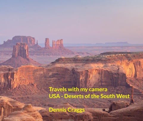
Zion National Park, Utah Bryce Canyon National Park, Utah Toadstools, Kanab, Utah Las Vegas, Nevada Death Valley, California Horseshoe Bend, Page, Arizona White Pocket, Arizona Antelope Canyon, Arizona Monument Valley, Arizona Bisti de-na-zin and Valley of Dreams, Farmington, New White Sands National Park, Almagordo, New Mexico
Dennis Craggs April 2023
bruary 2023, I flew to Las Vegas (Altitude 610 m) and, the organised trip having been cancelled, d a car and drove myself 320 km up to Kanab (Altitude 1,515 m) in Utah as a base to visit both Zion Bryce National Parks. Zion, my first stop, is located in south western Utah near the town of gdale, 258 km from Las Vegas. Located at the junction of the Colorado Plateau, Great Basin, and ve Desert regions, the park includes mountains, canyons, buttes (isolated steep sided hills with flat mesas (similar), monoliths, rivers, slot canyons (Long narrow gorges created by water erosion) and al arches. It ranges in altitude from 1,117 m to 2,660 m at Horse Ranch Mountain. A prominent re of the 590 km2 park is Zion Canyon, which is 24 km long and up to 800 m deep. The canyon walls eddish and tan-coloured Navajo Sandstone eroded by the North Fork of the Virgin River. Human ation of the area started about 8,000 years ago with small family groups of Native Americans. mons came into the area and settled there in the early 1860s.
09, President Taft named the area Mukuntuweap National Monument in order to protect the n. In 1918, the acting director of the newly created National Park Service, Horace Albright, drafted posal to enlarge the existing monument and change the park's name to Zion National Monument, being a term used by the Mormons. According to historian Hal Rothman, the name change played to valent bias of the time. Many believed that Spanish and Indian names would deter visitors who, if could not pronounce the name of a place, might not bother to visit it. In 1919, Congress ignated the monument as Zion National Park. I was joined by Amy Osness, one of the tour leaders Action Photo Tours, who drove 130 km from St George to Kanab to collect me by 5am and to drive the park in the dark to take me to the best dawn photo locations. A blessing in these situations to somebody who knows their way around, although a one to one tour is a bit of an extravagance! We great tour, heading back by about 2pm, making a really long day for Amy.
Canyon National Park, our second point of call the next day, is located 130 km from Zion towards egas. The major feature of the park is Bryce Canyon, which despite its name, is not a canyon, but a tion of giant natural amphitheatres along the eastern side of the Paunsaugunt Plateau. The park is smaller but sits at a much higher elevation than Zion, varying from 2,400 m to 2,700 m and it’s a bit for my dawn visit with a brisk freezing wind at 2,700 m. The area was settled by Mormon pioneers 1850s and was named after Ebenezer Bryce, who homesteaded in the area in 1874.
rea was originally designated as a national monument by President Harding in 1923 but was ignated as a national park by Congress in 1928, covering 145 km2. In 2018, Bryce Canyon received visitors, but in winter it’s quiet and a good time to visit: the desert floor is covered in snow but there ill hiking trails open although micro spikes (Crampons) are needed, so I was pleased to have brought Not, you might note, suitable for ski-ing, however. The park features delicate and colourful cles called ‘hoodoos’ that are up to 60 m high, formed by frost weathering and stream erosion of the and lake bed sedimentary rocks. The red, orange, and white colours of the rocks provide spectacular for park visitors. A series of amphitheatres extends more than 30 km north-to-south within the The largest is Bryce Amphitheatre, which is 19 km long, 5 km wide and 240 m deep.
ollowing day I visited White Wave and Peekaboo canyons and spent several hours in the afternoon vening at the aptly named Toadstools near Kanab, taking my first star trails photo, 11 exposures of 5 es each, aided by some light painting, and merged into a final photo with StarStax software. It was a ay and I was keen to know what wildlife comes out at night as I hiked back about a mile to the road yself aided solely by a (hopefully) trusty head torch and mobile phone (I now understand that rs do not come out at this time of year … very sensible of them and fortunate for me).
een trips to the National Parks, I spent a couple of days in Las Vegas, took my camera out and red both the Strip and the old downtown area around Fremont Street. Las Vegas (Spanish for "The ows"), often known simply as Vegas, is the 25th most populous city in the U.S.A. It is an ationally renowned major resort city, known primarily for its gambling, shopping, fine dining, tainment, and night-life. The city is famous for its luxurious and extremely large casino-hotels, so ned that once you are in, there is no natural light and you cannot find your way out again. It was d in 1905 off the incoming railway. Population growth has accelerated since the 1960s, and een 1990 and 2000 alone the population increased by 85% to over 2.2 million. However, Nevada is riest state in the U.S.A. and droughts in Southern Nevada have been increasing in frequency and ty, putting a further strain on Las Vegas' water security.
ont Street features the largest video screen in the world, recently renovated for $32 million. The n has 16.4million pixels, is 420 m long, 27 m wide and is suspended 27 m above Fremont Street’s trian mall. I decided that ICM best suited this location! I stayed in an hotel near the airport and used to get around....when in America, do as the locals do...although I found it a bit expensive. I spent a ating few hours in the Mob Museum near here that tells the story of the Mafia in America and by much of the history of this city. I can thoroughly recommend it.
story involved a sex worker going up to the room of a guest she propositioned in the casino. She apparently nced the guest to take a shower before doing anything and proceeds to steal his wallet and watch and run e door. He hears the door and chases after. Butt naked! We now have a man naked chasing a sex worker our hallways. They both manage to get to an elevator at the same time, full of other guests, and the guy beating the girl right there in front of the horrified guests until the elevator hits ground level and security tervene".
ked at a smaller casino that was in a low income area so we would have a lot of guests like pimps, sex rs and homeless people. The guests mainly were just people that would come in and stick a 5 dollar bill into ot machines while playing a penny at a time and would end up drinking 20 bucks worth of free alcohol on ot. The craziest thing I saw while working here was a guy proceed to get drunk and start demanding more while screaming at the top of his lungs at this poor cocktail waitress. Eventually security showed up and he eded to pee all over a blackjack table. Security ended up tackling him into the middle of the pit while he was and he knocked over multiple tables".
st came up to me while I was working and complained that people were doing lines of drugs in the lobby. I the lobby and sure enough, there is a group of people from South America doing lines off the table in the Not only that, but it’s only noon. I tell them that they can’t snort drugs here and they seem annoyed. “What u mean? This is Vegas! Everything is legal here!”. I reply that, no, drugs are not legal in Las Vegas and they genuinely surprised. They continue, “Come on, this is Las Vegas! Here, do a line with us!” I reiterate that are still illegal in Vegas and that they have a private hotel room that they can do cocaine in if they really o. I still find it incredibly funny that my job entails telling guests to please not snort lines of drugs at noon in daylight in front of other guests".
hose who don’t know, there are slot machines everywhere here. Bars, grocery stores, gas stations…. Most of places don’t own their own machines, they lease all that stuff and people like me would come around to ain them and occasionally remove and count the money. Removing and counting money, mostly from 7-11s wee hours of the morning, was my job for 3 years. I’ve seen the same drunks you get on the strip, sure, but on’t really know the depths of addiction until you’ve seen the sorts of people who are gambling in a North 7-11 at 4am. I once heard the life story of a woman who lost her home, her job and her husband’s job to ing. I guess they were a reasonably successful couple until she started feeding their 401k into machines. I’ve this story before, they’re a dime a dozen."
Las Vegas I joined a group of seven photographers with a guide from a U.S. based company, Back try Journeys (On this occasion, in a role reversal from the usual, I am the token Brit amongst icans) to drive 230 km and spend four nights at Furnace Creek in Death Valley, a desert valley in rn California, in the northern Mojave Desert, bordering the Great Basin Desert. It is home to the sha tribe of Native Americans, formerly known as the Panamint Shoshone, who have inhabited the for at least the past millennium. We visit the Mesquite Flat Sand Dunes at the northern end of the floor. These dunes have been used to scenes for several movies including films in the Star Wars . The largest dune is called Star Dune and is relatively stable and stationary because it is at a point e the various winds that shape the dunes converge. The depth of the sand at its crest is 40-43 m but small compared to other dunes in the area that have sand depths of up to 180-210 m deep. The ry source of the dune sands is probably the Cottonwood Mountains which lie to the north and -west. The tiny grains of quartz and feldspar that form the sinuous sculptures that make up this field began as much larger pieces of solid rock. In between many of the dunes are stands of creosote and some mesquite on the sand and on dried mud, which used to cover this part of the valley before unes intruded (mesquite was the dominant plant here before the sand dunes but creosote does better in the sand dune conditions).
ade one of our usual early starts to visit this location. The point's elevation reaches 1,961 m and is d for Jean Pierre "Pete" Aguereberry, a Basque miner who was born in 1874, emigrated from France 90, and lived at and worked the nearby Eureka Mine from 1905 to his death in 1945. From this oint, one can see the surrounding Panamint Range extending to the north and south; Death Valley e east, with Furnace Creek and the salt flats of Badwater Basin to the south-east; and Mount eston in Nevada far to the east.
adwater Basin is the point of lowest elevation in North America at 86 m below sea level. On the noon of July 10, 1913, the United States Weather Bureau recorded a high temperature of 134 °F °C) at Furnace Creek, which stands as the highest ambient air temperature ever recorded on the ce of the Earth (Although disputed). At this time of year, it is on the decidedly cool side, especially at de at dawn but the skies are so, so dry and clear! Lying near the border of California and Nevada, in reat Basin (A watershed with no outlets), east of the Sierra Nevada mountains, Death Valley tutes much of Death Valley National Park. It has an area of about 7,800 km2.
ocation was named after Christian Brevoort Zabriskie, vice-president and general manager of the c Coast Borax Company in the early 20th century. The company's twenty-mule teams were used to port borax from its mining operations in Death Valley. Millions of years ago, a lake covered a large on of Death Valley including the area around Zabriskie Point. During several million years of the existence, sediments collected at the bottom in the form of saline muds, gravels from nearby tains, and ashfalls from the then-active Black Mountain volcanic field. These sediments combined to what we today call the Furnace Creek Formation. The climate along Furnace Creek Lake was dry, ot nearly as dry as in the present. Camels, mastodons, horses, carnivores, and birds left tracks in the hore muds, along with fossilized grass and reeds. Borates concentrated in the lake beds from hot g waters. Weathering and alteration by thermal waters are also responsible for the variety of rs represented here. Mountains building to the west influenced the climate to become more and arid, causing the lake to dry up. Subsequent widening and sinking of Death Valley and the uplift of 's Black Mountains tilted the area and provided the necessary relief to accomplish the erosion that ced the badlands we see today. Manly Beacon in the centre of the image below, was named in ur of William L. Manly, who along with John Rogers, guided members of the ill-fated Forty-niners f Death Valley during the gold rush of 1849. We made a dawn visit to this location and captured different light conditions as the sun rose.
Dante's View one can see the central part of Death Valley from a vantage point 1,700 m above sea This is the Badwater Basin. The snow covered Telescope Peak in the Panamint Range, 3,454 m sea level, can also be seen in this image. The mountain that Dante's View is on is part of the Black tains which along with the parallel Panamint Range across the valley forms what geologists call a and the valley that is called a graben. These structures are created when the surface of the earth is extensional, or a pulling force. The crust responds to this force by sending a large and long roughly ped block of crust down which forms the bedrock of the valley floor. The area frequently floods g the monsoon season although the water evaporates away leaving some amazing mineral deposits as at the “Devil’s Golf Course”.
adwater Basin is a salt flat adjacent to the Black Mountains. The massive expanse of white is made almost pure table salt. The basin is the second lowest depression in the Western Hemisphere, ed only by Laguna del Carbón in Argentina at 105 m.This pan was first created by the drying-up of m deep Recent Lake, 2,000 to 3,000 years ago. Unlike at the Devil's Golf Course, significant orms flood Badwater, covering the salt pan with a thin sheet of standing water. Each newly formed oes not last long though, because the 48 mm average rainfall is overwhelmed by a 3,800 mm annual ration rate. This, the nation's greatest evaporation potential, means that even a 4 m deep, 50 km ake would dry up in a single year. While flooded, some of the salt is dissolved, then is redeposited as sparkling crystals when the water evaporates.
Devil's Golf Course is a large salt pan on the floor of Death Valley. It was named after a line in the National Park Service guide book to Death Valley National Monument, which stated that "Only the could play golf" on its surface, due to a rough texture from the large halite salt crystal formations. Manly once covered the valley to a depth of 9 m. The salt in the Devil's Golf Course consists of the als that were dissolved in the lake's water and left behind when the lake evaporated. With an tion several feet above the valley floor, the Devil's Golf Course remains dry, allowing weathering sses to sculpt the salt there into complicated formations. Through exploratory holes drilled by the c Coast Borax Company, prior to Death Valley becoming a national monument in 1934, it was vered that the salt and gravel beds of the Devil's Golf Course extend to a depth of more than 300 m. studies suggest that in places the depth ranges up to 2,700 m.
rtist's Drive Formation rises up to the top of an alluvial fan fed by a deep canyon cut into the Black tains. Artist's Palette is an area on the face of the Black Mountains noted for a variety of rock rs. The rock formation provides evidence for one of the Death Valley area's most violently explosive nic periods and is made up of cemented gravel, playa deposits, and volcanic debris, perhaps 1,500 m Chemical weathering and hydrothermal alteration cause the oxidation and other chemical ons that produce the variety of colours displayed here. Our plans were interrupted by a sand storm g across the valley but this provided an unexpected opportunity to pop out of the vehicle and take photos.
anamint Valley basin runs between the Panamint range to the east and Argus and Slate ranges to the west 5 km. It has a width of about 16 km. It is an endorheic basin that can form a lake after heavy rain. Airspace the valley is part of the Panamint Military Operating Area, restricted to US military use. The ghost town of at had 400 residents at the turn of the 20th century when mines were active in the area. This provided er image of Telescope Peak although I failed to get the small cloud formation correctly aligned over the OCD I guess.
ril 2023 I joined Tony Spencer, Catherine Chetwynd, David Wakefield, Julia Moffett, Linda Aulicino usband, 'Miff', Mike Norris and a Swiss guy whose name I do not recall but who did not quite get the g culture, with his son, on a road trip from Las Vegas to Albuquerque. Mike was on good form. We scheduled to have two vehicles but our second planned group leader dropped out so Tony invited ad to come along and drive the second vehicle, which gave us some entertaining moments and tions on familial relationships which are, probably as well, out of scope of this book. I arrived a day and spent two nights in the Luxor in Las Vegas, the days mostly by the pool. I have had enough of Las this year so I did not get out and about much but I did visit the Titanic exhibition at the Luxor. We met up and headed out on our first 440 km drive to Page, Arizona, staying in the Super 8 by ham, one of those soulless American motels that really do not get the idea of breakfast. Our first stop was at the nearby Horseshoe Bend, a horseshoe-shaped incised meander of the Colorado located very close to Page, 8 km downstream from the Glen Canyon Dam and Lake Powell within len Canyon National Recreation Area. It is also referred to as the "east rim of the Grand Canyon." ewed it from the steep cliffs above, 1,300m above sea level. The Colorado River is 1,000 m above vel, so there is a 300m drop. To get the photo, it is necessary to go right to the edge but on this ion we did not lose anybody. It is a superb example of an “entrenched meander”. Six million years he region around here was much closer to sea level, and the Colorado River was a meandering river nearly level floodplain. Between six and five million years ago, the region began to be uplifted. This ed the Colorado River in its bed, and the river rapidly cut downwards to produce Horseshoe Bend as e it today. This is the iconic, much repeated image but does not do enough credit to demonstrating ow close I had to get to the edge. We planned to spend time at Lake Powell but the water level was ow due to the drought conditions so Tony did not consider it worthwhile.
our base in Page, we then made two visits to “White Pocket” (I guess about 80 km each way), an within the Vermilion Cliffs National Monument in northern Arizona immediately south of the Utah line and comprising 293,689 acres of land ranging from 944 to 1,981 m altitude. The park was only ished in 2000, carved from existing lands already under the management of U.S. Bureau of Land gement. The Vermilion Cliffs themselves run along the southern and eastern edges of the ment and comprise sedimentary rocks which have been deeply eroded for millions of years, ing hundreds of layers of richly coloured rock strata. Mesas, buttes, and large tablelands are persed with steep canyons, where some small streams provide enough moisture to support a ing of wildlife. More than twenty species of raptors, including bald eagles and golden eagles, rine falcons, and several hawk species, have been observed. Desert bighorn sheep, pronghorns and tain lions are found here. Human settlement in the region dates back 12,000 years, and hundreds of e American pueblos are spread across the monument. The first European explorers into the region Spanish missionaries and explorers in 1776. Later, Mormon explorers searched the region during 860s, some of them settling on land that is now within the monument. They built one of the first crossings on the Colorado River in 1871. Below the Vermilion cliffs runs the historic "Honeymoon a wagon route for Mormons who journeyed to have their marriages sealed in the temple at St. ge, Utah, and then to return. The route, through remote country, was otherwise seldom used. Today, egion surrounding the monument is relatively unspoiled with virtually no permanent inhabitants ning and limited road access. Our big GMC 4WD vehicles were put to good use to get up here.
ad two days of very different conditions, one with the most dramatic cloud cover and one with clear The photos here are a selection of both although the best light was at sunset. The long drives gave me very long days in the 4WD but we avoided rain so there was no problem crossing rivers on the tracks into the park although the going off road was very slow. These long road trips gave us the tunity to work through Tony's musical tastes, most of which did not appeal to me although I came with a love for The National, playing which always takes me back to this road trip.
e travelled east, we then visited Antelope Canyon, a slot canyon on Navajo land east of Lechee, na, a short drive from Page. It includes six separate, scenic slot canyon sections on the Navajo vation, referred to as Upper Antelope Canyon (or The Crack), Rattle Snake Canyon, Owl Canyon, tain Sheep Canyon, Canyon X and Lower Antelope Canyon (or The Corkscrew). The Canyons were d by the erosion of sandstone due to flash flooding. Rainwater, especially during monsoon season, nto the extensive basin above the slot canyon sections, picking up speed and sand as it rushes into arrow passageways. Over time the passageways eroded away, deepening the corridors and thing hard edges to form characteristic "flowing" shapes. The canyons are a popular location for eers, and a source of tourism business for the Navajo Nation. It has been accessible by tour since and in 1997 the Navajo Tribe made it a Navajo Tribal Park. Photography within the canyons is ult due to the wide dynamic range (often 10 ev or more) made by light reflecting off the canyon walls. r Antelope Canyon, called Hazdistazí, or 'spiral rock arches' by the Navajo, is located several miles Upper Antelope Canyon. Prior to the installation of metal stairways, visiting the canyon required ng pre-installed ladders in certain areas. Even following the installation of stairways, it can be a ult hike. Five flights of stairs of varying widths aid in descent and ascent. At the end, the climb out res more flights of stairs. Despite these limitations, Lower Antelope Canyon draws a considerable er of photographers but we could not use a tripod. Lighting is better in the early hours and late ng. It is accessible only by Navajo guided tours, in part because rains during monsoon season can y flood it. Rain does not have to fall on or near the Canyon for flash floods to whip through; rain dozens of miles away can funnel into them with little notice. In 1997, eleven tourists were killed in r Antelope Canyon by a flash flood. Very little rain fell at the site that day, but an earlier erstorm dumped a large amount of water into the canyon basin 11 km upstream. At the time, the r system consisted of amateur-built wood ladders that were swept away by the flood. Today, ladder ms have been bolted in place, and deployable cargo nets are installed at the top of the canyon. A A Weather Radio from the National Weather Service and an alarm horn are on hand at the fee . Despite improved warning and safety systems, the risks of injury from flash floods still exists. In several tourists were stranded on a ledge when two flash floods occurred at Upper Antelope on. Some of them were rescued and some had to wait for the flood waters to recede but no fatalities reported.
hen moved east about 200 km to camp with the Navajo above Monument Valley (Navajo: Tsé Biiʼ gaii meaning valley of the rocks), a region of the Colorado Plateau near the Utah-Arizona state line, cterized by a cluster of sandstone buttes, the largest reaching 300 m above the valley floor. The is a sacred area that lies within the territory of the Navajo Nation Reservation. Monument Valley een featured in many forms of media since the 1930s. Director John Ford used the location for a er of his Westerns; critic Keith Phipps wrote that "its five square miles have defined what decades vie goers think of when they imagine the American West". The area is part of the Colorado Plateau m 1,500 to 1,800 m above sea level. The floor is largely siltstone or sand derived from it, deposited e meandering rivers that carved the valley. The valley's vivid red colour comes from iron oxide ed in the weathered siltstone. The darker, blue-gray rocks in the valley get their colour from anese oxide. Between 1945 and 1967, the southern extent of the Monument valley was mined for um, which occurs in scattered areas together with vanadium and copper. We joined up with the o guides outside the park and used their 4WD vehicles to drive up to the camp site high on a butte. a pretty hairy drive of several hours and the drop off and steep inclines caused some distress to ore sensitive passengers. And the boulders at times gave our vehicles a good bashing. Eventually ached this stunning location looking over the park and made camp. We stayed there one night so photos at sunset near the camp and the following morning at dawn at a location a little further on. I t get much sleep needless to say.
hen drove about 240 km to Farmington, New Mexico, staying at La Quinta by Wyndham (Not mmended - we did the breakfasts at Denny's across the road). We spent a couple of days in the Bisti -zin and Valley of Dreams wilderness areas, desolate areas of steeply eroded badlands managed by ureau of Land Management (With some parcels of private Navajo land). Badlands are a type of dry n where softer sedimentary rocks and clay-rich soils have been extensively eroded. They are cterized by steep slopes, minimal vegetation, ravines, gullies, buttes, hoodoos and other such gic forms. Translated from the Navajo word Bistahí, Bisti means "among the adobe formations." Den, from Navajo Dééł Náázíní, translates as "Standing Crane." Petroglyphs of cranes have been found of the Wilderness. We spent time out in the middle of the day in over-bright sunny cloudless tions so on the following pages I reverted to black and white images. On this trip we savoured the ts of Applebee's, IHOP, Denny's and others fine restaurants. We were living it up here.
d our workshop, we took a long 630 km drive to Almagordo to visit the White Sands National Park ed in southern New Mexico and completely surrounded by the White Sands Missile Range. The park s 145,762 acres in the Tularosa Basin, including the southern 41% of a 710 km2 field of white sand composed of gypsum crystals. This gypsum dune-field is the largest of its kind on Earth, with a of about 9 m, dunes as tall as 20 m, and about 4.1 billion metric tons of gypsum sand. Approximately 0 years ago, the land within the Tularosa Basin featured large lakes, streams, grasslands, and Ice Age mals. As the climate warmed, rain and snow melt dissolved gypsum from the surrounding mountains arried it into the basin. Further warming and drying caused the lakes to evaporate and form selenite als. Strong winds then broke up crystals and transported them eastward. A similar process continues duce gypsum sand today. It’s a great location for some creative photography. On our first day there, ind blew and blew and blew and gave us some pretty effective white out conditions. I was not quite what effect gypsum particles might have on the lungs and was glad to have COVID masks to hand. econd day, the sun came out. Some care is required with navigation as it is easy to lose a sense of ion and it has been know for walkers to get lost. To end, a final 340 km drive back to fly home from uerque. A road trip indeed.
is Craggs