A week walking in Santorini A tip to the Dordogne with Charlie Waite and Sue Bishop Kerala and Tamil Nadu, India
Dennis Craggs December 2022
ril 2022, I travelled to Santorini with Astrid McGechan and Lightandland. Where better to start than he flag. The national flag of Greece, popularly referred to as the "blue and white" or the "sky blue hite" is officially recognised by Greece as one of its national symbols and has nine equal horizontal s of blue alternating with white. There is a blue canton in the upper hoist-side corner bearing a cross; the cross symbolises Eastern Orthodox Christianity, the prevailing religion of Greece. The n of the flag is "Azure, four bars Argent; on a canton of the field a Greek cross throughout of the d". The official flag ratio is 2:3. The shade of blue used in the flag has varied throughout its history, light blue to dark blue, the latter being increasingly used since the late 1960s. It was officially ed by the First National Assembly at Epidaurus on 13 January 1822. The nine stripes don't have any al meaning, the most popular theory says that they represent the syllables of the phrase Ελευθερία ή τος ("Freedom or Death"), the five blue stripes for the syllables Ελευθερία and the four white s ή Θάνατος. The nine stripes are also said to represent the letters of the word "freedom". White lue symbolise the colours of the Greek sky and sea and those were certainly the predominant rs on this trip.
is trip we took lots of photos of doors all over the place, big doors, little doors, ecclesiastical doors, d doors, ordinary doors, fun doors, whatever doors.
ayed at an hotel in Finikia, a village near Oia on the north of the island and consequently we spent f time in Oia at various times of day including this, in the 'blue period'. The beaches on the island are erent and the best resorts and rentals are high up on the rim of the caldera so you need a swimming There are about seven that I counted in this photo of downtown Oia, including what I suppose might fairly be described as plunge pools.
rini caldera is a large, mostly submerged caldera, located in the southern Aegean Sea, 120km north ete. Visible above water is the circular Santorini island group, consisting of Santorini (classic Greek a'), the main island, Therasia and Aspronisi at the periphery, and the Kameni islands at the centre. It een designated a Decade Volcano. The Decade Volcanoes are 16 volcanoes identified by the national Association of Volcanology and Chemistry of the Earth's Interior (IAVCEI) as being worthy rticular study in light of their history of large, destructive eruptions and proximity to densely ated areas. The Decade Volcanoes project encourages studies and public-awareness activities at volcanoes, with the aim of achieving a better understanding of the volcanoes and the dangers they nt, and thus being able to reduce the severity of natural disasters. Ah right, good to know. We ed.
marter resorts and rental properties of Santorini are designed and priced for high-end income fat rom investment banks and the like. It is a bit early in the season in April for them to come visiting but this one enjoying the view over the caldera. The photo shows the unusual architectural style of ngs on the island and suggests that white wash is the main industry here.
oofs of houses here generally adopt a traditional barrel shaped style. This is because they are built constructing a stone arch using local material, there being very little wood on the island to make a conventional structure. I suspect they are also quite earthquake resistant.
are lots of blue domed churches in Santorini and the guide notes tell me this one was in Firostefani, f the several villages that we visited.
hy white and blue? They were not always white. Cycladic houses were traditionally made of stone, was the material most readily available all over Greece. During the centuries when pirates roamed egean, the houses were largely left unpainted, thus blending into the landscape. Later on, and until te 1930s, many houses were painted in different colours. Yellow ochre, earth red, Egyptian blue and were widely used, much like in other areas of the country. In 1938, there was an outbreak of cholera ece. Dictator Metaxas, the ruler of Greece at the time, passed a law for all houses in the Cyclades to hitewashed in Limestone in an effort to stop its spread as this was considered a powerful ectant. The white colour also helps reflect the sunlight and cool down the indoor temperatures. blue? In fact, Cycladic house shutters are not always blue, although it tends to be one of the most on colours. You see shutters and other wooden surfaces painted in many different colours. ionally, the fishermen would paint their homes in whatever colour was left over after they had ed repainting their boat. It appears that the “blue” law was passed either by Metaxas in the late s, or most likely by the military regime of the 1960s. The colour blue, which also appears on the k flag, became the symbol of the nation. There were times when a radically different colour, like red, ted a communist ideology. It has actually been suggested that the blue-and-white architecture d be abandoned and the original multi-coloured style, or the more original natural stone colour, ed. The white-washing is no longer being reinforced by law.
ometimes spelt 'Thira', is the capital of Santorini. Fira is touted as the beautiful capital of the island he biggest and most cosmopolitan settlement of Santorini. It is located on the western edge of the , opposite the volcano and the two volcanic islands, Palaia Kammeni and Nea Kammeni. The cruise come in here to unload their passengers at the dock from whence they take a cable up to the edge of ldera....or perhaps by donkey path from the port, for those seeking a traditional experience. I made me multiple exposures to illustrate the busy character of the place.
alked a lot of streets around Santorini during our visit in various villages across the islands. Here are more photos of alleyways, steps and doors that we met along the way and which make up the scape.
below, to fill in the space, is a photo of our intrepid group of travelling photographers.
vening we walked up a short distance from the hotel to this chapel on the edge of the caldera and several photos in the lovely evening light. I also tested out the focus stacking on the camera, ing one below in the view towards Imerovigli. I elected to leave the giant Tui cruise ship out of the on the right. The second view below at sunset is of the Prophet Elias Holy Orthodox Church, a little er down the hill towards Oia.
are some 450 churches and chapels in Santorini, both Catholic and Orthodox, not bad for a anent population of about 10,000. The churches of Santorini, although very much part of the cubist ectural style, show a Western influence in their relatively large size. The volcano's eruptions and the rophic earthquakes that shattered the island from time to time strengthened the religious fervour e locals, which intensified when they were confronted with Catholicism during the Frankish ation. Before the 1956 earthquake, the island boasted some 260 larger churches. Most of those ave survived are of the one-aisled basilica type with dome, while others are cruciform in shape with The dome, which may be white, as in most churches, or blue, is frequently ridged rather than th. Sometimes it is capped by a lantern, a clearly Renaissance touch. The facades of the churches and drals alike are often dominated by the presence of twin bell towers.
alked the streets up to the castle and found some nooks and crannies to photograph. Pyrgos is situated 7km away from the island's capital, Fira. It is built on a hill that offers magnificent views of Santorini in t all directions. On top of this hill remain the ruins of a Venetian castle that was once the island's istrative centre. Pyrgos is a typical example of medieval architecture with narrow, labyrinthine streets, ed walls and hidden passages.
yellow wild flowers grow profusely in Santorini in the spring. I looked on the Internet to see if I find out their name. One website suggested Chrysanthemum Coronarium or more commonly n Daisies and the RHS website appears to concur. We visited Emborio on the southern end of rini to view some old windmills. This is a view south west towards the islands of Christiana, Askania schati. This chapel is in fact a private house, whether it was so designed or was in fact once a chapel lear.
bed this shot quickly as I was idling outside this most magnificent church in Oia and it was popular tagram so I have included it here; poor guy, he was only going about his business and did not know s going to be famous. The image below I took at a different location in Oia and is my take on the ct in Santorini between God and Mammon. Presbyter is, in the Bible, a synonym for bishop (episkopos), ing to a leader in local Church congregations. In modern Eastern Orthodox usage, it is distinct from p and synonymous with priest. Its literal meaning in Greek (presbyteros) is "elder."
pent a lot of time on this trip wandering the streets and taking photos of abstract things, mostly gst the new construction and fashionable rental cave houses.
d told us that when Charlie Waite came on an exploratory expedition, he spent a lot of time taking s of this pot below on a wall in the new development near Fira. A very 'Charlie' subject. So we all had ow suit. I wanted to photograph a blue pot but I never did find one so I worked this white one up in shop to give a substitute result.
gards the image opposite, we found a closed and abandoned bookshop on the main drag in Oia, ed with old books and other debris and covered in these hand painted graphics. It did cross my mind ad the owner spent as much time on running the shop as he did on creating this graffiti, then the might still be open. We all made a number of multiple exposures here, as it seemed to be the thing to st a bit of fun really.
ve that the one on the right is the Agia Theodossia Church at Pyrgos Kallistis. The church is located elow the castle's main entrance gate and is considered to be the protector of the walls. For this same n, there are churches of Saint Theodosia near other castles on the island. The original church was n 1639 and renovated in 1857, but it collapsed in the earthquake of 1956. In its place, the present h was built in 1965. It celebrates its saint's day festival on 29 May.
aid a number of visits to Oia, just a modest walk from the hotel, at various times including dawn and This image of the three churches is famous in tourist literature although one of them was covered in lding for maintenance during our visit so I had to adapt the composition accordingly.
windmill is one of a number on the northern end on the peninsula on which Oia is built. Santorini is a island and is home to about 70 historic windmills. The original windmills might have been built as as the 14th century. Traditional Santorini windmills were used to grind flour and housed bakeries as Most of the windmills you see today were built during the 17th century or later. These days of e, they are more likely to be holiday rentals. The second photo is another of the more famous hes. It is a bit of a scrum taking photos in this location, even out of season, as there are many ssional photographers working with clients here, as well as tourists generally. This photo however aken early in the day when the tourists were still in bed.
y 2022, I flew with Charlie Waite and Sue Bishop to Toulouse and travelled up to the Dordogne for a photographic excursion around its towns and villages. We visited alot of locations and my recording ations is not perfect, nor indeed is Charlie's, but my record shows that this location is near La Cave. unted around for a grove where the grass has not yet been cut and found this wonderful spot. The ique in both these images is to make a multiple exposure on a tripod, one image in focus and one y out of focus. The blended image is nice and soft and makes a nice print, in fact, the main image here favourite from this trip.
of a confession here, I am not sure if these are still walnuts or what they are, but we were still ng our way around the Dordogne and again tipping out of the minibus and finding locations to ce the same multiple exposure technique, at least I am.
ed north of the Lot, near the border with the Corrèze Department, in the Dordogne Valley, noux is attached to the town of Biars-sur-Cère. It is watered by the Cère and Le Mamoul rivers. ded in 1277 by the powerful Lord of Castelnau, it has retained its checker-board grid plan, unusual in e, with squares and covered arcades, remains of ramparts, and two beautiful turreted houses, one wn hall, the other the gendarmerie. We browsed and lunched.
essac is 15 km north-east of Gramat, towards the northern border of the Lot Department and is fied as one of the 'most beautiful villages of France'. It is a very pretty village set on a rocky outcrop unded by woods and open fields. Charlie had previously found this delightful little church and ed the timing of this visit just so we could catch the afternoon light coming through the stained glass ow. We spent time shuffling the chairs around and placing this remaining one just so.
her place visited on our whistle stop tour around the Dordogne. The village lies in the fertile valley of ordogne under the arid plateau locally named 'le Causse'. Its landmarks include a medieval priory, ning an 11th-century church and cloister, and a 16th-century castle. There are a few tourists d and I was minded to wait for this couple to pass on but...no.. I decided it was better to leave them id however have to clone out a couple on the far end of the bridge who stopped and waited patiently to take our photos without quite appreciating that they were in them already. Not any more.
osing the will to live, trying to remember where all these photos were taken but it is not really tant anyway. We stopped the minibus and piled out on the sight of this barn in a field and there was of discussion about composition, the line of the trees and so on. I now had a thing about multiple ures and tried out the technique again here as I think the resulting rather dreamy look suits the somnolent spring summer feel of rural France, that's my story anyway. The image below is in some tten village.
Gallic times there has been an important ford here on a historic road to the Mediterranean. From 0th century, Argentat is known to have had a priory in a walled city. The town experienced cant economic growth in the 18th and 19th centuries from river navigation by scows, which were n locally as courpet, that allowed the delivery of goods (mainly oak staves for cooperage and sonne-stakes for grapevines) to the Bordeaux region. This activity began to decline at the end of the century following the outbreak of phylloxera, which devastated the vineyards, and the inauguration railway in 1904. The reflections are topsy turvy, I hope you noticed.
e recorded the location on the right as near La Cave but I cannot identify the château on google I have since purchased a GPS locator for the Canon R5 so in future, I have a better chance of ng exactly were I am. Wherever it is, we spent some time here taking this long shot across the , waiting for the sun to put the light in the right place and getting somewhat over excited when it The photo below, however, I do recognise. It is of the Château de la Treyne taken from the Pont de c. The château is now an hotel.
monte is a commune in the Corrèze Department in central France. It is a medieval village cterised by its three castles. In a fortified position on a ridge overlooking a valley on both its eastern estern flanks, the village has historically had a strategic importance in the area. Its inhabitants are Curemontois. We spent some time here on one of our many pit stops. The image below is a barn ook our fancy. The locals and other passers by must have thought we were all a bit odd taking pics of rns. I was playing at the multiple exposure again for that dreamy look.
not take much to cause Charlie to slam the brakes on the minibus and have us all piling out to take s on this trip. In this case, it was a range of red poppies on a bank at the road side. It was very windy found it almost impossible to take macro images as the subjects were blowing all over the place. ad I have selected a wider image of an old barn. The settings are a bit odd though. Below right a of the maestro Sue in action, here aided by Charlie. I have also added another photo from yet er unknown Dordogne village.
opped at this delightful hill top village 30 km east of Cahors, on the way back to Toulouse on our last s position on a steep cliff 100m above the river, originally selected for defence, has helped make the one of the most popular tourist destinations in the Department, and the entire town is almost a um. After being 'discovered' by the Post-Impressionist Henri Martin, it became popular with other s and the home of the writer André Breton (Who??).
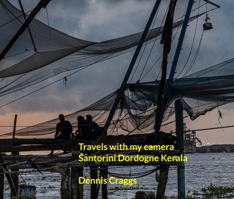
ptember 2022, I travelled to Kerala and Tamil Nadu in India with Charlie Waite and seven other photographers. Our starting point was Kochi, also known as Cochin (the official name until 1996), a port city on the Malabar Coast of India bordering the Arabian Sea. Kochi is the most densely ated city in Kerala, with a total urban population of more than 2.1 million. Called the "Queen of the an Sea", Kochi was an important spice trading centre on the west coast of India from the 14th ry onward, and maintained a trade network with Arab merchants from the pre-Islamic era. In 1505, ortuguese established trading ports in Cochin. There are still buildings like the Old Harbour House this period, some of which have been renovated in more recent times. The Kingdom of Cochin allied he Ming Dynasty, Portuguese, and Dutch and became a princely state of the British. The city was d the sixth best tourist destination in India according to a survey in October 2019 and was ranked th in Lonely Planet's list of top 10 cities in the world to visit in 2020 (A statistic that I find hard to e with all due respect). It was hot and humid but the monsoon had passed and we walked through storic heart of the city, Fort Kochi, and did tourist stuff. Photography wise, these fishing nets were bly the highlight of our excursions and we spent a fair amount of time around them. When tions are right, these great nets are lowered into the sea but the catch never seems to be that great.
ame straight off the plane and were well into our hour long drive down to Kochi and I had not slept o nights. Nonetheless, we stopped at the waterside on Gundu Island to take photos of the colourful g nets and fishing boats. Really there were too many fishermen around to get that classic image of ets (As in Vietnam) but it was worth the try. If there was the time and inclination, we could have alot more time around such locations.
und these two schools very close to the hotel on our very first excursion into the town. It was clear where we travelled that India aspires to very high educational standards but, for us on this occasion, achers were fortunately just a little indulgent as we completely disrupted the quiet harmony of the edings by our arrival and all hell let loose when the cameras came out.
Kochi, a neighbourhood of Kochi, takes its name from Fort Manuel of Cochin, the first European fort on soil, controlled by the Portuguese. This is part of a number of water-bound islands and islets toward the west of the mainland of Kochi adjacent to Mattancherry. The name Cochin implies "co-chin", meaning "like" as it looked like China when the Chinese came to the region during the 14th century. Mattancherry is the centre of old historic Cochin. In old Malayalam, the native language, it is Maadan-cheri, from cheri meaning Maad or cow was the stamp of the Old Royal Fort of the Rajah of Cochin. Fort Kochi was a fishing village in ngdom of Kochi in the pre-colonial Kerala. The Portuguese arrived at Kappad Kozhikode in 1498 during the Discovery, thus opening a direct sea route from Europe to India. The territory that would later be known as Kochi was granted to the Portuguese in 1503 by the Rajah of Kochi, after the forces of Afonso de uerque helped him fighting the forces of Saamoothiri of Kozhikode. The Rajah also gave them permission to Fort Emmanuel near the waterfront to protect their commercial interests but which the Dutch later yed. The Portuguese built their settlement behind the fort, including a wooden church, which was rebuilt in as a permanent structure, today known as the St Francis Church. Fort Kochi remained in Portuguese ssion for 160 years. In 1683 the Dutch captured the territory from the Portuguese, destroyed many guese institutions, particularly Catholic ones, including convents. The Dutch held Fort Kochi in their ssion for 112 years until 1795, when the British took control by defeating the Dutch. Foreign control of Fort ended in 1947 with the Indian independence. We walked widely around the area.
aundry was founded by the Dutch to service their army in Kochi but has continued to operate to the nt day. Dhobi ('though-bee') means washer man in Hindi. And Dhobi Ghat ('gaat') is basically a very open-air laundromat. The Dhobis show up at homes/hotels/ shops across the city to collect dirty es to wash/dry/press them at the Dhobi Ghat. They are famous landmarks amongst tourists for their of clean clothes drying in the tropical sun. There are rows of open-air concrete wash pens, each with its own flogging stone. For 18 to 20 hours a day, people flog, scrub, dye and bleach clothes on ete wash pens, dry them on ropes, neatly press them and transport the garments back to their nations. There is a little bit of modern technology in the form of tumble dryers, presumably for use in oon when nothing will dry naturally but otherwise it's a very labour intensive task. The gent on the m left here is very photogenic and makes his living posing for tourists. The more precise story of his nance I have forgotten.
kali is a major form of classical Indian dance. It is a "story play" genre of art, but one distinguished by aborately colourful make-up and costumes of the traditional male actor-dancers. It is native to the yalam-speaking south western region of Kerala and is almost entirely practised only there. It is one eight classical dances of India. It originated around the 17th century, but its roots are in the temple olk arts of the south western Indian peninsula, which are traceable to at least the 1st millennium CE. thakali performance, like all classical dance arts of India, synthesizes music, vocal performers, ography and hand and facial gestures together to express ideas. However, Kathakali differs in that it ncorporates movements from ancient Indian martial arts and athletic traditions of South India. The ional themes of the Kathakali are folk stories, religious legends and spiritual ideas from the Hindu and the Puranas. The vocal performance has traditionally been performed in Sanskritised yalam. We had the opportunity to photograph the two main characters in the course of making up, a hy process, and then returned later to observe the performance. We did not stay too long however. despite all the effort that goes into it, it was not well attended.
r is a town in the Dindigul district of India between Dindigul and Bathalagundua about 3 km west of atti. It is an old favourite of Charlie's as the people are so friendly and photogenic. However, the first thing und after descending the minibus were these wonderful murals on three sides of a monument. Although you e this location on google maps, there is no more information on their provenance. We thought that they make rather nice prints. We spent a fair amount of time in this area looking out for locations. We stayed at rdamon House established by an English doctor, Chris Lucas.
eriyar National Park and Wildlife Sanctuary is a protected area located in the districts of Idukki and namthitta in Kerala. It is notable as an elephant and tiger reserve. The protected area encompasses q km, of which 305 sq km of the core zone was declared as the Periyar National Park in 1982. The s a repository of rare, endemic, and endangered flora and fauna and forms the major watershed of mportant rivers of Kerala: the Periyar and the Pamba. The park is located high in the Cardamom Hills andalam Hills of the south Western Ghats along the border with Tamil Nadu. It is 4 km from Kumily, ximately 120 km south east of Kochi. We had an enjoyable day touring through the park but we did e any tigers, they are quite rare.
photos were taken at various locations, Abraham's spice garden at Thekkady (The photo below is mon), en route to Peryar and near the Cardamon House, Athoor, where we spent time with the walking to work in the fields. As ever, everybody was very friendly and obliging and happy for their s to be taken but they were worried that the boss might show up and give them trouble for being We managed their concerns by disbursing a little ready cash.
elephants are smaller than African elephants. They reach a shoulder height of between 2m and weigh between 2,000 and 5,000 kg and have 19 pairs of ribs. Their skin has small patches of dentation. Females are usually smaller than males and have short or no tusks. They have smaller ears, elatively broader skulls and larger trunks than African elephants. The mahout is an elephant rider, r, or keeper, used for both civilian and military use. Traditionally, mahouts came from ethnic groups generations of elephant keeping experience, with a mahout retaining his elephant throughout its ng life. In Kerala, mahouts use three types of device to control elephants. The thotti (hook), which is length and about 2cm thick; the valiya kol (long pole), which is 3m in length and about 2cm in ness; and the cheru kol (short pole). Today mahouts are employed in many countries by forestry es and the logging industry, as well as in tourism. I took a ride. It is all a bit controversial but it is that at this charity, the beasts are well looked after.
ere now high up in the tea plantations near Munnar on the border between Kerala and Tamil Nadu. pent alot of time trying to track down a group of tea workers in a suitable surrounding composition his is about the best we could do. India is one of the largest tea producers in the world, although over r cent of its tea is consumed within India itself. A number of renowned teas, such as Assam and eling, grow exclusively in India. The Indian tea industry has grown to own many global tea brands as evolved into one of the most technologically equipped tea industries in the world. The beautiful i Hills, sprawling through the states of Tamil Nadu, Karnataka and Kerala, are home to the pastoral tribe and tea gardens that create the fragrant cup of tea. Nilgiri tea has a slightly fruity, minty ur, probably because trees like the Blue Gum and Eucalyptus dot the region (And provide wind ction). And perhaps the spices produced in close proximity to the tea gardens lend the light brew its ness. The balanced blend of flavour and body makes Nilgiri tea a ‘blender’s dream’. The Nilgiri Hills under the influence of both south-west and north-east monsoons: a reason why the tea leaves n here are plucked around the year. Nilgiri Orthodox tea is a registered Geographical Indication (GI). Orthodox and CTC varieties of tea are manufactured in this region.
ear, Curl (CTC) is a method of processing black tea in which the leaves are passed through a series of rical rollers with hundreds of sharp teeth that crush, tear, and curl the tea into small, hard pellets. eplaces the final stage of orthodox tea manufacture, in which the leaves are rolled into strips, and from the 1930s in Assam. Today, most black teas are produced using the CTC method or the closely d rotorvane orthodox manufacture and are well suited for tea bags, as the product quickly gives a brew. The convenience, low price, strong liquor, generic flavour, and mild bitterness all have buted to the near-monopoly that CTC-type teas now enjoy in South Asia. In the Indian domestic et, this type of manufacture is by far the most popular – over 80% of tea production is of the CTC In the export market, particularly in the C.I.S. (Former U.S.S.R. states), the Middle East, United om and Ireland, CTC teas continue to be the most highly in demand.
ne of our drives though Tamil Nadu, one of our group spotted this colourful field of chrysanthemum e stopped and piled out with our cameras again. Mums are not a common crop, we did not see more his: more typically in Tamil Nadu, the major plantation crops are Cashew, Coffee, Tea, Rubber, Betel Areca nut, Coconut, Bamboo and Cocoa. Cashew is known as the ‘Gold mine’ of wasteland grown in t all kinds of soil and was originally introduced into India from Brazil in the sixteenth century mainly ecking soil erosion on the coast. India now is the largest producer and consumer of cashew nuts. Tea rst introduced in the Nilgiris from Assam in 1839 and was commercially cultivated from 1853. Now redominantly grown in hill slopes in Coimbatore and The Nilgris Districts. Coffee is grown in hill s of of Dindigul, The Nilgris, Salem, Theni and Coimbatore districts. Rubber is exclusively cultivated h Rainfall zones of Kanniyakumari. Bamboo and cocoa were cultivated in Tamil Nadu only after the duction of National Bamboo Mission and National Horticulture Mission Programmes.
is a state on the Malabar Coast of India formed by combining Malayalam-speaking regions of n, Malabar, South Canara, and Thiruvithamkoor, spread over 38,863 sq km with 33 million itants. The region's prominence in trade was noted in the works of Pliny as well as the Periplus d 100 CE. In the 15th century, the spice trade attracted Portuguese traders to Kerala, and paved the or European colonisation of India. It is one of the most prosperous and literate states and is the d-most urbanised major state. Hinduism is practised by more than half of the population, followed am and Christianity. The state has witnessed significant emigration, especially to the Arab states of ersian Gulf during the Gulf Boom of the 1970s and early 1980s, and its economy depends cantly on remittances from a large Malayali expatriate community. The production of pepper and al rubber contributes significantly to the total national output. In the agricultural sector, coconut, offee, cashew and spices are important. Around 1.1 million people in the state are dependent on the y industry. Kerala is one of the prominent tourist destinations of India, with coconut-lined sandy es, backwaters, hill stations, Ayurvedic tourism and tropical greenery as its major attractions.
Nadu is located in the extreme south of the subcontinent. The capital is Chennai, on the coast in the eastern portion of the state. The Tamils are especially proud of their language and culture. While it n industrial core in Chennai, the state is essentially agricultural with a population of 72 million. The s, the majority of the population, are descendants of the early inhabitants of India (the so-called dians), who were driven southward between about 2000 and 1500 BCE when the Aryans came into The population also includes various indigenous communities, who live primarily in the hill regions. mil Nadu, as in the rest of the country, the caste system is strong, even though discrimination has banned by the constitution of India. Members of Scheduled Castes (Groups that traditionally occupy ositions within the caste system) account for about one-fifth of the population. Indigenous peoples all outside the caste hierarchy, account for just a small fraction of Tamil Nadu’s residents. The whelming majority of Tamil Nadu’s residents practice Hinduism. There are, however, notable ities of Christians, Jains and Muslims.
is Craggs