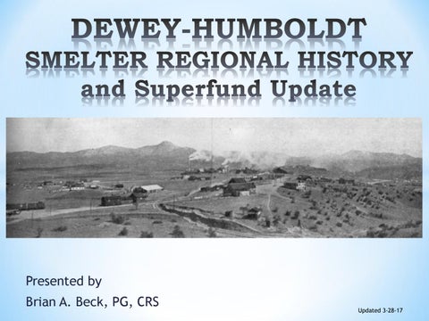
Presented by Brian A. Beck, PG, CRS
Updated 3-28-17
General Location of Dewey-Humboldt Flagstaff Dewey-Humboldt
Elevation: 4,580 ft amsl Area: 18.57 mi² Founded: 2004 Population: 4,621 (2015) The Town of Dewey-Humboldt was incorporated in 2004, combining the historical communities of Dewey and Humboldt. The Humboldt area economy was based on mining, whereas the economy of Dewey was based on agriculture and ranching.
Phoenix
Tucson
Existing land uses within the Town of Dewey-Humboldt include small farms, some higher-density urban development with adjacent commercial uses, and single-family residential neighborhoods . EPA-RI 2016
Reprint of 1924 Geologic Map of Arizona
Quick Smelter Regional History The area became part of the United States in 1848 as the New Mexico Territory. 1858 Gold was discovered in the Gila River, then the Bradshaws. Some mining was conducted under Apache duress. 1863, the Arizona Territory was established. 1870, the last of the Apache’s were declared to have been removed from the Territory. 1871, the first large mines were declared. 1874, the Aqua Fria Smelter was established and operated to about 1886. The mines operating at that time were mainly Aqua Frio, Carson, Silver Cabinet, Rebel, Little Jesse and Huron. The Ore smelted was a lead-silver with some copper ores. 1898, the Val Verde Smelter was established and operational in 1900. Burned down in 1904. The Val Verde Smelter was a copper smelter with ores from the Blue Bell and other mines in the Poland Area, brought in by Rail. 1905, Arizona Smelting was established and was a copper smelter with ores from the Blue Bell and the De Soto mines by rail. 1907, the Banker Depression shut down the smelter and under Bankruptcy the Arizona Consolidated Smelting was created. 1912, the smelter was rebuilt to the current configuration and operated thru World War I. After 1924, the smelter operated periodically to 1937. 1942, the smelter tailings were reworked by flotation according to the EPA. This questioned. 1958 to 1970, the smelter site was used for recycling of aluminum and zinc. 1970 to 2006, the smelter site was used for a sawmill, recycling aluminum and concrete precast.
Dewey-Humboldt Boundaries and general Superfund Area
N
The Superfund Area consist of the Iron King Mine and the Humboldt Smelter Areas
Geology of the Area is important to generally understand. Towns in 1924
There are four large scale rock groups in the Dewey-Humboldt (DH) Area.
Prescott Yaeger Cherry Dewey Humboldt Walker Huron Poland Stoddard Mayer Venezia Cordes Turkey Ocotillo Crown King Bumblebee Canyon
In general terms, these are Granites, Schists, Volcanics and modern sediments. Minerals deposits have been found in the schists and granites. 97% of the values have been mined from the schists in the form of Volcanic Massive Sulfide (VMS) deposits. There are approximately 1,300 mines in the DH Area. Detail from 1924 Geologic Map
The Bradshaw Mtns have produced: 2.21 bp Copper 2.13 bp Lead 2.93 bp Zinc 380m oz Silver 3.2m oz Gold From 1900 thru 1990, the main mines of the area are: Iron King
– 35% Zn, 20% Au, 15% Pb 10% Ag, 1% Cu
McCabe (Galena Gulch) - 20% Pb, 11% Ag
Binghamton - 1% Cu Stoddard - 2% Cu Blue Bell - 4.5% Cu, 0.2% Ag De Soto – 2.5% Cu, 0.2% Ag
1895 map of the area showing the Bowers house and Quartz Mill. Also shown are the Quartz Mills for the Silver Belt and McCabe Mines HWY 169 is near the Hillenbrand house
Estimated Location of the Bowers Quartz Mill
Bowers Former Aqua Fria
From the 1895 map Note the former course of the Aqua Fria River
Quartz Mill
Current course Aqua Fria River
This is the Official County Map that Established County Boundaries and Showed Major Features Prepared for Statehood
This detail of the 1903 County Map shows: Stoddard Smelter Oil Smelter Boggs Smelter Val Verde Smelter
Detail from the 1929 Topographic Survey T13N R1E Sections 14, 15, 16, 21, 22 & 23
Known Smelter, Mills and Burn Pits Smelters Consolidated Arizona Smelter Arizona Smelting Val Verde Mill & Smelter Aqua Fria Mill & Smelter Boggs Smelter Oil Smelter Stoddard Smelter
Burn Pits Binghamton Boggs/Huron Blue Bell Mill Sites Most production mines had their own mill
What is a Burn Pit?
A shallow trench was dug on a low angle slope. The center was filled with charcoal or coke and then ore was place on top. The charcoal/coke was then set on fire. The ores melted and formed what is called “Copper Cement�.
Mines sold their ore to Brokers or to Smelters
The Arizona Ore Company operated in Prescott and Humboldt, they concentrated and roasted ores. The above is from a map dated 1891.
There were four smelters within the Humboldt Superfund Area.
In this area there were: Aqua Fria, Val Verde, Arizona Smelting and Consolidated Arizona Smelting. Where were these smelters located?
Aqua Fria Mill/Smelter From the 1878 patent plat
This is where the Aqua Fria Mill and Smelter was located
Val Verde Smelter Location
West view of Val Verde Smelter
Vertical View
From the 1900 report to the territorial governor, the Val Verde Smelter was a custom mill and smelter. The Val Verde Smelter was processing copper and lead ores from the Big Bug Mining District. The major mines of that time were Chaparral, McCabe, Huron, Lone Pine, Henrietta and Ticonderoga. These were located to the south of smelter and west of the Iron King Mine. The Iron King Mine was not in production during this time. The Val Verde Smelter burned down in 1904 as reported by the Los Angles Herald: â€œâ€Śwhen a molten matte explosion and attendant fire destroyed the plant with a loss of $175,000.â€? A further report stated that the smelter floor was flooded when slag hit the floor and set fire to the building. No reports of injuries.
This is where the Val Verde Smelter was located
1906 Arizona Smelting
View to the southeast from approximately Butte St & 3rd Alley
New archive photograph from the Arizona State Mine Inspector
This view is to the east-northeast. All the descriptions of Arizona Smelting clearly state that this smelter was built on the site of the former Val Verde Smelter (burned down in 1904). This smelter processed copper ores from the Blue Bell (Mayer, Az) and De Soto Mines (Middleton, Az) by way of the new railway.
This is where the Arizona Smelter was located
Consolidated Arizona Smelter
View to the east from Main St. & 3rd St. This smelter was built after the Arizona Smelter closed in 1909. This smelter processed ores mainly from the Blue Bell and De Soto Mines. Only one shipment of ore from the Iron King Mine was processed by this smelter and was found not be suitable.
Consolidated Arizona Smelter
Arizona Smelting
Val Verde Smelter
Aqua Fria Mill and Smelters
The article describes the copper panic of 1907 and how it was created by New Yorker Bankers, which caused: 1) Shutdown of Arizona Smelting 2) Formation of Consolidated Arizona Smelting (Con Arizona) 3) Restart of the Smelter for a year 4) Shutdown after Con Arizona stock doubled in price and owner sold out. 5) The bills were not paid and the facility went into receivership in 1908. Mining Tycoons in the Age of Empire, 1870-1945: Entrepreneurship, High ... edited by Raymond E. Dumett
Detail of the Humboldt Smelter Site There has been 58 properties that needed some sort of clean-up outside of the smelter and mine area. 50 have been mitigated, 8 have refused mitigation. Non-smelter and mine impacts that have been found are: *Smelter/mine tailings used for house foundations and roads *Pb, As & Cu bearing paints used for Houses *As bearing landscape materials
Impacts from Smelter Activities The outlines here are the smelter locations with impacts from the Stacks shown.
EPA sampling has shown that the smelter stack impacts offsite may not require clean-up.
SO WHAT ABOUT THE GROUNDWATER? Did the Iron King Mine or the Humboldt Smelter impact groundwater?
Dewey-Humboldt Groundwater flows in a simlar path as the surface water from North to South. Depths to Groundwater from the ground surface range from 380 feet to less than 5 feet. Groundwater is generally confined by the surrounding bedrock to a sediment (sand, silt and gravel) filled basin. Smelter Area
Iron King Mine
It should be noted that the area from Blue Hills CafĂŠ to Highway 169 was called Indian Meadows and was described as Swampy, Indian Filled Ground in 1870.
From the 2016 Remedial Investigation Report (RI) by the EPA and the 2013 Prescott AMA status report, the current groundwater flow at Humboldt is shown here. Groundwater flow rates for the Prescott groundwater basin along the Aqua Fria River are in feet per day: 3 to 18 ft/dy. Groundwater flows along Chaparral Gulch from the Iron King Mine Tailings to the Aqua Fria River appear to be in feet per year. The flooded section of the Iron King Mine are 100 to 180 feet lower than the regional groundwater.
Arsenic in Groundwater Arsenic is commonly found in Arizona groundwater from many different sources and most are naturally occurring. The groundwater work conducted by the EPA-RI (2016) shows that the Iron King Mine and Humboldt Smelter has not impacted groundwater that is being used for any purpose. The reported impacted private and public wells that show high Arsenic levels are located upgradient (upstream) from both the Humboldt Smelter and Iron King Mine. Most of the impacted wells appear to be located along or in known mineralized zones or within geologic rock units with known arsenic contents. This is also true of the wells to the south and southeast of the Superfund Site.
Known Mineralized Trends
G
al en
a
G
ul ch
-I r
on
K
in
g
Tr
en
Iron King Mine
Smelter Area
Copper Mountain Tre nd
d
Groundwater Flow
The Galena Gulch-Iron King Trend is mainly a lead-zinc mineralization with secondary copper. The lead is mainly in the form of Galena (PbS2) that is enriched in Silver. Zinc is found in Sphalerite (ZnS). Pyrite (FeS2) is common and Arsenopyrite (FeAsS) not as common. Natural arsenic levels in soils near mineral zones can range from 50 to 1,000’s ppm. The Copper Mountain Trend is mainly a copper mineralization. Pyrite and Arsenopyrite are very common. Secondary alteration of the Copper Mountain Trend mineralization with Copper Arsenate minerals (oxides) is common. Natural arsenic levels in soils can range into the percents (+10,000 ppm) near mineral zones.
Naturally occurring mineralized deposits in the Dewey-Humboldt area are very common. All of these mineralized deposits have metals: Iron, Zinc, Lead, Copper and Arsenic Most of the mineral occurrences are stable, but breakdown with bacteria, acid rain and human activity. The biggest human activities that can impact mineral stability are: fertilizers, stock pens (horse and livestock) and septic systems.
CONCLUSION The Dewey-Humboldt area has had a mixed history from 1863 mainly from mining, smelters, railroads, agriculture and then homes. Impacts are limited from the Iron King Mine and Smelter areas, but the areas that are impacted pose a threat to human health and the environment.
Questions & Thank you for attending