
6 minute read
3-D LIVING SHORELINES MODEL LEAVES CHOICES TO THE IMAGINATION


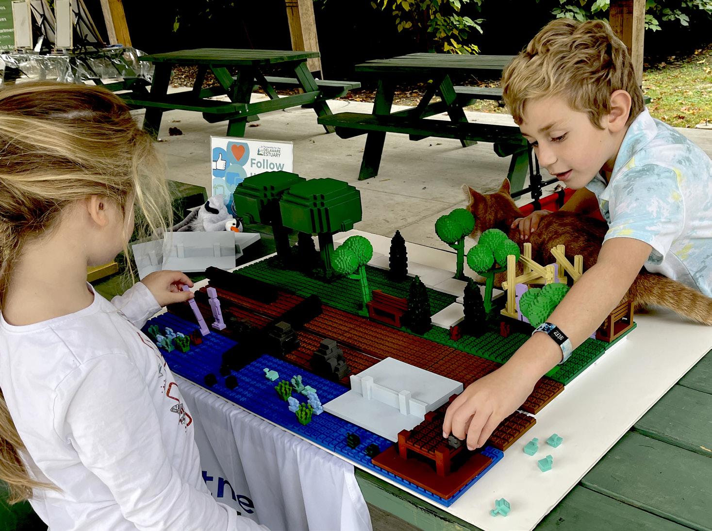
Two kids hunched over a 3-D model of a park next to a river. Caught up in a world of imagination, they deliberated over where they wanted to place the model’s brightly-colored pieces to complete the scene in which they could choose between creating a shoreline with natural elements like plants and logs vs. inserting a concrete berm, or bulkhead.
Spread over a green picnic table at Awbury Arboretum in Philadelphia, the set looks similar to a Minecraft or Lego playset. The children weren’t the only ones attracted to the model. Jana Savini, Partnership for the Delaware Estuary’s (PDE) Assistant Coordinator of Coastal Collaboration, noticed how the model drew people of all ages to PDE’s display table only to get caught in the delightful spell of playing with the pieces while learning about estuary science.
Advertisement
This 3-D model isn’t just a game, it’s an interactive education and engagement tool about living shorelines. It not only gets children and adults engaged in this erosion mitigation tactic, but it also teaches about what living shorelines are made of and what they look like. In return, PDE gets feedback on what people would want a shoreline to look like if they lived near one.
So far, the model has been a hit at outreach events like the one at the arboretum.
“This model helps us start these conversations and collect direct information regarding what people think is important along their waterways,” said Ella Rothermel, PDE’s Data Management Coordinator.
A living shoreline is an erosion control method often seen along the banks of rivers, creeks, and streams. They use natural elements such as native plants and grasses, shellfish habitat, and more, and provide various ecological benefits. Living shorelines can fit into virtually any setting, including urban areas near parks.
PDE created the 3-D living shoreline model with help from a $125,000 National Fish and Wildlife Foundation grant to expand living shorelines into Philadelphia. The overall goal of the grant is to conduct outreach to find out what people want shorelines to look like and then develop relevant designs based on their feedback. The model is spurring conversations around the impacts of people’s choices and the many, often overlooked, benefits that natural components can provide.
“We have been using the model at events to ask what people would like to see along the rivers and creeks they interact with,” said Ella Rothermel,” PDE’s Data Management Coordinator. “Unlike lower in the Estuary, where most of our living shorelines are away from public view, the idea of a living shoreline along the urban stretch of Delaware and Schuylkill Rivers is still pretty novel for the general public. Since these are highly-utilized areas, we want input from community members about what they’d like to see and we want to know what kind of outreach and messaging surrounding these projects will be best received and most impactful. This model helps us start these conversations and collect direct information regarding what people think is important along their waterways. Since the aim of this grant is to create a plan for the expansion of living shorelines and living shoreline outreach into Philadelphia, the model really helps us tick a lot of boxes in terms of understanding public interest.”
Using a concept similar to Lego, the model has movable pieces that attach to a textured board to create a scene that looks like a park next to a waterway. Users can include people, trees, rocks, benches, logs, and even fish, plants, and wildlife. What makes this unique and fulfills the educational goals of the model is it has built-in constraints that as people move the pieces around the board, the components stay consistent with a real living shoreline and surrounding area. Color-coded pieces will only fit in specific zones. Park areas are green, riverbank areas are brown/ yellow, and water areas are blue. Trees and benches only fit in the upland areas and fish will only go in the water. Turtles and wetland plants, on the other hand, can go in the water or on the intertidal portion of the model, but not in the upland portion.
“There is still some freedom,” said Rothermel. “People have wanted to put the pathway in the water to represent a floating water trail. Although it doesn’t fit perfectly there, those are still interesting ideas and we can accept creativity.” There are also pieces in the model for people to create seawalls and bulkheads, which are erosion control methods that use harder materials such as concrete. If someone places a seawall in the model, the base extends far away from the wall itself, blocking all the pegs around it so you can no longer have any animals or plants nearby, similar to how real seawalls/bulkheads work.
“This is meant to initiate a conversation about how hardened shorelines block off ecological connections,” Rothermel said.
Prior to developing the interactive model, PDE used to set up a living shoreline diorama at outreach events. The diorama was a popular attraction, but children were often disappointed to learn that its glued-down pieces were just for looks.
“It was a really great illustration of the differences between hardened structures and living shorelines, but we wanted to create something people could actually interact with and have fun using,” Rothermel said.
Philadelphia-based MakeItSo Engineering worked for about four months with PDE to develop and design the model and pieces created with a 3-D printer, and PDE already is talking with the company to develop new pieces for the model.
To learn more about living shorelines, go to our website at delawareestuary.org/science-and-research/living-shorelines/
HEALTHY HABITATS/STRATEGY H1.3: DEVELOP AND IMPLEMENT NATURAL AND NATURE-BASED TECHNIQUES TO STABILIZE AND RESTORE ERODING SHORELINES, AND TO BUILD AND PROTECT WETLANDS, INFRASTRUCTURE, AND OTHER KEY RESOURCES STRONG COMMUNITIES/STRATEGY C2.7: MONITOR, DEVELOP, AND PROMOTE OPPORTUNITIES TO ASSESS IMPACTS OF OUTREACH

Philadelphia-based company MakeItSo helped PDE develop the living shoreline model and created it with a 3-D printer.


