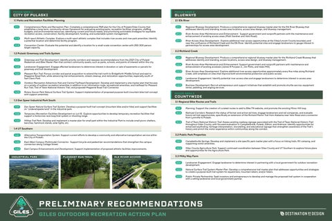
FOCUS AREA 1
FOCUS AREA 2
1.1 Parks and Recreation Facilities Planning
2.1 Elk River
1.1.1
2.1.1
Regional Blueway Development. Produce a comprehensive regional blueway master plan for the Elk River Blueway that addresses identity and branding, access area locations, access area design, and blueway management.
2.1.2
River Access Area Maintenance and Enhancement. Support government and nonprofit partners with the maintenance and enhancement of existing access areas (Matt Gardner and Veto Road).
2.1.3
River Access Area Development. Explore additional river access opportunities at the Giles/Lincoln County boundary and near the confluence of Richland Creek and the Elk River. Identify potential sites and engage landowners to gauge interest in partnerships for access area development.
CIT Y OF PULASKI
BLUEWAYS
Comprehensive Parks and Recreation Plan. Complete a comprehensive P&R plan for the City of Pulaski/Giles County that establishes a long-term, community-driven framework for evaluating existing parks, recreation facilities, programs, staffing, budgets, and environmental resources; identifying current and future needs; and prioritizing actionable strategies for equitable recreation access, conservation, facility development, funding, and sustainable system management.
1.1.2
Multi-sport Athletic Complex. Explore a multi-sport athletic complex that includes river access and river park amenities. Identify a potential location and determine facility program.
1.1.3
Convention Center. Evaluate the potential and identify a location for a small-scale convention center with 250-300 person target capacity.
1.2 Pulaski Greenway and Trails System 1.2.1 1.2.2 1.2.3
Greenway and Trail Development. Identify priority corridors and reassess recommendations from the 2021 City of Pulaski Pedestrian and Bike Master Plan that connect community assets, such as parks, schools, and points of interest within the city. Landowner Engagement. Engage affected landowners to determine interest in donation or sale of easements or parcels for greenway and trail development. Pleasant Run Trail. Pursue corridor and parcel acquisition to extend the trail north to Bridgeforth Middle School and east to Magazine Road Park, while advancing trail enhancements, stream cleanup, and restoration opportunities, especially south of Sam Davis Park.
1.2.4
Outdoor Recreation Adventure Hub and Central Trailhead Development. Develop and implement a site master plan that focuses on a variety of outdoor recreation amenities in addition to an information node, recreational amenities, and trailhead for Pleasant Run Trail, Trail of Tears National Historic Trail, and proposed Magazine Road Trail Connector.
1.2.5
Rotary Soccer Park Natural Surface Trail System. Support implementation of proposed purpose-built mountain bike trail concept with support amenities.
1.3 Dan Speer Industrial Park South
2.2 Richland Creek 2.2.1
Regional Blueway Development. Produce a comprehensive regional blueway master plan for the Richland Creek Blueway that addresses identity and branding, access locations, access area design, and blueway management.
2.2.2
River Access Area Maintenance and Enhancement. Support government and nonprofit partners with maintenance and enhancement of existing accesses (James R Puryear Jr., Jim Potts, and Vales Mill).
2.2.3
River Access Area Development. Explore additional river access opportunities approximately every five miles along Richland Creek, with emphasis on sites that improve both environmental protection and public access.
2.2.4
Landowner Engagement. Identify potential river access sites and engage landowners to determine interest in access area development.
2.2.5
Business Development. Recruit entrepreneurs and support initiatives that establish and promote shuttle service, equipment rental, paddling, and angling services.
FOCUS AREA 3
COUNTYWIDE 3.1 Regional Bike Routes and Trails
1.3.1
Dan Speer Natural Surface Trail System. Develop a purpose-built trail concept (mountain bike and/or hike) and support facilities on “undevelopable land” in the industrial park.
1.3.2
Temporary Recreation Facilities Development on Lot 15. Explore opportunities to develop temporary recreation facilities that support a motocross race loop/trail system or shooting range.
1.3.3
Hilltop Trail Park. Develop and implement a master plan for small park within the Industrial Park to include small picnic shelters, benches, hammock stands, solar lights, etc.
3.1.1
Planning. Support the creation of curated routes to add to Bike TN website, and promote the existing Minor Hill loop.
3.1.2
Railroad Corridors. Research the status of former and active rail lines, engage landowners and rail companies, and evaluate future rail trail opportunities, specifically an extension of the Richard Martin Trail from Alabama near Veto Road and a connector from Lynnville to Pulaski.
3.1.3
Trail of Tears National Historic Trail. Assess existing roadway signage associated with the Trail of Tears National Historic Trail throughout Giles County, with focused evaluation in Campbellsville, Pulaski, Elkton, and Ardmore. Identify opportunities for enhanced wayfinding, heritage interpretation, storytelling, and educational signage that strengthen awareness of the Trail’s history and enrich the visitor experience within communities along the corridor.
1.4 UT Southern 1.4.1
Alternative Transportation System. Support current efforts to develop a community and alternative transportation service within the City of Pulaski.
3.2 Public Park Properties
1.4.2
East-West Campus Multimodal Connector. Support bicycle and pedestrian recommendations that strengthen the campus connection along College Street.
3.2.1
Campbellsville Springs. Develop and implement a site specific park master plan with a focus on hiking trails, RV camping, and supporting visitor amenities.
1.4.3
East Campus Enhancements and Development. Support implementation of proposed athletic facilities improvements.
3.2.2
Giles County Agriculture Park. Support continued coordination between Giles County and UT Southern to explore future plans and opportunities for the Agriculture Park.
INDUSTRIAL PARK
PLEASANT RUN TRAIL
ELK RIVER ACCESS
3.3 Milky Way Farm 3.3.1
Landowner Engagement. Engage landowner to determine interest in partnering with a local government for outdoor recreation development.
3.3.2
Natural Surface Trail System Master Plan. Develop a comprehensive trail master plan that addresses opportunities and strategies to create a purpose-built trail system for equestrians, mountain bikers, and/or hikers.
3.3.3
Public Private Partnership. Seek investors and entrepreneurs to develop and manage the proposed trail system in cooperation with a willing landowner and local government partner.
PRELIMINARY RECOMMENDATIONS GILES OUTDOORS RECREATION ACTION PLAN
FOCUS AREA 4
FOCUS AREA 4
4.1 Lynnville
4.4 Minor Hill
4.1.1
Downtown Master Plan Development. Develop and implement a master plan for Downtown Lynnville with a focus on streetscape improvements, public space, and the Lynnville Railroad Museum.
4.4.1
Minor Hill Municipal Park Enhancements. Develop and implement a park enhancement plan with a focus on equestrian and agricultural events.
4.1.2
Lynnville Park Expansion/Enhancement. Explore opportunities to expand and enhance the park to serve festival and event needs and biking visitors.
4.4.2
Natural Surface Trail Loop. Support planning and implementation of a multi-use trail on City-owned property across from the municipal park.
4.1.3
Business Development. Seek entrepreneurs to explore outdoor recreation retail opportunities centered on road biking and support initiatives to establish and promote shuttle and equipment rental service.
4.4.3
Business Development. Seek entrepreneurs to explore retail opportunities focused on equestrians.
RURAL COMMUNITIES
RURAL COMMUNITIES (CONT.)
4.2 Elkton 4.2.1
Planning. Develop a comprehensive bike and pedestrian plan that connects community assets such as parks, schools, and key points of interest within the city.
4.2.2
City Gateway. Develop Main Street gateway into the City of Elkton at its intersection with US 31.
4.2.3
Streetscape Improvements. Design and implement ADA-accessible streetscape improvements to include wide sidewalks, lighting, furnishings, street trees, and landscaping.
4.5 Public Art, History, and Heritage 4.5.1
Public Art and Heritage Committee. Develop a public art, history, and heritage committee for the county and cities, with participation from the Giles County Historical Society, to identify locations for public art, murals, interpretive signage, and storytelling features that celebrate the area’s history and culture.
4.5.2
Art Walks and Storytelling Spaces. Work with the Giles County Historical Society and local partners to identify walking routes and key locations for curated art installations and interpretive storytelling displays, such as murals, plaques, and interactive exhibits.
4.5.3
Heritage Tourism Development. Partner with the Giles County Historical Society to develop a heritage tourism strategy that packages historic sites, cultural stories, notable figures, historic downtowns, cemeteries, churches, agricultural landscapes, and other heritage assets as visitor experiences.
4.2.4
Bike and Pedestrian Improvements. Explore sidewalk connectivity and enhancements, bike lanes, and intersection improvements within the town limits.
4.2.5
City Park System Expansion and Greenway Development. Evaluate opportunities to expand the city park system through inclusion and enhancement of the former US 31 bridge and the Matt Gardner Elk River access area, and explore development of a greenway and trail system that strengthens connectivity between parks, schools, and river accesses.
FOCUS AREA 5
Business Development. Seek entrepreneurs to explore outdoor recreation retail opportunities centered on fishing and boating, and support initiatives to establish and promote shuttle and equipment rental service.
5.1 Signage
4.2.6
BRANDING, WAYFINDING, AND GATEWAYS
4.3 Ardmore
5.1.1
Branding. Create a comprehensive branding package for Giles County that supports outdoor recreation, tourism, community identity, and future signage implementation.
4.3.1
Planning. Develop a comprehensive bike and pedestrian plan that connects community assets such as parks, schools, and key points of interest within the city.
5.1.2
Countywide Vehicular Wayfinding. In accordance with the Giles County brand, develop and implement a countywide vehicular wayfinding plan that includes the towns and key destinations.
4.3.2
Town Square Development. Develop and implement a master plan for a Town Square at the intersection of Main Street and Ardmore Avenue.
5.1.3
Gateways. Develop and implement a coordinated gateway signage strategy for primary entry corridors into the county and cities that utilize the Giles County brand and existing city brands.
4.3.3
Streetscape Improvements. Design and implement ADA-accessible streetscape improvements to include wide sidewalks, lighting, furnishings, street trees, and landscaping.
4.3.4
Bike and Pedestrian Improvements. Explore sidewalk connectivity and enhancements, bike lanes, and intersection improvements along Main Street from Lewter Chapel Drive to Delap Road.
4.3.5
Public Art Gateway. Explore opportunities for a mural that promotes the City of Ardmore, Giles County, and State of Tennessee on the CSX railroad underpass on Main Street.
DOWNTOWN LYNNVILLE
LYNNVILLE RAILROAD MUSEUM
LYNNVILLE PARK
PRELIMINARY RECOMMENDATIONS GILES OUTDOORS RECREATION ACTION PLAN
W aln ut St
Soda Pop Junction City Hall
Outdoor Dining
Sidewalk Improvements Parking Lot Improvements
Mill St
On Street Parking
Ma
in S
t
Food Truck Infrastructure
Lynnville Railroad Museum
Intersection Improvements • Bumpouts • Crosswalks
Tennessee Southern Railroad
Church St
M
ai
DOWNTOWN LYNNVILLE CONCEPTUAL SITE PLAN
nS
t
CONTOUR INTERVAL: 5 FT
1 IN = 20 FT
NORTH
EXISTING CONDITIONS
DOWNTOWN LYNNVILLE BIRDS EYE PERSPECTIVE
Shoal St
S Patterson St ADA Access 5% Slope Gateway Existing Residential Existing Shelter
Floodw
ay
2 Stall Restroom
Kiosk
Public Art
Pump Track
Kiosk Stairs Wall Ride
rs Tea il of Tra
Existing Restroom Removed
Stream Restoration
Two 5’ Retaining Walls
Benches
Creek Access
Existing Bridge
ery met
E Ce
Floodway
St Formalized Parking and Sidewalk
Sam Davis Park
Jack Deer Field
Pleasant Run Trail
PLEASANT RUN TRAIL AT PAT TERSON ST. PARK CONCEPTUAL SITE PLAN
City of Pulaski Parcels
Floodway
Giles Parcels
2 ft Contours
0
20
40
Feet
Scale: 1 in = 20 ft
CONTOUR INTERVAL: 2 FT
1 IN = 20 FT
NORTH
EXISTING CONDITIONS
PLEASANT RUN TRAIL AT PAT TERSON ST. PARK BIRDS EYE PERSPECTIVE
TRAILHEAD Shelter Existing Water Tower
4 Stall Restroom Plaza
Hiking Only
Lookout
RV Campsite
ALT 1: HILLTOP TOWER
Trailhead
Mowed Path Picnic Tables Lookout
Murco Wall Products
ALT 2: HILLTOP PARK
LEGEND Hiking Trail (approx. .6 mi)
Mowed Path Bathrooms
U
.
PavilionS. Fire Pit Lookout
H
Beginner Trails (approx. 2 mi)
ig
hw
ay
Proposed Primary Entrance
31
Tarpley Sho p
Rd
DAN SPEER INDUSTRIAL PARK-SOUTH CAMPGROUND AND TRAIL SYSTEM
Intermediate Trails (approx. 3 mi)
CONTOUR INTERVAL: 5 FT
1 IN = 150 FT
NORTH
EXISTING CONDITIONS
DAN SPEER INDUSTRIAL PARK-SOUTH BIRDS EYE PERSPECTIVE
EXISTING CONDITIONS
NIGHT RENDERING Back Lit Channel Letters Handrail Lighting
ELKTON PIKE BRIDGE BIRDS EYE PERSPECTIVE