SPECIAL EDITION
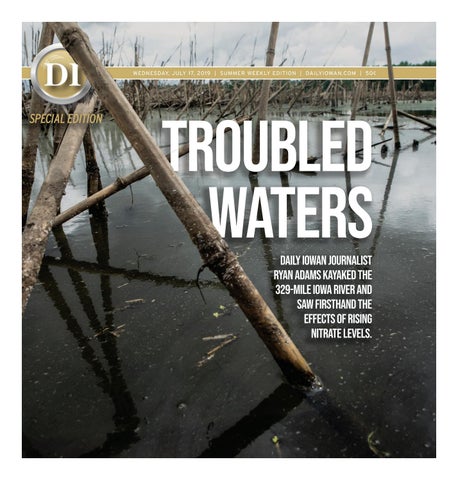
TROUBLED WATERS Daily Iowan journalist Ryan Adams kayaked the 329-mile Iowa River and saw firsthand the effects of rising nitrate levels.
Preface Bret Adams/The Daily Iowan Daily Iowan photojournalist Ryan Adams paddles along the bank of the Iowa River north of Oakville near the confluence with the Mississippi River on June 15.
I
n mid-January, I pieced together a pitch for a project at The Daily Iowan that would eventually become the story you are about to read. I am passionate about the natural beauty of Iowa and the conservation issues it faces, and I wanted to work with a subject matter close to my home state’s identity. I began with the concept of water quality and formulated that into a journey that would take me down the Iowa River. The river, the sixth-longest in the state, passes along the campus at the University of Iowa and produces a major source of outflow of water to the Mississippi River. The trip would be a solo expedition, taken by kayak. I would camp along the river over the span of 20 days, truly getting as close to the river as possible. After the approval of the project, months were spent preparing for the expedition, as well as planning what content I would need and how to present it. Everything down to the last packet of oatmeal was prepared, and I eagerly awaited the beginning of my journey. On the night of May 19, I lay in a bedroom in my grandparents’ house north of Iowa Falls, trying to get some sleep. It was the night before the expedition began, and I soon realized what a monumental task lay ahead of me. I knew the preparations had been made to the best of my ability, but there were inevitable unknowns ahead of me. Yet, the river had to be traveled. What I couldn’t prepare for was the river’s impact on me.
4 | DAILYIOWAN.COM | WEDNESDAY, JULY 17, 2019
A journey into a river’s environment Daily Iowan journalist Ryan Adans took a monthlong journey down the sixth-longest river in Iowa to learn about the quality of its water.
Ryan Adams/The Daily Iowan A vintage car protects the riverbank along the Iowa River east of Dows on May 23. The use of discarded automotive bodies is one of several practices used to reduce bank erosion along the river. The car is one of several lined along the water.
BY RYAN ADAMS ryan-adams@uiowa.edu I held tightly to the rope draped across my shoulder. On the other end of the rope was nearly 100 pounds worth of gear strapped to my kayak, meant to aid me in my 20-day trip from the northernmost tip of the Iowa River in Crystal Lake to the southernmost in Oakville. I had already traveled 11 days, and was exhausted from a day’s worth of paddling. It was 6
p.m. and I was tired and hungry. nitrate pollution in the Gulf of of the hypoxic zone in the gulf. I embarked on an expedition Dinner would consist of tea and Mexico. Iowa’s farm runoff is diof the 329-mile Iowa mashed potatoes cooked River on May 20 on my Jetboil. to research nitrate But dinner was a small levels — an indicaconcern compared to what was really driving ‘Throughout the next month, I would paddle, tor of water quality — in the waterway. me to make this expediphotograph, test, and live on the water.’ I started my jourtion. The fact is that as ney in the small an Iowan, I recognize — Ryan Adams stream that is the the issue of water quality beginning of the has become increasingly Iowa River, near politicized, as Iowa remains the leading contributor to rectly responsible for 45 percent Crystal Lake, Iowa. Throughout 5 | DAILYIOWAN.COM | WEDNESDAY, JULY 17, 2019
the next month, I would paddle, photograph, test, and live on the water. After conducting 104 nitrate tests of the Iowa River and adjoining tributaries, I found the nitrate levels consistently exceeded recommended limits, sometimes going 10 times over the recommended limit. These high levels can be attributed to the flooding that started in March and occurred throughout May and June, because stormwater can carry a
large amount of nitrogen son ivy, covered the forest data along the river. I found nitrate levels to be between and phosphorus pollut- floor. As daylight ran out, ev- 25-100 mg/L on most parts ants, according to the EPA. Late in the afternoon erything around me was of the river. To put these during a particularly warm submerged while I looked findings into perspecday, over 150 miles into my for a safe place to set up tive, the EPA recommends trip, I pulled my 14-foot kay- camp for the night. I heard 10mg/L as a cap for human ak through the waterlogged owls hooting, the quiet consumption of water. Anytimber that was supposed hum of crickets chirping thing above might prove to be my campsite for the in the meadow, and deer harmful to humans, as it evening. Every step was moving through the tall affects the blood’s ability to met with difficulty as my grass around me. I began carry oxygen. The Environmental sandals sunk into the mud- to navigate back onto the Groupreports dy ground under the two river once again, in hopes Working feet of floodwater filling the that I would find a piece that even though the EPA recomforest. m e n d s A r o u n d 10 mg as me were maa nitrate ple and ash ‘If I wanted to understand the current in trees, their condition of Iowa’s waterways, I had to see it, limit, order for leaves shieldfeel it, smell it, hear it, and taste it...’ there to be ing much of no adverse the wilderness — Ryan Adams health efmanagement fects, 0.14 area north of Chelsea, Iowa, from my of dry land to sleep for mg is considered a safer sight. The bottom of each the night — otherwise, I amount. Like most nights on the tree emerged from the might end up on the floodriver, I sat in my two-permurky water, where other ed water in the dark. These nights did not dis- son backpacking tent, low-lying vegetation, of which I hoped was not poi- courage me from collecting looking through content I
Ryan Adams/The Daily Iowan Adams holds a test strip up to approximate the levels of nitrate north of Iowa Falls on May 25. The estimated level of this test was 75 mg/L.
Ryan Adams/The Daily Iowan Daily Iowan photojournalist Ryan Adams’ breakfast awaits preparation north of Alden on the morning of May 25. Adams’ breakfast for each day of the expedition consisted of 3 packets of instant oatmeal and a cup of coffee. collected from the day. The shelter I managed to find was two miles downstream from where I had failed to find shelter before. Dusk had come, and a fog covered the field 100 feet from the riverbank. The setting sun left an orange-purple glow that illuminated the landscape. This is what I was hoping for when I set out on my trip. The only way I saw fit to tell this story was by getting my hands dirty and my paddles wet. Exploration and curiosity were values I obtained from a childhood playing in the dense timber and stream that bordered our home. They are also what motivated me to undertake this journey. If I wanted to understand the current condition of Iowa’s waterways, I had to see it, feel it, smell it, hear it, and taste it — though after seeing
6 | DAILYIOWAN.COM | WEDNESDAY, JULY 17, 2019
the water, I decided it might be safe to hold off on the taste test.
...
Iowa’s land fuels its agriculture industry. Approximately 3.2 million humans live in the state’s borders, but the 23 million hogs, 4 million cattle, and 60 million chickens involved in Iowa’s livestock industry outweigh the human population 27 times over, according to the Iowa Agriculture Literacy Foundation. Livestock creates nutrient-rich manure, which aids in the growing of crops. Iowa produces more than 3 billion bushels annually between corn and soybeans alone. However, with such massive amounts of waste produced by the livestock population, some of the nutrients, like phosphorus and nitrogen, find their way into tilling systems
and into our waterways. Because of recent record rainfall in Iowa, a high concentration of farm runoff has found its way into major channels such as the Cedar and Iowa Rivers, where they eventually flow into the Missouri or Mississippi Rivers. These rivers eventually feed into the Gulf of Mexico. Once in the Gulf, the nitrates that once promoted healthy crops then deplete oxygen levels in water, creating a “dead zone.” Filled with the nutrients from other states, the zone is inhabitable to aquatic life, and this year it is
Iowa Population by species Humans: 3.2 million Hogs: 23 million Cattle: 4 million Chickens: 60 million
The Gear Journalist Ryan Adams packed nearly 100 pounds of camera gear and living supplies into his kayak for his expedition on the Iowa River. Here is a handful of the items he brought. 7 | DAILYIOWAN.COM | WEDNESDAY, JULY 17, 2019
Ryan Adams/The Daily Iowan A bald eagle spreads its wings on the banks of the Iowa River on May 13. Bald eagles commonly build nests near bodies of water, making easier to access such prey as fish. predicted to cover an area the size of Massachusetts, according to the National Oceanic and Atmospheric Administration. The idea was that I would use my boat to travel down the Iowa River while collecting water-quality tests of nitrate, snapping pictures, shooting video, and interviewing Iowans along the way. Balancing the tasks at hand on the expedition was sometimes easier said than done. One of the first nitrate tests I needed to take was supposed to come from one of the upper branches of the river. However, as I was caught up in capturing the natural beauty around my boat, I missed the test site. This led to a half-mile paddle upstream. All the strength in my upper body transferred itself into my oars as I fought the swift current. A half-hour later, I arrived, exhausted, ready to test the water. As my journey pro-
gressed, testing the river became a familiar routine. The tube containing my test strips came out of its pouch on my life jacket, the lid opened with a thoomp, and out came a small plastic strip with two pads on one end. I leaned over the side of the boat, dipped the pads in the water for a second, and then shook it off as I brought it out of the water. My right wrist turned upward, allowing me to note the second hand. I had 60 seconds to wait while the chemicals reacted. The strip was marked with the test number, and I took a picture of the strip along with an estimate of the levels. All data, including the latitude and longitude of each testing location, I entered into a yellow, waterproof journal I had once hoped to purpose as a mountain-climbing logbook. Sitting in the tent, I began to question myself.
I had some whispers of doubt. I knew I had made it halfway through the 329 miles of river I needed to navigate, but all I could think of was real potatoes and a real bed. I had to remind myself that I needed to keep going through the fatigue I faced, because the curiosity propelled me to continue to discover the river. Up until this point, I had faced physical and mental strain, but never felt the task at hand was more than I could handle. Now, more than 150 miles into the journey, I wrestled with feelings of uncertainty. However, I decided to continue on. I knew I had to complete the expedition regardless of the hardships I faced, because there were uncertainties ahead that still needed to be explored.
sheer amount of flooding on the river. The river was above normal levels during the entire expedition, and nutrients from surrounding fields made their way into the waterway during that time. For example, a river gauge based at the Coralville Reservoirusually hovers around 685 feet deep; the section had increased to more than 700 feet when I passed through it. Water depth is only one tool used to measure the conditions in the state’s network of streams. State agencies and researchers are interested in data that indicate the health of the rivers. Chris Jones, a research engineer with the University of Iowa’s IIHR — Hydroscience and Engineering, monitors 60 real-time sensors in Iowa’s stream network. Current research at IIHR indicates that tiling is increasing in the state. Tiling is a common farming practice used to
4%
96% Source: Daily Iowan Data
96 percent of water tested by journalist Ryan Adams was found to be above the EPA-recommended 10 mg/L. drain excess water from fields. A culvert, or drain pipe, system lies in the low point of the field, allowing a path for water to exit. Typically the water enters a nearby waterway. Tiling soil makes farmland vulnerable to farm runoff and increases the flow of whichever body of water the tiling drains into. Increased streamflow increases erosion in a watershed and creates more
rapid flooding. One IIHR watershed study saw an increase of 12,000 miles of new tiling systems. However, Jones said, the issue remains. “If we did nothing, would it get a whole lot worse?” Jones said. “I think the answer to that is no. But, I think we do as a society want better water quality, and we do want our drinking water utilities to have robust and
...
Every farm and field I saw buried under the river’s flow opened my eyes more and more to the
Ryan Adams/The Daily Iowan The confluence of the Iowa River and the Mississippi River near New Boston, Illinois, on June 15, 2019. The spot indicates the end of the 329-mile Iowa River.
8 | DAILYIOWAN.COM | WEDNESDAY, JULY 17, 2019
TOP LEFT: The limestone bluffs in Iowa Falls are seen in detail on May 25. The bluffs in the area are home to Cliff swallows and the rare Cliff pigeon. TOP RIGHT: Water from the Iowa River stands in the edge of a farm field north of Belmond on May 22. Many fields near the riverbank experienced flooding during the 27-period in which Daily Iowan Photojournalist Ryan Adams was on the river. CENTER LEFT: A gosling pauses from feeding on vegetation near the Coralville Reservoir’s shore on June 10. BOTTOM LEFT: An old barn marked by the brand of Palisade Dairy sits above the riverbank on the Iowa River north of Iowa Falls. Palisade Holding Co. has operated in the Iowa Falls area for 31 years. CENTER RIGHT: A freight train crosses a railroad bridge in the Meskwaki—Sac Settlement south of Marshalltown on the Iowa River on May 31. Daily Iowan Photojournalist Ryan Adams portaged over the bridge considering the less-than 1 foot of clearance between the bridge and the river. BOTTOM RIGHT: Cows stand along the Iowa River as they graze south of Riverside on June 13. According to the Iowa Beef Industry Council, Iowa ranks eighth in terms of number of cattle and calves. (Ryan Adams/The Daily Iowan)
9 | DAILYIOWAN.COM | WEDNESDAY, JULY 17, 2019
Crystal Lake 20 mg/L
RYAN ADAMS/THE DAILY IOWAN
Dows 50 mg/L
RYAN ADAMS/THE DAILY IOWAN
Nitrate levels in the Iowa River Data collected by journalist Ryan Adams shows nitrate levels found along the Iowa River range from less than 10 mg/L to more than 125 mg/L
RYAN ADAMS/THE DAILY IOWAN
Data points found
THE IOWA RIVER And rising nitrate levels See all 104 nitrate level tests on dailyiowan.com Range of nitrate levels 10 | DAILYIOWAN.COM | WEDNESDAY, JULY 17, 2019
The EPA’s recommended limit of nitrate in drinking water is 10 mg/L. Flooding and record rainfall in Iowa contributed to much higher nitrate levels found by Daily Iowan journalist Ryan Adams during a monthlong kayak expedition down the Iowa River.
Iowa Falls 50 mg/L
RYAN ADAMS/THE DAILY IOWAN
Marshalltown 50 mg/L
Marengo 75 mg/L RYAN ADAMS/THE DAILY IOWAN
Iowa City 50 mg/L
Oakville 40 mg/L
RYAN ADAMS/THE DAILY IOWAN
Source: Daily Iowan data
11 | DAILYIOWAN.COM | WEDNESDAY, JULY 17, 2019
Ryan Adams/The Daily Iowan Ryan Adams/The Daily Iowan Farmer Dick Sloan points to a section of his cornfield near Rowley on June 18. Sloan implements cover crops, Cody Atkinson of Marengo holds two hulled catfish he caught on June 1. Atkinson had to forgo his normal prairie land, and no-till practices to reduce nutrient runoff and soil erosion in his fields. fishing destinations downstream because access was blocked off. clean sources of water.” The amount of fertilizer input into fields can affect water quality as well. In many places I passed through, the water was murky with sediment, possibly worse because of erosion from flooding. Iowa State University publishes a list of recommended fertilizer inputs for fields each year. Because these recommendations are made on a voluntary basis, farmers can choose how much fertilizer they apply to fields each year. Farmers around Iowa have had to adapt to the increase in annual precipitation, increased length between rainfall, and more intense rainfall, according to a study the U.S. Agriculture Department conducted using data in nine Midwestern states from 2011 to 2015. The report recommended farmers add a diversity
of erosion-management tools such as wetlands and cover crops. One farmer, Dick Sloan of Rowley, Iowa, participated in the USDA and ISU collaborative report and continues to implement nutrient- and erosion-reduction systems. Sloan farms roughly 700 acres in northeast Iowa. Embedded among the field are rows of wetlands, buffer strips, and cover crops. Sloan’s lips turned up in a half-smile as he walked across his fields. He walked along the rows of corn with a spring in his step, excitedly explaining all the practices he had implemented over the years. “When I started out, I had corn, hogs, and soybeans, and you feed the corn and soybeans to the pigs, and you use the nutrients from the pig manure … and raise more corn and soybeans, and it
struck me as odd,” Sloan said. “That’s a good little system, and it is on small-scale levels, but then there’s a lot missing — the diversity, the potential for adding more diversity.” The same programs that help farmers such as Sloan
cated $282 million to water-quality initiatives over the course of 12 years. Reynolds’ office did not respond to requests for comment from The Daily Iowan. The Nutrient Reduction Strategy, developed
‘I will say that it’s ironic that ever since we passed the bill, the party that did nothing has complained about this being too little.’ — Ken Rozenboom, R-Oskaloosa are funded through state and private sources. Iowa Gov. Kim Reynolds signed a bill in January 2018 — the first bill she signed upon taking office — that allo- Reynolds
in 2013, acted as a sort of road map for the plan outlined in the bill, aimed at reducing the flow of nitrates into the Gulf of Mexico. The strategy does not legally require farmers to practice farming a certain way; it instead encourages farmers to practice greener farming techniques to
12 | DAILYIOWAN.COM | WEDNESDAY, JULY 17, 2019
prevent farm runoff. Iowa Sen. Ken Rozenb o o m , R-Oskaloosa, the chair of the Natural Resources and EnRozenboom v i r o n m e n t Committee, said the water-quality bill Reynolds signed was a monumental step in addressing the issue, because there was nothing else like it before. “I will say that it’s ironic that ever since we passed the bill, the party that did nothing has complained about this being too little,” said Rozenboom, referring to his Democratic opposition. “When they were in control, there was no water-quality bill.” S e n . C h u c k Grassley, R-Iowa, said in a conferGrassley ence call with reporters
that former EPA Administrator Gina McCarthy, the head during the Obama administration, made statements during a 2013 visit to Iowa that summarized the effectiveness of the Nutrient Reduction Strategy. “She was asked at that time if she thought the way that Iowa’s doing it [Nutrient Reduction Strategy] would meet the federal requirements,” Grassley said. “… the fact that she thought that not only would Iowa’s plan satisfy the federal law, but it might be an example for other states to do as well.” Five years after the launch of the Nutrient Reduction Strategy, a UI study released in 2018 showed that Iowa’s contribution of nitrate pollution in the Gulf of Mexico has spiked by 47 percent in recent years. The study was based on a five-year running of
TOP LEFT: A pair of deer stand along the riverbank of the Iowa River north of Iowa City on June 11. TOP RIGHT: Vintage vehicles lay embedded into the riverbank of the Iowa River south of Riverside on June 13. In efforts to reduce riverbank erosion, vehicles are sometimes placed on the shore. TOP CENTER LEFT: A tadpole breaches a bubble to take a breath at Arney Bend Wildlife Area on May 29. BOTTOM CENTER LEFT: A drainage pipe stands on the bank of the Iowa River’s west branch on May 20. This pipe is one of several drainage solutions for excess water in Iowa farmlands and communities. CENTER: A bald eagle perches in a tree next to the Iowa River north of Middle Amana on June 3. BOTTOM LEFT: A pair of ducks stand on a log in a tributary of the Iowa River north of Iowa City on June 11. CENTER RIGHT: Iowa farmer Dick Sloan is seen driving near his 700-acre farm near Rowley on June 18. Sloan utilizes several conservation practices on his farm including cover crops, strips of prairie grass, and no-till practices. BOTTOM RIGHT:A monarch butterfly floats through a meadow at Arney Bend Wildlife Area north of Marshalltown on May 29. The 203-acre conservation area was established in 1980. (Ryan Adams/The Daily Iowan) 13 | DAILYIOWAN.COM | WEDNESDAY, JULY 17, 2019
Ryan Adams/The Daily Iowan Former Clarion art teacher and wrestling coach Jack Britton stands with his dog Razor near the Iowa River bank at Pikes Timber on May 22. Britton has spent most of his life along and on rivers in Iowa, including the Mississippi River, near which he grew up. Britton was in the area looking for morels.
Ryan Adams/The Daily Iowan A couch and bench sit in the floodwater along the south 0bank of the Iowa River downstream of Marshalltown, Iowa. on May 31. annual totals, but Rozenboom said that because nitrate levels are so sensitive, these studies need to be done during at least a 50-year period to accurately portray the condition of the river.
“Common sense should tell people that we don’t do a lot of things that we did two generations ago,” Rozenboom said. “And that has impacted water quality — not for the worse but for the better.”
When there’s a spike in nutrients in water, the water’s clarity decreases and sedimentation increases, changing the ecosystem of the waterways. Sediment-tolerable species are more likely to thrive,
while clear-water species the ground is farmed,” ing up others’ minds to struggle. Increases of ni- Bolkcom said. “If we’re implement the practices. While watching a breeze trogen and phosphorous not even able to take care also promote algae, which of … basic water quality blow through the infant corn have caused issues in oth- and soil erosion issues plants in his field, Sloan said, volunteering “What we do need is more er Midwest communities, through especially those along means, something more people trying, and I think that’s the main thing.” Lake Erie, where bacte- has to give here.” ... Evidence of flooding ria-inducing algae had followed my boat and me left communities without The Iowa River transdrinkable water. forms throughout its throughout the entire jourCritics of the bill Reyn- length. The beginnings are ney. I paddled over a seemolds signed say that $282 straight and narrow chan- ingly endless, completely million is not enough to nels running through the submerged gravel road, I felt address the issue of water farmland of north-central the pull of the river as it manquality. Iowa. From East Twin aged the overflow of water Sen. Joe Bolkcom, D-Io- Lake Wildlife Complex on, underneath the boat, and I wa City, the river begins to wind saw the evident force of the community and widen, until it be- water as I passed a crumpled e d u c a t i o n comes wider than Kinnick canoe wrapped around a log. I went to the river for director at Stadium’s football field. the Center Some of the unique fea- answers, and while I did for Global & tures along the river banks learn from the people I Regional En- include limestone bluffs spoke with, the flooding I Bolkcom vironmental in Iowa Falls, the expan- experienced, and the tests Research, said Republican sive Hawkeye Wildlife I conducted, the resoundleaders in the Iowa State- Management Area north ing answer I found came house will not raise taxes of Iowa City, and vegetat- from the river itself: Wato invest more money in ed islands that inhabit the ter quality isn’t a simple addressing water quality. channel after the conflu- issue to approach. It’s like “I think without a ence with the Cedar River. the river — ever-changing change in the General AsJones said it is easy to course, rising and lowering. Like the sembly and river, the isthe leadership sue is comof the Generplex. al Assembly, The nuwe’re going ‘What we do need is more people trying, and trient levto continue to I think that’s the main thing.’ els may be have kind of a high, and tepid, insuf— Dick Sloan, farmer in Rowley, Iowa flooding ficient effort may inaround soil creasingly conservation and water quality,” Bolk- become pessimistic about affect Iowa, but if anyone com said. the state of water quality can come together and Because Iowa has en- in Iowa’s waterways, but create change, it’s the peodured massive rainfall this there are solutions to the ple of this state. It’s the farmer in the year, it’s even more im- problem, such as diversifield, enthusiastically exportant to address how Io- fying crop rotation. wans can limit the amount Sloan is one of the farm- plaining new conservation of farm runoff. ers implementing diver- practices, the angler de“… I can see many, ma- sified practices, allowing scribing a lifelong relationny examples of bonehead him to better understand ship to a particular fishing farming practices and how to efficiently grow hole along the river, the poor farming practices crops while reducing nu- friends enjoying a weekthat result in significant trient loads. The Rowley end getaway as they paddle erosion and water pollu- farmer said he believes the down the river that gives tion because of the way issue is a matter of open- me hope.
14 | DAILYIOWAN.COM | WEDNESDAY, JULY 17, 2019
While this piece provides my experience, it is not the end of the project. During the expedition, I spent time capturing the journey on camera, with the goal of a film documenting my experience in ways written words cannot express. The project continues, and I look forward to completing the film in the fall.
EPILOGUE Ryan Adams/The Daily Iowan A cornfield on the right side of the picture is affected by standing water from rainfall on May 20. To the left side of the picture, the rocky bank of the cornfield meets the Iowa River.
L
ooking back on the time I spent on the water, I sometimes find it hard to believe that I accomplished what I set out to do. Through the hardship and adversity, I persisted, knowing that I wanted to tell this story. For me, this project was an indication of whether I was passionate enough to endure hardship in the outdoors to cover the issues needed to be talked about. Oddly enough, I began to crave the wind in my face, the waves fighting to push
over my boat, the nights spent inside my tent listening to driving rain. Everything that pushed against me made me push back even harder. I can only say that the river revealed itself in ways that impacted me to my core. It felt like the river held secrets, and it did everything to keep me from seeing what they were. Little by little, I peeled back the layers, and I felt I was experiencing the water in a way most people will never encounter. I found companionship in the wildlife that call
the river their home. I felt joy as the morning light touched my face. The more I paddled, the more in tune I became with the river and land around me. While this piece provides my experience, it is not the end of the project. During the expedition, I spent time capturing the journey on camera, with the goal of a film documenting my experience in ways written words cannot express. The project continues, and I look forward to ccompleting the film in the fall. 15 | DAILYIOWAN.COM | WEDNESDAY, JULY 17, 2019
Bret Adams/ The Daily Iowan