3 minute read
SNOWEX - NASA Snowpack Study


NASA Takes Snowpack Study to the Skies
Words: Amelia Arvesen
Advertisement
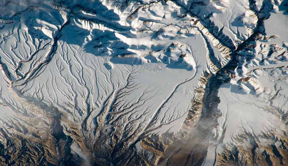
For at least the last 100 years, people have collected manual observations on the ground to understand how much snow pack exists. While satellites help map snow cover and track changes, there are limitations. “We’re pretty good at measuring the area that the snowpack covers, but we’re not very good at measuring the amount of water stored in that snowpack,” Elder says. SnowEx, launched in 2017, is trying to close that gap in remote sensing knowledge.
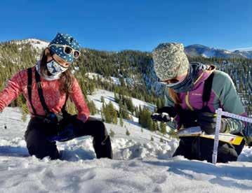
Snow-water equivalent, or SWE, informs flood and drought predictions as well as hydropower, reservoir, agriculture, and water resource decisions. It also informs outdoor recreation and ecological aspects, such as wildlife migration patterns and food access. But its measurement over a significant area requires more than one instrument. It’s inefficient and, in most cases, impossible to send hundreds of field workers into high altitudes and remote areas to keep collecting data. From January to March, a NASA aircraft flew over select locations in the West to measure snowpack while a team of field researchers like Dylan Craybeek dug dozens of holes in the snow below. “It takes close to an hour, and I’ll dig anywhere between four and eight pits on a field day,” Craybeek says. Spread across six sites in Idaho, Montana, Utah, and Colorado this winter, these researchers measured snow depth, density, temperature, grain size, and liquid water content, among other data points. The corroboration of the data collected from the air with the data collected on the ground is part of a years-long NASA-funded program called SnowEx.
One of the reasons they’re studying the massive swath of snowpack is because it’s changing, partly due to climate change, and the decrease in snow has an impact that extends far beyond the ski resorts. Scientists predict that, eventually, water isn’t going to flow freely as it does now.
“The one thing we can’t live without is water,” says Kelly Elder, one of the research hydrologists for the U.S. Forest Service. “People think oil is valuable, but that’s because people in power have all the water they want to drink now. Many people already live without adequate clean water.”
The one thing we can’t live without is water.
And capturing images from space has a wide margin of error. That’s why this program, using airborne lidar, radar, and imaging systems alongside data collected from the ground, is a step closer toward better understanding snow and the water stored within it.
“We’ve made incremental progress over the years,” says Carrie Vuyovich, a SnowEx 2021 project scientist and lead snow scientist for NASA’s Terrestrial Hydrology Program. “If anything, it’s more critical now, as the climate is changing and having a larger effect on seasonal snow, to understand what impact that’s going to have on our water resources.”
In the American West, snowmelt provides about 75 percent of our freshwater, but seasonal snow coverage in the northern hemisphere has been declining fast over the past few decades. If we can better measure snowpack in the headwaters of the Colorado River, for example, that will inform our understanding of how we allocate resources in the water rights areas of the river flowing from Colorado to California. Maybe if non-scientists knew just how precious our freshwater is and how sparse it could become, we might be even more inclined to preserve it. We might learn to prioritize storing safe drinking water over watering our lawns or washing our cars. And we’ll look at the snowpack beneath our skis even more lovingly than we already do.
There’s, of course, more research to be done after SnowEx. The program has at least one more winter of data collection ahead, Vuyovich says. Over the last four years, researchers have also observed snow in California and New Mexico. Yet the studied states only contain some of the six different climate categories in North America: alpine or arctic, Boreal forest, temperate forest, maritime, ephemeral, and prairie. Each category contains varying factors that impact the snow. Other phases of the program would observe snowpack in other states, like Alaska.
Once SnowEx concludes, the next phase will work to launch a global satellite mission that tracks snow from space. “If we figure out how to measure snow from space, we can measure large areas at high frequency,” Elder says.