5 minute read
200K DAY... GRENTE ALM


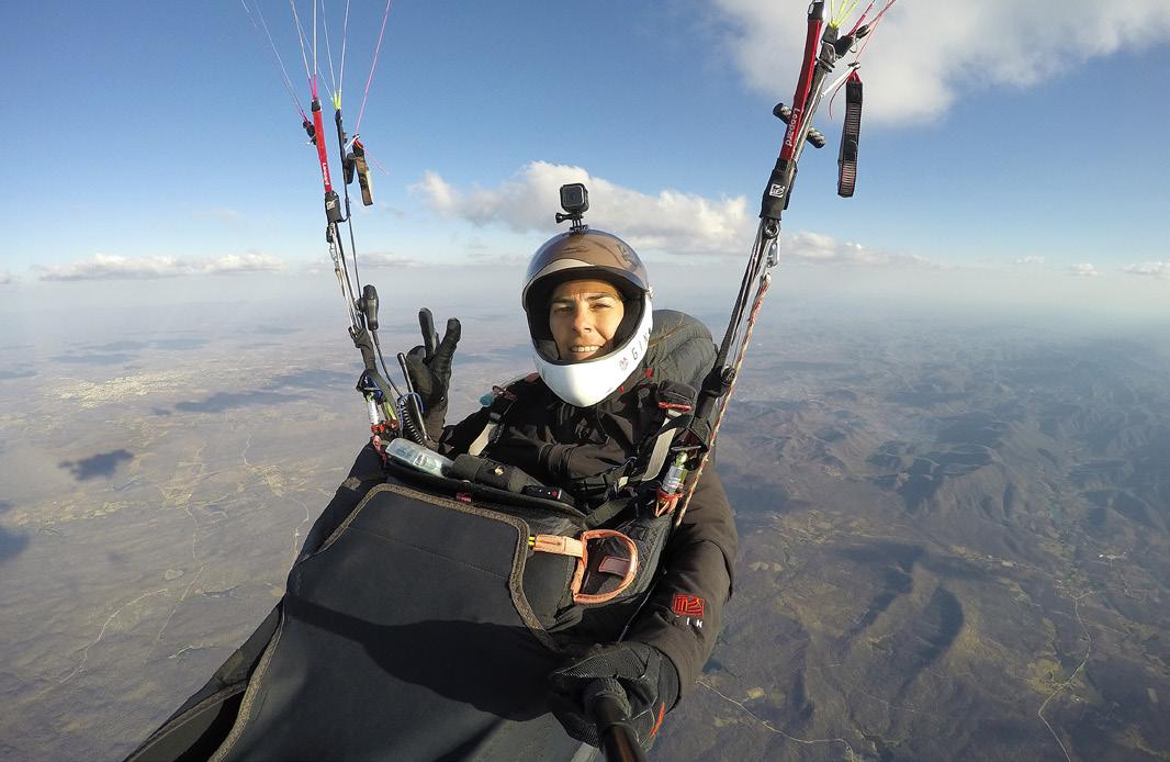
MORNING START Climbing out in the first thermal above Grente
Photo: Till Gottbrath
200K DAY... GRENTE ALM
Advertisement
While 100km flights are achievable for most XC pilots, a 200km FAI triangle is something much bigger, and puts you in an exclusive club of well-accomplished XC pilots. With more than 500 200km flights a year in recent years Grente, in the NE Italian Alps, is one of the best places in the world to try this – if not the best. Why?
Grente (full name Grente Alm – Alm meaning mountain pasture) has no gondola or road access. Instead, it requires a dawn start and a 1,000m hike to get to it. From the Grente Alm hut at 2,000m it is 1.5km on a small path to get to the take-offs above the treeline. There are several good spots between 2,200-2,350m.
On a promising day – light wind (single-digit), N to NW wind, which means drier conditions and higher cloudbase – top pilots from the eastern Alps and beyond flock here. There can be 150 pilots on launch, although crowding is not a problem. Fortunately, as everybody has walked up, you will find a nice sense of camaraderie among the pilots.
On my first visit I was shocked at how early pilots got ready. Watching them launch at 9.30am I was convinced they would bomb out and land 200m below. But I was wrong. They immediately found a thermal and off they went. The race was on!
Turnpoint 1
What makes the Grente triangle so special is its ideal exposure to the sun along the entire route, the fact that you don’t start at one of the turnpoints, and the unique final glide.
As soon as you launch you head east, passing the wild alpine scenery of the glaciated Rieserferner Group. When traversing Staller Sattel, the border between Austria and Italy with its beautiful Lake Obersee at 2,000m, get as high as possible, so you don’t come in too low when reaching Am Putzen, where you search for the next thermal. Following the peaks above the Defreggen Valley often turns into a race – on
a good day you will be dolphining along with high average speed.
Now you have to decide where to set your first turnpoint. Slightly northeast of Zunig (the last peak in the Defreggen ridge); after the traverse of the Isel Valley at Rotenkogel or slightly north of it; or even near Großglockner (3,798m). In any case, the Isel Valley traverse looks more challenging than it actually is.

On the first leg, heading east to Staller Sattel, with the wild alpine scenery of the Rieserferner Group on the horizon to the left
Photo: Till Gottbrath
Turnpoint 2
After your first turnpoint you will turn back on yourself and head west for a long time – almost 100km! The first part is identical to your first leg. Before traversing back to Staller Sattel try to get as high as you can. Don’t think of your average speed, just get high! By the time you arrive at Staller Sattel for the second time, the thermals will be stronger and, particularly with west wind, Staller Sattel can turn into an uncomfortable spot.
When back at Schwarze Wand (Black Wall, 3,000m), the major summit to the north of the launch, you have now already flown a flat triangle of 70km minimum. From Schwarze Wand the leg westwards usually presents no major challenges.
But after Gitschberg, heading west, there is no protection to the north from the high peaks of the Zillertaler Alps anymore. Until now they have protected you from north to NW winds.
When traversing from Höllenkragen over Sterzing to Rosskopf, you will normally look for the next thermal near the Rosskopf Gondola. But watch out: with stronger N to NW winds, it may be the better idea to head towards the forested ridge above Gossensaß and then keep to the north of the Ridnaun Valley-ridge. Once above the ridge, the kilometres are easy. Choose Turnpoint two about halfway along the ridge (many pilots do this) or all the way over the glaciers to Agglsspitze (3,196m) or even further west.

Passing Hochgall (3,436m), the high point in the Rieserferner group, east of launch
Photo: Till Gottbrath
Turnpoint 3
Leg three follows the next 25km back along the route that you came. When traversing Sterzing and the Eisack Valley, make sure to stay as high as you can again. If you get low here the strong valley winds will eat you.
Now you are approaching the crux of the entire flight: the traverse to Lüsener Alm and the Lüsener Alm itself. When high at Plattspitze, and enjoying a bit of a tailwind, you may fly the western option over Ochsenalm ski area. The other option is to return to Gitschberg and traverse south from there. This is a bit longer overall but with a shorter traverse to Lüsener Alm. Decide depending on clouds ahead, altitude and wind direction.
The Lüsener Alm is a long, wide and flat ridge at 2,000m and more. When searching for thermals there the wind often seems to change direction within seconds, thermals disappear in a blink of the eye. Do not wait for a strong thermal, instead take advantage of the smallest lift to gain altitude. You will need every metre until you have left Lüsener Alm behind and head towards turnpoint 3 somewhere near Heiligkreuzkofel with its mighty, now sunlit west face. To get there, you follow the ridge between San Vigilio to the northeast and San Martino to the southwest. It’s very logical.
Home
With high cloudbase and large thermals you now prepare for the icing on the cake. If early you can extend your triangle to the south as far as you dare, before heading back north towards the Antholzer Valley.
Thanks to the now sunlit rock faces, you will make good progress, even though it will be late by now. Piz da Peres (2,507m), located to the southeast of Kronplatz with its many ski lifts, is the last typical Dolomite-kind of peak with steep reddish rock faces. This is where you will nned to get as high as you can in order to complete the final 20km glide back to landing at Antholz. Made it! Till Gottbrath

Evening flying on the last leg through the Dolomites
Photo: Till Gottbrath
IN BRIEF

TRACKLOG A classic 200k FAI triangle from Grente, flown by Christian Schartner (AT, Nova Sector) on 2 June 2019. The flight took 8h45, with max altitude of 4,239m
Tracklog: Christian Schartner
Getting there: From the village of Antholz- Mittertal in the valley it’s a steep two-hour hike to the launches above Grente Alm. Following the 6.5km forestry track is longer but much less strenuous.
Best time: April to September
Etiquette: Don’t litter or go to the toilet in the forest. The foresters don’t like it and pilots are getting a bad rap. Take care where you park your van as this is also annoying local residents.
Online: facebook.com/Grente2, suedtirol.info, download the Südtirol2go app for public transport