
8 minute read
3.6 Landscape Vision, Working with Nature


The landscape vision for Ladyfield looks to carefully knit into the existing context by understanding what exists on the site already and how it can be supported and supplemented through stewardship and long term planning.
Advertisement
The masterplan for Ladyfield provides an opportunity to view the landscape in a broader setting alongside The Crichton, building on 200 years of shared heritage with some landscape assets even older than this. The proposals employ a 100 year vision for the site and the approach to connectivity and green space will be for the long term benefit, not short term gain.
The proposals reflect the importance of green spaces in supporting wellbeing and the positive impact access to these spaces can have on peoples physical and mental health. The masterplan integrates better accessibility to the Ladyfield site from The Crichton and neighbouring communities, with minimal impact on the existing wildlife.
The foundation of the design is the valuable existing natural heritage assets of the mature trees on the site, together with the information on ecology and water management. The importance of the landscape and its key components define the masterplan and how people will experience living and travelling through Ladyfield. This means extensive amounts of green space, a combination of open parkland, public and private gardens.
“Development proposals will contribute to the enhancement of biodiversity, including where relevant, restoring degraded habitats and building and strengthening nature networks and the connections between them. Proposals should also integrate nature-based solutions.” - NPF4, Policy 3
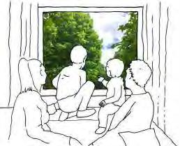
The Crichton benefits from views out onto the mature tree canopies and this is something that gives a sense of calm, and connection with changing seasons. This approach will be replicated at Ladyfield. By keeping the existing trees in the masterplan, residents of Ladyfield will experience the same opportunities.
The trees will provide shading as summers become dryer and hotter. This connection of new buildings to nature is called biophilic design, and analysis of The Crichton shows that this was understood in the early 1800’s as the campus developed strong links with its natural surroundings. Their significant value for wildlife is also acknowledged and there is a strong emphasis on enhancement of the site to improve biodiversity. It is important to consider and plan for the succession of the mature trees on the site. Planting of new trees on the site, for future generations to enjoy, aligns with The Crichton’s long term vision.
There will be a new layer of landscape infrastructure to integrate the development sensitively within the setting. The strategy should be to incorporate play areas, safe lanes around new homes which prioritise people and play, and playful elements next to key walking and cycling routes. The masterplan will;
• Enhance the landscape around Hannahfield through the retention and protection of the existing trees. These will be supplemented by new low-level tree planting with opportunities for light-touch paths and play.
• Woodland, tree belts and parkland scale trees, garden trees and hedgerows in the central and lower section of the site will strengthen the identity of the place, and provide a valuable extension to wildlife corridors
• Within the central zone a series of buildings will sit alongside the retained existing trees. Interventions will look to enhance biodiversity by strengthening corridors and providing a series of shared gardens for existing and future residents.
• New sustainable homes will be created closely following the existing topography, to minimise disturbance to the natural setting, with opportunities to create sustainable water management systems around common lanes and gardens which will support biodiversity.
The approach for roads infrastructure provision has been to provide the minimum required access whilst making the routes as efficient as possible. The design intent is to reduce unnecessary areas of hard landscape that are expensive to install, require drainage and ongoing long term maintenance. This will also encourage the use of active travel options.
3.7 Integrated Rainwater and Landscape
A sustainable approach to water management is being taken. Capturing water at surface level, water is slowed on its journey through the Ladyfield site with swales and wetlands, reducing pressure on public sewer systems. In addition, Ladyfield will be a thriving water resilient place designed to adapt to increased rainfall. Conserving water within the Ladyfield site aids climate resilience for dryer, hotter summers.
An integrated landscape and drainage strategy should be put in place that provides climate resilience, place-making, space for ecology and well-being. BlueGreen Infrastructure (BGI) integrates hydrological functions with nature and landscape. It makes use of water (blue) and nature (green) to future proof drainage infrastructure capacity, protecting against flooding and the effects of climate change.
These features should be integrated into streets, open-spaces and within building plots and contribute to a distinctive sense of place and habitat connectivity within the masterplan. BGI should work with the existing topography and the proposed built fabric to provide a holistic approach to landscape and drainage.
Within the Ladyfield site, the topography conveys water to existing low points, which function as collectors of over-land water flows. These damp areas should guide development to make best use of existing processes and systems and compliment the site’s natural hydrological function.
Slowing and capturing water flows across Ladyfield will reduce the impact of water run-off and potential for flooding from surface water. This is a particular issue associated with Character Area 3 that is currently let as agricultural land. When this area is not in crop, there is currently no natural vegetation or water gathering points to prevent surface water flooding during periods of high rainfall. The introduction of new vegetation and managed wetland at this location will mitigate the impact of this and protect neighbouring properties from water ingress.
Visible water management features such as swales, wetlands, rills, ponds and raingardens will be planted with native species and will collect and slow down rainwater. These design features will reduce the impact on the existing surface water sewer system. They will create a green network of interconnected and adaptable habitats which serve to move water, wildlife and people through the Ladyfield development.
Connecting water management and amenity space is an efficient and flexible way to structure diverse green space which performs more than one function. The delivery of sustainable flood risk management and the creation of great places to live that are resilient to climate change are now key features of Scottish planning policy. Ladyfield presents a special opportunity to demonstrate how new policy can be applied in practice.
These features will reduce the impact of flash cloudburst events by containing and slowing the flow of water, but they will also provide amenity value and expand the diversity of habitats. The proposals for the management of water on the Ladyfield site has the aim of ending uncontrolled flooding while improving environmental water quality. By considering water first, we can move from battling to overcome its negative impacts to capitalising the positive contribution it can make to creating environmentally friendly places.
In addition, complementary measures outwith the site boundary to control water flows and to reduce traffic speeds could be implemented.
“Development proposals for or incorporating new or enhanced blue and/or green infrastructure will be supported. Where appropriate, this will be an integral element of the design that responds to local circumstances.”
For example, in carriageway raingardens may be an effective intervention that prevents surface rainwater gathering on the roads adjacent to the site. Raingardens can simply be described as areas of planting designed to slow down and hold on to rainfall, slowly releasing it. They help reduce flooding as well as protecting our rivers and waterways. They are a more natural way of managing urban drainage, especially around existing properties and new developments.
A range of strategic partners, including the local community, will work collaboratively throughout the design process and will also identify potential sources of funding to deliver these innovative proposals.
3.8 Spatial Strategy
Ladyfield is a large site with a number of distinct character areas which require different approaches to housing typologies and spatial structures. Development should reflect this, through the formation of a network of primary, secondary and tertiary routes to support homes and community activities across the site.
The diagram opposite shows groups of new housing development in character areas 2 and 3. The layout of the groups should be considered so that infrastructure is reduced across the whole site and the development could be phased. Priority of phasing should support the development of connections, green-blue infrastructure and landscape as enabling works prior to the establishment of homes.
The character areas have been designated following the project principles and tested to provide capacities based on local, national and international density benchmarks. These should be considered upper limits, rather than targets to beat. They balance the protection of the environment and biodiversity of the site with the need to provide high quality affordable, mixed tenure housing.
Development of future detailed proposals for each character area should reflect an approach that is in keeping with the principles of the overall vision and provide a mix of housing models, tenures and sizes. This will ensure a mixed and intergenerational community is encouraged and supported through a phased delivery period.
Illustrative density benchmark developments
378 units, 212 houses, 166 apartment in car tamed development.
40 dwellings per hectare
42 dwellings, 2-5 bed terraced houses and 1-2 bed apartments plus flexible common house and separate workshop and gym.
42 dwellings per hectare
Development initiated/led by Scottish Government to sensitively place new homes alongside an 18th Century planned village.
22 units per hectare
Approximately 40 units
Approximately 60 units
Approximately 80 units
The final density achieved in each of the zones will be determined by the type of buildings that are submitted as part of any future planning application.
Character Area 1 The Hannahfield Parkland Density of 0 units per hectare
Approximately 50 units
Approximately 60 units
Character Area 2 The Heritage Quarter Density of up to 50 units per hectare
Approximately 60 units
Character Area 3 The Ladyfield Terraces Density of up to 30 units per hectare
3.8 Spatial Strategy
The spatial strategy for Ladyfield will follow the cues of the landscape features present within the site, principally trees and topography, to anchor development within the natural and conservation area context.
The site with existing trees located 1 2
A new primary road Access introduced between Kingholm Road and Kingholm Loaning
Blue green infrastructure
Sustainable water management systems such as wetlands, swales and raingardens fully integrated with the landscape design
New shared greens and gardens established A series of public, semi-public, shared and private green and amenity areas
3 4
A supporting lane network
The lane network is introduced to reduce the extent of wide roads across the site but ensure high connectivity
Pedestrian prioritised path network
A well connected path network for walking and wheeling, that is safe and encourages use
New trees and planting
Enhance and strengthen the existing landscape infrastructure with new trees
8
Illustrative Masterplan
The above diagram shows how development may be progressed to meet the masterplan principles; it is an illustration of one approach only and alternatives may be considered.
3.8 Spatial Strategy
Ladyfield should be developed in a phased manner in line with the indicative approach outlined opposite. This describes an approach which will support a sustainable ‘build-out’ which should enable a mixed community to organically develop as new elements stitch into The Crichton Quarter.
This phasing plan is to be viewed as a starting point for any future delivery discussions, to allow flexibility to meet any site challenges.
Phasing of any development works could be preceded by an initial phase of Infrastructure enabling works. This could comprise all route infrastructure, site wide drainage, SuDS, utilities, infrastructure, landscaping, planting and play. This will enable the phases identified on the plan adjacent to be ‘plugged-in’ as they are developed.
The masterplan identifies six potential phases or groupings within Character Areas 2 and 3, of varying scales. These have been developed to allow for phases to be delivered concurrently or separately.
Detailed phasing strategies should form part of any future planning applications for the site, relating back to the approach outlined opposite. This means the impact of the new development can be monitored incrementally and mitigation measures introduced should unforeseen problems be encountered.
Key
Enabling Primary Access Infrastructure
Enabling Internal Road Infrastructure
Enabling Active Travel Infrastructure
Indicative Areas of Development
Phase 2
Approximately 40 units
Phase 4
Approximately 60 units
Phase 6
Approximately 80 units
Phase 1
Approximately 50 units Opportunity for Care Campus
Phase 3
Approximately 60 units
Infrastructure Enabling Works Routes, Drainage, SuDS, Utilities and Landscape
Phase 5
Approximately 60 units


