1 minute read
1.4 Landscape Site Analysis


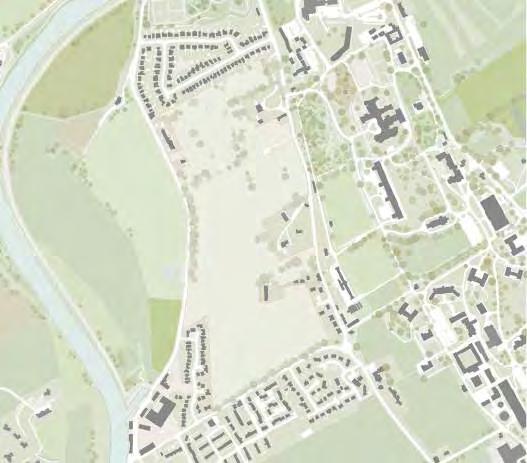
Topography and Water
The influence of the rural landscape is reflected in the surrounding developments of Castledykes and the newer parts of Kingholm Loaning, with strong east-west boundaries between development and agricultural land.
Advertisement
These strong boundaries run perpendicular to the topographical contours, combining water management systems of ditches and drains, directing run-off towards the Nith.
The road network cuts across these boundaries, following the topography to avoid steep rises; Kingholm Loaning is an exception to this rule, and is moderately steep.
The regular field pattern and boundary treatment changes as the lower dale typology meets the coastal flats. Within the Ladyfield site, the topography and field pattern is similar and conveys water to existing low points running from high to low from east to west toward the River Nith, which function as collectors of over-land water flows.
Salt marshes straddle the River Nith and it is essential that impacts of development within Ladyfield do not affect these sensitive environments. Currently there is a ditch that runs east to west conveying water to a low point which then crosses Kingholm Road ultimately terminating at the salt marsh and river beyond.
These damp areas have influenced the development of the masterplan and make best use of existing hydrological processes. They will also reduce the impact of surface water run-off and reduce the risk of flooding.