
8 minute read
Site and Context


This chapter is about the site. It establishes the physical and strategic context for the masterplan.
1.0 Site and Context
Advertisement
1.1 The Site
1.2 Location and Site Analysis
1.3 Landscape Site Analysis
1.4 Constraints and Opportunities
1.1 The Site
Ladyfield sits on the urban edge of Dumfries town centre, where town meets country and landscape and building gently come together to create a unique setting. The history and heritage of this part of Dumfries is strongly linked to the story of The Crichton.
The Ladyfield site of today is the result of hundreds of years of change and development, some planned and others through natural evolution and growth. A gently sloping topography, trees and landscape features associated with the agricultural heritage of Dumfriesshire help to give the site a rich character.
The Ladyfield landscape character is defined by the gently sloping nature of the site falling from Glencaple Road down towards the River Nith beyond Kingholm Road. The majority of the western boundary, along Kingholm Road, is lined by large existing trees and hedgerows which offer screening from outside the site. The southern edge addressing Kingholm Loaning is more open with sporadic trees lining the roadside beyond an existing hedgerow.
Within the site, a clear low point and natural basin is found centrally with cotton-grass present where surface water run-off collects. This wet area, whilst a natural soak away, will over time continue to damage and harm the established bank of trees without water management intervention.
The built context of the Ladyfield site is defined by the two listed former dwellings of Ladyfield, Hannahfield House to the north and Ladyfield House to the South. There are also clusters of vernacular housing along Glencaple Road and Kingholm Road, of these the Ladyfield Cottages offer the greatest heritage value.
The eastern boundary to Glencaple Road is formed by a stone wall which varies in height. To the south of the site, addressing Kingholm Loaning, are contemporary housing developments of mixed tenures.
On the River Nith sits the listed Kingholm Quay pier structures and listed early 19th century houses amongst larger industrial shed buildings. The northern edge of the site is defined by further contemporary housing dating from c.1970s of detached and semi-detached suburban dwellings typical of that period.
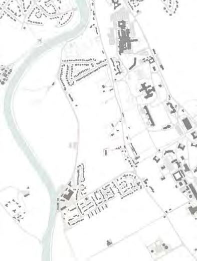
1.2 Location and Site Analysis
The location of Ladyfield can be seen as part of a wider group of projects that will make Dumfries a more accessible, vibrant and welcoming place to live, work and socialise. A vision that encompasses this ethos is set out in Dynamically Different Dumfries led by the Dumfries Partnership Action Group.
Ladyfield sits to the south of the established town centre, which is centred around the historic Midsteeple. The High Street is a pedestrianised zone, stretching from Buccleuch Street in the north to Shakespeare Street in the south. Like many similar sized towns, Dumfries town centre has suffered from reduced footfall from the rise of out-of-town retail and online shopping. This is exacerbated locally by a disproportionally ageing population and lack of affordable housing options.
The Dynamically Different Dumfries Action Plan sets out 5 thematic areas, identifying a series of priorities in each, and projects like The Midsteeple Quarter are an example where action is underway. Such projects will make a difference to the experience of the town centre, and it’s success as a place to live, work and spend time. The Ladyfield site presents an opportunity to further increase the local population with affordable and accessible housing only a short walk from the town centre and its rejuvenated offerings. Ladyfield can also be seen as an opportunity to extend the developing network of green and active travel routes.
Ladyfield offers a natural extension of the established public park spaces which stretch along the eastern side of the River Nith, helping the regeneration of the town centre through encouraging movement across a network of centres. Increasing usage via people moving through these places - from The Crichton Quarter to the town centre - increases their long term sustainability as well-used public spaces. Ladyfield can extend the principles within The Crichton Trust Masterplan and Development Framework by the extension of the formal ‘green corridor’, taking this from Dumfries and Galloway College in the east, through an accessible Ladyfield, to the River Nith and NCN7 in the west.
The future of Ladyfield, its connectivity to the town centre and its accessibility to public services present it as an ideal site for an exemplar 20-minute neighbourhood in line with National, Regional and Local Policy and Planning objectives. 20-minute neighbourhoods are places that are designed so residents can meet their day to day needs within a 20-minute walk of their home, with access to safe walking and cycling routes, or by public transport.
1.2 Location and Site Analysis
Built Heritage and Conservation Setting
The context of the Ladyfield site is unique and rich, in its social, cultural and heritage setting, sitting adjacent to The Crichton. This is recognised through the number of individual buildings with listed status in the local area in addition to their collective value within the broader Crichton Conservation Area. In addition to the built context, the landscape setting and mature tree lines are of significant importance and value to the local area.
Heritage buildings of significant value within the local context are of varying scales and typologies but all share a commonality in their integration with the landscape setting, their use of a simple palette of local building materials and their careful craft, whether vernacular or planned.
Given the value of individual buildings and the significance of the Conservation Area a separate Heritage and Conservation Appraisal is provided as Appendix 7.2, which outlines key buildings, features and assets which should be protected and enhanced by the masterplan proposals.
1.2 Location and Site Analysis
Residential Neighbourhoods and Urban Structures Ladyfield is surrounded by a number of established residential neighbourhoods, each with their own characteristics and spatial structures. These are typically modern housing developments with the contemporary urban approaches of their time evident in their arrangements. These neighbourhoods have been developed within historic field boundary patterns, which are not unlike those still present within the Ladyfield site today.
Key 11 Castledykes
12
1 3 Kingholm Quay McFarlane Avenue
1 4 Well Green, Ladyfield Cottages and Ladyfield Villas
Neighbourhood 1 - Castledykes
The neighbourhood of Castledykes is formed principally of two streets which form an enclosed cul-de-sac of detached and semi-detached homes. Streets are typically two lanes wide with footpaths on each side. All homes have private parking provision for at least 2 vehicles.
The homes, 2 storey and bungalows, are suburban in character and of a type found in other Scottish towns from this period and finished in buff facing brick, pepple-dash render and concrete roof tiles.
Neighbourhood 2 - Kingholm Quay
The majority of homes in Kingholm Quay are two storey former local authority houses formed in terraces which follow the contours of the landscape. The homes are set out in a ‘Radburn’ type arrangement with parking courts and pedestrian lanes linking between the blocks. A newer development, including student accommodation is located to the east in a more contemporary suburban character. The homes are typically pebble-dash render with concrete roof tiles.
1.2 Location and Site Analysis
Neighbourhood 3 - McFarlane Avenue
McFarlane Avenue is a development of detached and semi-detached homes dating from circa. 2003. The development is formed around a single road with footpaths to both sides. Each home is designed with off-street parking and typically an integral garage.
The large homes face McFarlane Avenue and have little integration from rear gardens to the landscape or streets beyond. Homes are formed in a red-buff facing brick and concrete roof tiles. Residents report ongoing issues with flooding due to their location.
Neighbourhood 4 - Well Green, Ladyfield
Cottages and Ladyfield Villas
Well Green, Ladyfield Cottages and homes along Glencaple Road represent a small but distinct neighbourhood within The Crichton Quarter. These historic cottages, alongside some sheltered accommodation operated by Loreburn Housing Association, are closely tied to historic lane patterns and are vernacular in character. Although unlisted Ladyfield Cottages are well mannered with open aspect over the field below. The homes are typically stone, either finished, washed or painted with slate roofs. Features such as porches, bays and chimney stacks add character.
The Crichton Urban Structure
The integration of built form into the topography of the land and the planned landscape and trees within The Crichton are what makes it such a unique and special place. The urban structure is defined by a series of large ward buildings, a number of which are repeating types, that sit on stepping platforms across the sloping site. More prominent buildings sit in more open spaces, with tree planting lining key boulevards, routes and boundaries.
The Crichton represents a remarkable, unified appearance despite differences in architectural styles. The Conservation Area Character Appraisal sets out the key characteristics listed below;
• Views into and out of the site are a key part of the original design concept;
• As a result of their landscape design and the careful choice of planting spaces are of high quality;
• High quality landscape settings for individual buildings;
• Evolution of the site over a period of time;
• The Crichton Royal Institution area is the most valuable part, between Bankend Road and Glencaple Road, for its historic, architectural and scenic value;

• The wider setting within the boundary contributes to its quality.
Within The Conservation Area Character Appraisal a number of key features are highlighted:
• Height is directly related to the position of the building in the landscape.
• Many buildings are orientated to face southwest.
• Buildings are positioned to have views.
• Buildings are positioned to preserve lines of view from existing buildings.
• Flat roofed buildings are used in key positions.
• Smaller buildings are placed out of the main view and away from key outdoor spaces.
• Most buildings have narrow, symmetrical floorplans.
• A consistent use of red sandstone.
• Building use signature towers and turrets.
• Vertically aligned windows and verandas and glazed arcades are common to many buildings.
• Trees give structure and subdivide the open landscape.
1.2 Location and Site Analysis
Connectivity
Ladyfield is well connected to services in and around Dumfries. The NCN7 cycle route passes to the west and provides an active travel route directly into the centre of Dumfries.
Reducing car dependency is a key opportunity for the Ladyfield masterplan, aligning with Scotland’s Climate Change Plan update (December 2020).
Transport Link
Shopping Facility
Education Facility
Health Facility
Sports Facility
Major Connections and Routes
The primary road network around The Crichton and Ladyfield is formed of Bankend Road, Glencaple Road and Kingholm Road which meet at the Three Road Ends as they arrive into Dumfries from the south. The NCN7 national cycle route skirts the site to the west.

Secondary and Tertiary Network
The secondary and tertiary route network is made up of a mixture of adopted and unadopted roads and paths which provide local access and routes through The Crichton. A number of new linkages would support and enhance this network.
1.4 Landscape Site Analysis
Natural Heritage Assets
The existing landscape is an important part of Ladyfield and careful consideration of this was made during the masterplan development process. This site is a natural resource for the people of Dumfries and for those who will live in the new homes created by this project.
The Ladyfield site is historically made up from the estates of two large houses, Hannahfield to the north and Ladyfield to the south, which are set within their own designed landscapes, which are visible on the 1888 Ordnance Survey maps.


Historically, the houses of Ladyfield and Hannahfield looked eastwards towards Glencaple Road; they both feature substantial gateways that meet the road, with a gatehouse at the entrance to Ladyfield. The gardens surrounding these houses, although not part of the study area, form a strong edge to the eastern boundary.
The historic mapping indicated there was a landscape structure (no longer exists) to the west of Hannahfield, this includes a drive from Kingholm Road.
Trees in this area have suffered fairly recent topping and lopping; but overall their condition is very good according to the tree survey that has been carried out. The tree belts to the west of the site, and bisecting the site a third of the way down from the north, are heritage assets for the site and form strong visual elements in the landscape.
From the late 1800’s until after the first World War in the 1920’s The Crown gave the estate to the War Department and it was used for training, exercise, the Officer’s Mess. It is defined by boundary stones and numbered markers. A local resident has provided information about these stones, many are still in place today.


