2 minute read
Keeping track of trees from orbit


Digital developments unfold at a fast pace, and for forestry this means opportunities for new, smarter ways of working. Satellite advancements have made it possible for Komatsu Forest to upgrade their fleet management system and offer ‘Precision’ like never before.
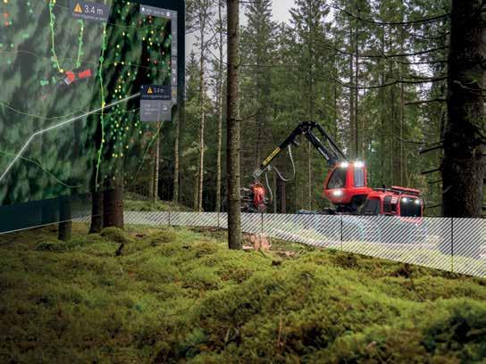
Thanks to developments in satellite positioning technology, Komatsu Forest’s fleet management system can now show the machine’s position within just a few centimetres, providing the foundation for a new and exciting function: Precision.
GPS positioning has long been used in forestry and has helped in the development of work methods, facilitated collaboration, and increased productivity. However, an error margin of 0–10 meters has meant fairly inaccurate positioning. Until now.
Today’s new real-time kinematic (RTK) technology enables positioning with an error margin of just a few centimetres, paving the way for countless possibilities and even heralding a paradigm shift to a smarter forestry.
“The new technology is a prerequisite for future solutions, but already today we can offer the exciting new MaxiFleet function Precision, which delivers valuable information and active operator support,”
said Jörgen Nilsson, Product Manager for Connected Products.
Mark exact boundaries
One new feature is that the operator can use geofencing – a digital fence that is added when planning an area. This could be around a harvesting area or to mark protected areas such as ancient monuments or charcoal pile remains.
This feature means greater peace of mind for forest owners and operators alike as it indicates more clearly where the operator should harvest and the areas they should avoid. Geofences can also be linked to alarms to warn the operator when the machine or the crane tip is approaching such a boundary.
“This means that the machine operator can safely harvest close to an area boundary without the risk of harvesting the neighbor’s trees,” explained Jörgen.
View the machine on a map
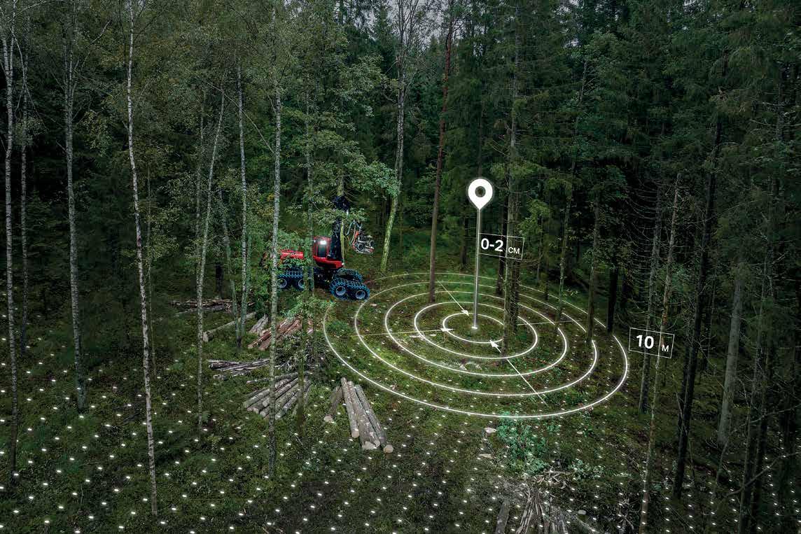
Since the machine’s position can be determined with great precision, the user can also see the machine in the map program – including the direction of the crane and the location of the crane tip. This extreme precision enhances the practical usability of the map layer data for the operator.
Another advantage of the new technology is that the machine’s route is plotted with significantly better accuracy, making the planning more effective.
Jörgen continued: “Today, most forest companies have to physically walk around the forest to mark trees – and in winter this can mean skiing on deep snow. Thanks to this new technology, boundaries and specific trees can be marked digitally, based on map data from, say, drones or LiDAR scanning.”
Keep track of the logs
In MaxiFleet, the operators have since long been able to see where a tree was felled, but with the greater precision now available, the exact position of each felled log can be shown.
This lets the operator know exactly where the timber is located, even in the dark or when covered with snow, and will make it easier to see the assortment found in each log pile or at the roadside.
“This also offers future development potential,” said Jörgen. “For instance, one plausible function would be to let the machine keep track of the timber volume until the operator believes it’s time to turn around and start loading so that the logs fit the load space.”


