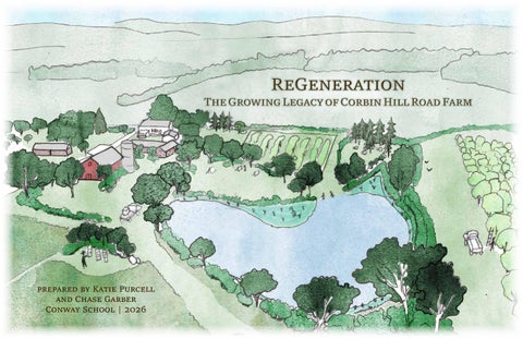
ReGeneration
The Growing Legacy of Corbin Hill Road Farm
prepared by Katie Purcell and Chase Garber Conway School | 2026
Index
Thanks to Dennis and Joy for sharing their vision and home with us. Thanks to the community stakeholders who offered their time and feedback: JaSon Auguste, CJ Buzzy, Francis Carter, Willie Cole, David Cox, David Derryck, Janet Hawkes, Savi Horne, Zavilla Jackson, Andrew Gascho Landis, Nicole Ndiaye, and Nando Rodriguez. “The trees act not as individuals, but somehow as a collective. Exactly how they do this, we don’t yet know. But what we see is the power of unity. What happens to one happens to us all. We can starve together or feast together.” - Robin Wall Kimmerer, Braiding Sweetgrass
Project Overview Land and Cultural Context Existing Conditions: Farm Center Existing Conditions: Farm Production Hydrology and Soils Wetlands Vegetation and Wildlife Microclimates Access and Circulation Residential Exclusion Feasibility Design Alternatives Final Design Design Details: Farm Center Design Details: Windbreaks Design Details: Pond Design Details: Meadows Design Details: Sustainable Water Management Design Details: Community Infrastructure References All images by the authors unless otherwise noted.
1 2 3 4 5 6 7 8 9 10 11 12 13 14 15 16 17 18 19
Community Visions
Corbin Hill Road Farm is a 95-acre agroforestry farm located in rural Schoharie County, New York. The site was purchased in 2009 by a group of eleven investors —of whom 72% were Black and Brown—with the intention of growing fresh food for communities of color and low-income communities in Harlem and the Bronx; with little experience in farming among the initial investors and communities who needed immediate solutions, two different missions and organizations emerged. Corbin Hill Food Project 501c3 was founded to connect existing producers in upstate New York to communities in New York City to meet food-security needs, a mission that continues to serve upwards of 65,000 people every year. Corbin Hill Road Farm LLC's mission seeks to connect ecological regeneration with intergenerational land stewardship and shared wealth creation for BIPOC people, a process described as the Theory of Change:
The client is working with Otsego Land Trust to protect the land in perpetuity, with much still unknown about the legal framework of protecting land in trust while also creating pathways to ownership. As the farm continues this transition to a long-term model based on its Theory of Change, a diverse group of stakeholders is focusing the collective vision around farmworkers—those who will have a direct investment in the land through their physical and intellectual labor. This intended community will be supported by profit-sharing of the farm's commercial operations and pathways towards equity-building and ownership of on-site housing. Additionally, the intended land uses can be categorized in the following ways:
The main client contact is Dennis Derryck, the founder of Corbin Hill Road Farm LLC. He and his wife Joy Anderson manage the farm operations and are the key vision-keepers for the farm's mission and future plan.They articulated goals for the site, which are summarized below.
• Spaces for small-scale subsistence and commercial farming for farm residents, including beekeeping and silvopasture
Community Group Use • Basic infrastructure to accommodate small, self-sufficient groups that offer educational and recreational opportunities for young people
Design Goals 1. Determine an area suitable for development into a residential exclusion 4 to 10 acres to accommodate "village-style" farmworker housing for 6-8 families, with separation and privacy from farm operations.
2. Improve circulation for all land use types and user groups Accomodate access and circulation for commercial farm operations, visitor-group uses, and everyday residential living.
3. Site ecologically-informed gardens and plantings
Residential Areas • Farmhouse: currently serves part-time residency for client contact, the only infrastructure that currently accomodates living needs • Seasonal worker housing: intended future conversion of bridal barn into living quarters for 2 to 3 workers in berry season
1337 Corbin Hill Road, Sloansville, NY 12031
The Client
• Farm fields for current and future growing and harvesting of timber, nut, and berry crops for commercial sale within a profit-share model
The Growing Legacy of Corbin Hill Road Farm
-Corbin Hill Road Farm website
Commercial Farm Operations
Project Overview
"If historically excluded farmers and workers gain shared ownership of land-based enterprises, and if these enterprises operate on regenerative, perennial systems that produce both cash flow and ecological value, then wealth and opportunity will circulate within the community rather than extract from it, creating lasting prosperity and environmental health."
Prepared by Chase Garber and Katie Purcell Spring 2026
A Growing Legacy
88 Village Hill Rd.Northampton, MA 01060 413-369-4044 www.csld.edu
Project Overview
• Permanent farmworker family housing: intended future housing development, the location of which is the primary design goal
New plantings that enhance the beauty and biodiversity of the landscape. Client desires include sculpture gardens and pollinator meadows. Not for construction. Part of a student project and not based on a legal survey.
1/19
88 Village Hill Rd.Northampton, MA 01060 413-369-4044 www.csld.edu
Land and Cultural Context Black farmers have long faced systemic discrimination by public and private institutions and barriers to economic mobility. Inequities in the administration of government farm programs and discrimination by the U.S. Department of Agriculture have had a devastating impact on rural communities of color (LDF Black Farmers FAQ).
Approximately 12,000 years ago, after the last glacial retreat, an era of human settlement in the broader Northeast began, and humans have been present ever since. Human agriculture has been a part of the region’s landscape for thousands of years, as glacial river valleys and their floodplains have prime agricultural soils and water access. Agriculture continues to define this area today, as the rural development surrounding the site is a patchwork of agricultural activities and freshwater riparian and wetland habitats; Corbin Hill Road Farm matches this regional typography.
“In 1910, at the height of Black land ownership, 16 million acres of farmland—14 percent of the total—was owned and cultivated by Black families. Now less than 1 percent of farms are Black-owned." -Leah Penniman, Farming While Black
"The Old Brown Homestead," painted by Fritz G. Vogt, 1898 (The Fenimore Art Museum).
The Site In more recent history, the house and potentially other structures on-site were constructed in 1802. According to local oral history, the property was referred to as the “Old Brown Homestead” for hundreds of years as it was passed down through generations of the Brown family. The farm operated as a dairy for over 180 years, characteristic of most farms in the region, until operations shuttered in the 1980s as industrial agriculture pushed many local family farms out of the market. The site remained largely dormant from agricultural activity from this time until the client purchased the property in 2009.
Farmers purchasing supplies from a cooperative at Roanoke Farms, NC, 1938. (Image: John Vachon, Library of Congress)
Aerial image of the site, 1977.
1337 Corbin Hill Road, Sloansville, NY 12031
The site is located in the ancestral homelands of the Mohawk Nation, the Kanien'keha:ka, also called the People of the Flint and the Keepers of the Eastern Door of the Haudenosaunee Confederacy. At the time of European contact, Mohawk territory broadly ranged from the St. Lawrence River in the north (spanning from Quebec to Ontario), to the Green Mountains in the east, New Jersey in the south, and to the border of the fellow-Haudenosaunee Oneida Nation in the west. The character and history of the land is reflected in its names; Schoharie, the county that Corbin Hill Road Farm is located in, roughly translates as the Mohawk term for “floating driftwood,” signifying the presence of many flowing creeks and rivers in the region. Many of these creeks are now called “kills,” a Dutch term for creek that is indicative of predominantly Dutch colonization and settlement of the area.
The Growing Legacy of Corbin Hill Road Farm
Cultural Context
Land and Cultural Context
The Land
Prepared by Chase Garber and Katie Purcell Spring 2026
A 200-year old dairy farm finds renewed purpose as a community-focused agroforestry operation for historically excluded farmers in the Mohawk River valley.
Black farmers protest in front of the White House in Washington, D.C., on March 1, 2023. (Image: Matt DeRienzo / Center for Public Integrity)
Aerial image of the site, 2026.
Not for construction. Part of a student project and not based on a legal survey.
2/19
88 Village Hill Rd.Northampton, MA 01060 413-369-4044 www.csld.edu
Existing Conditions: Farm Center A 95-acre property boasts a mix of wetland and forest habitat, agricultural fields, and a central human activity area.
Farm Center
Legend Farm Center
Tool Shed
Big Red Barn
Pond
3
Tractor Shed
1
2
Ag
ri c F i eu l t ld ura s l
N Farm Center building envelope and pond with algal blooms.
1
Neigh bor
Pond
2 Left to right: bridal barn, tool shed, processing shed, and big red barn.
3 Farmhouse.
Pond edge showing lack of vegetation on banks. 275-gallon water cubes are filled here at the water's edge and trucked to the fields where crops are watered by hand.
Fallo w Field s
The pond sits at the top of the hill near the farm center and is currently the main source of water for the fields. It has been in its current location since at least 1977, but was redug and expanded in 2010 to its current size of 0.6 acres and 8-feet deep at its greatest depth. A berm holds the north edge with a spillway extending from the northwest corner. Though the pond stays full throughout the year, there have been no reports of damage from excessive overflow in heavy rain events. The pond is prone to algal blooms, which is common in small ponds due to a lack of regular circulation. There is little wetland vegetation in and surrounding the pond, and the mown turf isn't as effective at filtering nutrients in runoff compared to sedges, rushes, and other types of wetland vegetation. Geese congregate on the pond's banks, adding nutrients through their droppings and further contributing to the eutrophication process. Once the algae die, the bacteria that aids in the decomposition of organic matter can use up the oxygen in the water, potentially leading to hypoxic conditions that can kill the micro- and macrobiology in the water. Not for construction. Part of a student project and not based on a legal survey.
1337 Corbin Hill Road, Sloansville, NY 12031
South of the driveway lies the tractor shed, a former roadside market that is now used to house the tractor, UTV, and excess equipment including beekeeping supplies. This shed is in the greatest state of disrepair of all utilized structures in the farm center, evidenced by an inaccessible western doorway and elemental damage inside and outside.
P
P
The Growing Legacy of Corbin Hill Road Farm
The big red barn is a sturdy, two-story structure that has been improved upon throughout the 2010s, with a defunct silo attached on the northern side. The barn currently stores equipment, but the client envisions the interior as a future event/gathering space. Immediately south of the barn, various farm equipment that can be stored outside is parked. East of the barn, stacked boxes of bee colonies struggle against the wind speeds atop the hill.
Processing Shed
Existing Conditions I
The bridal barn, a former tailoring/dress shop for the prior owners, is structurally sound but in need of many renovations for its future intended use as seasonal living quarters for farmworkers. A small tool shed sits between the bridal barn and the processing shed. The processing shed houses a walk-in cooler and a washing station, which are functional and ready for eventual berry processing. A small mown yard separates the processing shed and the big red barn; this is where box trucks are intended to park for loading up berries and transporting them off site.
Farmhouse
Bridal Barn
Cor bi R o an H i l l d
The structures are in varying states of repair. The farmhouse has been fully renovated to include a commercial kitchen, geothermal heating, newly installed heat pumps, and a generator. It serves as parttime lodging for investors and visitors, as well as the primary indoor gathering space for small meetings and guests. There is a private septic system which drains to the west of the farmhouse, and a private well system connected to the house as well as a hose hookup in the big red barn.
Forested Wetland
Pond
Prepared by Chase Garber and Katie Purcell Spring 2026
The heart of human activity on the site, the Farm Center building envelope, sits atop a hill. A gravel driveway extends from Corbin Hill Road and tapers at the southern foot of a big red barn. Users of the site — visitors, residents, or land tenders — most often pull off to park near the southeast side of a farmhouse, but larger vehicles and box trucks park on the east side of a processing shed.
3/19
88 Village Hill Rd.Northampton, MA 01060 413-369-4044 www.csld.edu
Existing Conditions: Farm Production
Corbin Hill Road Farm is developing timber, nut, and berry production operations to provide multiple revenue streams.
Legend
Corbin Hill Road Farm has been working with Propagate Agroforestry, an agroforestry consulting business, to develop a plan for its commercial systems. CJ Buzzy, Senior Project Manager of Propagate, developed a planting plan and is overseeing the preparation and planting of the crops in multiple phases. Three perennial productive systems — nuts, timber, and berries — are intended to complement one another in the landscape as well as provide a diversity of revenue streams for the farm, with short- and long-term returns. Once planted, maintenance of crops is then the responsibility of Corbin Hill Road Farm.
Chestnuts Black Locusts Hazelnuts
The farm's hazelnuts are a variety bred by Rutger's University to be resistant to eastern filbert blight disease.
Existing Tree Crops A small, centrally located area was planted as a chestnut test plot in fall 2021, most of which appeared to be heavily browsed by deer during a site visit in spring 2026. In spring 2025, hazelnuts and chestnuts were planted in the fields north of the Farm Center; the hazelnuts, inoculated with white truffle spores in the roots, are protected with an electric fence, and the chestnuts are all protected with individual tree tubes. In fall 2025, the field east of the test plot was planted with bare-root black locust saplings, which, according to the client, are sprayed twice per year with Trico, a deer/herbivory repellent naturally derived from sheep fat.
Chestnuts (Castanea mollissima) with plastic tree tubes; planted in 2025.
What the chestnuts might look like in 5-7 years. (Image: Propagate Agroforestry)
Future Perennial Crops
Implications
The three remaining fallow fields, due east and south of the black locust field, are slated to be planted with black walnut trees, intercropped with elderberries and black currants. These species will be interplanted with a yet-to-be-determined "biodiversity" under-story species.
Additional Activities
• Design interventions should accommodate the existing and planned commercial agroforestry systems.
Bare-root black locusts (Robinia pseudoacacia) staked with bamboo; planted in 2025.
What the black locusts might look like in 3-5 years. (Image: Propagate Agroforestry)
Black walnuts intercropped with elderberries and currants are slated to be planted this year. (Image: Kansas State Research)
The farm's bee colonies offer the potential to boost crop yields and provide additional revenue in the form of value-added honey products.
In addition to the core commercial crops, some areas are currently being used for auxiliary activities such as beekeeping and annual vegetables. The client has also expressed interest in the feasability of animals for silvopasture, though currently no domestic animals live on the property. The intention is for future farmworker residents to have space to engage in these activities and create additional opportunities for revenue as they see fit.
• Trico is generally considered non-toxic but EPA guidelines suggest it should not be applied near water, or possibly within a riparian buffer zone. Given the potential for surface runoff to enter the wetlands (see page 6), other deer deterrent measures such as fencing could be considered.
Not for construction. Part of a student project and not based on a legal survey.
Existing Conditions II
Bees
The Growing Legacy of Corbin Hill Road Farm
Prepared by Chase Garber and Katie Purcell Spring 2026
Future Crops
1337 Corbin Hill Road, Sloansville, NY 12031
Agroforestry
4/19
88 Village Hill Rd.Northampton, MA 01060 413-369-4044 www.csld.edu
Hydrology and Soils The hilltop site sheds water in all directions; poorly draining soils and hard pans could be impacting root growth.
le
W
at
er
sh
ed
Silty clay loams
Project Site Schoharie Creek Watershed
Loamy till, very stony Surface Runoff Flow
Hudson River Watershed
Site-scale soils and hydrology.
implications • Geotechnical consultants may be needed to determine if, where, and how buildings and septic systems within the residential exclusion can be constructed.
Corbin Hill Road Farm
• The farm's waterlogged soils could erode gravel driveways if rainwater and other runoff is not managed. • Site runoff could end up in the sensitive and ecologically valuable wetlands in the northeast so careful consideration should be made of site inputs such as fertilizers and pest treatments. Even organic practices used on the site (such as manure application) could still lead to harmful impacts downstream if not managed correctly.
Mohawk River Hudson River
Not-to-scale section of site and regional surrounds
N
• The site's unique geology contributes to the high water table and wetland conditions. However, waterlogged soils and potential for root- and waterblocking hard pans could possibly impede tree growth if planting areas are not prepped properly. Not for construction. Part of a student project and not based on a legal survey.
1337 Corbin Hill Road, Sloansville, NY 12031
ca
Muck, slightly acid
Schoharie Creek
S
-s
Channery silt loams
Major NY state watersheds near the site.
Catskill Mountains
Legend
te
The Growing Legacy of Corbin Hill Road Farm
Draina ge Ditch
Mowhawk River Watershed
Prepared by Chase Garber and Katie Purcell Spring 2026
Si
Hydrology and Soils
The wet soils, the always-full pond, and the large wetlands found on site and throughout the region likely suggests that shallow bedrock and/or frequent fragipans are limiting water infiltration and contributing to a high water table. Both of these factors could be a cause for concern because young trees may struggle to establish sufficient root depth or lack oxygen in waterlogged soils. Most of the species already planted and slated for planting (with the exception of
Climate change models predict that winter and spring precipitation will increase by 15 to 20% by the middle of this century. This could lead to an increase in springtime flooding, potentially exacerbating already water-logged conditions for growing trees or delaying planting for annual crops. Site conditions will need to be monitored, especially in the spring, to ensure the ground around tree roots is sufficiently draining.
il l R o a d
The soils are mostly poorly draining silt loam over a sub-soil heavily influenced by the shale bedrock. These soils are also prone to forming fragipans (or hardpans), a shallow, brittle layer of dense soil that can severely impede water infiltration and root depth. In the wet season, these soil types can easily become waterlogged, while in the drier season, they are more likely to dry out. When site analysis was conducted in spring 2026, soils were noticeably saturated throughout the entire property. No issues with the septic system or basement flooding have been reported.
hazelnuts and berries) have large tap roots that range from three feet to fifteen feet deep; however, the fragipans seen in these soil types are typically located between eighteen and thirty-seven inches deep. C o r b in H
The farm sits on a flat area (0-5% grade) at the top of a hill at 1250-feet elevation in the northern foothills of the Catskill Mountains, perched above the Mohawk River valley. Steep slopes (10-25%) run down to the north and northeast, directing rainfall and other surface runoff through the farm fields and into the large wetland that dominates the northeast corner of the property. Gentler slopes (0-10%) direct water from the top of the hill to the south and southwest, and into the drainage ditch on the east side of Corbin Hill Road, as well as on to the neighboring property to the south. Water moving off-site is part of the 316-square-mile watershed that drains to Schoharie Creek in the east and then to the larger watershed of the Mohawk River in the north. This river then moves east to the Hudson River which flows south and empties into the Atlantic Ocean at New York Bay.
5/19
88 Village Hill Rd.Northampton, MA 01060 413-369-4044 www.csld.edu
Wetlands
Wetland conditions are amplified by the presence of a very active beaver population in the northeast of the project site. A large beaver dam spans over 200 feet and dates back at least 30 years as observed in aerial images, which has created a late-successional beaver pond and lush meadow area. This dam is over four feet tall in some areas, and actively managed by beavers as evidenced by its holding capacity and many fresh beaver stumps nearby. A creek seeps through this dam and continues flowing west through the site and beyond. There are at least three smaller dams on site downstream of the large dam according to a neighbor; these relatively-newer dams may hinder access across the stream due to the raised water levels. The presence of beavers and large beaver pond have many effects on the broader ecology and conditions of the site, such as flood attenuation, facilitation of groundwater recharge, and enhanced plant diversity & habitat value; the damming and retention of water in the north likely elevates the water table, particularly on the northeastern slope. This higher water table does not seem to negatively impact the agricultural fields, and may actually support the young timber crops.
Red osier dogwood (Cornus sericea)
Legend
Wet Area
Wetland Bounds Surface Waters
implications
Beaver Meadow
• Wetlands contribute to biodiversity and overall landscape health, and design should take measures to protect or enhance their extent and function.
Forest/Shrub Wetland
• Beaver presence offers a natural firebreak to the north, and the habitat they shape supports pollinators that benefit tree crops.
Beavers in the landscape Beavers have long been a keystone species across the North American continent. Beaver populations numbered in the hundreds of millions prior to European colonization; by 1900, between the loss of habitat to agriculture and the demanding fur trade, there were only tens of thousands left. A series of beaver reintroduction efforts took place throughout the 1900s as recognition of the value of beavers in the landscape was reignited. Now, some scientists argue for the creation and protection of beaver habitat as foundational for climate adaptation planning, as beaver landscapes offer critical ecosystem services such as carbon sequestration, flood attenuation, and biodiversity value.
• Native wetland plants may volunteer in areas of the site with wetter conditions, if left unmanaged. Beaver dinner.
• State regulations prohibit certain types of development in or on wetlands, which impacts residential exclusion feasibility.
Not for construction. Part of a student project and not based on a legal survey.
1337 Corbin Hill Road, Sloansville, NY 12031
av
m
The Growing Legacy of Corbin Hill Road Farm
Be
er
Da
Wetlands
To the north, wetlands reign on nearly half of the site. Wetland boundaries vary between state and county datasets; the boundary depicted is a combination of the two, presuming the farthest extent of both is likely a wetland area. Observations on the site of spongy, hydric soils, wetland plant species, and surface waters confirm wetland conditions within this area. In the southwest corner of the parcel along Corbin Hill Road, moss and red osier dogwood grow abundantly in spongy soils as well.
Prepared by Chase Garber and Katie Purcell Spring 2026
The north of the site boasts a variety of wetland types, some of which are made possible by a robust beaver presence that has withstood the test of time.
6/19
88 Village Hill Rd.Northampton, MA 01060 413-369-4044 www.csld.edu
Vegetation and Wildlife
River birch (Betula nigra)
Trout lily (Erythronium americanum)
Mohawk River
Carex spp.
Legend Rare Plants or Animals Imperiled Freshwater Mussels
Schoharie Creek Corbin Hill
6 mi
Catskill Mountains
Significant Natural Communities
Hudson River
Most of the vegetation on-site is cropland, mown area, and hedgerows.
The site is broadly situated between the Catskill subrange of the Appalachian Mountains to the south and the Mohawk River valley to the north. This positioning, combined with rural development patterns and swaths of various forest and wetland types, creates a patchwork of habitats for wildlife. According to NYS DEC Environmental Resource Mapper, the site is part of a broader region to the north that has been identified to be a generalized location of habitat that supports rare, threatened, and/or endangered plants and animals (orange on the regional map). While most of the rare plants and animals are not identified in this publicly available data for their protection, the largest orange area that the site is within is considered habitat for rare bats, likely the Eastern small footed bat according to DEC data. The multiple habitat types on site could also support any number of other rare plants, birds, insects, and amphibians. Northern hardwood forests are also commonly home to large mammals such as moose, bear, coyote, bobcat, deer, and more.
implications • Protection and enhancement of the native ecosystems on site, particularly in the northern portion, is vital to maintaining regional habitat connectivity. • Disturbing land for new plantings could make these areas more vulnerable to invasive pressure due to the species composition in the hedgerows.
1337 Corbin Hill Road, Sloansville, NY 12031
Crops, mown area, Hedgerows
In unmanaged pockets throughout the property, such as the northern side of the processing shed and bridal barn, water-loving species grow such as paper birch and red-stem dogwood. Most of the rest of the site is continually mown throughout the growing season, save for the hedgerows that delineate the agricultural fields; these hedgerows are a mix of trees, mainly in the poplar and birch family, as well as a thick shrub layer with various invasive and native species, including wild grape, barberry, dogwood, and honeysuckle.
The Growing Legacy of Corbin Hill Road Farm
Northern Hardwoods, water-loving species
The vegetation in the northeast corner of the site is a northern-hardwood forest, specifically type 24 (per USFS Silvics and Forest Types System), which means that its overstory is dominated by Eastern hemlock and yellow birch. Other mature trees observed in this area include Eastern white pine, red maple, and river birch. The understory includes wetland woody plants such as red osier dogwood, young American beech, and river birch; in the spring of 2026, the ground was laden with trout lilies. The herbaceous layer fills in on the edges of the canopy line and surface waters; this includes cattails, Juncus spp., Carex spp., grasses, and cinnamon ferns. These woody and herbaceous vegetation types extend to the west within the wetland boundary at the foot of the northeastern sloping chestnut fields.
Vegetation and Wildlife
Riparian shrub zone, with beaver pond in distance.
Prepared by Chase Garber and Katie Purcell Spring 2026
Various vegetation types, combined with wetland and water access, contribute to high ecological value and a spectrum of habitats.
• Native flora and fauna can inspire species composition of ecological garden designs, and converting mown grass to diversified plant communities can enhance ecosystem services that support crops.
Not for construction. Part of a student project and not based on a legal survey.
7/19
Microclimates
High sun exposure Mostly shady
A sun-soaked and wind-blown landscape lacks refuge for growing trees, humans, and animals alike.
Wind shadow
Sun and Shade
Microclimates
The site receives a significant amount of sun, with no surrounding landforms blocking sun in any direction. However, the hill at the center of the farm creates a northeast-facing aspect on the north side and a southwest-facing aspect on the south side. The large trees around the farmhouse, as well as the buildings themselves, offer the most consistent shade during the summer, as well as the north and east side of those hedgerows with trees tall enough to cast shade.
By considering the combined effects of vegetation and buildings, and their influence on wind and sun, an inventory of the most comfortable existing microclimates around the farm can be made, followed by a determination of which farm use could most benefit from each microclimate. As the farm’s agroforestry system matures and trees grow in size and density, windbreaks and shade will increase sitewide, making comfortable alleys for humans and animals.
High sun exposure Mostly shady
Refuge from wind/sun
1
1
Prepared by Chase Garber and Katie Purcell Spring 2026
Legend
88 Village Hill Rd.Northampton, MA 01060 413-369-4044 www.csld.edu
Legend
Wind The farm’s location at the top of a hill exposes the site to the region's westerly wind patterns, though these patterns vary widely in intensity and direction depending on the season. Generally, the strongest winds occur from November to April and peak in February, bringing cold, dry air from central Canada and warm, wet air from the Great Lakes, resulting in the region's characteristic freezing temperatures and lake-effect snow belts. From April to November, gentler winds often bring warm, humid air up from the Gulf of Mexico, leading to hot and muggy weather across the region. The farm’s hedgerows offer some wind protection during the summer months when the largely deciduous shrubs and trees have leafed out. However, this protection is significantly reduced after leaf drop in the winter with there being only a single evergreen spruce tree near the south side of the farmhouse. During this time of year, respite from the wind is likely only found on the leeward side of buildings and the more dense and wide hedgerows.
• Young tree crops benefit from the current sun exposure but lack year-round wind protection; consultation with a professional on interventions to address this should be considered.
N Spring
W
Summer
Fall
Winter
Implications
E
S The darker blue denotes higher frequency of wind coming from that direction. Size of wedge denotes wind speed with longer sections denoting higher speed.
• Human comfort could be improved by increasing summer shade and protection from winter winds. Bees and farm animals have needs similar to humans, with morning sun and afternoon shade being especially important for bees. If grazing animals are housed outside in the winter, they will need to be a cold-hardy breed with dense windbreaks for protection. • The client goal of ecological gardens in the Farm Center can also create refuge by casting shade and serving as windbreaks. Given the hot and humid summer weather, some exposure to wind could still be desired during that time of year, while evergreen trees should be used in places where protection from winter winds is desired. • The southwest-facing slope is beneficial for siting passive and solar-powered buildings. Not for construction. Part of a student project and not based on a legal survey.
1337 Corbin Hill Road, Sloansville, NY 12031
The farm currently lacks much refuge from the wind and sun. During site analysis in the spring of 2026, a toppled beehive and numerous wind-blown trees were evidence of strong winds.
Wind shadow analysis combined with a summer sun and shade analysis reveals places of refuge.
Microclimates
Southwest Aspect
The Growing Legacy of Corbin Hill Road Farm
Northeast Aspect
8/19
88 Village Hill Rd.Northampton, MA 01060 413-369-4044 www.csld.edu
Access and Circulation The site is accessed by a single driveway from the east side of Corbin Hill Road. A 400-foot-long gravel road provides direct access by vehicle to all of the farm buildings, then tapers off to grass east of the barn. There is covered parking for one car at the farmhouse, and space for about four vehicles just off the gravel road between the farmhouse and the bridal barn. Between the processing shed and the barn is a roughly 45-foot gap east to west, and 200-feet of mown turf running north to south. In the past, this has been used by box trucks accessing the processing shed and is expected to receive daily use from box trucks in the future once berry production is established. Paths are mown throughout the site to create vehicular access for farm operations and other land maintenance, ranging from 10- to 20-feet in width.
Residential use
The farmhouse is currently the only residential building but the client has plans to convert the bridal barn into two to three small apartments for seasonal farmworkers.
Farm Operations Farm machinery, when not in use, is stored in the tractor shed, first floor of the barn, and in the yard south of the barn. Currently, the most-used machinery includes the riding mower, field plow, and water truck, which move out from the Farm Center as needed. Farm fields that have already been planted are designed with a roughly 20-foot headland gap for machinery to maneuver and turn around at the end of each row of trees, and have 10-feet of space between each row. Every field has at least one mown path through the bordering hedgerows to allow circulation between fields, ranging from ten to fifteen feet in width. Vehicle access is maintained at the southern pond edge so that water can be pumped to large storage cubes that are then trucked around the fields where crops are watered by hand.
Shared access Blind driveway
Pond water access
d Hill
Roa
Outdoor machine Storage
Future Circulation
Tractor Shed
N Vehicle access from Corbin Hill Road and circulation through the Farm Center.
r Co
bi
n
ll
ro
The client desires basic accommodations for farm use by outside groups of 10 to 15 people. This would likely require additional parking and possibly new bathrooms or access to existing bathrooms. Future residents in the exclusion area will need parking as well, budgeting at least one to two spots per household.
Implications
Car heading south Hi
Human Circulation Mown paths also create ease for human access throughout the site. With the exception of the forested wetlands in the northern portion of the property, most of the land contains gentle slopes, between 0 and 10 percent, that are easy to traverse on foot for those who do not require mobility aids. Several large swaths in the Farm Center are mowed less frequently and are more difficult to traverse.
Processing Shed Overflow storage Bridal Barn
bin
Farmhouse
Cor
At the juncture of the driveway and Corbin Hill Road, the hill slopes steeply to the north, inhibiting the view of oncoming traffic and making the left turn quite dangerous. This is a cause for concern, especially if the farm receives increased vehicle traffic as the various land uses develop. Since it is very unlikely the land form itself will be changed, a variety of other options could be considered such as an alternative driveway farther down the slope to the south, a mirror placed up high so that drivers can see oncoming cars, or a signaling system that could warn drivers of a hidden driveway.
Farm operations
ad
Car exiting the farm and turning south
Blind driveway section looking east, not to scale. Vehicles exiting the farm heading south cannot see oncoming traffic because of the hill.
10-15 ft hedgerow gap ~20 ft headlands
bet
we
en
t r e1 0 f ert ow s
Access widths and circulation routes for farm vehicles in and around the agricultural fields. (Image: Propagate Agroforestry)
• Adding residential units to the site raises the question of desired intersection between user groups. Residents may want to access garden space in the farm center or Farm Center facilities but may also appreciate some distance. Safety concerns may arise if school groups overlap with the circulation of farm machinery. • Alternative vehicle access from the road should be considered to prevent conflict, particularly where that access point will serve residents of the residential exclusion. • Different vehicle users have different spacial needs for parking, backing up, etc. Existing parking would be unable to accommodate community groups of up to ten to fifteen people. Concept designs for the residential exclusion should site additional parking for residents. • Given that maintaining and expanding commercial farm operations are the primary aim of the client, design interventions should seek to maintain existing farm access and circulation or improve upon it. • The farm plan uses 20-foot widths for mown vehicle paths, so design concepts can mimic that in other places where vehicle access needs to be maintained. Pedestrian-only paths can be smaller. Not for construction. Part of a student project and not based on a legal survey.
1337 Corbin Hill Road, Sloansville, NY 12031
Residential Use
The Growing Legacy of Corbin Hill Road Farm
Legend
Access and Circulation
Vehicle Access
Prepared by Chase Garber and Katie Purcell Spring 2026
A single driveway, a plethora of land and building uses, and differing accessibility needs creates conflict points in circulation patterns.
9/19
88 Village Hill Rd.Northampton, MA 01060 413-369-4044 www.csld.edu
Residential Exclusion Feasibility Determining the most suitable zone for residential development bases on analyses. Criteria One: Not within a riparian or wetland area
Prepared by Chase Garber and Katie Purcell Spring 2026
Wetlands are legally protected from certain types of development because of their ecological value. Logisitically, they would also require significant landscape alterations and monetary input to be suitable for building on.
Criteria Two: Less than 15% Slope As per New York State regulations, residential development cannot occur on slopes greater than 15 percent. Significant slopes can also interfere with the siting of effective septic.
Criteria Three: Spatial buffer from farm activities
Criteria Four: Does not impede on commercial production In order for the farm and its mission to succeed, landscape alterations must consider economic viability; siting the exclusion too close to commerical operations could interfere with machine access and crop growth, and therefore economic viability of the farm.
Criteria Five: Close to Corbin Hill Road Siting the exclusion development closer to the road limits the disturbance footprint, and shortens the distance for utility connections and driveways for daily vehicle, maintenance, and emergency access.
implications Criteria applied graphically reveals a green zone in which the exclusion could be configured. Part of this zone is planned as future commercial crops but a balance could be struck between the competing needs of this exclusion and the farm's production capacity. While this critera highlights areas that are more suitable to development, there may be additional constraints to consider as potential development moves forward. Not for construction. Part of a student project and not based on a legal survey.
1337 Corbin Hill Road, Sloansville, NY 12031
The Growing Legacy of Corbin Hill Road Farm
Exclusion Feasibility
The client desires separation between the exclusion and farm operations for resident-farmworkers to feel like their homespace is "away" from their place of work. Privacy/separation between residents in the exclusion and the Farm Center is also a factor to consider.
10/19
Concept 2: Silvopastoral Surrounds
Concept 3: Heart of the Farm
Compact, multi-family development close to road access reduces land disturbance.
Single-family housing developed along a central spine, allowing space for expanding agroforestry systems.
Single-family homes are the heart-center of farm operations with ample room for privacy and growth.
• Separate driveway access and parking for exclusion sited south of the existing roadside ditch and culvert.
• Separate driveway access extends into parcel and ends at a shared parking lot next to a separate community building, inspired by the Ecovillages cohousing in Ithaca, NY.
• The existing driveway is extended east and serves as a shared access drive for all land users. This minimizes impervious surfaces, runoff, and maintenance such as snow plowing.
• Tractor shed is moved to the east of the edge of the existing driveway to allow exclusion residents more yard and orchard space closer to housing.
• The barn is used for storage and houses sheep in the colder months; through warmer seasons, the sheep are rotationally grazed throughout the farm in a silvopasture system. This offers potential for any multitude of new commercial enterprises for the farm depending on sheep breed and desires of the farmworkercommunity.
• Defunct silo is outfitted with bat boxes and platforms, and meadow between barn and pond have multiple posted bird boxes, creating more habitat for birds of prey and bats; drawing this type of wildlife could help to protect berry crops from songbirds and reduce biting insect pests.
• A wind-powered aerator is installed on the pond edge to harness windy conditions to circulate the water and slow down eutrophication.
• Tractor shed is moved to create space for an outdoor-pavilion, a shared gathering space for Farm Center residents (seasonal and permanent), exclusion residents, and guests.
• No interference with existing or future commercial plantings.
• The pond edge, spillway, and hilltop are planted with willows for coppicing, another avenue for farm enterprise expansion; depending on willow variety, cuttings could be used as sheep fodder, basketry materials, woody-floral bouquets, and more.
• Tractor shed and community plots remain in their existing locations. • The pond is expanded in size and depth to accommodate space for riparian and littoral plantings to create natural filtration of excess nutrients in pond; a thick riparian buffer is planted along pond edge and spillway to deter geese congregations, enhance biodiversity value, and provide additional water filtration.
• Exclusion does take some space from future tree crop field.
Not for construction. Part of a student project and not based on a legal survey.
1337 Corbin Hill Road, Sloansville, NY 12031
The Growing Legacy of Corbin Hill Road Farm
Design Alternatives
• The barn is treated as an educational/event hosting space, and outdoor “rooms” for human gathering are formed by plantings that create comfortable microclimates between the barn and pond.
Prepared by Chase Garber and Katie Purcell Spring 2026
Concept 1: Close & Compact
88 Village Hill Rd.Northampton, MA 01060 413-369-4044 www.csld.edu
Design Alternatives
11/19
Corbin Hill Road Farm grows into its sustainable future by adding housing for its farmworker community while strengthening its commitment to ecological resilience. A plethora of land uses are able to harmonize with improved access, circulation, and buffered from each other with a rich tapestry of vegetation.
C
D
Large hedgerows are strategically placed around planted and human use areas to protect from western and northwestern winds (see sheet 14 for details). The pond is expanded southward, increasing water storage for farm uses. A vegetated buffer, ranging from ten to thirty-feet-wide, lines the pond edge, with two breaks in vegetation allowing multiple points of access to the water for farm use and recreation. These plants provide essential habitat for water-loving species while deterring geese from the banks. Additionally, a "littoral" shelf is added with submerged plants that help clean the pond, making it safer for agriculture, human use, and wildlife (see sheet 15 for details). Meadows reduce turf lawn and maintenance needs while expanding habitat with diversified vegetation and various bird and bat boxes. A gazebo and mown pathways allow for nature experiences for visitors and residents separated from farm operations (see sheet 16 for details).
G
Bioswales south of the new driveway and the exclusion area embrace the existing wetland conditions, offering runoff mitigation and additional stormwater storage. Roof runoff and greywater from the new homes is also routed to these swales where water can be filtered and allowed to infiltrate (see sheet 17 for details).
H
Orchard trees are centrally located between the Farm Center and residential exclusion for shared use by residents and guests. Residents have room to garden here in this protected microclimate.
I
A living barn shelters farm animals during the winter months.
Bridal Barn Farmhouse
Processing Barn Shed
F
P Tractor Shed
ill Road
F
Each house is oriented to a shared green space, fully embracing the southwestern exposure. A shared community building has additional parking for visitors and residents and is the central gathering space for community activities.
E
Corbin H
E
D
H
Residential Exclusion
B
P
A
C
G Community Building
Not for construction. Part of a student project and not based on a legal survey.
1337 Corbin Hill Road, Sloansville, NY 12031
The access to the residential exclusion forks off from the main drive through a threshold of wind-buffering vegetation, and provides driveway access for each home. The positioning of the road north and behind the houses keeps vehicle and pedestrian circulation separate.
The Growing Legacy of Corbin Hill Road Farm
B
Prepared by Chase Garber and Katie Purcell Spring 2026
A new southern driveway access connects to the existing driveway in a loop, providing an alternate access point with improved road visibility and efficient circulation for vehicles, farm machinery, and snow plows.
I
Final Design
A
88 Village Hill Rd.Northampton, MA 01060 413-369-4044 www.csld.edu
Final Design
12/19
88 Village Hill Rd.Northampton, MA 01060 413-369-4044 www.csld.edu
Design Details: Farm Center
The bridal barn is now two to three small apartments for seasonal farmworkers. Small- to medium-size deciduous trees on the west side of the building offer shade and privacy screening from the farmhouse. The interior courtyard serves as a private sanctuary for residents with small trees and shrubs providing a sense of enclosure around the opening (see sheet 18 for details).
C
Light green areas denote mown paths, twenty-feet wide for vehicle circulation routes and ten feet for pedestrian-only paths. Vehicle access on the east side of the processing shed is maintained for large box trucks, vans of students, or a school bus, with clearance to the south for backing up when needed.
D
The large open space due north of the building envelope is broken up with a mix of large shade trees, substantial hedgerows, and meadows offering a variety of "outdoor rooms" for camping and gathering.
G
D Camping Meadow
Joy's Garden
H
Bridal Barn Farmhouse
Silo
A E
F
The defunct silo is reimagined as shelter for barn swallows or bats. The meadows, increased tree canopy, and expanded pond offer a wealth of ecological services that could help sustain these or other rare and threatened species. The bees are relocated to a protected microclimate in the meadow just southeast of the pond. This wind refuge is sited away from highuse human activity areas but close enough to the Farm Center for easy management. Access to the bees is provided by a smaller mown path off the main circulation route.
G
A large hedgerow shields the farmhouse from the westerly winds, with conifers in the northwest (see sheet 14 for details).
H
In Joy's garden, the existing box elder maple is removed to make space for a larger deciduous tree to shade the back patio. The garden beds are reshaped to create meandering paths and a variety of microclimates that accommodate a diversity of plants.
Processing Shed
P
F Bees E
Barn
C
P
B
Tractor Shed
Not for construction. Part of a student project and not based on a legal survey.
1337 Corbin Hill Road, Sloansville, NY 12031
Parking for six vehicles is available south of the bridal barn for seasonal farmworkers and self-sufficient educational groups visiting the farm.
The Growing Legacy of Corbin Hill Road Farm
B
Pond
Design Detail I
A
Prepared by Chase Garber and Katie Purcell Spring 2026
The building envelope accommodates all user groups with windbreaks, privacy screens, and zones for different enjoyable experiences in nature without compromising farm circulation or operation of machinery.
13/19
88 Village Hill Rd.Northampton, MA 01060 413-369-4044 www.csld.edu
Design Details: Windbreaks
A “living barn” is planted north of the hazelnut field to provide shelter for livestock. This area is planted with a denser windbreak to the northwest, blocking winter winds but allowing a breeze through in the summer months. The entire area is more sparsely planted with conifers that can provide overhead shelter from precipitation. In the colder months, the livestock can stay in the living barn area, close to the Farm Center for ease of management access, and in the warmer months could be rotationally grazed throughout the site for distribution of livestock browse and natural fertilization of crops. Sheep would likely be compatible with the landscape, as they are not too heavy as to compact the roots of tree crops, and are more inclined to graze the grass than the crops. More research on feasibility is necessary to determine the right silvopasture system for the site.
Prevailing winds rarely exclusively only blow from one direction; while winds on-site are largely coming from the west, there is tendency for northwestern-prevailing winds in the winter months, and southwesternprevailing winds in summertime. Windbreaks in the design account for this wind shift accordingly, with windbreak plantings rounding off against these directions to reduce troublesome winds to ideally improve human comfort as well as the crop yields and apicultural system. Wider windbreaks in the design with a gradient vertical structure, with shorter vegetation on the side nearer to prevailing winds, are intended to redirect winds over the top of refuge areas to create a larger wind-shadow. Windbreaks can be planted more densely with conifers to provide wind protection year-round and more efficacy for blocking/redirecting snowblow, whereas more deciduous plant species can be used in windbreaks that are intended for protection only in the warmer months when there is foliage.
For more information on the implementation and benefits of successful windbreaks and silvopasture, consult the 2025 Agroforestry Training Manual produced by the Center for Agroforestry, University of Missouri.
Recommended Plants Botanical name
Common name
Height (at Spread (at Ideal Condition maturity) maturity)
Form
Notes
Pinus strobus
Eastern white pine
50-100'
20-40'
full-part sun, well-drained soil
coniferous tree
fast growing, resilient to adverse conditions
Betula lenta
Black birch
40-60'
10-25'
full-part sun, well-drained soil
deciduous tree
host plant to many species of Lepidoptera
Betula papyrifera
Paper birch
25-45'
15-25'
full-part sun, well-drained soil
deciduous tree
endless wildcrafting opportunities with bark
Picea mariana
Black spruce
20-50'
8-16'
full sun, wet to well-drained soil
coniferous tree
fragrant, valuable pollinator plant
Thuja occidentalis 'Nigra'
Dark green arborvitae
20-30'
10-15'
full-part sun, well-drained soil
coniferous tree
dense foliage, varieties of different sizes
Kalmia latifolia
Mountain laurel
4-10'
4-8'
full sun to full shade, wet to well-drained soil
evergreen shrub
incredible blooms, pollinator plant
Ilex glabra
Inkberry
5-8'
5-8'
full-part sun, wet to well-drained soil
evergreen shrub
salt tolerant, drought tolerant, browse-resistant
Morella caroliniensis
Bayberry
2-6'
3-6'
full-part sun, well-drained soil
evergreen shrub
resilient, fragrant, pollinator plant
Not for construction. Part of a student project and not based on a legal survey.
1337 Corbin Hill Road, Sloansville, NY 12031
A windbreak, also sometimes referred to as a “shelterbelt,” is any sort of barrier that reduces the velocity of winds, casting a wind shadow on its leeward size. A windbreak can be artificial or natural, and its efficacy depends on its size (height, length, width), density, and orientation. Windbreaks can enhance crop yields, capture runoff, protect soil from erosion, influence snow distribution, filter dust and odors, and increase plant diversity and wildlife habitat. In the case of Corbin Hill Road Farm, where prevailing winds come predominantly from the west, implementing windbreaks along the west of the Farm Center will create additional visual screening of the road. As windbreaks can obstruct views, their location must consider both its efficacy in reducing troublesome winds as well as which viewsheds it obstructs and which it frames.
The Growing Legacy of Corbin Hill Road Farm
Silvopasture
Design Detail II
Windbreaks
Prepared by Chase Garber and Katie Purcell Spring 2026
Densely-grouped plants square off against prevailing winds to offer refuge for humans, plants, and animals.
14/19
88 Village Hill Rd.Northampton, MA 01060 413-369-4044 www.csld.edu
Design Details: Pond
An expanded pond bolsters the farm water supply while expanding its ecological value and recreational opportunities.
Healthy ponds generally need very little maintenance once established apart from occasional removal of plant material and sediment. The buffer zone surrounding the pond can simply be left unmown or mown less frequently. Grazing animals can also be introduced sparingly into this area with beneficial effects on pond edge habitat, though nutrients from their droppings is a concern if overgrazed. The buffer zone will also deter geese from congregating on the pond's banks and dropping unwanted nutrients, though temporary fencing may need to be used in the early stages of plant growth to fully deter them. Pond information adapted from the Pond Creation Toolkit by the Freshwater Habitats Trust.`
Shallows: 0-4" The waters edge Mid-depth: 4-12" is the most ecologically rich part Taller plants that can Deeper Water: 12-36" of the pond where tolerate submerged many animal and Plants are completely plant species thrive. roots live here. submerged or floating on the pond's surface.
Pond section showing the ecological value of different water depths. Section not to scale.
Deepest Water: 3-8' Plants can no longer grow in this zone, which helps maintain open surface water. Allows fish, if present, to shelter in the winter, or for summer swimming.
Seasonal Pond
1250 ft
Berm Spillway
Pond Access
Recommended Plants Botanical name
Common name
Zone
Alnus incana
Speckled Alder
upland
Spirea tomentosa/alba
Steeplebush/ White Meadowsweet
upland
Swida amomum
Silky Dogwood
upland
Iris versicolor
Blue Flag Iris
shallows
Asclepius incarnata
Swamp Milkweed
shallows
Pontederia cordata
Pickerelweed
shallows
Nymphea odorata
White Water Lily
mid-depth and deeper
Elodea canadensis
Waterweed
mid-depth and deeper
*The New England Wetland Plants Inc. Wildflower Mix can be used throughout the pond's vegetated border.
Shallow Bar
1242 ft
Bottom (8ft)
1242 ft
1244 ft
1246 ft
1337 Corbin Hill Road, Sloansville, NY 12031
Maintenance
Water-loving shrubs anchor the pond banks, stabilizing the soil with their roots.
The Growing Legacy of Corbin Hill Road Farm
A shallow bar extending towards the center of the pond creates an additional submerged shelf for plants while also doubling as a windbreak, reducing some of the wave energy whipped up by the westerly winds, that might otherwise erode the opposite banks. When pond excavation is occurring, little hummocks and other microtopography can be made at the bottom to allow for even more diverse habitats. The northwest spillway is gently reshaped to create a smaller and shallower secondary pond which further bolsters the options for water-loving species. Material dredged from the pond can be spread thinly over nearby fields before planting as it is likely very nutrient rich.
Upland Banks
Prepared by Chase Garber and Katie Purcell Spring 2026
When the pond is dredged and reshaped, the bare earth left behind needs to be stabilized and planted as soon as possible to prevent both erosion and invasive plants from colonizing too quickly. Best practices recommend first laying down a natural geotextile fabric (see Resources page) to prevent erosion. In this design, a wide vegetated buffer zone along the pond's banks is seeded with a wetland meadow mix and interspersed with clumps of spreading shrubs that excel at early establishment. Herbaceous perennials that like to get their feet wet begin to infiltrate the water's edge before giving way to partially or fully submerged and floating plants.
Healthy ponds provide critical insect forage and drinking water for endangered bats.
Design Detail III
The pond is expanded from 0.6 acres to 1 acre to accommodate increased water storage and allow a broader area for shallow depths. The original depth of eight feet is maintained but the grade now more gradually slopes up to the bank, as gentle as 5% in the northwest corner. This increased "littoral" zone (the shallow nearshore water where sunlight can easily penetrate) is the ecologically richest part of the pond – just an inch to a few inches deep – supporting a variety of animals and water-filtering plants which, in turn, support the larger species that feed on them. The gradual slopes maximize the amount of shallow depths while steeper slopes on the north and south sides still allow depth for easy access to water harvesting or swimming.
1248 ft
Pond Access
1250 ft 1252 ft
Grading plan for the pond area. Elevation is labeled in feet with 2 feet between contour lines.
Not for construction. Part of a student project and not based on a legal survey.
15/19
88 Village Hill Rd.Northampton, MA 01060 413-369-4044 www.csld.edu
Design Details: Meadows
Diverse wildflowers and native herbaceous plants enhance habitat, create visual interest, and break up mown turf area.
A mix of these methods could be used on the site depending on budget, size of proposed meadow area, and maintenance availability. Both plugs and seeds will need more maintenance up front, for the first 2 to 5 years of establishment, and over time will need less upkeep.
3. Continued "editing" of meadow as it progresses
Implementation The least-effort, least-maintenance means to establishing a meadow would be to stop mowing regularly and see what comes up! To achieve a more "curated" composition of species, see steps below.
1. Creating room to grow An important consideration in developing a meadow is understanding what plants are already present in the area, and if they are not a desirable component of the meadow, suppressing these plants to create favorable conditions for the new, chosen meadow plants to establish. This can be done by tarping, scalping, or tilling, each with their own sets of benefits and constraints. Tarping will kill off most of the existing plants but still requires additional soil disturbance such as tilling to overturn the dead plants. Scalping–using a sod-cutter to excise the top layer of soil and roots–will remove the existing plants altogether while minimizing seedbank disturbance that could spur undesirable seeds to germinate and compete with chosen plantings. Tilling can loosen compaction that can benefit seeds in establishment, but again, also increases the risk of unfavorable plants taking hold.
2. Planting: seeds versus plugs Aside from not mowing, the most economically viable way to establish a meadow, especially for larger areas, is to plant by seeding. Terraseeding is a technique that ensures a uniform distribution and penetration of seeds by mixing them into compost and other growing media, increasing the chance of the seeds taking and germinating. This method is also more resilient to harsh weather conditions, such as wind, which could impact seed distribution. Hydroseeding–spraying a slurry mix of water, seed, fertilizer, and mulch–is also a viable option if the ground is properly prepared, but runs the risk of going awry due to the often-harsh winds on the site.
Proper identification and removal of undesirable plant species is a key aspect of maintenance to create the desired meadow. Aggressive wildflower species such as goldenrod will likely appear on their own in these areas, and should be removed in the early years so they don't outcompete other desireable species.
Recommended Plants Botanical name Muhlenbergia capillaris Monarda fistulosa Nuttallanthus canadensis Rudbeckia hirta
Common name Purple muhly grass Wild bergamot Blue toadflax Black-eyed Susan
Andropogon glomeratus Chamaecrista fasciculata Festuca rubra Sorghastrum nutans Elymus canadensis Elymus riparius Heliopsis helianthoides Coreopsis lanceolata
Bushy bluestem Partridge pea Red fescue Indian grass Canada wild rye Riverbank wild rye Ox-eye sunflower Lance-leaved coreopsis
Liatris spicata Vernonia noveboracensis Asclepias incarnata Eupatorium perfoliatum Aster novae-angliae
Marsh blazing star New York ironweed Swamp milkweed Boneset New England aster
Not for construction. Part of a student project and not based on a legal survey.
The Growing Legacy of Corbin Hill Road Farm
Bird boxes on posts throughout meadow areas create habitat for bluebirds, American kestrels, chickadees, and more.
Plugs are small, already-established plants typically sold by the tray. For smaller areas, plugs would be an option to have more control over spacing and distribution of different plants, offering a variation of maturity and species composition that can have an immediate, more "established" look than seeding. Plugs should be planted in the early spring to allow for proper root establishment.
Design Detail IV
Native pollinators are essential to successful crop yield and overall plant diversity and health; meadows offer valuable habitat for pollinators to nest, reproduce, and thrive. Supporting these insects at the bottom of the food chain strengthens biodiversity by supporting the higher trophic levels, including humans who are dependent on agriculture. Other valuable ecosystem services of meadows include stormwater filtration and sequestration, carbon storage, erosion control, and nutrient cycling, depending on the species composition of the meadow and other abiotic and biotic environmental conditions. In the case of this site, "meadow" refers to diversified herbaceous plants that require minimal mowing (1 to 2 times per growing season).
Prepared by Chase Garber and Katie Purcell Spring 2026
Seeding should occur in late summer or early fall. A seedmix such as the "New England Showy Wildflower Mix" from New England Wetland Plants, Inc. would likely perform well.
1337 Corbin Hill Road, Sloansville, NY 12031
The Value of Meadows
16/19
88 Village Hill Rd.Northampton, MA 01060 413-369-4044 www.csld.edu
Design Details: Sustainable Water Management Surface runoff from driveways and rooftops is managed by culverts, basins, and bioswales full of native, water-loving species.
P
124
Planted detention basins
P
A' 30 ft
Drainage Ditch Culvert Underground Drainage Pipe
P
Planted detention basins
Parking
Recommended Plants
wat e
rfl ow
Ditch
Pitched Road
Bioswale
Planted basin waterflow
Pitched parking
Culvert
A
Road section cut showing stormwater details.
B' A'
B
Botanical name
Common name
Size
Betula alleghaniensis
Yellow birch
medium tree
Amelanchier arborea
Common serviceberry
small tree
Hamamelis virginiana
Witch hazel
large shrub
Sambucus nigra
Black elderberry
large shrub
Cornus sericea
Red osier dogwood
medium shrub
1337 Corbin Hill Road, Sloansville, NY 12031
12
Water Flow
The Growing Legacy of Corbin Hill Road Farm
Cor bin Hil l Roa d
Underground Drainage Pipes
Bioswale
Legend
Gravel parking areas are also pitched slightly downslope to direct water to planted detention basins full of smaller native plants* that can tolerate salt and waterlogged-soils. In addition to beautifying and softening the edges of these hardscaped areas, these plants can aid in filtering polluted runoff from vehicles.
0 ft
Prepared by Chase Garber and Katie Purcell Spring 2026
B'
As the gravel drive enters the housing development, an upslope drainage ditch directs water down to a planted detention basin south of the develoment. The road itself is pitched to shed water downslope into smaller detention basins that double as gardens and privacy screens around each house. Roof runoff from the houses, as well as greywayter (used water from showers, sinks, and laundry machines), could also be fed to underground pipes that direct into one of the detention basins, as well as the larger bioswale to the west, reducing educing the burden on septic systems (Greywater systems need regulatory review). These planted basins will eventually add privacy screening from the neighbor to the south and Corbin Hill Road to the west.
ft
A
Culverts
1250
Design Detail V
B
The newly-sited gravel driveway will require much less maintenance if water runoff on its surface is minimized. This concept uses a ditch on the upslope side to direct rainwater and other surface runoff coming down the hill to a culvert that daylights in a large downslope"bioswale"– a planted channel that directs, slows, cleans, and infiltrates stormwater. The water-loving species already found in this area are joined by larger trees and shrubs* that thrive in these conditions. As the vegetation matures it will add privacy screening and valuable habitat for wildlife. The surface of the gravel drive is pitched slightly downslope to shed water into the swale, prolonging its life by preventing water from pooling on the drive's surface.
*The New England Wetland Plants, Inc. Wildflower Mix can be used throughout any bioswale or vegetated basin. Larger trees and shrubs listed above can go in the bioswale and larger basin areas while smaller basins by parking areas can be seeded with the seed mix.
Parking section cut showing stormwater details.
Not for construction. Part of a student project and not based on a legal survey.
17/19
88 Village Hill Rd.Northampton, MA 01060 413-369-4044 www.csld.edu
Design Details: Community Infrastructure
The courtyard created by the bridal barn, tool shed, and processing shed is cleared of vegetation so that it can be used as a private courtyard for seasonal farmworkers living in the renovated bridal barn apartments. Small trees and shrubs screen views from the east, giving some separation from farm activities.
Farmhouse
C
An open-air shelter is constructed in a desirable microclimate in the farm fields; this location was chosen for its refuge from wind and sun, and its centrality to all farm fields. Workers can rest and eat here during their working day without having to traverse back to the Farm Center or residential exclusion. This structure can also provide refuge for visiting educational groups learning about the agroforestry operations.
Bridal Barn Courtyard
B Processing Shed Tool Shed
An open-air shelter is centrally located in farm fields to offer a place to rest during the work day.
1 Farmhouse
1 Shade Tree
Deck Bridal Barn
Farmworker C Shelter
1337 Corbin Hill Road, Sloansville, NY 12031
B
Deck
The Growing Legacy of Corbin Hill Road Farm
A
Nestled underneath the shade of a large tree, a fifteen- by twenty-foot deck extends from the north sliding door of the farmhouse. Here, community dinners can be shared with expansive views of the meadows and pond in the distance. Steps off the west or north side of the patio lead into new garden beds protected from westerly winds.
Design Detail VI
Shade Tree
A
Prepared by Chase Garber and Katie Purcell Spring 2026
New community-focused elements give refuge from the elements and privacy from farm operations.
C
Courtyard
Not for construction. Part of a student project and not based on a legal survey.
18/19
McCully, Betsy. “Ice Age New York: Explore a Glacial Landscape.” Prehistoric New York, New York Nature, 18 July 2024, newyorknature. us/ice-age-new-york/. “Museum & Library.” Kanien’kehá:ka Onkwawén:na Raotitióhkwa Language and Cultural Center, 2019, www.korkahnawake.org/museum. National Museum of the American Indian. Haudenosaunee Guide for Educators. 2009. Native Land Digital. 2024, native-land.ca/maps/native-land. Wikipedia Contributors. “Schoharie County, New York.” Wikipedia, Wikimedia Foundation, 1 May 2026, en.wikipedia.org/wiki/Schoharie_ County,_New_York.
CULTURAL CONTEXT Price, Todd A, and Mackensy Lunsford. “The Receipts: Documented Discrimination against Black Farmers.” The Tennessean, Nashville Tennessean, 2025, www.tennessean.com/in-depth/news/americansouth/2022/11/16/the-receipts-documented-discrimination-againstblack-farmers/69609225007/.
WETLANDS Dankosky, John, and Lily Tyson. “The History of Beavers in New England with Ben Goldfarb.” New England News Collaborative, 2 Aug. 2018, archive.nenc.news/ben-goldfarb-the-history-beavers-newengland/. “Environmental Resource Mapper.” New York State Department of Environmental Conservation, gisservices.dec.ny.gov/gis/erm/?_gl=1.
“Terraseeding vs Hydroseeding: The Superior Seeding Solution.” Organix Applied, 17 Nov. 2023, organixapplied.com/terraseeding-vshydroseeding/. Wallace, Vickie, and Alyssa Siegel-Miles. “Preparing a Site and Planting a Meadow.” UConn Extension, Apr. 2017, https://wctrust.org/ wp-content/uploads/2023/07/Meadow-Prep.pdf.
POND “Pond Creation Toolkit.” Freshwater Habitats Trust, 2011, freshwaterhabitats.org.uk/advice-resources/pond-creation-hub/pondcreation-toolkit/.
Garver, John. “Beavers Thrive with Forest Recovery in the Mohawk Valley.” Substack, Notes from a Watershed - The Mohawk River, 25 Nov. 2024, mohawk.substack.com/p/beavers-thrive-with-forestrecovery.
VEGETATION AND WILDLIFE Richard, Godman. “Northern Hardwoods.” United States Department of Agriculture, North Central Forest Experiment Station, www.nrs. fs.usda.gov/pubs/nh/notes/nh_1_01.pdf.
FARM SYSTEMS Smith, Frederick. Trico. United States Environmental Protection Agency, 8 Apr. 2022.
SOILS AND HYDROLOGY “Castanea Mollissima Blume -- Chinese Chestnut.” USDA Plants Database, Natural Resources Conservation Service, 2026, plants. sc.egov.usda.gov/plant-profile/CAMO83/characteristics. Murdock, Lloyd, et al. Remediation of the Fragipan Using Annual Ryegrass. University of Kentucky Cooperative Extension Service. “New York.” State Climate Summaries 2022 150-NY, NOAA National Centers for Environmental Information, 2022, statesummaries.ncics. org/downloads/NewYork-StateClimateSummary2022.pdf. “Official Series Description - BURDETT Series.” United States Department of Agriculture, National Cooperative Soil Survey, 2004, soilseries.sc.egov.usda.gov/OSD_Docs/B/BURDETT.html.
MICROCLIMATES “Climate and Average Weather Year Round in Albany.” Weather Spark, Cedar Lake Ventures, Inc, weatherspark.com/y/24883/AverageWeather-in-Albany-New-York-United-States-Year-Round#SectionsWind.
WINDBREAKS Chedzoy, Brett, and Peter Smallidge. “Assessing Woodlands for Silvopasture.” Cornell Small Farms Program, Cornell College of Agriculture and Life Sciences, 4 July 2022, smallfarms.cornell. edu/2022/07/assessing-woodlands-for-silvopasture/. “Training Manual for Applied Agroforestry Practices.” University of Missouri Center for Agroforestry, 2025, centerforagroforestry.org/wpcontent/uploads/2025/04/2025-Agroforestry-Training-ManualMeadowPrep.pdf-COMPLETE.pdf.
88 Village Hill Rd.Northampton, MA 01060 413-369-4044 www.csld.edu
Youngsteadt, Elsa. Chestnut Growers’ Guide to Site Selection and Environmental Stress. The Journal of the American Chestnut Foundation, 2014, https://www.cobleskill.edu/about/sustainability/ pdfs/ch-guide.pdf.
“Planting for Pollinators: Establishing a Wildflower Meadow from Seed [Fact Sheet].” University of New Hampshire Extension, 2026, extension.unh.edu/resource/planting-pollinators-establishingwildflower-meadow-seed-fact-sheet.
Not for construction. Part of a student project and not based on a legal survey.
1337 Corbin Hill Road, Sloansville, NY 12031
“Kahnawà:ke.” Mohawk Council of Kahnawà:ke, 16 May 2025, kahnawake.com/.
Wikipedia Contributors. “Fragipan.” Wikipedia, Wikimedia Foundation, 22 Oct. 2025, en.wikipedia.org/wiki/Fragipan.
MEADOWS
The Growing Legacy of Corbin Hill Road Farm
Abler, Thomas. “Kanyen’kehà:ka (Mohawk).” The Canadian Encyclopedia, 21 Aug. 2019, thecanadianencyclopedia.ca/en/article/ mohawk.
“Official Series Description - ERIE Series.” United States Department of Agriculture, National Cooperative Soil Survey, 2017, soilseries. sc.egov.usda.gov/OSD_Docs/E/ERIE.html.
References
LAND HISTORY
Prepared by Chase Garber and Katie Purcell Spring 2026
References
19/19