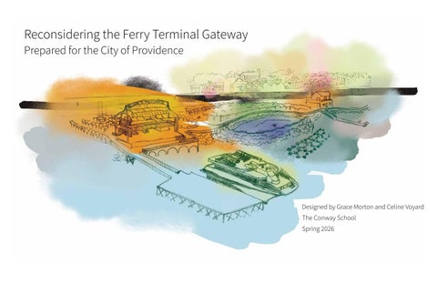
Reconsidering the Ferry Terminal Gateway Prepared for the City of Providence
Designed by Grace Morton and Celine Voyard The Conway School Spring 2026
*All images credited to the authors unless otherwise stated.
Spring 2026
Providence Ferry Terminal Gateway Project
Designed By: Grace Morton & Celine Voyard
We would like to thank the Providence Planning Department for the opportunity to work on this project. We would also like to thank the faculty at the Conway School for the support and guidance throughout this project. We appreciate the contribution from the members of the Providence community who were kind enough to share their thoughts and experiences to inform the designs.
Table of Contents
Acknowledgements
Project Introduction ............................................. 1 Area History ............................................................. 2 Ecology ..................................................................... 3 Floods & Infrastructure ........................................ 4 Existing Conditions ................................................. 5 Floodplain & Sea Level Rise .................................... 6 Zoning & Land Use ................................................... 7 Access & Circulation .............................................. 8 Pedestrian Experience ............................................ 9 Utilities ................................................................... 10 Heat, Vegetation & Surfaces .................................. 11 Summary Analysis .................................................... 12 Design Concepts ..................................................... 13 Design Concept #1 .................................................. 14 Design Concept #2 .................................................. 15 Design Concept #3 .................................................. 16 Final Design ............................................................ 17 Ferry Terminal Details ........................................... 18 Ferry Terminal Concept I ...................................... 19 Ferry Terminal Concept II ..................................... 20 Ferry Terminal Concept III .................................... 21 Design Details I ...................................................... 22 Design Details II ..................................................... 23 Design Details III .................................................... 24 Design Details IV .................................................... 25 Design Details V ..................................................... 26 Plant Palette I ....................................................... 27 Plant Palette II ...................................................... 28 References .............................................................. 29
88 Village Hill Rd. Northampton, MA 01060 413-369-4044 www.csld.edu
Table of Contents
Support the anticipated increase in visitors to the Ferry Terminal
Increase climate resiliency
Fox Point Neighborhood ut h M n St et
tr e e t
re
S To c k w otto n
ai
A pa rt m en t B u il d in g
In t e r s tat e 1
95
India Point Park In d ia S tr ee t
Providence River Pro
vid
St e c n e
eam
Co b o at
.
Ferry Parking
Fishing Pier
Providence Harbor Beautiful view of the waterfront looking west towards the hurricane barrier from India Point Park.
88 Village Hill Rd. Northampton, MA 01060 413-369-4044 www.csld.edu
So
Street
M ix ed U se
Tr ad er Jo e' s
W at e r
Hurricane Barrier
Improve pedestrian connectivity to Fox Point neighborhood
Support the local fishing community
S outh
Today, this area is dominated by concrete with the significant presence of Interstate 195 running through the site. Limited vegetation dapples this highly built environment and provides limited refuge for those navigating the streets. For those coming off the ferry, finding their way north into the heart of the city is not a clear or comfortable path to navigate. Not many others aside from a small local fishing community frequent this area unless they are on their way to or from the neighboring India Point Park or driving through to access the highway.
The City does not want to negatively impact current uses of the waterfront, and so it is interested in providing continued support to the local fishing community in the area. It wants to ensure that access to the waterfront for fishing is maintained, if not expanded.
Br idg e St re et
The City identified a roughly 35-acre area on the western portion of the Fox Point waterfront for the project location. The area contains a mix of private, city-owned, and state-owned parcels, as well as roadways managed by the Rhode Island Department of Transportation. The focus point of the site is the Providence Ferry Terminal where a seasonal ferry operates, taking passengers south through the Narragansett Bay to Bristol and Newport. This small, 149-seat ferry runs from mid-June through mid-October and makes four trips a day. The ferry terminal facilities include an 89-spot parking lot, a temporary tent and bathroom, and a temporary floating dock. All temporary equipment is removed off season and the lot is fenced off from the public. In the last two years, a small cruise line, the American Cruise Line, also began operating out of the terminal area. The cruise line runs trips from May through October, with 40 cruises departing from and returning to Providence in the 2026 season. These cruise ships are also small, offering 100 rooms to passengers. Those going on the cruise must park off-site and are shuttled directly to the waterfront where the ship is docked in front of the Providence Steamboat Company lot to the west of the ferry terminal. In addition to the ferry terminal, there are a few restaurants within the project site as well as a residential apartment building, commercial offices, and a community boating center.
Finally, with a longer term vision in mind, the Planning Department is looking to increase climate resiliency with flood-informed waterfront designs. The future impact of floods and sea level rise need to be taken into consideration throughout this process.
Spring 2026
Site
In support of the residents in the Fox Point neighborhood to the north of the waterfront, the City is also looking to improve pedestrian connectivity from the residential area to the waterfront. The City would like to ensure that those in the neighborhood have clear access to the resources along the waterfront and that the designs support many diverse community activities.
Ferry Terminal
The ferry terminal is at the center of a heavily built environment neighbored by river and harbor waters.
Community Boating Center
Designed By: Grace Morton & Celine Voyard
The Planning Department of the City of Providence is interested in revitalizing the waterfront area in the Fox Point neighborhood. The City has invested in developing beautiful India Point Park along the eastern portion of the waterfront in the neighborhood and is now looking for options to expand those efforts to the western working waterfront area. Chris Martin, the City’s Director of Special Projects, and Ryy Dickerson, a Principal Planner for the City, worked with the Conway students to identify options to renew this area of Providence.
The City of Providence has a few goals for this site, with the primary goal focusing on accommodating the anticipated increase in visitors to the ferry terminal area. The Planning Department is interested in creating a more welcoming entrance to the city as visitors step off the ferry. It would like to demystify the area with better wayfinding so it is a clear and comfortable pedestrian experience. It is also interested in considering possible off-season uses for the ferry terminal and parking area as it is currently unused for most of the year.
Providence Ferry Terminal Gateway Project
Clients
Goals
Project Introduction
A WORKING WATERFRONT
1/29
By the 1930s and 1940s, Fox Point was largely composed of Portuguese and Cape Verdean communities. Waltraud Berger Coli and Richard A. Lobban, authors of the book, The Cape Verdeans in Rhode Island: A Brief History, explain that Cape Verdeans established "mutual aid societies," especially by way of labor organizing on the waterfront, out of practice from formerly living under colonial rule in the islands. Andrade-Watkins further claims that over time, the community built “a buffer against discrimination because of…[their] control of the waterfront, the main source of income for the community that made…[themselves] sufficient.” Family life often revolved around longshore work, with annual picnics held by the water to celebrate their hard labor. As the second generation of Cape Verdeans came of age in the 1950s, the community advocated for an elementary school to be built in Tockwotton Park that would avoid displacement of other families if placed elsewhere. The waterfront was intrinsically linked to those living in Fox Point. Far beyond geographic convenience, it provided social, emotional, and economic relations that remained strong throughout the decades.
How I-195 Reshaped Fox Point Providence Boys Club on the corner of South Main Street. Photograph taken by the Providence Redevelopment Agency as a part of the East Side Renewal Project on July 2nd, 1962. Providence Public Library
However, in the midst of these social formations leading up to the construction of the Interstate 195 highway (I-195) in the 1960s, a series
Throughout the film, Andrade-Watkins, along with the many community members she interviewed, brings to life the neighborhood she grew up in. Within walking distance of the waterfront, one might pass by the Sheldon Street Church for afternoon tea, head down Tockwotton or South Main Street (at one point, the “Broadway of
Representative image of longshore workers in the 1950s. South Water Street Dock, circa 1925-1965. Providence Public Library, CC BY-SA 4.0
of city-sanctioned planning and policy decisions subjected Fox Point to large-scale infrastructural transformation and displacement. Residents remember receiving letters stating that their homes were located in
Fox Point Today Relying on Census data from 2020-2024, the Fox Point neighborhood is part of Tract 37, consisting of 3,924 people. Of this population, 57% fall between the ages of 20 and 39 years, 57% make over 100K a year, and 68% are non-family, indicating that much of this neighborhood is home to young professionals. About 23% of the population is below the poverty line, all consisting of seniors (ages 65 and over). The average house is worth $464,700, and the average rent is about $3,245, making housing unaffordable for working-class families. Finally, 70% of the population is white, 16% is Asian, 8% is Hispanic, 4% are two or more races, and 2% are Black. The conditions of Fox Point today have significantly changed, but how has the former community responded? While in the film it was a dream for residents like John "Johnny" Britto (known to be the "father of Fox Point") to "bring my people back to Fox Point," recent interviews from the second-generation Cape Verdeans, who are now seniors themselves, are thinking
Reconstruction of I-195 in Fox Point, circa 2003-2011. ArtInRuins.com
Harbor and buildings of Fox Point seen along Bridge Street. Providence Public Library, CC BY-SA 4.0.
88 Village Hill Rd. Northampton, MA 01060 413-369-4044 www.csld.edu
The construction of I-195 in the 1960s physically cut through the neighborhood on the southern end of South Main Street, removing homes and severing Fox Point’s direct connection to the waterfront. According to the Fox Point in 1939. Focus area outlined in red. Summary Relocation Data & Computations, an estimated 420 households (245 of them white, 175 of them nonwhite) were displaced. Due to crumbling infrastructure, the highway was then relocated a second time in the early 2000s where it remains today. Expansive parking lots began to line up in Fox Point, filling in the spaces once home to residents. The spatial connections between workplace and home were divided by infrastructure and redeveloped parcels. In the decades that followed, additional pressures compounded this disruption, including rehabilitation and redevelopment initiatives, historic preservation efforts, and increasing demand for off-campus student housing tied to nearby institutions, in Construction of I-195 in Fox Point, circa 1957-1968. particular Brown University. Although some residents were ArtInRuins.com promised they could return after development, many left out of haste, fear, or unaffordability. As Waltraud Berger Coli and Lobban explain, by 1990 the Cape Verdean community in Fox Point had "been all but erased by this process of gentrification," and the former residents were found scattered all around Rhode Island in "North Main, Camp Street, South Providence, North Providence... Washington Park...East Providence, North Providence, and various areas in Pawtucket."
Through community action, the Boys Club moved and eventually became the Fox Point Boys and & Girls Club; Sheldon Street Church remains a vital gathering place; longshoremen now working in Washington Park are protected by International Longshoremen's Association Local 1329; Silver Star Bakery blends in with the new cafes and antique shops on Wickendon Street; and street names have been renamed as a markers of honor and remembrance. Digital storytelling organizations like SPIA Media Productions document, preserve, produce, and carefully distribute quality content through story maps, documentaries, and narrative projects; the Cape Verdean Museum extends its collection to the larger diaspora; RI Cape Verdean Heritage (RICVH) plans the annual Independence Day Festival on the waterfront, an opportunity for the community to come together; the Fox Point Cape Verdean Heritage Place Project (FPCVHP) is an independent, community-based research initiative, composed of descendants of the first settlement of Cape Verdeans, that has been advocating for the community since 2014. Today, FPCVHP advocates for the installment of the "Tockwotton" Fox Point Cape Verdean Memorial Place hoped to be in India Point Park.
Spring 2026
Waterfront and Community, One and the Same
the area of the East Side Renewal Project; horses would block South Main Street to eventually turn it into the one-way road that is present today. As rents doubled in price, overlapping forces of redlining, urban renewal, and gentrification would displace hundreds of families.
Providence Ferry Terminal Gateway Project
Providence”) to make a few purchases or grab a bite to eat at Jafar’s, greet family and friends in the tenements, or, if young and a little scrappy, play at the Boys’ Club to stay out of trouble. When the parking lots were not in use at the end of the day, a takeover of children would use them to play “hopscotch, seven up, hide-and-seek, softball, and kickball.” After a long workday, longshoremen transformed into musicians. Folks would dance out on their porches, play cards, or talk union business and catch up in the bars or parlors.
Area History
Fox Point, once a vibrant waterfront neighborhood, now lives in a state of memory or record. Most of the former residents have since been displaced, aged, or passed away. Yet, the legacy of the community continues to persist under different circumstances, through annual gatherings, oral histories, and through the committed actions of their descendants. This area has been shaped by generations of immigrants: newcomers from Ireland, Eastern Europe, Syria, Lebanon, Azores, Portugal, and Cape Verde created a shared way of life in the mid-19th and early 20th centuries. In an interview published in the Brown Daily Herald Monthly Supplement in 1989, a lifetime resident, Charlie "Melay" Simon, recollected, “Everybody knew each other.… We had so little that all we had was each other. We didn’t know we were so poor because everybody was poor.” Another resident, Justino "Tiny" Andrade, opens the documentary, "Some Kind of Funny Puerto Rican?": A Cape Verdean American Story, directed by Claire AndradeWatkins, with the following: “The whole community was one big family. If somebody was sick…[we’d] all bring food over. You were never wanted for anything. …Doors were always open… .That was the way things were at Fox Point.”
further ahead: how can Fox Point be remembered by future generations even when we are no longer here?
Designed By: Grace Morton & Celine Voyard
WHAT REMAINS: COMMUNITY AND RESILIENCE OF FOX POINT
2/29
88 Village Hill Rd. Northampton, MA 01060 413-369-4044 www.csld.edu
A LOOK INTO THE UPPER NARRAGANSETT ESTUARY Early Coastal Ecologies
Infill and a Reshaped Shoreline The transformation of Fox Point waterfront, from salt marshes, dunes, and upland forests to railroads and shipyards, is rooted in a broader history of infill across the upper Narragansett Bay estuary. Beginning in the 19th century industrial period and continuing through the mid-20th century, marshes, wetlands, and shallow tidal areas were progressively filled to create developable land. Expansive waterways like the Providence and Woonasquatucket Rivers were converted into fixed narrow channels, the shoreline edges hardened with engineered structures. The process of infill, alongside Fox Point's historical role in wharves, maritime trade, and 19th-century railroad construction, contributed to the waterfront eventually being defined by industrial activity, transportation infrastructure, and other urban development. Currently, there are no marsh habitats along Fox Point shoreline nor upland forests in the neighborhood.
Map of Narragansett Bay by Charles Blaskowitz (rev. 1777). Focus area outlined in pink. David Rumsey Map Collection
Spring 2026
Historically, salt marshes and wetlands played a critical role in slowing down water movement, filtering pollutants, and stabilizing the shoreline through gradual sediment accumulation. Around 1000 CE, the upper estuary functioned as an integrated ecological and cultural landscape. As Maliane Teleo notes in the storymap, "Underneath Fox Point: Fox Point Reimagined Through its Native Lens," while there are no clear, specific records of precolonial land use in Fox Point, inferences can be made regarding Narragansett relationships to the estuarine shoreline, including fishing, shell fishing, medicinal plant gathering, and seasonal movement. The underlying estuarine form of the region remained partially intact into the colonial period. An 18th-century map of Narragansett Bay (1777) still depicts a coastline characterized by its irregular, organic shape, nearby upland forests, and wide, connected waterways between the Providence River and the upper Narragansett Bay estuary.
Providence Ferry Terminal Gateway Project
The Fox Point waterfront is part of the Narragansett Bay watershed, a regional drainage system in which upland and urbanized landscapes direct water through rivers and tributaries toward the coast. This system carries sediments, nutrients, and urban runoff downstream into the upper Narragansett Bay estuary. Here, where the Providence and Seekonk Rivers converge, freshwater and tidal saltwater mix, producing a dynamic and continuous estuarine environment.
Postcard image of Fox Point's railroads. Providence Public Library, CC BY-SA 4.0
Ecology
From an ecological perspective, infill represents not only a change in land form but also a disruption of system function with lasting implications for shoreline stability and public use. The burial of marsh systems removed key habitats responsible for filtering pollutants, buffering tidal forces, and stabilizing shoreline sediments. In addition, shoreline hardening strategies such as seawalls and bulkheads replaced porous ecological edges with rigid structural boundaries. According to the article, "What is a Living Shoreline?" by the National Oceanic and Atmospheric Administration (NOAA), unlike marsh systems that dissipate wave energy, present-day edges reflect it, preventing the inland migration of wetland systems. The widespread use of hardened edges likely contributes to the near disappearance of coastline wetlands. These conditions suggest at least two possible interventions. One is the potential reintroduction of former wetland species to create habitats that naturally stabilize the estuarine coast and increase aquatic communities. However, this may disrupt boating access, creating an area of conflict. Another is the integration of vegetated systems with hardened shorelines, which may improve public experience along the coast and yield long-term environmental benefits.
On Water Quality
Salt-tolerant grasses growing along the coast of India Point Park.
As of 2024, water quality in the upper Narragansett Bay estuary is impaired but improving. Rhode Island Department of Management (RIDEM) identifies low dissolved oxygen and nutrient enrichment as key factors limiting compliance with water quality standards. Save The Bay notes stormwater runoff and wastewater systems contribute bacteria and nutrients that lead to beach closures after rain. The Narragansett Bay Estuary Program (NBEP) reports significant reductions in pathogens and nitrogen over the past two decades, expanding shellfish harvesting areas, though upper estuary waters still show elevated contamination and ecological stress.
Designed By: Grace Morton & Celine Voyard
Considering the Future of the Shoreline
Stormwater outfalls at the edge of India Point Park.
3/29
Flood History
Major Coastal Storms • August 1635: The Great Colonial Hurricane (14'-20' surge)
Alongside the long history of filling and hardening the coastline, Providence has experienced repeated damage to the built environment due to storm surges throughout the years. Major floods have come along with nine hurricanes that have directly hit the Rhode Island coast over the past century, in addition to other damaging storms and king tides. In the early 20th century, two hurricanes brought significant damage to Providence—the Great New England Hurricane in 1938 and Hurricane Carol in 1954— both bringing up to eight feet of flooding within the city. Due to the hundreds of millions of dollars in damages, the City, with help from the Army Corps of Engineers, decided to build a hurricane barrier at the mouth of the Providence River in the 1960s. This barrier provides protection to a major portion of the city up-river, including the primary commercial and industrial areas, transportation facilities, and many homes. While this infrastructure has helped in limiting upstream impacts during major storm events, the Fox Point waterfront is outside of the barrier and continues to take the full brunt of frequent storms.
• September 1815: The Great September Gale (18' surge) • September 1938: The Great New England Hurricane (12'-15' surge) • August 1954: Hurricane Carol (14' surge) • 1960-1966: Building and completion of the hurricane barrier • August 1991: Hurricane Bob (6.5' surge) • April 2007: Patriot's Day Coastal Storm • October 2012: Superstorm Sandy (3'-5' surge)
The hurricane barrier is located alongside the Providence River Bridge just north of where the Providence River opens into the harbor and where it meets the Seekonk River. The three doors of the barrier are closed prior to major storm events to limit any additional water moving upstream. Most days, these doors are open, allowing for water to move freely up and down river as the tides change. The barrier was built to protect from storm surges up to 20 feet, but was not built to withstand the level of sea level rise that we may see in fifty or more years.
At the center of the three underpasses on the site, flood doors are installed for use during a major storm event. These large metal doors are closed to limit water from moving north into the city if the Fox Point waterfront is anticipated to be flooded. These doors are in line with the hurricane barrier and are typically deployed in tandem with closing the barrier doors.
Spring 2026
Looking Ahead
Flood door at the center of the underpass on South Water Street when open.
Looking south at both flood doors closed on Bridge Street during a storm event. Credit: “110828-A-BJ146-021” by CorpsNewEngland, CC BY-ND 2.0
The Fox Point community has confirmed that major storms have occurred more frequently over the last few years, hitting the Providence waterfront roughly every other year. These storms bring major damage to properties along the waterfront as well as leave debris behind in their wake. Any development along the coastline must be resilient to the ever-changing weather patterns and damaging effects that they bring.
Designed By: Grace Morton & Celine Voyard
Infrastructure Locations
Flood Doors
Floods & Infrastructure
Storm Surge Infrastructure Hurricane Barrier
Providence Ferry Terminal Gateway Project
• September 1985: Hurricane Gloria (8.25' surge)
Credit: "Washington Park Yacht Club during the 1938 hurricane " by Hurricamia75, CC BY 3.0)
Hurricane barrier looking south when the doors are open on a sunny day.
88 Village Hill Rd. Northampton, MA 01060 413-369-4044 www.csld.edu
A VULNERABLE COASTLINE
4/29
In addition to the temporary dock at the ferry terminal, there is a dock on the southeastern part of the site in front of the Community Boating Center as well as docks for the marina just north of the site on the Providence River. It has been observed that locals fish from three primary locations on the site—the fishing pier at the start of India Point Park, under the Providence River Bridge in front of the hurricane barrier, and the Providence River Park just north of the barrier. Some seating is available near the latter two locations, but there is no seating on the fishing pier.
So
e
d
Providence Harbor
Designed By: Grace Morton & Celine Voyard
tr
Ferry Terminal
P S tr o ea v i mb d oa e n tC c o. e
e
S ia
et
Existing Conditions
et
nc e d v i er o v P r Ri
The Providence River Bridge looking southwest from Bridge Street, showing a car parked along the shoulder near the local fishing spot.
5
A
In
A
9 I-1
B
I - 19 5
Bridge Street
t
in
k
re
kw
on
ee
o ia P
ar tP
St
l
et
c To
t ot
r St
Ind
in
tia
re
ce et re e n St v i d ark P ge id P r o iver R
St
Br
er
en
at
sid
hW
Restaurants
re
ut
Marina
Ma h ut So d pe lo ve el de rc U n Pa
Residential/ Commercial
South Main Street looking north from India Street, leading to the I-195 on-ramp to the east.
Spring 2026
The Fox Point neighborhood covers the southern portion of the peninsula between the Providence and Seekonk Rivers, with the project focus area in the southwest corner of the neighborhood.
B
Providence Ferry Terminal Gateway Project
India Street
Providence Harbor
Most of the lots and roadways within the project area are owned by the city or the state, with few privately owned lots. The largest private lot, on the southwest corner of the waterfront, is owned by the Providence Steamboat Company. Bridge, Tockwotton, and India Streets all offer on-street, parallel parking in sections. There are multiple parking lots across the site, but only one offers consistent public parking access. It has been observed that people tend to park their cars along the shoulder and on the sidewalk of Bridge Street near the underpass.
Most of the ground in the focus area is impervious surface (concrete) with some turf grass along the highway, on islands between the roadways, and covering one larger undeveloped parcel in the northeast corner of the site. A limited tree canopy consists of younger street trees as well as more mature trees along the Providence River Park and leading into India Point Park.
88 Village Hill Rd. Northampton, MA 01060 413-369-4044 www.csld.edu
S. Main Street
e
Cutting from east to west across the site is Interstate 195—an eight-lane highway that is raised above the at-grade streets. The concrete walls of the highway have a dominating presence and block the view from the waterfront looking north into the city. The at-grade streets provide connectivity to the waterfront as well as the highway, with on- and offramps within the focus area. Various sections of one-way traffic create a tricky network of roads to navigate when driving. Most of these streets have a sidewalk on at least one side, providing almost continuous pedestrian access.
I-195
nc ide ov er Pr Riv
The approximately 35-acre project site is located on the southwest corner of the Fox Point neighborhood of Providence. To the east of the site is India Point Park along the waterfront and to the west is the Providence River. To the south is the Providence Harbor where the Providence and Seekonk Rivers meet at the very top of Narragansett Bay, and to the north is the residential area of the Fox Point neighborhood. The ferry terminal is located near the western corner of the waterfront. It consists of an 89-spot parking lot and a concrete pad, both of which are fenced off from the public during the off-season. Most of the concrete pad area is fenced off from access at all times due to dangerous conditions created by the remnants of a demolished building.
Se ek Ri on ve k r
EXISTING CONDITIONS
5/29
100-Year Storm Due to its location along the waterfront, a large portion of the project site is within the 100-year floodplain, meaning there is a one percent chance in any year that the area will flood. The coastline area is outside of the protections of the storm surge infrastructure. North of the 100-year floodplain is an area with a reduced risk of flooding due to the hurricane barrier. Only the northeast corner of the site is currently outside of the flood risk zone.
50-Year Storm + Sea Level Rise When combining storm scenarios and sea level rise predictions, a more complete picture of shoreline impact over the coming decades can be understood. Higher sea levels create a higher launching point for storm surge, increasing the impact of a storm. Temporary storm flooding in addition to long-term sea level rise will significantly impact the Providence waterfront. Projections show that a 50year flood in 2050 with a one-foot sea level rise will cause water levels to reach the extent of most of the project focus area, except for the northeastern-most corner.
According to Sealevelrise.org, Providence has seen a sea level rise of 10.32 inches since 1930, mostly due to Rhode Island’s sinking land. The rate of increase has accelerated over the last ten years and is rising by over an inch every eight years. By 2050, predictions show a rise of 12 inches, and by the end of the century, the rise could be between 1.5 and 7.2 feet ("Sea Level Rise (SLR)").
Possible Impacts Land Loss & Coastal Erosion
Property Loss & Damage
Damaged Infrastructure
Drinking Water Contamination
Climate Migration & Gentrification
Design Takeaways Possibly by the middle of the century and more likely by the end of the century, the Fox Point waterfront will be significantly impacted by daily tidal inundation and storm events. Inundation of coastal properties will be more common during storm surges, damaging homes, businesses, as well as utilities and transportation infrastructure. As the climate changes, people will be forced to retreat away from the waterfront, especially as the coastal land continues to degrade and erode. It is critical to increase stormwater storage capacity where possible to limit its impact when the storms do come. Also, any future infrastructure along the waterfront needs to be designed for inundation—both temporary inundation in the short term, and permanent inundation in the long term.
Designed By: Grace Morton & Celine Voyard
Sea Level Rise
Floodplain & Sea Level Rise
Spring 2026
Providence Ferry Terminal Gateway Project
Recent coastal studies predict that 100-year storm surges will be 10-year storms or more frequent events by 2050, increasing the impact to infrastructure on coastal floodplains (SeaLevelRise.org).
88 Village Hill Rd. Northampton, MA 01060 413-369-4044 www.csld.edu
A CHANGING COASTLINE
6/29
STATE OR CITY
S. ET
STATE OR CITY
ST P R O EA VI MB DE OA NC T E CO .
RE
PRIVATE
Land Use
Ownership
However, public access becomes less apparent when examining the site’s existing uses. Industrial and commercial-service uses sit to the north of the I-195 highway, while mixedurban land and transportation, communications, and utilities make up the southern portion of the site. As mentioned in previous analyses, the highway itself reinforces a strong physical division, shaping how the site is accessed and traversed. Rather than forming a continuous public experience, the waterfront is interrupted by infrastructure, utilities, heavy production, and mixed-use areas that are not clearly defined as public-use spaces. Also, some of the areas shown as "mixed urban land" do read and function as public open space (e.g., India Point Park). Others, like the turf medians and partly used sidewalks do not read or function in this way.
Most of the focus area is City or State property aside from the Providence Steamboat Company in the south, restaurants and parking lots on either side of Bridge Street, and businesses and housing along South Water Street. The ferry terminal is owned by the Department of Environmental Management (DEM) but managed by Rhode Island Department of Transportation (RIDOT).
Design Takeaways Despite zoning frameworks that position the waterfront as continuous public and ecological resource, existing uses, infrastructural barriers, and mixed ownership prevent this vision from being realized. Fortunately, with most of the focus area being owned by the State or City, there is an opportunity to work towards a more connected, navigable, and publicly accessible waterfront.
Private parking between Bridge Street and South Water Street.
Property of Providence Steamboat Company along India Street.
The Community Boating Center on India Point Park, a park owned by the City of Providence.
Spring 2026
I
I ND
T AS
Providence Ferry Terminal Gateway Project
STATE OR CITY
ST P R O EA VI MB DE OA NC T E CO .
A similar intention is also present in the OS Open Space District, which seeks to “preserve open space areas, conservation areas, and outdoor recreation areas,” including parks, wetlands, and floodplains. While the districts are zoned for differing purposes, both position the focus area as one that serves the public, be it through accessible waterfront development or the preservation of open, recreational, and/or ecological landscapes.
CITY
T
The focus area has two distinct districts, the W-2 Mixed-Use Waterfront District and the OS Open Space District. According to the Providence Zoning Ordinance, the W-2 district is intended to “promote a balance among appropriately scaled residential and commercial development” while encouraging compatibility with surrounding neighborhoods and “enhanc[ing] and creat[ing] public access to the waterfront as a public resource”(9-1). This reflects the site’s proximity to the Fox Point neighborhood, and also emphasizes the notion that the waterfront should be a shared, public resource.
STATE OR
EE
ET
Zoning
TR
RE
ST P R O EA VI MB DE OA NC T E CO .
RS
ET
ST
TRANSPORTATION, COMMUNICATION, AND UTILITIES
PRIVATE
RE
AS
ET
PRIVATE
ST
I
GE
Waterfront/ Mixed Use
I ND
E TR
TE WA
T
95
ID
ET
BR
RE
I-1
GE
T
COMMERCIAL AND SERVICES
ID
A
MIXED URBAN LAND
BR
DI
EE
EE
ST
IN
T
TR
TR
GE
95
EE
RS
RS
ID
I-1
R ST
Designed By: Grace Morton & Celine Voyard
INDUSTRIAL
TRANSPORTATION, COMMUNICATION, AND UTILITIES
TE WA
TE WA
BR
Open Space/ Public Space
MIXED URBAN LAND
S.
S.
Open Space/ Public Space
Zoning & Land Use
Medium Density Residential
88 Village Hill Rd. Northampton, MA 01060 413-369-4044 www.csld.edu
ZONING & LAND USE
7/29
S. Ma
C
in St
re
S. te rS tr
re
tt
et
Ind
i
re
I-1 re
et
95 A
et
Benches on Bridge Street have been placed directly under street lights where pigeons tend to sit, resulting in dirty benches.
Design Takeaways While there are sidewalks, crosswalks, and green spaces within the site, the pedestrian experience can be improved with opportunities for refuge and further separation from vehicular traffic. Areas for rest and shade can provide an improved experience for those navigating to and from the waterfront. Also, pedestrian wayfinding signage could prove to be significant in demystifying the area and showing people the best (nicest and/or fastest) routes towards the northern parts of the city. Other amenities, like diverse seating options and bus shelters, could improve the on-the-ground experience for those spending time along the Fox Point waterfront. Although parking does not seem to be an issue on a daily basis, additional public parking may be helpful during peak-use days of the year.
C Signage for the ferry is designed for vehicles to navigate the one-way streets to the terminal parking lot.
Ferry Terminal
Assumed destinations and pedestrian routes connecting to the ferry terminal.
Designed By: Grace Morton & Celine Voyard
B
Access & Circulation
Along Bridge Street are eight areas for seating on benches or stone walls. These are the only clearly identifiable seating options throughout the site aside from India Point Park. Transportation resources include two bus stops without shelter, one at South Water and Tockwotton and another along South Main and the highway on-ramp, along with two sets of bike racks. Limited wayfinding signage can be found on the site, with a few signs directing vehicular traffic to the ferry terminal. While parking is abundant across the three largest parking lots and on-street parking, only one lot is available for public use. The ferry terminal lot is closed off-season and is only available for ferry users on-season. A parking garage under the highway off of Bridge Street is primarily reserved for use by the Attorney General’s office with a few spots available to the public by reservation. A lot on Tockwotton between Bridge and South Water is a paid public lot. Most of the streets offer on-street parking which is free to the public with time restrictions. The community has shared that all public parking is quickly filled during times of festivals and events in India Point Park and vehicular congestion occurs during those times.
ark
Spring 2026
B
t aS
o
t nS
Po
P int
Providence Ferry Terminal Gateway Project
t
St
ee
ge
c To
o kw
A Unsheltered bus stop at the busy intersection of South Main Street and the I-195 on-ramp.
ia Ind
et
Wa
id
There is an extensive network of sidewalks along the streets throughout the site. There are a few places where sidewalks end mid-block and require a pedestrian to cross the street for continued safe access. Crosswalks are present at most intersections, but are missing in a few key crossing locations. Pedestrians experience little refuge from the sun throughout the site and are frequently contending with vehicular traffic when navigating the roadways. Looking across the city at potential secondary destinations for those coming to and from the ferry terminal, a network of assumed pedestrian routes can be seen. There are multiple routes pedestrians can take to navigate to/from the waterfront— some more direct and others providing a more comfortable and enjoyable experience.
Br
Circulation across the site is dominated by vehicular traffic entering and exiting Interstate 195. South Water Street is one-way heading south and is the primary access point to the on-ramp of the highway. Heavy traffic on this street during weekday commuter hours requires police officers to be posted at three intersections to direct traffic. South Main Street is one-way heading north and intersects with the highway off-ramp. Both underpasses on these streets are narrow but do have sidewalks for pedestrian access. The third north-south access street is Bridge Street, which is one-way north of Tockwotton Street. When moving south from Tockwotton Street, it is two-way and turns into India Street along the waterfront. India Street is two-way, providing primary access to the ferry terminal and India Point Park. Tockwotton Street is the primary east-west connector between the north-south streets.
88 Village Hill Rd. Northampton, MA 01060 413-369-4044 www.csld.edu
ACCESS & CIRCULATION
8/29
For those walking to and from the ferry terminal area, the experience can be hot, loud, confusing and unwelcoming. Though some brick sidewalk details and embellishments on the walls of the highway help to announce arrival and care, this treatment is inconsistent. Sidewalks can be narrow with cracking concrete, and in some locations abut fences, concrete walls, or quickly moving traffic.
88 Village Hill Rd. Northampton, MA 01060 413-369-4044 www.csld.edu
PEDESTRIAN EXPERIENCE G A The underpasses on South Main Street and South Water Street have limited overhead lighting and sidewalks on one side. Noise echoes throughout the underpass when cars pass by. The concrete walls are windowless, though painted brick ties in to the brick material used for sidewalk segments nearby.
B
C
A
D
E
There is refuge from heat under the Providence River Bridge, with a few benches and low walls for seating. Overhead lighting share the same style as those in India Point Park. Some debris and trash has been observed around the fishing area.
E
C
An ADA ramp leads visitors from the temporary ferry terminal tent to the boardwalk that takes passengers to the floating dock. The view to the north is of the fenced- off location of the demolished building.
On the south side of India Street, pedestrians walk along barbed wire fencing on an interrupted, narrow concrete sidewalk to reach the ferry terminal entrance. No coverage from the sun is available. Some street lights are more industrial in design and are affixed to telephone poles.
G F
D
Traffic-light-controlled access to I-195 causes traffic to back up along the on-ramp. During busy commuter hours, a police officer is stationed at the South Main Street intersection to help direct traffic. A bus stop without shelter or seating is located on the island along the edge of the on-ramp.
The fishing pier offers access to the waterfront for people fishing, but does not have cover, seating, or nighttime lighting. It has been observed that people tend to bring their own seating when recreating in this area and leave before it gets dark.
Designed By: Grace Morton & Celine Voyard
B
Pedestrian Experience
Spring 2026
One-way traffic queues on South Water Street leading to the I-195 on-ramp. A bus stop without shelter or seating is located on the sidewalk. Brick sidewalks and the wave pattern on the highway bridge do provide interest along the way.
Providence Ferry Terminal Gateway Project
F
9/29
88 Village Hill Rd. Northampton, MA 01060 413-369-4044 www.csld.edu
analysis is presented in three layers (electric/gas/water/telecom; sewer; and stormwater). Data points were UTILITIES This derived from the 2025 Resiliency Review and Feasibility Study by GZA GeoEnvironmental, Inc. on behalf of the City of Providence Parks Department and its partner The Nature Conservancy.
Southern green space show the most flexibility for plantings.
RE
ET
Design Takeaways When combined, there is a potentially overwhelming amount of underground pipes and surface features, especially in the green space in the far west. This suggests a design approach that aligns the degree of conflict risk and density with the level of intervention; highly constrained areas could be appropriate for art, raised beds, or seating, while areas less impacted by utilities can support more landscape alterations and plantings. Also, there may be a chance to treat stormwater on the surface to reduce water quality impacts.
Eastern green space is also promising for plantings, aside from manholes on the far eastern side, and the highvoltage transmission pole to the west.
Spring 2026
DI
T AS
Designed By: Grace Morton & Celine Voyard
ST P R O EA VI MB DE OA NC T E CO .
IN
ST P R O EA VI MB DE OA NC T E CO .
ST P R O EA VI MB DE OA NC T E CO . T
Western green space shows the most utility conflicts.
T
EE
ET
T
EE
TR
RE
EE
TR
RS
ST D
TR
ET
TE
GE
IN
S IA
95
RE
WA
ID
95
I-1
ST
S.
BR
I-1
Sewer lines mainly run beneath roadways. However, the heaviest concentration of sewer infrastructure, which consists of both manholes and sewer lines, is located primarily at the southwestern green space adjacent to Bridge Street and India Street, as well as the far eastern portion of the site. A combined sewer main runs under South Water Street and appears to discharge along the waterfront. This means that untreated stormwater and sewage can enter the harbor here.
RS
T
ET
Sewer
GE
EE
RE ET
ID
TR
ST DI
RE
BR
RS
GE
IN
T AS
TE
TE
ID
95
WA
WA
BR
I-1
Utilities
S.
S.
Water, gas, and communication lines are concentrated mainly underneath roadways, posing some constraints to plantings or certain landscape interventions near the green spaces adjacent to the southern edge of South Water Street and the eastern portion of the site. Electrical lines are primarily above ground south of I-195, which may constrain tree plantings and/ or sidewalk expansions.
A simpler layout of inlets, manholes, pipes, and discharge outfalls, the stormwater infrastructure is mainly concentrated in the green spaces in the southern portion of the site. One outfall exists at the southern edge of the Providence Steamboat Company while two more are near the eastern fishing pier. This means that untreated stormwater can enter the harbor at these locations. Not shown here are downspouts exiting from the highway into the green space. While they appear near storm drains, it appears that runoff may overflow at these locations.
Providence Ferry Terminal Gateway Project
Stormwater
Electric/Gas/ Water/Telecom
10/29
S.
88 Village Hill Rd. Northampton, MA 01060 413-369-4044 www.csld.edu
HEAT, VEGETATION, IMPERVIOUS SURFACES WA TE RS T
GE
EE
ID
TR
BR
I-1
95
ST
IN
RE
S.
D
S IA
TR
EE
T
ET
WA TE T
ST RE
D
TR
EE
T
ST P R O EA VI MB DE OA NC T E CO .
ET
IN
S IA
Most of the site is dominated by impervious surfaces, which absorb and retain heat, with limited tree canopy or other sources of shade. In the summer, these conditions lead to discomfort and can be dangerous to humans and animals. Without mitigation, heat exposure is likely to worsen as the climate warms. Also, hot surfaces produce hot runoff, which affects the health of receiving waters.
FOX POINT
Spring 2026
EE
GE
95
Providence Ferry Terminal Gateway Project
TR
ID
I-1
ST P R O EA VI MB DE OA NC T E CO .
RS
BR
Heat data was collected by local volunteers organized by the State of Rhode Island in partnership with CAPA Strategies on the afternoons of July 29 and July 30, 2020. The data shows the intensity of the urban heat island effect across Providence, with the Jewelry District and portions of downtown reaching temperatures exceeding 100°F. When zooming into the site scale, temperatures remain similarly elevated, ranging in the 90s.
DOWNTOWN PROVID ENCE S. WA TE EE
95
T
GE ST RE ET
IN
DI
ST P R O EA VI MB DE OA NC T E CO .
EAST PROVID ENCE
UPPER SOUTH PROVID ENCE
Design Takeaways Opportunities to consider for this area may be to expand tree canopy cover, introduce vegetated and green cover in exposed areas, and add shaded structures, including potential solar canopies in larger paved zones such as parking lots. Future benefits may be a reduction of direct solar exposure with more usable surface area beneath for comfortable circulation throughout the site. Replacing existing hardscape with permeable materials or vegetated groundcover can further reduce heat retention and improve surface permeability. With the ferry currently running on a seasonal basis, mainly over the summer, heat mitigation is essential to accomplishing a welcoming experience.
Lack of shade along the sidewalks of India street, looking southwest.
T AS
RE
ET
Designed By: Grace Morton & Celine Voyard
TR
ID
I-1
Heat, Veg, Surfaces
RS
BR
JEWELR Y DISTRICT
11/29
88 Village Hill Rd. Northampton, MA 01060 413-369-4044 www.csld.edu
The focus area's analyses reveal strong potential for pedestrian connectivity and waterfront access, but designs will need to confront several constraints pertaining to climate change, infrastructural barriers, and private property ownership.
Constraints
• Comprehensive sidewalk network. • Underpasses provide refuge from heat. • Great views across the waterfront from the western and southern edges. • Green space and roads are State or City owned. • The ferry terminal is State owned, and as a public amenity, could provide more regular waterfront access, especially if designed for year-round use.
• Private lots limit connectivity to environmental mitigation efforts along the waterfront if they remain under private ownership. • Highway access creates vehicular traffic and pedestrian conflict areas, possibly making it difficult to completely separate pedestrians from vehicle traffic. • In the long term, most of the site may be flooded due to sea level rise and increasing frequency and severity of storms.
Note on Climate Change The summary analysis shows multiple compounding climate pressures within the focus area, including intense heat and sun exposure, long-term sea level rise, and flood risk. Projections show that current flood infrastructure is unlikely to provide adequate protection beyond the next 50 years as sea levels rise, exposing most of the focus area to periodic inundation under extreme storm conditions.
Designed By: Grace Morton & Celine Voyard
Assets
Summary Analysis
Spring 2026
Providence Ferry Terminal Gateway Project
SUMMARY ANALYSIS
12/29
88 Village Hill Rd. Northampton, MA 01060 413-369-4044 www.csld.edu
DESIGN CONCEPTS Given that the waterfront will be evolving over the coming decades, the following concepts take the form of three phases that could be considered as steps in a long-term development plan for the area. Ranging from lowest intervention short-term solutions to highest intervention long-term solutions, the three concepts explore options for the City of Providence to implement as it sees real-time changes occurring along the coastline. Each design incorporates the following shared features, many of which were inspired by the nearby parks around Providence.
Shared Design Features
In the Providence River Park just north of the hurricane barrier, beautiful trees provide shade to two sides of low ampitheater seating. No changes will be made to this area.
Murals are already present throughout the Fox Point neighborhood and could bring life to the concrete walls of the highway lining the waterfront.
Future Planning The Planning Department for the City of Providence was interested in design options that considered expanded use of the waterfront. That included an assumption that the ferry terminal lots could be open to the public during the off-season in the future, allowing for designs for year-round use. Also, with a long-term vision of the coastline in mind, the clients were also interested in design options where the Providence Steamboat Company lot transitioned into public space.
Plant palette inspiration has come from the thriving vegetation seen along the Providence River.
Spring 2026
Tables throughout the nearby I-195 District Park provide roll-up access for those in a wheelchair.
Designed By: Grace Morton & Celine Voyard
All utility boxes within I-195 District Park have been turned into opportunities for public art display.
Signs can be seen throughout I-195 District Park as part of the "Providence Wayfinding Project" which could be expanded along the waterfront.
Design Concepts
• Salt- and inundation-tolerant plants • Wayfinding • Public art (murals, sculptures) • Dark-sky-compliant street lighting • Sheltered bus stops • ADA accessible sidewalks and seating • Preservation of existing trees and seating areas
Providence Ferry Terminal Gateway Project
A few features persist throughout the three concept designs:
13/29
DESIGN CONCEPTS in St re
te rS tr ee
ot
to
re
et
Wa t
id ge St
To
w ck
t nS
et
re
9 I-1
et i
re
et
CONS • A portion of the waterfront remains inaccessible to the public • Limited depaving • Not offering a "bold" entrance to the city
Themed pavers incorporated into the sidewalk provide wayfinding for pedestrians navigating to and from the waterfront. Credit: Natalie Wilk
Designed By: Grace Morton & Celine Voyard
Solar canopies provide shade to the cars in the terminal lot and generate electricity for the city.
Design Concept I
Spring 2026
Ind
t aS
5
• Increased & diversified vegetation • Simple visual wayfinding with styled pavers (harbor walk) • Resource management with solar & water capture • Added resources for fishing community under the bridge (water spigot, lighting, seating) • Easiest to implement
Providence Ferry Terminal Gateway Project
Ma
S.
Br
This concept is the lowest intervention option, focusing on maintaining most of the current infrastructure. Simple wayfinding solutions are integrated throughout the landscape along with added vegetation along pedestrian routes to make paths clearer and more comfortable. A pedestrian path along the waterfront has been added starting at the ferry terminal and leading into India Point Park. An open air pavilion and a solar canopy over the parking lot are quick-build solutions for providing refuge for those parking at and navigating through the ferry terminal and/or for those utilizing the area off-season. Green space has been added around the pavilion for shade and comfort, allowing the lot to be depaved to increase stormwater infiltration. The undeveloped space in the northeast corner has been turned into park space with walkways at different elevations throughout the landscape along with a natural playscape area. All available green space has been vegetated with a diverse palette of low-maintenance, native plants and in some areas terraced, aiming to create refuge as well as increase water infiltration.
S.
Concept #1: Pedestrian Priority
88 Village Hill Rd. Northampton, MA 01060 413-369-4044 www.csld.edu
PROS
A small open-air pavilion and a four-season bathroom are utilized as ferry terminal facilities on-season and are available for public programming off-season. Terraced landscapes help slow and spread water, helping to increase infiltration into the soil. Credit: “Terraces 2 Sept 2011” by Eleanor Martin, CC BY-NC-SA 2.0
Natural materials can be used to create a simple playscape for children. Credit: “Natural Playground” by Michael Coghlan, CC BY-SA 2.0
14/29
DESIGN CONCEPTS in St re
te rS tr ee
tt
on
ee
t
t
St re
I-1
et tr
ee
95
t
CONS • New infrastructure will still be impacted by floods • Requires migration of tugboat company
An open-air pavilion able to withstand inundation provides shelter at the ferry terminal. Credit: “Alnwick Garden Pavilion” by Tom Parnell, CC BY-SA 2.0
A large gateway over the terminal area can be visible from the water when arriving on the ferry and provides a clear destination for pedestrians. Credit: “Tiger@” CC BY-SA 3.0, via Wikimedia Commons
To create visual interest for those arriving to Providence from the water, a large archway with illuminated pillars welcomes visitors to the city.
A pedestrian walkway lined with vegetation leads along the waterfront to India Point Park. Credit: “Haizhu wetland park” by llee_wu, CC BY-ND 2.0
Designed By: Grace Morton & Celine Voyard
A covered stage provides opportunity for concerts and other performances in the park.
Design Concept II
Spring 2026
In
S dia
et
Wa
ge
c To
o kw
r St
• Welcoming entrance to the city with the immediate destination of the park • Increased stormwater storage • Expands public use of waterfront and creates connectivity to India Point Park • Supports local businesses by hosting food trucks & vendors
Providence Ferry Terminal Gateway Project
Ma
S.
id
A large, illuminated gateway spreads over the ferry terminal lot, creating a visual welcoming entrance to the city for those arriving from the water. The ferry terminal dock is expanded to accommodate the cruise ship along with the ferry boat. A secondary public pier and transient dock is added close to the Community Boating Center for fishing and temporary boat docking. The green space in the northeast corner of the site is transformed into a park with an art-history walk, providing an immersive experience tying back to the history of the Fox Point waterfront.
Br
The second concept assumes that the City has acquired the Providence Steamboat Company lot at the southwest corner of the waterfront, allowing for the entire waterfront to be open to public access. This design creates an extension of India Point Park and maximizes public space for social gatherings and events for the community. The design depaves much of the waterfront lots and integrates subsurface stormwater storage under the green space. The park space offers room for food trucks and vendors closer to India Street, while a stage for concerts is located closer to the shoreline. Shade is provided with shade sails and tree cover throughout the site, as well as a vegetated archway along the southern wall of the highway. A walkway leads from Bridge Street, along the waterfront, past the ferry terminal pavilion and parking lot, and into India Point Park for continuous pedestrian access. The terminal parking lot is reduced in size to allow for public seating along the waterfront, while some street parking has been added along Bridge and Tockwotton Streets.
S.
Concept #2: Community Centered
88 Village Hill Rd. Northampton, MA 01060 413-369-4044 www.csld.edu
PROS
15/29
St re et
Wa te rS t on
t
CONS
id ge St
re
9 I-1
5
et In
di
t aS
re
et
• Highest intervention • Less open space for recreation • Designed for decades in the future
Providence Ferry Terminal Gateway Project
ee tt
ee
Spring 2026
In the green spaces along the highway and the bridge, stone and vegetation is added to create rain gardens that are fed by the downspouts coming off of the highway. These gardens clean and infiltrate the runoff before it overflows into the stormwater system. A small ferry terminal building and parking lot are built on the open lot in the northeast corner of the site. The parking is partially covered by a solar canopy, providing shade for cars. Vegetation is planted around the building with seating for those waiting to get on the ferry. A secondary pedestrian bridge, mirroring the one further east in India Point Park, leads from the terminal building, over the highway, and to the waterfront to access the ferry dock. For those arriving into the city and getting off the ferry, they are greeted by the unique and beautiful landscape of the wetland park.
A tall look-out tower provides beautiful views of the bay as well as visual interest along the shoreline for those coming in on the ferry. Credit: “la tour.” by groucho, CC BY-NC-ND 2.0
A beautiful wetland park at Hunter's Point Park South in Long Island City, NY. Credit: “Hunter's Point Park South” by sarahtarno, CC BY-NC-ND 2.0
The India Point Park Bridge is the primary bike & pedestrian connection to the waterfront over the I-195 highway. Credit: “IMG_1948” by Ani Od Chai, CC BY-NC 2.0
Design Concept III
tr
Br c To
o kw
r St
88 Village Hill Rd. Northampton, MA 01060 413-369-4044 www.csld.edu
in
S.
The third concept looks decades into the future and works with the changing coastline instead of fighting against it. This includes a planned, managed retreat of the ferry terminal facilities to the northeast corner of the site, which is safest from the flood waters. With an uninhabited coastline, the city is able to depave the coastal lots and work to rebuild the marsh wetland ecology.
• Most flood resilient—longest term solution • Builds native ecosystems • Unique & beautiful experience for those getting off of the ferry
Designed By: Grace Morton & Celine Voyard
Ma
Concept #3: Changing With The Tides
The waterfront is turned into a wetland park where areas have been dug out to capture and infiltrate stormwater. Other areas are bermed up to create pedestrian pathways where people can walk through and enjoy the landscape. Bioretention gardens are planted along the pathways to capture and clean water coming off of the paths. Low stone walls along the coastline are submerged at high tide and capture water as the tide goes out, creating a tidal habitat and an area where people can walk down and experience the tide pools. A tower and covered pavilion provide multiple look-out points with views of the harbor.
PROS
S.
DESIGN CONCEPTS
16/29
S. M ai n re et
rS tr t
idg
ee
Br
Along the north side of the highway, the green spaces are further terraced and seeded with a RI DOT-approved grass and wildflower seed mix, providing pollinator habitat and raising public awareness about the importance of pollinators in the local ecosystem. Drainage spouts from the highway are redirected to the gardens to clean and encourage infiltration of the water prior to it overflowing to the street-level stormwater drains. Shade trees line the sidewalk to provide refuge for pedestrians as they walk along Tockwotton Street.
eS tr ee
ck To A
wo
o tt
nS
e tr
et
9 I-1
5
t
I
G Community Boating Center
o.
F
Public Dock
ea
mb
oa
Under the Providence River Bridge, resources have been added for the local fishing community. Fishing rod holders are installed along the railing and additional bench seating is provided. A portion of the sidewalk under the bridge is reconfigured to allow for the addition of four on-street parallel parking spots, turning the observed parking areas into official parking spots.
t
E
D
B
ee
tC
B Fishing Area Amenities
ia nd
r St
id
en
ce
St
C
Ferry Dock
Observatory
Pr
ov
Just to the north of the bridge, a water spigot is tucked into a rain garden to allow people to clean off their hands after fishing and for the water to be infiltrated into the garden. The downspouts from the bridge have been redirected to allow runoff to flow through the garden prior to meeting the on-street stormwater system, helping to clean, cool, and infiltrate some of the highway runoff prior to it discharging into the harbor.
Spring 2026
te
Terraced Wildflower Gardens
Providence Ferry Terminal Gateway Project
Wa
A
St
S.
H
C India Street Reconfiguration
D
Rain Gardens with Public Art
The green spaces south of the I-195 highway have the sidewalks removed and are replanted as rain gardens to help clean some of the water from the highway downspouts. The runoff water first meets sediment forebays, which separate out pollutants prior to releasing the runoff into gardens. The gardens' salt-tolerant grasses and perennials help clean and infiltrate the water prior to overflow entering the stormwater system. Vining vegetation grows up the fences of the open walls of the parking garage. Art, in the form of sculptures and murals along the highway, is present throughout this area, telling stories of the past or simply adding color and texture to the concrete highway walls and many utility boxes.
E
Ferry Terminal
The ferry terminal has been transformed into a welcoming entrance to the city, offering a variety of vegetation, shaded and accessible seating areas, an open air pavilion, and a year-round bathroom. Pedestrian access to the waterfront is available from three different paths that connect to the sidewalk on India Street, including a new ADA crosswalk from S. Main Street. The terminal area is fronted by green space before leading to the waterfront pavilion. The pavilion has a second-story deck allowing visitors to walk up the stairs and enjoy the view of the harbor. The reconfigured parking lot's permeable paving material allows for stormwater infiltration. Off-season, the facilities can be used by the public for various programming.
G
Park Expansion with New Public Amenities
A portion of the former parking lot is depaved and turned into additional public park space, creating an extension of India Point Park. West of the Community Boating Center, shade trees have been added along with seating for the public. A walking path continues across the southern end of the terminal lot along the harbor, connecting India Point Park to the ferry terminal. South of the park floats a public dock where locals or visitors can launch their kayaks, park their boats, and enjoy the nearby attractions of Providence. The existing fishing pier to the east of the site is further enhanced with seating, lighting, a community board, and an awning.
Details on design concepts are on pages 19-21.
F
Floating Wetlands
In the harbor floats a grid of wetland gardens filled with native marshland plants. While working to establish the coastal marshland habitat that has been lost over time, these floating gardens can also help clean the harbor waters. The wetlands' location between the ferry dock and the new public dock means that all visitors to the area can enjoy the beautiful sights of the wetland and learn about the environmental restoration efforts happening across the Providence waterfront.
H
South Main Street Lot
The open South Main Street lot is not designed as a green space; the Planning Department anticipates that an apartment building is being designed for that lot. All vegetation recommendations (pages 27-28) would also be appropriate for the landscape around the future residential building.
Not for construction. Part of a student project and not based on a legal survey.
Final Design
On the southwestern-most corner of India Street where it meets Bridge Street, the roadway is slightly reconfigured to allow for space for street trees and other kinds of vegetation. By narrowing the southern shoulder of the roadway and reconfiguring sidewalks, space is added along the Providence Steamboat Company lot to allow for an enhanced pedestrian experience on the sidewalk. The tree-lined sidewalk and themed permeable pavers invite pedestrians to continue along the harbor waterfront to experience what the river waterfront offers next. The "Fox Point Observatory" has been re-established with a look-out pier for visitors to enjoy the sights of the tugboats in the water.
Designed By: Grace Morton & Celine Voyard
The final design focuses on pedestrian connectivity and comfort. The design improves walkability, adds accessible pedestrian amenities, creates an inviting streetscape, and helps to revitalize public spaces while increasing the long-term sustainability of the site.
88 Village Hill Rd. Northampton, MA 01060 413-369-4044 www.csld.edu
FINAL DESIGN
17/29
Ferry Terminal
Parking Lot
Expanded Park & Public Pier
The ferry terminal lot has been completely reconstructed to create more green space and gathering space that offers opportunities for year-round use. A small open-air pavilion with an attached bathroom is available for ferry ticketing and for public programming. Solar panels face south on the roof of the building. A set of stairs leads up to a secondstory lookout deck where visitors have an unobstructed view of the harbor. An illuminated “Providence” sign spans the railing of the deck, welcoming visitors coming into the harbor on the ferry.
The parking lot has been reconfigured to increase green space and the asphalt has been replaced with permeable surfacing, allowing water to infiltrate into the ground instead of running off into the harbor. Multiple options for the surface type can be considered:
The southern portion of the terminal parking lot has been turned into a vegetated green space with many shade trees throughout. Benches are placed along the pedestrian path that extends from India Point Park and leads to the ferry terminal. Along the eastern-most edge of the lot, a wide pedestrian walkway leads to a public floating dock where visitors can put in their kayaks or pull up their boat to a slip and park for a while.
• Plastic grid systems filled with gravel or grass (e.g., True Grid Pavers) • Interlocking pavers • Porous asphalt
88 Village Hill Rd. Northampton, MA 01060 413-369-4044 www.csld.edu
FERRY TERMINAL DETAILS
Spring 2026
Providence Ferry Terminal Gateway Project
Tucked in a corner of the lot is space for bike parking and a “Spin” bike or scooter dock.
In the harbor waters in front of the ferry terminal lot, a floating wetland has been established. Mirroring the design for the “Public Street Waterfront Access Project” around the corner in Upper South Providence, this floating wetland is created as a network of vegetated floating platforms, aiming to reestablish a salt marsh habitat. This vegetation will help clean the harbor waters while creating opportunities for refuge and food for coastal fauna. The wetland is also a unique focal point for those getting off the ferry and/ or enjoying the waterfront park.
Floating wetlands are being tested and are proving successful in other coastal cities like Baltimore, MD. Credit: “Floating wetlands in Baltimore” by Chesapeake Bay Program, CC BY-NC 2.0
Permeable parking lot options, like porous asphalt, can help decrease runoff into the harbor waters. Credit: " Porous asphalt" by Jenny Hill, CC BY 4.0
Designed By: Grace Morton & Celine Voyard
Floating Wetlands
Low railings along the coastline and public pier include lighting for ease of navigation & visibility. Credit: “Illuminated pedestrian Pont y Werin bridge between Penarth and Cardiff at dusk, Wales, United Kingdom, July 2022” by Sergei Gussev, CC BY 2.0
Ferry Terminal Details
An open-air pavilion with an attached bathroom provides operational space for the ferry terminal and programming space for the public. Credit: “Pavilion tables” by Ramsey County Minnesota, CC BY-SA 2.0
18/29
88 Village Hill Rd. Northampton, MA 01060 413-369-4044 www.csld.edu
FERRY TERMINAL CONCEPT I Ferry Terminal Alternatives A 57-spot parking lot is mostly covered by solar canopies, providing shade to those in the parking lot and generating energy for the city.
Not for construction. Part of a student project and not based on a legal survey.
Spring 2026
Designed By: Grace Morton & Celine Voyard
Ferry Terminal Concept I
A vegetated and shaded park space welcomes pedestrians to the waterfront prior to arriving at the terminal pavilion. A variety of benches and picnic tables surround a natural playground and water feature. Visitors are buffered from the street with layers of vegetation along the sidewalk.
eet
Prov Stea idence mboa t Co .
India Str
Providence Ferry Terminal Gateway Project
Three concepts have been drafted for the ferry terminal and adjacent parking lot. These designs offer varying levels of green space and parking. Different aspects of each design can be combined to create the best configuration of the lots for their intended users. All three concepts include the features highlighted on the "Final Design" page. The following detail pages highlight unique aspects of the three concepts.
19/29
treet
88 Village Hill Rd. Northampton, MA 01060 413-369-4044 www.csld.edu
Spring 2026
India S
A 59-spot parking lot is partially covered by solar canopies and receives cover from the trees lining India Street.
On the bricked patio on the eastern side of the pavilion, shade sails provide refuge for the accessible seating options underneath.
A pocket park near the public dock includes a small amphitheater with built in seating that is surrounded by layers of vegetation.
Not for construction. Part of a student project and not based on a legal survey.
Designed By: Grace Morton & Celine Voyard
Providen Steamboa ce t C o.
A park space with informal paths is dotted with shade trees and low-lying vegetation. Visitors can enjoy the open park space before navigating to the terminal pavilion.
Ferry Terminal Ferry Terminal Concept II Providence Gateway Project
FERRY TERMINAL CONCEPT II
20/29
reet
A tide pool is dug out from the coastline above a low stone wall which captures water as the tide moves out, creating a tidal habitat.
An expansive green space buffers the eastern parking lot from the waterfront. A dense canopy of shade trees provides refuge for visitors and pedestrians walking the harborfront path. Not for construction. Part of a student project and not based on a legal survey.
Designed By: Grace Morton & Celine Voyard
Spring 2026
Providen Steamboa ce t C o.
India St
88 Village Hill Rd. Northampton, MA 01060 413-369-4044 www.csld.edu
A 27-spot parking lot lines up along India Street and receives cover from a solar canopy and the line of street trees to the north. One-way traffic limits conflict for vehicles and pedestrians.
An area for food trucks lines the northern edge of an open park space. Shade sails are spotted throughout along with accessible picnic tables. Low vegetation creates separation between the park space and the ferry terminal.
Ferry Terminal Ferry Terminal Concept III Providence Gateway Project
FERRY TERMINAL CONCEPT III
21/29
88 Village Hill Rd. Northampton, MA 01060 413-369-4044 www.csld.edu
DESIGN DETAILS I Stormwater Management
India Stree t
Curb cuts along the road allow storm runoff to enter the rain garden to be cleaned and infiltrated prior to the excess entering the stormwater system. Credit: " IMAX Stone Inlet" by Alexveglio, CC BY 4.0
Not for construction. Part of a student project and not based on a legal survey.
Spring 2026
Providence Ferry Terminal Gateway Project
Western Green Space
Design Details I
**Per the RIDOT Stormwater Program, there may be two Hydrodynamic Separators already in place—one near the corner of India Street and South Water Street and the other near I-195 over Bridge Street. Further investigation would be required to understand how these could be incorporated into the stormwater management designs.
India Street
Bri dge Str eet
*Further utility investigation would be needed to confirm exact placement and depth of this infrastructure.
Eastern Green Space
Designed By: Grace Morton & Celine Voyard
Sustainable stormwater management solutions are integrated across the site, aiming to clean, cool, and slow down rain water before runoff enters the city’s stormwater system. By rerouting runoff from the I-195 drain pipes or from the roadways through gardens, the water is able to infiltrate into the soil, decrease in temperature, and be cleaned by the soil and plants. On the primarily flat area south of the highway along India Street, the concrete sidewalks are removed and vegetated rain gardens are installed. On the western green space, runoff from the storm drain outfalls off the highway first leads through sediment forebays for pretreatment to capture sediment and debris before the water continues through the vegetated garden areas. On the eastern green space, cuts in the curb on the higher elevation portion of the island direct storm runoff from the roads through the rain garden. Shrubs, grasses, and perennials are planted in a sand and soil mix with a stone-lined channel through the middle that helps clean the water as it moves through the sinuous garden. A perforated underdrain system at the low end of the garden leads the cleaner water into storm drains.
22/29
88 Village Hill Rd. Northampton, MA 01060 413-369-4044 www.csld.edu
DESIGN DETAILS II Stormwater Management
Designed By: Grace Morton & Celine Voyard
On the small green space on the north side of the bridge footing, a rain garden is built on the raised support structure. A spigot is added at standing-height for those fishing to be able to rinse their hands. Water from the spigot as well as the highway runoff is channeled through narrow stone and plantfilled swales to slow and clean the water prior to entering the storm drains. Grasses and perennials are planted along the swales to help slow and infiltrate the water. Fish sculptures are placed throughout, bringing whimsy to this area dominated by concrete.
Design Details II
Spring 2026
Providence Ferry Terminal Gateway Project
On the sloped green spaces on the north side of the highway, additional terracing of the land helps slow the movement of water. Runoff from the highway is channeled through a stonefilled catchment trench that helps percolate the water across the densely planted terraces as it moves downhill, and eventually meets a stone-filled trench that routes overflow into storm drains.
23/29
As part of the "Providence Tree Plan," the City partnered with the SNEP (Southeast New England Program) Network to create the “PVD Trees & Infrastructure Plan.” This guide provides detail on tools and techniques for properly planting street trees across Providence. The following approaches are particularly applicable to this design. Refer to the plan for details on where to use, cost ranges, and length of effectiveness for each approach. Installation
Right Tree, Right Place
Root Barriers
Curb-Bulbs
Root Paths
Soil Modification
Soil Volume
Structural Soils
Suspended Pavement
Maintenance
Corrective Pruning
Mulch
Spring 2026
Continuous Trenches
Designed By: Grace Morton & Celine Voyard
Providence Steamboat Company fencing may be within the City right-of-way. If the Providence Steamboat Company were to move its fencing back to the property boundary, there would be 4+ feet of right-of-way space for low vegetation. If this is not possible, the City could pursue obtaining an easement on a portion of the Providence Steamboat Company lot to vegetate between the sidewalk and the fence. Themed fish pavers have been added to the center of the new permeable paver sidewalk. These fish pavers provide visual wayfinding for those navigating to and from the waterfront moving north into the city.
Providence Ferry Terminal Gateway Project
At the southwestern corner of India Street, the road shoulder has been narrowed to reposition the sidewalk, creating room for green space on both sides of the sidewalk. From the intersection of Bridge Street to the intersection of South Water Street, reducing the road shoulder allows for a sevenfoot planting alley on either side of the six-foot sidewalk, buffering pedestrians from the road as well as the fence along the Providence Steamboat Company lot. This space is planted with a mix of trees, shrubs, grasses, and perennials that provide shade and visual interest to pedestrians. East of the South Water Street intersection, there is less street space available for vegetation. Exact property boundaries must be confirmed, but the parcel and roadway data available on RIGIS shows that the
Tree Planting
Design Details III
Enhanced Pedestrian Sidewalk
88 Village Hill Rd. Northampton, MA 01060 413-369-4044 www.csld.edu
DESIGN DETAILS III
24/29
88 Village Hill Rd. Northampton, MA 01060 413-369-4044 www.csld.edu
DESIGN DETAILS IV
Across the entire site lie many opportunities for incorporating public art. Large concrete highway walls, underpass walls, and open green spaces can be filled with art to bring vibrancy to this part of the waterfront. Community artists or students from the Rhode Island School of Design might be approached about contributing to the public art and could create designs that tie in the history of this working waterfront.
Designed By: Grace Morton & Celine Voyard
Public Art
Design Details IV
Spring 2026
To support recreation in the area, some resources for the fishing community have been added. For the popular fishing area under the Providence River Bridge, additional lighting and seating is added, and fishing rod holders have been installed along the railing. Four additional street parking spots have been added to Bridge Street to turn the current parking area into formal parking spots. On the fishing pier at the start of India Point Park, lighting and seating have been added in addition to an awning providing shelter from the elements. A community board is erected for people fishing to leave notes for others in the community about conditions and what they caught on a day-to-day basis.
Providence Ferry Terminal Gateway Project
Fishing Resources
25/29
Observatory
Educational Signage
Although there is limited space for seating or shelter for the South Water Street bus stop, improvements have been made to the stop on 1A before South Main Street. A shelter with seating shields riders from sun, wind, and rain. A paved landing area provides ADA accessibility and connectivity to the sidewalks with lighting on either end. Above a few benches, shade trees surround the landing area, increasing passenger comfort and attractiveness of the bus stop.
Instead of rebuilding the crumbling seawall along the Fox Point Observatory area, a viewing deck has been built up above the wall on pilings. The railing of the deck aligns with the fishing area under the bridge, creating an extension of the popular fishing spot. Conveniently located between the hurricane barrier and where the tugboats tie up, this viewing deck provides views of passing boats for those walking along the waterfront. In the long term, this deck could eventually connect to a harbor walk extension if the Providence Steamboat Company lot becomes public park space.
Across the site, signs educate visitors on climate change and the adaptation approaches that the City of Providence is employing. On one side of the western green space on India Street, the sidewalk has been expanded to create a resting place for pedestrians with benches and shade trees, creating room for an educational sign. Explaining the benefits and functionality of a rain garden, the sign teaches visitors about the landscape and how it is cleaning runoff water prior to entering the harbor.
Credit: “New Bus Shelter at 14th & P” by The Ardvaark, CC BY-NC-ND 2.0
Credit: “Ida-Virumaa” by Sergei Gussev, CC BY 2.0
Credit: “Sign, Pierce's Park Rain Gardens, 716 Eastern Boulevard, Baltimore, MD 21202” by Baltimore Heritage, Public Domain Dedication (CC0)
Stone pillars can be used at the three pedestrian entrances to the ferry terminal, parking lot, and public pier to tie into the stone used in front of India Point Park and the observatory.
An illuminated sign can welcome visitors to Providence as they arrive on the ferry. Credit: “#TORONTO illuminated in Blue Jays colors” by Views from the Seven Photography, CC BY-NC-SA 2.0
Design Details V
Other Precedents
Underpass art and lighting can increase pedestrian comfort and interest. Credit: “architecture, travel, modern, light, city, perspective, tunnel, building” by PPD, CC0 1.0
Designed By: Grace Morton & Celine Voyard
Spring 2026
Providence Ferry Terminal Gateway Project
Bus Stop Enhancements
88 Village Hill Rd. Northampton, MA 01060 413-369-4044 www.csld.edu
DESIGN DETAILS V
26/29
Botanical Name
Type
Mature Size
Common Name
Botanical Name Type
Mature Size
Floating Wetlands
River Birch
Betula nigra 'Heritage'
Tree
40'-70' H 40'-60' W
Little Bluestem
Schizachyrium scoparium
Grass
2'-4' H 1'-2' W
Roadside Pollinator Habitat
Hackberry*
Celtis occidentalis
Tree
40'-60' H 40'-60' W
Purple Lovegrass
Eragrostis spectabilis
Grass
1'-2' H 1'-2' W
Swamp White Oak
Quercus bicolor
Tree
50'-60' H 50'-60' W
Wavy Hair Grass
Deschampsia flexuosa
Grass
2'-3' H 1'-2' W
Red Oak
Quercus rubra
Tree
50'-75' H 50'-75' W
Purple Coneflower
Echinacea purpurea
Herbaceous perennial
American Elm*
Ulmus americana
Tree
60'-80' H 40'-70' W
3'-4' H 1'-2' W
Swamp Mallow
Hibiscus moscheutos
Herbaceous perennial
Black Tupelo
Nyssa sylvatica
Tree
30'-50' H 20'-30' W
3'-7' H 2'-4' W
Wild Bergamot
Monarda fistulosa
Herbaceous perennial
Pitch Pine
Pinus rigida
Tree
30'-60' H 15'-25' W
2'-4' H 2'-3' W
Yarrow
Achillea millefolium
Herbaceous perennial
2'-3' H 2'-3' W
Black-Eyed Susan
Rudbeckia hirta
Herbaceous perennial
1'-3' H 1'-2' W
Columbine
Aquilegia canadensis
Herbaceous perennial
2'-3' H 1'-2' W
Herbaceous perennial
2'-4' H 1' W
Herbaceous perennial
3'-6' H 1'-2' W
Ilex glabra
Inkberry*
Potentilla fruticosa
Shrubby Cinquefoil
Hamamelis virginiana
Witch Hazel
Rosa carolina
Carolina Rose
Rhus aromatica
Fragrant Sumac
5'-8' H 5'-8' W
Shrub
2'-4' H 3'-5' W
Shrub
6'-15' H 6'-15' W
Shrub
3'-6' H 5'-10' W
Shrub
2'-6' H 6'-10' W
Shrub
Common Milkweed* Asclepias syriaca New England Aster
Aster novae-angliae
*Seen in India Point Park and/or I-195 District Park
*Seen in India Point Park and/or I-195 District Park
Roadside Pollinator Habitat The Rhode Island Department of Transportation has recently begun a "Pollinator Habitat Initiative" along the state roadways. With the aim to increase biodiversity and promote environmental health, RI DOT is utilizing a mix of native grass and wildflower seeds while reducing mowing (exact seed mix is unknown). It is recommended that the RIDOT mix is utilized within the terraced green spaces on the north side of the highway as well as the narrow green strips on the southern side of the highway wall.
Floating Wetlands
Coastline Stabilization
Mirroring the plan for the network of floating wetlands for the Public Street Waterfront Access Project in Upper South Providence, these species help establish a salt marsh habitat and create a food source for fish, water fowl, and crustaceans.
Common Name
Botanical Name
Type
Mature Size
Saltgrass
Distichlis spicata
Grass
3' H
Cordgrass
Spartina alterniflora
Grass
3'-6' H
Marsh Elder
Iva frutescens
Shrub
2'-12' H
Bordering the pedestrian path along the coastline, this palette provides beauty along with coastline stabilization.
Common Name
Botanical Name
Type
Mature Size
Red Twig Dogwood
Cornus sericea
Shrub
6'-9' H 5'-10' W
Seaside Goldenrod*
Solidago sempervirens
Herbaceous perennial
3'-6' H 2'-3' W
Switchgrass
Panicum virgatum
Grass
3'-6' H 2' W
Northern Bayberry
Myrica pensylvanica
Shrub
5'-10' H 5'-10' W
Red Chokeberry
Aronia arbutifolia
Shrub
6'-10' H 3'-6' W
*Seen in India Point Park
Spring 2026
Common Name
Designed By: Grace Morton & Celine Voyard
Coastline Stabilization
A palette of native, salt-tolerant plants can be used in multiple places across the site to fill in patches of green space along the streets and to vegetate park spaces. An inclusion of trees, shrubs, grasses, and herbaceous perennials can create varying layers of vegetation at different points of the landscape. Many of the trees come from the Providence Tree List provided by the Department of Public Works.
Providence Ferry Terminal Gateway Project
Shading & Framing Vegetation
Shading & Framing Vegetation
Plant Palette I
All vegetation proposed for the site is native to New England and is salt-tolerant. While most of the species listed can be used across the site, preferred locations have been identified for each palette.
88 Village Hill Rd. Northampton, MA 01060 413-369-4044 www.csld.edu
PLANT PALETTE I
27/29
Rain Garden: Upland
88 Village Hill Rd. Northampton, MA 01060 413-369-4044 www.csld.edu
PLANT PALETTE II Rain Garden: Low Lying
Botanical Name
Type
Mature Size
Common Name
Botanical Name
Type
Mature Size
Canadian Serviceberry
Amelanchier canadensis
Shrub
25'-30' H 15'-20' W
Sweet Pepperbush
Clethera alnifolia
Shrub
3'-8' H 4'-6' W
Shrubby St. John's Wort
Hypericum prolificum
Shrub
2'-4'H 3'-4' W
Buttonbush
Cephalanthus occidentalis
Shrub
5'-12' H 4'-8' W
Black Chokeberry
Aronia melanocarpa
Shrub
3'-6' H 3'-6' W
Pussy Willow
Salix discolor
Shrub
6'-15' H 4'-12' W
Bayberry
Myrica pensylvanica
Shrub
5'-8' H 5'-8' W
Switchgrass
Panicum virgatum
Grass
3'-6' H 2' W
River Oats
Chasmanthium latifolium
Grass
2'-4' H 1'-2' W
Fox Sedge
Carex vulpinoidea
Grass
1'-3' H 1' W
Windflower
Anemone canadensis
Herbaceous perennial
1'-2' H 1'-2' W
Common Rush
Juncus effusus
Grass
1'-2' H 1' W
Boneset
Eupatorium perfoliatum
Herbaceous perennial
3'-6' H 2'-3' W
Gray Sedge
Carex grayi
Grass
2'-3' H 1'-2' W
Virginia Creeper*
Parthenocissus inserta & P. Vine quinquefolia
Spreads
Blue False Indigo
Baptisia australis
Herbaceous perennial
3'-4' H 3'-4' W
Wild Clematis*
Clematis virginiana
Spreads
Blue Flag Iris
Iris versicolor
Herbaceous perennial
2'-3' H 1' W
Joe-Pye Weed
Eutrochium dubium
Herbaceous perennial
3'-6' H 2'-4' W
Vine
*Option to plant along highway wall to climb up garage fences
Spring 2026
Common Name
Providence Ferry Terminal Gateway Project
To support the effectiveness of the rain gardens established along the highway, this palette of plants can tolerate salt, inundation, and drought. At the edges, upland species used to dry conditions can thrive, while amongst the stones at the base of the garden, water-loving plants can take root.
Rain Garden: Upland Rain Garden: Low Lying
Canadian Serviceberry
River Oats
Blue Flag Iris
Buttonbush
Credit: “Bring Out Your Dead... Serviceberry is in Bloom” by Michael Nerrie, CC BY-NC-SA 2.0
Credit: “River Oats” by Anne McCormack, CC BY-NC 2.0
Credit: “Iris prismatica (slender blue flag)” by Daniel, CC BY-NCSA 4.0
Credit: “Tiger Swallowtail On Buttonbush” by Stan Lupo, CC BYNC-ND 2.0
Designed By: Grace Morton & Celine Voyard
Plant Palette II
*Seen in I-195 District Park
28/29
Census Reporter. “Census Profile: Census Tract 37, Providence, RI.” Census Reporter, censusreporter.org/ profiles/14000US44007003700-census-tract-37-providence-ri. Chalchinsky, Josh and Roger Williams University. “The Providence Hurricane Barrier: An Assessment.” Macro Center Working Papers, by Macro Center Working Papers Center For Macro Projects and Diplomacy, 2006, docs.rwu.edu/cmpd_working_papers/29. Cordero Alvarado, Manuel, et al. PUBLIC STREET WATERFRONT ACCESS PROJECT UPDATE. report, 2023, www.providenceri.gov/wpcontent/uploads/2023/12/Public-Street-Sustainability-Commission-11-20-23.pdf. David R. Vallee, et al. RHODE ISLAND HURRICANES AND TROPICAL STORMS: A FIFTY-SIX YEAR SUMMARY. report, 1993. Development Plan. www.195district.com/for-developers/development-plan. Drc. Blaskowitz Map of Narragansett Bay-1777. www.gaspee.org/Blaskowitz.htm. Experience. experience.arcgis.com/experience/df401367ce96417c9990726ab82b0dad. Fisheries, Noaa. “Understanding Living Shorelines.” NOAA, www.fisheries.noaa.gov/insight/understanding-living-shorelines. Fox Point Cape Verdean Heritage Place. “Welcome - Fox Point Cape Verdean Heritage Place.” Fox Point Cape Verdean Heritage Place, 17 Feb. 2025, fpcapeverdeanhp.org. “FOX POINT HISTORY | Fox-point-na.” Fox-point-na, www.fpna.net/fox-point-history. “Interstate 195 Over the Providence River | ArtInRuins.” ArtInRuins, artinruins.com/property/195-over-providence-river. Medina, Brianna. “Preserving Rhode Island’s Cape Verdean Legacy - Ocean State Media.” Ocean State Media, 7 Dec. 2024, www. oceanstatemedia.org/shows/generation-rising/preserving-rhode-islands-cape-verdean-legacy. Museum, Cape Verdean. “Cape Verdean Museum.” Cape Verdean Museum, capeverdeanmuseum.org/about-us. Nitzman, Alex. “Interstate 195 – Rhode Island.” AARoads, www.aaroads.com/guides/i-195-ri. “Our Region — Narragansett Bay Estuary Program.” Narragansett Bay Estuary Program, www.nbep.org/study-area. “Our Rhode.” StoryMapJS, uploads.knightlab.com/storymapjs/f4f93256e003a737782f1f74b54b6c3a/our-rhode/index.html?trk=public_ profile_project-button.
“Rhode Island Salt Marsh Vegetation.” USGS, 27 June 2016, www.usgs.gov/media/images/rhode-island-salt-marsh-vegetation. “RICVH — RI Cape Verdean Heritage.” RI Cape Verdean Heritage, www.ricapeverdeanheritage.org/what-we-do-1. “RIDOT Environmental Division - Office of Stormwater - Rhode Island Rhode Island Department of Transportation.” Rhode Island Department of Transportation, www.dot.ri.gov/EnvironmentalDivision/Office_of_Stormwater.php/#control-plans. Save The Bay. “Improving Water Quality - Save the Bay.” Save the Bay -, 29 Nov. 2021, savebay.org/bay_issues/water-quality. Schiller, Andrew. “Fox Point, Providence, RI 02906, Neighborhood Profile.” NeighborhoodScout, 31 Mar. 2026, www. neighborhoodscout.com/ri/providence/fox-point. “Sea Level Rise 101.” NRDC, www.nrdc.org/stories/sea-level-rise-101. “Sea Level Rise (SLR).” Sustainability & Resiliency | Brown University, sustainability.brown.edu/resiliency/sea-level-rise-slr. “SLR.” Sustainability & Resiliency | Brown University, sustainability.brown.edu/resiliency/sea-level-rise-slr. SeaLevelRise.org. “Rhode Island’s Sea Level Has Risen 5 Inches.” Sea Level Rise, sealevelrise.org/states/rhode-island. Sheldon Street Church. sheldonstreetchurch.org/history.cfm. Society, Katy Pickens Providence Preservation. “Fox Point - East Side Renewal Project.” ArcGIS StoryMaps, 20 Jan. 2026, storymaps. arcgis.com/stories/3453790e38794722b48e7fe164915934. “South Main and South Water Street - East Side Renewal Project.” ArcGIS StoryMaps, 15 Jan. 2026, storymaps.arcgis.com/ stories/71297ca1bbd94de983a4cd3fb8e1454c.
Spring 2026
Building History One Voice at a Time. spiamedia.com.
RHODE ISLAND DEPARTMENT OF ENVIRONMENTAL MANAGEMENT. 2024 INTEGRATED WATER QUALITY MONITORING AND ASSESSMENT REPORT. 2024, dem.ri.gov/sites/g/files/xkgbur861/files/2025-02/2024%20RIDEM%20Integrated%20Report.pdf.
SPIA Media Productions. “‘Some Kind of Funny Porto Rican?’: A Cape Verdean American Story - 82min Extended Version.” YouTube, 27 Oct. 2015, www.youtube.com/watch?v=Se1oGDuCg1I. State of Narragansett Bay and Its Watershed. Narragansett Bay Estuary Program, 2017, static1.squarespace.com/ static/5eea260cea828333324dba1c/t/5fbeb6cc61e25426e1194945/1606334429711/State-of-Narragansett-Bay-and-ItsWatershed-Summary-Report_opt.pdf. Teleo, Meliane. “Underneath Fox Point.” ArcGIS StoryMaps, 9 Dec. 2025, storymaps.arcgis.com/stories/ df884bbc4a7942bfba1d5e739d6787b5. “Thematic and Historic Maps - Woonasquatucket River Watershed Council.” Woonasquatucket River Watershed Council, 14 Feb. 2023, wrwc.org/thematic-and-historic-maps.
Pickens, Katy. “‘The Magnitude of the Community That We Had': Fox Point, Gentrification, Urban Renewal.” The Brown Daily Herald, 27 Apr. 2022, www.browndailyherald.com/article/2022/04/the-magnitude-of-the-community-that-we-had-fox-pointgentrification-urban-renewal.
TRUEGRID Paver. “Plastic Grid Pavers - TRUEGRID Pavers.” TRUEGRID Paver, 14 Nov. 2024, www.truegridpaver.com/products.
“Providence.” ProvLibDigital, provlibdigital.org/islandora/object/vm0110501113?search_api_fulltext=%22fox%20point%22%20 photos.
“Where Are The Neighborhoods Now?” The Brown Daily Herald Monthly Supplement, Volumn CXXIV, Number 2, 2 Nov. 1989.
Verifying Connection. provlibdigital.org/islandora/object/vm013gf3234?search_api_fulltext=fox%20point%20photos. “What We Do.” Down the Point, downthepoint.com/what-we-do.
Designed By: Grace Morton & Celine Voyard
Berger Coli, Waltraud. The Cape Verdean in Rhode Island. Providence, The Rhode Island Heritage Commission, The Rhode Island Publications Society, 1990, preservation.ri.gov/sites/g/files/xkgbur406/files/pdfs_zips_downloads/heritage_pdfs/pamphlets/ cape-verdean.pdf.
“Rhode Island Bus Stop Design Guide.” Rhode Island Bus Stop Design Guide, 2024.
Providence Ferry Terminal Gateway Project
Andrade, By Kevin G. “John ‘Johnny’ Britto, Father Figure in Fox Point Neighborhood, Dies at 87.” The Providence Journal, 27 Jan. 2021, www.providencejournal.com/story/news/local/2021/01/26/john-johnny-britto-father-fox-point-providence-dies87/4270167001/?gnt-cfr=1.
pvdwaterways.org/storymap. “Providence Waterways: StoryMap.” ArcGIS StoryMaps, 16 Sept. 2021, storymaps.arcgis.com/stories/ f8ba1f4a781046adb36df91cfc828fff.
References
“Along the Waterfront.” Rhode Tour, rhodetour.org/items/show/36.
88 Village Hill Rd. Northampton, MA 01060 413-369-4044 www.csld.edu
REFERENCES
29/29