IMAGINING
FLOOD-ADAPTED FUTURES
IN THE WINDHAM REGION
Prepared for the Windham Regional Commission
Conway School | 2026
Chase Garber | Anna Goff | Liz Jaeger
Prepared for the Windham Regional Commission
Conway School | 2026
Prepared for the Windham Regional Commission
Acknowledging the land and Vermont’s First Peoples.
“We are Here, Together, Now — we share the land, we share the consequences of climate change, pollution, and degradation.
Acknowledging our shared responsibility to the land and non-human relatives is one important step towards healing a multitude of fractured relationships.”
- Kessi Watters Kimball (descended from The Listuguj First Nations Mi’kmaq)
We are here on the ancestral land of the Western Abenaki, including the Sokoki, Cowasuck and Pennacook tribes. Before European contact in the Northeast, many tribes moved unimpeded across the land in a constellation of relationships known to each other in many languages. These groups often organized around sacred places such as the rivers we discuss in this document. We recognize, with gratitude, Wabanaki peoples’ enduring stewardship of these rivers and mountains, and acknowledge the ongoing colonization of the land and the erasure of indigenous culture. In respect to those who remain on the land we call Vermont, it is important to note that we did not seek input from existing tribal organizations in compiling this information.

As extreme storm events become more common with global warming, communities are increasingly faced with questions of how to protect their residents, structures, and infrastructure. For the towns of Vermont’s Windham region, most of which are located along rivers and contain numerous brooks, flooding is of particular concern. The need to adapt to this evolving risk can add pressure to municipalities that already feel stretched thin in terms of time and financial resources. The task of figuring out how to navigate these needs and risks is held in part by the region’s planning commissioners, most of whom are volunteers. A key question planners face is how can development be a tool for increasing community resilience?
This project was developed at the request of the Windham Regional Commission to help the planners of the region to envision flood-adapted infill development in their towns’ village centers. The Vermont Department of Housing & Community Development defines gentle infill as “the alteration of existing or addition of development on underutilized properties that is compatible with the pattern of development that already exists around it.” This project strives to illustrate how planners can increase their flood-risk literacy, how they might approach identifying suitable locations for village infill development that responds to town needs and goals, and how they might navigate impediments to realizing such development.
After an introduction to the ecological and social context of the region, a synthesis of pertinent river and stream dynamics and flood-hazard information is given to help planners identify flood risks and begin to plan for flood adapted development. This foundation informs exploration of the different types of flood-adaptation with a focus on infill development strategies in and around village centers.
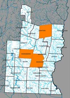
A process for siting and envisioning theoretical infill development based on mapping, town documents, and community input is laid out. The three pilot towns of Wardsboro, Newfane, and Grafton, selected by the Windham Regional Commission, are used to develop and model this process. Working with these pilot towns helped tailor the process to the unique development needs and flood-hazard profiles of actual village centers in the region. A set of digital mapping criteria are used to help identify suitable areas for flood-adapted village infill development. These criteria are layered to create “exclusion maps” that can help planners read broad patterns in the landscape related to development potential. The maps produced by this process are explored for each of the pilot towns.
Using this combined information, several theoretical development scenarios are illustrated in the pilot towns, with discussion of how these scenarios might relate to development needs and flood-related hazards identified by town planning commissioners, Town Plans, and Hazard Mitigation Plans. Though specific sites in these village centers are discussed, this project is only meant as a theoretical visioning exercise and is not meant to propose actual development projects. The goal is that by imagining how village centers could evolve through infill development, the region’s planners might be further inspired to help steward their towns towards a more floodresilient future.

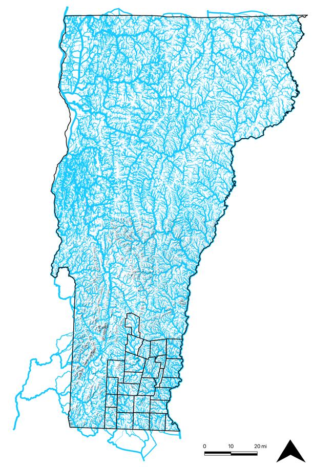

A vision for the future: “Development, conservation, and preservation interests working together for the benefit of our communities and the environment.”
-The 2025 Windham Regional Plan
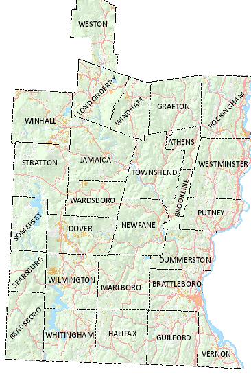
The Windham region is in the southeastern corner of the state of Vermont. The Connecticut River forms its eastern boundary, with the state of New Hampshire across the water. To the south is Massachusetts, and its western boundary is the Green Mountains.
The total population is near 50,000 as of the 2020 census. Though there have been modest gains annually since the 1950’s, overall population growth in Windham county has slowed since 2000. A slight spike in population since 2020 and the COVID-19 pandemic is attributed to in-migration from urbanites, remote workers, and seasonal homes becoming year-round residences. The region hosts several ski resorts and has historically had a high percentage of second-home owners tied to the outdoor recreation industry. This is also reflected on the municipal level, with towns like Stratton seeing a 104% increase in population since 2010, compared to Athens with a 14% decrease.
The Windham Regional Commission was created in 1965. At that time, Vermont, and particularly southern Vermont, was experiencing increased development pressure because of a successful campaign to attract tourists from nearby cities like New York and Boston. This led to large subdivisions built near ski resorts on land that risked being ecologically degraded as a result. In response, legislation was enacted to preserve natural resources in the state and seriously restrict development, and the regional commissions were tasked with helping municipalities navigate the new regulations.
Today the WRC continues to help community members understand and address complex regional issues with a wide range of technical assistance. The heart of this work is in supporting and coordinating the mostly volunteer planners and administrators at the town level. Keeping governing power small and local is the way Vermonters have historically done things, and the regional planning commission helps them to stay resilient as times change.
Vermonters now grapple with the tension between a housing crisis and increasing flood risk due to climate change. The WRC commissioned this project to help planners to envision change and growth that would move critical resources and homes up and away from flood prone areas.
The northeast region has experienced a 71% increase in annual precipitation since the 1950’s. Annual average precipitation is projected to increase in Vermont throughout this century, particularly during winter and spring. Corresponding increases in temperature will increase the proportion of precipitation that will fall as rain rather than snow. In addition, extreme precipitation, defined as greater than 2 inches, is projected to increase and make flooding more frequent and intense (Runkle et al.).
This region of Vermont sits between the Green Mountains and the Connecticut River Valley. The rugged terrain is part of the Appalachian Mountain range, with the highest peak of Mount Stratton at 3,940 feet. The Basin 11 watershed, the largest in the region, includes the sub basins of the West, Winhall and Saxtons Rivers and drains into the Connecticut River watershed, which empties into the Long Island Sound.
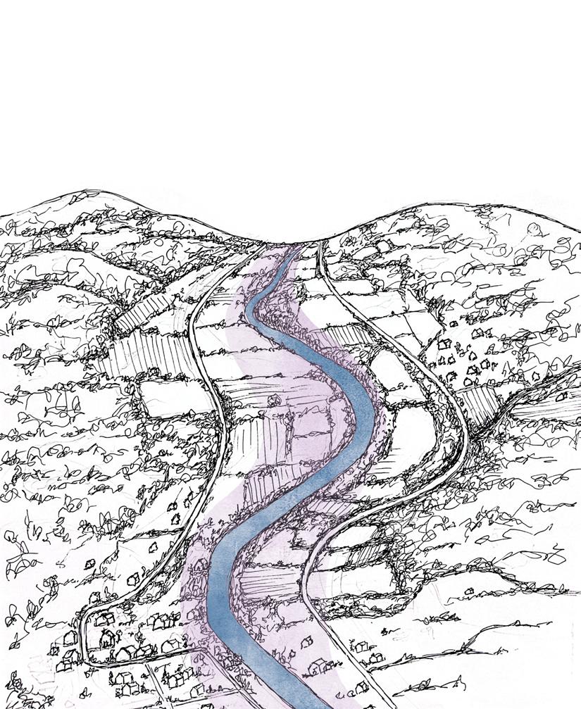
The rivers and their tributaries have carved two distinct types of river valleys that move water and sediment in different ways. The first type is wide, low-lying valleys with meandering rivers that periodically rise and flood the lateral flood plain. The second is narrow and steep, occurring in higher elevation terrain, where the river channel’s greater slope creates higher water velocity and more erosive potential. Rivers and their floodplains offer flat, sandy soil that is easy to build both structures and roads upon. This loose soil is the result of thousands of years of glaciation, water flow, and sedimentation.
Colonial settlement evolved from trapping and timber camps into more permanent settlement like the hilltop homesteads whose cellar holes can still be found today. Early European farmers cleared land from the hills down into the valleys as they cut wood for fuel and expanded pasture range, eventually favoring the proximity to rivers for transport and hydro power. In the early 19th century, pasture expansion to support the Merino sheep boom deforested nearly 80% of Vermont. Grist mills, saw mills, and tanneries, and then wool and paper mills, were built up in the 1800’s, but many of these were lost to floods, or became obsolete as industry changed. Some still stand in towns today, serving other purposes.
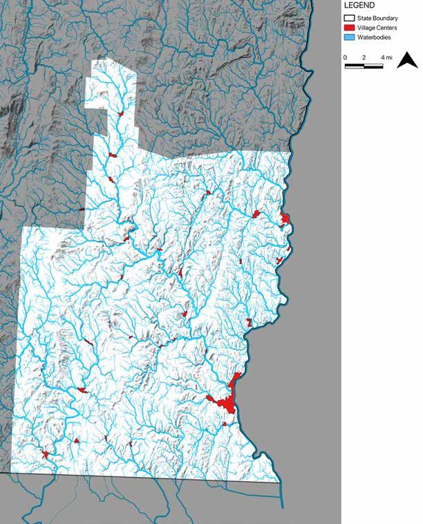
Village centers today consist of a mix of residential, commercial, small industry and community facilities, and are recognized as “future growth areas” in the 2025 WRC regional plan. The historic pattern of compact settlement surrounded by natural resources defines the character of the region’s landscape. It also means that many village centers are vulnerable to flooding, which is likely to increase as the climate warms.
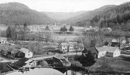
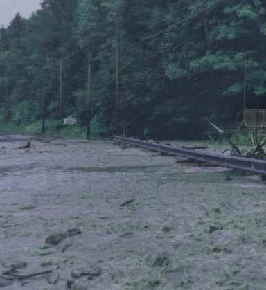
“Perhaps the major reason why, for much of the last two millennia, you cannot step into the same river twice is that humankind has radically changed the ecology of rivers and their surroundings... Unknowable thresholds of uncontrollable effects makes for a future of radical uncertainty.”
-Excerpt from James C. Scott’s In Praise of Floods
1927
“The Great New England Hurricane” 1932 1973 July 6: Severe storms, flooding, and landslides
“The Great Flood”
Data from FEMA “federally-declared disasters in Windham County” and weather.gov (NOAA) archive
August 8: Tropical Storm Irene
October 29: Severe storms and flooding
July 29: Severe storms and flooding
July 7: Severe storms, flooding, landslides, and mudslides
December 18: Severe storms and flooding
August 8: Severe storms and flooding
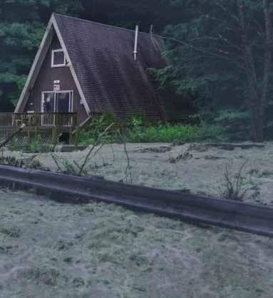
August 8, 2025: parts of northern Vermont see flash flooding on this date for the third year in a row
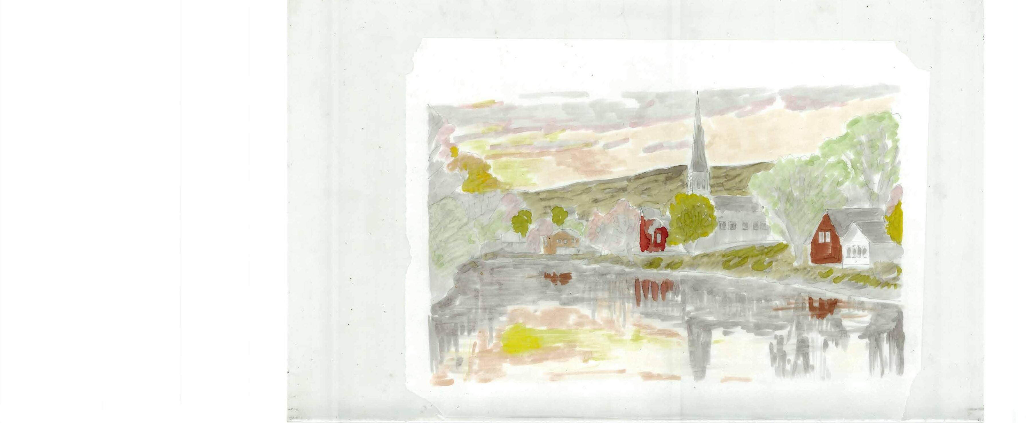
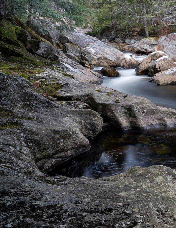
Vermont’s varied topography shapes how its rivers and streams move and the waters, in turn, shape the landscape. Understanding this relationship is integral to understanding the associated risks that living in these river valleys presents. River conditions are naturally dynamic and, to some degree, unstable, especially in a landscape prone to erosion. Climate change and increased precipitation exacerbates this instability.
The following section explores some of the dynamics of river and brook movement, how human settlements in the region have attempted to grapple with this dynamic, and the implications for current and future human development.
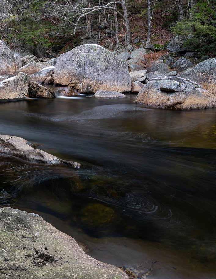

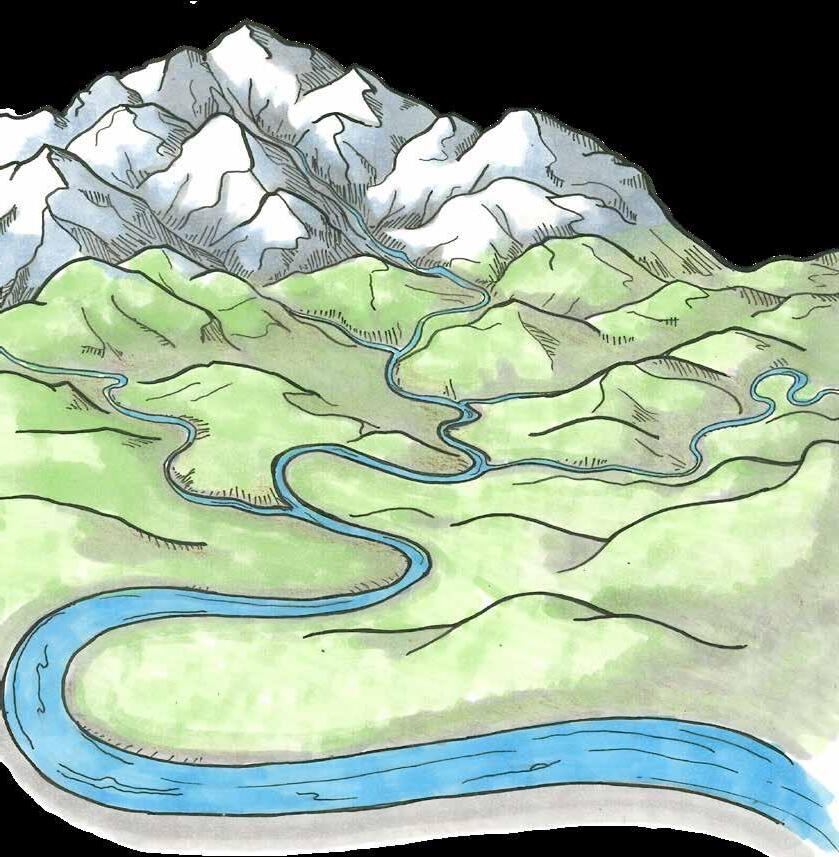
Every river has a form that reflects the complex interaction between its inputs from the watershed and the physical characteristics of the land, combined with human alterations of the landscape. When all these elements are in balance, a river is said to be in “dynamic equilibrium” which means it can move its load of water, sediment, and debris without dramatic changes in its shape or location (Dolan and Kline). Vermont’s varied terrain creates different types of river valleys which are generally characteristic of uplands and lowlands, though elements of both can be found in combination or at any elevation.

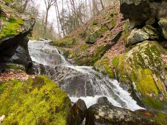
In the narrow, upland valleys of the Green Mountains, rivers and streams are flashy and fast flowing, constrained by the steep topography. Here, the water carves its way through the loose till of boulders, gravel and sand, deposited millennia ago by the glaciers that once dominated this region. Landslides and the resulting debris flows are a natural part of this erosion-prone terrain, though climate change and increases in heavy precipitation events have led to greater destabilization in recent times.
In wider valleys, rivers have a chance to slow down and broaden their floodplains. A floodplain is a natural and crucial component of rivers which stores water during flood events and slowly releases it back into the main channel of the river as the flood passes. The shape, size, and composition of any floodplain will determine how effective it is at storing and slowing floodwaters. Human encroachments in floodplains can compromise effectiveness and have may have cascading impacts downstream (NRC Solutions).
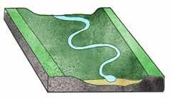
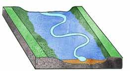
When rivers are less constrained by narrow valleys, alterations in course can happen, known as channel migration. This may occur gradually, such as when a stream erodes away one bank and deposits sediment along the opposite side, or quite quickly during floods or high water events. Sudden changes in channel location can be catastrophic for human developments along the river (WA State Dept. of Ecology).

Today, most streams in Vermont are not in an equilibrium condition, because riverside development, channelization practices, and other historical land uses have prevented the river from assuming its most stable natural shape. Increased precipitation events due to climate change exacerbate these imbalances, causing catastrophic damages when rivers overflow or erode their banks. Historical settlement patterns have placed humans in the midst of this river and floodplain relationship and made them vulnerable to flood-related hazards (Dolan and Kline 2010).
Structures built in floodplains are vulnerable to damage as the river channel changes over time.
Structures in floodplain are flooded during high water event.
In an attempt to prevent property damage, physical barriers are erected. As a result, the river is confined and flows faster, scouring and deepening the channel and eroding the banks downstream.
The deeper river channel and faster water flow caused by encroachment eventually leads the bank to collapse during a high water event. Structures in the floodplain are lost or damaged (VT Floodready).
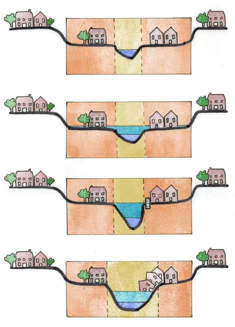
from a graphic titled “Why
Channelization refers to the human alteration of a river channel by straightening, usually done to allow more development along its banks. Many brooks and rivers in the Windham region have undergone some amount of channelization, especially in the village centers.
This alteration shortens the length of the river, increasing its slope and subsequently its hydrologic power—in other words, a greater volume of water that is moving more quickly. This increased force causes it to cut deeper into its channel and become disconnected from the slowing power of its floodplain, further increasing its power. Stream banks downhill then receive the full brunt of this power, resulting in stream bank erosion and “flashier” (more sudden) flood events (Dolan and Kline 2010).
Dredging is another common management practice in Vermont and refers to the excavation of the riverbed in order to deepen its channel, both to enable navigability by water craft and to lower the height of the waterway in an effort to decrease its ability to flood its banks. This is often done in conjunction with channelization and has similar consequences such as limiting floodplain access and increasing hydrologic force downstream. As the channel is made deeper, the banks become steeper and eventually fail, widening the channel once again.
Altering stream banks with rocks or concrete is known as armoring, which also disconnects the river from its floodplain and degrades the floodplain itself by removing vegetation which can act as a natural stabilizer. The force of the river, eventually degrades this infrastructure, or funnels this force downstream in the form of costly stream bank erosion elsewhere and culvert or bridge damage.
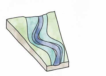
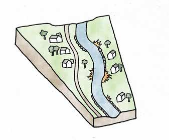
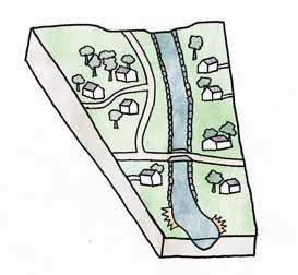
Human settlements in Vermont’s river valleys are increasingly vulnerable to flood damage. Historically, the response to erosion-related flood losses has been additional costly alterations such as channelization, dredging, and armoring, which only exacerbates the hazards and encourages further human encroachment into floodplains and erosion prone areas. The following section shares tools that can be used to locate these hazardous areas in communities in the process of developing adaptation strategies.
Federal and state agencies have attempted to map the areas associated with the greatest flood-related risks. This mapping can inform policy at a state, regional, and town level and is a good proxy for where not to develop.
The Federal Emergency Management Agency (FEMA) maps Special Flood Hazard Areas (SFHA) as part of its National Flood Insurance Program (NFIP). These maps represent where inundation flooding might occur during particular storm events. Though FEMA is currently updating these maps, many areas remain out of date so this information should be used as a very conservative and limited assessment of where inundation flooding has occurred and may occur in the future.
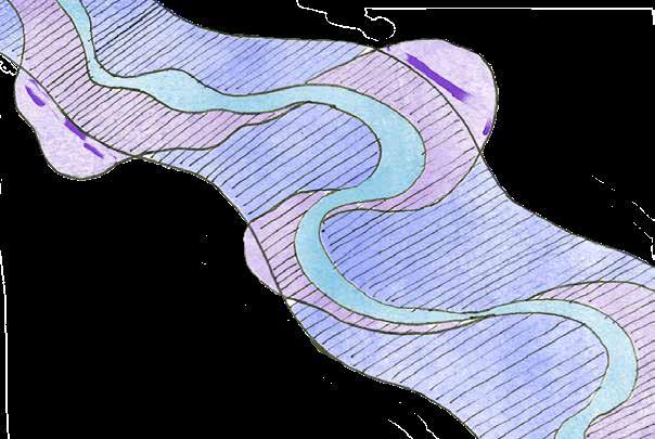
inundation flooding: when a water body temporarily overflows its banks due to heavy rainfall
fluvial erosion: erosion caused by rivers and streams; can range from gradual bank erosion to catastrophic changes in river channel location and dimension during flood events
The River Corridor is a Vermont state designation that identifies the space a river needs to re-establish and maintain stable “equilibrium” conditions. One can think of this belt width as the particular “wiggle room” a river needs to find its most stable path down the valley. Fluvial erosion is most likely to happen within this corridor (VT Floodready).
...BUT THERE’S MORE TO THE STORY.
How water moves through the land is complex and sometimes unexpected. By becoming familiar with the local terrain, and consulting state river engineers, planners can gain a more nuanced understanding of flood and erosion risk in their community.
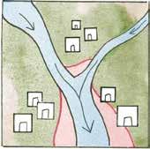
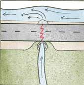
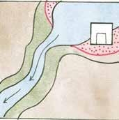
Hydrologic forces can concentrate where two water bodies meet. The surrounding banks in these areas may be subject to greater fluvial erosion.
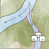
When waterways are artificially routed to meet at right angles— often at a culvert under a road—the hydrologic force can become destructive during heavy flows, damaging infrastructure.
Historic mill ponds once allowed sediment and debris to slow and settle, building up river banks. These areas are often unstable and at greater risk of erosion.
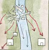
Log jams or other debris can block the flow of water, causing it to overflow its banks.
During heavy precipitation, water may jump its banks in unsuspected ways due to subtle changes in topography.
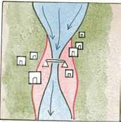
Narrow points in the landscape can also concentrate hydrologic forces. Human settlements are often located in these areas because it was easier to span the river with hydropower infrastructure.
River Corridor and FEMA mapping combined with a nuanced understanding of local flood-related hazards will enable planners to identify which areas are best left undeveloped. If development already exists, an assessment can be made of how much risk is present and whether those assets should be moved or redeveloped outside of harm’s way. The following chapter will explore regional development needs in general and how flood risk understanding might influence development related decisions.
River Management Engineers (River Engineers) are part of the Vermont Department of Environmental Conservation’s (DEC) Rivers Program. River Engineers work to align infrastructure (such as roadways, stormwater systems, bank stabilization, and other development) with natural river dynamics through a combination of permitting, engineering, geomorphological analysis, and land-use planning. In addition to determining whether to authorize Stream Alteration Permits—which the DEC states are intended to, “prevent the creation of flood hazards, protect against damages to aquatic life, and protect the rights of neighboring landowners”—River Engineers play an important advisory and educational role. According to the DEC, they “provide river diagnostics, alternatives analysis, project design, and construction inspection for instream work.” (“River Management”)
“Walking the River” with a regional River Management Engineer is an opportunity to learn to read a river or stream as a dynamic living system and can help planners gain a more holistic understanding of the different factors (like those described on pages 21 & 23) that can impact flooding and erosion. River Engineers field calls from landowners, towns, and V-Trans, whom they work closely with on culvert and bridge design and installation, as well as roadway stabilization. Much of a River Engineer’s work is in the field and they can spend multiple days a week visiting sites along their region’s waterways, even without a flood event. As a result, River Engineers develop an in-depth and nuanced understanding of the waterways in their region.
According to one of Windham Region’s River Engineers, there is a need for more stream and river management at a municipal level, as many towns’ ordinances still leave room for development in the river corridor, floodplain, and in portions of the watershed that impact waterways. It may be ok for one person to protect their shed by berming, but if everyone is thinking that way the cumulative effect can pose a significant risk. More education of landowners is needed, as well as the adoption of appropriate and enforceable town bylaws to foster the collective approach needed to mitigate the risks posed by waterways.
River Engineers are also connectors. They work closely with contractors and know of contractors and other organizations in the region who do quality work in and around waterways. This includes armoring and hardscaping if necessary, though River Engineers are a strong proponent of giving the rivers the space they need to move and stabilizing the banks through bioengineering with vegetation where possible. Typically the goal is to return streams and rivers to their natural states and remove infrastructure, such as buildings and berms, from the river corridor as much as possible.
Hmmm... that’s not lookin’ so good.
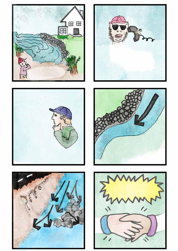
Hey is this the Vermont d.e.c.? i could use some help, can someone come look at the stream behind my property?
Sure thing, we’ll send Jimmy your regional river engineer.
& neighborly solutions ! this bank was bermed up in the 1970’s when many folks were reeling from a big flood. the stone armoring is attempting to keep the water off the property, but water always finds a way around, or under.
The result of blocking the stream’s natural inclination to spread out is that the water picks up velocity and can ricochet off of other banks.

Unfortunately, the effects of many individuals taking these measures is cumulative and leads to much bigger problems. During a big weather event, this can cause the channel to shift and jump the banks, or tear them away entirely. Erosion is the most
effect of
our
An understanding of the nuances of flood risk should inform planning for development that reduces risk to town assets. This understanding will help towns to develop a comprehensive plan for evolving up and away from flood-prone areas while maintaining the character and function of their village centers. Structures, infrastructure, and parcels threatened by flooding or erosion can be assessed to identify which type of flood adaptation is possible and appropriate. From there, a town can begin setting adaptation priorities, identifying and ameliorating challenges to planned adaptation, and securing the resources needed to realize desired adaptation projects.

There are different approaches to flood adaptation, including adaptation within the flood zone, infill development in the village center outside of the flood zone, and development beyond the village center. In response to state and town goals of compact development surrounded by rural countryside, this project focuses on exploring infill development in and around village centers. However, all flood adaptation options should be weighed and considered in the planning process. Factors such as the cost of a given adaptation strategy, the level of threat posed to a particular asset, the historical significance or condition of a building, and the availability of alternate structures or developable land outside the flood zone will impact which adaptation approach is appropriate.
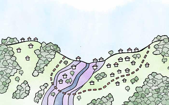
Adaptation beyond the village center
Infill in and around village centers, outside of the flood zone
Adaptation in the flood zone
Movement out of areas with flood and erosion risk is likely to be a process that will unfold gradually over time. Towns can move up and away from flood risk by degrees, while holding the eventual vision of a fully floodadapted community in mind to guide planning and development. Understanding the different types of adaptation is a key part of this holistic planning process.

Naturalizing river corridors and floodplains is ecologically and hydrologically beneficial. If there weren’t economic and spatial limitations, removing all assets from the River Corridors and FEMA Special Flood Hazard Areas and siting them elsewhere in and around village centers would be preferred. However, in some cases adapting and protecting assets within the flood zone rather than relocating them may be deemed to be a more economical and sustainable option for the short or long term.
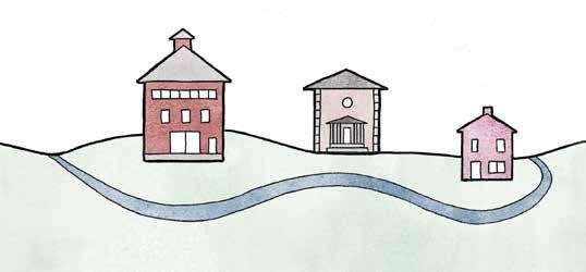
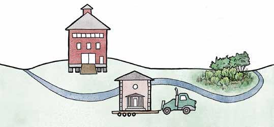
Some structures may be at great enough risk that removal or relocation to beyond the flood zone is the best option for safety of the community downstream (“Planning for Flood Recovery” 24). Other structures may be deemed safe enough that adaptation in place is reasonable. Some buildings can be retrofitted to better withstand potential flooding.
There are engineered options for modifying a waterway’s course, fortifying banks or directing flow to protect key structures and infrastructure. These can involve bioengineering with the help of vegetation or hardscaping. As cited in chapter two, channel alterations that modify the waterways farther from their natural state can have unexpected negative consequences.
Infill development can bring more life to downtown areas while increasing flood readiness. While the term “infill” is most often used to describe development of underutilized land and buildings in urban environments, it can refer to such development within any existing development pattern. Infill increases density in already developed areas to reduce development pressure on surrounding agricultural and forested lands and mirrors historic precedent of denser building in village centers pre-automobile.
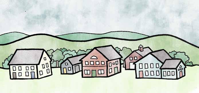
Repurposing existing buildings outside of the flood zone can range from a change of use with no renovation to a partial or full renovation (Vermont Homes For All). Underutilized buildings in the village center are prime candidates for this type of infill development. Buildings of particular significance can in some cases be physically relocated from the flood zone to a safer infill site (“Planning for Flood Recovery” 25). This relocation process can be expensive, though funding earmarked for historic preservation can help.
Infill options include development on vacant lots, replacing existing buildings with new buildings, adding additional structures to lots with pre-existing structures, and subdividing lots for new development.
There may be infill opportunities beyond, but close to, a village center. Infill around the village border would expand the village zone, while maintaining the goals of concentrated settlement.
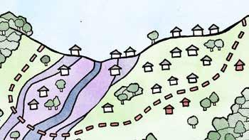
If needs exceed the safe space available for infill development in or around village centers, it may be necessary to develop elsewhere. In such cases, new development can be concentrated in zones farther from the village center to avoid dispersed development. For example, infill in existing hamlets where there’s already a concentration of development, but less than that of village centers, or new concentrated development on large tracts of open land, can be explored. In extreme cases the flood risks posed to a small village center may be great enough to warrant relocation of the village center.
Planners can use the process outlined in the following section of this document to help assess if the development needs identified through hazard mapping, Hazard Mitigation Plans, Town Plans, and community input exceed the amount of developable space in and around the village center. This understanding can help towns as they formulate an appropriate town-wide flood adaptation strategy, and determine if development outside existing village centers is necessary.
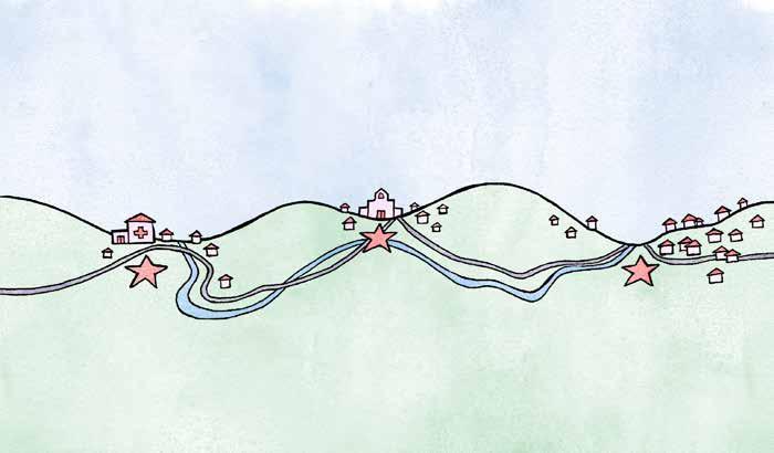
due to economic, demographic, or spatial constraints, sharing assets with nearby towns may be the most efficient adaptation option. While the loss of a local school or the idea of commuting for work may not be ideal, in cases where municipalities are straining to meet all of their needs independently, towns may benefit from considering resilience through a regional lens and prioritizing development accordingly. For example, towns in this situation would need to prioritize maintaining flood-safe connectivity between towns that they depend on for critical assets and services.
around Townshend, VT.
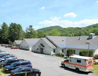
Many of the vulnerable structures in the flood zones in the Windham region are residences. Most Vermont towns, including those in the Windham region, report that the need for affordable year-round housing is greater than the available housing stock. Often the homes in a town’s river corridor are appraised at less, or were purchased for less, than the cost of relocating to a less at-risk house in the town, making it difficult for owners of vulnerable houses to find safe housing without moving away. This situation may lead residents to stay in unsafe situations, remaining in their at-risk homes, because this is their only housing option for staying in their community. Conversely, loss of homes due to flooding and erosion increases the already existing need for more housing.
Creation of affordable housing through infill development can give people living in vulnerable residences a safe housing option. New flood-adapted housing can cater to other community needs and goals, like senior housing or residences designed to support at-home businesses.
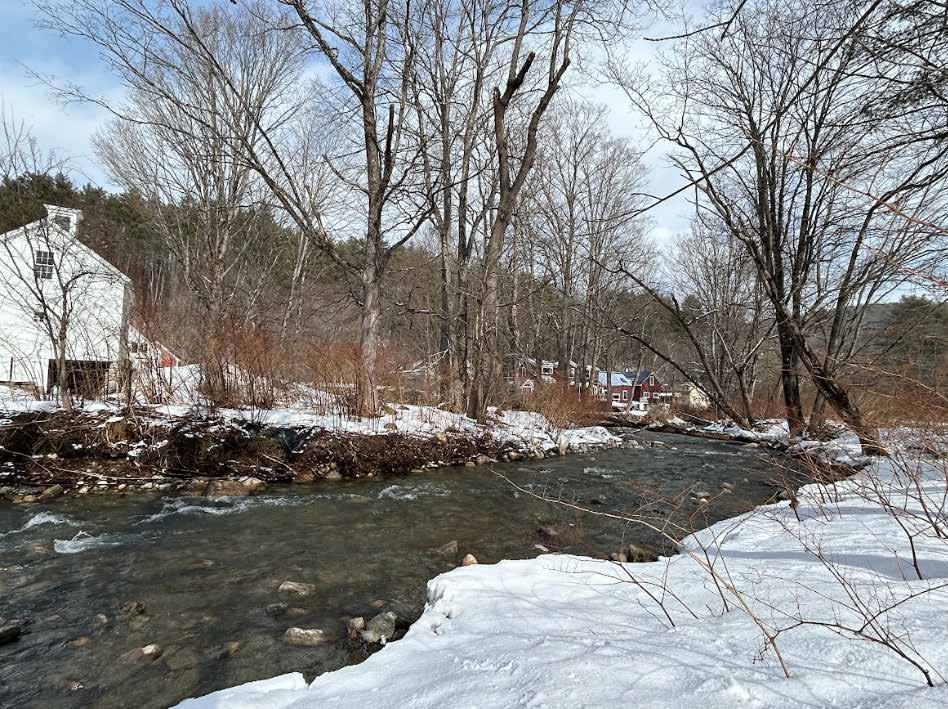
The regional pattern of villages and roadways being built along waterways leaves the roadways vulnerable to flood damage. Roads may be rendered unusable during and after flood events, leading to potentially unsafe situations that are costly to remedy. The vulnerability of roads in the face of increasing flood events must be considered in siting flood-safe development, as ideally both the town assets and vehicular access to those assets would be safe from flood risk.

Many towns cite limited human resources as an impediment to planning for and executing flood adaptation. Volunteer planning commissioners and other municipal staff are often stretched thin and keeping positions filled can be a challenge. Allocating or securing funding for consultants, contractors and development projects is another challenge. Community education about the urgency of flood adaptation and other challenges facing towns is one step towards encouraging increased civic engagement among residents.
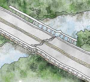
Septic systems and wells in flood zones are vulnerable to damage. Septic failures, due to flooding and/or aging, can lead to pollution and are a significant safety concern. The lack of municipal wastewater systems and drinking water supply in many Windham Region villages limits the feasibility of some infill development opportunities. Investments in municipal infrastructure that seemed too costly in the past may make more sense in the context of flood adaptation.

In order to identify opportunities for flood-adapted infill development within village centers, a set of digital mapping criteria is used. These criteria are layered to create “exclusion maps” that can help planners read broad patterns in the landscape related to development potential.
2. What Type of Development is Appropriate?
Different flood adaptation strategies may be needed to achieve different development priorities. This project focuses on infill development only, which includes adaptive reuse (re-purposing an existing structure outside of flood-prone areas) and new development (new construction within or near the village center and outside flood-prone areas). Community input can help identify existing structures suitable for adaptive re-use.
Visualizing different scenarios can help planners see the possible futures and determine what development will best support town goals. While the present challenges can seem insurmountable, going through a process such as this one can help direct efforts such as funding, policy change, infrastructure improvements, and community outreach.
Flood Risk mapping and Hazard Mitigation Plans can reveal assets vulnerable to flood damage and inform development priorities.
Town Plans and community surveys help identify the specific development priorities of the town (e.g., residential, commercial, cultural, conservation). These needs can then be evaluated in relation to flood adaptation.
After priorities and adaptation strategies are chosen, planners can begin to identify possible development sites using a list of exclusion criteria. When areas of land that don’t meet the criteria are excluded, suitable areas come into focus.
Digital mapping tools, like the ones used in this study, help planners “read” the physical landscape from an objective point of view and reveal opportunities that might have otherwise gone unnoticed.

To explore the process of siting and envisioning flood-adapted infill in village centers, this project focuses on three pilot towns, selected by the Windham Regional Commission based on the availability of their planning commissions during the project’s duration and the towns’ histories and planning activities regarding flooding. Different development scenarios that respond to existing conditions and identified development needs are illustrated for each pilot town.
The three pilot towns’ village centers are sited along rivers and streams, with limited room for development due to the slopes that surround the towns. The towns are located in the more mountainous western and northern portions of the Windham region. Tourism and seasonal residents shape the towns’ economies and housing markets. Like much of Vermont and the Windham region, the towns have seen population growth over the past half century, along with a continued increase in the average age of residents. None of the three pilot towns have municipal water supply or wastewater infrastructure. Wardsboro has two designated village zoning districts, Newfane has three districts, and Grafton has a single village center, but has not adopted zoning.
“Wardsboro’s beginnings were much the same as most other rural towns in Vermont... many of the descendants of the founding families still live here and the economy remains that of a small, rural community... Wardsboro’s current land-use pattern is characterized by extensive forest areas, rural residential development, small villages, and a regional highway that passes through ski and vacation home development on the eastern slopes of the Green Mountains.”
-Wardsboro Town Plan, 2019
Population: 869
Total Area: 29.3 square miles
(According to 2020 census data)
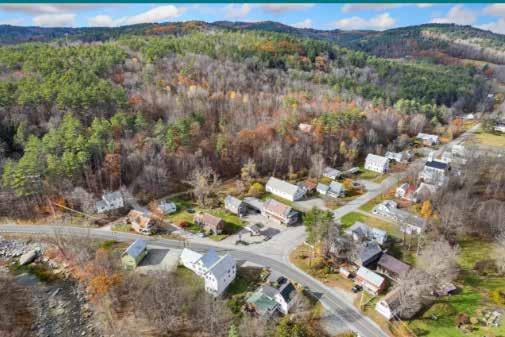
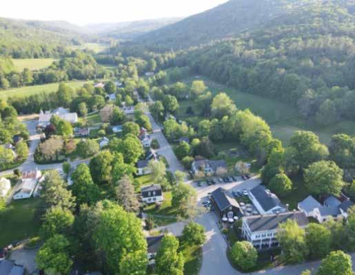
“Each village is a uniquely clustered settlement, dominated by older, historic homes with small commercial and community-related services. These village centers are surrounded by a more rural, forested landscape which has experienced residential growth over the years. Housing development has been targeted most significantly in many of the more rural, back-road areas of the community.”
-Newfane Hazard Mitigation Plan, 2024
Population: 1,645
Total Area: 40.4 square miles
(According to 2020 census data)
“Varied topography and distance from the commercial or resort centers have kept the town small and have forestalled, thus far, the pressures for rapid growth and large-scale development affecting many nearby towns... the Town intends to accommodate the resulting needs for housing and other facilities and services without detracting from its present character.”
-Grafton 2020-2028 Town Plan
Population: 645
Total Area: 38.4 square miles
(According to 2020 census data)
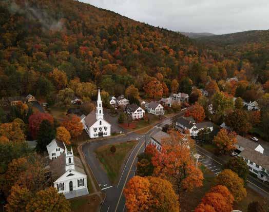
The following pages present criteria that can be used to help answer the question of where to develop (Process Step #3) using Wardsboro Village as an example. Then in the following section, this criteria, along with an exploration of steps #1, 2, and 4, will be applied to three “pilot towns” in Windham region Vermont.
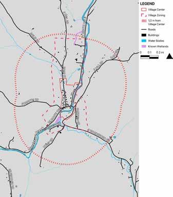
Many towns in the Windham region have established zoning that identifies where the village centers are and where they would like new development to be located. Using these boundaries as a guide, rather than a hard and fast rule, planners can focus on infill development while staying open to nearby options that fall outside of this boundary.
For towns that do not have village zoning, a rough buffer of 1/2 mile out from the village center can be used to ensure a reasonable amount of room for growth while maintaining good connectivity to existing infrastructure and services.
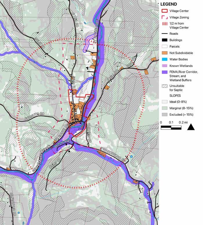
In this example, Wardsboro has village zoning that shows desired growth beyond the current village center. This boundary focuses development along the two main traffic corridors: Route 100 in the east and Main Street to the west.
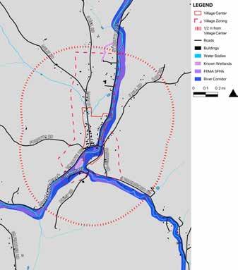
FEMA data and River Corridor maps provide means of assessing flood vulnerability (with limitations). Using these maps, planners can see where the majority of flood-related hazards are and exclude development in these areas. They can also develop an initial inventory of what critical assets are at risk (e.g., fire station, medical services, utilities, etc.) as well as the amount of vulnerable residential, commercial, or other community resources. Hazard Mitigation Plans often contain more details about specific risk areas and vulnerable infrastructure.
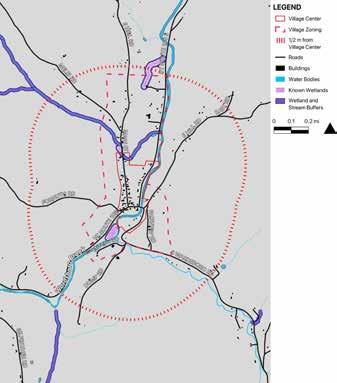
In this example, Wardsboro’s flood and erosion risk zones are shown in purple and dark blue respectively, and are concentrated along Wardsboro Brook, with much of the existing village center lying just outside these areas.

Known wetlands, including a 50-foot buffer from their edges, are protected by state law so are excluded from consideration.
Additionally, Vermont has mapped 50-foot setbacks from any stream that has a drainage area between 0.25 and 2 square miles. This buffer zone is in lieu of the River Corridor designation that applies only to larger waterways. Excluding these areas serves to avoid impacts to smaller streams and helps to protect developments from potential flooding or stream bank erosion.
In this example, Wardsboro contains three known wetlands in the north, south and along a major stream that runs along the north side of the village center. This stream is large enough to warrant a 50-ft buffer.
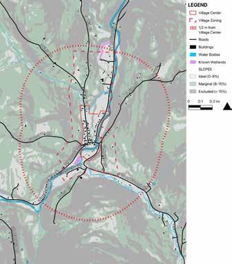
According to the Federal Department of Housing and Urban Development (HUD), optimal slopes for most development are below 12%. Some town plans will state guidelines for what they believe are an optimal range. Though engineering can make steeper slopes buildable, this study limits buildable slopes to 15% with an optimal range of 0-8% . Restricting development on steeper slopes also helps with potential suitability for septic.
In this example, Wardsboro’s town plan aligns with the slope criteria used in this project. Optimal slopes in Wardsboro are concentrated around the existing village center and along Route 100, Main Street, and Melis Road.
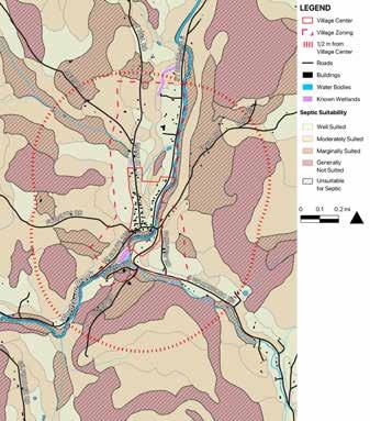
Since many towns in the Windham region do not have municipal wastewater services and rely primarily on private septic systems, the suitability of soils to handle septic is an important consideration for development. Vermont has classified the state’s soils as: Well Suited, Moderately Suited, Marginally Suited, and Generally Not Suited. This model limits potential development sites to the first two categories and unsuitable areas have an additional black cross -hatching.
In this example, the majority of soil types in Wardsboro are mapped as suitable for septic. Unsuitable areas share some overlap with steep slopes and are also concentrated along the rivers.
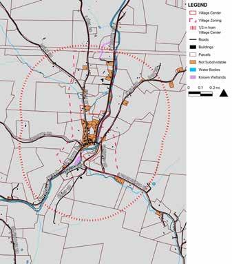
Subdividing parcels allows for increased density. Most town plans contain minimum lot sizes set by the town’s zoning ordinances. For the purposes of this project, parcels with buildings on them and less than 1 acre in size are excluded from consideration because they would not meet a minimum lot size of 1/2 acre after subdivision.
In this example, Wardsboro has a minimum lot size of 1/2 acre, so the chosen criteria aligns with this particular case. Excluded lots are concentrated in the village center which means any new subdivisions would need to be farther out within the growth boundary.
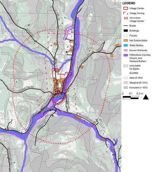
Putting this analysis all on one map produces a summary of areas that are excluded from development consideration. To increase readability, the following alterations are made:
• FEMA and River Corridor zones are combined with the wetland and stream buffers and shown as the color purple.
• The septic suitability rating is simplified to only show unsuitable areas excluded from development with a black cross-hatching.
With these areas excluded, potential suitable development sites can be found where the map is mostly white with some green. These sites have ideal or marginally ideal slopes, soils suitable for septic, are outside of flood-hazard and wetland or stream buffer areas, and are located on a parcel that either doesn’t have an existing building, or is large enough to be subdividable.
Once generally suited areas are identified, the following considerations can be taken into account:
Siting development close to major traffic corridors will help towns maintain a compact yet connected village. Since this project focuses on infill development, most parcels will be serviced by existing roads. Many towns have minimum road frontage requirements for new developments in their zoning bylaws. Potential flooding and the vulnerability of existing or planned roads and drives should be considered.
Most towns in the Windham region rely on private wells for a majority if not all of the town’s water needs. Internet and power are less likely to be limiting factors in village centers though connectivity might be a consideration for developments farther afield.
Since this project focuses on infill development, conserved lands are less of a limiting factor, as the majority of conservation land exists outside village centers. If land that is suitable for infill development is conserved, the conservation easement would have to be consulted to see what, if any, development is permitted. Towns can advocate for land conservation while also recommending exclusion areas to be reserved for flood-smart development.
Forested land contributes to flood resilience. These areas act as sponges, contributing to the land’s ability to retain water and limiting how much runoff enters the waterways, thereby potentially reducing flood-related hazards. Deforestation at development sites should be kept to a minimum in areas prone to runoff, while prioritizing opportunities to reforest previously cleared land.
When the exclusion summaries created in the last section are combined with an assessment of village center existing conditions, town goals, and hazards, potential development sites come further into focus. Planners can then determine where floodadapted development might be sited and how it can contribute to the town’s development needs.
The following pilot town summaries draw from a variety of sources to paint this picture and are keyed as follows:
• Town Plan (TP)
• Hazard Mitigation Plan (HMP)
• Planning Commission Members (PCM)
• River Engineer (RE)
With potentially suitable areas identified, theoretical infill development scenarios will be explored that attempt to meet town goals.
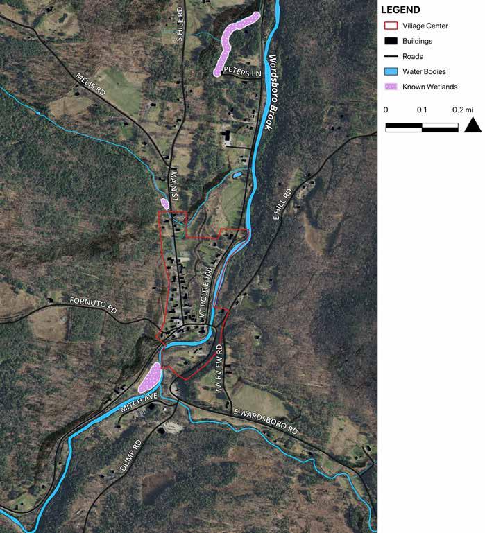
Wardsboro is located in the Green Mountains, near Stratton Mountain and Mount Snow, two of southern Vermont’s large ski areas. The town is ninety percent forested and much of the town is defined by steep slopes not suited to development. Much of the development in the town is found along the historic roadways that run through the valleys alongside rivers and streams.
The town of Wardsboro includes three village centers, Wardsboro, West Wardsboro, and South Wardsboro. Wardsboro Village is the focus of this project, as it “functions as the center of civic and commercial activity in the town” (Town Plan). Both Wardsboro Village and West Wardsboro are located on Vermont Route 100, which runs alongside the Wardsboro Brook and is the main transportation route for the West River Valley. Wardsboro Brook is a tributary of the West River, part of the Connecticut River watershed. Tributaries enter the Wardsboro Brook just south and north of Wardsboro village. The tributary to the south runs along the South Wardsboro Road, one of the roads connecting Wardsboro to Newfane and the site of the greatest extent of fluvial erosion in Wardsboro (Hazard Mitigation Plan).
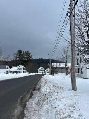
Identified by the Town Plan (TP), Hazard mitigation plan (HMP), and Planning Commission Members (PCM)
• “Allow both infill development and appropriate reuse of vacant or underused existing structures in the Villages. Carefully plan new development so as not to affect the existing carrying capacity with respect to septic systems and water supplies.” (TP p.21)
• “Promote safe and affordable housing for all segments of Wardsboro’s population.” (TP p.89)
• Desire to attract younger residents and families. (PCM)
• Desire to provide options for seniors to downsize and age in place. (PCM)
• Walkable and bikeable village center (TP)
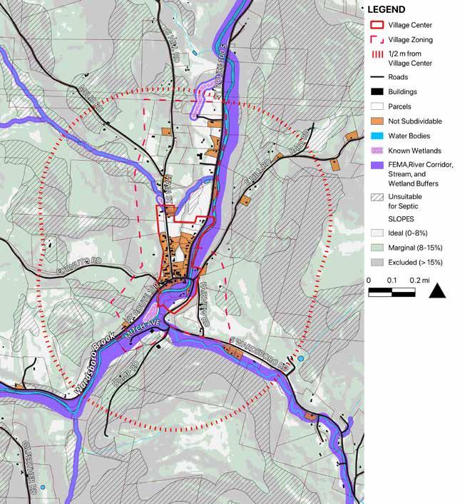
Applying the exclusion criteria, as defined on pages 36 to 39, to available geospatial data produces the map below. Potential suitable development sites can be found where the map is white (ideal slopes) or green (marginally suitable slopes) without cross-hatching (suitability of soil for septic).
Identifying structures vulnerable to flooding and erosion (those located in the river corridor or FEMA SFHA) and other potential flood hazard areas based on mapping and community input can help guide the prioritization and siting of future infill development projects.
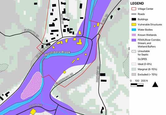
VULNERABLE STRUCTURES IN THE VILLAGE CENTER
1. Wardsboro Post Office
2. The History House (Wardsboro Historical Society)
3. Plimpton Excavation
• Several other commercial structures
• Numerous residences
• Parts of the Wardsboro village center lie within the VT ANR River Corridors and the FEMA Special Flood Hazard Areas. These areas, plus the wetland and large stream buffers, are all mapped in lavender.
• Potentially vulnerable structures that lie in these areas are shown in yellow and include 14 residential units and several commercial and community structures.
• A special area of concern is Route 100 (also shown in yellow), which runs alongside Wardsboro Brook in the northeast part of the village. Route 100 was damaged during Hurricane Irene and subsequently rebuilt. It’s reasonable to expect more damage to happen to this road in the future, especially at meander bends and where tributaries cross under the road via culverts (HMP, PCM).
• Wardsboro to Newfane and the site of the greatest extent of fluvial erosion in Wardsboro (HMP).
• Wardsboro Elementary also doubles as the community’s emergency shelter and is accessed solely by Route 100. In the event this road becomes impassable due to flooding, the town’s only emergency shelter would become inaccessible.
The summary exclusion map below highlights potentially suitable development sites, outlined in green. These areas:
• Do not fall in the exclusion zones based on the development criteria.
• Have road frontage on or potential driveway access to town roads.
Though the town has identified the corridor along Route 100 as preferable for growth, this road is vulnerable to flood and erosion hazards so sites along this road are excluded from consideration in this model.
(As a reminder, this project is not intending to site actual development on these specific parcels, but rather model a thought process and set of criteria that planners can use to imagine flood-adapted development.)
This area off Melis Road has moderate slopes but good access to the road and the village center. There are large parcels here that could be sub-divided with existing cleared areas that may currently be or were once agricultural fields.
This area is right off Main Street with good connectivity to the village center. Moderate slopes exist with some ideal slopes and cleared areas. The proximity of these parcels to Wardsboro Elementary could be a good opportunity to locate housing appealing to families.
This area is right off Main Street and part of the village center proper with both ideal slopes and cleared areas. Part of this area is the skate park and ball field which could be a good opportunity to locate housing appealing to families.
This area off Fornuto Road has a mix of ideal and moderate slopes with larger parcels that could be subdivided. Extensive tree cover in this area would require some clearing.
This parcel is in the middle of the village center so could be an ideal infill opportunity. It is large enough to be subdivided so a new building could be built behind the existing building with a driveway easement enough road frontage to satisfy zoning requirements and access needs.
This area contains ideal slopes and fields previously cleared for agriculture. Though this area is not mapped as being at risk of flooding, its proximity to the eastern tributary of Wardsboro Brook potentially makes it a higher risk zone.
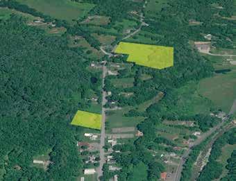
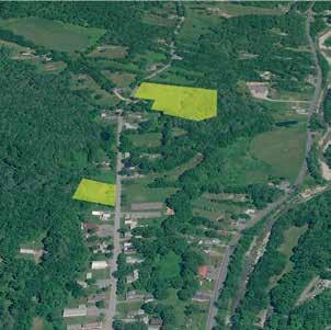
Theoretical development scenarios will be explored on two parcels (1 and 2) that lie within these suitable areas, prioritizing proximity to the village center.
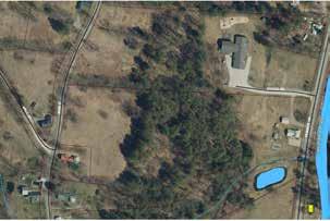
This parcel is off Main Street and adjacent to Wardsboro Elementary. Though steeper slopes and a wooded area constrain this site to some degree, some flatter and already cleared areas, as well as its proximity to the elementary school, make it an appealing place to site housing geared towards young families.
This parcel off Main Street is within the village center and across from the softball field and skate park, and features a flat, cleared area near to the elementary school, make it an appealing place to site housing geared towards young families.
The first two scenarios show different housing densities currently allowed by Wardsboro’s zoning regulations. Scenarios are applied to the six-and-ahalf acre lot (parcel 1) neighboring the elementary school and are intended to provide housing options for younger families.
The elementary school’s dual role as an emergency shelter is considered by ensuring that the new road built for these developments can double as an alternative means of access to the school in the event that Route 100 becomes unusable due to flooding. This drive can be closed to vehicle access with bollards in non-emergency situations, allowing pedestrian and bicycle access between the new development and the school.
If trail easements are made along the eastern border of this property and along the properties to the south, there is potential for a connecting pedestrian and bike trail within the wooded corridor running south towards the village center.
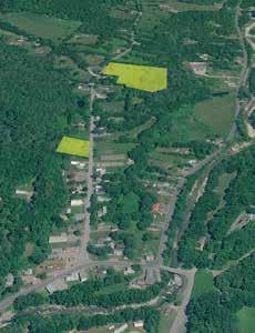
• 6.41 acres
• Privately owned
• No existing structures
• Adjacent to Wardsboro Elementary
• North of Village Center
• Accessed from Main Street
• partially forested, partially cleared
As a reminder, this project is not intending to site actual development on these specific parcels, but rather model a thought process and set of criteria that planners can use to imagine flood-adapted development.
This scenario sites a six-unit apartment or condo along Main Street on the west side of parcel 1. Multi-family buildings are usually more cost-effective to construct than single-family buildings, which can make home ownership or renting more affordable. Six units on one lot is the maximum allowed by Wardsboro’s current zoning laws.
With density concentrated in a single structure, impermeable surfaces are reduced compared to a singlefamily home subdivision. This allows more of the land to remain forested; trees intercept rainfall and help limit the amount of runoff entering Wardsboro Brook during heavy rainfall events, thereby reducing the potential for flooding and erosion.
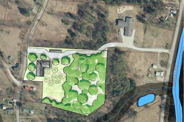
• More affordable housing options for younger families close to the school.
• Small building footprint minimizes impermeable surfaces and runoff.
• Improves flood and other hazard resilience by creating an alternate vehicular access route to the community emergency shelter.
• Trail extending to village center would contribute to village walkability and bikeability.
• The access road between the school and new building cuts across a section of steep slopes which might increase the cost of its construction and require some tree removal.
• A large multi-family unit looks different from the single-family homes in the area.
• Soils on site are mapped as suitable for septic but further assessment will be needed to determine actual capacity.
In this scenario, parcel 1 is subdivided into nine 1/2 acre lots with single-family homes. This is an example of maximum density infill housing if the homes are single-family and the lot sizes are the minimum prescribed by zoning laws (1/2 acre). Two homes are accessed by the Main Street frontage while seven are served by a new road. To adhere to current zoning laws, this new road is given a 50-foot easement (25’ from its center line).
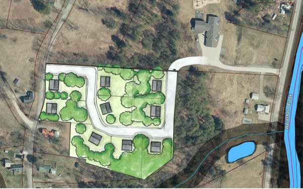
• Increases housing near the village center and the school.
• The density and form of the two street-facing homes are similar to that of the neighborhood.
• Improves flood and other hazard resilience by creating an alternate vehicular access route to the community emergency shelter.
• The long road creates more impermeable surface than scenario 1 but its alignment avoids the steepest section of slope on its way to the school.
• Single-family homes on individual lots can be less affordable than multi-family options.
• Increased land needed for single-family homes requires more tree clearing, regrading of topography, and impermeable surfaces, potentially increasing runoff if stormwater measures are not put into place.
As a reminder, this project is not intending to site actual development on these specific parcels, but rather model a thought process and set of criteria that planners can use to imagine flood-adapted development.
• Soils on site are mapped as suitable for septic but further assessment will be needed to determine actual capacity and appropriate siting of leach fields.
On a subdivided parcel (2) on the west side of Main Street., this scenario explores what a housing development might look like if a village wastewater system was built or zoning laws were changed to allow for increased density in situations where septic suitability allowed it.
The nearly ten-and-a-half acre lot is subdivided to create a roughly one-acre parcel with 230 feet of Main Street frontage and a fifty-foot road easement. An additional twenty-foot easement along the north end provides access to the remaining larger parcel to the west.
This co-housing-style development consists of seven single-family units with a 400-square-foot footprint each. These small single- or two-story dwellings could be suitable for seniors looking for an affordable way to downsize and age in place, or individuals and couples without children. The small size increases affordability while the convivial arrangement encourages neighborly connection, resource sharing, and communal gardening in a car-free interior courtyard.
• A one-acre subdivision of an existing 10.39-acre parcel
• Privately owned with no existing structures
• Northwest end of Village Center and accessed from Main Street
• Mostly cleared, flat land near road, with wooded area sloping up to the west
• Accessed from Main Street
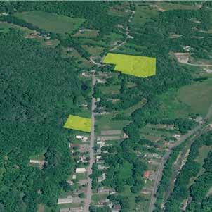
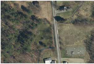
Even though this scenario increases density beyond current zoning maximums, the smaller one- to threebedroom unit size limits the number of people in each unit. If the soils are deemed suitable enough in terms of septic capacity, an exception to the minimum lot size could be made in order to prioritize dense affordable housing. Alternatively, if municipal wastewater is built, developments like this one become much more feasible.
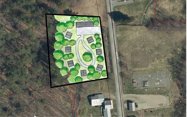

• Increased housing density near the village center.
• Provides affordable options for seniors to downsize or individuals working from home.
• Using small building footprints creates space for more vegetated land to absorb surface runoff and reduce down-stream flooding and erosion risks.
• Co-housing can increase community connection and resource sharing.
• Separated parking area might decrease accessibility.
• The form of the development is visually distinct from existing development styles.
• Soils on site are mapped as suitable for septic but further assessment will be needed to determine actual capacity and appropriate siting of leach fields.
As a reminder, this project is not intending to site actual development on these specific parcels, but rather model a thought process and set of criteria that planners can use to imagine flood-adapted development.
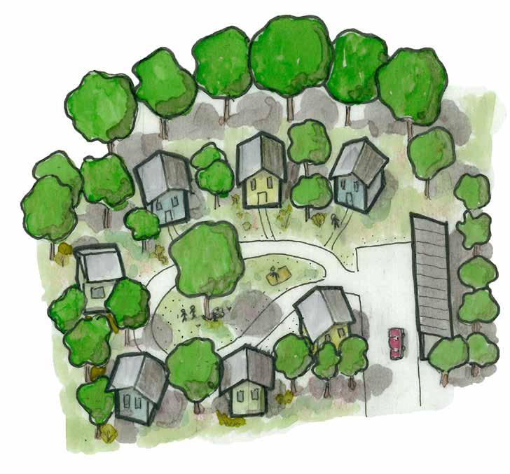
Perspective view of village co-housing, looking west
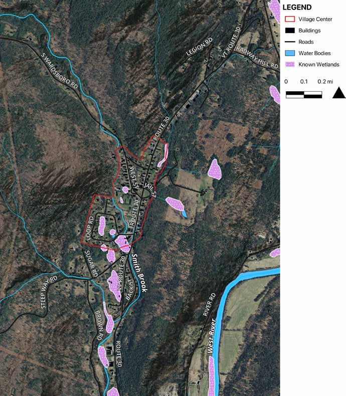
Newfane is the “shire town,” or county seat, of Windham County Vermont. It is includes the central Newfane Village, along VT Route 30, and two other village centers, Williamsville and South Newfane, on the Dover Road in the southwest portion of town. The Rock River and the West River are the dominant water bodies in Newfane, with several brooks also crossing the terrain. Many perennial and intermittent streams flow down from the hills and into the larger brooks and rivers, particularly during wet seasons and high precipitation events. These water bodies supplied water to the industry of the past, and settlement is generally clustered alongside them.
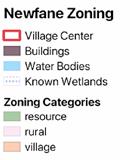
Newfane’s current zoning and mapped future land use districts provide a road map for discerning potentially desirable sites for future development. Central to the existing settlement pattern is the Village zoning. This is a fairly small and strictly defined area around the village centers. Village zoning allows for the densest development of a mix of uses. Surrounding the village-zoned area is the rural district, where low- to mediumdensity housing and business could be sited. Further outward is the resource zoning district, which is meant to prioritize conservation of natural resources like headwaters, contiguous forest land, and wildlife habitat. The zoning in Newfane strongly supports the future land use goals of the region as whole of compact settlement surrounded by undisturbed nature.
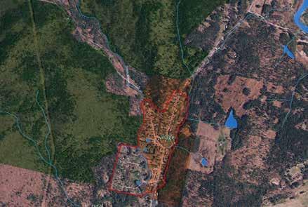
Some goals of the town as articulated in the Town Plan and Hazard Mitigation Plans are:
• to protect floodplains, river corridors, land adjacent to streams, wetlands, and upland forests
• to maintain historic settlement patterns
• to maintain and improve forest blocks and habitat
• to maintain and enhance recreational opportunities for residents and visitors
A farther goal of the town is “to promote the development of diverse, safe and affordable housing to meet the needs of all Newfane residents, including those of low and moderate incomes.”
Applying the exclusion criteria, as defined on pages 36 to 39, to available geospatial data produces the map below. Potential suitable development sites can be found where the map is white (ideal slopes) or green (marginally suitable slopes) without cross-hatching (suitability of soil for septic).
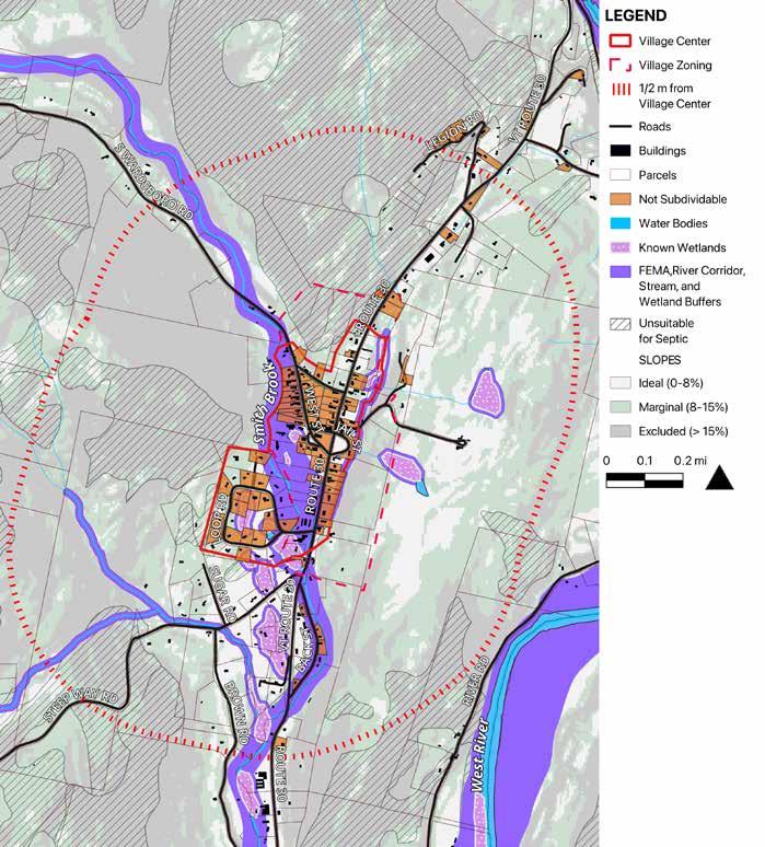
Identifying structures vulnerable to flooding and erosion (those located in the river corridor or FEMA SFHA) and other potential flood hazard areas based on mapping and community input can help guide the prioritization and siting of future infill development projects.
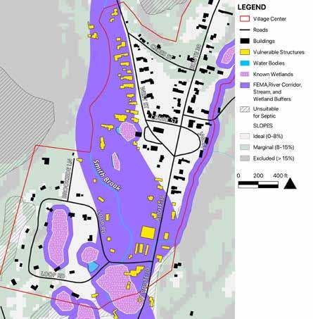
• The Post Office
• The Town Office
• The Library
• WW Building Supply and Dutton’s Farmstand
• Other commercial structures
• Numerous residences
For this exercise, the focus is on Newfane Village and not the town’s other two village centers in southeast Newfane. In the case of Newfane, physical conditions can vary significantly even within a mile; however, many of the goals articulated by the Town Plan and related documents, which are referenced here, apply to the whole town. According to the town’s 2024 Hazard Mitigation Plan (HMP), both flooding and fluvial erosion risk is highly likely and will have a critical impact. Vulnerability to these hazards is rated as high.
To plan for flood mitigation and floodplain protection, Newfane has adopted the strictest flood hazard bylaws recommended by the Vermont Department of Environmental Conservation.
The main thoroughfare, VT Route 30, runs between two flood hazard zones precisely where the historic village center is located. This area has suffered severe flooding in the past and as a result is heavily armored and fortified with culverts.
The summary exclusion map below highlights potentially suitable development sites, outlined in green. These areas:
• Do not fall in the exclusion zones based on the development criteria.
• Have road frontage on or potential driveway access to town roads.
(As a reminder, this project is not intending to site actual development on these specific parcels, but rather model a thought process and set of criteria that planners can use to imagine flood-adapted development.)
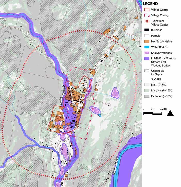
Identified by Planning Commission Members and Public Outreach
• The Flea Market site on Route 30 at the intersection of Radway Hill Road (Area A below)
• Cemetery Hill above Newfane Village (Area B below)
• Parcels uphill from the Smith Brook on Brown Road (Area C below)
• Union Hall and Williamsville Hall *
• Dewitt’s Field in Williamsville off Grimes Hill Roadd *
• A large field on Route 30 near the town line with Townshend *
*These three locations are not discussed further because they exist outside of the Newfane Village area.
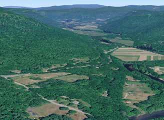
Area A is a flat five-acre parcel 0.9 miles north of Newfane Village. It currently hosts the Newfane Flea Market, and is privately owned. The soils and slope at this location are suitable to septic installation, and it is near to the West River but significantly uphill from flood hazards. It sits about 100 feet above the Base Flood Elevation of the West River.
Assets of this site are the conditions favorable to construction and the potential to increase connectivity with nearby Putney, as well as nearby hiking trails and conservation land. A drawback of this site is that it is greater than 0.5 miles from a village center.
This area will be explored in the Village Expansion Scenario designs.
Area B contains several suitable, small parcels along Route 30. Though they are outside of the Village zoning district, they have excellent connectivity to the Village Center and could be used in an Infill or Adaptive Reuse scenario to re-site critical infrastructure such as the Town Office, Post Office or the Library.
Area C contains over 200 acres of varying terrain, the majority of which is suitable to septic. It is uphill from flood risk, and within 0.5 miles of Newfane Village center. Currently, access to the area by paved roads is very limited, and there are two identified wetlands which require caution to build near. Ultimately, this site is not feasible because it is in the process of being purchased for permanent conservation. This is a good outcome for this area as it also contains wildlife habitat connectivity, wetlands and contiguous forestland.
Area D contains several parcels that have soils well-suited for development and existing roadways that connect directly into the village center. It is uphill from flood risk, but the nearby Smith Brook has flooded the main access roads to the area in the past.
Lying up-slope and at the confluence of several brooks and perennial and intermittent streams, and known wetlands, makes this a challenging site to build on as development here will increase the town’s need to maintain roads and culverts and could jeopardize delicate and important ecosystems.
Using the new development criteria to locate suitable sites for development, plus community input, the “Newfane flea market” parcel stands out. Situated in the Rural Residential zoning district, it is 5 acres of flat ground with paved road frontage on two sides that are well above the designated River Corridor and the base flood elevation. Use of these existing paved roads to access would help limit the need for increased impermeable surface area. The site is mostly cleared of vegetation, which further reduces the extent of disturbance needed.
Additionally, it is near essential services like the hospital, grocery stores, and recreation sites. There are other sites in this vicinity that could also be subdivided to further increase residential development in this part of town. Newfane could pursue increasing the connectivity from the village district to this site with sidewalks, bike lanes, or public transit. The site itself can serve to foster connection between Newfane and Putney, just to the east.
Currently, the Green Mountain Conservancy is working to conserve 250 acres to the south of this site to connect to the nearby Deer Run Nature Preserve in Putney.
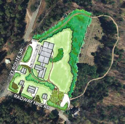
This is an opportunity to support the community and a number of housing goals. Shown in the theoretical design are building typologies that are designed for aging-in-place, workforce housing, or starter homes. There are multi-unit structures and single-family units that could both be adapted to this site; however, zoning reform would need to occur to allow for increased density.
• 5 acres
• Privately owned with existing structures
• Road frontage on Route 30 and Radway Hill Road
• Relatively flat, mostly cleared land
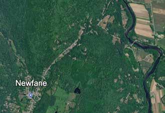
0.9milestovillagecenter
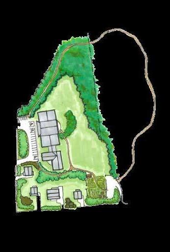
Current zoning subdivision bylaws would allow for two units on this site, one per two acre parcel, because it is in the rural district. With smart zoning reform, a design such as this would support 12 units of housing. Increasing building density means more area can be covered in vegetation, and with green infrastructure to manage stormwater, this new neighborhood could be a model for a “spongier” built-environment that mitigates run-off.
• Provides housing in a safer location away from flood zones to residents currently living in areas of high flood risk.
• Increases existing housing stock with options for residents across a spectrum of needs.
• Makes greater use of a relatively under-utilized parcel of land near the village center.
• Serves as an attraction to residents and visitors with space for gathering, new trails, and potential wider trail linkages.
Riverwalk Trail creates connectivity within the neighborhood and to surrounding woodlands.
Apartment style central building with attached community center or garden-style units.
A mix of single-family and duplex units for an affordable starter home or downsizing to age-in-place.
Open gathering space can be used to host the local farmer’s market, for community gardening, or as a sports field. Additional parking and access from Radway Hill invites visitors and maintains privacy for residents.
• Currently, the safest way to get to this site from the village center is by motor vehicle. Adding sidewalks along Route 30 would increase the cost to the town.
• Current zoning does not allow for housing at this density in the Rural district.
• Without municipal wastewater services, a new septic system on site would be costly. Shared systems could serve multiple units, but further assessment by professionals and cooperation among developers (if there were more than one) would be needed to make this happen.

4-Square Single Type

Side-by-Side Duplex Type
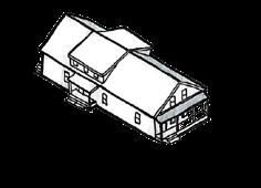
This scenario incorporates arcitectural designs adapted from the Vermont Homes for All toolkit. These housing types are are based on familiar Vermont architecture and offer a range of units with options for ADA accessibility. The Vermont Homes for All project aims to support affordability and to help “cultivate a new generation of small developers.” The Homes For All document is a great source of information on the different stages of planning and realizing infill development.
Using predesigned houses such as those adapted from Vermont Homes for All is one way to cut the costs associated with new development. Other ways to help actualize development goals are discussed in the appendix.
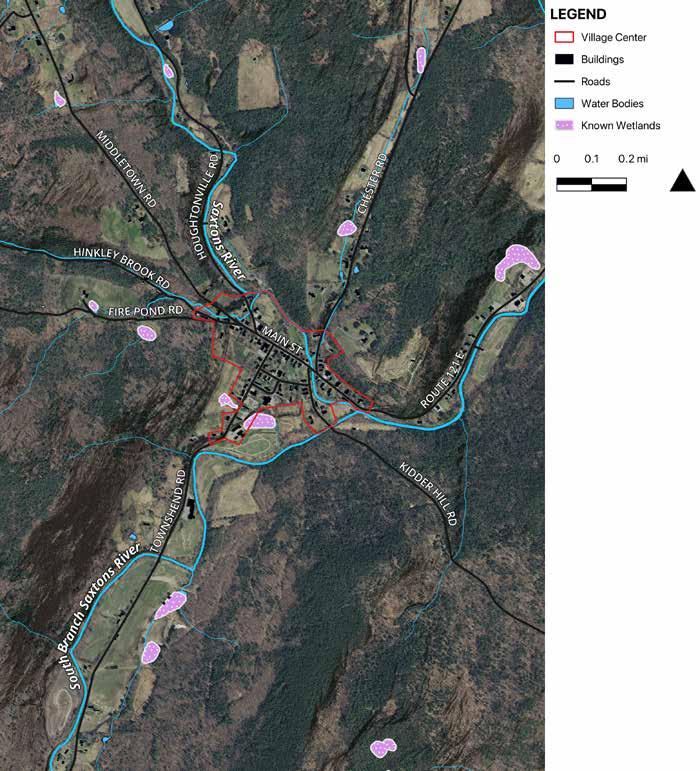
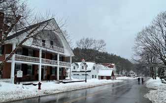
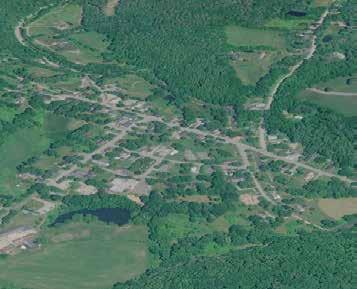
The town of Grafton has a single historic village surrounded by relatively undeveloped, mostly forested land. The varied and steeply sloped topography surrounding much of the village has shaped the settlement pattern and limited development. There are four primary roads (Route 121 East and West, Townsend Road, and Chester Road) connecting the village to surrounding towns. These access corridors all run along waterways and are flanked by acres of meadow and cleared land with good agricultural soils. Grafton’s commercial agricultural landuse has declined significantly, but the land use pattern remains due to efforts to keep historic agricultural lands open. (Grafton Town Plan).
The village lies at the convergence of several rivers, brooks and streams. There are forty-three bridges in Grafton, eighteen of which have a span of twenty feet or more (TP). Most of the major roads that connect the village center to the surrounding area run alongside a river or brook. The largest of these rivers is the Saxtons River. The South Branch of the Saxtons River joins just east of the village center and the Hinkley Brook, another major tributary, flows into the Saxtons at the northwest perimeter of the village center. The Saxtons and its tributaries are part of the Connecticut River watershed.
Identified by the Town Plan (TP), Hazard mitigation plan (HMP), and Planning Commission Members (PCM)
• “Providing safe, affordable and convenient housing for all is a priority for Grafton...” (TP)
• “...population demographics are not expected to change significantly in the next five years, though an increase in the average age of the populations may increase the vulnerabilities of the population.” (HMP) There is a need for safe homes and services for an aging community
• There is a desire to attract younger residents to the town. School enrollment has dropped significantly over the past few years. (PCM)
• “Incentivize business growth that utilizes the land in ways that support and complement agricultural and forest products, telecommuting, small scale manufacturing and the service industries.” (TP)
• “Continue to have a vibrant cultural community including visual and performing arts.” (TP)
• The village center could use more parking during tourist season. (PCM)
Applying the exclusion criteria, as defined on pages 36 to 39, to available geospatial data produces the map below. Potential suitable development sites can be found where the map is white (ideal slopes) or green (marginally suitable slopes) without cross-hatching (suitability of soil for septic).
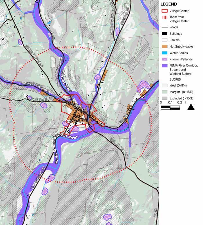
Identifying structures vulnerable to flooding and erosion (those located in the river corridor or FEMA SFHA) and other potential flood hazard areas based on mapping and community input can help guide the prioritization and siting of future infill development projects.
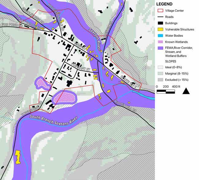
VULNERABLE STRUCTURES IN THE VILLAGE CENTER:
1. Grafton Library (identified as a critical facility in HMP)
2. Old Fire Station
3. Grafton Village Cheese Creamery
• Numerous Private Residences
Identified by Grafton’s Hazard Mitigation Plan (HMP), Regional River Engineer (RE)
• “The most damages to date have occured to the town highway infrastructure in the form of washouts and culvert failures.” (HMP)
• Historic berms along the Saxtons, downstream (east) from the Old Fire Station, contribute to flood risk along Route 121 East, as the berming chokes the river making the sediment that comes down from Windham more likely to create blockages (RE)
The below summary exclusion map highlights potentially suitable development sites outlined in green. These areas:
• Do not fall in the exclusion zones based on the development criteria.
• Have road frontage on or potential driveway access to town roads.
(As a reminder, this project is not intending to site actual development on these specific parcels, but rather model a thought process and set of criteria that planners can use to imagine flood-adapted development.)
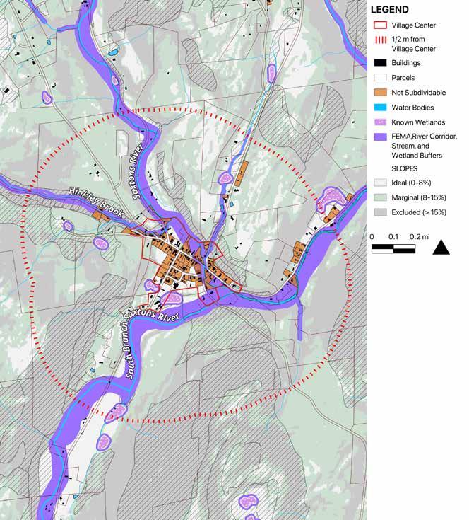
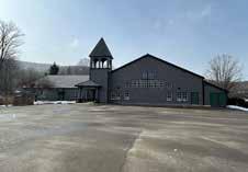
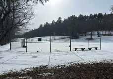
Developable space right in the village center is limited due to the need for adequate space for septic systems to support new development. Development of a number of the areas (sites A-D) identified in the village center hinges on relocating or eliminating their current cultural or recreational uses. Depending on town priorities, new development in these areas might better serve the village center and town.
Grafton Public School (concern that the school will close in the next few years due to low attendance and state level consolidation; unutilized developable land on school parcel) (PCM)
Playing field (baseball diamond) (PCM)
Tennis and Pickleball Courts (PCM)
Greenhouses and the former Mining and Mineral Museum (closed) (PCM)
Land along Middletown Road (Exclusion Mapping and PCM). The site on Middletown Road has less suitable slopes than the other sites discussed. The deforestation required to develop most of this area is of greater concern due the increased potential for runoff on steeper slopes. Most of Middletown Road is unpaved and can be difficult to navigate during mud season, making connectivity to potential new development a concern.
The sites identified on the Chester Road north of town could potentially support housing development. The flashy brook (flanked by a FEMA Special Flood Hazard Area) that runs alongside the road could create accessibility issues during significant climatic events. As portions of both the sites are already cleared, stormwater-smart development could be possible without significantly altering runoff or habitat value. Impacts on stormwater related to the clearing of forest canopy for development in other portions of the areas would have to be considered and managed.
Some of the area north of the Townsend Road is not suitable for septic, but enough of it is to allow development.
SITES EXPLORED IN DEVELOPMENT SCENARIOS ON THE FOLLOWING PAGES
Theoretical development scenarios will be explored on two sites (1 and 2) that lie within these suitable areas (A and B), prioritizing proximity to the village center.
2 1
PAST AND PRESENT
The Grafton Public Library is a much loved building and gathering place. In addition to the library collections, the library hosts educational and cultural events and programming. The library is currently the only building deemed a critical asset located in the River Corridor in Grafton. The cultural significance and vulnerability of the library make it a good example for considering adaptation possibilities.
Since 1955, the library has been housed in the Butterfield House, one of ninety structures in Grafton listed on the Vermont State Register of Historical Sites (Grafton Hazard Mitigation Plan 2025 Draft). The Butterfield House has also been listed on the National Register of Historic Places since 2012, due to its architectural and cultural significance.
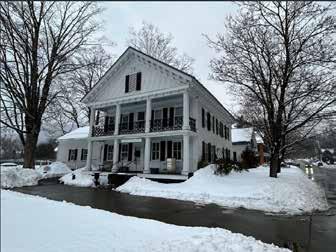
While there is much history tied to the library in its current location, there is also a precedent for the library function being relocated within the town due to evolving town needs and a precedent for modifying the Butterfield House to better suit community needs. There has been a public library in Grafton since 1874, formerly sited on the first floor and then in the basement of the Town Hall. The floor plan of the Butterfield House has been partially modified since its sale to the trustees of the Grafton Public Library in 1952, to create larger interior spaces for library functions (“NRHP nomination for Butterfield House”).
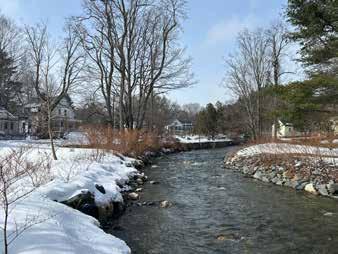
• The Saxtons River is armored upstream and along the portion that passes by the Library. This can increase flow rate, making it more likely for a waterway to jump its course.
• The confluence of the Saxtons River and the stream along Chester Road is about 150 feet northwest (upstream) of the library building.
• The library building sits approximately 18 feet above the Saxtons River.
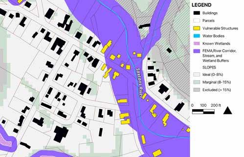
• The library building is within the River Corridor, but about 135 feet from the nearest point of the Saxtons River and the associated Flood Hazard Area.
A more complete geomorphic assessment, with the assistance of a state river engineer or other similarly qualified professional, would help determine how vulnerable the current library building and its contents are to flood risk.
• Flood adapt the building in place and maintain its function.
• Flood adapt the building in place and change its function, moving library function elsewhere.
• Move the building out of the flood zone (to one of multiple possible sites) and maintatin its fuction.
• Repurpose an existing structure to serve the library functionoutside of the flood zone.
• Construct a new library and classroom space outside of the flood zone.
• Construct new library on school parcel
PROS & CONS OF ADAPTATION & SITE OPTIONS
A. Current Library Site Adaptation in Place
Pros: If deemed safe, this could preserve the historic structure (and potentially its function) in its historic location on the river.
Cons: This does not decrease structures in the River Corridor.
B. Ball Courts Site Relocation
Pros: The site has room for permeable parking; short move; maintains proximity to the river and surrounding lawns; allows the current library site to be revegetated as flood adapted and flood mitigating park space.
Cons: not far outside river corridor; loss of ball courts on this site
C. School Site Adaptive Reuse, New Infill Development, or Relocation
Pros: Moving it into the school building is a safe, affordable option pending school closure; already has parking; there is also room for relocating the historic library on site, possibly utilizing existing septic & water
Cons: Expense of new construction or relocation
D. Playing Field Site New Infill Development or Relocation
Pros: Option for new construction or the relocation of the Butterfield House; there is room for permeable parking on site; site is near the nature museum, open space, and other town assets; a new build could integrate classrooms, meeting spaces, and other town needs.
Cons: Would require installation of a septic system and well; expensive.
Parcel 1, for the sake of this development scenario, refers to two parcels, the public school parcel owned by the Town and part of the privately owned parcel to the east. The school parcel has an asphalt parking lot off of Pleasant Street. There is a gravel public parking area on an abutting parcel to the southwest. The school is located upslope from a delineated wetland (shown with setback). There is a trail from the school to the Grafton Trails & Outdoor Center property to the south.
The eastern parcel included in the site would be subdivided (along the dashed pink line below), dividing the undeveloped, cleared southern portion of the parcel from the existing single-family home. The southern edge of the site is a slope up from the South Branch of the Saxtons. The land above the slope ranges from ten to twenty feet above the river corridor, which passes through the abutting parcels to the south.
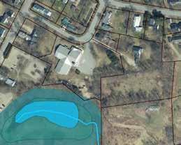
• Worker housing: responds to the town goal of attracting younger, working families to the town and the need for affordable housing to support them.
• Senior/ADA housing: the assisted living facility responds to the need for safe, affordable homes for the town’s aging population.
• Stormwater management: of particular significance due to the proximity to a large wetland and the river, with steep slopes between the development and the waterbodies.
• Flood-safe library site: this is an affordable option for resiting the library outside of the river corridor that would allow for intergenerational activity between the senior residents and library patrons.
• Construction expense of new development: creative funding sources and development partnerships would be needed to build new affordable housing.
• Lack of Town ownership of the theoretical subdivided house site east of the current school would eliminate one of the new residences included in the design.
• Potential PFA contamination: due to the history of PFAs in the school’s water, wells for the new housing would need to be tested for PFA contamination and remediated if necessary.
Adaptive Reuse and New Infill Development, Parcel B
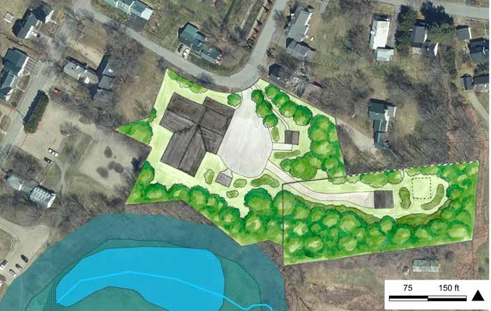
Adaptive Reuse of School as Assisted Living Facility
ADA Accessible Pavillion
smart vegetation & swales
Adaptive Reuse: The ADA-compliant school building is renovated as an assisted living facility. The building could potentially incorporate a public library as well, if the library needs to be moved from its current location due to flood risk.
New Infill Housing: One building next to the school parking lot with two two-bedroom units based on a Houmes For All “Side-by-Side” housing type (Vermont Homes For All), to be tied into the school building septic. A three-bedroom single-family-house with a new septic field is added on the eastern parcel.
Public Garden Space: a garden with a covered gathering space is added to the south of the existing parking lot for residents, visitors, and stormwater management.
The closure of a local school can be a significant loss, as they often function as social, cultural and civic anchors within a community, as well as an educational facility. However some closures may be unavoidable due to demographic trends and state-led consolidation efforts within the education system. In the case of a school closure, adaptive reuse provides an option for retaining the building as a community asset and reimaging how it might serve community needs.
As a reminder, this project is not intending to site actual development on these specific parcels, but rather model a thought process and set of criteria that planners can use to imagine flood-adapted development.
The playing field site is currently cleared and maintained as short lawn. It is located below the conserved town forest which slopes up to the northeast. The eastern two-thirds of the playing field parcel are relatively flat, while the western third has slopes of 8-35 percent. It is bordered by a number of residential properties, a church, and parcels owned by the Windham Foundation, a local non-profit. The playing field parcel does not have road frontage. It is located southwest of the intersection of Main Street and Grafton Road. This intersection is also the location of the Town Hall, Post Office, Grafton Inn and Phelps Barn Pub.
• Family Housing: responds to the town goal of attracting younger, working families to the town and the need for affordable housing to support them.
• Senior/ADA Housing: 3 ADA-compliant singlebedroom units in this design respond to the need for safe, affordable homes for the town’s aging population.
• Public Offstreet Parking: more parking located near the town center that does not significantly increase runoff.
• Stormwater Management: the stormwater design features in this development could decrease runoff, relative to the current expanse of mown lawn at the base of a slope.
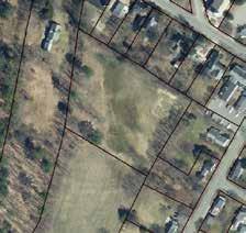
• Construction Expense: creative funding sources and development partnerships would be needed to build new affordable housing. Communal septic can require a more involved permitting process, but allow for increased density and reduce development costs.
• Spans Multiple Properties (Varied Ownership): would require the purchase of multiple parcels or for an easement to be granted by the Windham Foundation, the owners of the parcel the septic drainage field is sited on in this design. The design requires a right-of-way easement across two other Windham Foundation parcels for driveway access.
• Loss of Open Recreational Space in the Village Center: There is limited safe, open public space in the village center. The impact on the community of relocating this function to outside the village center would have to be explored.
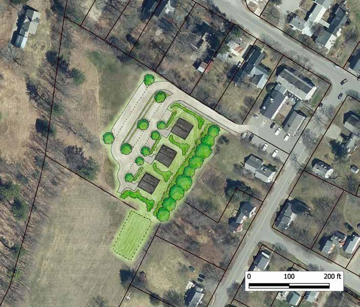
This scenario sites three multi-unit residential buildings on the east side of parcel A, with private parking for the residences and additional public parking for the village. The development is accessed from Main Street, with the parking area located on the west of the parcel, past the residential structures so it does not interfere with the historic village character. Trees and greenspace are incorporated into the parking area for aesthetics, privacy screens, shade and stormwater management. Vegetated buffers and swales directed down-grade from the parking and homes are added for additional stormwater management. The scenario shows a communal septic drainage field, allowing for increased housing density and lower cost per housing unit.
As a reminder, this project is not intending to site actual development on these specific parcels, but rather model a thought process and set of criteria that planners can use to imagine flood-adapted development.
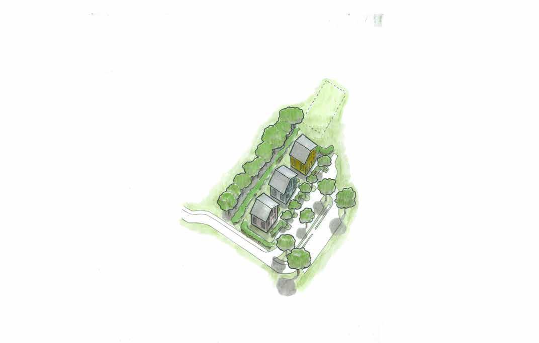
Vegetated swales or rain gardens
Working with the natural contours of the land and minimally regrading as needed, the goal is to slow runoff from slopes, roofs, and other impervious surfaces, allowing it to infiltrate into the ground or evapotranspire. This reduces the rate and volume of stormwater or snowmelt entering a waterway, thus decreasing the impact of runoff on flood risk.
Infiltration basin at base of the sloped town forest to the north
Pervious parking with vegetated breaks
Stormwater-smart development that incorporates green infrastructure can reduce the runoff associated with flood-risk, in some cases decreasing overall runoff from pre-development conditions. Revegetating the river corridor and floodplain is just one part of the picture—reducing runoff beyond the corridor is also important. A town may consider adopting local ordinances that exceed the state requirements for stormwater management to ensure that new development does not result in increased runoff. Vermont’s Stormwater Treatment Standards are a valuable resource for planners trying to better understand how to reduce flood risk through encouraging or mandating certain stormwater management best practices (Vermont Stormwater Management).
Examples of stormwater-smart design elements:
• Rain gardens and vegetated swales (bioretention)
• Inflitration basins and trenches
• Grass channels and check dams
• Filter strips
• Pervious alternatives to impervious surfaces
• Spreading bars
• Hedgerows
Arendt, Randall. Rural by Design: Planning for Town and Country. Taylor & Francis (CAM), 2017.
Brown, Rebecca A. Where the Great River Rises: An Atlas of the Connecticut River Watershed in Vermont and New Hampshire. Dartmouth College Press [u.a.], 2009.
Clark, M., Crossett, C., 2021. Climate Change in Vermont. In Galford, G.L., Faulkner, J. et al. (Eds), The Vermont Climate Assessment 2021. Burlington, Vermont: Gund Institute for Environment at the University of Vermont.
Dolin, Kari, and Mike Kline. “Municipal Guide to Fluvial Erosion Hazard Mitigation.” Vermont Agency of Natural Resources River Management Program, 10 May 2010, anrweb.vt.gov/PubDocs/DEC/WSMD/Rivers/ Docs/rv_NFIPFEHFactSheet.pdf.
Haviland, William A., and Marjory W. Power. The Original Vermonters: Native Inhabitants, Past and Present. University of Vermont, Published by University Press of New England, 1994.
Mathewson, R. Duncan, III. “Western Abenaki of the Upper Connecticut River Basin: Preliminary Notes on Native American Pre-Contact Culture in Northern New England.” Journal of Vermont Archeaology, vol. 12, 2011.
“NRHP Nomination for Butterfield House.” National Park Service, 2005, npgallery.nps.gov/NRHP/GetAsset/ NRHP/05000806_text.
“Planning for Recovery and Long Term Resilience in Vermont.” United States Environmental Protection Agency, July 2014, www.epa.gov/smartgrowth.
“Protect River Corridors and Floodplains.” Flood Ready Vermont , floodready.vermont.gov/flood_protection/ river_corridors_floodplains. Accessed 9 Feb. 2026.
“River Management” Agency of Natural Resources Department of Environmental Conservation, https://dec. vermont.gov/watershed/rivers/river-management. Accessed March 2026.
“Rivers, Streams, and Floodplains.” Naturally Resilient Communities, nrcsolutions.org/floodplains. Accessed 1 Mar. 2026.
Runkle, J., K.E. Kunkel, S.M. Champion, L.-A. Dupigny-Giroux, and J. Spaccio, 2022: Vermont State Climate Summary 2022. NOAA Technical Report NESDIS 150-VT. NOAA/NESDIS, Silver Spring, MD, 4 pp.
Scott, James C. In Praise of Floods: The Untamed River and the Life It Brings. Yale University Press, 2025. Yale Agrarian Studies Series.
“Stream Channel Migration Zones.” Washington State Department of Ecology, ecology.wa.gov/watershorelines/shoreline-coastal-management/hazards/stream-channel-migration-zones. Accessed 9 Mar. 2026.
“Vermont Homes for All Toolkit.” Vermont Agency of Commerce and Community Development, Spring 2024, https://accd.vermont.gov/current-initiatives/homesforall/toolkit.
“Vermont Stormwater Management Manual and Design Guidance.” Vermont Agency of Natural Resources, 1 July 2017, https://dec.vermont.gov/sites/dec/files/wsm/stormwater/docs/Permitinformation/2017%20 VSMM_Rule_and_Design_Guidance_04172017.pdf.
Some other ways to help actualize desired infill development include:
• Enticing reputable developers through municipal tax incentives, such as property tax abatement or tax stabilization agreements.
• Changes in zoning ordinances that allow for more economical development by allowing greater density and shared infrastructure to decrease the cost of construction per unit.
• Public education can help build citizen support for development projects. The support of residents for development projects is important for apporoving proposed development budgets and because of citizens’ capacity to organize to further a cause (for example through the creation of a local non-profit or volunteer civic engagement.) Towns can invite experts or panels of experts for public presentations and conversations on different aspects of infill development, flood risk adaptation, and other pressing town needs.
• Partnering with non-profits that support housing development.
Organizations involved with developing affordable housing in Southeastern Vermont:
• Windham and Windsom Housing Trust is the biggest player in affordable housing (often lead developer and longterm owner-operator)
• Vermont Housing and Conservation Board
• Housing Vermont (co-develops with local organizations)
• Evernorth (frequent partner on rural village projects, helping to make small-town projects financially viable)
• Habitat for Humanity
• Westgate Housing Inc. (precedent for tenant-led housing)
• Brattleboro Area Affordable Housing (precedent for volunteer run local organization addressing housing)
There are also organizations that are not primary developers, but support rental and housing access:
• Groundworks Collaborative
• Southeastern Vermont Community Action
• Brattleboro Development Credit Corporation (provides support to towns in SE Vermont through facilitating partnerships, education, and strategic planning, to help towns realize workforce development projects, including workforce housing.)
• Vermont Council on Rural Development (Creation of local village trusts to facilitate the creation of community-owned real estate and the conversion of large historic homes into multiple units.)
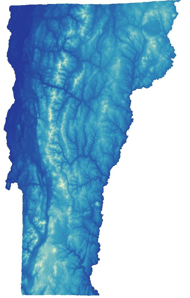
“A good solution solves more than one problem, and it does not make new problems.”
-Wendell Berry
The Windham region is located in the southeastern corner of Vermont, an area with varied topography ranging from the peaks and ridges of the Green Mountains in the west to the rolling hills and wider valleys along the Connecticut River in the east. Numerous rivers and streams criss-cross the region, with most of the settlement concentrated along larger waterways. This regional pattern of historic village centers located along rivers makes many of the villages vulnerable to inundation flooding and fluvial erosion. The effects of climate change have increased this vulnerability, as Vermont has experienced more extreme weather over the past couple of decades. At the request of the Windham Regional Commission, this document provides information and inspiration to support the region’s planning commissions as they explore how flood-adapted infill development in and around village centers can help towns become safer and more resilient.
The Conway School is the only institution of its kind in North America. Its focus is sustainable landscape planning and design and its graduates are awarded a Master of Science in Ecological Design degree. Each year, students from diverse backgrounds are immersed in a range of real-world design and planning projects, ranging from sites to cities to regions.
