
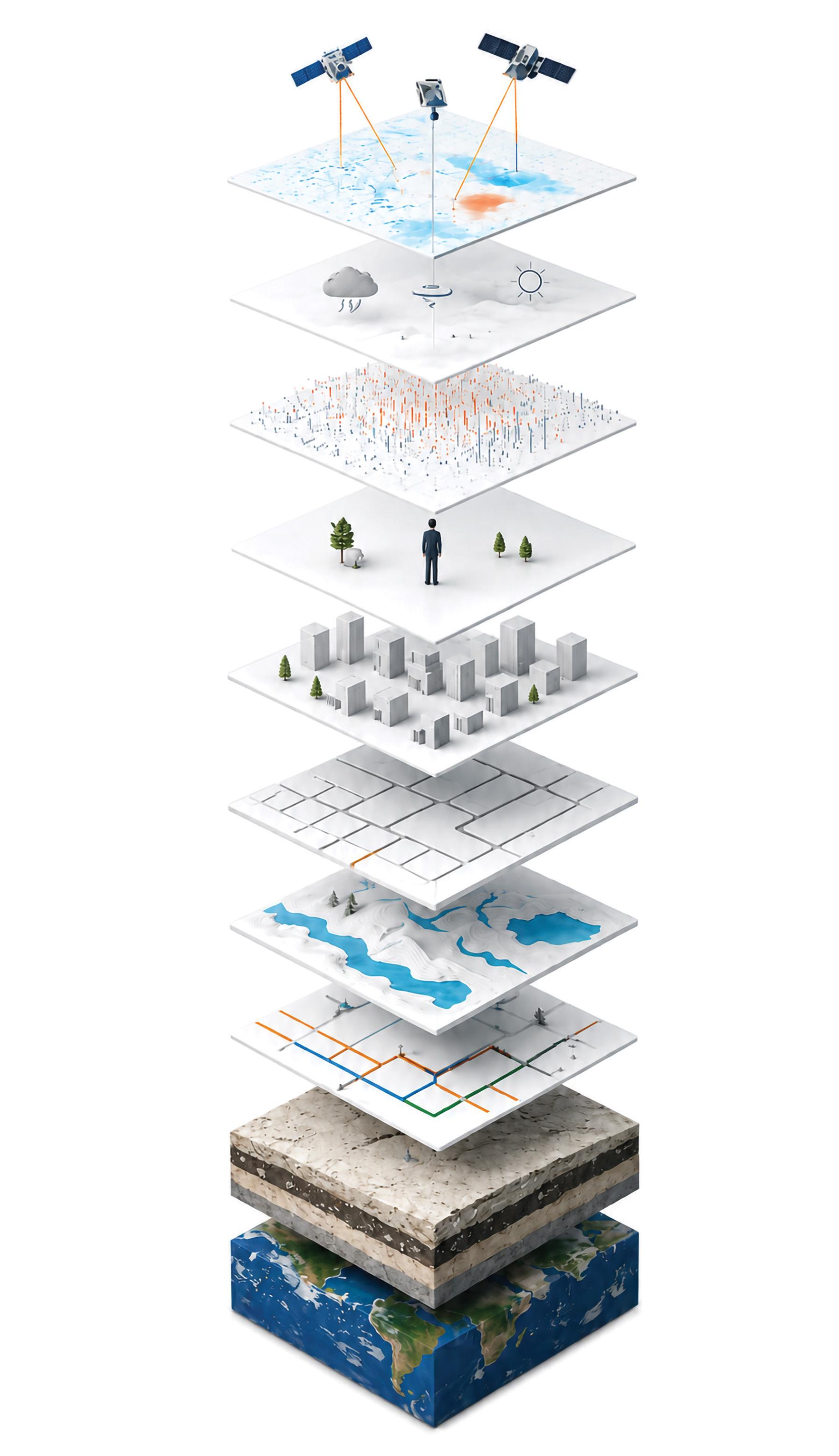
Consortis Geospatial, our mission is to exceed our clients’ expectations by delivering exceptional solutions tailored to evolving needs.
Our services span the full spectrum of geospatial information and surveying, from cartographic applications and spatial data collection to advanced data processing, high-precision surveying, geometric inspections, engineering analysis, and technical support for complex projects.
By combining expertise in geoinformatics with the precision of surveying engineering, we deliver integrated and reliable solutions tailored to the specific requirements of each project.
We support public and private sector organizations in various areas, such as urban and spatial planning, environmental management, infrastructure development and monitoring, real estate and investment management, as well as the implementation of complex engineering and development projects.
Our commitment to client satisfaction drives us to continuously enhance our services, solutions, and geoinformation applications, ensuring access to the most advanced tools and technologies. With a team of dedicated specialists and a strong commitment to excellence, we are ready to provide high-level services in the fields of surveying and geoinformatics.

1. End-to-end solutions from project conception to successful completion
2. Commercial Off-The-Shelf (COTS) software solutions
3. Use of Free and Open-Source Software (FOSS) to reduce operational costs and minimize vendor lock-in
4. Cutting-edge innovation through Research & Development
5. Highly qualified team with university, postgraduate, and doctoral-level expertise and continuous professional training
6. Specialized expertise in Geographic Information Systems (GIS) and Geoinformatics
7. Use of Earth Observation data in innovative monitoring services
8. Development and implementation of AI/ML techniques for algorithmic and process optimization
9. Use of state-of-the-art technologies
10. Customized geoinformatics solutions for a wide range of sectors and operational needs
11. Proven track record in the successful implementation of complex projects
We collaborate with, and serve both public and private sector organizations:
Ministries | Regional Authorities | Municipalities | Public Water Utilities | Port Authorities
Industries | Hotels | Tourism Development Companies | Retail Businesses | Shipping Companies | Real Estate Companies | Utility Companies | Financial Institutions | Urban & Interurban Transport Operators
We are among the key contributors to the success of the Hellenic Cadastre, thanks to our expertise and long-standing experience in the design, implementation, and management of complex geospatial information projects.
Our services cover a broad range of activities, including the creation of cartographic basemaps, collection and processing of property declarations, cadastral surveying, database design and development, and legal verification procedures. We also support property owner support and consultation, objection review processes, the management of geometric changes and error correction requests, as well as the restructuring and continuous updating of cadastral databases.
Maximum accuracy in measurements and surveying calculations is a fundamental priority for us and is supported by continuous investment in state-of-the-art technologies.
However, the quality of our services is not based solely on technological equipment. Equally important are the high level of professional responsibility, consistency, and dedication that have always characterized our company and constitute the foundation of the trust placed in us by our partners and clients.
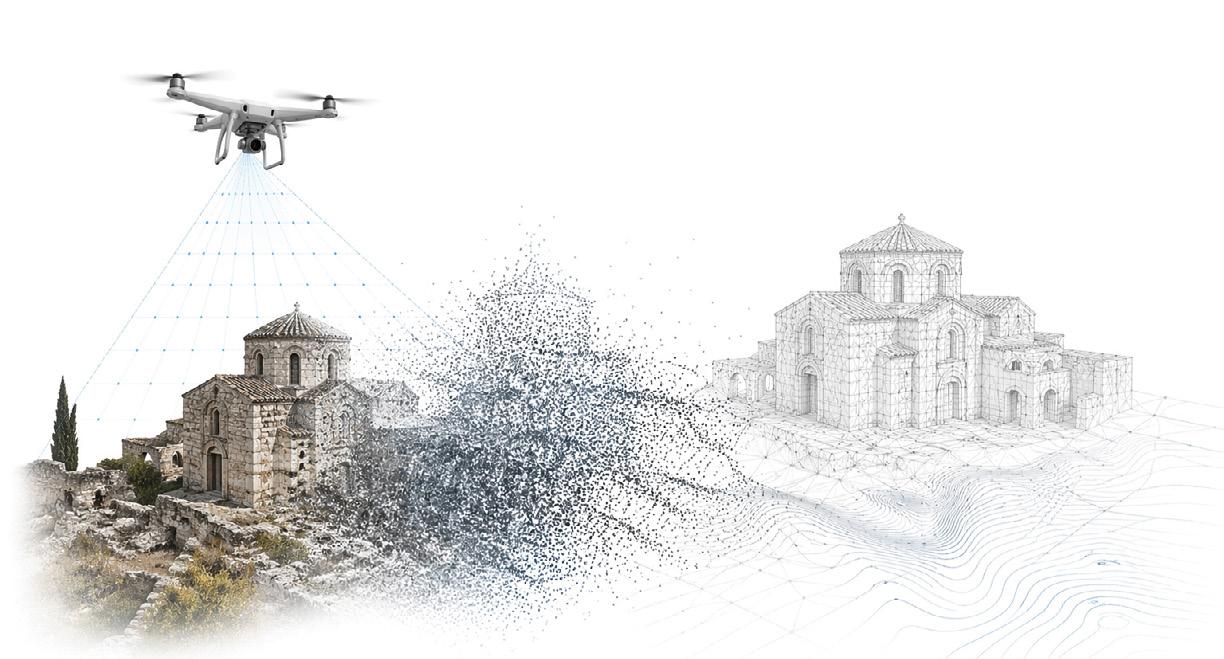
Photogrammetry, whether aerial or terrestrial, using Unmanned Aerial Vehicles (UAVs/drones) or 3D laser scanners, is a modern, high-precision method for producing point clouds, reliable digital maps, and terrain models. It is now widely used for scanning of buildings, monuments, and archaeological sites.
We specialize in terrestrial and aerial surveying, tailoring our approach to each project by selecting the most suitable method or combination of methods according to its technical requirements and accuracy standards.
DIGITAL MODELS & BASEMAPS
• Production of high-accuracy orthophoto maps
• Creation of Digital Terrain Models (DTM)
• Digital Geospatial Data Services
• Bathymetric surveys & creation of Digital Bathymetric Models (DBM)
CADASTRAL SURVEYS & IMPLEMENTATION ACTS
• Cadastral surveys for Urban Planning Studies
• Preparation of Implementation Acts
• Elevation studies
• Implementation diagrams
• Corrective Implementation Acts
• Land Redistribution and Compensation Acts
CALCULATIONS & TECHNICAL SUPPORT
• Earthworks calculations & volumetrics
• Establishment and monitoring of high-precision networks
• Construction site and engineering project support
REAL ESTATE VALUATIONS
• Preparation of property valuation reports
TOPOGRAPHIC DIAGRAMS & SURVEYS
• Preparation of topographic diagrams for notarial deeds and permitting procedures
• Parcel and land plot boundary setting-out and demarcation
• As-built surveys
• Geometric change diagrams
THREE-DIMENSIONAL REPRESENTATION
• Digital Twins
• Creation and analysis of 3D point clouds / LiDAR technologies
• Development of 3D BIM models
SURVEYING WITH ADVANCED TECHNOLOGIES
• Large-scale topographic surveys using UAVs (drones)
• Surveys using 3D Laser Scanners
INFRASTRUCTURE & LAND CONSOLIDATION STUDIES
• Cadastral and expropriation studies for road construction projects
• Reclamation studies
Our company applies advanced UAV technologies to support a wide range of surveying and mapping applications. By combining state-of-the-art aerial data acquisition with specialized geospatial expertise, we deliver fast, accurate, and cost-effective results for projects requiring high-quality spatial information.
All UAV operations are carried out by experienced, certified personnel, ensuring safety, reliability, and full regulatory compliance.
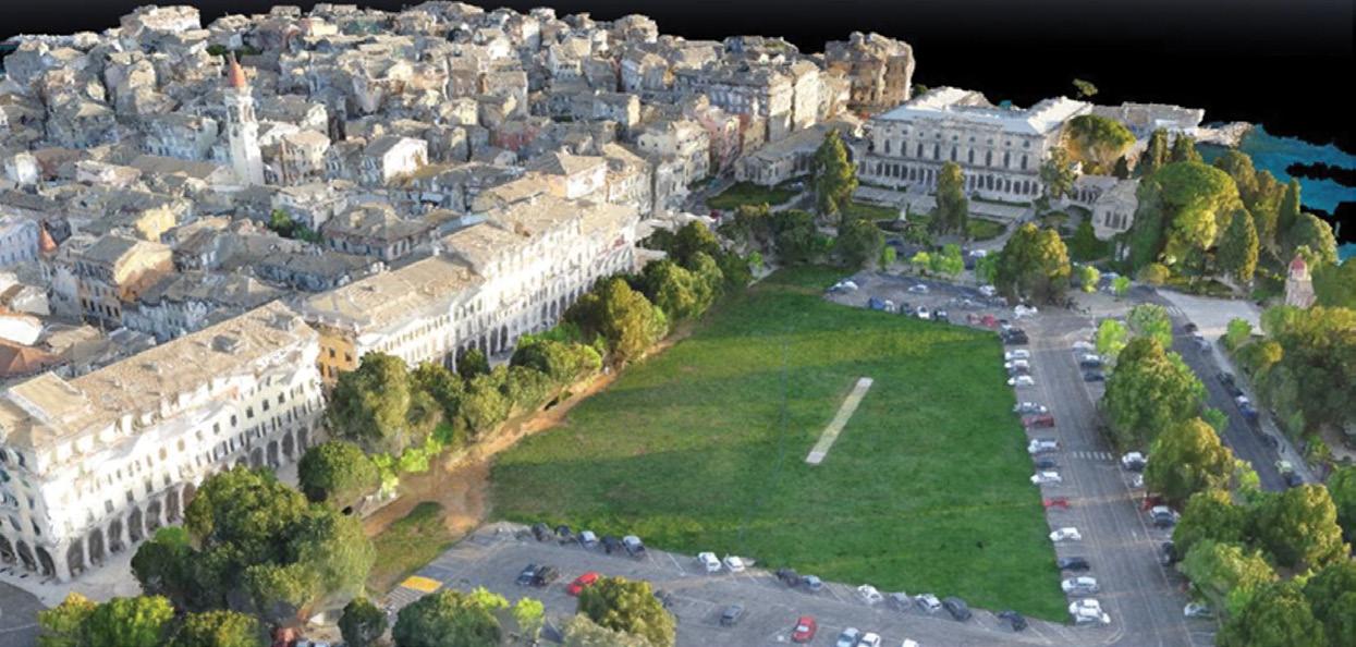
Aerial photogrammetric survey for the Special Urban Planning Study of Corfu Old Town
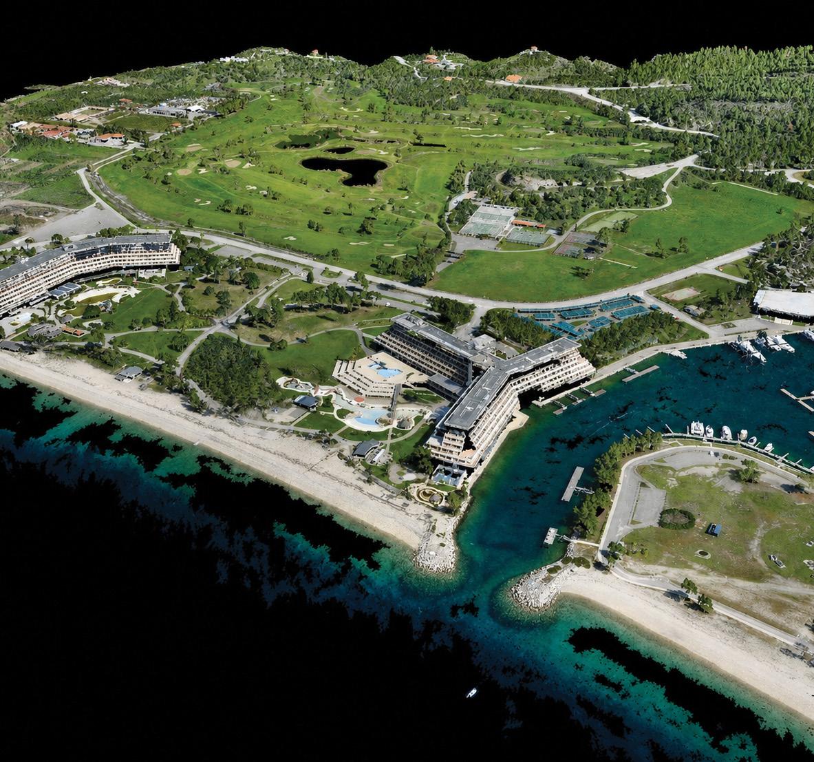
Aerial survey of a hotel complex using UAV systems with integrated GPS
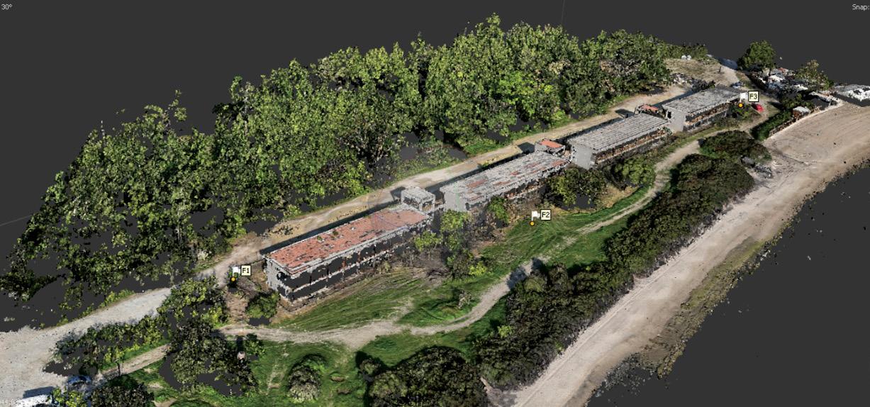
Aerial photogrammetric survey of the Kipoi Evros Customs Office
Aerial photogrammetric survey of the preserved Xenia Paliouri building complex
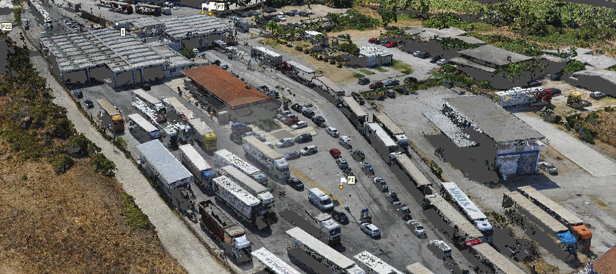
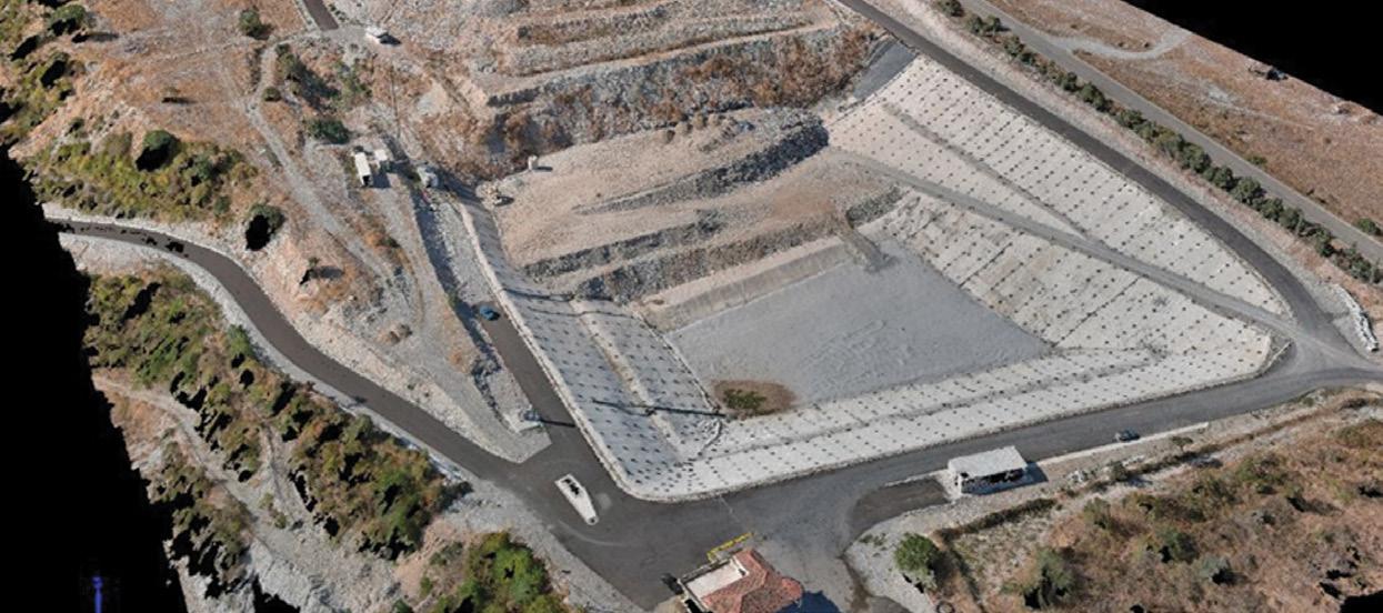
UAV survey at landfill sites
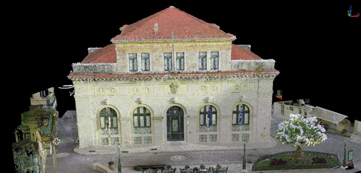
3D laser scanner survey of a listed building in Corfu
Terrestrial Laser Scanning (TLS)

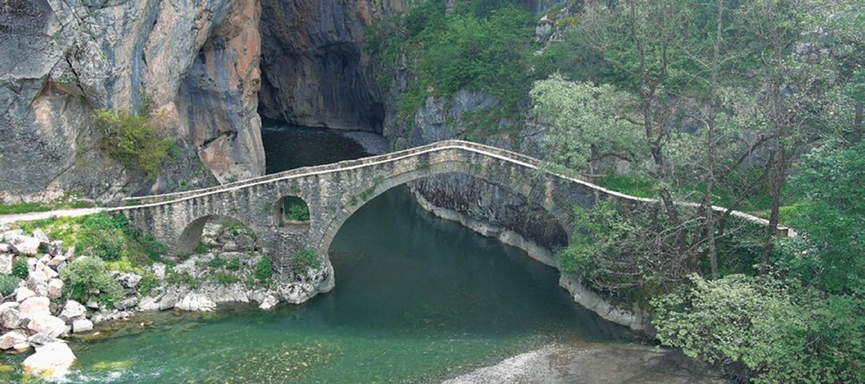
Terrestrial laser scanner surveys of stone bridges in Western Macedonia
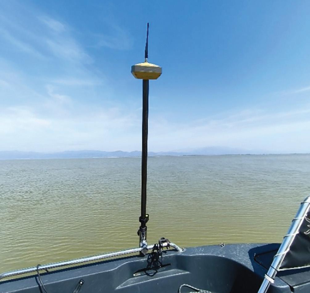
Bathymetric surveys using echo-sounding equipment and GPS at Lake Vistonida
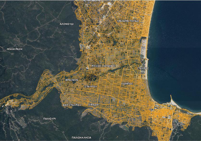

Within the framework of cadastral mapping for the remaining areas of the Regional Unit of Thessaloniki, tasks involving the collection and processing of cadastral data, the development of digital basemaps, and the preparation of cadastral tables and diagrams were carried out in 19 areas, contributing to the creation of a modern and reliable cadastral system.
The production of high-accuracy digital orthophotos and aerial imagery is carried out through modern aerial photography campaigns and advanced photogrammetric methods, providing reliable geospatial data for mapping applications, spatial planning, engineering studies, and infrastructure management.
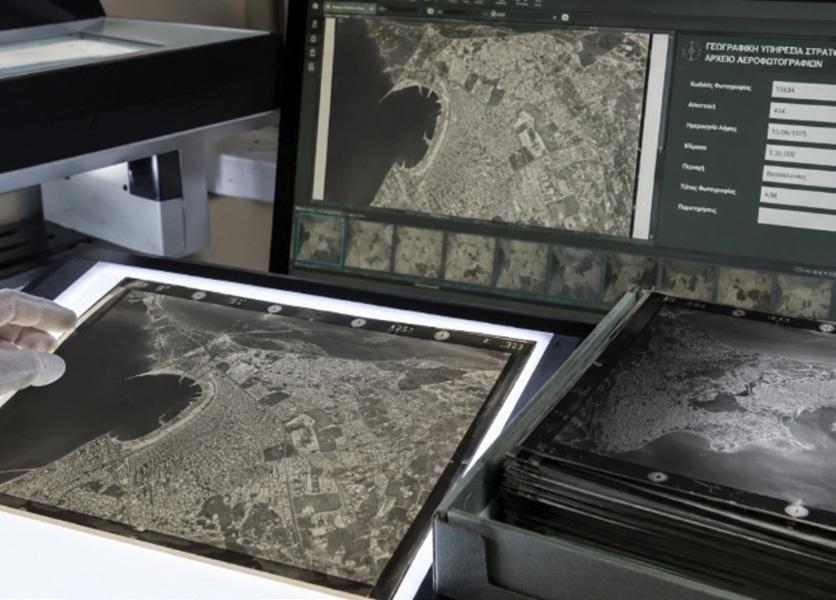
The project concerns the digitization and utilization of the historical aerial photography archive of the Hellenic Military Geographical Service, aiming at the preservation, organization, and digital dissemination of valuable geospatial material.
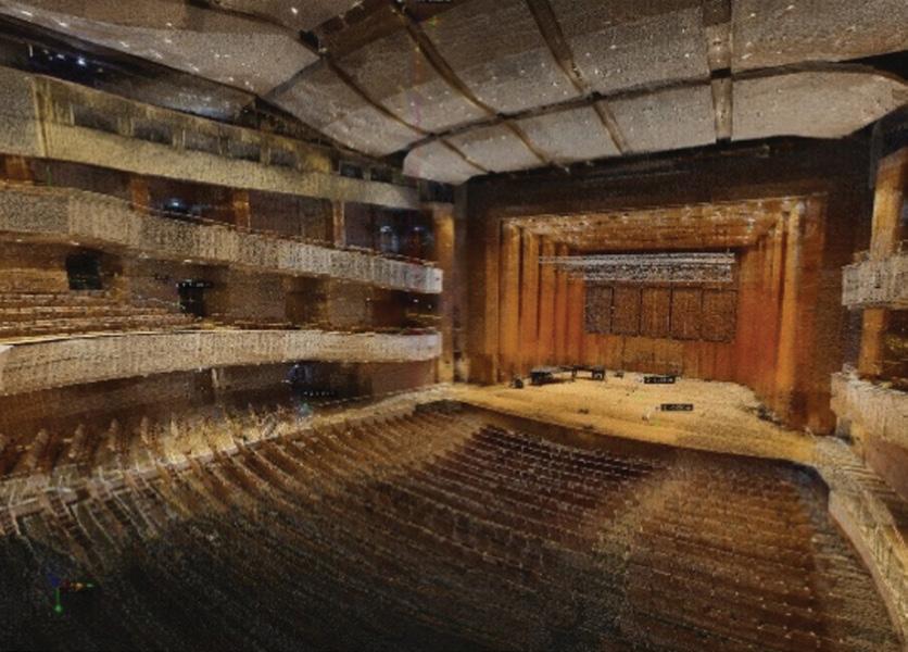
Three-dimensional surveying and regulatory compliance inspection of Buildings M1 and M2 of the Thessaloniki Concert Hall, aiming at the creation of an accurate 3D digital basemap and the technical documentation of the facilities.
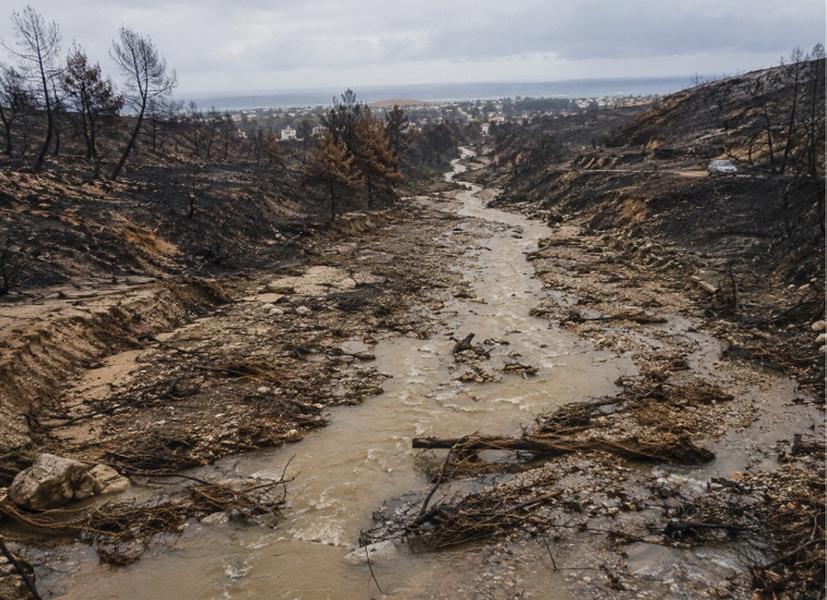
The project concerns the creation of a topographic basemap and expropriation study for flood protection works in the Municipality of Alexandroupoli, aiming to address the impacts caused by the August 2023 wildfires. Within the framework of the project, specialized high-accuracy topographic and cadastral works are being implemented.
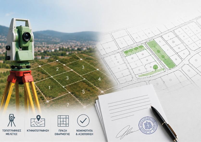
• Agios Nikolaos - Koube, Perivolia, and Kallithea of the Rethymno Municipal Unit
• Planning Unit 15 of the Pylaia Municipal Unit, Municipality of Pylaia -Chortiatis
• Planning Units 17 and 14 of the Polichni Municipal Unit
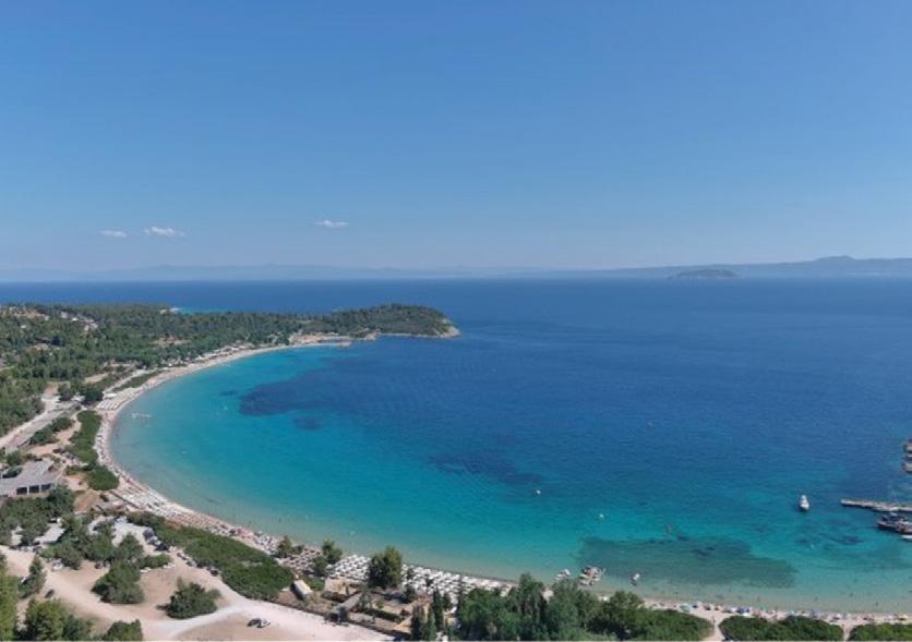
A project with high technical requirements, including the preparation of topographic diagrams, the development of a digital terrain model, and the production of orthophoto maps, contributing to the future utilization of the area through modern technologies and specialized expertise.
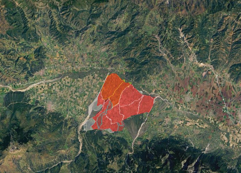
The land consolidation project of the Eastern Vistriza agricultural area aims to improve land utilization and agricultural development. The project includes topographic and cadastral works, preparation of cartographic basemaps, and redesign of land parcels, contributing to the creation of more functional agricultural holdings.

Consortis Geospatial integrates Earth Observation technologies to provide high added-value solutions for geospatial analysis. We invest in the processing and analysis of satellite data in order to transform raw information into critical knowledge that supports decision-making across a wide range of applications.
At Consortis Geospatial, Earth Observation is a tool for understanding our constantly changing world. We leverage data from the most advanced satellite constellations, including the Copernicus Program, to provide services in:
1. Monitoring of natural and anthropogenic environments for the study of climate change, biodiversity, ecosystems, and urban areas.
2. Disaster management through early forecasting, impact mapping, and support for mitigation and recovery planning.
3. Urban and rural development through precise monitoring of cities, infrastructure, and agricultural production.
4. Production of high-resolution and high-accuracy digital terrain and surface models.
The company systematically invests in cutting-edge technologies by combining Earth Observation with Artificial Intelligence (AI) and Machine Learning (ML). This synergy enables automated pattern extraction, KPI generation, and change detection at both regional and local scales, ensuring that our clients have access to the most reliable and up-to-date geospatial data.
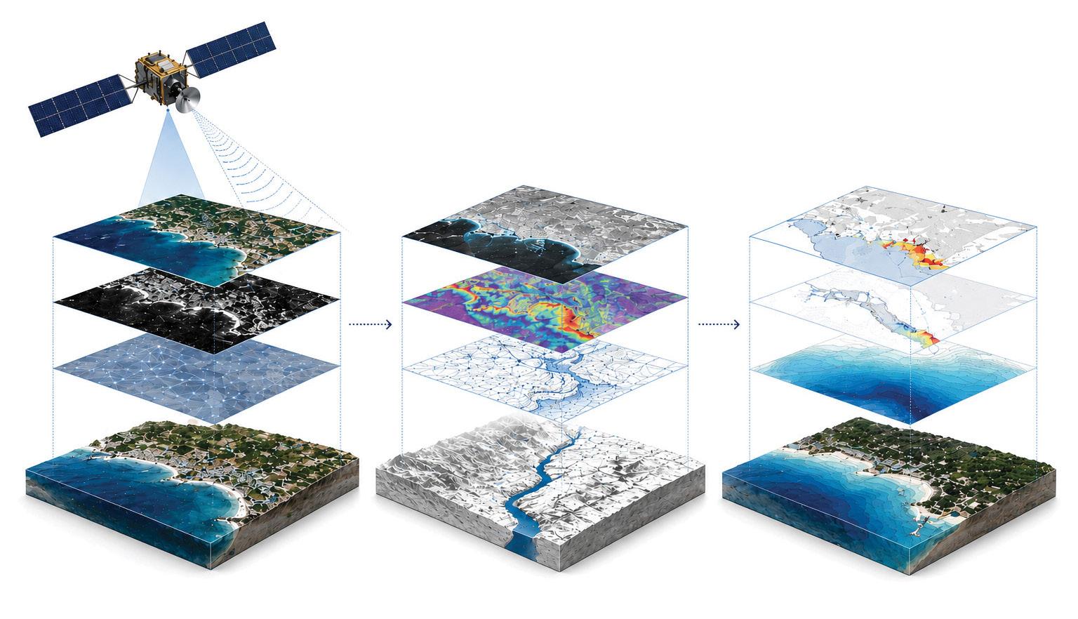
• Provision and analysis of optical, multispectral, and radar satellite imagery
• Collection, processing, and management of Earth Observation data for terrestrial and marine environments
• Big Data management
• Development and implementation of AI/ML techniques for algorithmic optimization and extraction of innovative, reliable results
• LiDAR applications
• Aerial / Mobile Mapping
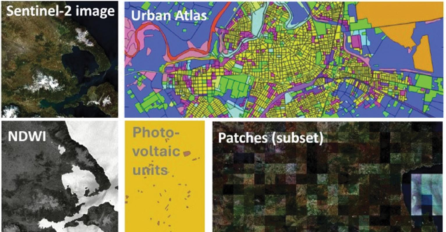
The Sat4GAIA project (Axis 3) concerns the development of advanced satellite services for land use monitoring, enhancing national capabilities in the field of space applications within the Copernicus and GEOSS frameworks, with funding from the Recovery and Resilience Facility (RRF). Through the utilization of microsatellite data, tools are being developed for change detection analysis, Land Use / Land Cover (LULC) mapping, smart agriculture support, and natural hazard management with early warning capabilities, thus contributing to improved decision-making, environmental protection, and sustainable development.
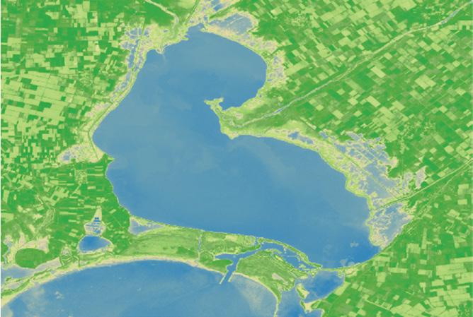
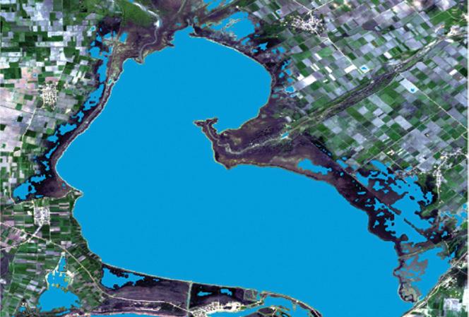
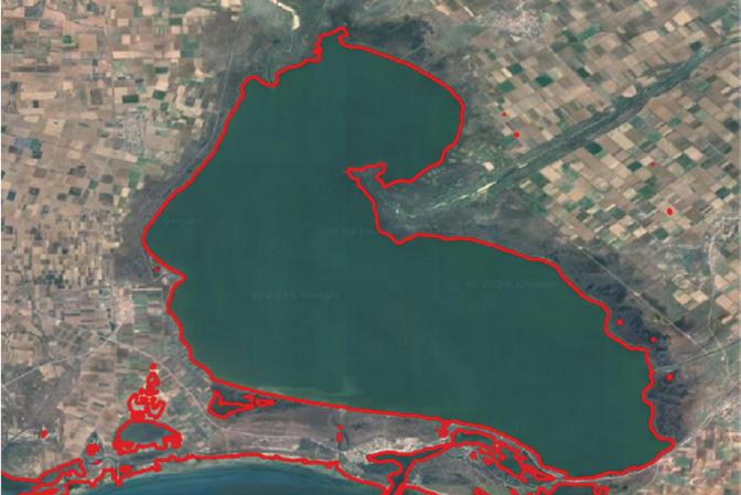
The analysis of satellite imagery (optical and radar) enables the monitoring of coastline changes and the detection of flooded areas. Through data processing, critical areas of high interest, significant coastline change trends, and the impact of natural phenomena on the coastal environment are identified. The use of these technologies supports the effective management and protection of coastal areas, while also enhancing informed decision-making and natural disaster prevention.
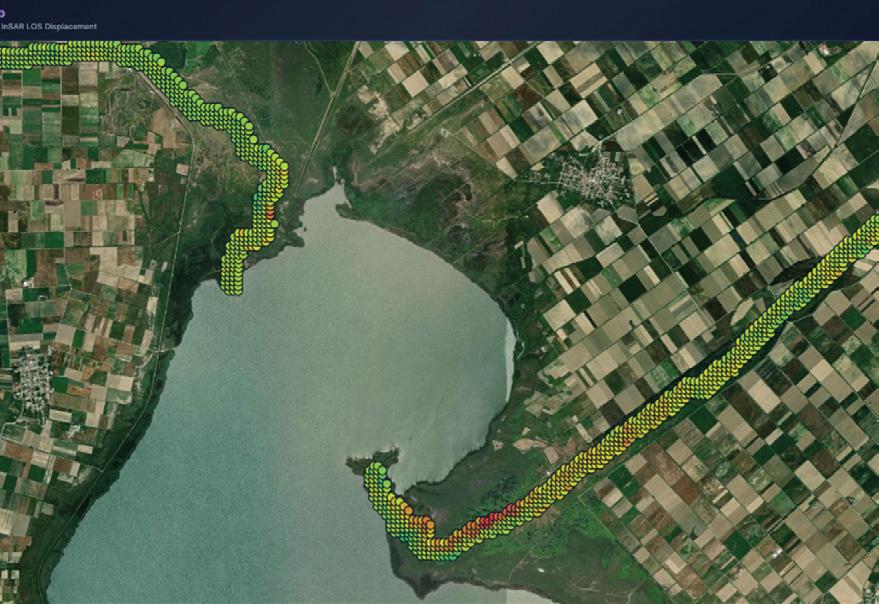
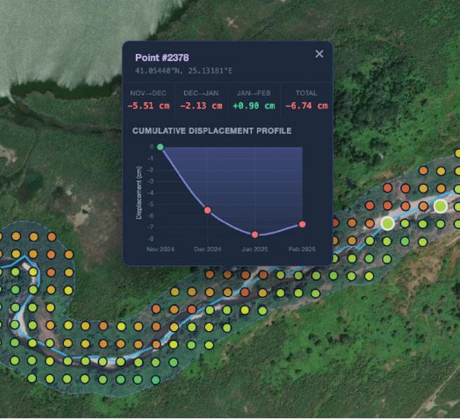
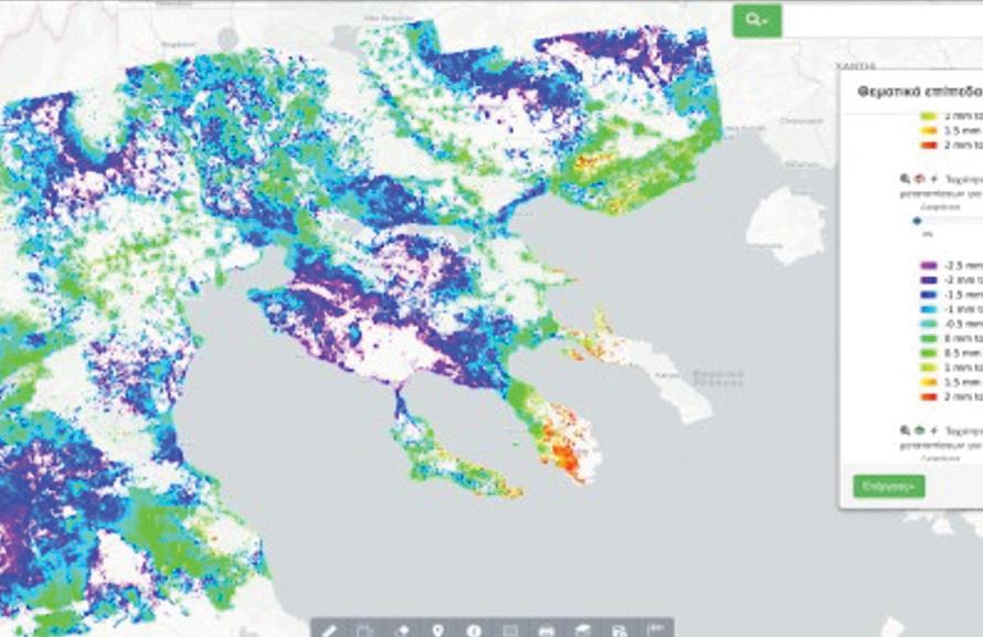
Through the analysis of radar satellite data using InSAR, we support the long-term monitoring of vertical ground deformation along river corridors and watercourses. The processed data are transformed into thematic maps and diagrams that highlight areas of significant subsidence or uplift, helping authorities plan targeted management and maintenance interventions. This methodology also contributes to the identification of sediment deposition patterns, supporting watercourse cleaning operations and the monitoring of long-term morphological evolution.
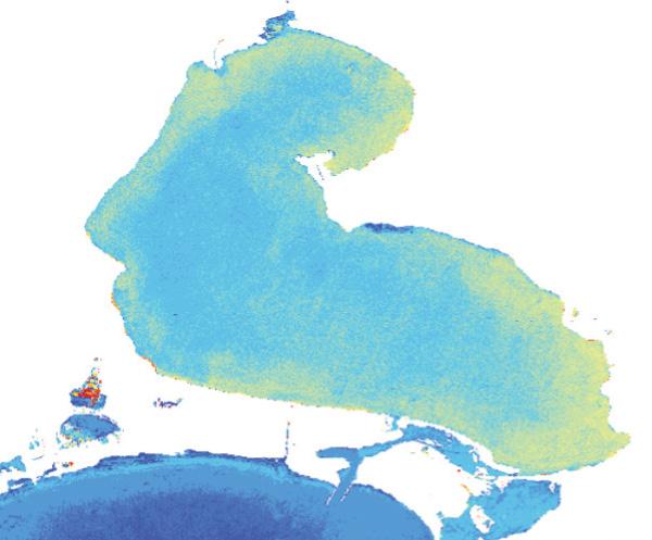
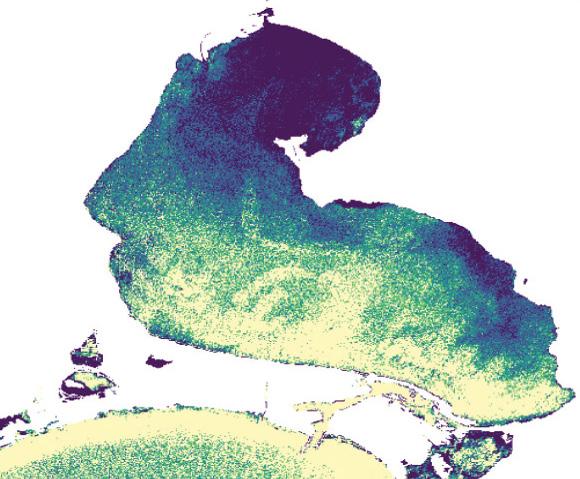
The utilization of Earth Observation techniques can provide reliable results for bathymetry estimation in both shallow and deeper waters. The use of different wavelengths enables the detection of the spectral characteristics of water bodies and their substrates, providing information regarding bathymetry, water clarity, biological productivity, and seabed composition. These results constitute a valuable tool for researchers, water management authorities, and policy makers, reducing the need for extensive in-situ data collection.

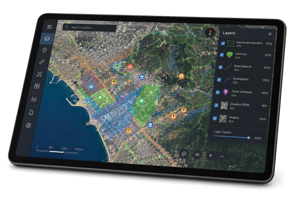
The GIS & Application Development Department of Consortis Geospatial is a specialized center of expertise in geospatial information, with a strong presence in the design and implementation of integrated digital mapping, spatial analysis, and geospatial data management solutions.
Our team combines scientific knowledge, technological expertise, and practical experience to develop modern applications and systems that enable efficient visualization, processing, and utilization of spatial information.
With a strong focus on the creation of reliable cartographic basemaps, mapping applications, and decision-support tools, the GIS & Application Development Department plays a key role in the organization, monitoring, and strategic planning of complex projects.
Leveraging modern technologies and flexible geospatial infrastructures, we deliver highly functional, value-added solutions tailored to the real needs of each organization and project.
• Collection, processing & management of geospatial data
• Creation of spatial databases
• Spatial data analysis
• Digital cartography services
• Photogrammetry services
• Asset management (green infrastructure, fleet, cultural heritage)
• Development of early warning systems for natural phenomena
• Web and mobile application development
• IoT application development
Our collaboration with Consortis Geospatial on the upgrade of the Road and Junction Accident Registry System was exemplary. Their advanced technologies and the integration of geospatial data visualization significantly improved our operational efficiency and user satisfaction. Consortis Geospatial’s unwavering support and deep understanding of our needs played a key role in achieving a smooth transition and immediate improvements in the way we operate.
Aikaterini
Fassou,
Deputy Head of Infrastructure Safety Department D14, Ministry of Infrastructure and Transport
Our collaboration with the Consortis Geospatial team was excellent. They stood by our side every step of the way, implementing a telemetry data visualization and monitoring platform for transboundary watershed areas with exceptional attention to detail and a strong commitment to meeting all our requirements.
The team’s scientific approach and professional expertise exceeded our expectations, while their continued support even after the project’s completion ensures the platform’s proper and efficient operation.
Georgios
Kampas,
Head of Water Division, Eastern Macedonia - Thrace
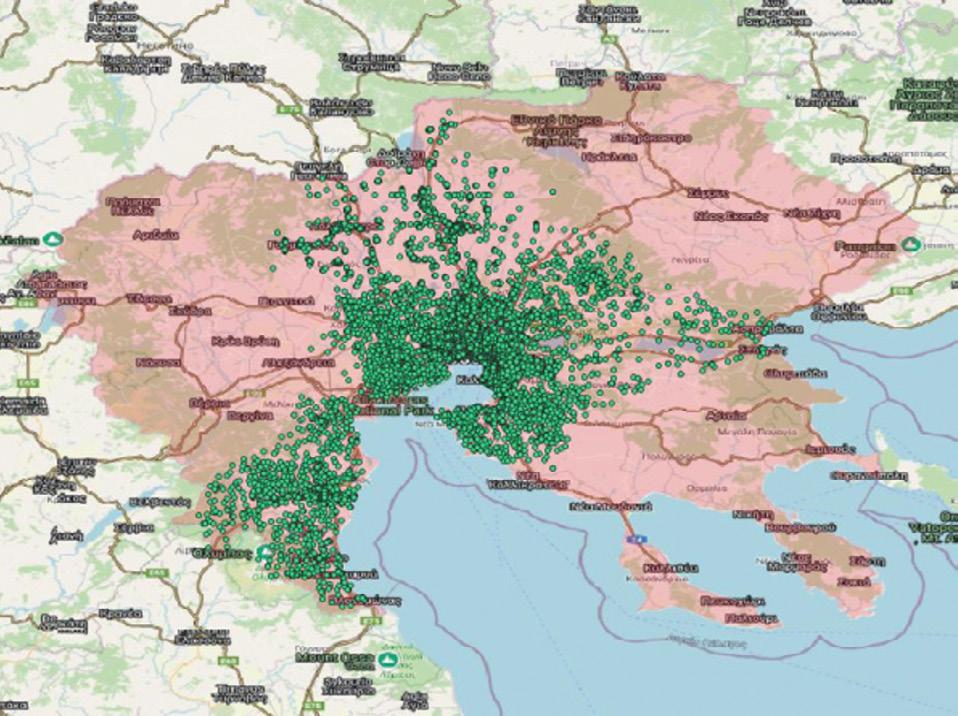
Developed under the “ANTONIS TRITSIS” program and the “Digital Convergence” axis, the Interoperable Geospatial Information System aims to consolidate and efficiently manage fragmented geospatial data through a modern digital platform. The system collects, manages, and disseminates information while enabling interoperability between different Directorates of the Region.
The solution includes the digitization and integration of large volumes of data, development of management and monitoring subsystems, and the use of advanced technologies and datasets including satellite data, IoT and time series data to support operational functions and Key Performance Indicators (KPIs).
Build on open standards, the EVRYMAP web-based platform ensures interoperability, scalability, and easy access to geospatial information. The system enhances decisionmaking, service efficiency, and strengthens the digital capabilities of personnel.
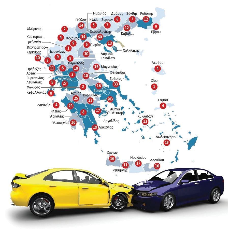
A desktop GIS application, with the prospect of further upgrading into a fully web-based application. The system enables rapid accident search by route and linear reference using maps, generation of reports, and accident statistics per year, route, etc.
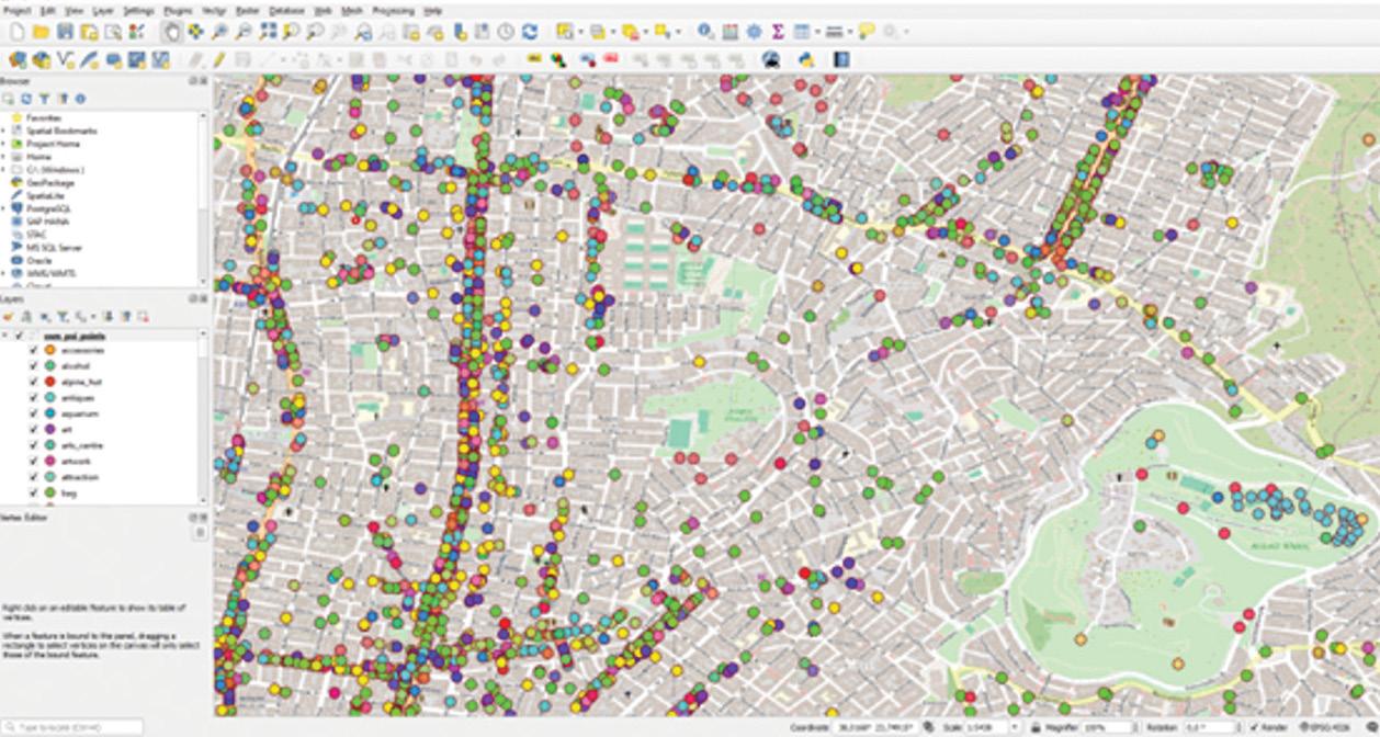
For the Municipality of Athens, we developed an automated OpenStreetMap (OSM) data synchronization mechanism based on PostgreSQL/PostGIS, ensuring continuously updated, reliable geospatial data for municipal operations.
Built with open-source technologies and Docker-based containerization, the solution delivers a resilient and automated infrastructure for efficiently integrating OSM updates, streamlining workflows, and reducing operational effort.
The platform supports key applications such as spatial planning, routing, and accessibility analysis, contributing to sustainable mobility and improving citizens’ daily lives, especially for vulnerable social groups.
By enhancing data reliability and operational efficiency, the solution supports better decision-making and contributes to the Municipality’s transition toward a modern, interconnected digital governance model.
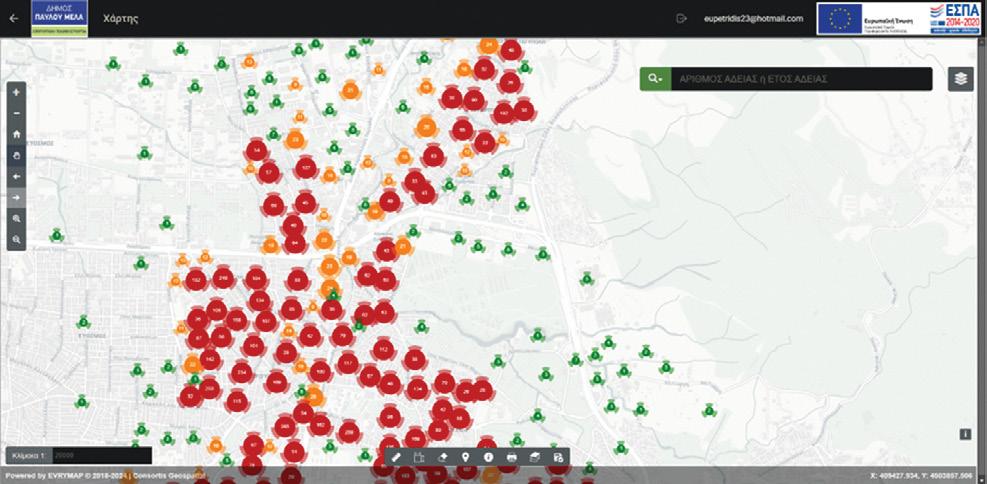
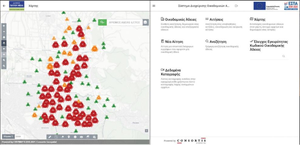
Public access to the physical archive of existing building permits of the Pavlos Melas Municipality through a user-friendly UI.
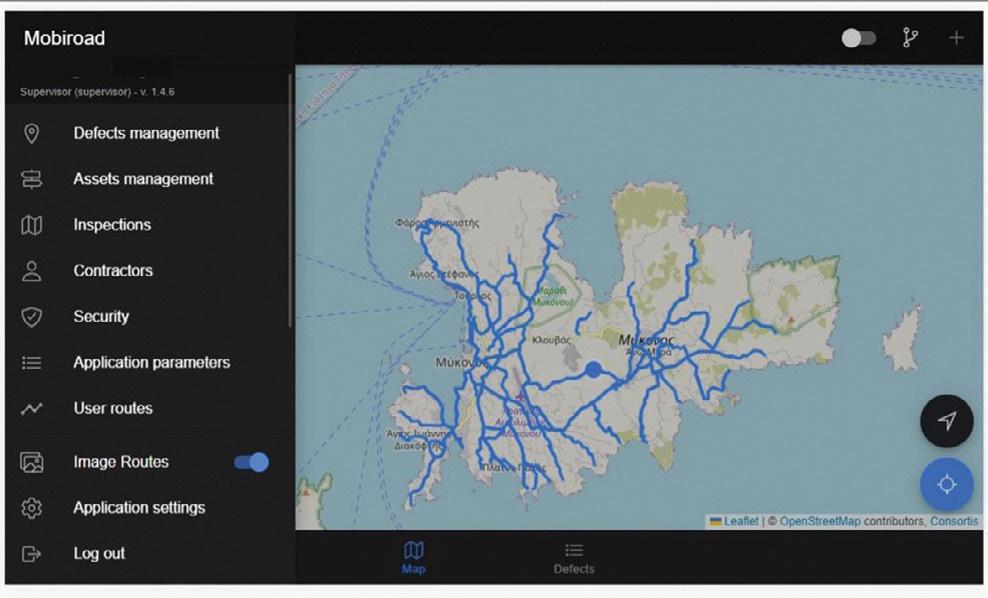
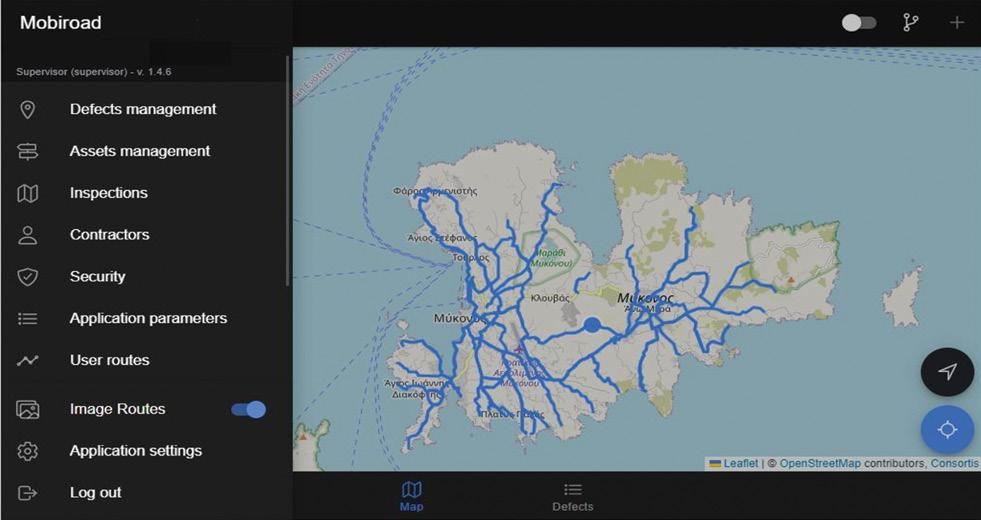
Mobiroad© is a specialized mobile and web-based application for the recording, analysis, and management of road infrastructure assets and defects.
For the road network of Mykonos, Mobiroad© served as the central data management platform, supporting the collection, organization, and analysis of information essential for effective maintenance.
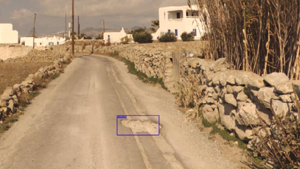
The assets were captured using Mobile Mapping techniques, while the project also provided an excellent testing ground for our experimental Machine Learning (ML) algorithm.
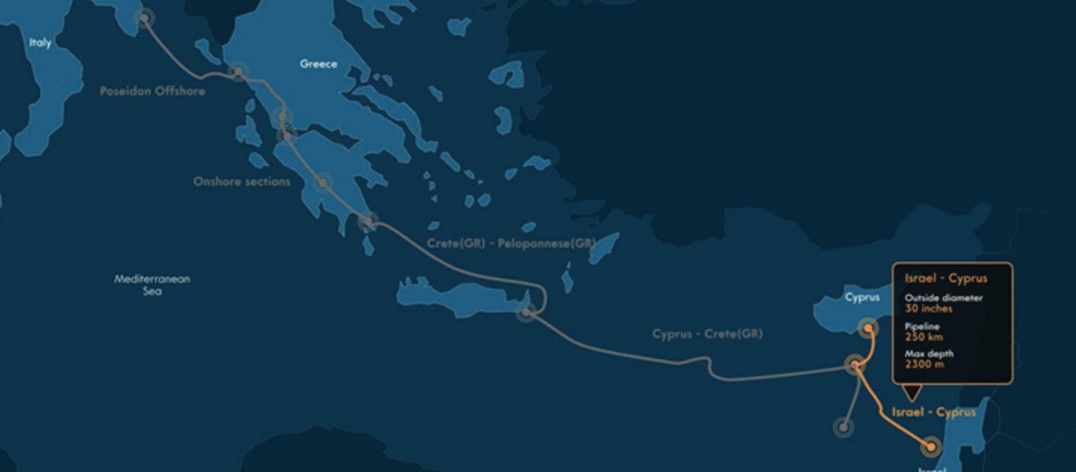
Figure 1: The EastMed Pipeline (https://igi-poseidon.com )
Consortis Geospatial, in collaboration with the Surveying Department, provided support services to IGI Poseidon regarding the acquisition of the land required for the onshore facilities. Our company carried out the above activities in both Greece and Cyprus.
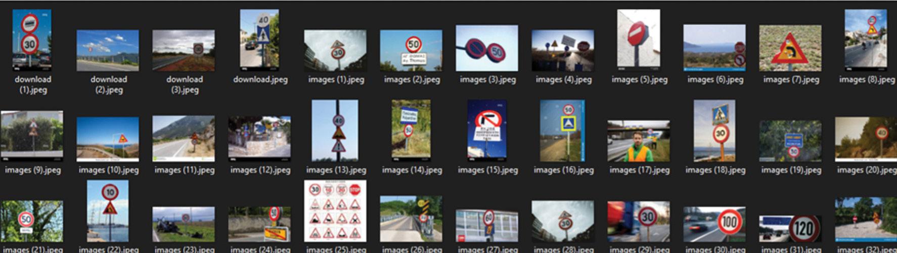
An innovative mapping and GIS system capable of operating as a Software as a Service (SaaS) platform. This application can serve as the first step toward the “gamification” of navigation in urban environments, as well as an educational tool for younger users.
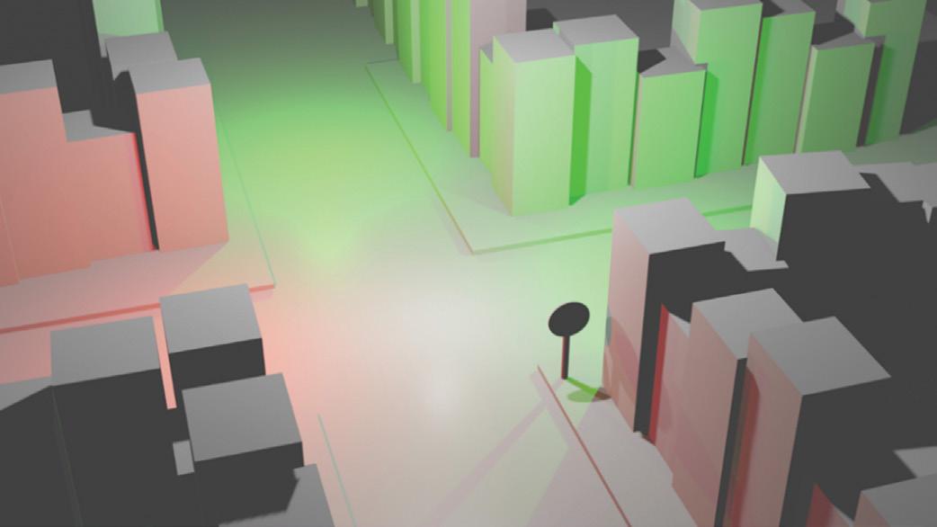
A web-based GIS platform designed to support decision-making and the evaluation of alternative development strategies for coastal zones, aiming at the prevention and management of coastal erosion risk under the impacts of climate change.
EVRYMAP is a customizable online map portal that enables organizations to share geospatial data securely and efficiently, both internally and externally.
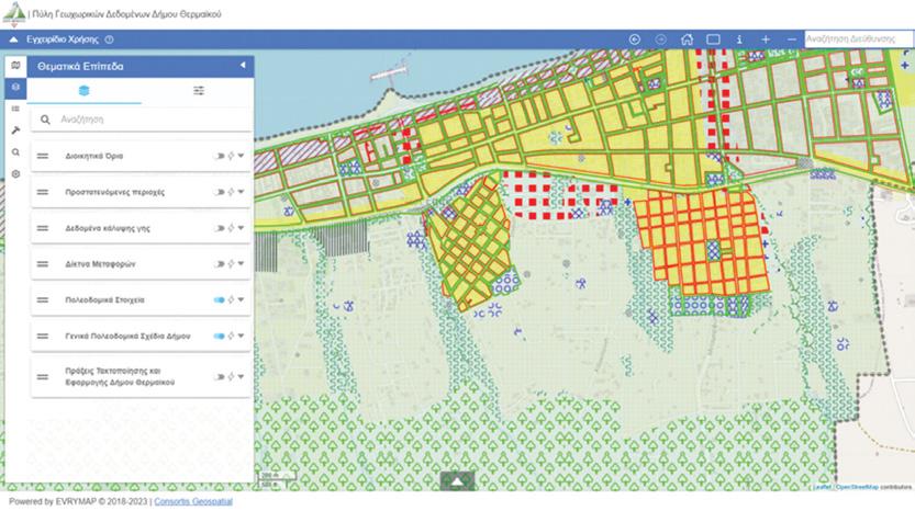
With its scalable architecture, comprehensive toolset, flexible configuration options, and powerful access management console, EVRYMAP offers a complete environment for publishing and managing maps and thematic layers. Users can easily search, visualize, explore, and download geospatial data through an intuitive web interface.
• Simple Administration: Easily manage and configure the map portal through a user-friendly administration environment.
• Search and Geolocation: Quickly search for map features, locations, addresses, or other spatial elements, and perform geolocation directly within the portal.
• Real-Time Urban Planning Data: Access and download up-to-date urban planning information, including building conditions, permitted land uses, and related documentation.
• Integration with External Data Sources: Connect to external spatial data sources using OGC standards such as WMS, WFS, WMTS, WCS, and CSW.
• Data Viewing and Downloading: View, explore, and download geospatial data directly through the portal interface.
• Map Printing: Create and print maps directly from the portal using integrated map printing tools.
• Flexible Data Export: Export selected datasets in multiple file formats, according to the options defined by the administrator.




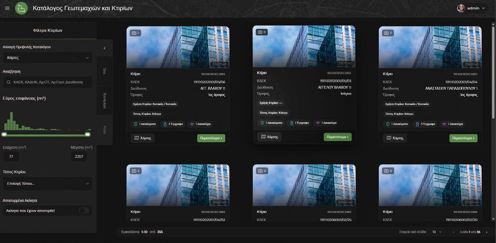
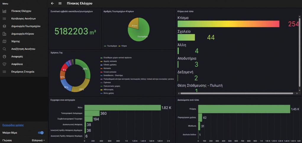
The application is already in active use by numerous municipalities, helping staff improve citizen services, strengthen collaboration with other departments and organizations and significantly reduce administrative workload while saving public resources.
• Quick and Easy Overview: Gain a clear, comprehensive and intuitive overview of real estate assets.
• Real Estate Registration and Processing: Streamline the registration processing and management of land and building information.
• Improve Citizen Services: Enhance citizen services by providing easy access to real estate information, documentation and related services.
• Interdepartmental Collaboration: Facilitates seamless collaboration and communication between departments involved in real estate management.
• Open-Source GIS Capabilities: Leverage open-source GIS technologies for advanced mapping, spatial analysis and location-based asset management.


MAPtheYA is an advanced GIS-based information system designed for water utilities, providing comprehensive management, monitoring, and supervision of water supply and drainage networks. The platform helps optimize network performance, improve operational efficiency, and reduce maintenance and operational costs.
Key Features
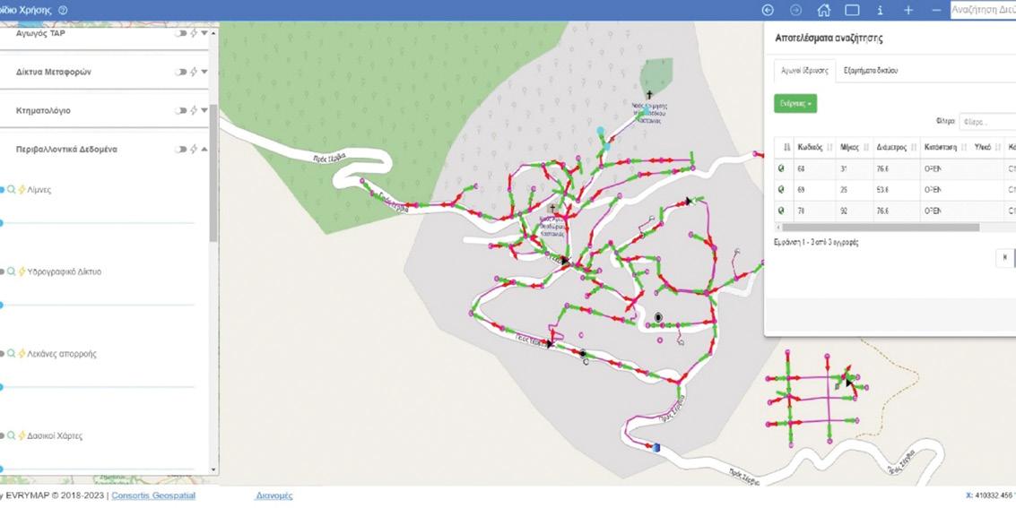

• Unified Mapping Environment: View, manage and edit water supply networks through a single, integrated mapping interface.
• Topological Rules and Data Integrity: Apply topological rules to ensure correct hydraulic connectivity, network consistency and reliable spatial data.
• Integration with External Systems: Seamlessly integrate with external platforms such as SCADA, CMS, ERP systems through REST APIs for enhanced interoperability.
• Hydraulic Modeling: Perform hydraulic modeling through EPANET to simulate flows, pressures, reservoir levels, and water quality parameters.
• Scenario Evaluation: Evaluate what-if operational scenarios and emergency events using graphical outputs and thematic map visualizations.
• Consumer Data Management: Record and manage consumer-related data to support effective customer service and operational planning.
• Role-Based User Access: Define user roles and permissions through administrator-controlled access management.
• Geometric Network Management: Manage the water supply network as a geometric network and use emergency response tools to quicky address defects, leaks, and other critical incidents.

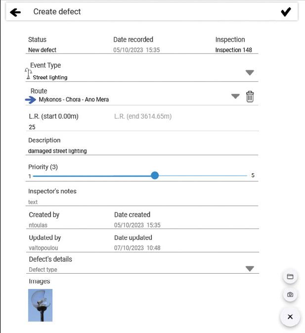
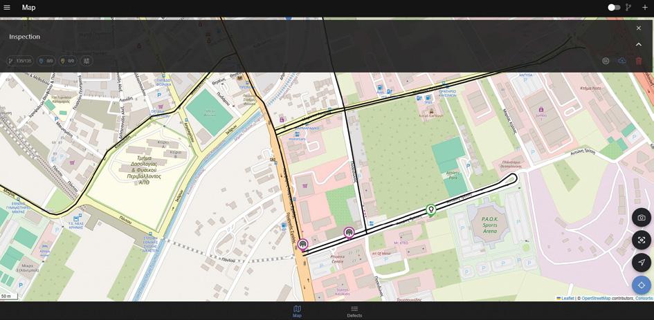
A web-based management platform designed specifically for organizations responsible for the maintenance and supervision of public assets. The solution consists of two complementary applications that share a common database, ensuring seamless coordination between office-based management and field operations.
1. 2 .
Web Office Application: Manage operations, monitor asset condition, organize inspections, and coordinate maintenance activities through a centralized web-based environment.
Mobile Application: Carry out field inspections, record defects, collect georeferenced data, and update asset information directly on site through the mobile app.
The platform is fully extensible and customizable, allowing it to adapt to the specific operational needs, workflows, and asset categories of each organization.
A specialized solution designed specifically for highway authorities and organizations responsible for managing road networks. The platform streamlines the full road network inspection and maintenance workflow, from asset collection and defect recording to repair assignment, monitoring, and reporting.
KEY FEATURES
• Mobile-first application
• Map-Based Feature Collection
• Customizable Asset and Defect Types
• Linear Referencing System
• Workflow management
• Online/offline inspections
• Price list configuration
• User and role management
• Assignment of repair works to external contractors
• Report generation
Tailored for urban environments, MobiCity enhances city infrastructure management by focusing on inspections and maintenance of urban assets.
KEY FEATURES
• XY and Street Address Recording
• Indexing of urban Asset Types
• Issue Reporting and Tracking
• Real-time communication with all stakeholders



Specialized in the management of parks and green spaces, focusing on the maintenance of natural assets and recreational facilities.
KEY FEATURES
• Asset Catalog
• Green Area Health Monitoring
• Public Engagement
• Maintenance Scheduling

Focused on industrial asset management, Mobi Industry supports the monitoring and maintenance of critical infrastructure within industrial plants and facilities.
KEY FEATURES
• Plant Asset Management
• Issue Detection and Resolution
• Safety and Compliance
• Contractor Management

Consortis Geospatial offers you access to earth observation data and images from Pasco’s ALOS and ALOS-2 satellites.
• Ability to compare the evolution of areas over different time periods, enabling informed conclusions across a wide range of activities
• Reliable and accurate data supports smart decision-making and drives development in every sector.
Contact us today for more information and let us help you choose the right sensor according to your specific needs. Consortis Geospatial is committed to delivering high-quality Earth Observation solutions tailored to optimize your project outcomes.
www.pasco.co.jp/eng/

Thessaloniki
Phoenix Centre | 27 Georgikis Scholis Avenue | P.O. Box 4318 | 57001 Pylaia Τ. +30 2310 889336 | +30 2310 888333
Athens
5 Lykavittou Street | 10672 Kolonaki | Τ. +30 210 3639799
www.consortis-geo.gr
email: geospatial@consortis.gr