EMP3 Changes of Use of Employment Land or Premises
EMP4 Rural Enterprise Sites
EMP5 Aligning Skills and Jobs
EMP6 Locations for Employment Development
EMP7 Non-B or E(g) Use Classes in Employment Areas
Housing
HOU1 Size, Type and Quality of New Housing
HOU2 Affordable Housing
HOU3 Specialist and Supported Housing
HOU4 Gypsy and Traveller Accommodation
HOU5 Travelling Showpeople Accommodation
HOU6 Protecting Existing Housing
HOU7 Gypsy and Traveller and Travelling Showpeople
Chapter 7 – Ensuring the Vitality of Town Centres
R1 Supporting Town Centres
R2 Development in Basildon Town Centre
R3 Primary Shopping Areas (PSA)
Ensuring the Vitality of Town Centres
R4 Locations for New Retail and Leisure Development outside of Town Centres
R5 Out of Town Retail and Leisure Parks
R6 Hotels
R7 Ensuring the Vitality of Town Centres
R8 Local Centres
Chapter 8 – Meeting the Challenge of Climate Change: resilience, flood risk and greenhouse gas reduction
CC1 Responding to Climate Change
CC2 Addressing Flood Risk
CC3 Water Efficiency and Sustainable Drainage Systems (SuDS)
Meeting the Challenge of Climate Change
CC4 Operational Energy and Carbon (Net Zero) in Homes and Buildings
CC5 Embodied Carbon and Circular Economy in Homes and Buildings
CC6 Renewable & Low Carbon Energy Infrastructure
Chapter 9 – Achieving Well Designed Places
D1 Design and Place Shaping Principles
Achieving Well Designed Places
D2 Major Developments - Design
D3 Design in Smaller Scale Projects
D4 Advertisements
Chapter 10 – Healthy Communities
HC1 Health and Well-being Strategy
Healthy Communities
HC2 Open Spaces, Local Green Spaces, Sport and Recreation
HC3 Strategic Approach to Education, Skills and Learning
Chapter 11 – Conserving the Local Environment
NE1 Conserving and Enhancing the Natural Environment
Conserving the Local Environment
GB1 Protecting the Green Belt
Chapter 12 – Conserving and Enhancing the Historic Environment
GB2 New Development in the Green Belt Conserving and Enhancing the Historic Environment
Chapter 13 – Improving Air Quality and Mitigating Pollution
Improving Air Quality and Mitigating Pollution
AQMP1 Mitigating Environmental Pollution
AQMP2 Contaminated Land
AQMP3 Ensuring Health and Safety in Development
AQMP4 Protecting High Quality Agricultural Land
Chapter 14 – Sustainable Transport and Infrastructure
STAT1 Strategic Transport
STAT2 Transport Network Improvements
STAT3
Managing Congestion
STAT4 Safe and Sustainable Access
STAT5 Parking Standards
Sustainable Transport and Infrastructure
INF1
INF2
Infrastructure Delivery
Securing Infrastructure Contributions
INF3 Social and Community Infrastructure
INF4
INF5
Digital Connectivity
Digital Infrastructure
INF6 Cultural Infrastructure
Part 4 – Detailed Site Allocation Policies
Chapter 15 – Site Allocation Policies
H1 Southeast Billericay
H2A Land at Kennel Lane
H2B Land West of Great Burstead
H3 Land South of Great Burstead
H4 Land West of Laindon Road
H5 Land Adjacent to Tye Common Road and South of London Road
H6 Land North of London Road, Billericay
H7 Land West of Bowers Gifford
H8 Land North of A13
H9 Land West of West Mayne
H10 Land Adjacent to Dunton Road
H11 London Road, Vange
H12 Land Adjacent to Nevendon Road
H13 Land Adjacent to Wick Country Park
H14 Land North of Southend Road, Shotgate
H15 Land South of Barn Hall, Wickford
H16 Land North of London Road, Wickford
H17 Land South of London Road, Wickford
H18 Land North of Wash Road
H19 North Benfleet Plotlands
H20 Land North of Dry Street
H21 Gardiners Lane South
H22 Land South of Wash Road
H23A-J Crays Hill
H24A Land East of Castledon Road
H24B Land West of Castledon Road
H25 Ramsden Bellhouse
H26 Land at Mountnessing Road
H27A Land to the Rear of Potash Road
H27B Land at Potash Road
H28 Land East of Bowers Gifford
H29 Land East of Laindon Road
H30 Land at Bell’s Hills Road
Gypsy and Traveller Allocations
GT1 Land South of Harrow Road
Employment Allocations
E1 Burnt Mills
E2 Dunton Boot Sale
E3 Land Adjacent to Hovefields Avenue
E4 Land West of Canvey Way
E5 Friern Manor Farm
E6 South of Nevendon Road
E7 South of Fanton Hall Farm
E8 Bonvilles Farm Extension
PART 1: Context
Foreword
Basildon Borough is a vibrant and growing community, and this Local Plan sets out how we will manage that growth and development through to 2043. It represents a significant milestone in shaping the future of our borough, ensuring that development is sustainable, infrastructure is resilient, and opportunities are maximised for all who live and work here.
Guided by the National Planning Policy Framework (NPPF), this Plan is both aspirational and realistic in its approach. It clearly outlines what is acceptable in planning terms, and just as importantly, what is not. It is built on a robust foundation of evidence, commissioned and developed by the Council, to ensure that our policies reflect the needs of our residents and the ambitions of our borough.
Basildon’s population has grown by over 6% since the last Census, with a notable increase in residents aged 25–34. This is a clear signal that Basildon is a place where people want to build their lives. Our Local Plan must respond to this demand, providing affordable homes, supporting economic growth, protecting our environment, and delivering the infrastructure that underpins a thriving community.
Planning is a powerful tool in shaping the places we live, and this Plan will provide clarity and certainty about where development is appropriate. It will help us protect what matters most while enabling progress where it is needed.
As we move through each stage of consultation, it is vital that our residents, businesses, and stakeholders engage with the process. Your input will help ensure that the final Plan reflects our shared priorities and aspirations, complies with national policy, and delivers the best possible outcomes for Basildon.
Together, we can shape a future that works for everyone.
Gary Jones Chief Executive
Chapter 1: Introduction
1.1 The Local Plan sets out the vision for future development in the Borough of Basildon. National policy requires every area in England and Wales to have an up-to-date Local Plan in place, and for it to be reviewed at least every five years.
1.2 It also establishes the policies that will guide development proposals of all scales, ensuring they contribute positively to the delivery of the Local Plan.
1.3 This Local Plan forms the Development Plan for Basildon Borough Council. Its policies will replace the 2007 Saved Policies from the Basildon District Local Plan, originally adopted in 1998.
Borough are supported by policies that sets out a strategic approach of how sustainable development will be achieved to ensure benefits for existing communities and new ones for.
1.9 As set out in Paragraph 21 of the NPPF (December 2024), the Local Plan must clearly distinguish between strategic policies and non-strategic planning policies. As such, this document will be structured in the following Parts:
• Part 2 – Spatial Strategy sets out the Spatial Portrait, the Spatial Vision and Objectives, and the Settlement Hierarchy. These Strategic Objectives form the overarching Strategic Policies for the Plan.
What is a Local Plan and How to Use It
1.4 Local Plans are used to inform planning related decisions, including the determination of planning applications. In effect, they serve as the local guide to what can be built and where, shaping infrastructure investment and determining the future pattern of development in the Borough.
1.5 This document covers all planning matters except those relating to waste disposal and mineral extraction.
1.6 This version of the Local Plan is being published for consultation in accordance with Regulation 18 of the Town and Country Planning (Local Planning) (England) Regulations 2012.
1.7 This document comprises the full suite of Strategic Policies Allocation Policies and Development Management policies.
1.8 A Vision and Objectives for future development and inclusive growth within the
• Part 3 – Themed Planning Policies:
◦ Strategic policies guide broader large-scale development of the Borough as a whole and in the wider context of South Essex; including how large-scale developments will be brought forward in sufficient time and quantity over the plan period.
◦ Development Management policies guide assessment of smaller-scale developments bespoke to our Borough. It was appropriate to place these policies under the relevant policy themes to make the Local Plan easier to follow and to ensure that all development contributes effectively to the delivery of our Local Plan’s Vision and Objectives.
• Part 4- Site Allocation Policies identifies specific locations for development. The Strategic Policies provide the wider framework for how the Council, working in partnership with others, will respond to the vision and objectives for development and change within the Borough over the Plan Period. These
policies establish the basis for joint working, managing development and supporting service provision. They also set out a borough-wide approach for guiding development to designated parts of the Borough, and include mechanisms for delivering infrastructure, as well as protecting and enhancing the built and natural environment, including the Green Belt. The Allocation Policies identify the specific locations where development and change will occur. To ensure that development supports the vision and objectives of the Local plan, a Vision and Core Principles for each allocation has been created, setting out the types of development which the Council will support and encourage, along with any mitigation measures including infrastructure provision, phasing for delivery.
1.10 The policies in the Local Plan may be supported by Supplementary Planning Documents (SPDs) which will provide further local guidance on specific elements of development. This could include the application of vehicle parking standards; design in plotland sites or the use of nature-based solutions for climate resilience. SPDs may also assist in coordinating or managing development in specific areas, such as town centres or conservation areas. An SPD can be prepared at any time to supplement the Local Plan and support its delivery.
1.11 Furthermore, the Local Plan can be supplemented by Neighbourhood Plans, prepared by Local Councils or Neighbourhood Forums, in accordance with the Localism Act 2011. These could establish additional planning policies for managing development within smaller, distinctive localities, consistent with the Local Plan. Once “made”, Neighbourhood Plans are part of the statutory Development Plan for the Borough.
1.12 This Local Plan has been prepared in the context of ongoing joint working across South Essex to address strategic crossboundary matters. A Joint Strategic Plan for The South Essex is being developed. As such,
the proposals in this Local Plan contribute to the shared ambitions for inclusive growth supported by infrastructure set out in that Strategy.
1.13 To ensure that this Local Plan is robust and effectively addresses local issues, all policy preparation has been supported by an evidence base. This evidence includes studies and assessments undertaken to understand both the need for development and growth, their likely impacts, and the physical constraints on development and growth in the Borough.
1.14 As part of the evidence base, an Infrastructure Delivery Plan (IDP) will be prepared. The IDP identifies the additional infrastructure that may be required to support the growth being allocated in the Local Plan. The IDP is an evolving document, which is regularly refined and updated to provide the most current information on infrastructure requirements across the Borough, and therefore is subject to change and amendment as the emerging Plan progresses towards adoption.
Plan Period
1.15 Basildon Borough Council is currently preparing the new Local Plan for the period 2023 to 2043. This will set out how the borough should be developed over the next 20 years, in line with national policy and legislation.
PART 2: Spatial Strategy
Chapter 2: Spatial Portrait
2.1 Basildon Borough lies at the heart of South Essex, 30 miles east of London, covering an area of approximately 42 square miles.
2.2 The Borough comprises the urban areas of Basildon (including Laindon, Noak Bridge and Pitsea), Billericay and Wickford and the three serviced villages of Bowers Gifford, Crays Hill, and Ramsden Bellhouse. Its main settlements are separated by countryside designated as Green Belt, containing several smaller rural settlements. The Green Belt contains two unserviced villages and thirteen plotland settlements. Basildon is the principal town, providing a wide range of services and facilities.
2.3 Basildon Borough is part of the wider South Essex area and works in partnership to deliver excellent digital infrastructure, improved connectivity, high-quality blue and green infrastructure, skills development and quality new homes and commercial development.
Historic Environment
2.4 The main settlement in the Borough is Basildon. It was designated a Mark 1 New Town in 1949 and developed over 50 years to provide structured housing in place of the plotlands and to accommodate London’s expanding population. The New Town Designated Area largely absorbed the villages of Basildon, Laindon, Nevendon, Vange and Pitsea.
2.5 There are three nationally designated Scheduled Monuments in the Borough: Bronze Age earthworks in Norsey Woods, Billericay, and two moated sites at Botelers and West Thorpe, Basildon. The Borough contains four Conservation Areas (Billericay High Street, Little Burstead, Great Burstead, and Noak Bridge) and around 130 Listed Buildings, including two Grade I churches in Great Burstead and Laindon.
Population and Demography
2.6 The population of the Borough has increased significantly since the 1950s following the phased construction of Basildon New Town and the gradual expansion of the older settlements of Billericay and Wickford. The 2021 Census recorded 187,600 residents, an increase of 6.6% since 2011. Basildon (including Laindon and Pitsea) accommodates around two-thirds of the population.
2.7 The South Essex Housing Needs Assessment (SEHNA) (2022) projects a population increase of 34,784 between 2020 and 2050.
2.8 The main changes in the population since 2011 have been an increasing proportion of residents aged between 25-34 (up by 1.1%) and those aged between 50-64 (up by 0.9%).
Transport Connections
2.9 The Borough is served by strategic road networks serving South Essex, including the east-west A127 and A13 to M25 and London and the north-south A130 to the rest of Essex. Providing strategic connections to London, Southend Airport, Stansted Airport, and the ports of Felixstowe Freeport East, Thames Freeport Tilbury and London Gateway.
2.10 Rail connections include two railway lines to the north and south and five stations: Basildon, Laindon, Pitsea, Billericay, and Wickford. Rail services link Billericay and Wickford to Stratford City and London Liverpool Street. Crossrail services are now fully operational from Shenfield, one stop west of Billericay, linking with Reading and Heathrow Airport, via Central London. In the south of the Borough, rail services run between
London Fenchurch Street and Shoeburyness with services to Lakeside Shopping Centre and Dagenham, via a junction at Pitsea.
Landscape and Natural Environment
2.11 The Borough features varied landscapes, from the higher ground of Langdon Hills and Billericay to the flat Thames Estuary at Vange and Bowers marshes. There are three main urban development areas and three serviced settlements, set within arable farmland, permanent grazing with hedgerows, woodland, and a large area of the Thames Estuary’s coastal grazing marshland. The plotlands are characterised by sporadic residential development and a mosaic of scrub, grassland, and woodland habitats.
2.12 The local natural environment is rich in nationally and locally important habitats with six Sites of Special Scientific Interest (SSSIs) ranging from Ancient Woodland and rich grasslands in Billericay to coastal marsh in Vange, Fobbing and Pitsea. There are 49 Local Wildlife Sites (LoWS), Local Nature Reserves (LNRs), and Country Parks with over 150km of Public Rights of Way that provide a means of accessing the open countryside.
2.13 The borough has 782 square kilometres of green infrastructure (21% of the county), 5.3% woodland, and 4,058 miles of Public Rights of Way. Basildon ranks third in the county for green and blue infrastructure, covering 38.4% of the borough. The largest types are natural and semi-natural open spaces, areas around premises, and coastal features (marshes), followed by outdoor sports facilities, parks, gardens, and ancient woodlands.
2.14 There are no internationally or European protected habitats in the Borough, however there are Ramsar Sites, Special Protection Areas (SPA), and Special Areas of Conservation (SAC) within 5km of the Borough boundary,
CHAPTER 2: Spatial Portrait
principally downstream of the River Crouch, the Borough’s main watercourse, which has its source in Little Burstead.
Housing Stock
2.15 The Borough has around 82,000 homes: 63% owner-occupied, 21% socially rented, and 14% privately rented. Housing types include 17% detached, 17% semi-detached, 37% terraced, and 19% flats and others, with 68% having 2-3 bedrooms.
Education Provision and Performance
2.16 In 2024, Essex County Council recorded 49 state primary schools and 9 state secondary schools, five of which have state sixth forms, in the Borough. Educational attainment in both primary and secondary level is slightly lower than the East of England and England averages. The 2021 Census also showed that the skills levels amongst adult residents is low. Only 25% of residents are qualified to NVQ4 and above, and 21% hold only NVQ1 or no qualifications at all. Higher education and adult education including Community Learning are provided at South Essex College, and ProCAT, as well as some secondary academies.
2.17 Five mainstream schools in Basildon district offer specialist provision for children and young people with SEND covering autism, dyslexia, hearing impairment and speech and language.
2.18 Basildon Borough and Essex County Council are committed to ensuring there are sufficient affordable, quality, and inclusive early years and childcare places to give children in Basildon Borough the best start in life.
Economy
2.19 The Employment Land Needs Assessment 2024 (ELNA) identifies Basildon as the largest economy in South Essex. There are around 104,700 jobs based in the Borough, which is home to the A127 Enterprise Corridor, the largest concentration of employment in Essex.
2.20 The Borough’s working age population broadly matches the county and regional average. However, the low resident skills base results in high levels of out commuting. Key employment sectors across Basildon in 2023 were public services (25,200 jobs), professional & other private services (24,200 jobs), and wholesale & retail (15,400 jobs).
2.21 There are over 7,500 VAT registered business enterprises trading in the Borough. Five-year business survival rates (39.5%) outperform the East of England (33.9%) and UK (38.4%) averages. Business start-ups are one of the highest in the country at 82.3/10,000 population, above regional and national averages.
2.22 Unemployment is slightly lower than the national average with a claimant rate of 3.6% for residents aged 16-64 (national 3.8%).
Retail, Leisure, and Provision
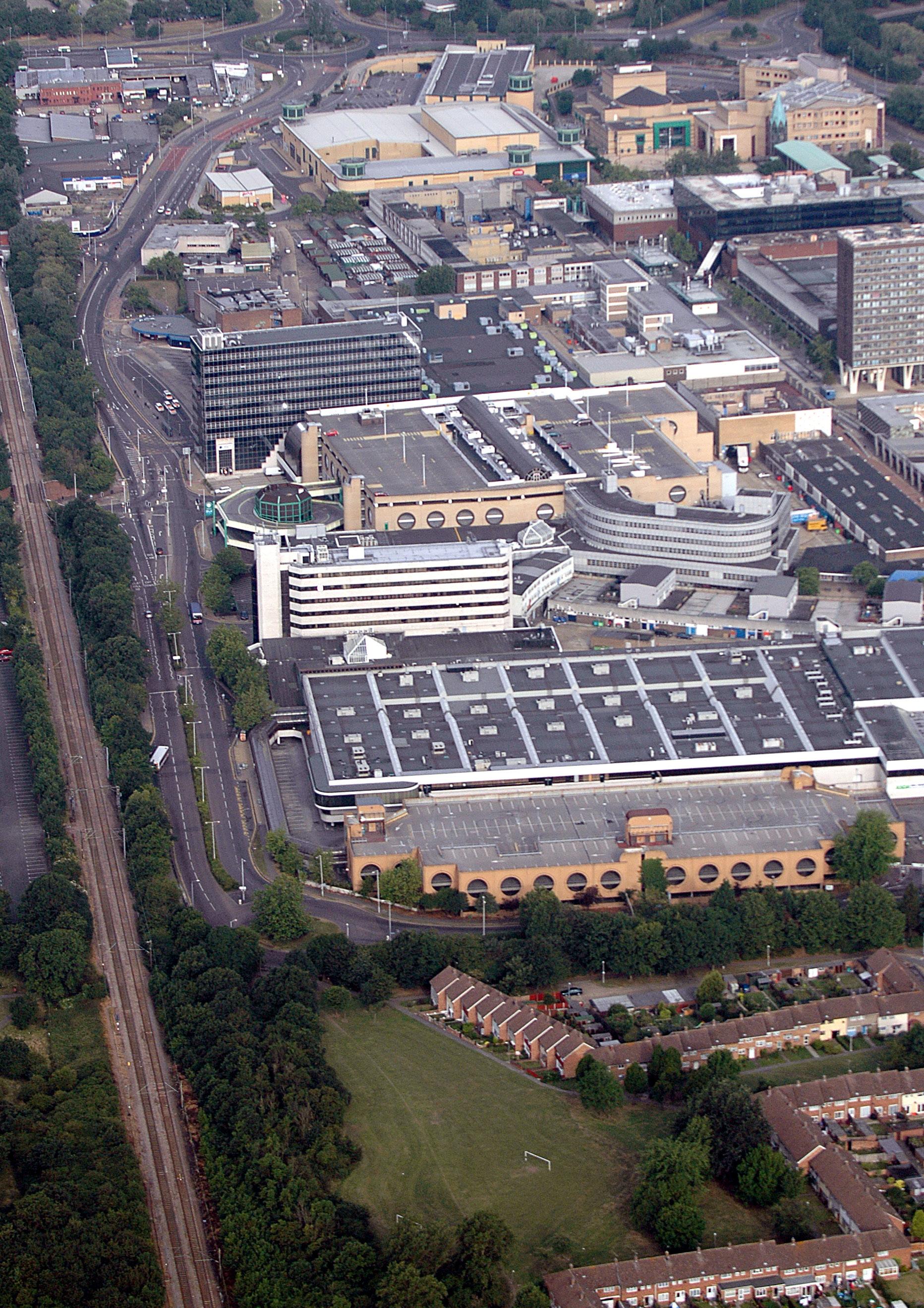
2.23 Basildon Town Centre is one of Essex’s regional town centres, alongside Chelmsford, Southend-on-Sea, and Colchester. There are four other town centres in the Borough: Pitsea, Laindon, Billericay and Wickford.
2.24 The Borough has four out-of-centre retail parks, each with at least one large supermarket. A number of local centres support the Borough’s residential and business neighbourhoods with basic shopping and service needs.
2.25 The Borough offers a range of leisure and recreational opportunities including the
Basildon Sporting Village as well as several health clubs, four golf courses, four country parks and approximately 1,300ha of open space.
2.26 Basildon Festival Leisure Park is the Borough’s principal commercial leisure complex, featuring a multiplex cinema, bowling alley, wakeboarding centre, play centre, a gym, go-karting centre, and several restaurants and hotels.
2.27 Residential provision should be maximised in the most sustainable locations, particularly in town centres, as part of a balanced mix of uses. The Basildon Retail and Leisure Needs Study 2024 highlighted the need to diversify town centre uses in response to falling market demand, rising occupancy costs, and increasing competition from online and out-ofcentre shopping, exacerbated by the COVID-19 pandemic. The regeneration of Basildon Town Centre will help enhance amenities available and provide economic benefits.
Health
2.28 Healthy Life Expectancy (HLE) data demonstrates a significant gap of up to 14 years in healthy life expectancy between wards in Basildon, highlighting stark inequalities within the borough. Residents in more deprived areas are living fewer years in good health, despite often having similar overall life expectancy. This represents not only avoidable ill health but also increased demand on health, social care, and housing services. Core20PLUS5 is a national NHS England approach to inform action to reduce healthcare inequalities at both national and system level. The approach defines a target population – the ‘Core20PLUS’ – and identifies ‘5’ focus clinical areas requiring accelerated improvement. The Local Plan presents a critical opportunity to align with the Core20PLUS5 approach in Basildon by:
• Prioritising investment in the most deprived 20% of communities, where poor housing conditions, overcrowding and housing
insecurity are most prevalent.
• Identifying and addressing groups who experience compounded disadvantage, including people in insecure housing, those with long-term mental health conditions, and people with cardiovascular risk factors.
• Embedding prevention and early intervention within housing design, regeneration, and allocation policies. Mental health should be a priority within the Local Plan due to its high prevalence locally and its strong association with housing quality, affordability, and stability. Poor housing conditions, overcrowding, fuel poverty, and housing insecurity are all linked to increased rates of anxiety, depression, and severe mental illness. Housing that is safe, warm, secure, and well-connected to green space and services can significantly improve mental wellbeing and reduce pressure on health services. Cardiovascular disease (CVD) remains a leading cause of premature mortality and long-term ill health in Basildon. There is a strong relationship between CVD and the wider determinants of health, including deprivation, poorquality housing, limited access to healthy food, physical inactivity, and chronic stress. Housing developments that support active travel, reduce fuel poverty, improve air quality, and enable access to green spaces can directly contribute to reducing cardiovascular risk.
Chapter 3: Vision and Objectives
Local Plan Vision
3.1 Our vision sets out the Council’s aspirations for inclusive growth and desired change to achieve sustainable development up to 2043. The vision was influenced by the Regulation 18 Consultations and has been revised to place greater emphasis on protecting and enhancing the natural environment.
Strategic Objectives
3.2 Our Strategic Objectives set out how we will deliver this vision. They form the basis of the Local Plan, ensuring that growth is focussed in the most sustainable locations and supported by proportionate improvements to essential infrastructure. These Strategic Objectives have been informed by the Regulation 18 Consultations and revised throughout accordingly.
Vision 2043
Basildon Borough will:
• Be a great place to live and work, delivering ambitious opportunities and sustainable development.
• Maximise development opportunities to the benefit of our population and economy whilst protecting and enhancing the natural environment.
• Deliver a wide range of housing to meet the needs of all our residents.
• Deliver an improved quality of life and wellbeing for all.
• Embrace our New Town heritage and our opportunity as a Borough.
Strategic Objectives Main Tasks
• Enhance the quality of the Borough’s natural, historic, and built environment through spatial planning and design.
SO1: Protect and enhance the quality of the Local Environment
SO2: Improve the quality and value of the Green Belt
• Conserve heritage assets and enhance the distinctive character and sense of place of each area of the Borough.
• Provide, protect and enhance high-quality multifunctional blue and green infrastructure and its connectivity that demonstrably contributes to delivering Local Nature Recovery Strategy priorities and Biodiversity Net Gain (BNG) outcomes across the Borough.
• Provide living and working environments which are attractive, enjoyable, safe, and accessible.
• Ensure that land in the Borough’s Green Belt continues to contribute positively to the functions of the Green Belt.
• Continue to enforce against inappropriate and unauthorised development in the Green Belt.
• Maximise use of previously developed land to accommodate development.
• Provide opportunities to enhance environmental quality and accessibility of the remaining Green Belt in proportion to development, ensuring attractive and improved landscapes near residential areas, fostering a connection to nature.
• Maximise sustainable patterns of development.
• Seek to deliver more than 10% biodiversity net gain where possible.
• Protect our water resources and minimise flood risk.
SO3: Minimise our impact on the Environment
SO4: Create vibrant and thriving town centres
• Protect the highest quality agricultural land.
• Maximise resource efficiency to support the circular economy, reducing waste and promoting reuse and recycling.
• Encourage sustainable modes of travel by enhancing greener travel networks.
• Enable town centres in the Borough to grow and thrive.
• Offer new opportunities for town centre living alongside an improved retail and leisure offer in Basildon Town Centre.
• Conserve the distinctive identities of Billericay, Wickford, Pitsea and Laindon town centres.
• Promote mixed use developments providing a range of retail, leisure, cultural activities, education, healthcare and community facilities alongside high-quality public realm improvements, safe active travel opportunities and good access to public transport.
• Ensure sufficient housing growth is directed to appropriate locations to support the vitality of the Borough’s town centres
• Integrate new urban greening of our town centres with climate resilience and other co-benefits.
Strategic Objectives Main Tasks
SO5: Strengthen the competitiveness of the Local Economy
SO6: Deliver a range of new homes to meet local needs
SO7: Mitigate against the impact of Climate Change
CHAPTER 3: Vision and Objectives
• Maintain the Borough’s position as a sub-regional economic hub by allocating sufficient land for businesses to grow and to improve the quality of business accommodation.
• Improve access to education, skills, and training opportunities for the local workforce and to increase the percentage of local residents achieving level 4 qualifications and reducing Young People Not in Education, Employment or Training (NEET) across the borough.
• Capitalise on local tourism opportunities.
• Protect major strategic employment sites.
• Identify sufficient land for housing needs to be met.
• Prioritise urban areas and previously developed land for high quality residential development.
• Ensure a range of size, types, and tenures of homes to meet local needs including key worker housing, specialised and adaptable housing for the elderly and those living with a disability.
• Deliver a range of affordable housing to meet all needs, including social housing.
• Ensure new homes meet high-quality design standards.
• Ensure all new buildings, including homes, are net zero carbon in operation, minimise embodied carbon, and generate sufficient renewable energy to meet or exceed their consumption. Incorporate material and resource efficiency, energy and water conservation, and a design for climate resilience.
• Increase the use of renewable energy technologies and opportunities for on-site energy generation.
• Prioritise development in sustainable locations and locations which provide high levels of connectivity to jobs and services.
• Increase the sustainability of locations by improving accessibility through use of active travel and public transport measures.
• Encourage a reduction in private car use and commuting by promoting the use of public transport and active travel to minimise the environmental impact of the Boroughs growth.
• Utilise green and blue infrastructure to enhance climate resilience, reduce urban heat and manage stormwater effectively.
• Promote the retention and reuse of existing buildings, and the appropriate retrofitting of historic buildings.
Strategic Objectives Main Tasks
• Ensure access to leisure, sport, and green and blue spaces for our intergenerational population.
• Provide leisure opportunities, safe walking and cycling routes to support active lifestyles with active travel.
SO8: Help local people maintain healthier lifestyles
SO9: Enhance the quality of life for all
• Secure access to high quality healthcare facilities.
• Design and create healthier food environments.
• Promote health and wellbeing and prevent ill-health in line with the Basildon Health and Wellbeing Strategy; and reduce health inequalities.
• Encourage urban planting for its co-benefits to serve its intergenerational population to support physical, mental and emotional wellbeing that will also benefit biodiversity and our local economy.
• Ensure equitable access to education, skills, and training.
• Deliver an improved quality of life and wellbeing for all while looking to reduce health inequalities. Provide accessible community, sports, and cultural facilities to support healthier, stronger communities.
• Provide well-designed public spaces that are safe, secure, and welcoming.
• Prioritise new development in well serviced locations.
SO10: Secure the delivery of supporting infrastructure
• Ensure new developments are supported by the necessary infrastructure to make them sustainable and beneficial to existing communities. This includes transport; utilities, including digital connectivity; nature-based solutions for climate resilience which encompasses sustainable drainage; green and blue infrastructure; flood defences; education and skills; play space provision; health services; police, ambulance and fire and rescue; waste management and community facilities.
• To secure transparent, viable and deliverable new developments with clear funding, phasing, implementation and delivery mechanisms, to secure the timely provision of new infrastructure and services from new developments.